total petroleum systems of the illizi province, algeria ... · total petroleum systems of the...
TRANSCRIPT

Total Petroleum Systems of the Illizi Province,
Algeria and Libya—Tanezzuft-Illizi
By
T.R. Klett
U.S.
Geological Survey
Bulletin 2202–A
U.S. Department of the InteriorU.S. Geological Survey

U.S. Department of the Interior
Bruce Babbitt, Secretary
U.S. Geological Survey
Charles G. Groat, Director
This report is only available online at:
http://greenwood.cr.usgs.gov/pub/bulletins/b2202–a/
Any use of trade, product, or firm names in this publicationis for descriptive purposes only and does not imply endorsement by the U.S. Government
Published in the Central Region, Denver, ColoradoManuscript approved for publication July 19, 2000Graphics by the authorPhotocomposition by Norma J. MaesEdited by Lorna Carter

III
Contents
Foreword................................................................................................................................................ 1Abstract ................................................................................................................................................. 2Acknowledgments ............................................................................................................................... 2Introduction........................................................................................................................................... 2Province Geology ................................................................................................................................. 5
Tectonic History .......................................................................................................................... 5Stratigraphy.................................................................................................................................. 8Petroleum Occurrence .............................................................................................................. 11
Regional Exploration History .............................................................................................................. 11The Tanezzuft-Illizi Total Petroleum System (205601) .................................................................... 11 Source Rocks............................................................................................................................... 11 Overburden Rocks....................................................................................................................... 13
Reservoir Rocks .......................................................................................................................... 13Seal Rocks ................................................................................................................................... 13
Trap Types in Oil and Gas Fields............................................................................................... 13 Assessment of Undiscovered Petroleum by Assessment Unit ........................................... 13Summary................................................................................................................................................ 14References Cited.................................................................................................................................. 14Appendix. Exploration-activity and discovery-history plots for the Tanezzuft-Illizi Structural/Stratigraphic Assessment Unit
Figures
1–3. Map showing approximate locations of: 1. USGS-defined geologic provinces and major structures in north-
central Africa ......................................................................................................................... 3 2. Areal extent of total petroleum systems and Silurian source rocks (Tanezzuft Formation), and locations of stratigraphic cross sections, north-central Africa............................................................................................. 4 3. Areal extent of assessment units within Illizi Province................................................. 6 4. Stratigraphic cross sections through Illizi and neighboring provinces ..................................................................................................................................... 7 5. Columnar section and stratigraphic nomenclature for Illizi, Triassic, and Ghadames (Berkine) Basins...................................................................................................... 9
6.
Tanezzuft-Illizi Total Petroleum System................................................................................... 12
Tables
[Tables and Appendix follow References Cited]
1. Abbreviations, names, ages, and lithology of formations used in the total petroleum systems events chart 2. Reservoir properties of accumulations for the Tanezzuft-Illizi Structural/Stratigraphic Assessment Unit through 19953. Number and sizes of discovered fields for the Tanezzuft-Illizi Structural/Stratigraphic Assessment Unit through 19954. Estimated sizes, number, and coproduct ratios of undiscovered oil and gas fields for the Tanezzuft-Illizi Structural/Stratigraphic Assessment Unit 5. Estimated undiscovered conventional oil, gas, and natural gas liquids volumes for oil and gas fields for the Tanezzuft-Illizi Structural/Stratigraphic Assessment Unit

1
Foreword
This report was prepared as part of the U.S. Geological Sur-vey World Petroleum Assessment 2000. The primary objective of World Petroleum Assessment 2000 is to assess the quantities of conventional oil, gas, and natural gas liquids outside the United States that have the potential to be added to reserves in the next 30 years. Parts of these assessed volumes reside in undiscovered fields whose sizes exceed the stated minimum-field-size cutoff value for the assessment unit, which is variable but must be at least 1 million barrels of oil equivalent. Another part of these assessed volumes occurs as reserve growth of fields already discovered. However, the contribution from reserve growth of discovered fields to resources is not covered for the areas treated in this report.
In order to organize, evaluate, and delineate areas to assess, the Assessment Methodology Team of World Petroleum Assess-ment 2000 developed a hierarchical scheme of geographic and geologic units. This scheme consists of regions, geologic prov-inces, total petroleum systems, and assessment units. For World Petroleum Assessment 2000, regions serve as organizational units and geologic provinces are used as prioritization tools. Assessment of undiscovered resources was done at the level of the total petroleum system or assessment unit.
The world was divided into 8 regions and 937 geologic provinces. These provinces have been ranked according to the discovered known oil and gas volumes (Klett and others, 1997). Then, 76 “priority” provinces (exclusive of the United States and chosen for their high ranking) and 26 “boutique” provinces (exclusive of the United States) were selected for appraisal of oil and gas resources. Boutique provinces were chosen for their anticipated petroleum richness or special regional economic or strategic importance.
A geologic province is an area having characteristic dimen-sions of hundreds of kilometers that encompasses a natural geo-logic entity (for example, a sedimentary basin, thrust belt, or accreted terrane) or some combination of contiguous geologic entities. Each geologic province is a spatial entity with common geologic attributes. Province boundaries were drawn as logi-cally as possible along natural geologic boundaries, although in some places they were located arbitrarily (for example, along specific water-depth contours in the open oceans).
Total petroleum systems and assessment units were delin-eated for each geologic province considered for assessment. It is not necessary for the boundaries of total petroleum systems and assessment units to be entirely contained within a geologic province. Particular emphasis is placed on the similarities of
petroleum fluids
within total petroleum systems, unlike geo-logic provinces and plays in which similarities of
rocks
are emphasized.
The total petroleum system includes all genetically related petroleum that occurs in shows and accumulations (discovered and undiscovered) generated by a pod or by closely related pods of mature source rock. Total petroleum systems exist within a limited mappable geologic space, together with the essential mappable geologic elements (source, reservoir, seal, and over-burden rocks). These essential geologic elements control the fundamental processes of
generation, expulsion, migration, entrapment, and preservation of petroleum within the total petro-leum system.
An assessment unit is a mappable part of a total petroleum system in which discovered and undiscovered oil and gas fields constitute a single relatively homogeneous population such that the methodology of resource assessment based on estimation of the number and sizes of undiscovered fields is applicable. A total petroleum system might equate to a single assessment unit. If necessary, a total petroleum system may be subdivided into two or more assessment units such that each assessment unit is
sufficiently
homogeneous in terms of geology, exploration con-siderations, and risk to assess individually. Differences in the distributions of accumulation density, trap styles, reservoirs, and exploration concepts within an assessment unit were recognized and
not
assumed to extend homogeneously across an entire assessment unit.
A numeric code identifies each region, province, total petroleum system, and assessment unit. The criteria for assign-ing codes are uniform throughout the project and throughout all publications of the project. The numeric codes used in this study are:
Unit Name Code
Region Middle East and North Africa
2
Province Illizi 2
056
Total Petroleum System Tanezzuft-Illizi 2056
01
Assessment Unit Tanezzuft-Illizi Structural/ 205601
01
Stratigraphic
A graphical depiction that places the elements of the total petroleum system into the context of geologic time is provided in the form of an events chart. Items on the events chart include (1) the major rock-unit names; (2) the temporal extent of source-rock deposition, reservoir-rock deposition, seal-rock deposition, overburden-rock deposition, trap formation, generation-migra-tion-accumulation of petroleum, and preservation of petroleum; and (3) the critical moment, which is defined as the time that best depicts the generation-migration-accumulation of hydrocar-bons in a petroleum system (Magoon and Dow, 1994). The events chart serves only as a timeline and does not necessarily represent spatial relations.
Probabilities of occurrence of adequate charge, rocks, and timing were assigned to each assessment unit. Additionally, an access probability was assigned for necessary petroleum-related
Total Petroleum Systems of the Illizi Province, Algeria and Libya—Tanezzuft-Illizi
T.R. Klett
By

2 Total Petroleum Systems of the Illizi Province, Algeria and Libya
activity within the assessment unit. All four probabilities, or risking elements, are similar in application and address the question of whether at least one undiscovered field of minimum size has the potential to be added to reserves in the next 30 years somewhere in the assessment unit. Each risking element thus applies to the entire assessment unit and does not equate to the percentage of the assessment unit that might be unfavorable in terms of charge, rocks, timing, or access.
Estimated total recoverable oil and gas volumes (cumula-tive production plus remaining reserves, called “known” vol-umes hereafter) quoted in this report are derived from Petroconsultants, Inc., 1996 Petroleum Exploration and Produc-tion database (Petroconsultants, 1996a). To address the fact that increases in reported known volumes through time are com-monly observed, the U.S. Geological Survey (Schmoker and Crovelli, 1998) and the Minerals Management Service (Lore and others, 1996) created a set of analytical “growth” functions that are used to estimate future reserve growth (called “grown” vol-umes hereafter). The set of functions was originally created for geologic regions of the United States, but it is assumed that these regions can serve as analogs for the world. This study applied the Federal offshore Gulf of Mexico growth function (developed by the U.S. Minerals Management Service) to known oil and gas volumes, which in turn were plotted to aid in estimating undis-covered petroleum volumes. These estimates of undiscovered petroleum volumes therefore take into account reserve growth of fields yet to be discovered.
Estimates of the minimum, median, and maximum number, sizes, and coproduct ratios of undiscovered fields were made based on geologic knowledge of the assessment unit, exploration and discovery history, analogs, and, if available, prospect maps. Probabilistic distributions were applied to these estimates and combined by Monte Carlo simulation to calculate undiscovered resources.
Illustrations in this report that show boundaries of the total petroleum systems, assessment units, and extent of source rocks were compiled using geographic information system (GIS) soft-ware. The political boundaries shown are not politically defini-tive and are displayed for general reference only. Oil and gas field center points were provided by, and reproduced with per-mission from, Petroconsultants (1996a and 1996b).
Abstract
Undiscovered conventional oil and gas resources were assessed within a total petroleum system of the Illizi Province (2056) as part of the U.S. Geological Survey World Petroleum Assessment 2000. The Illizi Province is in eastern Algeria and a small portion of western Libya. The province and its total petro-leum system coincide with the Illizi Basin. Although several total petroleum systems may exist within the Illizi Province, only one “composite” total petroleum system is identified. This total petroleum system comprises a single assessment unit.
The main source rocks are the Silurian Tanezzuft Formation (or lateral equivalents) and Middle to Upper Devonian mud-stone. The total petroleum system was named after the oldest major source rock and the basin in which it resides.
The estimated means of the undiscovered conventional petroleum volumes in the Tanezzuft-Illizi Total Petroleum
System are 2,814 million barrels of oil (MMBO), 27,785 billion cubic feet of gas (BCFG), and 873 million barrels of natural gas liquids (MMBNGL).
Acknowledgments
I thank Philip Farfan and Francois Gauthier of Anadarko Algeria Corporation, Rob Hoar and Randie Grantham of Oryx Energy Company, and David Boote and Marc Traut of Occiden-tal Oil and Gas Corporation for their suggestions, which greatly improved the text. I also thank Katharine Varnes, Gordon Dol-ton, and Gregory Ulmishek for their editorial review.
Introduction
Undiscovered conventional oil and gas resources were assessed within a total petroleum system of the Illizi Province (2056) as part of the U.S. Geological Survey (USGS) World Petroleum Assessment 2000. This study documents the geology, undiscovered oil and gas volumes, exploration activity, and dis-covery history of the Illizi Province.
The Illizi Province is a geologic province delineated by the USGS; it is located in eastern Algeria and extreme western Libya (fig. 1). The province encompasses approximately 200,000 km
2
(square kilometers) and coincides with the Illizi Basin. Neighboring geologic provinces, delineated by the USGS, are the Trias/Ghadames Basin (2054), Hamra Basin (2047), Tihemboka Uplift (2057), Hoggar (7041), and Grand Erg/Ahnet Basin (2058).
More than one total petroleum system may exist within the Illizi Basin (Boote and others, 1998). Data available for this study are insufficient to adequately determine the relative contri-bution of each system to individual accumulations and therefore preclude further subdivision. Consequently only one “compos-ite” total petroleum system is described in this report, which contains all total petroleum systems, called the Tanezzuft-Illizi Total Petroleum System (fig. 2). Tanezzuft refers to the Tanez-zuft Formation (Silurian), which is the oldest major source rock in the system; in the total petroleum system name, “Tanezzuft” is then followed by the basin name in which the total petroleum system exists. Due to scarcity of data, province and total petro-leum system boundaries can only be approximately delineated and therefore are subject to future modification.
One assessment unit was defined in the Tanezzuft-Illizi Total Petroleum System; the assessment unit coincides with the total petroleum system (fig. 3). The assessment unit is named after the total petroleum system with a suffix of “Structural/Stratigraphic.” This suffix refers to the progression from a struc-tural and combination trap exploration strategy to a stratigraphic (subtle) trap exploration strategy.
The Illizi Province contains more than 4,600 million bar-rels (MMB) of known (estimated total recoverable, that is, cumulative production plus remaining reserves) petroleum liq-uids (approximately 3,700 million barrels of oil, MMBO, and 900 million barrels of natural gas liquids, MMBNGL) and approximately 45,000 billion cubic feet of known natural gas (10
9
CFG or BCFG) (Petroconsultants, 1996a). The Illizi

Introduction 3
Approximate lim
it of salt
Saharan Flexure
Oued MyaBasin
Tilrhemt ArchH
assi Atshan Arch
Gargaf Arch
TriassicBasin
IlliziBasin
Idjerane-M'Z
ab Structural A
xis
Azz
ene
Hig
h
Alla
l Hig
h
Ougarta Range
Antiatlas Range
Hoggar Massif
AhnetBasin
TimimounBasin
Bechar/AbadlaBasins
MouydirBasin
SbaaBasin
ALGERIA
LIBYA
TUNISIA
MOROCCO
Grand Erg/AhnetProvince 2058
Trias/GhadamesProvince 2054
IlliziProvince 2056
PelagianProvince 2048
PelagianBasin
Country boundaryProvince boundary
Structural axis (crest)
Djoua Saddle
HamraBasin
Oued NamousDome
MaharezDome
EdjelehAnticline
Tihem
boka ArchA
mgu
id-H
assi
Tou
areg
Str
uctu
ral A
xis
Atlas Mountains
Benoud Trough
Province of interest
Mediterranean Sea
MediterraneanSea
MelrhirBasin
Ghadames(Berkine)
Basin
Talemzane - Gefara Arch
App
roxi
mat
elim
it of
sal
t
Ain RichHigh
Zou
sfan
aS
addl
e
Ben
i Abb
esS
addl
e
Saharan flexure0 500 KILOMETERS
5oW 0
o5oE 10
oE 15
oE
20oN
25oN
30oN
35oN
Mouydir
Structural
Terrace
Figure 1. North-central Africa, showing USGS-defined geologic provinces and major structures (modified from Aliev and others, 1971; Burollet and others, 1978; Montgomery, 1994; Petroconsultants, 1996b; Persits and others, 1997).

4 Total Petroleum Systems of the Illizi Province, Algeria and Libya
A
A'B'
B
Tanezzuft-TimimounTPS
Tanezzuft-AhnetTPS
Tanezzuft-SbaaTPS
Tanezzuft-MelrhirTPS
Tanezzuft-OuedMya TPS
Tanezzuft-MouydirTPS
Tanezzuft-GhadamesTPS
Tanezzuft-IlliziTPS
Country boundaryTotal petroleum system boundary
Silurian source rock boundaryOil fieldGas field
ALGERIA
LIBYA
TUNISIA
MOROCCO
T-Shaped Anticlinorium
Figure 2. North-central Africa, showing the areal extent of total petroleum systems and Silurian source rocks (Tanezzuft Formation), and locations of stratigraphic cross sections (modified from Petroconsultants, 1996b; Persits and others, 1997; Boote and others, 1998).
Tanezzuft-BenoudTPS
Tanezzuft-Bechar/Abadla
TPS
0 500 KILOMETERS
5oW 0
o5
oE 10
oE 15
oE
20oN
25oN
30oN
35oN
Total petroleum systems of interest

Province Geology 5
Province contains the giant Tin Fouye-Tabankort and Zarza-itine oil fields.
Province Geology
The Tanezzuft-Illizi Province coincides with the Illizi Basin and is bounded on the north by the Ghadames (Berkine) Basin, on the east by the Tihemboka Arch, on the south by the Hoggar Massif, and on the west by the Amguid-Hassi Touareg structural axis.
The south-to-north plunging Tihemboka Arch separates the Illizi Basin from the Hamra Basin to the east (fig. 1) and is located near the Algerian-Libyan border. Along the western boundary, the Amguid-Hassi Touareg structural axis separates the Illizi Basin from the Mouydir Basin of the Grand Erg/Ahnet Province.
The boundary between the Illizi and Ghadames (Berkine) Basins is defined by a break or hinge line in the slope of the basement rocks. This hinge line was responsible for separating much of the petroleum generation, migration, and accumulation between the two basins (fig. 4
A
). The Illizi Basin is presently perched on a basement high and is not as deep as the neighbor-ing Ghadames (Berkine) and Hamra Basins. The Illizi-Gha-dames (Berkine) Basin boundary represents the approximate extent of Triassic and Jurassic evaporites that were deposited within the Mesozoic-aged Triassic Basin.
Tectonic History
The regional stratigraphy is continuous across North Africa, but petroleum generation, migration, and entrapment within each total petroleum system have been controlled by the tectonic history of individual basins. Deformational events in the region, most of them minor, are recorded by unconformities reflecting basin tilting, uplift, and erosion of intracratonic structural axes at various times throughout the Phanerozoic. The main deforma-tional events occurred in the Precambrian to Early Cambrian (Pan African event), Late Silurian to Early Devonian, Late Devo-nian (Frasnian event), Carboniferous to Permian (Hercynian event), Early Jurassic, Early Cretaceous (Aptian, Austrian event), Late Cretaceous, and Tertiary (Eocene to Oligocene, Pyrenean event) (Aliev and others, 1971; Peterson, 1985; Boud-jema, 1987; van de Weerd and Ware, 1994).
Throughout most of the Paleozoic, North Africa was a sin-gle depositional basin on the northern shelf of the African craton (Aliev and others, 1971; van de Weerd and Ware, 1994). The basin generally deepened northward where deposition and marine influence were greater (Daniels and Emme, 1995). Some gentle but large structures existed in this area throughout the Paleozoic and affected the thickness of the sedimentary cover (Aliev and others, 1971; van de Weerd and Ware, 1994). There was a general conformity of structure throughout most of the Paleozoic until the Hercynian event. In the Late Silurian and Early Devonian, Laurasia separated from Gondwana resulting in minor deformation, uplift, and local erosion (Aliev and others, 1971; Boote and others, 1998). Many of the basins and uplifts preserved today were initially developed during this event from
earlier structures (Peterson, 1985). Later, in the Middle to Late Devonian, the initial collision of Laurasia and Gondwana began resulting in erosion and further modification of preexisting struc-tures (Boote and others, 1998).
Repeated minor uplift of the Tihemboka Arch and Amguid-Hassi Touareg structural axis occurred in the Late Silurian through the Devonian, with resulting local erosion and gradual development of the Illizi as a discrete basin (Aliev and others, 1971; van de Weerd and Ware, 1994; Boote and others, 1998).
The Hercynian event marks the collision between Laurasia and Gondwana and caused regional uplift, folding, and erosion (Aliev and others, 1971; Boote and others, 1998). Paleozoic basins that were delineated by earlier tectonic events were modi-fied, resulting in the development of several intracratonic sag and foreland basins (Aliev and others, 1971; van de Weerd and Ware, 1994; Boote and others, 1998).
Several transgressive-regressive cycles occurrred through-out the Paleozoic. Two major flooding events, one in the Sil-urian and the other in the Late Devonian, were responsible for the deposition of source rocks (Aliev and others, 1971; Boud-jema, 1987). Many of the prograding fluvial, estuarine, deltaic, and shallow marine sands that were deposited during these cycles are now reservoirs (Aliev and others, 1971).
Some petroleum may have been generated during the Car-boniferous Period within the Paleozoic depocenter southwest of the Illizi Basin, but uplift caused petroleum generation to cease. Subsequent erosion probably removed or dispersed most petro-leum that had accumulated (Tissot and others, 1973).
During the early Mesozoic, extensional movements caused by the opening of the Tethys and Atlantic oceans developed a cratonic sag basin called the Triassic Basin. The depocenter was superimposed on some of the Paleozoic basins (Aliev and others, 1971; Boudjema, 1987). Triassic fluvial sands followed by a thick Triassic to Jurassic evaporite section were deposited within the sag basin (Aliev and others, 1971; Boudjema, 1987). Sand-stones resulting from the fluvial deposition are major reservoirs, and the evaporites provide a regional seal for these fluvial and Paleozoic reservoirs (Aliev and others, 1971). Clastic then car-bonate deposition occurred throughout the remainder of the Mesozoic over much of central North Africa (Aliev and others, 1971; Boudjema, 1987). Sediment deposition gradually dimin-ished in the Tertiary over most of the area (Aliev and others, 1971; Peterson, 1985; Boudjema, 1987). Much of the petroleum present in Saharan Africa was generated in the Cretaceous and early Tertiary (Daniels and Emme, 1995; Makhous and others, 1997).
Transpressional movements (wrenching) during Austrian deformation reactivated older structures such as those along the Tihemboka Arch and Amguid-Hassi Touareg structural axis, causing local uplift and erosion (Claret and Tempere, 1967; Aliev and others, 1971). The southern portion of the Illizi Basin was unroofed at this time and was never again reburied (Macgregor, 1998; Boote and others, 1998; van de Weerd and Ware, 1994).
The initial stages of the Africa-Arabia and Eurasia collision during Late Cretaceous to middle Tertiary caused compressional movements and uplift (Peterson, 1985; Guiraud, 1998). These movements tilted the Triassic Basin to its present configu-ration (Aliev and others, 1971; Boote and others, 1998).

6 Total Petroleum Systems of the Illizi Province, Algeria and Libya
LIBYA
Illizi Basin
Tanezzuft-Illizi Structural/Stratigraphic
150 KILOMETERS
ALGERIA
10oE8
oE6
oE
28oN
30oN
26oN
Country boundaryTotal petroleum system boundary
Silurian source rock boundaryOil fieldGas field
Geologic province boundary
Silurian absent
Silurian absent
Figure 3. Areal extent of assessment units within the Illizi Province (modified from Petroconsultants, 1996b; Persits and others, 1997).

Province Geology 7
0 100 KILOMETERS
NORTH SOUTH
GHADAMES (BERKINE)BASIN
ILLIZI BASIN
0
1
2
3
4
5
6
7KM
TERTIARY
UPPER CRETACEOUS
LOWER CRETACEOUS
JURASSIC
UPPER TRIASSIC
ORDOVICIAN
BASEMENT
CAMBRIAN
SILURIAN
DEVONIAN
CARBONIFEROUS
SILURIAN
DEVONIAN
A
SALIFEROUS UNITS
Tanezzuft-GhadamesTPS (205403)
Tanezzuft-IlliziTPS (205601) A'
TALEMZANE-GEFARAARCH
B-B'
Figure 4. Stratigraphic cross sections through Trias/Ghadames and Illizi Provinces. A, North-to-south stratigraphic cross section through the Ghadames (Berkine) and Illizi Basins (modified from van de Weerd and Ware, 1994, after Aliev and others, 1971).
Regional seal
Sections containing source rocks
Sections containing reservoir rocks
Fault
Unconformity
EXPLANATION
A
WEST EAST
0
1
2
3
4
5
KM
B
TERTIARY
UPPER CRETACEOUS
DEVONIAN
SILURIAN
CAMBRIAN-ORDOVICIAN
BASEMENT
SILURIAN
DEVONIAN
CARBONIFEROUS
BASEMENT
LOWER CRETACEOUS
AHNETBASIN
IDJERANE-M'ZABSTRUCTURAL AXIS
AMGUID-HASSI TOUAREGSTRUCTURAL AXIS
TIHEMBOKAARCH
ILLIZIBASIN
MOUYDIRBASIN
B'Tanezzuft-MouydirTPS (205804)
Tanezzuft-IlliziTPS (205601)
A-A'
0 100 KILOMETERS
JURASSIC
CAMBRIAN-ORDOVICIAN
CAMBRIAN-
ORDOVICIAN
Sections containing source rocks
Sections containing reservoir rocks
Fault
Unconformity
EXPLANATION
JURASSIC
Figure 4—Continued. Stratigraphic cross sections. B, West-to-east stratigraphic cross section through the Mouydir and Illizi Basins (modified from Makhous and others, 1997).
B

8 Total Petroleum Systems of the Illizi Province, Algeria and Libya
Petroleum was generated within the Illizi Basin from the Middle to Late Jurassic to early Tertiary (Daniels and Emme, 1995). Some spillage or secondary migration occurred (Boote and others, 1998; van de Weerd and Ware, 1994). Many of the structural traps were formed by vertical movements of the base-ment during Mesozoic and Tertiary deformational events (Echikh, 1998).
Stratigraphy
The regional stratigraphy of lower Paleozoic sections is generally continuous, but the Devonian and overlying sections show more localized depositional systems. Stratigraphic nomenclature varies among the Saharan basins and countries. This study primarily uses nomenclature given in Boudjema (1987), Montgomery (1993), and Echikh (1998). Columnar sec-tions, stratigraphic nomenclature, and correlations are shown in figure 5.
Principal source rocks are the Silurian Tanezzuft Formation and Middle to Upper Devonian mudstone (Givetian to Famen-nian) (Tissot and others, 1973; Daniels and Emme, 1995). Other minor or relatively unimportant source rocks are also present but contributed significantly less petroleum than did the Silurian or Middle to Upper Devonian mudstone (Daniels and Emme, 1995; Boote and others, 1998). Reservoir rocks include sandstone of Cambrian-Ordovician, Silurian, Devonian, and Carboniferous age. Intraformational Paleozoic marine mudstone provides the primary seals.
During the late Precambrian and Early Cambrian, erosion of a preexisting craton to the south occurred due to uplift during the Pan African deformational event. Eroded sediments were deposited northward as alluvial and fluvial deposits and make up the thick Cambrian sandstone of the Hassi Leila Formation. The Hassi Leila Formation and its lateral equivalents, the Hassaouna and Hassi Messaoud Formations, are major oil and gas reser-voirs (Petroconsultants, 1996a; van de Weerd and Ware, 1994).
The Lower Ordovician In Kraf Formation unconformably overlies the Hassi Leila Formation. The In Kraf Formation con-tains mudstone and sandstone laterally equivalent to the Zone des Alterances, Argile d'El Gassi, and Gres d'El Atchane Formations of the Triassic Basin (fig. 5). The Argile d'El Gassi and equivalents may be locally minor source rocks (Makhous and others, 1997; Malla and others, 1997).
Overlying the In Kraf Formation is the quartz-rich, marine to marginal marine sandstone of the Hamra Formation (van de Weerd and Ware, 1994). Above the Hamra Formation is the Middle Ordovician Edjeleh Formation. The Edjeleh Formation is a marine sandstone that is a local facies of the Argiles d'Azzel mudstone (D. Boote, oral commun., 1999). Both the Hamra and Edjeleh Formations are important oil and gas reservoirs in the Illizi Province. Upper Ordovician to Lower Silurian marine and glacial mudstone and fine-grained sandstone of the Gara Louki Formation overlie the Edjeleh Formation.
Overlying the Gara Louki Formation is the organic-rich, graptolitic, marine mudstone of the Silurian Tanezzuft Formation. In the Illizi Basin, the Tanezzuft is sometimes referred to as “Argileux.” The Tanezzuft Formation, a principal source rock, was deposited during a major regional flooding event and contains mostly sapropelic and mixed (type I and II)
kerogen (Daniels and Emme, 1995; Makhous and others, 1997). The present-day total organic carbon (TOC) content ranges from less than 2 to 9 percent across the Illizi Basin, but may be reduced by as much as one-half due to increased thermal matu-rity (Daniels and Emme, 1995). The TOC content is greatest at the base of the section (Daniels and Emme, 1995). The thick-ness, richness, and kerogen type of this source rock are region-ally variable and dependent on paleogeography (Daniels and Emme, 1995). The thickness of the Tanezzuft Formation, before Hercynian erosion, ranged from about 200 m to greater than 500 m (Boote and others, 1998).
The Tanezzuft Formation grades upward into sandstone and mudstone of the Silurian Zone de Passage. These sediments were deposited in marine to marginal marine environments and are laterally equivalent to the Acacus sandstone.
Devonian rocks unconformably overlie the Upper Silurian sediments. Devonian rocks consist of interbedded marine sand-stone and mudstone. Sandstone members within the Devonian section are each given a code, F2 to F6 with F6 being the oldest and F2 the youngest (fig. 5). These sandstone members are prin-cipal oil and gas reservoirs in the Illizi Province.
Middle to Upper Devonian mudstone is another major source rock, particularly the Frasnian-aged mudstone, which is the richest in this interval (Daniels and Emme, 1995). This mud-stone, like the Silurian Tanezzuft Formation, was deposited dur-ing a major regional flooding event and contains mostly sapropelic and mixed (type I and II) kerogen (Daniels and Emme, 1995; Makhous and others, 1997). Distribution of rich-ness and kerogen type were presumably controlled by paleo-geography. The present-day TOC content generally ranges from about 2 to 4 percent but can reach 7 percent (Daniels and Emme, 1995). Thickness of Middle to Upper Devonian mudstone ranges from about 200 m to more than 400 m near the Hoggar Massif (Daniels and Emme, 1995).
The Lower to lower Middle Carboniferous rocks consist of cycles of limestone or mudstone, siltstone, sandstone, and con-glomerate representing deltaic and shallow marine deposition. Upper Middle to Upper Carboniferous rocks consist of lime-stones, marls, dolostones, and gypsiferous mudstone that were deposited in evaporitic shallow-marine and tidal environments. As with Devonian rocks, Carboniferous formations are divided into members, each having a code from A to F, with A being the oldest and F the youngest (fig. 5).
No Permian rocks are present in the Illizi Province. Her-cynian deformation started during the Late Carboniferous and continued into the Early Permian. Uplift caused deep erosion of Carboniferous through Devonian sections on the bounding struc-tural highs and the basin began to assume its modern form.
The lower Mesozoic transgression, which swept across the eroded Hercynian peneplain from the northeast, did not reach the Illizi Province until very Late Triassic and Jurassic. The Tri-assic to Lower Cretaceous section is represented by nonmarine clastic rocks passing up into marginal marine clastics and then
Figure 5 (next two pages).
Columnar section and stratigraphic nomen-clature for Illizi, Triassic, and Ghadames (Berkine) Basins (modified from Boudjema, 1987). Major reservoir rocks are shown in yellow, source rocks in gray, and seals in red.

Province Geology 9
Infr
a-C
ambr
ian
Cam
bria
nO
rdov
icia
nS
iluria
nD
evon
ian
Car
boni
fero
usS
yste
m
Stage
Stephanian
Westphalian
Namurian
Visean
Tournaisian
Famen. -FrasnianGivetian -EifelianEmsian
Siegenian -Gedinnian
Cardocian
Llandeilian -Llanvirnian
Arenigian
Tremadocian
Cambrian-Ordovician
Triassic Basin(Boudjema,
1987)
Ghadames(Berkine) andHamra Basins(Montgomery,
1994; Echikh, 1998)
Tiguentourine
El Adeb LaracheDembaba
Assed JeffarOubarakat
Assekaifaf
IssendjelMrar
Tahara (Shatti)Gara Mas Melouki
Tin Meras Aouinet Ouenine
Ouan KasaOrsine
Hassi Tabankort Tadrart
Acacus
Oued Imirhou Tanezzuft
Gres de RemadaArgile Microcgl.
Memouniat
Melez Chograne
Gres d'Oued Saret
Argiles d'Azzel
Gres de Ouargla
HaouazQuartzites De
Hamra
Gres d'El Atchane
Argile d'El Gassi
Zone des AlternancesRi
Ro
R2
R3
SocleInfra Tassilian/
Mourizidie
Hassaounaand
Mourizidie
Illizi Basin(van de Weerd
and Ware,1994)
"Argileux"
Gara Louki
Edjeleh
Hamra
In Kraf
Hassi Leila
Generallithology
(Boudjema,1987)
Description(Boudjema, 1987)
Hercynian Unconformity
Mudstone, limestone, and gypsum
Limestone, gypsum, and mudstone
Limestone and sandstone
Limestone and sandstone with concretions
Mudstone and sandstone
Limestone and mudstone
SandstoneMudstone Frasnian UnconformitySandstoneMudstone and limestoneMudstone and sandstone
Sandstone
Late Silurian-Early Devonian UnconformitySandstone and mudstone
Black mudstone with graptolites
SandstoneMicroconglomeratic mudstone Glacial Unconformity
Limestone, sandstone, and mudstone
Silty black mudstone
Sandstone
Sandstone
Sandstone and mudstone
Mudstone
Sandstone and mudstone
Sandstone
Sandstone and conglomerate
Pan-African Unconformity
Metamorphic and magmatic rocks
Has
si M
essa
oud
F6
F4-5
F3
F2
A
B
C
D
E
F
M'K
ratta
Com
plex
(Sbaa)
Zone de Passage
Strunian
Bir Tlacsin
Achebyat

10 Total Petroleum Systems of the Illizi Province, Algeria and Libya
Sys
tem
Stage
Cre
tace
ous
Lias
Dogger
Malm
Neocomian
Barremian
Aptian
Albian
Tria
ssic
Jura
ssic
Cenomanian
Turonian
Senonian
EocenePaleog.
Neo
gene
Miocene
Pliocene
Generallithology
(Boudjema,1987)
Description(Boudjema, 1987)
Conglomerate
Marl, gypsum, and sandstone
Gypsum, marl, limestone, sandstone,and conglomerate
Pyrenean UnconformitySandstone and marl
Limestone and marl
Anhydrite, limestone, dolostone, marl,and mudstone
Limestone and dolostone
Anhydrite, dolostone, and marl
Austrian UnconformitySandstone, mudstone, and dolostone
Sandstone and mudstone
Sandstone and dolomitic mudstone
Anhydrite, limestone, dolostone, marl,and sandstone
Mudstone, sandstone, limestone,and anhydrite
Salt, anhydrite, and mudstone
Sandstone, mudstone, salt,and volcanic rocks
Hercynian Unconformity
Triassic, Ghadames (Berkine),and Hamra Basins
(Montgomery, 1994)
Al Hamra Group
Nefousa Group
ContinentalIntercalaire
Scesciuch(Shakshuk)
Tigi
SaliferousUnits
Argilo-GreseuxSuperieur
(Gassi Touil)Argilo-Carbonate
(Oulad Nsir)Argilo-Greseux
Inferieur(Nezla)
Cabao
Paleocene
ZarzaitineInferieur
ZarzaitineSuperieur
ZarzaitineMoyen
Seriede Taouratine
SerieD'In Akamil
Argile Gypse
Calcaire
CalcaireMarnes
Illizi Basin(Chaouchi andothers, 1998)
Oligocene
Regional Exploration History 11
into marine carbonate rocks forming a north-facing sedimentary wedge. The Cenozoic section is represented by thin, discontinu-ous Miocene-Pliocene nonmarine rocks and Quaternary sediments.
Petroleum Occurrence
Most of the oil and gas fields found by the end of 1995 in the Illizi Province are located in the north-central part of the Illizi Basin and along the Tihemboka Arch, near the Triassic Basin where Mesozoic generation and migration occurred. Most of these accumulations are within low-relief, commonly faulted anticlines (Boote and others, 1998; Petroconsultants, 1996a). The number of accumulations in the southern and west-ern portions of the province had been destroyed by uplift, inac-tive generation, erosion of reservoir and seal rocks, and water flushing during and following Hercynian deformation (Boote and others, 1998; Macgregor, 1998). There is a lower potential for new discoveries in these areas compared to the northern and eastern portions of the Illizi Basin.
Regional Exploration History
Exploration activity in Algeria fluctuated through time due to its war for independence from 1954 to 1962, nationalization of the oil industry from 1963 to 1971, and political and eco-nomic problems into the 1980’s (Traut and others, 1998; Mont-gomery, 1994). Libya also experienced fluctuations and discontinuities. Between 1963 and late 1980’s, Algeria had leg-islation regarding concession contracts and royalties that dis-couraged exploration by foreign companies (Montgomery, 1994). Since the late 1980’s, however, Algeria revised its legis-lation, encouraging foreign companies to explore and develop oil and gas resources (Davies and Bel Haiza, 1990; SONATRACH, c. 1992; Montgomery, 1994; Traut and others, 1998).
Not all areas in Algeria and Libya were accessible for exploration. Shifting sand of Saharan African deserts presents technical difficulties in exploration and hazards in production operations (Echikh, 1998). Since the 1980’s, some of these tech-nical difficulties in exploration have been resolved. Recent advances in gathering, processing, and reprocessing of seismic data allow exploration beneath sand-sea environments such as the Algerian Grand Erg Oriental where the Ghadames (Berkine) and Illizi Basins lie (van de Weerd and Ware, 1994; Macgregor, 1998).
New discoveries can be easily brought on line without con-struction of major pipelines because a basic infrastructure has been established (SONATRACH, c. 1992). Algeria has an extensive pipeline network that connects most of the major pro-ducing areas to port cities in Algeria and Tunisia (Pennwell, 1996). The pipelines allow transportation of oil, gas, and natural gas liquids. In Libya, an oil pipeline connects fields of the Gha-dames (Berkine) and Hamra Basins to the port city of Az Zaw-iyah. An extension of this pipeline was completed in 1996 that connects producing areas within the Murzuk Basin with the
coast (Traut and others, 1998; Pennwell, 1996), and another pipeline is planned to connect the Libyan portion of the Trias/Ghadames Province to the coast (Arab Petroleum Research Center, 1996).
The Tanezzuft-Illizi Total Petroleum System (205601)
The Tanezzuft-Illizi Total Petroleum System is coincident with most of the Illizi Basin and Province. Paleozoic rocks, including the major source rocks, crop out along the Hoggar Massif (figs. 2 and 3). An events chart (fig. 6) summarizes the timing of sources, reservoirs, seals, trap development, and gener-ation and migration of petroleum. Table 1 shows the formation names, ages, and lithology for abbreviations used in the events chart.
Source Rocks
The principal source rocks in the Tanezzuft-Illizi Total Petroleum System are the Silurian Tanezzuft Formation and Middle to Upper Devonian mudstone (Tissot and others, 1973; Daniels and Emme, 1995). In the Illizi Basin, the present-day TOC content of the Silurian Tanezzuft source rock typically ranges from 0.5 to 8 percent, but can be as much as 16 percent (Daniels and Emme, 1995; Makhous and others, 1997). Middle to Upper Devonian source rocks typically contain from 2 to 8 percent TOC (Daniels and Emme, 1995; Makhous and others, 1997). Equivalent vitrinite reflectance of Silurian source rocks ranges from 1.1 to 1.75 percent (Daniels and Emme, 1995) and the Middle to Upper Devonian, 1.1 to 1.3 percent R
o
(Daniels and Emme, 1995). In the north-central, central, and southeastern portions of the total petroleum system, Silurian and Middle to Upper Devonian source rocks are presently in the peak to late oil generation phase (Daniels and Emme, 1995). In the northeastern portion, both source rocks are presently in the late oil to wet gas generation phase (Daniels and Emme, 1995). Silurian source rocks in the south and southwestern portions are presently in the wet to possibly the dry gas generation phase, whereas Devonian source rocks are presently in the late oil generation phase (Daniels and Emme, 1995).
Oil generation from both Silurian and Middle to Upper Devonian source rocks in the southern and western portion of the total petroleum system probably started and reached peak generative phases in the Carboniferous, but generation was halted during the Hercynian deformational event (Tissot and oth-ers, 1973; Daniels and Emme, 1995). Erosion resulting from Hercynian deformation probably removed most or all of the petroleum generated prior to the Hercynian event, and the source rocks in this portion of the total petroleum system were never again sufficiently buried to resume generation (Tissot and others, 1973). Hercynian deformation was followed by Mesozoic sub-sidence and deposition to the north, which resulted in petroleum generation in the central, northern, and eastern portions of the total petroleum system (Tissot and others, 1973). Oil generation

12 Total Petroleum Systems of the Illizi Province, Algeria and Libya
PR
ES
ER
VA
TIO
N
CR
ITIC
AL
MO
ME
NT
GE
NE
RA
TIO
N-
TR
AP
FO
RM
AT
ION
OV
ER
BU
RD
EN
RO
CK
RE
SE
RV
OIR
RO
CK
SE
AL
RO
CK
SO
UR
CE
RO
CK
RO
CK
UN
IT
PE
TR
OL
EU
MS
YS
TE
M E
VE
NT
S
GE
OL
OG
ICT
IME
SC
AL
EC
EN
.M
ES
OZ
OIC
TE
RT
TR
E.L
.E
.E
.L
.L
.E
.E
.E
.M
.M
.M
.L
.L
.L
.L
.E
.E
.M
.L
.L
.
JUR
CR
ET
AC
CU
MU
LA
TIO
NM
IGR
AT
ION
-
PA
LE
OZ
OIC
CA
MO
RD
SIL
DE
VP
Pre
C
01
00
20
03
00
40
05
00
60
01
50
25
03
50
45
05
50
50
TP
S N
ame:
Tan
ezzu
ft-Ill
izi (
2056
01)
Pro
vinc
e N
ame:
Illi
zi B
asin
(20
56)
Aut
hor(
s):
Tim
othy
R. K
lett
Dat
e: 1
1-15
-98
CA
RB
EO
M
HL
HM
ED
GL
TZ
F4-6
F3
F2
A, B
D
Glacial Unconformity
Pan-African Event
Pyrenean EventLate Cretaceous Event
Austrian Event
Hercynian Event
Frasnian Event
Late Silurian-Early Devonian Event
TECTONIC EVENTS
AO
Figure 6. Events chart for Tanezzuft-Illizi Total Petroleum System. Names for abbreviations used in rock unit column are given in table 1. Gray boxesindicate secondary or possible occurrences.
The Tanezzuft-Illizi Total Petroleum System (205601) 13
from Silurian source rocks in the central and southeastern por-tions of the total petroleum system peaked during the middle Cretaceous, whereas in the northern and eastern portions, gener-ation probably peaked during the Middle to Late Jurassic (Daniels and Emme, 1995). Oil generation from Middle to Upper Devonian source rocks peaked during the Eocene in the central portion of the total petroleum system and Early to Late Cretaceous in the northern and eastern portions (Daniels and Emme, 1995). Petroleum most likely migrated laterally into adjacent or juxtaposed migration conduits and reservoirs. Some vertical migration occurred along faults or fractures in structur-ally deformed areas (Boote and others, 1998).
Overburden Rocks
Overburden rocks are variable across the area mainly due to nondeposition and erosion during the Hercynian, Austrian, and Pyrenean deformational events (fig. 4
A
and
B
). Carboniferous and Mesozoic rocks comprise most of the overburden for the Tanezzuft-Illizi Total Petroleum System. Large portions of Pale-ozoic section were removed by erosion during Hercynian defor-mation. Mesozoic rocks thin southward as a result of both original deposition and Tertiary uplift and unroofing in the south. As a result, Paleozoic rocks are thickest in the center of the basin (approximately 2,500 m, while the Mesozoic is thickest to the north and west (fig. 4
A
and
B
) (Bishop, 1975; Chiarelli, 1978; Boudjema, 1987; Montgomery, 1993; D. Boote, oral commun., 1999). A thin Cenozoic section is present over the northern part of the total petroleum system.
Reservoir Rocks
The primary known reservoir rocks in the Tanezzuft-Illizi Total Petroleum System are Devonian sandstone. Devonian res-ervoirs include paralic to marine sandstone of the F2, F3, F4, F5, and F6 members (Petroconsultants, 1996a). Other known reser-voir rocks include Cambrian-Ordovician, Silurian, and Carbon-iferous sandstone. Cambrian-Ordovician reservoirs include fluvial to marine sandstone of the Hassi Leila Formation, Hamra Formation, and marine and glacial sandstone of the Edjeleh For-mation (Petroconsultants, 1996a, van de Weerd and Ware, 1994). Carboniferous reservoirs include the deltaic to marine sandstone of the B and D members, and Issendjel and Mrar Formations (Petroconsultants, 1996a). Only a few unnamed Silurian marine sandstone reservoirs are known (Petroconsultants, 1996a). Names of laterally equivalent rock units are shown in figure 5, and known reservoir properties are given in table 2.
Seal Rocks
Intraformational Paleozoic marine mudstone is the primary seal for reservoirs in the Tanezzuft-Illizi Total Petroleum System (Boote and others, 1998). Triassic to Jurassic evaporites, mud-stone, and carbonate rocks that provide a regional top seal for reservoirs in the Ghadames (Berkine) Basin do not extend into the Illizi Province.
Trap Types in Oil and Gas Fields
Most of the accumulations discovered prior to 1996 are within anticlines and faulted anticlines (Echikh, 1998; Boote and others, 1998; Petroconsultants, 1996a, van de Weerd and Ware, 1994). Accumulations within combination traps are present in the Illizi Basin. These are generally unconformity-related reser-voir pinchouts across Hercynian or Austrian structures (Echikh, 1998). Hydrodynamic traps may also be present but are not common (Echikh, 1998; Chiarelli, 1978; Aliev and others, 1971). Accumulations within one of the largest oil fields of the Illizi Basin, Tin Fouye-Tabankort, are presumed hydrodynami-cally trapped (Echikh, 1998; Alem and others, 1998).
Assessment of Undiscovered Petroleum by Assessment Unit
One assessment unit was identified for the Tanezzuft-Illizi Total Petroleum System, called Tanezzuft-Illizi Structural/Strati-graphic Assessment Unit (fig. 3). As of 1996, it contained 102 fields. Of these discovered fields, 51 are oil fields, 38 are gas fields, and 13 fields are not classified because they contain less than 1 million barrels of oil equivalent (MMBOE) (based on USGS oil and gas field definitions). Combined, these fields con-tain 3,670 MMBO, 45,061 BCFG, and 898 MMBNGL, as known volumes (table 3) (Petroconsultants, 1996a). Minimum field sizes of 10 MMBO or 60 BCFG were chosen for this assessment unit based on the field-size distribution of discovered fields.
The exploration density as of 1996 was 16 new-field wild-cat wells per 10,000 km
2
. The overall success rate as of 1996 was 32 discoveries per 100 new-field wildcat wells (or about one discovery per three new-field wildcat wells). The success rate in terms of discoveries per number of new-field wildcat wells drilled remained relatively constant through time. Plots showing exploration activity and discovery history are presented in the appendix at the end of this report.
Exploration activity was not consistent through time: peaks occurred from the late 1950’s to mid-1960’s, in the early 1970’s, and in the mid-1980’s. The first major discoveries were the Edjeleh field in 1956 and the Zarzaitine field in 1957. Little exploration occurred and few discoveries were made between the early 1970’s and 1990. The sizes of discovered oil and gas fields have decreased somewhat through time and with respect to exploration activity. Some large accumulations are still being discovered, however. Exploration appears to be moderately mature across much of the area.
Until recently, only structural traps have been explored for oil and gas. Continued exploration of structural and combina-tion traps is expected for the next 30 years. New exploration concepts could include the search for both structural and strati-graphic traps. Potential exists for the discovery of hydrody-namic traps along the flanks of structures that have already been explored (Chiarelli, 1978).
This study estimates that about one-third of the total number of fields (discovered and undiscovered) of at least the minimum size have been discovered. The estimated median

14 Total Petroleum Systems of the Illizi Province, Algeria and Libya
size and number of undiscovered oil fields are 25 MMBO and 67 fields; the same values for undiscovered gas fields are 200 BCFG and 45 fields. The ranges of number, size, and coprod-uct-ratio estimates for undiscovered fields are given in table 4.
The estimated means of the undiscovered conventional petroleum volumes are 2,814 MMBO, 27,785 BCFG, and 873 MMBNGL (table 5). In addition, the mean largest anticipated undiscovered oil and gas fields are 222 MMBO and 1,842 BCFG, respectively.
Summary
One total petroleum system and a corresponding assessment unit were identified, both coinciding with the Illizi Basin. This total petroleum system is called the Tanezzuft-Illizi.
The primary source rocks are the Silurian Tanezzuft Forma-tion and Middle to Upper Devonian mudstone. In the southern and western portions, the source rocks reached peak generative phases during the Carboniferous. Elsewhere, peak oil generation occurred from the Middle to Late Jurassic to the Eocene. The primary reservoir rocks include Cambrian-Ordovician, Silurian, Devonian, and Carboniferous sandstone. Intraformational Paleo-zoic marine mudstone is the primary seal. Most of the known accumulations are within anticlines and faulted anticlines.
The estimated means of the undiscovered conventional petroleum volumes in the Tanezzuft-Illizi Total Petroleum Sys-tem are 2,814 MMBO, 27,785 BCFG, and 873 MMBNGL.
References Cited
Alem, N., Assassi, S., Benhebouche, S., and Kadi, B., 1998, Controls on hydrocarbon occurrence and productivity in the F6 reservoir, Tin Fouyé-Tabankort area, NW Illizi Basin,
in
Macgregor, D.S., Moody, R.T.J., and Clark-Lowes, D.D., eds., Petroleum geology of North Afri-ca: Geological Society, London, Special Publication 132, p. 175–186.
Aliev, M., Aït Laoussine, N. A., Avrov, V., Aleksine, G., Barouline, G., Iak-ovlev, B., Korj, M., Kouvykine, J., Makarov, V., Mazanov, V., Medvedev, E., Mkrtchiane, O., Moustafinov, R., Oriev, L., Oroudjeva, D., Oulmi, M., and Saïd, A., 1971, Geological structures and estimation of oil and gas in the Sahara in Algeria: Spain, Altamira-Rotopress, S. A., 265 p.
Arab Petroleum Research Center, 1996, Arab Oil and Gas Directory: Paris, France, Arab Petroleum Research Center, 615 p.
Bishop, W.F., 1975, Geology of Tunisia and adjacent parts of Algeria and Libya: American Association of Petroleum Geologists Bulletin, v. 59, no. 3, p. 413–450.
Boote, D.R.D., Clark-Lowes, D.D., and Traut, M.W., 1998, Palaeozoic petroleum systems of North Africa,
in
Macgregor, D.S., Moody, R.T.J., and Clark-Lowes, D.D., eds., Petroleum geology of North Afri-ca: Geological Society, London, Special Publication 132, p. 7–68.
Boudjema, A., 1987, Evolution structurale du bassin petrolier «Triasique» du Sahara Nord Oriental (Algerie): Thèse a l’Université de Paris-Sud, Centre d’Orsay, 290 p.
Burollet, P.F., Mugniot, J.M., and Sweeney, P., 1978, The geology of the Pelagian block: The margins and basins off southern Tunisia and Tripolitania,
in
Nairn, A.E.M., Kanes, W.H., and Stehli, F. G., eds., The ocean basins and margins: New York, Plenum Press, v. 4B, p. 331–359.
Chaouchi, R., Malla, M.S., and Kechou, F., 1998, Sedimentological evolu-tion of the Givetian-Eifelian (F3) sand bar of the West Alrar field, Illizi Basin, Algeria,
in
Macgregor, D.S., Moody, R.T.J., and Clark-Lowes, D.D., eds., Petroleum geology of North Africa: Geological Society, London, Special Publication 132, p. 187–200.
Chiarelli, A., 1978, Hydrodynamic framework of Eastern Algerian Sahara - Influence on hydrocarbon occurrence: American Association of Petroleum Geologists Bulletin, v. 62, no. 4, p. 667–685.
Claret, J., and Tempere, C., 1967, Une nouvelle region productrice au Sahara Algerien; l’anticlinorium d'Hassi Touareg: Proceedings of the Seventh World Petroleum Congress, v. 2, Origin of oil, geology and geophysics, p. 81–100.
Daniels, R.P., and Emme, J.J., 1995, Petroleum system model, eastern Algeria, from source rock to accumulation; when, where, and how?: Proceedings of the Seminar on Source Rocks and Hydrocarbon Habitat in Tunisia; Entreprise Tunisienne d’Activités Petrolieres Memoir 9, p. 101–124.
Davies, W.C., and Bel Haiza, A., 1990, Sweeter E and P terms, Cretaceous Abiod chalk oil play lead to busier exploration in Tunisia: Oil and Gas Journal, December 10, p. 50–53.
Echikh, K., 1998, Geology and hydrocarbon occurrences in the Ghadames Basin, Algeria, Tunisia, and Libya,
in
Macgregor, D.S., Moody, R.T.J., and Clark-Lowes, D.D., eds., Petroleum geology of North Africa: Geological Society, London, Special Publication 132, p. 109–129.
Guiraud, R., 1998, Mesozoic rifting and basin inversion along the northern African Tethyan margin—An overview,
in
Macgregor, D.S., Moody, R.T.J., and Clark-Lowes, D.D., eds., Petroleum geology of North Afri-ca: Geological Society, London, Special Publication 132, p. 217–229.
Klett, T.R., Ahlbrandt, T.S., Schmoker, J.W., and Dolton, G.L., 1997, Rank-ing of the world’s oil and gas provinces by known petroleum vol-umes: U.S. Geological Survey Open-File Report 97-463, 1 CD-ROM.
Lore, G.L., Brooke, J.P., Cooke, D.W., Klazynski, R.J., Olson, D.L., and Ross, K.M., 1996, Summary of the 1995 assessment of conventionally recoverable hydrocarbon resources of the Gulf of Mexico and Atlan-tic Outer Continental Shelf: Minerals Management Service OCS Report MMS 96-0047, 67 p.
Macgregor, D.S., 1998, Giant fields, petroleum systems and exploration maturity of Algeria,
in
Macgregor, D.S., Moody, R.T.J., and Clark-Lowes, D.D., eds., Petroleum geology of North Africa: Geological Society, London, Special Publication 132, p. 79–96.
Magoon, L.B., and Dow, W.G., 1994, The petroleum system,
in
Magoon, L.B., and Dow, W.G., eds., The petroleum system—From source to trap: American Association of Petroleum Geologists Memoir 60, p. 3–24.
Makhous, M., Galushkin, Y., and Lopatin, N., 1997, Burial history and kinetic modeling for hydrocarbon generation, part II, Applying the GALO model to Saharan basins: American Association of Petroleum Geologists Bulletin, v. 81, no. 10, p. 1679–1699.
Malla, M.S., Khatir, B., and Yahi, N., 1997, Review of the structural evolu-tion and hydrocarbon generation in Ghadames and Illizi Basins: Pro-ceedings of the 15th World Petroleum Congress, p. 1–11.
Montgomery, S., 1993, Ghadames Basin of north central Africa; Stratig-raphy, geologic history, and drilling summary: Petroleum Frontiers, v. 10, no. 3, 51 p.

Selected References 15
———1994, Ghadames Basin and surrounding areas; Structure, tecton-ics, geochemistry and field summaries: Petroleum Frontiers, v. 10, no. 4, 79 p.
Pennwell Publishing Company, 1996, International petroleum encyclope-dia: Tulsa, Okla., Pennwell Publishing Company, v. 29, 335 p.
Persits, F., Ahlbrandt, T., Tuttle, M., Charpentier, R., Brownfield, M., and Takahashi, K., 1997, Maps showing geology, oil and gas fields and geologic provinces of Africa: U.S. Geological Survey Open-File Report 97-470A, CD-ROM.
Peterson, J.A., 1985, Geology and petroleum resources of north-central and northeastern Africa: U.S. Geological Survey Open-File Report 85-709, 54 p.
Petroconsultants, 1996a, Petroleum exploration and production data-base: Houston, Tex., Petroconsultants, Inc. [database available from Petroconsultants, Inc., P.O. Box 740619, Houston, TX 77274-0619].
———1996b, PetroWorld 21: Houston, Tex., Petroconsultants, Inc. [database available from Petroconsultants, Inc., P.O. Box 740619, Houston, TX 77274-0619].
Schmoker, J.W., and Crovelli, R.A., 1998, A simplified spreadsheet pro-gram for estimating future growth of oil and gas reserves: Nonre-newable Resources, v. 7, no. 2, p. 149–155.
SONATRACH, c. 1992, Exploration in Algeria: Algeria, Sur Presses Spe-ciales U.A.F.A., 36 p.
Tissot, B., Espitalié, J., Deroo, G., Tempere, C., and Jonathan, D., 1973, Origin and migration of hydrocarbons in the eastern Sahara (Alge-ria): 6th International Meeting of Organic Geochemistry, reprinted in Demaison, G., and Murris, R.J., eds., Petroleum geochemistry and basin evaluation, American Association of Petroleum Geologists Memoir 25, p. 315–334.
Traut, M.W., Boote, D.R.D., and Clark-Lowes, D.D., 1998, Exploration his-tory of the Palaeozoic petroleum systems of North Africa,
in
Macgregor, D.S., Moody, R.T.J., and Clark-Lowes, D.D., eds., Petro-leum geology of North Africa: Geological Society, London, Special Publication 132, p. 69–78.
van de Weerd, A.A., and Ware, P.L.G., 1994, A review of the East Algerian Sahara oil and gas province (Triassic, Ghadames and Illizi Basins): First Break, v. 12, no. 7, p. 363–373.

Table 1.
Abbreviations, names, ages, and lithology of formations used in the total petroleum system events chart.________________________________________________________________________
Code Formation name Age Lithology________________________________________________________________________
A, B A and B Sandstone Lower Carboniferous SandstoneMembers
AO Aouinet Ouenine Middle to Upper Devonian Mudstone
D D Sandstone Member Lower Carboniferous Sandstone
ED Edjeleh Middle Ordovician Sandstone
F2 F2 Sandstone Member Upper Devonian Sandstone
F3 F3 Sandstone Member Middle Devonian Sandstone
F4-6 F4 to F6 Sandstone Lower Devonian SandstoneMembers
GL Gara Louki Upper Ordovician to Sandstone andLower Silurian mudstone
HM Hamra Lower Ordovician Sandstone
HL Hassi Leila Cambrian-Ordovician Sandstone
TZ Tanezzuft Silurian Mudstone
________________________________________________________________________

Table 2. Reservoir properties of discovered accumulations for the Tanezzuft-Illizi Structural/Stratigraphic Assessment Unit through 1995. [nd,represents either no data or insufficient data. Data from Petroconsultants (1996a)]
USGS Code Depth Gross thickness Porosity Permeability(meters) (meters) (percent) (millidarcies)
Minimum Mean Maximum Number Minimum Mean Maximum Number Minimum Mean Maximum Number Minimum Mean Maximum Number
205601 Tanezzuft-Illizi Total Petroleum System20560101 Tanezzuft-Illizi Structural/Stratigraphic Assessment Unit
Carboniferous 243 533 975 10 11 41 107 9 10 22 25 8 30 420 1,150 7Devonian 152 1,522 2,955 41 4 43 396 91 11 21 30 38 2 892 7,000 24
Silurian 200 800 1,399 2 16 16 16 1 4 4 4 1 nd nd nd 0Cambrian-Ordovician 453 1,817 3,100 120 7 55 176 28 4 9 15 103 10 552 800 102

USGS CodeNumber of
fields Known (discovered) volumes
Oil (MMBO) Gas (BCFG) NGL (MMBNGL)
205601 Tanezzuft-Illizi Total Petroleum System20560101 Tanezzuft-Illizi Structural/Stratigraphic Assessment Unit
Oil fields 51 3,406 14,795 263Gas fields 38 262 30,244 635
Fields < 1 MMBOE 13 2 22 0
All fields 102 3,670 45,061 898
2056 TotalOil fields 51 3,406 14,795 263
Gas fields 38 262 30,244 635Fields < 1 MMBOE 13 2 22 0
All fields 102 3,670 45,061 898
Table 3. Number and sizes of discovered fields for the Tanezzuft-Illizi Structural/Stratigraphic Assessment Unit through 1995. [MMBO, million barrels of oil; BCFG, billion cubic feet of gas; NGL, natural gas liquids; MMBNGL, million barrels of NGL. Volumes reported are summed for oil and gas fields (USGS defined). Oil and gas fields containing known volumes below 1 million barrels of oil or 6 billion cubic feet of gas (BCFG) are grouped. Data from Petroconsultants (1996a)]

USGS Code Size of accumulations Number of accumulations Gas-to-oil ratio NGL-to-gas ratio
(MMBO or BCFG) (CFG/BO) (BNGL/MMCFG)
Minimum Median Maximum Mean Shifted mean Minimum Median Maximum Mean Mode Minimum Median Maximum Mean Mode Minimum Median Maximum Mean Mode
205601 Tanezzuft-Illizi Total Petroleum System20560101 Tanezzuft-Illizi Structural/Stratigraphic Assessment Unit
Oil fields 10 25 500 28 38 10 67 200 75 14 2,350 4,700 7,050 4,705 4,700 11 22 33 22 22Gas fields 60 200 4,800 263 323 8 45 84 45 44 20 40 60 40 40
Table 4. Estimated sizes, number, and coproduct ratios of undiscovered oil and gas fields for the Tanezzuft-Illizi Structural/Stratigraphic Assessment Unit. [MMBO, million barrels of oil; BCFG, billion cubic feet of gas; CFG/BO, cubic feet of gas per barrel oil, not calculated for gas fields; BNGL/MMCFG or BL/MMCFG, barrels of natural gas liquids or barrels of total liquids per million cubic feet of gas. BNGL/MMCFG was calculated for USGS-defined oil fields whereas BL/MMCFG was calculated for USGS-defined gas fields. Shifted mean, the mean size of the accumulation within a lognormal distribution of field sizes for which the origin is the selected minimum field size]

USGS Code MFS Prob. Undiscovered conventional volumes Largest anticipated undiscovered field
(0-1) Oil (MMBO) Gas (BCFG) NGL (MMBNGL) (MMBO or BCFG)F95 F50 F5 Mean F95 F50 F5 Mean F95 F50 F5 Mean F95 F50 F5 Mean
205601 Tanezzuft-Illizi Total Petroleum System20560101 Tanezzuft-Illizi Structural/Stratigraphic Assessment Unit
Oil fields 10 1.00 601 2,520 6,000 2,814 2,655 11,444 29,734 13,235 55 244 685 291 86 205 419 222Gas fields 60 1.00 5,809 14,241 24,286 14,550 213 551 1,055 582 753 1,633 3,696 1,842
All fields 601 2,520 6,000 2,814 8,464 25,685 54,020 27,785 269 795 1,740 873
2056 Total
Oil fields 601 2,520 6,000 2,814 2,655 11,444 29,734 13,235 55 244 685 291Gas fields 5,809 14,241 24,286 14,550 213 551 1,055 582
All fields 601 2,520 6,000 2,814 8,464 25,685 54,020 27,785 269 795 1,740 873
Table 5. Estimated undiscovered conventional oil, gas, and natural gas liquids volumes for oil and gas fields for the Tanezzuft-Illizi Structural/Stratigraphic Assessment Unit. [MMBO, million barrels of oil; BCFG, billion cubic feet of gas; NGL, natural gas liquids; MMBNGL, million barrels of natural gas liquids. Volumes of undiscovered NGL were calculated for oil fields whereas volumes of total liquids (oil plus NGL) were calculated for USGS-defined gas fields. Largest anticipated undiscovered field is in units of MMBO for oil fields and BCFG for gas fields. Results shown are estimates that are fully risked with respect to geology and accessibility. Undiscovered volumes in fields smaller than the selected minimum field size are excluded from the assessment. Means can be summed, but fractiles (F95, F50, and F5) can be summed only if a correlation coefficient of +1.0 is assumed]

APPENDIX
Exploration-activity and discovery-history plots for each of the assessment units. Two sets of
plots and statistics are provided, one set showing known field sizes (cumulative production plus
remaining reserves) and another showing field sizes upon which a reserve-growth function was
applied (labeled grown). Within each set of plots, oil fields and gas fields are treated separately.
The plots include:
• Cumulative Number of New-Field Wildcat Wells vs. Drilling-Completion Year
• Number of New-Field Wildcat Wells vs. Drilling-Completion Year
• Oil- or Gas-Field Size (MMBO or BCFG) vs. Oil- or Gas-Field Rank by Size (With
Respect to Discovery Halves or Thirds)
• Number of Oil or Gas Fields vs. Oil- or Gas-Field Size Classes (MMBO or BCFG) (With
Respect to Discovery Halves or Thirds)
• Volume of Oil or Gas (MMBO or BCFG) vs. Oil- or Gas-Field Size Classes
(MMBO or BCFG)
• Oil- or Gas-Field Size (MMBO or BCFG) vs. Field-Discovery Year
• Oil- or Gas-Field Size (MMBO or BCFG) vs. Cumulative Number of New-Field
Wildcat Wells
• Cumulative Oil or Gas Volume (MMBO or BCFG) vs. Field-Discovery Year
• Cumulative Oil or Gas Volume (MMBO or BCFG) vs. Cumulative Number of New-
Field Wildcat Wells
• Cumulative Number of Oil or Gas Fields vs. Field-Discovery Year

• Cumulative Number of Oil or Gas Fields vs. Cumulative Number of New-Field
Wildcat Wells
• Reservoir Depth, Oil or Gas Fields (m) vs. Field-Discovery Year
• Reservoir Depth, Oil or Gas Fields (m) vs. Cumulative Number of New-Field
Wildcat Wells
• Gas/Oil, Oil Fields (CFG/BO) vs. Mean Reservoir Depth (m)
• NGL/Gas, Oil Fields (BNGL/MMCFG) vs. Mean Reservoir Depth (m)
• Liquids/Gas, Gas Fields (BL/MMCFG) vs. Mean Reservoir Depth (m)
• Number of Reservoirs in Oil Fields vs. API Gravity (Degrees)

Tanezzuft-Illizi Structural/Stratigraphic, Assessment Unit 20560101
0
50
100
150
200
250
300
350
400
1950 1955 1960 1965 1970 1975 1980 1985 1990 1995 2000
DRILLING-COMPLETION YEAR
CU
M. N
EW
-FIE
LD
WIL
DC
AT
WE
LL
S (
No
.)

Tanezzuft-Illizi Structural/Stratigraphic, Assessment Unit 20560101
0
5
10
15
20
25
30
35
40
45
50
1956
1958
1960
1962
1964
1966
1968
1970
1972
1974
1976
1978
1980
1982
1984
1986
1988
1990
1992
1994
DRILLING-COMPLETION YEAR
NE
W-F
IEL
D W
ILD
CA
T W
EL
LS
(N
o.)

Tanezzuft-Illizi Structural/Stratigraphic, Assessment Unit 20560101
1
10
100
1,000
0 2 4 6 8 10 12 14 16 18
OIL-FIELD RANK BY SIZE
KN
OW
N O
IL-F
IEL
D S
IZE
(M
MB
O)
First third of fields discoveredSecond third of fields discoveredThird third of fields discovered

Tanezzuft-Illizi Structural/Stratigraphic, Assessment Unit 20560101
0
2
4
6
8
10
12
1 to <
2
2 to <
4
4 to <
8
8 to <
16
16 to
<32
32 to
<64
64 to
<128
128 t
o <25
6
256 t
o <51
2
512 t
o <1,0
24
1,024
to <2
,048
2,048
to <4
,096
4,096
to <8
,192
8,192
to <1
6,384
16,38
4 to <
32,76
8
32,76
8 to <
65,53
6
65,53
6 to <
131,0
72
131,0
72 to
<262
,144
>=26
2,144
KNOWN OIL-FIELD SIZE (MMBO)
OIL
FIE
LD
S (
No
.)
Third third offieldsdiscovered
Second thirdof fieldsdiscovered
First third offieldsdiscovered

Tanezzuft-Illizi Structural/Stratigraphic, Assessment Unit 20560101
0
100
200
300
400
500
600
700
800
900
1,000
1 to <
2
2 to <
4
4 to <
8
8 to <
16
16 to
<32
32 to
<64
64 to
<128
128 t
o <25
6
256 t
o <51
2
512 t
o <1,0
24
1,024
to <2
,048
2,048
to <4
,096
4,096
to <8
,192
8,192
to <1
6,384
16,38
4 to <
32,76
8
32,76
8 to <
65,53
6
65,53
6 to <
131,0
72
131,0
72 to
<262
,144
>=26
2,144
KNOWN OIL-FIELD SIZE (MMBO)
VO
LU
ME
OF
OIL
(M
MB
O)

Tanezzuft-Illizi Structural/Stratigraphic, Assessment Unit 20560101
1
10
100
1,000
1950 1955 1960 1965 1970 1975 1980 1985 1990 1995 2000
FIELD-DISCOVERY YEAR
KN
OW
N O
IL-F
IEL
D S
IZE
(M
MB
O)

Tanezzuft-Illizi Structural/Stratigraphic, Assessment Unit 20560101
1
10
100
1,000
0 50 100 150 200 250 300 350 400
CUM. NEW-FIELD WILDCAT WELLS (No.)
KN
OW
N O
IL-F
IEL
D S
IZE
(M
MB
O)

Tanezzuft-Illizi Structural/Stratigraphic, Assessment Unit 20560101
0
500
1,000
1,500
2,000
2,500
3,000
3,500
4,000
4,500
1950 1955 1960 1965 1970 1975 1980 1985 1990 1995 2000
FIELD-DISCOVERY YEAR
CU
M. K
NO
WN
OIL
VO
LU
ME
(M
MB
O)
Tanezzuft-Illizi Structural/Stratigraphic, Assessment Unit 20560101
0
500
1,000
1,500
2,000
2,500
3,000
3,500
4,000
4,500
0 50 100 150 200 250 300 350 400
CUM. NEW-FIELD WILDCAT WELLS (No.)
CU
M. K
NO
WN
OIL
VO
LU
ME
(M
MB
O)
Tanezzuft-Illizi Structural/Stratigraphic, Assessment Unit 20560101
0
10
20
30
40
50
60
1950 1955 1960 1965 1970 1975 1980 1985 1990 1995 2000
FIELD-DISCOVERY YEAR
CU
M. O
IL F
IEL
DS
(N
o.)

Tanezzuft-Illizi Structural/Stratigraphic, Assessment Unit 20560101
0
10
20
30
40
50
60
0 50 100 150 200 250 300 350 400
CUM. NEW-FIELD WILDCAT WELLS (No.)
CU
M. O
IL F
IEL
DS
(N
o.)

Tanezzuft-Illizi Structural/Stratigraphic, Assessment Unit 20560101
0
500
1,000
1,500
2,000
2,500
3,000
3,500
4,0001950 1955 1960 1965 1970 1975 1980 1985 1990 1995 2000
FIELD-DISCOVERY YEAR
RE
SE
RV
OIR
DE
PT
H, O
IL F
IEL
DS
(m
)

Tanezzuft-Illizi Structural/Stratigraphic, Assessment Unit 20560101
0
500
1,000
1,500
2,000
2,500
3,000
3,500
4,0000 50 100 150 200 250 300 350 400
CUM. NEW-FIELD WILDCAT WELLS (No.)
RE
SE
RV
OIR
DE
PT
H, O
IL F
IEL
DS
(m
)

Tanezzuft-Illizi Structural/Stratigraphic, Assessment Unit 20560101
0
2,000
4,000
6,000
8,000
10,000
12,000
14,000
16,000
18,000
20,000
0 500 1,000 1,500 2,000 2,500 3,000 3,500 4,000
MEAN RESERVOIR DEPTH (m)
GA
S/O
IL, O
IL F
IEL
DS
(C
FG
/BO
)

Tanezzuft-Illizi Structural/Stratigraphic, Assessment Unit 20560101
0
200
400
600
800
1,000
1,200
0 500 1,000 1,500 2,000 2,500 3,000 3,500 4,000
MEAN RESERVOIR DEPTH (m)
NG
L/G
AS
, OIL
FIE
LD
S (
BN
GL
/MM
CF
G)

Tanezzuft-Illizi Structural/Stratigraphic, Assessment Unit 20560101
0
10
20
30
40
50
60
0 to <10 10 to<20
20 to<30
30 to<40
40 to<50
50 to<60
60 to<70
70 to<80
80 to<90
90 to<100
>=100
API GRAVITY (DEGREES)
RE
SE
RV
OIR
S IN
OIL
FIE
LD
S (
No
.)

Tanezzuft-Illizi Structural/Stratigraphic, Assessment Unit 20560101
1
10
100
1,000
10,000
0 2 4 6 8 10 12 14
GAS-FIELD RANK BY SIZE
KN
OW
N G
AS
-FIE
LD
SIZ
E (
BC
FG
)
First third of fields discoveredSecond third of fields discoveredThird third of fields discovered

Tanezzuft-Illizi Structural/Stratigraphic, Assessment Unit 20560101
0
2
4
6
8
10
12
14
6 to <
12
12 to
<24
24 to
<48
48 to
<96
96 to
<192
192 t
o <38
4
384 t
o <76
8
768 t
o <1,5
36
1,536
to <3
,072
3,072
to <6
,144
6,144
to <1
2,288
12,28
8 to <
24,57
6
24,57
6 to <
49,15
2
49,15
2 to <
98,30
4
98,30
4 to <
196,6
08
196,6
08 to
<393
,216
393,2
16 to
<786
,432
786,4
32 to
<1,57
2,864
>=1,5
72,86
4
KNOWN GAS-FIELD SIZE (BCFG)
GA
S F
IEL
DS
(N
o.)
Third third offieldsdiscovered
Second thirdof fieldsdiscovered
First third offieldsdiscovered

Tanezzuft-Illizi Structural/Stratigraphic, Assessment Unit 20560101
0
2,000
4,000
6,000
8,000
10,000
12,000
14,000
16,000
6 to <
12
12 to
<24
24 to
<48
48 to
<96
96 to
<192
192 t
o <38
4
384 t
o <76
8
768 t
o <1,5
36
1,536
to <3
,072
3,072
to <6
,144
6,144
to <1
2,288
12,28
8 to <
24,57
6
24,57
6 to <
49,15
2
49,15
2 to <
98,30
4
98,30
4 to <
196,6
08
196,6
08 to
<393
,216
393,2
16 to
<786
,432
786,4
32 to
<1,57
2,864
>=1,5
72,86
4
KNOWN GAS-FIELD SIZE (BCFG)
VO
LU
ME
OF
GA
S (
BC
FG
)

Tanezzuft-Illizi Structural/Stratigraphic, Assessment Unit 20560101
1
10
100
1,000
10,000
1950 1955 1960 1965 1970 1975 1980 1985 1990 1995 2000
FIELD-DISCOVERY YEAR
KN
OW
N G
AS
-FIE
LD
SIZ
E (
BC
FG
)
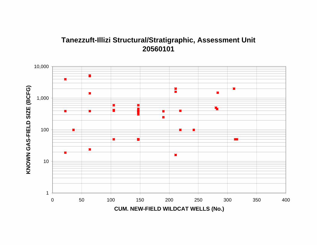
Tanezzuft-Illizi Structural/Stratigraphic, Assessment Unit 20560101
1
10
100
1,000
10,000
0 50 100 150 200 250 300 350 400
CUM. NEW-FIELD WILDCAT WELLS (No.)
KN
OW
N G
AS
-FIE
LD
SIZ
E (
BC
FG
)
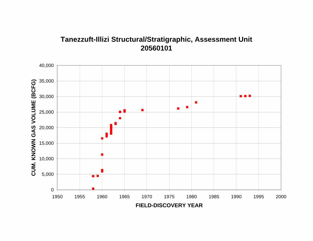
Tanezzuft-Illizi Structural/Stratigraphic, Assessment Unit 20560101
0
5,000
10,000
15,000
20,000
25,000
30,000
35,000
40,000
1950 1955 1960 1965 1970 1975 1980 1985 1990 1995 2000
FIELD-DISCOVERY YEAR
CU
M. K
NO
WN
GA
S V
OL
UM
E (
BC
FG
)

Tanezzuft-Illizi Structural/Stratigraphic, Assessment Unit 20560101
0
5,000
10,000
15,000
20,000
25,000
30,000
35,000
40,000
0 50 100 150 200 250 300 350 400
CUM. NEW-FIELD WILDCAT WELLS (No.)
CU
M. K
NO
WN
GA
S V
OL
UM
E (
BC
FG
)

Tanezzuft-Illizi Structural/Stratigraphic, Assessment Unit 20560101
0
5
10
15
20
25
30
35
40
1950 1955 1960 1965 1970 1975 1980 1985 1990 1995 2000
FIELD-DISCOVERY YEAR
CU
M. G
AS
FIE
LD
S (
No
.)

Tanezzuft-Illizi Structural/Stratigraphic, Assessment Unit 20560101
0
5
10
15
20
25
30
35
40
0 50 100 150 200 250 300 350 400
CUM. NEW-FIELD WILDCAT WELLS (No.)
CU
M. G
AS
FIE
LD
S (
No
.)

Tanezzuft-Illizi Structural/Stratigraphic, Assessment Unit 20560101
0
500
1,000
1,500
2,000
2,500
3,000
3,500
4,0001950 1955 1960 1965 1970 1975 1980 1985 1990 1995 2000
FIELD-DISCOVERY YEAR
RE
SE
RV
OIR
DE
PT
H, G
AS
FIE
LD
S (
m)
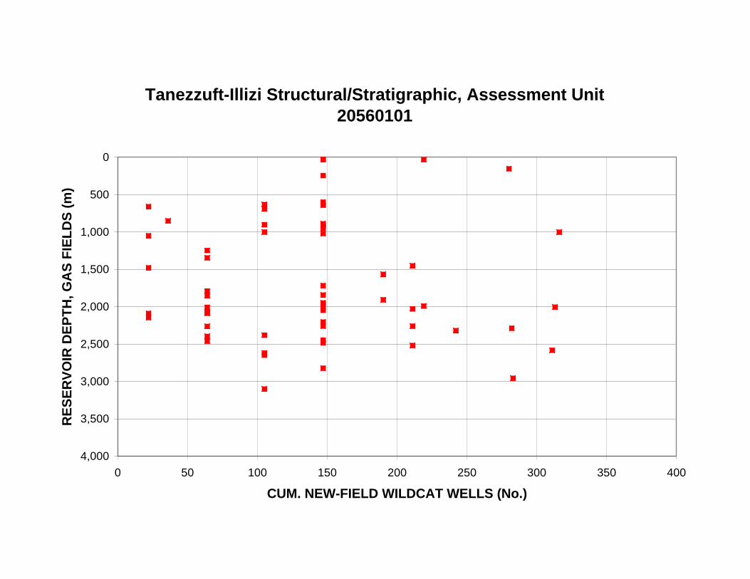
Tanezzuft-Illizi Structural/Stratigraphic, Assessment Unit 20560101
0
500
1,000
1,500
2,000
2,500
3,000
3,500
4,0000 50 100 150 200 250 300 350 400
CUM. NEW-FIELD WILDCAT WELLS (No.)
RE
SE
RV
OIR
DE
PT
H, G
AS
FIE
LD
S (
m)

Tanezzuft-Illizi Structural/Stratigraphic, Assessment Unit 20560101
0
10
20
30
40
50
60
70
80
90
100
0 500 1,000 1,500 2,000 2,500 3,000 3,500 4,000
MEAN RESERVOIR DEPTH (m)
LIQ
UID
S/G
AS
, GA
S F
IEL
DS
(B
L/M
MC
FG
)
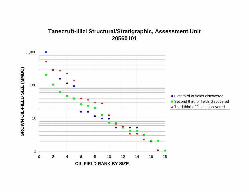
Tanezzuft-Illizi Structural/Stratigraphic, Assessment Unit 20560101
1
10
100
1,000
0 2 4 6 8 10 12 14 16 18
OIL-FIELD RANK BY SIZE
GR
OW
N O
IL-F
IEL
D S
IZE
(M
MB
O)
First third of fields discoveredSecond third of fields discoveredThird third of fields discovered

Tanezzuft-Illizi Structural/Stratigraphic, Assessment Unit 20560101
0
2
4
6
8
10
12
1 to <
2
2 to <
4
4 to <
8
8 to <
16
16 to
<32
32 to
<64
64 to
<128
128 t
o <25
6
256 t
o <51
2
512 t
o <1,0
24
1,024
to <2
,048
2,048
to <4
,096
4,096
to <8
,192
8,192
to <1
6,384
16,38
4 to <
32,76
8
32,76
8 to <
65,53
6
65,53
6 to <
131,0
72
131,0
72 to
<262
,144
>=26
2,144
GROWN OIL-FIELD SIZE (MMBO)
OIL
FIE
LD
S (
No
.)
Third third offieldsdiscovered
Second thirdof fieldsdiscovered
First third offieldsdiscovered

Tanezzuft-Illizi Structural/Stratigraphic, Assessment Unit 20560101
0
200
400
600
800
1,000
1,200
1,400
1,600
1 to <
2
2 to <
4
4 to <
8
8 to <
16
16 to
<32
32 to
<64
64 to
<128
128 t
o <25
6
256 t
o <51
2
512 t
o <1,0
24
1,024
to <2
,048
2,048
to <4
,096
4,096
to <8
,192
8,192
to <1
6,384
16,38
4 to <
32,76
8
32,76
8 to <
65,53
6
65,53
6 to <
131,0
72
131,0
72 to
<262
,144
>=26
2,144
GROWN OIL-FIELD SIZE (MMBO)
VO
LU
ME
OF
OIL
(M
MB
O)
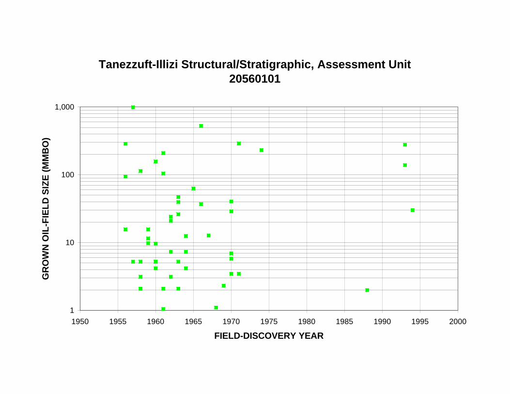
Tanezzuft-Illizi Structural/Stratigraphic, Assessment Unit 20560101
1
10
100
1,000
1950 1955 1960 1965 1970 1975 1980 1985 1990 1995 2000
FIELD-DISCOVERY YEAR
GR
OW
N O
IL-F
IEL
D S
IZE
(M
MB
O)

Tanezzuft-Illizi Structural/Stratigraphic, Assessment Unit 20560101
1
10
100
1,000
0 50 100 150 200 250 300 350 400
CUM. NEW-FIELD WILDCAT WELLS (No.)
GR
OW
N O
IL-F
IEL
D S
IZE
(M
MB
O)

Tanezzuft-Illizi Structural/Stratigraphic, Assessment Unit 20560101
0
500
1,000
1,500
2,000
2,500
3,000
3,500
4,000
4,500
1950 1955 1960 1965 1970 1975 1980 1985 1990 1995 2000
FIELD-DISCOVERY YEAR
CU
M. G
RO
WN
OIL
VO
LU
ME
(M
MB
O)
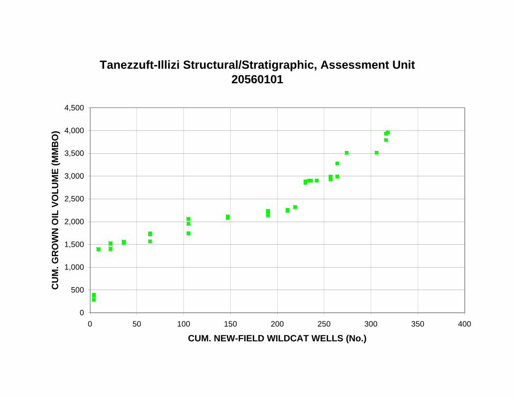
Tanezzuft-Illizi Structural/Stratigraphic, Assessment Unit 20560101
0
500
1,000
1,500
2,000
2,500
3,000
3,500
4,000
4,500
0 50 100 150 200 250 300 350 400
CUM. NEW-FIELD WILDCAT WELLS (No.)
CU
M. G
RO
WN
OIL
VO
LU
ME
(M
MB
O)

Tanezzuft-Illizi Structural/Stratigraphic, Assessment Unit 20560101
0
10
20
30
40
50
60
1950 1955 1960 1965 1970 1975 1980 1985 1990 1995 2000
FIELD-DISCOVERY YEAR
CU
M. O
IL F
IEL
DS
(N
o.)
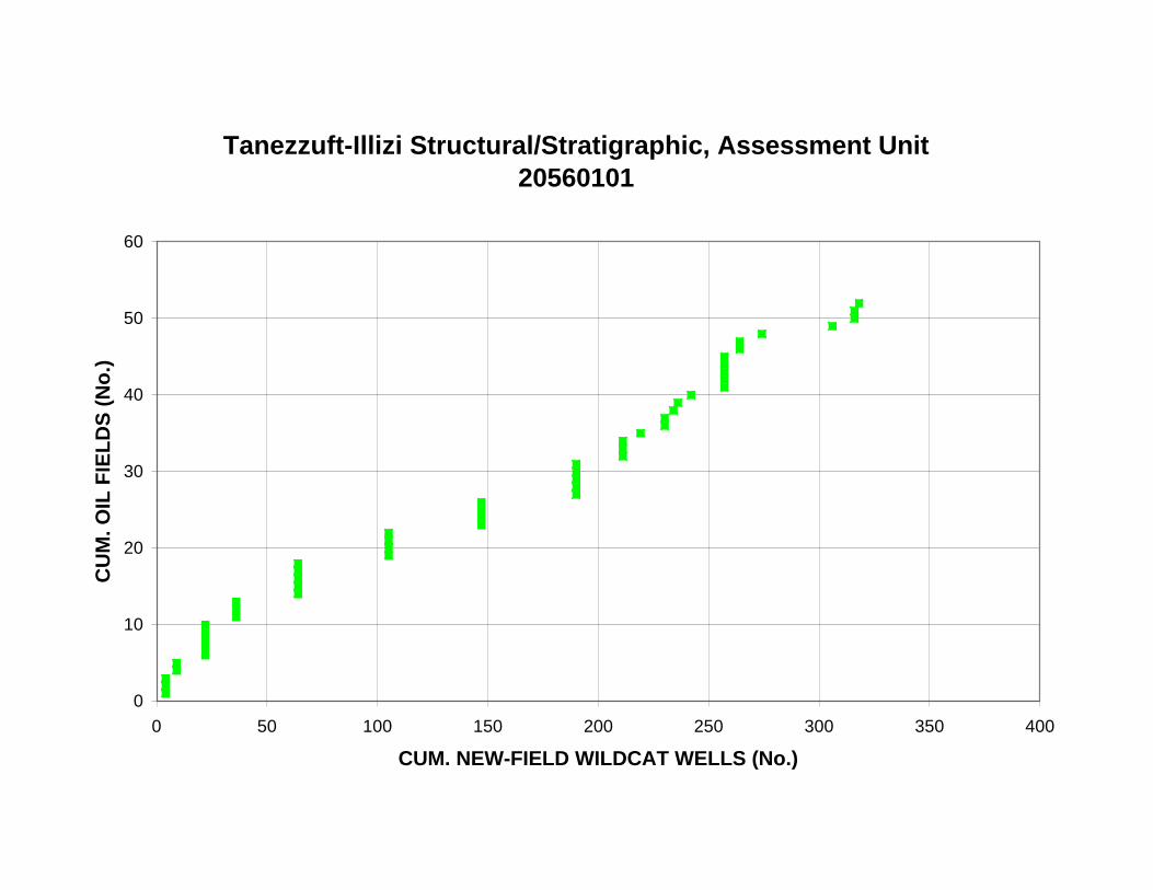
Tanezzuft-Illizi Structural/Stratigraphic, Assessment Unit 20560101
0
10
20
30
40
50
60
0 50 100 150 200 250 300 350 400
CUM. NEW-FIELD WILDCAT WELLS (No.)
CU
M. O
IL F
IEL
DS
(N
o.)

Tanezzuft-Illizi Structural/Stratigraphic, Assessment Unit 20560101
0
500
1,000
1,500
2,000
2,500
3,000
3,500
4,0001950 1955 1960 1965 1970 1975 1980 1985 1990 1995 2000
FIELD-DISCOVERY YEAR
RE
SE
RV
OIR
DE
PT
H, O
IL F
IEL
DS
(m
)

Tanezzuft-Illizi Structural/Stratigraphic, Assessment Unit 20560101
0
500
1,000
1,500
2,000
2,500
3,000
3,500
4,0000 50 100 150 200 250 300 350 400
CUM. NEW-FIELD WILDCAT WELLS (No.)
RE
SE
RV
OIR
DE
PT
H, O
IL F
IEL
DS
(m
)

Tanezzuft-Illizi Structural/Stratigraphic, Assessment Unit 20560101
0
2,000
4,000
6,000
8,000
10,000
12,000
14,000
16,000
18,000
20,000
0 500 1,000 1,500 2,000 2,500 3,000 3,500 4,000
MEAN RESERVOIR DEPTH (m)
GA
S/O
IL, O
IL F
IEL
DS
(C
FG
/BO
)

Tanezzuft-Illizi Structural/Stratigraphic, Assessment Unit 20560101
0
200
400
600
800
1,000
1,200
0 500 1,000 1,500 2,000 2,500 3,000 3,500 4,000
MEAN RESERVOIR DEPTH (m)
NG
L/G
AS
, OIL
FIE
LD
S (
BN
GL
/MM
CF
G)

Tanezzuft-Illizi Structural/Stratigraphic, Assessment Unit 20560101
0
10
20
30
40
50
60
0 to <10 10 to<20
20 to<30
30 to<40
40 to<50
50 to<60
60 to<70
70 to<80
80 to<90
90 to<100
>=100
API GRAVITY (DEGREES)
RE
SE
RV
OIR
S IN
OIL
FIE
LD
S (
No
.)

Tanezzuft-Illizi Structural/Stratigraphic, Assessment Unit 20560101
1
10
100
1,000
10,000
0 2 4 6 8 10 12 14
GAS-FIELD RANK BY SIZE
GR
OW
N G
AS
-FIE
LD
SIZ
E (
BC
FG
)
First third of fields discoveredSecond third of fields discoveredThird third of fields discovered

Tanezzuft-Illizi Structural/Stratigraphic, Assessment Unit 20560101
0
2
4
6
8
10
12
14
6 to <
12
12 to
<24
24 to
<48
48 to
<96
96 to
<192
192 t
o <38
4
384 t
o <76
8
768 t
o <1,5
36
1,536
to <3
,072
3,072
to <6
,144
6,144
to <1
2,288
12,28
8 to <
24,57
6
24,57
6 to <
49,15
2
49,15
2 to <
98,30
4
98,30
4 to <
196,6
08
196,6
08 to
<393
,216
393,2
16 to
<786
,432
786,4
32 to
<1,57
2,864
>=1,5
72,86
4
GROWN GAS-FIELD SIZE (BCFG)
GA
S F
IEL
DS
(N
o.)
Third third offieldsdiscovered
Second thirdof fieldsdiscovered
First third offieldsdiscovered

Tanezzuft-Illizi Structural/Stratigraphic, Assessment Unit 20560101
0
5,000
10,000
15,000
20,000
25,000
6 to <
12
12 to
<24
24 to
<48
48 to
<96
96 to
<192
192 t
o <38
4
384 t
o <76
8
768 t
o <1,5
36
1,536
to <3
,072
3,072
to <6
,144
6,144
to <1
2,288
12,28
8 to <
24,57
6
24,57
6 to <
49,15
2
49,15
2 to <
98,30
4
98,30
4 to <
196,6
08
196,6
08 to
<393
,216
393,2
16 to
<786
,432
786,4
32 to
<1,57
2,864
>=1,5
72,86
4
GROWN GAS-FIELD SIZE (BCFG)
VO
LU
ME
OF
GA
S (
BC
FG
)

Tanezzuft-Illizi Structural/Stratigraphic, Assessment Unit 20560101
1
10
100
1,000
10,000
1950 1955 1960 1965 1970 1975 1980 1985 1990 1995 2000
FIELD-DISCOVERY YEAR
GR
OW
N G
AS
-FIE
LD
SIZ
E (
BC
FG
)

Tanezzuft-Illizi Structural/Stratigraphic, Assessment Unit 20560101
1
10
100
1,000
10,000
0 50 100 150 200 250 300 350 400
CUM. NEW-FIELD WILDCAT WELLS (No.)
GR
OW
N G
AS
-FIE
LD
SIZ
E (
BC
FG
)

Tanezzuft-Illizi Structural/Stratigraphic, Assessment Unit 20560101
0
5,000
10,000
15,000
20,000
25,000
30,000
35,000
40,000
1950 1955 1960 1965 1970 1975 1980 1985 1990 1995 2000
FIELD-DISCOVERY YEAR
CU
M. G
RO
WN
GA
S V
OL
UM
E (
BC
FG
)

Tanezzuft-Illizi Structural/Stratigraphic, Assessment Unit 20560101
0
5,000
10,000
15,000
20,000
25,000
30,000
35,000
40,000
0 50 100 150 200 250 300 350 400
CUM. NEW-FIELD WILDCAT WELLS (No.)
CU
M. G
RO
WN
GA
S V
OL
UM
E (
BC
FG
)

Tanezzuft-Illizi Structural/Stratigraphic, Assessment Unit 20560101
0
5
10
15
20
25
30
35
40
45
1950 1955 1960 1965 1970 1975 1980 1985 1990 1995 2000
FIELD-DISCOVERY YEAR
CU
M. G
AS
FIE
LD
S (
No
.)

Tanezzuft-Illizi Structural/Stratigraphic, Assessment Unit 20560101
0
5
10
15
20
25
30
35
40
45
0 50 100 150 200 250 300 350 400
CUM. NEW-FIELD WILDCAT WELLS (No.)
CU
M. G
AS
FIE
LD
S (
No
.)

Tanezzuft-Illizi Structural/Stratigraphic, Assessment Unit 20560101
0
500
1,000
1,500
2,000
2,500
3,000
3,500
4,0001950 1955 1960 1965 1970 1975 1980 1985 1990 1995 2000
FIELD-DISCOVERY YEAR
RE
SE
RV
OIR
DE
PT
H, G
AS
FIE
LD
S (
m)

Tanezzuft-Illizi Structural/Stratigraphic, Assessment Unit 20560101
0
500
1,000
1,500
2,000
2,500
3,000
3,500
4,0000 50 100 150 200 250 300 350 400
CUM. NEW-FIELD WILDCAT WELLS (No.)
RE
SE
RV
OIR
DE
PT
H, G
AS
FIE
LD
S (
m)
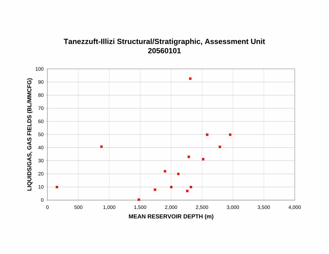
Tanezzuft-Illizi Structural/Stratigraphic, Assessment Unit 20560101
0
10
20
30
40
50
60
70
80
90
100
0 500 1,000 1,500 2,000 2,500 3,000 3,500 4,000
MEAN RESERVOIR DEPTH (m)
LIQ
UID
S/G
AS
, GA
S F
IEL
DS
(B
L/M
MC
FG
)