toronto urban design guidelines · city planning november 2012 (revision 1) toronto urban design...
TRANSCRIPT
City Planning November 2012(revision 1)
Toronto Urban Design Guidelines
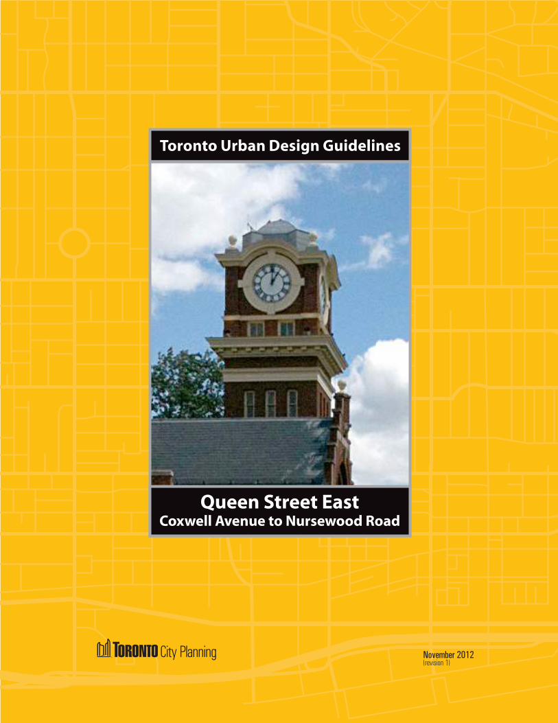
Queen Street EastCoxwell Avenue to Nursewood Road

URBAN DESIGN GUIDELINES
QUEEN STREET EAST: COXWELL AVENUE TO NURSEWOOD ROAD
TORONTOiOctober 2012
TABLE OF CONTENTS
MANDATE ..................................................................................................................................... 1
1. INTRODUCTION ............................................................................................................................ 2 1.1 Location ................................................................................................................................... 2 1.2 Sub Areas of Queen Street East ............................................................................................. 3
2. HISTORY OF THE BEACH ........................................................................................................... 4
3. THE BEACH AND ITS IMPORTANCE AS A TOURIST DESTINATION .................................10
4. GENERAL URBAN DESIGN GUIDELINES ...............................................................................11 4.1 Public Realm .......................................................................................................................... 12 4.2 Site Organization ................................................................................................................... 13 4.3 Massing .................................................................................................................................. 14 4.4 Heritage .................................................................................................................................. 15 4.5 Pedestrian Amenity ................................................................................................................ 15
5. WOODBINE BEACH PRECINCT URBAN DESIGN GUIDELINES .......................................... 16 5.1 Public Realm .......................................................................................................................... 16 5.2 Site Organization ................................................................................................................... 17 5.3 Massing .................................................................................................................................. 17
6. KEW BEACH PRECINCT URBAN DESIGN GUIDELINES ...................................................... 20 6.1 Public Realm .......................................................................................................................... 20 6.2 Site Organization ................................................................................................................... 20 6.3 Massing ...................................................................................................................................21
7. BALMY BEACH PRECINCT URBAN DESIGN GUIDELINES ................................................. 30 7.1 Public Realm .......................................................................................................................... 32 7.2 Site Organization ................................................................................................................... 32 7.3 Massing .................................................................................................................................. 34
8. DESIGN EXCELLENCE ............................................................................................................... 39
9. TRANSPORTATION AND INFRASTRUCTURE......................................................................... 40
10. SUSTAINABILITY ........................................................................................................................41
APPENDICES
APPENDIX A: MAPS ...................................................................................................................... 45
APPENDIX B: EXISTING ARCHITECTURAL STYLES ON QUEEN STREET EAST .................. 46
APPENDIX C: SHADOW STUDIES ................................................................................................ 48
APPENDIX D: ANGULAR PLANES AND 3D VIEWS ................................................................. 58
APPENDIX E: QUEEN STREET EAST STREETSCAPE MONTAGES - NORTH SIDE .............. 60
APPENDIX F: QUEEN STREET EAST STREETSCAPE MONTAGES - SOUTH SIDE ............... 62
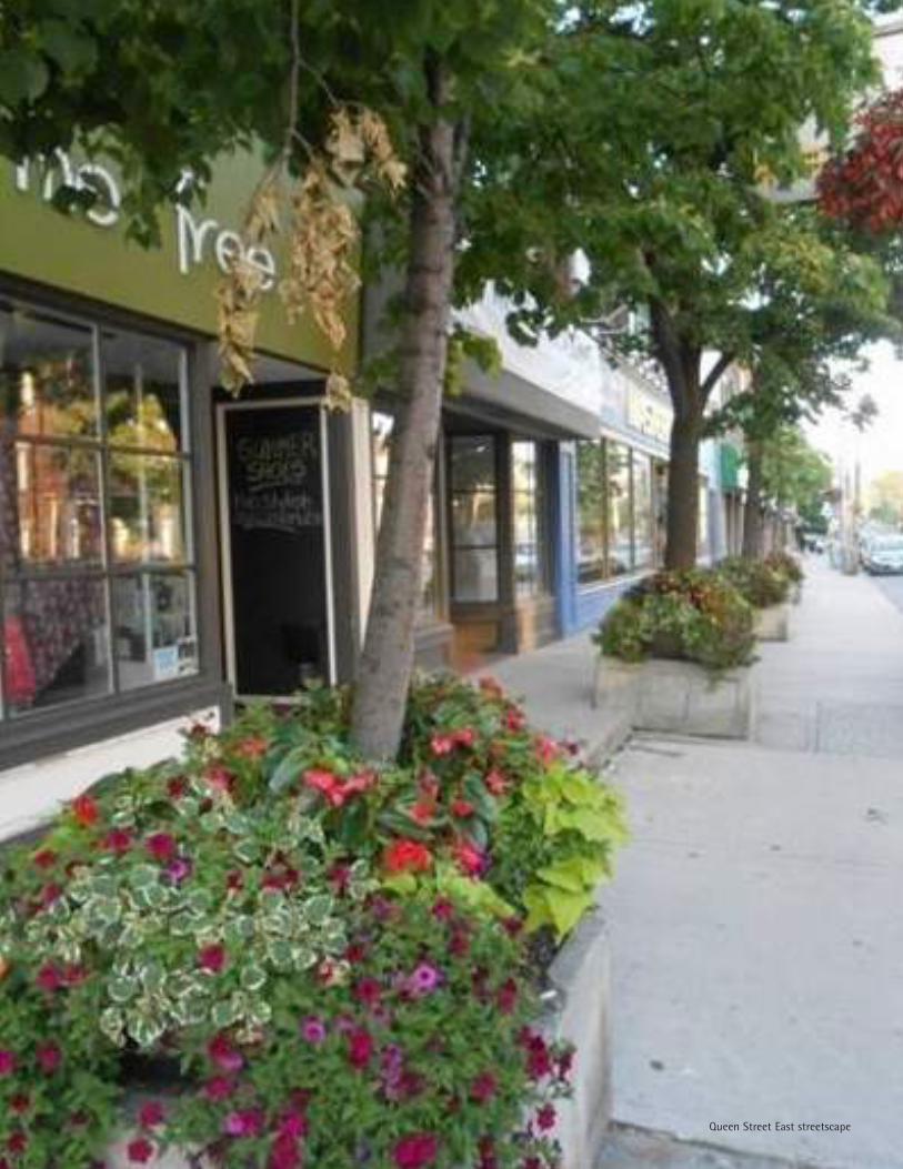
Queen Street East streetscape
URBAN DESIGN GUIDELINES
QUEEN STREET EAST: COXWELL AVENUE TO NURSEWOOD ROAD
TORONTO1October 2012
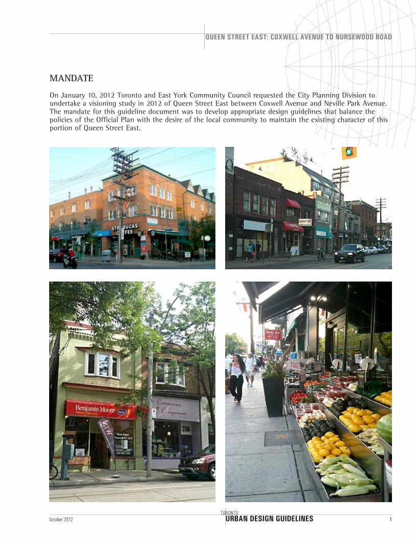
MANDATE
On January 10, 2012 Toronto and East York Community Council requested the City Planning Division to undertake a visioning study in 2012 of Queen Street East between Coxwell Avenue and Neville Park Avenue. The mandate for this guideline document was to develop appropriate design guidelines that balance the policies of the Official Plan with the desire of the local community to maintain the existing character of this portion of Queen Street East.
URBAN DESIGN GUIDELINES
QUEEN STREET EAST: COXWELL AVENUE TO NURSEWOOD ROAD
2TORONTO
October 2012
1. INTRODUCTION
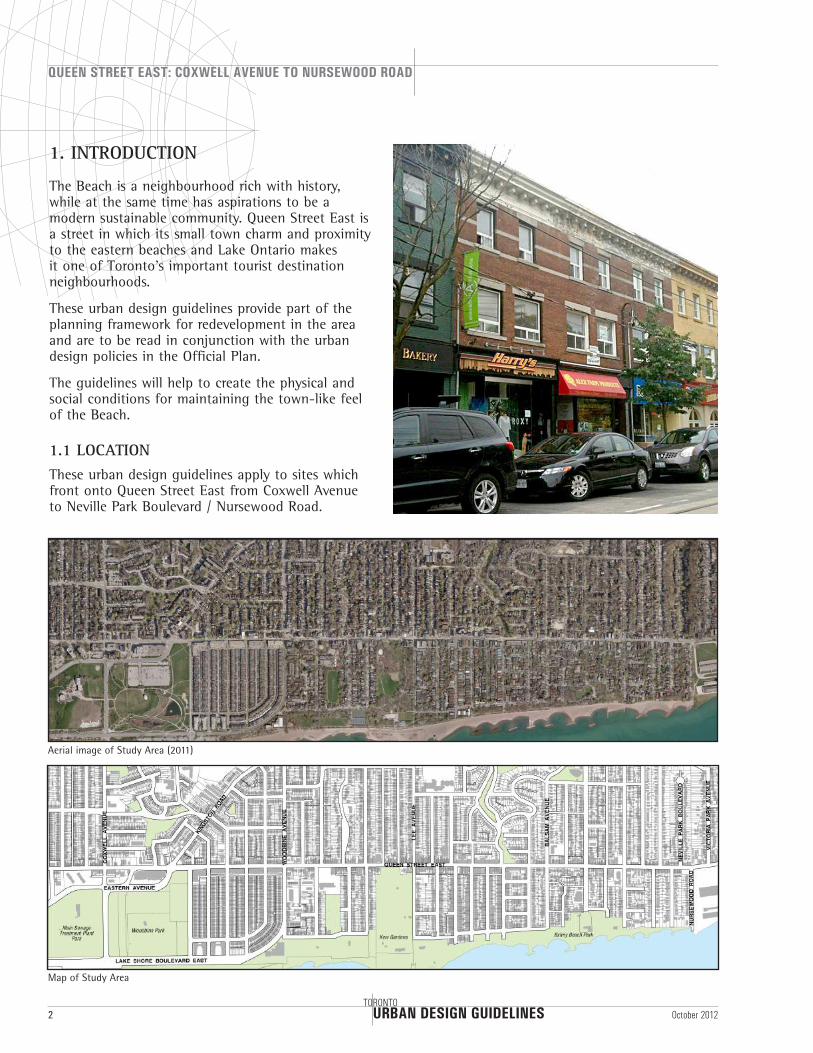
The Beach is a neighbourhood rich with history, while at the same time has aspirations to be a modern sustainable community. Queen Street East is a street in which its small town charm and proximity to the eastern beaches and Lake Ontario makes it one of Toronto’s important tourist destination neighbourhoods.
These urban design guidelines provide part of the planning framework for redevelopment in the area and are to be read in conjunction with the urban design policies in the Official Plan.
The guidelines will help to create the physical and social conditions for maintaining the town-like feel of the Beach.
1.1 LOCATIONThese urban design guidelines apply to sites which front onto Queen Street East from Coxwell Avenue to Neville Park Boulevard / Nursewood Road.
Aerial image of Study Area (2011)
Map of Study Area
URBAN DESIGN GUIDELINES
QUEEN STREET EAST: COXWELL AVENUE TO NURSEWOOD ROAD
TORONTO3October 2012
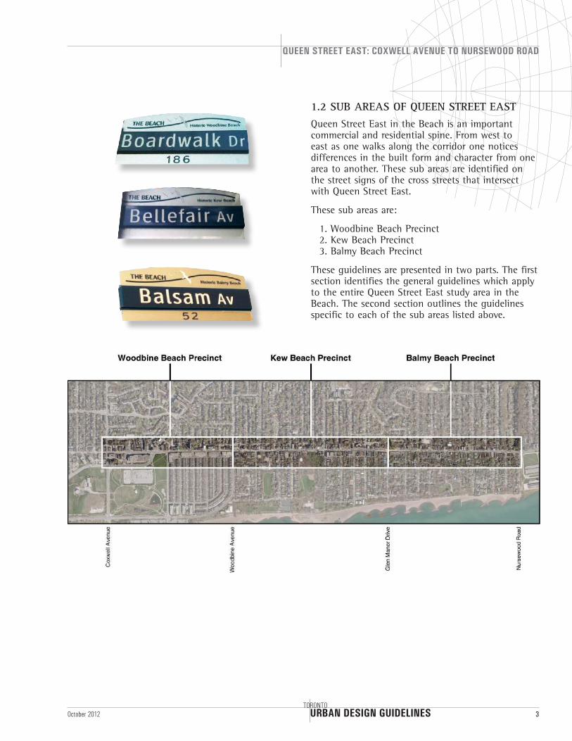
1.2 SUB AREAS OF QUEEN STREET EASTQueen Street East in the Beach is an important commercial and residential spine. From west to east as one walks along the corridor one notices differences in the built form and character from one area to another. These sub areas are identified on the street signs of the cross streets that intersect with Queen Street East.
These sub areas are:
1. Woodbine Beach Precinct 2. Kew Beach Precinct 3. Balmy Beach Precinct
These guidelines are presented in two parts. The first section identifies the general guidelines which apply to the entire Queen Street East study area in the Beach. The second section outlines the guidelines specific to each of the sub areas listed above.
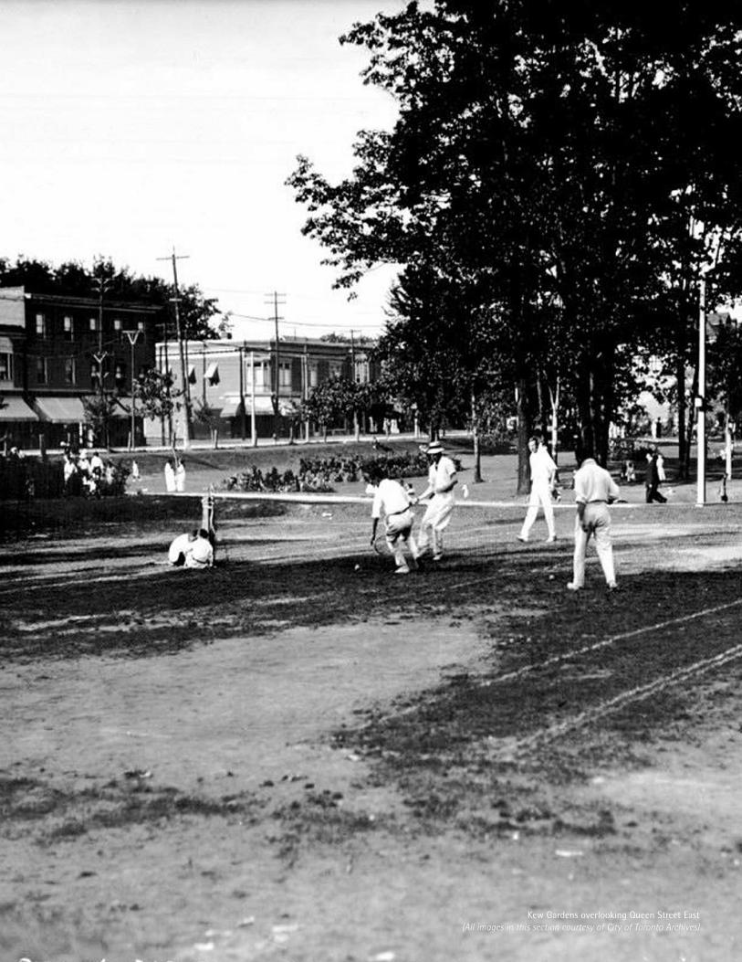
Kew Gardens overlooking Queen Street East(All images in this section courtesy of City of Toronto Archives)
URBAN DESIGN GUIDELINES
QUEEN STREET EAST: COXWELL AVENUE TO NURSEWOOD ROAD
TORONTO5October 2012
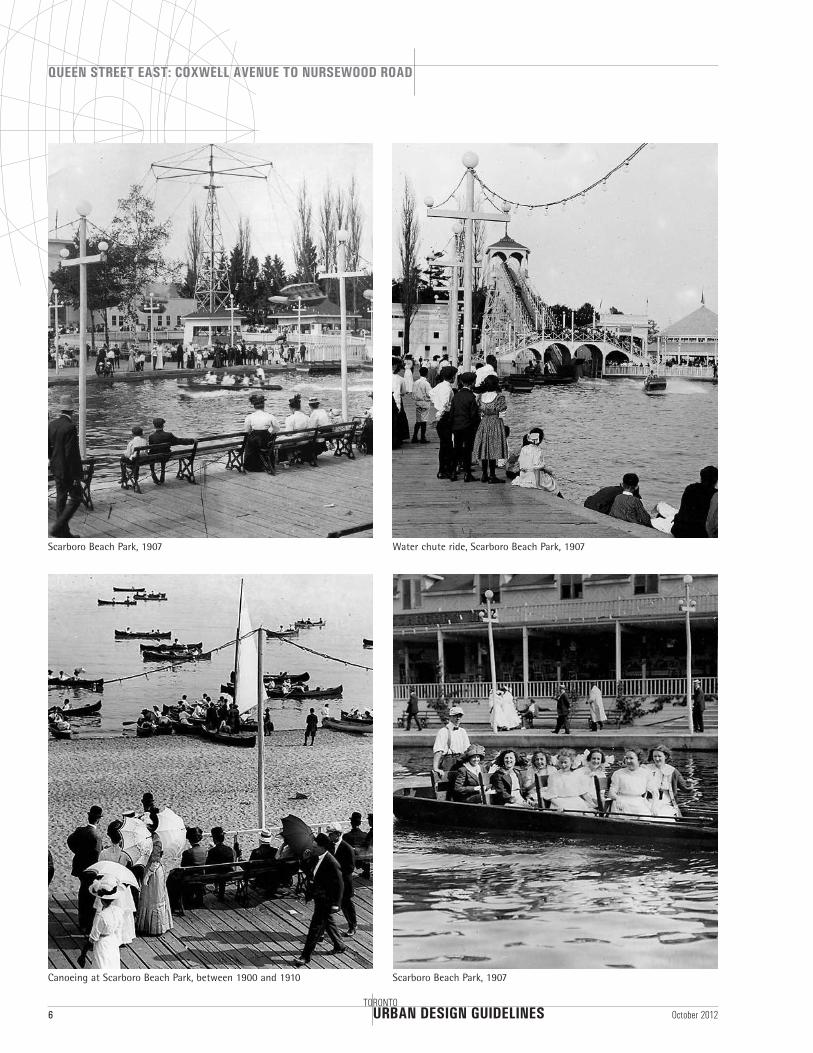
Scarboro Beach Park circa 1907, one of six Beaches amusement and recreation parks (including Woodbine Riding and Driving Club, Small’s Pond and Park) that were popular from the late 1880’s to the 1920’s
Ashbridges Estate
Water chute ride, Scarboro Beach Park
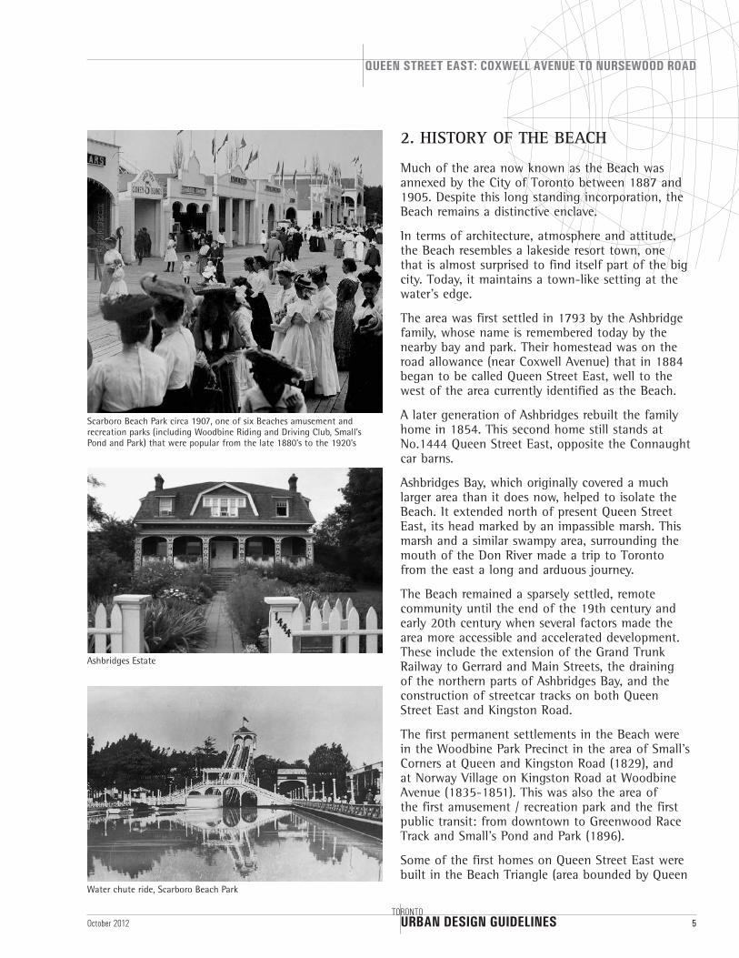
2. HISTORY OF THE BEACH
Much of the area now known as the Beach was annexed by the City of Toronto between 1887 and 1905. Despite this long standing incorporation, the Beach remains a distinctive enclave.
In terms of architecture, atmosphere and attitude, the Beach resembles a lakeside resort town, one that is almost surprised to find itself part of the big city. Today, it maintains a town-like setting at the water’s edge.
The area was first settled in 1793 by the Ashbridge family, whose name is remembered today by the nearby bay and park. Their homestead was on the road allowance (near Coxwell Avenue) that in 1884 began to be called Queen Street East, well to the west of the area currently identified as the Beach.
A later generation of Ashbridges rebuilt the family home in 1854. This second home still stands at No.1444 Queen Street East, opposite the Connaught car barns.
Ashbridges Bay, which originally covered a much larger area than it does now, helped to isolate the Beach. It extended north of present Queen Street East, its head marked by an impassible marsh. This marsh and a similar swampy area, surrounding the mouth of the Don River made a trip to Toronto from the east a long and arduous journey.
The Beach remained a sparsely settled, remote community until the end of the 19th century and early 20th century when several factors made the area more accessible and accelerated development. These include the extension of the Grand Trunk Railway to Gerrard and Main Streets, the draining of the northern parts of Ashbridges Bay, and the construction of streetcar tracks on both Queen Street East and Kingston Road.
The first permanent settlements in the Beach were in the Woodbine Park Precinct in the area of Small’s Corners at Queen and Kingston Road (1829), and at Norway Village on Kingston Road at Woodbine Avenue (1835-1851). This was also the area of the first amusement / recreation park and the first public transit: from downtown to Greenwood Race Track and Small’s Pond and Park (1896).
Some of the first homes on Queen Street East were built in the Beach Triangle (area bounded by Queen
URBAN DESIGN GUIDELINES
QUEEN STREET EAST: COXWELL AVENUE TO NURSEWOOD ROAD
6TORONTO
October 2012
Scarboro Beach Park, 1907 Water chute ride, Scarboro Beach Park, 1907
Scarboro Beach Park, 1907Canoeing at Scarboro Beach Park, between 1900 and 1910
URBAN DESIGN GUIDELINES
QUEEN STREET EAST: COXWELL AVENUE TO NURSEWOOD ROAD
TORONTO7October 2012
Street East, Kingston Road and Woodbine Avenue) in 1902 along with the construction of St. John’s Norway Church and Corpus Christie Church.
Woodbine, Kew and Balmy Beaches, were built as a community of summer cottages and hotels beside the Lake.
Amusement and recreation parks were also built, specifically: Woodbine Driving and Riding Club (1875), Victoria Park (1878), Kew Gardens (1879), Small’s Pond and Park (1896), Munro Park (1896), Balmy Beach Park (1903), and Scarboro Beach Amusement Park (1907).
The popularity of these parks peaked in the early 1900’s, but by the 1920s all had closed.
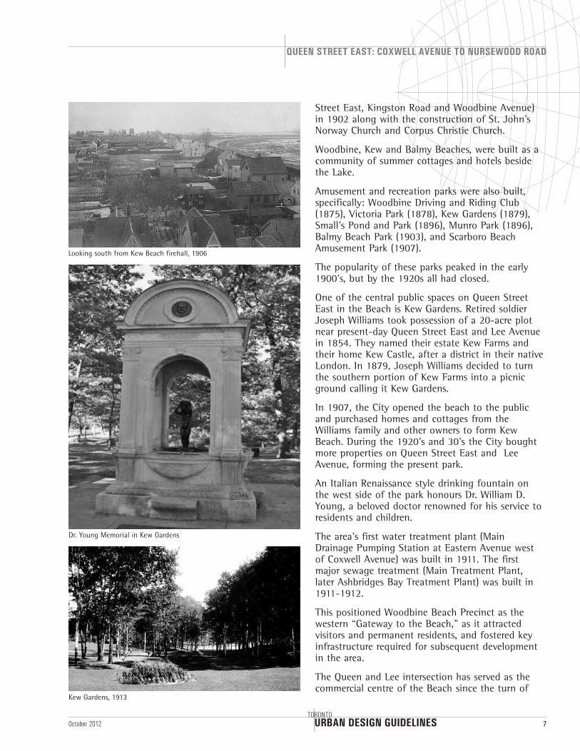
One of the central public spaces on Queen Street East in the Beach is Kew Gardens. Retired soldier Joseph Williams took possession of a 20-acre plot near present-day Queen Street East and Lee Avenue in 1854. They named their estate Kew Farms and their home Kew Castle, after a district in their native London. In 1879, Joseph Williams decided to turn the southern portion of Kew Farms into a picnic ground calling it Kew Gardens.
In 1907, the City opened the beach to the public and purchased homes and cottages from the Williams family and other owners to form Kew Beach. During the 1920’s and 30’s the City bought more properties on Queen Street East and Lee Avenue, forming the present park.
An Italian Renaissance style drinking fountain on the west side of the park honours Dr. William D. Young, a beloved doctor renowned for his service to residents and children.
The area’s first water treatment plant (Main Drainage Pumping Station at Eastern Avenue west of Coxwell Avenue) was built in 1911. The first major sewage treatment (Main Treatment Plant, later Ashbridges Bay Treatment Plant) was built in 1911-1912.
This positioned Woodbine Beach Precinct as the western “Gateway to the Beach,” as it attracted visitors and permanent residents, and fostered key infrastructure required for subsequent development in the area.
The Queen and Lee intersection has served as the commercial centre of the Beach since the turn of
Looking south from Kew Beach firehall, 1906
Dr. Young Memorial in Kew Gardens
Kew Gardens, 1913
URBAN DESIGN GUIDELINES
QUEEN STREET EAST: COXWELL AVENUE TO NURSEWOOD ROAD
8TORONTO
October 2012
the century. Previously, fine mercantile institutions such as Smith’s Grocery Store, Woolworth’s and Dominion Bank occupied the corners. The Beaches library, designed by Edan Smith and Son’s Architects, was constructed near these businesses by means of a Carnegie Foundation grant in 1915, and was most recently renovated in 2004.
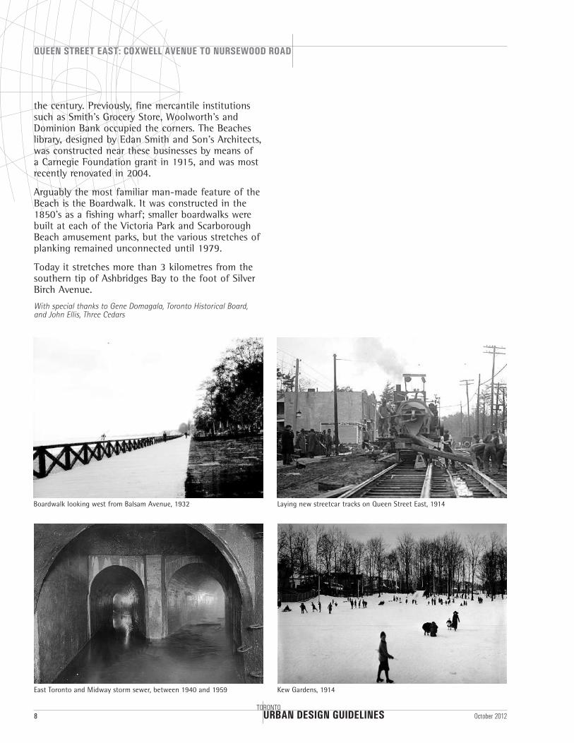
Arguably the most familiar man-made feature of the Beach is the Boardwalk. It was constructed in the 1850’s as a fishing wharf; smaller boardwalks were built at each of the Victoria Park and Scarborough Beach amusement parks, but the various stretches of planking remained unconnected until 1979.
Today it stretches more than 3 kilometres from the southern tip of Ashbridges Bay to the foot of Silver Birch Avenue.
With special thanks to Gene Domagala, Toronto Historical Board, and John Ellis, Three Cedars
Boardwalk looking west from Balsam Avenue, 1932
East Toronto and Midway storm sewer, between 1940 and 1959
Laying new streetcar tracks on Queen Street East, 1914
Kew Gardens, 1914
URBAN DESIGN GUIDELINES
QUEEN STREET EAST: COXWELL AVENUE TO NURSEWOOD ROAD
10TORONTO
October 2012
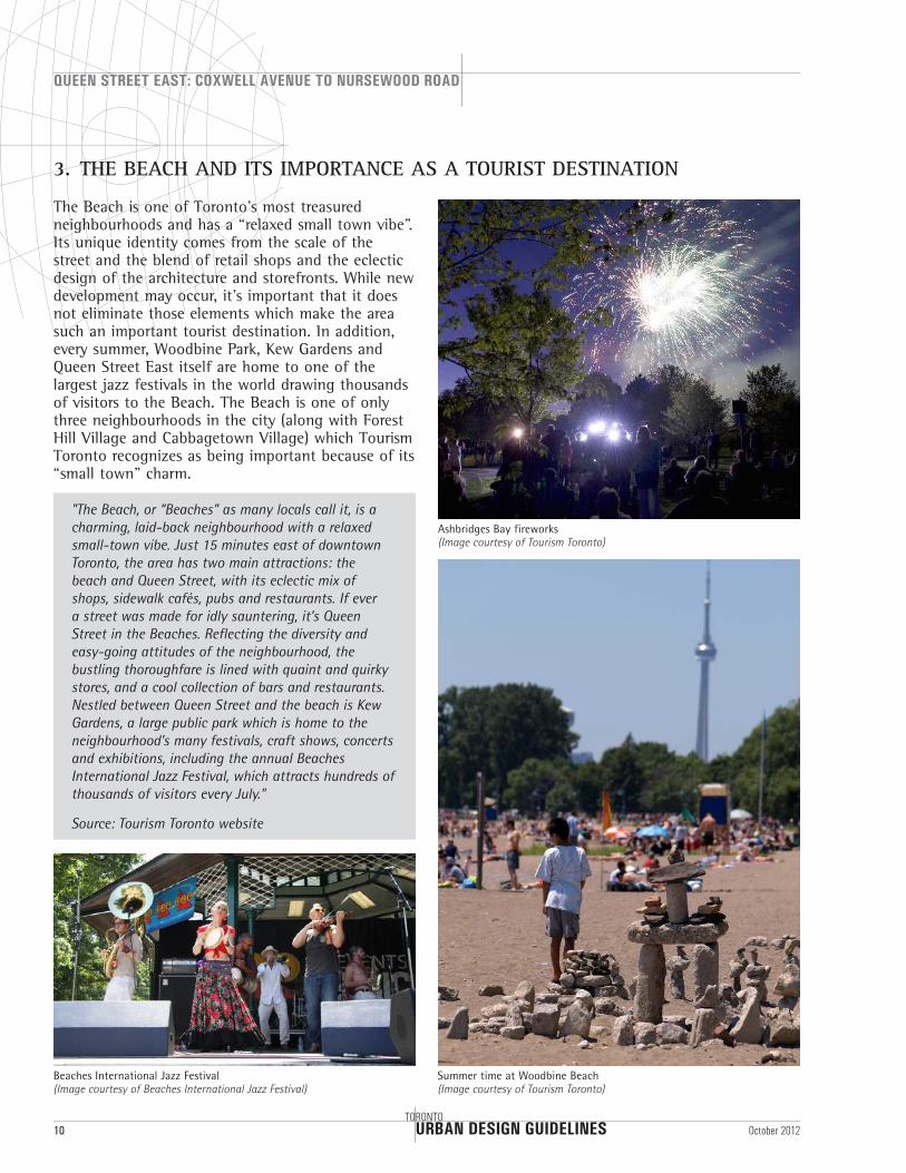
3. THE BEACH AND ITS IMPORTANCE AS A TOURIST DESTINATION
The Beach is one of Toronto’s most treasured neighbourhoods and has a “relaxed small town vibe”. Its unique identity comes from the scale of the street and the blend of retail shops and the eclectic design of the architecture and storefronts. While new development may occur, it’s important that it does not eliminate those elements which make the area such an important tourist destination. In addition, every summer, Woodbine Park, Kew Gardens and Queen Street East itself are home to one of the largest jazz festivals in the world drawing thousands of visitors to the Beach. The Beach is one of only three neighbourhoods in the city (along with Forest Hill Village and Cabbagetown Village) which Tourism Toronto recognizes as being important because of its “small town” charm.
"The Beach, or “Beaches” as many locals call it, is a charming, laid-back neighbourhood with a relaxed small-town vibe. Just 15 minutes east of downtown Toronto, the area has two main attractions: the beach and Queen Street, with its eclectic mix of shops, sidewalk cafés, pubs and restaurants. If ever a street was made for idly sauntering, it’s Queen Street in the Beaches. Reflecting the diversity and easy-going attitudes of the neighbourhood, the bustling thoroughfare is lined with quaint and quirky stores, and a cool collection of bars and restaurants. Nestled between Queen Street and the beach is Kew Gardens, a large public park which is home to the neighbourhood’s many festivals, craft shows, concerts and exhibitions, including the annual Beaches International Jazz Festival, which attracts hundreds of thousands of visitors every July."
Source: Tourism Toronto website
Beaches International Jazz Festival(Image courtesy of Beaches International Jazz Festival)
Summer time at Woodbine Beach(Image courtesy of Tourism Toronto)
Ashbridges Bay fireworks(Image courtesy of Tourism Toronto)
Guide l inesURBAN DESIGN
URBAN DESIGN GUIDELINES
QUEEN STREET EAST: COXWELL AVENUE TO NURSEWOOD ROAD
12TORONTO
October 2012
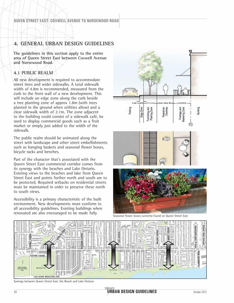
The guidelines in this section apply to the entire area of Queen Street East between Coxwell Avenue and Nursewood Road.
4.1 PUBLIC REALMAll new development is required to accommodate street trees and wider sidewalks. A total sidewalk width of 4.8m is recommended, measured from the curb to the front wall of a new development. This will include an edge zone along the curb beside a tree planting zone of approx 1.8m (with trees planted in the ground when utilities allow) and a clear sidewalk width of 2.1m. The zone adjacent to the building could consist of a sidewalk café, be used to display commercial goods such as a fruit market or simply just added to the width of the sidewalk.
The public realm should be animated along the street with landscape and other street embellishments such as hanging baskets and seasonal flower boxes, bicycle racks and benches.
Part of the character that’s associated with the Queen Street East commercial corridor comes from its synergy with the beaches and Lake Ontario. Existing views to the beaches and lake from Queen Street East and points further north and south are to be protected. Required setbacks on residential streets must be maintained in order to preserve these north to south views.
Accessibility is a primary characteristic of the built environment. New developments must conform to all accessibility guidelines. Existing buildings when renovated are also encouraged to be made fully
Synergy between Queen Street East, the Beach and Lake Ontario
4. GENERAL URBAN DESIGN GUIDELINES
Seasonal flower boxes currently found on Queen Street East
URBAN DESIGN GUIDELINES
QUEEN STREET EAST: COXWELL AVENUE TO NURSEWOOD ROAD
TORONTO13October 2012
accessible. This is an important aspect of being a welcoming community. These guidelines will promote building for all ages and abilities.
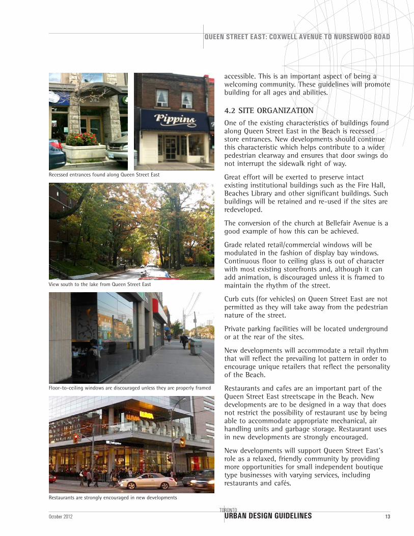
4.2 SITE ORGANIZATIONOne of the existing characteristics of buildings found along Queen Street East in the Beach is recessed store entrances. New developments should continue this characteristic which helps contribute to a wider pedestrian clearway and ensures that door swings do not interrupt the sidewalk right of way.
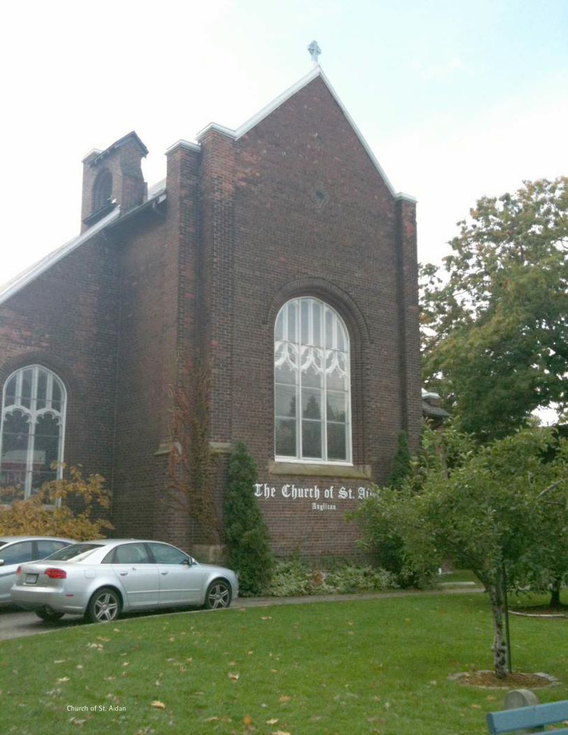
Great effort will be exerted to preserve intact existing institutional buildings such as the Fire Hall, Beaches Library and other significant buildings. Such buildings will be retained and re-used if the sites are redeveloped.
The conversion of the church at Bellefair Avenue is a good example of how this can be achieved.
Grade related retail/commercial windows will be modulated in the fashion of display bay windows. Continuous floor to ceiling glass is out of character with most existing storefronts and, although it can add animation, is discouraged unless it is framed to maintain the rhythm of the street.
Curb cuts (for vehicles) on Queen Street East are not permitted as they will take away from the pedestrian nature of the street.
Private parking facilities will be located underground or at the rear of the sites.
New developments will accommodate a retail rhythm that will reflect the prevailing lot pattern in order to encourage unique retailers that reflect the personality of the Beach.
Restaurants and cafes are an important part of the Queen Street East streetscape in the Beach. New developments are to be designed in a way that does not restrict the possibility of restaurant use by being able to accommodate appropriate mechanical, air handling units and garbage storage. Restaurant uses in new developments are strongly encouraged.
New developments will support Queen Street East's role as a relaxed, friendly community by providing more opportunities for small independent boutique type businesses with varying services, including restaurants and cafés.
Recessed entrances found along Queen Street East
View south to the lake from Queen Street East
Floor-to-ceiling windows are discouraged unless they are properly framed
Restaurants are strongly encouraged in new developments
URBAN DESIGN GUIDELINES
QUEEN STREET EAST: COXWELL AVENUE TO NURSEWOOD ROAD
14TORONTO
October 2012
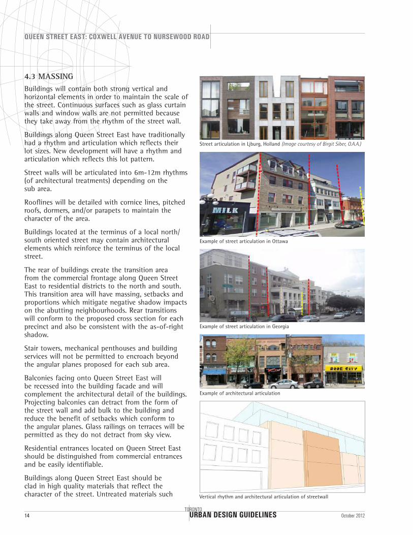
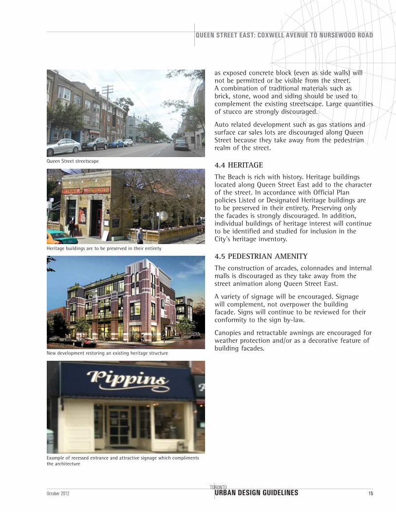
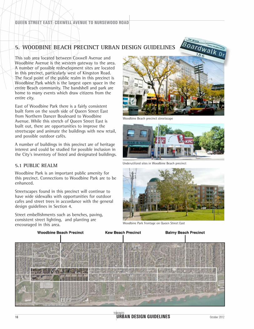
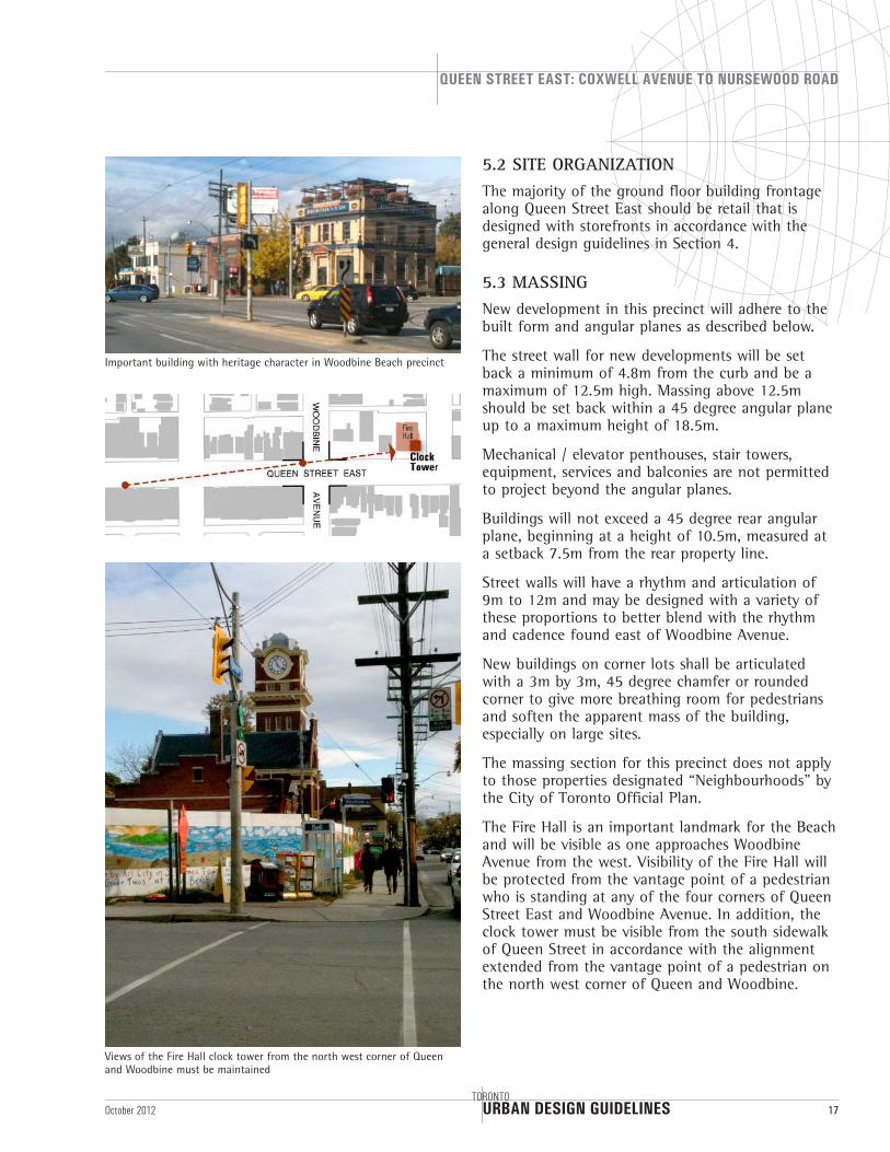
4.3 MASSINGBuildings will contain both strong vertical and horizontal elements in order to maintain the scale of the street. Continuous surfaces such as glass curtain walls and window walls are not permitted because they take away from the rhythm of the street wall.
Buildings along Queen Street East have traditionally had a rhythm and articulation which reflects their lot sizes. New development will have a rhythm and articulation which reflects this lot pattern.
Street walls will be articulated into 6m-12m rhythms (of architectural treatments) depending on the sub area.
Rooflines will be detailed with cornice lines, pitched roofs, dormers, and/or parapets to maintain the character of the area.
Buildings located at the terminus of a local north/south oriented street may contain architectural elements which reinforce the terminus of the local street.
The rear of buildings create the transition area from the commercial frontage along Queen Street East to residential districts to the north and south. This transition area will have massing, setbacks and proportions which mitigate negative shadow impacts on the abutting neighbourhoods. Rear transitions will conform to the proposed cross section for each precinct and also be consistent with the as-of-right shadow.
Stair towers, mechanical penthouses and building services will not be permitted to encroach beyond the angular planes proposed for each sub area.
Balconies facing onto Queen Street East will be recessed into the building facade and will complement the architectural detail of the buildings. Projecting balconies can detract from the form of the street wall and add bulk to the building and reduce the benefit of setbacks which conform to the angular planes. Glass railings on terraces will be permitted as they do not detract from sky view.
Residential entrances located on Queen Street East should be distinguished from commercial entrances and be easily identifiable.
Buildings along Queen Street East should be clad in high quality materials that reflect the character of the street. Untreated materials such
Street articulation in Ljburg, Holland (Image courtesy of Birgit Siber, O.A.A.)
Vertical rhythm and architectural articulation of streetwall
Example of architectural articulation
Example of street articulation in Ottawa
Example of street articulation in Georgia
URBAN DESIGN GUIDELINES
QUEEN STREET EAST: COXWELL AVENUE TO NURSEWOOD ROAD
TORONTO15October 2012
as exposed concrete block (even as side walls) will not be permitted or be visible from the street. A combination of traditional materials such as brick, stone, wood and siding should be used to complement the existing streetscape. Large quantities of stucco are strongly discouraged.
Auto related development such as gas stations and surface car sales lots are discouraged along Queen Street because they take away from the pedestrian realm of the street.
4.4 HERITAGEThe Beach is rich with history. Heritage buildings located along Queen Street East add to the character of the street. In accordance with Official Plan policies Listed or Designated Heritage buildings are to be preserved in their entirety. Preserving only the facades is strongly discouraged. In addition, individual buildings of heritage interest will continue to be identified and studied for inclusion in the City’s heritage inventory.
4.5 PEDESTRIAN AMENITYThe construction of arcades, colonnades and internal malls is discouraged as they take away from the street animation along Queen Street East.
A variety of signage will be encouraged. Signage will complement, not overpower the building facade. Signs will continue to be reviewed for their conformity to the sign by-law.
Canopies and retractable awnings are encouraged for weather protection and/or as a decorative feature of building facades.
Queen Street streetscape
Heritage buildings are to be preserved in their entirety
Example of recessed entrance and attractive signage which compliments the architecture
New development restoring an existing heritage structure
URBAN DESIGN GUIDELINES
QUEEN STREET EAST: COXWELL AVENUE TO NURSEWOOD ROAD
16TORONTO
October 2012
5. WOODBINE BEACH PRECINCT URBAN DESIGN GUIDELINES
This sub area located between Coxwell Avenue and Woodbine Avenue is the western gateway to the area. A number of possible redevelopment sites are located in this precinct, particularly west of Kingston Road. The focal point of the public realm in this precinct is Woodbine Park which is the largest open space in the entire Beach community. The bandshell and park are home to many events which draw citizens from the entire city.
East of Woodbine Park there is a fairly consistent built form on the south side of Queen Street East from Northern Dancer Boulevard to Woodbine Avenue. While this stretch of Queen Street East is built out, there are opportunities to improve the streetscape and animate the buildings with new retail, and possible outdoor cafés.
A number of buildings in this precinct are of heritage interest and could be studied for possible inclusion in the City’s inventory of listed and designated buildings.
5.1 PUBLIC REALMWoodbine Park is an important public amenity for this precinct. Connections to Woodbine Park are to be enhanced.
Streetscapes found in this precinct will continue to have wide sidewalks with opportunities for outdoor cafes and street trees in accordance with the general design guidelines in Section 4.
Street embellishments such as benches, paving, consistent street lighting, and planting are encouraged in this area.
Woodbine Beach precinct streetscape
Underutilized sites in Woodbine Beach precinct
Woodbine Park frontage on Queen Street East
URBAN DESIGN GUIDELINES
QUEEN STREET EAST: COXWELL AVENUE TO NURSEWOOD ROAD
TORONTO17October 2012
5.2 SITE ORGANIZATIONThe majority of the ground floor building frontage along Queen Street East should be retail that is designed with storefronts in accordance with the general design guidelines in Section 4.
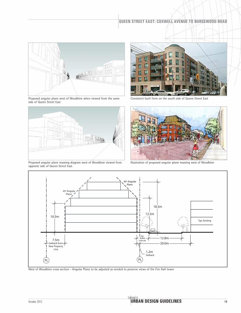
5.3 MASSINGNew development in this precinct will adhere to the built form and angular planes as described below.
The street wall for new developments will be set back a minimum of 4.8m from the curb and be a maximum of 12.5m high. Massing above 12.5m should be set back within a 45 degree angular plane up to a maximum height of 18.5m.
Mechanical / elevator penthouses, stair towers, equipment, services and balconies are not permitted to project beyond the angular planes.
Buildings will not exceed a 45 degree rear angular plane, beginning at a height of 10.5m, measured at a setback 7.5m from the rear property line.
Street walls will have a rhythm and articulation of 9m to 12m and may be designed with a variety of these proportions to better blend with the rhythm and cadence found east of Woodbine Avenue.
New buildings on corner lots shall be articulated with a 3m by 3m, 45 degree chamfer or rounded corner to give more breathing room for pedestrians and soften the apparent mass of the building, especially on large sites.
The massing section for this precinct does not apply to those properties designated “Neighbourhoods" by the City of Toronto Official Plan.
The Fire Hall is an important landmark for the Beach and will be visible as one approaches Woodbine Avenue from the west. Visibility of the Fire Hall will be protected from the vantage point of a pedestrian who is standing at any of the four corners of Queen Street East and Woodbine Avenue. In addition, the clock tower must be visible from the south sidewalk of Queen Street in accordance with the alignment extended from the vantage point of a pedestrian on the north west corner of Queen and Woodbine.
Important building with heritage character in Woodbine Beach precinct
Views of the Fire Hall clock tower from the north west corner of Queen and Woodbine must be maintained
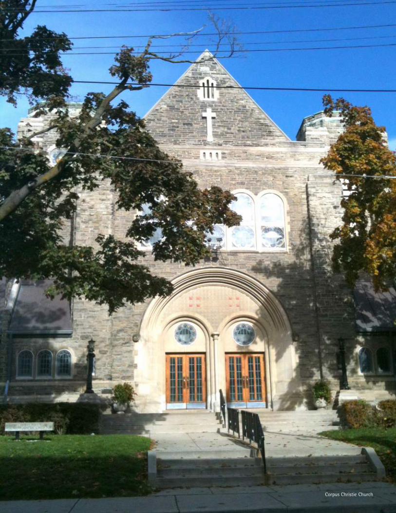
Corpus Christie Church
URBAN DESIGN GUIDELINES
QUEEN STREET EAST: COXWELL AVENUE TO NURSEWOOD ROAD
TORONTO19October 2012
20.0m
12.8m
Typ. Existing 9.0m
18.5m
12.5m
45º Angular Plane
10.5m
45º Angular Plane
1.2mSetback
PL
7.5mSetback from Rear Property
Line
PL
Min4.8m
Sidewalk
West of Woodbine cross section - Angular Plane to be adjusted as needed to preserve views of the Fire Hall tower
Consistent built form on the south side of Queen Street East
Proposed angular plane massing diagram west of Woodbine viewed from opposite side of Queen Street East
Illustration of proposed angular plane massing west of Woodbine
Proposed angular plane west of Woodbine when viewed from the same side of Queen Street East

URBAN DESIGN GUIDELINES
QUEEN STREET EAST: COXWELL AVENUE TO NURSEWOOD ROAD
20TORONTO
October 2012
6. KEW BEACH PRECINCT URBAN DESIGN GUIDELINES
This sub area is located between Woodbine Avenue and Glen Manor Drive and is the commercial and retail heart of the Beach. It is also the precinct on Queen Street East which attracts the most amount of tourists and visitors. A mixture of house-form buildings, with gaps between them, and main-street oriented buildings exist in this precinct and give it a “small town” ambience.
Many of the house-form buildings at the western end of this precinct are set back from the street with mature landscaping lining parts of the streetscape. The narrow width of most properties combined with the fragmented pattern of land ownership has contributed to the creation of small retail shops, restaurants and local services.
Rows of original “Price Brothers” buildings at the east end of this precinct are important for their cultural value and should be preserved.
6.1 PUBLIC REALMKew Gardens is the main public space in this sub area and a focal point in the Beach.
More street embellishments such as benches, bike racks, enhanced paving, consistent street lighting, and planting will be encouraged in this area.
6.2 SITE ORGANIZATIONThe majority of the ground floor of building frontage along Queen Street East should be retail that is designed with storefronts in accordance with the general design guidelines in Section 4.
Kew Beach precinct streetscape
View of Fire Hall clock tower from north side sidewalk
URBAN DESIGN GUIDELINES
QUEEN STREET EAST: COXWELL AVENUE TO NURSEWOOD ROAD
TORONTO21October 2012
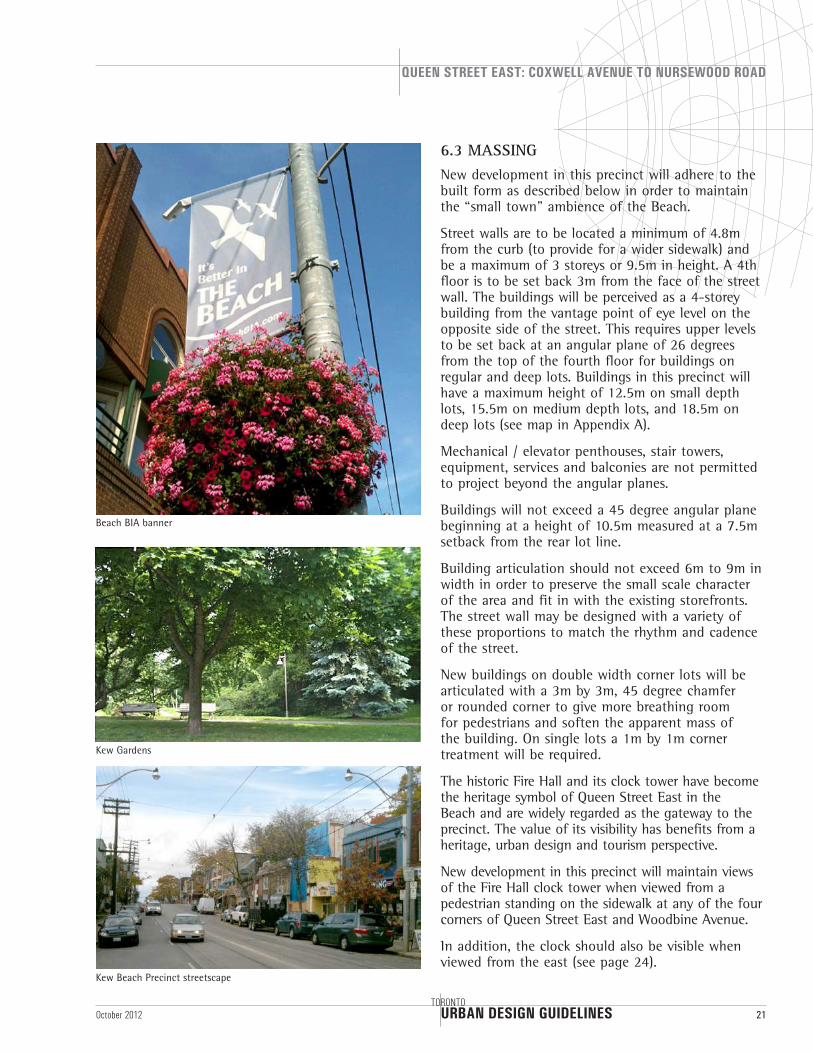
6.3 MASSINGNew development in this precinct will adhere to the built form as described below in order to maintain the “small town” ambience of the Beach.
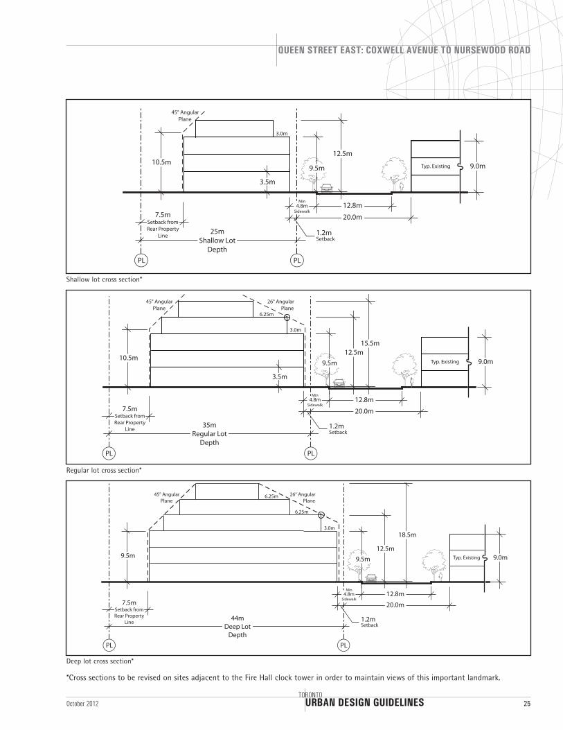
Street walls are to be located a minimum of 4.8m from the curb (to provide for a wider sidewalk) and be a maximum of 3 storeys or 9.5m in height. A 4th floor is to be set back 3m from the face of the street wall. The buildings will be perceived as a 4-storey building from the vantage point of eye level on the opposite side of the street. This requires upper levels to be set back at an angular plane of 26 degrees from the top of the fourth floor for buildings on regular and deep lots. Buildings in this precinct will have a maximum height of 12.5m on small depth lots, 15.5m on medium depth lots, and 18.5m on deep lots (see map in Appendix A).
Mechanical / elevator penthouses, stair towers, equipment, services and balconies are not permitted to project beyond the angular planes.
Buildings will not exceed a 45 degree angular plane beginning at a height of 10.5m measured at a 7.5m setback from the rear lot line.
Building articulation should not exceed 6m to 9m in width in order to preserve the small scale character of the area and fit in with the existing storefronts. The street wall may be designed with a variety of these proportions to match the rhythm and cadence of the street.
New buildings on double width corner lots will be articulated with a 3m by 3m, 45 degree chamfer or rounded corner to give more breathing room for pedestrians and soften the apparent mass of the building. On single lots a 1m by 1m corner treatment will be required.
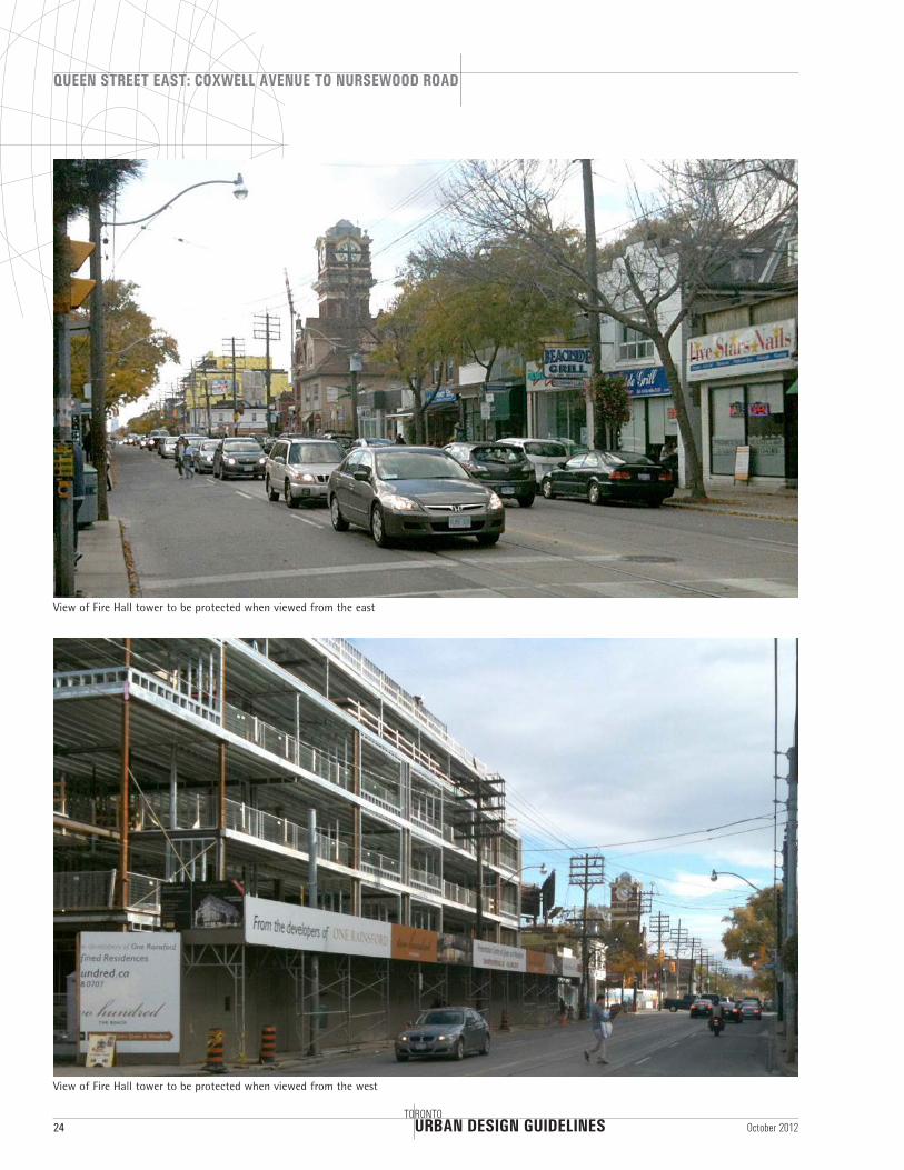
The historic Fire Hall and its clock tower have become the heritage symbol of Queen Street East in the Beach and are widely regarded as the gateway to the precinct. The value of its visibility has benefits from a heritage, urban design and tourism perspective.
New development in this precinct will maintain views of the Fire Hall clock tower when viewed from a pedestrian standing on the sidewalk at any of the four corners of Queen Street East and Woodbine Avenue.
In addition, the clock should also be visible when viewed from the east (see page 24).
Kew Gardens
Kew Beach Precinct streetscape
Beach BIA banner
URBAN DESIGN GUIDELINES
QUEEN STREET EAST: COXWELL AVENUE TO NURSEWOOD ROAD
22TORONTO
October 2012
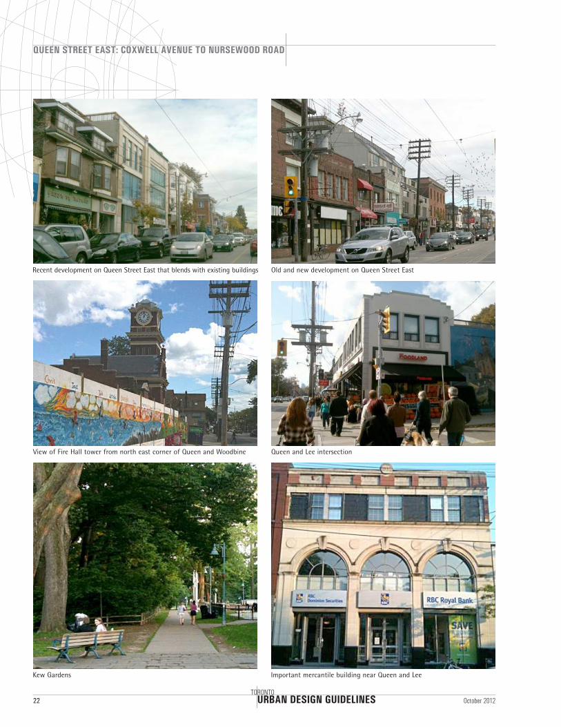
Recent development on Queen Street East that blends with existing buildings Old and new development on Queen Street East
View of Fire Hall tower from north east corner of Queen and Woodbine Queen and Lee intersection
Kew Gardens Important mercantile building near Queen and Lee
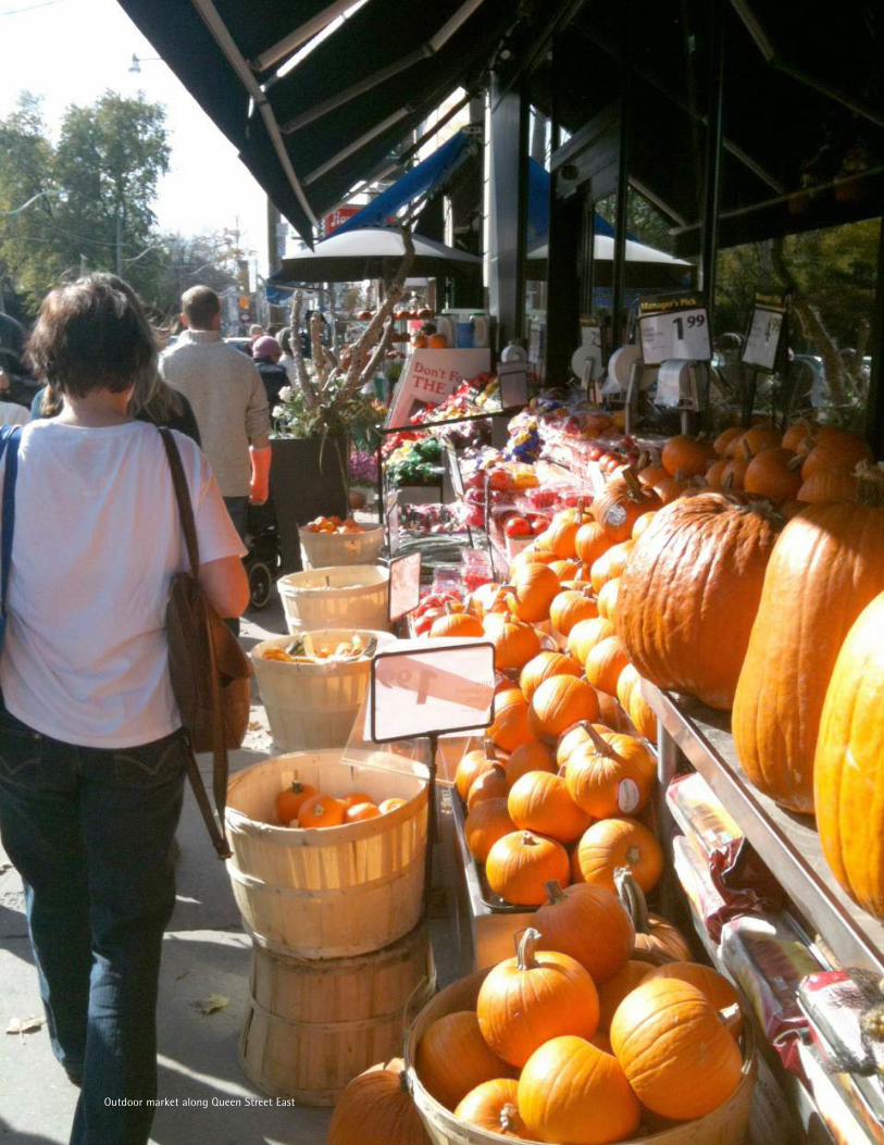
Outdoor market along Queen Street East
URBAN DESIGN GUIDELINES
QUEEN STREET EAST: COXWELL AVENUE TO NURSEWOOD ROAD
24TORONTO
October 2012
View of Fire Hall tower to be protected when viewed from the east
View of Fire Hall tower to be protected when viewed from the west
URBAN DESIGN GUIDELINES
QUEEN STREET EAST: COXWELL AVENUE TO NURSEWOOD ROAD
TORONTO25October 2012
10.5m
25mShallow Lot
Depth
7.5mSetback from Rear Property
Line
3.5m
20.0m
12.8m
Typ. Existing 9.0m
12.5m
45° Angular Plane
1.2mSetback
PL PL
Min4.8m
Sidewalk
9.5m
3.0m
10.5m
35mRegular Lot
Depth
7.5mSetback from Rear Property
Line
3.5m
26° Angular Plane
45° Angular Plane
3.0m
6.25m
20.0m
12.8m
Typ. Existing 9.0m12.5m
PLPL
1.2mSetback
15.5m
Min4.8m
Sidewalk
9.5m
20.0m
12.8m
Typ. Existing 9.0m
18.5m
Min4.8m
Sidewalk
9.5m
44mDeep Lot
Depth
7.5mSetback from Rear Property
Line
PL PL
1.2mSetback
26° Angular Plane
45° Angular Plane
12.5m9.5m
3.0m
6.25m
6.25m
Deep lot cross section*
Regular lot cross section*
Shallow lot cross section*
*Cross sections to be revised on sites adjacent to the Fire Hall clock tower in order to maintain views of this important landmark.
URBAN DESIGN GUIDELINES
QUEEN STREET EAST: COXWELL AVENUE TO NURSEWOOD ROAD
26TORONTO
October 2012
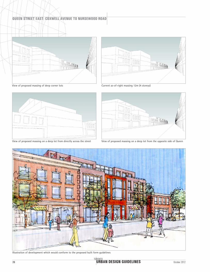
View of proposed massing on a deep lot from directly across the street View of proposed massing on a deep lot from the opposite side of Queen
Current as-of-right massing 12m (4 storeys)View of proposed massing of deep corner lots
Illustration of development which would conform to the proposed built form guidelines
URBAN DESIGN GUIDELINES
QUEEN STREET EAST: COXWELL AVENUE TO NURSEWOOD ROAD
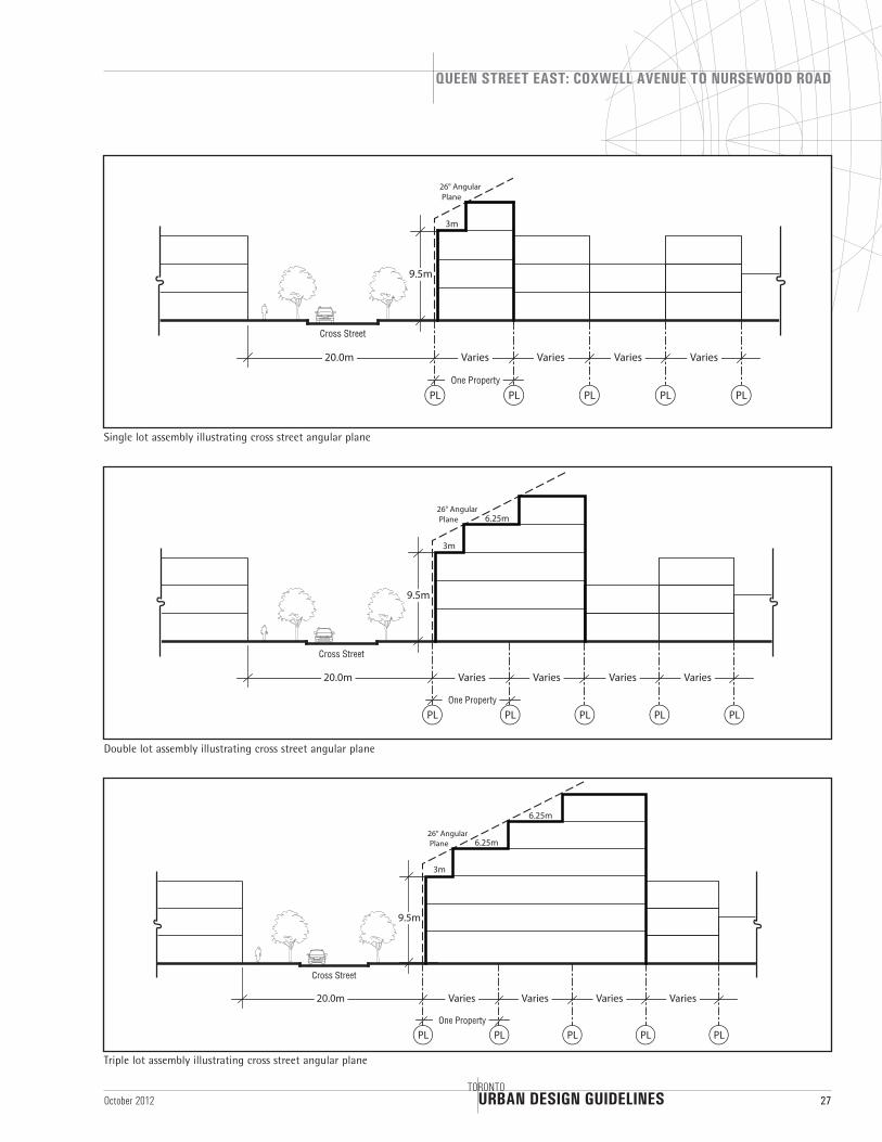
TORONTO27October 2012
9.5m
20.0m Varies Varies Varies Varies
One Property
Cross Street
26° Angular Plane
PL PL PL PL PL
3m
9.5m
20.0m
One Property
Cross Street
26° Angular Plane
PL PL PL PL PL
3m
6.25m
Varies Varies Varies Varies
9.5m
20.0m
One Property
Cross Street
26° Angular Plane
PL PL PL PL PL
3m
6.25m
6.25m
Varies Varies Varies Varies
Triple lot assembly illustrating cross street angular plane
Double lot assembly illustrating cross street angular plane
Single lot assembly illustrating cross street angular plane

URBAN DESIGN GUIDELINES
QUEEN STREET EAST: COXWELL AVENUE TO NURSEWOOD ROAD
28TORONTO
October 2012
Illustration of corner lot proposed massing in Kew Beach precinct
Illustration of proposed massing in Kew Beach precinct
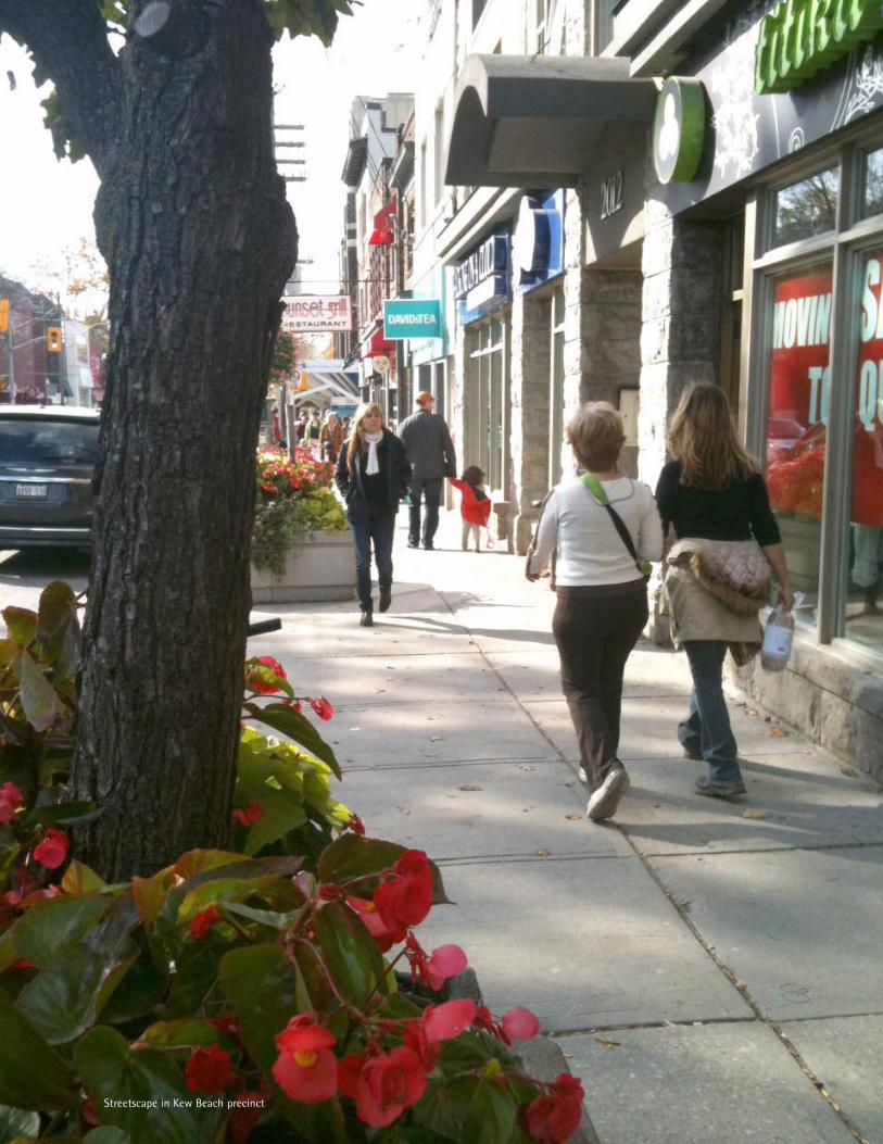
Streetscape in Kew Beach precinct
URBAN DESIGN GUIDELINES
QUEEN STREET EAST: COXWELL AVENUE TO NURSEWOOD ROAD
30TORONTO
October 2012
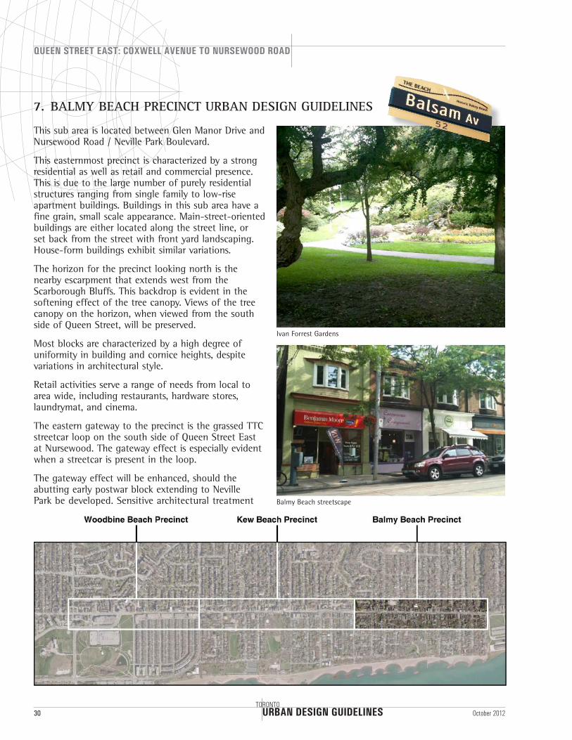
7. BALMY BEACH PRECINCT URBAN DESIGN GUIDELINES
This sub area is located between Glen Manor Drive and Nursewood Road / Neville Park Boulevard.
This easternmost precinct is characterized by a strong residential as well as retail and commercial presence. This is due to the large number of purely residential structures ranging from single family to low-rise apartment buildings. Buildings in this sub area have a fine grain, small scale appearance. Main-street-oriented buildings are either located along the street line, or set back from the street with front yard landscaping. House-form buildings exhibit similar variations.
The horizon for the precinct looking north is the nearby escarpment that extends west from the Scarborough Bluffs. This backdrop is evident in the softening effect of the tree canopy. Views of the tree canopy on the horizon, when viewed from the south side of Queen Street, will be preserved.
Most blocks are characterized by a high degree of uniformity in building and cornice heights, despite variations in architectural style.
Retail activities serve a range of needs from local to area wide, including restaurants, hardware stores, laundrymat, and cinema.
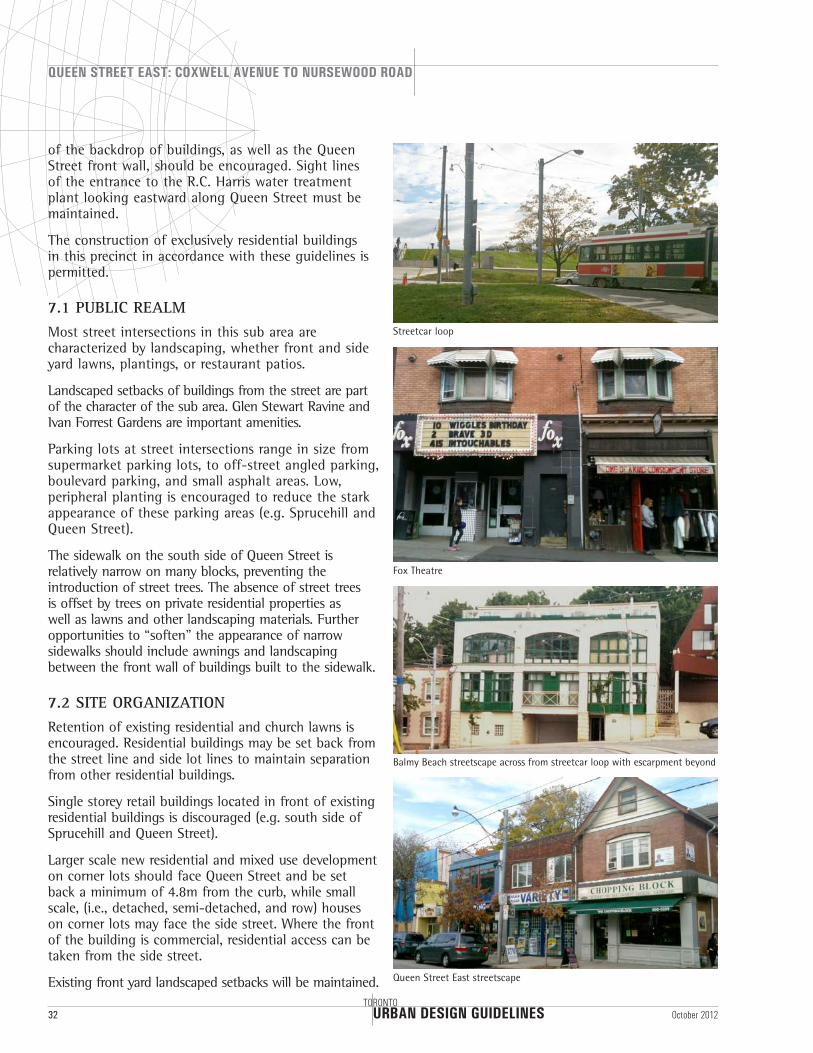
The eastern gateway to the precinct is the grassed TTC streetcar loop on the south side of Queen Street East at Nursewood. The gateway effect is especially evident when a streetcar is present in the loop.
The gateway effect will be enhanced, should the abutting early postwar block extending to Neville Park be developed. Sensitive architectural treatment Balmy Beach streetscape
Ivan Forrest Gardens
Glen Stewart Ravine
URBAN DESIGN GUIDELINES
QUEEN STREET EAST: COXWELL AVENUE TO NURSEWOOD ROAD
32TORONTO
October 2012
of the backdrop of buildings, as well as the Queen Street front wall, should be encouraged. Sight lines of the entrance to the R.C. Harris water treatment plant looking eastward along Queen Street must be maintained.
The construction of exclusively residential buildings in this precinct in accordance with these guidelines is permitted.
7.1 PUBLIC REALMMost street intersections in this sub area are characterized by landscaping, whether front and side yard lawns, plantings, or restaurant patios.
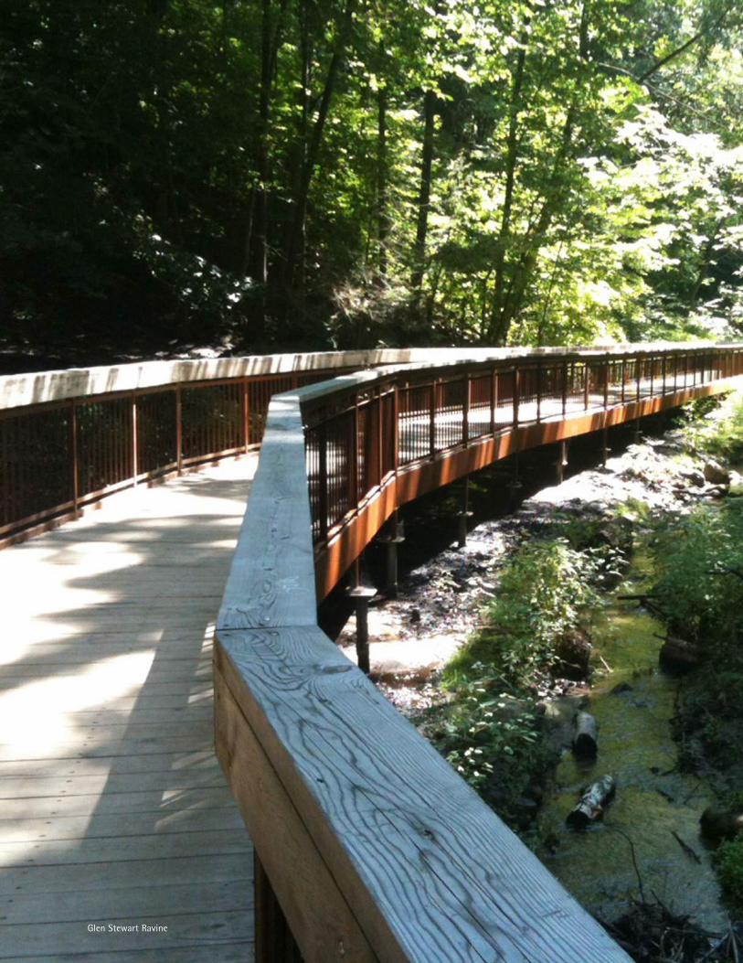
Landscaped setbacks of buildings from the street are part of the character of the sub area. Glen Stewart Ravine and Ivan Forrest Gardens are important amenities.
Parking lots at street intersections range in size from supermarket parking lots, to off-street angled parking, boulevard parking, and small asphalt areas. Low, peripheral planting is encouraged to reduce the stark appearance of these parking areas (e.g. Sprucehill and Queen Street).
The sidewalk on the south side of Queen Street is relatively narrow on many blocks, preventing the introduction of street trees. The absence of street trees is offset by trees on private residential properties as well as lawns and other landscaping materials. Further opportunities to “soften” the appearance of narrow sidewalks should include awnings and landscaping between the front wall of buildings built to the sidewalk.
7.2 SITE ORGANIZATIONRetention of existing residential and church lawns is encouraged. Residential buildings may be set back from the street line and side lot lines to maintain separation from other residential buildings.
Single storey retail buildings located in front of existing residential buildings is discouraged (e.g. south side of Sprucehill and Queen Street).
Larger scale new residential and mixed use development on corner lots should face Queen Street and be set back a minimum of 4.8m from the curb, while small scale, (i.e., detached, semi-detached, and row) houses on corner lots may face the side street. Where the front of the building is commercial, residential access can be taken from the side street.
Existing front yard landscaped setbacks will be maintained.
Fox Theatre
Balmy Beach streetscape across from streetcar loop with escarpment beyond
Queen Street East streetscape
Streetcar loop
Church of St. Aidan
URBAN DESIGN GUIDELINES
QUEEN STREET EAST: COXWELL AVENUE TO NURSEWOOD ROAD
34TORONTO
October 2012
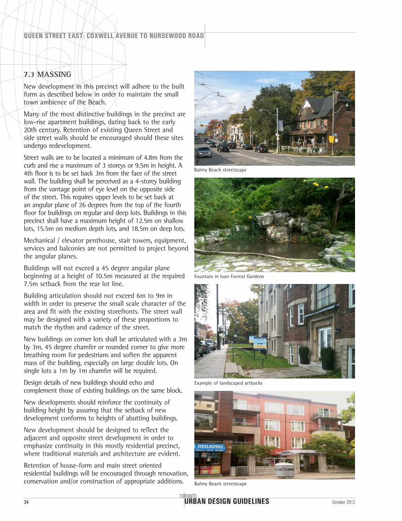
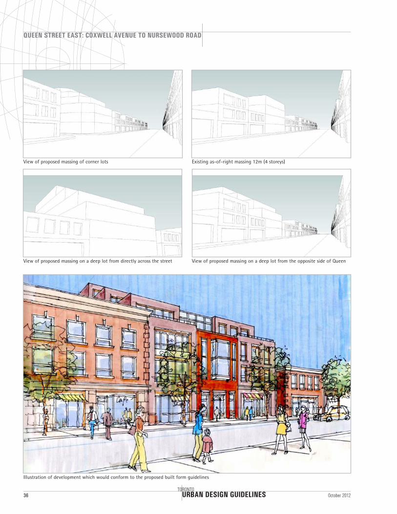
7.3 MASSINGNew development in this precinct will adhere to the built form as described below in order to maintain the small town ambience of the Beach.
Many of the most distinctive buildings in the precinct are low-rise apartment buildings, dating back to the early 20th century. Retention of existing Queen Street and side street walls should be encouraged should these sites undergo redevelopment.
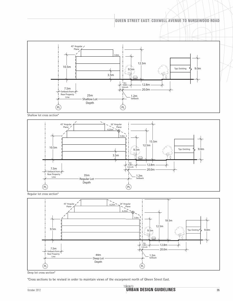
Street walls are to be located a minimum of 4.8m from the curb and rise a maximum of 3 storeys or 9.5m in height. A 4th floor is to be set back 3m from the face of the street wall. The building shall be perceived as a 4-storey building from the vantage point of eye level on the opposite side of the street. This requires upper levels to be set back at an angular plane of 26 degrees from the top of the fourth floor for buildings on regular and deep lots. Buildings in this precinct shall have a maximum height of 12.5m on shallow lots, 15.5m on medium depth lots, and 18.5m on deep lots.
Mechanical / elevator penthouse, stair towers, equipment, services and balconies are not permitted to project beyond the angular planes.
Buildings will not exceed a 45 degree angular plane beginning at a height of 10.5m measured at the required 7.5m setback from the rear lot line.
Building articulation should not exceed 6m to 9m in width in order to preserve the small scale character of the area and fit with the existing storefronts. The street wall may be designed with a variety of these proportions to match the rhythm and cadence of the street.
New buildings on corner lots shall be articulated with a 3m by 3m, 45 degree chamfer or rounded corner to give more breathing room for pedestrians and soften the apparent mass of the building, especially on large double lots. On single lots a 1m by 1m chamfer will be required.
Design details of new buildings should echo and complement those of existing buildings on the same block.
New developments should reinforce the continuity of building height by assuring that the setback of new development conforms to heights of abutting buildings.
New development should be designed to reflect the adjacent and opposite street development in order to emphasize continuity in this mostly residential precinct, where traditional materials and architecture are evident.
Retention of house-form and main street oriented residential buildings will be encouraged through renovation, conservation and/or construction of appropriate additions.
Balmy Beach streetscape
Fountain in Ivan Forrest Gardens
Example of landscaped setbacks
Balmy Beach streetscape
URBAN DESIGN GUIDELINES
QUEEN STREET EAST: COXWELL AVENUE TO NURSEWOOD ROAD
TORONTO35October 2012
10.5m
25mShallow Lot
Depth
7.5mSetback from Rear Property
Line
3.5m
20.0m
12.8m
Typ. Existing 9.0m
12.5m
45° Angular Plane
1.2mSetback
PL PL
Min4.8m
Sidewalk
9.5m
3.0m
10.5m
35mRegular Lot
Depth
7.5mSetback from Rear Property
Line
3.5m
26° Angular Plane
45° Angular Plane
3.0m
6.25m
20.0m
12.8m
Typ. Existing 9.0m12.5m
PLPL
1.2mSetback
15.5m
Min4.8m
Sidewalk
9.5m
20.0m
12.8m
Typ. Existing 9.0m
18.5m
Min4.8m
Sidewalk
9.5m
44mDeep Lot
Depth
7.5mSetback from Rear Property
Line
PL PL
1.2mSetback
26° Angular Plane
45° Angular Plane
12.5m9.5m
3.0m
6.25m
6.25m
Deep lot cross section*
Regular lot cross section*
Shallow lot cross section*
*Cross sections to be revised in order to maintain views of the escarpment north of Qheen Street East.
URBAN DESIGN GUIDELINES
QUEEN STREET EAST: COXWELL AVENUE TO NURSEWOOD ROAD
36TORONTO
October 2012
View of proposed massing on a deep lot from directly across the street View of proposed massing on a deep lot from the opposite side of Queen
Existing as-of-right massing 12m (4 storeys)View of proposed massing of corner lots
Illustration of development which would conform to the proposed built form guidelines

URBAN DESIGN GUIDELINES
QUEEN STREET EAST: COXWELL AVENUE TO NURSEWOOD ROAD
TORONTO37October 2012
9.5m
20.0m Varies Varies Varies Varies
One Property
Cross Street
26° Angular Plane
PL PL PL PL PL
3m
9.5m
20.0m
One Property
Cross Street
26° Angular Plane
PL PL PL PL PL
3m
6.25m
Varies Varies Varies Varies
9.5m
20.0m
One Property
Cross Street
26° Angular Plane
PL PL PL PL PL
3m
6.25m
6.25m
Varies Varies Varies Varies
Triple lot assembly illustrating cross street angular plane
Double lot assembly illustrating cross street angular plane
Single lot assembly illustrating cross street angular plane
URBAN DESIGN GUIDELINES
QUEEN STREET EAST: COXWELL AVENUE TO NURSEWOOD ROAD
38TORONTO
October 2012
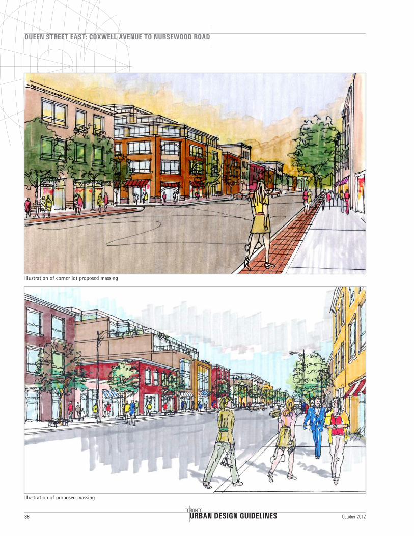
Illustration of corner lot proposed massing
Illustration of proposed massing
URBAN DESIGN GUIDELINES
QUEEN STREET EAST: COXWELL AVENUE TO NURSEWOOD ROAD
TORONTO39October 2012
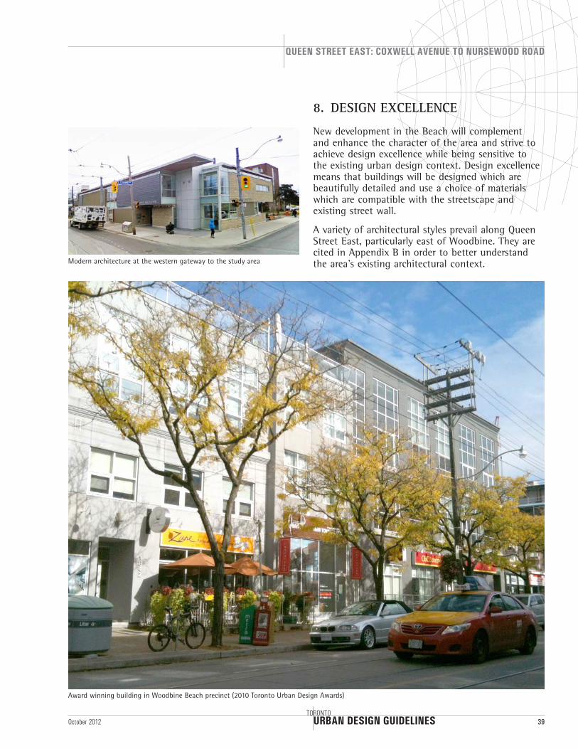
8. DESIGN EXCELLENCE
New development in the Beach will complement and enhance the character of the area and strive to achieve design excellence while being sensitive to the existing urban design context. Design excellence means that buildings will be designed which are beautifully detailed and use a choice of materials which are compatible with the streetscape and existing street wall.
A variety of architectural styles prevail along Queen Street East, particularly east of Woodbine. They are cited in Appendix B in order to better understand the area’s existing architectural context.Modern architecture at the western gateway to the study area
Award winning building in Woodbine Beach precinct (2010 Toronto Urban Design Awards)
URBAN DESIGN GUIDELINES
QUEEN STREET EAST: COXWELL AVENUE TO NURSEWOOD ROAD
40TORONTO
October 2012
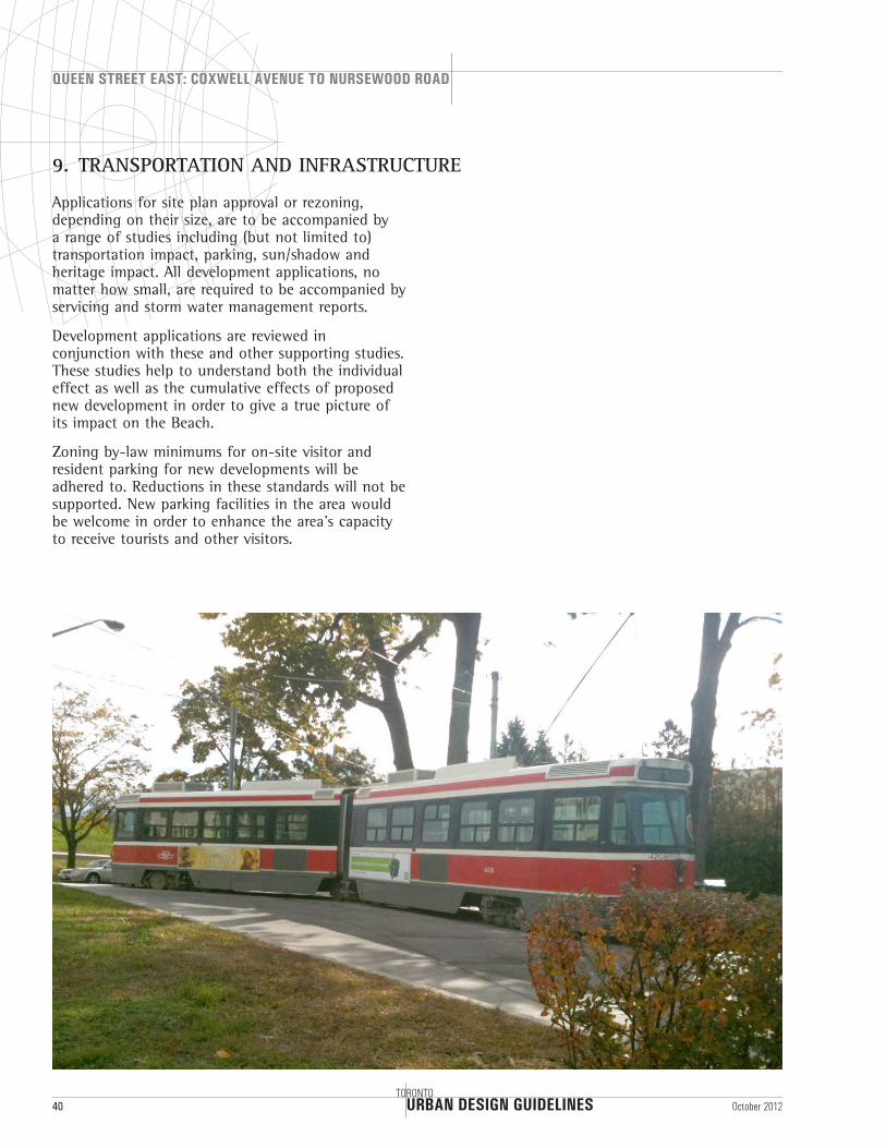
9. TRANSPORTATION AND INFRASTRUCTURE
Applications for site plan approval or rezoning, depending on their size, are to be accompanied by a range of studies including (but not limited to) transportation impact, parking, sun/shadow and heritage impact. All development applications, no matter how small, are required to be accompanied by servicing and storm water management reports.
Development applications are reviewed in conjunction with these and other supporting studies. These studies help to understand both the individual effect as well as the cumulative effects of proposed new development in order to give a true picture of its impact on the Beach.
Zoning by-law minimums for on-site visitor and resident parking for new developments will be adhered to. Reductions in these standards will not be supported. New parking facilities in the area would be welcome in order to enhance the area’s capacity to receive tourists and other visitors.
URBAN DESIGN GUIDELINES
QUEEN STREET EAST: COXWELL AVENUE TO NURSEWOOD ROAD
TORONTO41October 2012
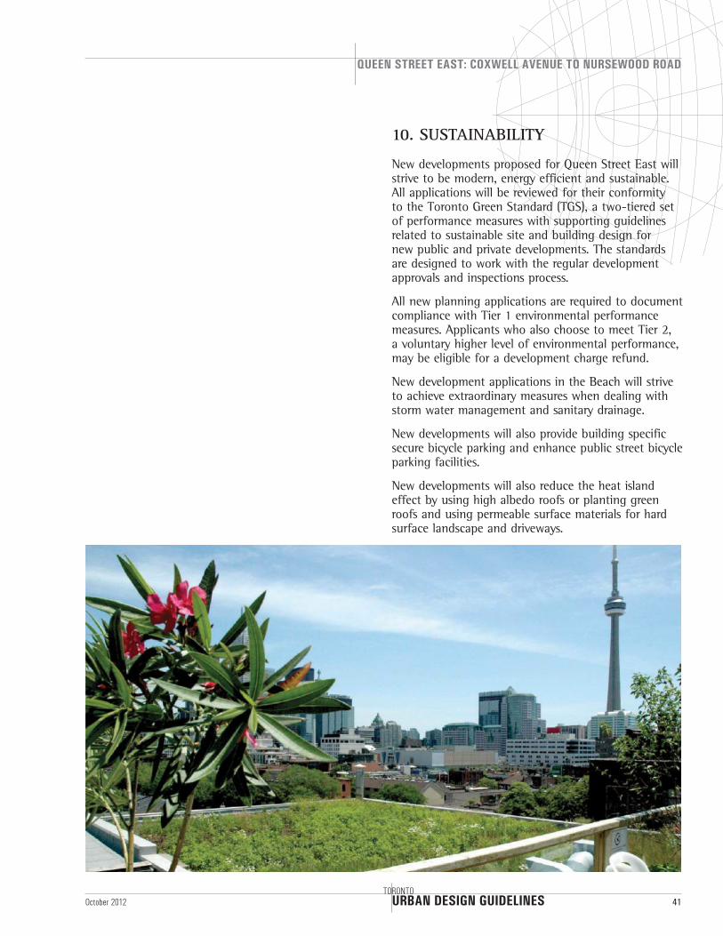
10. SUSTAINABILITY
New developments proposed for Queen Street East will strive to be modern, energy efficient and sustainable. All applications will be reviewed for their conformity to the Toronto Green Standard (TGS), a two-tiered set of performance measures with supporting guidelines related to sustainable site and building design for new public and private developments. The standards are designed to work with the regular development approvals and inspections process.
All new planning applications are required to document compliance with Tier 1 environmental performance measures. Applicants who also choose to meet Tier 2, a voluntary higher level of environmental performance, may be eligible for a development charge refund.
New development applications in the Beach will strive to achieve extraordinary measures when dealing with storm water management and sanitary drainage.
New developments will also provide building specific secure bicycle parking and enhance public street bicycle parking facilities.
New developments will also reduce the heat island effect by using high albedo roofs or planting green roofs and using permeable surface materials for hard surface landscape and driveways.
URBAN DESIGN GUIDELINES
QUEEN STREET EAST: COXWELL AVENUE TO NURSEWOOD ROAD
42TORONTO
October 2012
ACKNOWLEDGEMENT
The City of Toronto City Planning Division would like to thank all those who participated in the community conultation proces. This document has been much improved as a result of your valuable feedback.
The Division would also like to recognize the extraordinary contribution of Nicole Swerhun and her colleague Kate Green for their professional facilitation of the community consultation process.
URBAN DESIGN GUIDELINES
QUEEN STREET EAST: COXWELL AVENUE TO NURSEWOOD ROAD
TORONTO45October 2012
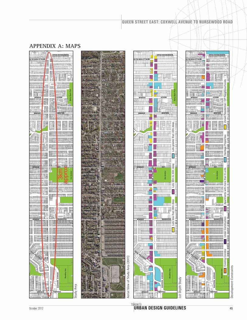
APPENDIX A: MAPS
Stud
y Ar
ea
Woo
dbin
e Pa
rk
Kew
Gar
dens
EA
STE
RN
AV
EN
UE
COXWELL AVENUE
WOODBINE AVENUE
NEVILLE PARK BLVD
BALSAM AVENUE
BEECH AVENUE
LEE AVENUE
NURSEWOOD ROAD
KINGSTON ROAD
Balm
y Be
ach
Park
3km
appr
ox.
Aeri
al V
iew
of
Stud
y Ar
ea (2
011)
Woo
dbin
e Pa
rk
Kew
Gar
dens
EA
STE
RN
AV
EN
UE
COXWELL AVENUE
WOODBINE AVENUE
NEVILLE PARK BLVD
BALSAM AVENUE
BEECH AVENUE
LEE AVENUE
NURSEWOOD ROAD
KINGSTON ROAD
Balm
y Be
ach
Park
QU
EE
N S
TRE
ET
EA
ST
Lots
30m
to 4
0m d
eep
Lots
gre
ater
than
40m
dee
pLo
ts le
ss th
an 3
0m d
eep
Lot
Dep
th S
tudy W
oodb
ine
Park
Kew
Gar
dens
EA
STE
RN
AV
EN
UE
COXWELL AVENUE
WOODBINE AVENUE
NEVILLE PARK BLVD
BALSAM AVENUE
BEECH AVENUE
LEE AVENUE
NURSEWOOD ROAD
KINGSTON ROAD
Balm
y Be
ach
Park
QU
EE
N S
TRE
ET
EA
ST
Exi
stin
g C
ondo
sU
nder
Con
stru
ctio
nA
partm
ents
with
mor
e th
an 6
uni
tsH
erita
ge P
rope
rties
Zone
d R
esid
entia
l / O
P N
eigh
bour
hood
s
Dev
elop
men
t Co
nstr
aint
s
URBAN DESIGN GUIDELINES
QUEEN STREET EAST: COXWELL AVENUE TO NURSEWOOD ROAD
46TORONTO
October 2012
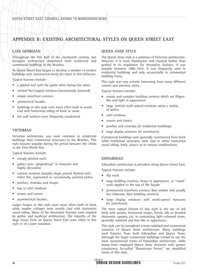
APPENDIX B: EXISTING ARCHITECTURAL STYLES ON QUEEN STREET EAST
LATE GEORGIAN
Throughout the first half of the nineteenth century, late Georgian architecture dominated both residential and commercial buildings in the Beaches.
As Queen Street East began to develop a number of modest buildings were constructed along the street in this influence.
Typical features include:
• a gabled roof with the gable often facing the street
• vertical flat-topped windows (occasionally louvered)
• simple storefront cornices
• symmetrical facades
• buildings in this style were most often built in wood, clad with horizontal siding of brick or stone
• the wall surfaces were frequently unadorned.
VICTORIAN
Victorian architecture was more common to residential buildings than commercial structures in the Beaches. This style became popular during the period between the 1850s to the First World War.
Typical features include:
• steeply pitched roofs
• gables were “gingerbread” in character and highly decorative
• vertical windows (usually single paned) flanked with either flat, segmented or, occasionally, pointed arches
• porches, verandas and stoops
• bay or oriel windows
• towers and turrets
• asymmetrical facades.
Larger houses in this style were most often built in brick while smaller cottages were usually clad with horizontal wood siding. Many of the decorative features were inspired by gothic and medieval architecture. The majority of the large house form on Queen Street East were either in this style or of a later variation.
QUEEN ANNE STYLE
The Queen Anne style is a variation of Victorian architecture. However, it is more flamboyant and classical (rather than gothic) in its inspiration for decorative features. It was popular between 1886-1914. It was frequently used in residential buildings and only occasionally in commercial building forms.
This style was very eclectic borrowing from many different current and previous styles.
Typical features include:
• ornate and complex building cornices which are filigree like and light in appearance
• large, vertical multi-paned windows using a variety of arches
• oriel windows
• towers and turrets
• porches and verandas (in residential buildings)
• large display windows (in storefronts).
Commercial buildings were generally constructed from brick while residential structures were clad in either horizontal wood siding, brick, stucco or in various combinations.
EDWARDIAN
Edwardian architecture is prevalent along Queen Street East.
Typical features include:
• flat roofs
• large building cornices, heavy in appearance, or “mock” roofs applied to the top of the façade
• pronounced storefront cornices (but smaller and usually less elaborate than building cornices)
• large display windows with multi-paned transoms (in storefronts).
The most typical feature of this style is the use of red brick with quoins, horizontal stripes, lintels, sills or detailed diamonds, squares, etc. in contrasting light-coloured stone, generally subdued and box-like in appearance.
This style can be considered a more subdued and commercial variation of Queen Anne architecture. Many buildings used features from both Edwardian and Queen Anne, although the larger commercial buildings tended to use the more monumental forms of Edwardian architecture, while house-form employed Queen Anne elements with greater consistency. So-called “Boomtown Fronts” are simplified forms of this style.
URBAN DESIGN GUIDELINES
QUEEN STREET EAST: COXWELL AVENUE TO NURSEWOOD ROAD
TORONTO47October 2012
MODERN BRICK VERNACULAR
Queen Street East continued to develop in the period between the wars (1919–1939), this style often termed ‘Tapestry Brick’ also became popular. It was a simple and economical way of adding some visual interest to otherwise straightforward speculative buildings.
Typical features include:
• flat roofs
• top of facades were very modest, but still defined with either simple corbelling for cornices, stepped parapets or “mock” roofs
• flat-topped windows, vertical or horizontal. With this style thin metal-framed casement and awning-type windows were introduced
• simple storefront cornices, large display windows (in storefronts).
The most common feature of this style is the use of textured brick in various colours and configurations. Decoration was usually restricted to inlays of brick panels in the shape of diamonds, squares or horizontal bands above or beside the upper façade windows. In this period it also became fashionable to apply certain exotic features to essentially modest brick apartment buildings. Along Queen Street East the most favored elements were usually popular conceptions of old England (Tudor Revival) or the Mediterranean architecture (Spanish Revival).
ART DECO AND STYLE MODERNE
In the nineteen thirties, the more prosperous developers (such as Kresge, Woolworth and other chain stores), consistently used Art Deco and Style Moderne architecture.
Both styles share many of the same qualities:
• flat roofs
• flat walls (often very smooth)
• flat-topped windows frequently with thin metal mullions and frames
• frequently constructed out of yellow brick, stone, porcelain steel panels, glazed terra cotta or stucco
• strong, clean lines dominate.
Art Deco emphasized the vertical in:
• the overall shape of windows
• the emphasis of window mullions
• the use of decoration, especially bas-relief panels (using classical or stylized motifs).
Style Moderne emphasized the horizontal in:
• the overall shape of windows
• the emphasis of window mullions
• the use of decorative materials in contrasting colours and textures.
URBAN DESIGN GUIDELINES
QUEEN STREET EAST: COXWELL AVENUE TO NURSEWOOD ROAD
48TORONTO
October 2012
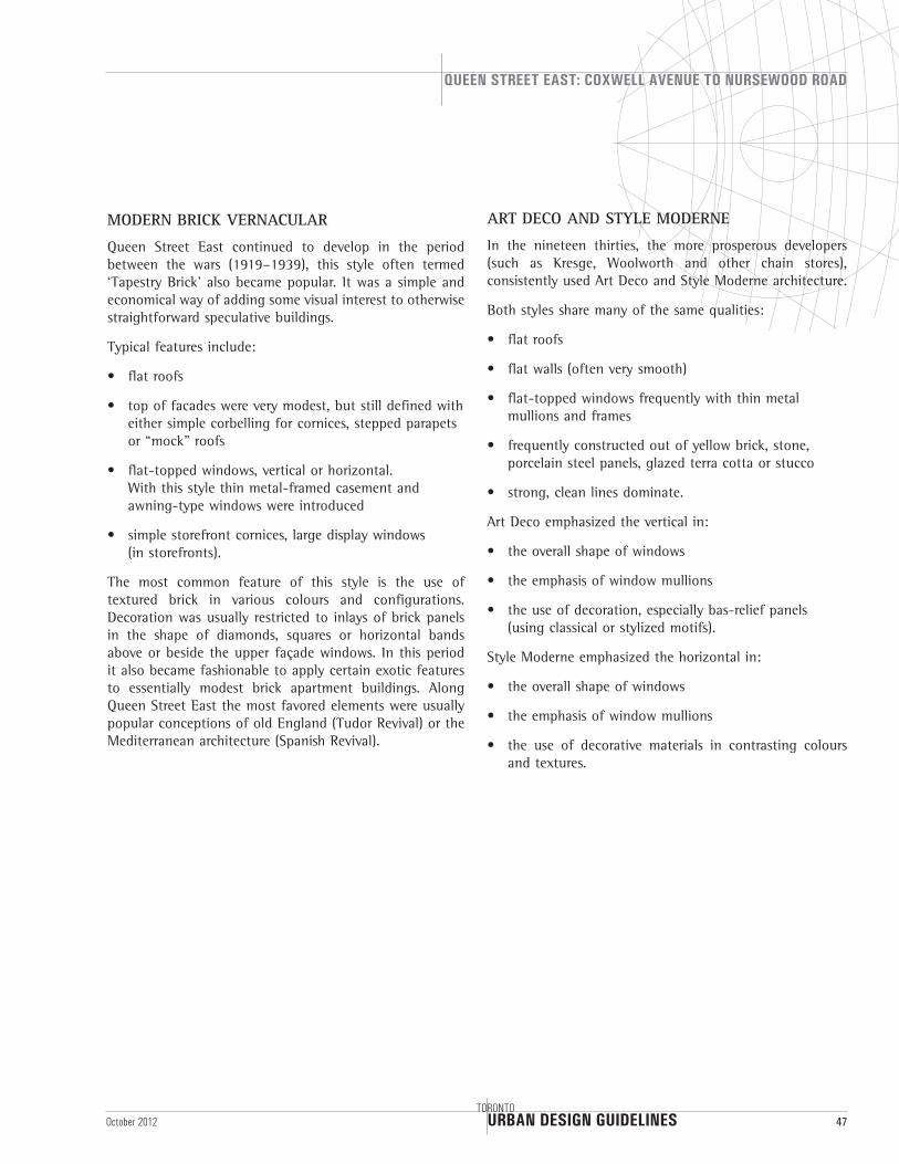
APPENDIX C: SHADOW STUDIES
AS-OF-RIGHT: June 21st
9:18 a.m. 11:18 a.m.10:18 a.m.
12:18 p.m. 2:18 p.m.1:18 p.m.
3:18 p.m. 5:18 p.m.4:18 p.m.
6:18 p.m.
URBAN DESIGN GUIDELINES
QUEEN STREET EAST: COXWELL AVENUE TO NURSEWOOD ROAD
TORONTO49October 2012
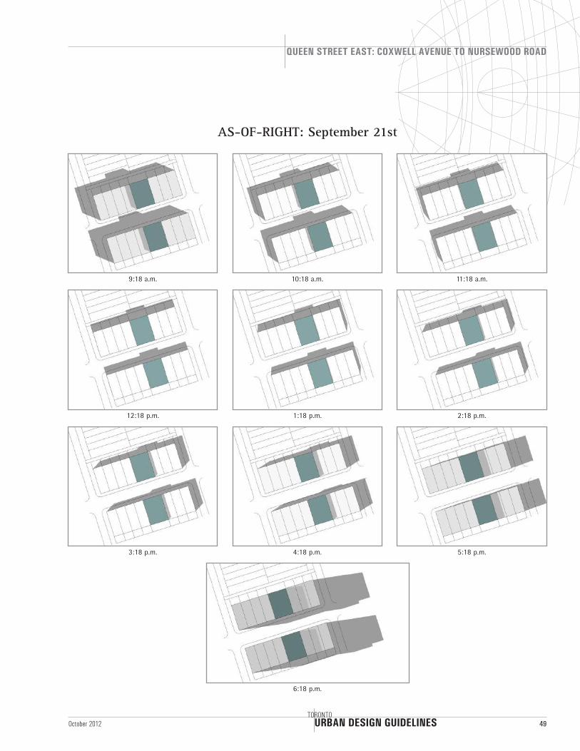
AS-OF-RIGHT: September 21st
9:18 a.m. 11:18 a.m.10:18 a.m.
12:18 p.m. 2:18 p.m.1:18 p.m.
3:18 p.m. 5:18 p.m.4:18 p.m.
6:18 p.m.
URBAN DESIGN GUIDELINES
QUEEN STREET EAST: COXWELL AVENUE TO NURSEWOOD ROAD
50TORONTO
October 2012
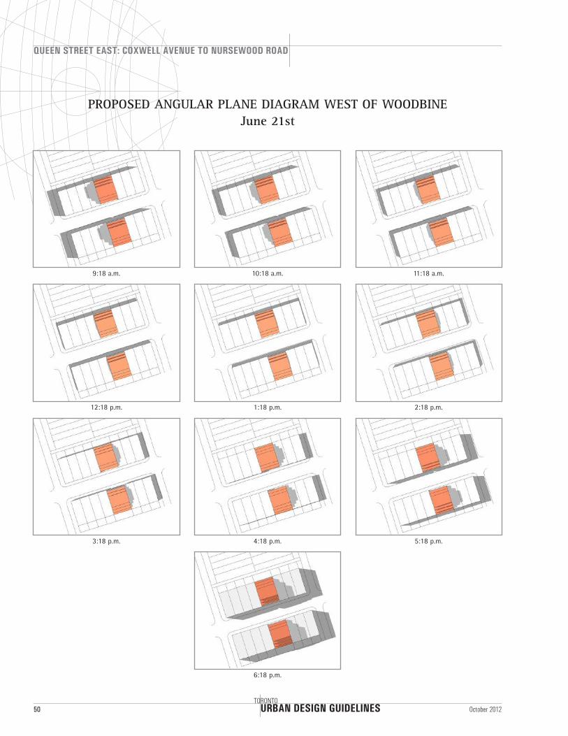
PROPOSED ANGULAR PLANE DIAGRAM WEST OF WOODBINE June 21st
9:18 a.m. 11:18 a.m.10:18 a.m.
12:18 p.m. 2:18 p.m.1:18 p.m.
3:18 p.m. 5:18 p.m.4:18 p.m.
6:18 p.m.
URBAN DESIGN GUIDELINES
QUEEN STREET EAST: COXWELL AVENUE TO NURSEWOOD ROAD
TORONTO51October 2012
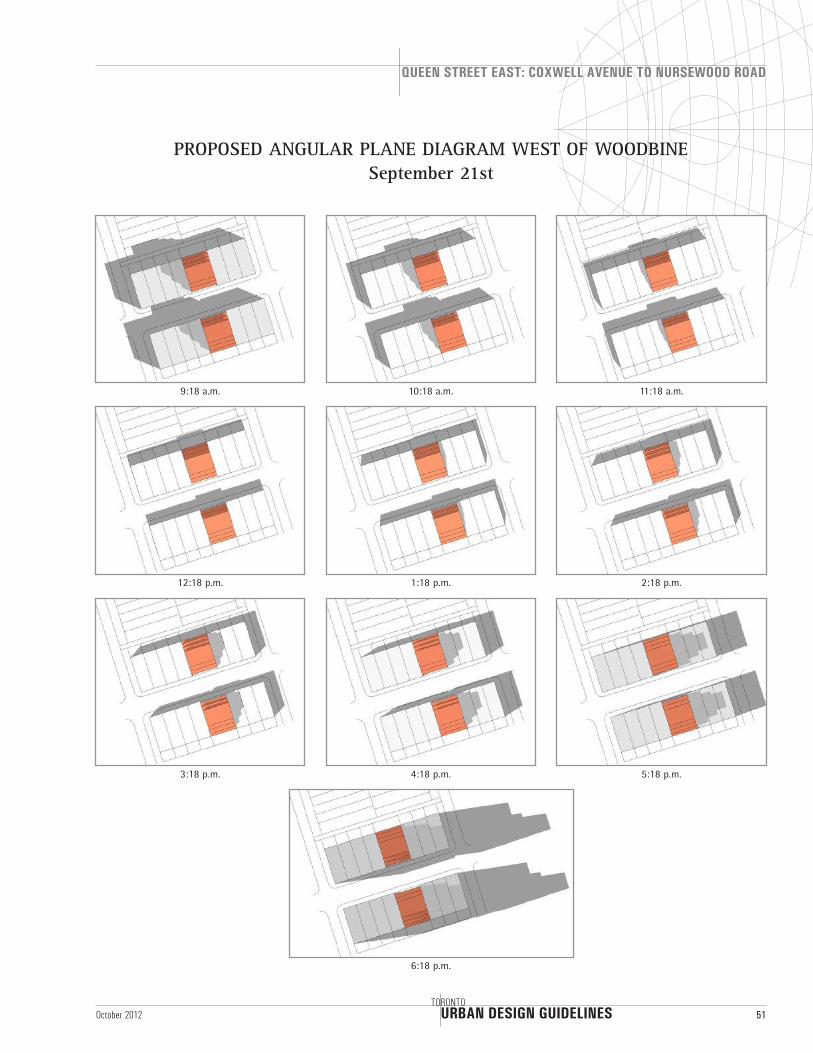
PROPOSED ANGULAR PLANE DIAGRAM WEST OF WOODBINE September 21st
9:18 a.m. 11:18 a.m.10:18 a.m.
12:18 p.m. 2:18 p.m.1:18 p.m.
3:18 p.m. 5:18 p.m.4:18 p.m.
6:18 p.m.
URBAN DESIGN GUIDELINES
QUEEN STREET EAST: COXWELL AVENUE TO NURSEWOOD ROAD
52TORONTO
October 2012
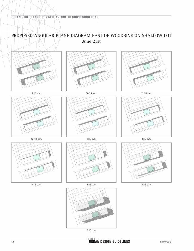
PROPOSED ANGULAR PLANE DIAGRAM EAST OF WOODBINE ON SHALLOW LOT June 21st
9:18 a.m. 11:18 a.m.10:18 a.m.
12:18 p.m. 2:18 p.m.1:18 p.m.
3:18 p.m. 5:18 p.m.4:18 p.m.
6:18 p.m.
URBAN DESIGN GUIDELINES
QUEEN STREET EAST: COXWELL AVENUE TO NURSEWOOD ROAD
TORONTO53October 2012
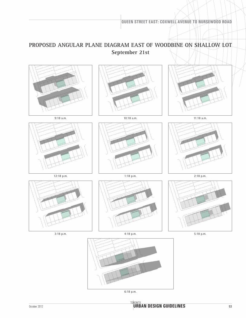
PROPOSED ANGULAR PLANE DIAGRAM EAST OF WOODBINE ON SHALLOW LOT September 21st
9:18 a.m. 11:18 a.m.10:18 a.m.
12:18 p.m. 2:18 p.m.1:18 p.m.
3:18 p.m. 5:18 p.m.4:18 p.m.
6:18 p.m.
URBAN DESIGN GUIDELINES
QUEEN STREET EAST: COXWELL AVENUE TO NURSEWOOD ROAD
54TORONTO
October 2012
9:18 a.m. 11:18 a.m.10:18 a.m.
12:18 p.m. 2:18 p.m.1:18 p.m.
3:18 p.m. 5:18 p.m.4:18 p.m.
6:18 p.m.
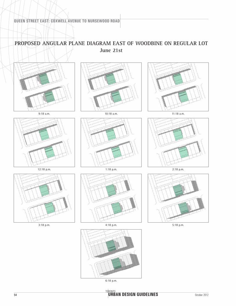
PROPOSED ANGULAR PLANE DIAGRAM EAST OF WOODBINE ON REGULAR LOT June 21st
URBAN DESIGN GUIDELINES
QUEEN STREET EAST: COXWELL AVENUE TO NURSEWOOD ROAD
TORONTO55October 2012
9:18 a.m. 11:18 a.m.10:18 a.m.
12:18 p.m. 2:18 p.m.1:18 p.m.
3:18 p.m. 5:18 p.m.4:18 p.m.
6:18 p.m.
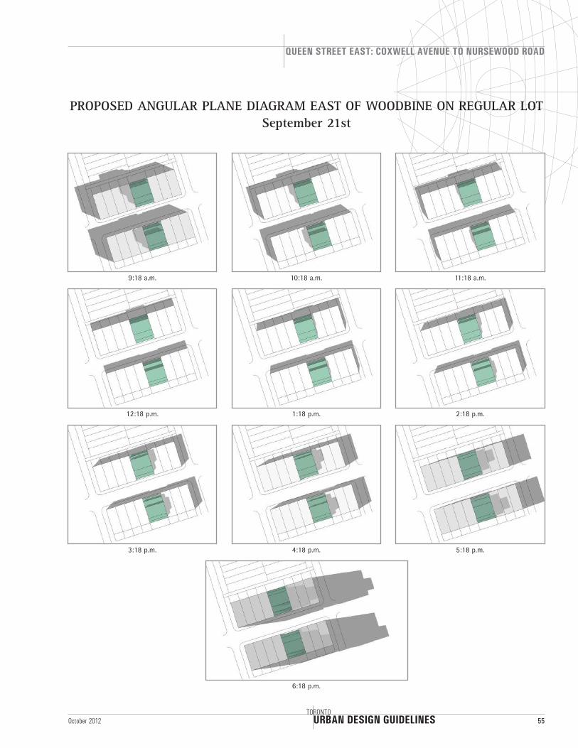
PROPOSED ANGULAR PLANE DIAGRAM EAST OF WOODBINE ON REGULAR LOT September 21st
URBAN DESIGN GUIDELINES
QUEEN STREET EAST: COXWELL AVENUE TO NURSEWOOD ROAD
56TORONTO
October 2012
9:18 a.m. 11:18 a.m.10:18 a.m.
12:18 p.m. 2:18 p.m.1:18 p.m.
3:18 p.m. 5:18 p.m.4:18 p.m.
6:18 p.m.
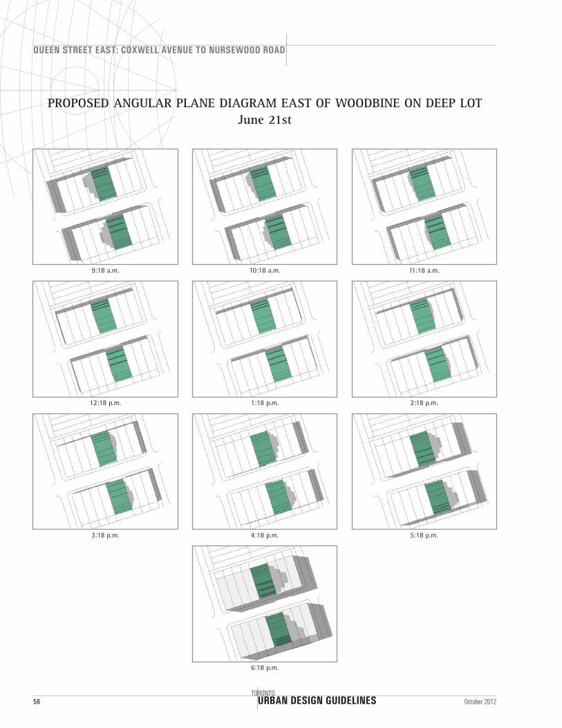
PROPOSED ANGULAR PLANE DIAGRAM EAST OF WOODBINE ON DEEP LOT June 21st
URBAN DESIGN GUIDELINES
QUEEN STREET EAST: COXWELL AVENUE TO NURSEWOOD ROAD
TORONTO57October 2012
9:18 a.m. 11:18 a.m.10:18 a.m.
12:18 p.m. 2:18 p.m.1:18 p.m.
3:18 p.m. 5:18 p.m.4:18 p.m.
6:18 p.m.
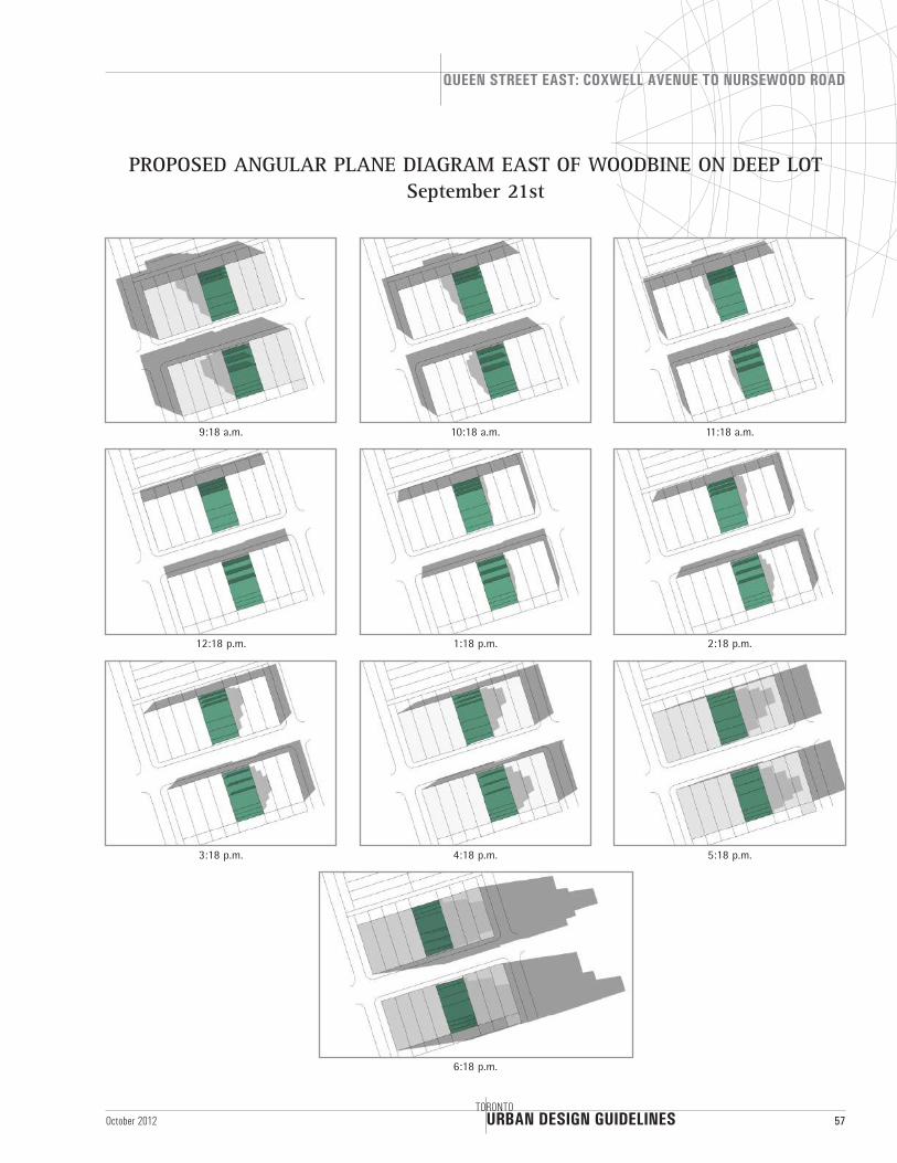
PROPOSED ANGULAR PLANE DIAGRAM EAST OF WOODBINE ON DEEP LOT September 21st
URBAN DESIGN GUIDELINES
QUEEN STREET EAST: COXWELL AVENUE TO NURSEWOOD ROAD
58TORONTO
October 2012
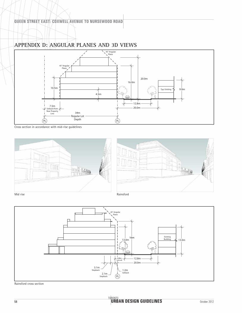
APPENDIX D: ANGULAR PLANES AND 3D VIEWS
PL
20.0m
12.8m
Typ. Existing 9.0m
16.0m
10.5m
34mRegular Lot
Depth
7.5mSetback from Rear Property
Line
PL
20.0m
4.5m
45° Angular Plane
45° Angular Plane
20.0m
12.8m
Existing Building 13.0m
1.2mSetback
16m13.0m
2.1mStepback
3.1mStepback
PL
45° Angular Plane
4.8mSidewalk
Rainsford cross section
Cross section in accordance with mid-rise guidelines
RainsfordMid rise
URBAN DESIGN GUIDELINES
QUEEN STREET EAST: COXWELL AVENUE TO NURSEWOOD ROAD
TORONTO59October 2012
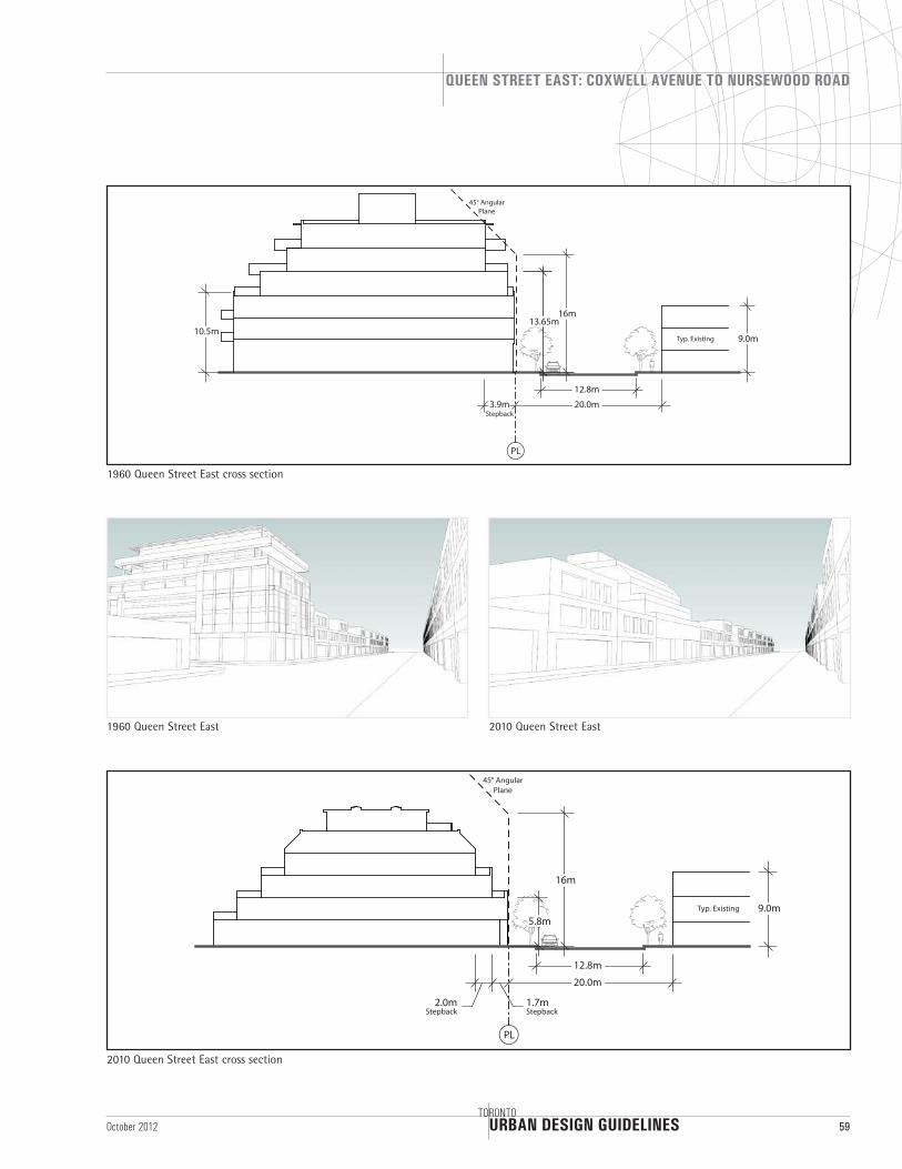
PL
20.0m
12.8m
Typ. Existing 9.0m
1.7mStepback
16m
5.8m
2.0mStepback
45° Angular Plane
2010 Queen Street East cross section
1960 Queen Street East 2010 Queen Street East
45° Angular Plane
PL
20.0m
12.8m
10.5mTyp. Existing 9.0m
3.9mStepback
16m13.65m
1960 Queen Street East cross section
URBAN DESIGN GUIDELINES
QUEEN STREET EAST: COXWELL AVENUE TO NURSEWOOD ROAD
60TORONTO
October 2012
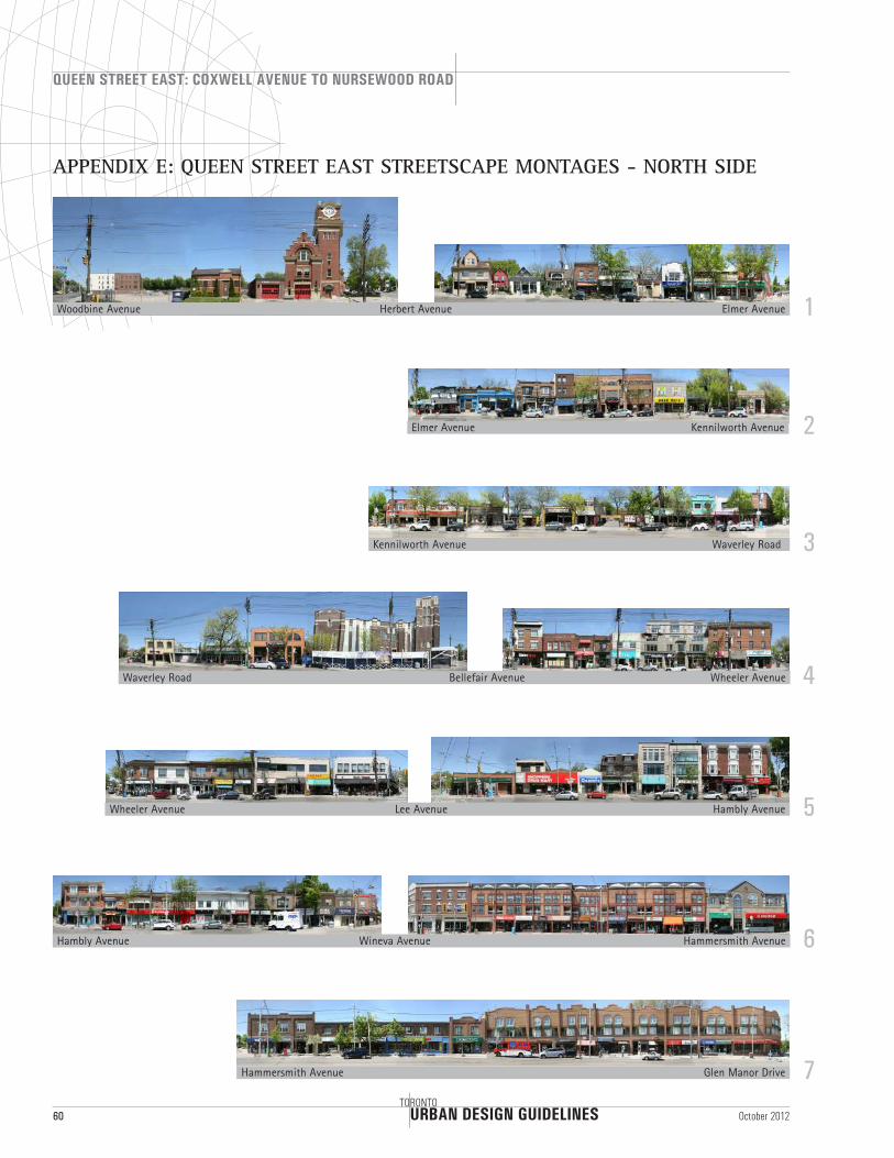
Elmer Avenue
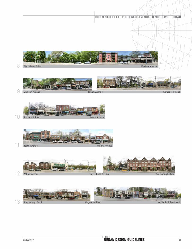
APPENDIX E: QUEEN STREET EAST STREETSCAPE MONTAGES - NORTH SIDE
Waverley Road
Hambly Avenue
Glen Manor Drive
1
3
5
7
2
4
6
Woodbine Avenue
Kennilworth Avenue
Wheeler Avenue
Hammersmith Avenue
Elmer Avenue
Waverley Road
Hambly Avenue
Kennilworth Avenue
Wheeler Avenue
Hammersmith Avenue
Herbert Avenue
Lee Avenue
Bellefair Avenue
Wineva Avenue
URBAN DESIGN GUIDELINES
QUEEN STREET EAST: COXWELL AVENUE TO NURSEWOOD ROAD
TORONTO61October 2012
Spruce Hill Road
Willow Avenue
Neville Park Boulevard
9
11
13
8
10
12
Maclean Avenue
Beech Avenue
Scarborough Road
Glen Manor Drive
Spruce Hill Road
Willow Avenue
Maclean Avenue
Beech Avenue
Scarborough Road
Balsam Avenue
Silver Birch Avenue
Kingswood Road
URBAN DESIGN GUIDELINES
QUEEN STREET EAST: COXWELL AVENUE TO NURSEWOOD ROAD
62TORONTO
October 2012
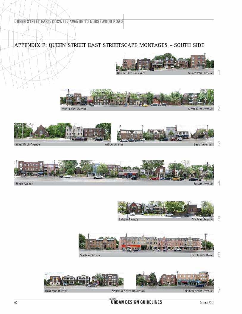
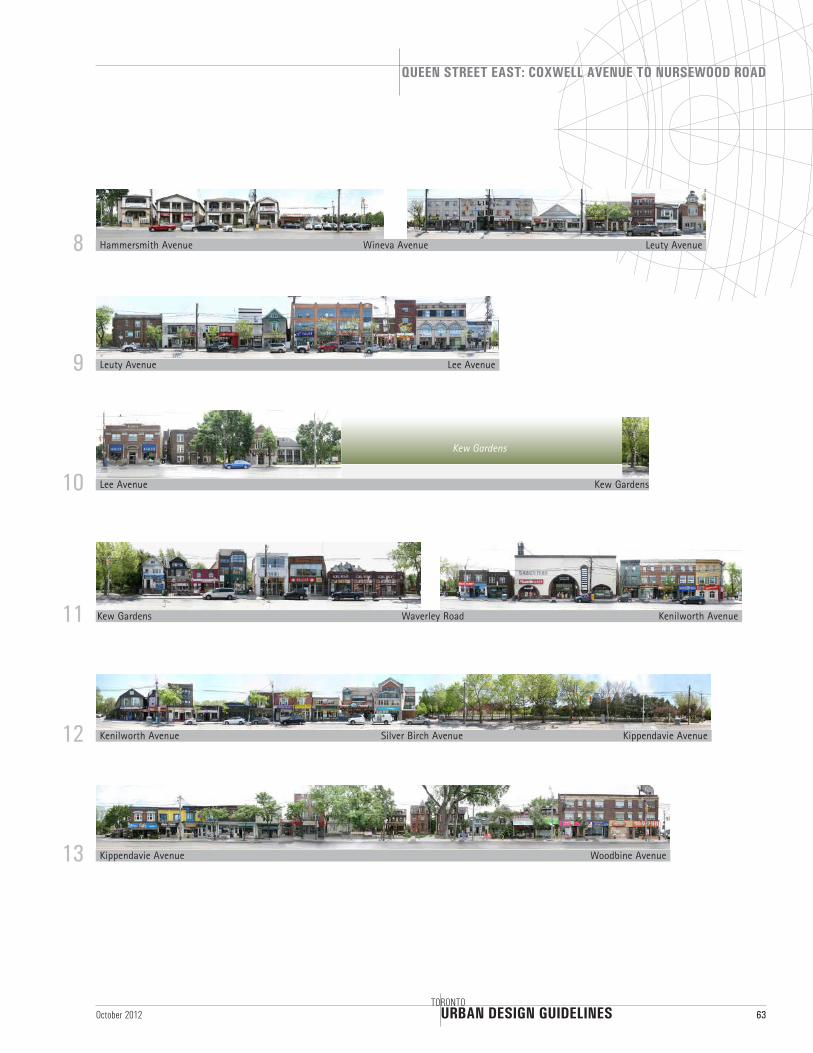
APPENDIX F: QUEEN STREET EAST STREETSCAPE MONTAGES - SOUTH SIDE
Munro Park Avenue
Beech Avenue
Maclean Avenue
Hammersmith Avenue
1
3
5
7
2
4
6
Neville Park Boulevard
Silver Birch Avenue
Balsam Avenue
Glen Manor Drive
Munro Park Avenue
Beech Avenue
Maclean Avenue
Silver Birch Avenue
Balsam Avenue
Glen Manor Drive
Willow Avenue
Scarboro Beach Boulevard
URBAN DESIGN GUIDELINES
QUEEN STREET EAST: COXWELL AVENUE TO NURSEWOOD ROAD
TORONTO63October 2012
Lee Avenue
Kenilworth Avenue
Woodbine Avenue
9
11
13
8
10
12
Leuty Avenue
Waverley Road
Kippendavie Avenue
Hammersmith Avenue
Lee Avenue
Kenilworth Avenue
Leuty Avenue
Kippendavie AvenueSilver Birch Avenue
Wineva Avenue
Kew Gardens
Kew Gardens
Kew Gardens
