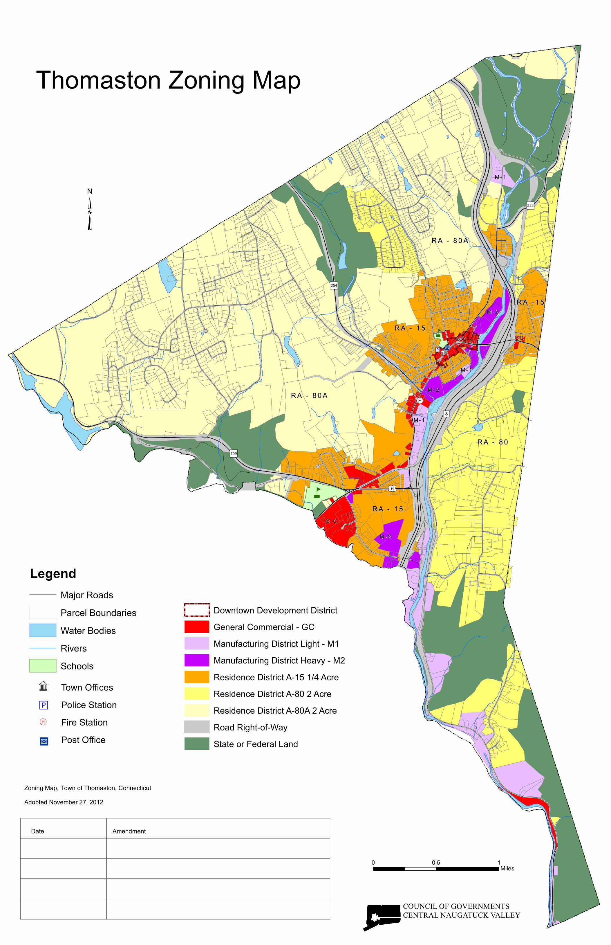
thomaston zoning map

1
" ) 109 " ) 8 £ ¤ 6 " ) 222 " ) 254 RA - 80A RA - 80A RA - 80 RA - 80 RA - 15 RA - 15 RA - 15 RA - 15 RA -15 RA -15 M-2 M-2 M-1 M-1 M-2 M-2 G C G C M-1 M-1 GC GC G C G C M-2 M-2 M-1 M-1 RA - 80A RA - 80A n n Ñ × " M I " 9 Thomaston Zoning Map ³ COUNCIL OF GOVERNMENTS CENTRAL NAUGATUCK VALLEY 0 0.5 1 Miles Zoning Map, Town of Thomaston, Connecticut Adopted November 27, 2012 Date Amendment Downtown Development District General Commercial - GC Manufacturing District Light - M1 Manufacturing District Heavy - M2 Residence District A-15 1/4 Acre Residence District A-80 2 Acre Residence District A-80A 2 Acre Road Right-of-Way State or Federal Land Legend Major Roads Parcel Boundaries Water Bodies Rivers Schools " M I " 9 Town Offices Police Station Ñ × Fire Station Post Office

Upload: others

Post on 27-Feb-2022

4 views

Category:

Documents


0 download

TRANSCRIPT

")109

")8

£¤6

")222

")254

R A - 8 0 AR A - 8 0 A

R A - 8 0R A - 8 0

R A - 1 5R A - 1 5

R A - 1 5R A - 1 5

R A - 1 5R A - 1 5

M - 2M - 2

M - 1M - 1

M - 2M - 2

G CG C

M - 1M - 1

G CG C

G CG C

M - 2M - 2

M - 1M - 1

R A - 8 0 AR A - 8 0 A

n

n

Ñ×

"M I"9

Thomaston Zoning Map

³

COUNCIL OF GOVERNMENTSCENTRAL NAUGATUCK VALLEY

0 0.5 1Miles

Zoning Map, Town of Thomaston, ConnecticutAdopted November 27, 2012

Date Amendment

Downtown Development DistrictGeneral Commercial - GCManufacturing District Light - M1Manufacturing District Heavy - M2Residence District A-15 1/4 AcreResidence District A-80 2 AcreResidence District A-80A 2 AcreRoad Right-of-WayState or Federal Land

LegendMajor RoadsParcel BoundariesWater BodiesRiversSchools

"M

I"

9 Town OfficesPolice Station

Ñ× Fire StationPost Office