the vertebrate fauna of wollondilly river nature reserve
TRANSCRIPT
The Vertebrate Fauna of Wollondilly River Nature Reserve 5
1 INTRODUCTION
1.1 PROJECT AIMS
The Central Directorate Parks and Wildlife Division (PWD) of the NSW Department of Environmentand Conservation (DEC, formerly NSW National Parks and Wildlife Service (NPWS)) has for the firsttime established a biodiversity survey priorities program for all NPWS managed estate within theDirectorate. This program recognises that Wollondilly River Nature Reserve (NR) is characterised byvery low levels of information on both flora and fauna values (NPWS 2003a). The decision to sampleWollondilly River NR at this point further benefited from the opportunity to integrate new survey workinto a broader study examining the biodiversity values of the Warragamba and Metropolitan SpecialAreas (DEC in prep.).
The fauna survey program seeks to address the shortfall of information on vertebrate fauna within andimmediately surrounding Wollondilly River NR. Improved information will enable park managers tobetter integrate local information into planning decisions and to become more active in promoting thevalues of the reserve. It will provide the opportunity to develop more focused strategies on threatenedspecies management, monitoring programs and community education. Importantly it will expand theability of management to understand the role the reserve plays in conserving fauna within the greaterSydney Region.
Specific objectives of this report are to:
1. Document, review and collate existing fauna data.
2. Identify and profile threatened fauna species and other regionally significant fauna that are knownor likely to occur.
3. Identify broad-scale patterns in fauna occurrence and habitat use across the reserve and identifyhabitats of particular conservation significance.
4. Highlight areas where further survey work may need to be carried out.
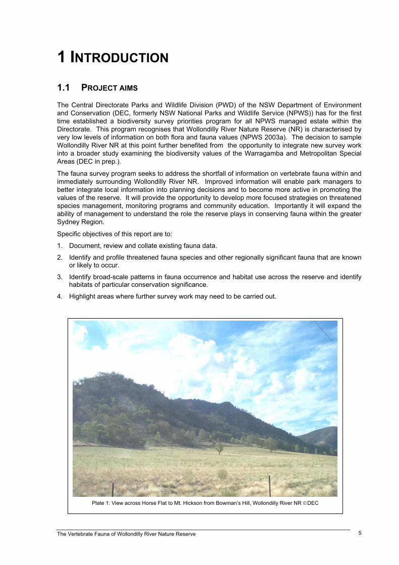
Plate 1: View across Horse Flat to Mt. Hickson from Bowman�s Hill, Wollondilly River NR DEC

The Vertebrate Fauna of Wollondilly River Nature Reserve6
1.2 BACKGROUND
Wollondilly River NR currently consists of two portions of land in the Wollondilly Valley approximately40 kilometres west of Mittagong on the Southern Highlands. The reserve is primarily surrounded byfreehold tenures, although additional Crown Land portions are found on the south side of theWollondilly River and a number of DEC reserves to the north and east including Nattai, BlueMountains and Bangadilly National Parks (NP) and Joadja NR (Map 1).
The south eastern portion is just under 300 hectares in area and consists of steep country to the northof the Wollondilly and Wingecarribee River junction (Plate 2). It is accessed through private land southof Wombeyan Caves Road near the locality of Bullio. The rugged terrain of this area means thatclearing has been restricted to the very northern boundary. The second, larger portion is 613 hectaresof land extending from the western bank of the Wollondilly River towards Tallygang Mountain (Plate 1).The main access is along the Wollondilly River from Goodmans Ford along a fire trail that extends tothe southern boundary. A homestead and various sheds have been retained from previousoccupation on Horse Flat and these have been used as a base for both DEC and Sydney CatchmentAuthority (SCA) staff.
Wollondilly River NR falls into the Warragamba Special Area that is managed by the SCA to retain thequality of Sydney�s drinking water. In 2002, some land with the Special Area that had been identifiedas of suitable conservation value were transferred to NPWS management. Wollondilly River NR wasgazetted as part of this process. Some investigations have been made towards acquiring furthercrown land on the southern side of the Wollondilly River and, if acquired, it is likely to be added to thisreserve. No attempt has been made to survey this land at this stage.
In 2001 DEC was commissioned by the SCA to investigate the biodiversity values of the Warragambaand Metropolitan Special Areas. Systematic flora surveys were undertaken within the park inNovember 2001 as part of this program and are reported in NPWS (2003c). In addition, a review ofbiodiversity data across the DEC Central Directorate Reserves identified Wollondilly River NR as ahigh priority area for the collection of fauna data (NPWS 2003a) and the Central Directorate Parks andWildlife Division (PWD) provided funding under the Biodiversity Survey Priorities Survey Program.Systematic fauna surveys were undertaken within and around the park between September 2002 andMarch 2004.
Plate 2: Rocky country near the confluence of the Wollondilly and Wingecarribee Rivers. DEC

The Vertebrate Fauna of Wollondilly River Nature Reserve 7
PROJECTION : Zone 56
Map 1:Wollondilly RiverNature Reserveand SurroundingDEC Reserves
Copyright NSW Department of Environment and Conservation June 2004This map is not guaranteed to be free from error or omission
The NSW Department of Environment and Conservation and its employeesdisclaim liability for any act done on the information in the
map and any consequences of such acts or omissions
Printed By
CADU, DEC
03 June 2004e:\sca_veg\sca_fauna\wollondilly_river.apr
Blue Mountains NP
Joadja NR
Nattai NP
Bangadilly NP
Wombeyan Caves RoadWollondillyRiver
WingecarribeeRiver
0 1 2 Kilometres
N
EW
S
Native Vegetation NPWS Estate5km Radius of WRNRWollondilly River NR
RoadsMajor RoadMinor RoadOther Roads
Rivers
South Eastern Highlands Bioregionand Wollondilly River NR (red box)
The Vertebrate Fauna of Wollondilly River Nature Reserve8
1.3 ENVIRONMENT
Wollondilly River Nature Reserve is comprised almost entirely from Bindook porphyry, an igneous rockformed during the Upper Devonian age. This is granite-like in appearance and erodes to form a clay-loam soil. These soils are highly erodable and form significant instability on the steepest slopes wherelandslips and scree slopes are common. The rugged nature of the landscape is illustrated by the factthat many slopes reach over 50 degrees. The highest point in the reserve is 790 metres at Mt.Hickson, in the western portion. The lowest point is Horse Flat on the narrow levee plain that hugs abend of the Wollondilly River. Deeper alluvial soil is found here, and as a result, most of the originalvegetation has been cleared for agriculture.
Wollondilly River NR lies on the extreme eastern boundary of the South Eastern Highlands Bioregion(Thackway and Creswell 1995) (inset Map 1). This Bioregion covers an extensive area of the CentralTablelands and slopes of New South Wales and Victoria. The Bioregion is dominated by a temperateclimate characterised by mild to warm summers and no dry season (NPWS 2003b). Approximatelyfifteen percent of the Bioregion is reserved for conservation (in National Parks, Nature Reserves, KarstConservation Reserves and State Conservation Areas) (NPWS 2003b). Just to the east of the reserveis the Sydney Basin Bioregion that is typified by the sandstone landscapes that surround the Sydneymetropolitan area.
1.4 CLIMATE
The average annual rainfall for the Wollondilly River NR ranges between 680 and 830 millimetres.This is typical of areas within the rainshadows in the Wollondilly and Burragorang Valleys.Temperatures are more extreme than in coastal environments, with warm summers and cool winters.The mean daily minimum temperature ranges from 4°C in higher elevations to 18°C on the river flats,whilst the mean maximum temperature ranges from 25°C at higher elevations to 30°C on the flats.The climate appears to be much more typical of areas on the south west slopes of NSW rather thanthe typical coastal and tableland climates found in the areas surrounding the reserve.
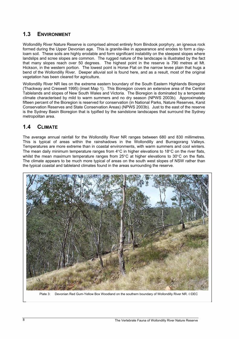
Plate 3: Devonian Red Gum-Yellow Box Woodland on the southern boundary of Wollondilly River NR. DEC
The Vertebrate Fauna of Wollondilly River Nature Reserve 9
1.5 VEGETATION
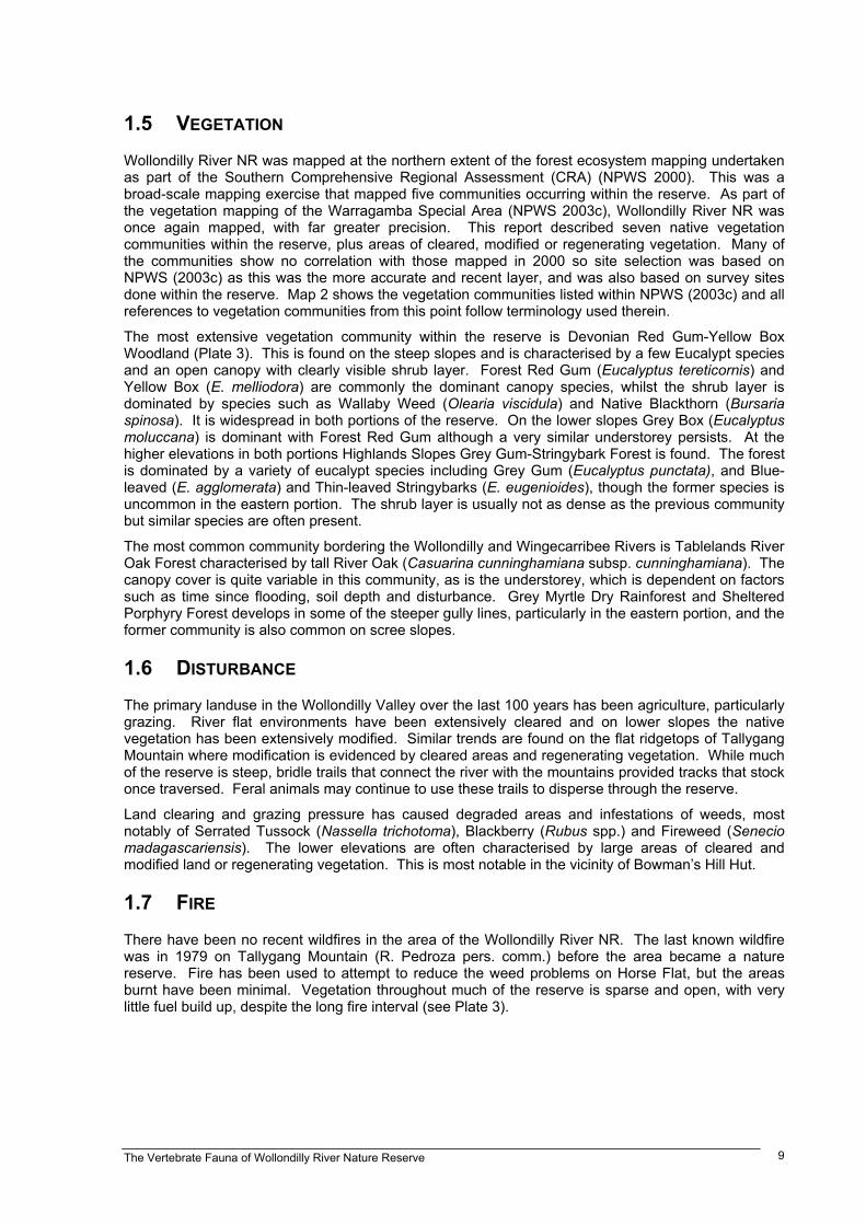
Wollondilly River NR was mapped at the northern extent of the forest ecosystem mapping undertakenas part of the Southern Comprehensive Regional Assessment (CRA) (NPWS 2000). This was abroad-scale mapping exercise that mapped five communities occurring within the reserve. As part ofthe vegetation mapping of the Warragamba Special Area (NPWS 2003c), Wollondilly River NR wasonce again mapped, with far greater precision. This report described seven native vegetationcommunities within the reserve, plus areas of cleared, modified or regenerating vegetation. Many ofthe communities show no correlation with those mapped in 2000 so site selection was based onNPWS (2003c) as this was the more accurate and recent layer, and was also based on survey sitesdone within the reserve. Map 2 shows the vegetation communities listed within NPWS (2003c) and allreferences to vegetation communities from this point follow terminology used therein.
The most extensive vegetation community within the reserve is Devonian Red Gum-Yellow BoxWoodland (Plate 3). This is found on the steep slopes and is characterised by a few Eucalypt speciesand an open canopy with clearly visible shrub layer. Forest Red Gum (Eucalyptus tereticornis) andYellow Box (E. melliodora) are commonly the dominant canopy species, whilst the shrub layer isdominated by species such as Wallaby Weed (Olearia viscidula) and Native Blackthorn (Bursariaspinosa). It is widespread in both portions of the reserve. On the lower slopes Grey Box (Eucalyptusmoluccana) is dominant with Forest Red Gum although a very similar understorey persists. At thehigher elevations in both portions Highlands Slopes Grey Gum-Stringybark Forest is found. The forestis dominated by a variety of eucalypt species including Grey Gum (Eucalyptus punctata), and Blue-leaved (E. agglomerata) and Thin-leaved Stringybarks (E. eugenioides), though the former species isuncommon in the eastern portion. The shrub layer is usually not as dense as the previous communitybut similar species are often present.
The most common community bordering the Wollondilly and Wingecarribee Rivers is Tablelands RiverOak Forest characterised by tall River Oak (Casuarina cunninghamiana subsp. cunninghamiana). Thecanopy cover is quite variable in this community, as is the understorey, which is dependent on factorssuch as time since flooding, soil depth and disturbance. Grey Myrtle Dry Rainforest and ShelteredPorphyry Forest develops in some of the steeper gully lines, particularly in the eastern portion, and theformer community is also common on scree slopes.
1.6 DISTURBANCE
The primary landuse in the Wollondilly Valley over the last 100 years has been agriculture, particularlygrazing. River flat environments have been extensively cleared and on lower slopes the nativevegetation has been extensively modified. Similar trends are found on the flat ridgetops of TallygangMountain where modification is evidenced by cleared areas and regenerating vegetation. While muchof the reserve is steep, bridle trails that connect the river with the mountains provided tracks that stockonce traversed. Feral animals may continue to use these trails to disperse through the reserve.
Land clearing and grazing pressure has caused degraded areas and infestations of weeds, mostnotably of Serrated Tussock (Nassella trichotoma), Blackberry (Rubus spp.) and Fireweed (Seneciomadagascariensis). The lower elevations are often characterised by large areas of cleared andmodified land or regenerating vegetation. This is most notable in the vicinity of Bowman�s Hill Hut.
1.7 FIRE
There have been no recent wildfires in the area of the Wollondilly River NR. The last known wildfirewas in 1979 on Tallygang Mountain (R. Pedroza pers. comm.) before the area became a naturereserve. Fire has been used to attempt to reduce the weed problems on Horse Flat, but the areasburnt have been minimal. Vegetation throughout much of the reserve is sparse and open, with verylittle fuel build up, despite the long fire interval (see Plate 3).
The Vertebrate Fauna of Wollondilly River Nature Reserve10
Map 2:Vegetation
Communitiesand SystematicSurvey Sites in
Wollondilly RiverNature Reserve
Copyright NSW Department of Environment and Conservation June 2004This map is not guaranteed to be free from error or omission
The NSW Department of Environment and Conservation and its employeesdisclaim liability for any act done on the information in the
map and any consequences of such acts or omissions
Printed By
CADU, DEC
03 June 2004e:\sca_veg\sca_fauna\wollondilly_river.apr
%
%%%%%%
%%%%% %%
%
%%%%%%
%
%
%%%
%%%%
%%%%%%
%%
%%%%%
%%%
%%%
%%
%%%%%
%
%%%
%%%%%%%%
%%%
%
%%%%
%%
%%%
%%%
%%%
%%
%
%
0 1 2 Kilometres
N
EW
S
Southern CRA FE Mapping#
SCA Vegetation Mapping*Closed Forest3 Grey Myrtle Dry RainforestTall Open Forest14 Escarpment Grey Gum Forest15 Highlands Gorge River Peppermint Forest18 Sheltered Porphyry ForestOpen Forest24 Highlands Sandstone Dry Shrub Forest30 Wingecarribee Slopes Stringybark Forest31 Highlands Slopes Grey Gum - Stringybark Forest35 Montane Exposed Silvertop Ash Forest39 Tablelands River Oak ForestWoodland48 Escarpment Slopes Dry Ironbark Woodland49 Dry Alluvial Paperbark Woodland51 Devonian Red Gum-Yellow Box Woodland52 Devonian Red Gum-Ironbark Woodland53 Devonian Red Gum-Grey Box Woodland54 Highlands Dry Scribbly Gum WoodlandModified Landscapes78 Regenerating Vegetation79 Exposed Rock80 Cleared-Modified Land81 Water Bodies
NPWS EstateWollondilly River NR
% Systematic Survey Sites
RoadsMajor RoadMinor RoadOther Roads
Rivers
* Not all vegetation communities listed occur within WollondillyRiver NR# Communities have not been separated on this map
The Vertebrate Fauna of Wollondilly River Nature Reserve 11
2 METHODOLOGY
2.1 EXISTING FAUNA DATA
The DEC Atlas of NSW Wildlife was the primary source of existing data. This data has been collatedfrom casual observations made by park workers, residents and recreational observers. There hadbeen no systematic fauna surveys conducted in the Wollondilly River Nature Reserve prior to thesesurveys. Included within this database are records collected as part of the Birds Australia Atlas, whichcollated data from around the country between 1998 and 2002 (Barrett et al. 2003).
2.2 SURVEY STRATIFICATION AND SITE SELECTION
The map of vegetation communities described by NPWS (2003c) covering the Warragamba SpecialArea and surrounds formed the primary stratum for the majority of survey planning (Map 2). Siteswere planned using Geographic Information Systems (ArcView 3.2) and were selected in order tosample all of the major vegetation communities in the reserve. Site selection in the field was based onthe following parameters:
• Consistent vegetation community throughout the site
• Vegetation community representative of the mapped community
• Accessible by either car or foot
The preferable sampling strategy would have aimed to sample the mapped vegetation communitiesproportionately according to the mapped area of each community within the reserve and have includedenough repeated sampling within each vegetation community to provide reasonable reliability thatpotential variations within widespread stratum were captured. However, due to the relatively smallsize of the reserve, there were difficulties in replicating sites within vegetation communities whilstmaintaining sufficient distance between sites to ensure they were independent from one another (onekilometre apart). Consequently, data from sites that were placed outside the reserve but within a fivekilometre radius have also been included in this report. Records of species that were collected outsidethe reserve area are specified as such throughout the report.
The majority of sites were placed on or near access trails to maximise the number that could beaccessed during the limited survey time. Nevertheless, considerable effort was put into theestablishment of sites away from trails. Off road sites were placed where walking access waspossible, which sometimes included access through adjoining private land. Some vegetation typeswere inaccessible during the time allocated for the survey period and therefore were not sampled.
Table 1 shows the number of sites conducted for each vegetation community. Generally, all surveymethods were conducted at each site, though this was not always the case. Often sites were chosenspecifically for a harp trap or Anabat placement based on suitability. Map 2 shows the locations of allsurvey sites in relation to mapped vegetation. A full list of site locations and associated surveys isprovided in Appendix A.
2.3 SURVEY METHODS
Systematic fauna survey methods undertaken were based on those described by NPWS BiodiversitySurvey Coordination Unit (NPWS 1997). This details the specifications of timed searches within fixedareas for all survey techniques. Six of these techniques were used to sample each of the followingvertebrate fauna groups: reptiles, diurnal birds, bats (two techniques), arboreal mammals andnocturnal birds. Consistency in the use of these techniques will allow future comparisons withconsistent surveys of environments elsewhere. Amphibians were not surveyed systematically due tothe dry conditions during, and in the several months preceding, the survey period. Creeklines andsoaks were dry, with the Wollondilly River the only permanent source of water on the fringe of thereserve. The river is fast flowing in many locations and has many fish, making it poor breeding habitatfor many species of frog, so this group was examined opportunistically. Due to time and budgetconstraints, small ground mammals were surveyed only by analysis of predator scats.