the use of videography in tracking earth satellites
TRANSCRIPT

The Use of Videography in Tracking Earth Satellites
By Greg Roberts

Introduction• Scattered around the world is a network of
about sixteen amateur observers who spend most of their spare time looking at earth satellites.
• They concentrate on tracking classified military satellites for which no data has been placed in the public domain.

Observer distribution

Observer distribution
• Australia – 1• British Isles - 4• Canada – 1• France – 2• Germany – 1
• Italy – 1• South Africa – 1• Sweden – 1• United states – 4

Working in close collaboration this group keeps regular track of about 120 satellites moving in a wide variety of orbits ranging from as close as 120 kilometresto as far out as 50000 kilometresor more.

Early Basic equipment
• Until a few years ago all observers were only equipped with binoculars ( or telescope), stop-watch and a suitable star atlas (+ warm coat!) and a comfortable deckchair.

In the early 1990’s relatively cheap low light level commercial so called “surveillance” cameras appeared . I soon recognised its potential for serious satellite tracking and was the first to apply it for positional work.

CoSaTrak Computerized Satellite Tracking
Upon retiring as a professional astronomer in Dec 1999 I made my first video observations of satellites using a homemade GOTO type of mounting driven by the freeware program CoSaTrak written by my colleague Willie Koorts – an electronics engineer employed by the South African Astronomical Observatory.

The program CoSaTrak (1)
CoSatrak runs under DOS and controls acamera and/or telescope similar to the commercial GOTO systems. What is unique about this system is that it is all home brewed and is fairly easy to duplicate IF you have access to a lathe/milling machine and know which end of a soldering iron is which.

CoSaTrak details• The program can point to any object above the
local horizon, using Right Ascension/Declination or azimuth/elevation coordinates.
• It can track an astronomical object object at stellar rate, despite being mounted on an altazimuth mounting.
• It can track a satellite at the satellites angular velocity which means the satellite will stay fixed in the field of view as the satellite passes over.

CoSaTrak details• The program tracks on precomputed
satellite positions so one can “step ahead”to later positions if one wishes to.
• The program can run in unattended mode if desired.
• The mount can be easily calibrated against bright reference stars or local ground targets.

Sample CoSaTrak screen

Sample CoSaTrak screen

Basic System
The system consists of a pc running CoSaTrak, an interface unit and the mounting, carrying a telescope and/or ccd camera and situated about 60 feet distance from the pc.

The original mount (1968)
The original mount was used by the US military in WWII for aiming big naval guns. Around 1960 the mount was made available to the MOONWATCH network and carried a 5 inch f/5 refractor designed to be able to track the 6inch diameter Vanguard satellite at the highest point of its orbit.

The Mounting (July 2001)The mounting is able to move in the horizontal (azimuth) as well as vertical plane (elevation) ,each axis being driven by a stepper motor under the control of the program CoSaTrak . The azimuth stepper motor is the blue unit on the left.

Mounting ( July 2001)
Here one can see the telephoto lens used as well as the 0.5 lux white camera. The stepper motor and belt drive for the elevation control is clearly shown

Looking towards the Control roomThe windows of the “control room” can be seen in the background.At the time of this photograph the mount carried a single 70mm telephoto lens.The brass elevation gear sector and worm are clearly shown.

Early “control room”The DOS computer running CoSaTrak and the stepper motors power supply is shown. NOT shown are the video monitors , time unit etc which came later.

Current “Control room”- 1
• Two video monitors for ccd image viewing• Two PC systems + monitors+keyboards• Precision crystal quartz clock• Two channel oscilloscope for setting the clock
against radio time signals• Two radio communication receivers

Current “Control room ” -2• Video time stamper unit• Video recorder• Video unit to superimpose crosswires /field
of view etc on one of the monitors• Two rack mounted power supply units• Power supply unit for the stepper motor
drives

The CCD unit
The original 5 inch refractor has been replaced by two CCD cameras each using the well known 1004x sold by RfConcepts in the UK.

The 1004x camera• These are unmodified except for the
contrast boost modification which gives an extra half magnitude
• Since images/times are needed in “real time” it is not necessary for the cameras to operate in “time exposure” mode
• Both cameras are run at about +9volts as this gives the least “noise”

The Main camera
The main camera uses a TAMRON lens of focal length 200mm and f/ratio 3.5. Using a focal reducer ( made from a 50mm binocular objective) the focal length becomes 145 mms at f/2.6. This gives a field of view of 1.9 by 1.4 degrees and satellites as faint as +10th
magnitude can be tracked in video mode. This is cooled by a computer CPU fan.

Finder camera• Sometimes satellites are not observed for many
weeks with the result that they do not run on time or appear exactly where predicted, so a “finder” is necessary to locate them .
• This also uses a 1004x chip and has a 50mm focal length f/1.8 lens giving a field of view of about 5.4 by 4.2 degrees and reaching down to about magnitude +8.

Time
In order to obtain a satellite position one needs the time of the event as accurately as possible -preferably to 0.1 second. A precision frequency standard that is electronically divided down to 1 pulse/second controls a “video time stamper”which records the time to 0.1 seconds on the video frame. This is being replaced by a GPS Motorola “ONCORE” 8 channel receiver time unit.

PredictionsIn order to point the camera at a satellite one needs to predict where it will be at a particular instant. Whilst there are many programs available I use SeeCoSat written by myself.

Data storageComposite video from the cameras is fed by coaxial cable to two monitors in the “control room”. The main camera/monitor feeds into the time stamper unit and the video output, with the time of each frame, is recorded on a domestic VCR. A typical tracking session of 4 hours can then be stored on video tape for subsequent analysis.

Data reduction (1)• It takes approximately 7 to 10 hours to
reduce the data from a 4 hour video tape.• Using the popular GUIDE 8 program one
is able to display the predicted satellite track against a background of stars down to magnitude +10 and set to the same scale/orientation as the captured CCD image.

Data reduction (2)
• By comparing the captured video image against the plotted track in GUIDE 8 one is able to identify the field of view.
• The next slide shows a typical view of a satellite going through the Pleiades. The predicted satellite track is in blue ,plotted at 1 second increments.


Data reduction (I1)• For each satellite observed one ideally would like
to get three well spaced positions along its observed track. A typical observing session will mean that about 40 to 50 satellites are observed so this results in a lot of measuring.
• Once measuring is complete the observations are reported to a central depot where an orbit to fit the observations is produced and subsequently made available to anyone interested.

Finding “UNKNOWN” satellites
Frequently one accidentally observes an object which cannot be identified against a master database of about 8500 satellites. If sufficient observations are obtained it is possible to compute an orbit and the satellite is added to the classified satellites list for regular observing.

Satellite No 90013• Accidentally discovered by me about a year ago as
a very slow moving object.• Subsequent observations showed that it was an
unknown geostationary satellite.• It is possibly the brightest geostationary satellite
known at about magnitude 8 steady.• The orbit is now well known and it is regularly
tracked.• It is visible from the UK.

Unknown #90013
This 4 minute exposure shows the movement of #90013 with relation to the trailed stars which indicates that the object is in an inclined orbit with respect to the earths equator.

Regular geostationary “flashers”
• Some satellites have characteristic flashing –this one flashes every 20 seconds when it is suitably illuminated by the sun.
• This animation has been speeded up!

Two NOSS satellites pass 47 Tuc
Two US Navy Ocean Surveillance satellites pass the fuzzy globular cluster 47 Tuc.The mount was tracking on the +7 magnitude satellites

Unexpected flasher
• Whilst tracking MILSTAR 3 – the long/bright streak, an unpredicted “flasher”crossed the field of view. This was identified as the fragment 81-084C.
• The faintest star shown is magnitude +9.3.

Not all are satellites!
I live under one of the flight paths to Cape Town International Airport so frequently capture passenger jets as they fly overhead at about 2000-3000 feet.

Another nice flasher
This is the classified KH 9-19 satellite. Its obvious flash pattern can be easily seen.

A nice meteor
Meteors are common sights.

Milstar 1 (and another satellite)
MILSTAR 1 geostationary satellite. This one appears as a dot as it is a true geostationary satellite at about 0 degrees inclination. A second geostationary may also be seen.

Too many satellites!
• The night sky is full of satellites and its not uncommon to see bright satellites crossing one another. Here Lacrosse 3 and Cosmos 1777 meet.
• Lacrosse 3 is about magnitude +2 steady.

Seeing double
Not all NOSS launches produced triplets- here we only have two objects flying in formation from the USA 160 launch.This is a short time exposure so hence appear as trails.

Seeing triple??
• This shows a short time exposure of the NOSS 2-1 triplet crossing the field of view. These are sometimes easily naked-eye and often give rise to UFO reports.

Another NOSS triplet
This short time exposure clearly shows the three satellites flying in formation.

The Pleiades down southThis image was obtained before adding an IR filter and gives a good idea of.what is seen in “real time” on the monitors in the control room on an average night.

Flashing satellite - EGP
The Japanese EGP satellite produces nice flashes as shown in this MINTRON time exposure photo by Rainer Kracht.

Pole
• This is a nearby electric pole I use to check my mount calibration.
• This was taken on a cloudy night with the sky bright from the lights of Cape Town.
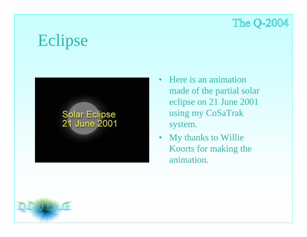
Eclipse
• Here is an animation made of the partial solar eclipse on 21 June 2001 using my CoSaTrak system.
• My thanks to Willie Koorts for making the animation.

You want high resolution images?• Some trackers like to get
detailed photos of the larger satellites. This needs a narrow field of view .
• For positional work one needs several stars in the field of view so its not possible to easily get such pictures. Consequently most satellites are seen as “starlike” objects.

Results• My CoSaTrak CCD system plays a major role in
the amateur tracking network, both because of my geographical location in the southern hemisphere and the accuracy of the system.
• It is ideally suited for looking for satellites that have become “lost” through infrequent observing.
• It is ideal for determining the optical characteristics of satellites since the satellite can be continuously followed during a pass.

Results• All the data is stored on video tape and can
be retrieved later for more detailed analysis etc.
• Any suspect observations, unknowns etc can be investigated at leisure.
• One can, in theory, derive as many positions as wished from a single pass which makes it ideal for determining the orbits of newly launched/newly discovered satellites.

The Future:• The quest is always on to be able to track fainter
and fainter satellites – this means more sensitive cameras/better optics etc.
• The timing system will shortly be modified to use GPS time signals as H.F radio time signal reception is not reliable enough.
• Reducing observations is soul destroying so automated means are being investigated.
• Encourage others as much as possible so that they too can enjoy using video for tracking.

Sincere thanks are due to:
• Willie Koorts for his freeware program CoSaTrak.
• My colleagues in the satellite tracking game who have constantly encouraged me to try better and put up with my constant waffling!

Sincere thanks are also due to:• To the software authors who make their
software available free or at minimal cost• To the QCUIAG newsgroup from which I
have learnt a lot • Finally,but not least, my wife Maureen who
puts up with me missing at night time when I should be in a nice warm bed!