the tenth symposium on polar science, 3 december 2019 …
TRANSCRIPT
The Final Frontier for Satellite Laser Ranging: Antarctica
Toshimichi Otsubo1*, Yuichi Aoyama2, Akihisa Hattori3, Koichiro Doi2,
Michael R Pearlman4* and Carey E Noll5*
1 Hitotsubashi University, 2 NIPR, 3 Sokendai,4 Smithsonian Astrophysical Observatory,
5 NASA/GSFC* International Laser Ranging Service
The Tenth Symposium on Polar Science, 3 December 2019

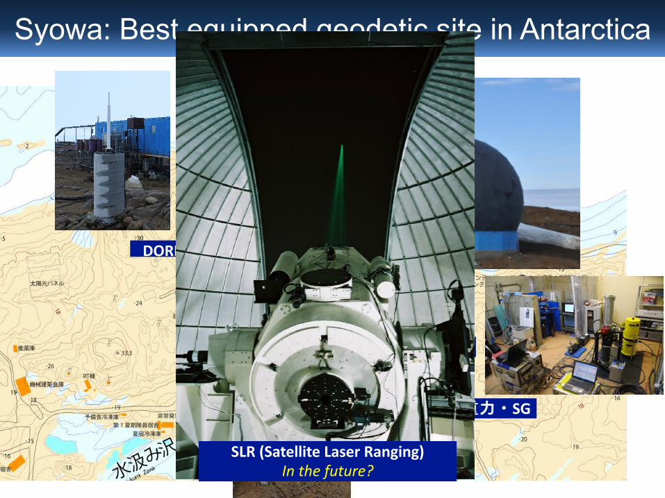
Syowa: Best equipped geodetic site in Antarctica
VLBI
絶対重力・SG
GNSS
DORIS
SLR (Satellite Laser Ranging)Future? Site Survey done in JARE59.

Geodesy is important.Geodesy is exciting.
SLR x Antarctica is important.SLR x Antarctica is exciting.
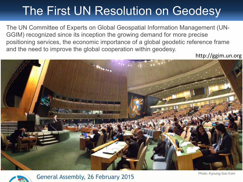
The UN Committee of Experts on Global Geospatial Information Management (UN-GGIM) recognized since its inception the growing demand for more precise positioning services, the economic importance of a global geodetic reference frame and the need to improve the global cooperation within geodesy.
http://ggim.un.org
The First UN Resolution on Geodesy

GGOS: Global Geodetic Observing SystemVision: Advancing our understanding of the dynamic Earth system by quantifying our planet’s changes in space and time.
New President (1 Nov 2019): B Miyahara (GSI)
Integration of Geodetic techniques
GGOS Core Station: equipped with VLBI, SLR and GNSS (and more).
VLBISLR
GNSS
DORIS

Latest trends in/around geodesyGeodesy for everyone? Low-cost & high-precision-positioning GNSS receivers.Strong demand for high-precision 3-D maps.New countries. Worldwide collaboration.
New Sciences in/from GeodesyNew technologies and new satellite missions.Wide application to Seismology, Volcanology, Oceanography, Hydrology, Atmosphere, Ionosphere, Cryosphere, Planetary Science, …

Solar Radiation Pressureà Total Solar Irradiance
Hattori & Otsubo (2019)Supports TSI = 1361 W/m^2 from Ajisai Orbit analysis
Precise orbit determination to contribute to the Earth energy balance study?

Earth Radiation Pressureà Optical properties of Earth surfaceEarth radiation pressure
= IR + Albedo~ 10-30% of SRP
IR: Cloud coverage, temperatureAlbedo: Surface & cloud coverage


Geodesy is important.Geodesy is exciting.
SLR x Antarctica is important.SLR x Antarctica is exciting.
Herstmonceux UK22 July 2016
TO
Syowa: Best equipped geodetic site in Antarctica
VLBI
絶対重力・SG
GNSS
DORIS
SLR (Satellite Laser Ranging)In the future?

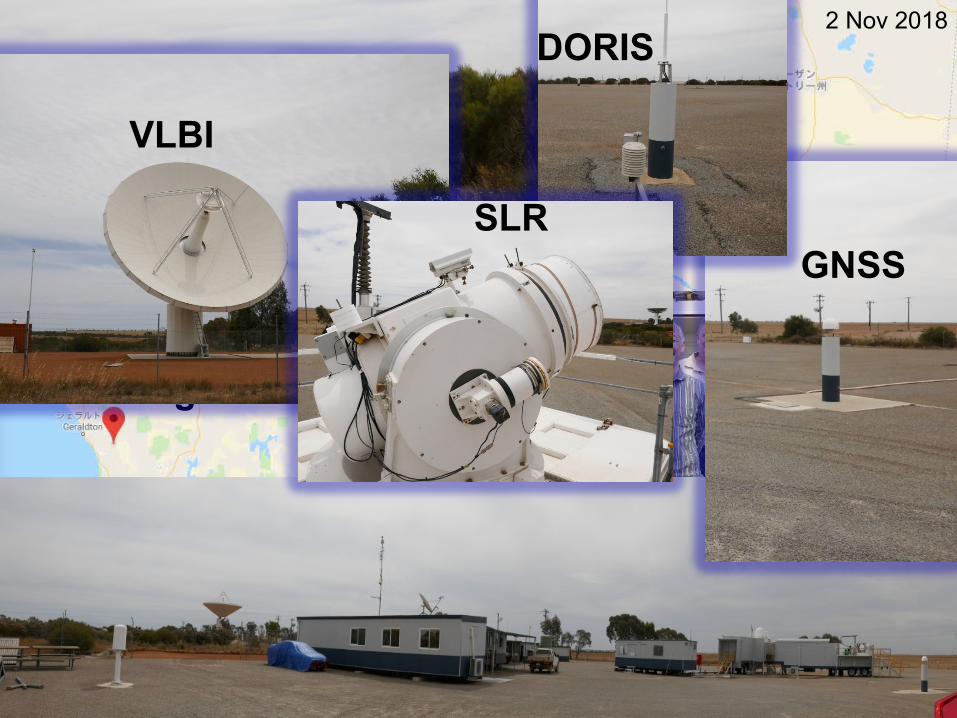
Yarragadee
2 Nov 2018
GNSS
DORIS
SLR
VLBI

Wettzell
15 Dec 2016GNSS DORIS
SLR SLR
VLBIVLBI
VLBI
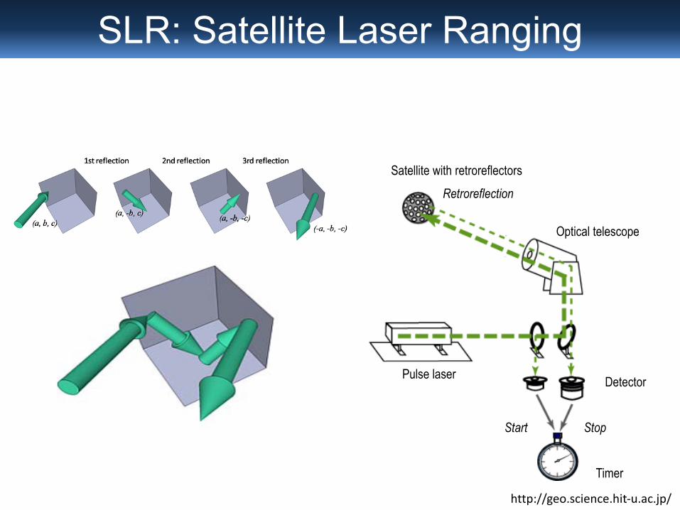
http://geo.science.hit-u.ac.jp/
Pulse laser
Timer
Start Stop
Detector
Optical telescope
Satellite with retroreflectors
Retroreflection
SLR: Satellite Laser Ranging
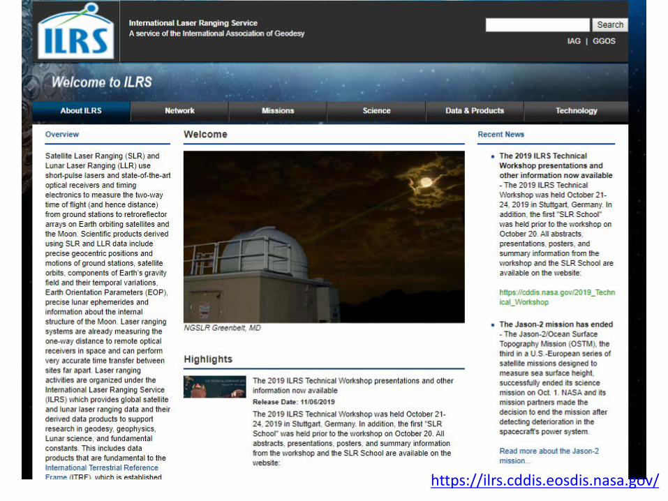

ILRS network
ILRS: Recent Developments 2019 ILRS Technical Workshop | Stuttgart, Germany 17
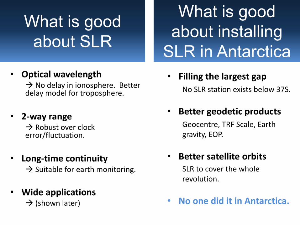
• Optical wavelengthà No delay in ionosphere. Better delay model for troposphere.
• 2-way rangeà Robust over clock error/fluctuation.
• Long-time continuityà Suitable for earth monitoring.
• Wide applicationsà (shown later)
What is good about SLR
What is good about installing
SLR in Antarctica• Filling the largest gap
No SLR station exists below 37S.
• Better geodetic productsGeocentre, TRF Scale, Earth gravity, EOP.
• Better satellite orbitsSLR to cover the whole revolution.
• No one did it in Antarctica.
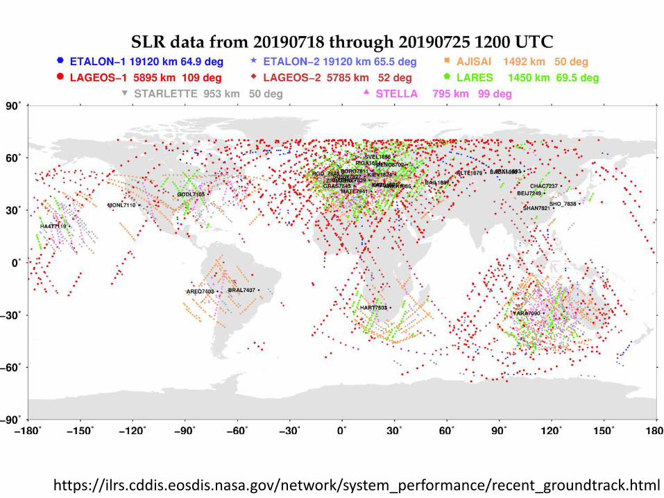
https://ilrs.cddis.eosdis.nasa.gov/network/system_performance/recent_groundtrack.html

Effective for polar orbitersPolar orbit: ~ 90-deg inclination
• Earth observations satellites inclGRACE, ICESAT, Cryosat, …
• Possible application to satellite communications.
àCollaboration with space agencies/projects?
Polar orbiters fly over Antarctica every rev.

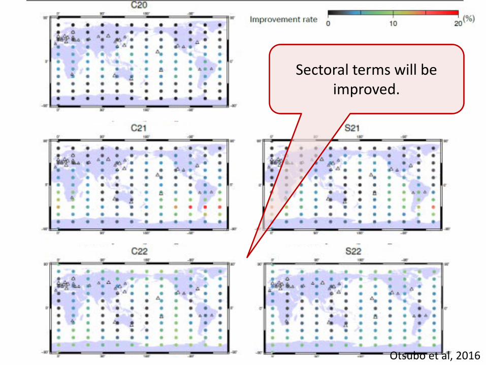
Otsubo et al, 2016
X & Y components of geocenter will be largely
improved.
Otsubo et al, 2016
Sectoral terms will be improved.

Improvement ratio (%)
Existing stationsactive for the satellite in Feb 2016
Virtual station’s contributionsfor along-track, radial and cross-trackorbital components
Cryosphere,Altitude 720 km,
Inclination 92 deg.
Oceanography,Altitude 1336 km, Inclination 66 deg.
Geodetic,Altitude 5850 km,
Inclination 110 deg.
Geodetic,Altitude 5625 km, Inclination 53 deg.

Laser ranging: To improve economy, performance, and adoption for new applications

SLR: Latest trends and new applicationsNew TechnologiesHigh-rate laser ranging using kHz ~ 100 kHz laser.Infrared laser ranging with higher efficiency.Innovative “zero-signature” satellite (e.g. BLITS-M).
New ApplicationsLunar & Deep-space projects.Space communications.Space debris tracking.Time transfer/comparison.

Low Cost? More Stations!
• SLR: Multi-million EUR/USD à 40 stations worldwide
• GNSS: 1% of SLR costà 18,000 stations worldwide
What will happen?
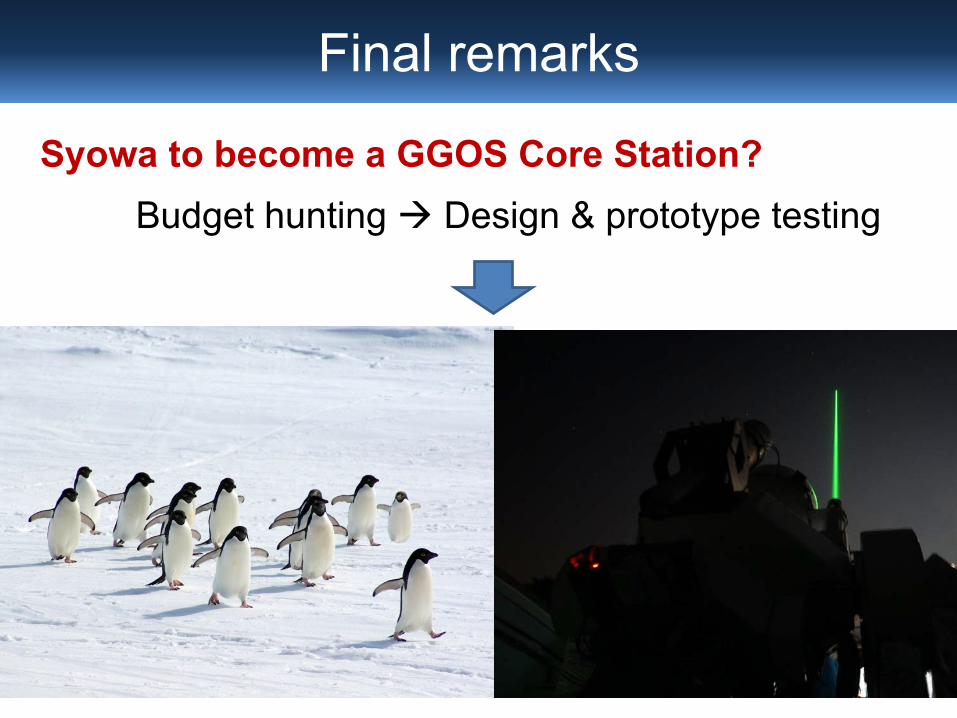
Final remarks
Syowa to become a GGOS Core Station?Budget hunting à Design & prototype testing