the statutes of the republic of singapore boundaries …
TRANSCRIPT
THE STATUTES OF THE REPUBLIC OF SINGAPORE
BOUNDARIES AND SURVEYMAPS ACT 1998
2020 REVISED EDITION
This revised edition incorporates all amendments up to andincluding 1 December 2021 and comes into operation on 31 December 2021.
Prepared and Published by
THE LAW REVISION COMMISSIONUNDER THE AUTHORITY OF
THE REVISED EDITION OF THE LAWS ACT 1983

Boundaries and SurveyMaps Act 1998
ARRANGEMENT OF SECTIONS
PART 1
PRELIMINARY
Section
1. Short title2. Interpretation3. Appointment of Chief Surveyor
PART 2
SURVEY
4. Survey requirements for land5. Powers of Chief Surveyor6. Duties of Chief Surveyor7. Coordinated cadastre8. Bench marks deemed conclusive evidence of height, etc.9. Notice to clear boundary line10. Replacement or repair of boundary mark or survey control mark11. Penalty for obliteration of boundary mark or survey control mark
PART 3
CONDUCT OF CADASTRAL SURVEYS
12. Powers of entry for survey purposes13. Inspection of Authority’s survey maps, plans or survey records14. Deposit of survey plans and survey documents15. Approval of cadastral surveys and assurance plans16. Correction of errors
PART 4
SURVEY MAP
17. Correction of map
31.12.2021
1
2020 Ed.
Section
18. Map to be conclusive evidence
PART 5
MISCELLANEOUS
19. Power to perform order at expense of person disobeying order20. Penalty for non-compliance21. Rules22. Fees to be paid to Authority
An Act to provide for the demarcation of land, the establishment andmaintenance of boundary marks and the publication of certainsurvey maps.
[16 October 1998]
PART 1
PRELIMINARY
Short title
1. This Act is the Boundaries and Survey Maps Act 1998.
Interpretation
2.—(1) In this Act, unless the context otherwise requires —
“approved coordinates” means coordinates approved by theChief Surveyor, or approved under section 7(c), which arecapable of describing and ascertaining the boundaries of anyland in relation to survey control marks;
“assurance plan” means any plan showing approximateboundaries or dimensions and areas for the purpose ofidentifying land which has not been surveyed to the ChiefSurveyor’s satisfaction but is required to be surveyed underthe provisions of any written law;
“authorised surveyor”means a surveyor who is employed by theAuthority, whether or not registered under section 12 of theLand Surveyors Act 1991;
Boundaries and SurveyMaps Act 19982 2020 Ed.
“Authority” means the Singapore Land Authority establishedunder the Singapore Land Authority Act 2001;
“bench mark” means any survey control mark in Singapore thatis used as vertical control to determine the vertical distancebetween the Singapore Height Datum and a survey pointabove or below;
“boundary mark” includes any survey stone, iron pipe, spike, orother survey mark authorised by law for the purpose ofmarking boundaries;
“cadastral survey”means any survey relating to the recording ofland boundaries, subdivision lines, buildings and relateddetails;
“certified plan” means a survey plan which has been approvedby, and filed in the office of, the Chief Surveyor undersection 4(1)(e);
“Chief Surveyor” means the Chief Surveyor appointed undersection 3(1), and includes an acting Chief Surveyor appointedunder section 3(2);
“land” includes —
(a) a parcel of land which is in the actual possession ofthe owner or other person holding by, through orunder the owner;
(b) land covered by water;
(c) a building or a structure erected on land;
(d) any parcel of airspace or any subterranean space,whether or not held apart from the surface of theearth; and
(e) any estate or interest in land;
“licence”means a licence to supply survey services in Singaporegranted under section 17 of the Land Surveyors Act 1991;
“limited liability partnership” has the meaning given to it bysection 4(1) of the Limited Liability Partnerships Act 2005;
Boundaries and SurveyMaps Act 19982020 Ed. 3
31.12.2021
“manager” —
(a) in relation to a corporation or partnership, means theprincipal executive officer of the corporation orpartnership for the time being by whatever namecalled and whether or not the officer is a director orpartner of the corporation or partnership; and
(b) in relation to a limited liability partnership, has themeaning given by section 2(1) of the LimitedLiability Partnerships Act 2005;
“owner”, in relation to any parcel of land, means the person forthe time being receiving the rent of the land, whether on theperson’s own account or as agent or trustee or who wouldreceive the rent if the land were let to a tenant;
“practising certificate” means an annual practising certificateissued under section 15 of the Land Surveyors Act 1991authorising the holder of the certificate to engage in surveywork in Singapore;
“registered surveyor” means a surveyor registered under theLand Surveyors Act 1991;
“repealed Act” means the Boundaries and Survey Maps Act(Cap. 25, 1985 Revised Edition) in force immediately before16 October 1998;
“Singapore Height Datum”means the fixed datum surface set at0.000 metres of Singapore’s historical mean sea level;
“strata title plan” has the meaning given by the Land Titles(Strata) Act 1967;
“survey control mark” means any survey mark placed under thesupervision of the Chief Surveyor the horizontal position orvertical distance from the Singapore Height Datum which isdetermined, and includes a bench mark;
“survey officer” means any person authorised by the ChiefSurveyor to carry out a cadastral survey for any parcel ofland;
“survey plan” includes a strata title plan;
Boundaries and SurveyMaps Act 19984 2020 Ed.
“survey work” has the meaning given by the Land SurveyorsAct 1991.
[2/2007; 30/2008; 11/2015]
(2) In this Act, any reference to a plan, unless the context otherwiserequires, includes a reference to a plan in electronic form.
Appointment of Chief Surveyor
3.—(1) The Minister may appoint a Chief Surveyor who mustadminister this Act and act in accordance with any directions that maybe given by the Minister.
(2) If the Chief Surveyor is temporarily absent from Singapore ortemporarily incapacitated by reason of illness or for any reasontemporarily unable to perform his or her duties, the Minister mayappoint a person to act in the place of the Chief Surveyor during anysuch period of absence from duty.
(3) The functions, duties and powers of the Chief Surveyor underthis Act may be carried out, discharged, performed or exercised byany person who is duly authorised by the Chief Surveyor to act on theChief Surveyor’s behalf.
PART 2
SURVEY
Survey requirements for land
4.—(1) A cadastral survey for any parcel of land must not be takento have been completed until —
(a) the boundaries of the land have been determined bystraight lines;
(b) the physical boundaries of the land have beendemarcated —
(i) by boundary marks or defined by approvedcoordinates; or
Boundaries and SurveyMaps Act 19982020 Ed. 5
31.12.2021
(ii) if it is impossible or impracticable to do so, byreference to floors and walls so as to enable theboundary lines of the land to be ascertained;
(c) the area of the land has been determined;
(d) a lot number has been assigned to the land by the ChiefSurveyor; and
(e) a survey plan, showing the location of the land and itsboundaries, area, lot number and the boundary marksplaced on the land or the approved coordinates, has beenapproved by, and is filed in the office of, the ChiefSurveyor.
(2) A certified plan is prima facie evidence of —
(a) the boundaries and boundary marks of the parcel of landreferred to in the certified plan; and
(b) the area and the lot number of that land.
(3) Any plan for a cadastral survey of a parcel of land approved by,and filed in the office of, the Chief Surveyor under the repealed Act isdeemed to have been approved by, and filed in the office of, the ChiefSurveyor under subsection (1)(e).
Powers of Chief Surveyor
5.—(1) The Chief Surveyor has and may exercise the followingpowers:
(a) to carry out a cadastral survey of any parcel of land for thepurposes of this Act or any other written law and doanything reasonably necessary for the carrying out of thesurvey, including all or any of the following:
(i) to carry out any preparatory work on the land and anyadjacent land;
(ii) to mark out the boundaries of the land;
(iii) to place boundary marks on the land and anyadjacent land;
Boundaries and SurveyMaps Act 19986 2020 Ed.
(iv) to alter, repair or remove any boundary mark placedon the land;
(v) to remove or destroy trees, crops, fences and otherproperty on the land and any adjacent land;
(b) to establish a survey control mark on any parcel of land andto enter on the land and any adjacent land to do all thingsreasonably necessary for the establishment, protection,maintenance, repair, alteration or removal of the mark;
(c) in respect of a cadastral survey of any parcel of land carriedout and submitted by a registered surveyor —
(i) to undertake field checks at any time;
(ii) to make any computations, from the field books,calculation sheets and survey data deposited, that arenecessary to prove the accuracy of the survey, thedimensions, areas, geographical position and theemplacement of boundary marks on the parcel ofland; and
(iii) to give any direction to the registered surveyor of thesurvey made by the registered surveyor.
(2) In the exercise of the powers conferred by subsection (1), theChief Surveyor and survey officer have the right of access to andentry upon any land, foreshore or seabed.
(3) The powers conferred on the Chief Surveyor and survey officerby subsections (1) and (2) may be exercised at all reasonable timesand with any number of assistants that the Chief Surveyor or surveyofficer (as the case may be) thinks appropriate.
Duties of Chief Surveyor
6.—(1) It is the duty of the Chief Surveyor —
(a) to assign a lot number, strata lot number and accessory lotnumber which would enable a parcel of land to beidentified for the purposes of any written law;
(b) to maintain all survey records;
Boundaries and SurveyMaps Act 19982020 Ed. 7
31.12.2021

(c) to make available copies of survey records and plans onpayment of the prescribed fees; and
(d) to perform such other functions specified in this Act or anyother written law.
(2) For the purposes of subsection (1), the Chief Surveyor mayinspect all records submitted and deposited by any registeredsurveyor, and request for any information from any registeredsurveyor that the Chief Surveyor requires.
(3) The survey records and plans for any land may be maintained bythe Chief Surveyor in any electronic media or other means.
Coordinated cadastre
7. The Chief Surveyor is responsible for establishing a coordinatedcadastre and may, for that purpose —
(a) establish and maintain a network of survey control markswith recorded coordinates for use in surveying, mappingand related practice;
(b) declare, by notice in the Gazette, specified areas to bedesignated survey areas, being areas of land in respect ofwhich cadastral surveys must be carried out by reference tosurvey control marks in accordance with surveyinstructions under this Act, and for which coordinatesmust be determined in accordance with those instructions;
(c) approve and record the coordinates of the boundaries ofland within each designated area as determined by surveyscarried out in the area (whether before or after thedeclaration of the area as a designated survey area),convert the coordinates recorded in relation to thoseparcels of land within the area and make any necessaryadjustments to the recorded coordinates;
(d) where the coordinates for all parcels of land within adesignated survey area have been so approved, recorded,converted and adjusted, declare, by notice in the Gazette,that area to be within the coordinated cadastre;
Boundaries and SurveyMaps Act 19988 2020 Ed.

(e) generate, from the coordinated cadastre, maps for any areaof land within the coordinated cadastre; and
(f) where the coordinates for all parcels of land in Singaporehave been declared to be within the coordinated cadastreunder paragraph (d), declare, by notice in the Gazette, thatthe maps generated from the coordinated cadastresupersede all maps published under the repealed Act.
Bench marks deemed conclusive evidence of height, etc.
8. Every bench mark placed under the supervision of the ChiefSurveyor in accordance with this Act is conclusive evidence for thepurposes of determining the vertical distance between the SingaporeHeight Datum and any survey point above or below.
[11/2015]
Notice to clear boundary line
9.—(1) A survey officer may cause a notice to be served on anyperson who is the owner of or has an interest in any land which is thesubject of a cadastral survey calling upon that person to clear anyboundary line of the land.
(2) Where a person fails to carry out work which the person isrequired to carry out by a notice served on the person by a surveyofficer under subsection (1) —
(a) the survey officer may himself or herself cause the work tobe carried out; and
(b) the cost of carrying out the work is recoverable from thatperson as a debt due to the Authority.
Replacement or repair of boundary mark or survey controlmark
10.—(1) Every owner of any land must preserve the boundarymarks erected on the boundaries of the land.
(2) Where the Chief Surveyor becomes aware that any boundarymark or survey control mark erected on any land has been injured,destroyed or removed, or requires repairs, the Chief Surveyor may—
Boundaries and SurveyMaps Act 19982020 Ed. 9
31.12.2021
(a) cause the mark to be replaced or repaired; and
(b) recover the costs of the replacement or repair from theowners of the lands for which the boundary marks andsurvey control marks are to serve as boundaries as a debtdue to the Authority, in any proportion that appears to theChief Surveyor to be proper.
(3) The costs of replacing or repairing boundary marks or surveycontrol marks where the marks are to serve as boundaries of 2 or moreparcels of land, including the costs of carrying out a cadastral surveyif the survey has been made by the order of the Chief Surveyor, mustbe borne by the owners of the lands for which the marks are to serveas boundaries in any proportion that appears to the Chief Surveyor tobe proper.
Penalty for obliteration of boundary mark or survey controlmark
11.—(1) Any person who wilfully obliterates, removes or injures,without reasonable excuse, any boundary mark or survey controlmark which has been made or erected by, or under the direction of, theChief Surveyor shall be guilty of an offence and shall be liable onconviction to a fine not exceeding $1,000 and may further be requiredby a Magistrate’s Court to pay 3 times the cost of replacing andrepairing the boundary mark or survey control mark and of makingany survey rendered necessary by the act for which the person wasconvicted.
(2) The amount mentioned in subsection (1) is to be levied in themanner provided by the Criminal Procedure Code 2010 for thecollection of fines.
(3) If any person committing an offence under this section cannotbe found, the Chief Surveyor may give directions for the replacementor repair of any boundary mark or survey control mark, and may orderthe cost of the replacement or repair to be paid by the owners of theadjacent lands in any proportion that appears to the Chief Surveyor tobe proper.
Boundaries and SurveyMaps Act 199810 2020 Ed.

PART 3
CONDUCT OF CADASTRAL SURVEYS
Powers of entry for survey purposes
12.—(1) For the purposes of conducting any cadastral survey orinstalling any boundary mark or survey control mark under this Act orany other written law, the Chief Surveyor may authorise, eithergenerally or specially and subject to any conditions that the ChiefSurveyor may impose, any registered surveyor who has in force apractising certificate or any assistant employed by the registeredsurveyor —
(a) to enter and re-enter any land, seabed, foreshore orbuilding at any reasonable time during the hours ofdaylight, with such workmen, aircraft, boats, vehicles,appliances, machinery and equipment as may bereasonably necessary to conduct the survey or to installthe boundary mark or survey control mark;
(b) to emplace any boundary mark or survey control mark in orupon such lands and premises, and to dig up any ground forthe purpose of emplacing the boundary mark or surveycontrol mark; and
(c) to cut down and remove any tree or other growth whichmay obstruct any survey line or any boundary.
(2) Before exercising any of the powers conferred by subsection (1)in respect of any land that is not a road, the person doing so must,where practicable, give reasonable notice to the occupier of the landof the intention to exercise those powers.
(3) Any person exercising any power under subsection (1) mustproduce evidence of the person’s identity and authority to exercisethose powers —
(a) if practicable, on first entering the land or premises; and
(b) whenever subsequently reasonably requested to do so.
Boundaries and SurveyMaps Act 19982020 Ed. 11
31.12.2021
(4) Nothing in this section exempts any registered surveyor or theregistered surveyor’s assistant or workman from liability for anydamage caused in the exercise of the powers conferred bysubsection (1).
[11A
Inspection of Authority’s survey maps, plans or survey records
13.—(1) For the purpose of obtaining data for a cadastral survey,the survey plan of which is to be lodged with the Authority, aregistered surveyor who has in force a practising certificate or anauthorised employee or manager of a licensed corporation,partnership or limited liability partnership may, on payment to theAuthority of the prescribed fee, at all reasonable times bepermitted —
(a) to inspect the relevant maps, plans or survey recordslodged with the Authority; and
(b) to take copies of such information from the maps, plans orsurvey records as he or she may require.
[2/2007]
(2) Any person referred to in subsection (1) must not remove anysuch maps, plans or survey records and shall be liable for any damagewhich the person may cause to them while they are under his or hercontrol.
[11B
Deposit of survey plans and survey documents
14.—(1) On completion of a cadastral survey, the registeredsurveyor who signs the survey plan of the cadastral survey mustdeposit that plan together with the relevant field books, calculationsheets and survey data (called in this Act survey documents) with theAuthority, in any form that the Authority may approve.
(2) If the survey plan is approved by the Chief Surveyor, the surveyplan and survey documents deposited with the Authority undersubsection (1) (including any copyright subsisting therein) are to bethe property of the Authority and must be filed as permanent surveyrecords.
Boundaries and SurveyMaps Act 199812 2020 Ed.
(3) The Chief Surveyor, on payment of the prescribed fee, mayprovide to any person applying for it a certified copy of any surveyplan or survey document deposited with the Authority undersubsection (1).
(4) Every such certified copy of a survey plan or survey documentsigned by the Chief Surveyor shall be received in evidence in anycourt, or before any person having authority by law or by consent ofparties to receive evidence, without proof of signature, as prima facieproof of all the matters contained in or entered on the survey plan orsurvey document, as the case may be.
(5) A printout of any information stored in a computer in theAuthority issued and signed by the Chief Surveyor shall be receivedin evidence in any court, or before any person having authority by lawor by consent of parties to receive evidence, without proof ofsignature, as prima facie proof of all the matters contained in orentered on that document.
[11C[4/2012]
Approval of cadastral surveys and assurance plans
15.—(1) No cadastral survey or survey plan thereof may beaccepted or adopted for the purpose of any written law unless ithas been approved by the Chief Surveyor.
(2) No assurance plan may be lodged in the Registry of Deeds or theLand Titles Registry of the Authority (as the case may be) unless theassurance plan —
(a) is signed by a registered surveyor and approved by theChief Surveyor; and
(b) bears a caution to the effect that the boundaries ordimensions and areas are inconclusive.
(3) The Chief Surveyor may refuse to approve any survey plan orassurance plan under this section if —
(a) the subdivision permission as required by section 12 of thePlanning Act 1998 has not been obtained;
(b) the prescribed survey fees have not been paid; or
Boundaries and SurveyMaps Act 19982020 Ed. 13
31.12.2021
(c) an encroachment has been created by the purchaser orowner of a parcel of land being surveyed for any relevantpurpose, which affects any parcel of land adjoining thatparcel of land, and the registered surveyor who signs theplan has not certified that the encroachment has beenresolved.
(4) Where the subdivision of land has been authorised by anotification made by the Minister under section 21(6) of thePlanning Act 1998, the Chief Surveyor is not, when the ChiefSurveyor approves any survey plan under this section, obliged toenquire whether any condition set out in the notification or imposedby the competent authority under that Act has been satisfied orcomplied with.
(5) Despite that a survey plan has been approved by the ChiefSurveyor, it is the duty of the registered surveyor who signed thesurvey plan to ensure that the survey plan and all information andmatters set out in the survey plan are correct and accurate.
(6) In subsection (3)(c), “relevant purpose”, in relation to anysurvey of a parcel of land, means a survey for the purpose of —
(a) obtaining a new State title for the parcel of land;
(b) amalgamating the parcel of land; or
(c) subdividing the parcel of land.
(7) Any cadastral survey, survey plan or assurance plan approvedbefore 31 March 2005 by the Chief Surveyor or other officerappointed by the Chief Surveyor under section 39 of the LandSurveyors Act 1991 then in force, is deemed to have been approvedunder this section.
[11D
Correction of errors
16.—(1) The Chief Surveyor or any authorised surveyor designatedby the Chief Surveyor may at any time undertake field and officechecks on the cadastral survey work of a registered surveyor or alicensed corporation, partnership or limited liability partnership.
[2/2007]
Boundaries and SurveyMaps Act 199814 2020 Ed.
(2) The Chief Surveyor may, at any time after the survey plan hasbeen deposited with the Authority, by written notice, direct anyregistered surveyor or any licensed corporation, partnership orlimited liability partnership to correct at his or her or its expensewithin a period specified in the notice any error in the cadastralsurvey made by that registered surveyor or by a registered surveyorwho is a director, a partner, a manager or an employee of thatcorporation, partnership or limited liability partnership, as the casemay be.
[2/2007]
(3) If any person fails to comply with the notice given undersubsection (2), the Chief Surveyor may undertake the correction ofthe cadastral survey and recover the cost of the correction from theperson.
(4) Where the Chief Surveyor is entitled to recover the cost of anycorrection of a cadastral survey under subsection (3), the ChiefSurveyor may serve on the registered surveyor, licensed corporation,partnership or limited liability partnership (as the case may be) astatement of the cost of the correction by registered post addressed tothe last known place of practice or residence of the registeredsurveyor, licensed corporation, partnership or limited liabilitypartnership.
[2/2007]
(5) Subsections (2) and (3) do not apply to an assurance plan.[11E
PART 4
SURVEY MAP
Correction of map
17.—(1) All maps published under the repealed Act continue to bevalid until the maps have been declared to be superseded undersection 7(f).
(2) No map (whether published under the repealed Act or generatedfrom the coordinated cadastre) may be corrected, altered or added to
Boundaries and SurveyMaps Act 19982020 Ed. 15
31.12.2021
in respect of any boundary of any land laid down in the map, except inthe following cases:
(a) where it is found that a map does not correctly represent theboundaries of any land, the Chief Surveyor must inquireinto the reason for the difference and, if it is found to be dueto inaccuracy in the survey caused by error in measuringthe angles or the sides of the land or in plotting the surveyor in the process of conversion and adjustment undersection 7, the Chief Surveyor must give notice to theowners of the land affected, or their agents if they areknown and are in Singapore, of the error and require themto forward to the Chief Surveyor within one month theirobjections (if any) to its correction;
(b) where it appears that wrong boundary marks have beenjoined up in the survey and delineation of a boundaryshown on a map, or where it appears that there has been achange in the position of a boundary from that which itheld at the time of the survey or at the time when it wasdelineated on the map under paragraph (c), the ChiefSurveyor must, after one month’s notice to the owners ofthe land affected, or their agents if they are known and arein Singapore, of the Chief Surveyor’s intention, proceed tohold an inquiry, which may be held in part upon the land;
(c) where in the case of the assignment or demise of any landcomprised wholly or partly in any State title in parcels orotherwise than the entirety of the land, the parcels havebeen properly demarcated and surveyed to the satisfactionof the Chief Surveyor and the fees payable in respect of thedemarcation and survey have been duly paid, theboundaries of the parcels or any subdivision of theparcels must be delineated upon the representation of theland or parcel of the land on the map;
(d) where any owners whose boundaries are conterminousagree to an alteration in their boundaries, the map may bealtered by the order of the Chief Surveyor upon a deed orinstrument being presented at the Registry of Deeds or the
Boundaries and SurveyMaps Act 199816 2020 Ed.
Land Titles Registry (as the case may be) of the Authorityeffectuating the alteration agreed to;
(e) where in any suit an order of the General Division of theHigh Court has been made which affects the position of theboundaries of any land, the map may be altered upon anoffice copy of the order being served on the ChiefSurveyor;
(f) where any land delineated on the map has been subdividedinto parcels and the parcels have not been surveyed to thesatisfaction of the Chief Surveyor, the Chief Surveyor —
(i) may proceed to make a cadastral survey of theparcels; and
(ii) if so, must —
(A) proceed to fix and demarcate the boundary inthe position which the Chief Surveyorconsiders to be the true position; and
(B) make an order for the delineation upon the mapof the boundary so fixed.
[40/2019]
(3) If no objection is lodged with the Chief Surveyor undersubsection (2)(a) within one month from the service of the notice, theChief Surveyor must make an order for the correction to be made.
(4) If any objection is lodged with the Chief Surveyor undersubsection (2)(a), the Chief Surveyor must hold an inquiry and makesuch order as he or she thinks fit.
(5) If, after taking into consideration the evidence of the owners ortheir agents appearing at the inquiry under subsection (2)(b) and ofany other persons who have knowledge of the subject, the ChiefSurveyor is satisfied that the boundary as it appears from the thenexisting occupation of the land is the true boundary, the ChiefSurveyor must make an order for the correction of the map.
(6) Where it is found that the boundaries of a Mukim or TownSubdivision shown on any map published under the repealed Act or
Boundaries and SurveyMaps Act 19982020 Ed. 17
31.12.2021
generated from the coordinated cadastre should be altered by reasonof —
(a) any correction, addition or alteration of the boundaries ofany land made in accordance with this section;
(b) the change in, alteration or deviation of, any boundarymark of the Mukim or Town Subdivision boundaries; or
(c) any reclamation of the foreshore or seabed,
the Chief Surveyor may, after the publication of a notice in theGazette describing the alteration of the boundaries of the Mukim orTown Subdivision, make an order for the delineation or alteration ofthe boundaries on the map.
[12
Map to be conclusive evidence
18.—(1) Every map published under the repealed Act is, until it hasbeen declared to be superseded under section 7(f), conclusiveevidence in all courts of the boundaries of the land comprised inevery land shown in the map, subject only to any order made undersection 17 for their modification, correction or alteration.
(2) Upon a declaration under section 7(f), every map generatedfrom the coordinated cadastre is conclusive evidence in all courts ofthe boundaries of the land comprised in every land shown in the map,subject only to any order made under section 17 for theirmodification, correction or alteration.
[13
PART 5
MISCELLANEOUS
Power to perform order at expense of person disobeying order
19.—(1) If any person (A) who is ordered under any provision ofthis Act to perform any act fails to perform the act within a reasonabletime, the person who gave the order (B) may, after giving notice to Aof B’s intention to do so, cause the act to be performed.
Boundaries and SurveyMaps Act 199818 2020 Ed.
(2) The expenses incurred in such performance are payable by A.[14
Penalty for non-compliance
20. Any person who being legally bound to comply with any orderunder this Act, or with the requisition contained in any notice servedupon him or her under this Act, wilfully refuses, or withoutreasonable excuse neglects, to comply with the order, shall beguilty of an offence and shall be liable on conviction to a fine notexceeding $100 for every day or part of every day during which therefusal or neglect continues after conviction.
[15
Rules
21.—(1) The Authority, with the approval of the Minister, maymake rules for carrying out the purposes of this Act and for any matterwhich is required under this Act to be prescribed.
(2) Without limiting subsection (1), the Authority, with theapproval of the Minister, may make rules —
(a) prescribing the fees for the purposes of this Act and thetime for payment of the fees;
(b) prescribing the manner and procedure for inquiries to beheld under this Act;
(c) regulating the following:
(i) preparation of plans and documents for the purposesof this Act;
(ii) lodgment and registration of plans under this Act;
(iii) preparation and making of cadastral surveys; and
(d) prescribing the manner (whether by electronic means orotherwise) in which —
(i) applications for or lodgments of lot numbers, surveyrecords and plans, survey documents or other recordsand documents may be made;
Boundaries and SurveyMaps Act 19982020 Ed. 19
31.12.2021
(ii) permissions, approvals and decisions may be grantedor made, and notified;
(iii) notices or other documents may be made ortransmitted; and
(iv) documents may be authenticated or certified.[17
Fees to be paid to Authority
22. All prescribed fees collected for the purposes of this Act mustbe paid into the funds of the Authority.
[18
Boundaries and SurveyMaps Act 199820 2020 Ed.
LEGISLATIVE HISTORY
BOUNDARIES AND SURVEYMAPS ACT 1998
This Legislative History is a service provided by the Law Revision Commissionon a best-efforts basis. It is not part of the Act.
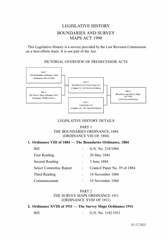
PICTORIAL OVERVIEW OF PREDECESSOR ACTS
LEGISLATIVE HISTORY DETAILS
PART 1THE BOUNDARIES ORDINANCE, 1884
(ORDINANCE VIII OF 1884)
1. Ordinance VIII of 1884 — The Boundaries Ordinance, 1884
Bill : G.N. No. 218/1884
First Reading : 20 May 1884
Second Reading : 3 June 1884
Select Committee Report : Council Paper No. 39 of 1884
Third Reading : 14 November 1884
Commencement : 14 November 1884
PART 2THE SURVEY MAPS ORDINANCE 1911
(ORDINANCE XVIII OF 1911)
2. Ordinance XVIII of 1911 — The Survey Maps Ordinance 1911
Bill : G.N. No. 1182/1911
31.12.2021
First Reading : 29 September 1911
Second Reading : 13 October 1911
Notice of Amendments : 10 November 1911
Third Reading : 10 November 1911
Commencement : 23 November 1911
PART 3BOUNDARIES AND SURVEY MAPS ACT(CHAPTER 25, 1985 REVISED EDITION)
3. 1920 Revised Edition — Ordinance No. 31 (Boundaries and SurveyMaps)
Operation : 28 November 1921
Note: This Revised Edition consolidated The Boundaries Ordinance, 1884(Ordinance VIII of 1884) and The Survey Maps Ordinance 1911(Ordinance XVIII of 1911).
4. 1926 Revised Edition — Ordinance No. 31 (Boundaries and SurveyMaps)
Operation : 1 August 1926
5. Ordinance 4 of 1929 — Boundaries and Survey Maps (Amendment)Ordinance, 1929
Bill : G.N. No. 2454/1928
First Reading : 10 December 1928
Second Reading : 28 January 1929
Notice of Amendments : 28 January 1929
Third Reading : 25 March 1929
Commencement : 25 April 1929
6. 1936 Revised Edition — Boundaries and Survey Maps Ordinance(Chapter 130)
Operation : 1 September 1936
7. G.N. No. S 93/1955 — Singapore Colony Order in Council, 1955(Consequential Provisions) (Council of Ministers)Order, 1955
Commencement : 4 April 1955
ii
8. Ordinance 37 of 1952 — Law Revision (Penalties Amendment)Ordinance, 1952
(Amendments made by section 2 read with item 38 of the Schedule to theabove Ordinance)
Bill : 32/1952
First Reading : 16 September 1952
Second and Third Readings : 14 October 1952
Commencement : 30 April 1955 (section 2 read withitem 38 of the Schedule)
9. 1955 Revised Edition — Boundaries and Survey Maps Ordinance(Chapter 241)
Operation : 1 July 1956
10. G.N. No. S (N.S.) 179/1959 — Singapore Constitution (Modification ofLaws) (No. 5) Order, 1959
Commencement : 20 November 1959
11. G.N. Sp. No. S 47/1963 — State Laws (Modification) (No. 3) Order, 1963
Commencement : 16 September 1963
12. 1970 Revised Edition— Boundaries and Survey Maps Act (Chapter 265)
Operation : 31 August 1971
13. Act 31 of 1973 — Boundaries and Survey Maps (Amendment) Act, 1973
Bill : 31/1973
First Reading : 11 July 1973
Second and Third Readings : 26 July 1973
Commencement : 1 September 1973
14. 1985 Revised Edition — Boundaries and Survey Maps Act (Chapter 25)
Operation : 30 March 1987
15. Act 7 of 1997 — Statutes (Miscellaneous Amendments) Act 1997(Amendments made by section 7 read with item (4) of the Second Schedule tothe above Act)
Bill : 6/1997
First Reading : 11 July 1997
Second and Third Readings : 25 August 1997
iii
Commencement : 1 October 1997 (section 7 read withitem (4) of the Second Schedule)
PART 4LANDMARKS ACT
(CHAPTER 159, 1985 REVISED EDITION)
16. Ordinance VII of 1882 — Landmarks Ordinance, 1882
Bill : G.N. No. 102/1882
First Reading : 7 March 1882
Second Reading : 20 April 1882
Notice of Amendments : 25 April 1882
Third Reading : 4 May 1882
Commencement : 4 May 1882
17. 1920 Revised Edition — Ordinance No. 29 (Landmarks)
Operation : 28 November 1921
18. 1926 Revised Edition — Ordinance No. 29 (Landmarks)
Operation : 1 August 1926
19. 1936 Revised Edition — Landmarks Ordinance (Chapter 131)
Operation : 1 September 1936
20. 1955 Revised Edition — Landmarks Ordinance (Chapter 252)
Operation : 1 July 1956
21. G.N. Sp. No. S 47/1963 — State Laws (Modification) (No. 3) Order, 1963
Commencement : 16 September 1963
22. 1970 Revised Edition — Landmarks Act (Chapter 278)
Operation : 31 August 1971
23. 1985 Revised Edition — Landmarks Act (Chapter 159)
Operation : 30 March 1987
iv

PART 5BOUNDARIES AND SURVEY MAPS ACT 1998
(2020 REVISED EDITION)
24. Act 35 of 1998 — Boundaries and Survey Maps Act 1998
Bill : 32/1998
First Reading : 31 July 1998
Second and Third Readings : 4 September 1998
Commencement : 16 October 1998
25. 1999 Revised Edition — Boundaries and Survey Maps Act(Chapter 25)
Operation : 30 December 1999
26. Act 17 of 2001 — Singapore Land Authority Act 2001(Amendments made by section 38(1) read with item (2) of the FourthSchedule to the above Act)
Bill : 17/2001
First Reading : 5 March 2001
Second and Third Readings : 19 April 2001
Commencement : 1 June 2001 (section 38(1) read withitem (2) of the Fourth Schedule)
27. Act 37 of 2004 — Land Surveyors (Amendment) Act 2004(Amendments made by section 17 read with item (1) of the Schedule to theabove Act)
Bill : 36/2004
First Reading : 1 September 2004
Second and Third Readings : 21 September 2004
Commencement : 31 March 2005 (section 17 read withitem (1) of the Schedule)
28. 2006 Revised Edition — Boundaries and Survey Maps Act(Chapter 25)
Operation : 1 April 2006
29. Act 2 of 2007 — Statutes (Miscellaneous Amendments) Act 2007(Amendments made by section 8 of the above Act)
Bill : 14/2006
First Reading : 8 November 2006
v
Second and Third Readings : 22 January 2007
Commencement : 2 May 2007 (section 8)
30. Act 30 of 2008— Statutes (Miscellaneous Amendments) (No. 2) Act 2008(Amendments made by section 3 of the above Act)
Bill : 27/2008
First Reading : 15 September 2008
Second and Third Readings : 17 November 2008
Commencement : 17 December 2008 (section 3)
31. Act 4 of 2012 — Evidence (Amendment) Act 2012(Amendments made by section 22(1) of the above Act)
Bill : 2/2012
First Reading : 16 January 2012
Second and Third Readings : 14 February 2012
Commencement : 1 August 2012 (section 22(1))
32. Act 11 of 2015 — State Lands (Amendment) Act 2015(Amendments made by section 5 of the above Act)
Bill : 6/2015
First Reading : 12 February 2015
Second and Third Readings : 13 March 2015
Commencement : 8 May 2015 (section 5)
33. Act 40 of 2019 — Supreme Court of Judicature (Amendment) Act 2019(Amendments made by section 28(1) read with item 13 of the Schedule to theabove Act)
Bill : 32/2019
First Reading : 7 October 2019
Second Reading : 5 November 2019
Notice of Amendments : 5 November 2019
Third Reading : 5 November 2019
Commencement : 2 January 2021 (section 28(1) readwith item 13 of the Schedule)
vi
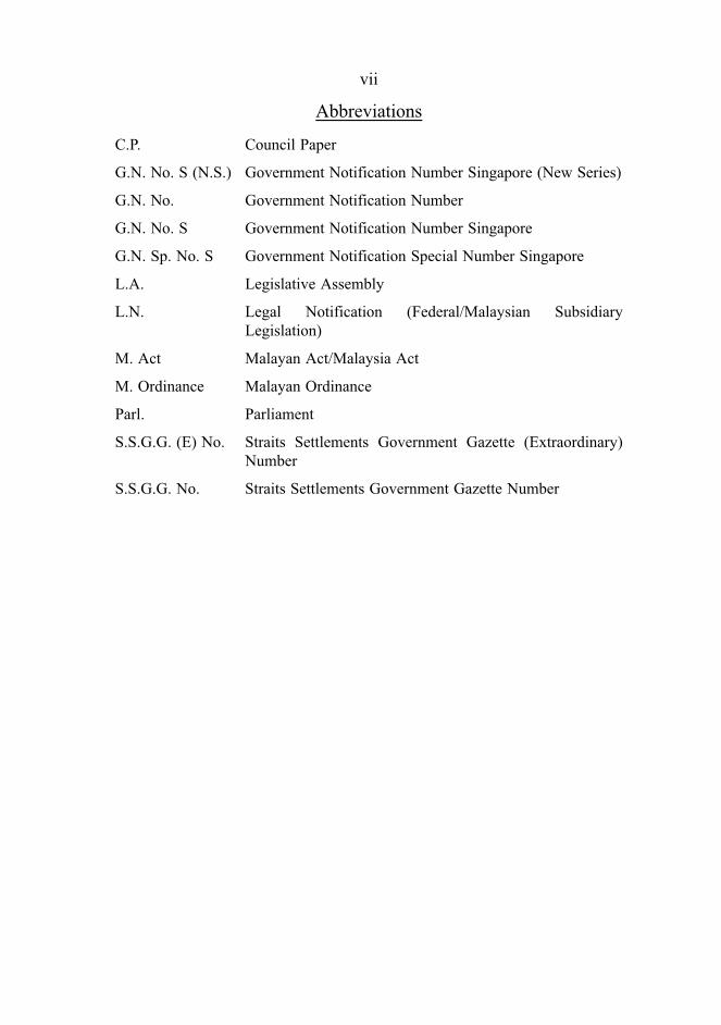
Abbreviations
C.P. Council Paper
G.N. No. S (N.S.) Government Notification Number Singapore (New Series)
G.N. No. Government Notification Number
G.N. No. S Government Notification Number Singapore
G.N. Sp. No. S Government Notification Special Number Singapore
L.A. Legislative Assembly
L.N. Legal Notification (Federal/Malaysian SubsidiaryLegislation)
M. Act Malayan Act/Malaysia Act
M. Ordinance Malayan Ordinance
Parl. Parliament
S.S.G.G. (E) No. Straits Settlements Government Gazette (Extraordinary)Number
S.S.G.G. No. Straits Settlements Government Gazette Number
vii

COMPARATIVE TABLE
BOUNDARIES AND SURVEYMAPS ACT 1998
This Act has undergone renumbering in the 2020 Revised Edition. ThisComparative Table is provided to help readers locate the corresponding provisionsin the last Revised Edition.
2020 Ed. 2006 Ed.
PART 3 PART IIA
12 11A
13 11B
14 11C
15 11D
16 11E
PART 4 PART III
17 12
18 13
PART 5 PART IV
19 14
20 15
— 16 [Repealed by Act 17 of 2001]
21 17
22 18
31.12.2021