the south atlantic lcc’s third thursday web forum · the south atlantic lcc’s third thursday...
TRANSCRIPT

10-15-2015
The South Atlantic LCC’s Third Thursday Web Forum
Tracing impacts: connecting conservation actions to indicators

• Introduction
• Monthly topic
• Questions and discussion about presentation
• South Atlantic LCC staff updates
• Questions and discussion about updates
2
Agenda

3
Christy Ihlo, Nicholas Institute for Environmental Policy Solutions & South Atlantic LCC
Tracing impacts: connecting conservation actions to indicators
10-15-2015
3

TRACING IMPACTS:
CONNECTING ACTIONS TO
INDICATORS
Dean Urban, Patrick Halpin, Jesse Cleary, John Fay, Lydia Olander, and Christy Ihlo
Duke University
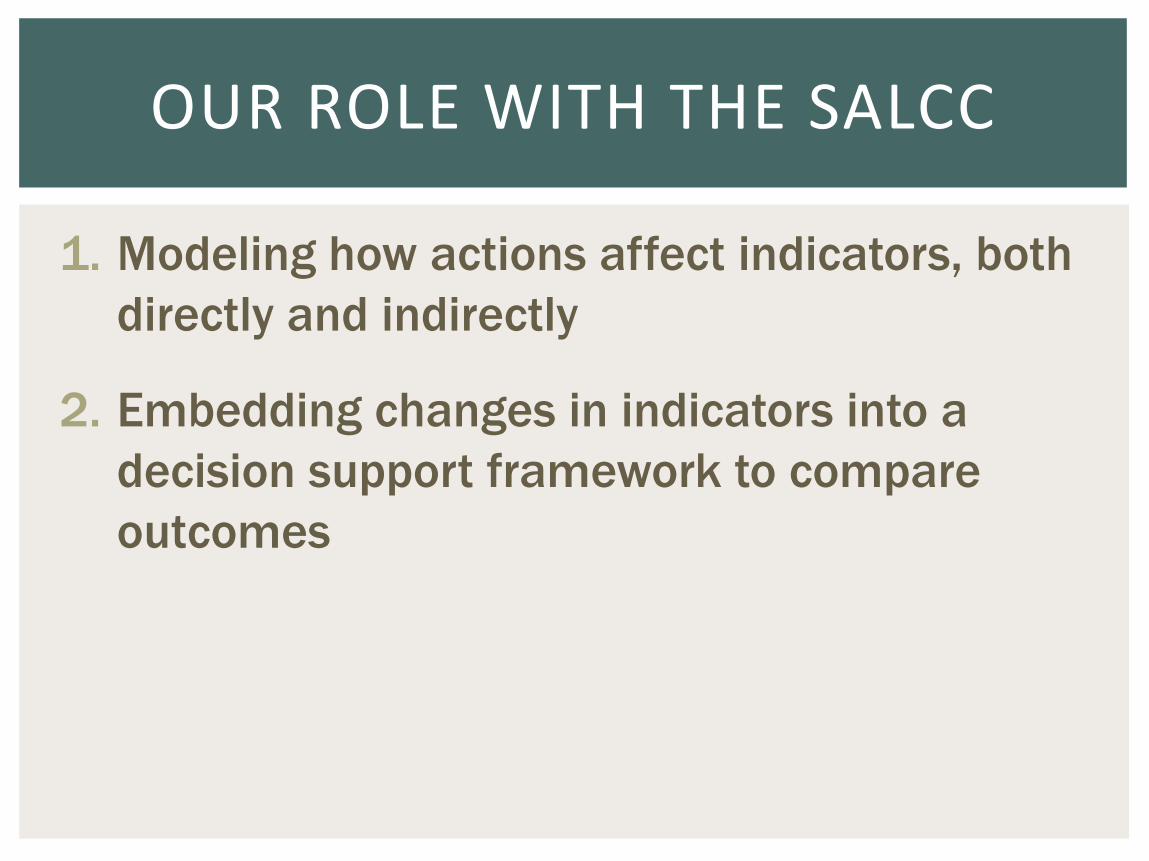
1. Modeling how actions affect indicators, both
directly and indirectly
2. Embedding changes in indicators into a
decision support framework to compare
outcomes
OUR ROLE WITH THE SALCC

Predicting impacts of prescribed burning
Predicting impacts of working with communities
on green growth
Impact of coastal conservation actions on marine
fish
Demonstrating and organization’s impact on the
indicators
Demonstrating impact of land acquisition
proposals on indicators
USE CASE SCENARIOS

Predicting impacts of prescribed burning
Predicting impacts of working with communities
on green growth
Impact of coastal conservation actions on marine
fish
Demonstrating and organization’s impact on the
indicators
Demonstrating impact of land acquisition
proposals on indicators
USE CASE SCENARIOS

Predicting impacts of prescribed burning
Goal: a tool that will output changes in pine and
prairie ecosystem indicators based on user input
shapefile of area burned
Demonstrating impact of land acquisition
proposals on indicators
Goal: a tool that will output changes in all affected
indicators based on existing land acquisition
proposals
USE CASE SCENARIOS

BUILDING A MEANS-ENDS DIAGRAM
ACTION INDICATOR

BUILDING A MEANS-ENDS DIAGRAM
ACTION ECOLOGICAL CHANGES INDICATOR

BUILDING A MEANS-ENDS DIAGRAM
Reg. Burn Habitat
(ha)
Prescribed Burning
Index, Pine Bird
RCWO Habitat (ha)
BCHS Habitat (ha)
NOBO Habitat (ha)
Land Acquisition (avoid. conversion)
ACTION ECOLOGICAL CHANGES INDICATOR
Ecosystem: Pine and Prairie
Index, Pine Amp
PARCAS (ha)
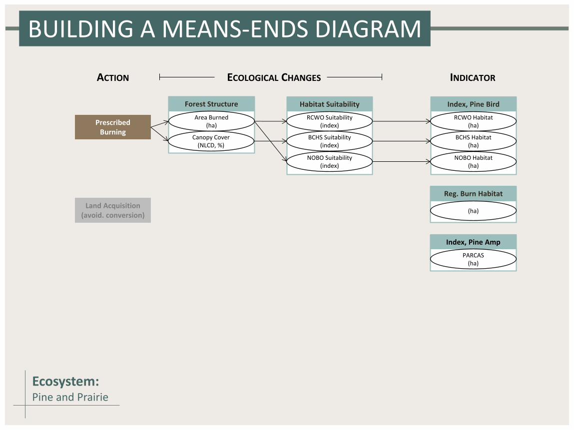
BUILDING A MEANS-ENDS DIAGRAM
Reg. Burn Habitat
(ha)
Prescribed Burning
Habitat Suitability
RCWO Suitability (index)
BCHS Suitability (index)
NOBO Suitability (index)
Index, Pine Bird
RCWO Habitat (ha)
BCHS Habitat (ha)
NOBO Habitat (ha)
Forest Structure
Canopy Cover (NLCD, %)
Area Burned (ha)
ACTION ECOLOGICAL CHANGES INDICATOR
Land Acquisition (avoid. conversion)
Index, Pine Amp
PARCAS (ha)
Ecosystem: Pine and Prairie
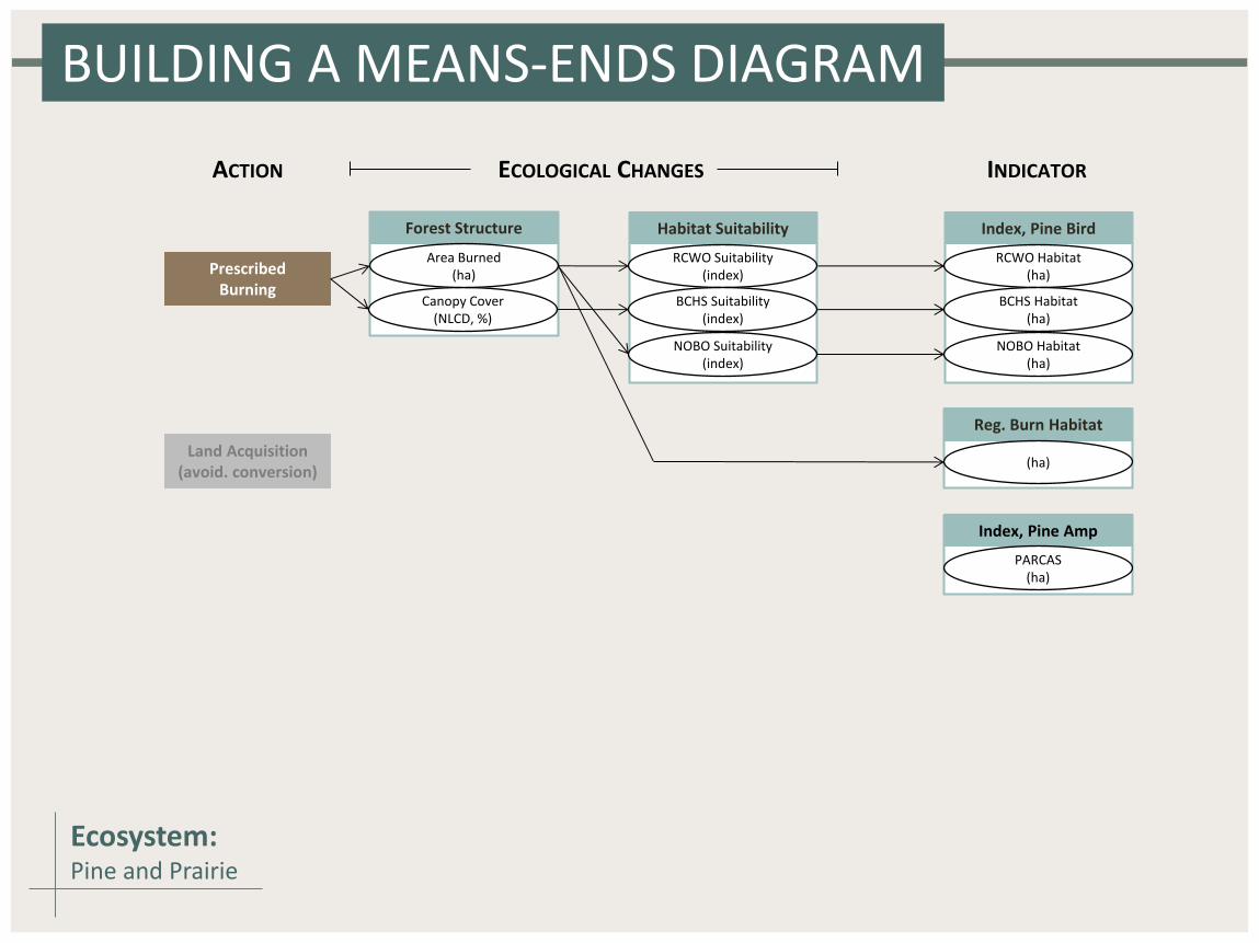
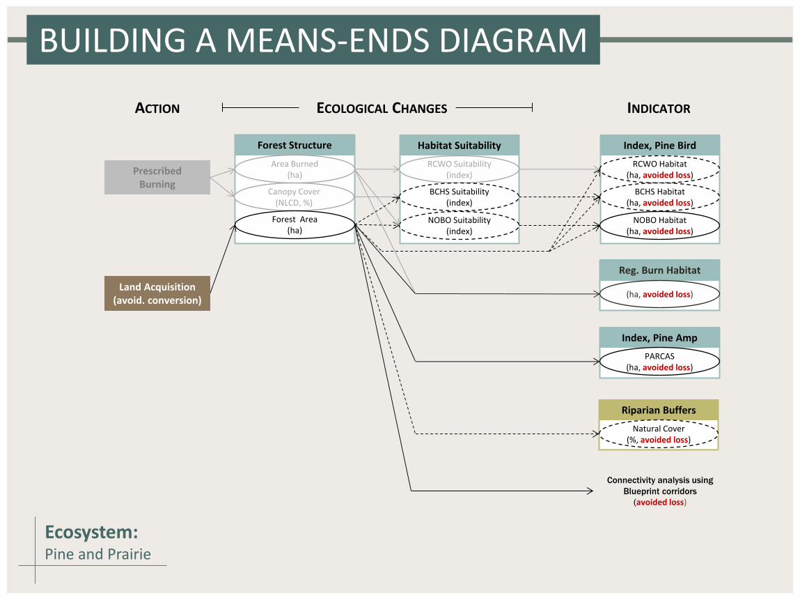
BUILDING A MEANS-ENDS DIAGRAM
Reg. Burn Habitat
(ha, avoided loss)
Prescribed Burning
Habitat Suitability
RCWO Suitability (index)
BCHS Suitability (index)
NOBO Suitability (index)
Index, Pine Bird
RCWO Habitat (ha, avoided loss)
BCHS Habitat (ha, avoided loss)
NOBO Habitat (ha, avoided loss)
Forest Structure
Canopy Cover (NLCD, %)
Area Burned (ha)
Forest Area (ha)
Connectivity analysis using
Blueprint corridors
(avoided loss)
Riparian Buffers
Natural Cover (%, avoided loss)
Index, Pine Amp
PARCAS (ha, avoided loss)
ACTION ECOLOGICAL CHANGES INDICATOR
Land Acquisition (avoid. conversion)
Ecosystem: Pine and Prairie

From means-ends diagrams, we look at how a
change in an indicator would be calculated
Continuing our fire example…. A change in bird index measured via an adjusted # of sp. per cell (some
habitat modeling, some changes in area)
A change in regularly burned habitat measured via a change in area
burned (ultimately, binary)
A change in amphibian index measured via an adjusted forest area in
PARCAS (land acquisition) (binary)
A change in natural habitat in riparian buffers (FW habitat indicator)
measured via a change in the percentage of natural cover (land
acquisition)
CALCULATING POTENTIAL UPLIFT

QUANTIFYING A MEANS-ENDS DIAGRAM
Arrows become
models/calculations
Reg. Burn Canopy
(ha)
Prescribed Burning
Habitat Suitability
RCWO Suitability (index)
BCHS Suitability (index)
NOBO Suitability (index)
Index, Pine Bird
RCWO Habitat (ha)
BCHS Habitat (ha)
NOBO Habitat (ha)
Forest Structure
Canopy Cover (NLCD, %)
Area Burned (ha)
ACTION ECOLOGICAL CHANGES INDICATOR
Land Acquisition (avoid. conversion)
Index, Pine Amp
PARCAS (ha)
Ecosystem: Pine and Prairie

Current BACS Habitat
Current NOBO Habitat
Current RCWO Habitat
Ecosystem Mask
Input Shapefile
Output Folder
Current Indicator: Pine Bird Index
Current Indicator: Reg. Burned Habitat
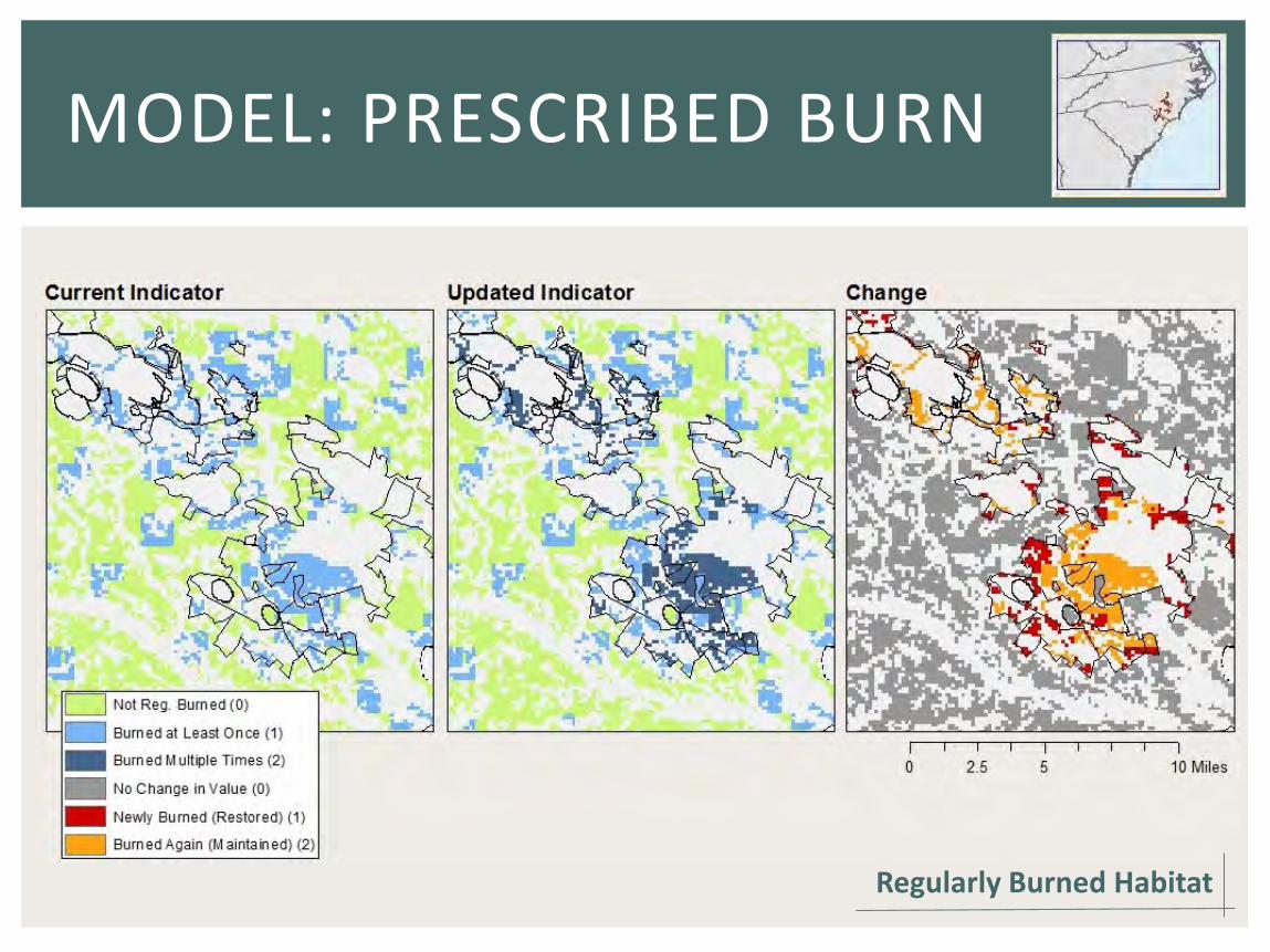
MODEL: PRESCRIBED BURN

Current BACS Habitat
Current NOBO Habitat
Current RCWO Habitat
Ecosystem Mask
Input Shapefile
Output Folder
Current Indicator: Pine Bird Index
Current Indicator: Reg. Burned Habitat
MODEL: PRESCRIBED BURN
Input Areas Outside Ecosystem

Current BACS Habitat
Current NOBO Habitat
Current RCWO Habitat
Ecosystem Mask
Input Shapefile
Output Folder
Current Indicator: Pine Bird Index
Current Indicator: Reg. Burned Habitat
MODEL: PRESCRIBED BURN
Updated Reg Burned Habitat Indicator
Reg Burned Habitat Indicator Change
Input Areas Outside Ecosystem

Current BACS Habitat
Current NOBO Habitat
Current RCWO Habitat
Ecosystem Mask
Input Shapefile
Output Folder
Current Indicator: Pine Bird Index
Current Indicator: Reg. Burned Habitat
MODEL: PRESCRIBED BURN
Updated Pine Bird Indicator
Pine Bird Indicator Changes
Updated Reg Burned Habitat Indicator
Reg Burned Habitat Indicator Change
Input Areas Outside Ecosystem
RCWO Habitat Maintained
MODEL: PRESCRIBED BURN
Regularly Burned Habitat

Updated Indicator Files and Change Files for:
Forested Wetland
Pine and Prairie
Freshwater Marsh
Maritime Forest
Beaches and Dunes (in development)
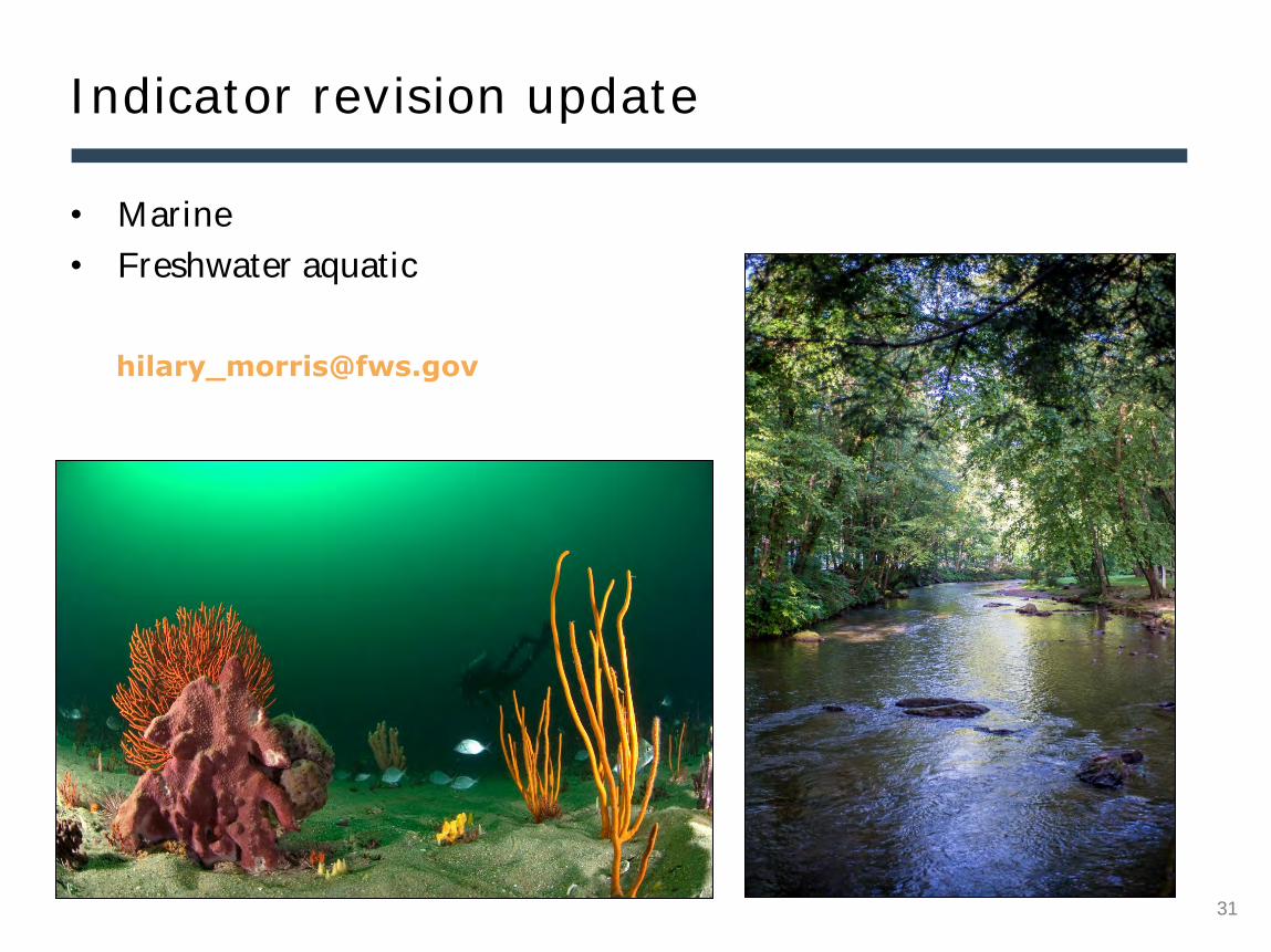
Freshwater Aquatic (in development)
Upland Hardwood (in development)
Landscape (in development)
Add some assumptions we are making
– loss of all habitat, accounting for
that, recalc patch sizes, loss of animal
habitat (email hilary re: logo)
MODEL: LAND ACQUISITION
Land acquisition is really an avoided conversion
question – if the land were not protected and was
developed or converted to agriculture, what would
be lost in terms of the SALCC indicators?
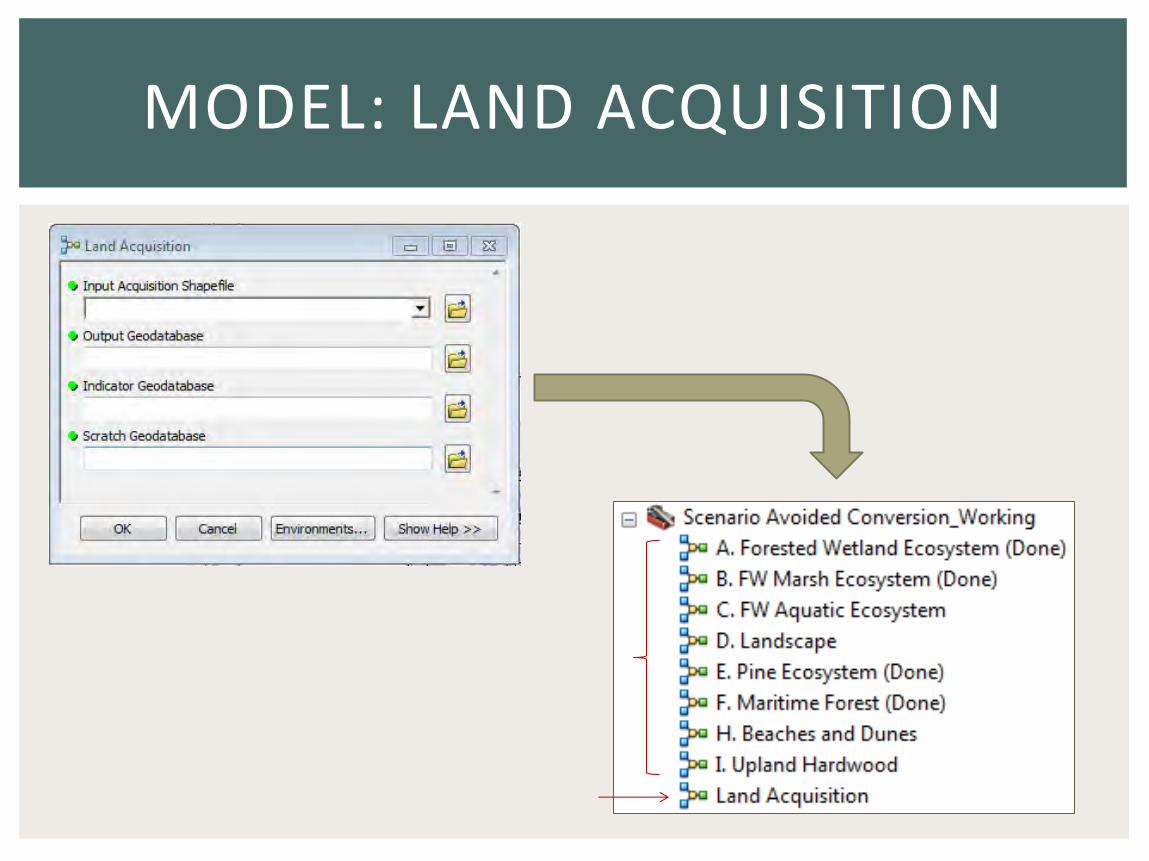
MODEL: LAND ACQUISITION

MODEL: LAND ACQUISITION
Forested Wetland Birds * Northern parula, black-throated green warbler, red-headed woodpecker, or Chuck-will’s widow

Indicators Alternative management actions
Acquire 1 Acquire 2 Acquire 3
Bird Index
Reg. Burned Habitat
Amphibian Index
Riparian Buffers
Cost
COMPARING ALTERNATIVES

What actions would you like to see modeled?

• Indicator revision update
30
South Atlantic LCC staff updates

South Atlantic salt marsh mapping: an update on regional mapping and
synthesis
Next month’s Third Thursday Web Forum
11-19-2015
10:00 am
Dr. Tom Allen
Professor of Geography
Department of Geography, Planning, and Environment
East Carolina University
32
33
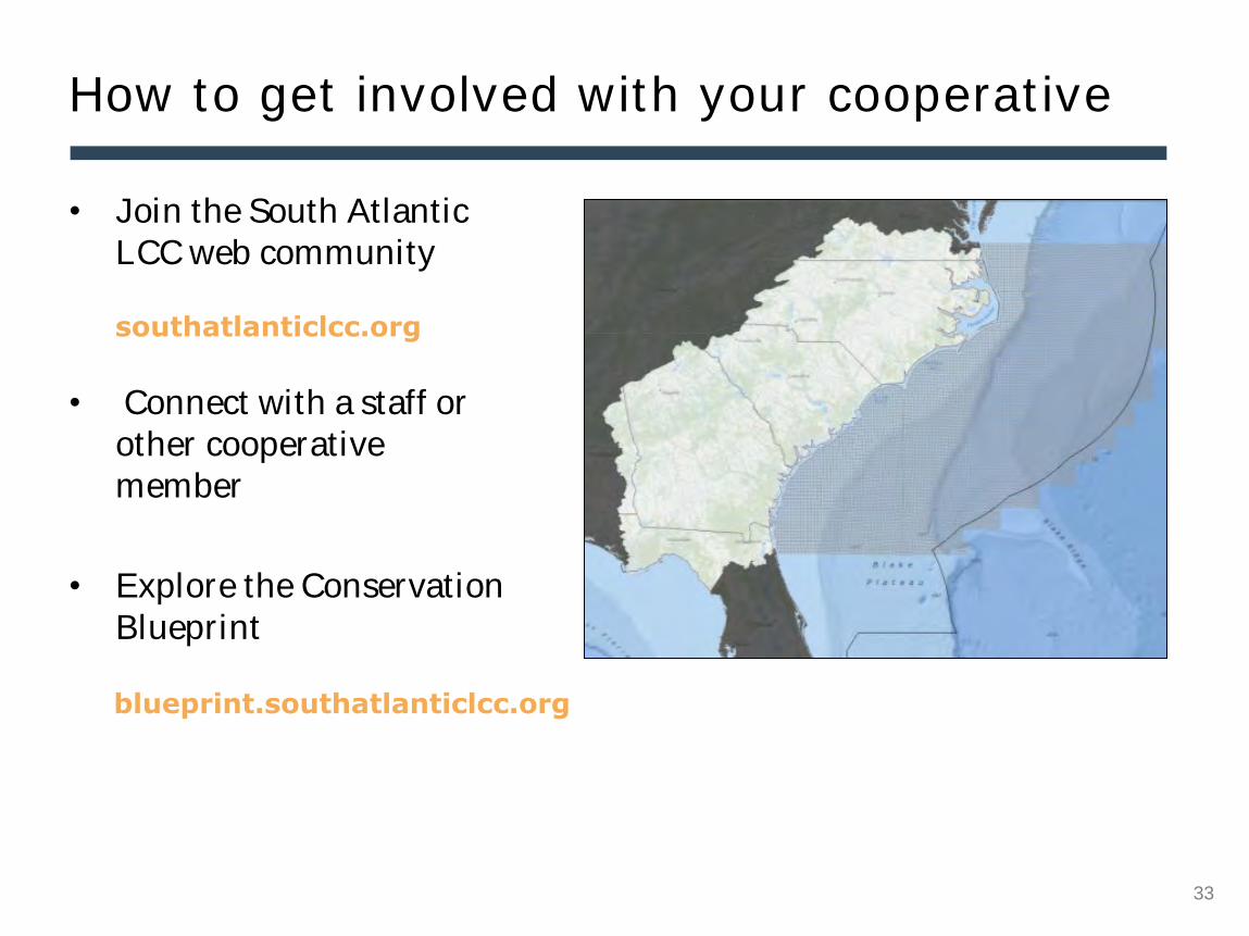
How to get involved with your cooperative
• Join the South Atlantic LCC web community
• Connect with a staff or other cooperative member
• Explore the Conservation Blueprint
blueprint.southatlanticlcc.org
southatlanticlcc.org

34 34
Questions? *6 to unmute