the geneva bay: from the glacier to the lake-dwellers
TRANSCRIPT
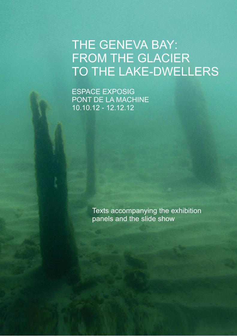
THE GENEVA BAY:FROM THE GLACIERTO THE LAKE-DWELLERS
ESPACE EXPOSIGPONT DE LA MACHINE10.10.12 - 12.12.12
Texts accompanying the exhibitionpanels and the slide show

THE GENEVA BAY:FROM THE GLACIERTO THE LAKE-DWELLERS20'000 years of Genevan history
ESPACE EXPOSIGPONT DE LA MACHINE10.10.12 - 12.12.12
Curator of the exhibitionPierre Corboud, Laboratoire d’archéologie préhistorique et anthropologie,Institut F.-A. Forel UniGe
ScenographyDaniel Kunzi, BLVDR
OrganizationSIG CommunicationIn association with the University of Geneva, Institut F.-A. Forel
Collaborations and partnershipsMusée d’art et d’histoire de la Ville de GenèveService cantonal d’archéologie, DU Etat de GenèveService de renaturation des cours d’eau, DIME Etat de GenèveOne FM
TranslationKaroline Mazurié de Keroualin

The prehistoric pile dwellings around the Alps nominated UNESCO World HeritageThe lakeside settlements (pile dwellings) are villages built and occupied during prehistoric times in riparian areas or in the shallow water zone.In June 2011, a representative selection of 111 prehistoric pile dwellings has been inscribed on UNESCO's World Heritage list in six countries bordering the Alps: France, Germany, Austria, Italia, Slovenia and Switzerland.
In Switzerland alone, 56 lakeside settlements are labelled as a UNESCO World Heritage site. In addition, 385 associated sites are protected at the cantonal and federal level.
Thanks to the outstanding preservation of organic material, the remains of the prehistoric villages deposited in waterlogged grounds are unique sources of information on the history of the first agrarian societies of Europe.
Map of the Alpine regions and location of the nominated pile dwellings (exclusively UNESCO sites)
In six countries around the Alps: 111 sites nominated UNESCO World Heritage and 645 associated sites
1
FR
CH
IT
DE
AT
SI
Slovenia, bog of Ljubljansko barjeAustria, potteries from Lake Mondsee
France, Le Roselet (Lake Annecy) Italia, bog settlement of Fiavè-Carera
Germany, basin of Lake Federsee
Switzerland, Concise (canton of Vaud)
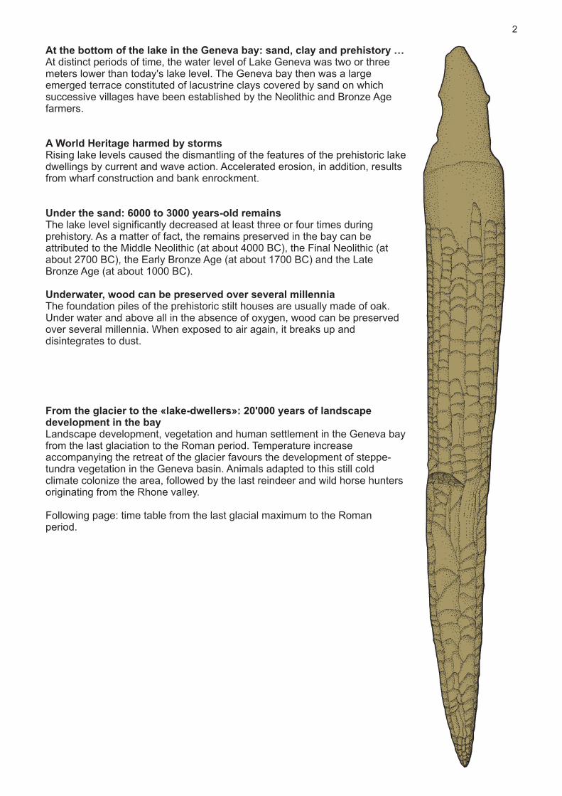
At the bottom of the lake in the Geneva bay: sand, clay and prehistory …At distinct periods of time, the water level of Lake Geneva was two or three meters lower than today's lake level. The Geneva bay then was a large emerged terrace constituted of lacustrine clays covered by sand on which successive villages have been established by the Neolithic and Bronze Age farmers.
A World Heritage harmed by stormsRising lake levels caused the dismantling of the features of the prehistoric lake dwellings by current and wave action. Accelerated erosion, in addition, results from wharf construction and bank enrockment.
Under the sand: 6000 to 3000 years-old remainsThe lake level significantly decreased at least three or four times during prehistory. As a matter of fact, the remains preserved in the bay can be attributed to the Middle Neolithic (at about 4000 BC), the Final Neolithic (at about 2700 BC), the Early Bronze Age (at about 1700 BC) and the Late Bronze Age (at about 1000 BC).
Underwater, wood can be preserved over several millenniaThe foundation piles of the prehistoric stilt houses are usually made of oak. Under water and above all in the absence of oxygen, wood can be preserved over several millennia. When exposed to air again, it breaks up and disintegrates to dust.
From the glacier to the «lake-dwellers»: 20'000 years of landscape development in the bayLandscape development, vegetation and human settlement in the Geneva bay from the last glaciation to the Roman period. Temperature increase accompanying the retreat of the glacier favours the development of steppe-tundra vegetation in the Geneva basin. Animals adapted to this still cold climate colonize the area, followed by the last reindeer and wild horse hunters originating from the Rhone valley.
Following page: time table from the last glacial maximum to the Roman period.
2

3
beech
dwarf birch
sea buckthorn
birch
open woodlandcomposed of pine
and birch
hazel wood
elm
lime tree
oak
ash
fir
spruce
alder
pine
hornbeam, walnut tree,chesnut, developmentof oak-dominatedforests
juniper
herbaceous plants
reeds
maple
willow
reindeer
wild horse
cave bear
aurochs
wild boar
red deer
roe deer
cattle
brown bear
sheep/goat
pig
Wild
faun
aDo
mes
tic fa
una
SUBBOREAL
LATEATLANTIC
BOREAL
YOUNGER DRYAS
OLDEST DRYAS
BÖLLING
EARLYATLANTIC
PREBOREAL
ALLERÖD
DEGLACIATION
LATE GLACIALMAXIMUM
LATE WÜRM
OLDERSUBATLANTIC
MIDDLE DRYAS
-20'000
-1000
-2000
-3000
-4000
-5000
-6000
-7000
-8000
-9000
-10'000
-11'000
-12'000
-13'000
-14'000
-15'000
-16'000
-17'000
-18'000
-19'000
0
early
middle
late
Hallstatt
middle
late
early
Magdalenian
La Tène
Upper Paleolithic
Epipaleolithic
Mesolithic
Bronze Age
Iron Age
Roman period
Neolithic
middle
early
Azilian
nomadic populations,economy of huntand collecting,tools of flint andof reindeer wood
start of climatic warming,small-sized flint tools
adaptation toforest-basedhunting andgathering economy
agricultural transition,domestication ofanimals, sedentarysettlements, firsthuman impact onenvironment
PLE
ISTO
CE
NE
HO
LOC
EN
E
late
Epochs Curve of temperaturevariations
Prehistoric periods Absolutedates BC
Interglacial stagesand stages of vegetation
Vegetation Wild fauna anddomestic fauna
Ho
t
Co
ld
mammoth

History of the Geneva bay, from the glacier to the lake-dwellers: 20'000 years of Genevan history (accompanying text of the slide show)
During the entire Quaternary, a period that started 2.5 million years ago, human presence in Europe coincides with alternating glacial phases and warmer phases.
Between 27'000 and 20'000 BC, the Rhone glacier reaches its maximum extent and advances as far as Lyon.
The last glaciation ends only 18'000 years ago. The melting of the ice is a discontinuous, sometimes interrupted process. When the melting process stops, fluvioglacial sediments are deposited.
At about 16'000 BC, alluvial deposits stemming from the glacier form the first bay, located north of the actual city of Geneva.
From 15'000 BC on, the bay was completely free of ice, and the water level was more than 30 m above today's lake level.
Erratic boulders have been deposited by the Rhône glacier on the shores and the bottom of the lake. This is the case, for example, for the two Neptune's stones (Pierres du Niton).
Reindeer and wild horse herds progressively colonize the region. They are attracted by herbs and grasses that compose the poor pioneer vegetation.The landscape, characterized by shrub type vegetation, is merely composed of a few juniper and rare dwarf birch.The last ice age mammoths ease their thirst in the muddy water of the bay.
From 14'000 BC on, the glacier has definitely retreated from the Lake Geneva basin and leaves a water table at about 36 to 33 m above today's lake level.
At about 13'000 BC, Magdalenian hunter groups cross the Geneva region following herds of reindeers and wild horses. They establish their camp in the region of Veyrier at the foot of rocks collapsed from the Salève.
The Bølling climatic phase, at about 12'000 BC, matches substantial expansion of the vegetation. The level of Lake Geneva continuously decreases and reaches an average height of 8 m above today's lake level. The vegetal covering is still sparse, with juniper joined by pine, birch and willow.
4
Drawing A. Houot

Between 7000 and 5000 BC, a climate optimum establishes. This warm period favours the development of denser and more diversified woodland. The landscape is characterized by mixed-oak forest mainly with oak, elm, hazel wood, lime, beech and fir.
This new environment gives rise to a more varied forest fauna such as red deer, roe deer, aurochs and wild boar.
From 5000 BC on, the first Neolithic farmers and stock breeders establish on the higher terraces above the bay. In Saint-Gervais, for example, vestigial remains of a Middle Neolithic village have been identified under the foundations of the protestant church.
From this period on, the lake level fluctuations influence on the settlement behaviour of the prehistoric farming communities.
During periods with low lake level, for example in 4000 BC several groups move closer to the lake and build their villages on the then emerged lacustrine terrace.
Fields for agriculture are opened in the forest thanks to clearing with polished stone axes.
During the Final Neolithic, from 3100 to 2700 BC, another significant decrease of the lake level encourages the prehistoric farmers of the Genevan region to reoccupy the riparian area.
Below the actual “Parc de la Grange”, the remains of one of these lakeshore villages have been uncovered. This village is particularly well-preserved under a layer of gravel deposited by wave action.
As a consequence of climatic deterioration, the levels of all the lakes in the northern Alpine region considerably rise. Between 1500 and 1100 BC, the inhabitants of the lake dwellings are once again forced to move on the higher terraces above the lake shores.The last period with low lake level lasts from 1100 to 850 BC. The water level of Lake Geneva is at least 3 m lower.
The sites of Pâquis, Eaux-Vives and Le Plonjon are occupied simultaneously or alternately. They represent the preserved remains of the first settlements within the area of the actual city of Geneva.
Nearly 250 years later, these villages are abandoned within a few decades, from 858 BC on in the Geneva bay and in 813 BC on the shores of Lake Le Bourget. All the lake dwellings are deserted and settlements are built in higher locations above the shores.
Such a general and sudden phenomenon is attributed to unfavourable climatic conditions that triggered lake transgression in all the lakes around the Alps.
From that period on, the level of Lake Geneva will never be very low again.This episode marks the end of the lakeside settlements. Such exceptional conditions of preservation will never occur again.
5
Drawing Y. Reymond
Middle Neolithic: from 4000 to 3200 BCThe first farmers and stock breeders in the region clear woodland with polished stone axes to create land for agriculture. They manufacture potteries with rounded bottom. Flint arrowheads are used for the hunting of deer, wild boar and other forest animals.
An exceptional Middle Neolithic site in GenevaThe potteries uncovered in the lakeside settlement of Corsier-Port were preserved within an archaeological layer containing very rich plant remains, dated to 3856 BC. Corsier-Port is one of the three sites in the canton of Geneva nominated UNESCO World Heritage.
Final Neolithic: from 3100 to 2500 BCFinal Neolithic lakeside settlements are abundant around Lake Geneva. Exchange of materials and objects with the Mediterranean and equally with the Swiss plateau, the Valais or France is frequent. Cultural influences also circulate within these exchanges.
Final Neolithic, a densely occupied territoryThe best preserved lakeside settlement of the Geneva bay is located in the lower part of “Parc de la Grange”. Polished stone axes were recovered in the entire area of the bay, as well as flint artefacts made on raw materials mainly imported from the region of Grand-Pressigny (Touraine, Central France).
Early Bronze Age: from 1800 to 1600 BCIn our regions, the first locally manufactured bronze objects (weapons, tools and ornaments) appear at about 2200 BC. However, the lakeside settlements are occupied only up until 1800 BC. Bronze axes allow improved woodland exploitation and more sophisticated wood craft, for example mortise and tenon joints.
Late Bronze Age: from 1100 to 850 BCAfter a period of generalized lake level rise in the northern Alpine region the lake shores are reoccupied during a time span of more than 250 years. Exceptional skill is reached in Bronze metallurgy with regard to both woodworking tools and ornaments (pins, pendants, etc.).
Late Bronze Age, accomplished potters and metalworkersThe potteries are flat-bottomed and they sometimes reach diameters of 50 cm. The fine ware is richly decorated, often burnished and polished, imitating metal objects.
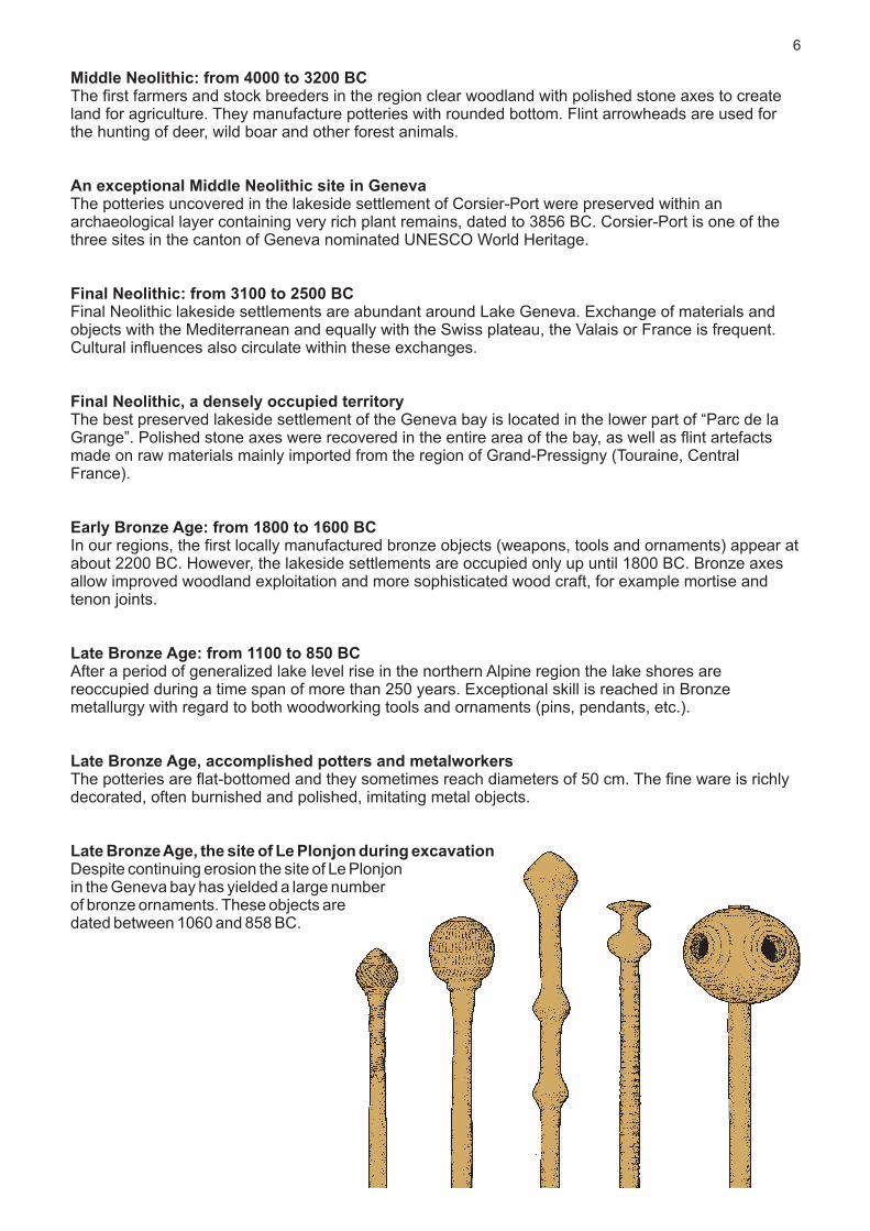
Late Bronze Age, the site of Le Plonjon during excavationDespite continuing erosion the site of Le Plonjonin the Geneva bay has yielded a large numberof bronze ornaments. These objects aredated between 1060 and 858 BC.
6

Dendrochronological analysis of timberThis method of absolute dating is based on tree-ring width measurement. The width of the tree-ring produced each year varies in response to the global climate, temperature and rainfall.The measurements of each sample are plotted in a graph. Each graph is then compared to reference sequences, specific for each region and each species of trees.By successively overlapping still older tree-ring sequences, the time line can be dated back to prehistoric periods and accurate dating can be made to the exact calendar year or even the season if the last growth ring formed by the tree is preserved.Thanks to this method of dating, piles with the same felling date can be connected with each other and the ground plans of the prehistoric houses reconstructed. In this way, successive village plans can be identified within pile fields of considerable size, including 2000 to 3000 piles without any apparent organization.
The water levels of Lake GenevaAfter the retreat of the Rhône glacier, the level of Lake Geneva stabilised at a mean water level close to the actual lake level. However, climatic variations and geological events downstream from the bay have caused secular and seasonal fluctuations within an interval estimated to 9 m.Since 1887, the lake is regulated by an artificial barrage, first by the Pont de la Machine weir and, from 1995 on, by the downstream Seujet weir.From the 18th century on, weirs have been erected in the Rhone River in Geneva in order to feed the hydraulic machines. These facilities caused important variations of the lake level so that the Canton of Vaud filed a complaint against Geneva to the Federal Supreme Court.The «Lake Geneva trial» has been arbitrated in 1884 by the signature of a convention established between both cantons that defined the limits of lake level variations. The construction of the sluice gates of Pont-de-la-Machine aimed at applying this convention.
Extreme water level variations of Lake Geneva between 1806 and 1941 (annual maximum and minimum, and smoothed curves, in red). According to the data provided by François-Alphonse Forel and by the “Service hydrologique et géologique national”.Photograph of the construction of the Pont de la Machine, in 1884.Facsimile of the convention made in 1884 (AEG, Travaux 14).
7
The experimental reconstruction of a Late Bronze Age houseDuring the Late Bronze Age, at about 1000 BC, house architecture reaches considerable complexity. By contrast to the Neolithic constructions, mortise and tenon joints dominate. The houses are larger in width, with four pile rows instead of three. The raised floors, in order to protect from possible water rise, were supported by timber directly connected with the load-bearing posts and not by independent piles as in the Neolithic.The experimental reconstruction of a Bronze Age house in the park of the Laténium in Hauterive-Champréveyres (Neuchâtel) is based on observations made at the occasion of excavations conducted into the Bronze Age lakeside villages of the region. It highlights the skill of prehistoric carpenters.

Pioneer archaeological research in Lake Geneva (F. Troyon and F.-A. Forel)Shortly after the discovery of prehistoric lake dwellings in Lake Zurich in 1854, similar finds have been made in Lake Geneva, in the cantons of Vaud and Geneva but also on the French side between Hermance and Evian.The pioneer researchers F. Troyon, A. Morlot, and F.-A. Forel in Switzerland as well as L. Revon and E. Chantre in Upper Savoy have reported almost sixty "lake dwellings" around the shores of Lake Geneva.In 1904, F.-A Forel compiled the first map of the pile dwellings of Lake Geneva, published in the third volume of his famous monograph "Le Léman" (1892-1904).
Map of the pile dwellings of Lake Geneva, F.-A. Forel 1904.
The discovery of lakeside settlements in the Geneva bay (H.-J. Gosse)After the discovery of prehistoric lake dwellings in Lake Zurich in 1854, Hippolyte-Jean Gosse, pharmacist, physician, scientist and founder of the “Musée historique genevois”, was the first to report on similar findings in Geneva. In 1881, he presented the first map of the pile dwellings in the Geneva bay on the basis of his observations and the recovered objects.This map shows, in blue, the areas attributed to Stone Age (Neolithic) occupations, in yellow, those attributed to Bronze Age (most likely Late Bronze Age) occupations, and in grey, those supposedly assigned to the Iron Age (a period non identified in the field).
Map published by H.-J. Gosse, drawn in May 1870 and completed by annotations made between 1852 and February, 1st, 1881.
1921: accurate mapping of the piles in Geneva bay by Louis BlondelThe first accurate map of the submerged prehistoric villages in the Geneva bay has been published in 1923 by Louis Blondel, head of the cantonal office of archaeology. The mapping was based on drawings and observations made between April, 9th and July 6th, 1921 at the occasion of fieldwork made possible by a substantial decrease of the lake level of about 1.50 m due to exceptional dryness. The survey has been made with two theodolites set up on the shore, the reference points being materialised on the bottom of the lake by numbered bricks. In this way, Louis Blondel and Alexandre Le Royer have produced a fairly precise mapping of the six sites they had identified in the bay.
Map of the prehistoric piles of the Geneva bay drawn by Louis Blondel in 1921-1922. CIG.
8

Map of the ongoing excavation in the site of Le Plonjon on the shore of the Eaux-Vives quarter in GenevaThe site of Le Plonjon is a submerged prehistoric site dated to the Late Bronze Age. It extends over an area of about one hectare and on a length of 260 metres.According to the observations made over these last 90 years, we know today that these architectural features are threatened with erosional destruction. The project of a new beach in the Eaux-Vives quarter allows to study and to sample the last remains still in situ, mainly piles, before they will definitely disappear. The rescue excavations have started in autumn 2009, and they should be completed in December, 2012.
Plan of all the piles currently registered and drawn on a map with contour lines.
The archaeological excavation of the lakeside settlement of Geneva - Le Plonjon.The different phases of research and analysis
– Delimitation of the excavation zone, setting up of the buoys.– Preparing the divers for the water.– Setting up of the underwater pumps and the pipes.– Cleaning of the lake bottom with pressured water.– Identification and labelling of the piles and pile holes.– Topographic survey by calm lake.– Removal of the piles with a winch of 2 tonnes.– Transport of the piles to the ground.– Analysis, description and sampling of the piles.– Measurements and dendrochronological analyses of the sliced samples (Laboratoire romand de dendrochronologie, Moudon).– Drilling for the collection of sedimentological data.– Sawing off of samples of the most fragile piles.– Recovering of an elm trunk of 8 m length.– Restoration of the bronze objects in the “Musée d'art et d'histoire” of Geneva.
9
Zone 1
Zone 2
Zone 3
Zone 4
Zone 5
Zone 6
Zone 7
368.3 - 368.4
368.4 - 368.5
368.5 - 368.6
368.6 - 368.7
368.7 - 368.8
368.8 - 368.9
368.9 - 369.0
369.0 - 369.1
369.1 - 369.2
369.2 - 369.3
369.3 - 369.4
50 m
N
Geneva - Le Plonjon sectors 1 - 7. The entire excavationarea (state of investigation, May 1st, 2012)
The piles are drawn 2.5 times of magnification.

Printed by: atelier ReproMail UniGe, October 2012