the earth and earth coordinates we’ve known for over 2000 years that the earth is spherical in...
TRANSCRIPT

The Earth and Earth Coordinates
• We’ve known for over 2000 years that the earth is spherical in shape
• Aristotle in the 4th century BC believed that the earth’s sphericity could be proven by careful visual observation
• The Greek scholar Eratosthenes made the first scientifically based estimate of the earth’s circumference
1

2Figure 1.1
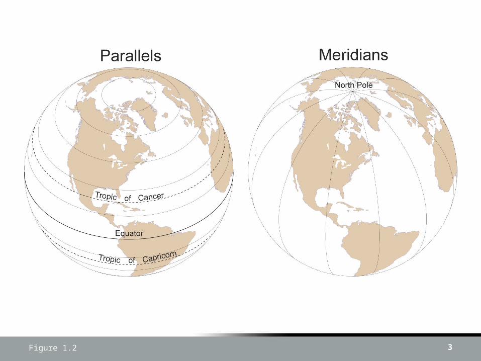
3Figure 1.2
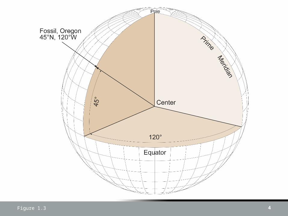
4Figure 1.3

Latitude & Longitude• Putting latitude and longitude together into
what is called a geographic coordinate (45oN, 120oW) pinpoints a place on the earth’s surface
• The latitude and longitude of the North Building 68th Street courtyard is:– 40o 46’ 05.64”N, 73o 57’ 52.29”W
5
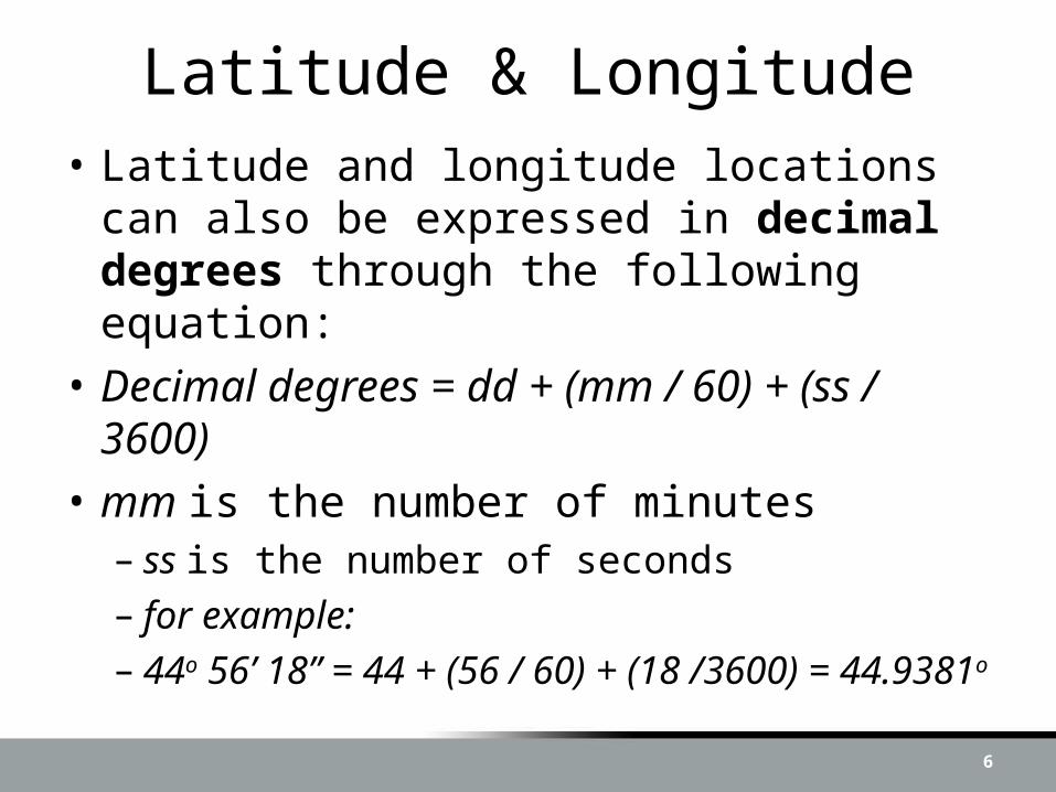
Latitude & Longitude• Latitude and longitude locations can also
be expressed in decimal degrees through the following equation:
• Decimal degrees = dd + (mm / 60) + (ss / 3600)
• mm is the number of minutes– ss is the number of seconds– for example:– 44o 56’ 18” = 44 + (56 / 60) + (18 /3600) =
44.9381o
6
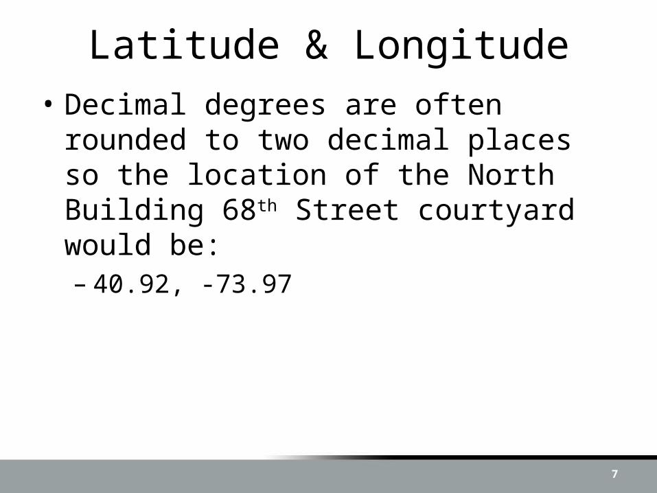
Latitude & Longitude• Decimal degrees are often rounded to two
decimal places so the location of the North Building 68th Street courtyard would be:– 40.92, -73.97
7

Prime Meridians• In the 4th century BC Eratosthenes
selected Alexandria as the starting meridian for longitude
• In medieval times the Canary Islands of the coast of Africa were used since they were then the westernmost outpost of western civilization
• In the 18th and 19th centuries, many countries used their capital city as the prime meridian for the nation’s maps
8
Prime Meridians• Pirate Maps……..
• Prime meridian problem was eliminated in 1884 when the International Meridian Conference selected as the international standard the British prime meridian
9
The Earth As An Oblate Spheroid
• Scholars assumed that the earth was a perfect sphere until the 1660s when Sir Isaac Newton developed the theory of gravity
10
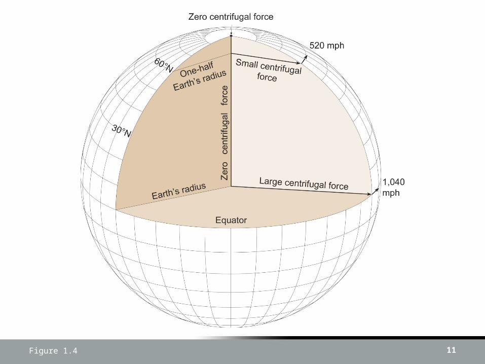
Figure 1.4 11

Figure 1.5 12

Historical and Current Oblate Ellipsoids
13

Ellipsoids• The World Geodetic System of 1984
(WGS84), replaced the Clarke 1866 ellipsoid in North America and is used as the basis of latitude and longitude on maps throughout the world
14

Figure 1.6 15
Figure 1.8 16
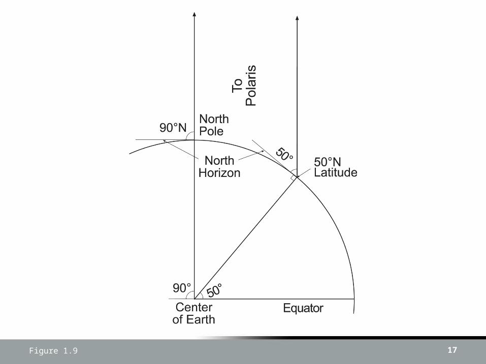
Figure 1.9 17
Figure 1.10 18

Figure 1.10 19
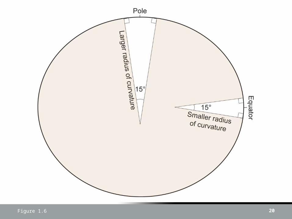
Figure 1.6 20

21Figure 1.3
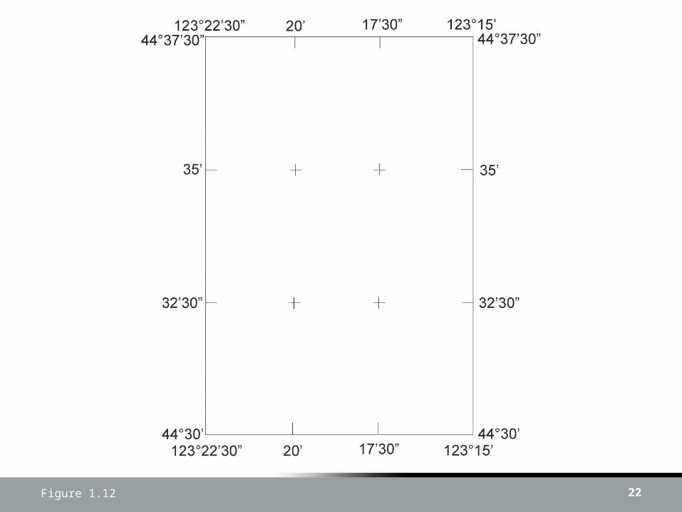
Figure 1.12 22
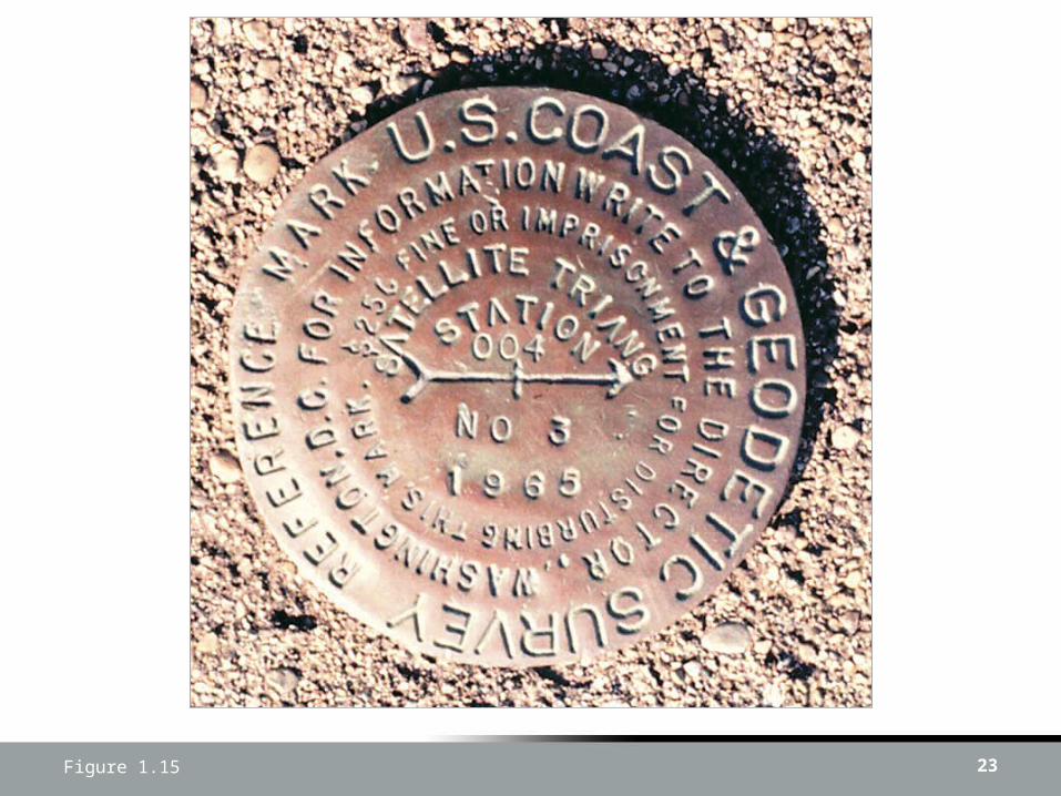
Figure 1.15 23

Figure 1.16 24

Figure 1.17 25

Figure 1.18 26