the dow chemical company - superfund records … · the dow chemical company midland, mi 48674...
TRANSCRIPT

______________________________________________________________________ The Dow Chemical Company Midland, MI 48674 January 3, 2011 Ms. Mary Logan Remediation Project Manager U.S. Environmental Protection Agency, Region 5 77 West Jackson Chicago, IL 60604 Re: Task 2.2 Monitoring Work Plan-Settlement Agreement No. V-W-10-C-942
for The Tittabawassee River/Saginaw River & Bay Site Dow Submittal Number 2010-078 Ms. Logan: Attached please find the Task 2.2 Monitoring Work Plan. The work plan is being submitted under AOC CERCLA Docket No. V-W-10-C-942 and Appendix A, Statement of Work Schedule. Please feel free to contact me with any questions or concerns. Sincerely, The Dow Chemical Company
Todd Konechne Project Coordinator cc: Al Taylor, MDNRE
Diane Russell, U.S. EPA Joseph Haas, U.S. Fish and Wildlife Steve Lucas, Dow Peter Wright, Dow Greg Cochran, Dow
The Dow Chemical Company
Midland, MI 48674
TASK 2.2 MONITORING WORK PLAN THE TITTABAWASSEE RIVER/SAGINAW RIVER & BAY SITE
PREPARED BY: TITTABAWASSEE & SAGINAW RIVER TEAM
PREPARED FOR AND SUBMITTED BY:
THE DOW CHEMICAL COMPANY
DECEMBER 31, 2010 DOW SUBMITTAL NUMBER 2010.078

The Dow Chemical Company
Midland, MI 48674
TABLE OF CONTENTS
1.0 INTRODUCTION ................................................................................................................1 2.0 MONITORING OBJECTIVES ............................................................................................1 3.0 IN-CHANNEL BED PIN MONITORING...........................................................................2 4.0 BATHYMETRIC SURVEYING..........................................................................................2 5.0 TOPOGRAPHIC SURVEYING ..........................................................................................2 6.0 SCHEDULE..........................................................................................................................2
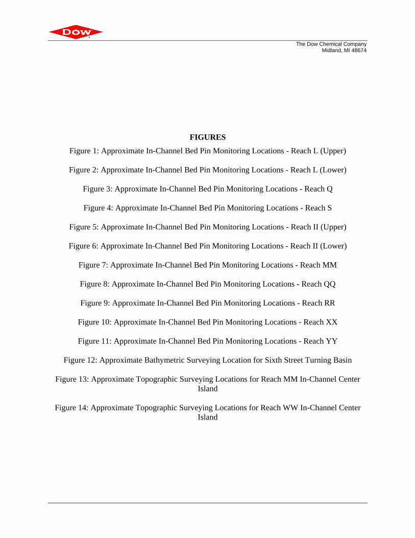
FIGURES Figure 1 ..................... Approximate In-Channel Bed Pin Monitoring Locations - Reach L (Upper) Figure 2 .....................Approximate In-Channel Bed Pin Monitoring Locations - Reach L (Lower) Figure 3 .................................. Approximate In-Channel Bed Pin Monitoring Locations - Reach Q Figure 4 ................................... Approximate In-Channel Bed Pin Monitoring Locations - Reach S Figure 5 .....................Approximate In-Channel Bed Pin Monitoring Locations - Reach II (Upper) Figure 6 .....................Approximate In-Channel Bed Pin Monitoring Locations - Reach II (Lower) Figure 7 .............................. Approximate In-Channel Bed Pin Monitoring Locations - Reach MM Figure 8 ................................Approximate In-Channel Bed Pin Monitoring Locations - Reach QQ Figure 9 ................................ Approximate In-Channel Bed Pin Monitoring Locations - Reach RR Figure 10 ..............................Approximate In-Channel Bed Pin Monitoring Locations - Reach XX Figure 11 ..............................Approximate In-Channel Bed Pin Monitoring Locations - Reach YY Figure 12 ................Approximate Bathymetric Surveying Location for Sixth Street Turning Basin Figure 13 ...................................... Approximate Topographic Surveying Locations for Reach MM In-Channel Center Island Figure 14 .......................................Approximate Topographic Surveying locations for Reach WW In-Channel Center Island TABLES Table 1 ......................................................Summary of In-Channel Bed Pin Monitoring Locations
i
The Dow Chemical Company
Midland, MI 48674
1
1.0 INTRODUCTION This Task 2.2 Monitoring Work Plan was prepared in accordance with the requirements contained in Section IX (“Work to be Performed”) of the Administrative Settlement Agreement and Order on Consent (AOC) for the Tittabawassee River/Saginaw River & Bay Site (“Site”), Settlement Agreement No. V-W-10-C-942) and the Statement of Work (SOW; Attachment A of AOC), effective January 21, 2010 (“Settlement Agreement”). The Task 2.1 Technical Memorandum dated July 16, 2010, which was approved by the U.S. Environmental Protection Agency (EPA) in a letter dated September 16, 2010, identified several areas where additional monitoring is needed to evaluate the potential for certain in-channel deposits, in-channel center islands, and bank areas to contribute to acute or near-term contaminant transport risk. Collecting additional sediment samples for chemical analysis (i.e., bank face sampling) in the areas associated with the in-channel center islands and bank areas were addressed in the Task 2.2 Work Plan, Revision 1, dated September 22, 2010, which was conditionally approved by EPA on November 8, 2010. This Monitoring Work Plan addresses additional monitoring for the remaining areas identified in the Task 2.1 Technical Memorandum, including: • In-channel bed pin monitoring at transects located in Reaches L, Q, S, II, MM, QQ, RR, XX,
and YY. • Bathymetric surveying of the Sixth Street Turning Basin (SSTB). • Topographic surveying of the in-channel center islands in Reaches MM and WW. Note that topographic surveying of the Reach MM and Reach WW in-channel center islands was not specified in the Task 2.1 Technical Memorandum. However, this monitoring is being proposed to provide additional information to help inform the Task 2.4 and Task 2.3 assessments of these islands, respectively. 2.0 MONITORING OBJECTIVES The objectives of the monitoring program described in this Work Plan are as follows: • Continue to monitor the stability of the in-channel deposits previously identified under Task
2.1. • Obtain additional bed elevation measurements from the SSTB to confirm the depositional
patterns observed from prior surveying activities and evaluate its ability to serve as a sediment trap for solids leaving the Tittabawassee River.
• Monitor the topography of the Reach MM and Reach WW in-channel center islands for potential changes relative to prior surveying activities.
Data collected under this Monitoring Work Plan, in conjunction with data collected under the Task 2.2 Work Plan dated September 22, 2010, will be used to support the Task 2.3 and Task 2.4 evaluations.
The Dow Chemical Company
Midland, MI 48674
2
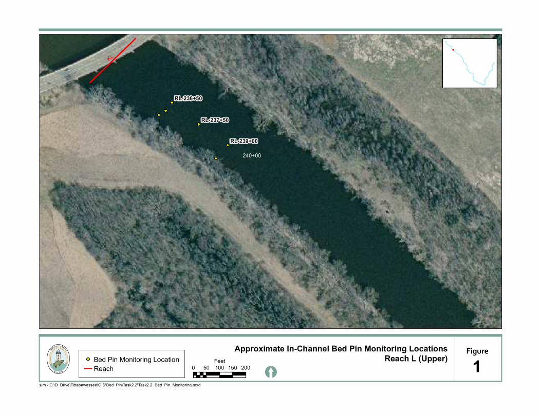
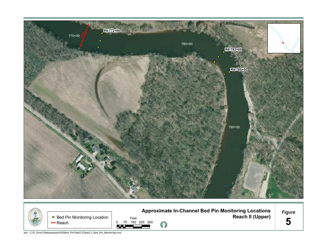
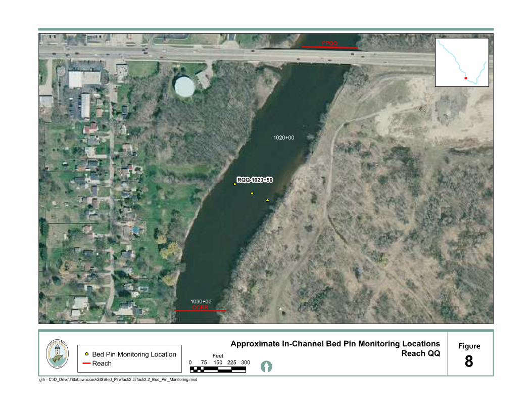
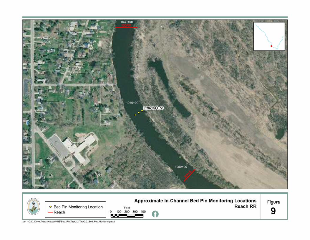
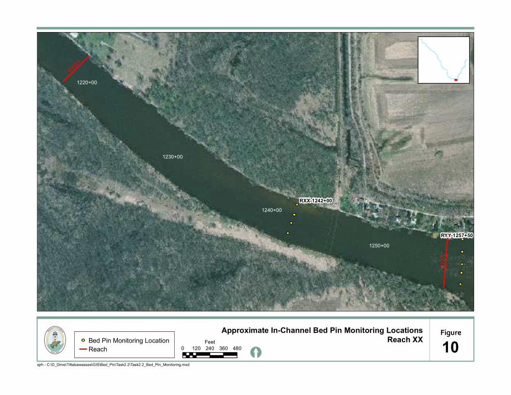
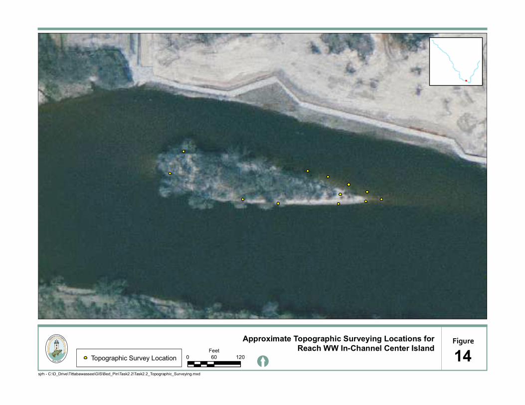
3.0 IN-CHANNEL BED PIN MONITORING In-channel bed pin monitoring will be conducted at the 27 in-channel transect locations identified in the Task 2.1 Technical Memorandum (July 2010). The bed pin monitoring locations are summarized in Table 1 and are depicted in Figures 1 through 11. The in-channel bed pin monitoring will be conducted twice during the 2011 field season: once in late spring/early summer (post-high flow survey) and once in late summer/early fall (low flow survey). Monitoring procedures employed during this survey will follow those outlined in the Tittabawassee River/Saginaw River/Saginaw Bay Quality Assurance Project Plan (March 2010, as amended). 4.0 BATHYMETRIC SURVEYING In the late spring/early summer of 2011, a bathymetric survey will be performed for the SSTB utilizing single beam technology as flow rates in the Saginaw River permit. The survey area will extend from approximately 1,300-feet upstream of the SSTB (just upstream of the railway crossing) to approximately 900-feet downstream of the SSTB, as indicated in Figure 12. The survey equipment and protocols will follow those outlined in the Standard Operating Procedure (SOP) for conducting a bathymetric survey, which will be developed prior to conducting the survey. 5.0 TOPOGRAPHIC SURVEYING Topographic surveys will be conducted for the Reach MM and Reach WW in-channel center islands during lower flow conditions in late summer/early fall. Elevation measurements will be collected at the 14 locations on the Reach MM island and the 12 locations on the Reach WW island that were previously surveyed in 2010 (see Figures 13 and 14). The survey equipment and protocols will follow those outlined in the Tittabawassee River/Saginaw River/Saginaw Bay Quality Assurance Project Plan (March 2010, as amended). 6.0 SCHEDULE As discussed above, it is anticipated that the first round of in-channel bed pin monitoring and the bathymetric surveying of the SSTB will be conducted in late spring/early summer of 2011. The second round of in-channel bed pin monitoring and the topographic surveying will be conducted in late summer/early fall to coincide with low-flow conditions. Consistent with the proposed data submittal schedule for the Task 4 Site-Wide Monitoring Plan, the Task 2.3 evaluation report which will include the data collected under this work plan will be submitted within 60 days after the end of the quarter in which the samples were analyzed (including quality control and data validation).
The Dow Chemical Company
Midland, MI 48674
FIGURES
Figure 1: Approximate In-Channel Bed Pin Monitoring Locations - Reach L (Upper)
Figure 2: Approximate In-Channel Bed Pin Monitoring Locations - Reach L (Lower)
Figure 3: Approximate In-Channel Bed Pin Monitoring Locations - Reach Q
Figure 4: Approximate In-Channel Bed Pin Monitoring Locations - Reach S
Figure 5: Approximate In-Channel Bed Pin Monitoring Locations - Reach II (Upper)
Figure 6: Approximate In-Channel Bed Pin Monitoring Locations - Reach II (Lower)
Figure 7: Approximate In-Channel Bed Pin Monitoring Locations - Reach MM
Figure 8: Approximate In-Channel Bed Pin Monitoring Locations - Reach QQ
Figure 9: Approximate In-Channel Bed Pin Monitoring Locations - Reach RR
Figure 10: Approximate In-Channel Bed Pin Monitoring Locations - Reach XX
Figure 11: Approximate In-Channel Bed Pin Monitoring Locations - Reach YY
Figure 12: Approximate Bathymetric Surveying Location for Sixth Street Turning Basin
Figure 13: Approximate Topographic Surveying Locations for Reach MM In-Channel Center Island
Figure 14: Approximate Topographic Surveying Locations for Reach WW In-Channel Center
Island
KL
240+00
RL-239+00
RL-237+50
RL-236+50
Approximate In-Channel Bed Pin Monitoring Locations
[
Bed Pin Monitoring Location
Reach
Figure
sjrh - C:\D_Drive\Tittabawassee\GIS\Bed_Pin\Task2.2\Task2.2_Bed_Pin_Monitoring.mxd
Reach L (Upper)
10 50 100 150 200
Feet

LM
250+00
260+00
RL-261+00
RL-260+50
RL-259+50
RL-258+50
RL-257+50
RL-257+00
RL-256+00
Approximate In-Channel Bed Pin Monitoring Locations
[
Bed Pin Monitoring Location
Reach
Figure
sjrh - C:\D_Drive\Tittabawassee\GIS\Bed_Pin\Task2.2\Task2.2_Bed_Pin_Monitoring.mxd
Reach L (Lower)
20 50 100 150 200
Feet

PQ
QR
360+00
370+00
380+00
RQ-359+00
Approximate In-Channel Bed Pin Monitoring Locations
[
Bed Pin Monitoring Location
Reach
Figure
sjrh - C:\D_Drive\Tittabawassee\GIS\Bed_Pin\Task2.2\Task2.2_Bed_Pin_Monitoring.mxd
Reach Q
30 80 160 240 320
Feet

RS
ST
400+00
410+00
430+00
420+00
RS-418+50
RS-417+50
RS-416+00
Approximate In-Channel Bed Pin Monitoring Locations
[
Bed Pin Monitoring Location
Reach
Figure
sjrh - C:\D_Drive\Tittabawassee\GIS\Bed_Pin\Task2.2\Task2.2_Bed_Pin_Monitoring.mxd
Reach S
40 125 250 375 500
Feet
HH
II
790+00
780+00
770+00
RII-783+00
RII-785+00
RII-772+00
Approximate In-Channel Bed Pin Monitoring Locations
[
Bed Pin Monitoring Location
Reach
Figure
sjrh - C:\D_Drive\Tittabawassee\GIS\Bed_Pin\Task2.2\Task2.2_Bed_Pin_Monitoring.mxd
Reach II (Upper)
50 75 150 225 300
Feet

IIJJ
810+00
800+00
RII-801+00
Approximate In-Channel Bed Pin Monitoring Locations
[
Bed Pin Monitoring Location
Reach
Figure
sjrh - C:\D_Drive\Tittabawassee\GIS\Bed_Pin\Task2.2\Task2.2_Bed_Pin_Monitoring.mxd
Reach II (Lower)
60 75 150 225 300
Feet

LL
MM
MMNN
920+00
910+00
900+00
890+00
RMM-913+50
RMM-905+00
RMM-903+50
RMM-900+50
Approximate In-Channel Bed Pin Monitoring Locations
[
Bed Pin Monitoring Location
Reach
Figure
sjrh - C:\D_Drive\Tittabawassee\GIS\Bed_Pin\Task2.2\Task2.2_Bed_Pin_Monitoring.mxd
Reach MM
70 100 200 300 400
Feet
PPQQ
QQRR1030+00
1020+00
RQQ-1023+50
Approximate In-Channel Bed Pin Monitoring Locations
[
Bed Pin Monitoring Location
Reach
Figure
sjrh - C:\D_Drive\Tittabawassee\GIS\Bed_Pin\Task2.2\Task2.2_Bed_Pin_Monitoring.mxd
Reach QQ
80 75 150 225 300
Feet
QQRR
RRSS
1050+00
1040+00
1030+00
RRR-1041+50
Approximate In-Channel Bed Pin Monitoring Locations
[
Bed Pin Monitoring Location
Reach
Figure
sjrh - C:\D_Drive\Tittabawassee\GIS\Bed_Pin\Task2.2\Task2.2_Bed_Pin_Monitoring.mxd
Reach RR
90 100 200 300 400
Feet
XX
YY
WW
XX
1250+00
1240+00
1230+00
1220+00
RYY-1257+50
RXX-1242+00
Approximate In-Channel Bed Pin Monitoring Locations
[
Bed Pin Monitoring Location
Reach
Figure
sjrh - C:\D_Drive\Tittabawassee\GIS\Bed_Pin\Task2.2\Task2.2_Bed_Pin_Monitoring.mxd
Reach XX
100 120 240 360 480
Feet

YY
XX
YY
1280+00
1270+00
1260+00
RYY-1276+00
RYY-1257+50
Approximate In-Channel Bed Pin Monitoring Locations
[
Bed Pin Monitoring Location
Reach
Figure
sjrh - C:\D_Drive\Tittabawassee\GIS\Bed_Pin\Task2.2\Task2.2_Bed_Pin_Monitoring.mxd
Reach YY
110 90 180 270 360
Feet

Approximate Bathymetric Surveying Locations for
[
Figure
sjrh - C:\D_Drive\Tittabawassee\GIS\Bed_Pin\Task2.2\Task2.2_Bathymetric_Surveying.mxd
Sixth Street Turning Basin
120 150 300 450 600
Feet
Downstream ExtentFlow Direction
Upstream Extent

Approximate Topographic Surveying Locations for
[Topographic Survey Location
Figure
sjrh - C:\D_Drive\Tittabawassee\GIS\Bed_Pin\Task2.2\Task2.2_Topographic_Surveying.mxd
Reach MM In-Channel Center Island
130 60 120
Feet
Approximate Topographic Surveying Locations for
[Topographic Survey Location
Figure
sjrh - C:\D_Drive\Tittabawassee\GIS\Bed_Pin\Task2.2\Task2.2_Topographic_Surveying.mxd
Reach WW In-Channel Center Island
140 60 120
Feet

The Dow Chemical Company
Midland, MI 48674
TABLES
Table 1: Summary of In-Channel Bed Pin Monitoring Locations

The Dow Chemical Company
Midland, MI 48674
Table 1: Summary of In-Channel Bed Pin Monitoring Locations
Reach Transect ID
Reach L RL-236+50
Reach L RL-237+50
Reach L RL-239+00
Reach L RL-256+00
Reach L RL-257+00
Reach L RL-257+50
Reach L RL-258+50
Reach L RL-259+50
Reach L RL-260+50
Reach L RL-261+00
Reach Q RQ-359+00
Reach S RS-416+00
Reach S RS417+50
Reach S RS-418+50
Reach II RII-772+00
Reach II RII-783+00
Reach II RII-785+00
Reach II RII-801+00
Reach MM RMM-900+50
Reach MM RMM-903+50
Reach MM RMM-905+00
Reach MM RMM-913+50
Reach QQ RQQ-1023+50
Reach RR RRR-1041+50
Reach XX RXX-1242+00
Reach YY RYY-1257+50
Reach YY RYY-1276+00