the bi-annual journal of desert survivors experience
TRANSCRIPT

The Bi-Annual Journal of Desert Survivors Experience Share Protect Fall 2014 33.2• •

2 /The Survivor Fall 2014
The Journal of Desert Survivors - Experience. Share. Protect.
Desert Survivors is an affiliation of desert lovers committed to experiencing, sharing and protecting desert wilderness wherever we find it. We recognize the places we love to explore will not remain wild unless we give others the opportunity to experience them as we do and unless we remain vigilant and active in our efforts to monitor and preserve them.
Cover photo: Cathy Luchetti takes her sun protection seriously as she ventures onto the playa of the Black Rock Desert. This during the June 2014 King Lear Peak car camp. Photo by Lynne Buckner.
And finally, most readers will recall a few years ago the efforts of Des-ert Survivors to block construction of the Ivanpah solar energy power plant. Our protest motto was, Solar on rooftops, not on the backs of tortoises! While our concern for the reptile is well founded, it turns out we should have been much more interested in the welfare of avian life. The power plant focuses the rays of the sun from 300,000 ga-rage-door-size mirrors onto the tops of three brightly glowing, super heated towers. This bright light is an attraction to insects and birds that feed on them, and when they fly into the focused rays the animals burst into flame. Workers in the plant call these birds “streamers” from the smoke trail they leave as they plummet from the sky. Last year investigating agents from Fish & Wildlife watched birds catch fire and fall at a rate of one every two minutes at the site. Bright Source Energy who owns the facility estimates only 1000 birds die as stream-ers each year. Other experts say the yearly death toll could be as high as 28,000. No matter the exact number, it is clear that industrial solar in the desert is a disaster for wildlife. Fish & Wildlife officials urged a halt to Bright Source’s plans for a simi-lar solar facility east of Joshua Tree, until there is further study. Desert Survivors believes permits for additional indus-trial solar plants should be denied and if the incineration of wildlife cannot be mitigated, that perhaps Ivanpah should be shut down. Our new motto: Solar on rooftops, not on the ashes of birds!
Nicholas Blake
FROM THE EDITOR:Since the publication of the last issue of The Survivor the U.S. Court of Appeals issued a ruling on the lawsuit to stop implementation of the Bureau of Land Management (BLM) plan to open large areas of protected desert sand dunes in Imperial County for off-highway-vehicles (OHVs). The decision went against the four environmen-tal groups—led by the Center for Biological Diversity and includ-ing Desert Survivors—that were attempting to keep the Algodones Dunes protected as wilderness. Within weeks of the ruling OHV enthusiasts removed the wilderness boundary markers in the dunes and 40,000 acres of pristine wilderness are now open to dune buggy, dirt-bike and quad-drive mayhem.
In July 2014 Desert Survivors signed on with The Center for Biologi-cal Diversity and other environmental groups with comments criti-cizing the BLM Environmental Assessment (EA) of exploratory min-ing by Glacial Minerals Inc in the central El Paso Mountains in Kern County. Glacial is proposing to develop a new, 964-acre gold & cop-per mine on land controlled by the BLM. The BLM EA would allow Glacial to dig a series of wells, pits, drilled holes and other activities in environmentally sensitive public lands. Our comments contend that BLM would violate land management plan of the California Desert Conservation Area, by the polluting of ground and surface water and transporting drilling rigs and heavy equipment over closed routes. We also contend that the BLM failed to comply with the National En-vironmental Policy Act (NEPA) in that its assessment included little if any analysis of the existing environment, such as studies of wildlife, native plants, soils, ground and surface water and cultural resources.
Under the Endangered Species Act, the BLM is required by law to submit annual reports to the U.S. Fish and Wildlife Service on im-pacts to desert tortoises, bighorn sheep and other threatened life from off-road vehicles, cattle grazing and other activities in the California deserts. In April 2014 the Center for Biological Diversity with Desert Survivors and other environmental groups sent a letter to the BLM notifying them of our intent to sue the agency to force it to create such reports. We contend that without the required monitoring and reporting, neither agency can know how many threatened and en-dangered species are being harmed by various activities or what steps might be taken to reduce that harm. Without monitoring and report-ing, vulnerable species could be pushed closer to extinction.
Now after all of this BLM bashing, I have to say in fairness and with complete sincerity that not all BLM offices are the same and that there are many great people associated with the BLM and the agency of-ten does good work in handling its public lands. For years, Desert Survivors has worked side by side with the BLM with our wilderness monitoring program.
There is a horror show of competing and conflicting entities out there, all with ideas as to how the BLM should do its job. The agency has satisfy an ambitious mandate in the face of budget cuts, hiring freez-es, sequestrations and a Republican party ideologically committed to abolishing it. I felt particular empathy for the BLM agents who, last spring while attempting to round up the cattle that were illegally graz-ing on federal land in Nevada, had to stand down in the face of an armed cadre of right-wing domestic terrorists. So hats off the BLM agents who work to protect the public lands and shame on those who want more gold mines and off-road vehicles.
Of course, this ruling was deeply disappointing to Desert Survivors. A key component of our mission is to protect deserts as wilderness. We feel that activities such as mining, grazing, expanded vehicle access, suburbanization, power corridors, industrial solar plants and military expansion are inherently harmful to the desert and its life. In spite of this setback we continue our efforts to protect this environment.
The carcass of a bird that was incinerated in flight at Ivanpah.
OHV enthusiasts taking down the wilderness boundary markers in the Algodones Dunes, May 2014.
Desert Survivors protest the Ivanpah
solar power plant project in 2011.
Phot
o: U
.S. F
ish &
Wild
life D
ept.
Photo: Ingrid Crickmore

3/The Survivor Fall 2014
A Conclave with the
Condors...
and your desert-loving friend
s
at theDesert Survivors
Annual General Meeting (AGM)
October 10-12, 2014, Fri-Sun
Pinnacles National Park
This year our AGM will take place at America’s newest National Park, The Pinna-cles. Just a two-hour drive from the Bay Area, the Pinnacles offers hiking among breathtaking spires and rock formations. We will seek out the California condor in the higher peaks and explore the chaparral vegetation. You can volunteer for a service project where we will remove and repair park fences. Following tradition, we will enjoy a Happy Hour on Friday evening and a potluck feast for Saturday dinner. Desert Survivors has dibs on the group campground so there is plenty of space for everyone. Sunday morning will feature the main event, our annual general meeting––where issues and directions for the organization will be discussed and our board of directors will be elected. All Desert Survivors members are encouraged to attend. We want you to be there.Information on reserving your campsite and the schedule of activities will be announced via email and posted on our website desert-survivors.org.
How to Reach Us
Editor: Nicholas [email protected]
Desert Survivor Websitewww.desert-survivor.org
Desert SurvivorsP.O. Box 20991
Oakland, CA 94620-0091________________________
BOARD OF DIRECTORS
President: Gerry [email protected]
Activities Director: Bob [email protected]
Managing Director: Michelle [email protected]
Secretary: Norma [email protected]
Volunteer Director: Martina Konietzny
Communications Director: Nicholas Blake
DIRECTORS AT LARGE
Barbara [email protected]
Peter [email protected]
Darrell [email protected]
Judy [email protected]
Kevin [email protected]
Rich [email protected]
_________________________
The Survivor is printed by Minuteman Press, Berkeley, CA
Newsflash Editor: open
Website: Nicholas Blake [email protected]
Phot
o: A
.H. C
omin
os
Trip leader Bob Davis takes in the
wide Mojave expanses from the porch of an aban-
doned mine during the Whipple
Mountains backpack, March 2014.

4 /The Survivor Fall 2014
Turmoil and tragedy pervade Shakespeare’s King Lear, not unlike Nevada’s jagged, brooding, Lear peak that spells—if not tragedy—at the very least, hard work.
The Trials of King Lear (Peak)
Notice the peak itself, staring out over the Black Rock Desert as if waiting for Burning Man. At 8843 ft., the summit looms nearly 5000 ft. above our campsite at McGill Creek, presenting a formidable climb for a single day.
By Cathy Luchetti
Like Shakespeare’s tragic king, the peak is also crowned, but with a jagged ring of dark, weirdly crenelated lava spikes cooled into tall, columnar joints sharp as blades, and completely unlike the usual soft erosion patterns of basin & range. Lear claims class 3 and 4 climbing status, since, as a technical description scarily points out, its weathered volcanic rock “fractures nicely.” The climb attracts about 20 technical climbers a year. What attracts us is finding the glass jar with a leaky lid that serves as the summit register. We have read John Hart’s “Hiking the Great Ba-sin” and believe his description of a “dawn-to dusk” hike.
To warm up, we day hike toward Parrot Peak, a 3000 ft. elevation gain in the North Jackson wilderness, which to-gether with the South Jackson Mountain once thrust up from the vast waters of prehistoric Lake Lahontan, but now presides over the newly created, 54,535 acre Black Rock National Conservation area. A mere 8 miles, our leader Dave assures us, and hours later, panting through narrow gullies of wild rose and willow, through groves of cottonwood, chokecherry, buckbrush and juniper, we are finally beaten by talus streams that turn uphill scrambling into a clumsy ballet—a constant strain to keep balance. Staggering views—is that Lassen?—and the crush and waft of rabbit brush and mint underfoot make the hike spec-tacular. The peak looms overhead, remote and beautiful, a reminder of why these mountains are so little known.
Top left photo: Desert Survivors hikers struggling through a steep boulder field.
Left: King Lear with the body of Cordelia, illustration by Friedrich Pecht, 1876.
Lower left photo: Lynne Brei and Mike Tadeschi are smiling on the outside, but inside they are thinking, this montain climb is more than they bargained for.
The elusive summit of King Lear Peak.
Phot
o: A
.H. C
omin
os
Phot
o: D
avid
Olin
e
Phot
o: A
.H. C
omin
os
5/The Survivor Fall 2014
The trip calls for “sixty miles over good gravel country roads” and we continue on in search of the elusive McGill turnoff, 40-miles from Sulfur, about 41 miles east of highway 447, an unmarked indenta-tion identical to all the preceding indentations. The road rambles briefly uphill, then degrades into humps and holes of such bizarre angles that the caravan of DS cars—including Vernon’s trailer—bare-ly makes it. Watching the procession dip out of sight into massive holes is like watching ships sink into a violent sea. Will they emerge?
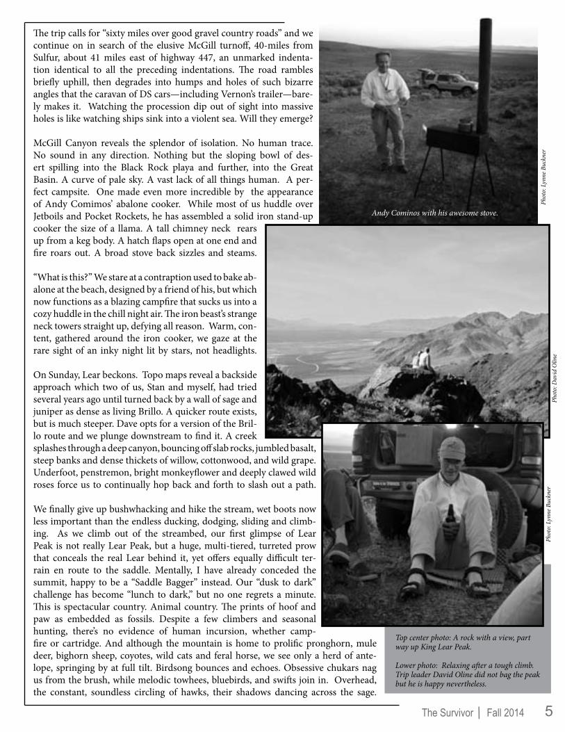
McGill Canyon reveals the splendor of isolation. No human trace. No sound in any direction. Nothing but the sloping bowl of des-ert spilling into the Black Rock playa and further, into the Great Basin. A curve of pale sky. A vast lack of all things human. A per-fect campsite. One made even more incredible by the appearance of Andy Comimos’ abalone cooker. While most of us huddle over Jetboils and Pocket Rockets, he has assembled a solid iron stand-up cooker the size of a llama. A tall chimney neck rears up from a keg body. A hatch flaps open at one end and fire roars out. A broad stove back sizzles and steams.
“What is this?” We stare at a contraption used to bake ab-alone at the beach, designed by a friend of his, but which now functions as a blazing campfire that sucks us into a cozy huddle in the chill night air. The iron beast’s strange neck towers straight up, defying all reason. Warm, con-tent, gathered around the iron cooker, we gaze at the rare sight of an inky night lit by stars, not headlights.
On Sunday, Lear beckons. Topo maps reveal a backside approach which two of us, Stan and myself, had tried several years ago until turned back by a wall of sage and juniper as dense as living Brillo. A quicker route exists, but is much steeper. Dave opts for a version of the Bril-lo route and we plunge downstream to find it. A creek splashes through a deep canyon, bouncing off slab rocks, jumbled basalt, steep banks and dense thickets of willow, cottonwood, and wild grape. Underfoot, penstremon, bright monkeyflower and deeply clawed wild roses force us to continually hop back and forth to slash out a path.
We finally give up bushwhacking and hike the stream, wet boots now less important than the endless ducking, dodging, sliding and climb-ing. As we climb out of the streambed, our first glimpse of Lear Peak is not really Lear Peak, but a huge, multi-tiered, turreted prow that conceals the real Lear behind it, yet offers equally difficult ter-rain en route to the saddle. Mentally, I have already conceded the summit, happy to be a “Saddle Bagger” instead. Our “dusk to dark” challenge has become “lunch to dark,” but no one regrets a minute. This is spectacular country. Animal country. The prints of hoof and paw as embedded as fossils. Despite a few climbers and seasonal hunting, there’s no evidence of human incursion, whether camp-fire or cartridge. And although the mountain is home to prolific pronghorn, mule deer, bighorn sheep, coyotes, wild cats and feral horse, we see only a herd of ante-lope, springing by at full tilt. Birdsong bounces and echoes. Obsessive chukars nag us from the brush, while melodic towhees, bluebirds, and swifts join in. Overhead, the constant, soundless circling of hawks, their shadows dancing across the sage.
Top center photo: A rock with a view, part way up King Lear Peak.
Lower photo: Relaxing after a tough climb. Trip leader David Oline did not bag the peak but he is happy nevertheless.
Andy Cominos with his awesome stove.
Phot
o: L
ynne
Buc
kner
Phot
o: D
avid
Olin
ePh
oto:
Lyn
ne B
uckn
er

6 /The Survivor Fall 2014
Fighting for footing, no two minutes are alike. We kick up a vertical slope, shinny through rock em-bankments, and elbow through root-locked rabbit-brush, gnarled sage and leaning towers of wind-shorn cedars snatching at air. It’s a tangled, welted, woody, knee deep, rim sticking, high desert jungle with no relief in sight. But lovely. Pure as breath. Bright col-ors that hover against the background blue, with the idea that if we could just cut, jump, and rampage our way through this brush, the summit would be ours with its promised views of Lassen, the Humboldt River drainage, Utah, the Sierra, Oregon, even Idaho. Finally, Neal, Lena, Lawrence and I succumb to the shade of a flat boulder while Stan and Dave continue up. Lazy insect drone and the re-
lief of not walking turns us drowsy. It’s easy to contemplate the warp of history here, the progress of the emigrants en route to the Pacific Coast through the edge of the Back Rock desert, exhausted travelers who despaired at the sight of barren wilderness. But to the Paiute, the land offered pure bounty. Trout filled streams, rampant game, and plants both medicinal and culinary. Every part of every plant had a use, and even the gnarly sagebrush offered seeds to be parched and ground into a nutritious meal, woody fiber to weave into baskets, and leaves to powder into a skin-sooth-ing application, or a tonic tea. Breathing in fumes from smoking leaves accompanied ritual purification ceremonies.
We have an agreed-upon turnaround time, and with a last glance at the unclaimed summit, Dave and Stan re-turn and we begin our return. The descent throws us downhill at a barreling pace and we slide the last quar-ter mile straight into the creek. From there, a path suddenly reveals itself, speeding our return. We meet Lynne Buckner and Judy Kendall, clean and smiling after a bath in one of the many pools. Lynne T. and Mike have de-parted, as have Andy and Vernon. The next day will be spent on the playa, exploring Nevada’s hidden hot springs.
First is Trego Hot Springs, halfway between Sulphur and Gerlach on the south end of the playa, next to the railroad tracks. We don’t stop as a cluster of people and trailers warn us away. Next is a walk on the playa , hiking out to Salt Wa-ter Spring, a stained green mineral and water slough with a cattle guzzler. The dazzling white playa shrinks and ex-pands us into mirage images as we stroll, examine plants, admire the vast terrain and finally navigate back. After comes an unnamed thermal, shown on the map as simply “hot spring” but which attracts Stan, Neal and Dan into shoveling it open. Cattle have trampled its rivulets shut, and after some digging, the hot water courses through. Someone has sectioned off a bathtub-sized soaking pool made of black plastic—perhaps it will be filled for future visitors. A breathtaking adventure in little-known terrain.
Top left photo: Hot springs abound in the Black Rock Desert. Fly Ranch Geyser (shown here in 2004) is not entirely a natural phenom-enon. It was created accidentally by water well drilling in 1964. The geyser is now fenced off from public access, however the trip partici-pants viewed it from from a nearby highway.
Above photo: Desert Survivors restore a course for thermal water to fill a soaking tub.
Right photo: Venturing onto the playa.
Phot
o: L
ynne
Buc
kner
Phot
o: D
avid
Olin
e
Photo: David Oline

7/The Survivor Fall 2014
As an archeologist for the National Park Service (NPS) I spend most of my working days piecing together old puzzles from a few artifacts pulled from dirt. Who was here? What did they do? Who did they cherish? My sources are usually dead––long ago, in fact––but no mind. If they could talk, where’s the challenge? I’m more puzzled, actually, by the strange and weird offerings mod-ern folks leave at archeological sites. A small sample from my favorites:
A few years I excavated in Chaco Culture National Historical Park with the University of New Mexico. We were digging beside an ancient Puebloan great house, when we heard the radio crackle with an emergency call-out to the park archeologist, “Meet the preservation crew! Pueblo Bonito, south side, hurry!” We rose from dust-covered torpor, and raced to the site. Rare excitement––an archeological emergency! Secretly we hoped for a wall collapse or a kiva in flames, but the crisis was nothing so dramatic. In a roped-off room, a group of Navajo stone masons restoring the site discovered a “gift” left by a modern admirer––a new-ager, a hippy, a Satanist, or whoever came to bask in Chaco aura. Hedging their bets in a cross-cultural world, the Navajos “killed” the offering by smashing it with a stone––a clean break to protect against lingering malevolence. You can never be too careful around other people’s idols.
The park archeologist emerged from the ancient structure carrying a broken onyx figure. We gathered around to mock the thing and the interloper who left it. Surprise! I had seen this figurine before. The little statue was the twin of a childhood treasure, a gift from a favorite uncle after his vacation to the pyramids of Mexico City. A cheap mass-produced trinket from a roadside stand, but my first visceral connection to exotica beyond the Louisiana piney woods. I kept the figure for years until it disappeared in a move. Who left its double in the ruins?
Sometimes “modern” is a broader frame of reference. I’m willing tomake allowances for a century or so over a three-thousand-year span. I recently spent a night in a Mormon ghost town in Sego Canyon, Utah. Flowing water and a natural north-south corridor through the Book Cliffs lured prehistoric travelers this way for thousands of years. Mormon coal miners settled in the canyon in the late-nineteenth century. I found this pictograph above an old livestock pen. A century-old, cowboy’s devil girl kicks up her high heels with ancient Barrier Ghosts, a Fremont Indian big-horned sheep, and a Ute deer. Who could be offended by such a charming combination?
The Pueblo Bonito idol lives now in the Chaco Collections at Albuquerque’s Hibben Center, where the NPS curates all such offerings. It pleases me to imagine it there on a shelf in the museum warehouse, a tourist’s souvenir surrounded by all the bling of ancient Chaco.
Some offerings are not so benign. A few years ago, the park service spent thousands of dollars to hire a professional cleaning crew after a tourist scattered the cremated ashes of their beloved across the Great Kiva at Casa Rinconada in Chaco. Strong cultural taboos proscribe Navajos from handling remains of the dead, and the preservation crew refused to enter the ruins. Vital stabilization of the ruin was halted until the kiva was vacuumed and cleansed. The Great Kiva is now closed to visitation.
by Barbara Bane
What They Left
EDITOR’S NOTE: The author currently works as a staff arche-ologist in Yosemite National Park. She is a member of Desert Survivors Board of Directors and she would be greatly offended if she found any new scribbles on a pictograph.
Phot
o: B
en B
ellor
ado
Photo: Courtesy of Barbara Bane
The author on the dig in Chaco Canyon.
In researching this article, Ms. Bane found the trinket for sale on the internet.
The Book Cliffs pictograph.

8 /The Survivor Fall 2014
On an October, 2013 trip to Central Nevada, my friend, Pat Devereux of Stagecoach, NV and I camped just outside the limits of the Berlin-Ichthyosaur State Park on Bu-reau of Land Management (BLM) land. We were in a Great Basin Desert landscape and from our camp we enjoyed a vista of mountains and dry plains spotted with junipers, pinyon pine and sagebrush. There was one additional aspect to this scene. Interspersed across our view and as far as we could see, white-colored, plastic drainpipes, 5 feet tall, protruded from the ground. These were markers for mining claims and there were dozens of them. Over the years I had seen such markers on Desert Survivors hikes, but in this area these pipes were everywhere.
Our camp was in a former silver mining area. It was now a land divided into hundreds of small mining claims (many from the 1980’s during a period when the price of silver was record-high) and most of them had their 4 corners marked, as required for claim registration, with white 4”or 6” diameter Polyvinyl Chloride (PVC) pipes. The pipes were driven into the dirt or propped up with rocks and none of them were capped. I had heard that such pipes presented a nuisance for birds and other animals attracted to them as possible nesting sites or maybe just a shady place to escape the afternoon sun.
We decided to investigate. At the claim marker nearest to our camp, I wiggled the pipe and pulled it from the ground and was amazed to see a mummified American Kestrel fall out, a bird whose North American population has been declining by an
estimated one and a half percent each year between 1966 and 2010. It was unmistakably a Kestrel with its boldly patterned head, gray coverts and rufous back. The Sibley Field Guide to Birds of Western North America states that the American Kestrel is uncommon and nests in tree cavities, birdhouses or crevices in buildings. It is easy to see why a mining claim marker would present an enticement to this species.
We went on to pull down 7 more markers and 2 of them con-tained birds. We found an entombed canyon wren and a baby bird of a larger species that was very deteriorated and difficult to identify but might have been a baby shrike, as it had a large bill with a hook. Coincidentally, the markers that contained birds were at angles to the ground of about 45°, which sug-gests that the ones standing upright are not as attractive to birds as the ones at an angle that mimic nesting sites found in nature. This is just speculation as I have no data to support this observation.
QUANTIFYING THE PROBLEM
There are 3.4 million mining claims on public lands in the United States. A marker is required for each claim corner and claim holders often mark other parts of their boundaries. Of-ficials are not sure how many uncapped PVC claim markers are out there, but it is sure to be in the millions. The American Bird Conservancy estimates that at least a million birds of 45 species are killed each year after getting trapped in the markers. The Audubon Society estimates the toll could be as high as 10 or even 20 million. Once inside, the animals cannot make their
MINING CLAIM MARKERS = DEATH TRAPS FOR WILDLIFEArticle by Karen Rusiniak
Phot
o: K
aren
Rus
inia
k
The author believes that leaning pipes, such as this one, are particularly perilous to birds since the angled, open top mimics nesting sites found in nature.

9/The Survivor Fall 2014
way up the slick plastic sides or are unable to extend their wings in such a constricted space to be able to fly out. The usual verticality of the pipes doesn’t help either. Other ani-mals such as lizards and small rodents also fall victim to these traps and, once inside, the animals will die of starvation and dehydration.
Why do the animals go into the PVC pipes? Many of the birds are known cavity nesters; maybe they are looking for food or a shady spot. Migrating birds may be looking for a resting place and sometimes try to pool together to save body heat.
Nevada has the most pipes by far, as there are over a mil-lion mining claims on public lands there. About 200,000 of them are considered inactive or abandoned and an un-known number of those have the PVC markers. By com-parison, California only has about 25,000 active mining claims and according to Debra Marsh of the BLM head-quarters in Sacramento: “We really have no idea how many of these claims have uncapped markers.” In former times claim holders used wooden stakes or piles of rocks to mark their claim boundaries and corners but, as in other areas of our lives, plastic, a petroleum-based product, started to be used to replace naturally occurring materials. In the late 1970s and 1980s prospective miners started using the PVC pipes as they are inexpensive, lightweight easy to carry to the claims, and can be seen from a distance. PVC is one of the most produced plastics and is used extensively in construc-tion work. This plastic pipe tends to become brittle with age
and exposure to the sun. It deteriorates, causing it to break down into small pieces (see photo) causing a secondary, nega-tive environmental effect of its life cycle. Although many states have banned uncapped PVC pipes, often the caps don’t stay on or the miners simply do not cap them to begin with. Finally, in 2010, this disturbing problem caught the attention of federal and state officials and some nonprofits. Biologists started to document the extent of the problem. In Nevada there is an average of one dead animal per pipe with up to 31 birds being found in a single pipe. Lists have been made of species found and their frequency, with the mountain blue-bird being the most common bird found in northern Nevada and the ash-throated flycatcher holding the dubious record for the south. In Oregon, birds average two per pipe. The record for number of skulls found in one pipe is 231 but that was in an agricultural vent pipe in Kern County. The Audu-bon Society website maintains a list of species found in these “death pipes,” which includes 44 species of birds, 4 types of lizards and 3 mammals with the largest being a desert cotton-tail. Journalist Henry Brean of the Las Vegas Review-Journal, brought widespread attention to this issue in his report pub-lished on November 7, 2011.
WHAT CAN BE DONE?
Since November 1, 2011, “durable plastic pipes” on mining claim markers in Nevada have been prohibited, but that regu-lation does little to address the thousands of abandoned pipes out there. On that date in Nevada, it also became legal for
Photos, clockwise from top left: The corpse of an American kestrel the author found in the first pipe she examined; Two dead birds discovered in another pipe; It is estimated that there are over a million PVC claim marker pipes in Nevada alone; PVC pipe becomes brittle with age and exposure to the sun. It often shatters into small pieces causing a secondary environmental problem.
Kille
d bi
rds a
nd b
roke
n pi
pe p
hoto
s by
Kare
n Ru
sinia
k.
Phot
o: N
evad
a D
epar
tmen
t of W
ildlif
e

10 /The Survivor Fall 2014
anyone on public land to pull down uncapped plastic tubes from mining claims and lay them on the ground where they find them.
Christy Klinger, a biologist for the Nevada Department of Wildlife, heads up the Nevada state effort to remove the PVC pipes and has so far taken down about 32,000 and document-ing 11,000 dead birds of 61 species. Efforts are being made but the problem is so large it might take decades to rid the environment of these animal death traps.
Darin Schoeder, Vice President of Conservancy Advocacy at the American Bird Conservancy (ABC) states, “It’s a large problem, one that has gone on for decades.” He advocates that the government should use some of the money provided in the Abandoned Mines Act to address this problem as it is just too large for volunteers to tackle. In fact, ABC offered to write a letter that would be sent to mine claim holders in-forming them of the danger to wildlife of PVC pipes and that killing species is in violation of the law. Many thousands of these letters were printed but then BLM said that due to sequestration and cutbacks, they did not have the resources to mail them. ABC then offered to underwrite the mailing cost, but the BLM still refused. They now sit in a BLM warehouse. Schoeder says “ This is troubling that this has not moved for-ward.”
As of January 1995, California required the removal of PVC pipes and now only allows wooden posts, mounds of stone, metal posts or solid metal rods. But once again, the number of abandoned pipes out there is unknown by officials. Also the regulations state that a claimant has 180 days to permanently remove markers off any claim that has been abandoned, relin-quished or lost, so all the PVC pipes still in California are no longer allowed by state regulations.
markers? Ignorance of the law can be cured by education, and the California BLM has made an attempt to educate the public with a piece on their website entitled: “Mining Claim Dangers and Wildlife Dangers.” This is clearly not enough.
I have been told by a California state geologist that if a mem-ber of the public comes across a standing, uncapped PVC pipe on a hike it is okay to place a rock on the top of the cap. How-ever, it would help if California had a law similar to Nevada’s that specifically allows anyone to take down an uncapped pipe.
After researching this issue, these are the recommendations I would encourage those in charge of sustaining “the health, diversity, and productivity of the public lands for the use and enjoyment of present and future generations” (the mission statement of the BLM) to implement:
• Pass a California law, similar to Nevada’s, allowing citizens to take down the PVC markers.
• Design a program to enforce California Public Resources Code Section 3915(e) that requires removal of the pipes, a $50 fine per pipe to the claimant and additional liability for any cost incurred by the federal, state or county gov-ernment agency which removes any monument or has it removed.
• Allow ABC to fund the mailing of the flyer to claimants.• Implement a program to educate mining class associa-
tions and prospecting clubs.• Use funds in the Abandoned Mines Act to address this
problem.
Who knows how many birds are still alive and trapped in a PVC pipe at this very minute? Taking these actions can save many birds’ lives. If anyone reading this article might be in-spired to help out on such an endeavor, please contact this author at [email protected].
So where is the enforcement of this regulation? This is where it gets murky. In speaking to BLM district and state officials, I was told things like: “It is not our job (BLM) to enforce state laws” and “it is against Federal law to disturb monuments in California.” Also the BLM is stretched thin these days with personnel being called to fight fires, sometimes in other states, sequestration, etc. Dealing with uncapped mining markers, which would involve locating the mines, the claimants, fieldwork to determine the type of the mark-ers, does not seem to be a priority. In a perfect world, mining claimants would be notified, and they would replace their own monuments. The question is how to get there, and what about the abandoned mine
In a 2010 Nevada study, 854 mining claim PVC pipes were examined. Researchers found 879 killed birds along with 113 reptiles and 30 mammals. The above photo shows some of the animal remains collected in the study.
Phot
o: N
evad
a D
epar
tmen
t of W
ildlif
e

11/The Survivor Fall 2014
The Desert Survivors field trip to the Ruth Bancroft Garden in Wal-nut Creek took place on a delightful sunny day, with temperatures in the low 80s–– a nice break from the fog along the Bay. This was only my second outing with the Desert Survivors. My apprehension of not knowing anyone was quickly extinguished as I saw Loretta Bauer, a former work colleague and backpacking partner. I also ran into someone from the earlier outing. After introductions all around, Mi-chelle Bashin, the trip leader, corralled us for quick briefing by our tour guide Carol Babst and we started our walk.
Ms. Babst, was an enthusiastic guide and rattled off the Latin names with ease. The scientific nomenclature is better at iden-tifying the plants because there are so many common names for plants that are similar in appearance. The Ruth Bancroft Garden started out in 1950 as a private garden adjacent to the home of Ruth and Phillip Bancroft, Jr. Mr. Bancroft was the grandson of Hubert How Bancroft for which The Bancroft Library at UC Berkeley was named. The original house remains, now off limits to the pub-lic; and amazingly, Ruth Bancroft still lives there at the age of 105! Ruth started out growing all kinds of plants. But at some point she became enamored with drought-resistant succulents and cacti and began to focus on collecting and cultivating them. She and her husband went up and down the West Coast acquiring succulents, cacti, and drought- resistant plants. They brought in similar flora from around the world. The original soil of the garden was too rich and compact for the needs of the plants Ruth wanted to grow, so truckloads of gravel and rocks were hauled in from a nearby quarry. Cacti and succulents thrive on well-drained soil. Too much water in the soil over a period of time will rot the roots. Most of our Desert Survivors know of the well-drained properties of the desert. A quick rain brings enough moisture to excite the plants into flowering with the rest of the water rushing off in a flash flood. Unlike most botanical gardens that grow plants grouped by geo-graphic area, the plantings at the Ruth Bancroft Garden are designed for aesthetic results. A towering Chilean Wine palm from South Amer-ica will be the focal point of California native plants and shrubs and a small forest of Yucca which resemble Joshua trees. Unfortunately, most of the Joshua trees planted by Ruth died early on in the garden’s life from a hard freeze.
The tour started with a large tumbled grouping called the Agave Grove. Our guide showed us that the plant’s blades start out so tightly wrapped that as the plant grows and opens up, a permanent impres-sion of the edges of the blade next to it remains for the life of the plant. An Agave will send up a towering stem which flowers just once in its life. Although some species are known as Century Plants and are thought to bloom once after a hundred years, this is a myth. The plants reproduce either by sending out “pups”-small plants surrounding the
mother plants, or some of the flowers at the top of the stalk can turn into plantlets. A short walk took us to the Tequila Agave grove where we Des-ert Survivors talked excitedly of this famous liquor. California natives in the garden in-cluded a hulking Valley oak and a mutant Manzanita that sprung up out of the gravel gathered at the quarry. Many of the plants come from other parts of the world with a similar “Mediterranean” climate as Califor-nia or desert regions of South Amer-ica, South Africa and Australia. Some of the plants looked like they came from another planet. The tour went on for almost two hours, and we kept seeing more amazing and colorful plants. There is almost al-
ways something blooming in the garden and their extensive website features what’s flowering at any given time. Finally, we Desert Survi-vors retired to several picnic tables under the trees and enjoyed con-versation and an outdoor lunch together. Somehow no one remem-bered to bring wine or beer, but we still had a great time! I enjoyed meeting more Desert Survivors and talking about desert conserva-tion, hiking & camping and more. I enjoyed the visit to the garden and wished that I could bring Carol Babst on a trip to the California desert to tell me about all the plants growing there. I went home with a bag of potting soil and a vow to repot and rearrange some of my own succulents and cacti. I also want to learn more about growing these and other drought-resistant plants, as we face our own drought conditions. A short article like this can not describe all to be seen in the garden. For more information about the Ruth Bancroft Gardens and its plants go to http://www.ruthbancroftgarden.org/index.html. It will make you start planning your own visit to the gardens. Deirdre Cerkanowicz
DESERT SURVIVORSRUTH BANCROFT GARDEN TOUR
TRIP REPORT:
JUNE 1, 2014
Tour participants find themselves surrounded by fascinating flora.
Phot
o: M
ichell
e Bas
hin

12 /The Survivor Fall 2014
My first Desert Survivors trip into the Inyos was in 2006 led by Craig Deutsche. In Craig’s trip description he stated: “...these mountains are the spiritual home of Desert Survivors for the word “Inyo” means dwelling place of the Great Spirit in the local Piute dialect. These mountains hold ancient trees, traces of generations of Native Americans, historic prospects, old mines and old trails, and is the crucible in which our organization was forged. I had seen a lot of the natural history, human history and the essence of the Inyos in the past trips so was intrigued when leader Gerry Goss stated that he had discovered something new and amazing in McElvoy Canyon and he wanted to share his discovery with us but he was keeping it a secret until we got there. Day 1: On the morning of the trip, we (Lawrence, Kim, Nick and myself) met Gerry and Stacy Goss in Lone Pine. I knew everyone from previous trips as there is a core group that tends to go on Gerry’s Inyo trips. We loaded our packs with 2 gallons each of water for a 3500 ft. hike up a trail to stash water for our first and last dry camp. Our camp was halfway up Pat Keyes Trail near a spring that is now dry. Funny how the 16 lbs of water with lunch and pack weight seems so heavy going up the steep grade. By late afternoon, we were back at the trailhead having climbed and then descended 3500 ft.
Day 2: We hiked up to the Pat Keyes Trail camp on the same flower-strewn trail (paintbrush, firecracker plant, primrose, gravel ghost, hopsage, claret cup cactus) as the day before. Halfway up, three of us who were bringing up the rear saw a strange sight on the path. At first it looked like an injured snake, on closer inspection, it was a rubber boa slowly crushing a lizard with its body. We had all day, so the three of us who were going a lot slower than the others, stopped for lunch and a nap when we reached some pinon pines. In the evening from our ridge camp we enjoyed a beautiful sunset-on-the-Sierras view.
It all started in 1997 when I was sitting in Saline Valley Hot springs watching Hale-Bopp Comet and hearing about the existence of some cabins in the rugged mountains surrounding the valley. I was intrigued and even though I was a year-round backpacker and in good shape, I never thought it would be possible to go there given the lack of water and marked trails. Fast forward to April 27, 2014, almost 20 years later, and I’m getting ready to make my seventh trip into the Inyo’s.
MY WALK IN
THE INYOSby Lynne Buckner
Phot
o: S
tacy
Gos
s
Phot
o: L
ynne
Buc
kner
Phot
o: L
ynne
Buc
kner
13/The Survivor Fall 2014
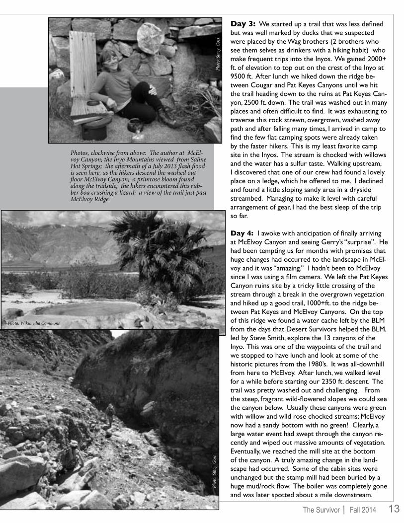
Day 3: We started up a trail that was less defined but was well marked by ducks that we suspected were placed by the Wag brothers (2 brothers who see them selves as drinkers with a hiking habit) who make frequent trips into the Inyos. We gained 2000+ ft. of elevation to top out on the crest of the Inyo at 9500 ft. After lunch we hiked down the ridge be-tween Cougar and Pat Keyes Canyons until we hit the trail heading down to the ruins at Pat Keyes Can-yon, 2500 ft. down. The trail was washed out in many places and often difficult to find. It was exhausting to traverse this rock strewn, overgrown, washed away path and after falling many times, I arrived in camp to find the few flat camping spots were already taken by the faster hikers. This is my least favorite camp site in the Inyos. The stream is chocked with willows and the water has a sulfur taste. Walking upstream, I discovered that one of our crew had found a lovely place on a ledge, which he offered to me. I declined and found a little sloping sandy area in a dryside streambed. Managing to make it level with careful arrangement of gear, I had the best sleep of the trip so far.
Day 4: I awoke with anticipation of finally arriving at McElvoy Canyon and seeing Gerry’s “surprise”. He had been tempting us for months with promises that huge changes had occurred to the landscape in McEl-voy and it was “amazing.” I hadn’t been to McElvoy since I was using a film camera. We left the Pat Keyes Canyon ruins site by a tricky little crossing of the stream through a break in the overgrown vegetation and hiked up a good trail, 1000+ft. to the ridge be-tween Pat Keyes and McElvoy Canyons. On the top of this ridge we found a water cache left by the BLM from the days that Desert Survivors helped the BLM, led by Steve Smith, explore the 13 canyons of the Inyo. This was one of the waypoints of the trail and we stopped to have lunch and look at some of the historic pictures from the 1980’s. It was all-downhill from here to McElvoy. After lunch, we walked level for a while before starting our 2350 ft. descent. The trail was pretty washed out and challenging. From the steep, fragrant wild-flowered slopes we could see the canyon below. Usually these canyons were green with willow and wild rose chocked streams; McElvoy now had a sandy bottom with no green! Clearly, a large water event had swept through the canyon re-cently and wiped out massive amounts of vegetation. Eventually, we reached the mill site at the bottom of the canyon. A truly amazing change in the land-scape had occurred. Some of the cabin sites were unchanged but the stamp mill had been buried by a huge mud/rock flow. The boiler was completely gone and was later spotted about a mile downstream.
Photos, clockwise from above: The author at McEl-voy Canyon; the Inyo Mountains viewed from Saline Hot Springs; the aftermath of a July 2013 flash flood is seen here, as the hikers descend the washed out floor McElvoy Canyon; a primrose bloom found along the trailside; the hikers encountered this rub-ber boa crushing a lizard; a view of the trail just past McElvoy Ridge.
Phot
o: S
tacy
Gos
sPh
oto:
Sta
cy G
oss
Photo: Wikimedia Commons

14 /The Survivor Fall 2014
Day 5: After a leisurely breakfast we set out to explore the canyon on our layover day. We were able to walk downstream through the newly exposed canyon. We marveled at the re-mains of large shaggy mushrooms and horsetails, two very primi-tive life forms, that were growing on the mudflow. We reached some old cabin sites that were, previously, only rumored to exist. We ended our walk downstream after the 2nd waterfall proved too challenging to descend. In the late afternoon, we headed up-stream from our camp to scout out a route out of McElvoy. This involved 2 climbs up waterfalls. I quit after the 2nd one proved too challenging, but the others pressed on and located a trail out of the canyon for future use. Back in camp we discovered some mountain lion scat that was, as described, as big as a toilet paper roll with little bones in it.
Day 6: The weather had been on a warming trend and the sun hit the south facing slopes early. On this day, I woke up early and headed up the steep part of the trail back to Pat Keyes ruin camp to photograph a mineshaft with historical artifacts left by the mysterious “Beekeeper of McElvoy Canyon”. See this fascinating story of the Beekeeper at: http://4reliablecomputers.net/california/inyo/mcelvoy-beekeeper-moyer.html. We again had lunch at the BLM cache site. Nick and Kim found lids for the 2 water jugs that had dead mice in them and transported them to the Pat Keyes camp for cleaning and water stashing in the event the water source dries up in the fall.
Day 7: Today was going to be challenging. If we hiked out without camping at our first day’s camp, we would be gaining 2500 ft. and descending 5000 ft. to our cars. With the pros-pect of sun on the south slope of the Pat Keyes ridge and the physical toll the trip had taken on me, I started before sunrise and the rest of the group. I was able to make it up the steep-est, most washed out part of the trail before it got really hot. I rested, cooking tea and breakfast at a mining ruin on the ridge. Two people had already passed me and the remaining members showed up a mere 15 minutes later! By lunch, we had reached the pass at 9500 ft. The descent to our first ridge camp was easy and everyone wanted to continue to cars, comfortable beds, beer and soft drinks. We got a group shot and were down before sunset. Gerry had a new camper with a working fridge that kept beer and soft drinks cold for our return. Gerry and Stacy gener-ously shared this liquid bounty before our little tribe dispersed.
I went North to Keough Hot springs for a needed bath. I was, again, in a hot spring looking at the Inyos, this time from the other side of the range. I was reflecting on how things that seem like they will stay the same forever can and do change in our lives as well as the mountains. I know that time will erode the cabins and mining structures. That is clear each time we go in there. We think of the mountains as static things but clearly they are gradually giving into the forces of entropy as well. I emerged clean from the bath, thankful that for a short period of my life, I have been able to experience the Inyo mountains and its offerings and head for home.
Above photo: The stampmill in McElvoy Canyon buried by mudflow debris.
Right photo: The stamp mill boiler, washed away by the 2013 flash flood, was found a mile down the canyon.
Below photo: Cougar scat.
The trip participants, (left to right, standing) Stacy, Gerry, Lynne, Nick (steated) Kim and Lawrence.
Upp
er th
ree p
hoto
s: Ly
nne B
uckn
er
Phot
o: S
tacy
Gos
s

15/The Survivor Fall 2014
True, in the desert nothing is beautifuland so very stilleverything quiets.
Sweat drained our chemical mindsof tap water untilwe could muse, trulyon life here and after
while spooling barbed wireand pulling wood poststo undo a cattle fenceno longer needed,
always watching for rattlesnakes and tortoise burrows in cat-claw brush and cactus
until dustyand tiredand satisfiedwe quit.
Mojave Service Trip
The main job we had was tearing out six miles of barbed wire and wood post fencing, an enclosure put up forty years ago on public land for a desert tortoise study. The fence kept cattle out of one section of tortoise habitat so the study could see how tortoise fared when protected versus outside on range land. Whatever the finding, the study was done and the fence would be undone. Packing the posts and wire a quarter mile out to the road took many trips by many volunteers that day, and was just what I wanted. Winding around scrub brush in sandy soil was like a desert hike, some-thing I had not done in a while, and hauling a post was like carrying a backpack. By mid-afternoon I was dusty and sweaty happy.
Sam Moorman
Photo: A.H. Cominos

16 /The Survivor Fall 2014
This article is a follow-up from my piece in the Spring 2013 edition of this magazine, “Is Death Valley the Hottest Place on Earth?” where I reported on the NASA, MODIS satellites which look down over the world, and measure the temperature of the ground. I ♥ Death Valley; it is one of my favorite places on earth. I have a relief map of the Valley on the wall in my room. Why do I love it so? Maybe ’cos I was brought up in a cool, rainy climate, where there was no history of desert exploration; maybe ’cos I had an uncle who was in a Middle East war; maybe ’cos I feel atavistically at home in the desert; and Death Valley has so many desert landscapes in one area. I had always thought of it as the hottest place on earth. Hot-test means with the highest recorded air temperature. Is it? Now follows a terribly tortuous torrid tale of twists and turns. The First Turn: There was a suggestion that a place in Libya was hotter. I’m sad. To me that suggestion had to be wrong, I wanted my Death Valley to be hottest, at 134°F. In 2012 it was internationally agreed that the Libyan 136°F was an errror and that Death Valley is hottest. I’m happy.
The Second Turn: NASA launched earth observing satellites that included sensors to measure the land surface temperature over the entire planet. The sensors measure radiant heat, in just the same way that your hand feels the temperature of a hot surface without touch-ing it. The idea has been around for a while in the desert—this is how rattlesnakes detect mammals which are warmer than the sur-roundings. Between 2003 and 2009 it found places with extremely high ground-surface temperatures. The top three hot spots were: The Lut Desert in Iran, the Turpan Depression in western China and the outback of Queensland, Australia. The measurement prob-lem is that the ground will be considerably hotter than the air at about eye-level (which is the standard height for measuring air tem-perature). You’ve experienced this even in town, where the pave-ment can be almost too hot to touch, but you can breathe comfort-ably. Sorry, but the story about cooking eggs on the sidewalk is very probably an urban legend, literally. Satellites measure the earth’s
skin (i.e. ground) temperature. So one needs “ground truth” mea-surements, that is, simultaneous measurement of air and satellite temperatures at the same place on the earth. The same group as in the original study, in “A global comparison…” found that the satel-lite temperatures are pretty accurate for places where there are green plants, but that the satellites read too high for deserts.
The Third Turn: This gives me hope that Death Valley might still be the hottest place. The way to establish ground truth is to go to the competing deserts (as well as Death Valley, as a control), set up proper weather stations to measure air temperatures, and see for our selves. I had publicly volunteered to help do this, preferably setting up the stations in the cool winter.
In a conversation with your Editor, we came up with the following idea: We would propose establishing a Desert Survivors Research Foundation for a monetary grant to set up such stations. The re-searchers would travel to the sites in vehicles, each equipped with sand ladders (see Ever got a car stuck in the sand? at end). For equipment, we would start with the traditional “Stevenson Screen” enclosure with legs that will place the thermometer away from direct sunlight and sit-uated the official distance of 1.2 to 2 meters above the ground. Since we only care about highest temperature, we can save money by doing away with all the other instruments of an official weather station such as wind direction and speed indicators, barometer and hydrom-
Death Valley, CALut Desert, Iran
Turpan Depression, China
88
8
8
8
Queensland, Australia
El Azizia, Libya
'
''' ' THE TOP SPOT
The Search for theHOTTEST PLACE ON EARTH
A $1,000,000 Proposalby Leonard Finegold Wallingford, Pennsylvania
On July 10, 1913 an air temperature of 134°F/57.3°C was reached at Greenland Ranch (now Furnace Creek Ranch,) Death Valley, CA–– seen here in 1926. This is the hottest temperature ever recorded on Earth.
eter… even a low temper-ature recorder. Who cares about that stuff?Needless to say, the station will be solar powered with bat-tery back-up and a satel-lite Internet system to automatically email us the high temperature reading every day. Costs will in-clude transportation and visiting fees to the locals A Stevenson Screen.
Phot
o: B
ancr
oft L
ibra
ry, U
nive
risit
y of
Cal
iforn
iaPh
oto:
Nac
hom
an-a
u, W
ikim
edia
Com
mon
s

17/The Survivor Fall 2014
(never say bribes). The weather station will give, triggered by a prox-imity detector, a recorded message in the local languages, to anyone approaching, assuring them that “I’m not a UFO, I’m harmless, just let me be.” Who in Desert Survivors could record a message?
The next two methods are not as much fun, because we would not travel on the ground (and I get air-sick, so I may not volunteer). We would deploy the weather stations by placing them manually, flying to the site by helicopter (an important tool for desert research in the Antarctic). The most expensive method will be an airdrop from a low-flying plane, with a parachute and the weather station automati-cally setting itself up. Since we can land elaborate equipment (e.g. Rovers) on the desert on Mars, this should be relatively simple.
We will avoid all temptations to adjust the software (as various gov-ernmental agencies are prone to do) to make the competing deserts appear to have lower temperatures than Death Valley. It may take a couple of seasons to get representative data. Our planning proposal will be a modest $1,000,000. Please send your check for the full amount to:
So I hope that it will be established that Death Valley will reign su-preme with the highest temperature. Thanks to Faye Flam and Nick Blake, for helpful comments.
Len Finegold [email protected]
THE PRETENDER THE CONTENDERS
For further reading:
Is Death Valley The Hottest Place On Earth? Leonard Finegold, The Survivor, Spring 2013; volume 32.1, pp. 10-11, available on-line at Desert-Survivors.org.Ever got a car stuck in the sand? Leonard Finegold The Survivor Spring 2013, volume 32.1, p. 15, available on-line at Desert-Survivors.org.Where are the hottest spots on Earth? Mildrexler, D. J., M. Zhang, and S. W. Running (2006), Eos Trans. AGU, 87(43), 461. http://earthobservatory.nasa.gov/Features/Hot-testSpot/A global comparison between station air temperatures and MODIS land surface temperatures reveals the cooling role of forests Mildrexler, D. J., M. Zhao and S. W. Running, Journal of Geophysical Research, v. 116, G03025 - Aug 2011 (doi: 10.1029/2010JG001486)
For 90 years some meteorologists believed El Azizia, Libya was the hottest place on the planet from a reading of 136°F/58°C on September 12, 1922. The World Meteorological Organization in 2012 identified several major flaws with this record. They invalidated it and gave the title to Death Valley. The above photo is from a 1935 Libyan postcard.
During five of the first seven years of the NASA, MODIS satellites’ land surface temperature readings (2003-2009) the Lut Desert of Iran recorded the highest temperatures on the planet. On a sizzling day in 2005 a surface temperature of 159.3°F/70.7°C was registered here.
In 2003 the second-hottest land surface temperature reading was record-ed in the desert outback in Queensland, Australia at 156.7°F/69.3°C. Mr. Finegold plans to place his thermometers in each of the contenders.
Like Death Valley, the Turpan Depression in western China is below sea level in elevation (-505 ft./-154 m) One day in 2008 the satellite in-dicated a surface temperature of 152.2°F/68.8°C here. Other potential hottest spots for the study would include: Kebili, Tunisia; Rub’ al Khali, Saudi Arabia; and below sea level, desert areas such as the Afar Depres-sion in Djibouti.
Phot
o: N
ASA
Phot
o: T
emsa
buita
, Wik
imed
ia C
omm
ons
Phot
o: H
adi K
arim
i, W
ikim
edia
Com
mon
s
Phot
o: W
ikim
edia
Com
mon
s
Desert Survivors, P.O. Box 20991, Oakland, CA 94620.

18 /The Survivor Fall 2014
Reluctantly I asked the park ranger if this was the Cottonwood Spring Visitor Center and of course, as we all know, when you have to ask, that moment disappears into the void. I already knew that we were off course, and in great danger of missing our first day of trekking in the desert.
The pleasant civil servant gave us not only one, but two options of how to get to the Cottonwood Spring––which in her mind was only an easy couple of hours away. She was pulling out maps and pencils to draw the two different routes while I was experiencing nausea and disbelief. My mind drifting while
Mr. Lyon led us back (by plan) to the very same canyon he blundered into in
February––where an “easy three-hour day hike” turned into a grueling 12-hour ordeal.
SURVIVOR CANYON !
The Return To
A Trip Report by Martina Konietzny
Mount San Jacinto was still covered in snow as we rolled into Joshua Tree National Park on the way to the wrong visitor center. We were breathing easy with an hour to spare to meet the others with fearless minds. My eyes were glazed over from only four hours of sleep in a highway motel when I noticed there were no Desert Survivors in or around the gift shop or near the visitor center––which at 9:00am was already not only open, but bustling with activity.
her fresh, well-slept voice full of positive spirits babbled on. Only in the distance, while having cotton balls in my ears mixed with the buzzing of the road, I remembered the words from The Little Prince, “What makes the desert beautiful is that somewhere it hides a well.”
One route required circling the park to the west and then around to the east en route to Palm Springs, past Coachella and Mecca––a refuge, a town with a purpose and a pursuit. I had never heard of it but its ring, its Middle Eastern flair, sounded so intriguing that I wanted to move there and stay forever. Or, she continued chirping, “Go smack through the park at a speed of 25 mph watching out for crossing coyotes, blooming ocotillos, jumping Teddy Bear cholas, flitting by the flat-tailed horned lizards, past the flowering Peirsons milk-vetch, the antelope ground squirrel carrying the Hantavirus, embarking to meet the venomous speckled rattlesnake.” I left the center with a quick thank you and a spirit that dragged behind me unnoticed on the asphalt.
It is hard to believe that after driving 12 hours and after days of plotting and impeccable planning that I still was not at the correct meeting spot, but none of us signed up with Desert Survivors because we wanted easy. There is only one reason why I am still in this game; it is because I can.
To our surprise, the Desert Survivors group, spearheaded by Robert Lyon, was still at the campground when we finally arrived at Cottonwood Spring. We were an hour late, elated and discombobulated. We were not ready at all to head out for the day’s very promising, difficult hike, but not to delay things, we quickly gathered our gear. I was thinking as long I had enough water on me I could fast if my food wasn’t enough. Little did I know, due to my war-child mentality, I of course, had more food than I needed and was able to share my overflow with my fellow hikers.
The hikers descended more than a dozen dry falls.
Atop the jumble before heading in.
Phot
o: K
eith
Bar
efoo
t
Phot
o: K
eith
Bar
efoo
t

19/The Survivor Fall 2014
We all jumped into 4-wheelers and jeeps to do the rigmarole of shuttling vehicles to the approximate spot where we were expected back that evening. A careful mathematical formula that combined ancient sexton readings with modern GPS devices was mixed and steered onto U.S.G.S. maps––a science I would not much be bothered with but would vocally question when I found myself on a path that was everything but easy.
In the shadow of a giant Caterpillar and earthmover/tractor, we found a small area of shade while we waited for those shuttling the vehicles to return. This being the last weekend in May the temperatures were already in the low 100°s. I remembered John Steinbeck’s Travels with Charley, “The desert, being an unwanted place, might well be the last stand of life against unlife.”
It was almost 11:30 am before we finally started to hike into the hills. Secretly it was dawning on me that this might become the worst, most challenging trip ever since the area where we were headed was written up in the guide books as, “Do not bother to go there.” Again, a typical Desert Survivor trip which easily could go awry as it had a couple of months back when a Desert Survivors group was stranded near here above a sheer wall with no path to go on––a story that had sent shudders through me.
Now I was heading up the slight rolling hills where soon the desert landscape was of blooming cacti, Joshua trees and long-deserted miners’ encampments. We marched into this huge expanse of sun-punished dry wasteland, a solitude of rugged vastness, an area so mysterious that my heart sank, not knowing, and worse not trusting, that anyone, not even a Robert Lyon, could get us across it safely. For the next six hours, I took no photos, I needed every inch of my concentration for myself and my body.
Mr. Lyon led us back (by plan) to the very same canyon he blundered into in February––where an “easy three-hour day hike” turned into a grueling 12-hour ordeal. On that trip the Desert Survivors got lost and had to navigate their way down a series of treacherous dry falls in pitch black night, with the only illumination from the few headlamps some of the more well-prepared trekkers had packed. On our trip the canyon probably seemed more dangerous since it was daylight and we could see the perilous drops and unsound footing. Nevertheless we plunged onward, hopping, jumping and sliding from boulder to boulder––a real Paleolithic experience. Finally, we noticed the glitter of metal in the distance––our cars. We knew we could carve another notch on our Desert Survivor belts. “Survivor Canyon” had been conquered, this time in a proper manner. Congratulations Robert Lyon.
The next day on our drive out of the park, we stopped at an overlook. My late father’s handkerchief that I carry with me on all Desert Survivors trips as a ”good luck charm” was snatched by wild winds from my pants pocket, and tossed into air high above the valley––fluttering and flapping and wind whipped. I froze to watch, first in fraught disbelief, and then in gratitude when through a magnificent turn of fate, the handkerchief was carried back overhead and it landed on a barrel cactus only meters away. I ran to grab it and covered my face with it. That moment a childhood memory struck through my frontal cortex. This soft linen had been used by my father 50 years prior to dab my bloody knees after an exuberant run ended with a fall. It had wiped my sweat and tears. Ms Konietzny after the hike and still in this game.
Above photo: Waiting in the shade of huge earthmovers.Right photo: A whole lot of the canyon was traversed by scooting along on one’s bum.
Above & below photos: The can-yon did not give itself up without a fight. The hikers came away with plenty of cuts and bruises.
Phot
o: K
eith
Bar
efoo
t
Photo: Martina Konietzny
Cuts
and
brui
ses p
ics:
Mar
tina
Koni
etzn
y

20 /The Survivor Fall 2014
Good news! Your vacation request has been ap-proved. You’ve signed up for a Desert Survivors adventure and your gear is piled next to the front door, ready to go. Best of all, perhaps, you’ve amassed a trove of lightweight, high-fat, high-sugar food to power your upcoming exer-tions without adding undue bulk or weight to your pack.
Backpacking food with a high calorie to weigh ratio is sup-ported by experienced national trail through-hikers and is favored by engineers who backpack. They are influenced by thermodynamic considerations of food calorie to weight ra-tios where fat wins and sugar comes a close second. Health considerations are sidelined in this approach.
There is an obvious appeal of potato chips, salami, cheese, butter, jelly, crackers, chocolate, M&Ms, cookies and Gato-rade. If the best diet choice was a simple fuel-input vs. work output calculation––like determining the fuel efficiencies of an electric motor verses a diesel engine––then the calorie dense diet would be great. Human metabolism and health is far more complicated that motor efficiency.
The high calorie density diet has unfortunate consequenc-es. In our culture it has been considered normal to gain a pound a year. This is not normal and leads to high incidents of avoidable disease. The weight gain is hard to notice as it creeps against the normal daily background fluctuation of a few pounds of water weight. After thirty years, thir-ty pounds have been gained, clothing size has increased
several times and considerable damage has been done.
The major weight gain foods are French fries, potato chips, other fried foods, sugar drinks, red meats, sweets and des-serts, refined grains, fruit juices, and butter. Hydrogenated fats in many processed foods are toxic to blood vessels and saturated fats also contribute to arterial disease. High fruc-tose corn syrup should be avoided. In addition there are the toxic additives and unnatural compounds that come with processed foods.
Refined sugar, glucose, has a high calorie load with no other nutritional benefits. High-fructose corn syrup and sucrose are even worse, particularly in excess. Evolution has not prepared us for frequent sudden spikes in blood sugar. Ex-cess sugar causes a sudden increase in blood insulin that has major effects on the liver, muscles, fat cells and brain. In ex-cess this contributes to causing diabetes and other diseases.
The best weight loss foods are fruits, vegetables, and whole grains. Dairy foods are not big contributors to weight gain. Low calorie yogurt and tree nuts in moderation are weight loss foods. Resist the silky voice of corporate advertising that has so successfully programmed the civilized world to drink diluted syrups and eat processed food.
Concerns about deteriorating health often leads a person to try a named weight-loss diet or cutting down on fats and sweets. The results of such weight reduction regimes usu-
HEALTHFUL BACKPACKING FAREDesert Survivors trip-leader and vascular surgeon, Bob Davis, challenges backpacking food conventions. He explains how traditional, high-fat, high-sugar, high-calorie, backpacking
nutriment leads to weight gain, and increase risk for arterial disease and diabetes. Bob offers inexpensive and healthful trail food alternatives, that are
lightweight in the pack and make for a light weight hiker.
Phot
o: B
ob D
avis

21/The Survivor Fall 2014
ally do not last. Our cultural background and corporate advertising tells us that we deserve a rich, sweet, high fat, and tasty diet. It is accepted that increased blood pressure, high cholesterols, and weight gain are natural companions to the aging process. So, we revert to our old ways reassur-ing ourselves that exercise and a superior genetic makeup will overcome any bad effects of the food we like. And then, if medical trouble does develop there are pills and even sur-gery to make things right. The truth is that medical treat-ment of the consequences of an unhealthy diet may help a few for a while but is a very poor alternative to the benefits of prevention.
Some might think that a fat-and-sugar-filled diet is accept-able during a short backpack trip. However, it is very diffi-cult to eat a high-fat diet for a while then revert to a healthy diet upon return. A well-known risk among national trail through-hikers is a profound weight gain during the months after a trip. A calorie rich diet is standard for through-hik-ers. Since they have a very high calorie need they can eat all they want and still lose weight but have great difficulty returning to a reasonable diet afterward. Currently most through-hikers have food supplied at sequential caches and carry very little food so that healthy food can be reasonable.
There are few who eat what they want and have gained very little weight since high school, perhaps through regular exercise or an inherited high metabolic rate. While this is better than a steady weight gain, it does not protect from the consequences of eating food that is unhealthy. There are many low-weight people that have arterial disease with a poor prognosis.
One could wonder how can energy be maintained on a strenuous trip without a high-fat diet. Won’t they be hun-gry? Won’t they fall behind their more energetic, fat-con-suming companions? No. In the first few days of greatly in-creased vigorous exercise, the body suppresses appetite in most people. So there’s no need to try to match calories to
workload over the first few days of a trip. Stored fat willprovide all of the energy needed.
As long as sugar is available in the blood, excess calories will be stored as fat and sugar will be used for energy. As the blood sugar is reduced, stored sugar is mobilized from glycogen. With continued exercise and fasting, as glycogen becomes scarce, fat will be used for energy. This is the only way fat is removed from fat cells. This fat burning process becomes more efficient when used frequently, analogous to the way exercise improves the function of muscles. Using fat will produce all of the energy needed and does not cause distress, fatigue or hunger. And since exercise-induced en-dorphins work like narcotics to relieve pain and produce a sense of well being the process can be markedly enjoyable.
Nutritious lightweight backpacking food can be assembled inexpensively at home starting with rice, noodles, cous-cous or quinoa and adding a selection of bean flakes, potato powder, dehydrated or freeze dried vegetables, grated hard cheese, powdered sauce mix and healthy oils.
My backpacking meal plan changes regularly. Currently I take 1 pound of food per day. Dinner starts with a soup that consists of pasta, couscous, instant rice, or noodles and a Lipton Cup of Soup packet, salt, and olive oil. Then there is a dehydrated grain and vegetable stew from Mary Jane Farm that is hydrate in the pouch. A large cup is used to boil water for the stew then a second boil to make a soup in the cup. No need for a pot or a bowl. I eat half of the stew at night and eat the remainder cold in the morning. Through the day I have salted peanuts, trail mix and dehydrated veg-etable chips.
If these recommendations seem extreme, do not attempt to make a radical change in your diet. Analogous to making the transition from a traditional heavy pack to an ultralite pack make the change gradually, one step at a time.
Bob Davis’ current daily diet while on the trail
Nutritious, lightweight and inexpensive backpacking food can be found at the supermarket and/or specialty grocers such as Whole Foods Market.

22 /The Survivor Fall 2014
Desert Survivors on the bone-dry and barren Carizzo Plains during the April 2014 Native Plants trip. About the trip Maureen Grabows-ki wrote, “Five years ago I went to this same place and it was lushly verdant with wildflowers, riots of color. I spoke with the person in the visitor center who said, ‘Usually we have eight inches of rain a year, this year only two.’ It wasn’t unexpected, as we all know we are in a drought. However, it was shocking.”
A tempting target for shooters on the Whipple Mountains backpack, March 2014
Charlie Brown enjoys the easy way up King Lear Peak.
Breakfast in the Mojave.
Desert flowers: A Yucca and Teresa.
Phot
o: B
ob D
avis
Phot
o: C
ourt
esy
of M
artin
a Ko
niet
zny
Phot
o: M
aure
en G
rabo
wsk
i
Phot
o: N
. Bla
ke
Phot
o: A
.H. C
omin
osPh
oto:
N. B
lake
Martina and Kevin manning the Desert Survivors informa-tion table at the Berkeley Marina, Earth Day celebration.
Phot
os fr
om
Our T
rips
'
This
gian
t bee
tle fo
und
a D
eser
t Sur
vior
s’ ha
t irr
estib
le.
Phot
o: M
aure
en G
.

23/The Survivor Fall 2014
Old Woman Mts. backpack, March 2014
Bob Lyon consulting the guide book during the “day hike” on the Joshua Tree car camp. The book was old and since its publication many roads had washed away. Near this place they took the wrong fork and became lost for the next 9 hours.
Our Summer Solstice celebration, at the Marta Perry ranch, June 2014.
Lunch break in a drywash during the Joshua Tree car camp, February 2014.
Above photo: Trip leader Mike Yantos with his daughter Amanda Yantos on the Carizzo Plains Na-tive Plants trip.
Left photo: A Queensland Bottle Tree (Brachychiton rupestris) on the Bancroft Garden tour.
Right photo: WHEN CACTUS ATTACK! Stan H. is exagerating his injury, but he did jam his index finger into some brush ––causing blood to flow, (see arrow.)
Phot
o: N
. Bla
ke
Photo: N. Blake
Photo: N. Blake
Phot
o: M
ichell
e Bas
hin
Phot
o: D
avid
Olin
ePh
oto:
Dav
id O
line
Phot
o: A
.H. C
omin
osan
d Ev
ents
Dan back in camp and enjoying a good book in the Black Rock Desert June 2014.
'
Phot
o: M
aure
en G
.

Non-ProfitOrganizationU.S. Postage
PAID
Berkeley, CAPermit 648
Desert SurvivorsP.O. Box 20991 Oakland, CA 94620-0091
Desert Survivors Membership Form Membership dues are just $30/year, although additional donations are welcome. You can renew your membership by filling out this form and mailing it in with a check to the address shown below.
Name (req’d) _____________________________________________________________
Street Address (req’d) ______________________________________________________
City, State, Zip Code (req’d)__________________________________________________
Phone number: ___________________________________________________________
E-mail address: ___________________________________________________________(Desert Survivors strives to prevent unsolicited use of members’ e-mail addresses, and contact
details, and will not knowingly allow misuse. Our email-list servers guard email confidentiality.)
I want to renew at the following rate (make check payable to “Desert Survivors”):
____ $30 - Tortoise (basic rate) ____ $50 - Roadrunner ____ $100 - Coyote _____$500 – Bristlecone ____$1000-Bighorn Desert Survivors • P O Box 20991, Oakland, CA 94620-0991 Turtle Mountains backpack, February 2014.
Phot
o: A
.H. C
omin
os