the automated delimitation of maritime boundaries - noaa coastal
TRANSCRIPT
1.
The Automated Delimitation of Maritime Boundaries– An Australian Perspective –
P.A. Collier1, B.A. Murphy2, D.J. Mitchell1 and F.J. Leahy1
1. Department of GeomaticsThe University of MelbourneVictoria 3010Email : [email protected] : +61 3 8344 8125Fax : +61 3 9347 2916
2. GeoFix Pty Ltd4/115 Crisp CircuitBruce A.C.T. 2617Email : [email protected] : +61 2 6251 5312Fax : +61 2 6253 5800

2.
Abstract
Determining the accurate location of maritime boundaries and computing the outerlimit of the extended continental shelf can be a mathematically demanding andcomputationally intensive task. This paper considers the relevant issues, particularlyfrom an Australian perspective. An efficient and automated solution to maritimeboundary and extended continental shelf delimitation has been designed andimplemented in the form of a software package known as MarZone. This paperintroduces the MarZone software. In the design of MarZone, emphasis was placed ona geodetically rigorous methodology while at the same time maintaining strictagreement with the relevant provisions of the United Nations Convention on the Lawof the Sea. The reasons for such an emphasis are explained in the paper.
Keywords: maritime boundaries, boundary delimitation, software, United NationsConvention on the Law of the Sea, territorial sea baseline, territorial sea, exclusiveeconomic zone, extended continental shelf
Introduction
The United Nations Convention on the Law of the Sea (UNCLOS) establishes thejurisdictional regimes under which a coastal State can claim, manage and utilise itsocean territories. With an increasing need to administer competing interests in oceanand seabed resources and the requirement to ensure sustainable exploitation of theseresources, Australia has embarked upon an ambitious program to redefine its maritimezone boundaries, including the outer limits of the extended continental shelf, to anunprecedented level of accuracy. For this purpose, comprehensive maritime boundarydelimitation software has been developed. This software, known as MarZone, takesfull account of the provisions and requirements of UNCLOS, while at the same timeemploying a rigorous geodetic methodology to provide an automated solution to themaritime boundary delimitation problem.
1. Maritime Boundary Administration in Australia
As the world’s largest island, Australia has a coastline length of approximately 36,700kilometres, which is amongst the longest of any coastal State. Apart from Papua NewGuinea and the Republic of Indonesia lying immediately to the north, Australia’srelative isolation from other coastal States enables it to claim one of the largestmaritime jurisdictions in the world, extending into the Indian, Southern and PacificOceans.
Proclaimed in August 1994, the Australian Exclusive Economic Zone (AEEZ) coversan area of 11.1 million square kilometres (sq km) of which 8.6 million sq km lie offthe Australian mainland, while a further 2.5 million sq km lie off the AustralianAntarctic Territory (AAT). Beyond the AEEZ, Australia may be entitled to claim anextended continental shelf that covers an estimated 4.6 million sq km (Kaye, 1995).The extent of the AEEZ associated with continental Australia, together with severalareas of claimable extended continental shelf, is shown in Figure 1.
Following ratification of UNCLOS on 5 October 1994, Australia became an originalParty to the Convention when it entered into force on 16 November in the same year.

3.
Under the provisions of Annex II, Article 4 of the Convention, a coastal State seekingentitlement to extended continental shelf must lodge a claim, together with supportingscientific and technical data, with the United Nations Commission on the Limits ofthe Continental Shelf (CLCS) within ten years of the Convention entering into forcefor that State. However, at the Eleventh meeting of States Parties to UNCLOS, heldin New York in May 2001, it was resolved that:
In the case of a State Party for which the Convention entered into forcebefore 13 May 1999, it is understood that the ten-year time period referredto in article 4 of Annex II to the Convention shall be taken to havecommenced on 13 May 1999.
United Nations (SPLOS/72, 2001)
Consequently, the date by which Australia must lodge its claim for extendedcontinental shelf has changed from 16 November 2004 to 13 May 2009.
The strategic, economic and political benefits to Australia of securing rights to vastareas of the ocean and seabed need no elaboration, but these come with significantresponsibilities in relation to delineation, administration, exploitation, andconservation of the marine environment.
In late 1990, following an earlier feasibility study, the Australian Surveying and LandInformation Group (AUSLIG), now the National Mapping Division of GeoscienceAustralia, commenced building the Australian Maritime Boundaries InformationSystem (AMBIS) utilising the capabilities and sophistication of a modern geographicinformation system (GIS). The decision to proceed with the implementation ofAMBIS at that time was influenced by several closely related factors, including:
• The implications of the impending entry into force of UNCLOS, bringing withit specific international obligations and rights in relation to the accuratedelineation of claimable ocean territory and seabed jurisdictions.
• GIS support for complex national maritime boundary legislation and maritimeboundary treaty negotiations with neighbouring coastal States.
• A growing requirement for the establishment of a national repository of digitalmaritime boundary data of common interest to federal, state and territorygovernment agencies.
Whilst maintenance and enhancement of AMBIS is on-going, today the systemprovides a comprehensive and sophisticated management and display environment forall spatial data used in the definition and administration of Australia’s maritimeboundaries, including internationally agreed boundaries and those still subject tonegotiation and delineation (Hirst et al., 1999). In addition to storing spatial data,AMBIS contains comprehensive details regarding the source, heritage and quality ofthat data. A principal component of AMBIS is the set of coordinates that define theterritorial sea baseline (TSB), the line from which the majority of Australia’smaritime zone boundaries are generated. Consequently, during the early stages ofdevelopment, priority was given to the acquisition of data which would enable the

4.
compilation and validation of the TSB, as zone boundaries could not be computeduntil this task was completed.
A number of federal, state and territory government agencies contribute to themanagement and administration of Australia’s maritime boundaries. Table 1, derivedfrom Hirst et al. (1999), generally summarises the role of each agency.
The Petroleum and Marine Division of Geoscience Australia, formerly the AustralianGeological Survey Organisation (AGSO), plays a key role in relation to theacquisition and analysis of data needed for the delimitation of Australia’s extendedcontinental shelf. Marine geophysical surveys provide the data essential fordetermination of the location of the foot of the continental slope and the 2500 misobath, together with the data necessary for determination of sedimentary rockthickness near the foot of the continental slope. A fuller explanation of thesignificance and role of this data in relation to continental shelf delimitation is givenin Section 2.2.1.
Although originally claiming a territorial sea of 3 M in width under the provisions ofthe 1958 Convention on the Territorial Sea and the Contiguous Zone, Australiaextended this claim to 12 M in November 1990. The consequence was thatjurisdiction over the territorial sea was divided between the federal government on theone hand and six state and one territory government on the other, giving the latterjurisdiction over the original 3 M territorial sea, while jurisdiction over the remaining9 M is exercised by the federal government.
The belt of water 3 M in width immediately adjacent to the coastlines of the six statesand the Northern Territory is defined in national maritime legislation as coastalwaters. The divided jurisdiction over the territorial sea is by no means unique, assimilar arrangements exist in other countries. In the Australian context, a furtherconsequence of the divided jurisdiction is that, in certain situations specificallyrelating to low-tide elevations, a dual baseline system arises whereby one baseline isused to define the outer limits of the 3 M width of coastal waters (the coastal watersbaseline), while a different baseline is used to define the outer limits of the 12 Mterritorial sea (the TSB). This situation is very much the exception rather than therule, as along most parts of the Australian coast both baselines are coincident.
2. Data for Maritime Boundary Delimitation in Australia
Although the scale of Figure 1 does not permit a detailed depiction of the two inner-most zones (3M and 12 M), there are five maritime zones defined within Australianwaters. The establishment of each of these zones is promulgated in national maritimelegislation, consistent with the relevant provisions of UNCLOS.
Maritime zones can be classified into two groups, namely those generated wholly bydistance as measured from the relevant baseline and those generated fromgeophysical, hydrographic and geomorphological data, in some cases using distanceoffsets in conjunction with these data. Each group requires specific and unique datasets for the solution of the zone boundary delimitation problem.

5.
2.1 Group 1 – Zones defined by distance
The strategy used for the delimitation of maritime zone boundaries measured from thecoastal waters or the territorial sea baseline is described in Section 2.1.4. Four of thefive maritime zones shown in Figure 1 fall wholly within this category, as describedbelow.
• Coastal Waters - the part or parts of the territorial sea that arewithin 3 M of the baseline appurtenant to a state orinternal territory.
• Territorial Sea - the belt of sea measured 12 M seaward from theTSB (UNCLOS Part II, Sections 1 and 2).
• Contiguous Zone - the belt of sea, contiguous to the territorial sea,measured 24 M seaward from the TSB (UNCLOSPart II, Section 4).
• Exclusive Economic Zone - the area beyond and adjacent to the territorial seameasured 200 M seaward from the TSB(UNCLOS Part V).
The TSB, from which maritime zones defined by distance are measured, can consistof either normal baseline, which includes bay closing lines and river closing lines, ora combination of normal baseline (Section 2.1.1) and straight baselines (Section2.1.2).
2.1.1 Normal baseline
Article 5 UNCLOS defines the normal baseline as being :
“…the low-water line along the coast as marked on large-scale chartsofficially recognised by the coastal State.”
In Australia, the normal baseline is explicitly defined in national maritime legislationas the line corresponding with the level of lowest astronomical tide (LAT). Hirst etal. (1999) explain that data to define the TSB were originally compiled in the late1960’s and early 1970’s from topographic mapping, tide-controlled infra-redphotography and Royal Australian Navy (RAN) hydrographic charting data thenavailable. In more recent times an extensive program of TSB validation has beenundertaken, in conjunction with the ongoing development of AMBIS. This programhas utilised information from modern large-scale topographic mapping, charting,remote sensing, aerial photography and Laser Airborne Depth Sounder (LADS) dataas well as hydrographic surveys of selected straight baseline terminal points.
2.1.2 Straight baselines
In addition to the normal baseline, Australia has proclaimed 397 straight baselines inrelevant national maritime legislation. These baselines are explicitly defined asgeodesics, where a geodesic is the line of shortest distance between two points on thesurface of the reference ellipsoid. The situation in Australia is somewhat unique sincein the maritime legislation of many other coastal States such an explicit definition ofline type is not given. Similarly, UNCLOS remains silent on the line type that can or
6.
should be used when defining straight baselines (see Articles 7, 9, 10 and 47). Thuscoastal States are free to choose the line type, which may include geodesics,loxodromes, great circles and normal sections. The rigorous definition and treatmentof geodesic straight baselines in the context of maritime boundary delimitation isdiscussed by Murphy et al. (1999).
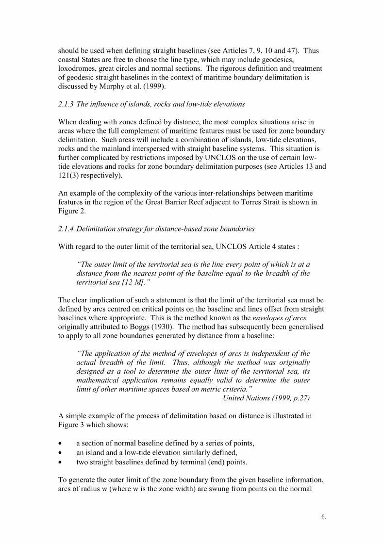
2.1.3 The influence of islands, rocks and low-tide elevations
When dealing with zones defined by distance, the most complex situations arise inareas where the full complement of maritime features must be used for zone boundarydelimitation. Such areas will include a combination of islands, low-tide elevations,rocks and the mainland interspersed with straight baseline systems. This situation isfurther complicated by restrictions imposed by UNCLOS on the use of certain low-tide elevations and rocks for zone boundary delimitation purposes (see Articles 13 and121(3) respectively).
An example of the complexity of the various inter-relationships between maritimefeatures in the region of the Great Barrier Reef adjacent to Torres Strait is shown inFigure 2.
2.1.4 Delimitation strategy for distance-based zone boundaries
With regard to the outer limit of the territorial sea, UNCLOS Article 4 states :
“The outer limit of the territorial sea is the line every point of which is at adistance from the nearest point of the baseline equal to the breadth of theterritorial sea [12 M].”
The clear implication of such a statement is that the limit of the territorial sea must bedefined by arcs centred on critical points on the baseline and lines offset from straightbaselines where appropriate. This is the method known as the envelopes of arcsoriginally attributed to Boggs (1930). The method has subsequently been generalisedto apply to all zone boundaries generated by distance from a baseline:
“The application of the method of envelopes of arcs is independent of theactual breadth of the limit. Thus, although the method was originallydesigned as a tool to determine the outer limit of the territorial sea, itsmathematical application remains equally valid to determine the outerlimit of other maritime spaces based on metric criteria.”
United Nations (1999, p.27)
A simple example of the process of delimitation based on distance is illustrated inFigure 3 which shows:
• a section of normal baseline defined by a series of points,• an island and a low-tide elevation similarly defined,• two straight baselines defined by terminal (end) points.
To generate the outer limit of the zone boundary from the given baseline information,arcs of radius w (where w is the zone width) are swung from points on the normal

7.
baseline of the mainland, the island and the low-tide elevation to determine thelocation of the outermost arc intersection points. Similarly, these arcs are intersectedby lines offset from the straight baselines where appropriate. The final outer limit isthen defined by the envelopes of arcs, which inter-connect the outermost arcintersection points, as well as the sections offset from the straight baselines. Clearlysuch a process satisfies the requirements of UNCLOS Article 4, in that all points oneach of the arcs and the lines offset from the straight baselines are exactly the zonewidth from the nearest point on the baseline (the critical point).
2.2 Group 2 – The outer limits of the extended continental shelf
2.2.1 Sources of data
Article 76 UNCLOS sets out the conditions under which a coastal State may beentitled to claim an extended continental shelf beyond 200 M from the TSB.
In the most complex situations, the outer limits of the extended continental shelf canbe defined by a combination of lines which are derived from geophysical,hydrographic and geomorphological data. In certain circumstances part or all of theouter limits can also be defined by a line measured 350 M from the TSB. The variouslines that must be considered in delineating the outer limits of the extendedcontinental shelf are:
• 1% sediment thicknessformula line
The line joining “…the outermost fixed pointsat each of which the thickness of sedimentaryrocks is at least 1% of the shortest distancefrom such point to the foot of the continentalslope.” [Article 76(4)(a)(i)]
• Foot of slope + 60 Mformula line
The line measured 60 M seaward from the footof the continental slope. [Article 76(4)(a)(ii)]
• 2500 m isobath +100 M constraint line
The line measured 100 M seaward of the2500m isobath. [Article 76(5)]
• 350 M distanceconstraint line
The line measured 350 M from the TSB.[Article 76(5)]
The CLCS, through its publication “Scientific and Technical Guidelines of theCommission on the Limits of the Continental Shelf” (United Nations, 1999), sets outdetailed criteria which must be satisfied to support any claim for extended continentalshelf and the delineation of its outer limits. In 1999 and 2001 the InternationalHydrographic Bureau, Monaco, hosted technical conferences directly related to thesecriteria. Both conferences were jointly organised by the International HydrographicOrganisation, the International Association of Geodesy and the InternationalOceanographic Commission Advisory Board on the Law of the Sea (ABLOS).Copies of the conference reports and technical papers can be downloaded from theABLOS web site: http://www.gmat.unsw.edu.au/ablos/.

8.
2.2.2 Delimitation strategy
The “Scientific and Technical Guidelines of the Commission on the Limits of theContinental Shelf” describe the steps required to determine an entitlement to extendedcontinental shelf. A summary of the process is given below :
• Before a coastal State can claim extended continental shelf, there must beevidence to prove that the foot of the continental slope plus 60 M formula line(FOS + 60 M) or the 1% sediment thickness formula line extend beyond 200 Mfrom the TSB.
• If this condition is satisfied, the outer limit of the extended continental shelf isdefined by the outer envelope of the two formulae lines. If only one formulaline is definable, then the outer limit is defined by that line. Figure 4 shows anarea where a claim for extended continental shelf is to be made. In the example,both the FOS + 60 M formula line and the 1% sediment thickness formula lineextend beyond the 200 M EEZ. The outer envelope of the two formulae lines isdepicted as the thick continuous line made up of parts of both the FOS + 60 Mand 1% sediment thickness formulae lines.
• However, the outer envelope of the two formulae lines is limited by either, or acombination of the two constraint lines. One of these lines is the distanceconstraint line measured 350 M seaward of the TSB, while the other is the depthconstraint line measured 100 M seaward of the 2500 m isobath. Again referringto Figure 4, the distance constraint and the depth constraint lines are bothshown, together with the outer envelope of the distance and depth constraintlines, which is shown as a thick dashed line.
• As the penultimate step, the outer limit of the extended continental shelf isdefined by the inner envelope of the formulae and constraint lines shown inFigure 5, as derived from the data depicted in Figure 4.
• Finally, the provisions of UNCLOS Article 76(7) must be satisfied bydelineating the outer limit of the extended continental shelf by straight lines notexceeding 60 M in length (this step is not shown in Figure 5).
3. The Need for Delimitation Software
3.1 Fundamental requirements
Following the decision by AUSLIG in late 1990 to commence the implementation ofAMBIS, it was recognised that Australia’s maritime boundaries would need to bedefined with a greater degree of accuracy than that which is usually required forcharting and navigation purposes. The ability to accurately determine position at sea,the requirement to manage competing maritime interests and the need to enforce andprotect rights in the maritime environment combine to create the need to accuratelyknow the location of maritime boundary. Although the DELMAR package developedby Carrera (1989) had been acquired in 1990, it was subsequently found to havelimitations in terms of AUSLIG’s future requirements since it could not handle thevery large and complex input data sets that were envisaged. Additionally, DELMAR

9.
was designed to operate under the now obsolete MS-DOS environment.Consequently, in the mid 1990’s, AUSLIG undertook an international search toidentify other software packages which might be capable of meeting the full range ofAustralia’s complex maritime boundary delimitation requirements. This searchproved unsuccessful.
The essential software characteristics identified by AUSLIG included:
1. The ability to undertake the delimitation of all zone boundaries (3, 12, 24, 200and 350 M) in strict accordance with the relevant provisions of UNCLOS,taking into account all combinations of maritime features such as :
• normal baseline, including bay and river closing lines• straight baselines• low-tide elevations• islands• rocks
2. The ability to cope with the dual baseline system, where one baseline is used todefine the 3 M width of coastal waters while the other is used to delimit the12 M territorial sea, the 24 M contiguous zone, the 200 M exclusive economiczone and the 350 M distance constraint on the outer limit of the continentalshelf.
3. The application of geodetically rigorous methods in performing all delimitationcomputations.
4. The ability to compute the outer limits of the extended continental shelf inaccordance with the provisions of UNCLOS Article 76.
As illustrated in Figure 2, Australia has some very complex stretches of coastline.The Great Barrier Reef and the Torres Strait regions are examples of areas where theinteraction and relationship between a diverse range of maritime features must beconsidered when solving the delimitation problem. The rigorous treatment of allavailable data in the generation of various maritime zone boundaries in accordancewith the relevant UNCLOS provisions is both technically and computationallydemanding.
Since no suitable software for maritime boundary delimitation was identified,AUSLIG prepared technical specifications for the development of such softwarewithin Australia1. The specifications divided the project into two parts following theclassification of zone boundaries presented in Section 2. Part 1 dealt with thegeneration of zone boundaries based on distance. Part 2 dealt with the requirementsof the delimitation of the outer limit of the extended continental shelf.
1 Though not available at the time, the intervening period has seen the development of commercialmaritime boundary delimitation software such as Caris LOTS (www.caris.com).

10.
3.2 Geodetic rigour
A key requirement of the technical specifications was that all computations shouldemploy a rigorous geodetic methodology. This is in contrast to earlier attempts atmaritime boundary delimitation in Australia where comprehensive geodeticcalculations could not be practically carried out and more emphasis was placed oncartographic correctness. The representation of maritime boundaries on hydrographiccharts by graphical means may be suitable for many purposes, but it is not sufficientlyaccurate for others where the shift in boundary location of only a few metres mayequate to a substantial monetary loss (or gain) in terms of gaining or not gainingaccess to underlying oil, gas and mineral reserves.
Examples of typical geodetic computations required in the context of maritimeboundary delimitation include:
• Defining arcs on the surface of the reference ellipsoid by a locus of pointsequidistant from the circle centre
• Calculating the intersection point between such arcs• Offsetting lines from straight baselines defined as geodesics• Intersecting geodesics with arcs• Computing geodesic azimuths and distances over very long lines (up to 350 M)
Some details of the geodetic methodologies used in MarZone can be found in Leahyet al. (2001).
4. MarZone – Maritime Boundary Delimitation Software
4.1 Background
In July 1998, AUSLIG called public tenders for the development of maritimeboundary delimitation software which would satisfy the requirements and meet thetechnical specifications discussed above. A small team comprising researchers fromthe Department of Geomatics at the University of Melbourne and a consultant fromGeoFix Pty Ltd, a Canberra-based firm specialising in maritime boundaries, was thesuccessful tenderer. Work commenced on the project in late 1998. Algorithm andsoftware development was carried out at the University of Melbourne. GeoFix PtyLtd provided expert technical advice and independent software testing. AUSLIGprovided overall contract management, software testing and technical input.Additional advice on continental shelf delimitation was provided by AGSO asrequired.
The project proved technically demanding and challenging. Considerable emphasiswas given to developing an efficient and robust solution based on strictimplementation of the relevant UNCLOS provisions and a rigorous geodeticmethodology. After almost two years of development, testing and refinement, thefirst production version of the software, MarZone, was delivered to AUSLIG inSeptember 2000.

11.
4.2 Basic functionality
MarZone has been written in Visual C++ to run on a PC under the Windows NT orWindows 95/98 operating systems. From a development and logic perspective, thesoftware is divided into two components, although the same interface, with someminor changes to menu items and options, is used to control interaction with the userin either case.
MarZone Part 1 is designed for the generation of any maritime zone boundary basedon distance criteria. Typical applications of this component of the software includethe generation of the following limits:
• Coastal waters (3 M from the coastal waters baseline)• Territorial sea (12 M from TSB)• Contiguous zone (24 M from TSB)• Exclusive economic zone (200 M from TSB)• User-selected zone width at any nominated distance from the TSB• Foot of continental slope plus 60 M formula line• Distance constraint line (350 M from TSB)• Depth constraint line (2500 m isobath plus 100 M)
The last three applications arise in the context of preparing data for use in MarZonePart 2, which relates to the delimitation of the outer limit of the extended continentalshelf. Through the performance of calculations necessary for the definition of theouter limits of the extended continental shelf, MarZone will play a key role in theprocess of preparing Australia’s claim for extended continental shelf to be lodgedwith the United Nations in due course.
MarZone does not provide the capability for analysing sediment thickness orbathymetric data. The data defining the location of the terminals of the 1% sedimentthickness formula line(s), the location of points defining the foot of the continentalslope and the location of the 2500 metre isobath(s) must be assembled by the userbefore computations for the delimitation of the extended continental shelf can becarried out. Of course, within MarZone, it is possible to use various combinations offoot of continental slope points, 1% sediment thickness points and 2500 m isobathlocations in order to compute different solutions and identify the optimum location ofthe outer limits of the extended continental shelf.
A MarZone web page has been developed which includes detailed informationrelating to current status. A demonstration version of the software and userdocumentation can also be downloaded through this page located at:www.geom.unimelb.edu.au/marzone
6. Conclusions
The vast extent of Australia’s coastline, together with the requirement to manage andadminister claimed maritime zones, have given rise to the need for an unprecedentedand accurate knowledge of the location of national maritime boundaries. Twofundamental criteria must be considered when delineating the location of a maritimezone: one is the need to satisfy the legal provisions of the United Nations Convention

12.
on the Law of the Sea; the other is the objective that the delimitation problem besolved with geodetic rigour. In order to meet these two objectives and to provideAustralia with a comprehensive tool for maritime boundary delimitation, the MarZonesoftware has been developed. Not only can this software be used to accuratelycompute the locations of distance-based zone boundaries such as the territorial seaand exclusive economic zone, but also to determine the outer limits of the extendedcontinental shelf in accordance with the provisions of UNCLOS Article 76.
7. References
Boggs, S.W. 1930. Delimitation of the Territorial Sea: the Method of DelimitationProposed by the Delegation of the United States at The Hague Conference for theCodification of International Law. American Journal of International Law 24 (3) :541-545.
Carrera, G. 1989 DELMAR 1.0 – A Computer Program Library for the Delimitationof Maritime Boundaries. International Centre for Ocean Development, Halifax, NovaScotia, Canada
Hirst B., B. Murphy and P.A. Collier. 1999. An Overview of Australian MaritimeZone Boundary Definition. Proceedings of the International Conference onTechnical Aspects of Maritime Boundary Delineation and Delimitation (includingUNCLOS Article 76 issues). International Hydrographic Bureau, Monaco, September8-9, 1999. pp. 191-199.
International Hydrographic Bureau. 1999. Proceedings of the InternationalConference on Technical Aspects of Maritime Boundary Delineation and Delimitation(including UNCLOS Article 76 issues). International Hydrographic Bureau, Monaco,September 8-9, 1999. See also: http://www.gmat.unsw.edu.au/ablos
Kaye S. 1995. Australia’s Maritime Boundaries. Wollongong Papers on MaritimePolicy No. 4. Published by the Centre for Maritime Policy, University ofWollongong, Australia.
Leahy F.J., B.A. Murphy, P.A. Collier and D.J. Mitchell. 2001. Uncertainty Issues inthe Geodetic Delimitation of Maritime Boundaries. Proceedings of the InternationalConference on Accuracy and Uncertainty Issues in the Delimitation of MaritimeBoundaries. International Hydrographic Bureau, Monaco, 18-19 October 2001. See:http://www.gmat.unsw.edu.au/ablos
Murphy B., P.A. Collier, D.J. Mitchell and B. Hirst. 1999. Maritime Zone BoundaryGeneration from Straight Baselines Defined as Geodesics. Proceedings of theInternational Conference on Technical Aspects of Maritime Boundary Delineationand Delimitation (including UNCLOS Article 76 issues). International HydrographicBureau, Monaco, September 8-9, 1999. pp. 133-141.
United Nations. 1997. United Nations Convention on the Law of the Sea. PublicationNo. E97.V10, United Nations, New York.

13.
United Nations. 1999. Scientific and Technical Guidelines of the Commission on theLimits of the Continental Shelf. CLCS/11, 13 May, 1999.
United Nations. 2001. United Nations Convention on the Law of the Sea –SPLOS/72. Available on line at -www.un.org/Depts/los/meeting_states_parties/documents/SPLOS_72.htm
8. Acknowledgment
The authors would like to gratefully acknowledge the assistance of Mr Colin French(National Mapping Division, Geoscience Australia) in the preparation of Figures 1and 2.

Agency Role
National Mapping Division,Geoscience Australiawww.auslig.gov.au/mapping/marbound/
• Maintenance of national repository ofmaritime boundary data (AMBIS)
• Compilation and validation of territorialsea baseline
• Computation of zone boundaries• Provision of technical advice on boundary
delimitation• Computation of the outer limits of the
extended continental shelf
Petroleum and Marine Division,Geoscience Australiawww.agso.gov.au/projects/oceans/20010917_13.jsp
• Acquisition and analysis of bathymetric,geological and geomorphological datarequired for extended continental shelfdelimitation
Australian Hydrographic Service,Department of Defence
• Acquisition of hydrographic data• Publication and maintenance of national
charting series
Attorney General’s Department • Expert advice on international law• Administration of national maritime
legislation• Treaty negotiations• Interpretation and application of UNCLOS
Department of Foreign Affairs andTrade
• Treaty negotiations• Interface with the United Nations
State and Territory Governments • Provision of large scale coastal mappingdata
Table 1 – The role of agencies in maritime boundary administration in Australia

Figure 1 – Australia’s maritime zones

Figu
re 2
– M
ariti
me
boun
dari
es in
the
Torr
es S
trai
t reg
ion
betw
een
Aust
ralia
and
Pap
ua N
ew G
uine
a

critical points
non-critical points
outermost arcintersection points
zone w
idth (
w)
island
low tideelevation
Figure 3 – Generating the limits of a maritime zone boundary by distance

oute
r env
elop
e of t
he d
ista
nce
and
dept
h co
nstr
aint
s
oute
r env
elop
e of
the
two
form
ula
lines
Figu
re 4
– D
eter
min
ing
the
oute
r lim
it of
the
exte
nded
con
tinen
tal s
helf

Out
er li
mit
of th
e ext
ende
d co
ntin
enta
l she
lf(in
ner e
nvel
ope o
f the
form
ulae
and
cons
trai
nt li
nes
Figu
re 5
– T
he fi
nal d
efin
ition
for t
he o
uter
lim
it of
the
exte
nded
con
tinen
tal s
helf