the annals of the hitotsubashi academy, 1(1suppl.): url · hitotsubashi university repository title...
TRANSCRIPT

Hitotsubashi University Repository
Title Study on the Palisade in Manchuria
Author(s) Sato, Hiroshi
CitationThe Annals of the Hitotsubashi Academy, 1(1suppl.):
32-44
Issue Date 1951-02
Type Departmental Bulletin Paper
Text Version publisher
URL http://doi.org/10.15057/11786
Right

STUDY ON THE PALISADE IN MANCHURIA
By HIROSHI SATO Professor of Ceography
This thesis is based on the.two studies on the palisade in Man-
churial effected by the author with financial assistance from the
Nihon Gakujutsu Shi,,kokai (Japan Society for the Promotion of
Science) in 1939 and 1940. The palisade2 was erected in the Ching dynasty (~i;~j) and is one of the remarkable examples
of an artificiai boundary.
I. Object of L;rectileg Palisade
Generally Speaking, all boundaries of the world are made by man, and
there cannot be any boundaries made by nature. Such boundaries as snow-lines, isothermal lines, coast lines, the lines beyond which no vegetation can
be cultivated, or the highest possible altitude fit for human habitation, are
boundaries and lines determined by man. But these are considered as natural
boundaries because the natural elements constituting a part of them are very strong. It is necessary for me to classify boundaries in making a study on the
palisade. That is, those boundaries determined by natural things such as rivers, mountain ranges, forests, sea-coasts, deserts, and swamps and lakes are
called natural boundaries, and those boundaries such as no-man's land,3 walls
and dykes, Iongitude and latitude, neutral zones, and buffer zones, are called
artiflcial boundaries. The palisade of which I am going to speak belongs to boundaries of the
category of walls and dykes, and is an artificial one. This kind of boundaries
were mostly erected in ancient times when the world was still uncivilized. For
mstance, the Great Wall of Chinaf was erected so as to check enemy invasions
l The name Manchuria was first employed in 1636 by the Emperor Tai-tsung (,~:9~) of the Ching dynasty, and it seems to have originated from his title, Man~hu (~it~).
2 The palisade is called the chang~ha (f{;<~l}) or liu-tiao-pienH:hiang (1~F~~~~l~ In Chinese, the tormer signifyin~' a long fence, and the latter a fence made of willow trees.-H. Sato, "On the Palisade in Manchuria," Jap. Jour,e. of Geol, afrd Geogr., Vol. 111, Nos. ~4 (1924).
* The N~man's land, separating Manchuria from ICorea down to the latter 1lalf ot the last cen-tury, was formed in 1627 by the Tai-tsung, Emperor of Ching, and was situated on the right bank of the Yalu river. It is a kind of artificial waste frontier and its main purposc is the defence of the Manchus against Korean invaders.-B. Koto "A Considcration on the Koreo-~'lanchurian Boundary" (in Japanese~. The Toyo Cakugei Zasshi, Vol. XXII, Nos. 290-291 (1904).
' The Great Wall of China was erected in 469 B.C. by the Prince Chung-shan and was accom-plished in 214 B.C. by Chi Hwang-ti (#~~=~~) of the Tsin dynasty. Its whole length is 3400 km.-F.G. Clapp, "Along and Across the Great Wall of China," The Ceogr. Rev., Vol. IX, No. 4 (1920). pp. 221-249:,G.B. Cressey. Chil~a's Geographic Fouardatiotbs (1934), pp. (~7.
STUDY ON 1,H1~ PALISADE IN MANCIlURIA 33
from the North, Walls of Antoninus5 and Hadrian6 were built against the in-vasion of the northern clans belonging to the Gaelic branch of the Celtic race,
known as Picts and S+ cots, and the Offa's Dyke7 built by Offa was set up to pre-
vent the entrance of the Welsh people. Wan's Dyke,8 the Wall of Media,9 ~¥'alls in Germany,10 the boundary line of Cairnsll in the northern Balkan; these
were all erected to check the invading enemies. Thus, the boundaries of the
world were built mainly by people to protect themselves and the cattle they raised, in the early stage of development of the race, from the invasion of daring
nomadic people. But the palisade of the Ching dynasty had its main object in
relieving the impoverished people, and in developing their cultivation, and it
purported to check people from going to Mongolia out of the land of Manchu-ria. They erected gates on the boundary to keep watch over the streams of men
and goods and imposed taxes on them. Therefore, the palisade, in its essence, served as a means to protect the people within and bring about better feeling
among the people rather than to prevent their enemies from coming in. The palisade which extended to 1,300 km accomplished its purpose of protecting the
people for their cultivation and maintaining public peace, and the gates on the strategic points served as a means to promote trade and bring about better
understanding within and without the gates. Of course, the palisade did help
much in checking the entering of nomad who raised cattle and wandered about
in search of grazing ground, but that was not the chief object of the palisade.
As a type, the palisade assumes the same form of defence boundary as Limes,
Vallum, Dyke, or Mauer in Europe, judging from the fact that the moat was built outside of the dyke, that is, on the Mongolian side. But essentially, the
object of the boundary was the development of cultivation within the boun-dary, that is, on the Manchurian side, and so it can be called an economic
boundary.
' The Wall of Antoninus (or Graham's Dyke) was constructed in 80 A. D, by Tacitus between the Firth of Clyde and the Firth of Forth.-T. Holdich, Political Frov,tiers atrd Bouardary Makiteg, (1916), pp. 16~164.
e The Wall of Hadrian was formed in 129 A.D. between the Tyne and the Solway and consisted of a stone wall 6 to 9 feet thick and about 12 feet high, which ran for 73 miles the Tyne to the Solway.-1hid., p. 164.
t The Offa's Dyke was constructed in the end of the eighth century A. D., by the powerful M,~ rcian King, Offa, as a protection against the Welsh. A part of it is incorporated in the county boundary of Denbigh. This great barrier extented from the Wye to the Dee.
8 Wan's Dyke, Buckinghamshire Grim's Dyke and M*iddlesex Grim's Dyke are all artificial boundarydykes of ancient Britain.-J. Berry, "Transylvania and its Relations to Ancient Dacia and Modern Rumania," The Geogr. Journ., Vol. LIII, No. 3 (1919), p. 134.
9 The ¥Vall of Media in Babylonia was constructed in the time of Xenophon between Balad and Istabulat. Its erector is called Nimrod.-K. Mason, "Notes on Canal System and Ancient Sites of Babylonia in the Time of Xenophon," The Geogr. Journ.. Vol. LVI, No. 6 (1920), p. 472. ,. *" In Germany, we find three relics of ancient boundarydyke, namely the Danewerk, the Grenz-
wall Karls des Grossen and Limes Germanicus.
*' The boundary of Cairns, separating southeastern Rumania from Banat, runs from Mt. Domo-gled to the opposite valley crossing the Cserna.
34 THJ~ ANNALS OF Tl~IE I-IITOTSUBASHI ACADI;¥- I Y [Feb
II< .Distribution of the
To Changi:h _ _-----' ~~~~:
' ¥,)・~・::~
'' t:;~,,{
La-la-tun ' -:~~~f¥ / ~' ' ¥~~'
://.'~~;
l~~~"" ' :;:~. ) "
~~ 41""
¥~l
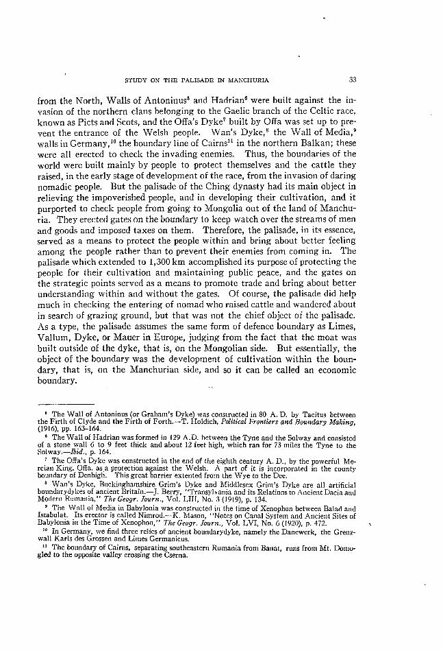
Q_-S k* F'ig. 1. The polisade'near Shih-pai-ling where they set
lrp a monument of an emperor.
the name of the Ea~tern Palisade runs over a
of 420kul hig'h, from Kai-yuan,. Wei-ytian-pu-men (~~:S~~~-'{.+*;i~r~), in the south-easterly direction, and running
east of reng-huang-cheng (r,~~~:~~) via Ying-~-cheng (~~:+*~i~~ie~}) 'and Ai-yan'b"-Pu (9;;~~~"*~!~+"~~~~~~~), it reaches the sea-
coast in the'.west of where the river'Ya-1u enters th~'
se~:' ~Thus, the palis<ade consists oi these two parfs,
and is kriowri hs the ~alisade of the Ching dynasty.
In the book of- Ching-i-tttr~g-ch,ih (i'i・~-~:~~~), it is '' recorded : The country fence of Cheng-king ()~:~~:)
rises in the south from Fellg-huang-cheng and reaches
Kai-yuan in the north, and turns west to Shan-hai-kuan (uJ~~;~~])12 till it reaches the Gr_eat Wall ()f 'China.
The entire length is over 1950 Ii (~~). 'The other part
of it runs east of Wei-ytian-pu, passes the northern side of Kirin,13 and ~xtend~ to l~~-t~-h~. Its lehgth is
over 690 Ii. Willows were planted on the palisade and ropes tied from willow to willow to form a bound-~
ary line. This was called a willow boundary (Liu-pien, ~~~~)."
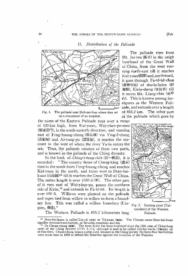
The Wesfern Palisade is 893.2 kilometers long
*s Shan-hai-kuan is called I+in-yti (~s,~) or Yti-kuan (t~~~~). signifies n~^ountain-sea-barrier, or between mountain and sea.
's Or Chuan~hang ('*~,s~). (~~~er.**) of the Ching dynasty (1745 A.D:), to that time.
Pa!isad e
The palisade rises from Mt. Tui-tzu (~S;~r-) in the neigh
bourhood of the Great Wall of China, from the west run-nirig riorth-east till it reaches
Kai-yuan(~!J~:)and,nort*nward,
it goes-through Fa-t~-h~-chan (~;~~~~Pi~*~S) of shu-1a-hsien (~~
~j~;~),' Kirin-sheng (d'~~ip:~~~) till
it meets Mt. I_,iang-chia (~iSFp
UJ). This is knownamong for-eigners as the Western Pali-sade, and extends over a length
of 893.2 km. The other part of the palisade which goes by
range
g-
q___lQ k m Fig. ~. ・ Starting point (Tui-
tzu-shan) of the Western
Palisade.
The Chinese name Shan-hai-kuan
The term J(irin has been employed since the 15th year of Chien-lung although it used to be called Chi-lin-¥~'u-1a (~~~~,~_.ft) up
Chuan~hang means a ship-yarf_i, because in the Ching period, the forty-fonr battleships were made here in 1658 to defend the l¥fanchus ngainst the invasions of the Russians
19511 STUDY ON TI-IE PALISADr. IN MAN'CHURTA
according to measurements derived frorn a ma~ whose ¥~]
scale was one one-hundred-thousandth. The meaSurement of the irloat surroundihg the wall, which is the remains o}
the palisade, is 571'75km long from end to end. That part .,, ,
of the palisade which can be actually surveyed is'prbbably
only about half of 893k'm. That part of the p'alisade north of Wei-ytian-pu is 'particularly ¥vell-preserved, and
especially in that poftiori southeast of Hsin-king, in a place called Shih-pai-1ing (~~:~~~~:',>1'~~), the dyke is low, but it
extends from' southwest to northeast and is magnificent
(Fig. 1). Here is a montiment set up in memory of an emperor who came to inspect the palisade. ' Surveyed from its place of origin in the west, tber
Western Palisade starts from Mt. Jui-tzu, 365 m hi**h, at
¥~rhich poin~ it meets the Great Wall (Fig. 2). This moun-
tair!_ is 22 km north of Shan-hai-kuan.
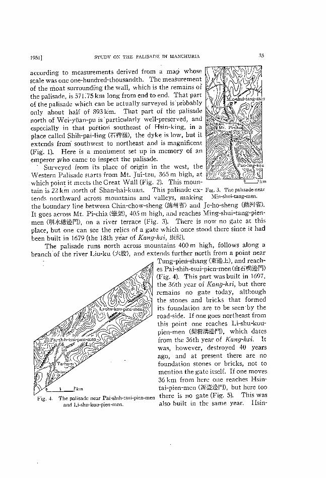
tends northward across mountains and valleys, making the boundary line between Chin-chow-sheng (~h~,,}M~i~) and
It goes across Mt. men (Q~jkt~~:~~r~), on a river terrace (Fig. 3). There is
been built in 1679 (the 18th y~ar of Koneg-hsi, r.~~+J~{).
The palisade runs north across mountains 400 m branch 'of the river Liu-ku (7~J~:*),
u !" es al-s ,.~!~J,,,j; (ri**. 4).
S:, . the 36th year of ~ o ~*~lh-*
~ * ..~' remains no gate the stones and its foundation
35
Mm~;hui-tang-me:1
u
o~_J l<*
This palisade ex- Flg' 3' The pahsade near
Min-shui-tang-men.
Je-ho-sheng (~~,~~T~?).
Pi-chia (~~~t"~), 405 m high, nnd reaches Ming-shui-tang-pien-
now no gate at this place, but one can see the relics of a **'ate ¥vhich once stood there since it had
high, follows along a
and extends further north from a point near Tung-pieri-shang (~:~~sJ~), and reach-
es Pai-shih-tsui-pien-men ( ~1~~f r~j;~~*~~;r'i)
This part was built in 1697,
the 36th year of K(h,tg-hsi, but there
today, although bricks that formed
L*~h
t;~~)
P**~;h*h-tsui-P*en-men ~
~~;~~i'/'~'~~!~_dc~__" ""
l!* }!*~flj~"/"" ~
~)'~~~~: f{';~~:~r;~~~:!i~~:f;/:A:;;~~;:::i:::;::{;!j<'
2 km
Fig. 4- The palisade near Pai-shlh-tsui-pien-men
and Li-shu-kou-pien-men.
are to be seen'by the
road-side. If one goes northeast from
this point one reaches Li-shu-kou-pien-men (~!~i=t~~~~f~), which dates
from the 36th year of Kaeeg-h,si. It
was, however, destroyed 40 years ago, and at present there are no foundation stones or bricks, not to mention the gate itself. If one moves
36 km from here one re<aches Hsin-tai-pien-men (~~~~~:";~~i"~,r'J), but here too
there is no gate (Fig. 5). This ¥vas
also built in the same year. I~:sin-

36 TI{E AN'N'ALs or T}IE rIITOTSUBASHI Ac*~DElvrv [Feb
tai-tsun (~~~~~~J') stands on a river terrace 2 to 3
meters high, and is a village of considerable size. If
one goes northeast, passing Chiang-chia-tun (~C=~~Tt!:),
to the western part of Cheng-chia-tai (~t~j~~:.:~~~), one
finds that the moat and dyke of the palisade have
stood the weather well. The next gate one comes km to is Sung-1ing-pien-men (~~~i~~~;f~), built in 1675
(14th of Koneg-hsi) and it has kept its original shape
Fig. 5. The palisade near well to this day (Fig. 6). The palisade extends to Hsin-tai- pien-men. Chiu-kuan-tai-pien-men (jL~~]~~~;f~) where one finds
no gate standing no¥~' (Fig. 7). This gate was built in 1676 (15th of Ka,eghsi),
and in the site where there once was a gate, a wooden door stands. F,rom here
the moat of the palisade runs eastwards to a mountain 242 m high. The winding moat creeping like a long snake is clearly visible from the height.
Now the palisade climbs a mountain 505 to 708m high, and t.hen begins to go down gradually till it reaches Ching-ho-pien-men (~~FJ'-~il~~~"'~<Fu). The origi-
nal gate of this part was erected in 1676 (15th of Kaleg-hsi), but it must have
been repaired since then as the gate which stands today looks rather new (Fig.
8). In the part between this point and the next Pai-tu-chang-pien-men (~}:h
~j~~~p~), which covers a distance of 42.65 km, the moat and dyke are well pre-
served (Fig. 9). The gate which was built in 1676 stands at the north end
corner of the village just as it stood in
the old days. The moat now begins '*~t'~~. to run across the great plain. Liao-ho
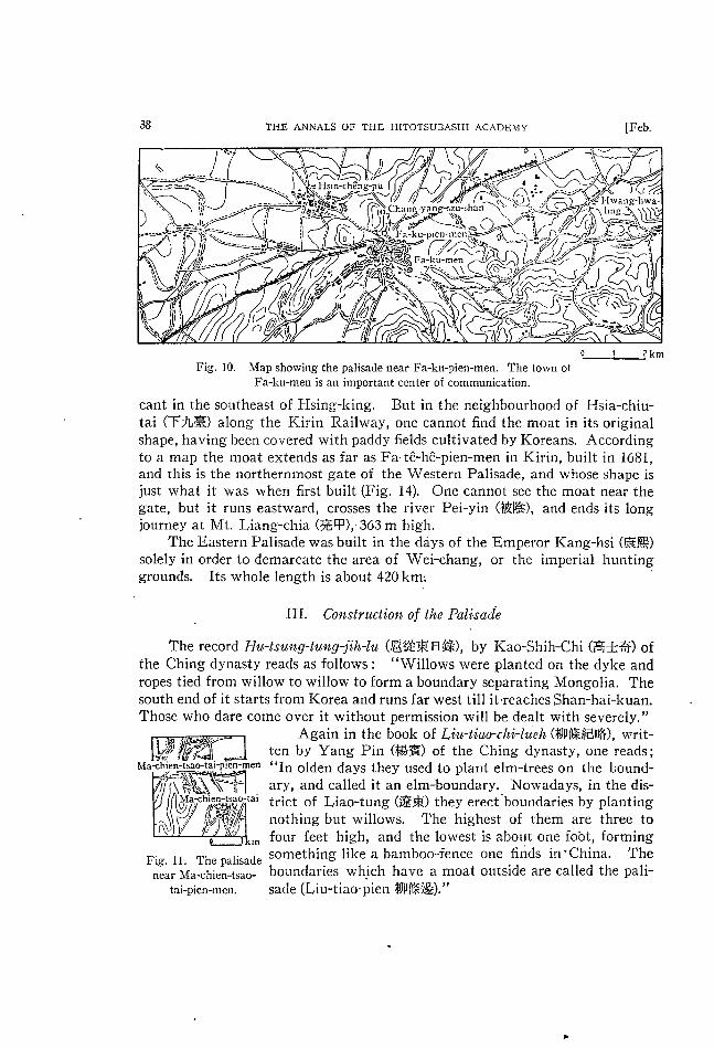
(~~~~D, and reaches Fa-ku-pien-men (~~~
,~~~f~), via Chang-wu-tai-pien-men Shong-nien-pan-kou 1687 (26th of Kon~g-hsi). The original ;~; (*'~.'~~~~~p~) which was founded in ~ ~1~=--..-.----~~~'~~~
shape of the moat in this part, except where it runs along hills, is not pre- ~ * ~l :/heng~:hla-wo-men ~ I~ served owing to frequent floods of the ' ~~ ~! river Liao-ho.
Fa-ku-pien-men was built in 1662,
the first year of Kang-hsi, and its gate can be seen even now (Fig. 10).
But the shape of the gate remains so remarkab, Ie that one cannot but wonder if it was not a successor to the
original one. From here the moat goes east, passing through Pai-chia-kou (#1~~?~;) and San-tai-tzu (Ei~~~F),
and reaches Ma~hien-tai-pien-men (,~~:,.~
sung-hng-tzu~Jen-men
!" ~'~~ )* ~*
': ' o
Fig. 6.
2 krrl
The palisade near Sun~-1ing-
tzu-pien-men.

19511 STuDY oN THJ~; PALISADE IN ltiANCHURlA
f~~.~~!"~~~c',f~) (Fig. 11) in the neighbourhood of
Yang-chia-wo-peng (~~;~~~i~D. At this point
neither the gate nor the moat can be seen, as this part is being cultivated. It seems the
gate was destroyed at some time since 1912. The palisade extends from here to Wei-ytian-
pu-pien-men, after crossing the Manchurian Railway from west -to east, and at the point
where it meets the railway, the original shape is very well kept and a wooden pillar standing at the spot indicates "the site of
37
/ :~~~ Chao-ki a-t
' .___J~
Fig. 8. The palisade near Ching-ho-pien-men.
day (Fig. 12). The scenery here is simply lovely and the place is a favourite
with the citizens of Ssu-ping-chieh
well in this part. To reach H~-~r-su-pien-men (~~~~:~~~~p~), founded
l kn]
Fig. 7. The pahsade near Chiu-kuan-tai-men.
the Palrsade." From a point ~ - . 5 km north of Kai-yuan, the moat runs ~-' ・・ ':~
' ~~.r'i --. '-~ northward along the eastern side of
the railway. One can see the moat quite well r,ear Chuan-tow (7~~i) Sta-
- tion where the moat comes closest to the line.
un - Pan-1a~;han-pien-men (~~~~CLLI~~F~) ~~krnwa:s founded in 1681 (20th of Koneg-hsi)
and its original shape . remains to this
(~II2~T'~). One can see the moat very
in 1681, one has to go farther north,
although no gate remains there now
(Fig. 13). But at the entrance of Erh-shih-chia-tzu (~+~~~F), which
lies 5 km north of this gate, one
can find stumps of willow trees, planted in the olden days, remain-
ing on the dyke 2 km long at an interval of 2 m between the two stumps. This fact serves to show that willow trees were in-dispensable in the construction of
the palisade.
Although one finds no gate at I-tung-pien-men (~~~~li~~F~) which
was built i'n 1681, the moat in its original shape can be seen here and
there that part going north from this
point. This is particularly signifi-
~: /;
~~~ ~~ ~ ~' -~: }~~~i~~:.. "' .,~
'~ ' )!' . ~' s-- '_"' ' '(1~;:',_ .. '-~ f~~;
' " 'Tou-tai Feiipie~ 'r~(;~;u ~;' .' ' . . . ~: ~"' 1~,
Er_h-ta]-tzu
t~I~:~ ' / I ' k/1:.'i ' '
. ' ~/~~~if7' ~7i~~~~~~;L~~'/1"~'
~!!~(~ Pai-tu~hang len-men
~JLJ2 km Fig' 9' The palisade near pai-tu-chang-
Pien-men'
38 THn ANNALS OF TH~; I-IITOTSUBASHI ACADEMY [Feb.
*~
J
2 km
Fig. 10. Map showing the palisade near Fa-ku-pien-men. The town ot
Fa-ku-men is an important center of communication.
cant in the southeast of Hsing-king. But in the neighbourhood of l~lsia-chiu-tai (T)L~) along the Kirin Railway, one cannot find the moat in its origir}.al
shape, having been covered with paddy fields cultivated by Koreans. According
to a map the moat extends as far as Fa-t~-h~-pien-men in Kirin, built in 1681,
and this is the northernmost gate of the Western Palisade, and whose shape is just what it was when first built (Fig. 14). One cannot see the moat near the
gate, but it runs eastward, crosses the river Pei-yin (~j~~:), and ends its long
journey at Mt. Liang-chia (i~~~~p),.363 m high.
The Eastern Palisade was built in the days of the Emperor Kang-hsi (~~~;)
solely in order to demarcate the area of Wei-chang, or the imperial hunting
grounds. Its whole length is about 420 km: '
III. Coctstructioft of the Palisade
The record Hu-tsufeg-tuleglfih-la (~~~=~:~: ~l~~c), by Kao-Shih-Chi (~~~~=・--・"*ti:~:) of
the Ching dynasty reads as follows : "Willows were planted on the dyke and
ropes tied from ¥villow to willow to form a boundary separating Mongolia. The
south end of it starts from Korea and runs far west till it・reaches Shan-hai-kuan. Those who dare come over it without permission will be dealt with severely."
Again in the book of Liee-tiao-chi-liteh (~p~~~E~~), writ-
ten by Yang Pin (~~~:) of the Ching dynasty, one reads; Ma~h!en-tsao-ta*-plen-men "In olden days they used to plant elm-trees on the bound-
ary, and called it an elm-boundary. Nowadays, in the dis-trict of Liao-tung (~i~~:) they erect'boundaries by planting
nothing but willows. The highest of them are three to four feet high, and the lowest is about one fobt, forming
Fig. Il. The palisade something' Iike a bamboo-fence one finds in'China. The
near Ma-chien-tsac~ boundaries which have a moat outside are called the pali-
tai-pien-men. sade (Liu-tiao-pien ~n~~;,.~~~;). "

195l] STUDY ON TnE PALISADl~ IN MANCHURIA 39
The
The
Western Palisade
N'ame ot the Gate
Mt. Tui- tzu Min- shui- tang- pien- men
Pai- shih- tsui- pien- men
Li- shu- kou- pien- men
HsiD- tai- pien- men Sung- Iing- pien- men Chiu- kuan- tai- pien- men
Ching- ho- pien- men Pai- tu- chang- pien- men
Chang- wu- tai- pien- men
Fa- ku- ' men pren-
Wei- yuan- pu- pien- men
Pan- Ia- shan- pien- men
H~- ~r- su- pien- men tung- ' pren-
Fa- t~- h~- pien- men
Mt, chia Liang- .
Eastern Palisade
Wei- ytian- pu- pien- men
Ying- ^- ' plen- men e
Hsing- ching- pien- men Chien- chang- pien- men
Ai- yang- pien- men Feng-huang~heng-pien-men The coast of Korea Bay
(~~
(n~
(~~
(~!
(~f,
(~ ( jt
( i~
(~~
(+**,,'
(~~
(r~:
(~ (~~i
(1~
(i~~
(*jL*
(~~Z
(~~
(~~f
(~~
(~~
(1~L
7k
~~ ~~r~~
~~ B~ ~~T
:t:
~; j~I~
~~
~1~
i~i
~~
;~~
~i
~ ~~ ~{~
~~:
~ ~~
9~;
t~
~~
~i~
~ ~:*__*
~l
~.~~
pl*->
M1
i~;.<
~~
Length of the Pansade
A**i.*t ti~' P****t ti~* uJ)
> 27.61"' 21.6k* ~~ r~) > 40.3 22.9 ~~~ F1)
> 4・2 o ~~~ rl) > 34・o 4.05 ~~ rl) > 60.0 38.55
~~ F~) ~
48 35 16.7 ~~ r~) '
~~: P1)> 35.0 19.0 ~~ r~) 42.65 41.75 ~~ rl)> 97.0 92.3
> 67.5 65.7 ~~ r~) - > 80.8 58.7 ~~; F~)¥
69 35 33.4 ~
~~; F~) ' 50 7 39 o ~~; F1) ' ' ~~ rl)/ 61.2 55.9
>159.55 147.2 i~~ pl)
> 15.0 15.0 ~l)
~~
~~ ~~ ~~;
~~
~~
893.2
f;; 75 ok* : ' 85'o
F~) > 95'o
F1)~ 40'o
F~)~ 65'o r~)( 60'o
571.75
420.0
Prom the above-mentioned records, it is clear
that the palisade consists of a dyke with willow trees planted on it, and a moat running along side.
According to sorne books, the height of the dyke is three feet and its width three feet. The moat is
five fe~t in depth and flve fep-t in width, so that if
the dyke ar!.d the moat were measured・ together, both the height and the depth would bc eight feet
each. Amon*" the palisades I inspected for my research, I could not find any moat of this type,
but I happened to come across.some moats which were on an inclining plane and which wer~ two to three feet deep, beaten by the weather. Those parts
"~~'~~ ~:~¥~:{ ~/'
/~~l~i~ ~' ¥ _' .~' t ¥¥ ; ,, i -)~~L-
i~hia~hih-kou~¥ ."' ' ~' . I~(~~ _/i"'~7~;~f:t_'
' ~/1'::'~:Pan-la~han-pien-men "I ' ' rc-): ~~!~ ~~;~~~~:; -/: ~
' ' 11 ---'~(~~_ ({ !f '-'~L~~?~~d~. f [ ~f . , ,~_~;C~,' ': _, ~
~~; ・ e; ~ ', .' ¥~. '~"' ~ ~f]~t ' !~ _ . ~~)~21~~ir¥;~~;~~i~32P ~~//~i~;~/-'(~~~~(~;:)~!~~;!J'::1
'r~ Ying-cheng-tlu
Fig. 12. The palisade o~!-Jkm
near Pan-la-shan-pien-men.
40THE ANNALS OF THE HITOTSUBASI・王I ACADEMY
] Fig-13. The palisade near Hε_套r_
su-P1en-m㎝.
Anyway,the moat on the Mongolian side and the dyke on the Manchu.
rian side comprise the palisade,and on the dyke willows are planted at a丘xed
i・t・…1…d・・p・・ti・dfmm…will・wt・…th・・;th・wi11・w・,・p…di㎎。。ttbeir branches,are thus turned convcnient1y into a fence.
[Fe止.
one丘nds to be4.5km in the south o正Pan-1a-
shan-pien-men(Fig.15),and near Chuan-tow
St・ti・・,th・m・・tg・t・…yd・・p.B・ti・g。一
nera1,the depth of the moat is1.5m,the width,
3.5m,and the height of the dyke1.5m andthe
width2.0m(Fig.16).
Some of the old stumps of the wi11ows
which remain to this day can be found at Shih-pai-1ing. But they served as fuel for the
peop1efrom the ancient days and it is quite rare
to乱1d any of them now. In the dyke of the
P・1i・・d・i・th・…th・fth・…d・・㎜i・gf・・mErh-shih-chia-tzu to He一εr利一pien-men,one can
m丘nd stumps which are considered as remains
of ancient wi11ows in the range extending over
2km at an interval of2meters.
o - 2k㎜
Fig,14. Map showing the distribution of the palisade mar Fa-tε一h←pien-men and
the terminal point of it at Mt.Liang-chia.
At strategic points gates were constructed.The
・」二一、’駄,1二庶、;f,la肌榊e苫1n孟鴛1輔;薫;12
o←レー一}H Pa1lsade,and one gate of the Eastern Pa11sadeFig・15・C㎝・t・u・tion ofth・Tho・e pa… whe・e one can丘nd gate.nowaday、、、、二
gate.Pan-la-shan-pien-men. from the south: Sung-1ing-pien-men, Chilコg-ho-
a is4.50叫b5.50m,c5,95m pien-men,Pai-tu-chang-pien-me1〕,Fa-ku-pien-men,
帥d d2.80m Pan-la-shan-pien-men, Fa-tε一hε一pien-men, Not

19511 STUDY ON THE PALISADF; IN MANCHURIA 41
1 11 ■
4 κ /彬ノ ノ
,■
ノ γ ノノノ ノ z7
2。』’
’一 、
一 ■」≡」
%’
,ノ z 4 ノ 4完
% / 先 % /z■
‘’一 劣
■
3 1 ノ
ク ク / 7ク■■7・
κ
13 ノ
1 ■
% ノ
7。ノア
4 i1ヱ
1
% ノ % ’ / 4 7 / / 7I 4
4
5 坦
ノ アア
一
i5 7勿%妨% ■ン7 ノ 7
I6 別 7
% ノ ノ ’
〃ノ ノ
’
1砺『
7 z ノ ノ 勿
77 4
’一
8 ノ ’
’i
ノ ’
%
z’’
sノ’
勿 7 z二 廿ノ
引一
劣7 ア
1κ7
」ア
z ノ■/
/
’ 一■,
日
I 7力 ■
7’完
■
Fig. 16. Cross-section of the moat and dyke of the palisade in Manchuria.
1 .At the northern side of Chiu-kuan-tai village, 2,..At HoH~hia-wo-peng (f・7~~~~~D near Chang-wu-tai. 3JL . .Near Fa-ku-pien-men. 5-6. . .At the vicinity of Ma-chien-tsao-tai-pien-men. 7. ..At
Wei-ytian-pu ・plen-men. 8-10...At "the site of the palisade. " 11 ...At Chuan-tow Station. 12... At Pan-1a-shan-pien-men. 1 3 . . .At He-er-su village, 1 4. . ,Near Erh-shih-chia-tzu village. 1 5 . . .
At I-tung-pien-men. 16-22...At the southern side of Shih-pai-1ing, 23-26...At Hsin-1i-tun, 27... At Pai tu~:hang-pien-men (This palisade is of Min dynasty), 28...At Ling-ttmg village near Ching-
ho-pien-men (dyke is uncertain),

42 THF: AN¥=AI.S OF T 1-1 F. i IITO TSUBASHr AC*¥DE~iV [Feb.
l' i-s~sikno tu~~lPlenen~mej~~//~~I ~: j::
paiFshihd'tsuil-Pien"men
Min-shuitang~pjenmen (1'tr"N'
The palisade of Min dvnasty
The palisade of Ching dynasty Fa-t~*he-Chang~:hunE~ Pien-men
I-tungl)ien-men
H~er~u-pien-men Pan-la~han-plen-men
ra-ku-pien-men wei-ytan-pu-pien-men Chang-wu-tal-plen-men s]
Kai-ytian Pal-tu~:hang-plen-nlen ying~-pien-men
Ching-ho-pien-men
Chiu-kuan-tai-pien-men a Moukden Hing-ki~1gJlen-men
Sung Img p en men - Chin~hou / C~ien~:hang-plenlTlen
/ Shan-hal*kuan
A i-yang-pien-men A / _ Feng-huang-plcn-Tne:l
b_J_.~sa
Fig. 17. Map showing the distributio~ oi the palisade in _Manchuria.
only in their size, heigh.t, width and type are they uniform, but in having a
station for guards on the left-hand side of the gate, on the inner side (Fig. 18),
, that is, on the Manchurian side.~ 'At Wei-yiian-pu-pien-men and Pan-la-shan-
pien-men one can still see t~e stations which have stood the weather well to '
this day. One can easily understand that the gates served as important places
for traf~c, judging from the fact that only one or two roads meet inside t~e
gate (Manchurian side), while more than two roads run into the Mongolian
From the foregoing explanatidil, I think the readers will gather that the
dyke with willows planted on it, and the moat lying outside of the dyke, and
the gate, pien-men (~~;rl~),14 are indispensable to the construction of the palisade
(Fig. 19). The reason why the palisadj~ could achieve its desired end with this
simple construction is that the trafiic in'thbse days was not at all heavy, and
was mainly by carriag'es. The incomings and out-goings of horses and car-riag"es must have been watched over witho~t any djfHculty. And it could 3uccessfully prevent the invasion ot~-nomadic people in the Ching dynasty, ,who
came with their cattle see;(ing new pastures. '
" Pien-men or Men mcans a barrler-entrance or a harrier-gate. We can see that bot_h the gates and entrances have contribLrted not a little to the development of markets or towns and also have done great service to the civilization or culture of the time when they were constructed.

1951] ~'1'L,1)¥~ ()¥' 'l* I I l, l ).¥ I . Jh_¥1 )i~ I¥ ll*¥¥'L'IIL:RI ¥ 4 .3
l¥*. C'o ,1 c ! u s i o ll
¥Vhat ¥'alue has this study on
the palisades, on human ob'eography,
pf}rticul.*,ril, on politlcal g"eography?
If ¥¥"e ¥-ic¥v this from a theore-
tical point, the palisade is one ot
the important forms in the de¥-clop-
ment of I)Oun(laries , a fact confirm-
ed by many g_"co.~~ra.pher~~.
A fence o_r zln carthen ¥¥'flil i~
built llroun(1 h~~,uscs, and this deve-
10ps into a citadel surroundin_~: El
city ; this de¥'elops;~ into the forln 1~'j<_'. 1<~' .. . ¥TI ancient ~uar(1-hollsc ,'.t
of the Great ¥~,rall of China or tllc ¥¥'(・i-i,ii~lll-1)ll-1)icn-mcll'
Roman C.it<・,del. In the proccss of thc l~oun(12lrics from thi~.' b'tag'c to this day when a bouncl.;~_ry js (i('tel~mine(1 by tretlties, tlle j]~ili:-~.".(1e s'er¥'es as' an important
" Mittelglicd." The palisadc, being differellt from man_¥' boundcrrles of walls,
has colonization as itb- main objcct and has for its second object the preven
tion of enemy invasionb'. This can be considered, therefore, as an economic
boundary. If ¥'It::'¥ve(1 from its practic_al use, the_ palisade in thos e days F,erved to separate
~~anchuria frorn ¥ron.<~"olia and did much to benefit Manchuria. In other words
the pali~~ade s,erved to separate the moist plains of Manchuria from the dry plains of ~,'Ton*"'olia, and o~a¥re the role of cultivation to Manchuria and that of
cattle llerding' to ~/fon'{~'olia. C'.onscquently this had a big influence on the de-
velopmcnt of industry Flnd culture in the Chin'b" dynasty. It is quite reasonable
to believe that il~dustries, citizent)~', and cities should centre about the east on
the Manchurian si(le ¥¥'here there is plentyt)f rain; and that sheep, paoes, or
e '~~tht$!,*'
I~j~. I ().
ff)r
Thc pali',, rt,Ic-;~atc, ra-1.:1~-pien-mcn and thc '~. tation '
;~llrlr(Is ill ~~~r)'1('rll ~;t¥ l(' af thc to~¥'n of 1"a-kll.
lama temples ¥¥'ould centre
on the Mongolian side where there is less rain, if weather
and soil stimulated botanical
g'ro¥vth, on ¥vhich animal li¥'es depended, and human activities depended on those
thin:.'~s. The palisade must
hav,e contrlbuted much to-¥vard the individual develop-
ment by (lividing these dis-
tricts from each other.
From the viewpoint of
44 THF ANNALS OF THE HITOTSUBASHI AcADEMY
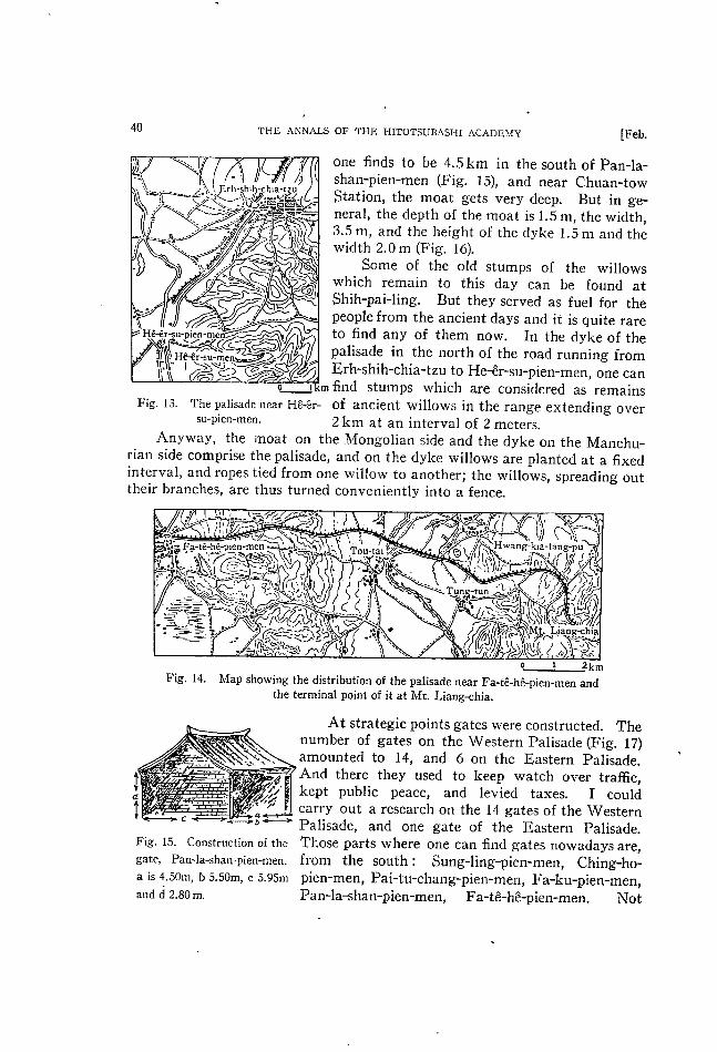
m.t・。i・1.f。。。t・dy,th・・t・dy山h・p・li・・d・…ldg…tlyも…丘tt止i・th…y
of boundaries.Just as Gamett15of the American Geological Surマey greatly
contributed to the theory of boundaries by his“Boundaries of America”and
Cohausen of Germany did1ikewise by his elaborate work on“Limes,”16this
study on the palisade can do much toward geography through data. Th;s is
because those data are recently compi1ed ones dealing with the present state of
the palisade,its construction and distribution.By this research it became clear
that the pa1isade belollgs to the same category of va1lum or dyke,simila-to
OHa’s Dyke or Trajanswa1l.17Also it has become evident that in Transy1vania
where there are few stones as in Mlanchuria,dykes are being constructed.The
fact that{he present state of many of the gates and stations found on the pali-
sade c〇三ncides with ancient records while their uniformity in form,construction
and position over a wide of gOOkm speaks plain1y how the Ching dynasty pros-
pered in those days,and how complete was the legislative system.
In other words,the palisade was“the national boundary which is the out-
come of its activities,”18and at the same time it was the acme of the1iYing
world. That is,“in the primitive days of apathetica1conception,those boun-
daries,to the people1iving in them,were the farthest points where their ne-
cessary food was avai1able.” Mloreover in the exten§ively wide f1at area of
Manchuria and M1ongo1ia,it was the best way to divide the two1ands by such
an arti五cia1obstac1e.
In short,the palisade is,from the natural point,a direct product of proper
1andscape(Landschaft)in Manch1コria and Mongo1ia,whi1e from the humanstandpoint,it is a product brought into existence by the mode of living in the
Ching dynasty.A1so,to the boundary between the two countries is very c1o-
sely knit together by mercanti1e tra冊c,human and vehecular tra冊c,and the
collecting of taxes,so that it was necessary to have a c1earcut boundary1ine.
Seeing that this was so,it might be said that the signi丘cance of the palisade
is great and that studies conceming the same are of considerab1e va1ue.
⑪
15H.Gannett,“Boundaries of the U口ited StatesI”肋〃.o〃伽び一5一αo1.∫“凧1No-226(1904),
pp-1_145. 11Limes is called“Limes Germanicus”or“Pfahlgmben。” It js a typ…cai arti拓cial boundary,erected in the s㏄ond century,separating the Roman Empire fmm Germama・It staTts fmm Rhei皿一brohl and reaches to the upper of the Dambe・crossing the Rhein・Its whole length is540km・一
A.von Co!1ausen,D〃五δ伽〃“加θ〃椛2刎囮〃加D舳な‘”佃伽d(188千)一 H Tmjanswall which was built by Romans is a boundorydyke m Rumania between Axiopolis and
Cons[antsa一_R-Hennig、αψo舳后(’928)。p.112. 1口Fr.Ratze1,Po1洲∫‘加Gωg柵ク1榊(1923),p.386_387.
Pri口ted at tho S臣n駝ido Pr巴s.Kand副.Tokyo一