technology - ossga · technology be even more ... a camera capable of high resolution ... the...
TRANSCRIPT
14 AVENUES
TECHNOLOGY
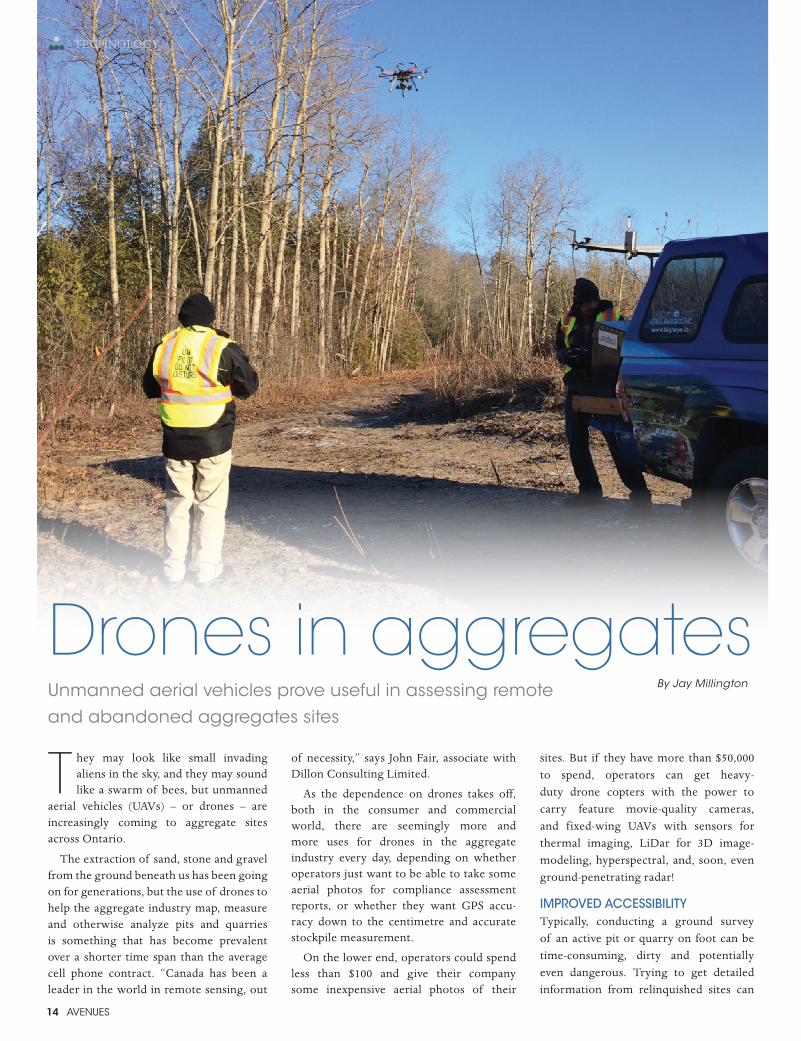
T hey may look like small invading aliens in the sky, and they may sound like a swarm of bees, but unmanned
aerial vehicles (UAVs) – or drones – are increasingly coming to aggregate sites across Ontario.
The extraction of sand, stone and gravel from the ground beneath us has been going on for generations, but the use of drones to help the aggregate industry map, measure and otherwise analyze pits and quarries is something that has become prevalent over a shorter time span than the average cell phone contract. “Canada has been a leader in the world in remote sensing, out
of necessity,” says John Fair, associate with Dillon Consulting Limited.
As the dependence on drones takes off, both in the consumer and commercial world, there are seemingly more and more uses for drones in the aggregate industry every day, depending on whether operators just want to be able to take some aerial photos for compliance assessment reports, or whether they want GPS accu-racy down to the centimetre and accurate stockpile measurement.
On the lower end, operators could spend less than $100 and give their company some inexpensive aerial photos of their
sites. But if they have more than $50,000 to spend, operators can get heavy-duty drone copters with the power to carry feature movie-quality cameras, and fixed-wing UAVs with sensors for thermal imaging, LiDar for 3D image-modeling, hyperspectral, and, soon, even ground-penetrating radar!
IMPROVED ACCESSIBILITYTypically, conducting a ground survey of an active pit or quarry on foot can be time-consuming, dirty and potentially even dangerous. Trying to get detailed information from relinquished sites can
Drones in aggregatesBy Jay MillingtonUnmanned aerial vehicles prove useful in assessing remote
and abandoned aggregates sites
AVENUES 15
TECHNOLOGY
be even more difficult and possibly more dangerous. For Erica Rumbolt, senior field technician for the Ontario Aggregate Resources Corporation (TOARC), her job often takes her to abandoned pits and quarries across Ontario, where there can be little or no chance of gaining access to the property where the site is located to conduct a survey.
“Another main difficulty is accessibility in regards to remote sites located in forested areas,” says Rumbolt. “Sometimes roads have been washed out or the walking path is extremely overgrown. A drone could access these sites and complete an inventory.”
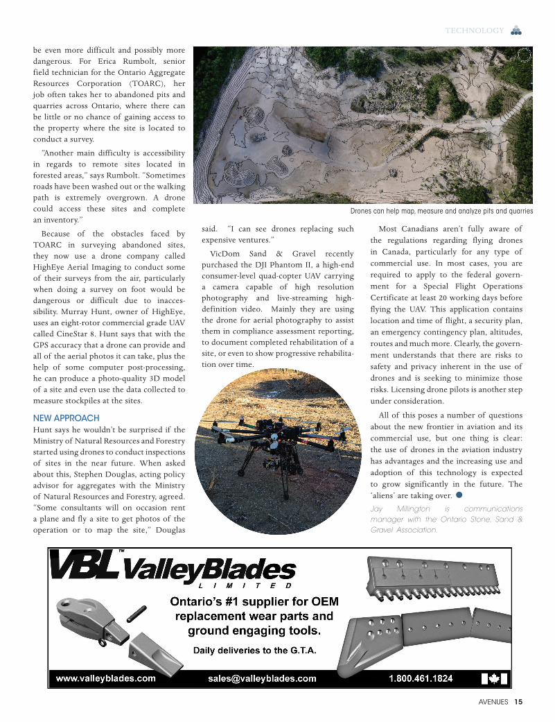
Because of the obstacles faced by TOARC in surveying abandoned sites, they now use a drone company called HighEye Aerial Imaging to conduct some of their surveys from the air, particularly when doing a survey on foot would be dangerous or difficult due to inacces-sibility. Murray Hunt, owner of HighEye, uses an eight-rotor commercial grade UAV called CineStar 8. Hunt says that with the GPS accuracy that a drone can provide and all of the aerial photos it can take, plus the help of some computer post-processing, he can produce a photo-quality 3D model of a site and even use the data collected to measure stockpiles at the sites.
NEW APPROACHHunt says he wouldn’t be surprised if the Ministry of Natural Resources and Forestry started using drones to conduct inspections of sites in the near future. When asked about this, Stephen Douglas, acting policy advisor for aggregates with the Ministry of Natural Resources and Forestry, agreed. “Some consultants will on occasion rent a plane and fly a site to get photos of the operation or to map the site,” Douglas
said. “I can see drones replacing such expensive ventures.”
VicDom Sand & Gravel recently purchased the DJI Phantom II, a high-end consumer-level quad-copter UAV carrying a camera capable of high resolution photography and live-streaming high-definition video. Mainly they are using the drone for aerial photography to assist them in compliance assessment reporting, to document completed rehabilitation of a site, or even to show progressive rehabilita-tion over time.
Most Canadians aren’t fully aware of the regulations regarding flying drones in Canada, particularly for any type of commercial use. In most cases, you are required to apply to the federal govern-ment for a Special Flight Operations Certificate at least 20 working days before flying the UAV. This application contains location and time of flight, a security plan, an emergency contingency plan, altitudes, routes and much more. Clearly, the govern-ment understands that there are risks to safety and privacy inherent in the use of drones and is seeking to minimize those risks. Licensing drone pilots is another step under consideration.
All of this poses a number of questions about the new frontier in aviation and its commercial use, but one thing is clear: the use of drones in the aviation industry has advantages and the increasing use and adoption of this technology is expected to grow significantly in the future. The ‘aliens’ are taking over. •Jay Millington is communications manager with the Ontario Stone, Sand & Gravel Association.
Drones can help map, measure and analyze pits and quarries