technical report on the coles hill … · technical report on the coles hill uranium property...
TRANSCRIPT

TECHNICAL REPORT ON THE COLES HILL URANIUM PROPERTY PITTSYLVANIA COUNTY, VIRGINIA
NORTH DEPOSIT (Centered near: 36º52’43”N, 79º18’12”W)
&
SOUTH DEPOSIT (Centered near: 36º52’18”N, 79º18’00”W)
BY
Peter A. Christopher, PhD, P.Eng.
PAC GEOLOGICAL CONSULTING INC.
3707 West 34th Avenue
Vancouver, B.C., V6N 2K9 CANADA
DATED
November 6, 2007
FOR
Norman W. Reynolds, President and CEO
VIRGINIA URANIUM, INC.
231 Woodlawn Heights
Chatham, Virginia 24531 U.S.A.

Technical Report On The Coles Hill Uranium Property 2
Dr. Peter A. Christopher, P.Eng. November 2007 2
2.0 TABLE OF CONTENTS TECHNICAL REPORT ON THE COLES HILL URANIUM PROPERTY ................ 1 PITTSYLVANIA COUNTY, VIRGINIA.......................................................................... 1 3.0 SUMMARY .................................................................................................................... 4
3.1 Introduction.................................................................................................................. 4 3.2 Location and Access .................................................................................................... 4 3.3 Property Ownership & Terms of Agreement............................................................... 6 3.4 Geological Setting & Mineralization ........................................................................... 8 3.5 Deposit Type & Exploration Concept.......................................................................... 9 3.6 Status of Exploration, Development and Operations................................................... 9
Table 3.1 South Coles Hill Deposit and North Coles Hill Deposit historic “uranium reserve” estimates after 1982 PAH study . .................................................................. 11
3.7 Conclusions and Recommendations .......................................................................... 13 3.8 Opinion of Merit ........................................................................................................ 14
4.0 INTRODUCTION........................................................................................................ 14 4.1 Terms of Reference and Purpose ............................................................................... 14 4.2 Source of Information and Data................................................................................. 14 4.3 Field Involvement of the Qualified Person (Author)................................................. 14
5.0 RELIANCE ON OTHER EXPERTS......................................................................... 15 6.0 PROPERTY DESCRIPTION AND LOCATION (Figures 6.1 & 6.2) ................... 15
6.1 Property Area and Term of Agreement (Figures 6.1, 6.2 & 6.3; Table 6.1) ............. 15 6.2 Property Location (Figures 6.1, 6.2 & 6.3)................................................................ 16 6.3 Legal Survey .............................................................................................................. 16 6.4 Environmental Liabilities........................................................................................... 17 6.5 Workings on the Property .......................................................................................... 17
7.0 ACCESSIBILITY, LOCAL RESOURCES, CLIMATE, & PHYSIOGRAPHY .. 17 7.1 Access to the Property and Proximity to Population Center(s) ................................. 17
Figure 6.1 General Location of the Danville Basin and Coles Hill Uranium Deposit in Pittsylvania County, Virginia....................................................................................... 18 Figure 6.2 Topographic Plan, Coles Hill Area, Pittsylvania County, Virginia. .......... 19 Figure 6.3. Property Plan for the Coles Hill Uranium Property. ................................. 20 Figure 6.4. Plan of Lease Land Holdings. ................................................................... 21
7.2 Topography, Elevation and Vegetation ..................................................................... 21 7.3 Relevant Climate and Length of Operating Season................................................... 21 7.4 Availability of Surface Rights, Power, Water and Mining Personnel ....................... 22 7.5 Potential Areas for Tailings Disposal, Heap Leach Pads and Plant Sites.................. 23
8.0 HISTORY ..................................................................................................................... 23 8.1 Historic Resources and Reserves ............................................................................... 24
Table 8.1 South Coles Hill Deposit and North Coles Hill Deposit historic “uranium reserve” estimates after 1982 PAH study . .................................................................. 28
9.0 GEOLOGICAL SETTING ......................................................................................... 29 9.1 Regional Geological Setting (Fig. 9.1) ...................................................................... 29 9.2 Property and Local Geology (Fig. 9.2) ...................................................................... 29
9.3 Structural Setting ....................................................................................................... 29 Figure 9.1. Regional Tectonic and Geologic Setting of the CHUP............................. 30

Technical Report On The Coles Hill Uranium Property 3
Dr. Peter A. Christopher, P.Eng. November 2007 3
Figue 9.2. Geologic map of Coles Hill area (from Jerden, 2001; after Marline, 1983; Henika and Thayer, 1983 and Lineberger, 1983). ....................................................... 31 Figure 9.3. Geologic cross-section X-X’ (Fig. 2) (from Jerden, 2001). ...................... 31
10.0 DEPOSIT TYPES (Figure 10.1) ............................................................................... 32 Figure 10.2 Schematic Block Model Showing Phases of veining in the Coles Hill Uranium Deposit (from Jerden and Sinha, 1999). ....................................................... 32
11.0 MINERALIZATION ................................................................................................. 33 12.0 EXPLORATION........................................................................................................ 36 13.0 HISTORIC DRILLING ............................................................................................ 36
Figure 13.1. Plan of Drill Holes Used to Evaluate South Coles Hill Deposit. ............ 37 Figure 13.2. Plan of Drill Holes Used to Evaluate North Coles Hill Deposit. ............ 38
14.0 SAMPLING METHOD AND APPROACH ........................................................... 39 15.0 SAMPLE PREPARATION, ANALYSIS AND SECURITY ................................. 39 16.0 DATA VERIFICATION ........................................................................................... 39 17.0 ADJACENT MINERAL PROPERTIES ................................................................. 39 18.0 MINERAL PROCESSING AND METALLURGICAL TESTING...................... 39 19.0 MINERAL RESOURCE AND MINERAL RESERVE ESTIMATES................. 40 20.0 OTHER RELEVANT DATA AND INFORMATION ........................................... 40 21.0 INTERPRETATION AND CONCLUSIONS ......................................................... 40 22.0 RECOMMENDATIONS........................................................................................... 40
22.1 Recommended Phase 1 Exploration (Figure 22.1; Table 22.1) ............................... 40 22.2 Recommended Phase 2 Exploration and Development (Table 22.2) ...................... 41 22.3 Opinion of Merit ...................................................................................................... 41
Figure 22.1 Plan of Proposed Drill Holes, South Coles Hill Deposit.......................... 42 Figure 22.2 Plan of Proposed Drill Holes, North Coles Hill Deposit.......................... 43 TABLE 21.1. PROGRAM AND BUDGET FOR PHASE 1 ON CHUP Pittsylvania County, Virginia (Recommended and Warranted) ...................................................... 44 TABLE 21.2. PROGRAM AND BUDGET FOR PHASE 2 ON CHUP Pittsylvania County, Virginia (Recommended and Warranted) ...................................................... 45
23.0 REFERENCES AND SOURCES OF INFORMATION........................................ 46 24.0 SIGNATURE, STAMP AND DATE ........................................................................ 48 25.0 CERTIFICATE.......................................................................................................... 49

Technical Report On The Coles Hill Uranium Property 4
Dr. Peter A. Christopher, P.Eng. November 2007 4
3.0 SUMMARY
3.1 Introduction Virginia Uranium, Inc. (“Virginia Uranium” or the “Company”) has acquired the Coles Hill Uranium Property (“CHUP”). The CHUP is situated on privately controlled lands that hold the mineral rights. The radiometric anomaly associated with the CHUP was found in the late 1970s by Marline Uranium Corporation (“Marline”), a wholly owned subsidiary of Marline Oil Corporation. The property was drilled from 1979 until 1983 with 182 rotary-percussion holes (124,799 feet of core) and 74 NQ cores holes (65,082 feet) totalling 256 holes and 189,881 feet of core. Historic resource estimates (called reserve calculations at the time) were completed for Marline by Pincock, Allen and Holt (“PAH”) for the South and North Coles Hill deposits in August 1982. Virginia Uranium has leased or purchased the mineral rights to approximately a total of 2,137 acres and associated surface rights to 1,799 acres covering the South Coles Hill Deposit (“SCHD”) and the North Coles Hill Deposit (“NCHD”) as well as areas for additional exploration, mining operations, milling, waste management areas and set-backs. A Restricted Area of about 637 acres exists around the Coles Hill historic buildings and cultural areas that allows underground mining but not surface rights. The Company, at this time, does not have access to the complete data and information that was compiled as a result of the drilling in the period 1979 to 1982 and does not have access to the assay data or down hole gamma logs or the details of the reserve study. Virginia Uranium is relying on Marline summary reports and discussions with the former president of Marline. Virginia Uranium retained Dr. Peter A. Christopher P.Eng. to prepare a report in compliance with National Instrument 43-101 (“NI43-101”) on the CHUP. The writer conducted a field examination of the CHUP, required for the preparation of this report, on January 16th, 2007 and viewed reports on the CHUP kept in Chatham on January 17th 2007. Furthermore, as of October 17, 2007, additional reports obtained from the Virginia Museum of Natural History in Martinsville and the Division of Mines, Mineral and Energy in Charlottesville regarding the CHUP were reviewed and found to be consistent with the previously reviewed information.
3.2 Location and Access The CHUP is situated in Pittsylvania County in south central Virginia and is composed of both the SCHD and the NCHD. The property is 6 miles (10KM) northeast of Chatham, Virginia the county seat, which has a population of about 1,500 people and is 20 miles (32KM) north of Danville, Virginia the largest city in Pittsylvania County with a population of about 50,000 people. The Southside area of Virginia is a good source of supplies and labour and some geological personnel. However, mining and most exploration services and personnel will initially need to be acquired from outside the local area. Two separate uranium mineral deposits have been delineated on the CHUP, the SCHD is centered near latitude 36º52’18”N, longitude 79º18’00”W on the Spring Garden USGS 7.5-minute quadrangle topographic map, and the NCHD is centered near latitude

Technical Report On The Coles Hill Uranium Property 5
Dr. Peter A. Christopher, P.Eng. November 2007 5
36º52’43”N, longitude 79º18’12W” on the Gretna USGS 7.5-minute quadrangle topographic map. The CHUP has easy and excellent road access from Danville through Chatham and from Chatham by secondary paved roads to the Coles gravel road (State Road 690) that bisects the project area. A number of dirt roads and lanes provide access to the Coles farm and Bowen farm lands that form the CHUP. The property consists of all of the Bowen farm lands and part of the Coles farm lands and is believed to cover all of the SCHD and most of the NCHD. The topography is subdued with typical rolling hills of the Piedmont Province having elevations ranging from about 560 feet in Mill Creek to under 700 feet. The area is drained by Mill and Whitethorn creeks with Mill entering Whitethorn Creek 1.4 miles east of the SCHD. Development of the North Coles Hill and South Coles Hill uranium deposits as a mine will likely require management of local surface drainage and groundwater and relocation of part of State Road 690. The Virginia power grid and a gas pipeline provide a local source of fuel and electrical power.

Technical Report On The Coles Hill Uranium Property 6
Dr. Peter A. Christopher, P.Eng. November 2007 6
3.3 Property Ownership & Terms of Agreement The CHUP consists of fee simple ownership and leasehold interests in the mineral and surface rights to a portion of the Coles property and the contiguous Bowen property as well as other properties as follows:
Surface MineralRights Rights
Item Acres AcresA Coles Hill, LLC Mineral Lease dated 4/4/07 252 904 (*)B Bowen Minerals, LLC Mineral Lease dated 4/4/07 112
252 1,016
C Crider Option for surface rights related to Bowen Mineral lease 112
D Burt land purchase dated 5/30/07 767 767
E Coles Option dated 5/31/07Parcel 1 148 148Parcel 2 206 206
354 354
F Marline purchase (recorded 8/9/07) 8 0
G Additional land purchased 10/10/07 226 226
H Additional land purchased 10/31/07 410 410
I Additional land purchased 11/6/07 167 167
Total Contiguous Project Area 2,296 2,940
(*) Protected Area in Coles Hill, LLC mineral lease restricts surface rights but allowsmineral rights by underground mining on about 652 acres (per 6/8/07 Ammedment)
The total mineral rights and leases cover approximately 2,940 acres (1,190 ha) with about a total of 2,296 acres (929 ha) in surface rights. Virginia Uranium and their legal counsel have satisfied themselves with respect to ownership and title to the CHUP. A description of the leases and acquisitions according to Virginia Uranium’s legal counsel is as follows: Acquisition of the Coles Lease and the Bowen Lease On April 4, 2007, Virginia Uranium entered into a deed of mineral lease with Bowen Minerals, LLC (the “Bowen Lease”) and a deed of mining lease with Coles Hill, LLC (the “Coles Lease” and collectively with the Bowen Lease, the “Leases”). Pursuant to the Leases, Virginia Uranium was granted the sole and exclusive right to drill, quarry, mine, process, store, remove and sell all of the uranium and all other fissionable source materials

Technical Report On The Coles Hill Uranium Property 7
Dr. Peter A. Christopher, P.Eng. November 2007 7
located on or under the lands of the two adjoining properties. The Leases expire on December 31, 2045, unless otherwise terminated or extended as agreed between the parties. The Coles Lease restricts activities in the Protected Area (as defined in the Coles Lease) to underground mining. Surface activities are only allowed by written permission of the owners of the surface of the Protected Area. Underground mining is permitted in the Protected Area as long as the mining does not disturb, harm or damage the historic or other structures located within the Protected Area or restrict the enjoyment thereof. On November 6, 2007, the owners of the surface rights gave written permission for ten holes to be drilled in the Protected Area. Land Acquisition and Option Agreements Pursuant to the terms of a land acquisition agreement dated May 22, 2007 among Fred W. Burt and Shirley C. Burt (the "Burts") and Virginia Uranium which contract was subsequently assigned to a company whose sole member is Virginia Uranium (“LandCo”). LandCo acquired approximately 767 acres of land contiguous to the South Coles Hill Deposit (the “Burt Lands”), excluding any mineral rights associated with the Burt Lands (the “Reserved Minerals”). LandCo also acquired an option to lease the Reserved Minerals (the “Burt Option”) from the Burts, which option may be exercised by LandCo at any time prior to 2045. Upon exercise of the Burt Option, Virginia Uranium through LandCo shall have the right to remove and sever all such Reserved Minerals from the Burt Lands. Pursuant to an option agreement (the “Crider Option Agreement”) dated June 1, 2007, between Roy Crider and Connie Crider (the "Criders") and Virginia Uranium, the Criders have granted to Virginia Uranium an option to purchase approximately 112 acres of land which covers part of the surface rights of the South Coles Hill Deposit exercisable for a period of 30 years commencing on June 1, 2007. The minerals rights under these 112 acres is covered by the Bowen Lease. Pursuant to an option agreement (the “Coles Option Agreement”) dated May 31, 2007, among Virginia Uranium, Walt Coles Sr. and Alice C. Coles, Virginia Uranium has acquired an option (the “Coles Option”) to purchase approximately 354 acres of land which covers the southern portion of the project area. It is exercisable for a period commencing after the Virginia General Assembly has enacted and the Governor of Virginia has signed legislation establishing a permitting program for Uranium and Virginia Uranium has received all necessary approvals to mine pursuant to a mining plan. The Coles Option expires on the earlier of the termination or expiration of the Coles Lease. Marline Property Purchase LandCo on behalf of Virginia Uranium purchased 8 acres of land that was owned by Marline and sold at auction for failure to pay real estate taxes to Pittsylvania County in July 2007. The deed was recorded on August 9, 2007. This purchase conveyed only the surface rights to Virginia Uranium and the mineral rights are retained by the churches that were part of Camp Pitt Church Camp.

Technical Report On The Coles Hill Uranium Property 8
Dr. Peter A. Christopher, P.Eng. November 2007 8
Additional Property Purchase of October 10, 2007 LandCo on behalf of Virginia Uranium purchased the surface rights to approximately 226 acres of non-contiguous property for set-back purposes on October 10, 2007. The original landowner retains the mineral rights but has granted LandCo the option to lease the mineral rights at any time prior to the year 2045. Upon the exercise of the mineral rights option, Virginia Uranium through LandCo shall have the right to at any time to remove and sever the mineral rights from this property for a period of twenty (20) years. Additional Property Purchase of October 31, 2007 LandCo on behalf of Virginia Uranium purchased approximately 410 acres of contiguous property on October 31, 2007 for process and set-back purposes. Additional Contiguous Property Purchase of November 6, 2007 LandCo on behalf of Virginia Uranium purchased approximately 167 acres of contiguous property on November 6, 2007. At closing, a fee simple title conveyed to LandCo. This property purchase will allow the non-contiguous property purchase of October 10th to be contiguous to the project site. The original landowner retains the mineral rights but has granted LandCo the option to lease the mineral rights at any time prior to the year 2045. Upon the exercise of the mineral rights option, Virginia Uranium through LandCo shall have the right to at any time to remove and sever the mineral rights from this property for a period of twenty (20) years. State Road 690 (Coles Road) The state road that goes through the property is a prescriptive easement in favor of the Commonwealth of Virginia but the mineral rights remain with the landowners. Prior to the relocation or closure of this road, consent will be requested from the Commonwealth of Virginia and/or local authorities. . 3.4 Geological Setting & Mineralization The CHUP, located in the Piedmont Geological Province of Virginia, consists of two approximately 350 m long and 250 m wide cylindrical mineral deposits (NCHD and SCHD). The deposits are hosted within a fault-bounded wedge of Precambrian or Paleozoic myolinitic quartzo-feldspathic gneiss and some amphibolite exposed along the Chatham fault zone at the faulted northwest margin of the Danville Triassic Basin. Initial cataclasis and brecciation along the Chatham fault zone resulted in hydrothermal events causing sodium metasomatism, chloritization, and argillization that were followed by hematization and uranium mineralization. The hydrothermal events may coextend and are coeval with Jurassic diabase dykes. Uranium mineralization occurs in three distinct episodes with the earliest and strongest mineralization consisting of coffinite and uranium rich apatite with chlorite and anatase in narrow (cm scale) zones within cataclasite and fault breccia. The initial phase is cut by calcite-pitchblende-anatase-pyrite and then by barium zeolite-pyrite-quartz-

Technical Report On The Coles Hill Uranium Property 9
Dr. Peter A. Christopher, P.Eng. November 2007 9
pitchblende-anatase vein sets. The productive phases are cut by three non ore mineral bearing phases dominated by chlorite, calcite and quartz, respectively. The writer collected a 1 meter chip sample from saprolitic soil and rock in a ditch at the discovery location along the west side of Coles Road. The sample contained 1,516.8 ppm uranium by Inductivity Coupled Plasma – Mass Spectrometry (“ICP-MS”). Oxidizing surface conditions generally remove uranium from near surface soils and weathered rock but recent road work exposed a small area of less oxidized and weathered material. A response from this small exposure allowed Marline’s 1978 vehicle-borne scintilometer survey to detect a large area of concealed uranium mineralization.
3.5 Deposit Type & Exploration Concept The Coles Hill uranium deposit is a fracture hosted deposit with uranium situated in cataclasite and fault gouge and cut by later and weaker uranium-zeolite and uranium-calcite veinlets. The deposit has characteristics of hydrothermal shear zone and vein type uranium deposits. Hydrothermal solutions and associated uranium mineralization was mobilized by the tectonic events related to formation of the Danville basin and intrusion along and movement on the Chatham Fault zone. Chemical and mineralogical changes of the host gneiss and amphibolite resulted in depletion of oxygen and neutralization of the uranium transporting solution with uranium mineralization deposited in areas of apatite enrichment and chloritization and hematization. Hematization of iron contained in magnetite and mafic minerals uses oxygen and results in a redox reaction that promotes deposition of uranium. Mineralization on the CHUP is associated with areas of increased hematite and reduced magnetite content that results in low magnetic signatures.
The uranium deposition at Coles Hill mechanism is similar to that in the Athabasca Basin as indicated by the presence of alteration minerals hematite, epidote and chlorite. The deposition mechanism in the Athabasca Basin has produced bonanza grade uranium mineralization which might occur in the untested deeper parts of the Coles Hill Deposits.
3.6 Status of Exploration, Development and Operations The CHUP (previously called the Swanson Uranium Project) was discovered by Marline in 1978 and extensively drilled by Marline between 1979 and 1982. After completion of grid drilling of the deposit Marline retained Pincock, Allen & Holt (“PAH”) in 1982 to estimate resources for the CHUP. The PAH resource estimates are summarized in Table 3.1. PAH estimated that the contained U3O8 in the SCHD varied from about 21 million pounds to about 55 million pounds as the cutoff grade was decreased from 0.150% U3O8 to 0.025% U3O8, and the contained U3O8 estimated for the NCHD varied from about 4 million pounds to about 54.5 million pounds as the cutoff grade was decreased from 0.150% U3O8 to 0.025% U3O8.
Other than site examinations, no current work has been conducted by Virginia Uranium to verify these historic estimates. Historic exploration programs are summarized below. The writer is of the opinion that exploration of the CHUP was conducted by Marline and Union Carbide to industry best practice standards of the time and as such the

Technical Report On The Coles Hill Uranium Property 10
Dr. Peter A. Christopher, P.Eng. November 2007 10
PAH estimates are considered to be both relevant, to the extent they establish the potential for mineral resources on the CHUP, and reliable. The PAH reported “reserves” are the equivalent of “resources” for purposes of NI 43-101 but the categories of resources can not be established without access to the historic data base.
PAH was a large engineering firm and its “reserve” estimates should have been
made using accepted 1982 methodology. The category of “reserve” as used by PAH in their 1982 estimate is not the equivalent to a “mineral reserve” as such term is currently defined in the CIM Definition Standards on Mineral Reserves and Mineral Resources and as such is not compliant with NI43-101 and should be treated as historic information and not to be considered as current reserves.

Technical Report On The Coles Hill Uranium Property 11
Dr. Peter A. Christopher, P.Eng. November 2007 11
Table 3.1 SCHD and NCHD historic “uranium reserve” estimates after PAH study (from reports titled “Geologic Reserves Coles Hill North Uranium Deposit” and “Geologic Reserves Coles Hill North Uranium Deposit” by Pincock, Allen & Holt, Inc. dated August 1982).
SOUTH COLES HILL DEPOSIT (“SCHD”)** %U3O8 Measured2 Indicated2 Totals*2 Cutoff Tons x
103 %U3O8 Tons
103 %U3O8 Tons
103 %U3O8 Pounds
103 0.150 3,282 0.232 1,457 0.209 4,739 0.225 21,326 0.125 3,891 0.217 1,781 0.196 5,672 0.210 23,922 0.100 4,760 0.198 3,690 0.154 8,450 0.179 30,251 0.075 5,618 0.180 8,332 0.116 13,950 0.142 39,618 0.050 8,734 0.137 12,978 0.097 21,712 0.113 49,069 0.025 13,342 0.103 16,353 0.085 29,695 0.093 55,233 * Minor change from PAH totals has resulted from rounding PAH numbers to nearest 103. ** Based on the downhole gamma %(e)U3O8 equivalents and subsequent confirmation by disequilibrium study. 2 Total tonnage above cutoff grade and average %U3O8 of that tonnage.
NORTH COLES HILL DEPOSIT (“NCHD”)** %U3O8 Measured2 Indicated2 Totals*2 Cutoff Tons x
103 %(e)U3O8 Tons
103 %(e)U3O8 Tons
103 %(e)U3O8 Pounds
103 0.150 557 0.204 376 0.225 933 0.212 3,956 0.125 1,066 0.170 869 0.172 1,935 0.170 6,579 0.100 2,657 0.133 2,974 0.127 5,631 0.130 14,641 0.075 5,298 0.109 6,439 0.104 11,737 0.106 24,882 0.050 11,002 0.085 14,923 0.080 25,925 0.082 42,517 0.025 17,188 0.068 24,749 0.063 41,937 0.065 54,518 * Minor change from PAH totals has resulted from rounding PAH numbers to nearest 103. ** Based on the downhole gamma %(e)U3O8 equivalents. 2 Total tonnage above cutoff grade and average %(e)U3O8 of that tonnage. Notes: 1. Estimates were reported as reserves but following CIM guidelines are considered by the writer to be historic measured and indicated resources requiring verification and current resource estimates and a current feasibility study. The PAH estimates can only be considered historic resources since no feasibility study was completed on the Coles Hill uranium deposit. 2. PAH used the cross section method with 100 foot spaced sections. Virginia Uranium has copies of the PAH historic “reserve estimates” but does not have the original assay sheets or details of the estimation methodology. Therefore, the writer cannot verify the resource or whether the estimate made prior to National Instrument 43-101 belong in the measured and indicated resource categories as defined by the CIM. The historic estimates may not be in compliance with current standards. Virginia Uranium is not relying on historic estimates. The Phase 1 program is planned to allow Virginia Uranium to obtain compliant current resource estimates and a preliminary assessment of the CHUP.
History The history of the Coles Hill uranium deposit’s exploration and development is highlighted in bullet form below:
• June 1977 Marline initiated ground radiometric reconnaissance survey. The 1977 activity was limited to carborne radiometric surveys.
Technical Report On The Coles Hill Uranium Property 12
Dr. Peter A. Christopher, P.Eng. November 2007 12
• Ground radiometric surveys led to discovery of uranium bearing rocks in mid-1978 and lease acquisition program started.
• In 1978 an extensive carborne radiometric survey was followed by a helicopter airborne gamma ray spectrometer and VLF EM survey over Danville Basin with ¼ mile flight lines and 175’ terrain clearance.
• Marline established an operating office in Danville in 1979 and in June 1979 exploration drilling initiated and continued to May 1982. Marline drilled 74 NQ (65,082’) and 206 six inch rotary – percussion holes with all core and 182 (124,799’) of the rotary holes used to delineate the NCHD and the SCHD.
• Pursuant to the Marline uranium discovery, the Virginia General Assembly in its 1981 session directed the Virginia Coal and Energy Commission (CEC) to undertake a study on the issue of uranium development in the Commonwealth, and specifically in Pittsylvania, County. The CEC commenced its study in April 1981 and created a Uranium Subcommittee in late summer of 1981.
• On October 1, 1981, the Board of Directors of Marline Oil Corporation voted to name the uranium mineral deposits at Coles Hill the Swanson Uranium Project in memory of Mr. Alaster G. Swanson, initial President and Chief Executive Officer of Marline. The historic name Swanson appears in some Marline reports produced after October 1, 1981.
• July 1982 Marline announcement of discovery of Coles Hill orebody. • The Uranium Subcommittee recommended in 1982 that Virginia adopt a statue
which would regulate the exploration of uranium ore. The recommendation was adopted through passage of Virginia Senate Bill 179, which also prohibited any Virginia agency from accepting permit applications for uranium mining before July 1, 1983, or until a program for permitting uranium mining is established by statute.
• Marline opened a public and government affairs office in Richmond in April 1982.
• December 1, 1982, Marline and Union Carbide Corporation (“Union Carbide”) enter an agreement with Union Carbide obtaining an 18 months option on the South Coles Hill Deposit to complete a feasibility study by June 1984 and must exercise option. (2 year extension possible if mining legislation not passed).
• On February 7, 1983, following the Uranium Subcommittee recommendations Senate Bill 155 (SB 155) established the Uranium Administration Group, charged with examination of uranium development “at specific sites in Pittsylvania County”.
• In 1985 the Uranium Subcommittee of the coal and energy commission and the uranium administrative group reported that “We now conclude that the moratorium on uranium development can be lifted if essential specific recommendations derived from the work of the Task Force are enacted into law.”
• From 1984 till the present time the CHUP has been studied and reported on by researchers at the Virginia Polytechnic Institute and State University (“Virginia Tech”). A dissertation was submitted to Virginia Tech entitled “Origin of Uranium Mineralization at Coles Hill Virginia (USA) and its Natural

Technical Report On The Coles Hill Uranium Property 13
Dr. Peter A. Christopher, P.Eng. November 2007 13
Attenuation within an Oxidizing Rock-Soil-Ground Water System” by Dr. James L. Jerden Jr. on September 21, 2001.
• Diamond drill core was donated to the Virginia Museum of Natural History and has been logged and carefully stored at the site. Cutting from RC holes were shipped to a radioactive disposal site in Colorado and are no longer available. The writer has not obtained access to the geochemical data base or to radiometric logs.
3.7 Conclusions and Recommendations The CHUP is an advanced staged exploration project that was brought to the feasibility study stage by Marline Uranium Corporation with joint venture participation of Union Carbide in the SCHD. The project contains sufficient “historic reserve” estimates for the State of Virginia to hold hearings and established the Uranium Administration Group, charged with examination of uranium development at Coles Hill. Regulatory permitting process delays extended into the 1980’s downturn in the uranium market and nuclear industry and the project was shelved with leased mineral rights eventually returned to the land owners. Uranium mining regulations were never finalized. The recommended Phase 1 program is intended to return the CHUP to the feasibility stage. The Phase 1 program includes acquisition and review of the Marline data bases, verification of historic drill results and once verified, digitizing of the drill results to allow for current resource estimates and a preliminary assessment (scoping study). Marline diamond drill core was donated to the Virginia Museum of Natural History (“VMNH”) and has been carefully stored on site. Virginia Uranium will attempt to obtain access to about 65,000 feet of stored core and with the participation of the museum, re-sample and assay previously split core for verification of results by comparison with previous assay records. Radiometric logs and historic reports referred to in studies conducted at Virginia Polytechnic Institute and State University (“Virginia Tech”) should be obtained. Phase 1 should include 41,000 feet (~12,500m) of confirmation and infill drilling with further equilibrium studies conducted on the North Coles Hill deposit. Proposed Phase 1 drill holes are shown in Figure 22.1. The writer estimates that a Phase 1 program of re-assaying existing drill core, 41,000 feet of NQ core drilling, land acquisition, community relations, a current resource estimates and a preliminary assessment of the CHUP will require a budget of US$10,000,000.00 (Table 22.1). The Phase 1 program is estimated to take 6-8 months to complete with some of the program continuing into Phase 2. The Phase 2 program will require continuation of baseline environmental studies, further drilling, metallurgical testing and engineering studies required for a feasibility study. Once mining regulations are established, a feasibility study should be completed. A budget of US$10,000,000.00 is estimated for the Phase 2 program (Table 22.2). The amount of drilling required will depend on the ability of Virginia Uranium to recover radiometric logs and the success of the Phase 1 verification drilling program. It assumes that Virginia Uranium will obtain access to the diamond drill core donated to the VMNH as well as radiometric logs and historic reports. The Phase 2 drill program should be constructed on the basis of Phase 1 results with the input of the engineering firm selected to complete the feasibility study.

Technical Report On The Coles Hill Uranium Property 14
Dr. Peter A. Christopher, P.Eng. November 2007 14
3.8 Opinion of Merit In the writer’s opinion, the character of the property is of sufficient merit to justify the recommended Phase 1 and Phase 2 programs and the programs represent worthwhile investment by Virginia Uranium. The writer believes that historic work suggests sufficient merit to warrant dealing with regulator issues that must be resolved before completion of a feasibility study.
4.0 INTRODUCTION
4.1 Terms of Reference and Purpose This Technical Report, prepared for Virginia Uranium, is to propose exploration to
further define mineralization and continue development of the CHUP in Pittsylvania County, south-central Virginia, USA. The report has been prepared in compliance with the requirements of National Instrument 43-101 and Form 43-101F1, and is for supporting documentation to be filed with the relevant securities commissions and the Toronto Stock Exchange.
4.2 Source of Information and Data The majority of the information for this report comes from reports and documents listed under the References and Sources of Information section of this report. Data was collected mainly from reports supplied by Virginia Uranium and extensive reporting of academic studies by faculty and students at Virginia Polytechnic Institute and State University. The writer believes that previous exploration conducted by Marline and Union Carbide used competent personnel for fieldwork and sampling and certified laboratories for analytical work. Historic analytical results were not available to the writer and reporting of analytical procedures is generally not to NI 43-101 standards. Diamond drill core was made available to the writer by the Virginia Museum of Natural History (“VMNH”) for review and spectrometer checking of mineralized section. The VMNH has agreed to make the core available to Virginia Uranium for exploration purposes. The writer personally examined the geological setting of the CHUP area on January 16th, 2007 and on January 17th, 2007 viewed reports on the CHUP kept by Virginia Uranium in Chatham, Virginia. The writer reviewed the geological setting of the CHUP with exploration geologists Norm Reynolds of Virginia Uranium and geologist William Henika currently at Virginia Tech and the geologist that originally mapped the area for the Virginia Division of Mineral Resources. Furthermore, as of October 17, 2007, additional reports obtained from the Virginia Museum of Natural History in Martinsville and the Division of Mines, Mineral and Energy in Charlottesville regarding the CHUP were reviewed and found to be consistent with the previously reviewed information.
4.3 Field Involvement of the Qualified Person (Author) The author of this report conducted a property examinations of the CHUP on
February 23rd and 24th, 2006 with geologists Norm Reynolds and William Henika with representatives of VMNH providing access to secured and archived historic drill core. The author also conducted a property examination of the CHUP on January 16th and 17th, 2007.

Technical Report On The Coles Hill Uranium Property 15
Dr. Peter A. Christopher, P.Eng. November 2007 15
5.0 RELIANCE ON OTHER EXPERTS The writer is required by NI 43-101 to include description of the property title and
terms of legal agreements that are presented in the following sections. The writer reviewed property agreements and title documents provided by Norm Reynolds, president of Virginia Uranium Inc., in order to provide summaries of title and ownership. Property agreements and title documents are legal matters and the author does not express any legal opinion as to the title or ownership of the CHUP.
6.0 PROPERTY DESCRIPTION AND LOCATION (Figures 6.1 & 6.2)
6.1 Property Area and Term of Agreement (Figures 6.1, 6.2 & 6.3; Table 6.1) The CHUP consists of fee simple ownership and leasehold interests in the mineral and surface rights to a portion of the Coles property and the contiguous Bowen property as well as other properties as follows:
Surface MineralRights Rights
Item Acres AcresA Coles Hill, LLC Mineral Lease dated 4/4/07 252 904 (*)B Bowen Minerals, LLC Mineral Lease dated 4/4/07 112
252 1,016
C Crider Option for surface rights related to Bowen Mineral lease 112
D Burt land purchase dated 5/30/07 767 767
E Coles Option dated 5/31/07Parcel 1 148 148Parcel 2 206 206
354 354
F Marline purchase (recorded 8/9/07) 8 0
G Additional land purchased 10/10/07 226 226
H Additional land purchased 10/31/07 410 410
I Additional land purchased 11/6/07 167 167
Total Contiguous Project Area 2,296 2,940
(*) Protected Area in Coles Hill, LLC mineral lease restricts surface rights but allowsmineral rights by underground mining on about 652 acres (per 6/8/07 Ammedment)
The total mineral rights and leases cover approximately 2,940 acres (1,190 ha) with about a total of 2,296 acres (929 ha) in surface rights. Virginia Uranium and their legal counsel have satisfied themselves with respect to ownership and title to the CHUP.

Technical Report On The Coles Hill Uranium Property 16
Dr. Peter A. Christopher, P.Eng. November 2007 16
The use of surface rights has been restricted by the leases in the area of the main Coles farm house (“Restricted Area”). Surveyed land plots are available in Chatham, the county seat. Virginia Uranium’s leased land covers the South Coles Hill Deposit and the North Coles Hill Deposit. The Company, at this time, does not have access to the complete data and information that was compiled as a result of the drilling in the period 1979 to 1982 and does not have access to the assay data or down-hole gamma logs or the details of the reserve study. Virginia Uranium is relying on Marline summary reports and the discussions with the former president of Marline. Some of the tonnage reported in the North Coles Hill Deposit extends into the Restricted Area of the surrounding lands. The type of mining that can be used in the Restricted Area has been limited to underground mining by the lease.
6.2 Property Location (Figures 6.1, 6.2 & 6.3) The CHUP is situated in Pittsylvania County in south central Virginia. The property is 6 miles (10KM) northeast of Chatham, the county seat, which has a population of about 1,500 people and is 20 miles (32KM) north of Danville, the largest city in Pittsylvania County with a population of about 50,000 people. The Southside area of Virginia is a good source of supplies and labour and some geological personnel but mining and most exploration services and personnel will initially need to be acquired from outside the local area. Two separate uranium mineral deposits have been delineated on the CHUP, the SCHD is centered near latitude 36º52’18”N, longitude 79º18’00W” on the Spring Garden 7.5-minute quadrangle USGS topographic map, and the north deposit, the NCHD is centered near latitude 36º52’43”N, longitude 79º18’12W” on the Gretna 7.5-minute quadrangle USGS topographic map. The CHUP has easy and excellent public road access from Danville, Virginia through Chatham, Virginia and from Chatham, Virginia by secondary paved roads to the Coles gravel road (State Road 690) that bisects the project area. A number of dirt roads and lanes provide access to the Coles farm and Bowen farm lands that form the CHUP. The topography is subdued with typical rolling hills of the Piedmont Province having elevations ranging from about 560 feet in Mill Creek to under 700 feet. The area is drained by Mill and Whitethorn creeks with Mill entering Whitethorn Creek 1.4 miles east of the SCHD. Development of the NCHD and SCHD as a mine will require management of local surface drainage and groundwater and relocation of part of State Road 690.
6.3 Legal Survey Survey plots of the Coles farm lands and the Bowen farm lands are available from
the land offices in Chatham, Virginia. Property plan 6.3 was constructed from legal survey plots obtained from Pittsylvania County.
Technical Report On The Coles Hill Uranium Property 17
Dr. Peter A. Christopher, P.Eng. November 2007 17
6.4 Environmental Liabilities The writer is not aware of any environmental liabilities related to the CHUP. Exploration holes drilled by Marline have been cemented as required by Virginia State regulations. The NCHD and the SCHD are mainly covered by a few meters of barren material and drilling was the only method used to explore the deposits.
6.5 Workings on the Property No surface workings are present on the CHUP but diamond drill core is stored in a secured corrugated metal building located immediately south of the leased areas.
7.0 ACCESSIBILITY, LOCAL RESOURCES, CLIMATE, & PHYSIOGRAPHY
7.1 Access to the Property and Proximity to Population Center(s) The property has excellent and easy, about 40 minute and 45km, public road access from Danville, Virginia through Chatham, Virginia and from Chatham, Virginia by secondary paved roads to the Coles gravel road (State Road 690) that bisects the project area. A number of dirt roads and lanes provide access to the Coles farm and Bowen farm lands that form the CHUP. The Company has also acquired rights to nearby lands for future property development. Raleigh-Durham area, North Carolina, population about 1,200,000 people, is about 110km SE of Danville, Virginia and 150km SE of the CHUP. Driving time from the Raleigh-Durham International Airport to the CHUP is about 2 hours.

Technical Report On The Coles Hill Uranium Property 18
Dr. Peter A. Christopher, P.Eng. November 2007 18
Figure 6.1 General Location of the Danville Basin and Coles Hill Uranium Deposit in Pittsylvania County, Virginia.

Technical Report On The Coles Hill Uranium Property 19
Dr. Peter A. Christopher, P.Eng. November 2007 19
Figure 6.2 Topographic Plan, Coles Hill Area, Pittsylvania County, Virginia.

Technical Report On The Coles Hill Uranium Property 20
Dr. Peter A. Christopher, P.Eng. November 2007 20
Figure 6.3. Property Plan for the CHUP and Virginia Uranium Purchased Lands.
North Deposit Center Location (36˚52’43”N; 79˚18’12”W) Approximate
South Deposit Center Location (36˚52’18”N; 79˚18’00”W) Approximate
Technical Report On The Coles Hill Uranium Property 21
Dr. Peter A. Christopher, P.Eng. November 2007 21
7.2 Topography, Elevation and Vegetation The topography at the CHUP is subdued with typical rolling hills of the Piedmont Province having elevations ranging from about 560 feet in Mill Creek to approximately 700 feet. The area is drained by Mill and Whitethorn creeks with Mill entering Whitethorn Creek 1.4 miles east of the SCHD.
7.3 Relevant Climate and Length of Operating Season The climate in the region is characterized by warm temperatures during the
summer months with cooler temperatures in the winter months producing some freezing and snow from mid-November through mid-March averaging about 10 inches annually. The area is warm with average maximum temperatures in Chatham and Danville over 80°F from June through September and average maximum temperatures between 47°F and 52°F from December through February. There is no defined rainy season however severe storms accompanied by heavy rain may occur from June through September. Occasional rain and cooler temperatures occur in December and January. The average annual precipitation is about 48 inches with monthly averages varying from about 3.0 inches to 4.6 inches. The humidity averages about 80% with higher average values near 90% occurring in August and September. A pleasant climate allows year round operation.

Technical Report On The Coles Hill Uranium Property 22
Dr. Peter A. Christopher, P.Eng. November 2007 22
7.4 Availability of Surface Rights, Power, Water and Mining Personnel The CHUP consists of leases on the mineral and surface rights to a portion of the Coles property and the contiguous Bowen property as well as other properties as follows:
Surface MineralRights Rights
Item Acres AcresA Coles Hill, LLC Mineral Lease dated 4/4/07 252 904 (*)B Bowen Minerals, LLC Mineral Lease dated 4/4/07 112
252 1,016
C Crider Option for surface rights related to Bowen Mineral lease 112
D Burt land purchase dated 5/30/07 767 767
E Coles Option dated 5/31/07Parcel 1 148 148Parcel 2 206 206
354 354
F Marline purchase (recorded 8/9/07) 8 0
G Additional land purchased 10/10/07 226 226
H Additional land purchased 10/31/07 410 410
I Additional land purchased 11/6/07 167 167
Total Contiguous Project Area 2,296 2,940
(*) Protected Area in Coles Hill, LLC mineral lease restricts surface rights but allowsmineral rights by underground mining on about 652 acres (per 6/8/07 Ammedment)
The total mineral rights and leases cover approximately 2,940 acres (1,190 ha) with about a total of 2,296 acres (929 ha) in surface rights. Virginia Uranium and their legal counsel have satisfied themselves with respect to ownership and title to the CHUP. The use of surface rights has been restricted by the leases in about 652 acres near the historic Coles farm house (“Restricted Area”). Virginia Uranium and their legal counsel have satisfied themselves with respect to ownership, title and agreements. Surveyed land plots are available in Chatham, the county seat. Development of the NCHD and SCHD as a mine may require management of local surface drainage and groundwater and relocation of part of State Road 690. The Virginia power grid and a gas pipeline provide a local source of fuel and electrical power.
Technical Report On The Coles Hill Uranium Property 23
Dr. Peter A. Christopher, P.Eng. November 2007 23
7.5 Potential Areas for Tailings Disposal, Heap Leach Pads and Plant Sites The Virginia Uranium controlled surface area will be required for the mining of the North and South Coles Hill uranium deposits. A number of areas, outside the leased area provide suitable flat areas for tailings management areas and plant sites and since acquisition of suitable sites is required, Virginia Uranium has about 1,508 acres (609 ha) of contiguous land under control for potential mine, mill, waste and tailing management areas. Reclamation requirements may call for part of the tailings to be returned to the pit areas and non-radioactive overburden used to cover tailings.
8.0 HISTORY The Danville Triassic basin was targeted by Marline in 1977 for uranium exploration because of the location of the basin near possible granitic sources of uranium, the probable existence of stratigraphic traps, and indications of uranium from airborne surveys (Dribus, 1978). The history of the Coles Hill uranium deposit’s exploration and development is highlighted in bullet form below: • June 1977 Marline initiated ground radiometric reconnaissance survey. The 1977
activity was limited to carborne radiometric surveys. • Ground radiometric surveys led to discovery of uranium bearing rocks in mid-1978
and lease acquisition program started. • First Marline mineral leases were acquired in Sept. 1978. • Coles Hill Lease acquired December 1978. • Marline 1978 surface sampling yield 0.5% U3O8. • Extensive airborne survey followed by a helicopter airborne gamma ray
spectrometer and VLF EM survey over Danville Basin with ¼ mile flight lines and 175’ terrain clearance in 1978.
• Marline established an operating office in Danville in 1979 and in June 1979 exploration drilling initiated and continued to May 1982. Marline drilled 74 NQ diamond drill core holes (65,082’) and 182 (124,799’) of the rotary holes used to delineate NCHD and SCHD.
• Pursuant to the Marline uranium discovery, the Virginia General Assembly in its 1981 session directed the Virginia Coal and Energy Commission (CEC) to undertake a study on the issue of uranium development in the Commonwealth, and specifically in Pittsylvania, County. The CEC commenced its study in April 1981 and created a Uranium Subcommittee in late summer of 1981.
• On October 1, 1981, the Board of Directors of Marline Oil Corporation voted to name the uranium mineral deposits at Coles hill the Swanson Uranium Project in memory of Mr. Alaster G. Swanson, initial President and Chief Executive Officer of Marline. The historic name Swanson appears in some Marline reports produced after October 1, 1981.
• July 1982 Marline announcement of discovery of Coles Hill orebody. • The Uranium Subcommittee recommended in 1982 that Virginia adopt a statue
which would regulate the exploration of uranium ore. The recommendation was adopted through passage of Virginia Senate Bill 179, which also prohibited any

Technical Report On The Coles Hill Uranium Property 24
Dr. Peter A. Christopher, P.Eng. November 2007 24
Virginia agency from accepting permit applications for uranium mining before July 1, 1983, or until a program for permitting uranium mining is established by statute.
• Marline opened a public and government affairs office in Richmond in April 1982. • December 1, 1982, Marline and Union Carbide Corporation (“Union Carbide”)
enter an agreement with Union Carbide obtaining an 18 months option on the SCHD to complete a feasibility study by June 1984 and must exercise option.
• On February 7, 1983, following the Uranium Subcommittee recommendations Senate Bill 155 (SB 155) established the Uranium Administration Group, charged with examination of uranium development “at specific sites in Pittsylvania County”.
• In 1985 the Uranium Subcommittee of the coal and energy commission and the uranium administrative group reported that “We now conclude that the moratorium on uranium development can be lifted if essential specific recommendations derived from the work of the Task Force are enacted into law.”
• Marline abandoned the Coles Hill uranium project in August 1990. Diamond drill core was donated to the Virginia Museum of Natural History and has been logged and carefully stored at the site. Cutting from RC holes were shipped to a radioactive disposal site in Colorado and are no longer available. The writer has not obtained access to the geochemical data base or to radiometric logs.
• From 1984 till the present time the CHUP has been studied and reported on by researchers at the Virginia Polytechnic Institute and State University. A dissertation was submitted to the Virginia Tech entitled “Origin of Uranium Mineralization at Coles Hill Virginia (USA) and its Natural Attenuation within an Oxidizing Rock-Soil-Ground Water System” by Dr. James L. Jerden Jr. on September 21, 2001.
8.1 Historic Resources and Reserves The CHUP (also called Swanson Uranium Project) was discovered by Marline in 1978 and extensively drilled by Marline between 1979 and 1982. After completion of grid drilling of the deposit Marline retained Pincock, Allen & Holt (“PAH”) in 1982 to estimate resources for the Coles Hill uranium deposit. The PAH resource estimates are summarized in Table 8.1. The PAH contained U3O8 estimated in the SCHD varied from about 21 million pounds to about 55 million pounds as the cutoff grade was decreased from 0.150% U3O8 to 0.025% U3O8, and the contained U3O8 estimated for the NCHD varied from about 4 million pounds to about 54.5 million pounds as the cutoff grade was decreased from 0.150% U3O8 to 0.025% U3O8.
In developing the reserve numbers for the Deposits PAH (1982) used the following method: “The measured reserves include material which is within the mineralized outlines and is within 50 ft. of a drill hole or is between holes showing continuous mineralization of similar grade up to a distance of 120 feet. The indicated reserves include the balance of the material within the mineralized outlines. To complete the grade information on some sections where drilling is widely spaced, hole information was projected from adjacent sections. The grade information projected was done as discreet grade ranges or as the average of the mineralized column being projected. The selection of the projections was based on a judgment of how well the projections correlated with adjacent material.” Other than site examinations, no current work has been conducted by Virginia Uranium to verify these historic estimates. Core holes were donated to the VMNH and
Technical Report On The Coles Hill Uranium Property 25
Dr. Peter A. Christopher, P.Eng. November 2007 25
have been maintained for further study and are available for non-destructive verification purposes. The writer is of the opinion that exploration of the CHUP was conducted by Marline and Union Carbide to industry best practice standards of the time. A description of the practices used are as follows from the PAH report on Geologic Reserves (starting p.7): South Coles Hill Deposit
“The Coles Hill South geologic reserves were measured on 15 vertical north-south sections (N28E, looking northwest) spaced 100 ft apart ranging from Section -970B to Section 430B grid east. Each section represents vertical elevations below surfact (650 ft + above sea level) to 1,500 ft below the surface (-900 ft) and horizontally a north-south grid length of 2,300 ft (Section 40A to Section 2340A). The reserves are based on exploration drilling conducted through May 1982. This includes 128 precussion and core holes totaling 105,415 ft. The grades used in the reserve calculation are from downhole natural gamma logging of the above mentioned drill holes. The logging was performed by Mineral Services Company (MSC) and Century Geophysics. Of the 128 exploration holes, 57 are core holes from which all mineralized intervals have been chemically assayed. Chemical (fluorimetric) assay data from 39 of the 57 core holes were used to evaluate the influence of disequilibrium on the reserves based on gamma logging. This study was conducted to evaluate the relationship between percent U3O8 estimated from natural gamma counts by MSC and that determined by chemical analysis from split core samples. The geologic basis for the reserve estimate was the interpretation developed May and June 1982 by Mr. R.W. Foster, Consulting Geologist for Marline. PAH has reviewed this work and based on the data available to date concurs with the interpretation of the Coles Hill South deposit. Mr. Foster provided outlines of the uranium mineralization on the above mentioned sections. The reserves were calculated by grouping like mineralization within the structural domains bounded by these outlines. The calculation of the reserves was done by PAH. The mineralization in the South Coles deposit is confined to fairly continuous shears and fractures and can be correlated between holes with confidence. Within these zones, intervals of like mineralization were visually grouped together. The visual groupings are based on graphic grade symbols plotted on the drill holes for radiometric grade ranges. All grade intervals were used in calculating the weighted average grade over the grouped interval. If a short interval of dissimilar grade was included in a grouping, its grade was used in the calculation of the overall weighted average grade. This was done for all drill holes within the mineralization zones. A particular hole’s influence is half the distance to the next hole, or to the boundary of mineralization, and half the distance (50 ft) to the next section except where hole information has been projected to adjacent sections where data is lacking.

Technical Report On The Coles Hill Uranium Property 26
Dr. Peter A. Christopher, P.Eng. November 2007 26
The reserves for each section were tabulated in six ranges of U3O8 grade:
0.025 percent to 0.049 percent 0.050 percent to 0.074 percent 0.075 percent to 0.099 percent 0.100 percent to 0.124 percent 0.125 percent to 0.149 percent 0.150 percent and greater percent
The reserves are divided into two categories within the six grade ranges, i.e.
measured and indicated. The measured reserves include material which is within the mineralized outlines and is within 50 ft of a drilled hole or is between holes showing continuous mineralization of similar grade up to a distance of 120 ft. The indicated reserves include the balance of the material within the mineralized outlines. To complete the grade information on some sections where drilling is widely spaced, hole information was projected from adjacent sections. The grade information projected was done as discrete grade ranges or as the average of the mineralized column being projected. The selection of the projections was based on judgment of how well the projections correlated with adjacent material.” North Coles Hill Deposit
“The Coles Hill North geologic reserves were measured on 16 vertical north-south sections (N-S, looking west) sections spaced 100 ft apart ranging from Section 725 to Section 2225 east. Each section represents vertical elevations below surfact (600 ft + above sea level) to 1,500 ft below the surface (-900 ft) and horizontally a north-south grid length of 2,200 ft from Section 2370 to Section 4570 north. The reserves are based on exploration drilling conducted through May 1982. This includes 92 precussion and core holes totaling 60,205ft. The grades used in the reserve calculation are from downhole natural gamma logging of the above mentioned drill holes. The logging was performed by Mineral Services Company (MSC) and Century Geophysics. Of the 92 exploration holes, 12 are core holes from which selected intervals have been chemically assayed. The geologic basis for the reserve estimate was the interpretation developed May and June 1982 by Mr. R.W. Foster, Consulting Geologist for Marline. PAH has reviewed this work and based on the data available to date concurs with the interpretation of the Coles Hill South deposit. Mr. Foster provided outlines of the uranium mineralization on the above mentioned sections. The reserves were calculated by grouping like mineralization within the structural domains bounded by these outlines. The calculation of the reserves was done by PAH.

Technical Report On The Coles Hill Uranium Property 27
Dr. Peter A. Christopher, P.Eng. November 2007 27
The mineralization in the North Coles deposit appears to be disseminated and the grade of mineralization is fairly uniform over its vertical extent. The North deposit is close to the surface over much of its area which may account for the dissemination of mineralization.
The basis for the grades used in the Coles Hill North reserves were 50 ft vertical composites down each drill hole using even 50 ft elevations as a reference. The bounds of mineralization truncated the 50 ft composites at the top and bottom of a zone, thereby reducing the composite length to something less than 50 ft.
The grades of these composites were based on graphic grade symbols plotted on
the drill holes for radiometric grade ranges. All grade intervals were used in calculating the weighted average grade over the composite. If a short interval of dissimilar grade was included, its grade was used in the calculation of the overall weighted average grade. This was done for all drill holes within the mineralization zones. A particular hole’s influence is half the distance to the next hole, or to the boundary of mineralization, and half the distance (50 ft) to the next section except where hole information has been projected to adjacent sections where data is lacking.
The reserves for each section were tabulated in six ranges of U3O8 grade:
0.025 percent to 0.049 percent 0.050 percent to 0.074 percent 0.075 percent to 0.099 percent 0.100 percent to 0.124 percent 0.125 percent to 0.149 percent 0.150 percent and greater percent The reserves are divided into two categories within the six grade ranges, i.e.
measured and indicated. The measured reserves include material which is within the mineralized outlines and is within 50 ft of a drilled hole. The indicated reserves include the balance of the material within the mineralized outlines. To complete the grade information on some sections where drilling is widely spaced, hole information was projected from adjacent sections. The grade information projected was done using the composited values.”
The writer is of the opinion that the described practices followed by PAH were
recognized standard best practices that were generally accepted and used by the industry in 1982. With the ability to split and assay the core held by VMNH combined with a number of infill and twin diamond drilled holes, a 43-101 compliant resource can be estimated. PAH, a large engineering firm is believed to have conducted “reserve” estimates using methodology, categories and classification acceptable in 1982.

Technical Report On The Coles Hill Uranium Property 28
Dr. Peter A. Christopher, P.Eng. November 2007 28
Table 8.1 SCHD and NCHD historic “uranium reserve” estimates after PAH study (from reports titled “Geologic Reserves Coles Hill North Uranium Deposit” and “Geologic Reserves Coles Hill North Uranium Deposit” by Pincock, Allen & Holt, Inc. dated August 1982).
SOUTH COLES HILL DEPOSIT (“SCHD”)**
%U3O8 Measured2 Indicated2 Totals*2 Cutoff Tons x
103 %U3O8 Tons
103 %U3O8 Tons
103 %U3O8 Pounds
103 0.150 3,282 0.232 1,457 0.209 4,739 0.225 21,326 0.125 3,891 0.217 1,781 0.196 5,672 0.210 23,922 0.100 4,760 0.198 3,690 0.154 8,450 0.179 30,251 0.075 5,618 0.180 8,332 0.116 13,950 0.142 39,618 0.050 8,734 0.137 12,978 0.097 21,712 0.113 49,069 0.025 13,342 0.103 16,353 0.085 29,695 0.093 55,233 * Minor change from PAH totals has resulted from rounding PAH numbers to nearest 103. ** Based on the downhole gamma %(e)U3O8 equivalents and subsequent confirmation by disequilibrium study. 2 Total tonnage above cutoff grade and average %U3O8 of that tonnage.
NORTH COLES HILL DEPOSIT (“NCHD”)**
%U3O8 Measured2 Indicated2 Totals*2 Cutoff Tons x
103 %(e)U3O8 Tons
103 %(e)U3O8 Tons
103 %(e)U3O8 Pounds
103 0.150 557 0.204 376 0.225 933 0.212 3,956 0.125 1,066 0.170 869 0.172 1,935 0.170 6,579 0.100 2,657 0.133 2,974 0.127 5,631 0.130 14,641 0.075 5,298 0.109 6,439 0.104 11,737 0.106 24,882 0.050 11,002 0.085 14,923 0.080 25,925 0.082 42,517 0.025 17,188 0.068 24,749 0.063 41,937 0.065 54,518 * Minor change from PAH totals has resulted from rounding PAH numbers to nearest 103. ** Based on the downhole gamma %(e)U3O8 equivalents. 2 Total tonnage above cutoff grade and average %(e)U3O8 of that tonnage. Notes:
1. Estimates were reported as reserves but following CIM guidelines are considered by the writer to be historic measured and indicated resources requiring verification and current resource estimates and a current feasibility study. The PAH estimates can only be considered historic resources since no feasibility study was completed on the Coles Hill uranium deposit.
2. PAH used the cross section method with 100 foot spaced sections. Virginia Uranium has copies of the PAH historic “reserve estimates” but does not have the original assay sheets or details of the estimation methodology. Therefore, the writer cannot verify the resource or whether the estimate made prior to National Instrument 43-101 belong in the measured and indicated resource categories as defined by the CIM. The historic estimates may not be in compliance with current standards. Virginia Uranium is not relying on historic estimates. The Phase 1 program is planned to allow Virginia Uranium to obtain compliant current resource estimates and a preliminary assessment of the CHUP.

Technical Report On The Coles Hill Uranium Property 29
Dr. Peter A. Christopher, P.Eng. November 2007 29
9.0 GEOLOGICAL SETTING
9.1 Regional Geological Setting (Fig. 9.1) The regional geologic and tectonic map of the Virginia portion of the Danville
quadrangle was adapted by Jerden (2001) from Henika’s (1998) geologic map. The CHUP is situated along the northwest margin of the Chatham fault zone, which separates the Danville Triassic basin from deformed and metamorphosed crystalline rocks of the Piedmont Geologic Province. In the deposit area the Chatham fault zone, a mylonitic zone, is defined by silicified breccia and cataclasite. The CHUP is hosted by sheared quartzo-feldspathic gneiss of the Forks Mountain Formation of the Western Piedmont Belt (WPB) (Figure 8.1 from Jerden, 2001). The biotite gneiss and mica schist of the Fork Mountain Formation and Martinsville igneous complex are the main formations mapped as part of the Smith River Allochthon (fault or fold transported rocks moved from there place of origin) by Conley and Henika (1973).
9.2 Property and Local Geology (Fig. 9.2) The property geology of the CHUP has been mapped by Marline geologists and
Henika and Thayer (1983) and modified by Jerden (2001) as shown in Figure 9.2. The Chatham Fault Zone has been mapped and studied by Lineberger (1983). The deposits are hosted within a fault-bounded wedge of Precambrian or Paleozoic mylonitic quartzo-feldspathic gneiss and some amphibolite exposed along the Chatham fault zone at the faulted northwest margin of the Danville Triassic Basin. The augen gneiss is probably a tectonically and hydrothermally altered variety of biotite gneiss and mica schist of the Fork Mountain Formation. Initial cataclasis and brecciation along the Chatham fault zone resulted in hydrothermal events causing sodium metasomatism, chloritization, and argillization that may have been followed by hematization and uranium mineralization. The hydrothermal events coextend and are coeval with northerly trending Jurassic diabase dykes. Jerden and Sinha (1999) suggested that the Coles Hill uranium deposit formed within a structurally controlled, hydrothermal cell that developed during Mesozoic extension in response to a localized heat flux associated with mafic intrusive activity.
9.3 Structural Setting Rocks of the WPB are mapped by Conley and Henika (1973) and Henika (1977) as part of the Smith River Allochthon, a westerly transported crystalline thrust sheet. The Allochthon is bounded on the northwest by the southeast dipping Bowen Creek Fault and on the southeast by the Ridgeway Fault (Jerden, 2001).

Technical Report On The Coles Hill Uranium Property 30
Dr. Peter A. Christopher, P.Eng. November 2007 30
Figure 9.1. Regional Tectonic and Geologic Setting of the CHUP (from Jerden, 2001, adapted from Henika, 1998).

Technical Report On The Coles Hill Uranium Property 31
Dr. Peter A. Christopher, P.Eng. November 2007 31
Figue 9.2. Geologic map of Coles Hill area (from Jerden, 2001; after Marline, 1983; Henika and Thayer, 1983 and Lineberger, 1983).
Figure 9.3. Geologic cross-section X-X’ (Fig. 2) (from Jerden, 2001).

Technical Report On The Coles Hill Uranium Property 32
Dr. Peter A. Christopher, P.Eng. November 2007 32
10.0 DEPOSIT TYPES (Figure 10.1) The CHUP is comprised of fracture hosted deposit with uranium situated in cataclasite and fault gouge and cut by later and weaker uranium-zeolite and uranium-calcite veinlets. The deposit has characteristics of hydrothermal shear zone and vein type uranium deposits. Hydrothermal solutions and associated uranium mineralization was mobilized by the tectonic events related to formation of the Danville basin and intrusion along and movement on the Chatham Fault zone. Chemical and mineralogical changes of the host gneiss and amphibolite resulted in depletion of oxygen and neutralization of the uranium transporting solution with uranium mineralization deposited in areas of apatite enrichment and chloritization and hematization. Hematization of iron contained in magnetite and mafic minerals uses oxygen and results in a redox reaction that promotes deposition of uranium. The Coles Hill deposits are associated with areas of increased hematite and reduced magnetite content that results in magnetic low signatures.
The uranium deposition mechanism at Coles Hill is similar to that in the Athabasca Basin as indicated by the presence of alteration minerals hematite, epidote and chlorite. The deposition mechanism in the Athabasca Basin has produced bonanza grade uranium mineralization which might occur in the untested deeper parts of the Coles Hill Deposits.
The variation in dip of sedimentary rocks in the Danville Triassic Basin, the various ages and compositions of veining (Figure 10.1) and phases of alteration suggest that movement along the Chatham Fault zone caused a number of pulses or extended periods of hydrothermal activity.
Figure 10.1 Schematic Block Model Showing Phases of veining in the Coles Hill Uranium Deposit (from Jerden and Sinha, 1999).

Technical Report On The Coles Hill Uranium Property 33
Dr. Peter A. Christopher, P.Eng. November 2007 33
11.0 MINERALIZATION Uranium mineralization occurs in three distinct episodes with the earliest and strongest mineralization consisting of coffinite and uranium rich apatite with chlorite and anatase in narrow (cm scale) zones within cataclasite and fault breccia. The initial phase is cut by calcite-pitchblende-anatase-pyrite and then by barium zeolite-pyrite-quartz-pitchblende-anatase vein sets. The productive phases are cut by three non ore mineral bearing phases dominated by chlorite, calcite and quartz, respectively (Figure 10.1).
The mineralization at the Coles Hill Uranium deposits was described by Halladay et al., in a report dated July 1982 and titled “Geology, Mineralogy and Geophysics of the Coles Hill Uranium Deposits” as follows:
The uranium mineralization at Coles Hill can be classified according to: 1. its form that is, disseminated or vein-type, and 2. its gangue mineral associations.
There are four principal gangue-mineral associations with uranium oxides:
1. Uranium oxide minerals associated with apatite, particularly with pilotaxitic (felty) aggregates of small, randomly-oriented fluorapatite prisms intermixed with chlorite – disseminated-type, manly in augen gneiss.
2. Uranium minerals associated with calcite – disseminated-type and vein-type, mainly in amphibolite.
3. Uranium oxides, generally as colloidal masses or films, along the rims of zeolite-filled veins, with or with-out pyrite and quartz – vein-type, mainly in augen gneiss.
4. Uranium minerals associated with anatase or rutile – in conjunction with uranium-apatite and uranium-calcite associations.
Disseminated mineralization
Disseminated mineralization is common in augen gneiss and slightly less common in amphibolite. Uranium oxides and associated gangue minerals replaced the fine-grained crushed groundmass of granulated rocks. Most of the protomylonitic augen gneisses exhibit some degree of granulation and areas with disseminated mineralization have more intensive granulation and/or brecciation, with reduced porphyroclasts size and increased fine-grained cataclastic groundmass.
The granulation and brecciation associated with mineralization occurred in a tectonic event following the formation of the original protomylonitic texture. The cataclasis that produced the granulation was less directional than that which formed the augen texture; it has in places erased the foliation in the augen gneisses imparted by narrow, subparallel shear-breccia zones, and created an essentially non-foliated rock consisting of subrounded to rounded feldspar and lithic clasts in a fine-grained feldspar-quartz-chlorite groundmass. Recrystallization effects in this groundmass are not prevalent as in the earlier-formed protomylonitic shear-breccia zones.

Technical Report On The Coles Hill Uranium Property 34
Dr. Peter A. Christopher, P.Eng. November 2007 34
In the granulated gneisses with disseminated mineralization, the groundmass has been partially to totally replaced by new minerals formed from solutions that were introduced via irregular fissures and sinuous veinlets. Two mineral associations have been defined: An apatite-uranium association is common in augen gneiss, and a calcite-uranium association occurs in amphibolite with up to 10 percent P2O5, (25% apatite) resulting from apatite-uranium mineralization. Apatite-uranium association
In the augen gneisses and feldspathic gneisses, the interstitial replacement material typically consists of crystals of fluorapatite, chlorite and uranium oxides (pitchblende and sooty pitchblende) with or without calcite, anatase/rutile, ilmenite/magnetite, pyrite and traces of other sulfides. Fluorapatite is the most abundant mineral, occurring as randomly-oriented, uniformly small (0.2 mm long) prismatic crystals that form pilotaxitic (felty) aggregates identified by x-ray diffraction and electron microprobe analysis..
Chlorite occurs as small scaly clots distributed erratically throughout the apatite groundmass. A microprobe analysis showed a Mg:Fe ratio of approximately 1, placing the mica in the prochlorite (ripidolite) field.
Uranium occurs most commonly as discrete grains of pitchblende or in clusters of grains. The grains are generally about 0.03 to 0.05 mm in diameter with common cubic outline suggesting crystallization as uraninite followed by alteration to pitchblende and sooty pitchblende.
The chlorite and uranium oxide grains are erratically distributed and occur throughout the apatite-chlorite groundmass or near the borders of feldspar porphyroclasts or lithic fragments.
The apatite-chlorite-pitchblende, with included small subangular to rounded fragment of gneiss, makes up nearly all of some intensively brecciated zones Later tectonic activity rebrecciated some rocks resulting in apatite-chlorite-pitchblende surrounded by either fine-grained quartz or coarsely crystalline calcite.
Mineralized breccia zones can have sharp boundaries with the enclosing augen gneiss and be conformable with the foliation in the gneiss. However, in most of the mineralized gneisses, the apatite-chlorite-pitchblende material has penetrated into irregularly-shaped areas or stringers that have no obvious relationship to the foliation of the host rock.
The uranium minerals are often concentrated near rutile and anatase grains within the apatite-chlorite material. Uranium oxide crystals are commonly intergrown with the titanium minerals in dense clusters; in some cases pitchblende or its alteration product sooty oichblende replaces rutile/sphene aggregates. The rutile and anatase in the apatite-chlorite groundmass formed by hydrothermal alterations of ilmenite and sphene that are present in the unaltered augen gneiss. The association of uranium with titanium minerals is common in calcite-pitchblende veins as well as in the apatite-pitchblende material. Calcite-uranium association

Technical Report On The Coles Hill Uranium Property 35
Dr. Peter A. Christopher, P.Eng. November 2007 35
The calcite with pitchblende has also penetrated into the fabric of the hose rocks,
especially where there has been some brecciation or granulation. According to Klemm (1982), there is a second, later stage of calcite-pitchblende mineralization that is confined to cross-cutting veins and fracture fillings. Klemm’s descriptions of polished and thin sections of highly mineralized (up to 2.4 percent U3O8), altered amphibolites from drill hole 41-166 suggest the following paragenesis for the earlier phase:
Brecciation and mylonitization of the amphibolite were followed by hydrothermal activity that produced chloritization and albitization and introduced calcite and pitchblende into the brecciated matrix via narrow veinlets. In some areas of the matrix, sooty pitchblende is associated with brown goethitic dust. More commonly the pitchblende, altered to sooty pitchblende, occurs in cockade structures around breccia fragments. Relict crystal outlines indicate that the primary mineralization occurred as uraninite.
Disseminated, pitchblende is closely associated with rutile and anatase.suggesting that ilmenite and sphene were dissolved from amphibolites during the mineralizing events and the liberated titanium redeposited as rutile and anatase. Vein-type mineralization
Microscopic studies (Klemm 1982) and autoradiography of drill core show that the vein mineralization cross-cuts and is later than the disseminated-mineralization. The veins are all extremely narrow and occupy fractures.with calcite-pitchblende veins occurring in amphibolities; and zeolite-pitchblende veinsoccurring in augen gneiss. Calcite-pitchblende veins
Klemm (1982) found that conformable and crosscutting calcite-pitchblende veins, were formed during a second tectonic phase accompanied by hydrothermal activity. Pitchblende, together with anatase, occurs mainly at the rims of the veins. In some veins, the uranium was originally deposited as botryoidal colloform pitchblende and was subsequently transformed to sooty pitchblende. Pitchblende also replaced aggregates of rutile and sphene. In one section, there is evidence that rutile or ilmenite reacted with primary pitchblende to form brannerite, which was later replaced by sooty pitchblende.
In addition to the pitchblende along the rims of veins there are inclusions of pitchblende within calcite grains in the veins. The inclusions have the idiomorphic shapes indicative of uraninite-type mineralization. Apparently, the calcite containing these inclusions precipitated at a higher temperature than did the earlier colloidal-type pitchblende at the walls of the veins.
Pyrite as small cubic crystals is common in both the calcite-pitchblende veins and in the carbonate-pitchblende groundmass. Accessory chalcopyrite and iron-poor sphalerite are also present within the calcite veins. Traces of galena occur in the pitchblende. A final phase of hydrothermal activity produced barren crosscutting quartz veins.

Technical Report On The Coles Hill Uranium Property 36
Dr. Peter A. Christopher, P.Eng. November 2007 36
Zeolite-pitchblende veins
Uranium-bearing zeolite-filled veins up to several millimeters wide occur in augen gneiss with uranium generally occurring as masses of colloidal pitchblende along the edges of the veins.. Microprobe analyses indicate areasof higher silica content suggesting the presence of trace amounts of coffinite and areas of iron and/or titanium enrichment suggesting intergrowths of magnetite, ilmenite or other titanium minerals. Galena is present as submicroscopic inclusions.
Coarse, drusy, euhedral quartz crystals and large pyrite octahedral penetrate inward from the walls along portions of the veins. The interiors of the veins are filled with coarsely-crystalline harmotome, a barium zeolite. The zeolite crystals are contain fine-grained opaque inclusions identified as iron-titanium oxide minerals. Slightly larger pyrite cubes occur in the zeolite crystal.
The order of crystallization in veins was: 1) colloidal pitchblende was precipitated as films and irregular masses along the edges of the veins; 2) quartz and pyrite crystallized next, forming comb-like structures that point inward from the vein walls; 3) harmotome crystallized last, accompanied by pyrite, magnetite and/or ilmenite.
In other uranium-zeolite veins that are narrower (0.1 mm) and more sinuous than those described above, there are bands of hematite along both sides of the veins. Uranium mineralization in some areas has penetrated fom these veins into the enclosing gneiss.
12.0 EXPLORATION The CHUP was extensively explored by Marline from 1978 through 1983 and the South Coles Hill Deposit was further explored by a Marline and Union Carbide Joint Venture from 1982 to 1984. Exploration included ground and airborne radiometric surveys and geological mapping which defined targets for an extensive drill program. Descriptions of the preliminary exploration and definition drilling (see section 13.0) were only available to the writer in summary form.
13.0 HISTORIC DRILLING The CHUP (also called Swanson Uranium Project) was discovered by Marline in 1978 and extensively drilled by Marline between 1979 and 1982. After completion of grid drilling of the deposit Marline retained Pincock, Allen & Holt (“PAH”) in 1982 to estimate the resources for the NCHD and SCHD. Marline drilled 74 NQ (65,082ft) and 206 six inch rotary – percussion holes. All previously described core and 182 (124,799ft) rotary holes were used to delineate Coles Hill deposits. A plan of drill holes used to define the South Coles Hill Deposit are shown in Figure 13.1 and a plan of drill holes used to define the North Coles Hill Deposit are show in Figure 13.2.

Technical Report On The Coles Hill Uranium Property 37
Dr. Peter A. Christopher, P.Eng. November 2007 37
Figure 13.1. Plan of Drill Holes Used to Evaluate South Coles Hill Deposit.
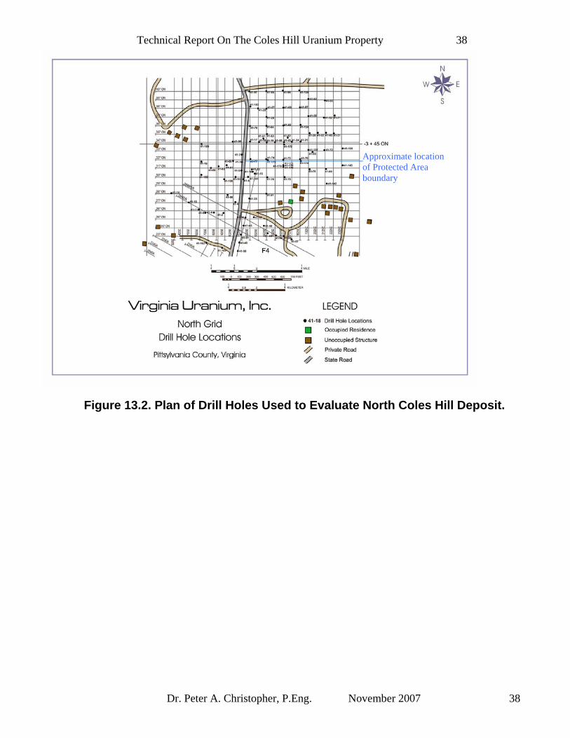
Technical Report On The Coles Hill Uranium Property 38
Dr. Peter A. Christopher, P.Eng. November 2007 38
Figure 13.2. Plan of Drill Holes Used to Evaluate North Coles Hill Deposit.
Approximate location of Protected Area boundary
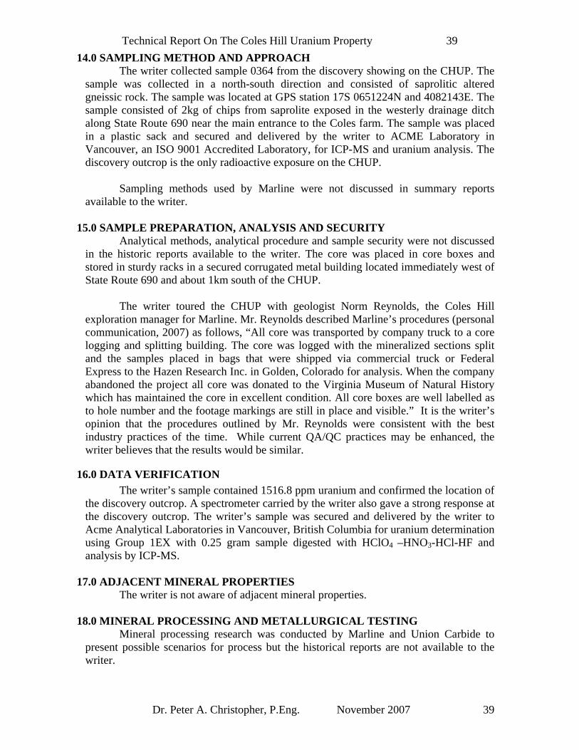
Technical Report On The Coles Hill Uranium Property 39
Dr. Peter A. Christopher, P.Eng. November 2007 39
14.0 SAMPLING METHOD AND APPROACH The writer collected sample 0364 from the discovery showing on the CHUP. The sample was collected in a north-south direction and consisted of saprolitic altered gneissic rock. The sample was located at GPS station 17S 0651224N and 4082143E. The sample consisted of 2kg of chips from saprolite exposed in the westerly drainage ditch along State Route 690 near the main entrance to the Coles farm. The sample was placed in a plastic sack and secured and delivered by the writer to ACME Laboratory in Vancouver, an ISO 9001 Accredited Laboratory, for ICP-MS and uranium analysis. The discovery outcrop is the only radioactive exposure on the CHUP. Sampling methods used by Marline were not discussed in summary reports available to the writer.
15.0 SAMPLE PREPARATION, ANALYSIS AND SECURITY Analytical methods, analytical procedure and sample security were not discussed in the historic reports available to the writer. The core was placed in core boxes and stored in sturdy racks in a secured corrugated metal building located immediately west of State Route 690 and about 1km south of the CHUP. The writer toured the CHUP with geologist Norm Reynolds, the Coles Hill exploration manager for Marline. Mr. Reynolds described Marline’s procedures (personal communication, 2007) as follows, “All core was transported by company truck to a core logging and splitting building. The core was logged with the mineralized sections split and the samples placed in bags that were shipped via commercial truck or Federal Express to the Hazen Research Inc. in Golden, Colorado for analysis. When the company abandoned the project all core was donated to the Virginia Museum of Natural History which has maintained the core in excellent condition. All core boxes are well labelled as to hole number and the footage markings are still in place and visible.” It is the writer’s opinion that the procedures outlined by Mr. Reynolds were consistent with the best industry practices of the time. While current QA/QC practices may be enhanced, the writer believes that the results would be similar.
16.0 DATA VERIFICATION The writer’s sample contained 1516.8 ppm uranium and confirmed the location of the discovery outcrop. A spectrometer carried by the writer also gave a strong response at the discovery outcrop. The writer’s sample was secured and delivered by the writer to Acme Analytical Laboratories in Vancouver, British Columbia for uranium determination using Group 1EX with 0.25 gram sample digested with HClO4 –HNO3-HCl-HF and analysis by ICP-MS.
17.0 ADJACENT MINERAL PROPERTIES The writer is not aware of adjacent mineral properties.
18.0 MINERAL PROCESSING AND METALLURGICAL TESTING Mineral processing research was conducted by Marline and Union Carbide to present possible scenarios for process but the historical reports are not available to the writer.

Technical Report On The Coles Hill Uranium Property 40
Dr. Peter A. Christopher, P.Eng. November 2007 40
19.0 MINERAL RESOURCE AND MINERAL RESERVE ESTIMATES The CHUP does not have current mineral reserve or mineral resource estimates. Historic resources are reviewed in section 9.1 of this report.
20.0 OTHER RELEVANT DATA AND INFORMATION The writer is not aware of any other relevant data or information that would influence the writer opinion about or recommendation for further Phase 1 and Phase 2 exploration of the CHUP.
21.0 INTERPRETATION AND CONCLUSIONS The CHUP is an advanced staged exploration project that was brought to the feasibility study stage by Marline with joint venture participation of Union Carbide in the SCHD. The project contains sufficient “historic reserve” estimates for the State of Virginia to hold hearings and established the Uranium Administration Group, charged with examination of uranium development at Coles Hill. Regulatory permitting process delays extended into the 1980’s downturn in the uranium market and nuclear industry and the project was shelved with leased mineral rights eventually returned to the land owners. Mine regulations were never finalized. The diamond drill core was donated to the VMNH and has been made available to Virginia Uranium for evaluation of the CHUP. It is recommended that Virginia Uranium split the remaining half core from the Marline sampling of mineralized intervals. The core can also be used to perform non destructive density measurements. The amount of drilling required to return the property to the feasibility level will depend on Virginia Uranium’s ability to obtain analytical records for previous drilling and on Virginia Uranium’s results from verification holes.
22.0 RECOMMENDATIONS
22.1 Recommended Phase 1 Exploration (Figure 22.1; Table 22.1) The recommended Phase 1 program is intended to return the project to the feasibility stage. The Phase 1 program includes acquisition and review of the Marline data bases, verification of historic drill results and once verified, digitizing of the drill results to allow for current resource estimates and preliminary assessment (scoping study). Marline diamond drill core was donated to the Virginia Museum of Natural History and has been carefully stored on site. Virginia Uranium will attempt to obtain access to about 65,000 feet of stored core and with the participation of the museum, re-sample and assay previously split core for verification of results by comparison with previous assay records. Radiometric logs and historic reports referred to in studies conducted at Virginia Polytechnic Institute and State University should be obtained. Phase 1 should include 41,000 feet (~12,500m) of confirmation and infill drilling with further equilibrium studies conducted on the North Coles Hill deposit. Proposed Phase 1 drill holes are shown in Figure 22.1. The writer estimates that a Phase 1 program of re-assaying existing drill core, 41,000 feet of NQ core drilling, land acquisition, community relations, a current resource estimates and a preliminary assessment of the CHUP will require a budget of

Technical Report On The Coles Hill Uranium Property 41
Dr. Peter A. Christopher, P.Eng. November 2007 41
US$10,000,000.00 (Table 22.1). The Phase 1 program is estimated to take 6-8 months to complete with some of the program continuing into Phase 2.
22.2 Recommended Phase 2 Exploration and Development (Table 22.2) The Phase 2 program will require continuation of baseline environmental studies, further drilling, metallurgical testing and engineering studies required for a feasibility study. Once mining regulations are established, a feasibility study should be completed. A budget of US$10,000,000.00 is estimated for the Phase 2 program (Table 22.2). The amount of drilling required will depend on the ability of Virginia Uranium to recover radiometric logs and the success of the Phase 1 verification drilling program. The Phase 2 drill program should be constructed on the basis of Phase 1 results with the input of the engineering firm selected to complete the feasibility study.
22.3 Opinion of Merit In the writer’s opinion, the character of the property is of sufficient merit to justify the recommended Phase 1 and Phase 2 programs and the programs represent worthwhile investment by Virginia Uranium. The writer believes that historic work suggests sufficient merit to warrant dealing with regulatory issues that must be resolved before completion of a feasibility study.

Technical Report On The Coles Hill Uranium Property 42
Dr. Peter A. Christopher, P.Eng. November 2007 42
Figure 22.1 Plan of Proposed Drill Holes, South Coles Hill Deposit.

Technical Report On The Coles Hill Uranium Property 43
Dr. Peter A. Christopher, P.Eng. November 2007 43
Figure 22.2 Plan of Proposed Drill Holes, North Coles Hill Deposit.

Technical Report On The Coles Hill Uranium Property 44
Dr. Peter A. Christopher, P.Eng. November 2007 44
TABLE 21.1. PROGRAM AND BUDGET FOR PHASE 1 ON CHUP Pittsylvania County, Virginia (Recommended and Warranted)
Drill Holes Description Amount Estimated Cost Project Preparation 50,000 Roads, Drill Sites & Reclamation
205,000
Diamond Drilling 35-43 holes 41,000 feet (~12,500m)
2,050,000
Staff 1,035,000 Living Out Allow 20,000 Sampling, Logging & Mapping
910,000
Geochemical Cost 100,000 Travel 100,000 Vehicles 100,000 Supplies & Eqip. 100,000 Permitting, 205,000 Reporting & Engineering
250,000
Data Compilation & Entry
250,000
Resource Estimate
50,000
Scoping Study 50,000 Drafting 25,000 Office charges & Rent
250,000
Land Acquisition, Consultants, Legal & Contingency
4,250,000
Phase 1 Total in US Dollars
$10,000,000

Technical Report On The Coles Hill Uranium Property 45
Dr. Peter A. Christopher, P.Eng. November 2007 45
TABLE 21.2. PROGRAM AND BUDGET FOR PHASE 2 ON CHUP Pittsylvania County, Virginia (Recommended and Warranted)
Work Type Description Amount Estimated Cost Preparation 50,000 Staff 1,035,000 Diamond Drilling 70 holes 70,000 feet
(~21,336M) 3,500,000
Community Relations and Education
1,500,000
Feasibility Study 2,500,000 Metallurgy 250,000 Vehicles 100,000 Office charges 250,000 Contingency 815,000 Phase 2 Total in US Dollars $10,000,000

Technical Report On The Coles Hill Uranium Property 46
Dr. Peter A. Christopher, P.Eng. November 2007 46
23.0 REFERENCES AND SOURCES OF INFORMATION Barron, T., 1983. Marline Confidential Memorandum. For Marline Uranium Corporatrion, draft dated March 31, 2003. Burton, R.N. (For Members of Uranium Task Force), 1984. Report of the Uranium Task Force Commonwealth of Virginia. Dated October 1, 1984. Dalkamp, F., Reynolds, N.W., Reifenstuhl, R., and Singletary, H., 1980. Geologic Appaisal of the Uranium Occurrences in the Area of the Danville Basin, Virginia. For Marline Oil Corporation, dated December 31, 1980. Dravo Engineers, Inc., 1984. An Evaluation of Uranium Development in Pittsylvania County, Virginia (October 15, 1983). Volume I Technical Summary and 1984 Supplement with Supporting Technical Memoranda. For Marline/Umetco, dated September 1984. Dribus, J.R., 1978. Preliminary study of the uranium potential of the Dan River Triassic basin system, Northern Carolina and Virginia. U.S. Dept. of Energy GJBX-131(78) open file report. Marline/Umetco, 1984. An Evaluation of Uranium Development in Pittsylvania County, Virginia (October 15, 1983). Technical Memoranda, Volume 2, supplements the 1982 report, dated September 1984. Foster, R.W., 1981. Geological Report on The Dan Project, Virginia with particular Emphasis on the Coles Area Uranium Deposits. Dated May 4, 1981. Halladay, C.R., and Lineberger, H.D., 1982. Geology, Mineralogy and Geophysics of the Coles Hill Uranium Deposits, Pittsylvania County, Virginia. For Marline Uranium Corporation, dated July 1982. Henika, W.S. and Thayer, P.A., 1983. Geologic Map of the Spring Garden Quadrangle, Virginia. Virginia Division of Mineral Resources, Pub. 48 (GM47D). Henika, W.S., 1977. Geology of the Blairs, Mount Hemon, Danville, and Ringgold Quadrangle, Virginia, with sections on the Triassic System by Thayer, P.A.. Virginia Diviion of Mineral Resources Pub. 2, 45p. Internal Report, October 15, 1983. An Evaluation of Uranium Development in Pittsylvania County Virginia. Submitted by Marline Uranium Corp. and Union Carbide Corp. to the Virginia Uranium Administrative Group, Pursuant to Section 45.1-285.1 et seq of the Code of Virginia (1983) (Senate Bill 155) dated October 15, 1983. Jerden, J.L., and Sinha, A.K., 1999. Geology, Mineralogy and Geochemistry of the Coles Hill Uranium Deposit, Virginia: An Example of a Structurally Controlled, Hydrothermal Apatite-Coffinite-Uraninite Orebody. Geol. Soc. Am., Abstracts with Programs (National Meeting), v. 31, no. 7, A-69.
Technical Report On The Coles Hill Uranium Property 47
Dr. Peter A. Christopher, P.Eng. November 2007 47
Jerden, J.L., 2001. Origin of Uranium Mineralization at Coles Hill Virginia (USA) and Its Natural Attenuation within an Oxidizing Rock-Soil-Ground Water System. Thesis (Ph.D.) Virginia Polytechnic Institute and State University dated September 21, 2001. Pincock, Allen & Holt, 1982. Description of the Swanson Uranium Project. Prepared for Marline Uranium Corporation, dated November 1982. Pincock, Allen & Holt, 1982. Geologic Reserves Coles Hill North Uranium Deposit Pittsylvania County, Virginia, Dated August 1982. (Stamped by Harry J. Winters, Arizona Professional Engineer 9402) Pincock, Allen & Holt, 1982. Geologic Reserves Coles Hill South Uranium Deposit Pittsylvania County, Virginia, dated August 1982. (Stamped by Harry J. Winters, Arizona Professional Engineer 9402) Report of the Uranium Task Force Commonwealth of Virginia. Dated October 1, 1984. Boring logs with natural gamma (counts per second), self-potential (SP, milli-volts) and resistivity (ohms) of about 251 holes by Mineral Service Co. of Corpus Christi, TX and Grand Junction, Co starting from July 1979. Soil descriptions of about 251 holes by Marline geologists. Pincock, Allen & Holt, 1981. Order-of-Magnitude Study of Coles Hill Project South Orebody, Prepared for Marline Uranium Corporation dated September 1981. Pincock, Allen & Holt, 1982. Geotechnical Survey of Coles Hill Project Area, Prepared for Marline Oil Corporation dated February 1981. (Stamped by Lutz Kunze, Arizona Professional Engineer 13376) Ian G. Park, Consulting Geophysicist, 1981. Ground VLF Electromagnetic tests and Comments on Geophysical Surveys Coles and Frith Properties. Prepared for Marline Oil Corporation dated January 12, 1981

Technical Report On The Coles Hill Uranium Property 48
Dr. Peter A. Christopher, P.Eng. November 2007 48
24.0 SIGNATURE, STAMP AND DATE
Signed and stamped at Vancouver, B.C., this 6th day of November 2007.
“Original document signed and sealed by Peter A. Christopher, PhD, P.Eng”
_____________________________________
Peter A. Christopher, PhD, P.Eng. PAC GEOLOGICAL CONSULTING INC.

Technical Report On The Coles Hill Uranium Property 49
Dr. Peter A. Christopher, P.Eng. November 2007 49
25.0 CERTIFICATE I, Peter A. Christopher, with business address at 3707 West 34th Avenue, Vancouver, British Columbia, do hereby certify that:
1. I am a Consulting Geological Engineer registered (#10,474) with the Association of Professional Engineers and Geoscientists of British Columbia since 1976.
2. I am a Fellow of the Geological Association of Canada. 3. I hold a B.Sc. (1966) from the State University of New York at Fredonia,
a M.A. (1968) from Dartmouth College and a Ph.D. (1973) from the University of British Columbia.
4. I have been practicing my profession as a Geologist for over 35 years and as a Consulting Geological Engineer since June 1981. I have authorized over 300 qualifying engineering and exploration reports, and over 20 professional publications. I have work experience in most areas of the United States, Canada, Papaua New Guinea, Madagascar, Mexico, Philippines and several other Latin American countries. I have worked on uranium exploration projects in Saskatchewan, British Columbia, NWT, Washington State, Wyoming, Eastern USA, and Madagascar. As a result of my experience and qualifications, I am a qualified person as defined in National Instrument 43-101.
5. I have no direct or indirect, nor do I expect to receive any interest directly or indirectly in the properties or securities of Virginia Uranium, Inc. I am independent of Virginia Uranium in accordance with the application of Section 1.4 of National Instrument 43-101.
6. I am responsible for preparation of this report entitled “Technical Report on the Coles Hill Uranium Property, Pittsylvania County, Virginia”. I have based this report on previous uranium exploration experience, review of references listed in section 23 and site examinations on February 23rd and 24th, 2006 and January 16th, 2007. As of the date of this certificate and to the best of my knowledge, information and belief, the Technical Report contains all the scientific and technical information that is required to be disclosed to make the Technical Report not misleading.
7. I have read National Instrument 43-101, Form 43-101F1 and prepared a Technical Report in compliance with National Instrument 43-101.
8. I consent to the filing of the “Technical Report on the Coles Hill Uranium Property, Pittsylvania County, Virginia” dated November 6, 2007 by Virginia Uranium with any stock exchange and other regulatory authority in connection with Virginia Uranium’s public offering and for compliance purposes.
Signed and Sealed in Vancouver, British Columbia, the 6th day of November 2007. “Original document signed and sealed by Peter A. Christopher, PhD, P.Eng” ___________________________________ Peter A. Christopher, PhD., P.Eng. PAC GEOLOGICAL CONSULTING INC.