technical memorandum - ecmwf | advancing global … conditions can therefore help improve the...
TRANSCRIPT

695
Skill and global trend analysis
of soil moisture from reanalyses and microwave remote sensing
C. Albergel, W. Dorigo1, R. H. Reichle2, G. Balsamo, P. de Rosnay, J. Muñoz-Sabater,
L. Isaksen, R. de Jeu3 and W. Wagner1
Research Department
March 2013
1) Department of Geodesy and Geo-information, Vienna University of Technology, Vienna, Austria
2) Global Modelling and Assimilation Office,
NASA Goddard Space Flight Centre, Greenbelt, MD, USA
3) Department of Earth Sciences, Faculty of Earth and Life Sciences, VU University Amsterdam, Amsterdam, Netherlands
To be published in Journal of Hydro-meteorology

Series: ECMWF Technical Memoranda A full list of ECMWF Publications can be found on our web site under: http://www.ecmwf.int/publications/ Contact: [email protected] © Copyright 2013 European Centre for Medium Range Weather Forecasts Shinfield Park, Reading, Berkshire RG2 9AX, England Literary and scientific copyrights belong to ECMWF and are reserved in all countries. This publication is not to be reprinted or translated in whole or in part without the written permission of the Director. Appropriate non-commercial use will normally be granted under the condition that reference is made to ECMWF. The information within this publication is given in good faith and considered to be true, but ECMWF accepts no liability for error, omission and for loss or damage arising from its use.

Skill and global trend analysis of soil moisture …
Technical Memorandum No.695 1
Abstract
In situ soil moisture measurements from 2007 to 2010 for 196 stations from five networks across the world (USA, France, Spain, China and Australia) are used to determine the reliability of three soil moisture products: (i) a revised version of the ERA-Interim reanalysis from ECMWF (ERA-Land), (ii) a revised version of the MERRA reanalysis from NASA (MERRA-Land) and (iii) a new, microwave based multi-satellite surface soil moisture dataset (SM-MW). Evaluation of the time series and anomalies from a moving monthly mean shows a good performance of the three products in capturing the annual cycle of surface soil moisture and its short-term variability. On average, correlations (95% confidence interval) are 0.66(±0.038), 0.69(±0.038) and 0.60(±0.061) for ERA-Land, MERRA-Land and SM-MW. The two reanalysis products also capture the root zone soil moisture well; on average correlations are 0.68(±0.035) and 0.73(±0.032) for ERA-Land, MERRA-Land. Global trends analysis for 1988-2010 suggests a decrease of surface soil moisture contents (72% of significant trends are negative, i.e. drying) for ERA-Land and an increase in surface soil moisture (59% of significant trends are positive, i.e. wetting) for MERRA-Land. As the spatial extent and fractions of significant trends in both products differ, the trend reflected in the majority of grid points within different climate classes was investigated and compared to that of SM-MW. The latter is dominated by negative significant trends (73.2%) and is more in line with ERA-Land. For both reanalysis products trends for the upper layer of soil are confirmed in the root zone soil moisture (first meter of soil).
1 Introduction
The importance of soil moisture in the global climate system has recently been underlined by the Global Climate Observing System (GCOS) Programme endorsing soil moisture as an Essential Climate Variable (ECV). It is a crucial variable for numerical weather prediction (NWP) and climate projections because it plays a key role in hydrological processes. A good representation of soil moisture conditions can therefore help improve the forecasting of precipitation, droughts and floods. For many applications global or continental scale soil moisture maps are needed.
Among the first soil moisture analysis systems used for operational NWP was the system implemented by the European Centre for Medium-Range Weather Forecasts (ECMWF) in 1994 to prevent the Land Surface Model (LSM) drifting to dry conditions in summer. Since then, major upgrades have been implemented in the land surface modelling and analysis systems of the high-resolution component of the Integrated Forecasting System (IFS) used operationally at ECMWF (Balsamo et al., 2009; de Rosnay et al. 2012a, b). These upgrades have led to a better representation of soil moisture (Albergel et al. 2012a). The operational IFS relies on continuous efforts to improve the system, resulting in several updates per year (including changes in spatial and vertical resolutions, data assimilation, parameterizations and sources of data), possibly leading to changes in the product. For a long-term study, a steady (“frozen”) configuration, such as used for reanalysis, is preferred to avoid, as much as possible, spurious climatic trends and anomalies that are due to system upgrades rather than a genuine climate signal. In recent years new and reliable reanalyses have been produced and this has extended the applications of land surface simulations that are performed offline.
In particular, the ECMWF Interim reanalysis (ERA-Interim, Dee et al. 2011) and the (National Aeronautics and Space Administration (NASA) Modern-Era Retrospective Analysis for Research and Applications (MERRA Rienecker et al. 2011) provide global reanalyses for the past three decades (from 1979 onwards) at high spatial resolution manuscript (spatial resolution of about 80 km for ERA-

Skill and global trend analysis of soil moisture …
2 Technical Memorandum No.695
Interim, 1/2º and 2/3 º spatial resolution in latitude and longitude for MERRA) and with modern data assimilation and modelling systems. Reanalyses of past land-atmosphere conditions constitute a major numerical modelling and data assimilation undertaking. Such atmospheric reanalyses can be updated only every 5-10 years, hence delaying the benefit from the most recent land surface model and data assimilation advances. To update only the land surface component of the ERA-Interim reanalysis, ECMWF recently developed ERA-Interim/Land (hereafter referred to as ERA-Land) simulations where the ERA-Interim near-surface meteorological forcing is used with the latest version of the ECMWF land surface model (Balsamo et al., 2012). Similarly, an enhanced MERRA land surface data product, MERRA-Land, has recently been released (Reichle et al. 2011; Reichle 2012).
Besides using modelling approaches, global soil moisture can be estimated through active and passive satellite microwave remote sensing with adequate spatial-temporal resolution and accuracy. Indeed, microwave remote sensing is able to provide quantitative information about the water content of a shallow near-surface layer (Schmugge 1983, Calvet et al. 2010), particularly in the low frequency microwave region from 1 to 10 GHz. Most spaceborne microwave radiometers operate at frequencies above 5 GHz. Among them are the Scanning Multichannel Microwave Radiometer (SMMR) on board Nimbus-7 between 1978 and 1987 (6.6 GHz and above), followed by the Special Sensor Microwave Imager (SSM/I starting in 1987 at 19 GHz and above) and the TRMM Microwave Imager (TMI) on the Tropical Rainfall Measuring Mission (TRMM) satellite (1997, at 10.7 GHz and above). More recent sensors operating in C-band and higher frequencies have been the Advanced Microwave Scanning Radiometer for the Earth Observing System (AMSR-E on the Aqua satellite from 6.9 to 89.0 GHz), Windsat (from 6.8 to 37 GHz) and the scatterometer on board the European Remote Sensing Satellite (ERS-1&2, 5.3 GHz). More recently the Soil Moisture and Ocean Salinity mission (SMOS, in L-band ~1.42 GHz), a dedicated soil moisture mission, was launched (November 2009, Kerr et al. 2010). In addition, the Advanced Scatterometer (ASCAT) on board METOP-A (launched in 2006, followed by METOP-B in September 2012) is a C-band radar operating at 5.255 GHz (Bartalis et al. 2007) and the first sensing satellite to provide a surface soil moisture product in near-real time. The combination/ensemble of these sensors opens up the possibility of studying the global behaviour of soil moisture from 1979 onwards using only observations (Dorigo et al. 2012a). In this context, Liu et al. (2011, 2012) proposed a method of merging soil moisture products from different microwave sensors into a single dataset covering 1979–2010. This led to the preparation of a consistent global soil moisture data record based on active and passive microwave sensors (hereafter referred to as SM-MW; Dorigo et al. 2012a).
The typical validation approach for model and satellite based data products is to compare them to in situ observations. Hence in situ measurements of soil moisture are a highly valuable source of information for assessing the quality of model and satellite moisture products. While in the 1980s and 1990s records of in situ soil moisture measurements were available for only a few regions and often for only very short periods, huge efforts have been made in the last decade to install long-term observations networks in contrasting biomes and climate conditions.
This study evaluates the three above mentioned global soil moisture products (ERA-Land, MERRA-Land and SM-MW) vs. in situ observations and provides global trends analysis. After a description of the soil moisture products used in this study (section 2.1), the metrics used for the statistical analysis

Skill and global trend analysis of soil moisture …
Technical Memorandum No.695 3
(section 2.2) and the trends analysis (section 2.3) are detailed. The ability of the global products to represent in situ measurements is assessed for 2007-2010, for both surface and root zone soil moisture (section 3.1). 1988–2010 trends in ERA-Land and MERRA-Land surface soil moisture are determined following the approach adopted by Dorigo et al. (2012a) who presented the first evaluation of trends in SM-MW data set. Trends in ERA-Land, MERRA-Land surface soil moisture are then analysed on a global scale and for the individual classes of the updated Köppen-Geiger climate classification (Kottek et al. 2006); they are confronted to that of SM-MW from Dorigo et al. (2012). Moreover, trends in root-zone soil moisture (first meter of soil) from ERA-Land and MERRA-Land are also investigated for the same period (section 3.2). Section 4 discusses the results and section 5 provides a summary and conclusions.
2 Material and Methods
2.1 Soil moisture products
The different soil moisture data sets used in this study; ERA-Land, MERRA-Land and from in situ measurements are presented in Table 1.
2.1.1 ERA-Land reanalysis
ERA-Interim is the latest global atmospheric reanalysis produced by ECMWF (Dee et al. 2011). It uses IFS version 31r1 (more information at http://www.ecmwf.int/research/ifsdocs/) with a spatial resolution of about 80 km (T255) and with analyses available for 00:00, 06:00, 12:00 and 18:00 UTC. ERA-Interim covers the period from 1 January 1979 onwards, and continues to be extended forward in near-real time (with a delay of approximately one month). Berrisford et al. (2009) provide a detailed description of the ERA-Interim product archive. In ERA-Interim, the model forecast for the land surface analysis is provided by the TESSEL land surface scheme (Van den Hurk et al. 2000). It considers four layers of soil (0–7, 7–28, 28–100 and 100–289 cm). The assimilation technique used for soil moisture is Optimal Interpolation (OI, Mahfouf 1991). Initially the OI scheme produces estimates of screen-level temperature and relative humidity by combining synoptic observations (2-meter relative humidity and temperature) over land with background estimates (short-range forecasts) from the most recent analysis (Douville et al. 2000). Analysed fields of screen-level temperature and relative humidity are then used to update the soil moisture (and soil temperature) estimates for the various layers of the model. TESSEL was then upgraded to H-TESSEL (Van den Hurk and Viterbo 2003; Balsamo et al. 2009) Compared to the TESSEL scheme used in ERA-Interim, the current H-TESSEL scheme used in the IFS provides an improved match to in situ soil moisture observations (Balsamo et al. 2009; Albergel et al. 2012a). It benefits from an improved hydrology; the formulation of the soil hydrological conductivity and diffusivity was revised to be spatially variable according to a global soil texture map (FAO/UNESCO Digital Soil Map of the World, DSMW, FAO, 2003). In addition, surface runoff is based on variable infiltration capacity. There is a new snow scheme (Dutra et al., 2010) and a multi-year satellite based vegetation climatology (Boussetta et al., 2010). Also, the formulation of the bare soil evaporation has been revisited to allow a smooth transition between vegetated and non-vegetated areas and to realign the formulation of bare ground evaporation with studies in the literature (Albergel et al., 2012c).

Skill and global trend analysis of soil moisture …
4 Technical Memorandum No.695
Table 1: The soil moisture products used in this study. LSM stand for Land Surface Model.
Soil Moisture data set Type
Soil layer depth used in this study(cm)
Considered period
Spatial resolution
Number of stations
Land use / Climate (*)
ECMWF ERA-Land (Balsamo et al., 2012)
ERA-Interim driven LSM run
0-7, 7-28 and 0-100
Jan. 2007 to Dec. 2010, Jan. 1980 to Dec. 2010
80 km Global product
Global product
NASA-GMAO MERRA-Land (Reichle et al., 2011)
Revised version of the Land component of the MERRA system
0-2 and 0-100
Jan. 2007 to Dec. 2010, Jan. 1980 to Dec. 2010
1/2º and 2/3 º in latitude and longitude
Global product
Global product
SMOSMANIA in France (Albergel et al., 2008, Calvet et al., 2007)
In situ observations
5, 10, 20, 30 Jan. 2007 to Dec. 2010
Local scale 12 Natural fallow / Oceanic- Mediterranean
Maqu in China (SU et al., 2011)
In situ observations
5 Jul. 2008 to Aug. 2010
Local scale 20
Grassland used for grazing / wet and cold with dry winter and rainy summers
OZNET in Australia (Smith et al., 2012)
In situ observations
0-5 or 0-8, 0-30, 30-60 and 60-90
Jan. 2007 to Dec. 2010
Local scale 38 Agricultural with some forested areas / Oceanic
NCRS-SCAN in the USA (Schaefer and Paetzold, 2000)
In situ observations
5, 10, 20, 50 and 100
Jan. 2007 to Dec. 2010
Local scale 177
Natural fallow or short grasses / Continental, Semi-arid, Oceanic
REMEDHUS in Spain (Sanchez et al., 2012)
In situ observations
5 Jan. 2007 to Dec. 2010
Local scale 20
Agricultural with some patchy forest Semiarid, Continental Mediterranean
(*) Climates are according to the Köppen climate classification (by FAO –SDRN– Agrometeorologist group, 2005).
The improvements in the operational ECMWF LSM scheme, in particular with respect to soil moisture (Albergel et al. 2012b), provided the motivation for producing an updated land surface reanalysis using offline (land-only) LSM simulations. Hence a new land product, ERA-Land, has been generated at ECMWF that benefits from the most recent land modelling improvements; the ERA-Interim near-surface meteorological forcing has been used to force the improved H-TESSEL LSM (Balsamo et al. 2012). Land surface fields obtained from ERA-Land were shown to be a good choice for initializing the latest seasonal forecasting system (System-4, Molteni et al. 2011). In this study, surface soil moisture from ERA-Land is from the first soil layer (0–7 cm) and root zone soil moisture is from the weighted average of the first three soil layers (0-100 cm).
2.1.2 MERRA-Land reanalysis
MERRA is a reanalysis generated by the NASA Global Modeling and Assimilation Office (GMAO) using the Goddard Earth Observing System (GEOS) version 5.2.0 (Rienecker et al. 2011; http://gmao.gsfc.nasa.gov/research/merra/). MERRA incorporates information from in situ and remote sensing observations of the atmosphere, including many modern satellite observations. All these observations are assimilated into the GEOS-5 Atmospheric General Circulation Model, using the

Skill and global trend analysis of soil moisture …
Technical Memorandum No.695 5
Gridpoint Statistical Interpolation package from the National Center for Environmental Prediction. MERRA covers the period from 1979 onwards and continues to be updated a few weeks in arrears, but it does not include a land surface analysis. Estimates of surface meteorological and land surface fields for MERRA are available at hourly time steps and at 1/2º and 2/3º resolution in latitude and longitude.
A supplementary and improved product of land surface hydrological fields called MERRA-Land (Reichle et al. 2011; Reichle 2012) was generated by rerunning a revised version of the land component of the MERRA system. Compared to MERRA, MERRA-Land benefits from corrections to the precipitation forcing with the National Oceanic and Atmospheric Administration Climate Prediction Center Unified daily precipitation product and from revised parameter values in the rainfall interception model. The skill of MERRA-Land estimates of soil moisture was found to be similar to that of ERA-Interim (Reichle et al. 2011; Reichle 2012). Surface and root zone soil moisture from MERRA-Land are used (top soil layer, 0–2 cm, root zone layer, 0-100cm).
2.1.3 Remotely-sensed data
In response to the GCOS endorsement of soil moisture as an ECV, the European Space Agency Water Cycle Multi-mission Observation Strategy (WACMOS) project and Climate Change Initiative (CCI, http://www.esa-soilmoisture-cci.org) have supported the generation of a soil moisture product based on multiple microwave sources. The first version of the combined product, SM-MW, was released in June 2012 by the Vienna University of Technology. SM-MW was generated using active and passive soil moisture products, derived from SMMR, SSM/I, TMI and ASMR-E (for the passive products), and the ERS and ASCAT scatterometers (for the active products) (Liu et al. 2011, 2012; Wagner et al. 2012). Initially, data were separated into two homogenized products: one for active and one for passive data. Then they were merged into a single active-passive product according to their relative sensitivity to vegetation density. SM-MW data are in volumetric (m3m-3) units and quality flags (snow coverage or temperature below zero degree, dense vegetation) are provided.
2.1.4 In situ measurements
This study makes use of in situ soil moisture measurements obtained through the International Soil Moisture Network (ISMN, http://www.ipf.tuwien.ac.at/insitu/, Dorigo et al. 2011, 2012b), a data hosting centre where globally-available ground-based soil moisture measurements are collected, harmonized and made available to users. Data from five networks in the ISMN are considered in this study: NRCS-SCAN (Natural Resources Conservation Service - Soil Climate Analysis Network) over the United States (177 stations for surface soil moisture, 161 for the root zone), SMOSMANIA (Soil Moisture Observing System-Meteorological Automatic Network Integrated Application) in France (12 stations), REMEDHUS (REd de MEDición de la HUmedad del Suelo) in Spain (20 stations), MAQU in China (20 stations) and OZNET in Australia (38 stations). While many others stations are available through the ISMN, the five networks were selected because they have data over most of 2007–2010 and were successfully used at ECMWF to evaluate soil moisture products from either modelling (e.g. Albergel et al. 2012a) or remote sensing (e.g. Albergel et al. 2012b). They also cover a wide variety of climatological conditions. Figure 1 gives an overview of the location of the stations used in this study.

Skill and global trend analysis of soil moisture …
6 Technical Memorandum No.695
Figure 1: Location of the in situ soil moisture stations used in this study (black dots) and ERA-Land mean soil moisture over the whole 1979-2010 period (filtered from snow covered areas).
NRCS-SCAN
177 stations from NRCS-SCAN (http://www.wcc.nrcs.usda.gov/scan/, Schaefer and Paetzold 2000) were used in this study. This network is a comprehensive, USA-wide soil moisture and climate information system designed to provide data to support natural resource assessments and conservation activities with a focus on agricultural areas in the USA. The observing network is used to monitor soil temperature and soil moisture at several depths, soil water level, air temperature, relative humidity, solar radiation, wind, precipitation and barometric pressure amongst others. NRCS-SCAN data have been used for various studies ranging from global climate modelling to agricultural studies. The vegetation cover at those sites consists of either natural fallow or short grass. Data are collected by a dielectric constant measuring device and typically measurements are made at 5, 10, 20, 50 and 100 cm. While observations at 5 cm depth are used to evaluate the 3 products considered in this study, observations over the first meter of soil are used to build a proxy of the root zone soil moisture (by weighed averaging, 161 stations are available) used to evaluate ERA-Land, MERRA-Land root zone soil moisture (0-100cm).

Skill and global trend analysis of soil moisture …
Technical Memorandum No.695 7
SMOSMANIA
SMOSMANIA is a long-term effort to acquire profiles of soil moisture from 12 automated weather stations in southwestern France. It was developed to validate remote sensing and model soil moisture estimates. SMOSMANIA is based on the existing automatic weather station network of Météo-France. The stations were chosen to form a Mediterranean-Atlantic transect following the marked climatic gradient between the two coastlines. The locations of the chosen stations are in relatively flat areas and the altitude of the highest station is 538 m a.s.l. The three most eastward stations are representative of a Mediterranean climate. The observations from this well monitored network have been extensively used for the validation of modelled and satellite-derived soil moisture, including ASCAT and SMOS (Albergel et al. 2009, 2010, 2012b; Brocca et al. 2011; Parrens et al. 2012). Four soil moisture probes were horizontally installed per station at four depths: 5, 10, 20 and 30 cm. The ThetaProbe ML2X of Delta-T Devices was chosen because it has been used successfully during previous long-term campaigns of Météo-France and because it can easily be interfaced with the automatic stations. Albergel et al. 2012a also used observations from SMOSMANIA at depth of 5, 10, 20 and 30 cm to build a proxy of the root zone soil moisture and evaluate ERA-Land and MERRA-Land root zone soil moisture.
REMEDHUS
Twenty stations from the REMEDHUS network in Spain are available through the ISMN website. This network is located in a central sector of the Duero basin; the climate is semi-arid continental Mediterranean and the land use is predominantly agricultural with some patchy forest. This area is mainly flat, ranging from 700 to 900 m a.s.l. Each station was equipped with capacitance probes (HydraProbes, Stevens) installed horizontally at a depth of 5 cm. Analyses of soil samples were carried out to verify the capacitances probes and to assess soil properties at each station (Sánchez et al., 2012). This network provides measurements of surface soil moisture each hour. It has already been used for the evaluation of both remotely-sensed and modelled soil moisture estimates (Ceballos et al. 2005; Wagner et al. 2007; Albergel et al. 2012a, b; Sánchez et al. 2012).
MAQU
The Maqu soil moisture and soil temperature monitoring network (Su et al. 2011) was established in July 2008 in the source region of the Yellow River to the south of Maqu County in Gansu province, China. The network, consisting of 20 stations, monitors the soil moisture and soil temperature at various depths (from 5 to 80 cm below the surface) at 15 min intervals. Data used in this study cover July 2008 to August 2010. Surface soil moisture from this network is considered.
OZNET
In situ measurements at 38 stations of the OZNET network (http://www.oznet.org.au, Smith et al. 2012) are used in this study. They are all located within the Murrumbidgee experimental catchment in southern New South Wales, Australia. Climate variations in this catchment are primarily associated with elevation, varying from semi-arid in the west (altitude from ~50 m a.s.l.) to temperate in the east (altitude up to ~2000 m a.s.l.). The highest station is 937 m a.s.l. Land use in the catchment is

Skill and global trend analysis of soil moisture …
8 Technical Memorandum No.695
predominantly agricultural with some forested areas in the steeper parts of the catchment. Each soil moisture site of the Murrumbidgee network measures the soil moisture at 0–5 cm with a soil dielectric sensor (Stevens Hydraprobe a soil dielectric sensor) or at 0–8 cm, 0–30 cm, 30–60 cm and 60–90 cm with water content reflectometers (Campbell Scientific). As the sensor response to soil moisture may vary with soil characteristics (e.g. salinity, density, soil type and temperature), the sensor calibration was undertaken using both laboratory and field measurements. Reflectometer measurements were compared with both field gravimetric samples and Time-Domain Reflectometry (TDR) measurements. As for the NRCS-SCAN network bot surface soil moisture and root zone soil moisture are used for the evaluation.
2.2 Metrics used for the statistical comparison
The choice of performance metrics to be used is of crucial interest; it is governed by the nature of the variable itself and is influenced by the purpose of the investigation and its sensitivity to the considered variables (Stanski et al. 1989). No single metric or statistic can capture all the attributes of environmental variables. Some are robust in respect to some attributes while insensitive to others (Entekhabi et al. 2010). The most commonly used metrics to evaluate the accuracy of soil moisture retrievals are the correlation coefficient (R, Eq.1), the root mean square difference (RMSD, Eq.2), the bias (Bias, Eq.3) and the unbiased root mean square difference (ubRMSD, Eq.4).
( )( )1
1 Nn nn
SM insitu
SM SM insitu insituNR
σ σ=
− −=
∑ (1)
( )2
1
1 Nn nn
RMSD insitu SMN =
= −∑ (2)
( )1
1 Nn nn
Bias insitu SMN =
= −∑ (3)
( ) ( ){ }2
1
1 Nnn n nn
ubRMSD SM SM insitu insituN =
= − − − ∑ (4)
The σ symbols in Eq.1 represent the variance of the products (σSM) and measurements (σinsitu), N is the length of the record at a given station. As in situ data may contain errors (instrumental and representativeness), they are not considered the ‘true’ soil moisture. This is emphasised by using the RMS difference terminology instead of RMS error. Also, the normalised standard deviation (SDV, Eq.5) and the centred unbiased RMSD (E, Eq.6) between satellite and in situ observations are used. SDV is the ratio between standard deviations of the soil moisture product and in situ measurements; it gives the relative amplitude whilst E quantifies errors in the pattern variations. E does not include any information on biases because means of the fields are subtracted before computing second order errors.
/SM insituSDV σ σ= (5)
( )2 2 2 2/ insituE RMSD Bias σ= − (6)

Skill and global trend analysis of soil moisture …
Technical Memorandum No.695 9
The main reason for computing the two last scores is that R, E and SDV can be displayed on a single two-dimensional diagram (Taylor diagram) and this helps with the interpretation of the results. These three parameters are complementary but not independent as they are related by Eq.7 (Taylor, 2001).
2 2 1 2E SDV SDV R= + − ⋅ ⋅ (7)
In a Taylor diagram the SDV is displayed as a radial distance and R as an angle in the polar plot. In situ measurements are represented by a point located on the x axis at R=1 and SDV=1; the distance to this point represents E.
Usually, soil moisture time series show a strong seasonal pattern that could artificially increase the perceived agreement between satellite and in situ observations in terms of R. Therefore, to avoid seasonal effects, time series of anomalies from a moving monthly average are also calculated. The difference from the mean is calculated using a sliding window of five weeks all over the 2007-2010 period, and the difference is scaled to the standard deviation. For each soil moisture estimate at day (i), a period F is defined, with F=[i-17, i+17] (corresponding to a five-week window). If at least five measurements are available in this period, the average soil moisture value and the standard deviation over each time window are calculated. The dimensionless anomaly (Ano) is then given by Eq.8.
( )
( ) ( )( )( )
SM i SM FAno istdev SM F
−= (8)
Anomaly time-series reflect the time-integrated impact of antecedent meteorological forcing. The latter is mainly reflected in the upper layer of soil.
The p-value (a measure of the correlation significance) is also calculated; this indicates the significance of the test (as in Albergel et al. 2010) and only cases where the p-value is below 0.05 (i.e. the correlation is not a coincidence) are retained. Stations with non-significant R values can be considered suspect and are excluded from the computation of the network average metrics. This process has probably removed some good stations too (e.g. in areas where the model might not realistically represent soil moisture). As in Draper et al. (2012) for each R estimate a 95% Confidence Interval (CI) was calculated using a Fisher Z transform.
Eq. 1-6 are applied to each individual station of each network, Eq.1 (R) is applied on both the volumetric and anomaly time series. Thereafter, network-average metrics are computed by averaging the statistics from the individual stations within each network. Note that Eq. 7 is not strictly valid for network-average metrics.
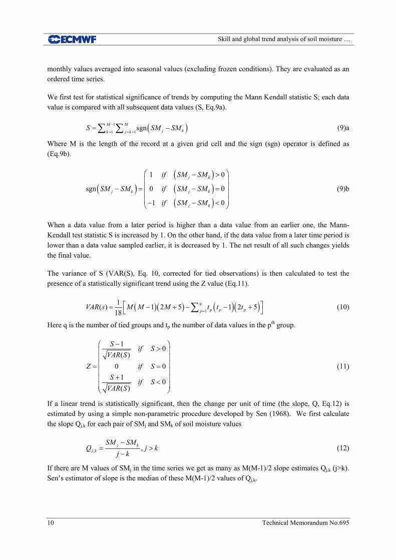
2.3 Trends in soil moisture
MERRA-Land and ERA-Land are analysed for monotonous trends with the non-parametric seasonal Mann-Kendall test and Sen’s method for slope estimates (Mann 1945; Kendall 1975; Sen 1968; Hirsch et al. 1982). It is a robust and distribution independent test widely used for detecting monotonic trends in environmental time series (Burn and Hag Elnur 2002; Sheffield and Wood 2008). While daily values are used for the evaluation against in situ measurements, the analysis of trends is based on
Skill and global trend analysis of soil moisture …
10 Technical Memorandum No.695
monthly values averaged into seasonal values (excluding frozen conditions). They are evaluated as an ordered time series.
We first test for statistical significance of trends by computing the Mann Kendall statistic S; each data value is compared with all subsequent data values (S, Eq.9a).
( )1
1 1sgnM M
j kk j kS SM SM−
= = += −∑ ∑ (9)a
Where M is the length of the record at a given grid cell and the sign (sgn) operator is defined as (Eq.9b).
( )( )( )( )
1 0
sgn 0 0
1 0
j k
j k j k
j k
if SM SM
SM SM if SM SM
if SM SM
− > − = − = − − <
(9)b
When a data value from a later period is higher than a data value from an earlier one, the Mann-Kendall test statistic S is increased by 1. On the other hand, if the data value from a later time period is lower than a data value sampled earlier, it is decreased by 1. The net result of all such changes yields the final value.
The variance of S (VAR(S), Eq. 10, corrected for tied observations) is then calculated to test the presence of a statistically significant trend using the Z value (Eq.11).
( )( ) ( )( )1
1( ) 1 2 5 1 2 518
qp p pp
VAR s M M M t t t=
= − + − − + ∑ (10)
Here q is the number of tied groups and tp the number of data values in the pth group.
1 0( )
0 01 0( )
S if SVAR S
Z if SS if S
VAR S
− > = =
+ <
(11)
If a linear trend is statistically significant, then the change per unit of time (the slope, Q, Eq.12) is estimated by using a simple non-parametric procedure developed by Sen (1968). We first calculate the slope Qj,k for each pair of SMj and SMk of soil moisture values
, ,j kj k
SM SMQ j k
j k−
= >−
(12)
If there are M values of SMj in the time series we get as many as M(M-1)/2 slope estimates Qj,k (j>k). Sen’s estimator of slope is the median of these M(M-1)/2 values of Qj,k.

Skill and global trend analysis of soil moisture …
Technical Memorandum No.695 11
Monthly soil moisture values from ERA-Land, MERRA-Land are averaged into seasonal values: December–February (DJF), March–May (MAM), June–August (JJA), and September–November (SON) to allow a comparison with the trends obtained for SM-MW by Dorigo et al. (2012a). Monotonous trends in MERRA-Land and ERA-Land for both surface and root zone soil moisture are analysed over 1988–2010.
Main trends reflected by the different grid points of each product are investigated in different classes according to the Köppen-Geiger climate classification (Köppen 1900; Geiger 1954) updated by Kottek et al. (2006) for the second half of the 20th century. This new classification, which has 31 classes, was developed at the German Weather Service based on recent datasets from the Climatic Research Unit of the University of East Anglia and the Global Precipitation Climatology Centre. Five main climate zones were identified (Equatorial, Arid, Warm temperate, Snow and Polar) with their associated precipitation conditions (e.g. fully humid, dry summer/winter) and temperature classification (e.g. hot steppe, warm summer, extremely continental). A full description of the updated Köppen-Geiger classification can be found in Kottek et al. (2006) and http://koeppen-geiger.vu-wien.ac.at/present.htm.
3 Results
3.1 Comparison with in situ measurements
This section presents the results of the comparison vs. in situ observations of SM-MW, MERRA-Land and ERA-Land, beginning with surface and then addressing root zone soil moisture. For all the stations used in this study, a first visual quality check was performed. When suspicious data were observed, they were discarded. Also spurious soil moisture observations from the ISMN website were detected using a global quality control (QC) procedure which flags for unnatural increases or decreases in soil moisture (e.g. spikes and breaks). Also, the QC procedure detects for unresponsive measurements and soil moisture values below 0 m3m-3, exceeding the regional saturation points, or exceeding the physically plausible upper moisture content of 0.6 m3m-3 (Dorigo et al., 2012b). Additional quality control was necessary for the stations from the NRCS-SCAN network; as indicated in their website, NRCS-SCAN data are provisional and subject to revision, very little control is applied to measurements. Dharssi et al. (2011) used a simple process to identify stations where sensors might be dysfunctional. Stations are rejected based on the scores obtained when compared to their experiments (in term of correlations, RMSDs and biases). A similar process is applied based only on the correlation level. Stations for which either ERA-Land, MERRA-Land or SM_MW have a correlation less than 0.3 are rejected. This rather strict process has probably removed some good stations too (e.g. in areas where the model might not realistically represent soil moisture, Albergel et al., 2012a, c).
Figure 2 illustrates surface soil moisture from the three products and the in situ measurements for one station from the SMOSMANIA network (Savenes, Fig 2 top) and one station from the SCAN network (Levelland in Texas, Fig 2 bottom) over 2007–2010. A look at Figure 2 suggests that the three global products are similar; they range within a rather similar dynamical range and represent the soil moisture annual cycle well (with respect to the in situ measurements); most peaks and troughs are well represented. Despite its deeper surface layer, ERA-Land surface soil moisture (0-7cm) has a higher

Skill and global trend analysis of soil moisture …
12 Technical Memorandum No.695
variability and dynamical range than MERRA-Land (0-2cm). For the station from the SMOSMANIA network, the two reanalysis products tend to overestimate in situ measurements (Fig 2, top). For the station in Texas (USA), located in a more dry area, ERA-Land is able to correctly match the lowest values observed.
The statistical scores for 2007-2010 surface soil moisture from SM-MW, MERRA-Land and ERA-Land are presented in Table 2, Figure 3 shows the estimated R and its 95% CI for the surface (top) and root-zone (bottom) soil moisture, averaged across each networks. For this period, and for the 3 products, 196 stations out of 267 have R values that are different from zero at the 5% significance level (p-value<0.05) for the three products, their scores are averaged per network. Comparisons between in situ measurements and the three products show good temporal correlations. On average, R values (95% confidence interval of R) are 0.66(±0.038), 0.69(±0.038) and 0.60(±0.061) for ERA-Land, MERRA-Land and SM-MW, respectively. Biases are on average -0.086 m3m-3, -0.033 m3m-3 and 0.011 m3m-3, RMSD values 0.121 m3m-3, 0.102 m3m-3 and 0.108 m3m-3, and ubRMSD values are 0.061 m3m-3, 0.052 m3m-3 and 0.058 m3m-3, respectively.
Figure 2: Surface soil moisture for (top) the SMOSMANIA/SAVENES station in France and (bottom) the SCAN/LEVELLAND station in Texas, USA. Black dots represent in situ measurements at a depth of 5 cm, red dots the SM-MW products, orange solid line ERA-Land (0–7 cm) and green solid line MERRA-Land (0–2 cm).

Skill and global trend analysis of soil moisture …
Technical Memorandum No.695 13
Table 2: Comparison of surface soil moisture with in situ observations for SM-MW, MERRA-Land and ERA-Land for 2007–2010. Mean correlations (on volumetric and anomaly time series; R and R_ANO), root mean square differences (RMSD), bias (in situ measurements minus products), unbiased root mean square differences (ubRMSD), normalised standard deviation (SDV) and centred unbiased RMSD (E) are given for each network and each product. Scores are given for significant correlations with p-values <0.05. For each R estimate a 95% Confidence Interval (CI) was calculated using a Fisher Z transform.
Networks 2007-2010
R(stdev_R) R_ANO RMSD m3m-3
BIAS m3m-3
ubRMSD m3m-3
SDV E
SCAN 113 stations of 177*
SM-MW 0.48(±0.096) 0.37 0.097 -0.026 0.061 0.70 0.90
MERRA-LAND 0.68(±0.047) 0.50 0.101 -0.062 0.052 0.60 0.74
ERA-LAND 0.66(±0.046) 0.49 0.129 -0.081 0.065 1.06 0.85
SMOSMANIA 11 stations of 12*
SM-MW 0.63(±0.043) 0.47 0.118 0.047 0.061 0.65 0.78
MERRA-LAND 0.81(±0.021) 0.59 0.074 0.019 0.047 0.73 0.59
ERA-LAND 0.80(±0.022) 0.64 0.094 -0.059 0.050 0.82 0.60
REMEDHUS 19 stations of 20*
SM-MW 0.63(±0.036) 0.38 0.114 -0.064 0.056 0.88 0.82
MERRA-LAND 0.67(±0.030) 0.52 0.136 -0.108 0.050 0.73 0.74
ERA/LAND 0.71(±0.028) 0.54 0.162 -0.135 0.073 1.51 1.07
OZNET 36 stations of 38*
SM-MW 0.67(±0.030) 0.49 0.073 -0.018 0.057 0.82 0.7
MERRA-LAND 0.71(±0.030) 0.55 0.099 -0.072 0.056 0.81 0.81
ERA/LAND 0.75(±0.025) 0.68 0.124 -0.108 0.054 0.85 1.01
MAQU 17 stations of 20*
SM-MW 0.61(±0.100) 0.53 0.138 0.117 0.055 0.75 0.80
MERRA-LAND 0.60(±0.063) 0.56 0.101 0.060 0.056 0.41 0.82
ERA-LAND 0.40(±0.070) 0.50 0.095 -0.045 0.063 0.31 0.92
Averaged values 196 stations of 267*
SM-MW 0.60(±0.061) 0.45 0.108 0.011 0.058 0.76 0.80
MERRA-LAND 0.69(±0.038) 0.54 0.102 -0.033 0.052 0.66 0.74
ERA-LAND 0.66(±0.038) 0.57 0.121 -0.086 0.061 0.91 0.89
*with significant level of correlation (p-values <0.05)
Figure 3: Mean R values for (top) surface and (bottom) root-zone soil moisture from SM-MW (red), MERRA-Land (green) and ERA-Land (orange) with 95% confidence intervals. The number of sites in each network is given in the axis labels.

Skill and global trend analysis of soil moisture …
14 Technical Memorandum No.695
Figure 4 (left) shows a Taylor diagram illustrating the averaged statistics from the comparisons of SM-MW, MERRA-Land and ERA-Land with in situ measurements of surface soil moisture for each network for 2007–2010. These results underline the good range of correlations of the three products with most values being above 0.50. The red dashed line in the Taylor diagrams represents a SDV value of one, as SDV is the ratio between the standard deviations of a product and in situ measurement (Eq.5); a symbol located below this line indicates that the product has less variability than the in situ measurements (SDV < 1). For SM-MW and MERRA-Land, symbols are below this line (i.e. their variability is smaller than that of the in situ measurements). But this is not the case for ERA-Land with symbols on each side of the SDV=1 line. The higher variability of ERA-Land (with respect to the observations) compared to the other products is also visible in Figure 2. Particularly good scores are obtained for the SMOSMANIA network with R values around 0.80 for the two reanalyses.
Figure 4: Taylor diagrams illustrating the (left) surface and (right) root zone soil moisture statistics versus in situ observations for SM-MW (in red), MERRA-Land (in green) and ERA-Land (in orange). Statistics are network average for SCAN (circles), SMOSMANIA (squares), REMEDHUS (triangles), Maqu (stars) and OZNET (diamonds). See Table 2 for numerical values of the statistics.
The results presented above give an overview of the quality of the three products in representing the annual scale of soil moisture. To address their ability to capture the short-term variations, anomaly time series were derived and associated correlations computed. As expected, correlations of volumetric time series (0.66, 0.69 and 0.60 on average for ERA-Land, MERRA-Land and SM-MW) are larger than those for the monthly-anomaly time series (0.57, 0.54 and 0.45 on average). The good level of correlation of the volumetric time series is explained by seasonal variations, which are suppressed in monthly anomalies. MERRA-Land has slightly better anomaly R values than ERA-Land; this could be explained by the fact that its precipitation forcing was corrected using observations (CPCU data). One may note that over the Maqu network in China, ERA-Land has lower R values than MERRA-Land and SM-MW [0.40(±0.70) compared to 0.60(±0.063) and 0.61(±0.10)], R values for this network also present larger 95% CI (figure 3).

Skill and global trend analysis of soil moisture …
Technical Memorandum No.695 15
In situ measurements of root zone soil moisture from the SCAN, SMOSMANIA and OZNET networks were also used to evaluate ERA-Land, MERRA-Land. 137 stations (out of 211) present significant R values for the three products. Results of the comparison are shown in Table 3. Figure 5 illustrates the 2 root zone soil moisture products and in situ measurements used in this study for one station from the OZNET network (Alabama, Fig 5 top) and one station from the SCAN network (Lonoke Farm in Arkansas, Fig 5 bottom) over 2007–2010. In situ root-zone soil moisture (integrated over 0-100cm), presents a smaller variability than the surface soil moisture which is in line with ERA-Land and MERRA-Land. Over the 2007-2010 period, averaged statistical scores [correlation, anomaly correlation, RMSD, bias and ubRMSD] are 0.68(±0.035), 0.52, 0.104 m3m-3, -0.073 m3m-3 and 0.048 m3m-3 for ERA-Land and 0.73(±0.032), 0.58, 0.088 m3m-3, -0.047 m3m-3 and 0.045 m3m-3 for MERRA-Land. As for the first layer of soil evaluated in this study, better averaged correlations are found for the stations from the SMOSMANIA network than for the OZNET and SCAN. Figure 4 (right) presents a Taylor diagram illustrating the averaged statistics from the comparisons of MERRA-Land and ERA-Land with in situ measurements of root zone soil moisture for 2007–2010. For the considered networks, results are similar as for the surface soil moisture. From fig.3 (bottom) one may see that MERRA-Land root zone soil moisture is significantly that the one of ERA-Land for SMOSMANIA and OZNET networks.
Figure 5: Temporal evolution of root zone soil moisture time series used in this study for 2007–2010 for (top) one stations belonging to OZNET in southeastern Australia and (bottom) one station belonging to SCAN in USA (Arkansas). Black dots represent in situ measurements integrated over the first meter of soil, orange solid line ERA-Land (0–100 cm) and green solid line MERRA-Land (0–100 cm).

Skill and global trend analysis of soil moisture …
16 Technical Memorandum No.695
Table 3: Same as Table 2 but for root zone soil moisture (0-100cm)
Networks 2007-2010
R(stdev_R) R_ANO RMSD m3m-3
BIAS m3m-3
ubRMSD m3m-3
SDV E
SCAN 101 stations of 161*
MERRA-LAND 0.65(±0.047) 0.43 0.086 -0.011 0.041 0.92 0.81
ERA-LAND 0.63(±0.051) 0.39 0.118 -0.069 0.043 1.04 0.88
SMOSMANIA 12 stations of 12*
MERRA-LAND 0.82(±0.020) 0.64 0.061 -0.034 0.037 0.78 0.57
ERA-LAND 0.77(±0.024) 0.56 0.098 -0.082 0.043 0.88 0.65
OZNET 24 stations of 38*
MERRA-LAND 0.73(±0.030) 0.68 0.117 -0.096 0.057 0.68 0.46
ERA-LAND 0.68(±0.031) 0.60 0.097 -0.067 0.058 0.71 0.55
Averaged values 137 stations of 211*
MERRA-LAND 0.73(±0.032) 0.58 0.088 -0.047 0.045 0.79 0.61
ERA-LAND 0.68(±0.035) 0.52 0.104 -0.073 0.048 0.88 0.69
*with significant level of correlation (p-values <0.05)
3.2 Trend analysis in soil moisture
Figure 6 shows global maps of the 1988-2010 trends in surface soil moisture for ERA-Land (Fig. 6a), MERRA-Land (Fig. 6b) and SM-MW (Fig6.c, adapted from Dorigo et al. 2012a). In their analysis, Dorigo et al., 2012a applied a mask to SM-MW data for; (i) dense vegetation, (ii) frozen soils, (iii) snow cover, (iv) non-convergence of the algorithm and (v) complex topography. Only significant trends (p=0.05) are shown. 34% and 52% of ERA-Land and MERRA-Land grid cells present significant trends, respectively. Both wet (positive) and dry (negative) trends occur. ERA-Land is dominated by decreasing soil moisture content over time; 72% of all significant trends (Fig.6a) are drying trends (negative values). However, MERRA-Land behaves differently: only 41% of all significant trends are drying and 59% are wetting (Fig.6b). Both products agree in many areas; for example, there are prominent negative trends in the southern USA, northern Africa and the Middle East, central Eurasia, northeast China and Mongolia, and south and western parts of Australia. MERRA-Land also has a strong negative trend in central southern Africa, which is likewise present within ERA-Land (but not significant). Most prominent wetting patterns where both products agreed are in high latitude such as in northern Canada and northeast Siberia. The fraction and spatial extent of significant trends is different for both products so it is difficult to compare them on the global scale.
Table 4 indicates the dominant trend reflected in the majority of grid points within the climate classes of the updated Köppen-Geiger classification (when applicable, i.e. 26 out of 31 classes) for ERA-Land, MERRA-Land and SM-MW. For the three main classes (Snow/fully humid/cool summer, Arid/desert/hot arid and Equatorial/winter dry covering about 31% of the global land surface) both products from re-analysis have the same tendency (wetting, drying and drying, respectively).

Skill and global trend analysis of soil moisture …
Technical Memorandum No.695 17
However, there are differences in the trends between ERA-Land and MERRA-Land for 7 classes covering about 25% of the globe. For comparison, Figure 6c shows the trends of SM-MW as calculated from Dorigo et al. (2012a). Because the analysis by Dorigo et al. (2012a) is based on seasonal and not monthly data, trends analysis for both ERA-Land and MERRA-Land was also performed with seasonal values of soil moisture. The results are similar to those in Table 4; both monthly and seasonal trends have the same tendency within the 26 considered classes. For four out of 7 where MERRA-Land and ERA-Land differ, SM-MW provides sufficient data; the main trends reflected in the majority of grid point are in agreement with ERA-Land. Examination of Figures 6a, b and c reveals areas where ERA-Land and SM-MW are in agreement while MERRA-Land has a different pattern (e.g. south-eastern USA, southern South America and Western Australia). There are also 2 classes where the main trend reflected in both ERA-Land, MERRA-Land is different than the one of SM-MW, including the one main climate class (snow/fully humid/cool summer). The relatively low number of grid points with significant trends in this class in SM-MW (251) compared to ERA-Land, MERRA-Land (3269 and 4954, respectively) might explain this difference.
Figure 6: 1988-2010 trends in monthly surface soil moisture (m3m-3y-1) for a) ERA-Land, b) MERRA-Land and c) SM-MW (adapted from Dorigo et al. 2012a). Only significant trends (p=0.05) based on the Mann-Kendall test are shown.

Skill and global trend analysis of soil moisture …
18 Technical Memorandum No.695
Table 4: 1988-2010 dominant trend reflected in the majority of grid points within the climate classes of the updated Köppen-Geiger classification for ERA-Land, MERRA-Land, and SM-MW. Analysis of the sign of trends was applicable for 26 of 31 climate classes. W stands for wetting and D for drying.
Updated Köppen-Geiger classification % of covering (N grid cells)
Trend reflected in the majority of grid points (N grid cells with significant trends)
ERA-Land MERRA-Land SM-MW
Equatorial/fully humid 4 W (778) W (1089) D (275)
Equatorial/monsoonal 3 W (492) D (743) W (131)
Equatorial/summer dry 0.4 W (67) W (55) W (8)
Equatorial/winter dry 10 D (1376) D (2316) D (266)
Arid/desert/cold arid 3 D (1158) D (485) D (124)
Arid/desert/hot arid 11 D (3480) D (1511) D (1595)
Arid/steppe/cold arid 6 D (1812) D (901) D (250)
Arid/steppe/hot arid 6 D (1395) W (914) D (282)
Warm temperate/fully humid/hot summer 5 D (1314) W (1111) D (256)
Warm temperate/fully humid/warm summer 4 D (478) W (652) W (58)
Warm temperate/fully humid/cool summer 0.2 NA W (41) NA
Warm temperate/summer dry/hot summer 2 D (313) W (163) D (35)
Warm temperate/summer dry/warm summer 1 D (155) D (129) D (23)
Warm temperate/winter dry/hot summer 3 D (259) W (518) W (42)
Warm temperate/winter dry/warm summer 1 D (103) D (214) NA
Snow/fully humid/hot summer 1 D (467) D (121) D (76)
Snow/fully humid/warm summer 8 D (1457) D (1382) D (704)
Snow/fully humid/cool summer 18 W (3269) W (4954) D (251)
Snow/fully humid/extremely continental 1 W (348) W (339) W (6)
Snow/summer dry/hot summer 0.1 D (36) D (10) NA
Snow/summer dry/warn summer 0.4 D (72) D (52) NA
Snow/summer dry/cool summer 0.5 D (67) D (99) D (2)
Snow/winter dry/hot summer 0.5 D (175) D (146) D (28)
Snow/winter dry/warn summer 1 D (296) D (343) D (57)
Snow/winter dry/cool summer 2 D (422) W (656) D (39)
Snow/winter dry/extremely continental 0.2 W (36) W (77) NA
Figure 7: Same as Fig. 6 but for root zone soil moisture, ERA-Land and MERRA-Land only.

Skill and global trend analysis of soil moisture …
Technical Memorandum No.695 19
Figure 7 presents the change in root zone soil moisture over 1988-2010 for ERA-Land (Fig.7, left) and MERRA-Land (Fig.7, right). Again, only significant trends are represented. 48% of ERA-Land and 56% of MERRA-Land trends are significant (slightly more than for the surface). Amongst them, 62% are drying and 38% wetting for ERA-Land, 39% and 61% for MERRA-Land, respectively. Like for the surface soil moisture most prominent drying trends occur in the USA, Mongolia and southeastern Australia, and the most prominent positive trends are in high latitude such as in northern Canada and northeast Siberia. Trends in the root zone soil moisture are in line with that of surface soil moisture for ERA-Land and MERRA-Land, both at a global scale and within the climate classes of the updated Köppen-Geiger classification.
4 Discussions
The study of long term trends in soil moisture is of crucial importance to detect climate change effects on water resources. At ECMWF, atmospheric fields from the latest ERA-Interim reanalysis were used to force the most advanced version of the LSM. This is a computationally affordable way to update the ERA-Interim land surface components and generate the ERA-Land product. This off-line (land-only) system also makes it possible to study the impact of a single modification in the LSM. For instance, Albergel et al. (2012c) used surface-only simulations to evaluate the impact of a revised version of the ECMWF LSM’s evaporation over bare ground. As implemented in operations along with other modifications affecting soil moisture, it would have been difficult to isolate the impact of the bare soil evaporation without using land-only simulations. Work similar to that carried out at ECMWF was undertaken at NASA. This led to the recent release of MERRA-Land a revised lan
of the MERRA reanalysis (Reichle et al. 2011). Balsamo et al. (2012) and Albergel et al. (2012c) have shown that the improvement of ERA-Land over ERA-Interim soil moisture is attributed to the various updates of the LSM (e.g. revised hydrology with H-TESSEL, new evaporation over bare ground) while for MERRA-Land, the model changes from MERRA were much more limited and most of the improvement in MERRA-Land soil moisture (over MERRA) came from the precipitation corrections (Reichle et al. 2011).
Both ERA-Land and MERRA-Land have the advantage of being reasonably consistent over the whole period from 1979. This makes it possible to use them in climate studies. Another recent long-term soil moisture product is the merged microwave-based surface soil moisture product (SM-MW). While in situ measurements of soil moisture are now available for a large variety of biomes and climates, multi-decadal time series of in situ soil moisture are still rare. In this context SM-MW was used as a first attempt to evaluate possible long-term trends in modelled soil moisture. The present study compared the skill in representing soil moisture using in situ observations and the long term trend of the three global products.
In general, the three global products capture the temporal dynamics of the observed surface soil moisture well, the two modelled products also represent the root zone soil moisture well. On average both ERA-Land and MERRA-Land have better scores versus in situ observations than SM-MW for the surface soil moisture. However, for the Maqu network, better correlations are obtained with SM-MW than with ERA-Land. This highlights the interest of SM-MW in areas where models might not realistically represent soil moisture. Albergel et al. (2010, 2012a) have highlighted some non-realistic

Skill and global trend analysis of soil moisture …
20 Technical Memorandum No.695
representation of soil moisture in ECMWF products that might be caused by shortcomings in the soil characteristics and pedotransfer functions that are employed, as well as by the difficulty of representing the spatial heterogeneity of these properties. For instance, a wrong representation of the soil texture could lead to a poor representation of soil moisture when compared to in situ data. Further improvements might be obtained by using more accurate information of soil texture. The soil texture map currently used at ECMWF is from the Food and Agricultural Organization (FAO) dataset (FAO, 2003) and the implementation of a new map such as the new comprehensive Harmonized World Soil Database (HWSD) (FAO, 2009) could lead to better results.
Good level of correlation is obtained over the OZNET network with SM-MW (better than over the other networks used in this study but the REMEDHUS network). Albergel et al (2012b) also obtained very good level of correlation over OZNET with ASCAT data. With respect to SM-MW and from a retrieval point of view, results are more likely to be best in semi-arid regions where (i) retrievals are most accurate (Dorigo et al, 2010) and (ii) observation density is highest (Dorigo et al, 2013, under review). A reduced sensitivity to soil moisture is to be expected over dense vegetation canopies and better results will be obtained in the presence of a significant fraction of bare soil and/or of dry vegetation (Calvet et al., 2011). While Dente et al. (2012) found lower R values with ASCAT data over the Maqu network, the SM-MW product analysed here uses improved ASCAT data set and is therefore more skilful.
A first global trend analysis of SM-MW was proposed by Dorigo et al. (2012a); they found that most major trends found in SM-MW were also visible in other datasets, including NDVI from AVHRR-based Global Inventory Monitoring and Modelling Studies (GIMMS) and surface soil moisture from GLDAS-Noah model. While ERA-Land and MERRA-Land give different signals for the global trend (area fraction of global drying and wetting trends, respectively), ERA-Land surface soil moisture is more in line with that found for SM-MW. The results show that 72% of the ERA-Land significant trends are negative (drying) while for MERRA-Land the figure is only 44% (73% for SM-MW). It should be noted that the global drying trend of SM-MW was not consistent with the positive global trend in the satellite-gauge precipitation product from the Global Precipitation Climatology Product (GPCP) (Dorigo et al. 2012a) and that the global wetting trend in MERRA-Land may simply be a reflection of the gauge-based precipitation corrections in MERRA-Land. The Climate Prediction Center Unified (CPCU) daily precipitation product used to correct MERRA-Land precipitation is a purely gauge-based product. GPCP is based on gauges for long-term variations, and for the most part those gauges are the same as those used for the CPCU product. This explains that trends in MERRA-Land precipitation forcing match those of GPCP precipitation. ERA-Interim precipitation, used to force ERA-Land, has been thoroughly investigated and compared to many other datasets such as the Global Precipitation Climatology Center (GPCC, based on gauges measurements also) dataset and GPCP (Simmons et al., 2010, Dee et al., 2011). Dee et al. (2011) found that an abrupt reduction of approximately 1mm day-1 in the global mean occurs in ERA-Interim precipitation at the beginning of 1992, followed by additional (but smaller) reductions in subsequent years. After 2006 the values gradually return to their pre-1992 levels. The shifts in global mean precipitation are spurious and explained by a known issue in the rain assimilation scheme used at ECMWF (more details in Dee et al., 2011). Over land however, the information used by the model to generate precipitation is more strongly constrained by in situ measurements of temperature and humidity from radiosondes and land

Skill and global trend analysis of soil moisture …
Technical Memorandum No.695 21
stations. The quality of precipitation estimates from re-analyses tends to be better over well observed land locations than over oceans. Simmons et al. (2010) found that over land GPCC and ERA-Interim identify generally similar inter-annual continental scale variations precipitation. ERA-Interim shows however a general decline in values relative to GPCC for the latest decade. ERA-Land decline in soil moisture over time is consistent with the decrease observed in the precipitation from ERA-Interim.
The spatial extent of significant trends differs for all products; the main trends reflected in all products (number of grid points with drying and wetting trends) was investigated according to climate classes from the updated Köppen-Geiger climatological classification. It was found that ERA-Land and MERRA-Land disagree for only seven classes (out of the 26 used). For four of these seven classes, SM-MW agrees with ERA-Land (for the other three very few data were available from SM-MW). The most remarkable contradictory result is obtained in southern South America where MERRA-Land indicates a strong positive (wet) trend while for ERA-Land and SM-MW it is negative (dry). A negative trend observed in independent evaluation datasets (precipitation and NDVI) by Dorigo et al. (2012a) appears however to confirm the accuracy of the result from ERA-Land. Note also that Reichle et al. (2011) found that MERRA and, to a lesser extent, MERRA-Land show abnormal latent heat fluxes over South America.
At the same time, Liu et al. 2012 have analysed spatio-temporal changes in a Vegetation Optical Depth (VOD) dataset derived from passive microwave (SSM/I, TMI and AMSR-E) over 1988-2008. Trends of ERA-Land strongly coincide with the microwave vegetation trends in many areas (e.g. negative trends over Mongolia, central South America, southeastern Australia and Alaska, positive trends in northern Canada, Eastern Europe), giving additional confidence in some of the ERA-Land trend maps. Prominent negative (dry) trends observed in the three products such as over northeast China and Mongolia, south eastern Australia and southern USA can be linked to changes in the recent decades documented in the literature. Liu et al., (2012) stated that the strong decline in VOD over 1988-2008 in Mongolia and south eastern Australia (which strongly coincides with the decline in soil moisture observed in our study) corresponds to precipitation changes over the same period. Also, Verdon-Kidd and Kiem (2009) mentioned the Australian ‘Big Dry’ (from ~1997) particularly affecting south eastern Australia. The Russian Heat waves described in Dole et al., (2010) is also reflected in our trends (western Russia) and information from the American drought monitoring website (http://droughtmonitor.unl.edu/) tend to confirm the decrease in soil moisture observed in southern USA. The decrease in soil moisture observed in southern South America by ERA-Land and SM-MW (but not by MERRA-Land) is consistent with the negative trends in evapo-transpiration observed by Jung et al. (2010) over the past decades.
Finally, an analysis of 1988-2010 trends for the root zone soil moisture (0-100cm) of ERA-Land and MERRA-Land confirms the findings for the upper layer of soil with a majority of drying trends in soil moisture for ERA-Land and a majority of wetting trends for MERRA-Land. The representation of the root zone soil moisture takes into account more processes than the upper layer, which is more subjected to rapid drying and rewetting, so that soil moisture variations in the upper level are more pronounced. Root zone soil moisture is a more robust indicator of changes in soil moisture giving more strength to the analysis of the upper layer.

Skill and global trend analysis of soil moisture …
22 Technical Memorandum No.695
The analysis of global trends is however subject to many uncertainties. There are numerous inhomogeneities in the observational record. The atmospheric observing system used in the atmospheric reanalyses has undergone dramatic changes during 1988-2010 (e.g., Robertson et al. 2011, Dee et al. 2011) and impacts the long-term consistency of the surface meteorological forcing of ERA-Land and MERRA-Land. Similarly, SM-MW data set has some limitations and uncertainties (Dorigo et al. 2012a) related to the different sensors used (differences in temporal resolution and coverage, spatial resolution, observation principle, sensor calibration, centre frequencies, band width, and radiometric accuracy) and to the algorithm itself (sensitive to topography, surface water and vegetation). While the use of a 23-yr period for analysing trends might be considered as short, it was constrained by the SM-MW data set. Further analyses of the trends in ERA-Land and MERRA-Land could consider a longer time period (from 1980).
5 Conclusions
This study made use of in situ soil moisture measurements from various locations, under different biomes and climate condition, to evaluate three recently released long-term soil moisture products:
• ERA-Land; an updated version of ERA-Interim reanalysis land surface components,
• MERRA-Land; a revised version of the land surface component of the MERRA reanalysis from NASA-GMAO,
• SM-MW; a new, microwave-based multi-satellite surface soil moisture product, generated within the WACMOS and CCI Soil Moisture projects.
These three global products cover the last three decades. In situ measurements from 2007 to 2010 from 196 stations out of 267 from five networks in different countries (USA, Spain, France, China and Australia) were considered for the evaluation. In general the three products capture well the temporal dynamic of observed surface soil moisture with averaged correlations (95% Confidence Interval) of 0.66(±0.038), 0.69(±0.038) and 0.60(±0.061) for ERA-Land, MERRA-Land and SM-MW for 2007–2010. Good results were obtained here with SM-MW over the remote Maqu network in China, thereby highlighting the potential of such data in areas where remotely-sensed soil moisture might be the only measurement available or where models might not realistically represent soil moisture (ERA-Land in this case). This is particularly encouraging because the record of satellite microwave observations will be continued through AMSR-2 (launched in May 2012), MetOp-B ASCAT (launched in September 2012), and SMAP (Soil Moisture Active-Passive, scheduled for launch in 2014) mission from NASA. ERA-Land and MERRA-Land also capture the root zone soil moisture well with averaged correlations values of 0.68(±0.035) and 0.73(0.032), respectively.
Despite the recent availability of numerous in situ soil moisture measurements across the world (e.g. through the ISMN website), multi-decadal time series are still scarce, thereby limiting the opportunities to evaluate trends using in situ measurements. A global trend analysis over a 23-year period (1988–2010) has shown that even if many of the most evident trends are visible in both ERA-Land and MERRA-Land (e.g. central Eurasia, northeast China and Mongolia) there are areas of

Skill and global trend analysis of soil moisture …
Technical Memorandum No.695 23
disagreement. Significant trends in ERA-Land are dominated by a decrease of soil moisture while the ones in MERRA-Land are dominated by an increase. As the spatial extent (and fraction) of significant trends differs for both products, trends reflected in the majority of grid points was investigated for different classes according to the updated Köppen-Geiger climate classification. Also, SM-MW remotely sensed observations of soil moisture were used as an attempt to evaluate possible trends in modelled long-term soil moisture. Though most of the classes agreed on the main trends (area fraction) for both ERA-Land and MERRA-Land, they differ for seven (out of 26). For four of them SM-MW has sufficient data and its main trends are in line with those of ERA-Land. In these cases the ERA-Land and SM-MW trends also agree with trends suggested by independent datasets such as vegetation from passive microwave. An analysis of trends for the root zone soil moisture (first meter of soil) shows a general good agreement with that of the surface, with a decrease of soil moisture over time for ERA-Land and an increase for MERRA-Land.
Additional work will focus on the possible drivers of modelled and observed trends. This will include use of an independent data set, such as long-term Leaf Area Index, and consideration of internal forcing with respect to the reanalysis (i.e. precipitation and evapotranspiration). Moreover, a longer period for the two revised products will be considered to investigate the robustness of the method. Future perspectives of the ERA-Land simulations envisage combining this methodology with advanced land data assimilation methods such as the Extended Kalman Filter which is already used in ECMWF operations for soil moisture analysis.
Acknowledgments
Authors would like to acknowledge J.-C. Calvet from Météo-France for giving access to the SMOSMANIA data, J. Walker and C. Rüdiger from Monash University are thanked for the OZNET soil moisture data. The initial setup and maintenance of the OZNet monitoring network was funded by two ARC grants (DP0343778, DP0557543). Thanks to D. Dee and P. Poli from the re-analysis section of ECMWF for the fruitful discussion. R. Riddaway from ECMWF is thanked for his valuable comments on the English style. A. Bowen and R. Hines from ECMWF are thanked for their help in improving the figures. Authors thank the EUMETSAT Satellite Application Facility on Support to Operational Hydrology and Water Management “(HSAF)” and the ESA Climate Change Initiative (CCI) for their funding support.
References
Albergel, C., C. Rüdiger, D. Carrer, J.-C. Calvet, N. Fritz, V. Naeimi, Z. Bartalis, and S. Hasenauer, 2009: An evaluation of ASCAT surface soil moisture products with in situ observations in Southwestern France, Hydrol. Earth Syst. Sci., 13, 115–124, doi:10.5194/hess-13-115-2009.
Albergel, C., Calvet, J.-C., de Rosnay, P., Balsamo, G., Wagner, W., Hasenauer, S., Naemi, V., Martin, E., Bazile, E., Bouyssel, F. and Mahfouf, J.-F., 2010: Cross-evaluation of modelled and remotely sensed surface soil moisture with in situ data in southwestern France, Hydrol. Earth Syst. Sci., 14, 2177-2191, doi:10.5194/hess-14-2177-2010.

Skill and global trend analysis of soil moisture …
24 Technical Memorandum No.695
Albergel C., de Rosnay, P., Balsamo, G., Isaksen, L. and Muñoz Sabater, J., 2012a: Soil moisture analyses at ECMWF: evaluation using global ground-based in situ observations, J. Hydrometeor., 13, 1442-1460, doi:10.1175/JHM-D-11-0107.1.
Albergel C., P. de Rosnay, C. Gruhier, J. Muñoz-Sabater, S. Hasenauer, L. Isaksen, Y. Kerr and Wagner W., 2012b: Evaluation of remotely sensed and modelled soil moisture products using global ground-based in situ observations, Remote Sens. Environ., 10.1016/j.rse.2011.11.017.
Albergel, C., Balsamo, G., de Rosnay, P., Muñoz-Sabater, J. and Boussetta, S., 2012c: A bare ground evaporation revision in the ECMWF land-surface scheme: evaluation of its impact using ground soil moisture and satellite microwave data, Hydrol. Earth Syst. Sci., 16, 3607-3620, doi:10.5194/hess-16-3607-2012.
Balsamo, G., P. Viterbo, A.C.M Beljaars, B.J.J.M. van den Hurk, M. Hirschi, A.K. Betts, and Scipal K., 2009: A revised hydrology for the ECMWF model: Verification from field site to terrestrial water storage and impact in the ECMWF-IFS, J. Hydrometeor., 10, 623–643, doi:10.1175/2008JHM1068.1.
Balsamo G., C. Albergel, A. Beljaars, S. Boussetta, E. Brun, H. Cloke, D. Dee, E. Dutra, F. Pappenberger, P. de Rosnay, J. Muñoz-Sabater, T. Stockdale, F. Vitart, 2012: ERA-Interim/Land: A global land-surface reanalysis based on ERA-Interim meteorological forcing, ERA-Report series, n. 13, August 2012.
Bartalis, Z., Wagner, W., Naeimi, V., Hasenauer, S., Scipal, K., Bonekamp, H., Figa, J. and Anderson, C. (2007). Initial soil moisture retrievals from the METOP-A advanced Scatterometer (ASCAT), Geophys. Res. Lett., 34, L20401, doi:10.1029/2007GL031088.
Berrisford, P., D.P. Dee, K. Fielding, M. Fuentes, P. Kallberg, S. Kobayashi and SM Uppala, 2009: The ERA-Interim Archive. ERA Report Series, No.1. ECMWF: Reading, UK.
Boussetta, S., G. Balsamo, A. Beljaars & J. Jarlan, 2010: Impact of a satellite-derived Leaf Area Index monthly climatology in a global Numerical Weather Prediction model. ECMWF Tech. Memo. No. 640.
Bouttier, F., 2001, The development of 12-hourly 4D-Var. ECMWF Tech. Memo 348, pp21.
Brocca, L., Hasenauer, S., Lacava, T., Melone, F., Moramarco, T., Wagner, W., Dorigo, W., Matgen, P., Martínez-Fernández, J., Llorens, P., Latron, J., Martin, C. and Bittelli, M., 2011: Soil moisture estimation through ASCAT and AMSR-E sensors: an intercomparison and validation study across Europe, Remote Sens. Environ., 115(12), 3390-3408.
Burn, D. H., and M. A. Hag Elnur, 2002: Detection of hydrologic trends and variability, J. Hydrol., 255(1-4), 107-122.

Skill and global trend analysis of soil moisture …
Technical Memorandum No.695 25
Calvet, J.-C., Wigneron, J.-P., Walker, J.P., Karbou, F., Chanzy, A. and Albergel, C., 2011: Sensitivity of passive microwave observations to soil moisture and vegetation water content: L-band to W band, IEEE Trans. Geosci. Remote. Sens., 49, 4, 1190-1199 doi: 10.1109/TGRS.2010.2050488.
Ceballos, A., Scipal, K., Wagner, W. and Martinez-Fernandez, J., 2005: Validation of ERS scatterometer-derived soil moisture data in the central part of the Duero-Basin, Spain. Hydrol. Process., 19, no.8, 1549-1566, May 2005.
Dente, L., Vekerdy, Z., Wen, J. and Su, Z., 2012: Maqu network for validation of satellite-derived soil moisture products. Internat. J. of Appl. Earth Observation and Geoinf., 17, 55-65
de Rosnay, P., Drusch, M., Vasiljevic, D., Balsamo, G., Albergel, C. and Isaksen, L., 2012a: A simplified Extended Kalman Filter for the global operational soil moisture analysis at ECMWF. Q. J. R. Meteorol. Soc., 15pp, doi:10.1002/qj.2023.
de Rosnay, P., Balsamo, G., Albergel, C,. Muñoz-Sabater, J and Isaksen, L., 2012b: Initialisation of land surface variables for Numerical Weather Prediction, Surveys in Geophysics, in press, doi: 10.1007/s10712-012-9207-x.
Dee, D.P., S.M. Uppala, A.J. Simmons, P. Berrisford, P. Poli, S obayashi, U. Andrae, M.A. Balmaseda, G. Balsamo, P. Bauer, P. Bechtold, A.C.M. Beljaar, L. van de Berg, J. Bidlot, N. Bormann, C. Delsol, R. Dragani, M. Fuentes, A.J. Geer, L. Haimberger, S.B. Healy, H. Hersbach, E.V. Holm, L. Isaksen, P. Kallberg, M. Kohler, M. Matricardi, A.P. McNally, B.M. Monge-Sanz , J.-J.Morcrette, B.-K. Park, C. Peubey, P. de Rosnay, C. Tavolato, J.-N. Thépaut and F. Vitart, 2011: The ERA-Interim reanalysis: configuration and performance of the data assimilation system. Q. J. R. Meteorol. Soc., 137, 553–597. DOI:10.1002/qj.828.
Dharssi, I, Bovis, K., Macpherson, B. and Jones C., 2011: Operational assimilation of ASCAT surface soil wetness at the Met Office, Hydrol. Earth Syst. Sci., 15, 2729-2746, doi:10.5194/hess-15-2729-2011.
Dorigo, W., Scipal, K., Parinussa, R. M., Liu, Y. Y., Wagner, W., de Jeu, R. A. M., and V. Naeimi, 2010 : Error characterisation of global active and passive microwave soil moisture datasets. Hydrol. Earth Syst. Sci., 14, 2605–2616, 2010, doi:10.5194/hess-14-2605-2010.
Dorigo, W.A., Wagner, W., Hohensinn, R., Hahn, S., Paulik, C., Drusch, M., Mecklenburg, S., van Oevelen, P., Robock, A. and Jackson, T., 2011: The International Soil Moisture Network: a data hosting facility for global in situ soil moisture measurements, Hydrol. Earth Syst. Sci., 15, 1675-1698, doi:10.5194/hess-15-1675-2011.
Dorigo, W., de Jeu, R., Chung, D., Parinussa, R., Liu, Y. Wagner, W. and Fernandez-Pietro, D., 2012a: Evaluating global trends (1988-2010) in harmonized multi satellite soil moisture data. Geophys. Res. Lett., 39, L18405, 7 PP., doi:10.1029/2012GL052988.

Skill and global trend analysis of soil moisture …
26 Technical Memorandum No.695
Dorigo, W.A., Xaver, A., Vreugdenhil, M., Gruber, A., Hegyiová, A., Sanchis-Dufau, A.D., Wagner, W. and Drusch, M., 2012b: Global automated quality control of in-situ soil moisture data from the International Soil Moisture Network. Vadose Zone Journal, accepted.
Dorigo, W., Gruber, A., de Jeu, R.A.M., Wagner, W., Stacke, T., Loew, A., Albergel, C., Brocca, L., Chung, D., Parinussa, R.M. and R. Kidd: Global evaluation of the ESA CCI soil moisture product using ground-based observations, submitted to Remote Sensing of Environment, 2012.
Douville H, Viterbo P, Mahfouf J-F and Beljaars ACM., 2010: Evaluation of the optimum interpolation and nudging techniques for soil moisture analysis using FIFE data. Mon. Weather Rev. 128: 1733–1756.
Draper C.S., R. H. Reichle, G. J. M. De Lannoy and Q. Liu, 2012: Assimilation of passive and active microwave soil moisture retrievals, Geophysical Research Letters, 39, L04401, doi:10.1029/2011GL050655.
Dutra, E., G. Balsamo, P. Viterbo, P.M.A. Miranda, A. Beljaars, C. Schär and K. Elder, 2010: An improved snow scheme for the ECMWF land surface model: description and offline validation. J. Hydrometeor., 11, 899-916.
Entekhabi D., Reichle R.H., Koster, R.D. and Crow, W.T., 2010: Performance Metrics for Soil Moisture retrieval and apllication requirements. Journal of Hydrometeorology, 11, pp.832-840, doi:10.1175/2010JHM1223.1
FAO, 2003: Digital soil map of the world (DSMW). Technical report, Food and Agriculture Organization of the United Nations, re-issued version.
FAO/IIASA/ISRIC/ISSCAS/JRC: Harmonized World Soil Database (version 1.1), FAO, Rome, Italy and IIASA, Laxenburg, Austria, 2009.
Geiger, R., 1954: Landolt-Börnstein – Zahlenwerte und Funktionen aus Physik, Chemie, Astronomie, Geophysik und Technik, alte Serie Vol. 3, Ch. Klassifikation der Klimate nach W. Köppen. – Springer, Berlin. 603–607.
Hirsch R.M., J.R. Slack and R.A. Smith, 1982: Techniques of Trend Analysis for Monthly Water-Quality Data, Water Resources Research, 18, 107-121.
Kendall, M. G., 1975: Rank Correlation Methods. Charles Griffin, 202 pp.
Kerr, Y.H., Waldteufel, P., Wigneron, J.-P., Delwart, S., Cabot, F., Boutin, J., Escorihuela, M.-J., Font, J., Reul, N., Gruhier, C., Juglea, S.E., Drinkwater, M.R., Hahne, A., Martín-Neira, M. Mecklenburg, S. 2010: The SMOS Mission: New Tool for Monitoring Key Elements of the GlobalWater Cycle. Proceedings of the IEEE, 98 (5), 666 - 687.
Köppen, W., 1900: Versuch einer Klassifikation der Klimate, vorzugsweise nach ihren Beziehungen zur Pflanzenwelt. Geogr. Zeitschr. 6, 593-611, 657-679.

Skill and global trend analysis of soil moisture …
Technical Memorandum No.695 27
Kottek, M., J. Grieser, C. Beck, B. Rudolf, and F. Rubel, 2006: World Map of the Köppen-Geiger climate classification updated. Meteorol. Z., 15, 259-263. DOI: 10.1127/0941-2948/2006/0130.
Liu, Y. Y., R. M. Parinussa, W. A. Dorigo, R. A. M. De Jeu, W. Wagner, A. I. J. M. van Dijk, M. F. McCabe, and J. P. Evans, 2011: Developing an improved soil moisture dataset by blending passive and active microwave satellite-based retrievals. Hydrol. Earth Syst. Sci., 15, 425-436, doi:10.5194/hess-15-425-2011.
Liu, Y. Y., W. A. Dorigo, R. M. Parinussa, R. A. M. De Jeu, W. Wagner, M. F. McCabe, J. P. Evans, and A. I. J. M. Van Dijk 2012: Trend-preserving blending of passive and active microwave soil moisture retrievals, Remote Sens. Environ., 123, 280–297, doi:10.1016/j.rse.2012.03.014
Liu, Y.Y., A. van Dijk, M. McCabe, J. Evans and R.A.M. de Jeu, 2012: Global vegetation biomass change (1988-2008) and attribution to environmental and human drivers, Global Ecology and Biogeography, GEB-2012-0022.R2, accepted.
Mahfouf, J.-F., 1991a: Analysis of soil moisture from near surface parameters: A feasibility study, J. Appl. Meteorol., 30, 506–526.
Mahfouf, J.-F. and Rabier, F., 2000: The ECMWF operational implementation of four dimensional variational assimilation. Part II: Experimental results with improved physics. Q. J. R. Meteorol. Soc., 126, 1171-1190.
Mann, H. B., 1945: Non-parametric test against trend. Econometrika, 13, 245–259.
Molteni, F., T. Stockdale, M. Balmaseda, G. Balsamo, R. Buizza, L. Ferranti, L. Magnusson, K. Mogensen, T. Palmer and F. Vitart, 2011: The new ECMWF seasonal forecast system (System 4), ECMWF Tech. memo 656.
Parrens, M., Zakharova, E., Lafont, S., Calvet, J.-C., Kerr, Y., Wagner, W., Wigneron, J.-P., 2012: Comparing soil moisture retrievals from SMOS and ASCAT over France, Hydrol. Earth Syst. Sci., 16, 423-440.
Rabier, F., H. Järvinen, E. Klinker, J.-F. Mahfouf and A. Simmons, 2000: The ECMWF operational implementation of four dimensional variational assimilation. Part I: Experimental results with simplified physics. Q. J. R. Meteorol. Soc., 126, 1143-1170.
Reichle, R. H., R. D. Koster, G. J. M. De Lannoy, B. A. Forman, Q. Liu, S. P. P. Mahanama, and A. Toure, 2011: Assessment and enhancement of MERRA land surface hydrology estimates, J. Climate, 24, 6322-6338, doi:10.1175/JCLI-D-10-05033.1.
Reichle, R. H., 2012: The MERRA-Land Data Product, GMAO Office Note #3. Available from http://gmao.gsfc.nasa.gov/publications (last visit October 2012).
Rienecker, M.M., M.J. Suarez, R. Gelaro, R. Todling, J. Bacmeister, E. Liu, M.G. Bosilovich, S.D. Schubert, L. Takacs, G.-K. Kim, S. Bloom, J. Chen, D. Collins, A. Conaty, A. da Silva, et al.,

Skill and global trend analysis of soil moisture …
28 Technical Memorandum No.695
2011. MERRA - NASA's Modern-Era Retrospective Analysis for Research and Applications. J. Climate, 24, 3624-3648, doi: 10.1175/JCLI-D-11-00015.1.
Robertson, F. R., M. Bosilovich, J. Chen, and T. Miller, 2011: The Effect of Satellite Observing System Changes on MERRA Water and Energy Fluxes. J. Climate, 24, 5197-5217.
Rubel, F., and M. Kottek, 2010: Observed and projected climate shifts 1901-2100 depicted by world maps of the Köppen-Geiger climate classification. Meteorol. Z., 19, 135-141. DOI: 10.1127/0941-2948/2010/0430.
Sánchez, N., Martínez-Fernández, J., Scaini, A., Pérez-Gutiérrez, C., 2012: Validation of the SMOS L2 soil moisture data in REMEDHUS network (Spain). IEEE Trans. Geosci. Remote. Sens., 50, 1602-1611.
Schaefer, G.L. and R.F. Paetzold 2000: SNOTEL (SNOwpack TELemetry) and SCAN (Soil Climate Analysis Network) Presented at the Automated Weather Station (AWS) workshop, March 6-10. Lincoln, NE.
Schmugge, T. J., 1983: Remote sensing of soil moisture: recent advances, IEEE T. Geosci. Remote Sens., GE21, 145–146.
Sheffield, J., and E. F. Wood, 2008: Global trends and variability in soil moisture and drought characteristics, 1950-2000, from observation-driven simulations of the terrestrial hydrologic cycle, J. Climate, 21(3), 432-458.
Sen, P. K., 1968: Estimates of the regression coefficient based on Kendall's tau, J. Am. Statist. Ass., 63, 1379–1389.
Simmons A.J., Willet, K.M., Jones, P.D., Thorne P.W. and Dee, D.P., 2010: Low-frequency variations in surface atmospheric humidity, temperature and precipitation: Inferences from reanalysis and monthly gridded observational datasets. Journal of Geophysical Research, 115, doi:10.1029/ 2009JD012442.
Smith, A. B., Walker, J. P., Western, A. W., Young, R. I., Ellett, K. M., Pipunic, R. C., Grayson, R. B., Siriwardena, L., Chiew, F. H. S., and Richter, H., 2012: The Murrumbidgee soil moisture monitoring network data set. Water Resources Research, 48, W07701, doi:10.1029/ 2012WR011976
Stanski, H.R., Wilson, L.J. and Burrows, W.R., 1989: Survey of common verifications methods in meteorology. WMO World Weather Watch Tech. Rep. 8, WMO/TD 358, 114p.
Z. Su, J. Wen, L. Dente, R. van der Veldel, L.Wang, Y. Ma, K. Yang, and Z. Hu, 2011: The Tibetan Plateau observatory of plateau scale soil moisture and soil temperature (Tibet-Obs) for quantifying uncertainties in coarse resolution satellite and model products. Hydrol. Earth Syst. Sci., 15, 2303–2316, doi:10.5194/hess-15-2303-2011.

Skill and global trend analysis of soil moisture …
Technical Memorandum No.695 29
Taylor, K.E., 2001: Summarizing multiple aspects of model performance in a single diagram, J. Geophys. Res., 106, 7183-7192.
van den Hurk B.J.J.M., P. Viterbo, A.C.M. Beljaars, and A.K. Betts, 2000: Offline validation of the ERA-40 surface scheme. ECMWF Tech. Memo., 295, 43 pp.
van den Hurk, B.J.J.M. and P. Viterbo, 2003: The Torne-Kalix PILPS 2(e) experiment as a test bed for modifications to the ECMWF land surface scheme. Global and Planetary Change, 38, 165–173.
Wagner, W., Naeimi, V., Scipal, K, de Jeu, R. and Martinez-Fernandez J., 2007: Soil moisture from operational meteorological satellite. Hydrogeol. J., 15,121-113.
Wagner, W., W. Dorigo, R. de Jeu, D. Fernandez, J. Benveniste, E. Haas, M. Ertl, 2012: Fusion of active and passive microwave observations to create an Essential Climate Variable data record on soil moisture. XXII ISPRS Congress, Melbourne,Australia. (In Press)