tales told with markers - history of colorado tales told with markers in this guide the state...
TRANSCRIPT
I~
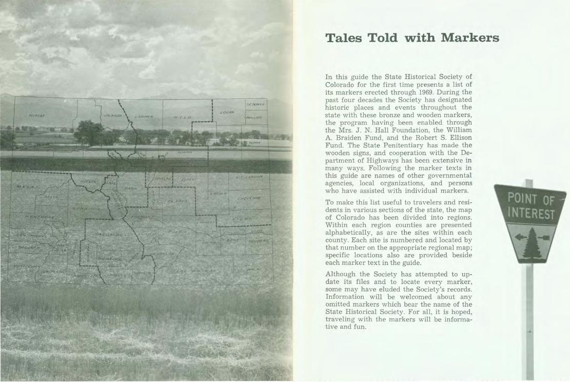
Tales Told with Markers
In this guide the State Historical Society of Colorado for the first time presents a list of its markers erected through 1969. During the past four decades the Society has designated historic places and events throughout the state with these bronze and wooden markers, the program having been enabled through the Mrs. J. N. Hall Foundation, the William A. Braiden Fund, and the Robert S. Ellison Fund. The State Penitentiary has made the wooden signs, and cooperation with the Department of Highways has been extensive in many ways. Following the marker texts in this guide are names of other governmental agencies, local organizations, and persons who have assisted with individual markers.
To make this list useful to travelers and residents in various sections of the state, the map of Colorado has been divided into regions. Within each region counties are presented alphabetically, as are the sites within each county. Each site is numbered and located by that number on the appropriate regional map; specific locations also are provided beside each marker text in the guide.
Although the Society has attempted to update its files and to locate every marker, some may have eluded the Society's records. Information will be welcomed about any omitted markers which bear the name of the State Historical Society. For all, it is hoped, traveling with the markers will be informative and fun.

ELBERT
••• SEDGWICK
PHILLIP.5 G
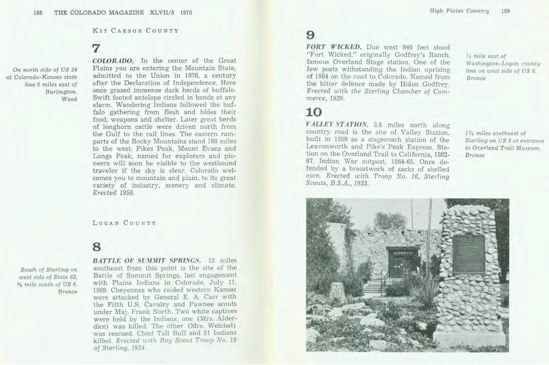
MORGAN
YUMA
WA5HINGTON
LINCOLN
KIT CAR.SON 8
CHEYENNE 0 oe e f)
0 Kl 0 WA
High Plains Country
The rolling plains here begin their climb from midwestern farmlands to the regions dominated by the adjacent Rockies. Where dry farming, cattle raising, and oil production now thrive, Indians and buffalo once roamed the prairie. Gold seekers crossed the prairie along the Platte River and the Smoky Hill Trail; the Pony Express, stage lines, and the railroad followed. In this brief interval the last of Colorado's Indian battles were fought and the Indians were removed. The great herds of buffalo survived little longer.
CHEYENNE COUNTY
1 COLORADO. The Mountain State reaches across the great plains to welcome you. This is the Smoky Hill Trail, a short cut found in 1860 from the Missouri River to the Pikes Peak and Cherry Creek gold diggings. On this route to the mountains wagon trains and stage coaches brought thousands from water hole to water hole across the dry plains. In the 1870's rails followed the wagon tracks and steam trains were halted by herds of buffalo. Nomad Indians-Cheyennes, Comanches and Kiowas-sometimes attacked wagons and outlaws held up trains. Today these dry lands yield immense crops and graze thousands of fat cattle. The Rocky Mountains
State line marker on US 40, east of Cheyenne Wells. Wood
186 THE COLORADO MAGAZINE XLVII/3 1970
Kit Carson, in park on north side of US 40.
Bronze
12 miles north of Kit Carson on the
west side of State 59.
Bronze
will soon be visible as you proceed west, traveling in a quarter of an hour or less the distance the wagon trains came in a day. Erected 1956.
2 KIT CARSON. Named for the great western scout, guide, trapper, and Indian fighter. Located on famous trails-at the junction of the Smoky Hill stagecoach route and the TexasMontana Potter and Bacon, and Chisum cattle tr~ils . On the old Kansas Pacific Railroad, at junction of branches running to Denver and to Las Animas. Erected with the Chamber of Commerce of Kit Carson, 1954.
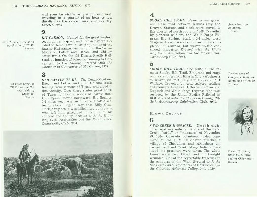
3 OLD CATTLE TRAIL. The Texas-Montana, Bacon and Potter, and J. S. Chisum trails, leading from sections of Texas, converged in this vicinity. Over these routes great herds of Texas longhorns, scions of hardy stock from Spain, moved northward. Big Springs, 2.4 miles west, was an important cattle watering place. Legend says that Billy Comstock, early scout, was killed here by Indians, who left him unscalped in tribute to his courage and ability. Erected with the Highway 59-61 Association and the Mount Pearl Community Club, 1954.
High Plains Country 187
4 SMOKY HILL TRAIL. Famous emigrant and stage road between Kansas City and Denver. Stations and stock were moved to this shortened north route in 1866. Travelled by pioneers, soldiers, and Wells Fargo Express. Big Springs Station 2.4 miles west. Stagecoach service was withdrawn upon completion of railroad, but wagon traffic continued thereafter. Erected with the Highway 59-61 Association and the Mount Pearl Community Club, 1954.
5 SMOKY HILL TRAIL. The route of the famous Smoky Hill Trail. Emigrant and stage road extending from Kansas City (Westport) to Denver, via Fort Riley, Fort Hays and Fort Wallace. Traveled by gold seekers, soldiers and pioneers. Route of Butterfield's Overland Dispatch and Wells Fargo Express. The trail replaced by the Union Pacific Railroad in 1870. Erected with the Cheyenne County Fiftieth Anniversary Celebration Club, 1939.
KIOWA COUNTY
6 SAND CREEK MASSACRE. North eight miles, east one mile is the site of the Sand Creek "battle" or "massacre" of November 29, 1864. Colorado volunteers under command of Col. J. M. Chivington attacked a village of Cheyennes and Arapahoes encamped on Sand Creek. Many Indians were killed; no prisoners were taken. The white losses were ten killed and thirty-eight wounded. One of the regrettable tragedies in the conquest of the West. Erected with the Eads and Lamar Chambers of Commerce and the Colorado Arkansas Valley, Inc. , 1950.
Same location as above. Bronz•e
7 miles west of Cheyenne Wells on north side of US 40. Bronze
On north side of State 96, 314 mile east of Chivington. Bronze
188 THE COLORADO MAGAZINE XL VII/3 1970
On north side of US 24 at Colorado-Kansas state
line 6 miles east of Burlington.
Wood
South of Sterling on west side of State 63,
3,4 mile south of US 6. Bronze
KIT CARSON COUNTY
7 COLORADO. In the center of the Great Plains you are entering the Mountain State, admitted to the Union in 1876, a century after the Declaration of Independence. Here once grazed immense dark herds of buffalo. Swift footed antelope circled in bands at any alarm. Wandering Indians followed the buffalo gathering from flesh and hides their food, weapons and shelter. Later great herds of longhorn cattle were driven north from the Gulf to the rail lines. The eastern ramparts of the Rocky Mountains stand 160 miles to the west. Pikes Peak, Mount Evans and Longs Peak, named for explorers and pioneers will soon be visible to the westbound traveler if the sky is clear. Colorado welcomes you to mountain and plain, to its great variety of industry, scenery and climate. Erected 1956.
LOGAN COUNTY
8 BATTLE OF SUMMIT SPRINGS. 13 miles southeast from this point is the site of the Battle of Summit Springs, last engagement with Plains Indians in Colorado, July 11, 1869. Cheyennes who raided western Kansas were attacked by General E. A. Carr with the Fifth U.S. Cavalry and Pawnee scouts under Maj. Frank North. Two white captives were held by the Indians; one (Mrs. Alderdice) was killed. The other (Mrs. Weichel) was rescued. Chief Tall Bull and 51 Indians killed. Erected with Boy Scout Troop No. 18 of Sterling, 1934
High Plains CO'lmtry 189
9 FORT WICKED. Due west 940 feet stood "Fort Wicked," originally Godfrey's Ranch, famous Overland Stage station. One of the few posts withstanding the Indian uprising of 1864 on the road to Colorado. Named from the bitter defence made by Holon Godfrey. Erected with the Sterling Chamber of Commerce, 1929.
10 VALLEY ST AT ION. 3.8 miles north along country road is the site of Valley Station, built in 1859 as a stagecoach station of the Leavenworth and Pike's Peak Express. Station on the Overland Trail to California 1862-67. Indian War outpost, 1864-65. On~e defended by a breastwork of sacks of shelled corn. Erected with Troop No. 16, Sterling Scouts, B.S.A., 1933.
1h mile east of Washington-Logan county
line on west side of US 6. Bronze
1 % miles southeast of Sterling on US 6 at entrance to Overland Trail Museum. Bronze

On north side of
US 6, 3/4 mile west of Colorado-Nebraska
state line. Wood
Julesburg, on 1st St. (US 138) between
Oak and Elm streets. Wood
PHILLIPS COUNTY
11 COLORADO. In the early 1860's this highway was traversed by stage lines and oxteam caravans whose prairie schooners bore the legend "Pikes Peak or Bust." This was a short cut where water was often scarce. Disillusioned, gold-seeking "pilgrims" returning eastward sometimes added to their covered wagons the legend: "Busted, by Thunder." This highway crosses early buffalo grazing grounds and cattle ranges where Indians often fought the white men in an effort to keep back the encroaching settlers. Some sixty miles ahead it joins the South Platte River route at Sterling, along which were early forts and trading posts. Much adjacent territory was settled from 1886-1889. Leaving Denver the route spirals westward over the Continental Divide through an area colored with robust history of Colorado's early mining camps. Erected 1956.
SEDGWICK COUNTY
12 COLORADO. Here on the Great Plains where the ramparts of the Rocky Mountains still lie some hours westward the Mountain State welcomes you. This highway leads up the valley of the South Platte River to Den-
High Plains Country 191
ver. In 1859 and 1860 the gold rush carried thousands westward along this trail, in wagons, on horseback, with handcarts and on foot, seeking fortune. They saw then an empty land, traversed only by nomad Indian bands who followed great dark herds of buffalo, often miles in extent. Towns like Julesburg soon grew from stage stations armed against Indian attack. In the 1870's the first rails were laid almost in the wagon ruts. Today the highway traverses bountiful lands and substantial cities. Erected 1956.
13 FORT SEDGWICK. Due south 11/4 miles is the site of Fort Sedgwick. Established in September, 1864, as a United States Army post. Called Camp Rankin and Post Julesburg. Name changed in November, 1865, to honor General John Sedgwick, who was killed at Spottsylvania May 9, 1864. The fort protected the stage line and emigrant trains from Ir1-diaps. Abandoned in May, 1871. From thl.s fort, Sedgwick County derives its name. Erected with the Julesburg Historical Society, 1940.
Ovid, on south side of US 138 at eastern city limits . Bronze
A Juan Menchaca painting of Fort Sedgwick.

192 THE COLORADO MAGAZINE XLVIl/3 1970
From Ovid, 1.5 miLes south on Main St., then
east on dirt road 1.5 miles (north side of dirt road) .
Bronze
8 miles south from Atwood on State 63, then east
5 miles on dirt road. Bronze
14 JULESBURG. Due north 1235 feet is the original site of Old Julesburg, named for Jules Beni, whose trading post was established at the "upper crossing" of the Platte prior to 1860. Junction of Oregon and Overland trails. Pony Express station, 1860-61. Overland Stage station, 1859-65. Burned in Indian raid, Feb. 2, 1865. Erected with citizens of Sedgwick County, 1931 .
The telegraph office at Julesburg.
WASHINGTON COU NTY
15 SUMMIT SPRINGS BATTLEFIELD. Fleeing after a series of bloody raids on the Kansas frontier , a band of 450 marauding Cheyenne dog soldiers led by Tall Bull (Tatonka Raska) camped here. On the afternoon of July 11, 1869, 300 men of the 5th Cavalry and the Pawnee scouts under Gen. E. A . Carr
High Plains Country 193
made a successful surprise attack on the camp. Chief Tall Bull was among the 52 Indians killed in the battle; 418 horses and mules were captured, and 84 lodges were put to the torch. Fifth Cavalry scout Buffalo Bill Cody later made this last Plains Indian battle in Colorado a regular feature of his Wild West Show. Erected with the Sterling Lions CLub and the Logan County Commissioners, 1966.
YUMA COUNTY
16 COLORADO. Here near the springs of the Republican River, you enter the Mountain State in the center of the Great Plains. These prairies, once called the American Desert, and the wall of the Rocky Mountains to the west once barred the advance of the white man. Here grazed buffalo in unbelievable numbers. Shy, swift antelope coursed the arroyos. Indians on horseback, their tepees tied on dragging poles, raided the buffalo herds for meat and hides. Today highways, railroads and airplanes carry the traveler in a few minutes farther than ox-hauled wagons reached in a day. Colorado is one of the last settled areas of America but today 1,500,000 residents inhabit its plains, mountains and cities surrounded by varied agriculture, industry, scenery and climate. The people of Colorado welcome you. Erected 1956.
On north side of US 34, 1 mile west of state line . Wood

G & • 9 ••• fD
EL PASO
CROWLEY
OTERO
L.AS ANIMAS
G CD G>
G
PROWERS
BA C A
Arkansas Trade Routes
Scouted by Pike, following traces of Indians and Spaniards, the Arkansas River and its tributaries provided a route across southeastern Colorado to the foothills and deep into the Rockies, as modern highways along its banks connect commercial centers such as La Junta, Pueblo, Canon City, and Colorado Springs today. But the boldest of the early trade efforts was along the Santa Fe Trail and the Mountain Branch which crossed Raton Pass near Trinidad.
BENT COUNTY
17 BENT'S NEW FORT. The site of Bent's New Fort, built by William W. Bent in 1853 as an Indian trading post. Sold to U.S. government, 1859. Buildings added one mile west and named Fort Wise in 1860. Re-named Fort Lyon in 1861[2]. Fort moved farther west, 1867. Erected with the Lamar Junior Chamber of Commerce, 1942.
Fort Lyon in 1863.
US 50, 1.1 miles west of US 287 (north), south 1 mile on dirt road, .2 mile east, .5 mile south to locked gate. Bronze

196 THE COLORADO MAGAZINE XLVIl/3 1970
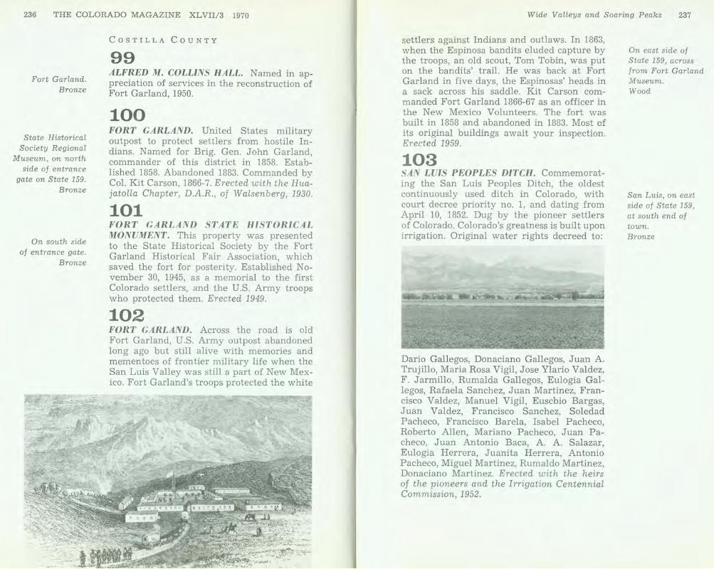
Roadside park on south side of
US 50 8.5 miles east of La Junta.
Wood
2 miles south of Las Animas on east
side of State 101. Bronze
Colorado Springs, in Bancroft Park, W. Colorado
Ave. at 24th St. Bronze
18 BIG T IMBERS. Beginning about 25 miles down the Arkansas River from the mouth of the Purgatoire, a belt of giant cottonwoods stretched eastward for another 25 miles along both banks of the river. The lush grass, abundant game, plentiful wood, and fresh water made it a favorite camping place for Indians. Zebulon Pike passed through here in November, 1806. Surveyors and traders, following the Mountain Branch of the Santa Fe Trail, paused at Big Timbers to rest or to trade with the Indians. Although Bent's Old Fort was located a few miles up river, William Bent maintained trading stations in the Big Timbers and in 1853 built his new stone fort there. After the removal of the Indians in the 1860's, the area was opened to settlement, and the Big Timbers furnished building material for settlers' cabins and wood for their cookstoves. Erected 1965.
19 BOGGSVILLE. Established in 1866. Named for Thomas 0 . Boggs, first settler on this site. Home of Kit Carson and John W. Prowers, noted pioneers. Seat of Bent County, 1870. Site of first public school in southeastern Colorado. Erected with Mary Prowers HudnaLL and citizens and school children of Las Animas, 1946.
EL PASO COUNTY
20 COLORADO CITY. Founded here in August, 1859, then in El Paso County, Kansas. So named because at the gateway to mines thought to be on the Colorado River. Incorporated with Colorado Springs on June 11, 1917. The first capital of Colorado, so desig-
nated by the first territorial legislature, 1861. Erected with the EL Paso County Pioneers' Association and the City of Colorado Springs, 1940.
21 FIRST CAPITOL. Log house from Colorado's first designated territorial capital at Colorado City (now a part of Colorado Springs). This log house was built in 1859. The first legislative assembly in Denver in 1861 named Colorado City the capital. The 2nd assembly met there in 1862. This is the only remaining building associated with that meeting. Erected 1959.
22 JIMMY'S CAMP. One mile southeast are the spring and site of Jimmy's Camp, named for Jimmy (last name undetermined), an early trader who was murdered there. A famous camp site on the trail connecting the Arkansas and Platte rivers and variously known as "Trappers' Trail," "Cherokee Trail," and "Jimmy's Camp Trail." Site visited by Rufus Sage (1842), Francis Parkman (1846), Mormons (1847), and by many gold seekers of 1858-59. Erected with the Kinnikinnik Chapter, D.A.R., 1949.
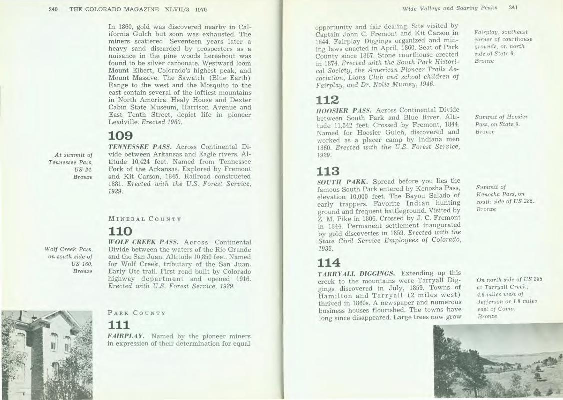
23 OLD FORT AND STOCKADE. This marks the site of the old fort and stockade built by pioneers of Colorado City. Used in defense against the Indians in 1864 and 1868. Constructed of logs set on end. Erected with the EL Paso Pioneers' Association and the City of Colorado Springs, 1936.
Same location as above . Bronze
Southeast side of US 24, east of Colorado Springs, 2¥2 miles east of junction with State 94. Bronze
Colorado Springs, 2824 Pikes Peak Ave. Bronze

198 THE COLORADO MAGAZINE XLVII/3 1970
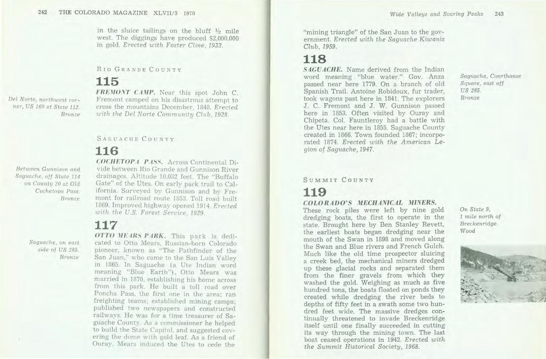
On west side of 1-25 (US 85-87) between north
and south entrances to U .S. Air Force Academy.
Wood
North side of US 24, 5 miles east of Peyton.
Wood
24 PIKES PEAK. Southwest rises the summit of Pikes Peak. This mountain, 14,110 feet above the sea and the most celebrated peak in America, is named for the explorer, Capt. Zebulon M. Pike, who saw it first in 1806. He attempted to climb it, failed and reported it unclimbable. Ascended in 1820 by Dr. Edwin James, a later explorer. A cog railway reached the summit in 1890 and a highway, in 1915. Motor races up the peak are held annually. The resort city of Colorado Springs, founded 1871 nestles at its foot where the fi rst town ' . called Colorado [City] stood years earlier. The U.S. Air Force Academy rises ten miles north. Pikes Peak is famed for its history and conspicuous position. Colorado contains more than fifty mountains over 14,000 feet h igh. Erected 1964.
25 PIKES PEAK. Southwest rises the summit of Pikes P eak. This mountain, 14,110 feet above the sea and the most celebrated peak in America, is named for the explorer, Capt. Zebulon M. P ike, who saw it first in 1806. He attempted to climb it but was turned back by deep snow. Ascended in 1820 by Dr. Edwin James, a later explorer. A cog railway reached the summit in 1890 and a
Arkansas Trade Routes 199
highway, in 1915. Motor races up the peak are held annually. The resort city of Colorado Springs, founded 1871, nestles at its foot where the first town called Colorado City stood years earlier. The U.S. Air Force Academy is a few miles north. Pikes Peak is famed for its history and conspicuous position. Colorado contains more than fifty mountains over 14,000 feet high. Erected 1959.
26 STONE FORT. Due south 610 feet is the old stone fort built at the pioneer home of David McShane. Constructed as a defense against Arapaho and Cheyenne raiders, it was a refuge used in 1865-1868 by the following pioneer families of the upper Monument Valley: Brown, Chandler, Davidson, DeMasters, Faulkner, Guire, Jackson, McShane, Oldham, Roberts, Simpson , Shideler, Teachout, Walker, Watkins, Welty. Erected with the Zebulon Pike and K innikinnik Chapters, D.A.R., and by citizens of the Monument region, 1950.
27 UTE PASS. Named from the old Ute Trail which led from South Park through Manitou to the plains. Traversed by the Utes on hunting and war expeditions. Improved highway built, 1916-28. Erected with the U.S . Forest Service, 1929.
FREMONT COUNTY
28 FLORENCE AND CRIPPLE CREEK R AILROAD. The city of Florence and Fremont County, Colorado, owe much of their growth and development to the building and operation of the Florence and Cripple Creek Rail-
Near Monument 3)1 mile west of 1- 25 (US 85 - 87) on south side of State 105, west of railroad tracks. Bronze
:i6 mile west of Manitou Springs on old U S 24, across from Rainbow Falls. Bronze
Florence, on grounds of high school at northeast corner of State 115 and 2nd St. Bronze

On OiL Creek, 6.4
miles north of Canon City via Field Ave.
Bronze
On the west side of State 67, 8~ miles south of Florence.
Wood
road (May 10, 1893-May 10, 1915). This tablet marks the approximate location of the Florence & Cripple Creek roundhouse, railroad yards and mainline tracks. In its day, this railroad was one of the busiest narrow gauge lines, mile for mile, in the colorful history of the West. Erected with the Pioneer Day Association of Florence, 1956.
29 GARDEN PARK. Garden Park type locality of dinosaurs. The first remains of several species of dinosaurs were found within a twomile radius of this point in 1877 by Prof. 0. C. Marsh of Yale University, and Prof. E. D. Cope of the Academy of Sciences of Philadelphia. This discovery of extinct giant reptiles in the western hemisphere received world-wide acclaim. The specimens excavated on these and subsequent expeditions are in the museums listed below.
Tyrannosaurus American Museum
Stegosaurus Yale Peabody Museum Denver Museum
Diplodocus Carnegie Museum
Brontosaurus Ceratosaurus Phil. Acad. of Sciences U.S . National Museum
Erected with the Canon City Geology Club and citizens of Canon City, 1953.
30 HARDSCRABBLE. Much of this area's early history occurred in nearby trading posts and settlements which lived and died leaving little trace of their existence. Such was the post built one mile west by Maurice Leduc in the 1830's and the village of Hardscrabble established in the 1840's by traders and trappers below the fork of Hardscrabble and Adobe creeks. Hardscrabble's walls and flatroofed adobe houses formed a protective square in the middle of country long fought
Arkansas Trade Routes 201
over by the Ute and Arapaho Indians. Villagers traded with anyone who happened by, but the tiny community was too far removed from the main-traveled Santa Fe Trail to survive. By late November, 1848, when John C. Fremont and his men briefly visited Hardscrabble on their way west in search of a central railroad route through the mountains, the village was almost deserted. Erected with the Arkansas Valley Chapter, D.A.R. , 1969.
31 OIL CREEK. Site of the first oil well in the west; second place in the United States to produce petroleum from wells. In 1862, just across the stream from this point, A. M. Cassid I al y drilled an oil well fifty feet deep. By February, 1863, production was one barrel a day. Later, several thousand gallons of petroleum were produced by primitive methods, and kerosene and lubricating oil were shipped by ox-team as far as Denver & Santa Fe. Cassid I al y's success led to the finding of Colorado's first real oil field about seven miles south of here. This field, known as the Florence Pool, was discovered in 1876 by Isaac Canfield. It subsequently was operated for about seventy years by Continental Oil Company and its predecessors. The field still produces a small amount of petroleum. Erected with the Continental Oil Company, the Canon City Geology Club, and citizens of Canon City , 1957.
32 OLDEST OIL FIELD IN THE WEST. In Florence and surrounding area was developed the first recognized oil field west of the Mississippi River, as a result of the discovery of oil by A. M. Cass id I a I y in Fremont County in 1862. More than 1,300 wells, averaging 2,300 barrels per acre, have been drilled in this 14-square-miles area, including many
North of Canon City, 4. 7 miles on Oil Creek via Field Ave. Bronze
Florence, north side
of US 115 in front of Municipal Building. Bron2oe
'
I I
202 THE COLORADO MAGAZINE XLVIl/3 1970
East end of RoyaL Gorge , .7 mile west of US 50,
below Tunnel Drive at west edge of Canon City.
Bronze
At each end of Royal Gorge Bridge, Located
8 miles west of Canon City and 4 miles
south of US 50. Wood
within the city limits. One mile north is Well No. 42, drilled in 1889, the oldest continuous commercial producing oil well in the world. It has produced more than 1,000,000 barrels. Erected with the Florence Pioneer Day Association, 1962.
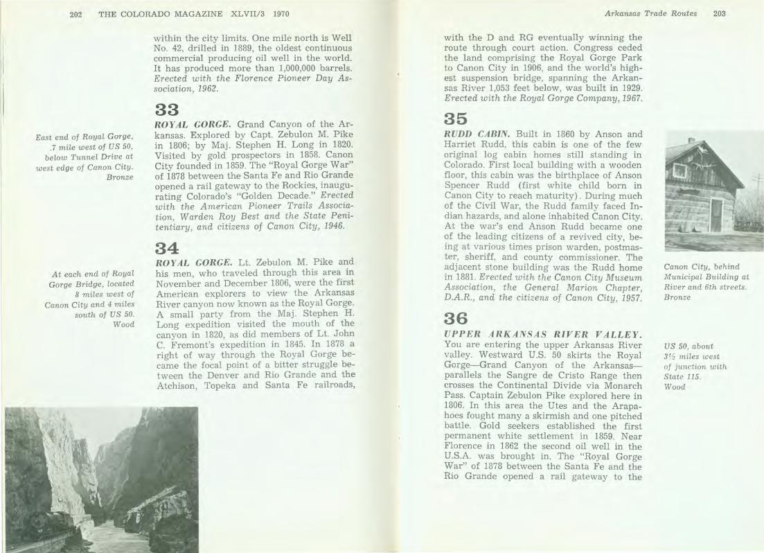
33 ROY AL GORGE. Grand Canyon of the Arkansas. Explored by Capt. Zebulon M. Pike in 1806; by Maj. Stephen H. Long in 1820. Visited by gold prospectors in 1858. Canon City founded in 1859. The "Royal Gorge War" of 1878 between the Santa Fe and Rio Grande opened a rail gateway to the Rockies, inaugurating Colorado's "Golden Decade." Erected with the American Pioneer Trails Association, Warden Roy Best and the State Penitentiary, and citizens of Canon City, 1946.
34 ROY AL GORGE. Lt. Zebulon M. Pike and his men, who traveled through this area in November and December 1806, were the first American explorers to view the Arkansas River canyon now known as the Royal Gorge. A small party from the Maj. Stephen H. Long expedition visited the mouth of the canyon in 1820, as did members of Lt. John C. Fremont's expedition in 1845. In 1878 a right of way through the Royal Gorge became the focal point of a bitter struggle between the Denver and Rio Grande and the Atchison, Topeka and Santa Fe railroads,
Arkansas Trade R011,tes 203
with the D and RG eventually winning the route through court action. Congress ceded the land comprising the Royal Gorge Park to Canon City in 1906, and the world's highest suspension bridge, spanning the Arkansas River 1,053 feet below, was built in 1929. Erected with the Royal Gorge Company, 1967.
35 RUDD CABIN. Built in 1860 by Anson and Harriet Rudd, this cabin is one of the few original log cabin homes still standing in Colorado. First local building with a wooden floor, this cabin was the birthplace of Anson Spencer Rudd (first white child born in Canon City to reach maturity). During much of the Civil War, the Rudd family faced Indian hazards, and alone inhabited Canon City. At the war's end Anson Rudd became one of the leading citizens of a revived city, being at various times prison warden, postmaster, sheriff, and county commissioner. The adjacent stone building was the Rudd home in 1881. Erected with the Canon City Museum Association, the General Marion Chapter, D.A.R., and the citizens of Canon City, 1957.
36 UPPER ARKANSAS RIVER VALLEY. You are entering the upper Arkansas River valley. Westward U.S. 50 skirts the Royal Gorge-Grand Canyon of the Arkansasparallels the Sangre de Cristo Range then crosses the Continental Divide via Monarch Pass. Captain Zebulon Pike explored here in 1806. In this area the Utes and the Arapahoes fought many a skirmish and one pitched battle. Gold seekers established the first permanent white settlement in 1859. Near Florence in 1862 the second oil well in the U.S.A. was brought in. The "Royal Gorge War" of 1878 between the Santa Fe and the Rio Grande opened a rail gateway to the
Canon City, behind Municipal Building at River and 6th streets. Bronze
US 50, about 3tt.z miles west of junction with State 115. Wood
204 THE COLORADO MAGAZINE XLVII/3 1970
On the east
side of I-25 (US 85-87) between
exits 22 and 23. Bronze
Bloom House State Historical Society
Regional Museum, Trinidad, in parlor.
Bronze
Rockies, inagurating Colorado's golden decade. Canon City, site of the State Penitentiary, lies in the heart of vast natural resources. Erected with the Royal Gorge Chapter State Civil Service Employees' Association, 1959.
HUERFANO COUNTY
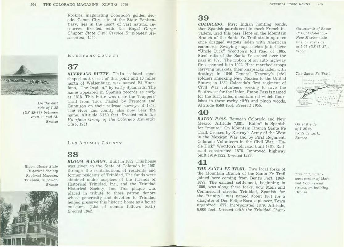
37 HVERF ANO BUTTE. This isolated coneshaped butte, east of this point and 10 miles north of Walsenburg, was named El Huerfano, "The Orphan," by early Spaniards. The name appeared in Spanish records as early as 1818. This butte was near the Trappers' Trail from Taos. Passed by Fremont and Gunnison on their railroad surveys of 1853. The river and county also now bear the name. Altitude 6,150 feet. Erected with the Huerfano Group of the Colorado Mountain Club, 1951.
LAS ANIMAS COUNTY
38 BLOOM MANSION. Built in 1882. This house was given to the State of Colorado in 1961 through the contributions of residents and former residents of Trinidad. The funds were obtained under auspices of the Friends of Historical Trinidad, Inc., and the Trinidad Historical Society, Inc. This plaque was placed in tribute to those patron donors whose generosity and devotion to Trinidad helped preserve this historic home as a house museum. (List of donors follows text.) Erected 1962.
Arkansas Trade Routes 205
39 COLORADO. First Indian hunting bands, then Spanish patrols sent to check French invaders, used this pass. Here on the Mountain Branch of the Santa Fe Trail straining oxen once dragged wagons laden with American commerce. Swaying stagecoaches jolted over "Uncle Dick" Wootton's toll road of 1865. Steel rails of the Santa Fe arched over the pass in 1878. The ribbon of an auto highway first spanned it in 1922. Here marched troops carrying muskets, their knapsacks laden with destiny; in 1846 General Kearney's [sic] soldiers annexing New Mexico to the United States; in 1862 Colorado's first regiment of Civil War volunteers seeking to save the Southwest for the Union. Raton Pass is named for the furrytailed mountain rat which flourishes in these rocky cliffs and pinon woods. Altitude 8560 feet . Erected 1955.
40 RATON PASS. Between Colorado and New Mexico. Altitude 7,881. "Raton" is Spanish for "mouse." On Mountain Branch Santa Fe Trail. Crossed by Kearny's Army of the West in the Mexican War and by First Regiment, Colorado Volunteers in the Civil War. "Uncle Dick" Wootton's toll road built 1865. Railr0ad constructed 1878. Improved highway built 1919-1922. Erected 1929.
41 THE SANT A FE TRAIL. Two local forks of the Mountain Branch of the Santa Fe Trail joined here coming from Bent's Fort, 1840-1879. The earliest settlement, beginning in 1859, was along these forks , now Main and Commercial streets. Trinidad, Spanish for the "trinity," was named about 1861 for a daughter of Don Felipe Baca, a pioneer. Town organized 1877; incorporated 1879. Altitude, 6,000 feet. Erected with the Trinidad Cham-
On summit of Raton Pass, at Colorado-N ew Mex ico state l i ne, on east side of I-25 (US 85-87) . Wood
The Santa Fe Trail.
On east side of I-25 in roadside park. Bronze
Trinidad, northwest corner of Main and Commercial streets , on building. Bronze
206 THE COLORADO MAGAZINE X L VII/3 1970
At roadside rest on south side of US 50,
30 miles east of Holly and near
Colorado-Kansas state line.
Wood
In Greenhorn Meadow Park, Colorado City,
just off State 165, 3.4 miles west of I-25.
Bronze
ber of Commerce and H . K. Holloway of Trinidad, 1930.
PRO WE R S COU N TY
42 COLORADO. Th is route parallels the old Santa Fe Trail for 85 miles to La Junta, then continues westward along the Arkansas River , th e Gunnison and the Colorado rivers. On th ese plains once roamed Cheyenne, Arapahoe, K iowa and Comanche Indians subsisting on buffalo which grazed in immense dark herds. This region was once Spanish, then French and became American in 1803. Zebulon Pike carried the first American flag westward on this route into the mountains in 1806. The great peak named for Captain Pike but to him unclimbable will soon be visible. After 1822 uncounted wagon trains carried freight past here to Santa Fe. Mountain men like Kit Carson trapped beaver, fought Indians. Explorers Fremont and Gunnison took this route and later the gold seekers whose discoveries in 1859 launched Colorado. Here marched history. Erected 1956.
PUEBLO COUNTY
43 CUERNO VERDE. In this vicinity the Comanche chief Cuerno Verde (Greenhorn), the "Cruel Scourge," w as defeated and killed by the Spaniards under Gov. Juan B. Anza on Sept. 3, 1779. The nearby mountain and stream take their name from the chief. Anza's was the first expedition through certain parts of Colorado. Erected with the State Civil Service E1 iployees of Colorado, 1932.
44 FORT REYNOLDS. This is the site of Fort Reynolds, 1867-1872. U .S. military outpost to protect settlers from hostile Indians. Named for Gen. John F. Reynolds, killed at Gettysburg in 1863. First occupied by Company F, Fifth United States Infantry. The fort was built of adobe. Erected w ith State Civil Service Employees of Colorado, 1932.
45 JACOB FOWLER'S LOOKOUT AND FOUNTAIN CITY. The hill one block east is Jacob Fow ler's Lookout, later called Sugar Loaf Hill. Near it in a log house Fowler and his t rappers lived in Jan., 1822. Fountain City, predecessor of Pueblo and founded in the fall of 1858, ran west from the hill to the Fountain River. Men who came as gold seekers remained to farm, trade, and found a city. Erected with the Fontaine Qui Bouille Chapter, D.A.R., 1936.
46 MORMON BATTALION. A detachment of United States soldiers of the Mormon Battalion in the Mexican War spent the winter of 1846-47 near this site. With their families and Mormon immigrants from Mississippi they formed a settlement of 275 persons. They erected a church and rows of dwellings of cottonwood logs. Here were born the first white children in Colorado. Erected with Colorado members of the Church of Jesus Christ of L atter Day Saints and citizens of Pueblo, 1946.
2% miles east of Avondale, on north side of Business Route US 50. Bronze
Pueblo, at junction of Joplin Ave. (State 227) and Damson St . Bronze
Pueblo, 100 yards east of junction of Santa Fe Drive, Santa Fe Ave., and Business Route US 50 . Bronze
~- :""""' .-
! !. ;
' r>-ir---+--+-c~+...,.~~~~.,_~__:~::s,, .... ~~ : -.. j ... ..
'r I
L{ ..,
I . ,-·-···~
Mile-High City
A mile high and still growing, Denver has become the capital city not only of Colorado but also of all the Rocky Mountain West. From a placer on Dry Creek, a boisterous frontier settlement spawned and went on to earn reputations as cow town, commercial and industrial hub, cultural mecca, queen city of parks and emerald lawns, center of Colorado's population, and the proud seat of Colorado's state government.
DENVER COUNTY
47 AURARIA. On November 1, 1858, the center of this stream was designated the east boundary of Auraria, first duly located and platted town at the mouth of Cherry Creek. This 1,200-acre settlement, with Indian Row and "Uncle Dick" Wootton's store, was the definite beginning of Denver. The town was named for Auraria, Georgia, meaning "gold."
Denver, southwest end of Market St. bridge at Speer Blvd. northbound. Bronze

210 THE COLORADO MAGAZINE XLVIl/3 1970
Denver, at southwest corner of 26th Ave.
at Colorado Blvd. Bronze
Denver, at northwest end of viaduct at
corner of West 8th Ave. and Vallejo.
Bronze
Denver, State Historical Society
of Colorado Library. Bronze
William Green Russell and his brothers discovered the first gold in paying quantity in Colorado, inciting the gold rush of 1859. Auraria was the cradle of Colorado's pioneer business and political development. On April 5, 1860, a ratification meeting was held by moonlight, on the Larimer Street bridge one block south, at which Auraria and Denver consolidated under the name Denver. Erected with the Peace Pipe Chapter, D.A.R., 1959.
48 CAMP ADAMS. Immediately northeast was the site of Camp Adams. The Colorado National Guard encamped here April 28, 1898. Infantry units mustered in as First Colorado Lnfantry, U.S.V., under command of Col. Irving Hale. These forces participated in the capture of Manila, P.I., raising the first flag over the city, Aug. 13, 1898. Other units from this camp served elsewhere in the war. Erected with the First Colorado Infantry, U.S.V. Association, 1952.
49 CAMP WELD. This is the southwest corner of Camp Weld. Established September 1861 for Colorado Civil War volunteers. Named for Lewis L . Weld, first secretary of Colorado Territory. Troops leaving here Feb. 22, 1862, won victory over Confederate forces at La Glorieta, New Mexico, saved the Southwest for the Union. Headquarters against Indians 1864-65. Camp abandoned 1865. Erected with the City and County of Denv er, 1934.
50 EDWARD BROADBENT MORGAN. The library of the State Historical Society of Colorado owes much to the collections donated by Edward Broadbent Morgan (Dec. 18, 1862-Sept. 6, 1935) . Lawyer, chairman of the Colorado Tax Commission. He came to Colorado
Mile-High City 211
in 1864. He was president of this Society, 1903-14, and at his death a director. He was the foremost collector of Colorado historical materials. The harvest of his gathering enriched this institution. Erected 1935.
5 1 ELEPHANT CORRAL. Immediately northeast of this point and covering much of Block 18 East Denver stood the famous Elephant Corral. Camp ground, immigrant headquarters and stock yards of pioneer Denver. Begun early in 1859 by Blake & Williams with their Denver House, the first hotel in Denver City. Horace Greeley was a guest here and addressed the pioneers June 6, 1859. During the 1860s the corral was surrounded by an eightfoot wall having loopholes for Indian defense. Erected with the City and County of Denver, 1935.
Denver, west side main girder, at northwest corner Speer Blvd. and Blake St. Bronze
212 THE COLORADO MAGAZINE XLVII/3 1970
Denver, 1360 12th St. on building.
Bronze
Denver, southwest shore Sloan's Lake, on stone boathouse.
Bronze
52 FIRST SCHOOL. On this site in Auraria (West Denver) the first school in Colorado was opened on October 3, 1859. "Professor" 0. J. Goldrick, who came to Denver dressed in frock coat and high hat and driving a bull team, was the first teacher. The school house was a rented log cabin with dirt roof and canvas door. Pupils paid $3.00 per month tuition. Free public schools were not established until 1862. Erected with the American Pioneer Trail Association and school children of Denver, 1947.
53 MANHATTAN BEACH. On the northwest shore of Sloan's Lake was Manhattan Beach, popular amusement park of the gay nineties, with a theater, boating, dancing, and specialties. Opened on June 27, 1891. The theater burned Dec. 26, 1908. Some amusement features continued to 1914. Erected with the American Pioneer Trails Association and the City Administration of Denver, 1953.
Mile-High City 213
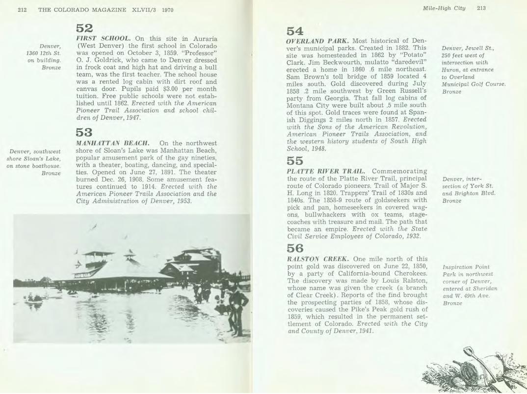
54 OVERLAND PARK. Most historical of Denver's municipal parks. Created in 1882. This site was homesteaded in 1862 by "Potato" Clark. Jim Beckwourth, mulatto "daredevil" erected a home in 1860 .6 mile northeast. Sam Brown's toll bridge of 1859 located 4 miles south. Gold discovered during July 1858 .2 mile southwest by Green Russell's party from Georgia. That fall log cabins of Montana City were built about .5 mile south of this spot. Gold traces were found at Spanish Diggings 2 miles north in 1857. Erected with the Sons of the American Revolution, American Pioneer Trails Association, and the western history students of South High School, 1948.
55 PLATTE RIVER TRAIL. Commemorating the route of the Platte River Trail, principal route of Colorado pioneers. Trail of Major S. H . Long in 1820. Trappers' Trail of 1830s and 1840s. The 1858-9 route of goldseekers with pick and pan, homeseekers in covered wagons, bullwhackers with ox teams, stagecoaches with treasure and mail. The path that became an empire. Erected with the State Civil Service Employees of Colorado, 1932.
56 RALSTON CREEK. One mile north of this point gold was discovered on June 22, 1850, by a party of California-bound Cherokees. The discovery was made by Louis Ralston, whose name was given the creek (a branch of Clear Creek). Reports of the find brought the prospecting parties of 1858, whose discoveries caused the Pike's Peak gold rush of 1859, which resulted in the permanent settlement of Colorado. Erected with the City and County of Denver, 1941.
Denver, Jewell St., 250 feet west of intersection with Huron, at entrance to Overland Municipal Golf Course. Bronze
Denver, intersection of York St. and Brighton Blvd. Bronze
Inspiration Point Park in northwest corner of Denver, entered at Sheridan and W. 49th Ave. Bronze
Denver, at south end of Market St. bridge
across Cherry Creek, on southwest
abutment. Bronze
Denver, at Colfax, Broadway, and
Cheyenne Place, on east face of
Pioneer Monument. Bronze
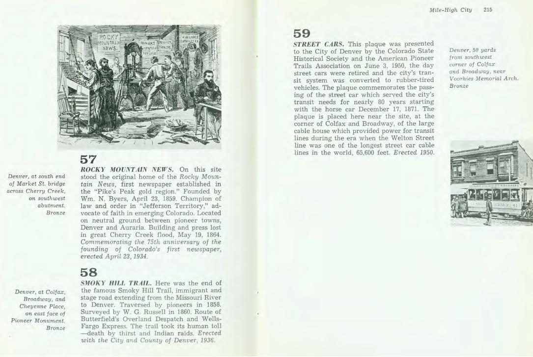
57 ROCKY MOUNTAIN NEWS. On this site stood the original home of the Rocky Mountain News, first newspaper established in the "Pike's Peak gold region." Founded by Wm. N. Byers, April 23, 1859. Champion of law and order in "Jefferson Territory,'' advocate of faith in emerging Colorado. Located on neutral ground between pioneer towns, Denver and Auraria. Building and press lost in great Cherry Creek flood, May 19, 1864. Commemorating the 75th anniversary of the founding of Colorado's first newspaper, erected April 23, 1934.
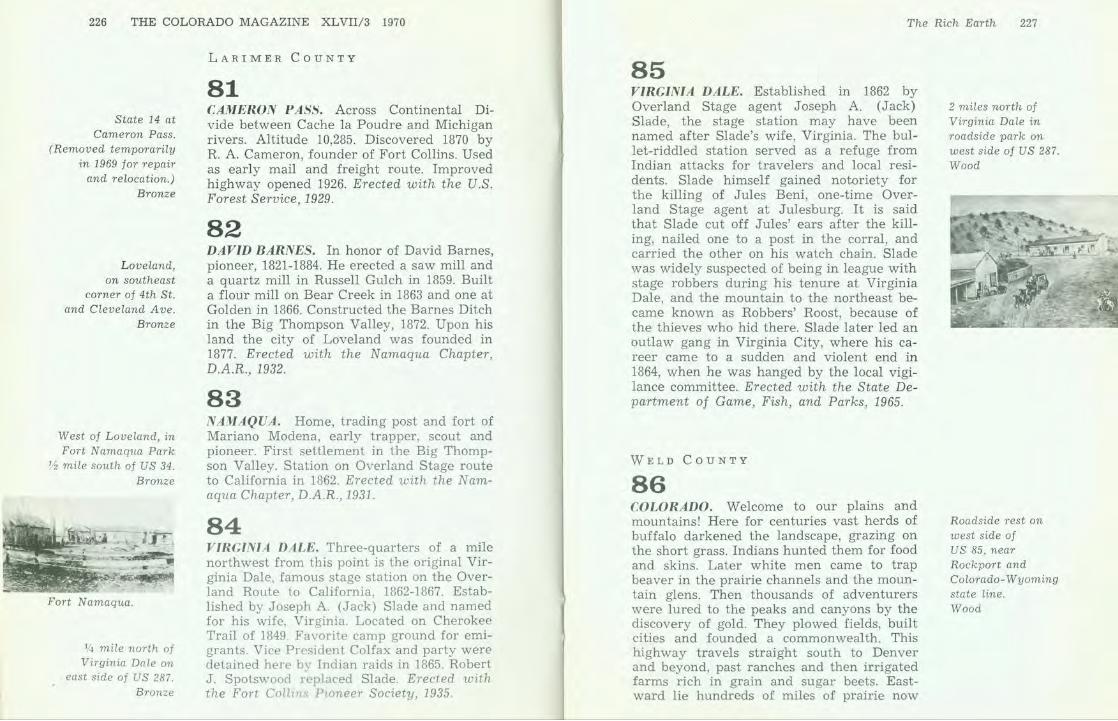
58 SMOKY HILL TRAIL. Here was the end of the famous Smoky Hill Trail, immigrant and stage road extending from the Missouri River to Denver. Traversed by pioneers in 1858. Surveyed by W. G. Russell in 1860. Route of Butterfield's Overland Despatch and WellsFargo Express. The trail took its human toll -death by thirst and Indian raids. Erected with the City and County of Denver, 1936.
Mile-High City 215
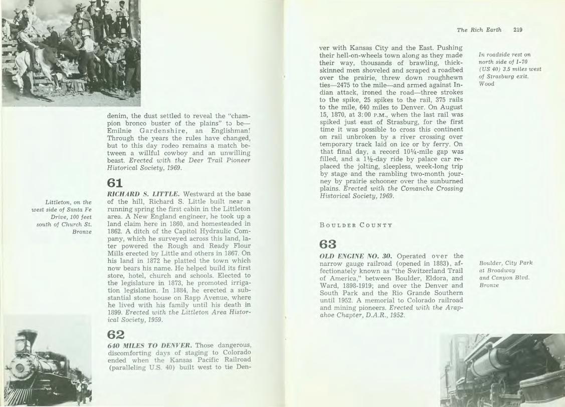
59 STREET CARS. This plaque was presented to the City of Denver by the Colorado State Historical Society and the American Pioneer Trails Association on June 3, 1950, the day street cars were retired and the city's transit system was converted to rubber-tired vehicles. The plaque commemorates the passing of the street car which served the city's transit needs for nearly 80 years starting with the horse car December 17, 1871. The plaque is placed here near the site, at the corner of Colfax and Broadway, of the large cable house which provided power for transit lines during the era when the Welton Street line was one of the longest street car cable lines in the world, 65,600 feet. Erected 1950.
Denver, 50 yards from southwest corner of Colfax and Broadway, near Voorhies Memorial Arch. Bronze

LARIMER
CD BOULDER
G>
-w
WELD
ADAM.S
ARAPAHOE(D CD
The Rich Earth
Riches of mountains and plains combine in north-central Colorado. From mountain mines came the state's first bonanzas of gold and silver. And earlier from the hills came riches in beaver pelts, taken along streams which now irrigate the fertile soils of the plains below. In the cities which have grown up in these productive counties are found the state universities of Colorado.
ARAPAHOE COUNTY
60 BEGUN ON A BET. At first, rodeo had no chutes or fences or deadlines, just a cowboy, a horse, and the open prairie. After long spells off by himself, one of the most lonesome, yarn-spinning, natural-born gamblers in the world-the workaday cowboy-looked for action and found it betting he could stay atop the devil himself wrapped in horsehide if he could be roped and saddled. Then, man and horse battled it out until one or the other gave up or gave out. One of the earliest rodeos, the first recorded with rules and prizes, took place at Deer Trail when the Hashknife, Mill Iron, and Camp Stool outfits celebrated the Fourth of July in 1869 trying to bust the cussedest of the biting, twisting broncos. After the daylong mixup of rawhide and
Deer Trail, in City Park at Elm St. and 2nd Ave. Wood
Littleton, on the west side of Santa Fe
Drive, 100 feet south of Church St.
Bronze
denim, the dust settled to reveal the "champion bronco buster of the plains" to beEmilnie Gardenshire, an Englishman! Through the years the rules have changed, but to this day rodeo remains a match between a willful cowboy and an unwilling beast. Erected with the Deer Trail Pioneer Historical Society, 1969.
61 RICHARD S. LITTLE. Westward at the base of the hill, Richard S. Little built near a running spring the first cabin in the Littleton area. A New England engineer, he took up a land claim here in 1860, and homesteaded in 1862. A ditch of the Capitol Hydraulic Company, which he surveyed across this land, later powered the Rough and Ready Flour Mills erected by Little and others in 1867. On his land in 1872 he platted the town which now bears his name. He helped build its first store, hotel, church and schools. Elected to the legislature in 1873, he promoted irrigation legislation. In 1884, he erected a substantial stone house on Rapp Avenue, where he lived with his family until his death in 1899. Erected with the Littleton Area Historical Society , 1959.
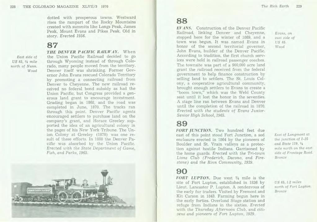
62 640 MILES TO DENVER. Those dangerous, discomforting days of staging to Colorado ended when the Kansas Pacific Railroad (paralleling U.S. 40) built west to tie Den-
The Rich Earth 219
ver with Kansas City and the East. Pushing their hell-on-wheels town along as they made their way, thousands of brawling, thickskinned men shoveled and scraped a roadbed over the prairie, threw down roughhewn ties-2475 to the mile-and armed against Indian attack, ironed the road-three strokes to the spike, 25 spikes to the rail, 375 rails to the mile, 640 miles to Denver. On August 15, 1870, at 3: 00 P.M., when the last rail was spiked just east of Strasburg, for the first time it was possible to cross this continent on rail unbroken by a river crossing over temporary track laid on ice or by ferry. On that final day, a record 10%-mile gap was filled, and a 11/z-day ride by palace car replaced the jolting, sleepless, week-long trip by stage and the rambling two-month journey by prairie schooner over the sunburned plains. Erected with the Comanche Crossing Historical Society, 1969.
BOULDER COUNTY
63 OLD ENGINE NO. 30. Operated over the narrow gauge railroad (opened in 1883), affectionately known as "the Switzerland Trail of America," between Boulder, Eldora, and Ward, 1898-1919; and over the Denver and South Park and the Rio Grande Southern until 1952. A memorial to Colorado railroad and mining pioneers. Erected with the A rapahoe Chapter, D.A .R., 1952.
In roadside rest on north side of I-70 (US 40) 3.5 miles west of Strasburg exit. Wood
Boulder, City Park at Broadway and Canyon Blvd. Bronze

South of Longmont at junction of State 119 and
County 20, turn west for 4. 7 miles,
then south on County 39 for 1 mile.
Bronze
Summit of Berthoud Pass, US 40.
Bronze
Roadside rest on north side of US 6,
2 miles east of State 119.
Wood
• • • .
' . :>;;t ~~
64 RYSSBY. First Swedish settlement in Colorado. Begun 1869-70. Homestead claims filed, 1870. Swede Ditch constructed, 1871. Log schoolhouse built, 1875. Ryssby church, religious and social center, built .1881-82. Erected with the descendants and friends of the original Swedish settlers, 1933.
CLEAR CREEK COUNTY
65 BERTHOUD PASS. Across Continental Divide between South Platte and Colorado River drainages. Altitude 11,314 feet. Discovered by Capt. E. L. Berthoud, Colorado pioneer, May 12, 1861. Surveyed by Berthoud and Jim Bridger July, 1861. Toll road opened 1874. Improved highway opened 1923. Erected with the U.S. Forest Service, 1929.
66 CLEAR CREEK CANYON. This creek saw the first great gold discoveries which converted Colorado from a wilderness to a commonwealth. The transcontinental highway replaces a narrow gauge railroad which first braved the gorge. Two miles above at Forks Creek the road branches right to old Central City and a cluster of once prosperous towns where now a summer opera festival flouri~hes. There in May 1859, John H. Gregory found a gold vein, so founding the Little Kingdom of Gilpm County. Left at the forks
The Rich Earth 221
the main route traverses Idaho Springs first known for rich placer mines after their discovery by George A. Jackson, January 1859. Georgetown once called the Silver Queen lies above. The gravel heaps along the stream were left by gold dredges early this century. Erected 1959.
67 GEORGETOWN. Commemorating the historical importance of the Georgetown mining region. The Griffith Lode (2500 ft. N.E.), later a silver producer, was discovered June 17, 1859, by George W. Griffith, for whom Georgetown was named. Town site claimed June 29, 1860. The Belmont Lode (5.7 miles S.W.), first important silver discovery in Colorado, located Sept. 14, 1864. Boom productions in 1870s and 1880s. Metal output totals $50,000,000. Erected with the Georgetown Library Association, 1935.
68 GEORGETOWN LOOP. Site of the high bridge of the Georgetown Loop, famed scenic railroad attraction. Built in 1883-84 as a branch of the Union Pacific, and later acquired by the Colorado and Southern. Here the railroad track looped over itself, the high bridge being 75 feet above the track beneath. Daily trains bulging with awed excursionists once climbed the loop. It was abandoned and the high trestle dismantled in 1939. Erected with the Georgetown Civic Association, 1947.
Georgetown, at southwest corner of 6th St. and Rose. Bronze
On east side of old US 6, west of Georgetown. Bronze

222 THE COLORADO MAGAZINE XLVIl/3 1970
Georgetown, on hotel wall on 6th St.
near Taos St. Bronze
Georgetown, on the southeast corner of
6th St. and Taos . Bronze
Franktown, on west side of State 83, % mile south of
junction with State 86.
Bronze
69 HOTEL DE PARIS. A Norman inn built in a great silver mining camp by a mysterious Frenchman called Louis Dupuy. Opened in 1875, richly furnished from New York and abroad, it became nationally noted for Continental delicacies and the literary bent of its proprietor, a philosopher, social rebel and master cook. Upon his death in 1900, Dupuy was revealed as Adolphe Francois Gerard, a French gentleman and refugee, formerly a journalist in Paris, London and New York. Erected with the National Society of Colonial Dames of America in Colorado, 1954.
70 McCLELLAN OPERA HOUSE. In 1868 Erskine McClellan erected on this site a place of public gathering, McClellan Hall, which he later enlarged, calling it the McClellan Opera House. During the years 1869-1892, the great and the near-great of the theatrical world performed here. Georgetown was a two-night stand on both the silver and gold circuits which played the Colorado mining camps. Erected with Barbara and Benjamin Draper, the National Society of the Colonial Dames of America in Colorado, and the McClellan Players, 1962.
DOUGLAS COUNTY
71 FRANKTOWN. Named for J . Frank Gardner, a pioneer who settled here in 1859. First known as "California Ranch," it was a way station on the stage line between Denver and Santa Fe. In a stockade built here, neighbors found refuge from Indians in 1864. Franktown became the first county seat of Douglas County, in 1861 Erected with the Amer-
l
The Rich Earth 223
ican Pioneer Trails Association, Dr. Margaret Long, and children of Franktown, 1946.
72 NIGHTHAWK. Nighthawk, a gold mmmg town and lumber camp with a population at its height of one hundred, took its name from that adopted by the mining district. It was platted by E. L. Rogers in 1896, on the east bank of the South Platte River near the mouth of Pine Creek. Three hundred feet southeast of this marker a hotel, post office, general store, livery stable, and blacksmith shop were located. Two newspapers were published in the settlement, the "Mountain Echo," from 1897 to 1899, and the "West Creek Mining News," from 1898 to 1903. Travelers arrived by wagon and stagecoach until the Colorado and Southern Railway built a narrow gauge road to Twin Cedars Lodge in 1904. The line was abandoned in 1916. Erected with the Colorado State Society, Children of the American Revolution, 1968.
73 TWENTY MILE HOUSE. Due west 1/4 mile stood the Twenty Mile House (twenty miles from Denver). First house built in Parker, 1864. On the Smoky Hill Trail , an emigrant route that was dotted with unmarked graves of pioneers. Junction of the Smoky Hill Trail and Santa Fe stage lines. A refuge for early settlers against Indian attacks. Hostelry kept in turn by Nelson Doud and by Jam es S. Parker (for whom the town of Parker is named). Erected with the American Pioneer Trails Association, Dr. Margaret Long, and school children of Parker, 1945.
GILPIN COUNTY
74 GREGORY DIGGINGS. On this ground, la-
Between Deckers and South Platte, % mile south of Twin Cedars Lodge on South Platte River. Wood
Parker, on northwest corner of junction State 13 and Parker Road. Bronze

224 THE COLORADO MAGAZINE XLVII/3 1970
Between Central City and Black Hawk,
on south side of Gregory St.
Bronze
East of Golden on the south side
of W. 44th Ave. near Mcintyre.
Bronze
On south side
of State 74 at Bergen Park.
Bronze
ter known as Gregory Diggings, John H. Gregory of Georgia discovered the first gold lode in Colorado on May 6, 1859. This discovery inaugurated the permanent development of Colorado. The district has produced $85,000,000 in gold. Erected with the State Civil Service Employees of Colorado, 1932.
JEFFERSON COUNTY
75 ARAPAHOE CITY. In this immediate area once stood Arapahoe City, a pioneer placer mining camp, the earliest town in Jefferson County. Named for the Arapaho Indians. Town company organized Nov. 29, 1858. From here went George A. Jackson and John H. Gregory to make their historic gold discoveries near Idaho Springs and Central City. Arapahoe's population was 80 in 1860. Extensive gold dredging operations of 1904 covered part of the site. Erected with the students of Fairmont School, A. D. Quaintance, and the American Pioneer Trails Association, 1946.
76 BERGEN PARK. Thomas C. Bergen took up the first squatter's claim here, June, 1859. On this spot he completed his first log cabin July 4, 1859. "Bergen's Ranch" became a famous way station on the stagecoach and wagon road to the mines. This ground acquired for Denver Mountain Parks system, Oct. 13, 1915. Erected with the City and County of Denver, 1934.
77 COLORADO SCHOOL OF MINES. On this site stood the first building of the Colorado
- - - - - - - - - - - - - - - - - - - - - -
The Rich Earth 225
School of Mines. Built in 1866 as part of Jarvis Hall, through the efforts of Bishop George Randall and the Episcopal Church. The building was destroyed by a wind-storm, August 12, 1869. Rebuilt 1870. The School of Mines became a territorial institution through deeding of property and by legislative act of Feb. 9, 1874. The school was maintained here until 1879, when it was moved to its present location in Golden. Erected with the Mount Lookout Chapter, D.A.R., 1949.
7 8 GOLDEN. From 1862 to 1867 Golden was the territorial capital of Colorado. Legislative sessions were held in this building (erected by W. A. H. Loveland) and in others, now demolished, across the street. Golden was named for Thomas L. Golden who camped on the site in 1858. Town founded by Boston Company June 12, 1859. Incorporated Jan. 2, 1871. Erected with the Mount Lookout Chapter, D.A.R., 1936.
79 MORRISON. George Morrison (1822-1895), of Scottish ancestry and a native of Canada, came to Colorado in the Pike's Peak gold rush of 1859. He acquired this land in 1864. He was an organizer of the Morrison Town Company (1872), which helped to bring the Denver, South Park and Pacific narrow gauge railroad to the town in 1874. Erected with the Red Rocks Lions Club, 1964.
80 SECOND SCHOOL. The second school in Colorado was opened at Golden on January 9, 1860, with eighteen students attending. Thomas Dougherty was the teacher. The school house stood near the northeast corner of Thirteenth and Washington streets. Erected with the citizens of Golden, 1939.
- - - - - - - -
South of Golden, in 2600 block of Jackson, on grounds of Lookout Mountain School for Boys. Bronze
Golden, on building at northwest corner
of Washington Ave. at 12th St.
Bronze
Morrison, in roadside park
01 mile east of town on State 8.
Bronze
Golden, in entryway, Mitchell Elementary School, 12th St. at Jackson. Bronze
- - - - - - - - - - - - - -
226 THE COLORADO MAGAZINE XLVIl/3 1970
State 14 at Cameron Pass.
(Removed temporarily in 1969 for repair
and relocation.) Bronze
L oveland, on southeast
corner of 4th St. and Cleveland Ave.
Bronze
West of Loveland, in Fort Namaqua Park
~ mile south of US 34. Bronze
Fort Namaqua.
114 mile north of Virginia Dale on
east side of US 287. Bronze
LARIMER COUNTY
81 CAMERON P A.S.S. Across Continental Divide between Cache la Poudre and Michigan rivers. Altitude 10,285. Discovered 1870 by R. A. Cameron, founder of Fort Collins. Used as early mail and freight route. Improved highway opened 1926. Erected with the U.S . Forest Service, 1929.
82 DAVID BARNES. In honor of David Barnes, pioneer, 1821-1884. He erected a saw mill and a quartz mill in Russell Gulch in 1859. Built a flour mill on Bear Creek in 1863 and one at Golden in 1866. Constructed the Barnes Ditch in the Big Thompson Valley, 1872. Upon his land the city of Loveland was founded in 1877. Erected with the Namaqua Chapter, D.A.R., 1932.
83 NAMAQUA. Home, trading post and fort of Mariano Modena, early trapper, scout and pioneer. First settlement in the Big Thompson Valley. Station on Overland Stage route to California in 1862. Erected with the Namaqua Chapter, D.A.R., 1931.
84 VIRGINIA DALE. Three-quarters of a mile northwest from this point is the original Virginia ·Dale, famous stage station on the Overland Route to California, 1862-1867. Established by Joseph A. (Jack) Slade and named for his wife, Virginia. Located on Cherokee Trail of 1849. Favorite camp ground for emigrants. Vice President Colfax and party were detained here by Indian raids in 1865. Robert J. Spotswood replaced Slade. Erected with the Fort Collms Pioneer Society, 1935.
The Rich Earth 227
85 VIRGINIA DALE. Established in 1862 by Overland Stage agent Joseph A. (Jack) Slade, the stage station may have been named after Slade's wife, Virginia. The bullet-riddled station served as a refuge from Indian attacks for travelers and local residents. Slade himself gained notoriety for the killing of Jules Beni, one-time Overland Stage agent at Julesburg. It is said that Slade cut off Jules' ears after the killing, nailed one to a post in the corral, and carried the other on his watch chain. Slade was widely suspected of being in league with stage robbers during his tenure at Virginia Dale, and the mountain to the northeast became known as Robbers' Roost, because of the thieves who hid there. Slade later led an outlaw gang in Virginia City, where his career came to a sudden and violent end in 1864, when he was hanged by the local vigilance committee. Erected with the State Department of Game, Fish, and Parks, 1965.
WELD COUNTY
86 CO LO RADO. Welcome to our plains and mountains! Here for centuries vast herds of buffalo darkened the landscape, grazing on the short grass. Indians hunted them for food and skins. Later white men came to trap beaver in the prairie channels and the mountain glens. Then thousands of adventurers were lured to the peaks and canyons by the discovery of gold. They plowed fields, built cities and founded a commonwealth. This highway travels straight south to Denver and beyond, past ranches and then irrigated farms rich in grain and sugar beets. Eastward lie hundreds of miles of prairie now
2 miles north of Virginia Dale in roadside park on west side of US 287. Wood
Roadside rest on west side of US 85, near Rockport and Colorado-Wyoming state line. Wood
228 THE COLORADO MAGAZINE XLVIl/3 1970
East side of US 85, 114 mile
north of Nunn. Wood
dotted with prosperous towns. Westward rises the rampart of the Rocky Mountains crested with summits like Longs Peak, James Peak, Mount Evans and Pikes Peak. Old in story. Erected 1956.
87 THE DENVER PACIFIC RAILWAY. When the Union Pacific Railroad decided to go through Wyoming instead of through Colorado, many people moved from the territory. Denver itself was shrinking. Former Governor John Evans rescued Colorado Territory by promoting a connecting railroad from Denver to Cheyenne. The new railroad received no federal bond subsidy as had the Union Pacific, but Congress provided a generous land grant to encourage investment. Grading began in 1868, and the road was completed in June, 1870. The tracks ran through this point. Denver Pacific agents encouraged settlers to purchase land on the company's grant, and Horace Greeley supported the idea of an agricultural colony in the pages of his New York Tribune. The Union Colony at Greeley (1870) was one result of these efforts. In 1880 the Denver Pacific was absorbed by the Union Pacific. Erected with the State Department of Game, Fish, and Parks, 1965.
The Rich Earth 229
88 EV ANS. Construction of the Denver Pacific Railroad, linking Denver and Cheyenne, stopped here for the winter of 1869, and a town was begun. It was named Evans in honor of the second territorial governor, John Evans, builder of the Denver Pacific. According to tradition, the first church services were held in railroad passenger coaches. The townsite was part of a 900,000 acre land grant the railroad received from the federal government to help finance construction by selling land to settlers. The St. Louis Colony, a cooperative agricultural community, brought enough settlers to Evans to create a "boom town," which was the Weld County seat until it lost the honor in the seventies. A stage line ran between Evans and Denver until the completion of the railroad in 1870. Erected with the students of Evans JuniorSenior High School, 1965.
89 FORT JUNCTION. Two hundred feet due east of this point stood Fort Junction, a sod enclosure erected in 1864 by the pioneers of Boulder and St. Vrain valleys as a protection against hostile Indians. Garrisoned by the home guards. Erected with the Tri-town Lions Club (Frederick, Dacono, and Firestone) and the Rinn Community, 1939.
90 FORT LUPTON. Due west % mile is the site of Fort Lupton, established in 1836 by Lieut. Lancaster P. Lupton. A rendezvous of the early fur traders. Visited by Fremont and Kit Carson in 1843. Farming begun here in the early forties. Overland Stage station and refuge from Indians in the sixties. Erected with the Thursday Afternoon Club, and citizens and pioneers of Fort Lupton, 1929.
Evans, on east side of us 85. Wood
East of Longmont at the junction of I-25 and State 119, 114 mile north on the east side of Frontage Road.
Bronze
US 85, 1.2 miles north of Fort Lupton.
Bronze

230 THE COLORADO MAGAZINE XLVIl/3 1970
On grounds of Fort Vasquez State
Historical Society Regional Museum,
.2 mile south of Platteville on US 85 .
Bronze
Same location as above.
Wood
91 FORT VASQUEZ. Established in 1837 by Louis Vasquez and Andrew W. Sublette. 1
Maintained until 1842 as a post for trade in buffalo robes and beaver skins with Arapahoes and Cheyennes. Rendezvous of early trappers. Emigrant station on Platte River Trail after gold rush of 1859. Erected w ith the State Civil Service Employees of Colorado, 1932.
, ..
92 FORT VASQUEZ. In this area along the South P latt e River, competing fur companies in the late 1830's established a string of four adobe tradin g posts- Fort Vasquez, Fort St. Vrain, Fort J ackson, and Fort Lupton. Traversed by the old Trappers' Trail which connected Fort Bent on the Arkansas w ith Fort
1 The fort w as established in 1835, not 1837. See LeRoy R. Hafen, Fort Vasquez (De n ver : The State His torical Society of Colorado, 1964), p. 10.
The Rich Earth
Laramie on the North Platte, this country of wide horizons was the commercial center of a vast region. Here trappers, traders and Indians bartered calico, knives and beads for buffalo robes and beaver skins. Built in 1835 by Louis Vasques (later partner of Jim Bridger) and Andrew Sublette, this fort once was flanked by the South Platte River. In the spring of 1840 a mackinaw boat was launched here loaded with 700 buffalo robes and 400 buffalo tongues. It reached St. Louis in 69 days. Abandoned in 1842, the fort was ransacked by Indians. Later partly restored it sheltered gold rush emigrants and troops during Indian troubles. Fort Vasquez was reconstructed on its original site from adobe bricks made from remains of its crumbling walls. Weld County's so-called first court house stands near the gate. Erected 1959.
231
PARK
G»G SAqUACHE
RIO c:iRAND
•• CONEJOS
G fl)
• O® G) COSTILL A
Wide Valleys and Soaring Peaks
Through the San Luis Valley, South Park, and the mountain basins of the Arkansas came the Indians, the Spanish settlers, trappers and traders, prospectors, cattlemen, and vigilantes. A region of extremes, from the state's highest peaks down into immense bowls, the central and south-central portions of Colorado remain today part of the rural West.
CHAFFEE COUNTY
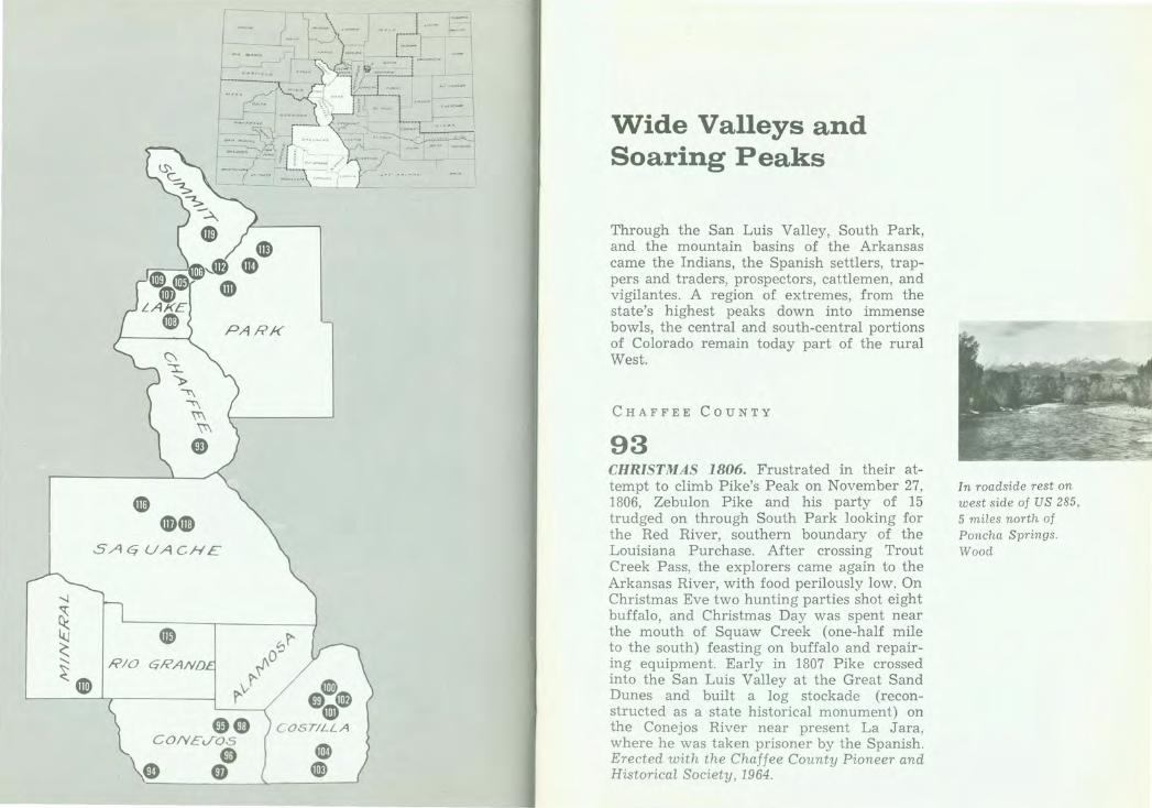
93 CHRISTMAS 1806. Frustrated in their attempt to climb Pike's Peak on November 27, 1806, Zebulon Pike and his party of 15 trudged on through South Park looking for the Red River, southern boundary of the Louisiana Purchase. After crossing Trout Creek Pass, the explorers came again to the Arkansas River, with food perilously low. On Christmas Eve two hunting parties shot eight buffalo, and Christmas Day was spent near the mouth of Squaw Creek (one-half mile to the south) feasting on buffalo and repairing equipment. Early in 1807 Pike crossed into the San Luis Valley at the Great Sand Dunes and built a log stockade (reconstructed as a state historical monument) on the Conejos River near present La Jara, where he was taken prisoner by the Spanish. Erected with the Chaffee County Pioneer and Historical Society , 1964.
In roadside rest on west side of US 285, 5 miles north of Poncha Springs. Wood
234 THE COLORADO MAGAZINE XLVII/3 1970
Between Antonito and
Chama on north side opposite road to Cumbres depot.
Bronze
La Jara, on school grounds at northeast
corner of Main St. at Poplar.
Bronze
Manassa, on the north side of
State 142 across
from Dempsey Park. Bronze
Conejos, entrance to grounds, Our Lady
of Guadalupe Church,
off US 285. Bronze
CONEJOS COUNTY
94 CUMBRES PASS. Near Continental Divide between the waters of the Rio Grande and the San Juan. "Cumbres" is Spanish for "summit." Altitude 10,022 feet. Railroad built 1880. Toll road built 1881. Improved highway opened 1923. Erected with the U.S . Forest Service, 1929.
95 LA JARA CONSOLIDATED SCHOOL. District Number 1. Organized January 25, 1915, for the betterment of rural education. The first consolidated school in the San Luis Valley. Erected with the students and board of education of the consolidated school, 1950.
96 MORMON PIONEERS. In 1878, Mormon pioneers came from the southern states and Utah, settling first at Los Cerritos. In 1879, they organized the town of Manassa, built homes, a school house, and place of worship from native logs. Settlements of Ephraim (1879) and Richfield (1881) and others having been made, the San Luis Stake was organized June 9, 1883. Erected with the Daughters of L.D.S. Pioneers, 1963.
97 OUR LADY OF GUADALUPE. D.O.M. June 10, 1958. This tract was selected by Bishop Machebeuf, for the first permanent church in Colorado. Here was built a jacal (picket) church, later replaced by a larger church. The first parish of Colorado was erected 100 years ago with Our Lady of Guadalupe as patron by John B. Lamy, first bishop of Santa Fe. Father Montano was the first pastor. The finished church, dedicated by Bishop Lamy on
Dec. 12, 1863, was under the Jesuit Fathers 1871-1920. Since 1920, it has been under the Theatine Fathers. Fire destroyed the church on Ash Wednesday, 1926. John Henry Tihen, third bishop of Denver, dedicated a new church Dec. 12, 1927, In 1948 this church was enlarged and embellished with its towers by the Rev. Michael Pascual, C.R., pastor. The Most Rev. Joseph C. Willging, first bishop of Pueblo, dedicated an addition to the church on Aug. 7, 1948. Erected 1958.
98 PIKE'S STOCKADE. On this ground stood Pike's Stockade, erected in February, 1807, by Capt. Zebulon Montgomery Pike, U.S.A., first official American explorer of Colorado and the Southwest. First U.S. fort on Colorado soil. Site acquired by the state, 1926. Erected with the Historical Association of the Adams State Teachers College, 1936.
5 miles east of Sanford. Road marked by guide
signs. Bronze
236 THE COLORADO MAGAZINE XLVII/3 1970
Fort Garland. Bronze
State Historical Society Regional
Museum, on north
side of entrance gate on State 159.
Bronze
On south side of entrance gate.
Bronze
COSTILLA COUNTY
99 ALFRED M. COLLINS HALL. Named in appreciation of services in the reconstruction of Fort Garland, 1950.
100 FORT GARLAND. United States military outpost to protect settlers from hostile Indians. Named for Brig. Gen. John Garland, commander of this district in 1858. Established 1858. Abandoned 1883. Commanded by Col. Kit Carson, 1866-7. Erected with the Huajatolla Chapter, D.A.R. , of Walsenberg, 1930.
101 FORT GARLAND STATE HISTORICAL MONUMENT. This property was presented to the State Historical Society by the Fort Garland Historical Fair Association, which saved the fort for posterity. Established November 30, 1945, as a memorial to the first Colorado settlers, and the U.S. Army troops who protected them. Erected 1949.
102 FORT GARLAND. Across the road is old Fort Garland, U.S. Army outpost abandoned long ago but still alive with memories and mementoes of frontier military life when the San Luis Valley was still a part of New Mexico. Fort Garland's troops protected the white
Wide VaHeys and Soaring Peaks 237
settlers against Indians and outlaws. In 1863, when the Espinosa bandits eluded capture by the troops, an old scout, Tom Tobin, was put on the bandits' trail. He was back at Fort Garland in five days, the Espinosas' heads in a sack across his saddle. Kit Carson commanded Fort Garland 1866-67 as an officer in the New Mexico Volunteers. The fort was built in 1858 and abandoned in 1883. Most of its original buildings await your inspection. Erected 1959.
103 SAN LUIS PEOPLES DITCH. Commemorating the San Luis Peoples Ditch, the oldest continuously used ditch in Colorado, with court decree priority no. 1, and dating from April 10, 1852. Dug by the pioneer settlers of Colorado. Colorado's greatness is built upon irrigation. Original water rights decreed to:
Dario Gallegos, Donaciano Gallegos, Juan A. Trujillo, Maria Rosa Vigil, Jose Ylario Valdez, F. J armillo, Rumalda Gallegos, Eulogia Gallegos, Rafaela Sanchez, Juan Martinez, Francisco Valdez, Manuel Vigil, Eusebio Bargas, Juan Valdez, Francisco Sanchez, Soledad Pacheco, Francisco Barela, Isabel Pacheco, Roberto Allen, Mariano Pacheco, Juan Pacheco, Juan Antonio Baca, A. A. Salazar, Eulogia Herrera, Juanita Herrera, Antonio Pacheco, Miguel Martinez, Rumaldo Martinez, Donaciano Martinez. Erected with the heirs of the pioneers and the Irrigation Centennial Commission, 1952.
On east side of State 159, across from Fort Garland 1'viuseum. Wood
San Luis, on east side of State 159, at south end of town. Bronze

238 THE COLORADO MAGAZINE XLVII/3 1970
San Luis, on Costilla County
courthouse grounds. on east side of State 159.
Bronze
Leadville, at Harrison Ave. and E. 10th St.,
at State Historical Society Regional
Museum. Bronze
Summit of Fremont Pass on State 91.
Bronze
104 SAN LUIS VALLEY. Commemorating the historical importance of the pioneers who were responsible for the first permanent settlement in Colorado, 1851. Erected with the citizens of the San Luis Valley , 1951.
LAKE COUNTY
105 DEXTER CABIN. Dexter Cabin, erected in 1879 by James Viola Dexter, pioneer Leadville mining man. Purchased in 1936 by the Leadville Historical Society, through gift of Phyllis Campion Webster, and presented to the state in 1947. Restored by the State Historical Society of Colorado as a memorial to perpetuate the name of James V. Dexter, through bequest of Roland G. Parvin, his son-in-law. Erected 1950.
106 FREMONT PASS. On Continental Divide between Arkansas and Blue River drainages. Altitude 11,316 feet. Western boundary of the Louisiana Purchase of 1803. Named in honor of John C. Fremont, famous western explorer. Erected with the Mount Massive Chapter, D.A.R., 1930.
107 HEALY HOUSE. A regional state museum. Erected 1878 by August R. Meyer, builder of Leadville's first reduction works. Given to the Leadville Historical Association, 1936, by Nellie Healy, agent for the heirs of Daniel Healy. Presented to the State of Colorado by said association, 1947, and established as a monument to the silver mining era of the state by the State Historical Society of Colorado and the Leadville Historical Association. Erected with the Leadville Historical Association, 1948.
108 LEADVILLE. Entering the Cloud City. Altitude 10,152 feet. Here on the roof-top of the nation flourished about 1877 the most famous silver mining camp in the world. Perhaps 30,000 fortune hunters made this town about 1880 the second largest city of Colorado. Here grew fabulous fortunes-among many that of H. A. W. Tabor. A gay and cultivated social life, violent labor contests, ambitious projects like the Ice Palace marked the city.
Leadville, at Harrison Ave. and E. 10th St. at State Historical Society Regional Museum. Bronze
Leadville, Harrison Ave. (US 24) at Elm. Wood
240 THE COLORADO MAGAZINE XLVII/3 1970
At summit of Tennessee Pass,
us 24. Bronze
Wolf Creek Pass, on south side of
us 160. Bronze
In 1860, gold was discovered nearby in California Gulch but soon was exhausted. The miners scattered. Seventeen years later a heavy sand discarded by prospectors as a nuisance in the pine woods hereabout was found to be silver carbonate. Westward loom Mount Elbert, Colorado's highest peak, and Mount Massive. The Sawatch (Blue Earth) Range to the west and the Mosquito to the east contain several of the loftiest mountains in North America. Healy House and Dexter Cabin State Museum, Harrison Avenue and East Tenth Street, depict life in pioneer Leadville. Erected 1960.
109 TENNESSEE PASS. Across Continental Divide between Arkansas and Eagle rivers. Altitude 10,424 feet. Named from Tennessee Fork of the Arkansas. Explored by Fremont and Kit Carson, 1845. Railroad constructed 1881. Erected with the U.S. Forest Service, 1929.
MINERAL COUNTY
110 WOLF CREEK PASS. Across Continental Divide between the waters of the Rio Grande and the San Juan. Altitude 10,850 feet. Named for Wolf Creek, tributary of the San Juan. Early Ute trail. First road built by Colorado highway department and opened 1916. Erected with U.S. Forest Service, 1929.
PARK COUNTY
111 FAIRPLAY. Named by the pioneer miners in expression of their determination for equal
Wide Valleys and Soaring Peaks 241
opportunity and fair dealing. Site visited by Captain John C. Fremont and Kit Carson in 1844. Fairplay Diggings organized and mining laws enacted in April, 1860. Seat of Park County since 1867. Stone courthouse erected in 1874. Erected with the South Park Historical Society, the American Pioneer Trails Association, Lions Club and school children of Fairplay, and Dr. Nolie Mumey, 1946.
112 HOOSIER PASS. Across Continental Divide between South Park and Blue River. Altitude 11,542 feet. Crossed by Fremont, 1844. Named for Hoosier Gulch, discovered and worked as a placer camp by Indiana men 1860. Erected with the U.S. Forest Service, 1929.
113 SOUTH PARK. Spread before you lies the famous South Park entered by Kenosha Pass, elevation 10,000 feet. The Bayou Salado of early trappers. Favorite Indian hunting ground and frequent battleground. Visited by Z. M. Pike in 1806. Crossed by J. C. Fremont in 1844. Permanent settlement inaugurated by gold discoveries in 1859. Erected with the State Civil Service Employees of Colorado, 1932.
114 TARRY ALL DIGGINGS. Extending up this creek to the mountains were Tarryall Diggings discovered in July, 1859. Towns of Hamilton and Tarryall (2 miles west) thrived in 1860s. A newspaper and numerous business houses flourished. The towns have long since disappeared. Large trees now grow
Fairplay, southeast corner of courthouse grounds, on north side of State 9. Bronze
Summit of Hoosier Pass, on State 9. Bronze
Summit of Kenosha Pass, on south side of US 285. Bronze
On north side of US 285 at Tarryall Creek, 4.6 miles west of Jefferson or 1.8 miles east of Como. Bronze
242 THE COLORADO MAGAZINE XLVII/ 3 1970
Del N orte, northwest cor ner, US 160 at S tate 11 2.
Bronze
Between Gunnison and Sa guache, off State 11 4
on County 20 at Old Cochetopa Pass.
Bron ze
S agiw che, on east side of US 285.
Bronze
in the sluice tailings on the bluff 112 mile west. The diggings have produced $2,000,000 in gold. Erect ed w ith Fost er Cline, 1933.
Rro GRA N D E Co uNTY
115 FRE.lun·T CA.lf P. Near this spot J ohn C. Fremont camped on his d isastrous attempt to cross the mou ntains December, 1848. Erected with t he Del Norte Community Clu b, 1928.
S AGUAC H E COUNTY
116 COCHETOPA. PAS."i. Across Continental Divide between Rio Grande and Gunnison River d rainages. Altitude 10,032 feet. The "Buffalo Gate" of the Utes. On early pack trail to Califo rnia. Surveyed by Gunnison and by Fremont fo r railroad route 1853. Toll road built 1869. Improved highway opened 1914. Erected with the U.S. Forest Service, 1929.
117 OTTO .l/EARS PARK. This park is dedica ted to Otto Mears, Russian-born Colorado pioneer, known as "The Pathfinder of the San Juan," who came to the San Luis Valley in 1865. In Saguache (a Ute Indian word meaning "Blue Earth"), Otto Mears was married in 1870, establish ing his h ome across from this park. He built a toll road over Poncha Pass, the first one in the area; r an freighting teams; established mining camps; published two newspapers and constructed railways. He was for a time treasurer of Saguache County. As a commissioner he helped to build the State Capitol, and suggested covering the dome with gold leaf. As a friend of Ouray, Mears induced the Utes to cede the
Wide Valle y s and Soaring Peaks 243
"mining triangle" of the San Juan to the government. Erected with the Saguache Kiwanis Club, 1959.
118 SAGUACHE. Name derived from the Indian word meaning "blue water." Gov. Anza passed near here 1779. On a branch of old Spanish Trail. Antoine Robidoux , fur trader, took wagons past here in 1841. The explorers J. C. Fremont and J . W. Gunnison passed here in 1853. Often visited by Ouray and Chipeta. Col. Fauntleroy had a battle with the Utes near here in 1855. Saguache County created in 1866. Town founded 1867; incorpor ated 1874. Erected with the American Legion of Saguache , 1947.
SUMMIT COUNTY
119 COLORADO'S MECHANICAL MINERS. These rock piles were left by nine gold dredging boats, the first to operate in the state. Brought here by Ben Stanley Revett, the earliest boats began dredging near the mouth of the Swan in 1898 and moved along the Swan and Blue rivers and French Gulch. Much like the old time prospector sluicing a creek bed, the mechanical miners dredged up these glacial rocks and separat.ed them from the finer gravels from which they washed the gold. Weighing as much as five hundred tons, the boats floated on ponds they created while dredging the river beds to depths of fifty feet in a swath some two hundred feet wide. The massive dredges continually threatened to invade Breckenridge itself until one finally succeeded in cutting its way through the mining town. The last boat ceased operations in 1942. Erected with the Summit Historical Society, 1968.
Saguache, Courthouse S quare, east off us 285. B ron ze
On State 9, 1 mile north of Breck enridge. Wood
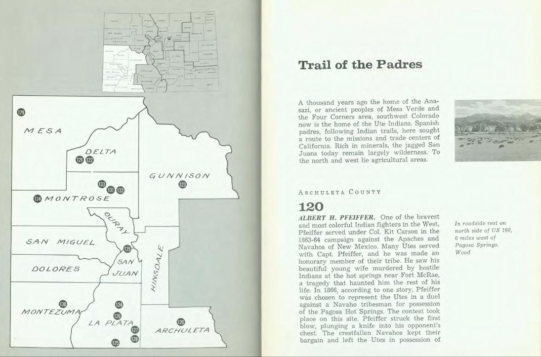
MESA
DELTA
~@
SAN MIGUEL
DOLORES
• MONTEZ UM
LA
e • PLATA • e e
GUNNISON
®
@ ARCHULETA
Trail of the Padres
A thousand years ago the home of the Anasazi, or ancient peoples of Mesa Verde and the Four Corners area, southwest Colorado now is the home of the Ute Indians. Spanish padres, following Indian trails, here sought a route to the missions and trade centers of California. Rich in minerals, the jagged San J uans today remain largely wilderness. To the north and west lie agricultural areas.
ARCHULETA COUNTY
120 ALBERT H. PFEIFFER. One of the bravest and most colorful Indian fighters in the West, Pfeiffer served under Col. Kit Carson in the 1863-64 campaign against the Apaches and Navahos of New Mexico. Many Utes served with Capt. Pfeiffer, and he was made an honorary member of their tribe. He saw his beautiful young wife murdered by hostile Indians at the hot springs near Fort McRae, a tragedy that haunted him the rest of his life. In 1866, according to one story, Pfeiffer was chosen to represent the Utes in a duel against a Navaho tribesman for possession of the Pagosa Hot Springs. The contest took place on this site. Pfeiffer struck the first blow, plunging a knife into his opponent's chest. The crestfallen Navahos kept their bargain and left the Utes in possession of
In roadside rest on north side of US 160, 6 miles west of Pagosa Springs . Wood
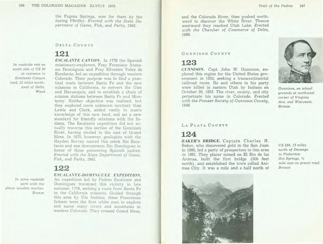
246 THE COLORADO MAGAZINE XLVII/3 1970
In roadside rest on south side of US 50
at entrance to Escalante Canyon
road, 12 miles northwest of Delta.
Wood
In same roadside park with the
above wooden marker. Bronze
the Pagosa Springs, won for them by the daring Pfeiffer. Erected with the State Department of Game, Fish, and Parks, 1965.
DELTA COUNTY
121 ESCALANTE CANYON. In 1776 the Spanish missionary-explorers, Fray Francisco Atanasio Dominguez and Fray Silvestre Velez de Escalante, led an expedition through western Colorado. Their purpose was to find a practical route between Santa Fe and the new missions in California, to convert the Utes and Havasupais, and to establish a chain of mission stations between Santa Fe and Monterey. Neither objective was realized, but they explored more unknown territory than Lewis and Clark, added vastly to man's knowledge of this new land, and set a new standard for friendly relations with the Indians. The Escalante expedition did not actually traverse this section of the Gunnison River, having circled to the east of Grand Mesa. In 1875, however, geologists with the Hayden Survey named this creek Rio Escalante and one downstream Rio Dominguez in honor of these pioneering Spanish padres. Erected with the State Department of Game, Fish, and Parks, 1965.
122 ESCALANTE-DOMINGUEZ EXPEDITION. An expedition led by Padres Escalante and Dominguez traversed this vicinity in late summer, 1776, seeking a route from Santa Fe to the California missions. Guided through this area by Ute Indians, these Franciscan fathers were the first white men to explore and name many rivers and mountains in western Colorado. They crossed Grand Mesa,
TraiL of the Padres 247
and the Colorado River, then pushed northward to discover the White River. Thence westward they reached Utah Lake. Erected with the Chamber of Commerce of Delta, 1960.
GUNNISON COUNTY
123 GUNNISON. Capt. John W. Gunnison, explored this region for the United States government in 1853, seeking a transcontinental railroad route. He and others in his party were killed in eastern Utah by Indians on October 26, 1853. The river, county, and city perpetuate his name in Colorado. Erected with the Pioneer Society of Gunnison County, 1946.
LA PLATA COUNTY
124 BAKER'S BRIDGE. Captain Charles H. Baker, who discovered gold in the San Juan in 1860, led a party of prospectors to this area in 1861. They placer mined on El Rio de las Animas, built the first bridge (300 feet north), and established the town called Animas City. It was a mile and a half north of
Gunnison, on school grounds at northwest corner of Virginia Ave. and Wisconsin. Bronze
US 550, 13 miles north of Durango to Pinkerton Hot Springs, V2 mile east on gravel road. Bronze
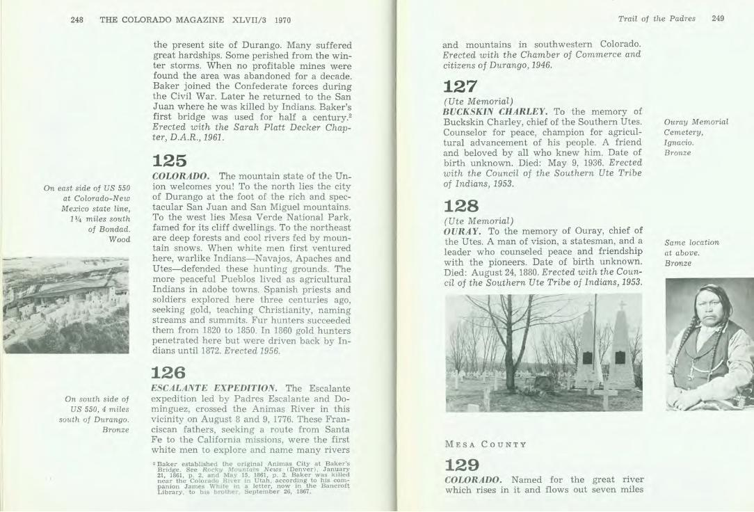
248 THE COLORADO MAGAZINE XLVII/3 1970
On east side of US 550 at Colorado-New Mexico state line,
11/4 miles south of Bondad.
Wood
On south side of US 550, 4 miles
south of Durango. Bronze
the present site of Durango. Many suffered great hardships. Some perished from the winter storms. When no profitable mines were found the area was abandoned for a decade. Baker joined the Confederate forces during the Civil War. Later he returned to the San Juan where he was killed by Indians. Baker's first bridge was used for half a century.2
Erected with the Sarah Platt Decker Chapter, D.A.R., 1961.
125 COLORADO. The mountain state of the Union welcomes you! To the north lies the city of Durango at the foot of the rich and spectacular San Juan and San Miguel mountains. To the west lies Mesa Verde National Park, famed for its cliff dwellings. To the northeast are deep forests and cool rivers fed by mountain snows. When white men first ventured here, warlike Indians-Navajos, Apaches and Utes-defended these hunting grounds. The more peaceful Pueblos lived as agricultural Indians in adobe towns. Spanish priests and soldiers explored here three centuries ago, seeking gold, teaching Christianity, naming streams and summits. Fur hunters succeeded them from 1820 to 1850. In 1860 gold hunters penetrated here but were driven back by Indians until 1872. Erected 1956.
126 ESCALANTE EXPEDITION. The Escalante expedition led by Padres Escalante and Dominguez, crossed the Animas River in this vicinity on August 8 and 9, 1776. These Franciscan fathers, seeking a route from Santa Fe to the California missions, were the first white men to explore and name many rivers
'Baker established the origin a l Animas City at Baker's Bridge. See Rocky Mountain News (Denver), January 21, 1861, p. 2, and May 15, 1861, p . 2. Baker was killed near the Colorado River in Utah, according to his companion James White in a letter, now m the Bancroft Library, to his brother September 26, 1867 .
Trail of the Padres 249
and mountains in southwestern Colorado. Erected with the Chamber of Commerce and citizens of Durango, 1946.
127 (Ute Memorial) BUCKSKIN CHARLEY. To the memory of Buckskin Charley, chief of the Southern Utes. Counselor for peace, champion for agricultural advancement of his people. A friend and beloved by all who knew him. Date of birth unknown. Died: May 9, 1936. Erected with the Council of the Southern Ute Tribe of Indians, 1953.
128 (Ute Memorial) OURAY. To the memory of Ouray, chief of the Utes. A man of vision, a statesman, and a leader who counseled peace and friendship with the pioneers. Date of birth unknown. Died: August 24, 1880. Erected with the Council of the Southern Ute Tribe of Indians, 1953.
MESA COUNTY
129 COLORADO. Named for the great river which rises in it and flows out seven miles
Ouray Memorial Cemetery, Ignacio. Bronze
Same location at above. Bronze

250 THE COLORADO MAGAZINE XLVIl/3 1970
On the south side of US 50-6,
1 mile east of Mack. Wood
In roadside rest on north side of US 160,
4 miles west of entrance to
Mesa Verde. Wood
south of this point. The mesas, mountains and plains of Colorado were the home first of wandering Indians, especially the Utes in the west and the ancestors of the Pueblos who built the cliff dwellings to the southwest. Three centuries ago Spanish priests and soldiers from Mexico explored and claimed this land. From 1820 to 1850 many solitary hunters for beaver fur traced every water course. Created as a territory in 1861, a state in 1876, Colorado has ever since grown and prospered. The Mountain State welcomes you to its peaks, its canyons and tumbling streams-only an hour or two eastward. Erected 1956.
MONTEZUMA COUNTY
130 THE SLEEPING UTE. The mountain formation to the southwest, known as Ute Peak, or the Sleeping Ute, has an elevation of 9884 feet at its highest point. The profile of a man lying asleep is easily identified. The head, face turned to the side, is at the northern end; the arms are folded across the chest; the knees seem to be flexed slightly; even the toes are apparent. According to a Ute legend, one of the gods became angry at his people, gathered the rain clouds together and lay down to sleep. When the clouds hang over the peak, they are said to have slipped out of his grasp. The legend also says that one day the god will cease to be angry and that he will awaken and lead the Utes in vanquishing their enemies. Erected with the State Department of Game, Fish, and Parks, 1966.
Trail of the Padres 251
MONTROSE COUNTY
131 CHIEF OURAY STATE HISTORICAL MONUMENT. This area was once a part of the farm of Ouray, Chief of the Ute Indians, and of his wife, Chipeta. Presented to the State Historical Society of Colorado by the Uncompahgre Chapter, D.A.R., which saved it for posterity. Established as a memorial to these great Utes, May 31, 1945. Erected 1949.
132 CHIEF OURAY STATE HISTORICAL MONUMENT. This area was once a part of the farm of Ouray, chief of the Ute Indians, and his wife, Chipeta. The park contains a memorial shaft, the graves of Chipeta and her brother, Chief John McCook, and the Ute Indian Museum. In the museum are many rare Indian relics, including the Thomas McKee collection. Chief Ouray, who spoke English and Spanish, as well as several Indian dialects, was one of the great Indian leaders in American history, always keeping faith with the whites. He induced the Ute tribe to cede to the whites the area now embraced in the San Luis Valley and the land of the Western Slope of Colorado. Chipeta was wise and intelligent. This property, saved to posterity by the Uncompahgre Chapter, of the D.A.R., was deeded to the state in 1945. Erected 1960.
2 miles south of Montrose, US 550, on Ute Indian Museum. Bronze
Same location as above, at road junction. Wood
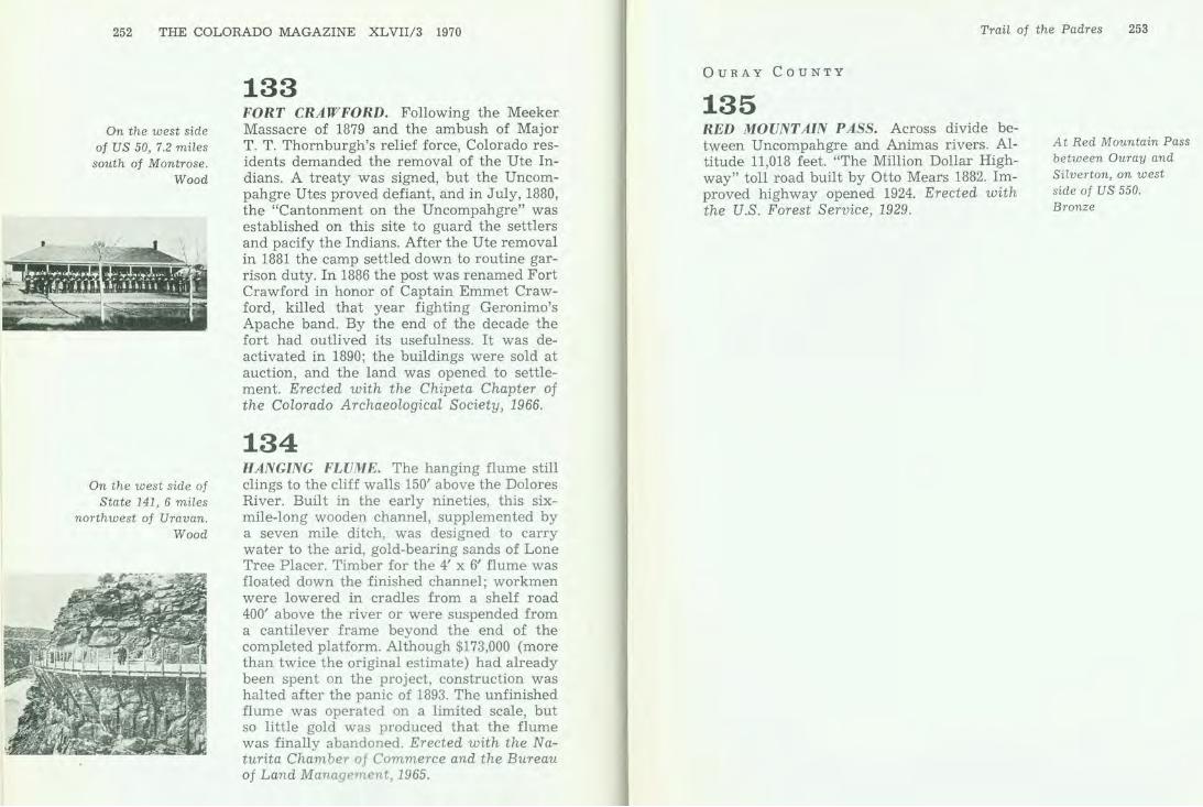
252 THE COLORADO MAGAZINE XLVII/3 1970
On the west side of US 50, 7.2 miles south of Montrose.
Wood
On the west side of State 141, 6 miles
northwest of Uravan. Wood
133 FORT CRAWFORD. Following the Meeker Massacre of 1879 and the ambush of Major T. T. Thornburgh's relief force, Colorado residents demanded the removal of the Ute Indians. A treaty was signed, but the Uncompahgre Utes proved defiant, and in July, 1880, the "Cantonment on the Uncompahgre" was established on this site to guard the settlers and pacify the Indians. After the Ute removal in 1881 the camp settled down to routine garrison duty. In 1886 the post was renamed Fort Crawford in honor of Captain Emmet Crawford, killed that year fighting Geronimo's Apache band. By the end of the decade the fort had outlived its usefulness. It was deactivated in 1890; the buildings were sold at auction, and the land was opened to settlement. Erected with the Chipeta Chapter of the Colorado Archaeological Society, 1966.
134 HANGING FLUME. The hanging flume still clings to the cliff walls 150' above the Dolores River. Built in the early nineties, this sixmile-long wooden channel, supplemented by a seven mile ditch, was designed to carry water to the arid, gold-bearing sands of Lone Tree Placer. Timber for the 4' x 61 flume was floated down the finished channel; workmen were lowered in cradles from a shelf road 400' above the river or were suspended from a cantilever frame beyond the end of the completed platform. Although $173,000 (more than twice the original estimate) had already been spent on the project, construction was halted after the panic of 1893. The unfinished flume was operated on a limited scale, but so little gold was produced that the flume was finally abandoned. Erected with the Naturita Chamber of Commerce and the Bureau of Land Mana gement, 1965.
Trail of the Padres 253
OURAY COUNTY
135 RED MOUNTAIN PASS. Across divide between Uncompahgre and Animas rivers. Altitude 11,018 feet. "The Million Dollar Highway" toll road built by Otto Mears 1882. Improved highway opened 1924. Erected with the U.S. Forest Service, 1929.
At Red Mountain Pass between Ouray and Silverton, on west side of US 550. Bronze

MOFFAT
ROUTT
@ GRAND
RIO BLANCO
EAGLE GARFIELD
PITKIN
The Old West
Here meet the old West of the cowboy and sheepherder and the new West of ski slopes, regattas, river running, and sportsmen. Away from the center of tourism and recreation which the mountain areas offer, northwest Colorado rolls down the Wes tern Slope toward Utah in immense undulating waves, with agricultural communities; ranches of wheat, sheep, cattle; and unbroken vistas of purple sage.
GARFIELD COUNTY
136 GLENWOOD SPRINGS. The hot springs were prized and used by Indians since time immemorial. Visited by Richard Sopris and white prospecting party, July 23, 1860. J. M. Landis squatted on site in 1879. Indian land until Ute removal, 1881. Town founded 1882, incorporated, 1885. Named for Glenwood, Iowa, and for the mineral springs here. Garfield County seat since 1883. First railroad arrived October, 1887. A region rich in mines and ranches, scenic and recreational attractions. Erected with the Lions Club of Glenwood Springs, 1947.
~ --- -"' ...... _ 4••·" ..
Glenwood Springs, at southeast corner of Ninth St. and Grand Ave. (State 82). Bronze
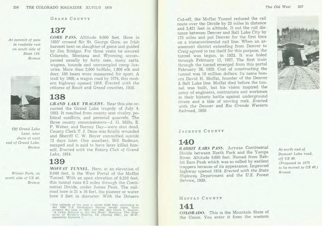
256 THE COLORADO MAGAZINE XLVII/3 1970
At summit of pass in roadside rest on south side of
State 134. Bronze
Off Grand Lake Lane, near
shore at west end of Grand Lake.
Bronze
Winter Park, on south side of US 40.
Bronze
GRAND COUNTY
137 GORE PASS. Altitude 9,000 feet. Here in 18553 crossed Sir St. George Gore, an Irish baronet bent on slaughter of game and guided by Jim Bridger. For three years he scoured Colorado, Montana and Wyoming, accompanied usually by forty men, many carts, wagons, hounds and unexampled camp luxuries. More than 2,000 buffalo, 1,600 elk and deer, 100 bears were massacred for sport. A trail by 1866, a wagon road by 1874, this modern highway opened 1956. Erected with the citizens of Routt and Grand counties, 1956.
138 GRAND LAKE TRAGEDY. Near this site occurred the Grand Lake tragedy of July 4, 1883. It resulted from county seat rivalry, political conflicts, and personal quarrels. The three county commissioners-J. G. Mills, E. P. Weber, and Barney Day-were shot dead, County Clerk T. J. Dean was fatally wounded and Sheriff C. W. Royer committed suicide 12 days later. One assailant, Bill Redman, escaped and is said to have later killed himself. Erected with the Rotary Club of Grand Lake, 1954.
139 MOFFAT TUNNEL. Here, at an elevation of 9,044 feet , is the West Portal of the Moffat Tunnel. With an apex elevation of 9,239 feet, this tunnel runs 6.2 miles through the Continental Divide, under James Peak. The railroad bore is 21 x 16 feet , the pioneer or water bore 8 feet in diameter. With the Dotsero
"The altitude of the pass is about 9,528 feet, according to the 1955 U.S . Geological Survey bench mark. Gore crossed the pass in 1854, not 1855. See Clark C. Spence, "A Celtic Nimrod 111 the Old West," Montana: The Magazine of W estern History, IX (Spring 1959), pp. 56-57, especially footnote I
The Old West 257
Cut-off, the Moffat Tunnel reduced the rail route over the Divide by 23 miles in distance and 2,421 feet in altitude. It cut the rail distance between Denver and Salt Lake City by 175 miles and put Denver for the first time on a transcontinental rail line. When an assessment district extending from Denver to Craig agreed to tax itself for this purpose, the tunnel was begun, in 1923. It was holed through February 12, 1927. The first train through the tunnel emerged from this portal February 26, 1928. Cost of constructing the tunnel was 18 million dollars. Its name honors David H. Moffat, founder of the Denver & Salt Lake line. Moffat died before the tunnel was built, but his vision inspired the army of engineers, contractors and workmen in their historic battle against underground rivers and a tide of moving rock. Erected with the Denver and Rio Grande Western Railroad, 1959.
JACKSON COUNTY
140 RABBIT EARS PASS. Across Continental Divide between North Park and the Yampa River. Altitude 9,680 feet. Named from Rabbit Ears Peak which was so called by earliest trappers because of its appearance. Improved highway opened 1919. Erected with the State Highway Department and the U.S. Forest Service, 1929.
MOFFAT COUNTY
141 COLORADO. This is the Mountain State of the Union. You enter it from the western
At north end of Dumont Lake road, off US 40. (Proposed in 1970 to be moved to US 40.) Bronze
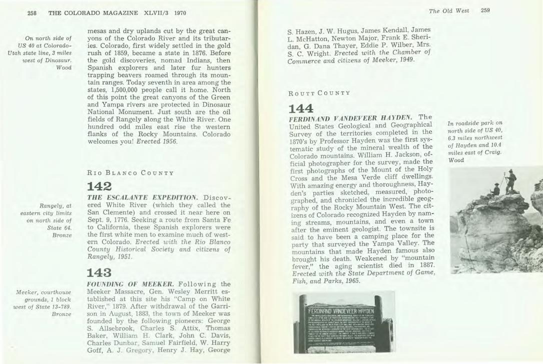
258 THE COLORADO MAGAZINE XLVIl/3 1970
On north side of US 40 at Colorado
Utah state line, 3 miles west of Dinosaur.
Wood
Rangely, at eastern city limits
on north side of State 64.
Bronze
Meeker, courthouse grounds, 1 block
west of State 13-789. Bronze
mesas and dry uplands cut by the great canyons of the Colorado River and its tributaries. Colorado, first widely settled in the gold rush of 1859, became a state in 1876. Before the gold discoveries, nomad Indians, then Spanish explorers and later fur hunters trapping beavers roamed through its mountain ranges. Today seventh in area among the states, 1,500,000 people call it home. North of this point the great canyons of the Green and Yampa rivers are protected in Dinosaur National Monument. Just south are the oil fields of Rangely along the White River. One hundred odd miles east rise the western flanks of the Rocky Mountains. Colorado welcomes you! Erected 1956.
Rro BLANCO CouNTY
142 THE ESCALANTE EXPEDITION. Discovered White River (which they called the San Clemente) and crossed it near here on Sept. 9, 1776. Seeking a route from Santa Fe to California, these Spanish explorers were the first white men to examine much of western Colorado. Erected with the Rio Blanco County Historical Society and citizens of Rangely, 1951.
143 FOUNDING OF MEEKER. Following the Meeker Massacre, Gen. Wesley Merritt established at this site his "Camp on White River," 1879. After withdrawal of the Garrison in August, 1883, the town of Meeker was founded by the following pioneers: George S. Allsebrook, Charles S . Attix, Thomas Baker, William H. Clark, John C. Davis, Charles Dunbar, Samuel Fairfield, W. Harry Goff, A. J. Gregory, Henry J . Hay, George
The Old West 259
S. Hazen, J. W. Hugus, James Kendall, Jam~s L. McHatton, Newton Major, Frank E. Sheridan, G. Dana Thayer, Eddie P. Wilber, Mrs. S. C. Wright. Erected with the Chamber of Commerce and citizens of Meeker, 1949.
ROUTT COUNTY
144 FERDINAND VANDEVEER HAYDEN. The United States Geological and Geographical Survey of the territories completed. in the 1870's by Professor Hayden was the first systematic study of the mineral wealth of the Colorado mountains. William H. Jackson, official photographer for the survey, made the first photographs of the Mount of the Holy Cross and the Mesa Verde cliff dwellings. With amazing energy and thoroughness, Hayden's parties sketched, measured, photographed, and chronicled the incredible geo.graphy of the Rocky Mountain West. The citizens of Colorado recognized Hayden by naming streams, mountains, and even a ~ow~ after the eminent geologist. The towns1te is said to have been a camping place for the party that surveyed the Yampa Valley. The mountains that made Hayden famous also brought his death. Weakened by "mountain fever," the aging scientist died in 1887. Erected with the State Department of Game, Fish, and Parks, 1965.
In roadside park on north side of US 40, 6.3 miles northwest of Hayden and 10.4 miles east of Craig. Wood

- - - --- - - - --- - - - --- - - - --- - - - ---
Missing Markers
COLORADO SEMINARY. Across Arapahoe Street to the south is the original site of Colorado Seminary, now the University of Denver. Founded March 5, 1864, pioneer institution of higher learning in Colorado. On this corner stood the home of Territorial Governor John Evans, civic leader and principal founder of the University of Denver. Erected with the University of Denver, 1955.
GRAND LAKE. Area, 507 acres; altitude 8,369 feet. Largest natural lake in Colorado. Source of the Colorado River, which gave its name to the state. Visited by early trappers and hunters. Land acquired from the Utes, 1868. Town of Grand Lake founded 1879. County seat of Grand County, 1881-88. A political feud caused the massacre of four county officers July 4, 1883. Annual regatta inaugurated 1901. Erected with the Grand Lake Woman's Club and the Grand Lake Chamber of Commerce, 1941.
LA VET A PASS. Between the waters of the Arkansas and the Rio Grande. Altitude 9,382 feet. "La Veta" is Spanish for "the vein." Named for the mineral veins appearing on the mountains. Narrow gauge railroad built 1877. Railroad later re-located. Abandoned grade converted into highway 1921-22. Erected 1929.
- - - - - - - - - ---
Denver, 14th and Arapahoe streets. Bronze
Grand Lake, US 34. Bronze
South of US 160 at old La Veta Pass. Bronze
- - - --- - - - --- - - - - - - -
262 THE COLORADO MAGAZINE XLVII/3 1970
North of US 50 at old Monarch Pass.
Bronze
About 101h miles north of A roya (off the
road, inaccessible). Bronze
us 138. Bronze
MONARCH PASS. Across Continental Divide between Arkansas and Gunnison River drainages. Altitude 11,386 feet. The Monarch Mining District, opened in the late seventies, lies east of the pass. Improved highway opened 1921. Erected with the U.S. Forest Service, 1929.
SMOKY HILL TRAIL. This monument stands on the Smoky Hill Trail on the Republican-Big Sandy Divide, the route of the Butterfield Stage, 1866-1870. Fifty yards east the Texas-Montana Cattle Trail crossed the Smoky Hill Trail. Erected with Scouts of the Smoky Hill Trail, 1939.
STERLING. Commemorating the fiftieth anniversary of the incorporation of Sterling, Colorado. "Old Sterling," some three miles to the north, was founded in 1873 by pioneers from the southern states. The present city was platted in 1881, incorporated on November 10, 1884. The first officers were: George H. Wilson-mayor; John Alexander-clerk; W. L . Henderson, R. E. Smith, J. M. King, J . E. Wallace, J. C. Strahorn-aldermen. Erected 1934.