stratigraphic and holocenic evolution of the submerged...
TRANSCRIPT

Stratigraphic and Holocenic Evolution of the Submerged Platform of the EasternMargin of the Lagoa dos Patos Lagoon, RS.
INTRODUCTION
It was identified along the eastern margin of the Lagoa dosPatos lagoon, southern Brazil, a wide platform (up to 1 km)bordering the lagoonal margins, and limited by the 1 m isobathwas described by (1977), (1989 and1994), (1990), and (1998),
(1999), and (2003). Theseauthors suggest that the border of the platform marks theposition of an ancient 1 m lower lagoonal level. According to
and (1989) this platform was drownedby a recent sea level rise started at about 1 2 ka.
By studying the subsurface stratigraphy of this platform thispaper aims to better define its nature. With this purpose ashallow core (2.7 m long) was collected close to the edge of theplatform.
The Lagoa dos Patos lagoon, situated in Rio Grande do Sulcoastal plain, southern Brazil, is the largest lagoon of thecountry, covering an area of about 10,000 km2 (Figure 1). Itsevolution was studied by (1977), (1989and 1994). In general the long-term evolution of the lagoonfollows the model of (1959). This large coastalwater body is permanently connected to the Atlantic Oceanthrough an inlet situated in its southern part. Because there isonly one inlet connecting the lagoon to the ocean, and becausethe coast is microtidal (mean tide range of about 0.30 m), tidaleffects on the lagoon-level and surface area are negligible.Thus, the Lagoa dos Patos lagoon is an open-water lagoon thathas a relatively constant water surface whose level is basicallycontrolled by the relative variation of the sea level.
The study area is placed in the area known as “Restinga daLaguna dos Patos”, which is a complex multiple barrier( , 1984), and whose origin is related to the relativevariations of the sea level during the Quaternary Period,associated to changes on climate an on sedimentary supply. Thearea selected for this study is located in the central portion of the
east margin of the Lagoa dos Patos lagoon, between the spits ofCristóvão Pereira and São Simão, and close to Mostardas city(Figure 1).
The studied core is 2.7 m long (Figure 2) and was collectedby a percussion method under a 1 meter deep water column.Three lithofacies were identified: 1) 2.7 to 2.3 m - stainedyellow quartzose very fine sand, well sorted, showing roots; 2)2.3 to 2.05 m gray quartzose very fine sand, well sorted, withorganic remnants and well preserved shells of
; 3) 2.05 to 0 m pale yellow quartzose very fine sand,well sorted and homogeneous textural. Two shell samples fromlithofacies C ages ranging from 240 +\- 80 years to 310+\- 60 years. Lithofacies 1 is interpreted as the Pleistocenesubstrate (Barrier III) of the Holocene lagoonal depositsdrowned and reworked by the Postglacial MarineTransgression. The top of this unit is limited by a ravinementsurface.
The succession of lithofacies 2 and 3 is a product ofprogradation of the lagoonal margin, with the surface oflithofacies 3 corresponding to the 1 m deep platform borderingthe lagoonal shoreline. It is suggested here that platformprogradation is contemporaneous to the progradation and growof the modern 2
beach slope (U.S. Army Corps Of Engineers,
VILLWOCK TOLDO JR.TOMAZELLI VILLWOCK TOMAZELLI
BARBOZA BARBOZA TOMAZELLI
TOMAZELLI VILLWOCK
VILWOCK TOLDO JR.
ZENKOVITCH
VILLWOCK
REGIONAL SETTING
STRATIGRAPHIC ANALYSIS
SEDIMENT DYNAMICS ON THESHOREFACE
Erodonamactroides
showed
sand spits. The young C ages obtained forlithofacies 2 indicates that lithofacies 3 was formed veryrecently at the border of the platform, and that progradation isprobably still active.
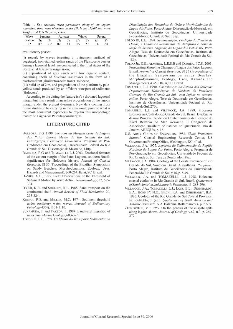
Wave statistics of the Lagoa dos Patos lagoon are used tocalculate the mean breaker waves depth ( ), and the thresholdof sediment motion. The results indicated an annual averagebreaker depth changing between 0.3 and 0.9 m, based on thewave height and
14
14
db
Journal of Coastal Research SI 39 266 - 269 ICS 2004 (Proceedings) Brazil ISSN 0749-0208
E. G. Barboza†‡; E. E. Toldo Jr.‡; L. J. Tomazelli‡; S. R. Dillenburg‡ and R. N.Ayup-Zouain‡
† Programa de Pós-Graduação emGeociências/IG/UFRGS - PRH 12-ANP/MME/MCTAv. Bento Gonçalves, 950091509-900, Porto Alegre, RS, [email protected]
BARBOZA, E. G.; TOLDO Jr, E. E.; TOMAZELLI, L. J.; DILLENBURG, S. R. and AYUP-ZOUAIN, R. N., 2006.Stratigraphic and Holocenic Evolution of the Submerged Platform of the Eastern Margin of the Lagoa dos PatosLagoon, RS. Journal of Coastal Research, SI 39 (Proceedings of the 8th International Coastal Symposium), 266 -269. Itajaí, SC, Brazil, ISSN 0749-0208.
It was identified along the eastern margin of the Lagoa dos Patos lagoon, southern Brazil, a wide (up to 1 km) and upto 1 m deep platform that occurs along most of the lagoon margin has been interpreted in previous studies as adrowned lagoonal margin. The Lagoa dos Patos lagoon is the largest lagoon of Brazil, has a length of 240 km, anaverage width of 40 km, and covers a surface of 10,000 km . The lagoon runs roughly NE-SW and its average depthis almost 6 m, and its means tidal amplitude is 0.30 m. The lagoon can be subdivided into three morphological cellspartially separated by sand spits that have grown from its margin. Although preliminary, this paper shows new datacould change these previous interpretations. Two radiocarbon dating of mollusk shells from a shallow core (2.7 mlong) recently collected near the edge of the submerged platform suggest an alternative origin for this morphologicfeature.According to the dating the feature isn't a drowned lagoonal margin but it is a result of an active progradationof the lagoon margin under the present dynamics. New data coming from future studies to be carrying in the areawould point to what is the most consistent hypothesis to explain this morphologic feature of Lagoa dos Patos lagoonmargins.
2
ADDITIONALINDEX WORDS: Rio Grande do Sul coastal plain, wave-cut terraces, submerged platform.
ABSTRACT
‡ Centro de Estudos de Geologia Costeira e OceânicaCECO/IG/UFRGS,Av. Bento Gonçalves, 950091509-900, PortoAlegre, RS, Brasil
Journal of Coastal Research Special Issue 39, 2006,

1984, pg. 130), and 3 m to depth where occur near-bottomturbulent conditions to sediment movement under oscillatorywater waves ( , 1994; , 2003), asmathematical defined by Jonsson (1978, cited in: ,1985), and (1974). During the strong windperiod (> 14 m.s ), in which a high frequency of shoaling waveis superimposed on a mean flow, the orbital motions cause asignificant turbulent mixing of the entire water column in thelagoon. The sum of the hours with storms of this magnitude in1988 corresponds to 15 days.
The results of the wave climate prediction show that east sideof the lagoon received, during storm conditions, a mean wavepower potential change between 1.1 and 2.2 kW.m . Thelagoonal beach and shoreface are a energetic environment in theLagoa dos Patos lagoon even for a reduced number of hourswith predicted waves.
shore normal component, and they tend to cause bedload andsuspended sediment transport when the near bottom orbitalvelocities exceed the threshold to the sediment movement.
According to and (1988), the transport ofsediments is a phenomenon that has been researched for manyyears. However, today it is still impossible to predict with safetythe transport rate. Even so, this subject can be reduced to anacceptable evaluation to indicate this phenomenon through thetransport potential induced by wave energy flow.
The sediment bars which are moving onshore, offshore orshow no movement are explained for every lagoonal shorefacefrom wave energy, derived from the wave hindcaste model. Weused the method of and (1984) to calculatethe sediment transport in the beach system:
TOLDO JR. TOLDO JR.DAVIES
KOMAR MILLER
DYER SOULSBY
SUNAMURA TAKEDA
et al.
-1
-1
POTENTIAL CROSS-SHORETRANSPORT
The waves on the shoreface are usually characterized by a
(1)
where is maximum wave height (m), is the accelerationof gravity (m.s ), is the maximum period, is theadimensional coefficient, is the grain size (mm). In this studythe maximum wave height ( )was changed
H /gT = K(D/H )bmax max b max
2
H g
T K
DH
bmax
max
bmax
2
to significant
Stratigraphic and Holocenic Evolution
Figure 1. Study area showing the submerged platform and core location. Satellite image (LANDSATTM 7).
Journal of Coastal Research Special Issue 39, 2006,
267

wave height ( ).The results of this parameter applied on the wave prediction
station 22 (near of the core location), point to a offshoremigration of the bars during the year.As observed in the Table 1,wave parameters are similar for stations on the same side and forthe same seasonality, and this way the control of the directionon-offshore seems be strongly governed by grain size (
, 1994; , 2003).Thus base on the model, the distribution of the flow energy of
waves at this lagoonal sector indicates that the cross-shoresediment transport dominantly occurs to offshore. Thistheoretical process could explain the building of this wideplatform as a consequence of progradation of lagoonal margins.
H
et al.
s
TOLDO
JR. TOLDO JR.
CONCLUSION
The analysis of the preexistent data together with the newdata of this study allowed the interpretation of three
Barboza .et al
Figure 2. Sampled core with lithofacies identified, level of shells and respective C ages.14
Journal of Coastal Research Special Issue 39, 2006,
268
evolutionary phases:
(i) rework by waves (creating a ravinement surface) ofvegetated, iron-stained, eolian sands of the Pleistocene barrierduring a lagoonal level rise connected to the final stages of thePostglacial Marine Transgression,(ii) depositional of gray sands with low organic content,containing shells of in the form of aplatform front (similar to a delta front) Holocene,(iii) build up of 2 m, and progradation of the platform by pale-yellow sands produced by an offshore transport of sediments(Holocene).
According to the dating the feature isn't a drowned lagoonalmargin but it is a result of an active progradation of the lagoonmargin under the present dynamics. New data coming fromfuture studies to be carrying in the area would point to what isthe most consistent hypothesis to explain this morphologicfeature of Lagoa dos Patos lagoon margins.
E.G. 1999.
Programa de Pós-Graduação em Geociências, Universidade Federal do RioGrande do Sul. Dissertação de Mestrado, 140p.
E.G. and L.J. 2003. Erosional featuresof the eastern margin of the Patos Lagoon, southern Brazil:significance for Holocene history.
, SI 35 (Proceedings of the Brazilian Symposiumon Sandy Beaches: Morphodynamics, Ecology, Uses,Hazards and Management), 260-264. Itajaí, SC Brazil.
A.G., 1985. Field Observations of the Threshold ofSediment Motion by Wave Action. , 32, 685-304.
K.R. and R.L. 1988. Sand transport on thecontinental shelf. . 20,295-324.
P.D. and M.C. 1974. Sediment thresholdunder oscilatory water waves.
43(4), 1101-1110.T. and I., 1984. Landward migration of
inner bars. , 60, 63-78.E.E. 1989.
Porto Alegre. Dissertação de Mestrado emGeociências, Instituto de Geociências, UniversidadeFederal do Rio Grande do Sul. 137p.
, E.E. 1994.
PortoAlegre. Tese de Doutorado em Geociências, Instituto deGeociências, Universidade Federal do Rio Grande do Sul.189p.
E.E.; L.E.S.B and I.C.S. 2003.Forecasting Shoreline Changes of Lagoa dos Patos Lagoon,Brazil. , SI 35 (Proceedings ofthe Brazilian Symposium on Sandy Beaches:Morphodynamics, Ecology, Uses, Hazards andManagement), 43-50. Itajaí, SC Brazil.
L.J. 1990.
Porto Alegre. Tese de Doutorado em Geociências,Instituto de Geociências, Universidade Federal do RioGrande do Sul. 270p.
L.J. and J.A. 1989. ProcessosErosivos na Costa do Rio Grande do Sul, Brasil: Evidênciasde uma Provável Tendência Contemporânea de Elevação doNível Relativo do Mar. II Congresso daAssociação Brasileira de Estudos do Quaternário, Rio deJaneiro,ABEQUA, p. 16.
, 1984.. Coastal Engineering Research Center, US
Government Printing Office, Washington, DC, 4 ed.J.A. 1977.
. Porto Alegre. Programa dePós-Graduação em Geociências, Universidade Federal doRio Grande do Sul. Tese de Doutorado, 189p.
J.A. 1984. Geology of the Coastal Province of RioGrande do Sul, Southern Brazil. A synthesis. ,Porto Alegre, Instituto de Geociências da UniversidadeFederal do Rio Grande do Sul, v.16, p. 5-49.
Erodona mactroides
Terraços da Margem Leste da Lagunados Patos, Litoral Médio do Rio Grande do Sul:Estratigrafia e Evolução Holocênica.
Journal of CoastalResearch
Sedimentology
Annual Review of Fluid Mechanics
Journal of SedimentaryPetrology
Marine GeologyOs Efeitos do Transporte Sedimentar na
Distribuição dos Tamanhos de Grão e Morfodinâmica daLagoa dos Patos.
Sedimentação, Predição do Padrão deOndas, e Dinâmica Sedimentar da Antepraia e Zona deSurfe do Sistema Lagunar, da Lagoa dos Patos, RS.
Journal of Coastal Research
Contribuição ao Estudo dos SistemasDeposicionais Holocênicos do Nordeste da ProvínciaCosteira do Rio Grande do Sul com ênfase no sistemaeólico.
Resumos,
Shore ProtectionManual
Aspectos da Sedimentação da RegiãoNordeste da Lagoa dos Patos
Pesquisas
LITERATURE CITED
BARBOZA,
BARBOZA, TOMAZELLI,
DAVIES,
DYER, SOULSBY,
KOMAR, MILLER,
SUNAMURA, TAKEDA,
TOLDO JR,
TOLDO JR
TOLDO JR, ALMEIDA, CORR A,
TOMAZELLI,
TOMAZELLI, VILLWOCK,
U.S. ARMY CORPS OF ENGINEERS
VILLWOCK,
VILLWOCK,
VILLWOCK,
VILLWOCK, TOMAZELLI,
Ê
th
J.A. and TOMAZELLI, L.J. 1998. Holocenecoastal evolution in Rio Grande do Sul, Brazil.
, 11, 283-296.J.A.; L.J.; E.L.;
E.A.; Fº, N.O.; F.A. and B.A.1986. Geology of the Rio Grande do Sul Coastal Province.In: J. (ed.).
A.A. Balkema, Rotterdam: v.4, p. 79-97.V.P. 1959. On the genesis of the cuspate spits
along lagoon shores. v.67, n.3, p. 269-277.
Quaternaryof South América and Antarctic Peninsula
Quaternary of South America andAntartic Peninsula.
Journal of Geology,
LOSS, DEHNHARDT,HORN BACHI, DEHNHARDT,
RABASSA,
ZENKOVITCH,
Stratigraphic and Holocenic Evolution
Journal of Coastal Research Special Issue 39, 2006,
269