statewide gis coordination. review of gis stakeholders strategic plan state cio office’s strategic...
Post on 19-Dec-2015
228 views
TRANSCRIPT
Statewide GIS Coordination

• Review of GIS stakeholders strategic plan• State CIO office’s strategic plan sets goals
for GIS office and council effective 07/01/11• GIS Use Survey• GIS Coordination Panel Discussion TODAY
Room 103 1:30 PM – 3:00 PM
Agenda

Richard Butgereit. GISP
GIS Administrator
Florida Division of Emergency Management
850-413-9907
Damu Kuttikrishnan
Enterprise Project Lead
Agency for Enterprise Information Technology (AEIT)
850-410-2954
http://www.myflorida.com/myflorida/cabinet/aeit/
PanelClaudia Paskauskas
GIS Manager
East Central Florida Regional Planning Council
407-262-7772
Martin Roche, GISP, CEcDGeoPlanning Services
Orlando, FL407-608-4186www.GeoPlanningServices.com
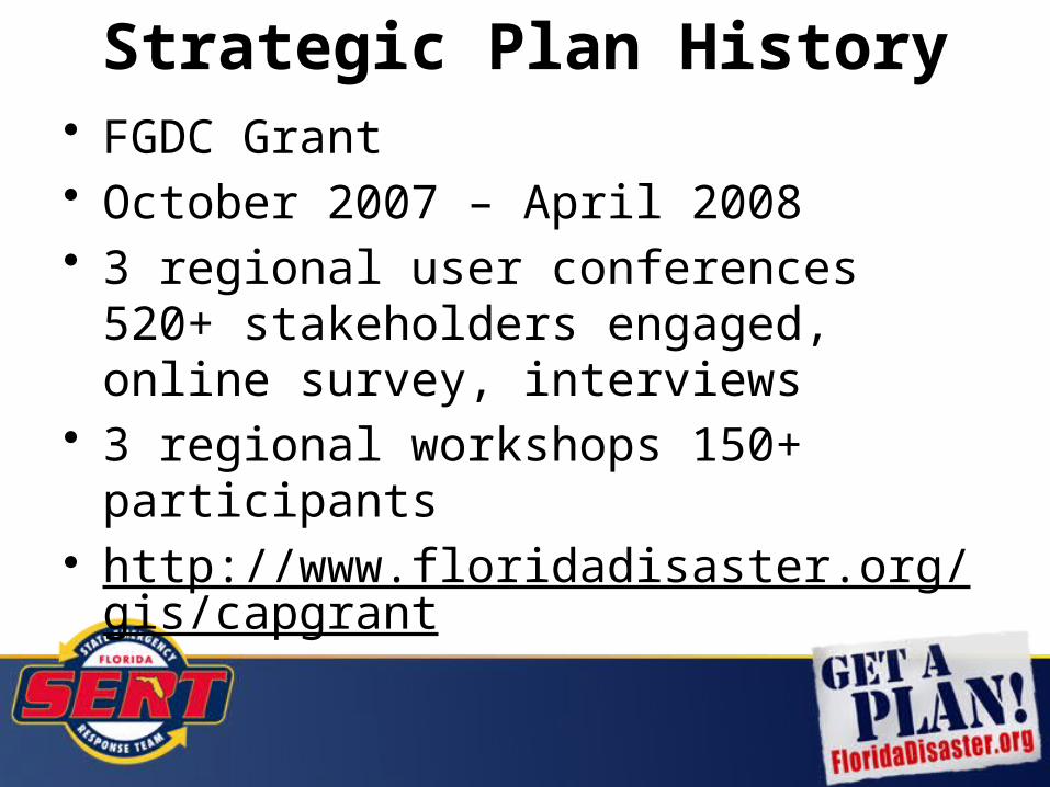
• FGDC Grant• October 2007 – April 2008• 3 regional user conferences 520+
stakeholders engaged, online survey, interviews
• 3 regional workshops 150+ participants• http://www.floridadisaster.org/gis/capgrant
Strategic Plan History

• Provide leadership for coordination of GIS efforts across all levels of government throughout the state.
• Invest in GIS infrastructure to fully realize the benefits of shared geospatial data and technology.
• Communicate and educate all concerned about the benefits and capabilities achieved by investments in GIS to support effective decision making.
Strategic Goals
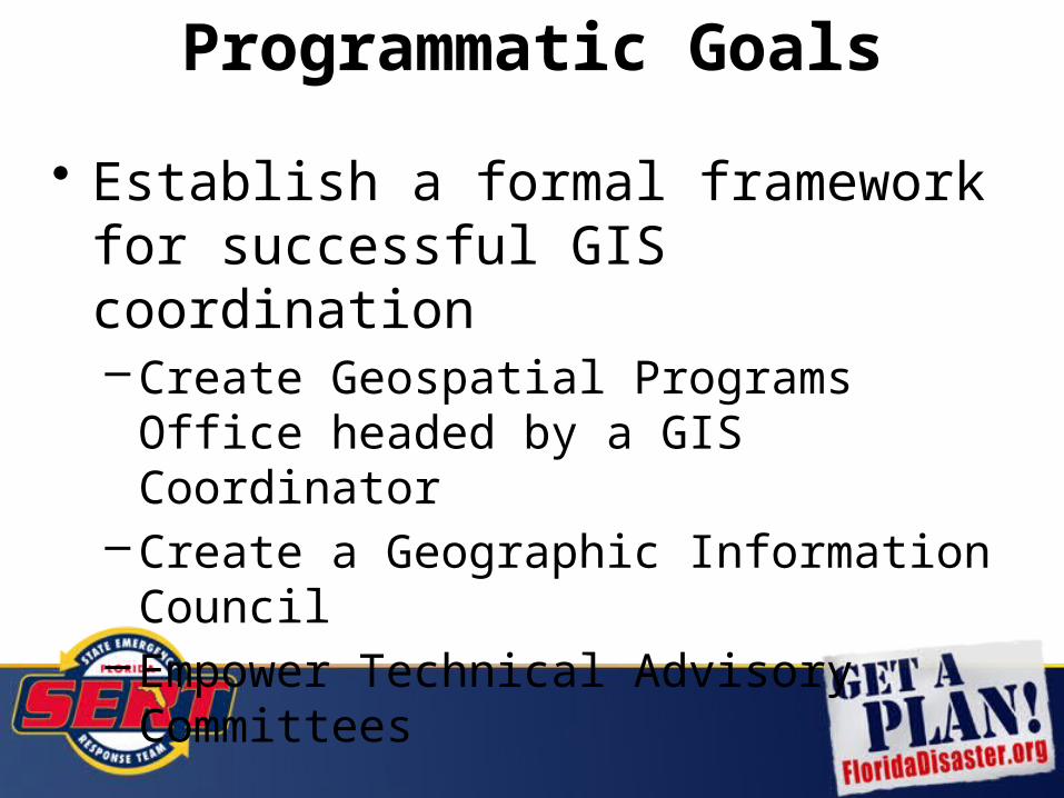
• Establish a formal framework for successful GIS coordination– Create Geospatial Programs Office headed
by a GIS Coordinator– Create a Geographic Information Council– Empower Technical Advisory Committees
Programmatic Goals
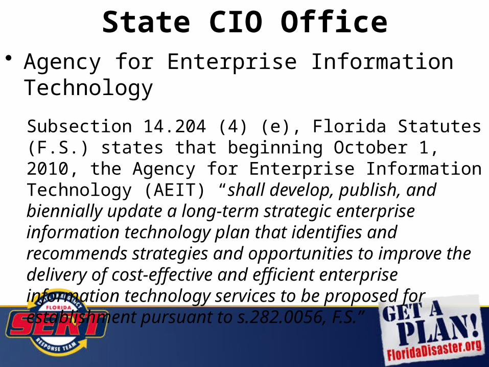
• Agency for Enterprise Information Technology
Subsection 14.204 (4) (e), Florida Statutes (F.S.) states that beginning October 1, 2010, the Agency for Enterprise Information Technology (AEIT) “shall develop, publish, and biennially update a long-term strategic enterprise information technology plan that identifies and recommends strategies and opportunities to improve the delivery of cost-effective and efficient enterprise information technology services to be proposed for establishment pursuant to s.282.0056, F.S.”
State CIO Office

“Tremendous potential exists for Geographic Information Service (GIS) as an enterprise service to revolutionize the way information can be leveraged to empower state government. By creating a formal, centrally coordinated organizational structure to better manage GIS resources, Florida has the potential to improve information used for the allocation of resources, obtain additional federal funding, save costs at the program level and improve quality of services to the public.”
State CIO Office
AEIT recommends the following:
• Making GIS an enterprise service and allocating two additional resources (one lead and one project analyst) effective July 1, 2011.
• Creating, in statute, the Geographic Information Office (GIO) within AEIT, with a GIS state coordinator overseeing the GIS program and solutions in Florida, effective July 1, 2011.
• Forming a Geographic Information Council (GIC) in statute, consisting of members appointed by state agencies, local and federal entities, effective July 1, 2011. GIC shall provide guidance to the GIO on issues related to GIS technology, data, and people.
State CIO Office

• Agency for Enterprise Information Technology Strategic Plan
–https://aeit.myflorida.com/agencyprojects– Results of state agency survey in Addendum A– Report from GIS Workgroup in Addendum B
• GIS Use Survey–http://www.surveymonkey.com/s/FL-GIS-Coor
dination-Survey
Statewide GIS Coordination

Florida GIS CoordinationOn-Line Survey
Preliminary Results
Martin Roche, GISP, CEcDGeoPlanning Services
Orlando, FL(407) 608-4186
www.GeoPlanningServices.com

Survey Respondents181 Total
City15%
County26%
State21%
Federal1%
Re-gional
6%
Pri-vate
Firms18%
Utility8%
Other6%
CityCountyStateFederalRegionalPrivate FirmsUtilityOther
• Other includes: School Districts, Universities, Not-For-Profit, Professional or Trade Association

Investment in GIS
• Government entities in FL spend approximately
$110,000,000 per year
on GIS hardware, software, personnel, data, and contracted GIS services!
• Based on 141 organizations responding. This number is likely much larger when all levels of government are considered.

Benefits from GIS
• Government entities in FL benefit approximately
$598,000,000
from their investment inGIS hardware, software, personnel, data, and
contracted GIS services!
• The approximate net benefit per year is $9 million.
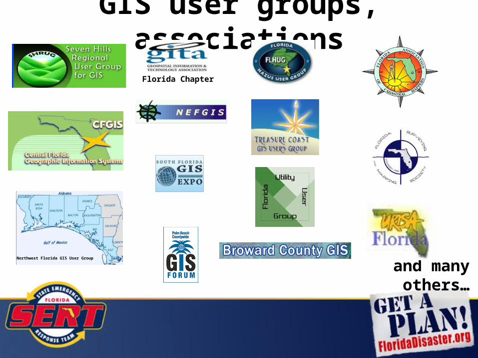
GIS user groups, associations
Northwest Florida GIS User Group
Florida Chapter
and many others…

“Building collaborative relationships and governance…ensures that the state plan effectively becomes a statewide plan that is relevant to the needs and incentives of local government as well as state government. Through this approach, state government will derive greater value from its geospatial knowledge base…”
Source: NASCIO 2008, page 16
State Plan
Statewide GIS Coordination1:30 PM – 3:00 PM 1-888-808-6959x3468962#