staking claims in michigan’s copper country · staking claims in michigan’s copper country. ......
TRANSCRIPT
Yarina | 32
CONTESTED LANDSCAPE(S)Staking Claims in
Michigan’s Copper CountryAbstractCompeting claims to rural landscapes broaden definitions of nature and resource in the context of Michigan’s Copper Country. In the Upper Peninsula’s new copper sulfide mining region, various actor groups stake claims on the same physical spaces. Different landscape objects (copper composites, aquifers, mineral lodes) are ascribed importance by these groups based on unique valuation regimes (i.e. hydrological, cultural, historical, or economic). These competing claims are further problemetized by complex ownership structures where surface and mineral rights are owned and operated by different stakeholders, and where biological and hydrological systems operate irrelevant of property boundaries. Thus, territorial claims manifest themselves across permeable horizontal and vertical spatial layers.
Introduction: Conflict in the Copper CountryIn 2002, transnational mining company Kennecott Minerals discovered a rich body of copper sulfide ore below the forests of Marquette County near the shores of Lake Superior. Although copper mining was historically the primary industry in the Western Upper Peninsula, new and proposed mines near Marquette harvest toxic copper sulfide instead of the native (pure) copper of the Keweenaw range. While native copper requires minimal processing, copper sulfide mining produces toxic sulfuric acid when it comes into contact with air and water. Water is introduced both through rainwater or leaks in the mine shaft, and through refining, where water is introduced to crushed rock to produce slurry. The area in
Elizabeth Yarina | Masters of Architecture + Masters of City Planning 2016 Massachusetts Institute of Technology
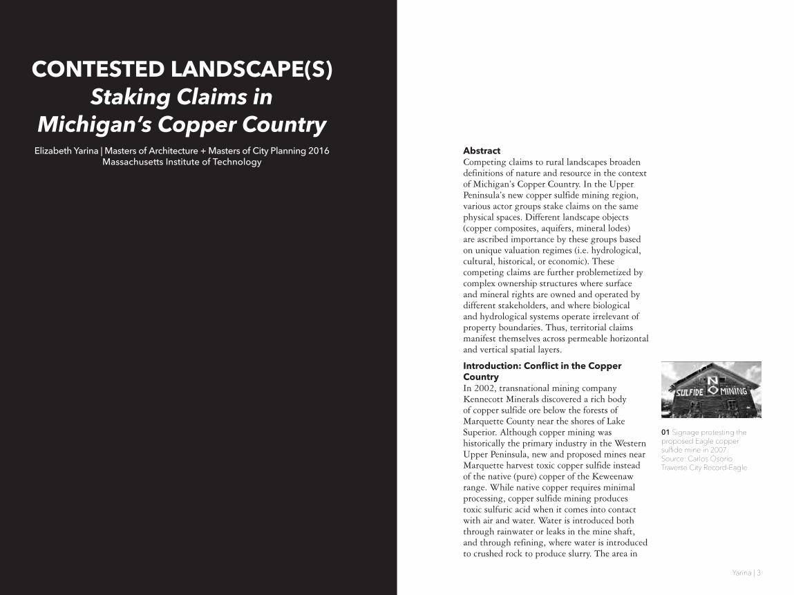
01 Signage protesting the proposed Eagle copper sulfide mine in 2007. Source: Carlos OsorioTraverse City Record-Eagle
ADD CITATIONS FOR LOCAL NEWS SOURCES.
SIDE IMAGES?
Yarina | 54
which Eagle Mine and the nearby processing plant Humboldt Mill were proposed and eventually built spans territories and objects of interest to a diverse array groups leading to resounding opposition to the project.
The copper mining industry largely left Michigan’s Upper Peninsula in the mid-twentieth century, when a combination of economics, labor supply, and extraction methods made copper mining much cheaper elsewhere in the world, particularly Chile’s Atacama region. In spite of the fact that the Keweenaw Peninsula has the world’s largest deposit of native copper, deep fissures and incredibly large veins make its extraction a laborious process. However, the discovery of an accessible copper sulfide lode in Marquette county in 2002, combined with rising copper prices, has led to a return of copper mining interests to the region. When Kennecott Minerals company requested to lease mineral rights for the construction of Eagle Mine from Michigan’s Department of Natural Resources in 2007, a number of groups stepped forward to contest this landscape claim. One of the strongest voices opposing the mine has been the Keweenaw Bay Indian Community (KBIC), who claim Eagle Rock (located on top of the sulfide lode) as a sacred site. In 2008 the KBIC launched three state and local cases against Kennecott questioning the legality of their mining permits alongside the National Wildlife Federation, Yellow Dog Watershed Preserve (a local conservancy organization), and Huron Mountain Club (a nearby private hunting and fishing club). These strange bedfellows brought the case all the way to a federal appeals court before ultimately failing to stop the construction of the mine. Eagle Mine began production in September 2014, and in the same month Lundin Mining (who took over Eagle Mine in 2013) made a Mineral Lease Request to the DNR for another proposed mine in Marquette County.
Each group involved in promoting or opposing Eagle Mine makes an argument relative to their own particular narratives of nature or natural resources. For mining interests (Kennecott/Rio Tinto/Lundin) the narrative is clearly an
economic one, where copper sulfide in the ground is potential capital to be harvested. For the Keweenaw Bay Indian Community, the narrative is one of heritage, where cultural values are closely tied to the elements of earth, water, plants, and animals. While their interests span landscape preservation across the Lake Superior watershed, their interest is heightened by the mines adjacency to Eagle Rock, and the lack of access to this site instigated by the mine. Eagle Mine lies at the perimeter of the Yellow Dog Watershed, and the Yellow Dog Watershed Preserve (YDWP) claims landscape value through narratives of biodiversity, hydrology, and ecology, particularly in relationship to rare Jack Pine habitats and the endangered Kirtland Warbler. For the exclusive members of the Huron Mountain Club, their high-end rural retreats in 20 square miles of perimeter patrolled land share watersheds, air, and fish and game stocks with the Eagle Mine just 3 miles from their boundary. For these elite, ownership of “untouched wilderness” serves as an exclusive mark of status and as a luxury commodity.
The introduction of copper sulfide mining in Marquette County has brought contestation over rights to the landscape by these diverse groups, each claiming different values of landscape or nature relating to overlapping surface and subsurface materials. While anti-mining groups may operationalize, value, or narrate different aspects of the landscape in different ways, opposition to the Eagle Mine aligns groups who otherwise make contentious landscape claims. However, an explication of their diverse claims effectively “repoliticizes” nature in the context of the copper country by broadening the way it is conceptualized [02].
Erik Swyngedouw argues that in the era of the Anthropocene, Nature has become de-politicized, “outside the field of public dispute, contestation, and disagreement,” and he calls instead for a re-politicization of nature that allows for complex and contested conversations surrounding contemporary indeterminate ecological threats. In the case of Eagle Mine, nature isn’t fetishized into a single-dimensional
02 Swyngedouw, Erik. “Depoliticized Environments: The end of Nature, Climate Change, and the Post-Political Condition.” Royal Institute of Philosophy Supplement, 69, pp 253-274.
2015 Copyright, Elizabeth Yarina

Yarina | 76
object for consumption or preservation, but instead through this diverse collection of voices becomes a richly conceived “object of concern” [03].
Research Methods: Copper As A Matter Of ConcernAs a method of analysis, the contesting landscape claims around Eagle Mine and the surrounding copper sulfide district in Marquette County are visualized in order to explicate the claims brought to the table by each party. This graphic and textual ‘forensic’ analysis spatializes the argument over mining rights by tracing areas of interest of each group in both the horizontal and vertical dimensions. In order to do so, we must take to hand the “murky evidence” [04] brought to the table by each group: blog posts, water samples, newspaper articles, protest songs, or aerial photographs. The arguments produced by these biased and indeterminate objects of evidence are not taken as “matters of fact” (Latour), but rather the collection of claims are used to illustrate a broader spatial discourse.
As in Eyal Weizman’s practice of “Forensic Architecture” the explication of these claims in drawing and space are intended to survey landscape beyond the singular conception to larger analytical frames and forces as a “multilayered political practice” [05]. As such, this exploratory analysis can be not only critical, but also operative, demonstrating overlaps in spatial claims which correspond to areas of contestation. The examination of these claims in three dimensions reveals that landscape claims are not only layered, but are interconnected with fluid systems that are not bound by property perimeters. As the following explication of this case will demonstrate, this calls for new and revised methods of ownership and regulation as we examine claims to earth, air, water, and biology surrounding the Eagle Mine case.
Historical Context: Early Landscape ModificationsThe communities of the Upper Peninsula of Michigan were founded on economies of
resource extraction. From the pure copper lode running along the spine of the Keweenaw Peninsula to the Menominee and Gogebic iron ranges as well as smaller deposits of gold and silver, the region has been actively mined since before European explorers arrived in the late 18th century [06]. Thus, despite it’s appearance of untouched wilderness, the lush landscape of the Upper Peninsula has been modified for centuries through mining processes.
Before the arrival of European settlers, Native Americans in the Keweenaw region practiced surface mining of copper, alongside logging and hunting in order to curate the landscape according to their needs. The Keweenaw copper lode was mined as early as 5,000 BC, and was found across the continent as a trade good in the form of jewelry, tools, and decorative objects [7,8]. While the Ojibwa (also called Chippewa or Anishinaabeg) who inhabited the Keweenaw when explorers arrived were not miners, it was through Native American legends that word of Michigan copper reached the first explorers and missionaries to the region. The sites of broad and shallow Native American pit mines later became the first successful mines by entrepreneurial settlers [9].
These early settlers saw the landscape as one to be tamed and consumed. Henry Schoolcraft, who saw the Upper Peninsula as the “ends of the earth” was in 1921 the first to recommend large-scale exploration of copper deposits [10], leading to the division of the land by the US government into 9 square mile (eventually 1 square mile) parcel units for mining activities. The land was ceded in 1842 to the United States as part of the Treat of La Pointe with the Ojibwe Native American tribe, as part of a land deal including much of Northern Wisconsin and the Western Upper Peninsula. Now bound and divided, early miners began clearing forests and blasting surface deposits, leading in 1844 to the Copper Boom, first US mining boom. Early manipulations of the landscape in the name of mining included the dredging of Portage Canal, laying of railroad and highways, logging for building and fuel, company built
04 Paulo Tavares, “Murky Evidence: Environmental forensics in the Age of the Anthropocene,” Cabinet 43: Forensics (2011): 101-105.
05 Weizman, Eyal. Forensic Architecture : Notes From Fields And Forums = Forensis-che Architektur : Notizen Von Feldern Und Foren. n.p.: Os-tfildern : Hatje Cantz, c2012., 2012. MIT Barton Catalog. Web. 4 Nov. 2014.
06 “Upper Michigan Metallic Mineral Ranges.” Source: Michigan Technological University Mining Engineering Department
07 National Park Service. “Timeline of Michigan Copper Mining Prehistory to 1850“ Keweenaw National Historic Park. < http://www.nps.gov/kewe/historyculture/cop-per-mining-timeline.htm>
09 Cleland, Charles E. (1992) Rites of Conquest: The History and Culture of Michigan's Native Americans, p. 18. Uni-versity of Michigan Press.
08 “Partial serpent artifact made of Lake Superior copper found at Effigy Mounds Na-tional Monument, Iowa.”Source: National Park Service
10 World’s largest piece of float copper, discovered in the Keweenaw and currently sited in Marquette County. Source: Lucy Hough
03 Bruno Latour, “From Real-politik to Dingpolitik,” Making Things Public: Atmospheres ofDemocracy (Cambridge: MIT Press, 2005).
2015 Copyright, Elizabeth Yarina
Yarina | 98
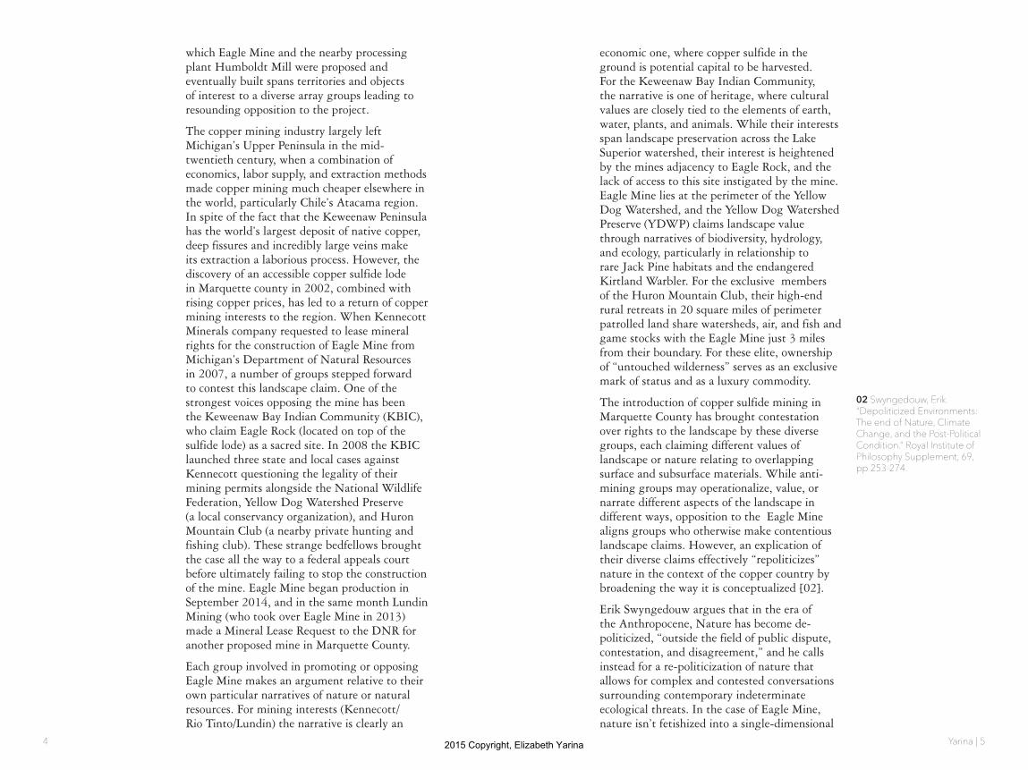
housing and schools, and the construction of mines and smelters [11]. While the Keweenaw copper lode is native copper, requiring minimal processing relative to composites such as copper sulfide, it still must be separated from attached hard or molten rock, producing stamp sands and slag. Stamp sands remain highly visible in the landscape of the Keweenaw today as large gravel sandbars dumped into lakes and canals. Stamp sands resist vegetation [12] and may also contain heavy metals dangerous to human and animal health. The built relics of the mining boom, which lasted until the mid-twentieth century, also define the region’s landscape [13], their status as cultural landmarks or dangerous ruins has also come into contestation in recent years [14].
While the copper mining industry large left upper Michigan until recently, the Upper Peninsula, while 80% forested, remains a curated landscape. Logging remains a major industry in the region and outdoor sports major recreational activities and tourist attractions. Everything from forest compostion to deer populations are regulated by economics and policy.
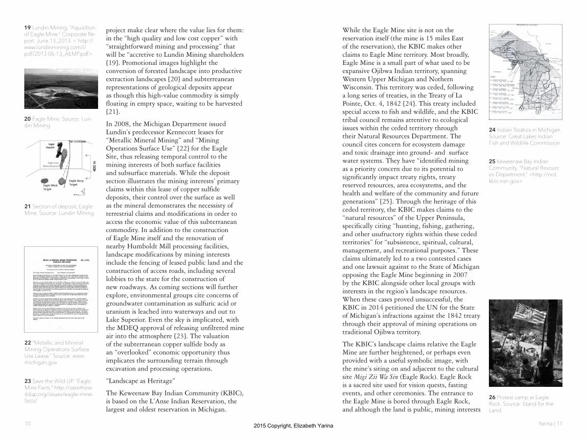
In light of these changing methods of landscape maniplation, what we refer to as ‘nature’ in the Upper Peninsula has not been a single univeral concept but rather a construct used differently by different groups over time. It is not simply “Pure Michigan” [15] or “5-Star Wilderness” as the state’s tourism board casts, but rather a “product of civilization” [16]. These branded conceptions of an ‘uninhabited wilderness’ also required the dismissal of millenia of Native American heritage and centuries of landscape modification by European settlers and eventually Americans. These ideas demonstrate the inherent contradictions in the ideas of nature and wilderness; “our very presence in nature represents its fall.” The categorization of the U.P. as natural or wild fails to acknowledge humanity’s continuos modifications of our physical environments since the beginning of history. Through this lens, instead of viewing the Upper Peninsula as a fetishized “uninhabited
wilderness,” understanding the role of the landscape as part of broader human history, culture and economics allows us to reintroduce ourselves into discourse on the landscape of the Copper Country [16].
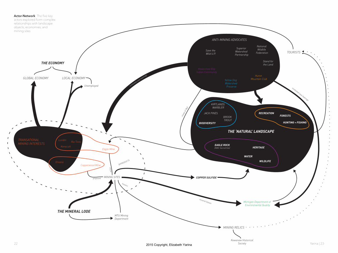
Whose Land and Whose Copper?: Actors and Their ClaimsIn the case of the Eagle Mine controversy, this reconsideration of nature as a social construction allows us to demonstrate how each of diverse actors in this dispute manufacture their own narratives of nature and resource values. Each make distinct claims to overlapping layers of landscape, revealed by spatialization in plan and section in the following drawings. While their claims may be to different layers, access to one layer (i.e. copper sulfide) results in disruptions to others (i.e. forests, sacred sites, watersheds). Although dozens of nonprofits, community groups, business interests, and government organization have been involved in the opposition or approval of Eagle mine, this section focuses on five key players that each have a distinct take on the value of the Upper Peninsula landscape.
“Landscape as Commodity”
As the Eagle Mine has changed hands three times since the process began, I term the corporations of Kennecott, Rio Tinto, and Lundin as ‘mining interests.’ Kennecott is a subsidiary of Rio Tinto, and all three are multinational mining companies operating resource extraction sites across the globe. The current owner, Lundin Mining Corporation, is Swiss-owned and operates in Europe, Africa, South America, and with the purchase of Eagle Mine in June 2013 for $325 million, now North America as well [17] . Lundin Mining is just one branch of the Lundin Group, a $14 billion dollar conglomeration of publicly-traded oil and mineral extraction and exploration companies. The title of their 2013 operations map sums up well the company’s ethos for a “continuous worldwide quest for overlooked opportunities” [18].
Lundin’s representations of the Eagle Mine
12 Stamp sands near Gay, Michigan. Source: Keweenaw Geoheritage Web site and Bill Rose
14 Hauglie, Kurt. "Many involved in future of smelter" The Daily Mining Gazette. De-cember 13, 2008. http://www.mininggazette.com/page/content.detail/id/503001.html?nav=5006
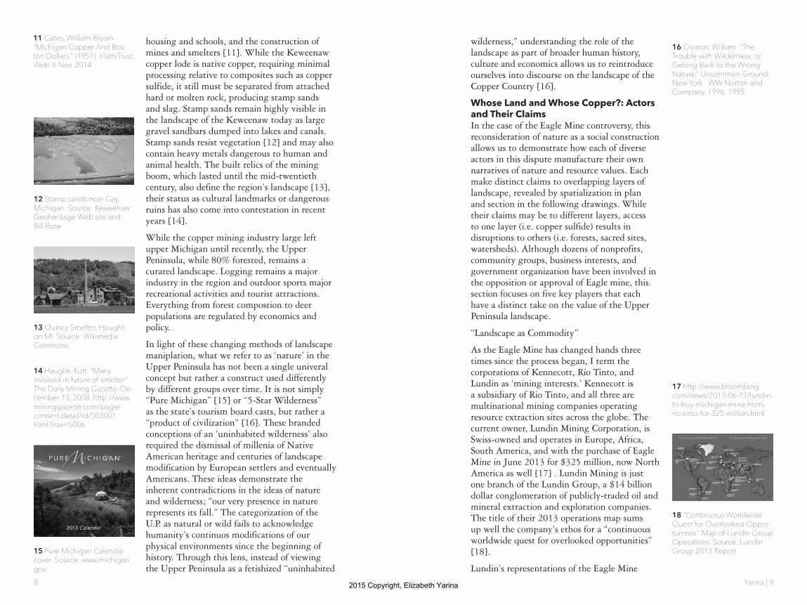
13 Quincy Smelter, Hought-on MI. Source: Wikimedia Commons
15 Pure Michigan Calendar cover. Source: www.michigan.gov
17 http://www.bloomberg.com/news/2013-06-12/lundin-to-buy-michigan-mine-from-rio-tinto-for-325-million.html
18 ”Continuous Worldwide Quest for Overlooked Oppor-tunities.” Map of Lundin Group Operations. Source: Lundin Group 2013 Report
11 Gates, William Bryam. “Michigan Copper And Bos-ton Dollars.” (1951): HathiTrust. Web. 6 Nov. 2014.
16 Cronon, William. “The Trouble with Wilderness; or, Getting Back to the Wrong Nature.” Uncommon Ground. New York : WW Norton and Company, 1996, 1995
2015 Copyright, Elizabeth Yarina
Yarina | 1110
project make clear where the value lies for them: in the “high quality and low cost copper” with “straightforward mining and processing” that will be “accretive to Lundin Mining shareholders [19]. Promotional images highlight the conversion of forested landscape into productive extraction landscapes [20] and subterreanean representations of geological deposits appear as though this high-value commodity is simply floating in empty space, waiting to be harvested [21].
In 2008, the Michigan Department issued Lundin’s predecessor Kennecott leases for “Metallic Mineral Mining” and “Mining Operations Surface Use” [22] for the Eagle Site, thus releasing temporal control to the mining interests of both surface facilities and subsurface materials. While the deposit section illustrates the mining interests’ primary claims within this lease of copper sulfide deposits, their control over the surface as well as the mineral demonstrates the necessisty of terrestrial claims and modifications in order to access the economic value of this subterranean commodity. In addition to the construction of Eagle Mine itself and the renovation of nearby Humboldt Mill processing facilities, landscape modifications by mining interests include the fencing of leased public land and the construction of access roads, including several lobbies to the state for the construction of new roadways. As coming sections will further explore, environmental groups cite concerns of groundwater contamination as sulfuric acid or uranium is leached into waterways and out to Lake Superior. Even the sky is implicated, with the MDEQ approval of releasing unfiltered mine air into the atmosphere [23]. The valuation of the subterranean copper sulfide body as an “overlooked” economic opportunity thus implicates the surrounding terrain through excavation and processing operations.
“Landscape as Heritage”
The Keweenaw Bay Indian Community (KBIC), is based on the L’Anse Indian Reservation, the largest and oldest reservation in Michigan.
While the Eagle Mine site is not on the reservation itself (the mine is 15 miles East of the reservation), the KBIC makes other claims to Eagle Mine territory. Most broadly, Eagle Mine is a small part of what used to be expansive Ojibwa Indian territory, spanning Western Upper Michigan and Nothern Wisconsin. This territory was ceded, following a long series of treaties, in the Treaty of La Pointe, Oct. 4, 1842 [24]. This treaty included special access to fish and wildlife, and the KBIC tribal council remains attentive to ecological issues within the ceded territory through their Natural Resources Department. The council cites concern for ecosystem damage and toxic drainage into ground- and surface water systems. They have “identified mining as a priority concern due to its potential to significantly impact treaty rights, treaty reserved resources, area ecosystems, and the health and welfare of the community and future generations” [25]. Through the heritage of this ceded territory, the KBIC makes claims to the “natural resources” of the Upper Peninsula, specifically citing “hunting, fishing, gathering, and other usufructory rights within these ceded territories” for “subsistence, spiritual, cultural, management, and recreational purposes.” These claims ultimately led to a two contested cases and one lawsuit against to the State of Michigan opposing the Eagle Mine beginning in 2007 by the KBIC alongside other local groups with interests in the region’s landscape resources. When these cases proved unsuccessful, the KBIC in 2014 petitioned the UN for the State of Michigan’s infractions against the 1842 treaty through their approval of mining operations on traditional Ojibwa territory.
The KBIC’s landscape claims relative the Eagle Mine are further heightened, or perhaps even provided with a useful symbolic image, with the mine’s siting on and adjacent to the cultural site Migi Zii Wa Sin (Eagle Rock). Eagle Rock is a sacred site used for vision quests, fasting events, and other ceremonies. The entrance to the Eagle Mine is bored through Eagle Rock, and although the land is public, mining interests
21 Section of deposit, Eagle Mine. Source: Lundin Mining
22 “Metallic and Mineral Mining Operations Surface Use Lease.” Source: www.michigan.gov
23 Save the Wild UP. “Eagle Mine Facts.” http://savethew-ildup.org/issues/eagle-mine-facts/
25 Keweenaw Bay Indian Community. “Natural Resourc-es Department.” <http://nrd.kbic-nsn.gov>
26 Protest camp at Eagle Rock. Source: Stand for the Land.
20 Eagle Mine. Source: Lun-din Mining
19 Lundin Mining. “Aquisition of Eagle Mine.” Corporate Re-port. June 13, 2013. < http://www.lundinmining.com/i/pdf/2013-06-13_AEMP.pdf>
24 Indian Treaties in Michigan. Source: Great Lakes Indian Fish and Wildlife Commission
2015 Copyright, Elizabeth Yarina

Yarina | 1312
have attempted to deny access through the terms of their Mineral Lease. This contention came to a head when tribe member Cynthia Pryor was arrested for “trespassing” while walking her dog on leased land still under contestation through the appeals case mentioned above [27]. Through the leveraging of local police (some news reports side bribes via trays of sandwiches) Pryor’s, as well as protesting campers’ claim to the land as recreational or sacred site is seemingly superseded by the mining interests’ ability to manipulate power.
“Landscape as Status”
Joining The KBIC in the 2007 filing of a contested case over the permitting of the Eagle mine was the National Wildlife Federation, The Yellow Dog Watershed Preserve (discussed in the following section) and the Huron Mountain Club (HMC) [28]. While all of these groups share concerns over pollution and degredation, the HMC is unique in being a closed, members-only organization with elite connotations.
The Huron Mountain Club is a 26,000 acre private hunting and fishing retreat founded in 1889 by wealthy residents of the Marquette area. It has about 150 members, 50 of whom own cabins on the site, although most are wealthy families who reside many hours away in Chicago or metro Detroit. High-profile members of HMC included actress Julie Harris and Henry Ford, who waited 13 years before receiving membership to the club [29]. Access to club land is restricted to members and their guests, and its perimeters are actively patrolled. The HMC and its members are cloaked in secrecy and information about its operations can be difficult to ascertain [30].
However, the HMC does allow pre-approved scientific and educational to visit their land for academic purposes. While this could be deemed as demonstrating priorities of education and ecological health, it is also true that a healthy ecosystem contributes to the status and value of the land.
28 Orthober, Andrew. “Public Participation in Michigan Mining Policty: the Kennecott Eagle Project Case.” Masters Thesis, Michigan Technologi-cal Univeristy. 2012.
30 Pace, Emily. “Behind the Gates.” Upper Michigan Source. 9 May 2008. < http://www.uppermichiganssource.com/news/story.aspx-?id=132343#.VHjRR0vxhBU>
29 Former University of Michigan President Alexander Ruthven with Bryant walker at the exclusive Huron Mountain Club. Source: University of Michigan Bentley Archives
31 Pepin, John. “Huron Moun-tain Club loses legal bid to stop Eagle Mine project.” The Mining Journal. 31 October 2013.
32 No Tresspassing sign at the Huron Mountain Club perimeter. Source: The Mining Journal
The priority of preserving shared watersheds and ecosystems which pass through HMC land came to a head with the Eagle Mine case. The boundaries of the HMC are only 3 miles from the Eagle Mine site, and share the watershed of the Salmon Trout River. While in their contestsed case against Kennecott/Rio Tinto the HMC cites the ecological damage to the rare brook trout spawning habitats in this river, they also cite “irreperable damage to the value of club lands” [31]. For the HMC, landscape value is inherently bound to wealth and status concerns [32].
“Landscape as Ecosystem”
The Yellow Dog Watershed Preserve (YDWP) is an environmental organization and another plaintiff in the contested cases opposing the Eagle Mine. Eagle Mine is sited at the Northern Boundary of the Yellow Dog Watershed in the Yellow Dog Plains, a unique jack pine habitat home to the endangered Kirtland Warbler [33]. The Yellow Dog River “runs free and clean through wild country until it eventually reaches Lake Superior” [34]. Protection of these water supplies and habitats are key to the YDWP’s mission.
Anti-sulfide mining advocacy has arisen as one of the YDWP’s main focus areas, and besides their political action against the mines through the court cases, they also have been monitoring the river’s quality since 2010. One of their (and others) major criticisms of copper sulfide mining is the danger of leaching toxic sulfuric acid and heavy metals into groundwater, thus contaminating drinking water, ecosystems, and ultimately Lake Superior (the cleanest and largest of the Great Lakes). Through thier discussion of water supply, the YDPW’s ecology-centric values are clear: “The most important thing in an ecosystem is the purity of its lifeblood, the water” [34]. In their terms, the landscape is not just a resource to be protected, but a living organism to be cared for and preserved.
33 Kirtland Warbler. Source: Houghton Mifflin Books
34 Yellow Dog Watershed Preserve. 2014. <www.yellow-dogwatershed.org>
27 Pryor, Cynthia. “A Sacred Fire Is Burning at Eagle Rock” Posted: 07/07/2010. < http://www.huffingtonpost.com/cynthia-pryor/a-sacred-fire-is-burning_b_567652.html>
2015 Copyright, Elizabeth Yarina

Yarina | 1514
“Landscape as Natural Resource” or “Landscape as Mediator”
While a number of state and federal agencies (i.e. Michigan Deparment of Environmental Quality, the EPA, County, State, and Federal Courts), the Michigan Department of Natural Resources (DNR) is particularly notable for their actual ownership of both the surface and mineral rights on the land that Kennecott/Rio Tinto/Lundin leased for the Eagle Mine. The DNR states its goals as “conservation, protection, management, use and enjoyment of the state’s natural and cultural resources” [35]. Their role in the Eagle Mine case suggests that ‘conservation,’ ‘protection’ and ‘enjoyment’ may not so easily align with ‘management’ and ‘use’ in cases where different stakeholders claim different rights to the same pieces of land.
The DNR owns 6 million acres of mineral rights, 4.5 million acres public hunting land, and 2.2 million acres of (leased) farmland [36]. As owners, they walk a difficult line between extracting profit from the land they own for the benefit of the state, and preserving it for “current and future generations.” This conflict is summed well in a 2014 letter regarding the proposal for a new mine in Yellow Dog Plains:
“You recently stated in an interview, “All we’re doing is saying that if there’s activity on state-owned land, we need to be paid for it. That’s what the lease does.” You must understand, however, that this public land is more valuable because its minerals have not been leased, because natural resources on the surface are not undermined or threatened by mine activity. What value does the DNR assign to silence, to the tranquility of being in a wilderness area, to the experience of seeing wild animals and sleeping to the sound of wolves howling at night?” [37]
For many opponents to the Eagle Mine, the DNR’s approval of the Kennecott Mineral Lease makes them implicit in crimes against the Upper Michigan landscape. However, their role in the management of natural resources, both above ground (flora, fauno, recreation space, timber, waterways) and below (ore
deposits, subsurface water, soils) but them in a unique position negotiating between different valuations of nature or landscape. The DNR must mediate betweeen values of the Upper Peninsula landscape as tradeable resource commodity, ecosystem health, and public realm.
“Lanscape as ________”
Nearly all of these groups make claims to landscape as not only horizontal, but also vertical territory--be it mineral mining/mineral operations, groundwater/surface water, or mineral rights/surface rights. As suggested by Bruce Braun in his discussion of geologic exploration of Canada [38], territory becomes vertical when we begin to value not only the ownership of the surface, but the capital (or other) potential of the geological strata which underlies it. Of course, when this geological strata harbors rich deposits with potentail capital gains, as in the case of the Eagle Mine, there is an impetus for verticalizing territory.
This above/below dichotomy is especially interesting in relationship to the DNR’s surface/mineral ownership structure. How can one own what’s below without owning what’s above, or vice versa? Furthermore, what does ownership of specific boundaries mean when fluid systems pass through and beyond them without limitation?
Conclusion: Re-territorializing landscapeThe contested claims to the landscape surrounding Eagle Mine in Marquette County will continue to be tested if the prediction of the Upper Peninsula’s second Copper Boom are correct. How can this landscape be re-territorialized in light of the competing value systems and valued objects in the landscape explored here?
Veronica Davidov’s essay on the changing natural resource identities in the Intago region of Ecuador provides a productive analog. In the Intago, over time, different ‘natural resources’ have gained primacy through ‘metynomic materiality,’ where a single resource lens become the dominant symbolic identity and
37 Rydholm, June. Letter to the Department of Natural Re-sources. 20 November 2014. Reprinted at keweenawnow.blogspot.com.
36 DNR Land and Mineral Ownership, Marquette Coun-ty. Source: Michigan DNR
35 Michigan Department of Natural Resources. 2014. <www.michigan.gov/DNR>
38 Braun, Bruce. “Producing Vertical Territory: Geology And Governmentality In Late Victo-rian Canada.” Cultural Geogra-phies 7.1 (2000): 7. Publisher Provided Full Text Searching File. Web. 9 Nov. 2014.
2015 Copyright, Elizabeth Yarina
Yarina | 1716
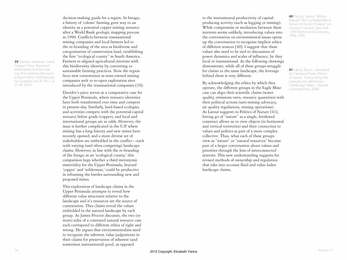
decision-making guide for a region. In Intago, a history of ‘colono’ farming gave way to an identity as a potential copper mining resource after a World Bank geologic mapping process in 1990. Conflicts between transnational mining companies and local farmers led to the re-branding of the area as biodiverse and categorization of conservation land, establishing the first “ecological county” in South America. Farmers re-aligned agricultural interests with this biodiversity identity by converting to sustainable farming practices. Now the region faces new contestation as state-owned mining companies seek to re-open exploration sites introduced by the transnational companies [39].
Davidov’s piece serves as a comparative case for the Upper Peninsula, where resource identities have both transformed over time and compete in present-day. Similarly, land-based ecologies and activities compete with the potential capital resource below grade (copper), and local and international groups are at odds. However, the issue is further complicated in the U.P. where mining has a long history and new mines have recently opened, and a more diverse set of stakeholders are embedded in the conflict—each with varying (and often competing) landscape claims. However, in line with the re-branding of the Intago as an ‘ecological county,’ this comparison begs whether a third metonymic materiality for the Upper Peninsula, beyond ‘copper’ and ‘wilderness,’ could be productive in reframing the battles surrounding new and proposed mines.
This exploration of landscape claims in the Upper Peninsula attempts to reveal how different value structures relative to the landscape and it’s resources are the source of contestation. Thes claims reveal the values embedded in the natural landscape by each group. As James Proctor discusses, the two (or more) sides of a contested natural resource case each correspond to different ethics of right and wrong. He argues that environmentalists need to recognize the inherent value judgements in their claims for preservation of inherent (and sometimes instrumental) good, as opposed
to the instrumental productivity of capital-producing activity (such as logging or mining). While compromise or mediation between these interests seems unlikely, introducing values into the conversation on environmental issues opens up the conversation to recognize implicit ethics of different stances [40]. I suggest that these values also need to be tied to discussions of power dynamics and scales of influence, be they local or transnational. As the following drawings demonstrate, while all of these groups struggle for claims to the same landscape, the leverage behind them is very different.
By acknowledging the ethics by which they operate, the different groups in the Eagle Mine case can align their scientific claims (water quality, emissions rates, resource quantities) with their political actions (anti-mining advocacy, air quality regulations, mining operations). As Latour suggests in Politics of Nature [41], letting go of “nature” as a single, fetishized construct allows us to view objects (in horizontal and vertical territories) and their connection to values and politics as part of a more complex collective. Thus, what each of these groups view as “nature” or “natural resources” become part of a larger conversation about values and priorities through the lens of interconnected systems. This new understanding suggests for revised methods of ownership and regulation that take into account fluid and value-laden landscape claims.
40 Proctor, James. “Whose Nature? The Contested Moral Terrain of Ancient Forests.” Un-common Ground. New York : WW Norton and Company, 1996, 1995
41 Latour, Bruno ; translated by Catherine Porter. Politics of nature : how to bring the sciences into democracy. Cambridge, Mass. : Harvard University Press, 2004.
39 Davidov, Veronica. “Land, Copper, Flora: Dominant Materialities and the mak-ing of Ecuadorian Resource Enviornments. Anthropologi-cal Quarterly, Vol. 87 No.1, p. 31-58. 2014.
2015 Copyright, Elizabeth Yarina

Yarina | 1918
COPPER SULFIDEDEPOSITS
WASTE ROCKSULFIDE
ORECRUSH +
GRIND
SLURRY
FLOAT
FILTRATION
PURE COPPER
PURENICKEL
TAILINGS
NATIVE COPPER DEPOSITS
WASTE ROCKNATIVE
COPPER OREMILL
NATIVE COPPER ORE
STAMP SAND
SMELTER
PURE COPPER
SLAG
WATERRAINCONTAMINATED
WATER
SULFURIC ACID CONTAMINATED
WATER
Native Copper vs. Copper Sulfide Mining While the extraction and refining of both native copper and copper sulfide ores produce waste, copper sulfide creates sulfuric acid when exposed to air and water. Since water is used in the floatation process and rainwater can easily enter mine shafts, this poses risks for groundwater and waterways.
2015 Copyright, Elizabeth Yarina
Yarina | 2120
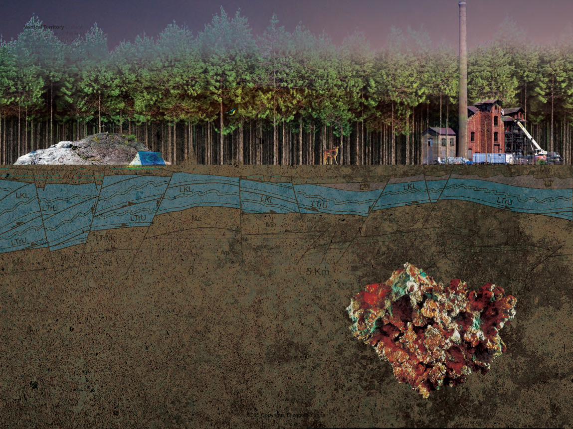
Vertical Territory Collage showing some of the key ob-jects of value in the sectional landscape: groundwater, wildlife, copper lodes, forest, sacred sites, and recreation spaces.
2015 Copyright, Elizabeth Yarina
Yarina | 2322
activ
e
proposed
historic
BYPRODUCTS
MTU Mining Department
Michigan Department of Environmental Quality
Unemployed
THE ‘NATURAL’ LANDSCAPE
THE MINERAL LODE
THE ECONOMY
LOCAL ECONOMYGLOBAL ECONOMY
MINING RELICS
TRANSATIONAL MINING INTERESTS
Orvana
Kenecott
Rio TintoLundin
MINING SITES
Eagle Mine
Copperwood Mine
COPPER SULFIDE
ANTI-MINING ADVOCATES
Save the Wild U.P.
Stand forthe Land
National Wildlife
Federation
Huron Mountain Club
Keweenaw BayIndian Community
Yellow Dog Watershed Preserve
Superior Watershed Partnership
EAGLE ROCK[KBIC Sacred Site]
WATER
FORESTSJACK PINES
KIRTLANDS WARBLER
BROOK TROUT
WILDLIFE
HERITAGE
TOURISTS
Kewenaw HistoricalSociety
RECREATION
HUNTING + FISHINGBIODIVERSITY
mineral leases
treat
y of 1
842
contested case hearings
contested case hearings
Actor-Network The five key actors explored form complex relationships with landscape objects, economies, and mining sites
2015 Copyright, Elizabeth Yarina
Yarina | 2524
2000
2001
2002
DNR[Michigan Department of
Natural Resources]
KBIC[Keweenaw Bay
Indian Community]
YDPW[Yellow Dog Watershed
Preserve]
HMC[Huron Mountain Club]
MINING CORPS[Kennecott, Lundin
Rio Tinto]
2002
: Dis
cove
ry H
ole
drill
ed a
t Eag
le
2003
2004
2005
2006
2007
02/0
6: S
tate
rec
eive
s pe
rmit
app
s fr
om K
enec
ott f
or E
agle
Min
e
2004
: Mic
higa
n pa
sses
Non
ferr
ous
Min
ing
Law
to r
egul
ate
cop
per
Sulf
ide
Min
ing
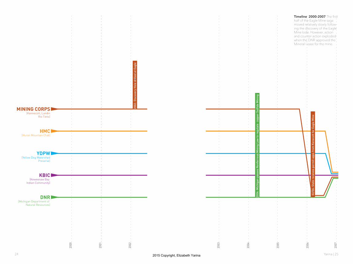
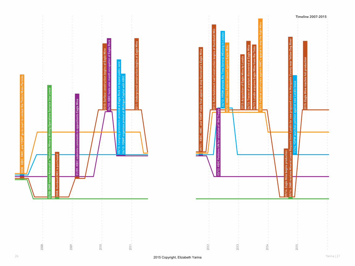
Timeline 2000-2007 The first half of the Eagle Mine saga moved relatively slowly follow-ing the discovery of the Eagle Mine lode. However, action and counter-action exploded when the DNR approved the Mineral Lease for the mine.
2015 Copyright, Elizabeth Yarina
Yarina | 2726
2008
2009
2010
2011
2011
: Und
ergr
ound
con
stru
ctio
n be
gins
at E
agle
Min
e
2010
: Sur
face
con
stru
ctio
n be
gins
at E
agle
Min
e
2008
: Hum
bold
t Mill
is p
urch
ased
06/1
0: Y
DW
P o
rgan
izes
pro
test
at M
ichi
gan
Cap
ital w
ith
KB
IC
02/0
8: D
NR
issu
es K
enec
ott a
“M
ieta
llic
Min
eral
Min
ing
Ope
rati
ons
Surv
ace
Use
Lea
se
01/0
9: K
BIC
sub
min
ts c
omm
ents
in o
ppos
itio
nto
Eagl
e M
ine
2008
: K
BIC
, HM
C, a
nd Y
DW
P g
o to
cou
rt to
con
test
Rio
Tin
to’s
Min
in P
erm
its
04/1
0: K
BIC
hos
ts o
ne-m
onth
occ
upat
ion
of E
agle
Roc
k
05/1
0: C
ampi
ng p
rote
ster
s ar
rest
ed a
t Eag
le R
ock
on le
ased
pub
lic la
nd
2012
2013
2014
2015
2013
: Acq
uisi
tion
of E
agle
Min
e by
Lun
din
04/1
3: T
race
s of
ura
nium
dis
cove
red
at E
agle
Min
e
06/1
3: L
undi
n ac
quir
es E
agle
Min
e fr
om R
io T
into
2015
: Eag
le M
ine
reac
hes
full
pro
duct
ion
2012
: Ref
urbi
shm
ent n
ad C
onst
ruct
ion
begi
ns a
t Hum
bold
t Mill
11/1
4: Y
DP
W la
unch
es p
etit
ion
agai
nst n
ew L
undi
n le
ase
04/1
2: Y
PD
W a
tten
ds R
io T
into
Gen
eral
MEe
ting
in L
ondo
n
09/1
1: K
BIC
, HM
C, a
nd Y
DW
P m
ake
final
app
eal t
o st
op K
enne
cott
’s E
agle
Min
e
10/1
3: F
eder
al c
ourt
rul
es a
gain
st H
MC
’s a
ppea
l to
stop
the
Egle
Min
e
05/1
2: H
MC
file
s Fe
dera
l law
suit
aga
inst
Eag
le M
ine
03/1
2: K
BIC
Pet
itio
ns U
N fo
r vi
olat
ion
of 1
842
Trea
ty
09/1
4: D
NR
rec
eive
s M
iner
al L
ease
Req
uest
from
Lun
din
for
new
pro
pose
d m
ine
in M
arqu
ette
Cou
nty
near
Yel
low
Dog
Riv
er09
/14:
DN
R r
ecei
ves
Min
eral
Lea
se R
eque
st fr
om L
undi
n fo
r ne
w p
ropo
sed
min
e in
Mar
quet
te C
ount
y ne
ar Y
ello
w D
og R
iver
09/1
4: E
agle
Min
e be
gins
pro
duct
ion
Timeline 2007-2015
2015 Copyright, Elizabeth Yarina
Yarina | 2928
HU
RO
N M
OU
NTAIN
CLUB
TERR
ITOR
Y
LAKE SU
PERIO
R W
ATERSH
ED
MAJO
R R
IVERS
YELLOW
DO
G W
ATERSH
ED
JACK PIN
E/ KIR
TLAND
WAR
BLER
HAB
ITAT
LAKES
RIVER
S / STREAM
S
DN
R O
WN
S LAND
DN
R O
WN
S MIN
ERALS
DN
R O
WN
S LAND
+ MIN
DER
ALS
Departm
ent of Natural R
esources
Yellow D
og Watershed Preserve
Huron M
ountain Club$$
$
MIN
ERAL LEASES/M
ININ
G CLAIM
S
BO
REH
OLES
ACTIVE MIN
E SITES
MIN
ERAL EXPLO
RATIO
N
EAGLE MINE
HUM
BOLDT MILL
OJIBW
A CEDED
TERR
ITOR
Y: 1842 TREATY
IMPO
RTAN
T HAB
ITAT AREAS [K
BIC D
ESIGN
ATION
]
IMPO
RTAN
T HAB
ITAT SITES [KB
IC DESIG
NATIO
N]
HAR
VEST LAKES
KB
IC HER
ITAGE SITES
Mining Interests
Kew
eenaw B
ay Indian Comm
unity
Marquette/B
araga Counties
$
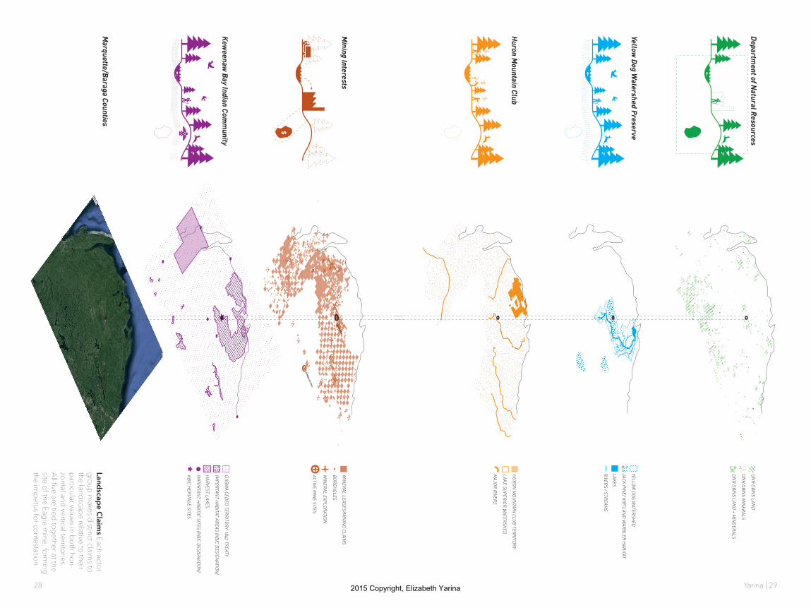
Landscape Claims Each actor
group makes distinct claim
s to the landscape relative to their particular values in both hori-zontal and vertical territories. All five are tied together at the site of the Eagle m
ine, forming
the impetus for contestation
2015 Copyright, Elizabeth Yarina

Yarina | 3130
Lundin Group 2013 market cap: $14 billion
2012 income: $98,314
2010 gaming income: $30.6 million
Annual budget:307.4 million
Purchase price of Eagle Mine by Lundin in June 2013: $325 million
DNR[Michigan Department of
Natural Resources]
KBIC[Keweenaw Bay
Indian Community]
YDPW[Yellow Dog Watershed
Preserve]
HMC[Huron Mountain Club]
MINING CORPS[Kennecott, Lundin
Rio Tinto]
Asset income in 2013 tax return: $4.9 million
Membership fees: $50,000/yr (per member)
Lundin Mining operationsLundin Group operationsHMC landYellow Dog WatershedKBIC ReservationKBIC ceded territoryState of Michigan
Scales of Influence While the landscapes of Marque-tte county these groups make claims to is the same, the scales of power behind them is far from equal. These visualizations of monetary control and spatial breadth—while not the only metrics for power—demonstrate some of the potential leverage behind the groups studied. Lundin Mining operates on a seperate order of magnitude of money and space altogether, relative to local and regional organi-zations.
2015 Copyright, Elizabeth Yarina

Yarina | 3332
2015 Copyright, Elizabeth Yarina