staff report to the benton county planning commission
TRANSCRIPT

Benton County Planning Department Planning Annex, P.O. Box 910, 1002 Dudley Avenue, Prosser WA 99350, Phone: (509) 786-5612 or (509) 736-3086, Fax (509) 786-5629
STAFF REPORT TO THE BENTON COUNTY PLANNING COMMISSION
FILE NO: OA 2017-002 & OA 2017-003
Workshop: Ordinance Amendment for the Periodic Update- Zoning and Subdivision Regulations
MEMO DATE: September 7, 2017
WORKSHOP DATE: September 19, 2017
APPLICANT: Benton County Planning Department
OWNER: N/A
LOCATION: Unincorporated Benton County
PROPERTY SIZE: N/A
AREA TO BE USED: N/A
LAND USE: N/A
COMP. PLAN: N/A
ZONING: N/A
SUGGESTED STAFF RECOMMENDATION: N/A
APPLICATION DESCRIPTION The State of Washington requires mandatory "periodic updates" of the entire comprehensive plan and development regulations every eight years for all "fully planning" cities and counties. Each Washington city and county must periodically review and, if needed, revise its comprehensive plan and development regulations to ensure that they comply with the GMA. The County is now reviewing and updating its Comprehensive Plan and Development Regulations as required by the State of Washington. In Benton County, development regulations include the following: 1. Zoning; 2. Subdivisions; 3. Shorelines; 4. Critical Areas; and 5. Mineral Resource Lands Staff has been working on the following updates:
OA 2017-002 & OA 2017-003 PC Staff Report September 19, 2017
2
Review Period: Fall of 2017
1. Zoning Code: The County’s zoning regulations were last updated as part of the ‘periodic’ review in 2011. Staff is proposing to add new chapters such as Home Occupation, Conditional Uses, Non-Conforming Uses, and Amendments while shortening other chapters and streamlining the regulations into one (1) ordinance. Additionally, the update will integrate in a new chapter for the Red Mountain Agricultural Zone.
2. Subdivision Code: The subdivision regulations are currently divided into four (4) ordinances. To streamline the regulations, Staff is proposing one (1) ordinance with consistent provisions and definitions and including new chapters such as an Introduction (including Definitions), Preliminary Plat, Final Plat, Design and Improvement, Lot Consolidation, and Tax Parcel Separation. This layout will give the County a typical local government subdivision ordinance with streamlined, easy to read and easy to administer chapters.
Review Period: W inter 2017-2018
3. Critical Area Regulations. The County’s CAO was originally adopted in 1994. The State required a periodic update of the regulations in 2006 which the County has not completed to date. The County has been out of compliance for the past 11 years. Staff is proposing to update the regulations to ensure compliance with state requirements. The current regulations are located in seven (7) ordinances in Title 15 of the County Code. The update will have one (1) Critical Areas Ordinance that will integrate current state standards and include the requirements for best available science.
4. Mineral Resource Lands. Currently located in Chapter 15.45 of the County Code, Staff is proposing to keep the regulations in Title 15, but review and update the ordinance as necessary. The Code was last updated in 1995 and a review for consistency with state laws and other county regulations is necessary.
Review Period: W inter/ Spring 2018
5. Future Title 15 Environment. Staff is proposing that Title 15 of the County Code be renamed to- Environment. Within this Title, the following regulations would be located.
15.04 Shoreline Master Program Regulations
15.08 Critical Area Regulations 15.12 Mineral Resource Lands 15.15 State Environmental Policy Act (SEPA) 15.18 Flood Damage Prevention Ordinance
6. Shoreline Regulations: Staff is proposing an ordinance to codify the shoreline regulations (separate from the shoreline policies) and integrate the regulations into the

OA 2017-002 & OA 2017-003 PC Staff Report September 19, 2017
3
county code. The shoreline jurisdiction critical area regulations will need to be updated to be consistent with the new critical area regulations, as necessary. 7. State Environment Policy Act (SEPA) & Flood Damage Prevention Ordinance. Staff is proposing to review, update, and integrate these two (2) ordinances into Title 15 of the County Code.
1
BCC TITLE 11 ZONING REGULATIONS
UPDATE SUMMARY 2017
ZONING REGULATIONS OVERVIEW OF CHANGES ● RCW 36.70A.130 requires the County to review and revise their respective development
regulations to comply with the Growth Management Act. ● Ensure and verify that all RCW, WAC, BCC, are update and correct. Consistency between
Zoning Chapters, County Codes, and the Comprehensive Plan. ● The County Zoning Code consists of twenty one (21) ordinances. ● Proposal is to have one (1) ordinance consisting of twenty eight (28) chapters. ● Regulatory layout of the proposed ordinance will allow for streamlined, shorter chapters
that are easy to read and administer. ● Create easy to find chapter(s); creation of new chapters such as the Red Mountain
Agricultural District, Conditional Use/Variances, Amendments and Appeals, Non-Conforming Uses and Home Occupation permitting.
● Create an Accessory Use section in each zoning district chapter. Helps clarify that
accessory uses are found on the same parcel as the principal use but are subordinate and incidental.
● Consolidation of all definitions into one chapter. ● Last required periodic update to the zoning regulations occurred in 2011.
CHAPTER TITLES:
Created the following new chapters:
11.02 General Provisions
11.04 Definitions
11.20 Red Mountain Agricultural District
11.42 General Use Regulations
11.50 Home Occupation

2
11.52 Variance and Conditional Use
11.54 Non-Conforming Use
11.56 Amendments and Appeals
DEFINITIONS:
Created the following new definitions:
● Open Record Hearing and Closed Record Appeal
● Red Mountain American Viticulturally Area (AVA)
● Nonconforming
● Planning Administrator
● (Horse) Riding Academy
● Stable (Private and Commercial)
● Fence
● Outdoor Storage
● Guest Ranch (modified)
● Solar Power Generator Facility- Major/Minor
● Variance
● Lot Coverage
● Wineries/Breweries/Distilleries
● Agri-Tourism Accommodations
ACCESSORY USES:
Create an Accessory Use section in each zoning chapter. The existing ordinances have accessory uses mixed in throughout the allowable uses section(s). Accessory uses, while they are allowed, are not established on a property until the principal or allowed use has been established on a site. This update proposes to categorize accessory uses differently than an allowed use.
USES SUBJECT TO PLANNING ADMINISTRATOR REVIEW:
Added Accessory Dwelling Units (ADU’s) to the list of uses that are subject to review by the Planner Administrator. This list also includes uses such as Temporary Dwellings (TD),

3
Multiple Detached Dwellings (MDD), Home Occupations, Child Care Facilities (Type A), and Non-Commercial Sand and Gravel Pits (RL-5, RL-20 and GMA AG).
HOME OCCUPATIONS:
Home Occupation application(s) and criteria has been historically described in each zoning district that allows a single family dwelling. This update relocates the home occupation criteria to a new Chapter 11.50. The result of this move is that each zoning district chapter will be shorter in length which will assist with streamlining the layout of the zoning regulations.
BUSINESS ACTIVITY (CONDITIONAL USE PERMIT)
A business activity conditional use is necessary for those business operations located in certain zones and which utilize a detached accessory building with a maximum size of 1800 sf. These business activities have historically been permitted as a conditional use in the RL-5 and RL-20 Zoning Districts. The update proposes that the business activity conditional use be considered in the RL-1, RL-5, and RL-20 if the site’s parcel size is at least 2 acres in size and the activity involves no more than 2,000 square feet of an accessory building.
RED MOUNTAIN AGRICULTURAL DISTRICT (RMAD)
Create new Chapter 11.20 RMAD. The proposed Red Mountain Agricultural District was developed by Planning Staff and an advisory committee near the time when the Red Mountain AVA Plan was approved (2013). The Red Mountain AVA Plan was completed, with substantial public involvement and consensus, as a means to provide a framework for future decision making and to guide future development for the Red Mountain Area. The AVA Plan required an amendment to the County’s Comprehensive Plan be completed including the adoption of the Plan as a Sub Area Plan. This has been accomplished. What was not finished was the implementation of the Plan through zoning regulations. Previous planning staff worked further on the regulations and completed a draft in 2015-2016. With new planning staff arriving in 2017, the draft was reviewed, finalized for consistency, and prepared for integration into the new Zoning Ordinance as part of this periodic update. The regulations will implement the Comprehensive Plan and associated Red Mountain AVA Sub Area Plan.
ACCESSORY USES ASSOCIATED WITH WINERY OR BREWERY
The update proposes new accessory uses in the GMA Agricultural District. Two of which focus on the winery/brewery/distillery industry. These two (2) uses are also proposed in the new Red Mountain Agricultural District.
4
● Onsite food service accessory to Winery/Brewery/Distillery.
● Retail sales establishment as an accessory use to Winery/Brewery/Distillery.
CONDITIONAL USES IN THE GMA AGRICULTURAL DISTRICT
The update proposes the following new additions to the allowed list of CUP options in the GMA Agricultural District.
● Overnight lodging within a structure used for processing wine/beer/spirits.
● Event facility on same parcel winery/brewery/distillery.
● Bed and Breakfast Facility.
● Commercial Sand and Gravel pits etc. This was a use subject to Planning Administrator review and approval. Changed to review under a conditional use permit. Non-commercial pits being proposed as an administrative review by the planner.
● Recreation and entertainment activities centered on an agricultural theme. This may include activities such as field mazes, hayrides, sleigh rides, animal rides, petting zoos and other similar uses.
● Veterinarian Clinics.
● Agri-Toursim Accommodations.
HORSES/LIVESTOCK IN THE GMA AGRICULTURAL DISTRICT, RURAL LANDS 20 AND 5:
The amendment proposes allowing “Commercial and/or private stables, riding academies, including farrier and training” as an allowed use in the GMA Ag and RL-20 zoning districts. In the RL-5 Zone, private stables are proposed as an allowed use while a conditional use option is available for commercial stables and riding academies. By definition, ‘stables’ includes all livestock animals (including horses).
PURPOSE STATEMENT FOR EACH ZONING DISTRICT-
The ‘Purpose’ for each zoning district has been verified and updated as necessary to be consistent with the County Comprehensive Plan. This Zoning Ordinance implements the County’s Comprehensive Plan.
CHAPTER 11.52 GENERAL USE REGULATIONS
5
This Chapter was formerly known as the General Provisions Ordinance.
Previously, the provisions consisted of Non-Conforming Uses, Conditional Uses, Variances, and Amendments and Appeals along with other topics. Placed the removed sections into individual Chapters in this update.
The new General Use Regulations Chapter is proposed to consist of the following:
● Access to Public Roads (Existing)
● Child Care Facilities, A and B (Existing)
● Multiple Detached Dwelling Units (MDD) (Existing)
● Accessory Dwelling Units (Existing)
● Temporary Dwelling Units (Existing)
● Temporary Outdoor Retail Sales (Existing)
● Building Permits (Existing)
● Non Commercial Sand and Gravel Pit Standards (NEW)
● Fencing Standards (NEW)
● Bed and Breakfast Facility (NEW)
● Solar Power Generator Facilities, Major/Minor (NEW)
● Prohibition of Marijuana Retail Sales (Pending)
LOT COVERAGE STANDARDS
Maximum lot coverage standards is a customary zoning regulation that assists in managing the amount of water runoff from properties. This storm-water management practice, typically utilized at local levels through zoning, establishes a maximum lot coverage standard which is expressed in percentage. This percentage represents the maximum percent of impervious surface (structures, buildings, etc.) on a lot divided by the total lot area. The proposed lot coverage standard involves structures only, does not include uncovered patios and driveways. The proposed percentage include 60% for smaller urban lots and 40% for larger rural lots. Standards are not applicable in the GMA AG, Red Mountain Agricultural, Commercial, and Industrial Zoning.
SOLAR POWER GENERATOR FACILITIES, MAJOR/MINOR
The update proposes that a minor facility be allowed as an accessory use in most zoning districts. Major facilities are a conditional use permit option in GMA Agriculture, RL-20, and Heavy Industrial Zoning Districts.

6
MARIJUANA – RETAIL SALES
The update integrates the recent changes to the zoning text as it relates to the prohibition of marijuana retail sales in the unincorporated County. This will be updated in late September at the completion of the public hearing with the Board of County Commissioners.

7
1
TITLE 11 ZONING CHAPTERS 11.02 GENERAL PROVISIONS 11.04 DEFINITIONS 11.06 ESTABLISHMENT OF ZONING DISTRICTS 11.08 COMMUNITY CENTER RESIDENTIAL DISTRICT (CCR) 11.10 URBAN GROWTH AREA RESIDENTIAL DISTRICT (UGAR) 11.12 RURAL LANDS ONE ACRE DISTRICT (RL-1) 11.14 RURAL LANDS FIVE ACRE DISTRICT (RL-5) 11.16 RURAL LANDS TWENTY ACRE DISTRICT (RL-20) 11.18 GROWTH MANAGEMENT ACT AGRICULTURAL DISTRICT (GMAAD) 11.20 RED MOUNTAIN AGRICULTURAL DISTRICT (RMAD) 11.22 PLANNED DEVELOPMENT DISTRICT (PD) 11.24 GENERAL COMMERCIAL DISTRICT (GC) 11.26 COMMUNITY COMMERCIAL DISTRICT (CC) 11.28 INTERCHANGE COMMERCIAL DISTRICT (IC) 11.30 LIGHT INDUSTRIAL DISTRICT (LI) 11.32 HEAVY INDUSTRIAL DISTRICT (HI) 11.34 LANDING FIELD DISTRICT (LF) 11.36 HIGHWAY SCENIC DISTRICT (HS) 11.38 PARK DISTRICT (P) 11.40 UNCLASSIFIED DISTRICT (U) 11.42 GENERAL USE REGULATIONS 11.44 ADMINISTRATION AND DISPOSITION OF INFRACTIONS 11.46 JOINT AIRPORT ZONING BOARD 11.48 COMMUNICATION FACILITY CRITERIA 11.50 HOME OCCUPATION (NEW) 11.52 VARIANCE AND CONDITIONAL USE 11.54 NON CONFORMING USES 11.56 AMENDMENTS AND APPEALS
2
CHAPTER 11.02
GENERAL PROVISIONS
SECTIONS:
11.02.010 Authority 11.02.020 Relationship to other regulations 11.02.030 Severability 11.02.040 Administration 11.02.050 Interpretation
11.02.010 AUTHORITY AND PURPOSE. (a) This title is adopted pursuant to RCW Chapters 36.70 and 36.70A, as they now exist or are hereafter amended, which empowers a county to enact a zoning ordinance and provide for its administration, enforcement and amendment. (b) The purpose of this title is to further the goals and policies of the comprehensive plan for the physical development of the county. The objectives of this title are to protect the public health, safety and welfare; encourage the orderly growth of the county; promote compatible uses of land; provide desired levels of population density and intensity of land use; facilitate adequate levels of community services and utilities; and to provide workable relationships between land uses, the transportation system, and the environment. (c) The provisions of this title shall apply to all lands, buildings, structures and uses classified under this title. (d) The provisions of this title shall be held to constitute the minimum requirements for the protection of the public health, safety and welfare of the citizens of the county.
11.02.020 RELATIONSHIP TO OTHER REGULATIONS. Other official controls, ordinances, regulations, and plans have a direct impact on the development of land in the county. The number and type of such ordinances may vary from time to time. Where provisions of other official controls and regulations overlap or conflict with provisions of this title, the more restrictive provisions shall govern.
11.02.030 SEVERABILITY. Shall any chapter, section, subsection, paragraph, sentence, clause or phrase of this title be declared unconstitutional or invalid for any

3
reason, such decision shall not affect the validity of the remaining portion of this title.
11.02.040 ADMINISTRATION. The Planning Administrator or his/her designee shall have the authority and duty to administer the provisions of this title. The Planning Administrator may adopt, and revise as required, such instructions, policies and forms as are necessary to carry out the provisions of this title.
11.02.050 INTERPRETATION. It shall be the duty of the Planning Administrator to: (a) Interpret in a zoning classification any use not described in this title as an allowable use, accessory use, administrative review or conditional use, and deem it to be in general keeping with the uses authorized in such zoning classifications. (b) Interpret the provisions of this title in such a manner as to carry out the intent and purpose of the zoning map(s). (c) Interpret and/or administer the provisions of this title in such a manner as to carry out the intent and purpose of the Benton County Comprehensive Plan as it presently exists or is hereafter amended. (d) A record shall be kept by the Planning Administrator of such interpretations to facilitate equitable future administration and to permit periodic amendments to this title.
4
CHAPTER 11.04
DEFINITIONS SECTIONS:
11.04.010 Definitions
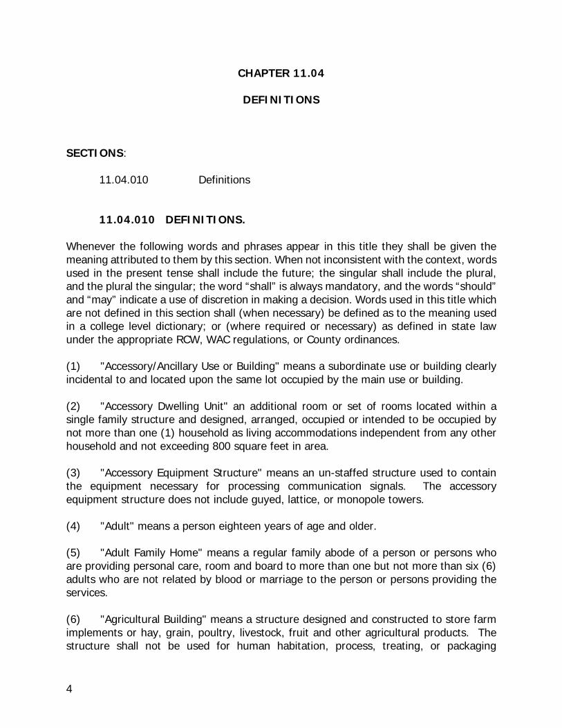
11.04.010 DEFINITIONS. Whenever the following words and phrases appear in this title they shall be given the meaning attributed to them by this section. When not inconsistent with the context, words used in the present tense shall include the future; the singular shall include the plural, and the plural the singular; the word “shall” is always mandatory, and the words “should” and “may” indicate a use of discretion in making a decision. Words used in this title which are not defined in this section shall (when necessary) be defined as to the meaning used in a college level dictionary; or (where required or necessary) as defined in state law under the appropriate RCW, WAC regulations, or County ordinances. (1) "Accessory/Ancillary Use or Building" means a subordinate use or building clearly incidental to and located upon the same lot occupied by the main use or building. (2) "Accessory Dwelling Unit" an additional room or set of rooms located within a single family structure and designed, arranged, occupied or intended to be occupied by not more than one (1) household as living accommodations independent from any other household and not exceeding 800 square feet in area. (3) "Accessory Equipment Structure" means an un-staffed structure used to contain the equipment necessary for processing communication signals. The accessory equipment structure does not include guyed, lattice, or monopole towers. (4) "Adult" means a person eighteen years of age and older. (5) "Adult Family Home" means a regular family abode of a person or persons who are providing personal care, room and board to more than one but not more than six (6) adults who are not related by blood or marriage to the person or persons providing the services. (6) "Agricultural Building" means a structure designed and constructed to store farm implements or hay, grain, poultry, livestock, fruit and other agricultural products. The structure shall not be used for human habitation, process, treating, or packaging

5
agriculture products, nor shall it be a place to be used by the public. (7) "Agricultural Market" means a use primarily engaged in the retail sale of fresh agricultural products, grown either on or off the site, but may include as incidental and accessory to the principle use, the sale of factory sealed or prepackaged food products and some limited non-food items. This definition does not include the sale of livestock. (8) “Agricultural Recreational Facility” means a facility where a fee is charged in return for access to agriculturally-related recreational opportunities, including but not limited to: enclosed arenas, rodeo, grounds and/or building for livestock exhibits, shows and competitions. (9) "Agricultural Related Industry" means specifically:
(a) Packaging Plants - may include but are not limited to the following activities: washing, sorting, crating, and other functional operations such as drying, field crushing, or other preparation in which the chemical and physical composition of the agriculture product remains essentially unaltered. Does not include processing activities, or slaughter houses, animal reduction yards, and tallow works.
(b) Processing Plants - may include but are not limited to those activities which
involve the fermentation or other substantial chemical and physical alteration of the agricultural product. Does not include slaughter houses or rendering plants.
(c) Storage Facilities - may include those activities which involve the
warehousing of processed and/or packaged agricultural products. (10) "Agricultural Stand" means a structure up to 1000 square feet in area used for the retail sale of agriculture products, excluding livestock, grown on the premises. (11) "Agricultural Use" means raising crops and livestock, horticultural activities, viticulture, animal husbandry, beekeeping, the storage of equipment for the above and related activities normally and routinely a part of such uses. (12) "Agricultural Wastes" means wastes on farms resulting from the production of agricultural products including but not limited to crop residues, manures, and carcasses of dead animals weighing each or collectively in excess of fifteen pounds. (13) "Agriculture Lands" refer to lands that are not already characterized by urban growth and are of long term significance for the commercial production of horticulture, agronomy, silviculture, aquaculture, apiary, animal products, turf, seed, Christmas trees not subject to excise tax, or livestock.

6
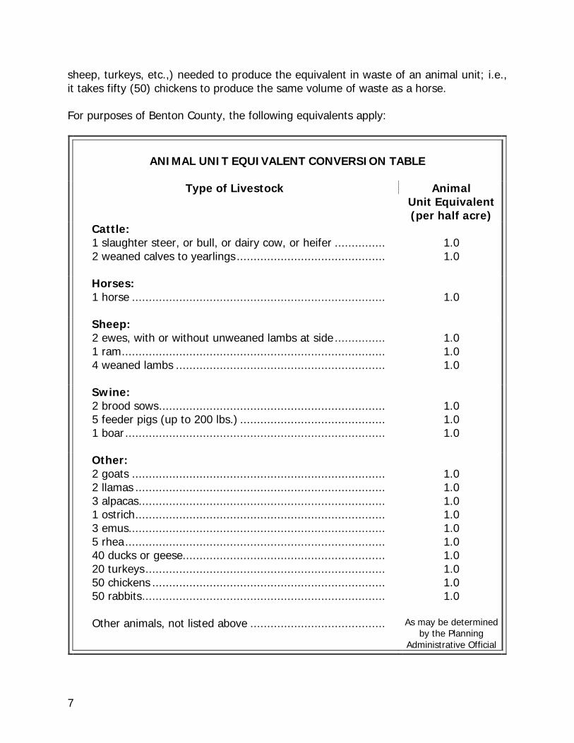
(14) "Agri-tourism Accommodation" means an agricultural business or organization offering overnight lodging in an agricultural setting. The purpose is to provide temporary tourist accommodations that are accessory to an onsite or adjacent agricultural use. Overnight lodging facilities are not to exceed a maximum of 5 guest units. An agri-tourism accommodation does not include bed and breakfast establishments, motels, hotels, and other similar uses. (15) "Agronomic Rates" or fertilizer guide means the rates of application of sludge, manure, or crop residues in accordance with rates specified by the appropriate fertilizer guide or by recommendation from a qualified soil scientist, for the crop under cultivation. (16) "Airport/Heliport" means a runway or landing area or other facility designed or used by public carriers for the landing and taking off of aircraft, including the following associated facilities: taxiways, aircraft storage and tie-down areas, hangars, servicing, and passenger and air freight terminals. (17) "Airstrip (personal)" means a runway without normal airport functions maintained for the private use of the owner of the property on which it is located. (18) "Airstrip commercial crop-dusting" means a private runway with service and maintenance facilities which serves the commercial crop-duster. (19) "Allowable Use" or “Permitted Use “means a use which is allowed outright, i.e., the land use itself does not require obtaining Planning Administrator review and approval, or a conditional use permit. (20) "Amateur (or Ham) Radio Facilities" means a radio transmission or receiving antenna or communication device operated for non-commercial purposes by individuals licensed by the Federal Communications Commission (FCC). (21) "Animal Feedlot" refers to a lot or building or combination of lots and buildings intended for the confined feeding, breeding, raising, or holding of animals and specifically designed as a confinement area in which manure may accumulate, or where the concentration of animals is such that a vegetative cover cannot be maintained within the enclosure. For purposes of Benton County, open lots used for feeding and rearing of poultry (poultry ranges) shall be considered to be animal feedlots. Pastures shall not be considered animal feedlots under these definitions. Seasonal use during the months of November through February is exempt from feedlot status. (22) "Animal Unit" is the volume of waste produced over a period of time by a horse, slaughter steer, or heifer. (23) "Animal Unit Equivalent" equals the number of other farm animals, (chickens,
7
sheep, turkeys, etc.,) needed to produce the equivalent in waste of an animal unit; i.e., it takes fifty (50) chickens to produce the same volume of waste as a horse. For purposes of Benton County, the following equivalents apply:
ANIMAL UNIT EQUIVALENT CONVERSION TABLE
Type of Livestock
Animal
Unit Equivalent (per half acre)
Cattle: 1 slaughter steer, or bull, or dairy cow, or heifer ............... 2 weaned calves to yearlings ............................................
1.0 1.0
Horses: 1 horse ...........................................................................
1.0
Sheep: 2 ewes, with or without unweaned lambs at side ............... 1 ram .............................................................................. 4 weaned lambs ..............................................................
1.0 1.0 1.0
Swine: 2 brood sows ................................................................... 5 feeder pigs (up to 200 lbs.) ........................................... 1 boar .............................................................................
1.0 1.0 1.0
Other: 2 goats ........................................................................... 2 llamas .......................................................................... 3 alpacas ......................................................................... 1 ostrich .......................................................................... 3 emus............................................................................ 5 rhea ............................................................................. 40 ducks or geese............................................................ 20 turkeys ....................................................................... 50 chickens ..................................................................... 50 rabbits ........................................................................
Other animals, not listed above ........................................
1.0 1.0 1.0 1.0 1.0 1.0 1.0 1.0 1.0 1.0
As may be determined
by the Planning Administrative Official
8
(24) "Antenna Array" means one or more rods, panels, discs or similar devices used for the transmission or reception of communication signals, which may include omni-directional antenna (rod), directional antenna (panel) and parabolic antenna (disc). The antenna array does not include the communication tower. (25) "Apartment House" means a building containing three or more family-dwelling units each of which, though independent of the other, is provided with joint service such as central heat, common hallways, common entrance or entrances to the building, janitor service, refuse disposal and similar services. (26) "Aquifer" A body of rock or soil that contains sufficient saturated permeable material to conduct groundwater and to yield economically significant quantities of groundwater to wells and springs. (27) "Attached Communication Facility" means an antenna array that is attached to a building or structure. The building or structure may be but is not limited to a utility pole or a water tower. (28) "Bakeries" means the conversion of raw materials through a baking process to finished consumable products and may include the marketing and sale or serving of such products and related accessory items on-site and/or off-site. (29) "Bed and Breakfast" means an owner occupied single family dwelling in which not more than five bedrooms are rented for money or other valuable consideration to the traveling public and only one meal, breakfast, may be served to guests. (30) "Best Management Practices (BMP's) "means physical, structural, and/or managerial practices that when used singularly or in combination, protect the functions and values of critical resources. Acceptable BMP's are found in the County's Administrative design Manual. BMP's are current and evolving conservation practices, or systems of practices, management or operational measures, or design and construction techniques; or normal and accepted industry standards that are applied to land uses and land use activity in a manner which:
(a) controls soil loss and reduces water surface and groundwater quality degradation caused by nutrients, animal wastes, toxins, and sediment; and (b) mitigates adverse impacts to the natural chemical, physical and biological environment of the County. (c) utilizes the county's natural resources on a long term, sustainable yield basis.
9
(31) "Biosolids" means municipal sewage sludge that is a primarily organic, semisolid product resulting from the wastewater treatment process that can be beneficially recycled and meets all requirements of Chapter 70.95J RCW, as it now exists or is hereafter amended. (32) "Buffer" means a designated area used to separate incompatible uses or protect resources or development. Buffers are generally undeveloped areas. There are different types of buffers for different purposes:
(a) buffers which protect sensitive natural resources (critical areas) from the adverse impacts of development are generally undeveloped open space which are ecologically part of the protected resource; (b) buffers which protect the integrity of development from certain natural hazards such as slope instability, floods or fire prone areas, are setbacks which avoid the hazard; (c) buffers to separate incompatible uses, such as residential from industrial, airports or certain activities common to commercial agriculture, are generally open or sparsely populated.
(33) "Business activity" means the production or sale of goods, or the sale of services that is clearly incidental and secondary to the use of the property for residential purposes and that complies with the criteria set forth in this title. (34) "Child" means a person seventeen years of age and under. (35) "Child Day Care Facility - Type A" means a dwelling unit where a childcare provider cares for twelve (12) or fewer children for periods of less than 24 hours a day. (36) "Child Day Care Facility - Type B" means a dwelling unit where a childcare provider cares for thirteen (13) or more children for periods of less than 24 hours a day, or a building or structure other than a dwelling unit where a childcare provider cares for any number of children for periods of less than 24 hours a day. (37) “Childcare provider” means an agency, person, or persons who regularly provide childcare for one or more children for compensation for periods of less than 24 hours a day while such children are apart from their parents or guardians. (38) "Church" means a structure, or group of structures, which by design and construction are primarily used for religious services and instruction. (39) "Citizen Band Radio" means two-way radio facilities used for short-range personal and business communications and operated without the need of a federal license.

10
(40) “Closed record appeal” means an appeal to the Board of County Commissioners, on a decision made during an open record hearing where no new evidence or information is being submitted, of a decision made following an open record hearing on a project permit application. (41) "Commercial Dairy" means any premises where three or more animal units are kept, milked, or maintained for licensed commercial sale of product. (42) "Commercial Hog Ranch" means the keeping of six (6) or more feeder pigs exceeding six (6) weeks of age, or more than two (2) brood sows. (43) "Commercial Horticulture" means the cultivation of fruits, vegetables, flowers, or plants on twenty (20) acres or more under common ownership. (44) "Commercial Poultry/ Rabbit Operation" means premises where more than one hundred (100) birds or fifty (50) rabbits are kept. (45) "Commercial Significance, Long Term" means the growing capacity, productivity and soil composition of the land for long term commercial production in consideration with the land's proximity to population areas, and the possibility of more intense uses of the land. (46) "Common Facilities" means any facility within the area of a planned development which is designed and constructed for the use of all residents of the development. (47) "Common Open Space" means any area of land or water or combination thereof within the area of planned development which is designed and intended for the use of all residents of the planned development. (48) "Communication Facility" means any facility used for the transmission and/or reception of communication services. Such facility usually, but not necessarily, consists of an antenna array, connection cables, and a communication tower to achieve the necessary elevation. (49) "Communication Facility Height" means the distance measured from ground level to the highest point on the communication facility, including the antenna array. (50) "Communication Services" means any communication services as defined in the Telecommunication Act of 1996, which includes: cellular services, personal communication services (PCS), specialized mobile radio (SMR), enhanced specialized mobile radio (ESMR), radio and television towers, paging services and similar services that currently exist or that may in the future be developed.
11
(51) "Communication Tower" means a freestanding structure designed and constructed specifically to support an antenna array. The structure may include a monopole tower, self-supporting (lattice) tower, guyed tower and other similar structures. (52) "Compatibility" means the congruent arrangement of land uses and/or project elements to avoid, mitigate, or minimize (to the greatest extent reasonable) conflicts. (53) "Comprehensive Plan" means the Benton County Comprehensive Plan and any amendments, addenda, or supplemental plans that are duly adopted under Chapter 36.70 RCW and Chapter 36.70A RCW, as they now exist or is hereafter amended, for Benton County or any portion thereof. (54) "Concentrated Animal Feeding Operation" means a structure or pens for the concentrated feeding or holding of animals or poultry, including but not limited to horses, cattle, sheep or swine. This definition includes dairy confinement areas, slaughterhouses, shipping terminal holding pens, poultry and/or egg production facilities and fur farms but does not include animal husbandry. (55) "Condition(s) of Approval" means restrictions or requirements imposed by a reviewing official pursuant to authority granted by this title. (56) "Conditional Use Permit" means a permit which is granted for a conditional use. The term "conditional use" means a use subject to specified conditions which may be permitted in one (1) or more classifications as defined by this title but which use, because of characteristics peculiar to it, or because of size, technological processes or type of equipment, or because of the exact location with reference to surroundings, streets and existing improvements or demands upon public facilities, or impacts to ground or surface water requires a special degree of control to make such uses consistent with and compatible to other existing or permissible uses in the same zone or zones, and to assure that such use shall not be adverse to the public interest. (57) "County" means Benton County. (58) "Crisis Residential Center" means a facility operated as a temporary shelter within a single family dwelling and providing twenty-four (24) hour a day care for up to six (6) children that is established and licensed by the State of Washington in accordance with RCW 74.13.032 as now in effect or hereafter amended. (59) "Designated Manufactured Home" means a new manufactured home constructed in accordance with state and federal requirements for manufactured homes, and which:
(a) is comprised of at least two (2) fully enclosed parallel sections each of which is not less than twelve (12) feet wide by thirty-six (36) feet long;
12
(b) is constructed with a composition or wood shake or shingle, coated metal, or similar roof of nominal 3:12 pitch; (c) has exterior siding similar in appearance to siding materials commonly used on conventional site-built single-family residences under the International Residential Code; (d) is set upon a permanent foundation, as specified by the manufacturer, and the space from the bottom of the home to the ground is enclosed by concrete or an approved concrete product which can be either load bearing or decorative; and, (e) the manufactured home is thermally equivalent to the state energy code.
(60) "Development" means "use" as defined by this title. (61) "Duplex" A single structure containing two (2) dwelling units, neither of which is defined as an accessory dwelling unit. (62) "Dwelling Unit" A room or rooms located within a structure, designed, arranged, occupied or intended to be occupied by not more than one (1) household. The existence of food preparation and bathroom areas within the room or rooms shall be evidence of the existence of a dwelling unit. (63) "Dwelling, Single-Family" or "Single Family Dwelling" or "One Family Dwelling" means one of the following types of buildings or structures designed to contain a single dwelling unit:
(a) a site built home - see "Site Built Home"; (b) a modular home - means a residential structure which meets the requirements of the Uniform Building Code or International Residential Code and is constructed in a factory and transported to the building site; (c) a designated manufactured home - see "Designated Manufactured Home".
(64) "Dwelling, Single-Family Detached" means one dwelling located on one lot and not attached to any other dwelling unit. (65) “Electric Vehicle Charging Station” means a parking space containing battery-charging station equipment that has as its primary purpose the transfer of electric energy (by conductive or inductive means) to a battery or other energy storage device in an electric vehicle and that does not meet the definition of a Rapid Charging Station.
13
(66) “Equipment Rental Facility” means a facility that stores equipment that can be rented for a specified period of time in return for payment. (67) "Factory Assembled Commercial Structure" means a factory assembled structure (FAS) designed or used for industrial, educational, assembly, professional, or commercial purposes. (68) "Family" means any number of individuals living together as a single housekeeping unit, and doing their own cooking on the premises exclusively as one household. (69) "Farm labor housing" means living quarters such as apartments, cabins, manufactured homes, bunkhouses, tents, or recreational vehicles maintained or temporarily located in connection with farm work, providing for the annual or seasonal housing of farm employees. (70) "Fence" means a substantial material serving as an enclosure, barrier, or boundary consisting of wood, metal, masonry wall, solid board fence, screen chain link or other substantial material. (71) "Fire Department Facility" means a building housing all or a portion of a duly organized fire department, fire protection district or fire company regularly charged with the responsibility of providing fire protection to a jurisdiction. (72) "Floodplain" means the total area subject to inundation by the base flood. (73) "Floodway" means the channel or waterway or those portions of the floodplain adjoining the channel which are reasonably required to carry and discharge the floodwaters of the watercourse without causing more than a one foot rise in the water surface elevation of a 100-year flood. (74) "Front Property Line" means the front property line as shown upon the official recorded plat of the property. In all cases where the front property line cannot be determined from a recorded plat, it shall be the property line abutting or adjoining a public road, street, highway, or lane. If there is more than one property line adjoining or abutting a public road, street, highway or lane, the front property line shall be considered to be the property line along the principal or main travelled public way. In the event there is question as to which public way is the principal one, the Planning Administrator shall, upon request from the County Engineer or any interested party, designate the front property line for any specific lot and such designation shall be final for the purposes of this title. (75) "Front Yard" means the required open space between the front property line and the nearest part of any building on the lot.
14
(76) "Golf Course" means a parcel or tract of land that is improved for the purposes of playing golf e.g., greens, tees or fairways, shelters, clubhouses, and ancillary maintenance buildings. (77) "Guyed Tower" means any structure, including but not limited to lattice towers or monopoles, which uses guy wires to connect above-grade portions of a communication tower diagonally with the ground in a radial pattern around the tower. (78) "Hazardous Waste and/or Material" means all dangerous and extremely hazardous waste as defined in RCW 70.105.010, as it now exists or is hereafter amended, except for moderate-risk waste. (79) "Hazardous Waste Storage" means the holding of hazardous waste for a temporary period as regulated by State Dangerous Waste Regulations, Chapter 173-303 WAC, as amended. (80) "Hazardous Waste Treatment" means the physical, chemical, or biological processing of hazardous waste to make wastes nondangerous or less dangerous, safer for transport, amenable for energy or material resource recovery, amenable for storage, or reduced in volume. (81) "Hazardous Waste Treatment and Storage Facility, Off site" means treatment and storage facilities that treat and store waste from generators on properties other than those on which the treatment and storage facilities are located. (82) "Hazardous Waste Treatment and Storage Facility" means treatment and storage facilities that treat and store wastes. (83) “Hearings Examiner” means an examiner appointed by the Board of County Commissioners, authorized to hear and make decisions on variances, land use permits, and certain appeals. (84) "Holding pens" means enclosed areas used for short term occupation by livestock and customarily serves as a staging area when moving livestock from place to place or for general livestock maintenance activities. (85) "Home Occupation" means any business use that is clearly incidental and secondary to the use of the property for residential purposes. (86) "Hotel" means a facility providing lodging and usually meals for the public, especially transients. (87) "Housing for People with Functional Disabilities" means housing used, or intended for use, by persons with functional disabilities. The term includes, but is not limited to,

15
Adult Family Homes, Residential Care Facilities, and housing for any Supported Living Arrangement, as therein defined. (88) "Hunting, Fee Access" means an activity where hunters pay a fee to lease private property from property owners allowing them access onto the property for hunting purposes. (89) "Hunting Preserve" means a parcel or contiguous parcels encompassing at least three hundred and twenty (320) acres used for hunting. (90) "Impervious Surface" means any material which reduces or prevents absorption of storm water into previously undeveloped land. (91) "Industrial Solid Wastes" means waste by-products from manufacturing and processing operations such as scraps, trimmings, packing, and other discarded materials not otherwise designated as dangerous waste under chapter 173-303 WAC, as it now exists or is hereafter amended, (92) "Infiltration" refers to the penetration of water into soil or other material. (93) "Kennel, Commercial" means any premises on which more than four (4) dogs, each more than six (6) months old are housed, groomed, bred, boarded, trained, or sold. (94) "Kennel, Private" means any premises on which one or more dogs are housed, groomed, bred, boarded, trained, or sold but that does not meet the definition of a commercial kennel as defined herein. (95) "Land" means any lot, parcel or tract of real property (ground, soil, or earth). (96) "Land Use" means the method or manner in which land and structures are occupied or utilized. (97) "Landscaping" means the planting, removal, and maintenance of vegetation along with the movement and displacement of earth, topsoil, rock, bark, and similar substances done in conjunction with the planting, removal and maintenance of vegetation. Landscaping products would include trees, shrubs, topsoil, landscaping rock, bark, irrigation supplies, ornamental fixtures, and/or similar materials used in landscaping property. (98) "Lattice Tower" means a structure that consists of a network of vertical and horizontal supports and crossed metal braces which form a tower that is usually triangular or square in cross-section. (99) "Law Enforcement Facility" means an office for the administration of any public

16
agency responsible for the public order and safety, i.e., police, sheriff, or state patrol. Law enforcement facilities do not include outdoor storage areas or maintenance shops. (100) "Lot" means:
(a) a parcel of land on which a principal building and its accessory buildings are placed or are to be placed, together with the required open spaces; or a "lot" designated as such on an officially recorded plat; (b) any subdivision of land by metes and bounds description prior to the adoption of this title and held under one ownership separate and distinct from the adjoining and abutting land shall be considered a "lot" as shown by the last conveyance of record; and, (c) when a tract of land consisting of more than one platted lot held under one ownership is to be developed as one unit, all the parcels or lots shall be considered as one lot for the purpose of this title.
(101) "Lot Area" means the total horizontal area within the boundary lines of a lot. (102) "Lot Coverage" means the percentage of area of a lot which is occupied by a primary building or structure and its accessory buildings or structures, not including uncovered patios, driveways, open steps and buttresses, terraces, and ornamental features projecting from buildings or structures which are not otherwise supported by the ground. (103) "Lot Depth" means the horizontal length of a straight line drawn from the midpoint of the front lot line to the midpoint of the rear lot line. (104) "Lot Line, Front:"
(a) in the case of an interior lot - the front lot line shall be the property line separating the lot from the road; (b) in the case of a corner lot - the front lot line shall be the property line with the narrowest street frontage, except, the Planning Administrator, or his/her designee, shall designate the front lot line for corner lots in residential districts. (c) in the case of a flag lot, when an access easement or right-of-way extends across the lot, the front lot line shall be the line separating the lot from the right-of-way or access easement. When the right-of-way or access easement does not extend across the property, the front lot line shall be determined by the building official.
17
(105) "Lumber Yard" means facilities used for the storage and sale of dimensional lumber. (106) "Manufactured Home" means a manufactured, relocatable living unit which, when erected on site, is designed to be permanently connected to required utilities and used as a dwelling, exceeds forty (40) feet in length and eight (8) feet in width, and bears the insignia of the U. S. Department of Housing and Urban Development. (107) "Manufactured Home/FAS Park" includes mobile home park. A site, lot or tract of land under the ownership or management of one person, firm or corporation, intended for occupancy by five (5) or more manufactured (mobile) homes/FAS for dwelling or sleeping purposes. This definition shall not include parks for the location of recreational vehicles for travel or recreation. (108) "Manure" means animal waste. (109) "Manure Storage Area" refers to an area associated with an animal feedlot where animal manure or runoff containing animal manure is stored until it can be utilized as domestic fertilizer or removed to a permitted animal manure disposal site. Animal manure packs or mounding within the animal feedlot shall not be considered to be manure storage. (110) "Master Planned Resorts/Summer Resorts" means a self-contained and fully integrated planned unit development, in a setting of significant natural amenities, with primary focus on destination resort facilities consisting of short-term visitor accommodations associated with a range of developed on-site indoor or outdoor recreational facilities. A master planned resort may include other residential uses within its boundaries, but only if the residential uses are integrated into and support the on-site recreational nature of the resort. (111) "Medical Facility" means an office from which emergency or routine health care services are provided and that does not involve overnight inpatient care. (112) "Monopole Tower" means a structure that consists of a single pole to support antennas and connecting appurtenances. (113) "Multi-family Dwelling" means a building arranged or designed to be occupied by more than two families, such as an apartment house, flat or rowhouse. (114) "New Manufactured Home" means any manufactured home required to be titled under Title 46 RCW, as it now exists or is hereafter amended, which has not been previously titled to a retail purchaser, and is not a "used mobile home" as defined in RCW 82.45.032(2), as it now exists or is hereafter amended,
18
(115) "Non-agricultural Accessory Use" means the production or sale of goods, or the sale of services that are not normally and routinely a part of the chain of production and harvesting of an agricultural or horticultural crop, or livestock. (116) “Nonconforming” means a lot, use, building or structure which was lawful prior to the adoption, revision or amendment of this title, but which fails, by reason of such adoption, revision or amendment, to conform to the current requirements of the zoning district. (117) "Nursery" means an establishment where trees, shrubs and other plant materials are grown on site for the purpose of sale. (118) "Open record hearing" means a hearing, conducted by a single hearing body or officer authorized by the Benton County Board of Commissioners, wherein a record will be created through the receipt of testimony and other appropriate evidence and information under procedures prescribed by the Benton County Code or by such body's or officer's rules of procedure. (119) "Outdoor Storage" means all materials, equipment, merchandise or objects kept or placed on the lot or not within an enclosed structure, for preservation or later use or disposal; it is not intended, however, to include the following exceptions:
(a) Those objects customarily stored outside an enclosed structure due to their size and due to their being of such character as to not readily deteriorate when exposed to the elements, such as automobiles, mobile homes, boats and other vehicles, farm machinery, irrigation and heavy construction equipment, and those objects which are themselves enclosures; provided, however, such objects are being kept primarily for immediate sale to others or for rental to others. (b) Neat and orderly outdoor displays of items or objects for immediate sale when such displays are incidental or accessory to an established commercial principal activity conducted from an enclosed structure.
(120) "Parcel" means land having fixed boundaries created in accordance with Benton County Code and/or state law. The term includes lots or tracts. (121) "Park" means a public or privately owned area with facilities for active or passive recreation by the public, including but not limited to: sports fields, skating facilities, water access facilities, trails for non-motorized uses, caretaker residences, and supporting infrastructure. (122) "Pasture" refers to areas where grass or other growing plants are used for grazing and where the concentration of animals is such that a vegetative cover is maintained during the growing season except in the immediate vicinity of temporary supplemental
19
feeding or watering devices. (123) "People with Functional Disabilities" means a person who, because of a recognized chronic physical or mental condition or disease, is functionally disabled to the extent of:
(a) needing care, supervision or monitoring to perform activities of daily living or instrumental activities of daily living, or; (b) needing support to ameliorate or compensate for the effects of the functional disability so as to lead as independent a life as possible, or; (c) having a physical or mental impairment which substantially limits one or more of such person's major life activities, or; (d) having a record of such an impairment, or; (e) being regarded as having such an impairment, but such term does not include current illegal use of or active addiction to a controlled substance.
(124) "Permit" means written government approval issued by an authorized official empowering the holder thereof to take some action permitted. (125) "Person" refers to any natural person, any state, municipality, or other governmental or other political subdivision or other public or private corporation, any partnership, firm, association, or other organization, any receiver, trustee, assignee, agent, or other legal representative of any of the foregoing, and any other entity. (126) "Planned Development" means any residential development approved and filed with the county auditor and developed in accordance with the provisions of this title. (127) “Planning Administrator” means the Benton County Planning Director or Manager or his/her designee. (128) “Planning Administrator Review” means the administrative review process in which the County Planning Director/Manager or his/her designee makes the administrative decision regarding a proposed use after all notifications to state and local agencies to assure consistency with applicable county, state and local requirements have been met. (129) "Planning Commission" means the duly constituted and appointed Planning Commission of Benton County. (130) "Planning Department" means the Benton County Planning Department. (131) "Premises" means a lot, parcel, or plot of land together with the buildings and
20
structures thereon. (132) "Professional Office" means an office used as a place of business by the following licensed professionals or persons in the following generally recognized professions using training or knowledge of technical, scientific or other academic discipline as opposed to manual skills and that do not involve outside storage or fabrication or on-site sale or transfer or commodities:
(a) Financial Services, Insurance and Real Estate Agents; (b) Accounting, Auditing, and Bookkeeping Services; (c) Legal Services; (d) Management and Public Relations Services; and (e) Engineering, Architectural, Planning and Surveying Services.
(133) "Public Garage" means any building or premises used for the storage or housing of more than three self-propelled vehicles (except farm implements used on the premises) or where such vehicles are repaired or kept for hire. (134) "Public Transit Center" means a facility where public transportation passengers interchange from one route or vehicle to another. (135) "Rapid Charging Station" means a facility offering electrical outlets to be used by consumers for a fee to expeditiously recharge electric vehicle batteries through high power levels that meet or exceed applicable standards under state law. (136) "Rear Property Line" means the property line of a lot most nearly parallel to the front property line of the same lot as defined in this title except that for a triangular shaped lot the rear property line shall be represented by the point of intersection of the two property lines which are not the front property line as defined in this title. (137) "Rear Yard" means the required open space on a lot extending along the rear property line through the whole width of the lot. (138) “Reception Facility” means a private building with restroom facilities and/or kitchen, and associated grounds used for social, educational, or cultural activities. (139) "Recreational Vehicle" means a motorized or non-motorized vehicle designed and manufactured for recreational use, including but not limited to boats, travel trailers, snowmobiles, go carts, motorcycles (including three and four wheelers), and dune buggies.
21
(140) "Recreational Vehicle (R.V.) Park" means any site, lot or parcel of ground occupied or intended for occupancy by two (2) or more recreational vehicles for travel, recreational or vacation uses, whether or not a fee is charged. Storage of two (2) or more unoccupied recreational vehicles does not constitute an R.V. park. (141) “Recycling Center” means a facility used to recycle, reprocess, and/or treat the following materials to then return to a condition in which they may be used again: newspapers, magazines, books, and other paper products, glass, metal cans. (142) “Red Mountain American Viticultural Area (AVA)” means the approximately 4,600-acre, federally designated grape-growing and wine-producing region on the south-facing slope of Red Mountain located in unincorporated Benton County. (143) "Rental Storage Facility" means a structure or structures containing separate, individual, and private storage spaces of varying sizes leased or rented individually for varying periods of time. (144) "Resource Lands" refer to agricultural and mineral lands. (145) “Retail Sales Establishment” means a facility used for the sale of goods directly to customers including, but not limited to: mini marts, farm supply and hardware stores, florists, and agricultural markets. (146) “Riding Academy” means any establishment where horses are kept for riding, driving, or stabling for compensation or incidental to the operation of any club, association, ranch or similar establishment. (147) "Sand" refers to large particles of soil from 0.5 to 2 millimeter in diameter. Sand soil contains at least 85 per cent sand with the percentage of silt plus 1.5 times the percentage of clay not exceeding 15 per cent. (148) "Satellite Earth Station" means the facilities used for reception and processing of programming services from a satellite prior to transfer to terrestrial distribution systems or for processing of programming services from a terrestrial source before transmission via satellite. (149) "School" means a public or private educational learning institution from which instruction is given to children no younger than three (3) years old, and includes high schools, colleges, and agricultural or technical schools or facilities. (150) "Setback, Front" is the minimum horizontal distance measured perpendicularly from the centerline of the adjacent right-of-way to the nearest wall of the structure. Where there is a partial right-of-way, the setback shall be measured perpendicularly from
22
the design centerline. (151) "Setback, Side and Rear" is the minimum horizontal distance measured perpendicularly from the nearest property line to the nearest wall of the structure. Except that a side setback on a corner lot, along the adjacent right-of-way shall be measured perpendicularly from the center line of right-of-way. When there is a partial right-of-way, the setback shall be measured perpendicularly from the design centerline. (152) "Shooting Range Facility" means a range, building or location used for practice with firearms and/or archery equipment. The facility may include limited retail sales and services to support shooting and archery activities and operated only during the time the shooting range facility is open. All sales and service must comply with federal, state and local regulations. (153) "Side Yard" means the required open space on a lot between the side wall line of a building and the side line of the lot, and extending from the front yard to the rear yard. (154) "Site built home" means a dwelling primarily constructed on the site to be occupied by the structure and which is permanently affixed to the ground by footings and foundation. (155) "Slaughterhouse" means a commercial establishment where animals are butchered. (156) "Solar Power Generator Facility, Major" means the use of solar panels to convert sunlight directly or indirectly into electricity. Solar power generators consist of solar panels, charge controllers, inverters, working fluid system, and storage batteries. Major facilities are developed as the primary land use for a parcel on which it is located and does not meet the siting criteria for a minor facility in BCC 11.04.010 (154). (157) "Solar Power Generator Facility, Minor" means the use of solar panels to convert sunlight directly or indirectly into electricity. Solar power generators consist of solar panels, charge controllers, inverters, working fluid system, and storage batteries. Minor facilities are sited on the power beneficiary premises, are intended primarily to offset part or all of the beneficiary’s requirements for electricity/gas, and are secondary or accessory to the beneficiary’s use of the premises. (158) "Solid Waste" means all putrescible and non-putrescible solid and semisolid wastes, including but not limited to garbage, rubbish, ashes, industrial wastes, swill, demolition and construction wastes, abandoned vehicles, or parts thereof, and discarded commodities. This includes all liquid, solid and semisolid materials which are not the primary products of public, private, industrial, commercial, mining, and agricultural operations. Solid waste includes but is not limited to wood waste, dangerous waste, and problem wastes. Agricultural wastes are exempt from this definition provided the wastes
23
are limited to manures and crop residues returned to the soil at agronomic (fertilizer) rates. (159) "Solid Waste Handling Facility" means a parcel of land or structure, or part thereof, larger than two hundred (200) square feet used for the storage, collection, or abandonment of solid waste; provided, establishments for the sale, purchase, storage and dismantling of vehicles and machinery are not considered solid waste handling facilities. (160) "Solid Waste Transfer Station" means a parcel of land or structure, or part thereof, used as a facility that receives and consolidates solid waste and at which solid waste may be loaded onto tractor trailers, railcars, or barges for long-haul transport to a distant disposal facility. (161) “Stable, Commercial” means a building in which horses or other livestock are kept for remuneration, hire, or sale. (162) “Stable, Private” means a building in which horses or other livestock are kept for private use. (163) "Stockyards" see "Animal Feedlots." (164) “Structure” means that which is built or constructed. (165) "Subsurface Water" refers to any water below the surface of the ground, including but not limited to water in the saturated and unsaturated zones. (166) "Supported Living Arrangement" means a living unit owned or rented by one or more persons with functional disabilities who receive assistance with activities of daily living, and/or medical care from an individual or agency licensed and/or reimbursed by a public agency to provide such assistance. (167) "Urban Growth Area" means an area designated by Benton County in its Comprehensive Plan where urban growth and municipal services are allowed and encouraged and where annexation by cities can occur. (168) "Use" means the activity or purpose for which land or structures or combination of land and structures are designed, arranged, occupied, or maintained together with any associated site improvement. This definition includes the construction, erection, placement, movement or demolition of any structure or site improvement and any physical alteration to land itself including any grading, leveling, paving or excavation. Use also means any existing or proposed configuration of land, structures, and site improvements, and the use thereof.
24
(169) "Use District" means a portion of Benton County within which certain uses of land and structures are permitted and certain other uses of land and structures are prohibited, certain yards and other open space are required and specific lot areas are established, all as set forth and specified in this title. This definition also includes the term "zone" and "zoning district." (170) "Utilities" means those business, institutions, or organizations which use pipes or conductors in, under, or along streets, alleys or easements to provide a product or service to the public. (171) "Utility Substation Facility" means above or below ground structures that are necessary to provide or facilitate distribution, transmission, or metering of water, gas, sewage, and/or electric energy. Such facilities may consist of, but are not limited to, the following:
(a) Water, gas, and electrical distribution or metering lines and sites; (b) Water or sewage pumping stations; (c) Water towers and reservoirs; (d) Public water wells and any accessory treatment facilities; and/or (e) Telephone switching facilities.
(172) “Variance” means a modification of specific regulations in accordance with the terms of this title for the purpose of assuring that no property, because of special circumstances applicable to it, shall be deprived of privileges commonly enjoyed by other properties in the same vicinity and zone district classification. Except as set forth or referenced herein, variances do not apply to use, minimum lot size, or required density standards. (173) "Veterinary Facility" means a business establishment or facility which renders surgical and medical treatment to animals and which includes inside or outside accommodations for animals. (174) "Warehouse" means a structure used for the storage of goods and materials. Also see "Agricultural Building." (175) "Wastes" see "Agricultural Wastes," "Industrial Solid Wastes," or "Solid Wastes." (176) "Wind Turbine" means a machine with turbine apparatus (rotor blades, nacelle and tower) capable of producing electricity by converting the kinetic energy of wind into rotational, mechanical and electrical energy; provided, the term does not include electrical
25
distribution or transmission lines, or electrical substations. (177) "Wind Turbine Farms" means two or more wind turbines on one parcel. (178) "Wind Turbine Height" means the distance measured from the ground level to the highest point on a wind turbine, including the rotor blades. (179) "Yard Sale" means the occasional sale of used household goods and personal items on the seller's premises. "Yard sale" includes but is not limited to garage sales, moving sales, patio sales, estate sales and rummage sales. (180) "Wineries/Breweries/Distilleries" means facilities where fruit or other products are processed into wine or spirits and related storage, bottling, shipping, sampling, tasting and sale of such. (181) "Wrecking Yard" means a lot, parcel of land or structure, or part thereof, larger than 200 square feet, used for the collecting, dismantling, storage, salvaging, or sale of machinery or vehicles not in operable condition or parts thereof; provided that this definition shall not be deemed to include lots used for the outdoor display and sale of used vehicles in operable condition; nor shall it include that part of a farm used for the storage of agricultural machinery kept for salvage by the owner for his own use, and not for sale, on farms having an area of not less than forty (40) acres. (182) "Zoning District" means a portion of Benton County within which certain uses of land and structures are allowed or conditionally permitted, certain other uses of land and structures are prohibited, and certain development standards may be specified, and includes the terms "zone" and "use district".
26
CHAPTER 11.06
ESTABLISHMENT OF ZONING DISTRICTS SECTIONS:
11.06.010 Purpose 11.06.020 Establishment of Zoning Districts 11.06.030 Maps 11.06.040 Boundary Determinations
11.06.010 PURPOSE.
For the purpose of promoting public health, safety, and general welfare, this section establishes zoning districts that are consistent with the Benton County Comprehensive Plan.
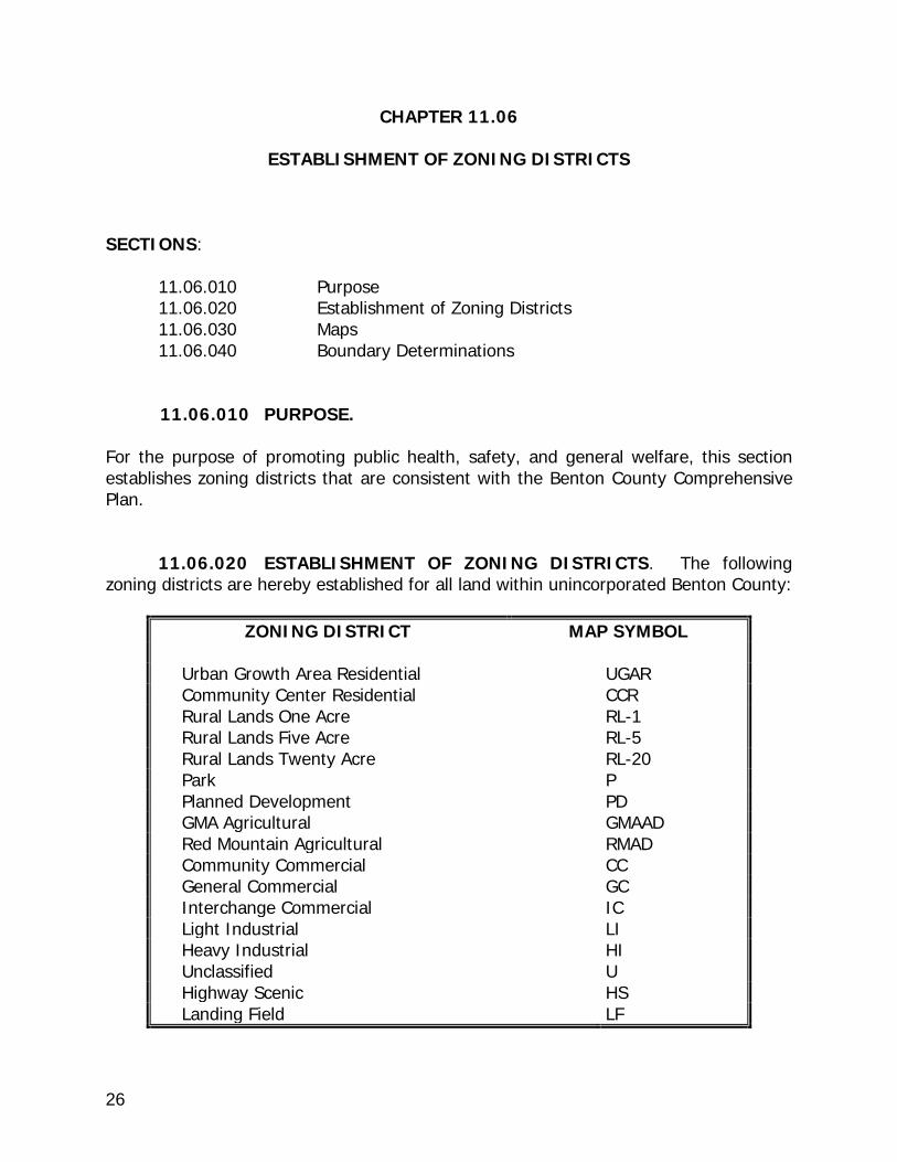
11.06.020 ESTABLISHMENT OF ZONING DISTRICTS. The following zoning districts are hereby established for all land within unincorporated Benton County:
ZONING DISTRICT MAP SYMBOL
Urban Growth Area Residential UGAR Community Center Residential CCR Rural Lands One Acre RL-1 Rural Lands Five Acre RL-5 Rural Lands Twenty Acre RL-20 Park P Planned Development PD GMA Agricultural GMAAD Red Mountain Agricultural RMAD Community Commercial CC General Commercial GC Interchange Commercial IC Light Industrial LI Heavy Industrial HI Unclassified U Highway Scenic HS Landing Field LF
27
11.06.030 MAPS. The location and boundaries of the above zoning districts
are established by separate ordinances and shall be as set forth on the official zoning maps of Benton County attached to said ordinances. Said official zoning maps in their entirety, including all amendments thereto, shall be a part of this code as if fully set forth and described herein. The official zoning maps shall be identified by signatures of the County Commissioners and shall carry the following words:
"We hereby certify that this map constitutes the Official Zoning Map as approved by Ordinance _____ of the Board of County Commissioners and signed by its chairman dated this _______________ day of ______."
11.06.40 BOUNDARY DETERMINATIONS. (a) In the event uncertainty exists as to the exact location of the boundaries of any district shown on the zoning maps for the applicable district, the following principles shall apply:
(1) If a district boundary is along a publicly owned right-of-way, such as a highway, street, alley, road, canal, or railroad, the centerline of the right-of-way shall be the boundary of the zoning district. (2) A publicly owned right-of-way, waterway or body of water shall, unless otherwise indicated, be included within the zoning district of the abutting property. If such right-of-way or body of water serves as a boundary between two (2) or more zoning districts, the centerline shall be considered the boundary between the districts. (3) If a vacated right-of-way was the established boundary of a zoning district, the abutting zoning districts shall continue to extend to the centerline of the former right-of-way. (4) When a land use district boundary or zoning designation unintentionally bisects a parcel of record, creating two different designations or zones for one parcel, the designations or district that covers the largest portion of the parcel shall apply to the whole parcel. (5) If application of the above principles does not clarify the zoning district boundary location, the zoning of the entire parcel shall be interpreted to be the zoning that is the largest portion of the parcel of record.

28
CHAPTER 11.08
COMMUNITY CENTER RESIDENTIAL DISTRICT (CCR) SECTIONS: 11.08.010 Purpose 11.08.020 Applicability 11.08.030 Allowable Uses 11.08.040 Accessory Uses 11.08.050 Subject to Planning Administrator Review and Approval 11.08.060 Uses Requiring a Conditional Use Permit 11.08.070 Uses Prohibited 11.08.080 Property Development Standards--General Standards 11.08.090 Property Development Standards--Setback Requirements
11.08.010 PURPOSE. The purpose of the Community Center Residential District (CCR) is to provide for the development of dwelling units within established rural activity areas characterized by mixed use and residential developments that utilize a variety of small scale rural services outside of Urban Growth Areas as allowed under Chapter 36.70 RCW. These areas are considered limited areas of more intensive rural development as allowed under RCW 36.70A.070. 11.08.020 APPLICABILITY. The provisions of this chapter shall apply to the areas designated as a Community Center Residential District (CCR) on the official zoning maps of Benton County and located in unincorporated Benton County.
11.08.030 ALLOWABLE USES. Provided all applicable code provisions are satisfied, the following uses are allowed within the Community Center Residential District (CCR) on a single parcel of record: (a) Single Family Dwelling (SFD). (b) Manufactured home if no older than five (5) years from the calendar year the home is placed.
29
(c) Duplex, subject to the provisions of BCC 11.08.080 (a)(1). (d) Fire department facility, law enforcement facility, and/or medical facility. (e) On any tract of land having an area of one (1) acre or more, the keeping of one animal unit equivalent per one-half acre of ground, exclusive of suckling animals. (f) Adult family home. (g) Utility substation facility. (h) Crisis residential center. (i) Hiking and non-motorized biking trails. (j) Church. 11.08.040 ACCESSORY USES. Provided all applicable code provisions are satisfied, the following uses are allowed as an accessory/ancillary use within the Community Center Residential District (CCR) on a single parcel of record: (a) One (1) or more accessory buildings and uses (commonly appurtenant to a single family dwelling).
(b) Yard Sales occurring for no more than three (3) consecutive days on two (2) different occasions during a calendar year.
(c) Kennel, Private. (d) Solar Power Generator Facility, Minor
(d) Uses subject to Planning Administrator review and approval, as specified in BCC 11.08.050(b)(c)(d).
11.08. 050 USES SUBJECT T0 PLANNING ADMINISTRATOR REVIEW
AND APPROVAL. The following uses may be allowed within the Community Center Residential District (CCR) on a single parcel of record upon the review and approval of the Planning Administrator:
(a) Temporary dwelling, subject to the provisions of BCC 11.42.110.
30
(b) Home occupation, subject to the provisions of BCC 11.50, involving business activities not otherwise expressly allowed or requiring a permit under BCC 11.08.060. (c) Child day care facility, Type A, subject to the provisions of BCC 11.42.050. (d) Accessory dwelling unit (within or attached to a single family home), subject to the provisions of BCC 11.42.020.
11.08.060 USES REQUIRING A CONDITIONAL USE PERMIT. The
following uses may be permitted on a single parcel of record within the Community Center Residential District (CCR) if a conditional use permit is issued by the Hearings Examiner after notice and public hearing as provided in BCC 11.52.040. (a) School, library, community clubhouse, grange hall, senior center, and/or other non-profit organizational hall. (b) Multi-family dwelling containing three (3) or four (4) dwelling units. (c) Public transit center. (d) Child Day Care Facility, Type B, subject to the provisions of BCC 11.42.060. (e) Cemetery, columbarium and/or mausoleum. (f) A Park. (g) Bed and Breakfast Establishment. (h) Home occupation involving the display and/or sale of products on the premises; provided, a home occupation permit is also required under BCC 11.50.
11.08.070 USES PROHIBITED. Any use not authorized or approved pursuant to BCC 11.08.030, BCC 11.08.040, BCC 11.08.050 or BCC 11.08.060 is prohibited within the Community Center Residential District (CCR).
11.08.080 PROPERTY DEVELOPMENT STANDARDS-GENERAL STANDARDS. All lands, structures and uses in the Community Center Residential District (CCR) shall conform to the following general standards, and if applicable, to the standards set forth in Title 15 BCC (Critical Area Regulations). (a) Minimum parcel size. Except as otherwise set forth herein, the minimum parcel

31
size that may be created in the CCR District is fourteen thousand (14,000) square feet; provided, the Benton-Franklin Health District may require a larger parcel size as necessary to meet on-site sanitary well and sewer provisions. In order to meet maximum density objectives, the following uses require the specified larger minimum lot sizes:
(1) Duplexes may only be located on parcels of at least twenty-eight thousand (28,000) square feet; provided, the Benton-Franklin Health District may require a larger parcel size as necessary to meet on-site sanitary well and sewer provisions. (2) Multi-family dwellings may only be located on parcels equal in size to at least fourteen thousand (14,000) square feet multiplied by the number of dwelling units; provided, the Benton-Franklin Health District may require a larger parcel size as necessary to meet on-site sanitary well and sewer provisions.
(b) Lot Width. Each parcel shall have an average width of not less than ninety (90) feet. (c) Maximum Lot Coverage. Sixty (60) percent. 11.08.090 PROPERTY DEVELOPMENT STANDARDS--SETBACK REQUIREMENTS. All lands, structures, and uses in the Community Center Residential District (CCR) shall meet the following setback requirements, and if applicable, the setback requirements set forth in Title 15 BCC (Critical Area Regulations). (a) Setback Requirements. The following minimum setbacks shall apply:
(1) Each dwelling unit, accessory building, and accessory use on a parcel shall have a setback of fifty-five (55) feet from the centerline of any public road right-of-way or twenty-five (25) feet from the property line bordering any public road right-of-way, whichever is greater; and a setback of twenty-five (25) feet from the closest edge of any legally-established boundary line of a private access easement. (2) Each dwelling unit shall have a setback of twenty-five (25) feet from the rear parcel lines. (3) Each accessory building and accessory use shall have a setback of ten (10) feet from all alleys and the rear parcel lines. (4) Each dwelling unit, accessory building, and accessory use on a parcel shall have a setback of ten (10) feet from the side parcel lines.
(5) All shelters, coops, or other structures used for the habitation of livestock shall have a setback of at least thirty (30) feet from every property line of the
32
parcel on which it is located, unless a greater setback is otherwise required under the Benton County Code. (6) Cornices, eaves, belt courses, sills, fireplace chimneys, and open, unenclosed stairways or balconies not covered by a roof or canopy may extend or project from a building three (3) feet into any required setback area; provided, none of these architectural features may be located within any easements.
(7) Ground floor uncovered, unenclosed porches, platforms, or landings may extend or project from a building six (6) feet into the setback area but no closer than five (5) feet from any parcel line; provided, none of these architectural features may be located within any easements. (8) All dwelling units and swimming pools shall have a setback of one hundred fifty (150) feet from any parcel located partially or wholly within the Growth Management Agricultural Act District (GMAAD) and from any adjacent orchard, hop field or vineyard (or combination thereof) of ten (10) acres or more on one parcel or on contiguous parcels under common ownership.
(b) Any additional setbacks required pursuant to Chapter 3.18 BCC shall apply.

33
CHAPTER 11.10
URBAN GROWTH AREA RESIDENTIAL DISTRICT (UGAR) SECTIONS: 11.10.010 Purpose 11.10.020 Applicability 11.10.030 Allowable Uses 11.10.040 Accessory Uses
11.10.050 Uses Subject to Planning Administrator Review and Approval 11.10.060 Uses Requiring a Conditional Use Permit 11.10.070 Uses Prohibited 11.10.080 Property Development Standards--General Standards 11.10.090 Property Development Standards--Setback Requirements
11.10.010 PURPOSE. The Urban Growth Area Residential District (UGAR) are lands within Urban Growth Areas (UGAs) that have been designated to accommodate the land use needs of a city’s projected future population growth. The UGAR District allows higher densities and a variety of uses similar to those typically found in the adjacent cities. The densities, uses and development provisions allowed within this district assure that development prior to annexation by a city results in densities, land uses and development patterns that are consistent with that city’s Comprehensive Plan. 11.10.020 APPLICABILITY. Provided all applicable code provisions are satisfied, the provisions of this chapter shall apply to the areas designated as an Urban Growth Area Residential District (UGAR) on the official zoning maps of Benton County and located within an Urban Growth Area of unincorporated Benton County.
11.10.030 ALLOWABLE USES. Provided all applicable code provisions are satisfied, the following uses are allowed within the Urban Growth Area Residential District (UGAR) on a single parcel of record: (a) Single Family Dwelling (SFD). (b) Duplex, subject to the provisions of BCC 11.10.080 (a).
34
(c) On any tract of land having an area of one (1) acre or more, the keeping of one animal unit equivalent per one-half acre of ground, exclusive of suckling animals. (d) Church. (e) Adult Family Home. (f) Crisis residential center.
11.10.040 ACCESSORY USES. Provided all applicable code provisions are
satisfied, the following uses are allowed as an accessory/ancillary use within the Urban Growth Area Residential District (UGAR) on a single parcel of record:
(a) One (1) or more accessory buildings and uses (commonly appurtenant to a single family dwelling).
(b) Yard Sales occurring for no more than three (3) consecutive days on two (2) different occasions during a calendar year.
(c) Kennel, Private. (d) Solar Power Generator Facility, Minor
(e) Uses subject to Planning Administrator review and approval, specified in BCC 11.10.050(b)(c)(d).
11.10.050 USES SUBJECT TO PLANNING ADMINISTRATOR REVIEW AND APPROVAL. The following uses may be allowed within the Urban Growth Area Residential District (UGAR) on a single parcel of record upon the review and approval of the Planning Administrator: (a) Temporary Dwelling, subject to BCC 11.42.110. (b) Home Occupation, subject to the provisions of BCC 11.50, involving business activities not otherwise expressly allowed or requiring a permit under BCC 11.10.060. (c) Child Day Care Facility, Type A, subject to the provisions of BCC 11.42.050. (d) Accessory dwelling unit (within or attached to a single family home), subject to the provisions of BCC 11.42.020.
35
11.10.060 USES REQUIRING A CONDITIONAL USE PERMIT. The following uses may be permitted on a single parcel of record within the Urban Growth Area Residential District (UGAR) if a conditional use permit is issued by the Hearings Examiner after notice and public hearing as provided in BCC 11.52.040.
(a) School, library, community clubhouse, grange hall, senior center and/or other non-profit organizational hall. (b) Fire department facility, law enforcement facility, and/or medical facility. (c) Child Day Care Facility, Type B, subject to the provisions of BCC 11.52.068. (d) Public transit center. (e) Bed and Breakfast Facility, subject to the provisions in BCC 11.42.030. (f) Home occupation involving the display and/or sale of products on the premises; provided, a home occupation permit is also required under BCC 11.50. (g) Nursery. (h) A Park. (i) Hiking and non-motorized biking trails. (j) Utility substation facility.
11.10.070 USES PROHIBITED. Any use not authorized or approved pursuant to BCC 11.10.030, BCC 11.10.040, BCC 11.10.050 or 11.10.060 is prohibited within the Urban Growth Area Residential District (UGAR).
11.10.080 PROPERTY DEVELOPMENT STANDARDS--GENERAL STANDARDS. All lands, structures and uses in the Urban Growth Area Residential District (UGAR) shall conform to the following general standards, and if applicable, to the standards set forth in Title 15 BCC (Critical Area Regulations).
(a) Minimum parcel size. Except as otherwise set forth herein, the minimum parcel size that may be created in the UGAR District is seven thousand five hundred (7,500) square feet; provided, the Benton-Franklin Health District may require a larger parcel size as necessary to meet on-site sanitary well and sewer provisions. Duplexes may only be located on parcels of at least fifteen thousand (15,000) square feet; provided, the Benton-Franklin Health District may require a larger parcel size as necessary to meet on-site
36
sanitary well and sewer provisions. (b) Lot Width. Each parcel shall have an average lot width of no less than seventy (70) feet. (c) Maximum Lot Coverage. Sixty (60) percent.
11.10.090 PROPERTY DEVELOPMENT STANDARDS--SETBACK REQUIREMENTS. All lands, structures, and uses in the Urban Growth Area Residential (UGAR) shall meet the following setback requirements, and if applicable, the setback requirements set forth in Title 15 BCC (Critical Area Regulations).
(a) Setback Requirements. The following minimum setbacks shall apply:
(1) Each dwelling unit, accessory building, and accessory use on a parcel shall have a setback of twenty-five (25) feet from the property line bordering any public road right-of-way; and a setback of twenty-five (25) feet from the closest edge of any legally-established boundary line of a private access easement. (2) Each dwelling unit shall have a setback of twenty-five (25) feet from the rear parcel lines. (3) Each accessory building and accessory use shall have a setback of ten (10) feet from all alleys and the rear parcel lines. (4) Each dwelling unit, accessory building, and accessory use on a parcel shall have a setback of ten (10) feet from the side parcel lines.
(5) All shelters, coops, or other structures used for the habitation of livestock shall have a setback of at least thirty (30) feet from every property line of the parcel on which it is located, unless a greater setback is otherwise required under the Benton County Code. (6) All dwelling units and swimming pools shall have a setback of one hundred fifty feet (150) from any parcel located partially or wholly within the Growth Management Act Agricultural District (GMAAD) and from any adjacent orchard, hop yard, or vineyard (or combination thereof) of ten (10) acres or more on one parcel or on contiguous parcels under common ownership. (7) Cornices, eaves, belt courses, sills, fireplace chimneys, and open, unenclosed stairways or balconies not covered by a roof or canopy may extend or project from a building three (3) feet into any required setback area. However, none of these architectural features may be located within any easements.

37
(8) Ground floor uncovered, unenclosed porches, platforms, or landings may extend or project from a building six (6) feet into the setback area but no closer than five (5) feet from any parcel line; provided, none of these architectural features may be located within any easements.
38
CHAPTER 11.12
RURAL LANDS ONE ACRE DISTRICT (RL-1) SECTIONS: 11.12.010 Purpose 11.12.020 Applicability 11.12.030 Allowable Uses 11.12.040 Accessory Uses 11.12.050 Uses Subject to Planning Administrator Review and Approval 11.12.060 Uses Requiring a Conditional Use Permit 11.12.070 Uses Prohibited 11.12.080 Property Development Standards--General Standards 11.12.090 Property Development Standards--Setback Requirements
11.12.010 PURPOSE. The purpose of the Rural Lands One Acre District (RL-1) is to provide for the appropriate development within areas where past actions have created smaller parcel sizes than generally allowed in the Rural Lands Five Acre District (RL-5) or that are adjacent to Urban Growth Areas (UGAs) given that these areas are considered limited areas of more intensive rural development as allowed under RCW 36.70A.070. 11.12.020 APPLICABILITY. The provisions of this chapter shall apply to the areas designated as a Rural Lands One Acre District (RL-1) on the official zoning maps of Benton County and located in unincorporated Benton County.
11.12.030 ALLOWABLE USES. Provided all applicable code provisions are satisfied, the following uses are allowed within the RL-1 District on a single parcel of record: (a) Single Family Dwelling (SFD). (b) Duplex, subject to the provisions of BCC 11.12.080 (a).
(c) Fire department facility, law enforcement facility, and/or medical facility.
39
(d) On any tract of land having an area of one (1) acre or more, the keeping of one animal unit equivalent per one-half acre of ground, exclusive of suckling animals. (e) Adult family home. (f) Utility substation facility. (g) Crisis residential center. (h) Hiking and non-motorized biking trails. (i) Equestrian trail. (j) Church, provided structures used as part of the operation of the church collectively shall not exceed three thousand five hundred (3,500) square feet in size.
11.12.040 ACCESSORY USES. Provided all applicable code provisions are satisfied, the following uses are allowed as an accessory/ancillary use within the the RL-1 District on a single parcel of record:
(a) One (1) or more accessory buildings and uses (commonly appurtenant to a single family dwelling).
(b) Yard Sales occurring for no more than three (3) consecutive days on two (2) different occasions during a calendar year.
(c) Kennel, Private. (d) Solar Power Generator Facility, Minor (e) Uses subject to Planning Administrator review and approval, specified in BCC 11.12.050(b)(c)(d)
11.12.050 USES SUBJECT T0 PLANNING ADMINISTRATOR REVIEW AND APPROVAL. The following uses may be allowed within the Rural Lands One Acre District (RL-1) on a single parcel of record upon the review and approval of the Planning Administrator: (a) Temporary dwelling, subject to the provisions of BCC 11.42.110. (b) Home occupation, subject to the provisions of BCC 11.50, involving business

40
activities not otherwise expressly allowed or requiring a permit under BCC 11.12.060. (c) Child Day Care Facility, Type A, subject to the provisions of BCC 11.42.050. (d) Accessory dwelling unit (within or attached to a single family home), subject to the provisions of BCC 11.42.020.
11.12.060 USES REQUIRING A CONDITIONAL USE PERMIT. The following uses may be permitted on a single parcel of record within the Rural Lands One Acre District (RL-1) if a conditional use permit is issued by the Hearings Examiner after notice and public hearing as provided by BCC 11.52.040. (a) School, library, community clubhouse, grange hall, senior center and/or other non-profit organizational hall. (b) Storage yard owned by a utility. (c) Public transit center. (d) Child Day Care Facility, Type B, subject to the provisions of BCC 11.52.068. (e) Bed and Breakfast Facility, subject to the provisions in BCC 11.42.030. (f) Cemetery, columbarium, and/or mausoleum. (g) Home occupation involving the display and/or sale of products on the premises; provided, a home occupation permit is also required under BCC 11.50. (h) Sewage treatment facility for industrial and/or domestic waste. (i) A Park. (j) Church, if not otherwise allowed under BCC 11.12.030. (k) Business activities, other than those set forth above, that are compatible with the allowed uses and purpose of the underlying zone and the surrounding land uses may be conducted from within an approved accessory building detached from all dwelling units if the following criteria as well as any other conditions required by the Hearings Examiner are satisfied:
(1) The business activity must take place on a parcel of land that is 2.0 acres or greater in size.
41
(2) There must be a residence on site, and at least one (1) of the proprietors of the business must be the owner or lessee of the property where the business and the residence are located and must reside in said residence. (3) No more than four (4) non-resident persons, whether they work on site or not, may be employed by or be partners in the business. (4) The business activity, including all storage space, shall not occupy more than two thousand (2000) square feet of total floor area within the detached accessory building. (5) Only one (1) approved detached accessory building on a parcel may be used for business activities. If more than one (1) business will be conducted within an approved detached accessory building, then a separate application must be submitted for each business activity, provided that the total area used by all business activities shall not exceed that permitted by BCC 11.12.060(k)(4). (6) No more than two (2) non-illuminating signs, with a maximum area of four (4) square feet each, shall be permitted in connection with the business activity. The posting of such signs is limited to the parcel on which the approved detached accessory building is located. On-street (inside the road right-of-way) sign posting and sign posting which interferes with the line-of-site for road intersections are prohibited. (7) Not more than three (3) vehicles marked to identify the business may be on the parcel at any one time. No other on-site outside storage of vehicles, equipment and/or supplies is allowed in connection with the business activity. This prohibition applies to, but is not limited to: lumber, plasterboard, pipe, paint, inoperable vehicles, and heavy equipment that are related to the business. (8) The property owner and the proprietor(s) of the business shall comply with all requirements of the Benton County Building Department, the Benton County Fire Marshal, the Benton-Franklin Health District, and all other local, state and federal regulations pertinent to the business activity pursued. The requirements of or permission granted by the Hearings Examiner shall not be construed as an exemption from such regulations. (9) Adequate off-street parking, as determined by the Hearings Examiner, must be provided. (10) Any waste created as a result of the business activity must be disposed of off-site in compliance with all local, state and/or federal regulations. (11) The presence of customers/clients and non-resident employees at the

42
location of the business activity shall be limited to the days and hours of operation as determined by the Hearings Examiner.
(12) The business activity does not require a marijuana processor or retailer
license from the Washington State Liquor Control Board.
11.12.070 USES PROHIBITED. Any use not authorized or approved pursuant to BCC 11.12.030, BCC 11.12.040, BCC 11.12.050 or BCC 11.12.060 is prohibited within the Rural Lands One Acre District (RL-1).
11.12.080 PROPERTY DEVELOPMENT STANDARDS--GENERAL STANDARDS. All lands, structures, and uses in the Rural Lands One Acre District (RL-1) shall conform to the following general standards, and if applicable, to the standards set forth in Title 15 BCC (Critical Area Regulations). (a) Minimum parcel size. Except as otherwise set forth herein, the minimum parcel size that may be created in the RL-1 District is one (1) acre; provided, the Benton-Franklin Health District may require a larger parcel size as necessary to meet on-site sanitary well and sewer provisions. In order to meet maximum density objectives, duplexes may only be located on parcels of at least two (2) acres; provided, that the Benton-Franklin Health District may require a larger parcel size as necessary to meet on-site sanitary well and sewer provisions. (b) Lot Width. Each parcel shall have an average lot width of not less than ninety (90) feet. (c) Maximum Lot Coverage. Forty (40) percent.
11.12.090 PROPERTY DEVELOPMENT STANDARDS--SETBACK REQUIREMENTS. All lands, structures, and uses in the Rural Lands One Acre District (RL-1) shall meet the following setback requirements, and if applicable, the setback requirements set forth in BCC Title 15 (Critical Area Regulations). (a) Setback Requirements. The following minimum setbacks shall apply:
(1) Each dwelling unit, accessory building, and accessory use on a parcel shall have a setback of fifty-five (55) feet from the centerline of any public road right-of-way or twenty-five (25) feet from the property line bordering any public road right-of-way, whichever is greater; and a setback of twenty-five (25) feet from the closest edge of any legally-established boundary line of a private access easement.

43
(2) Each dwelling unit shall have a setback of twenty-five (25) feet from the rear parcel lines. (3) Each accessory building and accessory use shall have a setback of ten (10) feet from all alleys and the rear parcel lines. (4) Each dwelling unit, accessory building, and accessory use on a parcel shall have a setback of ten (10) feet from the side parcel lines.
(5) All shelters, coops, or other structures used for the habitation of livestock shall have a setback of at least thirty (30) feet from every property line of the parcel on which it is located, unless a greater setback is otherwise required under the Benton County Code. (6) All dwelling units and swimming pools shall have a setback of one hundred fifty feet (150) from any parcel located partially or wholly within the Growth Management Act Agricultural District (GMAAD) and from any adjacent orchard, hop yard, or vineyard (or combination thereof) of ten (10) acres or more on one parcel or on contiguous parcels under common ownership. (7) Cornices, eaves, belt courses, sills, fireplace chimneys, and open, unenclosed stairways or balconies not covered by a roof or canopy may extend or project from a building three (3) feet into any required setback area; provided, none of these architectural features may be located within any easements.
(8) Ground floor uncovered, unenclosed porches, platforms, or landings may extend or project from a building six (6) feet into the setback area but no closer than five (5) feet from any parcel line; provided, none of these architectural features may be located within any easements.
(b) Any additional setback requirements pursuant to Chapter 3.18 BCC.

44
CHAPTER 11.14
RURAL LANDS FIVE ACRE DISTRICT (RL-5) SECTIONS: 11.14.010 Purpose 11.14.020 Applicability 11.14.030 Allowable Uses 11.14.040 Accessory Uses 11.14.050 Uses Subject to Planning Administrator Review and Approval 11.14.060 Uses Requiring a Conditional Use Permit 11.14.070 Uses Prohibited 11.14.080 Property Development Standards--General Standards 11.14.090 Property Development Standards--Setback Requirements
11.14.010 PURPOSE. The Rural Lands Five Acre District (RL-5) is designed to enhance and preserve Benton County's rural character, which includes: rural open space, low densities, wildlife habitat, public open space for outdoor recreational activities, and rural homesites on which a limited range of agricultural activities may be conducted. 11.14.020 APPLICABILITY. The provisions of this chapter shall apply to the areas designated as a Rural Lands Five Acre District (RL-5) on the official zoning maps of Benton County and located in unincorporated Benton County.
11.14.030 ALLOWABLE USES. Provided all applicable code provisions are satisfied, the following uses are allowed within the Rural Lands Five Acre District (RL-5) on a single parcel of record: (a) Single Family Dwelling (SFD). (b) Manufactured home if constructed after June 15, 1976. (c) Manufactured home placed in a manufactured home/FAS park. (d) Duplex, subject to the provisions of BCC 11.14.080 (a)(1)

45
(e) Agricultural uses, except for commercial dairies, commercial hog ranches, commercial poultry/rabbit operations, animal feedlots, and marijuana production (as each those terms is defined in RCW 69.50.101 respectively; provided on any tract of land having an area of less than five (5) acres, agricultural uses may not include the keeping of more than one animal unit equivalent per one-half acre of ground, exclusive of suckling animals. (f) One or more agricultural buildings. (g) Agricultural stand. (h) Adult family home. (i) Crisis residential center. (j) Nursery/greenhouse. (k) Utility substation facility. (l) Fire department facility, law enforcement facility, and/or medical facility. (m) Wineries/Breweries/Distilleries; provided structures used as part of the operation of the winery/brewery collectively do not exceed three thousand (3,000) square feet in size. (n) Hiking and non-motorized biking trail. (o) Equestrian trails. (p) Church, provided structures used as part of the operation of the church collectively shall not exceed three thousand five hundred (3,500) square feet in size. (q) No more than one (1) wind turbine and related support structures and other improvements per parcel for private use; provided:
(1) the wind turbine height must be less than sixty (60) feet; (2) the wind turbine must be set back from all property lines a distance equal to one (1) foot for every foot in height of the wind turbine; and (3) the wind turbine tower base shall be located at least forty (40) feet for every one (1) foot of tower height or one mile, whichever is greater, from the ends of and at least five thousand (5,000) feet from the sides of all aircraft runways

46
which are identified on the most current edition of the Sectional Aeronautical Charts produced by the National Aeronautical Charting Office (NACO).
(R) Private stables.
11.14.040 ACCESSORY USES. Provided all applicable code provisions are satisfied, the following uses are allowed as an accessory/ancillary use within the Rural Lands Five Acre District (RL-5) on a single parcel of record: (a) One (1) or more accessory buildings and uses (commonly appurtenant to a single family dwelling).
(b) Yard Sales occurring for no more than three (3) consecutive days on two (2) different occasions during a calendar year.
(c) Kennel, Private. (d) Solar Power Generator Facility, Minor
(e) Uses subject to Planning Administrator review and approval, specified in BCC 11.14.050(a)(c)(d)and(e).
11.14.050 USES SUBJECT T0 PLANNING ADMINISTRATOR REVIEW
AND APPROVAL. The following uses may be allowed within the Rural Lands Five Acre District (RL-5) on a single parcel of record upon the review and approval of the Planning Administrator: (a) Multiple detached dwelling units, subject to the provisions of BCC 11.42.080 (b) Temporary dwelling, subject to the provisions of BCC 11.42.110. (c) Home occupation, subject to the provisions of BCC 11.50, involving business activities not otherwise expressly allowed or requiring a permit under BCC 11.14.060. (d) Child Day Care Facility, Type A, subject to the provisions of BCC 11.52.067. (e) Accessory dwelling unit (within or attached to a single family home), subject to the provisions of BCC 11.42.020. (f) Non-Commercial sand and gravel pits, and stone quarries and other mineral extraction, subject to the provisions of BCC 11.42.090.

47
11.14.060 USES REQUIRING A CONDITIONAL USE PERMIT. The
following uses may be permitted on a single parcel of record within the Rural Lands Five Acre District (RL-5) if a conditional use permit is issued by the Hearings Examiner after notice and public hearing as provided by BCC 11.52.040.
(a) A school. (b) A community clubhouse, grange hall, senior center and/or other non-profit organizational hall. (c) A storage yard owned and operated by a utility. (d) A sand or gravel pit, stone quarry and similar use for the development of natural resources extracted on-site. (e) Bed and Breakfast Facility, subject to the provisions in BCC 11.42.030. (f) Kennel, commercial. (g) Home occupation involving the display and/or sale of products on the premises; provided, a home occupation permit is also required under BCC 11.50. (h) On-site hazardous waste treatment and/or hazardous waste storage facilities as an accessory use to an allowed or conditionally permitted use; provided, that such facilities must comply with the state siting criteria adopted in RCW 70.105.210, as currently in effect or as hereafter amended. (i) Child Day Care Facility, Type B, subject to the provisions of BCC 11.42.060. (j) Wineries/Breweries/Distilleries not otherwise allowed under BCC 11.14.030. (k) Cemetery, columbarium, and/or mausoleum. (l) Sewage treatment facility for industrial and/or domestic waste. (m) Rodeo facilities. (n) Reception facility with a capacity not to exceed two hundred (200) attendees. (o) A Park. (p) A golf course.

48
(q) Recreational Vehicle Park. (r) A public transit center. (s) Airport/Heliport. (t) Church, if not otherwise allowed under BCC 11.14.030. (u) Business activities, other than those set forth above, that are compatible with the principal uses and purpose of the underlying zone and the surrounding land uses may be conducted from within an approved accessory building detached from all dwelling units if the following criteria as well as any other conditions required by the Hearings Examiner are satisfied:
(1) The business activity must take place on a parcel of land that is 2.0 acres or greater in size.
(2) There must be a residence on site, and at least one (1) of the proprietors of the business must be the owner or lessee of the property where the business and the residence are located and must reside in said residence. (3) No more than four (4) non-resident persons, whether they work on site or not, may be employed by or be partners in the business. (4) The business activity, including all storage space, shall not occupy more than two thousand (2,000) square feet of total floor area within the detached accessory building. (5) Only one (1) approved detached accessory building on a parcel may be used for business activities. If more than one (1) business will be conducted within an approved detached accessory building, then a separate application must be submitted for each business activity, provided that the total area used by all business activities shall not exceed that permitted by BCC 11.14.060(u)(4). (6) No more than two (2) non-illuminating signs, with a maximum area of four (4) square feet each, shall be permitted in connection with the business activity. The posting of such signs is limited to the parcel on which the approved detached accessory building is located. On-street (inside the road right-of-way) sign posting and sign posting which interferes with the line-of-site for road intersections are prohibited. (7) Not more than three (3) vehicles marked to identify the business may be on the parcel at any one time. No other on-site outside storage of vehicles, equipment and/or supplies is allowed in connection with the business activity. This

49
prohibition applies to, but is not limited to: lumber, plasterboard, pipe, paint, inoperable vehicles, and heavy equipment that are related to the business. (8) The property owner and the proprietor(s) of the business shall comply with all requirements of the Benton County Building Department, the Benton County Fire Marshal, the Benton-Franklin Health District, and all other local, state and federal regulations pertinent to the business activity pursued. The requirements of or permission granted by the Hearings Examiner shall not be construed as an exemption from such regulations. (9) Adequate off-street parking, as determined by the Hearings Examiner, must be provided. (10) Any waste created as a result of the business activity must be disposed of off-site in compliance with all local, state and/or federal regulations. (11) The presence of customers/clients and non-resident employees at the location of the business activity shall be limited to the days and hours of operation as determined by the Hearings Examiner.
(12) The business activity does not require a marijuana processor or retailer
license from the Washington State Liquor Control Board.
(v) Commercial stables and/or riding academies.
11.14.070 USES PROHIBITED. Any use not authorized or approved pursuant to BCC 11.14.030, BCC 11.14.040, BCC 11.14.050 or BCC 11.14.060 is prohibited within the Rural Lands Five Acre District (RL-5).
11.14.080 PROPERTY DEVELOPMENT STANDARDS--GENERAL STANDARDS. All lands, structures, and uses in the Rural Lands Five Acre District (RL-5) shall conform to the following general standards, and if applicable, to the standards set forth in Title 15 BCC (Critical Area Regulations): (a) Minimum parcel size. Except as otherwise set forth herein, the minimum parcel size that may be created in the RL-5 District is five (5) acres; provided, the Benton-Franklin Health District may require a larger parcel size as necessary to meet on-site sanitary well and sewer provisions. In order to meet maximum density objectives, the following uses require the specified minimum lot sizes:
(1) Duplexes may only be located on parcels of at least ten (10) acres; provided, the Benton-Franklin Health District may require a larger parcel size as

50
necessary to meet on-site sanitary well and sewer provisions. (2) Multiple detached dwellings may only be located on parcels that contain at least five (5) acres for each dwelling unit; provided, that in all such cases the Benton-Franklin Health District may require a larger parcel size as necessary to meet on-site sanitary well and sewer provisions.
(b) Lot Width. Each parcel shall have an average lot width of not less than ninety (90) feet. (c) Maximum Lot Coverage. Forty (40) percent. 11.14.090 PROPERTY DEVELOPMENT STANDARDS--SETBACK REQUIREMENTS. All lands, structures, and uses in the Rural Lands Five Acre District (RL-5) shall meet the following setback requirements, and if applicable, the setback requirements set forth in Title 15 BCC (Critical Area Regulations). (a) Setback Requirements. The following minimum setbacks shall apply:
(1) Each dwelling unit, accessory building, and accessory use on a parcel shall have a setback of fifty-five (55) feet from the centerline of any public road right-of-way or twenty-five (25) feet from the property line bordering any public road right-of-way, whichever is greater; and a setback of twenty-five (25) feet from the closest edge of any legally-established boundary line of a private access easement. (2) Each dwelling unit shall have a setback of twenty-five (25) feet from the rear parcel lines. (3) Each accessory building and accessory use shall have a setback of ten (10) feet from all alleys and the rear parcel lines. (4) Each dwelling unit, accessory building, and accessory use on a parcel shall have a setback of ten (10) feet from the side parcel lines. (5) All shelters, coops, or other structures used for the habitation of livestock shall have a setback of at least thirty (30) feet from every property line of the parcel on which it is located, unless a greater setback is otherwise required under Benton County Code. (6) All dwelling units and swimming pools shall have a setback of one hundred fifty (150) feet from any parcel located partially or wholly within the Growth Management Agricultural Act District (GMAAD) and from any adjacent orchard, hop field or vineyard (or combination thereof) of ten (10) acres or more on one

51
parcel or on contiguous parcels under common ownership. (7) Cornices, eaves, belt courses, sills, fireplace chimneys, and open, unenclosed stairways or balconies not covered by a roof or canopy may extend or project from a building three (3) feet into any required setback area; provided, none of these architectural features may be located within any easements. (8) Ground floor uncovered, unenclosed porches, platforms, or landings may extend or project from a building six (6) feet into the setback area but no closer than five (5) feet to any parcel line; provided, none of these architectural features may be located within any easements.
(b) Any additional setbacks required pursuant to Chapter 3.18 BCC shall apply.

52
CHAPTER 11.16
RURAL LANDS TWENTY ACRE DISTRICT (RL-20)
SECTIONS: 11.16.010 Purpose 11.16.020 Applicability 11.16.030 Allowable Uses
11.16.040 Accessory Uses 11.16.050 Uses Subject to Planning Administrator Review and Approval
11.16.060 Uses Requiring a Conditional Use Permit 11.16.070 Uses Prohibited 11.16.080 Property Development Standards 11.16.090 Property Development Standards--Setback Requirements 11.16.010 PURPOSE. The Rural Lands Twenty Acre District (RL-20) is designed to enhance and preserve Benton County’s rural character, which includes rural open space, ridges, slopes, bluffs, low densities, wildlife habitat, public open space for outdoor recreational activities, and rural homesites on which a range of agricultural activities may be conducted. 11.16.020 APPLICABILITY. The provisions of this Chapter shall apply to the areas designated as Rural Lands Twenty Acre District (RL-20) on the official zoning map of Benton County and located in unincorporated Benton County. 11.16.030 ALLOWABLE USES. Provided all applicable code provisions are satisfied, the following uses are allowed within the Rural Lands Twenty Acre District (RL-20) on a single parcel of record: (a) Single Family Dwelling (SFD). (b) Manufactured home if constructed after June 15, 1976. (c) Agricultural uses except for commercial dairies, commercial hog ranches,
commercial poultry/rabbit operations and animal feedlots. (d) Agricultural stand.
53
(e) One or more agricultural buildings. (f) Adult family home. (g) Utility substation facility. (h) No more than one (1) wind turbine and related support structures and other improvements per parcel for private use; provided:
(1) the wind turbine height must be less than sixty (60) feet;
(2) the wind turbine must be set back from all property lines a distance equal to one (1) foot for every foot in height of the wind turbine; and
(3) the wind turbine tower base shall be located at least forty (40) feet for every one (1) foot of tower height or one mile, whichever is greater, from the ends of and at least five thousand (5,000) feet from the sides of all aircraft runways which are identified on the most current edition of the Sectional Aeronautical Charts produced by the National Aeronautical Charting Office (NACO).
(i) Hiking and non-motorized biking trails. (j) Crisis residential center. (k) Equestrian trails. (l) Commercial and/or private stables, riding academies, including farrier and training. 11.16.040 ACCESSORY USES. Provided all applicable code provisions are satisfied, the following uses are allowed as an accessory/ancillary use within the Rural Lands Twenty Acre District (RL-20) on a single parcel of record: (a) One (1) or more accessory buildings and uses (commonly appurtenant to a single family dwelling). (b) Yard Sales occurring for no more than three (3) consecutive days on two (2) different occasions during a calendar year. (c) Kennel, Private. (d) Solar Power Generator Facility, Minor

54
(e) Uses subject to Planning Administrator review and approval, specified in BCC 11.16.050(b)(c)and(e).
11.16.050 USES SUBJECT T0 PLANNING ADMINISTRATOR REVIEW AND APPROVAL. The following uses may be allowed within the Rural Lands Twenty Acre District (RL-20) on a single parcel of record upon the review and approval of the Planning Administrator: (a) Temporary dwelling, subject to the provisions of BCC 11.42.110. (b) Home occupation, subject to the provisions BCC 11.50, involving business activities not otherwise expressly allowed or requiring a permit under BCC 11.16.060. (c) Child Day Care Facility, Type A, subject to the provisions of BCC 11.42.050. (d) Communication facilities, subject to Chapter 11.48 BCC. (e) Accessory dwelling unit (within or attached to a single family home), subject to the provisions of BCC 11.42.020. (f) Non-Commercial sand and gravel pits, and stone quarries and other mineral extraction, subject to the provisions of BCC 11.42.090.
11.16.060 USES REQUIRING A CONDITIONAL USE PERMIT. The
following uses may be permitted on a single parcel of record within the Rural Lands Twenty Acre District (RL-20) if a conditional use permit is issued by the Hearings Examiner after notice and public hearing as provided by BCC 11.52.040. (a) A sand or gravel pit, stone quarry and similar use for the development of natural resources extracted on-site. (b) Kennel, commercial. (c) Child Day Care Facility, Type B, subject to the provisions of BCC 11.42.060. (d) A Park. (e) Bed and Breakfast Facility, subject to the provisions in BCC 11.42.030. (f) Agricultural Market. (g) Business activities, other than those set forth above, that are compatible with the
55
principal uses and purpose of the underlying zone and the surrounding land uses may be conducted from within an approved accessory building detached from all dwelling units if the following criteria as well as any other conditions required by the Hearings Examiner are satisfied:
(1) The business activity must take place on a parcel of land that is 2.0 acres or greater in size.
(2) There must be a residence on site, and at least one (1) of the proprietors of the business must be the owner or lessee of the property where the business and the residence are located and must reside in said residence. (3) No more than four (4) non-resident persons, whether they work on site or not, may be employed by or be partners in the business. (4) The business activity, including all storage space, shall not occupy more than two thousand (2,000) square feet of total floor area within the detached accessory building. (5) Only one (1) approved detached accessory building on a parcel may be used for business activities. If more than one (1) business will be conducted within an approved detached accessory building, then a separate application must be submitted for each business activity, provided that the total area used by all business activities shall not exceed that permitted by 11.16.060(g)(4). (6) No more than two (2) non-illuminating signs, with a maximum area of four (4) square feet each, shall be permitted in connection with the business activity. The posting of such signs is limited to the parcel on which the approved detached accessory building is located. On-street (inside the road right-of-way) sign posting and sign posting which interferes with the line-of-site for road intersections are prohibited. (7) Not more than three (3) vehicles marked to identify the business may be on the parcel at any one time. No other on-site outside storage of vehicles, equipment and/or supplies is allowed in connection with the business activity. This prohibition applies to, but is not limited to: lumber, plasterboard, pipe, paint, inoperable vehicles, and heavy equipment that are related to the business. (8) The property owner and the proprietor(s) of the business shall comply with all requirements of the Benton County Building Department, the Benton County Fire Marshal, the Benton-Franklin Health District, and all other local, state and federal regulations pertinent to the business activity pursued. The requirements of or permission granted by the Hearings Examiner shall not be construed as an exemption from such regulations.
56
(9) Adequate off-street parking, as determined by the Hearings Examiner, must be provided. (10) Any waste created as a result of the business activity must be disposed of off-site in compliance with all local, state and/or federal regulations. (11) The presence of customers/clients and non-resident employees at the location of the business activity shall be limited to the days and hours of operation as determined by the Hearings Examiner. (12) The business activity does not require a marijuana retail outlet license from the Washington State Liquor and Cannabis Board.
(h) Shooting range facility (i) One (1) wind turbine with a wind turbine height of sixty (60) feet or more or a wind turbine farm and related support structures and other improvements under the following conditions:
(1) The lowest point on all rotor blades must be at least thirty (30) feet above ground level; (2) No wind turbine(s) height exceeds three hundred and fifty (350) feet; (3) All wind turbine tower bases must be set back from all dwellings not located on the same parcel at least one thousand (1,000) feet; (4) All wind turbine tower bases must be set back from all property lines a distance equal to the associated wind turbine height, except that, where contiguous properties are leased for an identical duration for development of a wind farm, the tower bases set back from the property lines common with such leased properties may be eliminated so long as no part of any wind turbine extends past any such interior property lines and the above-required setbacks are maintained from the property lines comprising the exterior boundaries of the wind farm; (5) All wind turbine tower bases must be set back from the closest edge of a state, county, or city road right-of-way a distance equal to the wind turbine height; (6) All wind turbine tower bases must be set back a distance equal to the wind turbine height from all borders of the GMA Agricultural District, except for GMA Agricultural District borders adjacent to the Hanford Reservation owned by the Department of Energy or adjacent to another zoning district adopted by another

57
county that contains a general minimum parcel size of at least twenty (20) acres per parcel; (7) For wind turbine(s) proposed to be located within four (4) miles of the nearest point of the nearest runway of the nearest airport available for public use, the applicant for a building permit must comply with all the requirements imposed by the Federal Aviation Administration (FAA) and provide a written statement from the FAA that sets forth the FAA's comments and requirements, if any, for the proposal; (8) All wind turbine(s) must comply with the Federal Aviation Regulations Part 77, Objects Affecting Navigable Airspace, as currently in effect or as hereafter amended, including but not limited to, providing such notices to the FAA as required thereunder and compliance with all requirements or prohibitions imposed by the FAA on the applicant's proposal; (9) All wind turbine tower bases shall be located at least forty (40) feet for every one (1) foot of tower height or one mile, whichever is greater, from the ends of and at least five thousand (5,000) feet from the sides of all runways which are available solely for private use and identified on the most current edition of the Sectional Aeronautical Charts produced by the National Aeronautical Charting Office (NACO); (10) If the use of any wind turbine or wind turbine farm is discontinued for a period of one (1) year or more, the owner of such facility shall remove the facility within ninety (90) days of written notification by the Planning Department. If such facility is not removed within said ninety (90) days, the County may refer the issue to the code enforcement officer for appropriate action pursuant to Chapter 11.44 BCC; and (11) The wind turbine(s) and all associated service roads may not displace more than five (5) percent of the area of that parcel(s) on which they are located.
(j) Agri-tourism accommodations. (k) Solar Power Generator Facility, Major
11.16.070 USES PROHIBITED. Any use not authorized or approved pursuant
to BCC 11.16.030, BCC 11.16.040, BCC 11.16.050 or BCC 11.16.060 is prohibited within the RL-20 District. 11.16.080 PROPERTY DEVELOPMENT STANDARDS. All lands, structures
58
and uses in the RL-20 District shall conform to the following general standards, and if applicable, to the standards set forth in Title 15 BCC (Critical Area Regulations): (a) Minimum parcel size. The minimum parcel size that may be created in the RL-20 District is twenty (20) acres; provided, the Benton-Franklin Health District may require a larger parcel size as necessary to meet on-site sanitary well and sewer provisions. (b) Lot Width. Each parcel shall have an average lot width of not less than one-hundred sixty (160) feet. (c) Maximum Lot Coverage. Forty (40) percent. 11.16.090 PROPERTY DEVELOPMENT STANDARDS--SETBACK REQUIREMENTS. All lands, structures, and uses in the Rural Lands Twenty Acre District (RL-20) shall meet the following setback requirements, and if applicable, the setback requirements set forth in Title 15 BCC (Critical Area Regulations). (a) Setback Requirements. The following minimum setbacks shall apply:
(1) Each dwelling unit, accessory building, and accessory use on a parcel shall have a setback of fifty-five (55) feet from the centerline of any public road right-of-way or twenty-five (25) feet from the property line bordering any public road right-of-way, whichever is greater; and a setback of twenty-five (25) feet from the closest edge of any legally-established boundary line of a private access easement. (2) Each dwelling unit shall have a setback of twenty-five (25) feet from the rear parcel lines. (3) Each accessory building and accessory use shall have a setback of ten (10) feet from all alleys and the rear parcel lines. (4) Each dwelling unit, accessory building, and accessory use on a parcel shall have a setback of ten (10) feet from the side parcel lines. (5) All shelters, coops, or other structures used for the habitation of livestock shall have a setback of at least thirty (30) feet from every property line of the parcel on which it is located, unless a greater setback is otherwise required under Benton County Code. (6) All dwelling units and swimming pools shall have a setback of one hundred fifty (150) feet from any parcel located partially or wholly within the Growth Management Act Agricultural District and from any adjacent orchard, hop field or vineyard (or combination thereof) of ten (10) acres or more on one parcel or on
59
contiguous parcels under common ownership. (7) Cornices, eaves, belt courses, sills, fireplace chimneys, and open, unenclosed stairways or balconies not covered by a roof or canopy may extend or project from a building three (3) feet into any required setback area. Provided, none of these architectural features may be located within any easements. (8) Ground floor uncovered, unenclosed porches, platforms, or landings may extend or project from a building six (6) feet into the setback area but no closer than five (5) feet to any parcel line. A railing may be installed or constructed on any such porch, platform, or landing; provided, that it does not exceed four (4) feet in height. Provided, none of these architectural features may be located within any easements.
(b) Any additional setbacks required pursuant to Chapter 3.18 BCC shall apply.
60
CHAPTER 11.18
GROWTH MANAGEMENT ACT AGRICULTURAL DISTRICT (GMAAD)
SECTIONS:
11.18.010 Purpose 11.18.020 Applicability 11.18.030 GMA Agricultural District 11.18.040 Allowable Uses 11.18.050 Accessory Uses 11.18.060 Uses Subject to Planning Administrator Review and Approval 11.18.070 Uses Requiring a Conditional Use Permit 11.18.080 Uses Prohibited 11.18.090 Lot Requirements 11.18.100 Lot Requirements--Exceptions 11.18.110 Building Requirements 11.18.120 Setback Requirements 11.18.130 Setback Requirements--Exceptions
11.18.010 PURPOSE. The purpose of this chapter is to meet the minimum requirements of the State Growth Management Act (Chapter 36.70A RCW) that mandates the designation and protection of agricultural lands of long term commercial significance. The chapter protects the GMA Agricultural District (GMAAD) and the activities therein by limiting non-agricultural uses in the district to those compatible with agriculture and by establishing minimum lot sizes in areas where soils, water, and climate are suitable for agricultural purposes. This chapter is intended to work in conjunction with Chapter 14.05 BCC entitled "Right to Farm" which protects normal agricultural activities from nuisance complaints. The authorization of new fully contained communities as provided for under RCW 36.70A.350 is not prevented by this chapter.
11.18.020 APPLICABILITY. This chapter shall apply to lands and activities located in unincorporated Benton County and designated in the Zoning Map of Benton County in the GMA Agricultural District, unless otherwise specifically provided.
11.18.030 GMA AGRICULTURAL DISTRICT. The GMA Agricultural District

61
shall include those areas identified in the official Zoning Map of Benton County and in the Benton County Comprehensive Plan as having Critical Agricultural Resources (soils, climate, and water). The minimum parcel size shall be twenty (20) acres, with exceptions as provided by this chapter. Commercial agricultural activities are most appropriately conducted on large parcels of land with significant separation between uses that conflict with agricultural practices.
11.18.040 ALLOWABLE USES. Provided all applicable code provisions are satisfied, the following uses are allowed within the GMA Agricultural District on a single parcel of record: (a) Agriculture, floriculture, horticulture, nursery and general farming; except commercial dairying, poultry raising, commercial hog ranches, animal feedlots and stockyards.
(b) Agriculture buildings: as defined under BCC 11.04.010 (6). (c) Agricultural related industries as defined under BCC 11.04.010 (9), including but not limited to wineries/breweries/distilleries. (d) Agricultural stands as defined under Chapter 11.04.010(10) BCC. (e) Bakeries, on parcels with eighty (80) percent of its acreage planted with a producing commercial grain crop or on a parcel in common ownership with an adjacent parcel that has eighty (80) percent of its acreage planted with a producing commercial grain crop. (f) Single family dwelling. (g) Manufactured home if constructed after June 15, 1976. (h) Commercial specialty/exotic domesticated animal raising, including but not limited to miniature horses, cattle, goats, llamas, alpacas, ostrich, and emu. (i) Aquaculture. (j) Adult Family Homes. (k) Community club houses, grange halls and other agricultural nonprofit organization halls. (l) Commercial establishments that primarily provide custom agricultural land grading, plowing, planting, cultivating, harvesting and soil preparation services.

62
(m) Airstrips (personal). (n) Public or quasi-public buildings and yards and utility buildings, such as: pumping stations, fire stations, substations and telephone exchange and distribution facilities. (o) Schools and churches. (p) Kennels, both commercial and private. (q) Communication facilities described in BCC 11.48.030(b), BCC 11.48.030(c), BCC 11.48.030(d), or BCC 11.48.030(e). (r) No more than one (1) wind turbine and related support structures and other improvements per parcel for private use; provided, the wind turbine height must be less than sixty (60) feet and the wind turbine must be set back from all property lines a distance equal to one (1) foot for every foot in height of the wind turbine. (s) Meteorological towers used to gather data to assess wind energy potential; provided, that the towers:
(1) Shall be located at least forty (40) feet for every one (1) foot of tower height or one mile, whichever is greater, from the ends of and at least five thousand (5,000) feet from the sides of all runways which are available solely for private use and identified on the most current edition of the Sectional Aeronautical Charts produced by the National Aeronautical Charting Office (NACO); and (2) Must comply with the Federal Aviation Regulations Part 77, Objects Affecting Navigable Airspace, as amended, including but not limited to, providing such notices to the FAA as required thereunder and compliance with all requirements or prohibitions imposed by the FAA on the applicant's proposal.
(t) Commercial stables, private stables, and/or riding academies. 11.18.050 ACCESSORY USES. Provided all applicable code provisions are satisfied, the following uses are allowed as an accessory/ancillary use within the GMA Agricultural District: (a) One (1) or more accessory buildings and uses commonly appurtenant to a single family dwelling.
(b) One (1) or more accessory buildings and uses commonly appurtenant to an agricultural use or operation.
63
(c) Agricultural signs commonly associated with or accessory to agricultural activities.
(d) Hazardous waste treatment and storage facilities (on site) as an accessory use to an allowable or conditionally permitted use; provided, that such facilities must comply with the state siting criteria adopted in accordance with RCW 70.105.210, as currently in effect or as hereafter amended.
(e) Any accessory equipment structure ancillary to a legal communication facility.
(f) Yard Sales occurring for no more than three (3) consecutive days on two (2) different occasions during a calendar year. (g) Onsite food service that is clearly accessory to a Winery/Brewery/Distillery in the form of:
(1) Service of commercially-prepared or packaged, ready-to-eat appetizer-sized portions with limited preparation for palatability but no cooking of raw meats; and, (2) Catered food service for an event. Restaurants or buildings with interior seating dedicated primarily to meal service and cooked to order meal service are not considered on-site food service ancillary to a Winery/Brewery/Distillery and therefore not allowed under this section.
(h) Retail sales establishment as an accessory use to a Winery/Brewery/Distillery. (i) On any tract of land having an area of five (5) acres or less, the following uses are allowable as accessories to a single family dwelling: the keeping of one head of grazing stock per one-half acre of ground, exclusive of suckling animals; provided, that all barns, barnyards, or corrals shall be located not less than seventy-five (75) feet from any public road, street, or highway and not less than thirty (30) feet from any property held under different ownership. (j) Hunting Preserves; provided, the hunting activities are an accessory use to the agricultural use of the parcel or parcels. (k) Solar power generator facility, minor. (l) Uses subject to Planning Administrator review and approval, specified in BCC 11.18.060(b)(c)(f) and (h).
11.18.060 USES SUBJECT T0 PLANNING ADMINISTRATOR REVIEW
64
AND APPROVAL The following uses may be allowed within the GMA Agricultural District upon the review and approval of the Planning Administrator.
(a) Temporary dwellings subject to the provisions of BCC 11.42.110. (b) Multiple detached dwelling units, subject to the provisions of BCC 11.42.080.
(c) Child Day Care Facility-Type A, subject to the provisions of BCC 11.42.050.
(d) Non-Commercial sand and gravel pits, and stone quarries and other mineral extraction, subject to the provisions of BCC 11.42.090.
(e) Temporary outdoor retail sales, subject to the provisions of BCC 11.42.120.
(f) Home occupations, subject to the provisions of BCC 11.50. (g) Communication facilities, subject to the provisions of BCC Chapter 11.65. (h) Accessory dwelling unit (within or attached to a single family home), subject to the provisions of BCC 11.42.020. 11.18.070 USES REQUIRING A CONDITIONAL USE PERMIT. The following uses may be permitted within the GMA Agricultural District if a conditional use permit is issued by the Hearings Examiner after notice and public hearing as provided by BCC 11.52.040: (a) Slaughterhouses, commercial meat-packing plants, animal feedlots; provided, that they are not located in the floodway and floodplain as shown on the FEMA maps, or within two hundred (200) feet of a naturally occurring body of water, or a well used for domestic or municipal purposes and shall be designed to prevent infiltration or other movement of livestock wastes into the aquifer, or directly into surface waters. (b) Commercial dairy, hog, poultry, and rabbit operations, propagation of fur bearing species for commercial purposes, or livestock auction yard; provided, that at least the following setbacks are met as well as all other conditions imposed in connection with the issuance of the conditional use permit: one hundred (100) foot setbacks from any lot line to any animal enclosure, except for fenced pasture; and a five hundred (500) foot setback from any existing residential structure on adjacent property not under applicant's ownership.
(c) Commercial establishments for the transportation of agricultural products other than those produced on the premises, or agricultural supplies or equipment, together with the maintenance, storage, repair and servicing of the necessary trucks and
65
equipment. (d) The following agriculturally based recreational and sales facilities: covered arenas, rodeo events, livestock sales rings, and working animal events. The following accessory uses may be permitted during one or more of the above events: veterinary service, food concessions, RV parking area, and event related novelty/accessory sales. (e) Airstrips (commercial crop dusting). (f) Facilities for treatment of industrial solid wastes with associated spray fields related to the on-site processing of agricultural products. (g) Solid waste disposal site; except on lands designated as having less than 160 acre minimum parcel size. (h) Off-site hazardous waste treatment and storage facilities may be allowed by conditional use permit issued by the Benton County Hearings Examiner after notice and public hearing as provided in BCC 11.52.040 provided, that such facilities must comply with the state siting criteria adopted in accordance with RCW 70.105.210, as currently in effect or as hereafter amended. (i) Asphalt manufacture in conjunction with rock, sand and gravel mining. (j) Facilities for power generation, other than nuclear fueled, wind fueled or solar fueled. (k) Child Day Care Facility, Type B, subject to the provisions of BCC 11.42.060. (l) Farm labor housing, to the extent that the farm laborers are needed for the agricultural operation on premise. (m) Manufactured (mobile) home and factory assembled structure parks occupied by farm laborers and their families and pursuant to Chapter 3.22 BCC (Manufactured Home Park Ordinance). (n) Recreational vehicle parks occupied by farm laborers and their families. (o) Off-premise directional signs. (p) The production of bio-diesel and alcohol fuels from agricultural products. (q) The commercial maintenance, repair, servicing, and storage of agricultural machinery, implements, and equipment for use off the premises.
66
(r) Commercial establishments for the storage, sale and off-site application of agricultural chemicals, including but not limited to herbicides, fertilizers, insecticides, and pesticides. (s) Underground natural gas storage facilities. (t) One (1) wind turbine with a wind turbine height of sixty (60) feet or more or a wind turbine farm and related support structures and other improvements under the following conditions:
(1) The lowest point on all rotor blades must be at least thirty (30) feet above ground level; (2) No wind turbine(s) height exceeds three hundred and fifty (350) feet; (3) All wind turbine tower bases must be set back from all dwellings not located on the same parcel at least one thousand (1,000) feet; (4) All wind turbine tower bases must be set back from all property lines a distance equal to the associated wind turbine height, except that, where contiguous properties are leased for an identical duration for development of a wind farm, the tower bases set back from the property lines common with such leased properties may be eliminated so long as no part of any wind turbine extends past any such interior property lines and the above-required setbacks are maintained from the property lines comprising the exterior boundaries of the wind farm; (5) All wind turbine tower bases must be set back from the closest edge of a state, county, or city road right-of-way a distance equal to the wind turbine height; (6) All wind turbine tower bases must be set back a distance equal to the wind turbine height from all borders of the GMA Agricultural District, except for GMA Agricultural District borders adjacent to the Hanford Reservation owned by the Department of Energy or adjacent to another zoning district adopted by another county that contains a general minimum parcel size of at least twenty (20) acres per parcel; (7) For wind turbine(s) proposed to be located within four (4) miles of the nearest point of the nearest runway of the nearest airport available for public use, the applicant for a building permit must comply with all the requirements imposed by the Federal Aviation Administration (FAA) and provide a written statement from the FAA that sets forth the FAA's comments and requirements, if any, for the proposal;

67
(8) All wind turbine(s) must comply with the Federal Aviation Regulations Part 77, Objects Affecting Navigable Airspace, as currently in effect or as hereafter amended, including but not limited to, providing such notices to the FAA as required thereunder and compliance with all requirements or prohibitions imposed by the FAA on the applicant's proposal; (9) All wind turbine tower bases shall be located at least forty (40) feet for every one (1) foot of tower height or one mile, whichever is greater, from the ends of and at least five thousand (5,000) feet from the sides of all runways which are available solely for private use and identified on the most current edition of the Sectional Aeronautical Charts produced by the National Aeronautical Charting Office (NACO); (10) If the use of any wind turbine or wind turbine farm is discontinued for a period of one (1) year or more, the owner of such facility shall remove the facility within ninety (90) days of written notification by the Planning Department. If such facility is not removed within said ninety (90) days, the County may refer the issue to the code enforcement officer for appropriate action pursuant to Chapter 11.44 BCC; and (11) The wind turbine(s) and all associated service roads may not displace more than five (5) percent of the area of that parcel(s) on which they are located.
(u) Non-agricultural accessory uses that promote or sustain the continuation of the agricultural uses of a parcel if the accessory uses meet the following criteria as well as any other conditions required by the Hearings Examiner:
(1) The non-agricultural accessory use shall be located, designed, and operated so as to not interfere with, and to support the continuation of, the overall agricultural use of the parcel; (2) The non-agricultural accessory use must be consistent with the size, scale, and intensity of the existing agricultural use of the parcel and the existing buildings thereon; (3) The parcel on which the non-agricultural accessory use is located meets one of the following: (i) the parcel is no less than twenty (20) acres in size with eighty (80)
percent of the acreage primarily committed to agricultural use and has produced gross income equivalent to two hundred (200) dollars or more per acre each year for three (3) of the five (5) calendar years preceding the date of application;
68
(ii) the parcel is currently enrolled in the County's Agricultural Open Space program pursuant to Chapter 84.34 RCW, as currently in effect or as hereafter amended.
(iii) the parcel is not less than one hundred (100) contiguous acres that
has been in agricultural use for three (3) of the last five (5) years. (4) The non-agricultural accessory use, including any new buildings, parking or supportive uses associated therewith, shall be located within one thousand (1000) feet of the nearest existing buildings or residential structures and shall not otherwise convert more than one (1) acre of agricultural land to non-agricultural uses; (5) The non-agricultural accessory uses, including any storage space associated therewith, shall not collectively occupy more than fifteen thousand (15,000) square feet of building space; (6) No more than three (3) vehicles marked to identify the non-agricultural accessory use(s) may be on the parcel at any time. No other on-site outside storage of vehicles, equipment and/or supplies is allowed in connection with the non-agricultural accessory use; (7) No person may possess more than one valid permit at a time under this section and all non-agricultural accessory use permits issued under this section for any given parcel must be authorized in one permit; (8) No more than two (2) signs of a size determined by the Hearings Examiner shall be permitted in connection with the non-agricultural accessory use. Illumination of a sign shall be only by hooded directional lighting so that only the sign surface is illuminated. The posting of such sign is limited to the parcel on which the non-agricultural accessory use is located. On-street (inside the road right-of-way) sign posting is prohibited, and no sign outside of a road right-of-way may interfere with the line of sight for road intersection; (9) The parcel and non-agricultural accessory use owner shall comply with all requirements of the Benton County Building Department, the Benton County Fire Marshal, the Benton-Franklin Health District, and all other local, state, and federal regulations pertinent to the non-agricultural accessory use being pursued. The requirements of or the permission granted by the Hearings Examiner shall not be construed as an exemption from such regulations; (10) Adequate off road parking, as determined by the Hearings Examiner, must be provided;
69
(11) Any waste created as a result of the non-agricultural accessory use must be disposed of off-site in compliance with all local, state, and/or federal regulations; and, (12) The days and hours of operation shall be determined by the Hearings Examiner with the granting of a Conditional Use Permit. (13) The non-agricultural accessory use shall not require a marijuana retail outlet license from the Washington State Liquor and Cannabis Board.
(v) Overnight lodging within a structure primarily used for processing of beer, wine, or spirits that meets the following criteria:
(1) The number of guest rooms may not exceed two (2); and, (2) The area used for the guest rooms and associated with overnight lodging shall not exceed eight hundred square feet (800); and, (3) The overnight lodging guest rooms shall meet Benton-Franklin Health District requirements for septic systems and domestic water usage shall be demonstrated; and, (4) The overnight lodging guest rooms shall comply with all the applicable building code requirements.
(w) Events Facility on the same parcel as a Winery/Brewery/Distillery, but not related to the operational and marketing of the business, such as weddings, receptions, and meetings/retreats shall be limited to not more than two hundred (200) guest or less, meet the following criteria as well as any other conditions required by the Hearings Examiner:
(1) The events facility shall be located, designed, and operated so as to not interfere with, and to support the continuation of, the overall agricultural use of the parcel; (2) The events facility must be consistent with the size, scale, and intensity of the existing agricultural use of the parcel and the existing buildings thereon; (3) The events facility, including any new buildings, parking or supportive uses associated therewith, shall be located within one thousand (1000) feet of the existing Winery/Brewery/Distillery structures and shall not otherwise convert more than one (1) acre of agricultural land to the use; (4) The parcel and events facility shall comply with all requirements of the Benton
70
County Building Department, the Benton County Fire Marshal, the Benton-Franklin Health District, and all other local, state, and federal regulations pertinent to the events facility being pursued. The requirements of or the permission granted by the Hearings Examiner shall not be construed as an exemption from such regulations; (5) Adequate off road parking, as determined by the Hearings Examiner, must be provided; (6) Any waste created as a result of the event facility must be disposed of off-site in compliance with all local, state, and/or federal regulations
(x) Bed and Breakfast Facility, subject to the provisions in BCC 11.42.030. (y) Recreation and entertainment activities centered on an agricultural theme. This may include activities such as field mazes, hayrides, sleigh rides, animal rides, petting zoos and other similar uses. (z) Commercial sand and gravel pits, stone quarries, other mineral extraction, asphalt and/or concrete batching plants. (aa) Veterinarian Clinics. (bb) Shooting Range Facility. (cc) Solar power generator facility, major. (dd) Agri-tourism accommodations
11.18.080 USES PROHIBITED. Any use not authorized or approved pursuant
to BCC 11.18.040, BCC 11.18.050, BCC 11.18.060 or BCC 11.18.070 is prohibited within the GMA Agricultural District.
11.18.090 LOT REQUIREMENTS. All lands, structures and uses in the GMA
Agricultural District shall conform to the following lot requirements unless otherwise excepted as provided in BCC 11.18.100: (a) The size of a lot in the GMA Agricultural District shall be a minimum of twenty (20) acres (1/32 of a section). (b) Each lot in the GMA Agricultural District shall have:

71
(1) An average lot width of not less than one hundred sixty-five (165) feet; (2) a minimum depth of one hundred sixty-five (165) feet;
(3) a minimum frontage of ninety (90) feet on a road or access easement to a public road right-of-way.
11.18.100 LOT REQUIREMENTS--EXCEPTIONS. The following exceptions shall apply to all lands, structures and uses in the GMA Agricultural District, unless otherwise specified: (a) The creation of lots less than twenty (20) acres may be approved by the Planning Administrator on land to which one of the following applies; subject to appeal to the Hearings Examiner:
(1) The lot to be created is to be conveyed exclusively to a child or parent or such child or parent and his or her spouse of any of the present owners; the lot of record located in the GMA Agricultural District before division contains a minimum of twenty (20) gross acres; only one (1) lot may be created per related person; and only one (1) new lot is created per each twenty (20) acres in the GMA Agricultural District owned by the person conveying property hereunder. If at any time an owner of real property conveys any lot to any person other than a child or parent, no additional lot may be created under this provision for the family member who reconveyed the property.
(2) The present owner owned the property prior to the effective date of this ordinance and wishes to retain a parcel of land on such property with his or her private residence located thereon, and conveys the remaining portion of said property.
(3) The owner of record wishes to retain one (1) portion of the lot with his or her private residence located thereon, and conveys the remaining portion of said lot to the owner of record of abutting property.
(4) To accomplish the clustering of residential density; provided, the total acreage of the cluster shall not exceed fifteen (15) percent of the total land area over which the density is calculated and the number of lots allowed is two (2) per each twenty (20) acres in the GMA Agricultural District.
(5) The transfer, sale, or lease of a parcel that is at least a two (2) acre portion of a lot that is at least twenty (20) acres and the lot created has a habitable single family dwelling that has existed at least five (5) years or has a site built commercial agricultural structure.

72
(b) The creation of a lot of any size may be approved by the Planning Administrator, subject to appeal to the Hearings Examiners on a parcel of record which is divided by a physical barrier such as a railroad, canal, or other permanent barrier which interferes with the unified agricultural operation of the land; provided, the boundary of the lots created are divided solely as a result of and pursuant to the physical barrier. (c) In the GMA Agricultural District, parcels of less than the minimum size may be permitted where the Planning Administrator finds that the land division is for agricultural purposes only. Parcels created under this provision shall not result in a residential density greater than would have otherwise been permitted on the undivided acreage.
11.18.110 BUILDING REQUIREMENTS. All lands, structures and uses in the GMA Agricultural District shall conform to the following building requirements: (a) No residential building shall have a height greater than thirty-five (35) feet. (b) Development on land shall be in compliance with BCC Title 15 Critical Area Regulations.
11.18.120 SETBACK REQUIREMENTS. All lands, structures, and uses in the
GMA Agricultural District shall conform to the following minimum setback requirements; unless otherwise excepted as provided in BCC 11.18.130: (a) Each structure on a lot shall have a front yard setback of fifty-five (55) feet from the centerline of any city, county, or state road right of way of sixty (60) feet or less in width, twenty-five (25) feet from the property line bordering any road wider than sixty (60) feet, and twenty-five (25) feet from the legally-established boundary line of any access and/or combined access and utility easement adjacent to or within the property. (b) Each structure on a lot shall have a setback of twenty (20) feet from its rear and side lot line(s). (c) Those enclosures used in commercial dairy, hog, poultry, and rabbit operations, the propagation of fur bearing species for commercial purposes, or livestock auction yard shall have setbacks of one hundred (100) feet from all property lines; and a five hundred (500) foot setback from any existing residential structure on adjacent property not under common ownership with the operator of the facility.
11.18.130 SETBACK REQUIREMENTS-EXCEPTIONS. All lands, structures, and uses in the GMA Agricultural District shall have the following exceptions to setback

73
requirements: (a) The following architectural features shall not be subject to required setbacks:
(1) Cornices, eaves, belt courses, sills, fireplace chimneys, and open, unenclosed stairways or balconies not covered by a roof or canopy, may extend or project from a building three (3) feet into the setback area;
(2) Uncovered, unenclosed porches, platforms or landings, which do not extend above the level of the first floor, may extend or project from a building six (6) feet into the setback area.
(b) Animal feedlots and livestock may be excepted from setback requirements in the following instances:
(1) When it is found that prevailing wind patterns and natural land formation such as banks, ridges, slopes, etc., would reduce the impacts to adjacent residents to insignificant levels, or where the adjacent residents are accessory to the same type of agricultural use, a minimum of three hundred (300) feet can be allowed as the setback requirement; (2) In the case of livestock animals exhibited by youth groups such as FFA and 4-H who cultivate livestock projects for their educational value.

74
CHAPTER 11.20
RED MOUNTAIN AGRICULTURAL DISTRICT (RMAD)
SECTIONS:
11.20.010 Purpose 11.20.020 Applicability 11.20.030 Red Mountain Agricultural District 11.20.040 Allowable Uses 11.20.050 Accessory Uses 11.20.060 Uses Subject to Planning Administrator Review and Approval 11.20.070 Uses Requiring Conditional Use Permit 11.20.080 Lot Requirements 11.20.090 Lot Requirements--Exceptions 11.20.100 Setback Requirements 11.20.110 Setback Requirements--Exceptions
11.20.010 PURPOSE. The purpose of this chapter is to meet the minimum requirements of the State Growth Management Act (Chapter 36.70A RCW, as amended) that mandates the designation and protection of agricultural lands of long term commercial significance. The chapter protects the Red Mountain Agricultural District (RMAD) and the activities therein by limiting non-agricultural uses in the district to those compatible with agriculture and by establishing minimum lot sizes in areas where soils, water, and climate are suitable for agricultural purposes. Specifically, one purpose of this chapter is to support and carryout the directives of the Red Mountain AVA Master Site Plan (RMMSP) and to prevent future development within the (RMAD) that would preempt or impede the continued development of those lands into an agricultural area where visitors can experience premiere, world renowned vineyards, wines, and wineries. 11.20.020 APPLICABILITY. This chapter shall apply to lands and activities located in unincorporated Benton County and designated in the Zoning Map of Benton County as the Red Mountain Agricultural District (RMAD), unless otherwise specifically provided.
11.20.030 RED MOUNTAIN AGRICULTURAL DISTRICT. The Red Mountain Agricultural District is an area identified in the Benton County Comprehensive Plan that has Critical Agricultural Resources (soils, climate, and water). The minimum parcel size shall be twenty (20) acres, with exceptions as provided by this chapter. Commercial agricultural activities are most appropriately conducted on large parcels of land with significant separation between uses that conflict with agricultural practices.

75
11.20.040 ALLOWABLE USES. Provided all applicable code provisions are satisfied, the following uses are allowed as a permitted use within the Red Mountain Agricultural District. (a) Agriculture uses, except for commercial dairying, poultry raising, commercial hog ranches, animal feedlots, stockyards and marijuana production and processing (as each of those terms is defined in RCW 69.50.101 as currently in effect or as hereafter amended). (b) Agriculture buildings as defined under BCC 11.04.010 (6). (c) Agricultural related industries as defined under BCC 11.04.010 (9), including but not limited to Wineries/Breweries/Distilleries provided, marijuana production and processing (as each of those terms is defined in RCW 69.50.101) are not allowed. (d) Agricultural stands, as defined under BCC 11.04.010 (10), on parcel of at least twenty (20) acre or more.
(e) Single Family Dwelling. (f) Signs are allowed only if they do not exceed six (6) feet in height and twenty–four (24) square feet in total area and are not internally illuminated.
(g) Adult Family Homes.
(h) Bed and Breakfast Facility pursuant to BCC 11.42.030.
(i) Hiking and non-motorized biking trails.
(j) Public or quasi-public buildings and yards and utility buildings, such as: pumping stations, fire stations, substations and telephone exchange and distribution facilities.
(k) No more than one (1) wind turbine and related support structures and other improvements per parcel for private use; provided, the wind turbine height must be less than sixty (60) feet and the wind turbine must be set back from all property lines a distance equal to one (1) foot for every foot in height of the wind turbine.
11.20.050 ACCESSORY USES. Provided all applicable code provisions are satisfied, the following uses are allowed as an accessory/ancillary use within the Red Mountain Agricultural District:

76
(a) One (1) or more accessory buildings and uses commonly appurtenant to a single family dwelling. (b) One (1) or more accessory buildings and uses commonly appurtenant to an agricultural use or operation.
(c) Hazardous waste treatment and storage facilities (on site) as an accessory use to an allowable or conditionally permitted use; provided, that such facilities must comply with the state siting criteria adopted in accordance with RCW 70.105.210, as amended. (d) On any tract of land having an area of five (5) acres or less, the following uses are allowable as accessories to a single family dwelling: the keeping of one head of grazing stock per one-half acre of ground, exclusive of suckling animals; provided, that all barns, barnyards, or corrals shall be located not less than seventy-five (75) feet from any public road, street, or highway and not less than thirty (30) feet from any property held under different ownership. (e) Kennels, Private. (f) Onsite food service that is clearly accessory to a Winery/Brewery/Distillery in the form of:
(1) Service of commercially-prepared or packaged, ready-to-eat appetizer-sized portions with limited preparation for palatability but no cooking of raw meats; and, (2) Catered food service for an event. Restaurants or buildings with interior seating dedicated primarily to meal service and cooked to order meal service are not considered on-site food service ancillary to a Winery/Brewery/Distillery and therefore not allowed under this section.
(g) Retail sales establishment as an accessory use to a Winery/Brewery/Distilleries. (h) Wineries, brewery, distillery club events, winemaker or brewer dinners and regional promotional events. (i) Solar Power Generator Facility, Minor (j) Uses subject to Planning Administrator review and approval, specified in BCC 11.20.060 (b) through (d).
(k) Signs are allowed only if they do not exceed six (6) feet in height and twenty–four (24) square feet in total area and are not internally illuminated.
77
(l) Bed and Breakfast Facility pursuant to BCC 11.42.030.
11.20.060 USES SUBJECT TO PLANNING ADMINISTRATOR REVIEW AND APPROVAL. The following uses may be allowed in the Red Mountain Agricultural District upon the review and approval of the Planning Administrator:
(a) Temporary dwellings subject to the provisions of BCC 11.42.110. (b) Multiple detached dwelling units, subject to the provisions of BCC 11.42.080. (c) Accessory dwelling unit (within or attached to a single family home), subject to the provisions of BCC 11.42.020. (d) Child Day Care Facility-Type A, subject to the provisions of BCC 11.42.080. (e) Non-Commercial sand and gravel pits, and stone quarries and other mineral
extraction, subject to the provisions of BCC 11.42.090.
11.20.070 USES REQUIRING PERMITS--CONDITIONAL USE PERMIT REQUIRED. The following uses may be permitted upon a single parcel of record in the Red Mountain Agricultural District if a conditional use permit is issued by the Hearing Examiner after notice and public hearing as provided by BCC 11.52.040:
(a) Facilities for treatment of industrial solid wastes with associated spray fields related to the on-site processing of agricultural products. (b) Overnight lodging within a structure primarily used for processing of beer, wine, or spirits that meets the following criteria:
(1) The number of guest rooms may not exceed two (2); and,
(2) The area used for the guest rooms and associated with overnight lodging shall not exceed eight hundred square feet (800); and,
(3) The overnight lodging guest rooms shall meet Benton-Franklin Health District requirements for septic systems and domestic water usage shall be demonstrated; and,
(4) The overnight lodging guest rooms shall comply with all the applicable building code requirements.
78
(c) Events Facility on the same parcel as a Winery/Brewery/Distillery, but not related to the operational and marketing of the business, such as weddings, receptions, and meetings/retreats shall be limited to not more than two hundred (200) guest or less, meet the following criteria as well as any other conditions required by the Hearings Examiner:
(1) The events facility shall be located, designed, and operated so as to not interfere with, and to support the continuation of, the overall agricultural use of the parcel; (2) The events facility must be consistent with the size, scale, and intensity of the existing agricultural use of the parcel and the existing buildings thereon; (3) The events facility, including any new buildings, parking or supportive uses associated therewith, shall be located within one thousand (1000) feet of the existing Winery/Brewery/Distillery structures and shall not otherwise convert more than one (1) acre of agricultural land to the use; (4) The parcel and events facility shall comply with all requirements of the Benton County Building Department, the Benton County Fire Marshal, the Benton-Franklin Health District, and all other local, state, and federal regulations pertinent to the events facility being pursued. The requirements of or the permission granted by the Hearings Examiner shall not be construed as an exemption from such regulations; (5) Adequate off road parking, as determined by the Hearings Examiner, must be provided; (6) Any waste created as a result of the event facility must be disposed of off-site in compliance with all local, state, and/or federal regulations.
(d) Non-agricultural accessory uses that promote or sustain the continuation of the agricultural uses of a parcel if the accessory uses meet the following criteria as well as any other conditions required by the Hearings Examiner:
(1) The non-agricultural accessory use shall be located, designed, and operated so as to not interfere with, and to support the continuation of, the overall agricultural use of the parcel; (2) The non-agricultural accessory use must be consistent with the size, scale, and intensity of the existing agricultural use of the parcel and the existing buildings thereon;
(3) The parcel on which the non-agricultural accessory use is located meets
79
one of the following:
(i) The parcel is no less than twenty (20) acres in size with eighty (80) percent of the acreage primarily committed to agricultural use and has produced gross income equivalent to two hundred (200) dollars or more per acre each year for three (3) of the five (5) calendar years preceding the date of application;
(ii) The parcel is currently enrolled in the County's Agricultural Open
Space program pursuant to Chapter 84.34 RCW, as amended; or (iii) The parcel is not less than one hundred (100) contiguous acres that
has been in agricultural use for three (3) of the last five (5) years.
(4) The non-agricultural accessory use, including any new buildings, parking or supportive uses associated therewith, shall be located within one thousand (1000) feet of the nearest existing buildings or residential structures and shall not otherwise convert more than one (1) acre of agricultural land to non-agricultural uses; (5) The non-agricultural accessory uses, including any storage space associated therewith, shall not collectively occupy more than fifteen thousand (15,000) square feet of building space; (6) No more than three (3) vehicles marked to identify the non-agricultural accessory use(s) may be on the parcel at any time. No other on-site outside storage of vehicles, equipment and/or supplies is allowed in connection with the non-agricultural accessory use; (7) No person may possess more than one valid permit at a time under this section and all non-agricultural accessory use permits issued under this section for any given parcel must be authorized in one permit; (8) The parcel and non-agricultural accessory use owner shall comply with all requirements of the Benton County Building Department, the Benton County Fire Marshal, the Benton-Franklin Health District, and all other local, state, and federal regulations pertinent to the non-agricultural accessory use being pursued. The requirements of or the permission granted by the Hearings Examiner shall not be construed as an exemption from such regulations; (9) Adequate off road parking, as determined by the Hearings Examiner, must be provided; (10) Any waste created as a result of the non-agricultural accessory use must

80
be disposed of off-site in compliance with all local, state, and/or federal regulations.
(e) Commercial sand and gravel pits, and stone quarries and other mineral extraction.
11.20.080 LOT REQUIREMENTS. All lands, structures and uses in the Red Mountain Agricultural District shall conform to the following lot requirements unless otherwise excepted as provided in BCC 11.20.090: (a) The size of a lot in the Red Mountain Agricultural District shall be a minimum of twenty (20) acres (1/32 of a section). (b) Each lot in the Red Mountain Agricultural District shall have:
(1) An average lot width of not less than one hundred sixty-five (165) feet; (2) A minimum depth of one hundred sixty-five (165) feet; (3) A minimum frontage of forty (40) feet on a road or access easement to a public road right-of-way.
11.20.090 LOT REQUIREMENTS--EXCEPTIONS. The following exceptions
shall apply to all lands, structures and uses in the Red Mountain Agricultural District, unless otherwise specified: (a) The creation of lots less than twenty (20) acres may be approved by the Planning Manager, on land to which one of the following applies; subject to appeal to the Hearing Examiner:
(1) The lot to be created is to be conveyed exclusively to a child or parent or such child or parent and his or her spouse of any of the present owners; the lot of record located in the Red Mountain Agricultural District before division contains a minimum of twenty (20) gross acres; only one (1) lot may be created per related person; and only one (1) new lot is created per each twenty (20) acres in the Red Mountain Agricultural District owned by the person conveying property hereunder. If at any time an owner of real property conveys any lot to any person other than a child or parent, no additional lot may be created under this provision for the family member who re-conveyed the property; (2) To accomplish the clustering of residential density; provided, the total acreage of the cluster shall not exceed fifteen (15) percent of the total land area

81
over which the density is calculated and the number of lots allowed is two (2) per each twenty (20) acres in the Red Mountain Agricultural District; or, (3) The transfer, sale, or lease of a parcel that is at least a two (2) acre portion of a lot that is at least twenty (20) acres and the lot created has a habitable single family dwelling that has existed at least five (5) years or has a site built commercial agricultural structure.
(b) The creation of a lot of any size may be approved by the Planning Manager, subject to appeal to the Hearing Examiner on a parcel of record which is divided by a physical barrier such as a railroad, canal, or public roads which interferes with the unified agricultural operation of the provided, the boundary of the lots created are divided solely as a result of and pursuant to the physical barrier. (c) In the Red Mountain Agricultural District, parcels of less than the minimum size may be permitted where the Planning Manager finds that the land division is for agricultural purposes only. Parcels created under this provision shall not result in a residential density greater than would have otherwise been permitted on the undivided acreage.
11.20.100 SETBACK REQUIREMENTS. All lands, structures, and uses in the Red Mountain Agricultural District, shall conform to the following minimum setback requirements; unless otherwise excepted as provided in BCC 11.20.110: (a) Each structure on a lot shall have a front yard setback of fifty-five (55) feet from the centerline of any city, county, or state road right of way of sixty (60) feet or less in width, twenty-five (25) feet from the property line bordering any road wider than sixty (60) feet, and twenty-five (25) feet from the legally-established boundary line of any access and/or combined access and utility easement adjacent to or within the property. (b) Each structure on a lot shall have a setback of twenty (20) feet from its rear and side lot line(s).
11.20.110 SETBACK REQUIREMENTS--EXCEPTIONS. All lands, structures, and uses in the Red Mountain Agricultural District, shall have the following exceptions to setback requirements: (a) The following architectural features shall not be subject to required setbacks:
(1) Cornices, eaves, belt courses, sills, fireplace chimneys, and open, unenclosed stairways or balconies not covered by a roof or canopy, may extend or project from a building three (3) feet into the setback area;

82
(2) Uncovered, unenclosed porches, platforms or landings, which do not extend above the level of the first floor, may extend or project from a building six (6) feet into the setback area.

83
CHAPTER 11.22
PLANNED DEVELOPMENT (PD) SECTIONS:
11.22.010 Purpose 11.22.020 Where Permitted 11.22.030 Uses Permitted 11.22.040 Design Standards and Criteria 11.22.050 Application--Requirements 11.22.060 Open Record Hearing 11.22.070 Open Record Hearing--Notice Required 11.22.080 Planned Development--Planning Commission-- Consideration, Findings, and Recommendation 11.22.090 Planning Commission Recommendation to Board of County Commissioners 11.22.100 Board of County Commissioners--Decision 11.22.110 Final Plat(s)--Submittal--Final Review 11.22.120 Final Plat--Review by Agencies 11.22.130 Review by Planning Administrator 11.22.140 Board of County Commissioners--Approval or Denial 11.22.150 Filing and Recording 11.22.160 Requirements for Specific Performance 11.22.170 Major and Minor Adjustments 11.22.180 Waiver of Requirements
11.22.010 PURPOSE. The purpose of the planned development chapter is to provide a degree of flexibility and innovative land use design and development not possible under a strict interpretation of zoning and subdivision ordinances. It is the intention of the planned development chapter to accomplish the following specific goals through the use of improved techniques and design technology: (a) Encourage creativity in the design of large parcels of property for residential use. (b) Encourage the development of a variety of housing types to better serve the public. (c) Provide for maximum efficiency in the design and construction of streets, utilities and other public improvements. (d) Provide the necessary standards and controls to be used by developers in their

84
design and by county officials in their review and approval procedures. (e) Allow specific acreage within a planned development to be reserved and used for commercial horticultural purposes; provided, that such use is not inconsistent with the other permitted uses within a planned development and the undertaking of such activities are consistent with the conditions set forth in the approved site plan for the planned development. (f) Enhance the local and regional agricultural economy and protect the rural character of unincorporated Benton County by allowing commercial horticulture on specified acreages within planned developments located in areas having unique and valuable physical characteristics suitable for horticultural activities such as micro-climate, slope, exposure, water availability and soils capability.
11.22.020 WHERE PERMITTED. Planned developments shall be permitted in
any zone except Heavy Industrial (H-I) and Light Industrial (L-I).
11.22.030 USES PERMITTED. In a planned development district, no building or premises shall be used nor shall any building or structure hereafter be erected or altered unless otherwise provided in this chapter, except for one or more of the following uses: (a) One and two family dwellings. (b) Multiple family dwellings such as flats or apartments. (c) The usual accessory buildings and/or land uses commonly appurtenant to the above uses, including but not limited to private kennels. (d) Home occupations that comply with the criteria set forth in BCC 11.50. (e) Recreational facilities of a non-commercial nature including but not limited to tennis courts, swimming pools, playgrounds, etc. (f) Designated Manufactured homes and modular homes; provided, that:
(1) All dwelling construction in a planned development shall be placed on a permanent foundation, shall have all wheels and running gear removed and shall be placed on the assessor's tax rolls as real property. (2) Size, type and locations for all designated manufactured homes and modular homes shall be shown on the filed plans.

85
(3) Manufactured (mobile) home parks and recreational vehicle parks shall not be considered planned developments.
(g) Accessory uses such as, but not specifically limited to, schools, churches, libraries, community halls, etc., may be allowed where such facilities are found by the Board of County Commissioners to be consistent with the comprehensive plan and in the best interest of the community. (h) Incidental commercial and retail uses, designed as part of the planned development and intended to serve primarily the residents of the development may be permitted for planned developments greater than twenty (20) acres in size. No commercial or retail uses area allowed that require a marijuana processor or retailer license from the Washington State Liquor and Cannabis Board. (i) Horticultural uses as approved by the Board of County Commissioners at the time of the preliminary plat approval, subject to the terms and conditions as deemed appropriate and in the best interests of the planned development; provided, that commercial horticultural uses shall be subject to the following:
(1) The underlying zoning designation and the comprehensive plan allow commercial horticultural uses in the proposed planned development area; (2) The types of horticultural uses proposed within the planned development shall be recorded with the deeds for the parcels on which commercial horticultural uses are conducted and on the face of the final plat for the planned development; and, (3) The proposed commercial horticultural uses must be compatible with the residential nature of the planned development as demonstrated through the use of site planning techniques and mitigation measures. Such measures may include, but are not limited to: the use of open space buffers, visual screening and noise attenuation devices, site plan orientations relative to prevailing wind patterns as well as resident versus farming access and transportation routes, irrigation run-off control, operational measures and best management practices, and limitation on crop types.
(j) Hotel/conference centers may be allowed by conditional use permit provided, that such facilities are found to be consistent with the comprehensive plan and in the best interests of the planned development community. Such uses are also subject to any conditions and terms set forth by the conditional use permit.
11.22.040 DESIGN STANDARDS AND CRITERIA.
86
(a) Minimum Site Development Area - A planned development for strictly residential use shall consist of a minimum of five (5) acres. A planned development with designated uses in addition to residential uses shall consist of a minimum of twenty (20) acres. (b) Allowable Development Density - The maximum allowable density for a planned development shall be the allowable density for that area set forth in Title 16 of the Benton County Code. (c) Common Open Space - Each planned development shall identify any areas for common use of all the residents. Any anticipated improvements to the common areas shall be included in the information submitted to the planning commission for preliminary approval. (d) Public Access - Any parcel of property considered for planned development must front on and have direct access to a public road at a minimum of one location. The county engineer may require more than one direct access to a public road where it is determined to be in the best community interest. (e) Roads and Parking Areas - The interior road system for a planned development may be private if desired by the developer; provided, that roads which are located such that they could or should be an integral part of the overall county circulation pattern may be required to be constructed as public roads. The county engineer may also require either construction of additional public roads or reservation of right-of-way for future roads where necessary in his/her opinion to permit adequate circulation. Roads construction standards shall be as follows:
(1) Private roads shall be constructed to a standard agreed on between the developer, County Engineer and the County Fire Marshal, based on degree of service necessary for minimum safe circulation for residents and emergency vehicles. If agreement cannot be reached between the developer, County Engineer, and County Fire Marshal, minimum plat street standards as set forth in BCC 9.08.051, as currently in effect or as hereafter amended, shall apply.
(2) All public roads in a planned development shall be constructed in accordance with minimum standards for plat street construction as set forth in BCC 9.08.051, as amended.
Planned developments shall provide a minimum of two off-street parking spaces for every living unit. Additional off street parking shall be required if non-residential uses are proposed.

87
(f) Structure Setbacks - Required minimum setbacks for structures in a planned development shall be as follows:
(1) Fifty-five (55) feet from the centerline of any public road or twenty-five (25) feet from the property line, whichever is greater. (2) Twenty-five (25) feet from the exterior boundary line of the development. (3) Setbacks from private roads shall be adequate to assure safe sight distance and safe access on and off the road. (4) Fences may be constructed on the property line except that any fence built within the setback area along a public or private road shall be no more than forty-two (42) inches in height. There shall be no minimum required side or rear yard setbacks or minimum distances between buildings within the interior of a planned development.
(g) Sanitary and Water Facilities - Details of proposed sanitary and water facilities shall be as required by the Benton-Franklin Health District. Written approval by the health district and any municipality providing services of the proposed type of sanitary and water facilities shall be submitted to the planning and building department with the application for the planned development.
11.22.050 APPLICATION--REQUIREMENTS. Any owner or group of owners who wish to apply for a planned development shall submit the following information for preliminary review: (a) A Planned Development application form with all requested information and signatures. (b) One copy of a vicinity map showing the location site and its relationship to the surrounding area. Vicinity map should show the surrounding existing development for a distance of five-hundred (500) feet from the perimeter of the development. (c) Ten (10) copies of the preliminary plat for the planned development not less than twenty-four inches by thirty-six inches (24" x 36") in size, showing the following information and drawn to scale of not less than one (1) inch equal to one-hundred (100) feet and one eleven-inch by seventeen-inch (11" x 17") reproducible copy:
(1) Names and dimensions of streets bounding or touching the site. (2) Location and dimensions of all interior roads and pedestrian walkways.

88
(3) Existing topography with contours of five (5) feet intervals. (4) Proposed plans for grading and proposed methods for handling drainage, including irrigation water. (5) Proposed buildings for development, including location, size, type and number of dwelling units in each.
(6) Proposed off-street parking facilities.
(7) Areas of common open space and improvements proposed for each area. (8) Proposed locations of water lines, electric and telephone lines, sewer lines, and any other utilities to be located in the development. (9) Any other major features such as streams, canals, railroads, major easements or natural features which may affect or be affected by the development. (10) Location and types of horticultural uses, the number of horticultural related dwelling units to be located on the horticultural lands, and the site planning and operational measures proposed to assure compatibility between the horticultural uses and the residential uses within the planned development. (11) Locations and types of hotel or convention centers, including the number of units.
(d) In addition to the required drawings the developer shall submit two (2) copies of a written statement providing the following information:
(1) Program for development including staging and timing of development.
(2) Proposed ownership agreements for completed development. (3) Basic content of restrictive covenants, home owners association by-laws and other documents, including specific provisions guaranteeing construction and/or maintenance of all commonly owned areas and facilities.
(e) A Zone Change Application form with all required information and signatures requesting a change in zoning to a Planned Development zone. (f) An Environmental Checklist form with all required information and signed by the applicant.
89
(g) A title certificate from a title company not more than two (2) months old. The title certificate shall include a map showing the tax parcel ID number, names, and addresses of the surface owners of the property to be developed and names of all surface property owners within three hundred (300) feet of the exterior boundaries of the property involved. (h) Written verification from the Benton-Franklin Health District that the applicant(s) has provided all necessary information so that the Health District can review and make a recommendation on the proposed planned development. (i) A preliminary hydrology report as required by the Benton County Road Department. (j) The application fees as specified in the current fee schedule adopted by resolution of the Board of County Commissioners. (k) The applicant shall request a waiver or modification of any of the requirements of this chapter where topography or other special conditions make conformance impractical. Such request for waiver or modification shall be made at the time of application for the planned development and zone change. The waiver or modification shall be granted in accordance with BCC 11.22.180. 11.22.060 OPEN RECORD HEARING. An open record hearing is required for all Planned Developments. The Benton County Planning Commission shall conduct the hearing on a preliminary application and zone change at the same hearing.
11.22.070 OPEN RECORD HEARING--NOTICE REQUIRED.
(a) Notice of the open record hearing shall state: the time, place and purpose for which the hearing is to be held. The notice of open record hearing shall be published not less than ten (10) days prior to the hearing in the official newspaper of the county. (b) The Benton County Planning Department shall mail the notice of the hearing at least ten (10) days prior to the date of the hearing to:
(1) The owners of all properties located within three hundred (300) feet of the exterior boundaries of the proposed plat, as such owners appear on the records of the County Assessor.
(2) If the owner of the real property which is proposed to be subdivided owns another parcel or parcels of real property adjacent to the real property, notice of
90
hearing shall be mailed to the owner if all parcels are located within three hundred (300) feet of any portion of the boundaries of such adjacently located parcels of real property owned by the owner of the real property proposed to be subdivided.(3) The notice shall also be given to cities or towns located within one (1) mile of the proposed Planned Development. (4) If a proposed Planned Development is located adjacent to the right-of-way of a state highway or within two (2) miles of the boundary of a state or municipal airport, notice shall be given to the state secretary of transportation. (5) Notice shall also be given to anyone that has submitted a written request to the Benton County Planning Department of any proposed land use applications for one (1) or more of the parcels within the proposed planned development.
(c) All hearing notices shall include a description of the location of the proposed Planned Development. The description may be in the form of either a vicinity location sketch or a written description but need not include a legal description. 11.22.080 PLANNED DEVELOPMENT--PLANNING COMMISSION--CONSIDERATION, FINDINGS, AND RECOMMENDATION. After conducting an open record hearing and considering all information presented, the Planning Commission shall take action to recommend to the Board of County Commissioners that the preliminary planned development and rezone application be approved, approved with conditions that will be incorporated into the final plat to be recorded, or denied as proposed. The Planning Commission shall recommend approval or recommend approval with conditions if it makes each of the following findings: (a) The proposed Planned Development conforms with the Benton County Comprehensive Plan and any applicable zoning requirements or other applicable land use controls; (b) The proposed Planned Development provides adequate means of access as evidenced by the written approval of the county engineer; (c) The proposed Planned Development meets the requirements of this title; (d) The public use and interest will be served by permitting the proposed planned development; (e) The appropriate provisions are made for public health, safety, and general welfare and for needed drainage ways, streets, or roads, alleys, other public ways, transit stops, potable water supplies, sanitary wastes, parks and recreation, playgrounds, schools, school grounds, and sidewalks;
91
(f) The Benton Franklin Health District has reviewed and approves of the terms of the proposed Planned Development to ensure compliance with Health District rules and regulations; (g) The Benton County Road Department has reviewed and approved the proposed Planned Development to ensure conformance with the road and drainage provisions of Benton County; (h) If the proposed Planned Development is located within an irrigation district, that the district has reviewed and approved the proposed Planned Development to ensure compliance with RCW 58.17.310, as currently in effect or as hereafter amended. (j) If the proposed Planned Development is located within an urban growth area as designated in the Benton County Comprehensive Plan, that the proposed Planned Development is in conformity with the joint development standards for that area, if any, adopted by the County. 11.22.090 PLANNING COMMISSION RECOMMENDATION TO BOARD OF COUNTY COMMISSIONERS. The recommendation and findings and conclusion of the Planning Commission will be sent to the Board of County Commissioners within fourteen (14) days following the issuance of the written recommendation. 11.22.100 BOARD OF COUNTY COMMISSIONERS--DECISION. The Planning Administrator shall set a date for a closed record hearing upon issuance of the written recommendation, findings and conclusion of the Planning Commission. The Board of County Commissioners will consider the planned development application and may adopt, modify, or reject the recommendation of the Planning Commission. The decision of the Board shall be based on the record prepared by the Planning Commission. The Board shall give preliminary approval of a planned development with any conditions necessary, if it makes an affirmative finding on each issue set forth in BCC 11.22.080 (a) through BCC 11.22.080 (j) and denial if it makes a negative finding on any of these issues. 11.22.110 FINAL PLAT(S)--SUBMITTAL--FINAL REVIEW. Final plat(s) may be submitted for all or any part of a planned development which has received preliminary approval. All final plat(s) for all phases of the planned development review shall be submitted to the Planning Administrator within five (5) years after preliminary approval has been granted. Any part of a planned development for which final approval is requested shall meet all criteria required of the complete development. The information required to be submitted for final review and approval to record a final plat shall consist of the following:
92
(a) One (1) Mylar and eight (8) copies of the final plat and supplementary materials as specified in Chapter 9.08 BCC and one eleven-inch by seventeen-inch (11" x 17") reproducible copy prepared in accordance with Chapter 9.08 BCC for final plats. The final map shall also contain:
(1) Location and dimensions of all private and public roads and all areas reserved for parking. Roads and parking areas which are public shall be so identified.
(2) Identification, location and dimensions of all common open space.
(3) Identification and location of all commonly owned facilities.
(4) Location and dimensions of all structures and identification as to size, type and number of dwelling units.
(5) Identification of any open space or facilities which are to be common to or owned by only part of the residents of the development.
(6) Location and dimensions of all utility right-of-way lines.
(7) Any other major features such as streams, canals, railroads, major easements or natural features which may affect or be affected by the development.
(8) Location and types of horticultural uses, the number of horticultural related dwelling units to be located on the horticultural lands, and the site planning and operational measures proposed to assure compatibility between the horticultural uses and the residential uses within the planned development.
(9) Locations and types of hotel or convention centers, including the number of units.
(b) Two copies of a written statement including: (1) Final copies of all ownership agreements. (2) Final copies of restrictive covenants. (3) Final copies of homeowner’s association by-laws and other documents, including those specific provisions guaranteeing construction and/or maintenance of all commonly owned areas and facilities.
93
11.22.120 FINAL PLAT--REVIEW BY AGENCIES. The Planning Administrator shall forward copies of the final plat map to other state and local agencies, municipalities if located in an urban growth area, and utility companies or public agencies that the Planning Administrator determines have an interest in the Planned Development. All reviewing agencies shall have seven (7) days from the date of mailing of such final plat map to forward their comments to the Planning Administrator. 11.22.130 FINAL PLAT--REVIEW BY PLANNING ADMINISTRATOR. (a) The Planning Administrator shall review the final plat map to determine if:
(1) The final plat complies with the requirements of this title,
(2) The final plat is consistent with the approved preliminary plat and decision thereon; and,
(3) All changes and conditions imposed on the approved preliminary plat by the Board have been made and complied with.
(b) The Planning Administrator shall forward the Mylar to the Benton County Engineer, Benton County Planning Commission Chairman, Benton County Assessor, Benton Franklin Health District, and Benton County Treasurer for signature upon determining that the above requirements have been met. The Planning Administrator shall establish a date and time for public meeting with the Board of County Commissioners for review of the final plat. 11.22.140 FINAL PLAT--BOARD OF COUNTY COMMISSIONERS--APPROVAL OR DENIAL. (a) The Board of County Commissioners shall consider the final plat at a public meeting. The Board shall review the Planning Administrator’s recommendation and approve the final plat for recording if the following standards have been met:
(1) The final plat is consistent with the approved preliminary plat and the decision thereon;
(2) The final plat includes all of the information required by BCC 9.08.043;
(3) All changes and conditions imposed on the approved preliminary plat by the Board have been made and complied with; and,

94
(4) All applicable requirements of the state platting law and this title have been satisfied.
(b) If the Board determines that these standards have been met, the Chairman of the Board shall sign the final plat and by resolution approve the zone change for that portion of the property included in the final plat. If the Board finds that these standards have not been satisfactorily met, the Board shall deny the final plat and return it unsigned to the applicant for correction. 11.22.150 FINAL PLAT--FILING AND RECORDING. The Planning Administrator shall forward the final plat to the Benton County Auditor’s Office for recording upon its approval by the Board of County Commissioners and after submission by the applicant of the applicable fee for recording.
11.22.160 REQUIREMENTS FOR SPECIFIC PERFORMANCE. The developer shall be expected to show performance toward the completion of the planned development in accordance with the time schedule shown below unless a specific waiver or time extension is granted by the planning department. (a) All final plans for planned development shall be submitted for approval within five (5) years of receipt of preliminary approval. (b) The roads within a planned development, both private and public, shall be constructed or bonded by the developer, according to approved plans prior to the submittal of the final plat(s). Any request for extension of time from the requirements shown in items (a) and (b) above shall be made in writing to the Planning Administrator stating the reasons justifying a consideration for extension. After consideration, the developer shall be notified in writing whether the request has been approved or denied, and the reasons for the decisions. The Planning Administrator may grant a one-time extension for up to one year.
11.22.170 MAJOR AND MINOR ADJUSTMENTS. (a) Minor Changes or Adjustments - Minor changes to a planned development that has received preliminary approval under BCC 11.22.065 may be made with the approval of the Planning Administrator. Minor changes shall mean only those changes which only affect the precise dimensions or location of buildings or facilities, but do not change or affect the basic character or arrangement of buildings, the density of the development or the open space requirement. The Planning Administrator may elect to submit minor

95
changes to the Planning Commission and Board of County Commissioners under the process for major changes set forth in BCC 11.22.170(b). (b) Major Changes - Those changes which in the opinion of the planning director substantially affect the general design or density of the planned development shall require review by the planning commission and Board of Commissioners. In the event of a major change the planning commission shall hold a public hearing before submitting its recommendation to the Board of County Commissioners. The Board of County Commissioners shall consider the Planning Commission recommendation at a public meeting and shall approve major changes only if it can continue to make the affirmative findings required by BCC 11.22.080(a) through BCC 11.22.080(j). (c) Final Plats - Requested changes to the final plat(s) for a Planned Development or portion thereof shall be processed as an alteration to a subdivision pursuant to BCC 9.08.055 or a vacation pursuant to BCC 9.08.056. Any alteration must conform to the requirements of all applicable code provisions. (d) Building Permits - Building permits shall be issued only for those structures or facilities which are in conformance with the plan as filed or as amended.
11.22.180 WAIVER OF REQUIREMENTS. The Planning Commission may recommend to the Board of County Commissioners to waive or modify any requirement of this chapter where topography or other special condition make conformance impractical. In granting such a waiver or modification, the Planning Commission must first determine that the development will remain in substantial conformance with the intent of this chapter. In the event of any waiver or modification of requirements, the Planning Commission minutes shall show the specific requirements for which waiver is granted, and the special conditions and justification upon which the waiver or modification is based. The applicant shall request such waiver at the time of applying for the planned development and zone change.

96
CHAPTER 11.24
GENERAL COMMERCIAL DISTRICT (GC) SECTIONS: 11.24.010 Purpose 11.24.020 Applicability 11.24.030 Allowable Uses 11.24.040 Accessory Uses 11.24.050 Uses Subject to Planning Administrator Review and Approval 11.24.060 Uses Requiring a Conditional Use Permit 11.24.070 Uses Prohibited 11.24.080 Property Development Standards--General Standards
11.24.010 PURPOSE. The General Commercial District (GC) is designed to provide areas for the location of a broad array of wholesale, retail, and service orientated commercial uses serving regional, local, and community trade areas. 11.24.020 APPLICABILITY. The provisions of this Chapter shall apply to the areas designated as a General Commercial District (GC) on the official zoning maps of Benton County and located in unincorporated Benton County.
11.24.030 ALLOWABLE USES. Provided all applicable code provisions are satisfied, the following uses are allowed in the General Commercial District (GC) on a single parcel of record: (a) Indoor auction house for the sale of personal property other than livestock. (b) Automobile fueling station, electric vehicle charging station, truck stop, car wash, public garage, towing service, and/or mini-mart. (c) Retail sales establishment, subject to the prohibition on marijuana retail outlets set forth in Ordinance________. (d) Repair and service of machinery, equipment, automobiles, and/or trucks. (e) Locksmith service, building material store with associated lumber yard, and/or
97
irrigation supply store. (f) Food service establishment such as: restaurant, cafe, and/or espresso stand. (g) Veterinary facility with accommodations for animals within an enclosed building. (h) Professional office. (i) Fire department facility, law enforcement facility, and/or medical facility. (j) Equipment rental service. (k) Nursery and/or landscaping business. (l) Utility substation facility. (m) Kennel, commercial. (n) Wineries/Breweries/Distilleries. (o) Hiking and non-motorized biking trails. (p) Barber and beauty shop. (q) Pet grooming
11.24.040 ACCESSORY USES. Provided all applicable code provisions are satisfied, the following uses are allowed as an accessory/ancillary use within the General Commercial District (GC) on a single parcel of record: (a) Accessory/ancillary uses or buildings. (b) Solar Power Generator Facility, Minor
11.24.050 USES SUBJECT TO PLANNING ADMINISTRATOR REVIEW AND APPROVAL. The following uses may be allowed within the General Commercial District (GC) on a single parcel of record upon the review and approval of the Planning Administrator: (a) Communication facilities, subject to Chapter 11.48 BCC. (b) Adult use (entertainment) business, subject to the provisions of Chapter 4.02 BCC.
98
11.24.060 USES REQUIRING A CONDITIONAL USE PERMIT. The following uses may be permitted on a single parcel of record within the General Commercial District (GC) if a conditional use permit is issued by the Hearings Examiner after notice and public hearing as provided by BCC 11.52.040 (a) Recreational vehicle park. (b) Dwelling unit within a structure also used for commercial purposes that meets the following criteria is eligible to apply for a conditional use permit:
(1) The dwelling unit may not be located on the ground level or below; (2) The number of dwelling units may not exceed one (1) dwelling unit. (3) The dwelling unit must meet Benton-Franklin Health District requirements for septic systems and domestic water usage. (4) The dwelling unit shall comply with all of the applicable building code requirements.
(c) Rental storage facility. (d) Solid waste transfer station. (e) Hazardous waste treatment and/or hazardous waste storage facilities as an accessory use to an allowed or conditionally permitted use; provided, that such facilities must comply with the state siting criteria adopted in RCW 70.105.210 and only treat waste generated on the same parcel or a contiguous parcel. (f) Indoor shooting range. (g) Sewage treatment facility for industrial and/or domestic waste.
11.24. 070 USES PROHIBITED. Any use not authorized or approved pursuant to BCC 11.24.030, BCC 11.24.040, BCC 11.24.050 or BCC 11.24.060 is prohibited within the General Commercial District (GC).
11.24.080 PROPERTY DEVELOPMENT STANDARDS--GENERAL STANDARDS. All lands, structures and uses in the General Commercial District (GC) shall conform to the following standards, and if applicable, to the standards set forth in

99
Title 15 BCC (Critical Areas Ordinance). (a) Lot Width. Each parcel shall have an average lot width of not less than ninety (90) feet. (b) Each building on a parcel that is contiguous to a Community Center Residential (CCR), Rural Lands One Acre (RL-1), Rural Lands Five Acre (RL-5), Rural Lands Twenty Acre (RL-20), or Urban Growth Area Residential (UGAR) zoning district shall have a minimum setback of thirty (30) feet from said district border. (c) Each building must be at least twenty-five (25) feet from the property line bordering any public road right-of-way and at least twenty-five (25) feet from the closest edge of any legally established boundary line of a private access easement. (d) No building or structure shall be located within an easement or any public road right-of-way.
100
CHAPTER 11.26
COMMUNITY COMMERCIAL DISTRICT (CC) SECTIONS: 11.26.010 Purpose 11.26.020 Applicability 11.26.030 Allowable Uses 11.26.040 Accessory Uses 11.26.050 Uses Subject to Planning Administrator Review and Approval 11.26.060 Uses Requiring a Conditional Use Permit 11.26.070 Uses Prohibited 11.26.080 Property Development Standards--General Standards 11.26.090 Property Development Standards--Setback Requirements
11.26.010 PURPOSE. The Community Commercial District (CC) is designed to provide areas for retail commercial activities within rural communities. Development within this district shall be located in areas designed to allow adequate accessibility and parking facilities. 11.26.020 APPLICABILITY. The provisions of this chapter shall apply to the areas designated as a Community Commercial District (CC) on the official zoning maps of Benton County and located in unincorporated Benton County.
11.26.030 ALLOWABLE USES. Provided all applicable code provisions are
satisfied, the following uses are allowed in the Community Commercial District (CC) on a single parcel of record: (a) Automobile fueling station, electric vehicle charging station, and/or car wash. (b) Barber/beauty shop. (c) Retail sales establishment, provided no structure used for such purpose may exceed five thousand (5,000) square feet, subject to the prohibition on marijuana
101
retail outlets set forth in Ordinance________. (d) Tasting room, bar, and/or tavern. (e) Laundry mat, dry cleaning, and/or alteration service establishment. (f) Post office and/or public library. (g) Fire department facility, law enforcement facility, and/or medical facility. (h) Reception facility, provided all structures used for such purpose collectively may not exceed three thousand (3,000) square feet. (i) Professional office. (j) Food service establishment such as: restaurant, cafe, and/or espresso stand. (k) Veterinary facility with accommodations for animals within an enclosed building. (l) Bank. (m) Pet Grooming. (n) Hiking and non-motorized biking trails. (o) Church.
11.26.040 ACCESSORY USES. Provided all applicable code provisions are satisfied, the following uses are allowed as an accessory/ancillary use within the Community Commercial District (CC) on a single parcel of record:
(a) Accessory/ancillary uses or buildings. (b) Solar Power Generator Facility, Minor.
11.26.050 USES SUBJECT T0 PLANNING ADMINISTRATOR REVIEW AND APPROVAL. The following uses may be allowed within the Community Commercial District (CC) on a single parcel of record upon the review and approval of the Planning Administrator: (a) Communication facilities, subject to the provisions of BCC 11.48.
102
(b) Child Day Care Facility, Type A, subject to the provisions of BCC 11.42.050. 11.26.060 USES REQUIRING A CONDITIONAL USE PERMIT. The
following uses may be permitted on a single parcel of record within the Community Commercial District (CC) if a conditional use permit is issued by the Hearings Examiner after notice and public hearing as provided by BCC 11.52.040.
(a) Child Day Care Facility, Type B, subject to the provisions of BCC 11.42.060. (b) Kennel, commercial. (c) Public transit center. (d) Dwelling unit within a structure also used for commercial purposes that meets the following criteria is eligible to apply for a conditional use permit:
(1) The dwelling unit may not be located on the ground level or below. (2) The number of dwelling units may not exceed one (1) dwelling unit. (3) The dwelling unit must meet Benton-Franklin Health District requirements for septic systems and domestic water usage. (4) The dwelling unit shall comply with all of the applicable building code requirements.
(e) Hazardous waste treatment and/or hazardous waste storage facilities as an accessory use to an allowed or conditionally permitted use; provided, that such facilities must comply with the state siting criteria adopted in RCW 70.105.210 and only treat waste generated on the same parcel or a contiguous parcel. (g) School. (h) Sewage treatment facility for industrial and/or domestic waste. (i) Utility substation facility. (j) Community clubhouse, grange hall and/or senior center.
11.26.070 USES PROHIBITED. Any use not authorized or approved pursuant
to BCC 11.26.030, BCC 11.26.040, BCC 11.26.050 or BCC 11.26.060 is prohibited within the Community Commercial District (CC).
103
11.26.080 PROPERTY DEVELOPMENT STANDARDS--GENERAL STANDARDS. All lands, structures and uses in the Community Commercial District (CC) shall conform to the following general standards, and if applicable, to the standards set forth in Title 15 BCC (Critical Area Ordinance). (a) Lot Width. Each parcel shall have an average lot width of not less than ninety (90) feet. (b) Maximum Building Size. Each structure is limited to eighteen thousand (18,000) square feet.
11.26.090 PROPERTY DEVELOPMENT STANDARDS--SETBACK REQUIREMENTS. All lands, structures, and uses in the Community Commercial District (CC) shall meet the following setback requirements, and if applicable, the setback requirements set forth in Title 15 BCC (Critical Area Ordinance). (a) Each building on a parcel that is contiguous to a Community Center Residential (CCR), Rural Lands One Acre (RL-1), Rural Lands Five Acre (RL-5), Rural Lands Twenty Acre (RL-20), or Urban Growth Area Residential (UGAR) zoning district shall have a minimum setback of thirty (30) feet from said district border. (b) Each building must be at least twenty-five (25) feet from the property line bordering any public road right-of-way and at least twenty-five (25) feet from the closest edge of any legally established boundary line of a private access easement. (c) No building or structure shall be located within an easement or any public road right-of-way.
104
CHAPTER 11.28
INTERCHANGE COMMERCIAL DISTRICT (IC) SECTIONS: 11.28.010 Purpose 11.28.020 Applicability 11.28.030 Allowable Uses 11.28.040 Accessory Uses 11.28.050 Uses Subject to Planning Administrator Review and Approval 11.28.060 Uses Requiring a Conditional Use Permit 11.28.070 Uses Prohibited 11.28.080 Property Development Standards - General Standards
11.28.010 PURPOSE. The Interchange Commercial District (IC) is designed to provide for the development of commercial services that are easily accessible from limited access highways and that primarily rely on the automobile as the principal source of customer access. 11.28.020 APPLICABILITY. The provisions of this Chapter shall apply to the areas designated as an Interchange Commercial District (IC) on the official zoning maps of Benton County and located in unincorporated Benton County.
11.28.030 ALLOWABLE USES. Provided all applicable code provisions are satisfied, the following uses are allowed in the Interchange Commercial District (IC) on a single parcel of record: (a) Automobile fueling station, electric vehicle charging station, car wash and/or truck stop with ancillary personal services (i.e. barber, laundry. (b) Retail sales establishment, subject to the prohibition on marijuana retail outlets set forth in Ordinance________. (c) Food service establishment such as: restaurant, cafe, and/or espresso stand. (d) Hotel.

105
(e) Rest area or visitor information center. (f) Hazardous waste treatment and/or hazardous waste storage facilities as an accessory use to an allowed or conditionally permitted use; provided, that such facilities must comply with the state siting criteria adopted in RCW 70.105.210, as currently in effect or as hereafter amended, and only treat waste generated on the same parcel or a contiguous parcel. (g) Tasting room, bar, and/or tavern. (h) Wineries/Breweries/Distilleries. (i) Hiking and non-motorized biking trails. (j) Rapid Charging Station. (k) Dwelling unit within a structure also used for commercial purposes that meets the following criteria is eligible to apply for a conditional use permit:
(1) The dwelling unit may not be located on the ground level or below. (2) The number of dwelling units may not exceed one (1) dwelling unit. (3) The dwelling unit must meet Benton-Franklin Health District requirements for septic systems and domestic water usage. (4) The dwelling unit shall comply with all of the applicable building code requirements.
11.28.040 ACCESSORY USES. Provided all applicable code provisions are satisfied, the following uses are allowed as an accessory/ancillary use within the Interchange Commercial District (IC) on a single parcel of record:
(a) Accessory/ancillary uses or buildings.
(b) Solar Power Generator Facility, Minor.
11.28.050 USES SUBJECT T0 PLANNING ADMINISTRATOR REVIEW AND APPROVAL. The following uses may be allowed within the Interchange Commercial District (IC) on a single parcel of record upon the review and approval of the Planning Administrator:
106
(a) Communication facilities, subject to the provisions of BCC 11.48.
11.28.060 USES REQUIRING A CONDITIONAL USE PERMIT. The following uses may be permitted on a single parcel of record within the Interchange Commercial District (IC) if a conditional use permit is issued by the Hearings Examiner after notice and public hearing as provided by BCC 11.52.040.
(a) Recreational vehicle park. (b) Public transit center. (c) Sewage treatment for industrial and/or domestic waste. (d) Fire department facility, law enforcement facility, and/or medical facility. (e) Utility substation facility.
11.28.070 USES PROHIBITED. Any use not authorized or approved pursuant to BCC 11.28.030, BCC 11.28.040, BCC 11.28.050 or BCC 11.28.060 is prohibited within the Interchange Commercial District (IC). 11.28.080 PROPERTY DEVELOPMENT STANDARDS - GENERAL STANDARDS. All lands, structures and uses in the Interchange Commercial District (IC) shall conform to the following standards: (a) Lot Width. Each parcel shall have an average lot width of not less than ninety (90) feet. (b) Setback Requirements. The following minimum setbacks shall apply: (1) Each building on a parcel that is contiguous to a Community Center
Residential (CCR), Rural Lands One Acre (RL-1), Rural Lands Five Acre (RL-5), Rural Lands Twenty Acre (RL-20), or Urban Growth Area Residential (UGAR) zoning district shall have a minimum setback of thirty (30) feet from said district border.
(2) Each building must be at least twenty-five (25) feet from the property line
bordering any public road right-of-way and at least twenty-five (25) feet from the closest edge of any legally established boundary line of a private access easement.
(3) No building or structure shall be located within an easement or any public road right-of-way.
107
CHAPTER 11.30
LIGHT INDUSTRIAL DISTRICT (LI)
SECTIONS: 11.30.010 Purpose 11.30.020 Applicability 11.30.030 Allowable Uses 11.30.040 Accessory Uses 11.30.050 Uses Subject to Planning Administrator Review and Approval 11.30.060 Uses Requiring a Conditional Use Permit 11.30.070 Uses Prohibited 11.30.080 Property Development Standards
11.30.010 PURPOSE. The Light Industrial District (LI) is designed to provide an area for the establishment of manufacturing facilities that generally do not involve significant pollution issues, such as: research and development, computer component manufacturing businesses, and other businesses of a similar nature. Such light industrial activities should be sited and designed so as to avoid or significantly mitigate material adverse effects to the natural environment, adjacent non-industrial areas, and communities whenever feasible. 11.30.020 APPLICABILITY. Provided all applicable code provisions are satisfied, the provisions of this Chapter shall apply to the areas designated as a Light Industrial District (LI) on the official zoning maps of Benton County and located in unincorporated Benton County.
11.30.030 ALLOWABLE USES. The following uses are allowed within the
Light Industrial District (LI) on a single parcel of record: (a) Fire department facility, law enforcement facility, and/or medical facility. (b) Research and development facility, computer component manufacturing, laboratory, and/or electronic data processing facility. (c) Agricultural uses.
108
(d) Lumber yard and/or custom milling of logs into dimensional lumber. (e) Nursery and/or landscaping business. (f) Warehouse. (g) Utility substation facility. (h) Rental storage facility. (i) Food processing and/or cannery. (j) Metal fabrication and/or welding. (k) Sales of on-site manufactured goods. (l) Sales, service and repair of machinery equipment, automobiles, and/or trucks. (m) Wineries/Breweries/Distilleries. (n) Hiking and non-motorized biking trails. (o) Hazardous waste treatment and/or hazardous waste storage facilities as an accessory use to an allowed or conditionally permitted use; provided, that such facilities must comply with the state siting criteria adopted in RCW 70.105.210, as it now exists or is hereafter amended, and only treat waste generated on the same parcel or a contiguous parcel. (p) Rapid Charging Station.
11.30.040 ACCESSORY USES. Provided all applicable code provisions are satisfied, the following uses are allowed as an accessory/ancillary use within the Light Industrial District on a single parcel of record:
(a) Accessory/ancillary uses or buildings. (b) Accessory equipment structure if ancillary to a communication facility. (c) Solar Power Generator Facility, Minor. 11.30.050 USES SUBJECT TO PLANNING ADMINISTRATOR REVIEW AND APPROVAL. The following uses may be allowed within the Light Industrial District
109
(LI) on a single parcel of record upon the review and approval of the Planning Administrator: (a) Communication facilities, subject the provisions of BCC Chapter 11.48.
11.30.060 USES REQUIRING A CONDITIONAL USE PERMIT. The following uses may be permitted on a single parcel of record within the Light Industrial District (LI) if a conditional use permit is issued by the Hearings Examiner after notice and public hearing as provided by BCC 11.52.040. (a) Race track facility for automotive, motocross, or horse racing. (b) Agricultural recreational facility. (c) Sand and/or gravel pit, stone quarry, mining, crushing, stockpiling of mineral resources and similar uses for the development of natural resources extracted on-site. (d) Solid waste transfer station. (e) Airport/Heliport. (f) Asphalt plant. (g) Concrete plant. (h) Sewage treatment plant for industrial and/or domestic waste. (i) Wrecking yard. (j) Indoor shooting range. 11.30.070 USES PROHIBITED. Any use not authorized or approved pursuant to BCC 11.30.030, BCC 11.30.040 BCC 11.30.050 or BCC 11.30.060 is prohibited in the Light Industrial District (LI). 11.30.080 PROPERTY DEVELOPMENT STANDARDS. All lands, structures and uses in the Light Industrial District (LI) shall conform to the following standards: (a) Lot Width. Each lot shall have an average lot width of not less than ninety (90) feet.
110
(b) Setback Requirements. The following minimum setbacks shall apply:
(1) Each building on a parcel that is contiguous to a Community Center Residential (CCR), Rural Lands One Acre (RL-1), Rural Lands Five Acre (RL-5), Rural Lands Twenty Acre (RL-20), or Urban Growth Area Residential (UGAR) zoning district shall have a minimum setback of thirty (30) feet from said district border.
(2) Each building must be at least twenty-five (25) feet from the property line bordering any public road right-of-way and at least twenty-five (25) feet from the closest edge of any legally established boundary line of a private access easement.
(3) No building or structure shall be located within an easement or any public road right-of-way.
111
CHAPTER 11.32
HEAVY INDUSTRIAL DISTRICT (HI) SECTIONS: 11.32.010 Purpose 11.32.020 Applicability 11.32.030 Allowable Uses 11.32.040 Accessory Uses 11.32.050 Uses Subject to Planning Administrator Review and Approval 11.32.060 Uses Requiring a Conditional Use Permit 11.32.070 Uses Prohibited 11.32.080 Property Development Standards
11.32.010 PURPOSE. The purpose of the Heavy Industrial District (HI) is to provide an area for the location of industrial uses involving the manufacture, processing, or treatment of materials or products that may be inherently involved with potentially offensive characteristics such as odors, dust, smoke, noxious gases, noise, vibration, glare, heat, or other impacts.
11.32.020 APPLICABILITY. Provided all applicable code provisions are satisfied, the provisions of this Chapter shall apply to the areas designated as a Heavy Industrial District (HI) on the official zoning maps of Benton County and located in unincorporated Benton County.
11.32.030 ALLOWABLE USES. The following uses are allowed within the Heavy Industrial District (HI) on a single parcel of record:
(a) The processing, assembly and/or manufacturing of raw materials, semi-finished materials, and/or finished materials, except for the manufacturing reprocessing and/or storage of radioactive waste. (b) Ironwork, drop forge industry, and/or metal fabrication. (c) Repair of machinery equipment, automobiles and/or trucks.
112
(d) Food processing facility, cannery and/or cold storage facility. (e) Agricultural uses. (f) Retail sales of goods manufactured on the premises; provided, that the floor space devoted to such use does not exceed ten (10) percent of the gross floor area of all buildings on the parcel. (g) Wholesale sales of products. (h) Transportation facilities for handling cargo and/or passengers, including mooring facilities, grain elevator, or barge terminal. (i) Warehouse. (j) Utility substation facility. (k) Production of alcohol fuels, biodiesel, or ethanol. (l) Hiking and non-motorized biking trails. (m) Sewage treatment plant for industrial and/or domestic waste. (n) Solid waste transfer station and/or recycling center. (o) Wrecking yard. (p) Hazardous waste treatment and/or hazardous waste storage facilities as an accessory use to an allowed or conditionally permitted use; provided, that such facilities must comply with the state siting criteria adopted in RCW 70.105.210, as currently in effect or as hereafter amended, and only treat waste generated on the same parcel or a contiguous parcel. (q) Rapid Charging Station.
11.30.040 ACCESSORY USES. Provided all applicable code provisions are satisfied, the following uses are allowed as an accessory/ancillary use within the Heavy Industrial District (HI) on a single parcel of record:
(a) Accessory/ancillary uses or buildings. (b) Solar Power Generator Facility, Minor.

113
11.32.050 USES SUBJECT TO PLANNING ADMINISTRATOR REVIEW AND APPROVAL. The following uses may be allowed within the Heavy Industrial District (HI) on a single parcel of record upon the review and approval of the Planning Administrator: (a) Communication facilities, subject to the provisions of BCC 11.48.
11.32.060 USES REQUIRING A CONDITIONAL USE PERMIT. The following uses may be permitted on a single parcel of record within the Heavy Industrial District (HI) if a conditional use permit is issued by the Hearings Examiner after notice and public hearing as provided by BCC 11.52.040. (a) Facilities for generating power for sale to the public, including solar power generators; provided, that such power cannot be nuclear fueled. (b) Hazardous waste treatment and/or hazardous waste storage facility treating waste not generated on the same or a contiguous parcel; provided, that such facility must comply with Washington State siting criteria set forth in RCW 70.105.210, as currently in effect or as hereafter amended. (c) Sand and/or gravel pit, stone quarry, mining, crushing, stockpiling of mineral resources and similar uses for the development of natural resources extracted on-site. (d) Asphalt plant. (e) Concrete plant. (f) Airport/Heliport. (g) Railroad switch yards, maintenance and/or repair facilities. (h) State and/or local correctional facility, and/or Secure Community Transition Facility as described by RCW 36.70A.200, as currently in effect or as hereafter amended. (i) Solar Power Generator Facility, Major.
11.32.070 USES PROHIBITED. Any use not authorized or approved pursuant to BCC 11.32.030, BCC 11.32.040, BCC 11.32.050, or BCC 11.32.060 is prohibited in the Heavy Industrial District (HI).
114
11.32.080 PROPERTY DEVELOPMENT STANDARDS. All lands, structures and uses in the Heavy Industrial (HI) District shall conform to the following standards: (a) Lot Width. Each lot shall have an average lot width of not less than ninety (90) feet. (b) Setback Requirements. The following minimum setbacks shall apply:
(1) Each building on a parcel that is contiguous to a Community Center Residential (CCR), Rural Lands One Acre (RL-1), Rural Lands Five Acre (RL-5), Rural Lands Twenty Acre (RL-20), or Urban Growth Area Residential (UGAR) zoning district shall have a minimum setback of thirty (30) feet from said district border. (2) Each building must be at least twenty-five (25) feet from the property line bordering any public road right-of-way and at least twenty-five (25) feet from the closest edge of any legally established boundary line of a private access easement. (3) No building or structure shall be located within an easement or any public road right-of-way.
115
CHAPTER 11.34
LANDING FIELD (LF) SECTIONS:
11.34.010 Property Adjacent to Landing Fields and Airports
11.34.010 PROPERTY ADJACENT TO LANDING FIELDS AND AIRPORTS.
(a) The landing field district shall include all approaches to now existing and recognized landing fields and airports. (b) Such district will be considered an area surrounding existing landing and taxiing strips within twenty-five hundred (2,500) feet from such longitudinal extremity of the strips (2,500 feet at both ends) and within three hundred feet (300) from each extreme side edge of the strips. (c) Within this area there shall not be placed any obstructions. Owners of such property may not erect any buildings or structures without first applying for re-zoning before the planning commission which will conduct a survey of the area in order to determine to what extent, if any, proposed improvements may constitute hazards to landing planes. In reaching a decision, the planning commission shall list carefully all factors upon which its decision was made.
116
CHAPTER 11.36
HIGHWAY SCENIC DISTRICT (HS) SECTIONS:
11.36.010 Designation 11.36.020 Permit Required for Advertising 11.36.030 Application 11.36.040 Must Conform with Zoning Code 11.36.050 Areas Prohibited 11.36.060 Erection or Maintenance Prohibited 11.36.070 Repair
11.36.010 DESIGNATION. Highway scenic districts may be designated and established on one or both sides of any highway in combination with any other zoning district where roadside scenic vistas are available to a passing motorist. Within the considered highway scenic district, no outdoor advertising structure or signs shall be permitted. Provided, however, that in highway scenic districts combined with residential, suburban or agricultural districts, signs shall be permitted as provided in the chapter for those districts; and, provided further, that where a highway scenic district is combined with an unclassified district, only those signs permitted in a suburban or agricultural district will be authorized.
11.36.020 PERMIT REQUIRED FOR ADVERTISING. No person, firm, or corporation, except as set forth in this chapter shall erect or maintain upon any real property in the County of Benton outside the corporate limits of any city or town any outdoor advertising structure until a permit for the erection and maintenance of the same shall have been obtained from the county official duly authorized for this purpose.
11.36.030 APPLICATION. Any application shall be made to the county official duly authorized for this purpose for each outdoor advertising structure to be erected and maintained and each application shall be accompanied by a non-refundable application fee as established by resolution of the Board of County Commissioners. The application shall be in writing upon forms furnished by the county official duly authorized to do so and shall contain the full name and address of the applicant and such other information as said official may require, and shall be signed by the applicant and all persons holding an ownership interest in the real property. The application for a permit shall also state the location of the structure for which the permit is asked and shall be accompanied by

117
construction drawings; provided, that this section shall not apply to signs allowed in residential, suburban and agricultural districts and as to unclassified districts as set forth in this chapter.
11.36.040 MUST CONFORM WITH ZONING CODE. No permit shall be granted for the erection, construction or maintenance of any outdoor advertising structure which does not conform with the zoning code of Benton County.
11.36.050 AREAS PROHIBITED. Signs and advertising structures shall be prohibited within the following areas:
(a) Within a distance of three hundred (300) feet of the intersection or junction of a state highway or county F.A.S. secondary with another state or county F.A.S. secondary highway, or with a railway at a point where it would obstruct or interfere with the view of a vehicle, train or other moving object on the intersecting or joining highway or railway. (b) If placed along any highway in such a manner as to prevent a clear view of vehicles approaching within a distance of five hundred feet (500) along the said highway. (c) If placed closer than the front yard setback for the residential zone. (d) If placed within one thousand (1,000) feet of any public park or public playground and in public view therefrom.
11.36.060 ERECTION OR MAINTENANCE PROHIBITED. The following signs and advertising structures shall be prohibited: (a) Any advertising sign, if visible, from any highway which simulates any directional, warning or information sign if likely to be construed as giving warning to traffic, such as the use of words “stop”, “slow down”, etc. (b) Any outdoor advertising structure on private property the written consent from the owner of which has not been obtained.
11.36.070 REPAIR. All outdoor advertising structures, together with supports, braces, guys, and anchors, shall be kept in good repair and in a proper state of preservation.
118
CHAPTER 11.38
PARK DISTRICT (P)
SECTIONS: 11.38.010 Purpose 11.38.020 Applicability 11.38.030 Allowable Uses 11.38.040 Uses Subject to Planning Administrator Review and Approval 11.38.050 Uses Requiring a Conditional Use Permit 11.38.060 Uses Prohibited 11.38.070 Property Development Standards- General Standards 11.38.080 Property Development Standards- Setback Requirements 11.38.010 PURPOSE. The purpose of the Park District (P) is to recognize areas of the County having natural, historic, or scenic qualities such as: attractive natural environments, river corridors, unique wildlife habitats and visually prominent steep slopes and scenic vistas. The uses allowed are recreational opportunities such as: riverside or regional parks, trails, water activities, and historic or cultural activities. A variety of other uses are allowed for short-term economic benefits, such as agricultural and mining uses. These Park District (P) areas are designated to enhance the health, wellness, and quality of life of the County residents and those who visit the area. 11.38.020 APPLICABILITY. The provisions of this chapter shall apply to the areas designated as a Park District (P) on the official zoning maps of Benton County and located in unincorporated Benton County.
11.38.030 ALLOWABLE USES. The following uses are allowed within the Park District (P) on a single parcel of record: (a) Wildlife preserve or game management area. (b) Hiking and non-motorized biking trails. (c) Equestrian trails. (d) Parks and supporting service infrastructure, and any recreational or recreational
119
related use approved by the Benton County Parks Board and/or the Board of County Commissioners. (e) Utility substation facility. (f) Agricultural uses. (g) Caretaker residential dwelling, office and/or storage facility used in the maintenance and operation of an allowable use.
11.38.040 USES SUBJECT T0 PLANNING ADMINISTRATOR REVIEW AND APPROVAL. The following uses may be allowed within the Park District (P) on a single parcel of record upon the review and approval of the Planning Administrator: (a) Communication facilities subject to the provisions in BCC 11.48.
11.38.050 USES REQUIRING A CONDITIONAL USE PERMIT. The following uses may be permitted on a single parcel of record within the Park District (P) if a conditional use permit is issued by the Hearings Examiner after notice and public hearing as provided by BCC 11.52.040: (a) Sewage treatment plant. (b) Sand, gravel pit, stone quarry, mining, crushing, stockpiling of mineral resources and similar uses for the development of natural resources extracted on-site. (c) Recreational Vehicle Park. (d) Golf course. (e) Museum. (f) Grain elevator. (g) Reception facility. (h) Irrigation pumping station.
11.38.060 USES PROHIBITED. Any use not authorized or approved pursuant to BCC 11.38.030, BCC 11.38.040 or BCC 11.38.050 is prohibited within the Park District (P).

120
11.38.070 PROPERTY DEVELOPMENT STANDARDS--GENERAL STANDARDS. All lands, structures and uses in the Park District (P) shall conform to the following general standards, and if applicable, to the standards set forth in Title 15 BCC (Critical Area Regulations). (a) Frontage. Each parcel shall have a minimum frontage of forty (40) feet on a public road right-of-way or access easement.
11.38.080 PROPERTY DEVELOPMENT STANDARDS--SETBACK REQUIREMENTS. All lands, structures, and uses in the Park District (P) shall meet the following setback requirements:
(a) Each structure must be at least fifty-five (55) feet from the centerline of the public road right-of-way. (b) No structures shall be located within an easement or public road right-of-way.
121
CHAPTER 11.40
UNCLASSIFIED DISTRICT (U) SECTIONS:
11.40.010 Allowable Uses 11.40.020 Front Yard 11.40.030 Side Yard 11.40.040 Rear Yard
11.40.050 Uses Subject to Planning Administrator Review and Approval 11.40.060 Uses Requiring a Conditional Use Permit 11.40.070 Effective Date 11.40.010 ALLOWABLE USES. The following uses are allowed within the Unclassified District on a single parcel of record: (a) Any use permitted outright in the Heavy Industrial (HI), and/or Light Industrial (LI) zoning districts. (b) All energy related uses within the boundaries of the U. S. Department of Energy's Hanford site shall be permitted. (c) All environmental clean-up activities conducted by the U. S. Department of Energy, its contractors or subcontractors within the boundaries of the U. S. Department of Energy's Hanford site. (d) Research and development.
11.40.020 FRONT YARD. (a) There shall be front yard setback of at least fifty-five (55) feet from the centerline of any city, county or state road right-of-way of sixty (60) feet or less in width. If the right-of-way width exceeds sixty (60) feet, the setback then shall be at least twenty-five (25) feet from the property line. (b) No building shall be hereafter erected or altered so any portion thereof shall be nearer to the front property line than the distance indicated in the preceding subparagraph, EXCEPT eaves, cornices, belt course, and similar ornamentations may project over a front yard not more than two (2) feet. Steps, terraces, platforms, and
122
porches having no roof covering and being not over forty-two (42) inches in height may extend into a front yard. (c) There shall be a front yard setback of at least twenty-five (25) feet from any access and/or combined access and utility easement adjacent to or within the property.
11.40.030 SIDE YARD. (a) There shall be a side yard of at least ten (10) feet on each side of any dwelling, multiple family dwelling, manufactured home (mobile home) or accessory structure, provided that on a corner lot the side yard on the street side shall be at least fifty-five (55) feet from the centerline of any city, county, or state road right-of-way sixty (60) feet or less in width. If the right-of-way width exceeds sixty (60) feet, the setback then shall be at least twenty-five (25) feet from the property line. (b) No building shall be hereafter erected or altered so that any portion thereof shall be nearer to the side lot line than the distance indicated by the width of the required side yard, EXCEPT:
(1) Eaves, cornices, belt courses, and similar ornamentations may extend over a side yard for a distance of not more than two (2) feet. (2) Platforms, terraces, and steps, not over forty-two (42) inches in height may extend into the side yard. (3) Fireplaces may extend into a side yard a distance of not more than eighteen (18) inches.
(c) There shall be a side yard setback of at least twenty-five (25) feet from any access and/or combined access and utility easement adjacent to or within the property.
11.40.040 REAR YARD. (a) There shall be a rear yard of at least twenty-five (25) feet. (b) No dwelling, multiple family dwelling or manufactured home (mobile home) shall be hereafter erected or altered so that any portion thereof may be nearer to the rear lot line than the distance indicated by the depth of the required rear yard, EXCEPT eaves, cornices, steps, platforms, and open porches may extend into the rear yard. (c) An accessory structure may be located within the required rear yard but no closer than ten (10) feet to the property line provided that no more than forty (40) per centum
123
of the rear yard is occupied by the accessory building. (d) There shall be a rear yard setback of not less than twenty-five (25) feet from any access and/or combined access and utility easement adjacent to or within the property. (Applies to all buildings including accessory structures.) (e) For property that has the rear yard adjacent to a street (double frontage lots) all buildings or accessory structures shall be at least fifty-five (55) feet from the centerline of any city, county, or state road right-of-way sixty (60) feet or less in width. If the right-of-way width exceeds sixty (60) feet, the setback shall be at least twenty-five (25) feet from the property line. 11.40.050 USES SUBJECT TO PLANNING ADMINISTRATOR REVIEW AND APPROVAL. The following uses may be allowed within the Unclassified District (U) on a single parcel of record upon the review and approval of the Planning Administrator: (a) Communication facilities subject to the provisions of BCC 11.48. 11.40.060 USES REQUIRING A CONDITIONAL USE PERMIT. The following uses may be permitted on a single parcel of record within the Unclassified District (U) if a conditional use permit is issued by the Hearings Examiner after notice and public hearing as provided by BCC 11.52.040. (a) All uses of a parcel not specified in BCC 11.40.010 or BCC 11.40.060 and not otherwise prohibited by laws of Benton County or the State of Washington may be allowed only by conditional use permit issued by the Hearings Examiner after notice and public hearing provided by BCC 11.52.040.
124
CHAPTER 11.42
GENERAL USE REGULATIONS SECTIONS:
11.42.010 Access to Public Roads 11.42.020 Accessory Dwelling Units 11.42.030 Bed and Breakfast Facility 11.42.040 Building Permits 11.42.050 Child Care Facility, Type A 11.42.060 Child Day Care Facility, Type B 11.42.070 Fencing, Site Obscuring Fencing and Live Vegetation Screening 11.42.080 Multiple Detached Dwelling Units 11.42.090 Non-Commercial Sand and Gravel Pits 11.42.100 Solar Power Generator Facility 11.42.110 Temporary Dwelling 11.42.120 Temporary Outdoor Retail Sales 11.42.130 Prohibition of Marijuana Retail Sales
11.42.010 ACCESS TO PUBLIC ROADS.
(a) Every single-family dwelling, manufactured home, or multi-family dwelling constructed on or placed upon any property after May 10, 1976, shall be constructed on or placed upon a property which fronts upon and has direct access to a county road, state highway or city street, except the following:
(1) Dwelling placed in a planned development in accordance with the provisions of BCC 11.22. (2) Manufactured homes placed in an approved manufactured home park, pursuant to BCC 3.22 (Manufactured Home Park Ordinance).
(3) Dwellings to be located on property for which there is a non-exclusive and perpetual easement or right-of-way for ingress and egress recorded in the Benton County Auditor's office. Said easement or right-of-way shall be continuous from the boundary of the property on which the dwelling is to be located to a county road, state highway, or city street and shall serve only one dwelling unit per individual piece of property. All applicants for building permits issued under the authority of this subsection shall sign an affidavit stating that the responsibility for construction and maintenance of this easement shall be vested with the property

125
owner and not Benton County.
(4) A manufactured home located on property that proposes to provide access across state or federally owned property and for which there is a non-perpetual easement, lease, or right-of-way for ingress and egress across the state or the federally owned property, recorded in the Benton County Auditors office. That portion of the access easement crossing property not owned by the state or federal government shall comply with BCC 11.42.010(a)(3) above. Said easements or right-of-ways shall be continuous from the boundary of the property on which the manufactured home is to be located to a county road, state highway, or city street and shall serve only one dwelling unit per individual piece of property. The placement permit for the manufactured home shall be valid for no longer than the duration of the non-perpetual easement, lease, or right-of-way obtained over the state or federally owned property, and the manufactured home must be removed thereafter. All applicants for placement permits issued under the authority of this subsection shall sign and record an affidavit stating that the responsibility for construction and maintenance of the easement shall be vested with the property owner and not Benton County. Prior to recording of any transfer of ownership of property being served by an access easement per BCC 11.42.010(a)(4), a new easement must be granted to the new owner by the appropriate state or federal agency and recorded per BCC 11.42.010(a)(4).
(5) Dwellings placed on a lot in approved short plat; or
(6) Dwellings placed on a property for which a conditional permit or variance from these requirements has been granted.
(b) Any person submitting an application for a building permit to construct a dwelling on property which is exempt from the access requirement by BCC 11.42.010(a)(3) or an application for a placement permit to locate a manufactured home on property exempt from the access requirement by BCC 11.42.010(a)(4) shall also submit a copy of the recorded easement or right-of-way agreement to the Benton County Building Official. (c) A county road shall mean a road which is on the county road system as shown by the county engineer's maps and is maintained by Benton County. Roads included in an accepted plat, filed with the county auditor, for which construction provisions have been made shall also constitute county roads. (d) Except in planned developments established in accordance with BCC 11.22, short plat lots which obtain access via access easements, manufactured home parks established in accordance with BCC 3.22, recreational vehicle parks or when multiple detached dwellings are approved in accordance with BCC 11.42.080, no other dwelling shall be located between a single family dwelling, manufactured home or multiple family dwelling and the street, road, or highway upon which it fronts.

126
11.42.020 ACCESSORY DWELLING UNITS. [GW1]An accessory dwelling
unit shall be allowed on any real property located within unincorporated Benton County that is zoned for single family residences, except for those properties with an Industrial or Commercial zoning designation, thereby meeting the requirements of the Washington State Housing Policy Act of 1993 to incorporate provisions for accessory apartments in the County's zoning ordinance (Title 11 BCC). (a) The primary purpose of this chapter shall be to permit establishment of additional living quarters within single family residences in order to permit persons who due to a disability or an infirmity require the assistance of friends, relatives, or a professional nurse to remain in their home. (b) A secondary purpose is to permit an accessory dwelling unit in the home to provide housing for a person related to the occupant. (c) Accessory Dwelling Units authorized herein shall meet the following minimum criteria: (1) Existing residence. The single family dwelling in which the accessory
dwelling unit is to be located must meet Benton-Franklin District Health Department requirements for the additional unit.
(2) The accessory dwelling unit must be located within or attached to the single
family dwelling unit with a common wall. In no case shall an accessory dwelling be permitted in a detached structure such as a guest house or garage.
(3) The appearance and character of the single family residence shall be
maintained when viewed from the surrounding neighborhood. Whenever possible, any new entrance shall be placed at the side or rear of the building.
(4) Only one accessory dwelling unit shall be approved for each primary single
family dwelling. If the parcel has an approved Temporary Dwelling Permit as allowed in BCC 11.42.110, no accessory dwelling unit shall be allowed.
(5) The occupant of the accessory dwelling unit must be related to the occupant
or be providing or receiving continuous care and assistance necessitated by advanced age, illness, or other infirmity.
(6) Rent or other remuneration will not be required as a condition for occupancy
of the accessory dwelling unit. (7) The accessory dwelling unit shall not exceed a maximum of 800 square feet.
127
(8) The accessory dwelling unit shall comply with all of the applicable building
codes and zoning requirements of Title 3 and Title 11 of the Benton County Code. (d) Benton County shall record the permit issued for the accessory dwelling unit with the Benton County Auditor's Office. The recording fee shall be paid by the applicant for the accessory dwelling unit. 11.42.030 BED AND BREAKFAST FACILITY. (a) A bed and breakfast facility must be accessory to a household living use on a site. This means that an individual or family who operates the facility must occupy the house as their primary residence. (b) Banquets, parties, weddings, or meetings for guests or other non-family members are prohibited unless these type of activities are specifically stated in an approved conditional use permit. (c) Bed and breakfast facility shall comply with all applicable health (including Department of Health and Social Service review), fire safety and building codes. (d) One sign not to exceed thirty-two (32) square feet in area shall be allowed. Lighted signs may be permitted with external direct lighting. (e) Driveways accessing a facility shall be approved by the appropriate fire marshal and shall have a minimum easement width of thirty (30) feet with a twenty (20) foot fire apparatus road and be constructed at a grade in compliance with county standards. (f) One off-street parking space shall be provided for each room available for patrons in addition to the off-street parking requirements for the underlying zoning district. (g) Outdoor activity shall be limited to the hours of seven a.m. to ten p.m. (h) For the purposes of this section, a bed and breakfast facility is not a hotel, inn, motel, lodging or rooming house, or restaurant.
11.42.040 BUILDING PERMITS.
(a) No person, company, or corporation shall erect a building or structure of any kind or make any addition to an existing building or structure or alter any building or structure already erected within the unincorporated area of the County of Benton without first obtaining a permit in writing from a county official duly authorized for this purpose.
128
(b) The application for such permit and regulations governing construction, shall be as prescribed by the Benton County Building Code.
11.42.050 CHILD DAY CARE FACILITY, TYPE A. No Child Day Care Facility,
Type A, shall be permitted until a Child Day Care Facility Registration has been approved by the Planning Administrator upon compliance with this section. The following procedures shall apply: (a) Application. The property owner shall submit a completed application form supplied by the Benton County Planning Department. The application shall be accompanied by a site plan, drawn to a scale of one inch equals 100 feet showing the proposed use, all existing and proposed structures and means of access. The applicant's name, address, and telephone number, the signatures of all persons holding an ownership interest in the real property, the size and type of day care facility, including maximum number and ages of children cared for, and a non-refundable application fee as established by resolution of the Board of County Commissioners shall be included at the time an application for registration is submitted. (b) Review by Planning Administrator. The Planning Administrator shall refer the matter to appropriate agencies for their comments, and shall determine the following:
(1) The proposed use has received all necessary approvals from Washington State regarding child care facilities.
(2) The proposed use conforms with all applicable ordinances and regulations of Benton County which also apply to other permitted uses in the applicable zoning district.
(3) The proposed use complies with all applicable requirements of the Benton-Franklin District Health Department, Department of Social and Health Services, and any municipality or agency providing water or sewer.
(4) Signage is limited to no more than one non-illuminating sign, with a maximum area of four (4) square feet, and a maximum sign height of six (6) feet above grade. The posting of such signs is limited to the parcel on which the approved child day care facility is located. On-street (inside the road right-of-way) sign posting and any sign posting which interferes with the line-of-sight for road intersections are prohibited.
(5) The outdoor play area is fenced to a height of not less than four (4) feet. (6) Off-street parking areas shall be provided so as to allow one space for every
129
employee.
(7) An off-street parking area shall be designated for the loading and unloading of children. (8) The site for the proposed use shall be landscaped in such a manner to be compatible with surrounding uses.
(9) The residential character of an existing residential structure used for a child day care facility must continue, and maintain, the essence of the residential character of the surrounding neighborhood. Any structural or decorative alteration which alters the residential character is not permitted.
(10) The facility shall conform to International Fire Code (IFC), state, and local fire standards for fire prevention as now adopted or hereafter amended.
(11) The facility must comply with International Building Code (IBC) requirements as now adopted or hereafter amended.
(c) Notification. If the Planning Administrator determines all the above are satisfied, written notification of the proposed use shall be sent by first class U. S. Mail to owners of real property, as shown in the records of the Benton County Assessor, located within three-hundred (300) feet of any portion of the boundary of the proposed use; provided, if the owner of the property for which the proposed use is requested owns another parcel or parcels adjacent to the property, notification shall be mailed to owners of real property located within three-hundred (300) feet of any portion of the boundaries of such adjacent parcels. The notification shall contain a statement that the proposed use shall be approved without holding an open record hearing if no appeal is submitted to the Planning Administrator within fourteen (14) calendar days following date of mailing of notification. Failure to send notice to a person specified in this section or failure to receive notice shall not invalidate any proceedings or decision in connection with the proposed use. The appeal must be accompanied by a non-refundable fee as established by resolution of the Board of County Commissioners. (d) Approval by Planning Administrator. If no appeal is received by the Planning Administrator within fourteen (14) days following mailing of the notification, the proposed use shall be approved or conditionally approved. If conditional approval is given, the applicant shall have six (6) months to satisfy the conditions. (e) Denial. If, after reviewing the application, the Planning Administrator determines that the proposal does not meet the requirements of BCC 11.42.050(b), he/she shall deny the request and inform the applicant in writing the reasons for the denial.

130
(f) Revocation of Child Day Care Facility Registration. If the Planning Administrator determines that an activity is not being conducted in accordance with the terms of the Child Day Care Facility Registration and in compliance with the requirements of BCC 11.42.050, the registration may be revoked after notice to the holder of the registration. If the registration holder has not demonstrated to the Planning Administrator within seven (7) days of the mailing of such notice that grounds for revocation do not exist, then the registration will be revoked. Upon revocation of a child day care facility registration, all day care activities shall cease within twenty (20) days unless an appeal is in process. If the child day care activities do not timely cease, the matter may be referred to the code enforcement officer for appropriate action pursuant to Chapter 11.44 BCC, inclusive. 11.42.060 CHILD DAY CARE FACILITY, TYPE B--CONDITIONAL USE PERMIT REQUIRED. No Child Day Care Facility, Type B, shall be permitted unless a conditional use permit has been approved by the Benton County Hearings Examiner that meets the following criteria and any other conditions required by the Hearings Examiner: (a) The proposed use has received all necessary approvals from Washington State regarding child care facilities. (b) The proposed use conforms with all applicable ordinances and regulations of Benton County that also apply to other permitted uses in the applicable zoning district. (c) The proposed use complies with all applicable requirements of the Benton-Franklin District Health Department, Department of Social and Health Services, and any municipality or agency providing water or sewer. (d) Signage is limited to no more than one non-illuminating sign with a maximum area of four (4) square feet and a maximum sign height of six (6) feet above grade. The posting of such sign is limited to the parcel on which the approved Type B Child Day Care Facility is located. On-street (inside the road right-of-way) sign posting and any sign posting that interferes with the line of sight for a road intersection are prohibited. (e) Off-street parking areas shall be provided so as to allow one (1) space for every employee and one (1) space for every five (5) children that will be attending the facility. (f) A driveway designed for continuous forward flow of passenger vehicles for the purpose of loading and unloading children. (g) The facility shall conform to International Fire Code (IFC), State, and local fire standards for fire prevention as now adopted or hereafter amended.
131
(h) The facility must comply with International Building Code (IBC) requirements as now adopted or hereafter amended.
11.42.070 FENCING, SITE OBSCURING FENCING, AND LIVE VEGETATION SCREENING.
(a) Applicability.
(1) New Construction. The requirements contained in this section shall be deemed to be minimum standards for fencing and landscape screening and shall apply to all new development as specified in this section.
(2) Reconstruction. Whenever the cost of a remodel, alteration, reconstruction, or expansion of an existing fence or screen meets or exceeds thirty-three (33) percent of the assessed value of the fence or screen, the requirements of this chapter shall apply.
(b) Commercial and Industrial Zoning Districts- Screening required.
(1) Outdoor storage located in a commercial or industrial zone with existing or new development shall be screened from any adjacent residential zones and from residential zones across a public street or alley.
(2) Screening of outdoor storage shall be accomplished by one or both of the following methods:
(i) Dense shrubs and/or trees planted to provide a sight-obscuring screen and within a minimum height of six feet, both within two years of planting.
(ii) A solid or otherwise sight-obscuring fence or wall at least six feet in height.
(3) In commercial and industrial lots, side and rear yard areas adjacent to
residential districts must contain a six-foot high continuous solid screen.
(4) For security purposes, portions of the required screening, not to collectively exceed twenty (20) lineal feet along each street or alley adjacent to the lot from which vision is obscured, may be left unobstructed and open to view.
(5) Solid waste receptacles provided for multiple dwellings, provided in all commercial districts, and where visible in industrial districts, shall be located
132
within an area enclosed on three sides by a five-foot minimum site-obscuring fence, which provides a visual screen from any abutting street. In no case shall such enclosure and receptacle(s) be permitted within the required front yard. (6) Barbed wire fencing. Two strands of barbed wire is permitted along the top rail or within 6 inches of the top rail.
(c) Rural Lands (RL-1 and RL-5) and Residentially Zoned Properties- Design standards.
(1) Intersections. Landscape materials or foliage of any kind situated within the vision clearance triangle shall not obstruct or obscure horizontal vision between the heights of three and fourteen (14) feet above the adjacent street or driveway grade. (2) Fences, Walls, and Hedges. The height of fences, walls, and hedges located between a structure and a street shall be measured from the existing or finished grade of the fence, whichever is lower. For sloping lot conditions, the height may be averaged for each six-foot segment, with no height greater than eight feet. If you wish to place a fence or hedge above a retaining wall used to raise the grade of your property, the combined height of the retaining wall and fence/hedge is limited to nine and one-half feet. If the retaining wall is necessary to protect a cut in grade, the normal height limitations apply to the fence, as long as the fence is setback three feet from the retaining wall. (3) Front Yards. The height of fences, walls and hedges shall be limited to four feet within the front yard; provided, when two contiguous corner lots, or two corner lots separated only by an alley right-of-way, form the entire frontage between parallel or nearly parallel streets, the height of fences, walls and hedges shall be limited to six feet within the front yard adjacent to the street. (4) Rear and Side Yards. The height of fences, walls and hedges within the side and rear yards shall be limited to six feet. A gate or opening with a minimum three-foot width leading into at least one side yard shall be provided. (5) Electrified fences are not permitted except as a secondary means of securing property where the electrified fence is located behind an existing fence or to contain permitted farm animals.
(6) Barbed and razor wire fencing is prohibited on lots, tracts, or parcels that are one acre or less in size.

133
(d) Fence Construction. Fences shall not be constructed out of tires, pallets, tarps and/or sheet plastic, bed springs, multi-colored materials, except colored materials manufactured specifically for fencing (i.e., slats of chain link fences), corrugated sheet metal, wheel rims and similar or like materials not traditionally manufactured or used for fencing purposes. (e) Vision Triangle. No fence, wall or hedge, landscape material or foliage higher than three feet above curb grade shall be located or planted within an area twenty (20) feet along the property lines from the intersection of two streets including the area between such points, or fifteen (15) feet from the intersection of a street and an alley; provided, however, a chain link fence of six feet, or a smaller chain link fence set upon a maximum three-foot wall or other structure not exceeding a combined height of six feet, may be erected within such area of intersection of street and alley so long as the chain link or woven wire fence is at all times unobstructed by foliage or other matter. (f) Building Permit. Any fencing in excess of seven (7) feet shall not be erected without first obtaining a building permit from the Benton County Building Department. Fence heights shall be measured according to the provisions in BCC 11.42.070 (c) (2).
11.42.080 MULTIPLE DETACHED DWELLING UNITS (MDD). Where stated in this title that two (2), three (3), or four (4) detached single-family dwellings on an individual lot or two (2), three (3), or four (4) manufactured (mobile) homes on an individual lot may be permitted upon compliance with this section, the following procedure shall apply: (a) Application. The property owner shall submit a completed application form supplied by the Benton County Planning Department. The application shall accompany a plot plan, drawn to a scale of one inch equals fifty (l" = 50') feet showing the proposed use, all existing and proposed structures and means of access. The applicant's name, address, and telephone number, the signatures of all persons holding an ownership interest in the real property, and a non-refundable application fee as established by resolution of the Board of Benton County Commissioners shall be required. Each dwelling unit must have frontage on a county, city or state road or easement in a short plat. (b) Review by Planning Administrator. The Planning Administrator shall refer the matter to appropriate agencies for their comments, and shall determine the following:
(1) The proposed use does not have an adverse effect on other uses permitted in the applicable zoning district.
(2) The proposed use conforms with all applicable ordinances and regulations of Benton County which also apply to other permitted uses in the applicable zoning
134
district.
(3) The proposed use complies with the density requirements of the Benton County Comprehensive Plan.
(4) The lot size equals or exceeds the total square footage and setbacks required by this chapter for the total proposed dwellings as if the dwellings were located on separate parcels.
(5) The proposed use complies with all applicable requirements of the Benton Franklin District Health District, Department of Social and Health Services, Department of Ecology or any municipality providing water or sewer.
(c) Notification. If the Planning Administrator determines all the above are satisfied, written notification of the proposed use shall be sent by first class U.S. Mail to owners of real property, as shown in the records of the Benton County Assessor, located within three-hundred (300) feet of any portion of the boundary of the proposed use; provided, if the owner of the property for which the proposed use is requested owns another parcel or parcels adjacent the property, notification shall be mailed to owners of real property located within three-hundred (300) feet of any portion of the boundaries of such adjacent parcels. The notification shall contain a statement that the proposed use shall be approved without holding an open record hearing if no objection is submitted to the Planning Administrator within seven (7) calendar days following date of mailing of notification. Failure to send notice to a person specified in this section or failure to receive the notice shall not invalidate any proceedings or decision in connection with the proposed use. (d) Approval by Planning Administrator. If no objection is received by the Planning Administrator within seven (7) days following mailing of notification, the proposed use shall be approved or conditionally approved. If conditional approval is given, the applicant shall have six (6) months to satisfy the conditions. The Planning Administrator shall endeavor to issue his decision on the proposed use within fifteen (l5) working days from the date of submittal of a complete application. (e) Referral to the Hearings Examiner. If, after notification by the Planning Administrator, any objection to the proposed use is received within seven (7) days following the mailing thereof, the Planning Administrator shall refer the request to the Hearings Examiner and the Hearings Examiner shall act upon the request as if it were a request for conditional use permit, pursuant to BCC 11.52.040. (f) Denial. If, after reviewing the application, the Planning Administrator determines that the proposal does not meet the requirements of BCC 11.42.080(b), he/she shall deny the request and inform the applicant in writing the reasons for the denial.

135
(g) Appeal. Anyone aggrieved by the administrator's decision shall have fourteen (14) days from the date of decision to appeal to the Hearings Examiner. The Hearings Examiner shall hear the appeal pursuant to BCC 11.56.080.
11.42.090 NON-COMMERCIAL SAND AND GRAVEL PITS, QUARRIES, AND MINERAL RESOURCES- ADMINISTRATIVE REVIEW. (a) Review by Planning Administrator.
(1) The proposed use does not have an adverse effect on other uses permitted in the applicable zoning district.
(2) The proposed use conforms with all applicable ordinances and regulations of Benton County which also apply to other permitted uses in the applicable zoning district.
(3) The proposed use complies with all applicable requirements of the Benton Franklin District Health Department, Washington State Department of Ecology, the Washington State Department of Natural Resources and other agencies as applicable. (4) The proposed use is consistent with the intent of BCC 15.45 Mineral Resource Lands as currently existing and hereafter amended.
(b) Notification. If the Planning Administrator determines all the above are satisfied, written notification of the proposed use shall be sent by first class U.S. Mail to owners of real property, as shown in the records of the Benton County Assessor, located within three-hundred (300) feet of any portion of the boundary of the proposed use; provided, if the owner of the property for which the proposed use is requested owns another parcel or parcels adjacent the property, notification shall be mailed to owners of real property located within three-hundred (300) feet of any portion of the boundaries of such adjacent parcels. The notification shall contain a statement that the proposed use shall be approved without holding a public hearing if no objection is submitted to the Planning Administrator within seven (7) calendar days following date of mailing of notification. Failure to send notice to a person specified in this section or failure to receive the notice shall not invalidate any proceedings or decision in connection with the proposed use. (c) Approval by Planning Administrator. If no objection is received by the Planning Administrator within seven (7) days following mailing of notification, the proposed use shall be approved or conditionally approved. If conditional approval is given, the applicant shall have six (6) months to satisfy the conditions. The Planning Administrator shall

136
endeavor to issue his decision on the proposed use within fifteen (15) working days from the date of submittal of a complete application. (d) Referral to the Hearings Examiner. If, after notification by the Planning Administrator, any objection to the proposed use is received within seven (7) days following the mailing thereof, the Planning Administrator shall refer the request to the Hearings Examiner and the Hearings Examiner shall act upon the request as if it were a request for conditional permit, pursuant to BCC 11.52.040. (e) Denial. If, after reviewing the application, the Planning Administrator determines that the proposal does not meet the requirements of BCC 11.42.090(a), he shall deny the request and inform the applicant in writing the reasons for the denial. (f) Appeal. Anyone aggrieved by the administrator's decision shall have fourteen (14) days from the date of decision to appeal to the Hearings Examiner. The Hearings Examiner shall hear the appeal pursuant to BCC 11.56.080.
11.42.100 SOLAR POWER GENERATOR FACILITY- MAJOR AND MINOR (a) Minor Facilities. To promote the safe, effective and efficient use of solar energy facilities installed to reduce the on-site consumption of utility supplied energy.
(1) Height.
(i) Roof mounted systems shall not exceed the maximum building height of the zoning district in which located and shall not extend more than 5 feet above the highest point of the existing roof. (ii) Ground mounted systems shall not exceed 6’ in height.
(2) Setbacks. Roof and ground-mounted systems shall observe all front, side and rear setback standards in accordance with the zoning district in which located. In no instance shall any part of a roof-mounted solar energy system extend beyond the edge of the roof. (3) Lot Coverage. The surface area of a ground-mounted system, regardless of the mounted angle, shall be calculated as part of the overall lot coverage for the zoning district in which located. (4) General Standards.
(i) Building permits shall be obtained for all roof-mounted solar systems.
137
(ii) A roof-mounted system may be mounted on a principal building or accessory building. (iii) Solar panels shall be placed such that concentrated solar radiation or glare shall not be directed onto nearby properties or roadways. (iv) All minor facilities that are connected to the utility grid shall comply with the requirements of Chapter 80.60 RCW, Net Metering of Electricity, as it now exists or is hereafter amended.
(a) Major Facilities. Systems that solely serve offsite uses are utility-scale solar facilities sited on a parcel as the principal use.
(1) Setbacks: Shall meet the minimum zoning setbacks for the zoning district in which located. (2) Height: Twenty (20) feet maximum. (3) Lot Coverage: The surface area of a ground-mounted system, regardless of the mounted angle, shall be calculated as part of the overall lot coverage for the zoning district in which located. (4) Visibility:
(i) Solar facilities with panels located at least one hundred fifty (150) feet from an adjacent public street right-of-way, residentially zoned property, or residential use shall not require screening.
(ii) Solar facilities with panels located less than one hundred fifty (150) feet from an adjacent public street right-of-way, residentially zoned property, or residential use shall require screening. Screening is to include a perimeter landscape buffer as determined by the Planning Administrator through the required conditional use permit process.
(5) Solar facilities are to be equipped with a non-reflective finish/coating. 11.42.110 TEMPORARY DWELLING.
(a) Purpose. The purpose of this section is to provide for the approval of temporary dwellings to satisfy certain personal hardships, and to satisfy certain needs of the agricultural community. Because such hardships or needs are personal and generally transitory, the approval of temporary dwellings should not constitute a long-term land

138
use commitment which may conflict with the comprehensive plan and implementing ordinances. (b) Temporary Dwellings Authorized. Subject to the conditions and upon issuance of the permit provided for herein, one (1) temporary dwelling may be established and maintained on a parcel for use by one or more of the following:
(1) A person who is to receive or administer continuous care and assistance necessitated by advanced age, illness or infirmity. Such care must be received or administered by a resident of an existing dwelling located on the same lot;
(2) A caretaker, hired hand or other employee working on the parcel in connection with an agricultural use of the premises; or
(3) An owner in the process of building a permanent dwelling on the parcel. Owner shall have an approved and active building permit with the County Building Department; or
(4) A caretaker living on the parcel for the purpose of caring for the existing dwelling and for making other improvements on the property while the owner is on vacation or is working out of the area. Only a self-contained recreational vehicle shall be used as a temporary dwelling under this subsection.
(c) Temporary dwellings authorized herein shall meet the following minimum criteria: (1) The parcel upon which the temporary dwelling is to be placed shall be of
such configuration, and the temporary dwelling shall be located in such a manner to comply with the comprehensive plan and all applicable county, state and federal regulations, except density, lot size and the provisions in BCC 11.42.010.
(2) The temporary dwelling shall be designed, constructed and maintained in a
manner which will facilitate its removal on termination of the permit. Temporary dwellings shall include recreation vehicles and manufactured homes.
(3) A current vehicular license, if applicable, shall be maintained under this
section. (4) No more than (1) temporary dwelling per parcel shall be authorized under
this section. (5) No rent or other remuneration is paid for the occupancy of the temporary
dwelling. (6) The public health, safety and general welfare will not be adversely affected.
139
(7) Setback requirements applicable to other dwellings in the same zone must
be met. (8) The temporary dwelling must be located no closer to the front property line
than the primary dwelling. (d) Application. Applications for temporary dwelling permits shall be submitted to the Benton County Planning Department on forms provided by the department and shall include:
(1) A scaled drawing showing the size and boundaries of the parcel; the size and location of access, including driveways and access easements from the parcel to the county, state or city road; and the proposed location and size of the temporary dwelling;
(2) A description of the proposed temporary dwelling;
(3) Documentation of approval of proposed method of water supply and sewage disposal by the appropriate governmental agency; and,
(4) A statement signed by the applicant setting forth the circumstances which necessitate the temporary dwelling.
(5) A non-refundable application fee as established by resolution of the Board of Benton County Commissioners.
(e) Issuance. A permit for a temporary dwelling may be issued by the Planning Director after receipt of a completed application upon finding that the proposed temporary dwelling meets the requirements of this section. If the temporary dwelling is a manufactured home, all requirements of the Manufactured Home Placement Ordinance (BCC 3.20) must be met. (f) Termination. A temporary dwelling permit issued pursuant to BCC 11.42.110(b)(1) through BCC 11.42.110(b)(3) shall be valid for one (1) year or until the termination of the conditions authorizing the temporary dwelling, whichever occurs first. A temporary dwelling permit authorized under BCC 11.42.110(b)4) shall be valid for no more than six (6) months. (g) Renewal. A temporary dwelling permit authorized under BCC 11.42.110(b)(2) through BCC 11.42.1101(b)(4) may be renewed as follows.
(1) A request for renewal of a temporary dwelling permit authorized under BCC 11.42.110(b)(2) or BCC 11.42.110(b)(3) shall be submitted at least thirty (30) days
140
prior to the expiration of the permit by filing a statement showing that the conditions authorizing the temporary dwelling continue to exist and listing any changes in the information provided on the application for the original permit.
(2) In no case shall a temporary dwelling permit authorized under BCC 11.42.110(b)(2) or BCC 11.42.110(b)(3) be renewed more than once or for a period greater than one (1) year. Reapplication after expiration will be processed as if it were an original application; provided, that the combined duration of two (2) temporary dwelling permits for the same use, circumstances, and location shall not exceed two (2) years.
(3) No request to renew a temporary dwelling permit application under BCC 11.42.110(b)(4) may be made within six (6) months of the expiration of such permit for the same parcel. A request for a temporary dwelling permit authorized under BCC 11.42.110(b)(4) must be made each time such temporary dwelling is to be placed on the site.
(h) Continuation. A request for continuation of a temporary dwelling permit, authorized under BCC 11.42.110(b)(1) shall be submitted at least thirty (30) days prior to the expiration of the permit by filing a statement showing that the conditions authorizing the temporary dwelling continue to exist and are justified, for example, a letter from a physician substantiating a need for a person to receive or administer continuous care and assistance necessitated by advanced age, illness or infirmity, and a statement listing any changes in the information provided on the application for the original permit.
(1) A temporary dwelling permit, authorized under BCC 11.42.110(b)(1) may be continued on a year-to-year basis as specified above.
(2) Sixty (60) days prior to the expiration of the permit, the Planning Director or his representative shall send, postage prepaid, a notice to the applicant at the last known address the date that the temporary dwelling permit shall expire and the procedure to request a further one year continuation.
(3) If a request for continuation of a temporary dwelling permit, as specified above, is not received thirty (30) days prior to the expiration of the permit, the permit shall become null and void.
(4) Reapplication after expiration will be processed as if it were an original application, subject to existing ordinances at the time of reapplication.
(d) Revocation. A temporary dwelling permit or permit renewal issued pursuant to this section may be revoked by the planning director at any time when the director finds that:

141
(1) any of the requirements of this section have not been satisfied;
(2) any of the conditions attached to the permit have not been met; or,
(3) the circumstances requiring the permit have materially changed.
(e) Upon termination or revocation of a temporary dwelling permit, occupancy of the dwelling shall cease within ten (10) days after receipt of notification of termination or revocation by certified mail; all utilities shall be disconnected within thirty (30) days after the date of termination or revocation; and, if the temporary dwelling is a manufactured home, it shall be totally removed within thirty (30) days after the date of termination or revocation.
(f) Appeal. Any person aggrieved by the issuance, denial or revocation of a temporary dwelling permit may appeal the decision to the Benton County Hearings Examiner within fourteen (14) days from the date of the decision or the date the temporary dwelling is moved onto and/or hooked up on site, whichever is later, and the appeal shall be conducted in accordance with BCC 11.56.080.
11.42.120 TEMPORARY OUTDOOR RETAIL SALES. (a) Temporary outdoor retail sales of Christmas trees or fire works may be approved by the Planning Administrator after receipt of an application, supplied by the Planning Department, signed by all record owners of the real property upon which the sales are to be conducted, a non-refundable fee as established by resolution of the Board of Benton County Commissioners and upon the Planning Administrator's determination that: (1) The Engineer from Benton County, the State Department of Transportation
(D.O.T.) or municipality with roads within three hundred (300) feet has approved the proposed access location and has determined the traffic generated will have no adverse effect on vehicular circulation;
(2) Proposed parking areas are adequate for the volume and character of the
business; (3) The applicant has complied with all applicable federal, state and local
licensing requirements and other ordinances and regulations, including approval from the state and county Fire Marshal.
(4) The proposed use, in the duration proposed, will not foreseeably adversely
affect adjacent properties and is compatible with allowed uses in that zoning designation; and,

142
(5) The sales activity is conducted wholly outdoors; or partially within a
structure or structures which will be totally removed at the end of the approved period. Temporary outdoor retail sales shall not exceed thirty (30) days in duration. The approved duration period shall apply to the use and location rather than to the applicant.
(b) Anyone aggrieved by the Administrator's decision shall have fourteen (14) days from the date of decision to appeal to the Hearings Examiner. The board shall hear the appeal pursuant to BCC 11.56.080.
11.42.130 PROHIBITION OF MARIJUANA RETAIL SALES. The retail sale of “marijuana” or “marijuana-infused products” at a “retail outlet”, as those terms are defined in RCW Chapter 69.50 or any implementing regulations in the Washington Administrative Code, is prohibited in all zoning districts.

143
CHAPTER 11.44
ADMINISTRATION AND DISPOSITION OF INFRACTIONS SECTIONS:
11.44.010 Administration 11.44.020 Violations--Infraction--Misdemeanor 11.44.030 Injunctive Relief 11.44.040 Violations-- Investigations--Evidence 11.44.050 Failure to Provide Information Identifying Person 11.44.060 Notice of Infraction--Service 11.44.070 Form--Contents 11.44.080 Filing—Hearing in District Court 11.44.090 Determination Infraction Committed 11.44.100 Response--Requesting a Hearing--Failure to Respond or Appear—Order Set Aside 11.44.110 Person's Refusal to Sign--Misdemeanor 11.44.120 Person's Failure to Respond--Misdemeanor 11.44.130 Representation by Attorney 11.44.140 Infraction--Hearing--Procedure--Burden of Proof--Order--Appeal 11.44.150 Explanation of Mitigating Circumstances 11.44.160 Civil Penalty--Infraction 11.44.170 Violation--Penalties
11.44.010 ADMINISTRATION. Both the Benton County Planning Department and the Building Department shall have the responsibility for the administration and enforcement of this title.
11.44.020 VIOLATIONS--INFRACTION--MISDEMEANOR. The first violation of any provision of this title shall constitute an infraction. Upon final disposition of an infraction, a determination by the Planning and Building Department's authorized representative of a continuing violation of the same provision shall constitute a second or subsequent offense. The court's finding of a second or subsequent violation of the same provision of this title shall constitute a misdemeanor.
11.44.030 INJUNCTIVE RELIEF. Notwithstanding the existence or use of any other remedy or means of enforcement of the provisions hereof, Benton County may seek legal or equitable relief to enjoin any acts or practices which constitute a violation of any
144
of the provisions hereof and compel compliance with all provisions of this chapter. The costs of such action shall be taxed against the person violating the provisions of this chapter. The Planning Department may accept written assurance of discontinuance of any act in violation of this chapter from any person who has engaged in such act. Failure to comply with the assurance of discontinuance shall be a further violation of this chapter.
11.44.040 VIOLATIONS - INVESTIGATIONS - EVIDENCE. An authorized representative of either the Planning Department or the Building Department may investigate alleged or apparent violations of this title. If the name of the person allegedly or apparently in violation of this title is not known, or if the name of the person does not appear on the latest list of permits compiled by the department, upon presentation of credentials, an authorized representative of the department may inspect sites at which work is performed to determine whether a permit has been issued. Upon request of the authorized representative of either department, the person allegedly or apparently in violation of this title shall provide information identifying themselves.
11.44.050 FAILURE TO PROVIDE INFORMATION IDENTIFYING PERSON. Willful refusal to provide information identifying a person as required by BCC 11.44.040 is a misdemeanor.
11.44.060 NOTICE OF INFRACTION--SERVICE. If an authorized representative of the Planning Department or the Building Department reasonably believes that any provision of this title has been violated, that authorized representative or the Prosecuting Attorney may issue a notice of infraction for the first such violation. A notice of infraction issued under this title shall be personally served upon the person named in the notice or filed with the court for service.
11.44.070 FORM--CONTENTS. The notice of infraction shall include the following: (a) A statement that the notice represents a determination that the infraction has been committed by the person named in the notice and that the determination shall be final unless contested as provided in this chapter; (b) A statement that the infraction is a noncriminal offense for which imprisonment shall not be imposed as a sanction; (c) A statement of the specific infraction for which the notice was issued, the date and place the infraction occurred and the date the notice was issued;

145
(d) A statement that the civil penalty shall not exceed five hundred dollars ($500) for said violation and that the person may be ordered to pay court costs, if applicable, and restitution for any damages caused by said violation; (e) A statement of the options provided in this chapter for responding to the notice and the procedures necessary to exercise these options, including the name, address, and phone number of the court where the notice of infraction is to be filed and that the defendant must respond within fifteen (15) days; (f) A statement that a mailed response must be mailed not later than midnight on the day the response is due; (g) A statement that at any hearing to contest the determination the county has the burden of proving, by a preponderance of the evidence, that the infraction was committed; and that the person may subpoena witnesses, including the authorized representative of the department who issued and served the notice of infraction; (h) A statement, which the person who has been served with the notice of infraction shall sign, that the person promises to respond to the notice of infraction in one of the ways provided in this chapter; (i) A statement that refusal to sign the infraction as directed in subsection (g) of this section is a misdemeanor and may be punished by a fine or imprisonment in jail; and (i) A statement that a person's failure to respond to a notice of infraction as promised is a misdemeanor and may be punished by a fine or imprisonment in jail.
11.44.080 FILING - HEARING IN DISTRICT COURT. A violation designated as an infraction under this title can be heard and determined by either a district or superior court.
11.44.090 DETERMINATION INFRACTION COMMITTED. Unless contested in accordance with this chapter, the notice of infraction represents a determination that the person to whom the notice was issued committed the infraction.
11.44.100 RESPONSE - REQUESTING A HEARING - FAILURE TO RESPOND OR APPEAR - ORDER SET ASIDE. (a) A person who receives a notice of infraction shall respond to the notice as provided in this section within fourteen days of the date the notice was served. (b) If the person named in the notice of infraction does not want to contest the
146
determination, the person shall respond by completing the appropriate portion of the notice of infraction and submitting it, either by mail or in person, to the court specified on the notice. A check or money order in the amount of the penalty prescribed for the infraction must be submitted with the response. When a response which does not contest the determination is received, an appropriate order shall be entered in the court's records, and a record of the response and order shall be furnished to the department. (c) If the person named in the notice of infraction wants to contest the determination, the person shall respond by completing the portion of the notice of infraction requesting a hearing and submitting it, either by mail or in person, to the court specified on the notice. The court shall notify the person in writing of the time, place, and date of the hearing. The date of the hearing shall not be sooner than fourteen days from the date of the notice of hearing, except by agreement of the parties. (d) If any person issued a notice of infraction (1) Fails to respond to the notice of infraction as provided in subsection (b) of this section, or (2) Fails to appear at a hearing requested pursuant to subsection (c) of this section, the court shall enter an appropriate order assessing the monetary penalty prescribed for the infraction and shall notify the department of the failure of the person to respond to the notice of infraction or to appear at a requested hearing. (e) An order entered by the court under subsection (d)(2) of this section may, for good cause shown and upon such terms as the court deems just, be set aside for the same grounds a default judgment may be set aside in civil actions.
11.44.110 PERSON'S REFUSAL TO SIGN - MISDEMEANOR. It is a misdemeanor for any person who has been appropriately served with a notice of infraction to refuse to sign a written promise to respond to the notice.
11.44.120 PERSON'S FAILURE TO RESPOND - MISDEMEANOR. It is a misdemeanor for any person who has been appropriately served with a notice of infraction to willfully violate the written promise to respond to the notice.
11.44.130 REPRESENTATION BY ATTORNEY. A person subject to proceedings under this title may appear or be represented by counsel. Each party to an infraction case is responsible for costs incurred by that party. No costs or attorney fees may be awarded to either party in an infraction case.
11.44.140 INFRACTION - HEARING - PROCEDURE - BURDEN OF PROOF - ORDER - APPEAL.
147
(a) A hearing held to contest the determination that an infraction has been committed shall be without a jury. (b) The court may consider the notice of infraction and any sworn statement submitted by the department's authorized representative who issued and served the notice in lieu of his or her personal appearance at the hearing. The person named in the notice may subpoena witnesses, including the authorized representative who issued and served the notice, and has the right to present evidence and examine witnesses present in court. (c) The burden of proof is on the department to establish the commission of the infraction by a preponderance of the evidence. (d) After consideration of the evidence and argument, the court shall determine whether the infraction was committed. If it has not been established that the infraction was committed, an order dismissing the notice shall be entered in the court's records. If it has been established that the infraction was committed, an appropriate order shall be entered in the court's records.
11.44.150 EXPLANATION OF MITIGATING CIRCUMSTANCES. (a) A hearing held for the purpose of allowing a person to explain mitigating circumstances surrounding the commission of an infraction shall be an informal proceeding. The person may not subpoena witnesses. The determination that an infraction has been committed may not be contested at a hearing held for the purpose of explaining mitigating circumstances. (b) After the court has heard the explanation of the circumstances surrounding the commission of the infraction an appropriate order shall be entered in the court's records. (c) The person may not appeal the court's determination or order.
11.44.160 CIVIL PENALTY--INFRACTION. A civil penalty imposed by the court under this title is immediately payable. If the person or contractor is unable to pay at that time, the court may, in its discretion, grant an extension of the period in which the penalty may be paid. If the penalty is not paid on or before the time established for payment, the court shall notify the department of the failure to pay the penalty and the department shall not issue the person or contractor any future permits for any work until the penalty has been paid.
11.44.170 VIOLATION--PENALTIES.

148
(a) Upon a finding of a first violation of any provision of this title, any person or contractor shall be punished by a civil penalty not to exceed five hundred dollars ($500) for said violation, shall be responsible for court costs, if applicable, and shall be ordered to pay restitution for any damages caused by said violation. (b) Upon the court's finding of a second or subsequent violation of the same provision of this title, any person or contractor shall be found guilty of a misdemeanor.

149
CHAPTER 11.46
JOINT AIRPORT ZONING BOARD SECTIONS: 11.46.010 Creation 11.46.010 CREATION. There is hereby authorized and created a Joint Airport Zoning Board in conformity with the provisions of 14.08 RCW for the purpose of adopting, administering, and enforcing airport regulations applicable to the George O. Beardsley Airport, the municipal airport of the City of Prosser, located outside of the territorial limits of the City of Prosser in the County of Benton, and the airport hazard area in connection therewith, and the chair-man of the board of county commissioners is hereby authorized and directed to appoint two members of such joint airport zoning board to represent the County of Benton thereon, which said members shall hold office until the first day of January, 1952, and thereafter the board of county commissioners shall annually reappoint or appoint two members of such board to hold office for the term of one year thereafter and/or until their successors are appointed and qualified and during the pleasure of the Board of County Commissioners.

150
CHAPTER 11.48
COMMUNICATION FACILITY CRITERIA SECTIONS: 11.48.010 Purpose 11.48.020 Applicability
11.48.030 Exemptions 11.48.040 Development Standards 11.48.050 Planning Administrator Review And Approval 11.48.060 Application Required—Non-Refundable Application Fee 11.48.070 Notice To Other Agencies—Issuance Of Permit 11.48.080 Permit Issuance Or Denial--Notice To Applicant— Notice To Adjacent Property Owners—Appeal 11.48.090 Appeal Of Planning Administrator Decision— Non-Refundable Fee 11.48.100 Abandoned Communication Facilities—Notice— Removal Required—Violations
11.48.010 PURPOSE. The purpose of this chapter is to set forth regulations for the placement, development, permitting and removal of communication facilities, including communication towers and antennas. These standards are designed to comply with the Telecommunications Act of 1996 and are intended to minimize visual impacts and flight hazards while furthering the development of enhanced telecommunication services in the County.
11.48.020 APPLICABILITY. The requirements of this chapter shall apply to all communication facilities within the County and to the expansion and/or alteration of any existing communication facilities. 11.48.030 EXEMPTIONS. The following facilities and activities are exempt from the provisions of this chapter: (a) Satellite earth stations using antenna(s) not more than twelve (12) feet in diameter if located in the: General Commercial District (GC), Interchange Commercial District (IC), Light Industrial District (LI), or the Heavy Industrial District (HI);
151
(b) Direct-to-home satellite services in any zoning district; (c) Antennas for citizen band radios and Amateur (or ham) Radio Facilities; provided, such antennas and facilities are no more than sixty-five (65) feet above ground level; (d) Military, federal, state, and local government communication facilities in any zoning district that are only used for emergency preparedness and public safety purposes; provided, such facilities are no more than two hundred (200) feet above ground level; (e) Maintenance, repair, and replacement of existing communication facilities and related equipment that do not increase the size, footprint, or bulk of such facilities and that complies with local, state, and federal laws and regulations. 11.48.040 DEVELOPMENT STANDARDS. The development standards which follow shall apply to all non-exempt communication facilities and alterations thereto. (a) Height.
(1) An attached communication facility shall not add any height to a communication tower to which it is attached and shall not add more than twenty (20) feet in height to an existing building or other structure to which it is attached. (2) Communication towers shall have the following maximum height as measured from the ground to the highest point on the communication facility, including the associated antenna array:
(i) Sixty-five (65) feet in the Rural Lands 5 District (RL-5), Rural Lands 20 District (RL-20), Community Commercial District (CC), General Commercial District (GC), Interchange Commercial District (IC), Light Industrial District (LI), and Parks District (P). (ii) One hundred and fifty (150) feet in the Heavy Industrial District (HI) and Unclassified District (U). (iii) One hundred and fifty (150) feet anywhere in the Growth Management Act Agricultural District (GMAAD) or up to four hundred and fifty (450) feet in the GMAAD if:
a. the ground elevation of the location of the communication
tower is at least two thousand and fifty (2,050) feet above mean sea level as determined by a licensed Washington State Professional Land Surveyor; and

152
b. the communication tower is located within one half (1/2) mile from five (5) or more communication towers existing as of October 8, 2001.
(3) Accessory equipment structures shall have a maximum height of forty (40)
feet as measured from the ground to the highest point on the structure. (b) Setbacks.
(1) Attached communication facilities may extend up to five (5) feet horizontally beyond the edge of a properly set back building or structure to which it is attached, so long as the attached communication facility does not encroach upon any easements nor upon an adjoining parcel.
(2) All communication towers shall be set back from all property lines the greater of the following distances: fifty (50) feet or one (1) foot for every foot in height of the communication tower.
(3) All communication towers in excess of one hundred and fifty (150) feet in height also must be set back at least one thousand (1,000) feet from all dwelling units. (4) Accessory equipment structures shall meet the setback requirements for accessory buildings in the underlying zoning district in which they are located.
(c) Lighting and Fencing.
(1) Lighting, if any, of an attached communication facility shall be as required by the Federal Aviation Administration (FAA) and shall, to the extent feasible, be installed in a manner to minimize impacts on adjacent residences. (2) Communication towers shall not be artificially lighted, except for: (i) Security and safety lighting of accessory equipment structures if such
lighting is appropriately down-shielded to keep light within the boundaries of the site; and,
(ii) Such lighting of the communication tower as may be required by the
Federal Aviation Administration (FAA) and shall, to the extent feasible, be installed in a manner to minimize impacts on adjacent residences.
(3) Communication facilities that include a communication tower shall be enclosed by a security fence not less than six (6) feet in height; provided, that guy wires are not required to be within the enclosed security fence.

153
(d) Painting.
(1) All painting of communication facilities shall be consistent with any such requirements of the FAA.
(2) Absent painting requirements by the FAA, communication facilities sixty-five (65) feet in height or less shall be painted one of the following neutral, non-reflective colors that blend with the surrounding landscaping: shades of gray, beige, sand, taupe, or light brown. (3) Absent painting requirements by the FAA, communication facilities exceeding sixty-five (65) feet in height shall be painted in alternate bands of aviation orange and white. The alternate bands shall be:
(i) A width of one-seventh (1/7) the height of the communication tower;
provided, each band may not be less than one (1) foot six (6) inches (1.5 feet);
(ii) Equal in width; (iii) Perpendicular to the vertical axis of the communication tower, with the
bands at the top and bottom ends colored aviation orange; and, (iv) Odd in number.
(e) Aviation Requirements.
(1) All communication facilities must comply with Federal Aviation Regulation Part 77, Objects Affecting Navigable Airspace, including but not limited to, providing such notices to the FAA as required thereunder and compliance with all requirements or prohibitions imposed by the FAA on the applicant's proposed communication facility.
(2) All communication towers shall be located at least forty (40) feet for every one (1) foot of tower height or one mile, whichever is greater, from the ends of and at least five thousand (5,000) feet from the sides of all runways which are available for private use and identified on the most current edition of the Sectional Aeronautical Charts produced by the National Aeronautical Charting Office (NACO). 11.48.050 PLANNING ADMINISTRATOR REVIEW AND APPROVAL.
Where stated in this title that an attached communication facility and/or communication towers may be permitted upon compliance with this section, the procedures set forth in
154
BCC 11.48.060 through BCC 11.48.090 shall apply. 11.48.060 APPLICATION REQUIRED--NON-REFUNDABLE APPLICATION FEE. (a) The communication facility owner shall submit a complete application consisting of:
(1) A completed application form supplied by the Planning Department and signed by the facility owner and the parcel owner; (2) A scaled site plan detailing: the outer boundary and dimensions of the property, all structures located on the parcel, the location and height of the proposed communication facility, the distances from all proposed structures to all parcel lines, the distance of the proposed communication facility to the nearest point of the nearest runway of the nearest airport available for public use, the location of all public and private roads, the location of all easements, and the scale and a north arrow; (3) For communication facilities proposed to be located within four (4) miles of the nearest point of the nearest runway of the nearest airport available for public use, the applicant must provide a written statement from the Federal Aviation Administration (FAA) that confirms the FAA has reviewed the proposal and which sets forth the FAA's response, comments, and requirements, if any, for the proposal;
(4) For communication facilities proposed to be located within four (4) miles of a runway identified on the most current edition of the Sectional Aeronautical Charts produced by the National Aeronautical Charting Office (NACO), the applicant must provide a scaled site plan showing the location of any such runways; and, (5) For proposed communication towers in excess of one hundred and fifty (150) feet in height, a topographical map stamped and signed by a licensed Washington State Professional Land Surveyor must be submitted that indicates the ground elevation where the communication tower is to be located and a scaled site plan identifying all dwelling units within one thousand (1,000) feet of the proposed communication tower.
(b) A non-refundable application fee as established by resolution of the Board of County Commissioners shall be paid at the time the application is submitted. 11.48.070 NOTICE TO OTHER AGENCIES--ISSUANCE OF PERMIT. The
155
Planning Administrator shall refer the matter to appropriate agencies, allowing fourteen (14) calendar days for their comments. The Planning Administrator shall issue a communication facility permit if he or she determines that the proposed attached communication facility and/or communication tower will conform with the development regulations set forth in BCC 11.48.040 and all other applicable BCC provisions. 11.48.080 PERMIT ISSUANCE OR DENIAL--NOTICE TO APPLICANT--NOTICE TO ADJACENT PROPERTY OWNERS--APPEAL. (a) Notice of the Planning Administrator's decision as to whether the communication facility meets the necessary criteria and of the Planning Administrator's decision to issue or deny the permit shall be sent by first class mail to all persons signing the application. (b) Notice of the Planning Administrator's decision will also be sent to the owners of all real property, as shown in the records of the Benton County Assessor, located within three hundred (300) feet of any boundary of the property for which the proposed communication facility will be located; provided, if the owner of the property for which the proposed facility will be located owns another parcel or parcels adjacent to such property, notification also shall be mailed to owners of real property located within three hundred (300) feet of any boundaries of such adjacent parcels. (c) The notification shall contain a statement as to whether the proposed use is allowed or is not allowed. (d) The notification shall state that any person with standing shall have fourteen (14) calendar days to file a written appeal of the Planning Administrator’s decision. (e) The Planning Administrator's decision shall be deemed final upon the date of mailing of the written decision, unless an appeal is filed pursuant to BCC 11.48.090. 11.48.090 APPEAL OF PLANNING ADMINISTRATOR'S DECISIO--NON-REFUNDABLE FEE. (a) Any person with standing aggrieved by the Planning Administrator's decision shall have fourteen (14) calendar days from the date the Planning Administrator's decision was mailed to file a written appeal with the Planning Department. (b) Said appeal must be accompanied by a non-refundable fee as established by resolution of the Board of County Commissioners. (c) Said appeal is considered filed upon receipt.

156
(d) The Hearings Examiner shall act upon the appeal pursuant to BCC 11.56.080.
11.48.100 ABANDONED COMMUNICATION FACILITIES—NOTICE--REMOVAL REQUIRED--VIOLATIONS.
(a) If the use of any communication facility is discontinued for a period of one (1) year or more, the owner of such facility shall remove the facility within ninety (90) days of written notification by the Planning Department. (b) If such facility is not removed within said ninety (90) days, the County may refer the issue to the code enforcement officer for appropriate action pursuant to Chapter 11.48 BCC.
157
CHAPTER 11.50
HOME OCCUPATION SECTIONS: 11.50.010 Purpose 11.50.020 Application 11.50.030 General Criteria 11.50.040 Allowable Uses 11.50.050 Uses Not Allowed 11.50.060 Decision 11.50.070 Appeal
11.50.010 PURPOSE. This chapter is established to provide a means whereby the conduct of business may be permitted as a use accessory to an established residence within a zoning district that allows residential uses. The purpose is to create an administrative framework to authorize such uses that do not pose a disruption to or conflict with the existing residential environment.
11.50.020 APPLICATION. Any person seeking a home occupation permit
shall submit the following information to the Planning Department: (a) A completed application on a form supplied by the Planning Department; (b) A non-refundable application fee as established by resolution of the Board of County Commissioners; (c) A scaled site plan detailing the outer boundary and dimensions of the property, all structures located on the property, the location of the home occupation within the dwelling unit, the square footage of the area (including all storage areas) to be used for the home occupation, and a description of the home occupation; and,
(d) Any additional information as required by the Planning Administrator, in accordance with Title 17 BCC (Permit Review Process). 11.50.030 GENERAL CRITERIA. Except for those types of activities identified in BCC 11.50.050, all home occupations that meet the following criteria are allowed within a legally existing dwelling unit upon issuance of a home occupation permit by the Planning

158
Department: (a) There must be a dwelling unit on the parcel, and a proprietor of the home occupation must reside in the dwelling unit. (b) No more than two (2) non-resident persons, whether they work on site or not, may be employed by, or be partners or shareholders in the home occupation. (c) The total area for all home occupations on the premises, including all storage spaces used for such home occupations, shall not occupy more than the lesser of:
(1) thirty (30) percent of the dwelling unit’s floor area and any attached garage; or
(2) six hundred (600) square feet within a dwelling unit or attached garage.
(d) No more than one (1) non-illuminating sign, with a maximum area of four (4) square feet, extending a maximum height of six (6) feet above grade, shall be permitted in connection with the home occupation. The posting of such sign is limited to the parcel on which the home occupation is located. On-street (inside the road right-of-way) sign posting and any sign posting that interferes with the line-of-sight for road intersections are prohibited. (e) Noise, lighting, dust, smoke and other potential off-site impacts of the home occupation shall be controlled as follows: noise shall not exceed sixty-five (65) decibels at any property line; smoke, spray, airborne dust, noxious odors or other particulate materials shall not migrate to adjacent properties; lights must be hooded to illuminate downward and minimize the impact to adjacent properties; interference with neighborhood radio, TV, or phone reception and transmission shall not occur. (f) Only one (1) vehicle marked to identify the home occupation is allowed on the parcel at any one time, excluding vehicles parked within an enclosed structure. No other on-site, outside storage of vehicles, equipment, and/or supplies (including building materials and equipment such as lumber, plasterboard, pipe, paint, and heavy equipment) is allowed in connection with a home occupation. (g) Once a home occupation permit is issued, the Benton County Fire Marshal may require that the parcel be placed on the Fire Marshal’s Annual Inspection List.
11.50.040 ALLOWABLE USES. The following types of home occupations are
allowed:
(a) Art and craft work such as ceramics, painting, photography, sculpture, and similar

159
cottage industries.
(b) Office use activities used by architects, attorneys, contractors, consultants, computer/internet based businesses, and similar uses.
(c) Personalized services or lessons such as music, art, sports, dance, tutors, licensed counseling and massage therapy. (d) Other uses that the Planning Administrator determines to be similar and compatible in nature to those uses described above.
11.50.050 PROHIBITED USES. The following types of home occupations are
prohibited: (a) Repair, bodywork, or painting services on automobiles, motorcycles, marine, off-road vehicles, trailers, heavy equipment, recreational vehicles, or semi-trucks for persons not residing on the premises. (b) Cabinetwork and mill work. (c) Veterinary clinic or hospital. (d) Appliance repair. (e) Machine and sheet metal shops. (f) Uses that require a marijuana processor or retailer license from the Washington State Liquor and Cannabis Control Board. (g) Uses that require the handling of hazardous materials, substances, or wastes except for small unregulated quantities used for woodworking, painting, photography, or in the making of jewelry, ceramics, pottery or sculpture. (h) Uses that require explosives or highly combustible materials.
(i) Other uses that the Planning Administrator determines to be similar in impact to those listed above. 11.50.060 DECISION. The Planning Administrator shall issue or deny the permit. If the Planning Administrator determines that the proposed use is not consistent with BCC 11.50.020 through BCC 11.50.050, the Planning Administrator shall deny the request and inform the applicant in writing the reasons for the denial.

160
11.50.070 APPEAL. Anyone aggrieved by the Planning Administrator's decision shall have fourteen (14) days from the date of decision to appeal to the Hearings Examiner. The Hearings Examiner shall hear the appeal pursuant to BCC 11.56.080.

161
CHAPTER 11.52
VARIANCE AND CONDITIONAL USE SECTIONS: 11.52.010 Purpose 11.52.020 Minor Setback Variations- Planning Administrator 11.52.030 Variances 11.52.040 Conditional Use Permits 11.52.050 Procedures for Variance and Conditional Use
11.52.010 PURPOSE. This chapter is established to provide an administrative framework for minor setback variations, variance requests, and conditional use permit applications.
11.52.020 MINOR SETBACK VARIATIONS.
(a) The Planning Administrator may approve, without public notice, a minor variation consisting of a reduction in setback not exceeding 5 feet of the standards of the zoning district in which the use is located. In the case of a side yard setback variation, the variation shall not exceed 10 percent of the standards of the zoning district in which the use is located. Minor variations may not allow an increase in the number of dwelling units on a parcel.
(1) Any person requesting a minor variation shall submit a completed application on a form supplied by the Planning Department. The Planning Administrator shall approve a minor setback variation only if the findings in BCC 11.52.030 (d) (1)(i-viii) are met. (2) If the Planning Administrator denies a minor variation, the applicant may apply for a variance as provided in BCC 11.52.030. 11.52.030 VARIANCES.
(a) Variance—General Standards. The variance application process allows the Hearings Examiner in specific cases, as provided in RCW 36.70.970, to grant a variance to the provisions of this title when it can be demonstrated that such variance is in harmony with the general purposes and intent of this title and is in accordance with the

162
requirements of this section. No variance shall be granted to allow the use of property for purposes not authorized in the district in which the proposed use would be located, create lots with less than the minimum size required by the district, increase densities above that established for the district, or reduce/eliminate standards of other BCC Titles. (b) Variance—Application Required—Non-Refundable Application Fee. The Planning Department shall provide application forms for variances and prescribe the type of information to be provided in the application. No application shall be processed unless it complies with the requirements of this section. A completed application for a variance shall be filed with the Planning Department accompanied by a non-refundable fee as set by resolution of the Board of County Commissioners. (c) Variance—Application—Site Plan Required. Whenever a variance to the provisions of this title is sought, the Planning Department shall require the applicant to submit a site plan for the variance as part of the application. The site plan drawing shall be at a scale of not less than one inch equals fifty feet (1" = 50'), unless an alternate scale is approved by the Planning Administrator. The site plan drawing shall include the following:
(1) Boundaries, dimensions and square footage of the property proposed to be developed; (2) All proposed and existing buildings and setback lines; (3) Size and location of the variance requested; (4) All existing and proposed easements; (5) Locations of all utility structures and lines; (6) All means of vehicular and pedestrian ingress and egress to and from the site and the size and location of driveways, existing streets bordering or crossing the site; (7) Location and design of off-street parking areas showing their size and locations of internal circulation and parking spaces; (8) Location of all loading/unloading areas, including, but not limited to, loading platforms and loading docks where trucks will load or unload, if applicable; and, (9) Topographic maps, when the Planning Administrator deems the maps necessary for adequate review, which delineate existing and proposed contours, at intervals of two (2) feet and show the location of existing lakes, streams, and storm water drainage systems from existing and proposed structures, together with an estimate of existing maximum storm runoff, and any other information
163
deemed pertinent for adequate review. (d) Variance—Permit Granted.
(1) A variance shall be granted only if the Hearings Examiner concludes that based on his or her findings and the conditions imposed, if any, that:
(i) Granting of the proposed variance will not permit a use that is not classified as an allowable, accessory or conditional use in the zoning district wherein the use would be located; (ii) Special circumstances such as lot size, slope, topography or necessary size or shape of the building prevent compliance with the applicable property development standards; (iii) Due to special circumstances applicable to the subject property, strict application of the zoning district property development standards would deprive the subject property of rights and privileges enjoyed by other properties in the vicinity and under the same zoning district classification; (iv) The problem sought to be addressed by the variance is related to the physical features of the particular property or building and would exist regardless of the identity of the owner; (v) The problem sought to be addressed is not common for other property in the surrounding area; (vi) The variance would not be materially detrimental to the public welfare or injurious to the property or improvements in the vicinity under the same zoning classification; (vii) The variance will not adversely affect the health or safety of persons residing or working in the neighborhood in which the variance is being requested; and, (viii) The variance would not deny the preservation and enjoyment of substantial property rights of those owning property in the vicinity.
(2) The Hearings Examiner may grant a variance subject to specified conditions
designed to ensure that the purpose and intent of this title and the Comprehensive Plan will not be violated; provided, the specified conditions are needed to make the conclusions required by BCC 11.52.030(d)(1).

164
11.52.040 CONDITIONAL USE. (a) Conditional Use Permit-General Standards. The conditional use permit application process allows the Hearings Examiner to review the location and design of certain proposed uses, the configuration of improvements, and the potential impacts on the surrounding area. The application process also allows the Hearings Examiner to ensure that development in each zoning district protects the integrity of that district. The notice, hearing, decision and enforcement procedures are as set forth herein and in BCC 11.52.050. Certain uses are classified as conditional uses because of their unusual nature, infrequent occurrence, special requirements, or potentially significant impacts to the environment, public infrastructure or adjacent properties, and/or possible safety hazards and other similar reasons. Once granted, a conditional use permit may be transferred by a holder thereof after written notice to the Hearings Examiner; provided the use and location must remain the same and the transferee must continue to comply with the conditions of the permit and, if applicable, the requirements set forth in BCC 11.54. (b) Conditional Use Application Required—Non-Refundable Application Fee. The Planning Department shall provide application forms for conditional use permits and prescribe the type of information to be provided in the application. No application shall be processed unless it complies with the requirements of this section. A completed application for a conditional use permit shall be filed with the Planning Department accompanied by a non-refundable fee as set by resolution of the Board of County Commissioners. (c) Conditional Use Application-Site Plan Required. The Planning Department shall require the applicant to submit an application and a site plan as part of the application whenever such a permit is required for that use under the applicable zoning district. The application and site plan shall contain the following information:
(1) Identify the proposed use and associated facilities, together with the names, addresses and telephone numbers of the owner or owners of record of the land and of the applicant, and, if applicable, the names, addresses and telephone numbers of the architect, planner, designer, and/or engineer; (2) The proposed use or uses of the land and buildings; and, (3) A site plan drawing or drawings at a scale of not less than one inch equals fifty feet (1"=50'), unless an alternate scale is approved by the Planning Administrator. The site plan drawing(s) shall include the following:

165
(i) Location of all existing and proposed structures, including, but not limited to, buildings, fences, culverts, bridges, roads and streets;
(ii) Boundaries, dimensions and square footage of the parcel or parcels
involved; (iii) All setback lines; (iv) All areas, if any, to be preserved as buffers or to be dedicated to a
public, private or community use, or for open space under the provisions of this title;
(v) All existing and proposed easements; (vi) Location of all utility structures and lines; (vii) All means of vehicular and pedestrian ingress and egress to and from
the site and the size and location of driveways; (viii) Location and design of off-street parking areas showing their size
and locations of internal circulation and parking spaces; (ix) Location of all loading/unloading areas, including, but not limited to,
loading platforms and loading docks where trucks will load or unload; (x) Topographic maps, when the Planning Administrator deems the maps necessary for adequate review, which delineate existing and proposed contours, at intervals of two (2) feet and show the location of existing lakes, streams, and storm water drainage systems from existing and proposed structures, together with an estimate of existing maximum storm runoff, and any other information deemed pertinent for adequate review. (xi) Identification of all special districts, such as fire, school, sewer, drainage improvements, and irrigation districts, in which the proposed use would be located; and, (xii) The proposed number of square feet of paved or covered surfaces, whether covered by buildings, driveways, parking lots or any other structure covering land.
(d) Conditional Use-Permit Granted or Denied. A conditional use permit shall be granted only if the Hearings Examiner can make findings of fact based on the evidence presented sufficient to allow the Hearings Examiner to conclude that, as conditioned, the proposed use:
166
(1) Is compatible with other uses in the surrounding area or is no more incompatible than are any other outright permitted uses in the applicable zoning district; (2) Will not materially endanger the health, safety, and welfare of the surrounding community to an extent greater than that associated with any other permitted uses in the applicable zoning district; (3) Would not cause the pedestrian and vehicular traffic associated with the use to conflict with existing and anticipated traffic in the neighborhood to an extent greater than that associated with any other permitted uses in the applicable zoning district; (4) Will be supported by adequate service facilities and would not adversely affect public services to the surrounding area; and (5) Would not hinder or discourage the development of permitted uses on neighboring properties in the applicable zoning district as a result of the location, size or height of the buildings, structures, walls, or required fences or screening vegetation to a greater extent than other permitted uses in the applicable zoning district.
It is the applicant's burden to present sufficient evidence to allow the above conclusions to be made. If such evidence is not presented or all necessary reasonable conditions are not identified by the applicant so as to allow the Hearings Examiner to make the conclusions required above, the conditional use application shall be denied. 11.52.050 PROCEDURES—VARIANCE AND CONDITIONAL USE PERMITS. (a) Variance or Conditional Use —Application—Urban Growth Area—Notice to City. When a proposal requiring review under BCC 11.52.030 or BCC 11.52.040 is submitted with respect to a parcel within or partially within an Urban Growth Area, as designated on the Benton County Comprehensive Plan map, the Planning Department shall refer the variance or conditional use permit application to the respective city for comment. The Hearings Examiner shall consider comments from such city unless the respective city fails to supply comments to the Hearings Examiner prior to, or at the open record hearing. In such case, the Hearings Examiner will assume that the city intends to make no comment. (b) Variance or Conditional Use Permit—Application—Open Record Hearing—Notice Required. The Hearings Examiner will hold an open record hearing consistent with Title 17 BCC (Permit Review Process) on all variance and conditional use permit applications.

167
The notice of such open record hearing shall be given as follows:
(1) The Planning Department shall provide written notification for an open record hearing, subject to the rules and regulations set forth in RCW 36.70. Written notice shall be mailed at least twelve (12) days in advance of the open record hearing to the applicant and the owner of the parcel(s) to which the proposed variance or conditional use permit would apply, and to all owners of real property, as shown in the records of the Benton County Assessor, located within a distance of three hundred (300) feet of any portion of the applicable parcel, provided that if the owner of the parcel for which the proposed variance or conditional use permit is requested owns another parcel or parcels adjacent the parcel at issue, notification shall be mailed to owners of real property located within three hundred (300) feet of any portion of such adjacent parcels as well. Failure to receive the notice shall not invalidate any proceedings or decision in connection with the proposed variance or conditional use permit. Notices addressed to the last known owner of record as shown on the County Assessor's records shall be deemed proper notice to the owner of such property; and,
(2) By publication of a legal notice in a newspaper of general circulation in the County at least ten (10) days prior to the open record hearing date.
(c) Variance or Conditional Use Permit—Application—Approval or Denial—Decision Final.
(1) Following the conclusion of an open record hearing on a variance or conditional use permit application, the Hearings Examiner shall approve, approve with conditions, or deny the requested variance or conditional use permit. If the Hearings Examiner grants a variance or a conditional use permit, he or she shall also recite the conditions and limitations that are imposed. The decision shall be in writing and shall include the Hearings Examiner’s conclusions and the findings of fact supporting such conclusions. Upon receipt of a written request from an applicant stating the reasons for requesting the reconsideration, it is within the discretion of the Hearings Examiner to re-open the open record hearing on any matter prior to the adoption of such written decision; provided, written notice of such request and any hearing to consider the request must be given to all persons providing evidence to the Planning Department for submittal to the Hearings Examiner or who provided evidence at a hearing on such matter.
(2) Each conditional use permit approved by the Hearings Examiner shall specify the location, nature and extent of the conditional use, together with all conditions that are imposed to ensure the proposed use is consistent with all applicable state laws, the Benton County Code, the Benton County Comprehensive Plan and any other information deemed necessary for the issuance of the permit.
168
(3) The written decision of the Hearings Examiner on an application for a variance or conditional use permit shall be final. There are no administrative appeals on applications for variances or conditional use permits. Judicial appeals of the Hearings Examiner’s decision on variances or conditional use permits must be made in accordance with state law.
(d) Variance or Conditional Use Permit—Application—Conditions of Approval—Noncompliance—Permit Issuance or Non-Issuance. Any conditions imposed by the Hearings Examiner that must be met prior to issuance of a variance or conditional use permit shall be so specified. In such case, the Planning Department shall not issue a variance or conditional use permit until those specified conditions of approval, as set by the Hearings Examiner, have been met. No variance or conditional use permit shall become effective until issued by the Planning Department. If such specified conditions have not been met and the Planning Department does not issue the variance or conditional use permit within one (1) year from the time the Hearings Examiner conditionally approved the variance or conditional use permit, the Hearings Examiner may declare its approval null and void. Prior to doing so, the applicant shall be notified in writing at the applicant’s last known address at least twelve (12) days in advance. If the Hearings Examiner finds that the conditions have not been met, it shall adopt a written decision and findings of fact to support that decision. (e) Variance or Conditional Use Permit—Violations and Penalties—Permit Revocation. Any person who violates any term or condition of a variance or conditional use permit shall be considered in violation of this title and shall be subject to the penalties prescribed in Chapter 11.44 BCC. If the variance or conditional use permit has been issued by the Planning Department and violations exist, the Hearings Examiner may revoke the permit after an open record hearing with notice as set forth in BCC 11.52.050(b).

169
CHAPTER 11.54
NON-CONFORMING USES SECTIONS: 11.54.010 Purpose 11.54.020 Continuance 11.54.030 Discontinuance 11.54.040 Normal Upkeep, Repairs and Maintenance 11.54.050 Alteration, Expansion, or Restoration of Non-Conforming
Uses.
11.54.010 PURPOSE. The purpose of this section is to provide reasonable alternatives to property owners for the continuance of nonconformities and in certain circumstances limited expansion.
11.54.020 CONTINUANCE. Lots, structures, and uses that were legally established prior to the adoption of Title 11 BCC or that were in compliance with Title 11 BCC at the time of initial establishment but, due to revision or amendment of Title 11 BCC, have become noncompliant are nonconforming uses that may continue, without regard to ownership changes, so long as in compliance with this section. 11.54.030 DISCONTINUANCE. If a nonconforming use is replaced by a conforming use for any length of time, no structure or land use shall revert to the nonconforming use. The mere presence of a structure shall not constitute the continuance of a nonconforming use. When a nonconforming use is discontinued for a period of one (1) year or more without replacement by a conforming use, legal conforming use status expires and further use of the structure or lot must be in compliance with the provisions of this title.
11.54.040 NORMAL UPKEEP, REPAIRS, AND MAINTENANCE. Normal upkeep, repairs, maintenance, strengthening, or restoration to a safe condition of any nonconforming structures or part thereof are not prohibited solely as a result of the structure's nonconforming use status.
11.54.050 ALTERATION, EXPANSION, OR RESTORATION OF NON CONFORMING USES. Alteration, Expansion, or Restoration of Nonconforming Uses.
170
Alteration, expansion, or restoration of nonconforming structures and uses are not allowed except as set forth in this subsection: (a) Dwelling Units. Nonconforming dwelling units may be altered, expanded or
restored on conforming or nonconforming lots if: (1) All other requirements of the Benton County Code and the Benton-Franklin Health District are satisfied, including but not limited to setback requirements; and (2) To restore a damaged dwelling unit, a complete application for a building permit shall be submitted within one (1) year of the act causing damage or destruction to the dwelling unit.
This subsection shall apply to each dwelling unit when two or more single-family dwellings exist on a parcel pursuant to a valid multiple detached dwelling permit.
(b) Legally Required Alterations or Expansions. Alteration or expansion of a nonconforming use or structure is allowed if necessary to accommodate handicapped accessibility requirements, fire code, or other life safety related requirements mandated by local, state, or federal law.
(c) Other structures. Except as set forth above, nonconforming structures may not be altered or expanded. Such other structures may be restored if less than fifty (50) percent of the gross floor area has been unintentionally destroyed or damaged if:
(1) All other requirements of the Benton County Code and the Benton-Franklin Health District are satisfied, including but not limited to setback requirements; (2) The nonconforming use resumes within such structure within one (1) year from the destroying or damaging event; and (3) The restoration of the nonconforming structure does not increase the gross floor area that existed immediately prior to the destruction or damaging event. Structures intentionally destroyed or damaged and those with fifty (50) percent or more of their gross floor area unintentionally destroyed or damaged, may not be restored or reconstructed.

171
CHAPTER 11.56
AMENDMENTS AND APPEALS SECTIONS: 11.56.010 Purpose 11.56.020 Zoning Map and Text Amendments 11.56.030 Amendments- Initiation 11.56.040 Amendments- Application Required-Non Refundable Application Fee
11.56.050 Amendments- Planning Commission Hearing 11.56.060 Amendments- Board of Commissioners Review 11.56.070 Appeal of a Planning Commission Recommendation 11.56.080 Appeal of an Administrative Decision
11.56.010 PURPOSE. The purpose of this chapter is to establish procedures to amend the County’s Zoning Map, Zoning Text, or appeal a Planning Commission recommendation or an administrative decision.
11.56.020 ZONING MAP AND TEXT AMENDMENTS.
(a) The Board of Commissioners may, upon recommendation of the County Planning Commission, change by ordinance the following:
(1) The Benton County Official Zoning Map, pursuant to BCC 11.06, including zoning district boundary lines and zoning classifications. (2) Title 11 Zoning Ordinance Text, including the amendment, supplement, or change of the zoning regulations. 11.56.030 AMENDMENTS- INITIATION.
(a) The Board of Commissioners, upon its own motion, may request that the Planning Commission conduct a public hearing to develop a recommendation on a zoning map or zoning text amendment. (b) The Planning Commission may initiate an open record hearing to develop a recommendation for a zoning map or zoning text.
172
(c) Any resident or property owner may petition, subject to BCC 11.56.040, the Planning Commission for a text amendment.
11.56.040 AMENDMENT- APPLICATION REQUIRED- NON REFUNDABLE
APPLICATION FEE. (a) Application Form and Fees. The Planning Department shall provide application forms for zoning map or zoning text amendments and prescribe the type of information to be provided in the application. No application shall be processed unless it complies with the requirements of this section. A completed application for a zoning map or zoning text shall be filed with the Planning Department accompanied by a non-refundable fee as set by resolution of the Board of County Commissioners. (b) Site Specific Zoning Map Amendment Applications.
(1) A petition for a site specific change to the zoning map shall be signed by all persons with an ownership interest in the property to be reclassified, as shown in the records of the Benton County Assessor, and all persons, if any, with separate ownership of the mineral rights in such property. Notwithstanding BCC 17.10.090(b)(2), a petition for a change in zoning classification shall not be deemed complete without a representation that the petition has been signed by all such persons. (2) The signatures of all person or persons having a contract right, as purchaser to receive title to any lot or parcel of property upon completion of the purchase price thereof, shall, for the purpose of this title, be deemed the signature of all persons with an ownership interest in the property; provided that the said person or persons state in writing over their signature that they are purchasing the property in question under contract. Nothing in this subsection eliminates the requirement that all persons, if any, with separate ownership of the mineral rights in such property must also sign said petition. (3) All petitions requesting a change in zoning classification must state the address of each signer and the legal description of the property owned by him/her.
11.56.050 AMENDMENTS- PLANNING COMMISSION HEARING. After
holding at least one open record hearing, the County Planning Commission shall transmit to the Board of County Commissioners its recommendations for the zoning map or zoning text amendment. The Planning Commission may recommend for the approval, approval with conditions, or denial of the application request. The Planning Commission must make Findings of Fact with respect to the following:
173
(a) The amendment to the zoning map or zoning text will not result in any building construction, land use or other development related activity which would be detrimental to or endanger the public health, safety, comfort or general welfare of the community as a whole or any portion thereof.
(b) The amendment to the zoning map or zoning text is consistent with the spirit and intent of the Benton County Zoning Ordinance and Comprehensive Plan.
11.56.060 AMENDMENTS- BOARD OF COMMISSIONERS REVIEW.
(a) Zoning Text and Area Wide Zoning Map Amendment Applications. The Board of County Commissioners, upon receipt of the Planning Commission recommendation, may adopt, alter, or reject by ordinance the recommended amendment after holding its own open record hearing.
(b) Site Specific Zoning Map Amendment Applications. The Board of County Commissioners, upon receipt of the Planning Commission recommendation, may adopt, alter, or reject by ordinance the recommended amendment after holding a closed record appeal hearing, as outlined in BCC 11.56.070.
11.56.070 APPEAL OF A PLANNING COMMISSION RECOMMENDATION.
(a) Any person may appeal to the Board of County Commissioners any recommendation of the County Planning Commission adverse to his interest. (b) Appeals are to be filed with the Planning Department within fourteen (14) days from such recommendation. (c) The appeal shall be provided in writing and explain the rationale for the appeal accompanied by a non-refundable fee as set by resolution of the Board of County Commissioners. (d) Thereupon the Planning Department shall transmit to the Board of County Commissioners all papers constituting the record upon which the action appealed from was taken. (e) The Board of County Commissioners shall then conduct a closed record appeal hearing. Closed record appeals shall be conducted in accordance with the Board's rules of procedures and shall serve to provide argument and guidance for the Board's decision. Closed record appeals shall be conducted generally as public hearings, except no new evidence or testimony shall be given. The Board of County Commissioners shall have the
174
power to overrule or alter any such recommendation of the Planning Commission. 11.56.080 APPEAL OF AN ADMINISTRATIVE DECISION. When the
provisions of this Title allow approval, conditional approval, or denial of a use to be made by the Planning Administrator or his designated representative, that decision may be appealed by any person aggrieved to the Benton County Hearings Examiner, and the following procedure shall apply: (a) Appeals shall be filed within fourteen (14) days of the date of the decision being appealed. All appeals shall be in writing, in duplicate, shall be accompanied by a non-refundable fee as established by resolution of the Board of Benton County Commissioners, and shall be filed with the Hearings Examiner. (b) Upon the filing of an appeal, the Hearings Examiner shall set the time and place at which the matter will be considered in an open record hearing. At least a ten (10) day notice of such time and place together with one copy of the written appeal, shall be given to the official whose decision is being appealed and to the adverse parties of record, if any. The official whose decision is appealed shall transmit to the Hearings Examiner all of the records pertaining to the decision, together with such additional written report as he/she deems pertinent. (c) Notice shall be given not less than twelve (12) days before the hearing date, in the following manner:
(1) By United States Mail addressed to the applicant and to the owners of all property within a distance of three-hundred (300) feet in any direction from the subject property. (Notices addressed to the last known address of the person making the latest tax payment shall be deemed proper notice to the owner of such property.)
(2) By publication of a legal notice in a paper of general circulation.
(d) Upon hearing the appeal, the Hearings Examiner may reverse or affirm, wholly or in part, or may modify the decision appealed, and may make such decision as should be made and, to that end, shall have all the powers of the officials whose decision is appealed, as to the particular issue. (e) The Hearings Examiner shall keep in a written record of the case the findings of fact upon which the action is based.
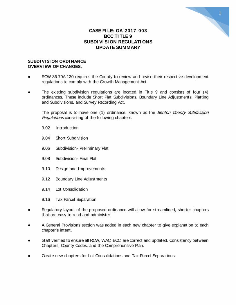
1
CASE FILE: OA-2017-003 BCC TITLE 9
SUBDIVISION REGULATIONS UPDATE SUMMARY
SUBDIVISION ORDINANCE OVERVIEW OF CHANGES: ● RCW 36.70A.130 requires the County to review and revise their respective development
regulations to comply with the Growth Management Act. ● The existing subdivision regulations are located in Title 9 and consists of four (4)
ordinances. These include Short Plat Subdivisions, Boundary Line Adjustments, Platting and Subdivisions, and Survey Recording Act.
The proposal is to have one (1) ordinance, known as the Benton County Subdivision Regulations consisting of the following chapters:
9.02 Introduction
9.04 Short Subdivision
9.06 Subdivision- Preliminary Plat
9.08 Subdivision- Final Plat
9.10 Design and Improvements
9.12 Boundary Line Adjustments
9.14 Lot Consolidation
9.16 Tax Parcel Separation
● Regulatory layout of the proposed ordinance will allow for streamlined, shorter chapters
that are easy to read and administer. ● A General Provisions section was added in each new chapter to give explanation to each
chapter’s intent. ● Staff verified to ensure all RCW, WAC, BCC, are correct and updated. Consistency between
Chapters, County Codes, and the Comprehensive Plan. ● Create new chapters for Lot Consolidations and Tax Parcel Separations.

2
INTRODUCTION: WHAT IS NEW? ● Exemption approval process for those exempt activities identified in BCC 9.02.050 such
as cemetery lots, testamentary provisions, and 20 acre or larger segregations. While the County has reviewed these land divisions in the past, the new code outlines an exemption process providing application requirements and review criteria.
● Update the Vacation portion of code to ensure it is consistent with state law. ● Add administrative appeal procedures, fees, violations/penalties and a consolidated
definitions section. ● Add definitions for closed record appeal and open record hearing consistent with Title
17.10. SHORT SUBDIVISION: WHAT IS NEW? ● Add provision for a pre-application meeting between the applicant and agencies. ● Update application requirements. ● Add new section and identified agencies of interest to receive and comment on the
application. ● Add review criteria for the planner to use in the administrative review of final short
subdivisions. ● Add both the Benton Franklin Health District and the County Engineer as signature
agencies on all short subdivisions. Currently the engineer only provides signature if the plat involves a county road.
SUBDIVISION- PRELIMINARY PLAT: WHAT IS NEW? ● Existing code includes provisions for preliminary plat, final plat, and improvements in one
(1) ordinance- Platting and Subdivisions. The proposed update creates a new chapter for each- 9.06 Preliminary Plat, 9.08 Final Plat, and 9.10 Design and Improvements.
● Add provision for a pre-application meeting between the applicant and agencies. ● Identify agencies of interest to receive and comment on the application. ● Update engineering requirements as requested by County Engineer. ● Add language for clarification as it relates to the Phasing of development.
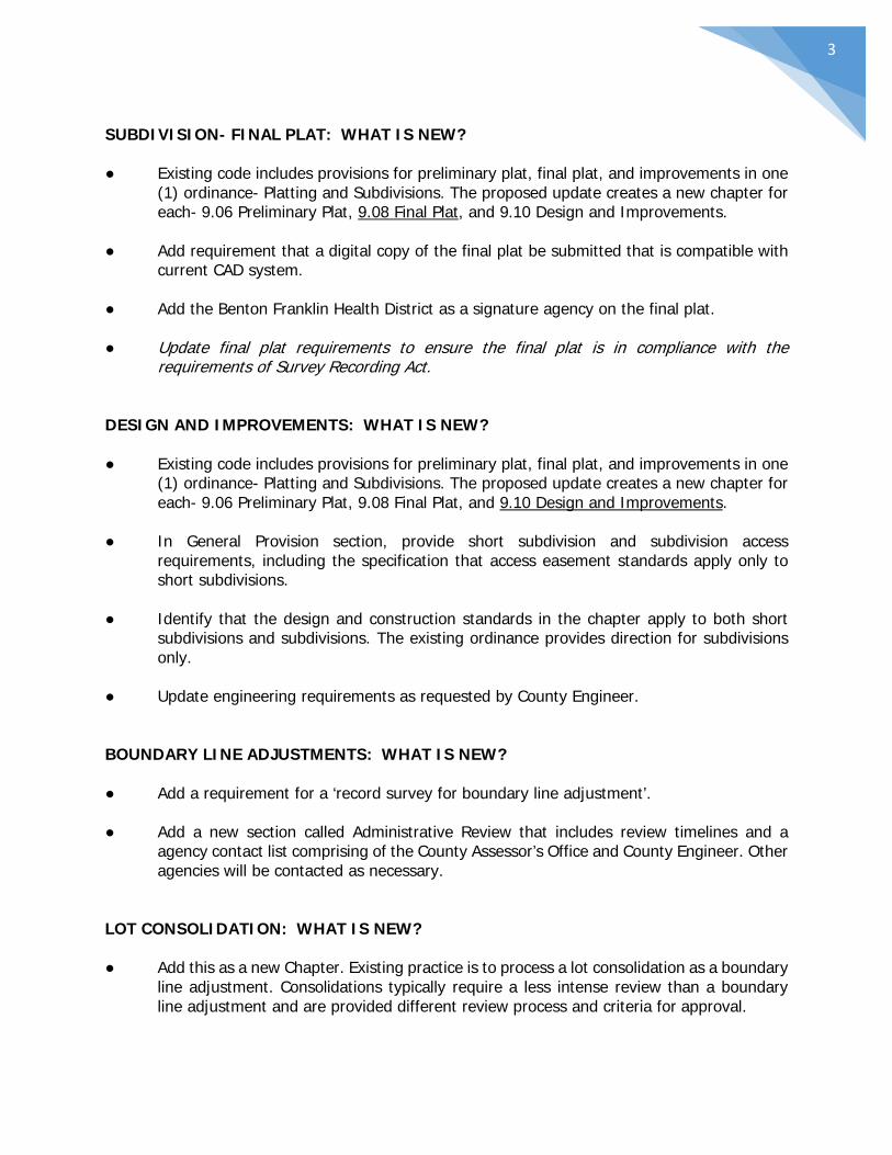
3
SUBDIVISION- FINAL PLAT: WHAT IS NEW? ● Existing code includes provisions for preliminary plat, final plat, and improvements in one
(1) ordinance- Platting and Subdivisions. The proposed update creates a new chapter for each- 9.06 Preliminary Plat, 9.08 Final Plat, and 9.10 Design and Improvements.
● Add requirement that a digital copy of the final plat be submitted that is compatible with
current CAD system. ● Add the Benton Franklin Health District as a signature agency on the final plat. ● Update final plat requirements to ensure the final plat is in compliance with the
requirements of Survey Recording Act. DESIGN AND IMPROVEMENTS: WHAT IS NEW? ● Existing code includes provisions for preliminary plat, final plat, and improvements in one
(1) ordinance- Platting and Subdivisions. The proposed update creates a new chapter for each- 9.06 Preliminary Plat, 9.08 Final Plat, and 9.10 Design and Improvements.
● In General Provision section, provide short subdivision and subdivision access
requirements, including the specification that access easement standards apply only to short subdivisions.
● Identify that the design and construction standards in the chapter apply to both short
subdivisions and subdivisions. The existing ordinance provides direction for subdivisions only.
● Update engineering requirements as requested by County Engineer. BOUNDARY LINE ADJUSTMENTS: WHAT IS NEW? ● Add a requirement for a ‘record survey for boundary line adjustment’. ● Add a new section called Administrative Review that includes review timelines and a
agency contact list comprising of the County Assessor’s Office and County Engineer. Other agencies will be contacted as necessary.
LOT CONSOLIDATION: WHAT IS NEW? ● Add this as a new Chapter. Existing practice is to process a lot consolidation as a boundary
line adjustment. Consolidations typically require a less intense review than a boundary line adjustment and are provided different review process and criteria for approval.

4
● Intent of a lot consolidation is to eliminate the boundary/lot line between two (2) or more lots of record (also- to consolidate contiguous lots of record which are under one ownership).
● Application requirements vary depending on if the effected parcels have been previously
platted. Platted lots require the submittal of the recorded plat as part of its application process. Un-platted lots require the submittal of existing and proposed legal descriptions.
TAX PARCEL SEPARATION: WHAT IS NEW? ● Add this as a new Chapter. Existing practice is to process a tax parcel separation as a
short subdivision. A tax parcel separation typically requires a less intense review than a short subdivision and are provided different criteria for approval and review process.
● Intent of a tax parcel separation is to separate platted lots of record into parcels suitable
as building sites. An example: A landowner has processed a lot consolidation application and combined two (2) lots in a subdivision. Landowner now wishes to put the lot line back that was removed during the consolidation.
● The Administrative Review section includes review timelines and an agency contact list
comprising of the County Assessor’s Office, BFHD, and County Engineer. Other agencies will be contacted as necessary.
● Tax parcel separation application requests must comply with the applicable zoning
district’s minimum lot size. All created lots must comply with today’s minimum lot size.
TITLE 9 SUBDIVISIONS
9.02 Introduction
9.04 Short Subdivision
9.06 Subdivision- Preliminary Plat
9.08 Subdivision- Final Plat
9.10 Design and Improvements
9.12 Boundary Line Adjustments
9.14 Lot Consolidation
9.16 Tax Parcel Separation

1
CHAPTER 9.02 INTRODUCTION
SECTIONS:
9.02.010 Title 9.02.020 Purpose and Intent 9.02.030 Applicability 9.02.040 Definitions 9.02.050 Administration 9.02.060 Exemptions 9.02.070 Exemption Approval 9.02.080 Complete Application 9.02.090 Residential Density- Lot Size 9.02.100 Building Permit Issued Prior to Finalization 9.02.110 Vacation 9.02.120 Appeal of Administrative Decision 9.02.130 Fees 9.02.140 Violations and Penalties 9.02.150 Severability
9.02.010 Title. This title shall be known as the Benton County Subdivision Regulations. 9.02.020 Purpose and Intent. In addition to those purposes set forth in Revised Code of Washington (RCW) 58.17.010, as now existing or hereafter amended, the following purposes are also essential to the regulation of the subdivision of land within the unincorporated areas of Benton County: (a) To prescribe procedures for the subdivision of land in accordance with officially adopted plans, policies, and standards, including the provisions of the Benton County Zoning Code and Benton County Comprehensive Plan; and (b) To provide for consistent and efficient processing of applications without undue delay; and (c) To provide uniform standards and regulations for the division of land; and (d) To promote effective use of land consistent with environmentally sensitive
2
development practices; and (e) To implement State Environmental Policy Act chapter 43.21C RCW and WAC 197-11 as now existing or hereafter amended; and (f) To require uniform monumentation of land subdivisions and conveyancing by accurate legal descriptions. 9.02.030 Applicability. This title applies to all division of land into two or more lots, and to subdivisions, short subdivisions, tax parcel separations, boundary line modifications, amendments, alterations, and vacations of short subdivisions and subdivisions hereafter established in unincorporated Benton County. 9.02.040 Definitions. (a) Whenever the following words and phrases appear in this chapter they shall be given the meaning attributed to them by this section. When not inconsistent with the context, words used in the present tense shall include the future; the singular shall include the plural, and the plural the singular; the word "shall" is always mandatory, and the word "may" indicates a use of discretion in making a decision. Except where specifically defined in this chapter all words in this title shall carry the customary meanings.
(1) "Alley" means a strip of land no more than sixteen (16) feet in width that abuts a public road, is dedicated to public use, and provides vehicular and pedestrian access to the rear portion of the properties.
(2) "Block" means a piece or parcel of land entirely surrounded by public highways, streets, stream, railroad rights-of-way, park, etc., or a combination thereof.
(3) "Board of County Commissioners" means the Board of County Commissioners of Benton County, Washington.
(4) "Boundary line adjustment" means the relocation of the boundaries between two or more lots, which does not result in the creation of any additional lot or lots.
(5) "Closed Record Appeal" means an appeal to the Benton County Board of Commissioners, on the record where no new evidence or information being submitted, of a decision made following an open record hearing on a project permit application.

3
(6) "Comprehensive Plan" means that plan or plans adopted by the Benton County Planning Commission and the Board of County Commissioners indicating the general locations recommended for major arterials, parks, streets, public buildings, other public improvements, and zoning districts. (7) "County" means the County of Benton located in the State of Washington. (8) “County Auditor" shall have the definition as set forth in Chapter 36.22 RCW as it now exists or is hereafter amended.
(9) “County Engineer" shall have the definition as set forth in Chapter 36.80 RCW as it now exists or is hereafter amended.
(10) “County Treasurer” shall have the definition as set forth in Chapter 36.29 RCW as it now exists or is hereafter amended.
(11) "Cul-de-sac" means a street closed at one end with such closed end of sufficient size to a fire truck to turn around.
(12) "Dedication" means the deliberate appropriation of land by an owner for any general and public uses, reserving unto himself or herself no other rights than such as are compatible with the full exercise and enjoyment of the public uses to which the property has been devoted. The intention to dedicate shall be evidenced by the presentment for filing of a final subdivision or short plat showing the dedication thereon; and, the acceptance by the public shall be evidenced by the final approval of such plat for filing by the appropriate governmental unit.
(13) "Developer", "Subdivider", or "Platter" means any person, firm, or corporation undertaking the subdivision or re-subdivision of any lot, tract, or parcel of land.
(14) "Discrepancy" means a boundary hiatus, an overlapping boundary or a physical appurtenance, which indicates encroachment, lines of possession, or conflict of title. (15) "Easement" means a person or the public’s interest in land owned by another person, consisting of the non-landowner’s right to use or control the surface of the land for a specific limited purpose. For purposes of this chapter, the term “easement” does not include mineral easements.
(16) "Final Approval" means that approval given by the Planning Administrator or the Board of County Commissioners which authorizes the recording of the short plat, subdivision, and/or dedication.
(17) "Final Plat" means the plan of a plat, subdivision or dedication of any portions thereof prepared for filing for record by the County Auditor and containing
4
those elements and requirements as set forth for final plats in these regulations. (18) “Final Short Plat" means the final drawing of the short subdivision and dedication prepared for filing for record with the County Auditor and containing all elements and requirements set forth in this chapter.
(19) "Hazardous Product" means petroleum, petroleum products, anhydrous ammonia, carbon dioxide, natural gas, flammable gas, or gas that is toxic or corrosive. (20) "Hearings Examiner" means an examiner appointed by the Board of County Commissioners authorized to hear and make decisions on variances, land use permits, and certain appeals.
(21) "Hydrology Report" means a report prepared by a qualified hydrogeologist or professional engineer licensed in the State of Washington for the removal of excess water from the subdivision site. The report shall evaluate probable storm events that will generate excess water and compares the water discharges onto and from the site for pre-development conditions to post-development conditions. The report shall identify improvements and management practices to safely convey drainage and mitigate any impacts due to the proposed subdivision, all prepared in accordance with Benton County standards. A preliminary hydrology report shall be submitted with the preliminary plat. The final hydrology report shall be submitted with the final plat/road construction drawings.
(22) "Improvements" means street grading or gravelling, permanent street and corner monuments, street pavement, curbs and sidewalks, pedestrian ways, water mains, and storm and sanitary sewers.
(23) "Lot" means a fractional part of subdivided lands having fixed boundaries, being of sufficient area and dimension to meet minimum zoning requirements for width and area. The term shall include tracts or parcels. (24) "Lot Consolidation" means the consolidation of contiguous lots of record which are under one ownership. The purpose of the consolidation shall be for planning and building purposes and any consolidation shall comply with all applicable zoning, subdivision, and other land use controls as deemed necessary by the Planning Administrator. Tax parcel consolidation requests shall be submitted to the Planning Administrator on forms provided by the Planning Department. (25) "Open Record Hearing" means a hearing, conducted by a single hearing body or officer authorized by the Benton County Board of Commissioners, wherein a record will be created through the receipt of testimony and other appropriate evidence and information under procedures prescribed by the Benton County Code or by such body's or officer's rules of procedure.
5
(26) “Ownership Interest” means a fee interest in the surface of the parcel proposed for division and does not include lien holder interests, mineral right interests, mineral easements or easements of any other kind that are separate from the fee interest in the surface rights.
(27) "Pedestrian Way" means a right-of-way dedicated to the public use as a footpath which cuts across a block to facilitate pedestrian movement and access to adjacent streets and properties.
(28) "Planning Administrator" means the Benton County Planning Manager or his/her designated representative who shall be responsible for the administration of this Title. (29) “Planning Department” means the Benton County Planning Department. (30) "Planning Commission" means the Benton County Planning Commission.
(31) "Preliminary Plat" means a neat and approximate drawing of the proposed subdivision showing the general layout of streets, blocks, lots and other elements of a subdivision consistent with the requirements of this chapter and which shall be the basis for the approval or disapproval of the general layout of the subdivision.
(32) "Private Road" means a road not dedicated to, nor maintained by, Benton County.
(33) "Public Road" means any improved road maintained by a city, the state or County at public expense.
(34) “Registered Engineer” means an individual, licensed by the State of Washington to practice civil engineering.
(35) "Short Plat" means the map or representation of a short subdivision.
(36) "Short Subdivision" means the division or re-division of land into four (4) or fewer lots, tracts, parcels, sites, or divisions for the purposes of sale, lease, or transfer.
(37) "Street Dead-end" means a street open at one end and not provided with a turn-around at the closed end.
(38) "Street - Marginal" or "Street - Frontal Access" means an access street which is generally parallel to and adjacent to arterial streets, limited access highways, or railroad rights-of-way and which provides direct access to abutting properties and protection to through traffic.
6
(39) "Street - Local Residential," or "Street - Minor" means a public way of limited continuity which serves or is intended to serve the local traffic needs of the immediate vicinity.
(40) "Subdivision" means every division or re-division of any land within unincorporated Benton County for the purpose of sale, lease, or transfer of ownership that does not fall within the definition of short subdivision.
(41) “Surveyor,” “Land Surveyor” or “Registered Land Surveyor” means a professional land surveyor registered in the State of Washington in accordance with Chapter 18.43 RCW as now in effect or hereafter amended.
(42) "Tax parcel separation" means the separation of platted lots of record into two or more tax parcels for the purpose of sale, lease or transfer of ownership and which separation does not result in the creation of more parcels than lots of record. (43) “Urban Growth Area” means an area designated as such by the Benton County Board of Commissioners pursuant to RCW 36.70A.110, as now in effect or hereafter amended.
9.02.050 Administration. The administration of this ordinance lies with the Planning Administrator. It is the purpose of these regulations to grant to the Planning Administrator, the Hearing Examiner, or Board of County Commissioners, the authority to approve, approve with conditions, or deny any land use action prescribed in this title. It is recognized that not all possible variations of requirements or processes which are required to administer this title can be listed or categorized. Any interpretation, administrative policies, or procedures which the Planning Administrator deems essential for the effective administration of this title shall be adopted by the Planning Administrator and shall be made available to the public upon request. 9.02.060 Exemptions. The provisions of this title shall not apply to the following: (a) Any cemetery or burial plot, while used for that purpose. (b) Any division made by testamentary provision or the laws of descent. (c) A division of land into lots or tracts each of which is one-thirty-second (1/32) of a section of land or larger, or twenty (20) acres or larger if the land is not capable of description as a fraction of a section of land; provided, that there is no dedication of land
7
to a public body in connection with such division and for the purposes of computing the size of any lot under this section that borders on a street or road, the lot size shall be expanded to include that area which would be bounded by the centerline of the road or street and the side lot lines of the lot running perpendicular to such centerline. (d) Any division of property made by recorded survey or contract sale prior to July 1, 1974. (e) Any division made pursuant to court order. (f) Any division for the purpose of leasing land for facilities providing personal wireless services while used for that purpose. "Personal wireless services" means any federally licensed personal wireless service. "Facilities" means unstaffed facilities that are used for the transmission or reception, or both, of wireless communication services including, but not necessarily limited to, antenna arrays, transmission cables, equipment shelters, and support structures. (g) Any division of land into lots or tracts of less than three (3) acres that is recorded in accordance with Chapter 58.09 RCW and will be used only for the purpose of establishing a site for construction and operation of consumer-owned or investor-owned electric utility facilities. For purposes of this subsection, "electric utility facilities" means unstaffed facilities, except for the presence of security personnel, that are used for or in connection with or to facilitate the transmission, distribution, sale, or furnishing of electricity including, but not limited to, electric power substations. This subsection does not exempt a division of land from any other zoning or permitting laws and regulations of Benton County. Furthermore, this subsection only applies to electric utility facilities that will be placed into service to meet the electrical needs of a utility's existing and new customers. New customers are defined as electric service locations not already in existence as of the date that electric utility facilities subject to the provisions of this subsection are planned and constructed. 9.02.070 Exemption Approval. An exemption approval shall be obtained from the Planning Administrator for those exempt activities in section BCC 9.02.060 above. Any person considering himself/herself exempt thereunder shall apply for an exemption approval, which includes a minimum review for conformance to adopted county regulations and ordinances. An application for exemption approval shall be processed by the Planning Administrator and shall be approved or denied within ten (10) days following the submittal of a complete application and the payment of application fees. (a) A complete application shall include the following:
(1) Completion of an application form supplied by the Planning Department.
8
(2) A non-refundable application fee as established by resolution of the Board of Benton County Commissioners.
(3) Copy of a record survey showing division(s) as prepared by a Washington State Licensed Surveyor, as applicable. (4) Copy of legal descriptions as prepared by a Washington State Licensed Surveyor, as applicable.
(b) The Planning Administrator shall determine whether:
(1) The proposed division complies with BCC 9.02.060. (2) The proposed division is served with a legal means of access including a recorded private access easement/road unless the newly created lot(s) has frontage on a public road/street. (3) The proposed division is in conformance with adopted county regulations and ordinances including, but not limited to, the Benton County Comprehensive Plan.
9.02.080 Complete Application. An application is required for all actions administered by this title. An application shall be determined to be complete upon the applicant’s submittal of all required application materials including the maps and exhibits required in the applicable section or chapter of this title, and the payment of fees required in conjunction with the processing of an application.
9.02.090 Residential Density- Lot Size. (a) Residential densities and lot sizes shall conform to the Benton County Comprehensive Plan and Benton County Code. Residential density and lot size shall also conform to the lot size requirements of the Benton-Franklin Health District's on-site waste disposal standards, if applicable. (b) Lot sizes in excess of minimum standards may be required for reason of sanitation, steep slopes, geological hazards, poor drainage, flood hazards or other unique conditions or features that warrant protection of the public interest. 9.02.100 Building Permit Issued Prior to Finalization. A single building permit may be issued on land which is located within the boundaries of

9
a preliminary subdivision or short subdivision provided: (a) The site does not contain any structures which are being used primarily for residential uses; (b) The building permit application illustrates the following: (1) Boundary of the preliminary subdivision plat or short plat; (2) Location of the structure for which a permit is requested; and (3) Lot dimensions of the lot which the permit is being requested on. (c) The building site has access which meets fire marshal requirements; (d) The lot corners are established; (e) The structure meets all required setbacks as if the lot were platted; and (f) All state and local land development laws and regulations were met at the time the lot was created or can be met prior to the issuance of the building permit.
9.02.110 Vacation.
(a) When any person wishes to vacate any or all of the land from a short subdivision or subdivision, an easement granted by the plat or an entire area designated or dedicated for public use, that person shall file an application for vacation, as provided by the Planning Administrator, with the Board of County Commissioners and pay a non-refundable application fee as established by resolution of the Board of County Commissioners. The application shall set forth the reasons for vacation and shall contain signatures indicating approval of all parties having an ownership interest in the land to be vacated from the subdivision and if an easement or area dedicated for public use is to be vacated, then the signature of all parties having an ownership interest within that portion of the subdivision. If the subdivision is subject to restrictive covenants filed at the time of approval of the subdivision, and the application for vacation would result in a violation of a covenant, the application shall contain an agreement signed by all parties subject to the covenants agreeing to terminate or alter the relevant covenants to accomplish the purpose of the vacation. When the vacation application is specifically for a county road or street, the procedure for road vacation or street vacation in Chapter 36.87 RCW or Chapter 35.78 RCW, as now existing or hereafter amended, shall be used and shall take precedence over any inconsistencies within this chapter. When the application is for vacation of the entire plat together with the roads and/or streets, the procedure for vacation in this section shall be followed.
10
(b) The Board of County Commissioners shall give notice as provided in RCW 58.17.080 and RCW 58.17.090, as now existing or hereafter amended, and shall conduct an open record hearing on the application for vacation. If the subdivision is located within a city’s Urban Growth Area boundary, such notice shall also be sent to that city. The notice shall also be given to cities located within one mile of the subdivision. If the subdivision is located adjacent to a state highway or within two (2) miles of a state or municipal airport, the notice shall be given to the Washington State Department of Transportation. (c) The Board of County Commissioners shall determine whether the public use or benefit is served by the vacation of the subdivision. Those portions of the land contained in the subdivision that were dedicated to the public for public use or benefit but are approved for vacation shall be deeded to the county unless the Board of County Commissioners determines that the public use or benefit would not be served in retaining title to those lands. (d) Title to vacated property shall vest with the rightful owners, as shown in county records. If the vacated land is land that was dedicated to the public for public use, other than a road or street, and the Board of County Commissioners has found that retaining title to the land is not in the public interest, title thereto shall vest with the rightful owners of the property on each side thereof, as determined by the Board of County Commissioners. When the road or street that is to be vacated is contained wholly within the subdivision and/or is part of the boundary of the subdivision, title to the vacated road or street shall vest with the owner or owners of property contained within the vacated subdivision. (e) This section shall not be construed as applying to the vacation of any plat of state granted tide or shore lands. 9.02.120 Appeal of Administrative Decision. (a) Not later than fourteen (14) days following the mailing of the written decision of the Planning Administrator, the decision may be appealed to the Benton County Hearings Examiner by the applicant or any interested parties as defined below. The notice of appeal shall be on a form provided by the Planning Department and shall be filed with the Planning Administrator. (b) Only persons or entities that have submitted written comments on the proposed land use action prior to the Planning Administrator’s decision shall be considered interested parties for the purpose of BCC 9.02.120. (c) A written appeal shall include:
(1) A statement containing specific references to any portions of the written

11
findings contained in the Planning Administrator’s decision alleged to be in error and any alleged errors of law.
(2) A statement of the relief sought, such as reversal of the Planning Administrator’s decision or modification of conditions.
(3) The signature, mailing address, and telephone number of the appellant or the appellant’s representative.
(4) An appeal fee as set by resolution of the Board of County Commissioners.
(d) The Planning Administrator shall notify the applicant and all interested parties, as defined in BCC 9.02.120(b) above, that an appeal has been filed. The Planning Administrator shall also forward the appeal to the Hearings Examiner and schedule an open record hearing. (e) The Hearings Examiner shall conduct an open record hearing to consider the appeal. Written notice of the hearing shall be mailed to the appellant and all interested parties, as defined in BCC 9.02.120(b) above, and shall be published in the official county newspaper at least ten (10) days prior to the hearing. (f) The Hearings Examiner shall review the written appeal, the record of the Administrator’s decision, and receive any written or verbal public testimony at the open record hearing. After reviewing the record and any testimony presented, the Hearings Examiner shall either:
(1) Deny the appeal and affirm the Planning Administrator’s decision; or
(2) Amend, reverse, or remand the Planning Administrator’s decision. (g) The Hearings Examiner shall enter findings of fact and conclusions of law based in support of his or her decision. 9.02.130 Fees. All applications shall be accompanied by the required fee. Fees for the administration of this title shall be established by resolution of the Board of County Commissioners. 9.02.140 Violations and Penalties. (a) It shall be unlawful to sell, lease, trade, or otherwise convey or offer to sell, lease, trade or otherwise convey any lot or parcel of land as part of, or in conformity with any plan, plat, or replat, of any short subdivision or subdivision unless and until said plat, replat, or plan shall have been first recorded in the office of the County Auditor.
12
(b) It shall be unlawful to receive or record in any public office any plan, plat, or replat of land laid out in building lots and streets, alleys, or other portions of the same intended to be dedicated to public or private use or for the use of purchasers or owners of lots fronting thereon or adjacent thereto and located within the County until said plan, plat or replat has complied with the provisions of this chapter. (c) No deed or contract for the sale of any parcel, lot or tract created or divided in violation of this title shall be recorded. The Benton County Treasurer shall neither receive nor certify the satisfaction of real estate excise taxes, if any, upon any such parcel, lot or tract unless and until all applicable provisions of this title have been complied with. (d) The violation of any of the provisions of this chapter shall constitute an infraction, subject to a maximum penalty of five hundred (500) dollars, plus costs and assessments. Each such violation shall constitute a separate infraction for each and every day or portion thereof during which such violation is committed, continued or permitted. 9.02.150 Severability. Shall any chapter, section, subsection, paragraph, sentence, clause or phrase of this title be declared unconstitutional or invalid for any reason, such decision shall not affect the validity of the remaining portion of this title.

13
CHAPTER 9.04 SHORT SUBDIVISIONS
SECTIONS:
9.04.010 General Provisions 9.04.020 Pre-Application Meeting 9.04.030 Application Requirements 9.04.040 Short Plat Requirements 9.04.050 Administrative Review 9.04.060 Administrative Determinations 9.04.070 Administrative Decision 9.04.080 Appeal of Administrative Decision 9.04.090 Preliminary Short Subdivision--Expiration--Null & Void Status 9.04.100 Preliminary Short Subdivision--Expiration--Extension of Time 9.04.110 Final Short Subdivision- Review and Approval 9.04.120 Recording of Short Plat 9.04.130 Amending a Recorded Short Plat 9.04.140 Re-subdivision Procedure
9.04.010 General Provisions. (a) The purpose of this chapter is to provide procedures and consistent criteria for the efficient and timely review and approval of the division of land into four (4) or fewer lots, parcels or tracts. (b) Any person seeking to divide or re-divide land situated in unincorporated Benton County for the purpose of sale, lease, or transfer of ownership, unless exempted from the provisions of this title in BCC 9.02.050 shall submit an application for the approval of a short subdivision to the Planning Administrator with the application requirements in BCC 9.04.030. 9.04.020 Pre-Application Meeting. Any person(s) proposing a short subdivision pursuant to this title may request from the Benton County Planning Department a pre-application meeting. The purpose of the pre-application meeting is to enable the applicant to obtain the input of the affected county departments as to applicable standards and provisions of this title and other state and county regulations and how they relate to the proposed short subdivision.

14
9.04.030 Application Requirements. Any person desiring to subdivide a parcel of land in unincorporated Benton County under the provisions of this chapter shall submit to the Planning Administrator an application for a short subdivision. An application for short subdivision shall consist of the following: (a) A short subdivision application form completed and signed by all persons with an ownership interest in the parcel to be divided. The forms shall be supplied by the Planning Department. (b) Copies of preliminary short plat:
(1) Ten (10) copies of a short plat prepared in accordance with the provisions of BCC 9.04.040; and (2) One (1) reduced copy of the short plat map on eight and one-half (8 1/2) inch by eleven (11) inch or eleven (11) inch by seventeen (17) inch paper; and (3) An electronic copy of the short plat.
(c) A title certificate from a title company that is not over two (2) months old showing the names and addresses of anyone with an ownership interest in the land being subdivided and showing all easements on the property proposed for division. (d) Written verification from the Benton-Franklin Health District that the applicant has provided all necessary information to enable the health district to review and make recommendations on the proposed site. (e) A non-refundable application fee as established by resolution of the Board of Benton County Commissioners. (f) A completed SEPA Environmental Checklist, only if required by WAC 197-11-800 (6)(d), as currently existing or hereafter amended. 9.04.040 Short Plat Requirements. A short plat shall be made by or under the supervision of a registered land surveyor of the State of Washington as a result of a land survey in compliance with the requirements of the Survey Recording Act, Chapter 58.09 RCW and the Washington Administration Code (WAC) 332-130 as they now exist or are hereafter amended, and all other requirements of this chapter pertaining to short subdivision of land. A short plat shall be drawn in ink on good quality paper, sheet size eighteen (18) inches by twenty-four (24) inches to a scale not to exceed one (1) inch equal to one-hundred (100) feet unless a
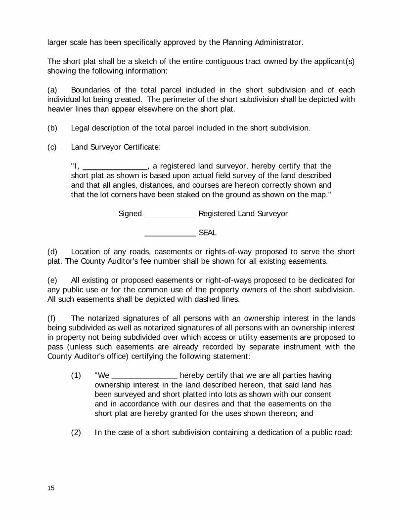
15
larger scale has been specifically approved by the Planning Administrator. The short plat shall be a sketch of the entire contiguous tract owned by the applicant(s) showing the following information: (a) Boundaries of the total parcel included in the short subdivision and of each individual lot being created. The perimeter of the short subdivision shall be depicted with heavier lines than appear elsewhere on the short plat. (b) Legal description of the total parcel included in the short subdivision. (c) Land Surveyor Certificate:
"I, _______________, a registered land surveyor, hereby certify that the short plat as shown is based upon actual field survey of the land described and that all angles, distances, and courses are hereon correctly shown and that the lot corners have been staked on the ground as shown on the map."
Signed Registered Land Surveyor SEAL
(d) Location of any roads, easements or rights-of-way proposed to serve the short plat. The County Auditor's fee number shall be shown for all existing easements. (e) All existing or proposed easements or right-of-ways proposed to be dedicated for any public use or for the common use of the property owners of the short subdivision. All such easements shall be depicted with dashed lines. (f) The notarized signatures of all persons with an ownership interest in the lands being subdivided as well as notarized signatures of all persons with an ownership interest in property not being subdivided over which access or utility easements are proposed to pass (unless such easements are already recorded by separate instrument with the County Auditor's office) certifying the following statement:
(1) "We hereby certify that we are all parties having ownership interest in the land described hereon, that said land has been surveyed and short platted into lots as shown with our consent and in accordance with our desires and that the easements on the short plat are hereby granted for the uses shown thereon; and
(2) In the case of a short subdivision containing a dedication of a public road:
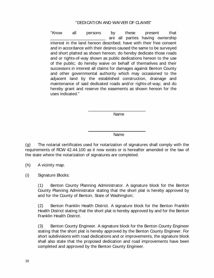
16
"DEDICATION AND WAIVER OF CLAIMS" "Know all persons by these present that ________________________ are all parties having ownership interest in the land hereon described; have with their free consent and in accordance with their desires caused the same to be surveyed and short platted as shown hereon; do hereby dedicate those roads and or rights-of-way shown as public dedications hereon to the use of the public; do hereby waive on behalf of themselves and their successors in interest all claims for damages against Benton County and other governmental authority which may occasioned to the adjacent land by the established construction, drainage and maintenance of said dedicated roads and/or rights-of-way; and do hereby grant and reserve the easements as shown hereon for the uses indicated."
_________________________ Name _________________________ Name (g) The notarial certificates used for notarization of signatures shall comply with the requirements of RCW 42.44.100 as it now exists or is hereafter amended or the law of the state where the notarization of signatures are completed. (h) A vicinity map. (i) Signature Blocks: (1) Benton County Planning Administrator. A signature block for the Benton
County Planning Administrator stating that the short plat is hereby approved by and for the County of Benton, State of Washington;
(2) Benton Franklin Health District. A signature block for the Benton Franklin Health District stating that the short plat is hereby approved by and for the Benton Franklin Health District. (3) Benton County Engineer. A signature block for the Benton County Engineer stating that the short plat is hereby approved by the Benton County Engineer. For short subdivisions with road dedications and or improvements, the signature block shall also state that the proposed dedication and road improvements have been completed and approved by the Benton County Engineer.
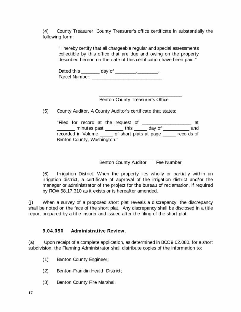
17
(4) County Treasurer. County Treasurer's office certificate in substantially the following form:
"I hereby certify that all chargeable regular and special assessments collectible by this office that are due and owing on the property described hereon on the date of this certification have been paid." Dated this _______ day of ________,________. Parcel Number: ___________________________ ________________________________ Benton County Treasurer's Office
(5) County Auditor. A County Auditor's certificate that states:
"Filed for record at the request of ___________________ at _______ minutes past _______ this _____ day of __________ and recorded in Volume _____ of short plats at page _____ records of Benton County, Washington."
_____________________ __________ Benton County Auditor Fee Number
(6) Irrigation District. When the property lies wholly or partially within an irrigation district, a certificate of approval of the irrigation district and/or the manager or administrator of the project for the bureau of reclamation, if required by RCW 58.17.310 as it exists or is hereafter amended.
(j) When a survey of a proposed short plat reveals a discrepancy, the discrepancy shall be noted on the face of the short plat. Any discrepancy shall be disclosed in a title report prepared by a title insurer and issued after the filing of the short plat. 9.04.050 Administrative Review. (a) Upon receipt of a complete application, as determined in BCC 9.02.080, for a short subdivision, the Planning Administrator shall distribute copies of the information to:
(1) Benton County Engineer; (2) Benton-Franklin Health District; (3) Benton County Fire Marshal;

18
(4) Benton County Assessor’s Office; (5) Applicable Fire District; (6) Applicable Irrigation District; (7) Applicable Utility provider(s); (8) The legislative authority of any city adjacent to or within one mile of the proposed short subdivision; (9) The State Department of Transportation, if the proposed short subdivision is adjacent to the right-of-way of any state highway or within two miles of the boundary of a state or municipal airport;
(10) The State Department of Ecology, or its successor, if the proposed short subdivision lies within a flood control zone designated pursuant to Chapter 86.16 RCW as now existing or hereafter amended; and (11) Other involved parties, County Departments, or agencies as necessary for review.
(b) In transmitting the proposed short subdivision to the parties referenced above, the
Planning Administrator shall solicit their comments and recommendations, and note the date by which comments and recommendations must be received by the Planning Administrator into order to be considered.
(c) Applicable comments are to be received by the Planning Department within 15
days. These comments shall be incorporated into the formal findings which will form the basis of the Planning Administrator’s decision on the short subdivision. If no comments are received from any of the parties referenced above, the Planning Administrator may make such findings as he/she reasonably deems appropriate.
9.04.060 Administrative Determinations. (a) The Planning Administrator shall, after conferring with appropriate officials and agencies, determine whether:
(1) The proposed short subdivision meets the requirements of this Title.
(2) The proposed short subdivision is in compliance with the Benton County Comprehensive Plan, any applicable zoning requirements or other land use controls that may exist, and the provisions of Chapter 58.17 RCW.
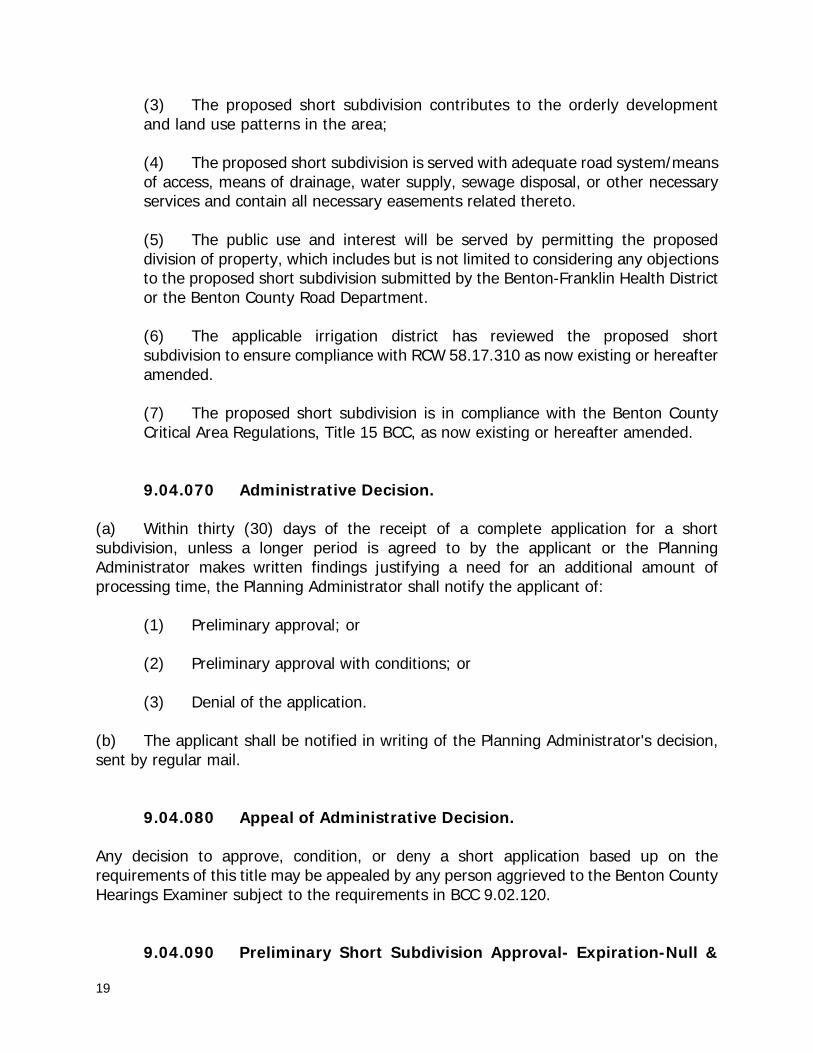
19
(3) The proposed short subdivision contributes to the orderly development and land use patterns in the area;
(4) The proposed short subdivision is served with adequate road system/means of access, means of drainage, water supply, sewage disposal, or other necessary services and contain all necessary easements related thereto.
(5) The public use and interest will be served by permitting the proposed division of property, which includes but is not limited to considering any objections to the proposed short subdivision submitted by the Benton-Franklin Health District or the Benton County Road Department.
(6) The applicable irrigation district has reviewed the proposed short subdivision to ensure compliance with RCW 58.17.310 as now existing or hereafter amended.
(7) The proposed short subdivision is in compliance with the Benton County Critical Area Regulations, Title 15 BCC, as now existing or hereafter amended.
9.04.070 Administrative Decision. (a) Within thirty (30) days of the receipt of a complete application for a short subdivision, unless a longer period is agreed to by the applicant or the Planning Administrator makes written findings justifying a need for an additional amount of processing time, the Planning Administrator shall notify the applicant of: (1) Preliminary approval; or (2) Preliminary approval with conditions; or (3) Denial of the application. (b) The applicant shall be notified in writing of the Planning Administrator's decision, sent by regular mail. 9.04.080 Appeal of Administrative Decision. Any decision to approve, condition, or deny a short application based up on the requirements of this title may be appealed by any person aggrieved to the Benton County Hearings Examiner subject to the requirements in BCC 9.02.120. 9.04.090 Preliminary Short Subdivision Approval- Expiration-Null &

20
Void Status. Preliminary approval of an application for a short subdivision, pursuant to BCC 9.04.070, shall automatically expire one (1) year after any preliminary approval is granted unless the final short plat is recorded within such time in accordance with this chapter or an application for time extension is approved. If a short plat is not so recorded or an application for an extension of time is not timely submitted and approved within the one (1) year period, the preliminary approval of the short subdivision shall be null and void.
9.04.100 Preliminary Short Subdivision Approval- Expiration- Extension of Time. (a) A completed application for an extension of time, together with supporting information, must be submitted to the Planning Administrator not less than thirty (30) days prior to the expiration of the approval of a preliminary short subdivision. (b) The Planning Administrator may, but is not required to, approve an extension of time only if:
(1) There has been significant changes in conditions since the approval that would render filing of the final short plat contrary to the public health, safety or general welfare, and (2) The applicant has taken substantial steps toward satisfying conditions of approval.
(c) The Planning Administrator may grant a one-time only extension for one (1) year under this section. The Planning Administrator shall issue a written decision approving or denying the time extension request and provide copies to affected agencies, the applicant, and those parties requesting a copy of such decision. No additional time extensions may be granted.
9.04.110 Final Short Subdivision-Review and Approval. (a) If the short subdivision application is approved pursuant to BCC 9.04.070, the applicant may submit the short plat to the Planning Administrator for final approval after satisfying all conditions of approval. (b) The submittal of a final short subdivision to the Planning Administrator shall include the following:
(1) A short plat drawn on an eighteen (18) inches by twenty-four (24) inches sheet of material approved by the County Auditor. All information provided on the short plat shall be in permanent black ink. The scale shall not exceed one hundred

21
(100) feet to the inch, unless specifically approved by the Planning Administrator. If the entire plat cannot be contained on one sheet, two (2) or more sheets shall be used. Each sheet used shall have a title block in the lower right hand corner showing the name of the plat, the sheet number and the total number of sheets. Each sheet shall have a two (2) inch margin on the left side and a one-half (1/2) inch margin on all other sides;
(2) The short plat shall contain all signatures as required in BCC 9.04.040, except for those of the County Treasurer, County Auditor, County Engineer and the Planning Administrator as these signatures will be obtained by the Planning Administrator.
(3) A digital copy of the final short plat in a format that is compatible with the County’s current CAD system;
(4) An updated title certificate dated not more than two (2) months prior to the date of recording of the final short plat containing all information required by BCC 9.04.030(c).
(c) The Planning Administrator shall review the file and the final short plat to determine if: (1) The final short plat complies with this title;
(2) The final short plat is consistent with the approved preliminary short plat;
(3) All changes and conditions of approval imposed by the preliminary short subdivision approval have been made and complied with;
(d) If the Planning Administrator makes the affirmative determinations required above by subsection (b), he/she shall approve the final short plat. The Planning Administrator will be the final signature block approval. 9.04.120 Recording of Short Plat. Once the final short plat has been signed by the Planning Administrator, the Planning Administrator shall record the original with the County Auditor. Auditor recording fees shall be paid by the short subdivision applicant. The short subdivision is not a legal subdivision until the short plat has been recorded with the County Auditor. 9.04.130 Amending a Recorded Short Plat. (a) Once a short plat has been recorded with the Benton County Auditor, no further division shall be made of any portion of said property for a period of five (5) years from the date of recording the short plat, unless the division has been granted an exemption
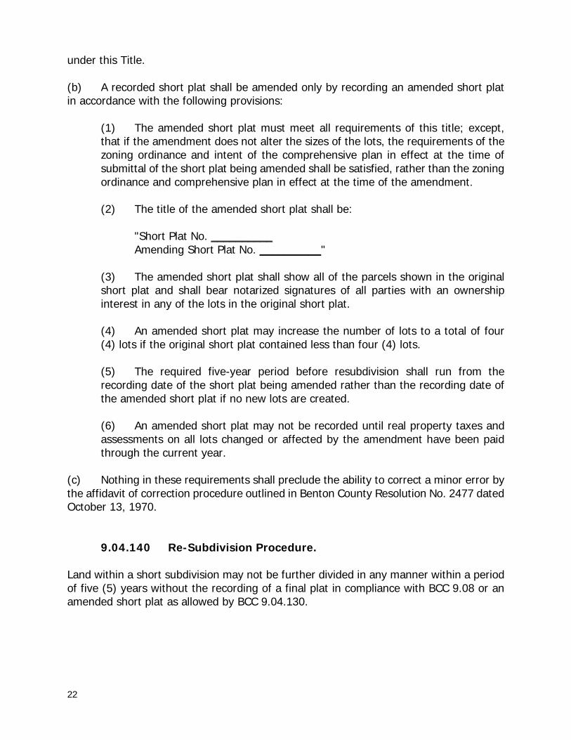
22
under this Title. (b) A recorded short plat shall be amended only by recording an amended short plat in accordance with the following provisions: (1) The amended short plat must meet all requirements of this title; except,
that if the amendment does not alter the sizes of the lots, the requirements of the zoning ordinance and intent of the comprehensive plan in effect at the time of submittal of the short plat being amended shall be satisfied, rather than the zoning ordinance and comprehensive plan in effect at the time of the amendment.
(2) The title of the amended short plat shall be: "Short Plat No. __________ Amending Short Plat No. __________" (3) The amended short plat shall show all of the parcels shown in the original
short plat and shall bear notarized signatures of all parties with an ownership interest in any of the lots in the original short plat.
(4) An amended short plat may increase the number of lots to a total of four
(4) lots if the original short plat contained less than four (4) lots. (5) The required five-year period before resubdivision shall run from the
recording date of the short plat being amended rather than the recording date of the amended short plat if no new lots are created.
(6) An amended short plat may not be recorded until real property taxes and
assessments on all lots changed or affected by the amendment have been paid through the current year.
(c) Nothing in these requirements shall preclude the ability to correct a minor error by the affidavit of correction procedure outlined in Benton County Resolution No. 2477 dated October 13, 1970. 9.04.140 Re-Subdivision Procedure. Land within a short subdivision may not be further divided in any manner within a period of five (5) years without the recording of a final plat in compliance with BCC 9.08 or an amended short plat as allowed by BCC 9.04.130.
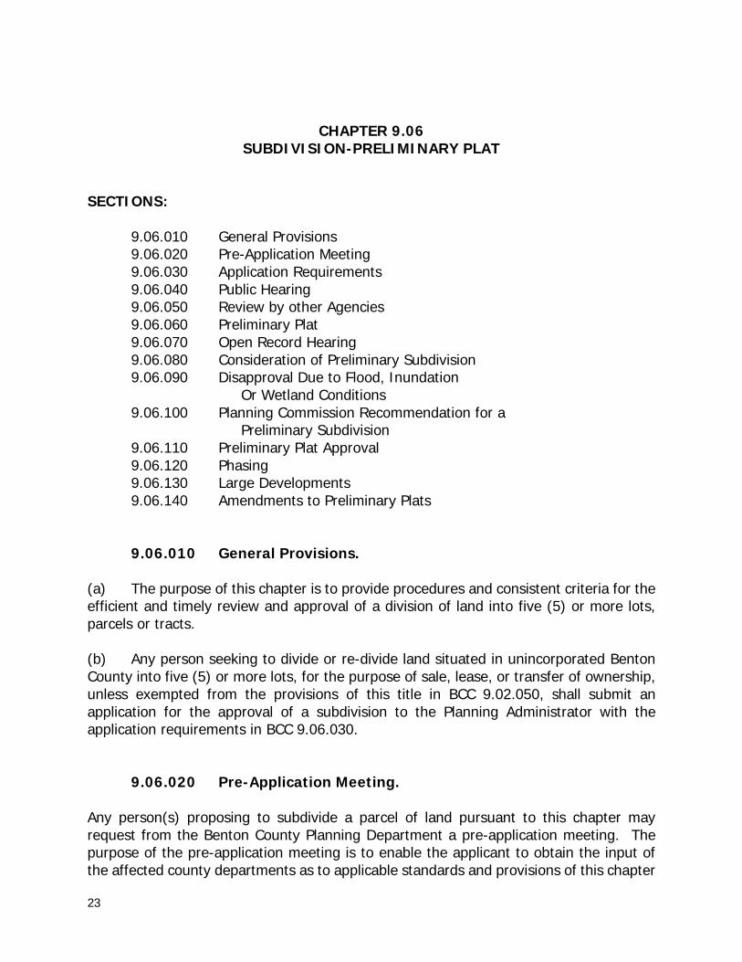
23
CHAPTER 9.06 SUBDIVISION-PRELIMINARY PLAT
SECTIONS:
9.06.010 General Provisions 9.06.020 Pre-Application Meeting 9.06.030 Application Requirements 9.06.040 Public Hearing 9.06.050 Review by other Agencies 9.06.060 Preliminary Plat 9.06.070 Open Record Hearing 9.06.080 Consideration of Preliminary Subdivision 9.06.090 Disapproval Due to Flood, Inundation Or Wetland Conditions 9.06.100 Planning Commission Recommendation for a Preliminary Subdivision 9.06.110 Preliminary Plat Approval 9.06.120 Phasing 9.06.130 Large Developments 9.06.140 Amendments to Preliminary Plats
9.06.010 General Provisions. (a) The purpose of this chapter is to provide procedures and consistent criteria for the efficient and timely review and approval of a division of land into five (5) or more lots, parcels or tracts. (b) Any person seeking to divide or re-divide land situated in unincorporated Benton County into five (5) or more lots, for the purpose of sale, lease, or transfer of ownership, unless exempted from the provisions of this title in BCC 9.02.050, shall submit an application for the approval of a subdivision to the Planning Administrator with the application requirements in BCC 9.06.030. 9.06.020 Pre-Application Meeting. Any person(s) proposing to subdivide a parcel of land pursuant to this chapter may request from the Benton County Planning Department a pre-application meeting. The purpose of the pre-application meeting is to enable the applicant to obtain the input of the affected county departments as to applicable standards and provisions of this chapter
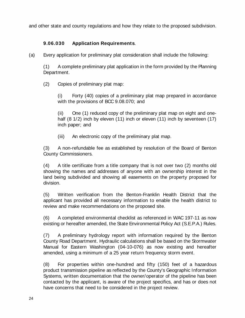
24
and other state and county regulations and how they relate to the proposed subdivision. 9.06.030 Application Requirements. (a) Every application for preliminary plat consideration shall include the following:
(1) A complete preliminary plat application in the form provided by the Planning Department.
(2) Copies of preliminary plat map:
(i) Forty (40) copies of a preliminary plat map prepared in accordance with the provisions of BCC 9.08.070; and
(ii) One (1) reduced copy of the preliminary plat map on eight and one-half (8 1/2) inch by eleven (11) inch or eleven (11) inch by seventeen (17) inch paper; and
(iii) An electronic copy of the preliminary plat map.
(3) A non-refundable fee as established by resolution of the Board of Benton County Commissioners.
(4) A title certificate from a title company that is not over two (2) months old showing the names and addresses of anyone with an ownership interest in the land being subdivided and showing all easements on the property proposed for division.
(5) Written verification from the Benton-Franklin Health District that the applicant has provided all necessary information to enable the health district to review and make recommendations on the proposed site.
(6) A completed environmental checklist as referenced in WAC 197-11 as now existing or hereafter amended, the State Environmental Policy Act (S.E.P.A.) Rules.
(7) A preliminary hydrology report with information required by the Benton County Road Department. Hydraulic calculations shall be based on the Stormwater Manual for Eastern Washington (04-10-076) as now existing and hereafter amended, using a minimum of a 25 year return frequency storm event. (8) For properties within one-hundred and fifty (150) feet of a hazardous product transmission pipeline as reflected by the County's Geographic Information Systems, written documentation that the owner/operator of the pipeline has been contacted by the applicant, is aware of the project specifics, and has or does not have concerns that need to be considered in the project review.

25
(9) All additional materials required in writing by the Planning Department. (b) The Planning Administrator shall not review any preliminary plat nor establish a hearing before the Planning Commission until all of the above elements are submitted and a complete application, consistent with BCC 9.02.080, has been determined for the application. 9.06.040 Public Hearing. (a) Upon receipt of a complete application, the Planning Administrator shall establish a file number for the subdivision. The Planning Commission shall conduct an open record hearing on the preliminary plat proposal for the purpose of taking testimony, hearing evidence, considering the facts relevant to the proposal, and evaluating the proposal for consistency with the Benton County Code and Comprehensive Plan. (b) Notice of the Planning Commission hearing shall be given as follows: (1) Publication of one or more legal notices at least ten (10) days prior to the
hearing in a paper of general circulation in the County. (2) By sending copies of the notice by U. S. mail not less than ten (10) days
prior to the date of the hearing to all landowners of parcels within the boundaries of the plat, as identified on the title certificate, and to all adjacent landowners of properties within three hundred (300) feet of the exterior boundaries of the proposed subdivision, as identified by the records of the County Assessor.
(3) If the owner of the real property that is proposed to be subdivided owns
another parcel or parcels adjacent to the parcel(s) at issue, notification shall be mailed to landowners of property located within three hundred (300) feet of any portion of such adjacent parcels as well.
(4) If the property proposed for subdivision is located within an Urban Growth
Area for a city, that city shall be notified. (5) The notice shall also be given to all cities located within one (1) mile of the
proposed subdivision. (6) If the location of a proposed subdivision is adjacent to the right-of-way of
a state highway or within two (2) miles of the boundary of a state or municipal airport, the notice shall be given to the Washington State Department of Transportation.
(7) By U.S. mail to any other interested party or agency as determined by the
Planning Administrator.
26
(c) All hearing notices shall include a description of the location of the proposed subdivision, which may be in the form of a legal description, a vicinity map or a written description other than a legal description. Failure to send notice to a person specified above in BCC 9.06.040 (b) or failure of a person to receive the notice shall not invalidate any proceedings in connection with the application. 9.06.050 Review by Other Agencies. (a) The Planning Administrator shall use his or her best efforts to forward copies of the preliminary plat to other departments, municipalities, utility companies, owners or operators of a hazardous product transmission line located within one hundred and fifty (150) feet of any part of the plat, and public agencies determined by the Planning Administrator to have an interest in the subdivision. These agencies include, but are not limited to, the following: (1) Benton County Engineer; (2) Benton-Franklin Health District; (3) Benton County Fire Marshal; (4) Applicable fire district; (5) Applicable irrigation district; (6) Applicable utility provider(s); (7) The legislative authority of any city adjacent to or within one mile of the
proposed preliminary plat; (8) The State Department of Transportation, if the proposed short plat is
adjacent to the right-of-way of any highway or within two miles of the boundary of a state or municipal airport;
(9) The State Department of Ecology, or its successor, if the proposed
preliminary plat lies within a flood control zone designated pursuant to Chapter 86.16 RCW as now existing or hereafter amended; and
(10) Other involved parties, County Departments, or agencies as necessary for
review. (b) In transmitting the proposed preliminary plat to the parties referenced above, the Planning Administrator shall solicit their comments and recommendations, and note the date by which comments and recommendations must be received by the Planning
27
Administrator in order to be considered. (c) Applicable comments are to be received by the Planning Department within 15 days. These comments shall be incorporated into the formal findings which will form the basis of the Planning Administrator’s recommendation on the preliminary plat. Failure to report within (15) days from the date of transmittal shall be interpreted to indicate that the proposed subdivision will not adversely affect the agency or utility involved. 9.06.060 Preliminary Plat. The preliminary plat shall be drawn on a standard size sheet of paper twenty-four (24) inches by thirty-six (36) inches to a scale not to exceed one hundred (100) feet to the inch (unless specifically approved by the Planning Administrator) and shall include the following information: (a) General
(1) Proposed name of the subdivision. (Names proposed shall not closely resemble those of existing subdivisions and given names or initials shall not be used with surnames in a plat name.) (2) A legal description of the property showing location of boundary lines in relation to section, quarter-section, quarter-quarter section lines and any adjacent corporate limits, describing the property clearly and precisely. (3) Names, addresses and telephone numbers of the developer and engineer or surveyor. (4) Name, address and telephone of an individual designated by the applicant to act as a contact person for all information and correspondence relating to the preliminary plat. (5) Date, scale and north arrow. (6) Contour lines, not to exceed ten (10) foot intervals to adequately show the topography of the land to be subdivided referenced to the North American Vertical Datum of 1988 (NAVD 88). Those areas within the land to be subdivided having a slope of fifteen (15) percent or greater shall be indicated on the preliminary plat. (7) A vicinity sketch, at a legible scale, showing the relation of the proposed plat to existing schools, parks, shopping centers, and so forth shall accompany the preliminary plat application. (8) Tabular Summary showing the following information:

28
Land Use Summary Gross acreage Net lot acreage Total number of lots Average lot size Minimum lot size Average density Present zoning Type of water service Type of sewerage Area of public roads
(9) Indication on face of plat that it is a preliminary plat.
(b) Existing Development
(1) The location of permanent buildings, wells (including wells within one-hundred (100) feet of the proposed subdivision), water courses, bodies of water, overhead and underground utilities, railroad lines, municipal boundaries, section lines, township lines, and other important features existing upon, over and under the land proposed to be subdivided.
(2) Names of adjacent subdivisions and the location and names of all adjacent streets, as well as, names of adjacent property owners to the subdivision.
(3) The location, name, right-of-way widths, and type of surfacing of all streets and alleys located within and adjacent to the land to be subdivided.
(4) The location of any existing walks, curbs, gutters, culverts, buried conduits and subsurface drains on or within 100 feet of the parcel(s) to be subdivided.
(5) Approximate width, location and purpose of all existing easements on or within 100 feet of the parcel(s) to be subdivided.
(6) Delineation of the location and approximate boundaries of any natural features such as rivers, streams, drainageways, one hundred (100) year floodplain and floodways as shown on official FEMA maps, slopes in excess of fifteen (15) percent, and wetlands within or adjacent to the land to be subdivided.
(7) Existing uses of parcel(s) to be subdivided, including the location and use of all existing structures and wells and which such structures and wells will remain on the property after platting.
(c) Proposed Development
29
(1) Location, width and names of proposed streets, alleys, pedestrian ways, and all necessary easements, including but not limited to easements for all utilities, watercourses, drainage ways, channels, or streams that traverse the subdivision with a width determined by the County Engineer for all easements for watercourses, drainage ways, channels or streams. (2) Indication of any portion or portions of the plat for which successive or separate final plats are to be filed. (3) Layout, number, and approximate dimensions of lots and blocks, the size of each lot in acres and square feet, and any structural setback requirements identified in Title 15 BCC. Lot sizes shall be in compliance with the size prescribed by the applicable zoning code. (4) Location and size of all parks, playgrounds, church sites, or other special uses of land considered for dedication, or reservation by deed or covenant, for special use or for the use of all property owners within the subdivision and any conditions of such dedication or reservation. (5) Indication of any lots of which a use other than residential is proposed by the developer.
(d) Supplemental Information
(1) Two (2) copies of proposed street grades may be required by the County Engineer where, in his or her opinion, conditions warrant them. (2) Preliminary grading plan.
9.06.070 Open Record Hearing. (a) The open record hearing on the proposed subdivision shall be held before the Planning Commission. The Planning Commission shall consider all relevant information, including but not limited to: (1) The report of the Planning Department. (2) Any written comments or concerns expressed by other reviewing agencies. (3) Oral and written testimony from persons present at the hearing. (b) If the Planning Commission finds that additional information is needed, the Planning Commission may continue the hearing for up to thirty-five (35) days or such longer period as agreed to by the applicant and direct that the additional information be
30
gathered.
9.06.080 Consideration of Preliminary Subdivision. After conducting the open record hearing and considering all information presented, the Planning Commission shall consider a recommendation to the Board of County Commissioners regarding whether the preliminary plat subdivision be approved, approved with conditions, or denied as proposed. Prior to making any recommendation for approval, the Planning Commission shall make the following written findings: (a) That the proposed subdivision conforms to the Benton County Comprehensive Plan, any applicable zoning requirements and other applicable land use controls; (b) That the County Engineer, or designee, has provided a written representation that the proposed subdivision provides adequate means of access and conformance with the road and drainage requirements of Benton County; (c) That the proposed subdivision meets the requirements of this chapter; (d) That the public interest will be served by the proposed division and dedication; (e) That appropriate provisions are made for the public health, safety, and general welfare, for open spaces, drainage ways, streets or roads, alleys, other public ways, transit stops, potable water, sanitary wastes, parks and recreation, playgrounds, schools, school grounds, and sidewalks; (f) That the Benton-Franklin Health District has reviewed the proposed subdivision for compliance with its rules and regulations and has not expressed objection to the proposed subdivision; and, (g) If any portion of the proposed subdivision is located within an irrigation district, that the applicant has compiled with RCW 58.17.310 as it now exists or is hereafter amended. 9.06.090 Disapproval Due to Flood, Inundation, or Wetland Condition. (a) Pursuant to RCW 58.17.120 as it now exists or is hereafter amended, the Planning Commission shall consider the physical characteristics of a proposed subdivision site and may recommend disapproval of the proposed subdivision because of flood, inundation or wetland conditions. (b) If consistent with the Benton County Critical Area Regulations, Title 15 BCC, as amended, construction of protective improvements may be required as a condition of approval and such improvements shall be noted on the final plat.
31
(c) No preliminary plat shall be approved that includes land situated in a flood control zone as provided in Chapter 86.16 RCW, as it now exists or is hereafter amended, without the prior written consent of the Washington State Department of Ecology. [Ord. 474 (2010) § 16] 9.06.100 Planning Commission Recommendation for a Preliminary Subdivision. The Planning Commission’s written record, including its findings, conclusions and recommendation, if any, shall be submitted to the Benton County Board of Commissioners no later than fourteen (14) days from the date of the execution of the written recommendation by the Chairman or Chairman Pro Tem of the Planning Commission. The Planning Administrator shall forward the Planning Commission’s recommendation to the Board of County Commissioners for the Board to consider the application. 9.06.110 Preliminary Plat Approval. (a) Upon the Board of County Commissioners receipt of the Planning Commission’s written record and recommendation, if any, the Planning Administrator shall set a date for a closed record appeal for the Board to consider the application. Following its closed record appeal, the Board of County Commissioners may adopt, modify or reject the recommendation of the Planning Commission. The decision of the Board of County Commissioners to approve, conditionally approve or deny the preliminary plat shall be based on the written record prepared by the Planning Commission. The decision of the Board of County Commissioners shall be in writing and effective upon its adoption. (b) The Board of County Commissioners' decision to approve, conditionally approve or deny the preliminary plat shall be made within ninety (90) days of the County's receipt of the complete preliminary plat application, except as follows:
(1) If an Environmental Impact Statement is required, the ninety (90) day period shall not include the time spent preparing and circulating the statement; (2) If the plat is located in a flood control zone as provided in Chapter 86.16 RCW as now existing or hereafter amended, the ninety (90) days shall be extended if necessary until the project receives written approval from the Department of Ecology; or (3) If the applicant consents in writing to an extension of such ninety (90) day period.
A copy of the resolution, along with the findings and conclusions, indicating the action of the Board of County Commissioners shall promptly be sent to the Planning Department, the County Engineer, the County Assessor, the Benton-Franklin Health District, the
32
applicant, the applicant's surveyor, to any person who submitted substantive comments on the application and to any person who, prior to the rendering of the decision, requested notice of the decision. (c) The Board of County Commissioners, if it approves the preliminary plat, authorizes the applicant to proceed with the preparation of the final plat in accordance with all the requirements of this chapter and any conditions of preliminary plat approval imposed by the Board of County Commissioners. (d) Preliminary plats approved on or before December 31, 2007 shall be effective for ten years from the date of approval by the Board of County Commissioners. Such preliminary plats shall be null and void after the ten (10) year period unless:
(1) A final plat for all phases has been submitted, reviewed and signed by the Chairman of the Planning Commission and all required infrastructure improvements including as built drawings and data of all underground utilities necessary to serve said plat must be constructed and accepted by the county engineer. In lieu of actually completing all improvements, the developer may provide the county with a bond or irrevocable line of credit in an amount equal to one hundred twenty-five (125) percent of the county engineer's estimate of the cost to complete the required infrastructure; or (2) A written application for time extension has been submitted to the Planning Administrator at least thirty (30) days prior to the expiration of the ten (10) year period and the applicant demonstrates that the applicant has attempted in good faith to satisfy the conditions of plat approval for all phases within the ten (10) year period. In such case, one extension of one year shall be granted, but additional or altered conditions and requirements may be imposed.
(e) Except as otherwise provided in subsection (f) below, preliminary plats approved on or after January 1, 2015 shall be effective for five (5) years from the date of approval by the Board of County Commissioners. Such preliminary plats shall be null and void after the five (5) year period unless:
(1) A final plat for all phases has been submitted, reviewed and signed by the Chairman of the Planning Commission and all required infrastructure improvements including as built drawings and data of all underground utilities necessary to serve said plat must be constructed and accepted by the county engineer. In lieu of actually completing all improvements, the developer may provide the county with a bond or irrevocable line of credit in an amount equal to one hundred twenty-five (125) percent of the county engineer's estimate of the cost to complete the required infrastructure; or (2) A written application for time extension has been submitted to the Planning Administrator at least thirty (30) days prior to the expiration of the five (5) year period and the applicant demonstrates that the applicant has attempted in good
33
faith to satisfy the conditions of plat approval for all phases within the five (5) year period. In such case, one extension of one year shall be granted, but additional or altered conditions and requirements may be imposed.
(f) Preliminary plats that were approved between January 1, 2008 and December 31, 2014 shall be effective for seven (7) years from the date of such approval by the Board of County Commissioners. Such preliminary plats shall be null and void after the seven (7) year period unless:
(1) A final plat for all phases has been submitted, reviewed and signed by the Chairman of the Planning Commission and all required infrastructure improvements including as built drawings and data of all underground utilities necessary to serve said plat must be constructed and accepted by the county engineer. In lieu of actually completing all improvements, the developer may provide the county with a bond or irrevocable line of credit in an amount equal to one hundred twenty-five (125) percent of the county engineer's estimate of the cost to complete the required infrastructure; or (2) A written application for time extension has been submitted to the Planning Administrator at least thirty (30) days prior to the expiration of the seven (7) year period and the applicant demonstrates that the applicant has attempted in good faith to satisfy the conditions of plat approval for all phases within the seven (7) year period. In such case, one extension of one year shall be granted, but additional or altered conditions and requirements may be imposed. 9.06.120 Phasing.
(a) Any subdivision may be developed in phases or increments. Phasing of short subdivisions is not permitted. A master phasing plan shall be submitted with the preliminary plat for approval by the Planning Administrator. The phasing plan may be approved provided: (1) The phasing plan includes all land identified within the legal notice; and (2) The sequence of phased development is identified by a map; and (3) Each phase has reasonable public or private infrastructure to support the
number of dwelling units contained in that phase; and (4) Each phase constitutes an independent planning unit with facilities,
adequate circulation, and any requirements established for the entire subdivision; and provided that any unfinalized portion meets the minimum lot size of the underlying zone for the proposed use; and
(5) The County Engineer approves the necessary documents so that all road
34
improvement requirements are assured for that phase. (b) A phasing plan may be amended following preliminary approval. Said plan may be approved administratively provided the above criteria are met.
9.06.130 Large Developments.
When a developer or group of developers have in their control an area of land which they wish to plat, they may prepare a preliminary plat of the entire area of the development. Once the total preliminary plat is approved, the project may be final platted and developed in two or more phases provided that:
(1) Each phase is final platted in accordance with the provisions of BCC 9.08 Final Plat and the provisions of preliminary plat approval; and (2) Each final plat is developed to allow for the systematic and logical extension of roads and utilities; and (3) No final plat for any phase may be submitted after the preliminary plat for the entire area of the development has expired pursuant to BCC 9.06.110.
9.06.140 Amendments to Preliminary Plats. An approved preliminary plat may be amended prior to submission of a final plat in accordance with the following criteria and limitations. Such a request for amendment shall be submitted on a form provided by the Planning Administrator. The Planning Administrator shall determine whether to process a proposed amendment as a minor or major amendment. (a) Minor Amendments. Minor amendments may only address changes to an approved preliminary plat that the Planning Administrator determines fall within the scope of the original approval and do not have the likely potential to increase impacts to governmental agencies or surrounding properties.
(1) General Requirements. Any additions or expansions proposed through minor amendments that exceed the requirements of this section shall be reviewed as a major amendment and shall be subject to current development regulations.
(2) Planning Commission Review. A copy of all applications and any pre-decision Department recommendation that exists shall be routed to the Planning Commission. The Planning Commission may provide comments to the Planning Administrator regarding the preliminary plat amendment proposal.
(3) Required Written Findings and Determinations. The Planning
35
Administrator’s written decision on a minor plat amendment shall include findings and conclusions, based on the record, to support the decision. A proposed minor plat amendment shall not be approved unless the Planning Administrator makes written findings that:
(i) The proposal does not result in a change of use of any proposed lot from what was identified in the original approval;
(ii) There are no proposed changes to conditions of approval;
(iii) Proposed changes to the proposal will not modify the intent of the original decision or result in increased storm water, traffic, open space, noise or any other type of impacts to the surrounding property owners;
(iv) The perimeter boundary of the original site is not being increased;
(v) The change does not increase the number of residential lots, residential units, or residential density;
(vi) The proposed change does not increase the number of dwelling units on any lot created by the plat;
(vii) The proposal does not reduce the designated buffers or open space set forth in the preliminary plat;
(viii) Access points identified on the preliminary plat are not reduced, increased or significantly altered;
(ix) The amendment will not negatively impact the future owners of the lots, tracts or parcels created by the subdivision;
(x) The proposal does not reduce required setbacks; (xi) The proposal does not alter the location or grade of any public roadways; and, (xii) The proposal does not alter the course of any drainage way or drainage easement.
(4) Approvals. After reviewing comments, if any, of the Planning Commission, the Planning Administrator has the authority to approve or deny any proposed minor amendment and may impose additional or altered conditions and requirements as necessary to assure that the proposal conforms with the intent of the Comprehensive Plan and other applicable County codes and state laws.
(b) Major Amendments. Any proposed amendment to an approved preliminary plat

36
that is not considered minor by the Planning Administrator shall constitute a major amendment. The following are required for all proposed amendments that are not considered minor amendments by the Planning Administrator or that the Planning Administrator elects to have considered under the criteria and limitations for major amendments.
(1) Open Record Hearing Required. The Department shall set a date for an open record hearing before the Planning Commission after all requests for additional information under BCC 9.06.030(a)(9) have been satisfied and, if applicable, either a determination or a mitigated determination of non-significance, or an environmental impact statement, if required, has been issued pursuant to the State Environmental Policy Act (SEPA). The open record hearing shall follow the procedures set forth in BCC 9.06.040 and BCC 9.06.070. (2) Other Land Use Actions. Any amendment that requires a discretionary permit other than those granted in conjunction with the original preliminary plat approval shall require the approval of such permit before or with the decision on the proposed major plat amendment. (3) Written Findings and Determinations. The Planning Commission shall consider making a written recommendation and the Board of County Commissioners shall make the final decision on a proposed major amendment following the same procedure and the same criteria as for the initial decision to approve, conditionally approve or deny the preliminary plat. Additionally, the proposed preliminary plat, as amended by the proposed major change, shall not be approved unless the Board of Commissioners can and does make the written findings required for the approval of all preliminary plats. (4) Approvals. The Board of County Commissioners has the authority to approve or deny any proposed major amendment and may impose additional or altered conditions and requirements as necessary to assure that the proposal conforms with the intent of the Comprehensive Plan and other applicable County codes and state laws.
37
CHAPTER 9.08 SUBDIVISION-FINAL PLAT SECTIONS:
9.08.010 General Provisions 9.08.020 Final Plat- General Requirements 9.08.030 Request for Final Plat Approval 9.08.040 Final Plat Review By Agencies 9.08.050 Final Plat Review By Planning Administrator 9.08.060 Board of County Commissioners' Approval 9.08.070 Recording 9.08.080 Final Plat Requirements 9.08.090 Certificates Required--Final Plat 9.08.100 Recording Requirements 9.08.110 Alteration of Plat
9.08.010 General Provisions.
(a) The purpose of this chapter is to provide procedures and consistent criteria for the efficient and timely review and approval of a final plat. (b) Any person seeking to finalize and record a plat that is creating five (5) or more lots that has completed the preliminary plat approval process pursuant to BCC Chapter 9.06 shall submit an application for the approval of a final plat to the Planning Administrator with the application requirements in BCC 9.08.020.
9.08.020 Final Plat- General Requirements. (a) Developers shall submit to the Planning Administrator all final plats prepared in accordance with the provisions of BCC 9.08.080 and the provisions of the preliminary plat approval. (b) The following information shall be submitted to the Planning Department in order to seek final plat approval:
(1) A request for final plat approval on a form provided by the Planning Department.
(2) Ten (10) copies of the final plat as specified in BCC 9.08.080, one eleven (11) inches by seventeen (17) inches reproducible copy of the final plat and any
38
required supplementary materials.
(3) Proof that road and utility plans prepared in accordance with the provisions of BCC 9.10.030 through BCC 9.10.060 have been prepared and submitted to the County Engineer. All required infrastructure improvements including as built drawings and data of all underground utilities necessary to serve said plat must be constructed and accepted by the county engineer. In lieu of actually completing all improvements, the developer may provide the county with a bond or irrevocable line of credit in an amount equal to one hundred twenty-five (125) percent of the county engineer's estimate of the cost to complete the required infrastructure. (4) A title certificate from a title company that is not more than two (2) months old, showing the names and addresses of anyone with an ownership interest in the land being subdivided and all easements on the property proposed for division.
(5) Written verification from the Benton-Franklin Health District that it has reviewed the final plat and that the applicant has included all necessary information and notes on the final plat as directed by said District.
(6) Complete field and computation notes showing original or re-established corners with descriptions of them and actual traverse showing error of closure and method of balancing, and a sketch showing all distances, angles, and calculations required to determine distances and corners of the plat. The allowable error shall not exceed one (1) foot in ten thousand (10,000) feet.
(7) A digital format of the final plat that is fully compatible with the County’s current CAD system.
(8) A non-refundable fee as established by resolution of the Board of Benton County Commissioners.
9.08.030 Request for Final Plat Approval. After receiving a request for final plat approval, the Department shall review the request for completeness as if it were an application under BCC 17.10.090 to determine if it is complete and contains all the information as required in BCC 9.08.020.
9.08.040 Final Plat Review by Agencies. (a) The Planning Administrator shall forward copies of the final plat map to other County departments, the relevant municipality if the plat is located in an Urban Growth Area, and utility companies or public agencies determined to have an interest in the subdivision.
39
(b) All reviewing agencies shall have fourteen (14) days from the date of mailing to forward their comments to the Planning Administrator.
9.08.050 Final Plat Review by Planning Administrator. (a) The Planning Administrator shall review the file and the final plat map to determine if:
(1) The final plat complies with the requirements of this title;
(2) The final plat is consistent with the approved preliminary plat;
(3) All changes and conditions imposed in connection with the approved preliminary plat approval have been made and complied with;
(4) The County Engineer has approved the road and utility plans. All required infrastructure improvements including as built drawings and data of all underground utilities necessary to serve said plat must be constructed and accepted by the county engineer. In lieu of actually completing all improvements, the developer may provide the county with a bond or irrevocable line of credit in an amount equal to one hundred twenty-five (125) percent of the county engineer's estimate of the cost to complete the required infrastructure; and, (5) All fees and charges for engineering plan review and construction inspection shall be paid.
(b) If the Planning Administrator makes the affirmative determinations required above by subsection (a), the applicant shall promptly submit one (1) final plat on material approved by the Benton County Auditor, and the Planning Administrator shall inform the Chairman of the Planning Commission of his or her determination who, in turn, shall sign the final plat and authorize that it be forwarded to the Board of County Commissioners. (c) Prior to scheduling the final plat before the Board of County Commissioners for approval at a public meeting, the signatures of the County Engineer, Planning Commission Chairman, County Assessor, County Treasurer and any applicable irrigation district must be on the final plat as required by BCC 9.08.090.
9.08.060 Board of County Commissioners’ Approval. (a) The Board of County Commissioners shall consider each final plat at a public meeting. The Planning Administrator shall, in coordination with Board of County Commissioners' staff, set the time, date and place for the meeting to review the following information:
40
(1) The original final plat complete with all signatures EXCEPT those of the Chairman of the Board and the County Auditor.
(2) An updated title certificate dated no more than two (2) months from the date the final plat was submitted to the Benton County Board of Commissioners, containing all information required by BCC 9.08.020(b)(4).
(3) The developers' provision for bond for improvements.
(4) Any other necessary certificates, bonds or endorsements.
(b) The Board of County Commissioners shall review the Planning Administrator’s recommendation and approve the final plat for recording if the following standards are met:
(1) The final plat is consistent with the preliminary plat;
(2) The final plat includes all of the information required by BCC 9.08.080;
(3) All changes and conditions imposed on the preliminary plat approved by the Board have been made and complied with; and
(4) All applicable requirements of the state law and this title have been satisfied.
(c) If the Board of County Commissioners determines that the above standards are met, the Chairman of the Board shall sign on the appropriate signature block on the face of the plat. If the Board of County Commissioners finds these standards have not been met, the Board shall deny the final plat and return it to the applicant for correction. The Board's approval of the final plat shall constitute County acceptance of all dedications.
9.08.070 Recording. (a) The final plat shall be recorded with the Benton County Auditor after receiving final approval from the Board of County Commissioners. 9.08.080 Final Plat Requirements. (a) Scale and sheet size - The final plat shall be drawn in black ink on good quality material approved by the Benton County Auditor with a scale of not more than one hundred (100) feet to the inch unless otherwise specifically approved by the Planning Administrator. All plats shall be drawn on a standard sheet twenty-four (24) inches by thirty-six (36) inches. If the entire plat cannot be contained on one standard sheet, two (2) or more sheets shall be used. Each sheet shall have a title block in the lower right
41
hand corner showing the name of the plat, the sheet number and the total number of sheets. Each sheet shall have a two (2) inch margin on the left side and a one-half (1/2) inch margin on all other sides. (b) Map Information - The final plat shall be made by or under the supervision of a registered land surveyor of the State of Washington as a result of a land survey in compliance with the requirements of the Survey Recording Act, Chapter 58.09 RCW and the Washington Administration Code (WAC) 332-130 as they now exist or are hereafter amended. Each final plat shall include an accurate map of the subdivided land, based upon a complete survey thereof and shall include the following information:
(1) Primary control points and descriptions and ties to such control points, to which all angles, bearings, dimensions, and similar data on the plat shall be referred.
(2) The final plat shall be accompanied by complete field and computation notes showing original or re-established corners with descriptions of them and actual traverses showing error of closure and method of balancing, with sketch showing all distances, angles, and calculations required to determine distances and corners of the plat. The allowable error shall not exceed one (1) foot in ten-thousand (10,000) feet.
(3) Tract boundary lines, right-of-way lines of streets, easements, and other rights-of-way, and property lines or residential lots and other sites with accurate bearings, dimensions, deflection angles, complete curve data for street centerlines and property lines and other information necessary to reproduce the plat on the ground. Dimensions shall be shown from all angle points and points of curves to lot lines.
(4) Name and right-of-way width of each street and other rights-of-way or easements.
(5) Locations, dimensions, and purposes of each easement.
(6) Purpose for which sites, other than residential lots, are dedicated or reserved.
(7) Number to identify each parcel or lot.
(8) Location and description of all monuments.
(9) Reference to recorded plats of adjoining land by record name, date and number.
(10) Located on the bottom or right edge of each sheet of the final plat:

42
(i) A title block identifying the business name of the firm and/or land surveyor that performed the survey;
(ii) On every sheet of multiple sheets, an identification number, i.e., “sheet 1 of 5”; (iii) A County Auditor’s Certificate that states:
“Filed for record at the request of ___________________________ at_________ minutes past ________, this _______ day of ___________________, __, and recorded in Volume _____ of plats at page ______, records of Benton County, Washington.
______________________________________ Benton County Auditor Fee Number
The Auditor’s Certificate shall be on the first sheet of multiple sheets; however, space on each sheet of a multiple page final plat shall be provided for the Auditor’s fee number, volume, and page numbers.
(iv) The surveyor’s certificate on the first sheet of multiple sheets stating:
"I _______________________, Professional Land Surveyor, do hereby certify that the plat of ____________________ is based upon an actual survey of the above described property; that the distances, courses and angles are shown thereon correctly and that the monuments and lot corners have been set on the ground as shown on the plat." _____________________________ Surveyor's Signature and seal
On each additional sheet, the seal and signature of the land surveyor and the date signed.
(c) General Information - In addition to the map or maps, every final plat shall contain the following written data:
(1) Name of the subdivision.
(2) The legal description of land contained within the subdivision. (3) The date, north point and scale. In general, all plats shall be oriented on the paper with the north towards the upper edge of the sheet.

43
(4) The area of each lot within the subdivision shall be placed on the face of the plat or a separate sheet accompanying the plat showing lot acreage or square footage.
(5) A vicinity map showing the location of the plat. (6) The street address of each lot, tract, and/or parcel, as determined by Benton County or applicable agency;
9.08.090 Certificates Required-Final Plat.
The following certificates shall be shown and all signatures affixed to a final plat shall be original signatures written in permanent black ink by the landowner's, the official involved or their designated representative: (a) County Engineer County Assessor County Treasurer Chairman of County Planning Commission Chairman of the Board of County Commissioners Benton Franklin Health District
Public Utility District Owners’ certificate in the form set forth below in subsection (d). Certificates, if any, required by subsection (e) below. (b) The final plat shall be accompanied by complete field and computation notes showing original or re-established corners with descriptions of them and actual traverses showing error of closure and method of balancing, with sketch showing all distances, angles, and calculations required to determine distances and corners of the plat. The allowable error shall not exceed one (1) foot in ten-thousand (10,000) feet. (c) Tract boundary lines, right-of-way lines of streets, easements, and other rights-of-way, and property lines or residential lots and other sites with accurate bearings, dimensions, deflection angles, complete curve data for street centerlines and property lines and other information necessary to reproduce the plat on the ground. Dimensions shall be shown from all angle points and points of curves to lot lines. (d) A certificate in the following form shall be executed by all parties having an ownership interest in the lands subdivided and acknowledged before a Notary Public:
Know all persons by these present that _______________________ are all parties having ownership interest in the land hereon described; have with their free consent and in accordance with their desires caused the same to be surveyed and subdivided as shown hereon; do hereby dedicate those roads and/or rights-of-way shown as public dedications hereon to the use
44
of the public; do hereby waive on behalf of themselves and their successors in interest all claims for damages against Benton County and any other governmental authority which may be occasioned to the adjacent land by the established construction, drainage and maintenance of said dedicated roads and/or rights-of-way; and do hereby grant and reserve the easements as shown hereon for the uses indicated. ______________________________ (Name) ______________________________ (Name)
(e) When the subdivision lies wholly or in part within an irrigation district, a certificate of approval of the irrigation district and/or the manager or administrator of the project for the bureau of reclamation, if required by RCW 58.17.310 as now existing or hereafter amended. 9.08.100 Recording Requirements. (a) The original final plat shall be submitted to the County Auditor who may accept it for recording only if all certifications and requirements of this title have been complied with. (b) At the time of the recording of a final plat, the subdivider shall pay to the County Auditor the statutory recording fees. (c) When restrictive covenants or other deed restrictions are to be placed upon the lots created by the subdivision, such covenants shall be recorded with the final plat.
9.08.110 Alteration of Plat. (a) When any person wishes to alter any portion of an approved final subdivision plat that person shall submit to the Planning Administrator an application to request the alteration with a preliminary plat map and a non-refundable application fee as established by resolution of the Board of County Commissioners. Plat alterations may consist of a change in designation on a plat or a change in location or size of a parcel or easement or other feature of a plat. The elimination of land from a plat, the elimination of an easement granted by the plat, or the elimination of an area dedicated for public use from the plat, shall require a vacation and must be processed under BCC 9.02.110. (b) Application for plat alteration shall contain the signatures of those persons having an ownership interest in the majority of lots, tracts, parcels or sites in the subject subdivision or portions thereof to be altered. If a parcel is owned by more than one person, all persons with an ownership interest in said parcel shall sign the application in
45
order to count said parcel when determining if owners of a majority of lots, parcels, tracts, or sites have signed the application. If the subdivision is subject to restrictive covenants which were filed at the time of the approval of the subdivision and the application for alteration would result in the violation of a covenant, the application shall contain an agreement signed by all parties subject to the covenants providing that the parties agree to terminate or alter the relative covenants to accomplish the purpose of the subdivision or portion thereof. (c) Upon issuance of a letter of completeness of such application pursuant to BCC 17.10.090, the Planning Administrator shall place the item on the Benton County Planning Commission's agenda for the appropriate regular meeting. The Planning Commission shall review and consider recommending either approval, approval with conditions, or disapproval of the proposed application for alteration. Any Planning Commission recommendation shall be submitted to the Board of County Commissioners, who shall conduct an open record hearing on the application for alteration, and, as provided for in RCW 58.17.080 and RCW 58.17.090, as they now exist or hereafter amended, provide notice for such open record hearing and describe the plat to be altered. The notice shall establish a place, date and time for an open record hearing. If the subdivision is located within a city’s Urban Growth Area boundary, such notice shall also be sent to that city. The notice shall also be given to cities located within one mile of the subdivision. If the subdivision is located adjacent to a state highway or within two (2) miles of a state or municipal airport, the notice shall be given to the Washington State Department of Transportation. (d) The Board of County Commissioners shall determine the public use and interest in the proposed alteration, and may approve or deny the application for alteration. If any land within the alteration is part of an assessment district, all outstanding assessments shall be equitably divided and levied against the remaining lots, parcels or tracts, or be levied equitably on the lots resulting from the alteration. If an alteration results in a reduction in size, but not elimination of a parcel or area dedicated to the general use of persons residing within the subdivision, the area no longer dedicated as a result of the alteration may be divided equitably among the adjacent properties. (e) After approval of an alteration, the applicant shall produce a survey containing a revised drawing of the approved alteration of the final plat. The survey shall contain information as required in BCC 9.08.080 and BCC 9.08.090. The information to be provided by the applicant, prior to obtaining permission to record an altered plat, shall include:
(1) One altered plat on materials approved by the Benton County Auditor and ten (10) copies of the altered plat as specified in BCC 9.08.080, one eleven (11) inches by seventeen (17) inches paper copy of the altered plat and any required supplementary materials.
(2) A title certificate no older than two (2) months, containing all information required by BCC 9.08.020(b)(4).
46
(3) Written verification from the Benton-Franklin Health District that it has reviewed the altered subdivision and that the applicant has provided all necessary information and notes on the final plat.
(4) Complete field and computation notes showing original or reestablished corners with descriptions, actual traverse showing error of closure and method of balancing, and a sketch showing all distances, angles, and calculations required to determine distances and corners of the plat. The allowable error shall not exceed one (1) in ten thousand (10,000) feet.
(f) After obtaining the signature of the Board of County Commissioners, the final plat as altered shall be filed with the County Auditor and become the plat of the property. This section shall not be construed as applying to the alteration or replatting of any plat of state granted tide or shore lands, and the alteration shall be disclosed in a title report prepared by a title insurer and issued after the filing of the final plat.

47
CHAPTER 9.10 DESIGN AND IMPROVEMENTS
SECTIONS:
9.10.010 General Provisions 9.10.020 Short Subdivision- Private Access Easement Requirements 9.10.030 Design and Construction Standards- General Layout Design
Standards 9.10.040 Road Design and Construction 9.10.050 Utility Design and Construction 9.10.060 Monuments 9.10.010 General Provisions.
(a) All subdivisions and short subdivisions shall comply with the following standards of design and improvements except as noted elsewhere in this title.
(b) The design of plats shall conform to the requirements of all applicable county plans and standards, and any official control relating to land use which has been adopted to implement the Benton County Comprehensive Plan. In addition:
(1) The design, shape, size, and orientation of the lots should be appropriate for the use for which the divisions are intended, and the character of the area in which they are located. (2) Block dimensions should reflect due regard to the needs of convenient access, public safety, emergency vehicle access, topography, road maintenance, and the provision of suitable sites for the land use planned. (3) Road alignments should be designed with appropriate consideration for existing and planned roads, anticipated traffic patterns, topographic and drainage conditions, public safety, and the proposed use of the land so divided. (4) Where a lot is platted into lots of one (1) acre or more in size, the Planning Administrator may require an arrangement of the lots and roads, such as to permit a subsequent re-division in conformity with roads or plans adopted by Benton County. (5) Lots should not be divided by the boundary of any city, county, zoning designation, public right-of-way, or drainage easement.

48
(c) All installation of improvements required in connection with the approval of a plat, including those serving a subdivision but located outside the subdivision, shall be installed in conformance with all applicable ordinances, codes and policies adopted by Benton County. (d) Private Road Easements. (1) Short Subdivision: New private road easements are permissible to meet the
access requirements for a new short subdivision subject to the requirements in BCC 9.10.020.
(2) Subdivisions: New private road easements are not permissible to meet the
access requirements for a new subdivision. 9.10.020 Short Subdivision- Private Access Easement Requirements. (a) All lots in a short subdivision must have a means of legal access to a city street, county road or state highway. In those cases where the lots are served by private access easement, the access shall be labeled on the plat map as "Private Road Easement," and a statement placed on the plat that construction and maintenance responsibility for the easement is not Benton County's. If the private road easement extends to land outside the boundaries of the short plat, recording details and parcels served outside the short plat shall be shown. (b) Except as set forth in BCC 9.10.020(d), private access easements are permissible to meet the access requirements for a new short subdivision imposed by BCC 9.10.020(a); provided, the width of such easement shall be at least forty (40) feet. (c) Private access easements may be combined with utility easements, but not irrigation easements. (d) A private access easement does not constitute adequate means of ingress and egress for the proposed lots if approval of the short plat would result in one private access easement serving more than twelve (12) lots. In such instances, access must be by a dedicated and constructed public road with widths and standards as required by the County Engineer. (e) Private access easements are not built, improved, or maintained by Benton County, and the enforcement of all easement rights are the responsibility of the holder(s) of such rights and not Benton County. (f) Road encroachment permits for all proposed private access easements abutting a county maintained public road shall be obtained prior to final short plat approval. When adjacent to a public road, the approach shall be shown on the final short plat.

49
(g) All dead-end private access easements shall be designed to include provisions for emergency vehicle turnarounds in accordance with standards established by the Benton County Code. (h) Cul-de-sacs and other dead-end streets, roads, or access easements will be permitted where topography or other conditions justify their use. Cul-de-sacs and other dead-end streets, roads, or access easements shall be limited to six hundred (600) feet in length unless a longer length is approved in writing by the Fire Marshal. Cul-de-sacs and other dead-end streets, roads, or access easements exceeding two hundred (200) feet shall end with a turn-around approved by the Benton County Fire Marshal. The turnaround shall be designed so that a pumper fire truck has to make no more than one back-up motion in order to reverse its direction. 9.10.030 Design and Construction Standards- General Layout Design Standards. (a) Location and alignment of all proposed streets within a short subdivision or subdivision shall conform to any corresponding provisions in the County Comprehensive Plan and shall be compatible with existing and planned streets, topographical conditions, public convenience and safety, and the proposed uses of the land to be served by such streets. (b) Where future alignment of roads is not shown in the County Comprehensive Plan, the alignment of roads in a subdivision shall:
(1) Be designed with appropriate consideration, as determined by the County Engineer, for existing and projected roads, anticipated traffic volumes and patterns, topographic and drainage conditions, public convenience, public safety, and the proposed uses of the land served; and (2) Conform to all other standards set by the County Engineer.
(c) Proposed streets shall continue as extensions of existing streets unless good site planning dictates a different solution. Street patterns shall take into consideration access needed to develop adjacent properties presently unsubdivided. Sketches of a proposed street system for adjoining properties may be required if owned by the subdivider or if the arrangement of the large tracts makes it necessary to provide future access through the property under consideration. (d) Local access streets shall be planned so as to discourage through traffic and to conveniently channel traffic onto collector streets and arterial roads. (e) When a tract is subdivided into larger than normal lots or parcels, such parcels shall be so arranged as to permit the logical resubdivision and opening of future streets
50
with provision for adequate utility connections for such resubdivisions. (f) When dead end streets are created by the development of a portion of a larger plat because of the desirability of continuing a street into a presently unplatted parcel a temporary turnaround shall be provided unless the length of the dead end street, as measured from the center of the nearest intersection, is 100 feet or less or the County Engineer recommends against the provision of such a turnaround. If such turnaround includes private property the right of way for the turnaround shall be protected by an easement that shall remain in force until such time as the street is extended and the need for the turnaround has ceased to exist. Private driveways shall not be permitted to be used as a turnaround. All temporary turn arounds shall be surfaced in the same manner as the adjacent plat roads and the size and configuration of such turn arounds shall be approved by the County Engineer. (g) Dead end streets created by the development of a parcel that are not planned to be extended in the future shall be terminated with a cul-de-sac regardless of their length. No dead end street exceeding 600 feet, as measured from the center of the nearest intersection to the center of the cul-de-sac shall be permitted. Cul-de-sacs shall be designed and constructed in accordance with the standards on file at the office of the County Engineer. (h) Street names shall be assigned to conform with existing streets on the same or similar alignment. New street names shall not be so similar to existing street names as may cause confusion. (i) Streets shall be laid out so as to intersect as nearly as possible to right angles, EXCEPT where topography or other conditions justify variations. The minimum angles of intersection of streets shall be seventy-five (75) degrees. (j) Intersections on arterial and collector roads shall be spaced not less than 300 feet apart measured centerline to centerline. Intersections on local access roads shall be spaced not less than 200 feet apart measured centerline to centerline. (k) Driveways on arterial and collector streets shall be spaced at not less than 300
feet measured centerline to centerline. Where the Developers property frontage does not permit such spacing the County Engineer may fix driveway locations to allow for a lesser spacing.
(l) Site distance calculations shall be done utilizing the WSDOT Design Manual for all
intersections and driveways within the project. Dedication of additional right of way may be required to encompass clear vision triangles. Use the following guidelines for determining required site distances: (1) For residential driveways and residential private roads use design vehicle P.
(2) For commercial driveways and commercial private roads use design vehicle
51
(SU-30 & CITY-BUS).
(3) For all roadway intersections within the urban growth area use design vehicle (SU-30 & CITY-BUS).
(4) For all roadway intersections in the rural area use deign vehicle (WB-40 & WB-67). On a case by case basis the County Engineer may permit a lower design vehicle in the rural area when the nature of the approaching road is determined to be primarily residential.
(m) Wherever the proposed land division contains or is adjacent to a railroad right-of-way or the right-of-way of a limited access highway, freeway, or primary arterial, provision may be required for a marginal or frontal access street at a distance appropriate to the proposed use of land between the right-of-way and the marginal access street. Such distance shall be determined with due consideration to future grade separations and for required lot depths. (n) Corner lots in residential areas shall be ten (10) percent wider than minimum lot widths to allow for adequate setback of a building from both streets. (o) Side lines of lots shall be approximately at right angles to the street in front or radial to curved street lines. (p) Lots with double frontage shall be avoided wherever possible. (q) All lots shall front on a dedicated street other than an alley. (r) In developments where individual sewage disposal systems are to be used, the size of the lots shall be subject to the approval of the Benton-Franklin Health District. (s) Drainage easements for storm sewers or open channel ditches may be required where it is not feasible to carry storm drainage under the streets or rights-of-way. Open channel easements may be required where there is evidence of a present or future natural drainage pattern which may carry water at such time as the general water table of the area is raised, or increased runoff will result from altered land use. Drainage easements shall be placed adjoining or straddling property boundary lines. The developer may be required to alter the grading of the proposed development in order to direct the drainage pattern to the established easements. (t) Where the roadway is at a higher elevation than the adjacent terrain the Developer shall be required to show how runoff from the roadway impacts the adjacent land in relation to ponding or pass through of stormwater. (u) Storm water analysis and facility design shall be based on the Stormwater Management Manual for Eastern Washington. The design storm for all calculations shall be the SCS Type IA storm with a 25 year return period.
52
(v) Infiltration rates for untested soils shall be fixed at 2 inches/hour. If the developer wishes to utilize a different infiltration rate they shall be required to provide certified infiltration test results from a licensed professional engineer qualified to perform such tests.
(w) Roadside ditches and drainage facilities shall be capable of storing and infiltrating all runoff from the required design storm without overtopping. Particular attention must be paid to low points in roadways to ensure adequate stormwater retention is provided. Roadside ditches in excess of a 2% gradient shall not be considered to store any runoff except at locations where a barrier causes the water to pool (e.g. driveway crossing with no culvert). Check dams will only be permitted in the ditch with express approval of the County Engineer. (x) Connection to an approved public water supply and/or an approved public sewer system may be required if deemed to be in the best interest of the public and/or the future residents of the subdivision. (y) Irrigation distribution facilities shall be provided as required under RCW 58.17.310 as now existing or hereafter amended, as directed by the applicable irrigation district. (z) Maximum profile gradient for rural roadways of all classes is 7.0%. Maximum profile gradient for urban roadways of all classes is 10.0%. All roadways shall have a minimum profile gradient of 0.5%. (aa) Horizontal and vertical alignments shall be based on the requirements set forth in the Washington State Department of Transportation Design Manual in order to provide stopping sight distance. The County Engineer shall determine the design speed for each roadway to be used in alignment design.
(bb) All fore slopes and back slopes of a height greater than 12 inches shall be within the County right of way. Additional right of way and/or slope easements may be required to encompass the slope areas. (cc) All subdivision plats with an average lot size of less than one (1) gross acre in size and more than sixteen (16) proposed dwelling units must include a second public road for access if otherwise served by a single public road over six hundred (600) feet in length. (dd) All subdivision plats containing more than fifty (50) lots shall have a second access via a public road.
9.10.040 Road Design and Construction. (a) Required Improvements - Before the final plat or final short plat is recorded, all
53
streets and other public rights-of-way shall be improved in accordance with minimum road requirements as set forth hereinafter, or if improvements are greater than the minimum requirements herein set forth, then as approved by the County Engineer; or in lieu thereof, a bond must be provided for the full amount of the cost of such work as estimated and/or approved by the County Engineer, including construction inspection costs, but in no case less than one thousand (1,000) dollars. Said bond shall be for a period of not less than two (2) years and shall guarantee that all construction inspection costs be paid and all streets and other public rights-of-way shall be improved within a period of one (1) year in accordance with the approved plans. If, after one (1) year, and total costs are not paid and/or all streets are not so improved, Benton County may cause such streets to be improved in accordance with the approved plans, and the cost thereof, including inspection costs shall be paid by the bonding company. The bond shall be approved by the County Engineer. If the road improvements are bonded, no building permits shall be issued for lots within the final plat or final short plat until the roads are constructed to at least subgrade standards. (b) All design and/or construction of plat streets shall be performed in accordance with standards, specifications and policies adopted by the Board of County Commissioners and on file in the office of the Benton County Engineer. 9.10.050 Utility Design and Construction. (a) Required Improvements - Before the final plat or final short plat is recorded, all proposed utilities shall be installed in accordance with the minimum utility requirements as set forth hereinafter, or if improvements are greater than the minimum requirements herein set forth, then as approved by the County Engineer and utility provider; or in lieu thereof, a bond must be provided for the full amount of the cost of such work as estimated and/or approved by the County Engineer, including construction inspection costs, but in no case less than one thousand ($1,000) dollars. Said bond shall be for a period of not less than two (2) years and shall guarantee that all construction inspection costs be paid and all proposed utilities shall be improved within a period of one (1) year in accordance with the approved plans. If, after one (1) year and total costs are not paid and/or all utilities are not so improved, Benton County may cause such utilities to be improved in accordance with the approved plans, and the cost thereof, including inspection costs, shall be paid by the bonding company. The bond shall be approved by the County Engineer. (b) All utility design and construction pertaining to subdivisions shall be performed in accordance with the standards, specifications and policies adopted by the Board of County Commissioners and on file in the office of the Benton County Engineer.
(a) Office of the Benton County Engineer - Guidelines for Road and Utility Planning and Construction for Subdivisions, December 3, 1973, as amended. (b) Other standards as set by the County Engineer and adopted by the Board
54
of County Commissioners.
9.10.060 Monuments.
(a) Concrete or iron pipe monuments approved by the County Engineer shall be set at the intersection of the centerlines of all streets; all angle points of street centerlines; all points of curvature and points of tangents in street centerlines at the radial point on cul-de-sacs; and all external corners of the subdivisions. (b) The corners of all lots within the subdivision shall be marked by a 1” minimum diameter iron pipe or 5/8” minimum diameter iron pin thirty (30) inches in length firmly driven into the ground to a depth of at least twenty-four (24) inches.
55
CHAPTER 9.12 BOUNDARY LINE ADJUSTMENT
SECTIONS: 9.12.010 General Provisions 9.12.020 Application 9.12.030 Record Survey for Boundary Line Adjustment
9.12.040 Administrative Review 9.12.050 Criteria for Approval
9.12.060 Approval of Boundary Line Adjustment 9.12.070 Appeal of Administrative Decision
9.12.080 Recording 9.12.090 Expiration 9.12.010 General Provisions. (a) The purpose of this chapter is to provide procedures and consistent criteria for the efficient and timely review and approval of a boundary line adjustment. (b) Any person seeking to modify the boundary lines between two (2) or more lots of record in unincorporated Benton County shall submit an application for a Boundary Line Adjustment to the Planning Administrator with the application requirements in BCC 9.12.020. (c) The intent of a boundary line adjustment is to address existing problems pertaining to building encroachment, irregular shaped lots, non-conforming lots sizes or to modify lot lines to promote orderly and efficient community growth.
9.12.020 Application.
(a) An application for the review and approval of a boundary line adjustment is required. An application is deemed complete when it meets the requirements of subsection (b). (b) A complete application for review and approval of a boundary line adjustment consists of the following:
(1) Submission of a completed application on a form provided by the Planning Administrator signed by all persons with an ownership interest in the parcels or lots being proposed for adjustment;
56
(2) Payment of a non-refundable application fee as set by resolution adopted by the Board of County Commissioners; and
(3) Submission of two (2) copies and one (1) electronic copy of a Record Survey for Boundary Line Adjustment. The Record Survey for Boundary Line Adjustment shall comply with the requirement of BCC 9.12.030. 9.12.030 Record Survey for Boundary Line Adjustment.
A Record Survey for Boundary Line Adjustment is to be submitted with all applications. The survey is to be prepared by a land surveyor registered in the State of Washington. The survey shall contain the following items at a minimum. (a) Legal descriptions of all existing and proposed lots prepared by a land surveyor registered in the State of Washington; (b) Unless otherwise required by law, existing property lines that will remain and proposed new property lines shall be drawn as solid black lines. Existing property lines proposed for removal shall be shown as dashed lines. All new and removed lines shall be clearly labeled; (c) Dimensions of all property lines and total square footage of the lots less than one acre in size or total acreage for lots larger than one acre, both before and after the adjustment; (d) Location and footprint of all existing structures on the site and the setbacks of such structures from existing and newly created property lines; (e) Location and purposes of all existing easements other than mineral easements within the boundaries of all existing and proposed lots; (f) Location and purposes of any newly created or extended easements; and (g) Location of adjacent public roads and points of access from the public roads (if a lot does not front on a public road, show how and where access is provided).
9.12.040 Administrative Review.
An application for a boundary line adjustment shall be approved, approved with conditions, returned to the applicant for modifications or denied within fifteen (15) days of its receipt by the Planning Administrator. The Planning Administrator shall not be considered to be in receipt of a complete application unless and until such time as the application meets the requirements of BCC 9.12.020 as determined by the Planning
57
Administrator. (a) The Planning Administrator shall forward one (1) copy of the proposed boundary line adjustment to the County Assessor’s Office and Benton County Engineer for review. Other agencies will be contacted by the Planning Administrator if determined to be applicable to the review of the boundary modification. These agencies include. (1) Benton-Franklin Health District; (2) Benton County Fire Marshal; (3) Applicable Fire District; (4) Applicable Irrigation District; (5) Applicable Utility provider(s);
(6) Other involved parties, County Departments, or agencies as necessary for review.
(b) Following review of the comments submitted, but no later than fifteen (15) days following receipt of a complete application, the Planning Administrator shall approve or deny the requested boundary line adjustment. If the boundary adjustment is denied the Planning Administrator shall make appropriate findings of fact in writing. Following a decision, the Planning Administrator shall notify the applicant.
9.12.050 Criteria for Approval. The proposed boundary line adjustment may only be approved if it complies with the requirements and limitations set forth in this section. The Planning Administrator shall review the application and determine whether the survey complies with this section prior to approving the proposed boundary line adjustment: (a) The Record Survey for Boundary Line Adjustment and all legal descriptions of the existing and proposed lots have been prepared by a land surveyor registered in the State of Washington; (b) The boundary line adjustment may not result in the creation of any additional lots, sites, parcels, or tracts of land; (c) The boundary line adjustment may not result in the creation of nonconforming lots, sites, parcels or tracts of land with respect to lot area, lot depth, setbacks or lot coverage requirements set forth in Title 11 of the Benton County Code; (d) The degree of nonconformance of existing nonconforming lots, sites, parcels or
58
tracts may not be increased with respect to lot area, lot depth, setbacks or lot coverage; (e) The boundary line(s) to be adjusted must be a common boundary line between two adjacent lots, sites, parcels or tracts; (f) The plan must not be inconsistent with any restrictions or conditions of approval for a recorded final plat or short plat; (g) The boundary line adjustment must not result in the violation of the applicable building code, fire code, Benton Franklin Health District regulation or any other locally administered applicable regulation; and (h) The boundary line adjustment must not result in a lot, site, parcel or tract that does not have legal access to a public road. 9.12.060 Approval of Boundary Line Adjustment. Upon approval of the boundary line adjustment and prior to the recording of any documents to implement the boundary line adjustment, the following must be submitted to the Planning Administrator: (a) Completed and executed deeds and excise tax affidavit forms with the record survey and legal descriptions of the adjusted lots that have been prepared by a land surveyor registered in the State of Washington; provided, all deeds must be executed in the presence of a notary public and include a certification of the property owners that all owners have signed the document; (b) Any other documentation necessary to demonstrate that any conditions of approval imposed by the Planning Administrator have been met; (c) The signature of the Benton County Treasurer, on forms provided by the County, certifying that all property taxes due and owing for the affected property have been paid; and (d) The payment of any fees which may be required by any office prior to completion of the transaction. 9.12.070 Appeal of Administrative Decision. Any decision to approve, condition, or deny a boundary line adjustment application based upon the requirements of this title may be appealed by any person aggrieved to the Benton County Hearings Examiner subject to the requirements in BCC 9.02.120.
59
9.12.080 Recording. The applicant shall record the Record Survey for Boundary Line Adjustment documents with the Benton County Auditor and a copy of the recorded documents containing the recording certificate shall be returned to the Planning Administrator.
9.12.090 Expiration. A boundary line adjustment application approval shall expire if all documents necessary to implement the boundary line adjustment have not been recorded within one (1) year from the date of approval. Upon such expiration, a new application must be submitted in accordance with BCC 9.12.020.
60
CHAPTER 9.14 LOT CONSOLIDATION
SECTIONS:
9.14.010 General Provisions 9.14.020 Application 9.14.030 Administrative Review 9.14.040 Criteria for Approval 9.14.050 Approval of Lot Consolidation 9.14.060 Appeal of Administrative Decision 9.14.070 Recording 9.14.080 Expiration
9.14.010 General Provisions. (a) The purpose of this chapter is to provide procedures and consistent criteria for the efficient and timely review and approval of a lot consolidation. (b) Any person seeking to eliminate the boundary/lot line between two (2) or more lots of record in unincorporated Benton County shall submit an application for a lot consolidation to the Planning Administrator with the application requirements in BCC 9.14.020. (c) The intent of a lot consolidation is to consolidate contiguous lots of record which are under one ownership. The consolidation shall comply with all applicable zoning, subdivision, and other land use controls.
9.14.020 Application.
Application for lot consolidation shall be made on forms to be provided by the Planning Administrator, and shall be submitted to the Planning Department together with the following: (a) A non-refundable application fee as established by resolution of the Board of Benton County Commissioners. (b) The parcel number(s) of the effected parcel(s). (c) Platted lots: Provide a copy of the recorded plat.

61
(d) Un-platted lots: Provide existing and proposed legal descriptions. The Planning Administrator may require the legal descriptions be prepared by a licensed land surveyor in order to ensure the accuracy of the new legal descriptions. (e) Two (2) copies of a plan, drawn to scale and accurately dimensioned, clearly showing the following information:
(1) The proposed parcel lines for all effected lots, indicated by heavy solid lines; (2) The location of all structures existing upon the effected parcel(s);
(3) The location and dimensions of any drain field, wellhead protection area, easement or right-of-way existing within or adjacent to any effected parcel(s);
(4) The area and dimensions of each parcel following the proposed consolidation;
9.14.030 Administrative Review.
An application for lot consolidation shall be approved, approved with conditions, returned to the applicant for modifications or denied within fifteen (15) days of its receipt by the Planning Administrator. The Planning Administrator shall not be considered to be in receipt of a complete application unless and until such time as the application meets the requirements of BCC 9.14.020 as determined by the Planning Administrator. (a) The Planning Administrator shall forward one copy of the proposed lot consolidation to the County Assessor’s Office and the Benton County Engineer for review. Other agencies will be contacted by the Planning Administrator if determined by the Planning Administrator to be applicable to the review of the lot consolidation. These agencies include. (1) Benton-Franklin Health District; (2) Benton County Fire Marshal; (3) Applicable Fire District; (4) Applicable Irrigation District; (5) Applicable Utility provider(s);
(6) Other involved parties, County Departments, or agencies as necessary for review.
62
(b) Following review of the comments submitted, but no later than fifteen (15) days following receipt of a complete application, the Planning Administrator shall approve or deny the requested lot consolidation. If the lot consolidation is denied the Planning Administrator shall make appropriate findings of fact in writing. Following a decision, the Planning Administrator shall notify the applicant.
9.14.040 Criteria for Approval. The proposed lot consolidation may only be approved if it complies with the requirements and limitations set forth in this section. The Planning Administrator shall, after conferring with appropriate officials and agencies, review the proposal to ensure that the lot consolidation will not result in the following: (a) Creation of any additional lot, tract, parcel, site or division. (b) Result in a lot, tract, parcel, site or division which contains insufficient area or dimension to meet the minimum requirements for area and dimension as set forth in Title 11 of the Benton County Code and local health codes and regulations. (c) Diminish or impair drainage, water supply, existing sanitary sewage disposal, and access or easement for vehicles, utilities, and fire protection for any lot, tract, parcel, site or division. (d) Diminish any easement or deprive any parcel of access of utilities, unless alternate easements, access or utilities can be satisfactorily provided. (e) No approval shall result in inconsistency with state or local platting requirements. (f) Amend the conditions of approval for previously platted property.
9.14.050 Approval of Lot Consolidation.
Upon approval of the lot consolidation and prior to the recording of any documents to implement the lot consolidation, the following items shall be submitted to the Planning Administrator: (a) Completed and executed deeds and excise tax affidavit forms with the record survey and legal descriptions of the adjusted lots that have been prepared by a land surveyor registered in the State of Washington (if required by the Planning Administrator); provided, all deeds must be executed in the presence of a notary public and include a certification of the property owners that all owners have signed the document; (b) Any other documentation necessary to demonstrate that any conditions of
63
approval imposed by the Planning Administrator have been met; (c) The signature of the Benton County Treasurer, on forms provided by the County, certifying that all property taxes due and owing for the affected property have been paid; and (d) The payment of any fees which may be required by any office prior to completion of the transaction.
9.14.060 Appeal of Administrative Decision. Any decision to approve, condition, or deny a lot consolidation application based upon the requirements of this title may be appealed by any person aggrieved to the Benton County Hearings Examiner subject to the requirements in BCC 9.02.120.
9.14.070 Recording.
The applicant shall record the lot consolidation documents with the Benton County Auditor and a copy of the recorded documents containing the recording certificate shall be returned to the Planning Administrator.
9.14.080 Expiration. A lot consolidation application approval shall expire if all documents necessary to implement the lot consolidation have not been recorded within one (1) year from the date of approval. Upon such expiration, a new application must be submitted in accordance with BCC 9.14.020.
64
CHAPTER 9.16 TAX PARCEL SEPARATION
SECTIONS:
9.16.010 General Provisions 9.16.020 Application 9.16.030 Administrative Review 9.16.040 Criteria for Approval 9.16.050 Approval of Tax Parcel Separation 9.16.060 Appeal of Administrative Decision 9.16.070 Recording 9.16.080 Expiration
9.16.010 General Provisions. (a) The purpose of this chapter is to provide procedures and consistent criteria for the efficient and timely review and approval of a tax parcel separation. (b) Any person seeking to separate platted lots of record into parcels suitable as building sites in unincorporated Benton County shall submit an application for a tax parcel separation to the Planning Administrator with the application requirements in BCC 9.16.020. (c) The intent of a tax parcel separation is to address problems pertaining to the previous parceling of multiple platted lots being combined as one taxable unit and to promote orderly and efficient community growth.
9.16.020 Application
Application for tax parcel separation shall be made on forms to be provided by the Planning Administrator, and shall be submitted to the Planning Department together with the following: (a) A non-refundable application fee as established by resolution of the Board of Benton County Commissioners. (b) Two (2) copies of a plan, drawn to scale and accurately dimensioned, clearly showing the following information:
(1) The proposed parcel lines for all effected lots, indicated by heavy solid lines;
65
(2) The legal description(s) and parcel number(s) of the effected parcel(s); (3) The location of all structures existing upon the effected parcel(s);
(4) The location and dimensions of any drain field, wellhead protection area, easement or right-of-way existing within or adjacent to any effected parcel(s);
(5) The area and dimensions of each parcel following the proposed separation;
(c) Written verification from the Benton-Franklin Health District that the applicant has provided all necessary information to enable the health district to review and make recommendations on the proposed application.
9.16.030 Administrative Review. An application for tax parcel separation shall be approved, approved with conditions, returned to the applicant for modifications or denied within fifteen (15) days of its receipt by the Planning Administrator. The Planning Administrator shall not be considered to be in receipt of a complete application unless and until such time as the application meets the requirements of BCC 9.16.020 as determined by the Planning Administrator. (a) The Planning Administrator shall forward one copy of the proposed tax parcel separation to the Benton County Assessor’s Office, Benton County Engineer and the Benton Franklin Health District for review. Other agencies will be contacted by the Planning Administrator if determined to be applicable to the review of the tax parcel separation. These agencies include. (1) Benton County Fire Marshal; (2) Applicable Fire District; (3) Applicable Irrigation District; (4) Applicable Utility provider(s);
(5) Other involved parties, County Departments, or agencies as necessary for review.
(b) Following review of the comments submitted, but no later than fifteen (15) days following receipt of a complete application, the Planning Administrator shall approve or deny the requested tax parcel separation. If the tax parcel separation is denied the Planning Administrator shall make appropriate findings of fact in writing. Following a decision, the Planning Administrator shall notify the applicant.
66
9.16.040 Criteria for Approval.
The proposed tax parcel separation may only be approved if it complies with the requirements and limitations set forth in this section. The Planning Administrator shall, after conferring with appropriate officials and agencies, review the proposal to ensure that the separation will be consistent with any applicable health, building or similar regulations and will not result in any of the following: (a) Will not result in the creation of more tax parcels than platted lots; (b) Result in a lot, tract, parcel, site or division which contains insufficient area or dimension to meet the minimum requirements for area and dimension as set forth in Title 11 of the Benton County Code and local health codes and regulations. (c) Diminish or impair drainage, water supply, existing sanitary sewage disposal, and access or easement for vehicles, utilities, and fire protection for any lot, tract, parcel, site or division. (d) Diminish any easement or deprive any parcel of access of utilities, unless alternate easements, access or utilities can be satisfactorily provided. (e) No approval shall result in inconsistency with state or local platting requirements.
9.16.050 Approval of Tax Parcel Separation.
Upon approval of the tax parcel separation and prior to the recording of any documents to implement the tax parcel separation, the following items shall be submitted to the Planning Administrator: (a) Completed and executed deeds and excise tax affidavit forms with the legal descriptions of the lots that have been prepared by a land surveyor registered in the State of Washington (if required by the Planning Administrator); provided, all deeds must be executed in the presence of a notary public and include a certification of the property owners that all owners have signed the document; (b) Any other documentation necessary to demonstrate that any conditions of approval imposed by the Planning Administrator have been met; (c) The signature of the Benton County Treasurer, on forms provided by the County, certifying that all property taxes due and owing for the affected property have been paid; and (d) The payment of any fees which may be required by any office prior to completion of the transaction.
67
9.16.060 Appeal of Administrative Decision. Any decision to approve, condition, or deny a lot separation application based upon the requirements of this title may be appealed by any person aggrieved to the Benton County Hearings Examiner subject to the requirements in BCC 9.02.120.
9.16.070 Recording.
The applicant shall record the tax parcel separation documents with the Benton County Auditor and a copy of the recorded documents containing the recording certificate shall be returned to the Planning Administrator.
9.16.080 Expiration. A tax parcel separation application approval shall expire if all documents necessary to implement the tax parcel separation have not been recorded within one (1) year from the date of approval. Upon such expiration, a new application must be submitted in accordance with BCC 9.16.020.