staff report: appeal – de novo
TRANSCRIPT
STATE OF CALIFORNIA - NATURAL RESOURCES AGENCY GAVIN NEWSOM, GOVERNOR
CALIFORNIA COASTAL COMMISSION South Coast District Office 301 E Ocean Blvd., Suite 300 Long Beach, CA 90802-4302 (562) 590-5071
W12a Filed: 7/13/18 Staff: FSY-LB Staff Report: 1/22/21 Hearing Date: 2/10/21
STAFF REPORT: APPEAL – DE NOVO Application No.: A-5-DPT-18-0046
Owner: Harbor Bluff Corp. (Cannons Seafood Grill Restaurant)
Applicant: Joe Lancor, AIA
Agent: Sherman Stacey
Location: 34344 Street of the Green Lantern, City of Dana Point, Orange County; APN No. 672-232-06
Project Description: Demolition of a 10,400 sq. ft. restaurant (Cannons Seafood Grill) and construction of a 44,164 sq. ft., 100-room resort hotel, with a restaurant, café, spa, and associated parking facilities on a coastal bluff lot overlooking Dana Point Harbor. The project also includes a 10 ft. wide by approximately 360 ft. long paved blufftop public walkway along the seaward edge of the property, a Tentative Tract Map to consolidate five underlying legal lots, and conversion of an existing service structure on an adjacent City property into a public viewing area.
Staff Recommendation: Approval with conditions.
SUMMARY OF STAFF RECOMMENDATION
On June 11, 2018, the City of Dana Point Planning Commission approved Local Coastal Development Permit CDP16-0005 for the demolition of an existing restaurant and construction of a new resort hotel and associated amenities.

A-5-DPT-18-0046 Joe Lancor, AIA
2
On July 13, 2018, Coastal Commissioners Brownsey and Aminzadeh appealed the development on the project site approved by the City of Dana Point through Local Coastal Development Permit CDP16-0005.
On September 9, 2019, the Commission determined that the appeal raised a Substantial Issue, thereby taking jurisdiction over the application and voiding the City of Dana Point’s approval of the Local Coastal Development Permit.
This staff report is for the De Novo portion of the hearing on the appeal where the Commission will deny or approve the proposed development. The Dana Point Specific Plan (DPSP)/Local Coastal Plan (LCP) issues addressed by the staff recommendation relate to potential impacts and benefits to hazards and geologic stability, lower-cost accommodations, public access and recreation, parking and transportation, marine resources and water quality, and visual resources. Commission staff is recommending APPROVAL of the visiting-serving commercial development.
The City’s DPSP/LCP requires that development be setback a sufficient distance from the bluff edge to be safe from the threat of bluff erosion for a minimum of 50 years and not reliant upon existing protective devices or require such devices in the future. The proposed project is the demolition of an existing restaurant and construction of a hotel and associated development. The proposed project also includes a paved public walkway along the bluff edge, that is required by the DPSP/LCP, located on top of a bluff that experienced failure in the 1980’s along the now inactive Dana Cove Fault located under the Cannons Seafood Grill Restaurant and subsequently was repaired. The repair consisted of the installation of bluff protective structures to restore access to Cove Road, located below the site, and alleviate the threat to the restaurant building.
The proposed project raised concerns regarding whether the minimum proposed 25 ft. setback is adequate for the development and if the new development is reliant upon the existing bluff protection structures. The applicant’s geologist submitted several reports analyzing the stability of the site. Initially, however, the slope stability analyses included the support provided by the existing protective devices. Commission staff indicated to the applicant that analyses discounting the bluff protective devices were necessary in order to determine where new development could be safely sited without relying on bluff protection. In response, the applicant submitted the necessary analyses. These analyses also concluded that due to shoreline changes resulting from the construction of Dana Point Harbor, significant bluff erosion and retreat was unlikely to occur over the minimum 50-year project life mandated in the Dana Point LCP.
While erosion was not a significant concern, the factor of safety and setbacks for the development along much of the bluff raised concerns. As originally proposed, development footprints on the western and eastern portions of the bluff, and in particular in the area previously affected by the 1980 landslide would have a minimum setback of 25 feet from the bluff edge. However, the applicant has recently proposed several engineered foundation system alternatives that would achieve the 1.5 factor of safety

A-5-DPT-18-0046 Joe Lancor, AIA
3
and allow new development to be sited in more seaward locations while avoiding reliance on new or existing bluff or shoreline protective devices.
The project site is known to be hazardous and unpredictable and to ensure that the proposed development is consistent with the hazards policies of the DPSP/LCP, staff recommends the Commission impose several special conditions. Special Condition No. 3 requires the applicant to agree that no new bluff protective devices shall ever be constructed to protect the blufftop development. Special Condition No. 4 requires the applicant to acknowledge the risks and indemnify the Commission against claims for damages that may occur as a result of its approval of this permit. Special Condition No. 1 requires the applicant, prior to issuance of the permit, to submit Final Foundation Plans including the Clear Span and Truss Foundation System for the Western Bluff and Landslide Zone area of the development and the Cantilevered Foundation Design for the Eastern Bluff area of the development.
Coastal Act Section 30213, which is incorporated into the DPSP/LCP, requires lower-cost facilities to be protected, encouraged, and, if feasible, provided. In order to encourage and provide lower-cost accommodations, the Commission has focused on three (3) primary methods to do so either through conversion of existing stock or preclusion of lower-cost accommodations: (1) ensure lower-cost accommodations are provided on site as some portion of the proposed project; (2) ensure an equivalent number of lower-cost units are created off-site; or (3) ensure “in-lieu” funds are paid to create an equivalent amount of new lower-cost accommodations to be constructed elsewhere. In this case, the applicant is proposing the construction of a new 100 room resort hotel with 25% of the rooms on site reserved at an identified low-cost rate, which is consistent with approaches taken in past projects the Commission has approved as adequately mitigating for the impact created by the high-cost rooms. With the applicant’s proposal to provide low-cost room on site, staff does not believe that submittal of an “in-lieu” fee is required. However, although the applicant is proposing these lower cost rooms onsite, to ensure that the rooms remain low-cost over time, staff recommends the Commission impose Special Condition No. 5, which memorializes the applicant’s proposal to provide 25% of the rooms on site at a low-cost rate. In addition, staff recommends the Commission impose Special Condition No. 6, which requires the applicant to submit a Monitoring Plan and identifies reporting requirements to ensure the applicant actually provides the required affordable rooms onsite.
Additionally, the proposed project includes the construction of a new 10 ft. wide, 360 ft. long paved public walkway along the seaward edge of the blufftop for the entire southern frontage of the property. The applicant is proposing an irrevocable offer to dedicate a landside public access easement with it. The proposed blufftop walkway would provide an important public access opportunity that overlooks the harbor and ocean below the site that does not currently exist. The DPSP/LCP contains numerous policies requiring this public walkway along the blufftop properties in this area which is envisioned to provide a link from the Dana Point Headlands to the west connecting to Doheny State Beach to the east of the site. While the applicant has proposed that an irrevocable offer to dedicate for public access easement will be imposed on the

A-5-DPT-18-0046 Joe Lancor, AIA
4
walkway, to ensure that this irrevocable offer to dedicate is provided as required by the DPSP/LCP, staff recommends the Commission impose Special Condition No. 8 requiring an irrevocable offer to dedicate for public access easement be imposed on the blufftop public walkway. The applicant and the City have indicated that the City will accept the offer to dedicate. To further ensure that this lateral landside public access is provided, staff recommends the Commission impose Special Condition No. 9, which requires the owner to record deed restriction restricting the use and enjoyment of the parcel, and providing public access, recreational uses, and public amenities in perpetuity. Because the project site is located near a hazardous area with history of a previous bluff failure, the area covered by the easement and the deed restriction and the proposed paved blufftop public walkway within that easement and deed restricted area shall be ambulatory and therefore shall move inland within the project site, if relocation and/or reconstruction becomes necessary for continued use.
While the applicant has proposed the paved blufftop public walkway and also proposed other visitor-serving amenities, such as six (6) designated free parking stalls for public visitor use and the repurposing of an existing trash enclosure to provide a public view area, the applicant has not provided sufficient information about how the these public amenities would be managed, such as hours of operation or signage, which is necessary to determine that the project will protect and provide this low cost form of recreation for public use. Therefore, to ensure the seamless integration of all the public elements of the project and to identify how these elements will be operated and maintained, staff recommends the Commission impose Special Condition No. 7, which requires the applicant to submit a Public Access Management Plan for Executive Director approval.
The proposed project will provide a total of 165 parking spaces within a subterranean parking garage, which is more than the 136 parking spaces required. While the proposed project does provide sufficient parking for the uses on site, the applicant has not indicated if any measures have been proposed to reduce energy consumption or vehicle miles traveled (VMTs). Therefore, staff recommends the Commission impose Special Condition No. 10, which requires the applicant to submit a Transportation Demand Management Plan identifying the onsite programs/measures being imposed on site to reduce energy consumption or VMTs.
To ensure that impacts to water quality are reduced to the maximum extent feasible during construction and post-construction, staff recommends the Commission impose several conditions: Special Condition No. 11, which requires, prior to issuance of the permit, submittal of a Construction Pollution Prevention Plan; Special Condition No. 12, which requires, prior to issuance of the permit, submittal of a Revised Post Development Water Quality Management Plan; Special Condition No. 2, which requires the permittee to submit a Revised Landscaping Plan; and Special Condition No. 13, which requires the applicant to comply with all requirements, requests and mitigation measures from the California Department of Fish and Wildlife (CDFW), the Regional Water Quality Board (RWQCB), the U.S. Army Corps of Engineers (USACE),

A-5-DPT-18-0046 Joe Lancor, AIA
5
and the U.S. Fish and Wildlife Service (USFWS) with respect to preservation and protection of water quality and marine environment.
Due to the harbor front location of the proposed development, there is a substantial risk of bird strikes into the glass railing proposed for the decks. Therefore, Special Condition No. 14 would require the applicant to submit revised plans that revise the railing material for the decks facing the beach.
The project site is located on a blufftop lot adjacent to the Street of the Green Lantern and the proposed hotel would entirely block views of the coast across the existing parking lot and would also result in the continued blockage of the public views where the restaurant currently exists, essentially eliminating the iconic views of the Dana Point coastline that would otherwise exist at the site. The City’s certified DPSP/LCP requires protection of scenic and visual resources as a resource of public importance and the proposed project provides an opportunity to be consistent with the LCP.
The existing Cannons Seafood Grill Restaurant building significantly limits views of the harbor and ocean from the Street of the Green Lantern as it extends above the street level. The applicant states the proposed portion of the hotel that would be located where the existing Cannons restaurant sits has been designed to be lower in height and shorter in length than the existing building and as a result would reduce visual impacts. However, it would still extend above the street level of the Street of the Green Lantern and therefore impact public views of the harbor and ocean below Street of the Green Lantern and from the adjacent northern intersection of Santa Clara Avenue and Street of the Green Lantern. Commission staff and the applicant discussed modifications to the project to preserve these views. In response, the applicant agreed to the removal of the third level of the portion of the hotel, which consists of seven (7) rooms. Eliminating this top level which is approximately at the street level of Street of the Green Lantern would provide the public views of the harbor and ocean at this site from the Street of the Green Lantern and also from the adjacent northern intersection of Santa Clara Avenue and Street of the Green Lantern. While the applicant has proposed this project revision, no revised plans have yet been submitted. Therefore, staff recommends the Commission impose Special Condition No. 1, which requires the applicant, prior to issuance of the permit, to submit Revised Project Plans eliminating the third floor level of the portion of the proposed hotel located where the existing Cannons restaurant is located, and requires that the revised building shall not exceed the top of curb of the adjacent street of the Green Lantern located at approximately at the top of curb elevation of 196.00 ft. This condition also allows for the seven (7) lost hotel rooms to be added to portion of the hotel on the existing parking lot.
On the western adjacent property that is owned by the City of Dana Point, the project also includes the conversion into a public view area of an existing trash storage enclosure at street level that impedes public views of the harbor and ocean below the site. The proposed final design for the view area has not been finalized. Potential installation of a structure in the proposed view area, such as a gazebo, would continue the view impact created by the existing service structure. Therefore, staff recommends

A-5-DPT-18-0046 Joe Lancor, AIA
6
the Commission impose Special Condition No. 1, which requires the applicant, prior to issuance of the permit, to submit Revised Project Plans for the proposed public view area indicating that no development shall exceed the top of curb of the adjacent Street of the Green Lantern located at approximately at the top of curb elevation of 196.00 ft., except for transparent safety fences/railings.
The proposed project has been approved by the City of Dana Point; however, the City has only tentatively approved the demolition of this service structure and reconstruction into a public viewing area. This final design approval from the City for this project component is still pending. As memorialized by Special Condition No. 1, the proposed design of the public viewing area, as well as, the proposed hotel building located where the existing Cannons restaurant is found have been revised. Thus, not only must the final design of the public viewing area need to be reviewed by the City of Dana Point Community Development Department, but also the revised hotel building located where the existing Cannons restaurant is found. Therefore, staff recommends the Commission impose Special Condition No. 1, which requires the applicant, prior to issuance of the permit, to submit final approval from the City for the revised project design. In order to ensure that any development on the site, for example conversion of the new rooftop to a deck of the portion of the hotel revised by Special Condition No. 1, does not occur which could potentially adversely impact visual resource concerns expressed in this staff report, staff recommends the Commission impose Special Condition No. 15, which informs the applicant that future development at the site requires an amendment to this permit (A-5-DPT-18-0046) or a new coastal development permit.
To ensure that any prospective future owners of the property are made aware of the applicability of the conditions of this permit, the Commission imposes Special Condition No. 16, which requires the property owner record a deed restriction against the property, referencing all of the above special conditions of this permit and imposing them as covenants, conditions and restrictions on the use and enjoyment of the property.
If approved with conditions to preserve lower-cost accommodations and address development located in hazardous area, public access and recreation, energy consumption and VMT issues, marine resources and water quality and visual resources, the proposed project will conform with the City’s certified 1986 Dana Point Specific Plan (DPSP)/Local Coastal Program (LCP).
The motion to approve the CDP application is on Page Ten. The special conditions begin on Page Eleven.
PLEASE NOTE THAT THIS WILL BE A VIRTUAL MEETING. As a result of the COVID-19 emergency and the Governor’s Executive Orders N-29-20 and N-33-20, this Coastal Commission meeting will occur virtually through video and teleconference. Please see the Coastal Commission’s Virtual Hearing Procedures posted on the Coastal Commission’s webpage at www.coastal.ca.gov for details on the procedures of

A-5-DPT-18-0046 Joe Lancor, AIA
7
this hearing. If you would like to receive a paper copy of the Coastal Commission’s Virtual Hearing Procedures, please call 415-904-5202.

A-5-DPT-18-0046 Joe Lancor, AIA
8
TABLE OF CONTENTS
I. MOTION AND RESOLUTION ............................................................. 10
II. STANDARD CONDITIONS ................................................................. 10
III. SPECIAL CONDITIONS ..................................................................... 11
IV. FINDINGS AND DECLARATIONS...................................................... 27
A. Project Location, Project Description, Standard of Review and Prior Permit History .................................................................................................................................. 27 B. Hazards ................................................................................................................. 29 C. Lower-Cost Accommodations ............................................................................... 41 D. Public Access and Recreation .............................................................................. 44 E. Parking and Transportation ................................................................................... 53 F. Marine Resources/Water Quality ........................................................................... 54 G. Visual Resources .................................................................................................. 60 H. Deed Restriction ................................................................................................... 64 I. California Environmental Quality Act (CEQA) ......................................................... 64
APPENDIX A – SUBSTANTIVE FILE DOCUMENTS ............................... 66
EXHIBITS
Exhibit 1 – Location Map
Exhibit 2 – Site Plan
Exhibit 3 – Project Plans
Exhibit 4 – Project Site Plan indicating the four (4) sectors that comprise the bluff
Exhibit 5 – Draft Foundation Exhibit prepared by GeoFirm dated November 5, 2020 and Revised January 6, 2021
Exhibit 6 – DPSP/LCP Figure 8: Proposed Access
Exhibit 7 – Proposed 10 ft. wide by approximately 360 ft. long paved blufftop public walkway
Exhibit 8 – Alternatives analysis view simulations from Gaines & Stacey, LLP submitted on October 6, 2020

A-5-DPT-18-0046 Joe Lancor, AIA
9
Exhibit 9 – View analyses from Gaines & Stacey, LLP submitted on September 4, 2020 and October 9, 2020
Exhibit 10 – Draft revised project exhibits prepared by Gaines & Stacey, LLP submitted on November 30, 2020 and January 19, 2021

A-5-DPT-18-0046 Joe Lancor, AIA
10
I. MOTION AND RESOLUTION Motion:
I move that the Commission approve Coastal Development Permit A-5-DPT-18-0046 pursuant to the staff recommendation.
Staff recommends a YES vote on the foregoing motion. Passage of this motion will result in approval of the permit as conditioned and adoption of the following resolution and findings. The motion passes only by affirmative vote of a majority of Commissioners present.
Resolution:
The Commission hereby approves Coastal Development Permit No. A-5-DPT-18-0046 and adopts the findings set forth below on grounds that the development as conditioned will be in conformity with the Certified Local Coastal. Approval of the permit complies with the California Environmental Quality Act because either 1) feasible mitigation measures and/or alternatives have been incorporated to substantially lessen any significant adverse effects of the development on the environment, or 2) there are no further feasible mitigation measures or alternatives that would substantially lessen any significant adverse impacts of the development on the environment.
II. STANDARD CONDITIONS 1. Notice of Receipt and Acknowledgment. The permit is not valid and
development shall not commence until a copy of the permit, signed by the applicant or authorized agent, acknowledging receipt of the permit and acceptance of the terms and conditions, is returned to the Commission office.
2. Expiration. If development has not commenced, the permit will expire two years from the date on which the Commission voted on the application. Development shall be pursued in a diligent manner and completed in a reasonable period of time. Application for extension of the permit must be made prior to the expiration date.
3. Interpretation. Any questions of intent of interpretation of any condition will be resolved by the Executive Director or the Commission.
4. Assignment. The permit may be assigned to any qualified person, provided that the assignee files with the Commission an affidavit accepting all terms and conditions of the permit.
5. Terms and Conditions Run with the Land. These terms and conditions shall be perpetual, and it is the intention of the Commission and the applicant to bind

A-5-DPT-18-0046 Joe Lancor, AIA
11
all future owners and possessors of the subject property to the terms and conditions.
III. SPECIAL CONDITIONS 1. Revised Project Plans. PRIOR TO THE ISSUANCE OF THE COASTAL
DEVELOPMENT PERMIT, the applicant shall submit, for the Executive Director's review and written approval, two (2) full size sets of Revised Project Plans approved by the City of Dana Point Community Development Department, including floor, elevation, grading, drainage, shoring, foundation, etc. The Revised Project Plans shall be in substantial conformance with the plans dated May 29, 2018, except they shall be modified according to the following:
A. Final Foundation Plans shall include a Clear Span and Truss Foundation System for the Western Bluff and Landslide Zone area of the development and the Cantilevered Foundation Design for the Eastern Bluff area of the development consistent with the draft foundation exhibit and memorandum prepared by GeoFirm dated November 5, 2020, and revised January 6, 2021.
B. The proposed western portion of the hotel structure located where the Cannons Seafood Grill Restaurant currently exists, shall be modified consistent with the draft exhibits prepared by Gaines & Stacey, LLP submitted on November 30, 2020 (Exhibit 10) such that no development exceeds the top of curb of the adjacent Street of the Green Lantern located at approximately 196.00 ft., except for transparent safety fences/railings and the proposed hotel room layout will be modified to include a maximum total of one hundred (100) rooms within the proposed building envelope of the structure to recuperate the seven (7) hotel rooms eliminated through this modification; and any future request to convert the roof of this this modified western portion of the hotel to a roof deck shall require a coastal development permit; and
C. The proposed public view area located at the adjacent western property owned by the City of Dana Point (Exhibit 2 and Exhibit 9, page 2) shall be revised such that no development exceeds the top of curb of the adjacent Street of the Green Lantern located at approximately 196.00 ft., except for transparent safety fences/railings.
D. The 10 ft. wide paved blufftop public walkway shall be free of any development that would inhibit public access, including side yard fences/walls, and shall terminate at the same grade as the required blufftop public access walkway located at the 34343 Street of the Blue Lantern property, such that the connection of the proposed paved blufftop public walkway on the project site can immediately connect with adjacent paved blufftop public walkway, once the adjacent paved blufftop public walkway is completed.

A-5-DPT-18-0046 Joe Lancor, AIA
12
The permittee shall undertake development in accordance with the approved final plans. Any proposed changes to the approved final plans shall be reported to the Executive Director. No changes to the approved final plans shall occur without a Commission amendment to this Coastal Development Permit unless the Executive Director determines that no amendment is legally required.
2. Revised Landscape Plan.
A. PRIOR TO ISSUANCE OF THE COASTAL DEVELOPMENT PERMIT, the permittee shall submit, in a form and content acceptable to the Executive Director, two (2) full size sets of Revised Landscape Plans prepared by an appropriately licensed professional that comply with the following:
(1) The plans shall demonstrate that:
a. All planting shall provide 90 percent coverage within ninety (90) days and shall be repeated if necessary to provide such coverage;
b. All plantings shall be maintained in good growing condition throughout the life of the project, and whenever necessary, shall be replaced with new plant materials to ensure continued compliance with the landscape plan;
c. All landscaping shall consist of native or non-native drought tolerant non-invasive plant species native to coastal Orange County and appropriate to the habitat type. No plant species listed as problematic and/or invasive by the California Native Plant Society (http://www.CNPS.org/), the California Invasive Plant Council (formerly the California Exotic Pest Plant Council) (http://www.cal-ipc.org/), or as may be identified from time to time by the State of California shall be employed or allowed to naturalize or persist on the site. No plant species listed as a “noxious weed” by the State of California or the U.S. Federal Government shall be utilized within the property. All plants shall be low water use plants as identified by California Department of Water Resources (See: http://www.water.ca.gov/wateruseefficiency/docs/wucols00.pdf); and
d. Use of reclaimed water for irrigation is encouraged. If using potable water for irrigation, only drip or micro-spray irrigation systems may be used. Other water conservation measures shall be considered, such as weather-based irrigation controllers.
e. All proposed landscaping in the front yard area fronting Street of the Green Lantern shall be maintained at a height of three ft. or lower (including raised planters) to preserve public views.
(2) The plan shall include, at a minimum, the following components:

A-5-DPT-18-0046 Joe Lancor, AIA
13
a. A map showing the type, size, and location of all plant materials that will be on the developed site, the irrigation system, topography of the developed site, and all other landscape features, and
b. a schedule for installation of plants.
The permittee shall undertake development in accordance with the approved Revised Landscape Plan plans unless the Commission amends this permit so as to relieve the Permittee of this obligation, or the Executive Director issues a written determination that no amendment is legally required for any proposed minor deviations.
3. No Future Bluff Protective Device.
A. By acceptance of this permit, the applicant agrees, on behalf of himself or herself and all successors and assigns, that no new bluff protective device, shall ever be constructed to protect the blufftop development in the event that the development is threatened with damage or destruction from waves, erosion, storm conditions, bluff retreat, landslides or other natural hazards. By acceptance of this Permit, the applicant hereby waives, on behalf of himself or herself and all successors and assigns, any rights to shoreline armoring that may exist under Public Resources Code Section 30235 or under the certified Dana Point Specific Plan LCP;
B. By acceptance of this permit, the applicant agrees, on behalf of himself or herself and all successors and assigns, that the blufftop development will remain only as long as it is reasonably safe from failure and erosion without having to propose any bluff protective device to protect the blufftop development in the future;
C. By acceptance of this permit, the applicant further agrees, on behalf of himself or herself and all successors and assigns, that the landowner is required to remove the development authorized by this permit if the City or any other government agency with legal jurisdiction has issued a final order, not overturned through any appeal or writ proceedings, determining that the structures are currently and permanently unsafe for occupancy or use due to natural hazards and that there are no measures that could make the structures suitable for use without the use of bluff protective devices. The permittee shall obtain a coastal development permit for removal of approved development unless the Executive Director provides a written determination that no coastal development permit is legally required. In the event that portions of the development fall to the public road before they are removed, the permittees shall remove all recoverable debris associated with the development from the public road and lawfully dispose of the material in an approved disposal site; and

A-5-DPT-18-0046 Joe Lancor, AIA
14
D. In the event the edge of the bluff recedes to within 10 ft. of the foundation of the blufftop development, the permittees shall submit a geotechnical investigation prepared by a licensed geologist or civil engineer with coastal experience, that addresses whether any portions of the blufftop development are threatened by waves, erosion, storm conditions, bluff retreat, landslides or other natural hazards. The report shall identify all those immediate or potential future measures that could stabilize the blufftop development without a new bluff protective device, including, but not limited to, removal or relocation of portions of the blufftop development. The report shall be submitted to the Executive Director and the appropriate local government official within 90 days of the bluff edge reaching 10 ft. of the foundation of the blufftop development. If the Executive Director determines based on the geotechnical report that the blufftop development or any portion of the blufftop development is no longer safely sited, the permittees shall, within 90 days of submitting the report, apply for a coastal development permit or amendment to this CDP to undertake measures required to remove the blufftop development or reduce the size of the blufftop development to reduce the hazard potential.
4. Assumption of Risk, Waiver of Liability and Indemnity Agreement. By acceptance of this permit, the applicant acknowledges and agrees (i) that the site may be subject to hazards from erosion and coastal bluff collapse; (ii) to assume the risks to the applicant and the property that is the subject of this permit of injury and damage from such hazards in connection with this permitted development; (iii) to unconditionally waive any claim of damage or liability against the Commission, its officers, agents, and employees for injury or damage from such hazards; and (iv) to indemnify and hold harmless the Commission, its officers, agents, and employees with respect to the Commission’s approval of the project against any and all liability, claims, demands, damages, costs (including costs and fees incurred in defense of such claims), expenses, and amounts paid in settlement arising from any injury or damage due to such hazards.
5. Provision of Onsite Affordable Accommodations. By acceptance of this permit, the applicant agrees to operate the hotel consistent with its proposal to provide affordable accommodations onsite to the general public consisting of 25 lower-cost rooms for the life of the development, as described below.
A. The applicant has offered to provide 25% of the rooms per night at $130.00 per room per night, adjusted for changes in the Consumer Price Index (CPI) starting in 2019, and to be adjusted in the future according to CPI not more than once per year, with written notice to the Executive Director. If the applicant seeks to increase the rates or reduce the percentage of lower-cost accommodations, they will need to obtain an amendment that will authorize the change in conjunction with a requirement to mitigate for any increased rates (i.e. payment of in-lieu mitigation fees).

A-5-DPT-18-0046 Joe Lancor, AIA
15
B. PRIOR TO ISSUANCE OF THE COASTAL DEVELOPMENT PERMIT, the applicant shall also provide, for the Executive Director’s review and written approval, rules and procedures describing how the applicant will provide the affordable accommodations, a list of room numbers that will be used for this purpose, how they will be reserved, and how reservations will be made. The rules must also state:
i. The rates shall not be adjusted seasonally.
ii. No resort fees shall be assessed for the 25 low-cost rooms.
C. The applicant shall undertake development in accordance with the applicant’s proposal, the approved revised plans, and approved rules and procedures, unless the Commission amends this permit so as to relieve the Permittee of this obligation, or the Executive Director provides a written determination that no amendment is legally required.
6. Monitoring Report.
A. By acceptance of this permit, the applicant agrees to submit an annual monitoring report for review and written approval by the Executive Director that provides evidence of operation of the affordable accommodations in compliance with all requirements of this permit, including sufficient detail to demonstrate the total number of rooms rented daily in the hotel, the number of low-cost hotel rooms rented for each day, the room rates for the low-cost hotel rooms, and the total cost (including parking fees and Transient Occupancy Taxes) charged to guests for the reservation of these rooms:
1. The Permittee shall be required to make changes to the format (e.g., information provided, etc.) of the monitoring reports as required by the Executive Director to ensure that the information provided in the reports is sufficient to review consistency with the terms and conditions of this permit.
2. Nothing in this condition is intended to limit the authority or ability of the Executive Director to investigate compliance with the terms and conditions of this CDP and take appropriate enforcement action as necessary. The permittee shall provide, at any time at the request of Executive Director, all evidence necessary to demonstrate compliance with the terms and conditions of this permit, including, but not necessarily limited to the information described in this condition.
3. The monitoring report must include a description of proposed low-cost rates for the upcoming year (which shall be allowed to increase at no more than the annual Consumer Price Index each

A-5-DPT-18-0046 Joe Lancor, AIA
16
year without a CDP amendment), and an assessment of compliance with the terms and conditions of this CDP regarding the low-cost units.
4. The applicant shall provide the monitoring information required by this condition to the Executive Director annually for the life of the development.
5. By the third anniversary of approval of this CDP, and by the same date every three years thereafter, the permittee shall retain an independent auditing company, approved by the Executive Director, to perform an audit to evaluate compliance with Special Condition No. 5 of this CDP. The permittee shall ensure that the auditing company provides the Executive Director with a report that satisfies the following criteria. The auditor’s report shall evaluate compliance by the permittee during the prior three-year period. The report shall identify the auditor's findings, conclusions and the evidence relied upon, including the sufficiency of both the information required by the CDP to perform the audit and the information made available by the permittee. After the first report by the auditing company, the three-year audit period may be extended to five years upon written approval of the Executive Director. The Executive Director may grant such approval if each of the previous audits revealed compliance with the conditions in the auditor's opinion, if confirmed by the Executive Director.
B. The applicant shall undertake development in conformance with the approved Monitoring Report unless the Commission amends this permit so as to relieve the Permittee of this obligation, or the Executive Director provides a written determination that no amendment is legally required.
7. Public Access Management Plan. PRIOR TO ISSUANCE OF THE COASTAL DEVELOPMENT PERMIT, the permittee shall submit for Executive Director review and approval two (2) full-size sets of a Public Access Management Plan (Access Plan). The Access Plan shall clearly describe the manner in which general public access associated with the approved project is to be provided and managed, with the objective of maximizing public access to the public access areas of the site (including the 10 ft. wide by approximately 360 ft. long paved public walkway along the seaward edge of the blufftop bluff for the entire southern frontage of the property, the six (6) designated parking stalls for visitor use and the repurposing of the existing trash enclosure structure to provide a public view area). The Access Plan shall be substantially in conformance with the public access portion of the plans submitted to the Coastal Commission as shown in Exhibit 7, except as modified by these special conditions, and shall at a minimum include the following:
A-5-DPT-18-0046 Joe Lancor, AIA
17
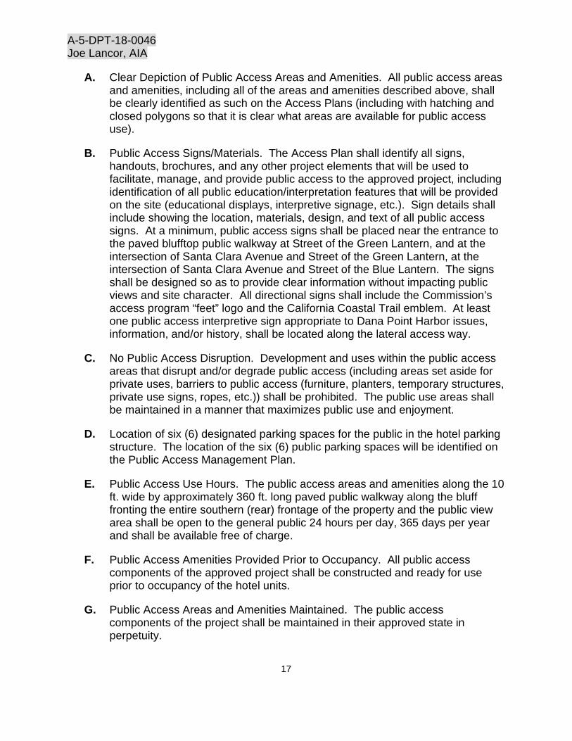
A. Clear Depiction of Public Access Areas and Amenities. All public access areas and amenities, including all of the areas and amenities described above, shall be clearly identified as such on the Access Plans (including with hatching and closed polygons so that it is clear what areas are available for public access use).
B. Public Access Signs/Materials. The Access Plan shall identify all signs, handouts, brochures, and any other project elements that will be used to facilitate, manage, and provide public access to the approved project, including identification of all public education/interpretation features that will be provided on the site (educational displays, interpretive signage, etc.). Sign details shall include showing the location, materials, design, and text of all public access signs. At a minimum, public access signs shall be placed near the entrance to the paved blufftop public walkway at Street of the Green Lantern, and at the intersection of Santa Clara Avenue and Street of the Green Lantern, at the intersection of Santa Clara Avenue and Street of the Blue Lantern. The signs shall be designed so as to provide clear information without impacting public views and site character. All directional signs shall include the Commission’s access program “feet” logo and the California Coastal Trail emblem. At least one public access interpretive sign appropriate to Dana Point Harbor issues, information, and/or history, shall be located along the lateral access way.
C. No Public Access Disruption. Development and uses within the public access areas that disrupt and/or degrade public access (including areas set aside for private uses, barriers to public access (furniture, planters, temporary structures, private use signs, ropes, etc.)) shall be prohibited. The public use areas shall be maintained in a manner that maximizes public use and enjoyment.
D. Location of six (6) designated parking spaces for the public in the hotel parking structure. The location of the six (6) public parking spaces will be identified on the Public Access Management Plan.
E. Public Access Use Hours. The public access areas and amenities along the 10 ft. wide by approximately 360 ft. long paved public walkway along the bluff fronting the entire southern (rear) frontage of the property and the public view area shall be open to the general public 24 hours per day, 365 days per year and shall be available free of charge.
F. Public Access Amenities Provided Prior to Occupancy. All public access components of the approved project shall be constructed and ready for use prior to occupancy of the hotel units.
G. Public Access Areas and Amenities Maintained. The public access components of the project shall be maintained in their approved state in perpetuity.

A-5-DPT-18-0046 Joe Lancor, AIA
18
The Permittee shall undertake development in conformance with the approved Public Access Management Plan unless the Commission amends this permit so as to relieve the Permittee of this obligation, or the Executive Director issues a written determination that no amendment is legally required for any proposed minor deviations.
8. Public Access Easement. PRIOR TO ISSUANCE OF THE COASTAL DEVELOPMENT PERMIT, Harbor Bluff Corp. (or its successor Permittee if applicable) shall execute and record a document, in a form and content acceptable to the Executive Director, irrevocably offering to dedicate to a public agency or private entity, approved by the Executive Director, a public access easement for public recreational access use in perpetuity, as described below.
A. Easement Area. The easement area shall consist of the public access walkway in the approved Revised Project Plans (Special Condition No. 1) and the approved Public Access Management Plan (Special Condition No. 7), generally described as the 10 ft. wide by approximately 360 ft. long landside public access walkway for lateral public access along the southern-most bluff-side portion of the property (see easement area generally depicted in Exhibit 7).
B. Allowed Development. No development, as defined in Coastal Act Section 30106, shall occur within the easement area except for the following: installation of hardscape, landscape, utilities, public access amenities, and signage as necessary. The document(s) shall also provide that public access along the public access way shall be uninterrupted at all times and allow maintenance and repair of approved development within the restricted area(s) approved by this coastal development permit, all as identified in the approved Revised Project Plans and approved Public Access Management Plan, consistent with the requirements of Special Conditions No. 1 and No. 7. Repair and maintenance associated with the allowed development, consistent with the terms and conditions of this CDP, shall also be allowed in the easement area. Harbor Bluff Corp. and their successors and assigns shall be jointly and individually responsible for the installation, repair, maintenance and accessibility of the public access areas, improvements and amenities for public recreational uses and enjoyment consistent with the terms and conditions of this CDP and the approved Public Access Management Plan. The document shall provide that the offer of dedication shall not be used or construed to allow anyone to interfere with any rights of public access acquired through use which may exist on the property, and shall also provide that public access consistent with the terms and conditions of this CDP shall be uninterrupted at all times.
C. Additional Parameters. The document shall also provide that all public access areas, improvements, and amenities within the easement area shall be available to the general public 24 hours a day and shall be free of charge. The public access easement shall be ambulatory, and the easement boundaries

A-5-DPT-18-0046 Joe Lancor, AIA
19
and amenities within (e.g., access ways, etc.) shall move inland within the Harbor Bluff Corp. (or its successor) property if relocation and/or reconstruction of public access amenities inland of the easement area are necessary to retain their continuity and/or utility in response to erosion and related coastal hazards.
D. Recordation. The document shall be recorded free of prior liens and any other encumbrances that the Executive Director determines may affect the interest being conveyed, and it shall include the approved Public Access Management Plan, a legal description of the legal parcels subject to this CDP as well as a metes and bounds legal description and a corresponding graphic depiction, drawn to scale, of the perimeter of the easement area within the subject property, prepared by a licensed surveyor based on an on-site inspection of the easement area.
E. Duration. The offer to dedicate shall run with the land in favor of the People of the State of California, binding successors and assigns of Harbor Bluff Corp. in perpetuity; shall be irrevocable for a period of 21 years, such period running from the date of recording; and shall indicate that the restrictions on the use of the land shall be in effect upon recording and remain as covenants, conditions and restrictions running with the land in perpetuity, notwithstanding any revocation of the offer.
9. Public Access Deed Restriction
A. PRIOR TO ISSUANCE OF THE COASTAL DEVELOPMENT PERMIT, and in order to implement the applicant’s proposal, the permittee shall execute and record a document(s) in a form and content acceptable to the Executive Director, restricting the use and enjoyment of the parcel(s), and providing public access, recreational uses, and public amenities in perpetuity as shown on Exhibit 7.
1. Public Access Areas. The deed restriction shall reflect that the permittee shall provide public access for recreational uses on the southern-most bluff-side edge of the property located at 34344 Street of the Green Lantern, consistent with the terms and conditions of this coastal development permit, in the following locations (as generally shown in Exhibit 7):
a. A 10 ft. wide by approximately 360 ft. long landside public access way for lateral public access along the southern-most bluff-side portion of the property.
Access improvements within the deed restricted areas shall be ambulatory, including that the deed restricted area boundaries and amenities (e.g., paths and trails, benches, interpretive signs) shall
A-5-DPT-18-0046 Joe Lancor, AIA
20
move inland within the permittee’s property, if relocation and/or reconstruction of access amenities in the deed restricted area is necessary to retain their continued use.
2. Development and Use Restrictions. No development, as defined in Section 30106 of the Coastal Act, shall occur within any of the public access areas described in subsection A.1 of this condition, and as described and depicted in Exhibit 7 of this staff report, except for the following development authorized by this coastal development permit:
Installation of hardscape, landscape, utilities, public access amenities, and signage. The document(s) shall also provide that public access along the public access way shall be uninterrupted at all times and allow maintenance and repair of approved development within the restricted area(s) approved by this coastal development permit.
B. The recorded document(s) shall include a legal description and corresponding graphic depiction of the legal parcel(s) subject to this permit and a metes and bounds legal description and a corresponding graphic depiction, drawn to scale, of the designated public access area(s) prepared by a licensed surveyor based on an onsite inspection of the public access area(s).
C. The deed restriction shall be recorded free of prior liens and any other encumbrances that the Executive Director determines may affect the interest being conveyed.
D. The deed restriction shall run with the land in favor of the People of the State of California, binding successors and assigns of the applicant or landowner in perpetuity.
10. Transportation Demand Management Plan. PRIOR TO ISSUANCE OF THE COASTAL DEVELOPMENT PERMIT, the permittee shall submit, for the review and written approval of the Executive Director, two (2) sets of a Transportation Demand Management Plan. The plan shall be prepared by a qualified professional. The plan shall include, at a minimum, the following components:
A. The permittee or any successor-in-interest or tenant of the permittee shall actively encourage employee participation in a Ride Sharing/Carpooling program, schedule shifts to benefit this program, and shall offer coordination services free of charge. A commuter information area shall be provided that offers employees appropriate information on available transportation alternatives to the single-occupancy vehicle (i.e., current maps, routes and schedules for public transit; ridesharing match lists; available employee incentives; ridesharing promotional material supplied by commuter-oriented
A-5-DPT-18-0046 Joe Lancor, AIA
21
organizations, etc.). This area shall be centrally located and accessible to all employees.
B. A public transit fare reimbursement program shall be implemented by the permittee or any successor-in-interest or tenant of the permittee. The permittee or any successor-in-interest or tenant of the permittee shall provide to employees of the development a minimum of 50% reimbursement to 100% of the public transit fare to and from work. Posters, brochures and registration materials of the program shall be available to employees at all times. Employees shall be informed of the program upon orientation and annually thereafter.
C. Provision of a short-term bicycle parking area for the public on the property outside of the public right-of-way. Short-term bicycle parking may be located outside or inside the building with direct access to a public street and shall be located to maximize visibility from the main entrance, no farther than 50 ft. of walking distance from a main pedestrian entrance. For buildings with more than one main pedestrian entrance, short term bicycle parking shall be split evenly among all main pedestrian entrances. Adequate lighting shall be provided to ensure safe access to bicycle parking facilities.
D. Provision of employee long-term bicycle parking and facilities for employee showers and lockers, free of charge, on the property and encouragement, to the extent possible, to walk or ride bicycles to and from work. Long-term bicycle parking shall be secured from the general public and enclosed on all sides and protect bicycles from inclement weather. Acceptable examples of long-term bicycle parking include bicycle lockers, bicycle rooms, or bicycle cages.
E. The permittee or any successor-in-interest or tenant of the permittee shall provide, to the maximum extent possible, communal bicycles and/or company vehicle(s) for employee use for worked related activities.
F. A Revised Site Plan identifying the number and location of proposed bicycle racks/bicycle parking areas on the project site; and also identifying the location of public transit and seasonal trolley stops in the vicinity of the project site.
The permittee shall undertake development in conformance with the approved Transportation Demand Management Plan unless the Commission amends this permit or the Executive Director provides a written determination that no amendment is legally required for any proposed minor deviations.
11. Construction Pollution Prevention Plan. PRIOR TO ISSUANCE OF THE COASTAL DEVELOPMENT PERMIT, the applicant shall submit, for the written approval of the Executive Director, a Construction Pollution Prevention Plan that

A-5-DPT-18-0046 Joe Lancor, AIA
22
includes, at a minimum, the following requirements to protect coastal water quality during construction and demolition activities:
A. General Construction-Phase Best Management Practices
(1). Best Management Practices (BMPs) designed to minimize adverse impacts resulting from construction and demolition activities shall be implemented prior to the onset of such activity, including BMPs to minimize erosion and sedimentation, minimize the discharge of pollutants and non-stormwater runoff, and minimize land disturbance and soil compaction, as applicable. The plan shall specify the description and location of all BMPs to be implemented during construction and demolition.
(2) All BMPs shall be maintained in a functional condition throughout the duration of the construction and demolition activities, and shall be promptly removed when no longer required.
(3) Sediment control BMPs shall be installed at the perimeter of staging and storage areas, to prevent sediment in runoff from construction-related activities from entering the storm drain system.
(4) The use of temporary erosion and sediment control products (such as fiber rolls, erosion control blankets, mulch control netting, and silt fences) that incorporate plastic netting shall be prohibited, to minimize wildlife entanglement and plastic debris pollution. Only products with 100% biodegradable (not photodegradable) natural fiber netting shall be allowed.
B. Stockpile and Debris Management
(1) All stockpiles, demolition and construction materials, debris, and waste shall be properly stored and contained, covered during rain events, and not stored in contact with the soil, and shall be located a minimum of 50 ft. from storm drain inlets.
(2) Demolition or construction debris shall be removed from work areas each day that demolition or construction occurs, to prevent the accumulation of debris, sediment, and other pollutants that may potentially be discharged into the storm drain system.
(3) All debris resulting from demolition or construction activities, and any remaining construction materials, shall be removed from the project site within 24 hours of completion of the project.
(4) All trash and debris shall be disposed of in the proper trash and recycling receptacles at the end of every construction day.

A-5-DPT-18-0046 Joe Lancor, AIA
23
(5) The permittee shall provide adequate disposal facilities for solid waste, including excess concrete, produced during demolition or construction.
(6) Debris shall be disposed of at a legal disposal site or recycled at a recycling facility. If the disposal site is located in the coastal zone, a coastal development permit or an amendment to this permit shall be required before disposal can take place unless the Executive Director determines that no amendment or new permit is legally required.
C. Spill Prevention and Equipment Maintenance
(1) Spill prevention and control measures shall be implemented to ensure the proper handling and storage of construction products or materials that may have adverse environmental impacts. The discharge of any construction products or materials into the storm drain system shall be prohibited.
(2) Leaks or spills of fuel, oil, grease, lubricants, hydraulic fluid, chemicals, preservatives, paints, or other construction products or materials shall be immediately contained onsite and disposed of in an environmentally-safe manner as soon as feasible.
(3) Construction vehicles operating at the project site shall be inspected daily to ensure there are no leaking fluids, and shall be serviced immediately if a leak is found.
(4) Fueling and maintenance of construction equipment and vehicles shall be conducted off-site, if feasible. Any fueling and maintenance of mobile equipment conducted on site shall take place at a designated area located at least 50 ft. from storm drain inlets (unless these inlets are blocked to protect against fuel spills). The fueling and maintenance area shall be designed to fully contain any spills of fuel, oil, or other contaminants. Equipment that cannot be feasibly relocated to a designated fueling and maintenance area (such as cranes) may be fueled and maintained in other areas of the site, provided that procedures are implemented to fully contain any potential spills.
(5) Equipment, machinery, and vehicles shall be washed only in designated areas specifically designed to contain runoff and prevent discharges into storm drain inlets. Thinners, oils, and solvents shall not be discharged into the sanitary sewer or storm drain systems.
D. The permittee shall undertake development in accordance with the approved plan. Any proposed changes to the approved final plan shall be reported to the Executive Director. No changes to the approved final plan shall occur without a Commission amendment to this coastal development permit, unless the Executive Director determines that no amendment is legally required.

A-5-DPT-18-0046 Joe Lancor, AIA
24
12. Revised Water Quality Management Plan. PRIOR TO ISSUANCE OF THE COASTAL DEVELOPMENT PERMIT, the applicant shall submit, for the written approval of the Executive Director, a Revised Water Quality Management Plan, prepared by a qualified licensed professional, that conforms with the plan submitted to the Commission titled Preliminary Water Quality Management Plan, prepared by Total Engineering, Inc., dated June 2017. The Revised Water Quality Management Plan shall demonstrate that the project complies with the following additional requirements for post-development water quality protection
A. BMP Sizing Calculations Using Design Storm Standard. The plan shall provide BMP sizing calculations for the proposed green roof, permeable pavement system, and underground stormwater harvesting tank, demonstrating that these BMPs shall be sized and designed to ensure that the project will retain onsite, at a minimum, the runoff volume produced by the 85th percentile 24-hour design storm, to the extent appropriate and feasible.
B. Underground Stormwater Storage Tank. The underground stormwater storage tank shall be sized and designed to retain onsite, for use in indoor plumbing and landscape irrigation, at a minimum, the runoff volume produced by the 85th percentile 24-hour design storm. The storage tank and usage of the stored stormwater shall also be designed to prevent the post-development runoff peak runoff flows discharged from the site from exceeding pre-project peak flows for the 2-year through 10-year storm events. If overflow runoff from the permeable pavement and/or green roof will be directed to the underground stormwater storage tank, this runoff volume shall be taken into account in calculations for sizing the storage tank.
C. Permeable Pavement System. The plan shall include a description of the design of the driveway’s permeable pavement system, specifying the type of permeable pavement, depth of sub-surface recharge bed, the runoff treatment volume provided, whether the system will infiltrate runoff into the underlying native soil, and where overflow runoff from the system will be directed. A monitoring and maintenance plan for the permeable pavement system shall be included in the plan.
D. Runoff from Green Roof. The plan shall include calculations of the expected volume of runoff that will be discharged from the green roof once the plant palette of the green roof has matured, and indicate where the runoff from the green roof will be directed. A monitoring and maintenance plan for the green roof shall be included in the plan.
E. Manage BMPs for Life of Development. Appropriate protocols shall be implemented to manage BMPs (including ongoing operation, maintenance, inspection, and training), to protect coastal water quality for the life of the development. Routine maintenance, including inspection and regular cleaning of structural BMPs, shall be performed to ensure their effectiveness prior to

A-5-DPT-18-0046 Joe Lancor, AIA
25
and during each rainy season, from October 15th through April 31st of each year.
The permittee shall undertake development in accordance with the final Water Quality Management Plan, unless the Commission amends this permit or the Executive Director issues a written determination that no amendment is legally required for any proposed minor deviations.
13. Resource Agencies. The permittee shall comply with all requirements, requests and mitigation measures from the California Department of Fish and Wildlife (CDFW), the Regional Water Quality Control Board (RWQCB); the U.S. Army Corps of Engineers (USACE), and the U.S. Fish and Wildlife Service (USFWS) with respect to preservation and protection of water quality and marine environment. Any change in the approved project that may be required by the above-stated agencies shall be submitted to the Executive Director in order to determine if the proposed change shall require a permit amendment pursuant to the requirements of the Coastal Act and the California Code of Regulations.
14. Bird Strike Prevention
A. PRIOR TO ISSUANCE OF THE COASTAL DEVELOPMENT PERMIT, the permittee shall submit final revised plans showing the location, design, height and materials of fences, screen walls and gates for the review and approval of the Executive Director. Said plans shall reflect the requirements of this special condition. Ocean front deck railing systems, fences, screen walls and gates subject to this permit shall use materials designed to minimize bird-strikes with the deck railing, fence, or gate. Such materials may consist, all or in part, of wood; wrought iron; frosted or partially frosted glass, Plexiglas or other visually permeable barriers that are designed to prevent creation of a bird strike hazard. Clear glass or Plexiglas shall not be installed unless appliqués (e.g. stickers/decals) designed to reduce bird-strikes by reducing reflectivity and transparency are also used. Any appliqués used shall be installed to provide coverage consistent with manufacturer specifications (e.g. one appliqué for every 3 foot by 3 foot area) and the recommendations of the Executive Director. Use of opaque or partially opaque materials is preferred to clean glass or Plexiglas and appliqués. All materials and appliqués shall be maintained throughout the life of the development to ensure continued effectiveness at addressing bird strikes and shall be maintained at a minimum in accordance with manufacturer specifications and as recommended by the Executive Director.
B. The permittee shall undertake development in accordance with the approved final plans. Any proposed changes to the approved final plans shall be reported to the Executive Director. No changes to the approved final plans shall occur without a Commission amendment to this coastal development

A-5-DPT-18-0046 Joe Lancor, AIA
26
permit unless the Executive Director determines that no amendment is legally required.
15. Future Development. This permit is only for the development described in CDP No. A-5-DPT-18-0046. Pursuant to Title 14 of the California Code of Regulations, Section 13253(b)(6), the exemptions otherwise provided in Public Resources Code Section 30610(b) including any exemption that might apply to the construction of a rooftop deck over the revised western portion of the hotel, shall not apply to the development governed by CDP No. A-5-DPT-18-0046. Accordingly, any future improvements to, the development authorized by this permit, including but not limited to repair and maintenance identified as requiring a permit in Public Resources Code Section 30610(d) and Title 14 of the California Code of Regulations, Sections 13252(a)-(b), shall require an amendment to CDP No. A-5-DPT-18-0046 from the Commission or shall require an additional CDP from the Commission or from the applicable certified local government.
16. Deed Restriction. PRIOR TO ISSUANCE OF THE COASTAL DEVELOPMENT PERMIT, the applicant shall submit to the Executive Director for review and approval documentation demonstrating that the landowners have executed and recorded against the parcel(s) governed by this permit a deed restriction, in a form and content acceptable to the Executive Director: (1) indicating that, pursuant to this permit, the California Coastal Commission has authorized development on the subject property, subject to terms and conditions that restrict the use and enjoyment of that property; and (2) imposing the Special Conditions of this permit as covenants, conditions and restrictions on the use and enjoyment of the Property. The deed restriction shall include a legal description of the entire parcel or parcels governed by this permit. The deed restriction shall also indicate that, in the event of an extinguishment or termination of the deed restriction for any reason, the terms and conditions of this permit shall continue to restrict the use and enjoyment of the subject property so long as either this permit or the development it authorizes, or any part, modification, or amendment thereof, remains in existence on or with respect to the subject property.

A-5-DPT-18-0046 Joe Lancor, AIA
27
IV. FINDINGS AND DECLARATIONS A. Project Location, Project Description, Standard of Review and Prior Permit History
Project Location
The project site is a 40,189 sq. ft. coastal blufftop lot overlooking Dana Point Harbor and the Pacific Ocean (Exhibit 1). The site is bordered by the Blue Lantern Inn to the east, and multi-family development and the City-owned Hilltop Park across Street of the Green Lantern to the west. To the north, across Santa Clara Avenue, is a retail commercial center, and to the south is an Orange County-owned and maintained coastal bluff that slopes from the bluff edge property line of the project site to the street below (Exhibit 1).
The project site is designated as Coastal Visitor Commercial District (C-VC) on the Coastal Land Use Regulations Map (Figure 13) of the Implementing Actions Program (Chapter III (B)(2)(b)) of the Dana Point Specific Plan (DPSP)/Local Coastal Plan (LCP), the Orange County Zoning Code (OCZC) of the 1986 DPSP/LCP, and is designated Tourist Recreational/Commercial on the Land Use Element Map (Figure 10) of the Land Use Plan of the 1986 DPSP/LCP. It is located within the appellate jurisdiction of the California Coastal Commission.
The C-VC District of the DPSP identifies hotels as a principal permitted use, as are the proposed accessory food service establishments (restaurant and café). The proposed accessory spa is considered a retail and service businesses associated with the needs of visitors and tourists, pursuant to Section i under the “Other Permitted Uses” section of the C-VC District.
Project Description
The proposed project consists of the demolition of an existing three-story, 10,400 sq. ft. restaurant (Cannons Seafood Grill) constructed in 1972, with associated exterior improvements including a bluff-side dining deck and a 78-stall surface parking lot, and construction of a 35 ft. high, multi-level, 44,164 sq. ft., 100-room resort hotel, with a 2,996 sq. ft. restaurant, patio and café, an 892 sq. ft. spa, and 54,731 sq. ft. of associated parking facilities with a total of 165 parking spaces in a covered, partially subterranean and subterranean parking garage on a coastal blufftop lot overlooking Dana Point Harbor and the ocean. A 10 ft. wide by approximately 360 ft. long paved blufftop public walkway is proposed along the seaward edge of the property, and the project is conditioned to include an irrevocable offer to dedicate this easement for public access. Six (6) car parking spaces are reserved in the hotel structure for free public use (Exhibits 2-3). A Tentative Tract Map is also proposed to consolidate five underlying legal lots that comprise the larger site to allow construction of the proposed hotel. Also,

A-5-DPT-18-0046 Joe Lancor, AIA
28
an existing service structure (used as a trash storage) on an adjacent property located west of the project site that is owned by the City of Dana Point will be reconstructed into a public viewing area, for the harbor and ocean below the site.
Standard of Review
Section 30604(b) of the Coastal Act states:
After certification of the local coastal program, a coastal development permit shall be issued if the issuing agency or the commission on appeal finds that the proposed development is in conformity with the certified local coastal program.
The standard of review for the Coastal Commission’s de novo hearing on this project is the City of Dana Point’s certified Local Coastal Program. Dana Point is a shoreline community in southern Orange County that incorporated as a City in 1989. On September 13, 1989, the Commission approved the City's post-incorporation LCP. The City’s LCP is comprised of a variety of planning documents. At the project site, the applicable document is the City’s certified 1986 Dana Point Specific Plan (DPSP)/Local Coastal Program (LCP).
Prior Permit History
Project Site
CDP No. 5-83-190
In October 1980, the Commission approved Administrative Coastal Development Permit No. A-80-7456 granted to Cannons Seafood Grill Restaurant for installation of six (6) horizontal drain holes and two (2) to three (3) ground water observation holes. Water produced by the horizontal drain hole system would be carried through a plastic pipe across a slide area and deposited in the parking lot below Cove Road. No special conditions were imposed.
Adjacent to Project Site: Bluff area below 34344 Street of the Green Lantern (Project Site) to Cove Road
CDP No. 5-83-190
In May 1983, the Commission approved Coastal Development Permit No. 5-83-190 granted to the County of Orange for the removal of slide debris and reconstruction of a portion of Cove Road, thereby stabilizing an existing landslide; and construction of a retaining wall to protect the public road, Cove Road. The Commission approved the project subject to one special condition requiring that the applicant shall provide for a blufftop walkway located generally along the alignment of the blufftop walkway depicted in the certified Land Use Plan (LUP). The condition stated that the walkway may be routed landward of the existing Cannons restaurant structure if, in the opinion of the Executive Director, the specific alignment depicted in the LUP is unsafe at that time.

A-5-DPT-18-0046 Joe Lancor, AIA
29
Furthermore, the condition stipulated that as used in the condition, “provide for” means to construct the bed for or to obtain appropriate easements for. In addition, full compliance with the condition shall occur prior to or coincide with completion of construction and shall be subject to prior review and approval of the Executive Director. Lastly, the condition stated that nothing in the condition would preclude the ultimate provision of the blufftop walkway along the preferred alignment as shown in the LUP as recycling of the blufftop development occurs.
CDP No. 5-83-190-A
On July 8, 1985, the County of Orange applied for an amendment to the original permit for the deletion of the special condition requiring blufftop walkway across top of the stabilized slope. Commission staff has conducted research to determine the outcome of this amendment application and based on the information we have; no action seems to have been taken.
B. Hazards
Dana Point Specific Plan (DPSP) Local Coastal Program (LCP) Policies
Section II. B. 1. a. “Land Use Plan/Resource Component/Introduction/Coastal Act Policies” of the City’s certified LCP states in part:
Section 30251. The scenic and visual qualities of coastal areas shall be considered and protected as a resource of public importance. Permitted development shall be sited and designed to protect views to and along the ocean and scenic coastal areas, to minimize the alteration of natural land forms, to be visually compatible with the character of surrounding areas, and, where feasible, to restore and enhance visual quality in visually degraded areas. New development in highly scenic areas such as those designated in the California Coastline Preservation and Recreation Plan prepared by the Department of Parks and Recreation And by local government shall be subordinate to the character of its setting.
Section 30253. New development shall:
1. Minimize risks to life and property in areas of high geologic, flood and fire hazard;
2. Assure stability and structural integrity, and neither create nor contribute significantly to erosion, geologic instability, or destruction of the site or surrounding area or in any way require the construction of protective devices that would substantially alter natural landforms along bluffs and cliffs.

A-5-DPT-18-0046 Joe Lancor, AIA
30
Section II. B. 4. a. 18, 21 and 23. “Land Use Plan/Resource Component/Environmental Hazards/Geologic Hazards/Policies” of the City’s certified LCP states in part:
18. In areas of new development, above-ground structures will be set back a sufficient distance from the bluff edge to be safe from the threat of bluff erosion for a minimum of 50 years. The City will determine the required setback. A geologic report shall be required by the City in order to make this determination.
21. Development and activity of any kind beyond the required blufftop setback will be constructed to ensure that all surface and subsurface drainage will not contribute to the erosion of the bluff face or the stability of the bluff itself.
23. A waiver of public liability shall be a condition of new development approvals for all property located in identified hazard areas (e.g., geologic, flood, fire, etc.).
Section II. B. 4. c. 1. “Land Use Plan/Resource Component/Environmental Hazards/Beach Erosion/Policies” of the City’s certified LCP states in part:
1. Construction of seawalls, cliff retaining walls, and other protective devices shall only be permitted when required to serve coastal dependent uses or to protect existing structures or public beaches in danger from erosion and when designed to mitigate adverse impacts on local shoreline and supply [Section 30235 of the Coastal Act].
Section II. E. 1. a. “Land Use Plan/New Development Component/Introduction/Coastal Act Policies” of the City’s certified LCP states in part:
Section 30253: New development shall:
Minimize risks to life and property in areas of high geologic, flood and fire hazard;
Assure stability and structural integrity, and neither create nor contribute significantly to erosion, geologic instability, or destruction of the site or surrounding area or in any way require the construction of protective devices that would substantially alter natural landforms along bluffs and cliffs;
Where appropriate, protect special communities and neighborhoods which, because of their unique characteristics, are popular visitor destination points for recreational uses.
Section III. C.18-19. “Implementation/General Provisions” of the City’s certified LCP states in part:

A-5-DPT-18-0046 Joe Lancor, AIA
31
18. A comprehensive geologic/soils report is to be presented to the Grading Section of Orange County EMA prior to any development activity in the landslide and fault hazard areas delineated on figure 2 HAZARDS, of the certified LCP.
At a minimum this report shall evaluate: geologic conditions including soil, sediment and rock types, evidence of past or potential landslide conditions and potential effects of development on landslide activities; impact of construction activity on site stability; ground and surface water conditions and variations potential erodibility; and mitigating measures.
The soils engineer and geologist most certify the suitability of a graded site prior to issuance of a coastal permit. Development projects shall incorporate all recommendations of the geology and soils reports and shall provide for the following:
a. At a minimum any development shall be required to maintain a 50-foot structural setback from any identified active fault.
b. New development shall be set back a sufficient distance from the bluff edge to be safe from the threat of bluff erosion for a minimum of 50 years. The County will determine the required setback based upon the geologic report and other applicable information.
This setback area shall be dedicated as an open space easement or deed restriction as a condition of the approval of new development.
c. Within the required blufftop setback, drought-tolerant vegetation shall be maintained. Grading, as may be required to establish proper drainage or to install landscaping, and minor improvements that do not impact public views or bluff stability, may be permitted.
Development and activity of any kind beyond the required blufftop setback shall be constructed to ensure that all surface and subsurface drainage will not contribute to the erosion of the bluff face or the stability of the bluff itself.
No development shall be permitted on the bluff face, except for engineered staircases or access ways to provide public beach access. Drainpipes will be allowed only where no other less environmentally damaging drain system is feasible and the drainpipes are designed and placed to minimize impacts to the bluff face, toe, and beach. Drainage devices extending over the bluff face will not be permitted if the property can be drained away from the bluff face.

A-5-DPT-18-0046 Joe Lancor, AIA
32
19. A waiver of public liability shall be a condition of new development approvals for all property located in identified hazard areas depicted in Figure 2.
The waiver shall be in the form of a deed restriction for recording, free of prior liens except tax liens, that binds the applicant and any successors in interest. The form and content of the deed restriction shall be subject to the review and approval of the Director, EMA. The deed restriction shall provide that (1) the applicant understands that the site is subject to the specified extraordinary hazard from erosion and from bluff retreat, wave hazards, etc.) and that applicant assumes the liability from these hazards (2) the applicant unconditionally waives any claim of liability on the part of the Commission or any other public agency for any damage from such hazards and (3) the applicant understands that construction in the face of these known hazards may make him or her ineligible for public disaster funds or loans for repair, replacement or rehabilitation of the property in the event of erosion, landslides, wave damage, etc.
The proposed project is the demolition of an existing restaurant and construction of a new hotel and additional development on top of a 165 to 180 ft. high coastal bluff with a history of stability issues located on the eastern flank of the Dana Point Headlands, overlooking the Dana Cove (Dana Point Harbor). The bluff is a former seacliff that has been cut off from marine erosion since the construction of Dana Point Harbor in the 1960s. The toe of the bluff is now separated from the shoreline by a graded slope (supporting Cove Road) and an extensive area of fill occupied by several parking lots and Dana Point Harbor Drive (Exhibit 1).
The lower portion of the coastal bluff, adjacent to and below the project site, experienced a failure in 1980. Cove Road is below the lower portion of the bluff where the failure occurred, which is a public road that provides access to the harbor. Cove Road is accessible from Street of the Green Lantern, which is the street that fronts the project site. The 1980 slope failure resulted in the temporary closure of Cove Road.
The failure occurred along the inactive Dana Cove Fault that bisects the western portion of the site and runs directly beneath the existing restaurant building. The fault separates two different rock formations, the San Onofre Breccia and the Capistrano Formation. On the western side of the fault, the bluff consists of hard, cemented San Onofre Breccia bedrock, which is strong and intact, very resistant to erosion, and at low risk for slope failures. On the eastern side of the fault, the bluff consists of Capistrano Formation siltstone that is fractured and deformed and is susceptible to landsliding and failure. It was within this zone of broken rock immediately east of the fault that a large wedge failure occurred during heavy rains in 1980. The landslide occurred on the bluff face immediately south of the existing restaurant. Landslide materials buried Cove Road, and the restaurant itself was deemed to be at imminent risk from further slope failures.

A-5-DPT-18-0046 Joe Lancor, AIA
33
The County of Orange was required to repair the bluff in response to a court order obtained by the owners of the Cannons restaurant, as all of the slide occurred on property owned by the County. The repair consisted of the installation of bluff protective structures to restore access to Cove Road and alleviate the threat to the restaurant building. The upper bluff is held in place by an anchored concrete slab providing lateral support to weak Capistrano Formation materials, on the east side of the fault, that were considered at high risk of additional failure. The structure is stabilized by large (80 – 100 ft. long) rock anchors drilled across the fault into competent San Onofre Breccia bedrock. Several other upper bluff retaining walls were also constructed to retain loose materials on the bluff face on the west side of the fault. On the lower bluff above Cove Road, the landslide debris were excavated and replaced by a graded fill slope, which was further supported by a large crib-type retaining wall along the northern (inland) side of the road. The County of Orange completed repairs in 1985 consistent with CDP No. 5-83-190 approved by the Commission in May 1983.
The City’s certified 1986 DPSP/LCP includes policies including incorporation of Section 30253 of the Coastal Act, which states that new development must minimize risks to property in areas subject to hazards and must assure stability and structural integrity and neither create nor contribute significantly to erosion, geologic instability, or destruction of the site or surrounding area or in any way require the construction of protective devices that would substantially alter natural landforms along bluffs and cliffs. The DPSP/LCP also incorporates language similar to Section 30235 of the Coastal Act through Section II. B. 4. c. 1, which states that bluff protective devices shall only be permitted to protect existing development. Also, to address new development that is subject to hazards, the City’s certified 1986 DPSP/LCP includes Section II. B. 4. a. 18, which states the setback for new development shall be a sufficient distance from the bluff edge to be safe from the threat of bluff erosion for a minimum of 50 years based upon a geologic report and other applicable information.
The City’s certified DPSP/LCP requires the proposed project to minimize risks to life and property in this area of high geologic hazard and not be reliant upon protective devices or require the construction of bluff protective devices. In order to address geologic site conditions of the project site, a minimum 25 ft. blufftop setback was incorporated into the proposed project. As stated earlier, the site has been subject to geologic instability. Therefore, there is a concern whether the proposed hotel development, including the paved public blufftop walkway, is sufficiently setback to be safe from the threat of bluff erosion for a minimum of 50 years. The application also raises questions about whether or not the currently proposed new development will adversely impact geologic stability, and either is reliant upon the bluff protective devices or will create the need for an additional bluff protective device.
Geologic Setback Line (GSL) Determination
To find a proposed blufftop development consistent with the City’s DPSP/LCP policies on development and shoreline and bluff protective devices, the project must be sited such that it will not require a bluff protective device that would substantially alter natural

A-5-DPT-18-0046 Joe Lancor, AIA
34
landforms along the bluffs throughout its useful life. As evidenced by the bluff protective devices fronting the project site, the proposed development is clearly in a hazardous location and needs to be sited so it is not reliant upon the existing protective devices nor in the future requires the installation of bluff protective devices. While the new development will be located landward of the existing restaurant and accessory structure, it will still be located in a potentially hazardous location. A Factor of Safety (FoS) of 1.5 is the industry standard for new development and has been the Commission’s benchmark for “stability” under Section 30253 of the Coastal Act over the years.
In general, when a blufftop property is redeveloped, the Commission requires that the new development be sited in a location that assures stability for the economic life of the proposed structure. In this case, the certified LCP specifies new development shall be set back from the bluff edge a sufficient distance to ensure that it will not be in danger from erosion and that it will ensure stability for its projected 50-year economic life. A Geologic Setback Line (GSL) to assure such stability for new development must be determined on a case-by-case basis for each property.
To further assess the geologic stability of a project site, a geotechnical report must be submitted which includes a site-specific quantitative slope stability analyses and an estimation of the long-term erosion rate for the area. Assessing the stability of slopes against land sliding is undertaken through a quantitative slope stability analysis. In such an analysis, the forces resisting a potential landslide are first determined. These are essentially the strength of the rocks or soils making up the bluff. Next, the forces driving a potential landslide are determined. These forces are the weight of the rocks as projected along a potential slide surface. The resisting forces are divided by the driving forces to determine the “factor of safety.” A value below 1.0 is theoretically impossible, as the slope would have failed already. A value of 1.0 indicates that failure is imminent. Factors of safety at increasing values above 1.0 lend increasing confidence in the stability of the slope. A slope stability analysis is performed by testing hundreds of potential sliding surfaces. The surface with the minimum factor of safety will be the one on which failure is most likely to occur. Generally, as one moves back from the top edge of a slope, the factor of safety against land sliding increases. Therefore, to establish a safe setback for slope stability from the edge of a coastal bluff, one needs to find the distance from the bluff edge at which the factor of safety is at least or equal to 1.5.
Site Analysis
Site Stability
For purposes of discussing geologic stability at the project site and evaluating the applicant’s proposed measures for addressing stability concerns of the bluff, it is useful to divide the site into four generalized sectors: (1) The Western Bluff located to the west of the Dana Cove Fault, which is comprised of stable San Onofre Breccia bedrock; (2) The 1980 Landslide Zone, which is comprised of a narrow band of fractured and

A-5-DPT-18-0046 Joe Lancor, AIA
35
deformed Capistrano Formation rock located immediately east of the Dana Cove Fault; (3) The Central Bluff, which is east of the fault and is comprised primarily of Capistrano Formation sandstone; and (4) The Eastern Bluff, which is further east of the fault and is comprised of Capistrano sandstone interbedded with layers of weaker siltstone (Exhibit 4). The geologic differences among these four zones dictate the degree of bluff stability, the bluff-top setbacks needed to assure required factors of safety against slope failure, and the engineering approaches proposed by the applicant to assure the stability of new development without reliance on the existing stabilization structures.
During the course of the Commission review process, the applicant provided Commission staff multiple geotechnical reports by their geologist, Geofirm. The first of these reports dated 6/24/15 included slope stability analyses for the Western, Central and Eastern Bluff portions of the site based on present-day conditions, with the existing bluff protection devices in place. This Geofirm report also provided cross sections that spanned these bluff sections of the site: Western Bluff (Section A-A’), Central Bluff (Section B-B’) and Eastern Bluff (Section C-C’) portions of the site. A second report dated 5/19/20 re-evaluated slope stability along the Western Bluff and Central Bluff while discounting the stabilizing effects of the bluff protective devices. Neither of these reports evaluated the 1980 Landslide Zone itself, presumably because this area had been previously stabilized by the County-maintained retaining walls. However, in order for the Commission to determine where new development could be safely sited within relying on bluff protection devices, it is also necessary to understand the stability of the bluff in the Landslide Zone in the absence of the retaining structures. A previous geotechnical evaluation of this particular portion of the bluff is provided by another report produced in 1989 following the County’s stabilization project(Kerwin 1989).1 In November 2020, Geofirm provided an additional slope stability analysis of the Landslide Zone (represented by Section E-E’) with a newly proposed deepened foundation system in place (to be discussed later).
Regarding the Western Bluff (consisting of intact, well-cemented San Onofre Breccia), the 2015 Geofim report found this portion of the bluff, which includes portions of the existing upper and lower bluff retaining structures, to be grossly stable under present conditions, with minimum factors of safety of 1.9 (static) and 1.5 (seismic). The follow-up May 2020 report indicates that without the bluff protection structures, the bluff would remain grossly stable (FoS > 1.5 /1.1), but that the unretained upper bluff terrace deposits would be unstable, with a minimum static FoS of 0.7. The analysis indicates that in the absence of the upper bluff retaining walls a blufftop setback of about 35 ft. would be necessary to achieve a 1.5 FoS (1.1 seismic FoS) within the upper bluff materials.
1 Kerwin, S.T., 1989. Sea cliff stabilization using long rock anchors. In Cann, L.R., and Steiner, E.A., (eds.), Engineering Geology Along Coastal Orange County, Association of Engineering Geologists, Southern California Section Guidebook, p. 103-116.

A-5-DPT-18-0046 Joe Lancor, AIA
36
The 1980 Landslide Zone located on the east side of the Dana Cove Fault consists of weakened Capistrano Formation rock. The existing bluff protection structures have effectively stabilized the bluff face on either side of the Dana Cove Fault for the past 35 years, and the slope stability analysis provided by the 2015 Geofirm report indicates that the anchor slab and sidewalls assure factors of safety in excess of 1.5 (static) / 1.1 (seismic) in the most vulnerable area nearest the bluff edge. However, the 1989 Kerwin report indicates that the factors of safety are below 1.5/1.1 without the tieback loading; specifically, a factor of safety of 1.0 was estimated for a wedge of bluff material extending approximately 40 feet inland. No analysis is available to indicate the blufftop setback that would be needed to achieve the required factors of safety in the absence of the stabilization structures. However, it is likely the setback would be substantially more than 40 ft.
The 2015 Geofirm report states that the Central Bluff portion of the project site, located approximately 45 ft. east of the Dana Cove Fault, consists of intact, relatively strong Capistrano Formation sandstone topped by terrace deposits. At the toe of the bluff, this section intersects with the Eastern Bluff section of the fill slope reconstruction crib walls above Cove Road that were part of the repair work following the 1980 landslide. This portion of the bluff was found to be grossly stable in both the 2015 (with lower bluff protection) and 2020 (without lower bluff protection) Geofirm analyses, with FoS above 1.5 (static) and 1.1 (seismic).
The Eastern Bluff portion of the site is comprised of Capistrano Formation rock and occurs entirely to the east of the existing bluff protection structures. The Geofirm slope stability analyses (2015 and 2020) determined that the bluff on this portion of the site is stable, but with a minimum factor of safety of 1.4 (static). This lower factor of safety is likely due to the presence of the somewhat weaker siltstone beds within the Capistrano Formation in this portion of the bluff. The 2020 analysis indicates that a 1.5 FoS is achieved approximately 65 ft. inland of the bluff edge along this cross-section.
Long-term Bluff Erosion & Retreat
For several reasons, significant bluff erosion and retreat is unlikely to occur over the minimum 50-year project life mandated in the Dana Point LCP. First, as noted earlier, the toe of the bluff is no longer subject to wave action and marine erosion due to the shoreline changes related to the construction of Dana Point Harbor. The United States Geologic Service (USGS) Coastal Storm Modeling System (CoSMoS) projection tool indicates that flooding of the harbor parking lots could occur under the higher future sea level rise projections (>4.9 ft. Sea Level Rise (SLR)) and storm conditions, but that waves would not reach the base of the slope below Cove Road and the project site even with 6.6 ft. (2 m) of SLR. In short, the likelihood of significant marine erosion of the bluff over the project life is negligible. Second, the bluffs underlying most of the project site are relatively stable and are unlikely to experience significant slope failures over the project life. The one location where this is not true, in the Landslide Zone immediately east of the Dana Cove Fault, the bluff has been stabilized by protection
A-5-DPT-18-0046 Joe Lancor, AIA
37
structures. As a result, bluff retreat at the site over the next 50 years will likely be limited to subaerial erosion processes.
The 2015 Geofirm report examined historical aerial photographs dating to 1970 and did not detect any significant erosion or bluff retreat on the western and central portions of this site, which they attribute in part to the stabilization structures and drainage improvements installed after the 1980 landslide. Geofirm estimated that up to a few feet of bluff edge erosion had occurred in the upper bluff terrace deposits on the eastern portion of the site, translating into an erosion rate of 1-2 inches per year since 1972. Based on this analysis, Geofirm indicated that 50-100 inches (4-8 feet) of upper bluff retreat could occur over the next 50 years, although drainage improvements associated with the proposed project may reduce the potential for erosion from uncontrolled runoff. The 2015 Geofirm report analysis did not evaluate the potential for future bluff retreat on the Western and Central Bluff Portions of the site in the absence of the existing bluff protection devices. However, because the upper bluff terrace deposits in these areas are very similar to those on the Eastern Bluff and would be subject to the same processes of subaerial erosion, it is reasonable to apply the estimated historic erosion rates from the Eastern Bluff to the entire site.
Total Setbacks (not reliant upon protection)
The City of Dana Point LCP requires new development to be setback a sufficient distance from the bluff edge to be safe from the threat of bluff erosion for a minimum of 50 years without relying on shoreline or bluff protection structures. Furthermore, it states that the setback will be based upon a geologic report and other applicable information and in this case a minimum 25 ft. setback from the bluff edge has been proposed by the applicant. The Commission has typically interpreted these policies to require a minimum 25 ft. blufftop setback sufficient to maintain a 1.5 factor of safety at the site of the new development over the full project life, accounting for the amount of bluff retreat that can be expected to occur over this time period. In the absence of bluff protection structures or other engineered stabilization, the following total bluff edge setbacks would be necessary to assure the stability of new development at the project site over the next 50 years:
Western Bluff: 39 - 43 ft. (35 ft. for 1.5 FoS against upper bluff failure + 4-8 ft. for future bluff retreat)
Landslide Zone: Unknown, but likely much greater than 50 ft. (40 ft. for just FS 1.0; see above)
Central Bluff: 4 - 8 ft. (0 ft. for 1.5 FoS + 4-8 ft. for future bluff retreat)
Eastern Bluff: 69 - 73 ft. (65 ft. for 1.5 FoS + 4-8 ft. for future bluff retreat)
In the Western Bluff, Landslide Zone and Eastern Bluff areas, the proposed development footprints would have a minimum setback of 25 ft. but would not assure

A-5-DPT-18-0046 Joe Lancor, AIA
38
stability over the full project life without relying on bluff protection devices. However, as described below, the applicant has proposed several engineered foundation systems that would allow new development to be sited in more seaward locations while avoiding reliance on new or existing bluff or shoreline protective devices.
Proposed Engineering Measures to Assure Stability and Allow for Reduced Development Setbacks
The Western Bluff area and Landslide Zone are currently stabilized by several bluff protection structures installed in the aftermath of the 1980 Cove Road landslide. A side wall extending west of the Dana Cove Fault serves to retain and stabilize oversteepened upper bluff terrace deposits that would otherwise be prone to failure, while the large, anchored retaining wall east of the fault protects against further deep-seated slope failures in the weakened Capistrano Formation siltstone immediately east of the Dana Cove Fault. The proposed 25-ft. development setback for the proposed westernmost resort building would not, in the absence of these bluff protection structures, be sufficient to achieve a 1.5/1.1 FS and protect against potential bluff retreat.
In order to overcome these challenges, the applicant has proposed to use a Clear Span and Truss Foundation System that would bridge the Dana Cove Fault and unstable bluff materials that are supported by the existing tieback anchor system, and thus provide a stable foundation for the new development without relying on the existing protection structures. The proposed 52-ft. long truss span would be supported at the four corners by four isolated bridge supports (abutments or piers) drilled deep into stable bedrock (Exhibit 5). The southwestern supports (S1 and S2) would be embedded into stable San Onofre breccia on the west side of the fault, below the existing tieback anchors. The northeastern supports (N1 and N2) would be installed east of the fault trace. These supports would be drilled through the terrace deposits and Capistrano Formation rock, through the inclined fault plane, and terminate in stable San Onofre bedrock.2 The supplemental slope stability analysis provided by Geofirm dated 11/5/20 indicates that this proposed foundation system would achieve the required 1.5 (static) and 1.1 (seismic) factors of safety for the new building without relying on the existing bluff protection systems. Moreover, because the truss span would be supported by only four widely spaced support structures (likely piers) this foundation system would not retain the bluff or act as a bluff protection device. East of the truss span, the building could be built on a conventional foundation. The proposed building and foundation elements would be set back a minimum of 25-feet from the bluff edge and would, even in the absence of the existing bluff protection devices, not be affected by incremental bluff edge retreat (of 4-8 feet) within a 50-year project life.
2 The plane of the Dana Cove Fault dips approximately 70 degrees to the east, meaning that a pier support drilled vertically into the bluff immediately east of the fault will, at depth, cross the fault plane into the rock located on the west side of the fault.

A-5-DPT-18-0046 Joe Lancor, AIA
39
An additional challenge associated with this proposed foundation system is the presence of the existing tieback anchor system within the bluff. The northern bridge supports (N1, N2) would be located at a distance from the existing anchor arrays, but the southern bridge supports (S1, S2) would need to be drilled close to the existing anchors, which extend 80 – 100 ft. into the bluff. In order to avoid overlap with and potential damage to the existing anchors during the excavation of the southern bridge supports, the applicant proposes to map and verify the exact locations of the buried tieback anchors and tendons using ground penetrating radar (GPR).
The Central Bluff area east of the landslide zone was found to be grossly stable (FoS > 1.5/1.1), and potential incremental bluff edge retreat over the next 50 years is unlikely to exceed 8 ft. Thus, new development in this area need only meet a minimum 25 ft. setback and based on project plans, proposed new structures in this area would all be 25 ft. or more from the bluff edge, and would be supported on conventional foundations.
As discussed earlier, the 2015 and 5/19/20 Geofirm slope stability analyses found that the Eastern Bluff portion had a minimum static FoS of 1.4, less than the standard required and California Building Code, and that a 1.5 FoS was achieved 65 ft. inland of the bluff edge. The original project design proposed to install a line of caissons with tieback anchors approximately 25-30 feet inland of the bluff edge to increase the FoS above 1.5 and allow for new development closer to the bluff edge. However, in response to Commission staff concerns that the proposed caissons would not minimize alteration to the natural landform and could represent a bluff protection structure, Geofirm evaluated two alternatives in their 5/19/20 report. The first alternative involved the elimination of the caissons and use of a buried grade beam with tieback anchors installed beneath the patio area, in the same location as the caisson system.
The second alternative, which the applicant has now proposed, is a Cantilevered Foundation Design for the portion of the proposed building that would extend seaward of the 1.5 FoS line. Under this design, the portion of the building extending beyond the 1.5 FoS line would be built atop a ground-level cantilever that is structurally connected to the main foundation located landward of the 1.5 FoS line. In other words, although the building footprint would still extend to within about 40 ft. of the bluff edge, all building loads would be supported by foundations located in areas of the bluff achieving a 1.5 FS. Based on the conceptual plans submitted by the applicant in May 2020, the foundation element (anchor wall) supporting the cantilever would be located approximately 70-95 feet inland of the bluff edge. This total setback would be sufficient to sustain a 1.5/1.1 FoS and accommodate potential incremental bluff retreat (estimated 4-8 ft.) over the next 50 years.
However, to ensure that the proposed development is consistent with the policies of the DPSP/LCP, several special conditions have been imposed. The project site is known to be hazardous and unpredictable. Since the applicant has chosen to construct the proposed development in this location despite these risks, the Commission imposes several special conditions. The proposed development has been designed so that it would not rely upon the existing bluff protective device nor will it require a future bluff

A-5-DPT-18-0046 Joe Lancor, AIA
40
protective device. However, to ensure that the proposed development does not in the future require such devices, the Commission imposes Special Condition No. 3, which requires the applicant to agree that no new bluff protective shall ever be constructed to protect the blufftop development. The Commission also imposes Special Condition No. 4, which requires the applicant to acknowledge the risks and indemnify the Commission against claims for damages that may occur as a result of its approval of this permit.
While the applicant has proposed changes to the foundation system so that the proposed development would be consistent with the DPSP/LCP, not reliant upon the existing bluff protective devices, setback a sufficient distance to achieve a 1.5 factor of safety from the bluff edge, and to be safe from the threat of bluff erosion for a minimum of 50 years, the applicant has not submitted final plans for the proposed Clear Span and Truss Foundation System for the Western Bluff and Landslide Zone area of the development and the Cantilevered Foundation Design for the Eastern Bluff area of the development. Therefore, the Commission imposes Special Condition No. 1, which requires the applicant, prior to issuance of the permit, to submit Final Foundation Plans including the Clear Span and Truss Foundation System for the Western Bluff and Landslide Zone area of the development and the Cantilevered Foundation Design.
While the proposed buildings have been designed so as not to be reliant upon the existing bluff protective devices or in the future require such devices, the proposed 10 ft. wide and approximately 360 ft. long paved public walkway spanning along the entire southern blufftop portion of the property is to be located within the 25-ft. blufftop setback and would be reliant upon the existing protective devices. As such, the proposed paved blufftop public walkway may be impacted if a hazardous event results in the failure of the protective devices. However, as conditioned pursuant to Special Condition No. 8 requiring an irrevocable offer to dedicate for public access easement be imposed on the blufftop public walkway and Special Condition No. 9, which requires the owner to record deed restriction restricting the use and enjoyment of the parcel, and providing public access, recreational uses, and public amenities in perpetuity, the proposed paved blufftop public walkway within the easement and deed restricted area shall be ambulatory and therefore shall move inland within the project site if relocation and/or reconstruction of the public walkway is necessary to retain its continued use due to the failure of the existing bluff protective devices and/or erosion of the bluff.
In addition, to assure that future owners of the property are aware of potential hazards of the property and permit requirements, the Commission imposes Special Condition No. 16 , which requires a deed restriction to be recorded against the property that identifies the terms and conditions of the subject permit.
Thus, as conditioned, the Commission finds that the proposed project is consistent with policies of the City’s certified DPSP/LCP, requiring that new development minimize risks to life and property in this area of high geologic hazard and not rely upon protective devices or require the construction of bluff protective devices.

A-5-DPT-18-0046 Joe Lancor, AIA
41
C. Lower Cost Accommodations
Dana Point Specific Plan (DPSP) Local Coastal Program (LCP) Policies
Section II. D. 1. a. “Land Use Plan/Access Component/Introduction/Coastal Act of 1976” of the City’s certified LCP states in part:
Section 30213. Lower cost visitor and recreational facilities and housing opportunities for persons of low and moderate income shall be protected, encouraged, and where feasible, provided.
Coastal Act Section 30213, as incorporated into the DPSP/LCP, requires lower-cost facilities to be protected, encouraged, and, if feasible, provided. In a November 2016 report to the Commission, Commission staff found that, since 1989, out of six hotel “cost” categories ranging from “economy” to “luxury,” a total of 24,720 economy hotel rooms were lost, compared to 11,247 hotel rooms in the remaining five categories. Economy rooms have been lost over the same time period at over twice the rate of all other cost categories combined. Over the years, issues related to lower-cost overnight accommodations have been especially important because permit applicants have often requested that the Commission and LCP-certified local governments approve higher-cost overnight accommodations on land zoned for visitor-serving uses (in some locations where lower-cost accommodations are already situated) rather than pursuing lower-cost accommodations (e.g., economy hotels).
Background research for a 2006 Commission workshop showed that only 7.9% of overnight accommodations in nine (9) popular coastal counties were considered lower cost, affirming the ongoing need for more effective implementation of Coastal Act Section 30213 and LCP equivalents. Additionally, the Commission has fielded increasing applications for the conversion of hotels and motels, or the construction of hotels and motels as time shares, condominiums, or similar ownership frameworks. Overall, the Commission must guard against the loss or preclusion of lower-cost overnight accommodations along the coast, as recognized in the Dana Point LCP.
To facilitate lower-cost accommodations, the Commission has focused on three (3) primary methods where proposed visitor-accommodating development would have adverse impacts on lower-cost accommodations either through conversion of existing stock or preclusion of lower-cost accommodations: (1) ensure lower-cost accommodations are provided onsite as some portion of the proposed project; (2) ensure an equivalent number of lower-cost units are created off-site; or (3) ensure “in-lieu” funds are paid to create an equivalent amount of new lower-cost accommodations to be constructed elsewhere. To implement any of these options, the Commission must first: (1) define what is and is not a lower-cost unit; and (2) determine how many units per a given proposed project should be reserved as lower-cost. Under any of the approaches, the basis for requiring lower-cost accommodations (or an in-lieu fee payment) as mitigation for approval of a higher-cost accommodation project is premised

A-5-DPT-18-0046 Joe Lancor, AIA
42
on the adverse impacts that the higher-cost accommodations, if approved, have either on the existing stock of lower-cost accommodations or the availability of space for lower-cost accommodations in the future.
Defining Low-, Moderate-, and High-Cost Accommodations
The first step to implement Dana Point’s LUP Section II. D. 1. a (Coastal Act Section 30213) is to define what is and is not a lower-cost unit. In a constantly changing market, it can be difficult to define what price point constitutes low-, moderate-, and high-cost accommodations for a given area. As such, the Commission has utilized different approaches over time to define such terms, including by considering the unique factual circumstances for each particular project. In previous actions, the Commission has addressed appropriate terms for lower-cost and high-cost hotels, including applying a quantitative methodology for determining what is considered “lower cost.” The formula is based on California hotel and motel accommodations (single room up to double occupancy), and does not account for hostels, RV parks, campgrounds or other alternative accommodations, as these facilities do not typically provide the same level of accommodation as hotels and motels. Rather, hostels and campgrounds are generally lower-cost, and are the type of facilities that a mitigation measure for the loss of lower-cost overnight accommodations might require.
The formula calculates the average daily peak rate (generally July and August) of lower-cost hotels and motels based on the average daily rates of hotels and motels across the entire State of California. Under this formula, lower cost is determined as the average daily room rates for all hotels within a specific area that have a room rate 75% less than the statewide average daily room rate. This percentage reflects the Coastal Conservancy’s 2019 Explore the Coast study,3 in which lower cost coastal accommodations were defined as those having a daily rate of 75% or less of the statewide ADR. To obtain data inputs for the formula, statewide average daily room rates (ADR) are collected monthly by Smith Travel Research (STR) and are available on the “Visit California” webpage. To be most useful, peak season (summer) rates for standard, double occupancy rooms are utilized for the formula, and to ensure that the lower-cost hotels and motels surveyed meet a minimally acceptable level of quality, including safety and cleanliness, standard use of the formula only includes AAA Auto Club-rated properties, that are rated one- and two-diamond rated hotels. Once the low-cost rate is identified, the Commission has determined that the high-cost rate are generally prices 125% of the statewide average daily room rate. By definition, the hotel rooms that are more expensive than the low-cost room rate as calculated, but less expensive than the high-cost room rate as calculated, qualify as moderate-cost rooms. In other words, if $100 was the statewide average room rate, and low-cost rooms were determined to be 25% less (or $75), then high cost would be defined as those rooms
3 https://scc.ca.gov/webmaster/ftp/pdf/sccbb/2019/1903/20190314Board04E_ETCO-Report.pdf

A-5-DPT-18-0046 Joe Lancor, AIA
43
125% of the statewide average, or $125. The moderate-cost rooms would range between $75 to $125.
Number of Required Lower-Cost Rooms
After defining the project as low-, moderate-, or high-cost, the Commission must next determine how many, if any, lower-cost rooms/units should be provided for a given project as mitigation for impacts to lower-cost visitor accommodations caused by the proposed development. Typically, the Commission has required replacement of any lost lower cost rooms (either onsite or off-site), or payment of an in-lieu fee for each lost lower-cost room at a rate of 1:1, plus 25% of the new high-cost rooms proposed in order to mitigate for the loss of lower-cost overnight accommodations both now and in the future. In other words, the exact number of lost lower cost rooms would need to be replaced onsite, off-site, or through payment of an in-lieu fee, while 25% of the proposed high-cost rooms would need to be reserved at the identified low-cost rate. Although the provision of onsite lower-cost accommodations is superior, if onsite provision is found to be infeasible, the Commission has alternatively required “in-lieu” mitigation payments for the construction of an equivalent number of lower-cost rooms/units (such as hostel beds) offsite. The funds are paid into an account managed by an appropriate entity, including the local government, State Coastal Conservancy, California State Parks, Hostelling International, or similar agency familiar with low-cost accommodations management to ensure that such funds are spent on new lower cost units, including new campground and hostel facilities.
Proposed Project
First, using the Commission’s methodology, as described above, to define the low-cost room price threshold, Commission staff obtained statewide peak season (July and August 2019) average daily room rates (ADR) collected monthly by Smith Travel Research (STR) and available on the “Visit California” webpage, which were $172.66 for July 2019 and $173.85 for August 2019. The average daily room rates for the year 2019 are being used since the average daily room rates for 2020 have dropped significantly due to the COVID-19 pandemic and would not correctly identify average daily room rates under non-pandemic circumstances. Using the July 2019 ADR, the low-cost rate is $129.50, high-cost rate is $215.83, and the moderate-cost is between $129.51 and $215.82. Using the August 2019 ADR, the low-cost rate is $130.39, high-cost rate is $217.31, and the moderate-cost is between $130.39 and $217.30. Taking an average from both July 2019 and August 2019, you get the following statewide rate: 2019 ADR is $173.26, the low-cost rate is $129.95, high-cost rate is $216.57, and the moderate-cost is between $129.95 and $216.57.
As stated previously, the applicant has offered to provide 25% of its rooms, a total of 25 rooms, at a rate considered to be low-cost: 75% of the ADR, which in this case is $129.95 (rounded to $130.00) based on the average ADR of $173.26 for July 2019 and August 2019.

A-5-DPT-18-0046 Joe Lancor, AIA
44
Analysis
As described above, the applicant has determined it is feasible to provide lower-cost accommodations onsite and is proposing 25% of the proposed 100 hotel rooms to be lower-cost. No existing lower cost rooms are being demolished or replaced, since the project concerns the demolition of a restaurant and not an existing lower cost hotel or motel. Such a proposal is consistent with the Commission and Dana Point’s overarching goals and intent in ensuring that proposed visitor-accommodation facilities in the coastal zone include lower-cost rooms onsite. Doing so provides for lower-cost hotel units, thereby self-mitigating in-kind, as well as ensures that the mitigation is located immediately adjacent to the impact (i.e., the location of the high-cost rooms), thereby self-mitigating onsite. Alternative mitigation approaches, including paying off-site in-lieu fees, while certainly beneficial, include added complexity to see such mitigation be fruitful. With the applicant’s proposal to provide low-cost room onsite, submittal of an “in-lieu” fee is not required.
The applicant’s proposal is secured, tangible, on-the-ground mitigation that will provide bona fide lower-cost hotel rooms at the same time and in the same location as the high-cost rooms. The applicant’s proposal thus represents an opportunity to build new in-kind lower-cost hotel rooms, which may serve as a low-cost option for people to access coastal amenities in the City of Dana Point, especially the nearby harbor. Thus, as proposed, the project includes an adequate number of onsite lower-cost hotel units to mitigate for its proposed high-cost ones.
Therefore, the Commission finds that no low-cost accommodations mitigation is required because the project, as proposed, provides the requisite number of low-cost accommodations onsite to find the project consistent with Section II. D. 1. a. of the DPSP/LCP. Thus, the proposed project increases the range of opportunities for overnight accommodations and does not displace any existing overnight low-cost accommodations. However, to ensure that the rooms remain low-cost over time, Special Condition No. 5 memorializes the applicant’s proposal to provide 25% of the rooms onsite at a low-cost rate. Special Condition No. 6 requires monitoring and reporting requirements to ensure the applicant provides the required affordable rooms onsite.
Thus, as conditioned, the Commission finds that the proposed project is consistent with policies of the City’s certified DPSP/LCP requiring the protection of lower-cost visitor and recreational facilities.
D. Public Access and Recreation
Dana Point Specific Plan (DPSP) Local Coastal Program (LCP) Policies
Section II. B. 4. a. 18. “Land Use Plan/Resource Component/Environmental Hazards/Geologic Hazards/Policies” of the City’s certified LCP states in part:

A-5-DPT-18-0046 Joe Lancor, AIA
45
18. In areas of new development, above-ground structures will be set back a sufficient distance from the bluff edge to be safe from the threat of bluff erosion for a minimum of 50 years. The County will determine the required setback. A geologic report shall be required by the County in order to make this determination.
Section II. B. 4. a. 19. “Land Use Plan/Resource Component/Environmental Hazards/Geologic Hazards/Policies” of the City’s certified LCP states in part:
19. The setback area mentioned in Policy 18 will be dedicated as an open space easement as a condition of the approval of new development. Further setback requirements are specified in the Access Component.
Section II. B. 5. c. 28.b. “Land Use Plan/Resource Component/Scenic Resources/Policies/Dana Point Specific Plan Community Design Element/Bluff Edge from Dana Point Headlands to Doheny State Beach” of the City’s certified LCP states in part:
1. The blufftop walk should connect to the regional trail entering the Dana Point Headlands from Laguna Niguel.
2. The blufftop walk should connect to Doheny State Park, a regional recreation area.
3. The blufftop walk should link to the proposed open space proposals in the Dana Point Headlands southwest of Cove Road; the Lantern Bay lookout park; and the existing and proposed lookout points.
4. In the tourist recreational commercial areas, the blufftop walk should be integrated into the design of the commercial complexes to assure continuous pedestrian access along the bluff.
Section II. D. 1. a. “Land Use Plan/Access Component/Introduction/Coastal Act of 1976” of the City’s certified LCP states in part:
Section 30210. In carrying out the requirement of Section 4 of Article X of the California Constitution, maximum access, which shall be conspicuously posted, and recreational opportunities shall be provided for all the people consistent with public safety needs and the need to protect public rights, rights of private property owners, and natural resource areas from overuse.
Section 30211. Development shall not interfere with the public’s right of access to the sea where acquired through use or legislative authorization, including, but not limited to, the use of dry sand and rocky coastal beaches to the first line of terrestrial vegetation.

A-5-DPT-18-0046 Joe Lancor, AIA
46
Section 30222. The use of private lands suitable for visitor serving commercial recreational facilities designed to enhance. public opportunities for coastal recreation shall have priority over private residential, general industrial, or general commercial developments, but not over agriculture or coastal-dependent industry.
Section 30223. Upland areas necessary to support coastal recreational uses shall be preserved for such uses, where feasible.
Section II. D. 6. c. “Land Use Plan/Access Component/Issue Analysis/Upland Trails/Blufftop Trail” of the City’s certified LCP states in part:
Bluff Top Trail
The Dana Point Specific Plan proposes the development of a blufftop walk to provide linkage between the regional pedestrian trail entering the Dana Point area from Laguna Niguel to Doheny State Beach and between upland recreational uses proposed along the coastal bluffs. The specific use of the blufftop walks will be to provide pedestrian access and coastal viewing.
As depicted on Figure 8 [included as Exhibit 6 of this staff report], two blufftop walks are proposed for adoption. The permanent or planned trail is generally located adjacent to the bluff edge within the entire Dana Point coastal area. In contrast, the interim trail is located away from the bluff edge from the Street of the Green Lantern to Street of the Golden Lantern.
The provision of this interim trail is essential to the successful implementation of a blufftop trail system within the near future. The dedication of an easement from a property owner for the trail system is exacted at the time of development or redevelopment of his property. Consequently, in areas which are developed and unlikely to redevelop in the near term, the provision of a blufftop trail system in the immediate future is unlikely. The interim trail, however, will skirt those properties and thus facilitate the timely implementation of the trail system.
It should be noted that the exact location of the trail is conceptual. To ensure the protection of the trail from potential bluff instability and to permit some flexibility in the site design of property, the precise location of the trail will be determined as development plans are reviewed by the County.
Section II. D. 7. c. “Land Use Plan/Access Component/General Access Policies” of the City’s certified LCP states in part:
3. Setbacks from the coastal bluff face and beach sands and access points, need to be established to protect the public interest in the shoreline as a unique recreational and scenic resource (Conservation Element, Shoreline Management Guideline Number 2b, page VI-B)

A-5-DPT-18-0046 Joe Lancor, AIA
47
Section II. D. 7. c. 25-29, 31-35, 37-38 and 84-87 “Land Use Plan/Access Component/Blufftop Trail” of the City’s certified LCP states in part:
25. The blufftop walk should link the proposed open space areas of the Dana Point Headlands southwest of Cove Road, the Lantern Bay lookout park, and the existing and proposed lookout points. (Dana Point Specific Plan Community Design Element, page IX-2)
26. In the tourist recreational commercial areas, the blufftop walk should be integrated into the design of the commercial complexes to assure the continuous pedestrian access along the bluff. (Dana Point Specific Plan Community Design Element, page IX-2)
28. A continuation of the Regional Bike Trails System and an establishment of a blufftop walk (Dana Point Specific Plan Local Costal Program Policy, page X-6)
29. A blufftop walk/bike trail will follow a route from the Dana Point Headlands to the Dana Point Palisades. (Because of the already developed property along the bluff, it is extremely difficult to establish a continuous system. However, the system will not require extensive public acquisition and, further, connects with existing and planned vista points and view parks). (Dana Point Specific Plan Local Coastal Program Policy, page X-6)
31. While most likely in private ownership, the majority of the area should be easily accessible to the public, particularly along the bluff edge. (Dana Point Specific Plan Headlands Use Policy, Area E, page rv-23)
32. A blufftop public walkway will be provided, and integrated with future land uses. (Dana Point Specific Plan Community Headlands Land Use Policy, Area E, page IV-23)
33. The use of the blufftop walk will be limited to pedestrian access and coastal viewing.
34. The blufftop walk on the Headlands, Lantern Bay Sectors and other properties within the Dana Point area will be permanently available to the public as implemented by an open space management system. This system will assure permanency as well as long-term maintenance for all public systems.
35. The location of the blufftop walk as depicted on Figure 8 is conceptual in nature. Precise alignment of the blufftop walk will be determined as new development plans are reviewed by the County.
37. An, interim blufftop walk as shown on Figure 8 will be used until the completion of the permanent trail system.

A-5-DPT-18-0046 Joe Lancor, AIA
48
38. The blufftop walk will provide adequate lighting to accommodate evening use, utilize path materials and finishes compatible with expected uses, provide seating areas along the walk, and provide a minimum width of eight feet.
Section II. D. 7. c. 44-47, and 51 “Land Use Plan/Access Component/Blufftop Trail/Trail Design Guidelines and Dedicate Requirements” of the City’s certified LCP states in part:
44. Improved, public access will be provided in conjunction with private and public development along the shoreline bluff.
45. New or improved access will be an integral part of site planning for development.
46. Adequate improvements will be designed and built to provide public access and protect public safety in hazardous areas. These improvements will include, but are not limited to staircases down steep bluffs, fences along the edge of narrow bluffs and handrails and steps on steep trails.
47. Where improvements for safe public access have not yet been provided or cannot be built because of the physical limitations of the site, existing access trails will be resited if they are extremely hazardous. However, no development shall be allowed on the site which would adversely affect the future provision of improved access.
51. For all proposed development which lies between Pacific Coast Highway and the shoreline, public access to the shoreline and the coast will be provided.
a. For all development proposed along the shoreline blufftop, a lateral easement will be irrevocably offered for dedication to a public agency or private association approved by the County to ensure implementation of the blufftop trail system. The trail will be set back a sufficient distance from the bluff edge to assure safety from the threat of erosion for 50 years. A 10-foot buffer area between the access way and proposed structures will be required to minimize the impacts associated with the access way upon adjacent residential uses.
b. A 10-foot vertical easement will be irrevocably offered for dedication to a public agency or private association approved by the County to ensure implementation of the beach trails depicted in Figure 8.
A 10-foot buffer area between the access way and proposed structures shall be required to minimize the impacts associated with the access way upon adjacent residential uses.
Section II. D. 7. c. 72-73 “Land Use Plan/Access Component/Blufftop Trail/Signage Policies” of the City’s certified LCP states in part:

A-5-DPT-18-0046 Joe Lancor, AIA
49
72. New or improved public access will be well posted. The County will implement a coordinated access signing system to facilitate regional access from Interstate 5 and Pacific Coast Highway.
73. Signs indicating the location of parks, blufftop walk entrances, and support facilities will be posted from Pacific Coast Highway and at the point of entry. In addition, trails will be signed every 1/2 mile to maintain the continuity of the trail in difficult terrain and to warn trail users about their responsibility to respect privacy and avoid trespassing on adjacent properties.
Section II. D. 7. c. 84-87 “Land Use Plan/Access Component/Blufftop Trail/Visitor-Serving and Commercial Recreation Facilities Policies” of the City’s certified LCP states in part:
84. Future visitor-serving facilities will be located in those areas designated as tourist recreation/commercial by the Land Use Plan.
85. The primary use within this area will be a hotel/lodge facility integrated with a public open space system adjacent to the bluffs. (Dana Point Specific Plan Headlands Land Use policy, Area 0, page IV-23)
86. Proposed uses will be oriented exclusively toward Tourist- Recreation/Commercial facilities, and include but not be limited to overnight lodging, retail shops, restaurants, and other similar facilities. (Dana Point Specific Plan Local Coastal Program Policy, page X-7)
87. Open spaces provided as part of any Tourist- Recreation/Commercial use shall be integrated with any contiguous public open spaces. (Dana Point Specific pJ.an Headlands Use Policy, Area D, page IV-23)
Section III. C.29-30. “Implementation/General Provisions” of the City’s certified LCP states in part:
29. For all new development between Pacific Coast Highway and the shoreline, public access to the shoreline and the coast shall be provided in a manner which carries out the policies of the LUP including the Access Component.
As a condition of development the applicant shall cause to be duly executed and record an irrevocable offer to dedicate an easement for public access as follows:
a. For all development proposed along the shoreline blufftop, a lateral easement shall be irrevocably offered for dedication to a public agency or private association approved by the County to ensure implementation of the blufftop trail system as shown in Figure 8 of the LUP. The easement shall be a minimum of 10 feet wide and shall be set back a sufficient distance from the bluff edge to assure safety from

A-5-DPT-18-0046 Joe Lancor, AIA
50
the threat of erosion for 50 years. A 10-foot setback from the access way easement shall be required for any proposed structures to minimize the impacts between the access way and adjacent residential uses.
b. A 10-foot wide vertical easement will be irrevocably offered for dedication to a public agency or private association approved by the County to ensure implementation of the beach trails depicted in Figure 8.
A 10-foot setback from the access easement shall be required for any proposed structures to minimize the impacts between the access way and adjacent residential uses.
The easement document shall be subject to the review and approval of the Executive Director of the Coastal Commission and shall include legal descriptions of the Parcel(s) to be used by the applicant and the easement area the easement shall be recorded free of prior liens except for the tax liens and free of prior encumbrances which may affect the interest being conveyed. The offer shall run with the land and shall bind the landowner and his or her successors and assigns and shall be irrevocable for a period of 21 years from date of recording.
30. Prior to the approval of a Coastal Development Permit for development along the bluff edge, the applicant must show on the permit application how the blufftop open space features depicted in Figure 8 of the LUP shall be developed and maintained for public use, consistent with Policies 18 and 34 of the Access Component.
The proposed project includes the construction of a new hotel which is a visitor-serving overnight accommodation use, and a 10 ft. wide by approximately 360 ft. long paved public walkway along the bluff for the entire southern (rear) frontage of the property (Exhibit 2 and Exhibit 7). The applicant is proposing an irrevocable offer to dedicate this landside public access easement. The DPSP/LCP contains numerous policies requiring this public walkway along the blufftop properties in this area, envisioning linking the Dana Point Headlands west of the site to Doheny State Beach east of the site. The intent of this public walkway is to provide pedestrian access, recreation, and coastal viewing. The applicant is also proposing six (6) car parking spaces reserved in the hotel structure for free to the public and conversion of an existing service structure (used as a trash storage) into a public viewing area on an adjacent property owned by the City of Dana Point located to the west of the project site. The project also includes construction of a restaurant and café that would be open to the public.
The standard of review for this project is the City’s certified Local Coastal Program. The DPSP/LCP Section II. D. 1. a. requires that recreational opportunities be provided, that development not interfere with the public’s right of access to the sea and that use of

A-5-DPT-18-0046 Joe Lancor, AIA
51
private lands suitable for visitor-serving commercial recreational opportunities designed to enhance public opportunities for coastal recreational shall have priority over private residential development, and that new commercial development shall be located where it will not have significant adverse effects either individually or cumulatively on coastal resources. The public recreational components of the proposed project meet the requirements of the DPSP/LCP policies.
The applicant has proposed the paved blufftop public walkway as required by the DPSP/LCP to provide public recreational opportunities. It will be 10 ft. wide and approximately 360 ft. long spanning along the entire southern blufftop portion of the property (Exhibit 7). The Blue Lantern Inn, east of the project site and located at 34343 Street of the Blue Lantern (Exhibit 1, page 2), was previously conditioned by a CDP (issued by the County of Orange when the County was the permit issuing authority) to install a public walkway along the bluff edge with an OTD similar to what the applicant is proposing on the project site. Linking the proposed walkway with unobstructed access to the existing public walkway on the Blue Lantern Inn property would assist in meeting the DPSP/LCP goal of providing public access along the blufftop lots on the area. Northwest of the project site and across the Street of the Green Lantern is the Headlands Trail Stairs and as part of the project proposal, the applicant will construct a pedestrian crosswalk along Street of the Green Lantern that will link this trail and the proposed paved blufftop public walkway. Installing this connection to the Headlands and connecting to the required public walkway on the Blue Lantern Inn site would be consistent with the DPSP/LCP envisioned goal of creating a public walkway along the blufftop linking the Dana Point Headlands to Doheny State Beach.
The DPSP/LCP Sections II. D. 6. C; II. D. 7 .c. 51. a. b.; and III. C. 29. a-b. require that an irrevocable offer to dedicate for public access easement be imposed on the blufftop public walkway. In conformance with the DPSP/LCP, the applicant has proposed this irrevocable offer to dedicate. However, to ensure that this irrevocable offer to dedicate is provided, the Commission imposes Special Condition No. 8 requiring an irrevocable offer to dedicate for public access easement be imposed on the blufftop public walkway. The applicant and the City have indicated that the City will accept the offer to dedicate. To further ensure that the public blufftop walkway is made available for use by the public, the Commission imposes Special Condition No. 9, which requires the owner to record deed restriction restricting the use and enjoyment of the parcel, and providing public access, recreational uses, and public amenities in perpetuity. The proposed paved blufftop public walkway is located near a hazardous area since an adjacent bluff failure took place to the past, as discussed previously. As such, the proposed paved blufftop public walkway could be impacted by a hazardous event. However, as conditioned, the proposed paved blufftop public walkway within the easement and deed restricted area shall be ambulatory and shall move inland within the project site if relocation and/or reconstruction of the public walkway is necessary to retain its continued use.
To ensure that the proposed paved blufftop public walkway connects to the public walkway located at the Blue Lantern Inn, Special Condition No. 1 requires that the

A-5-DPT-18-0046 Joe Lancor, AIA
52
proposed public walkway connects without obstruction to the public walkway at the Blue Lantern property once the walkway is completed.
Additionally, to assure that future owners of the property are aware of this public access deed restriction, and all of the conditions of the subject permit, Special Condition No. 16 requires a deed restriction to be recorded against the property that identifies the terms and conditions of the subject permit.
While the applicant has proposed the paved blufftop public walkway and indicated that signage will be made available identifying it as a public facility and that a map would be installed of the Headlands and Harbor Trail Systems, the submitted application did not include information about how the paved public blufftop walkway would be managed, such as hours of operation or the contents of signage, which is necessary to determine that the project will protect and provide this free form of public recreation.
In addition to the paved public blufftop walkway, the proposed project includes other visitor-serving amenities, consisting of six (6) designated free parking stalls for public visitor use and repurposing of an existing trash enclosure structure to provide a public view area. However, similar to the paved blufftop public walkway, the application submittal did not include specific information detailing how these recreational opportunities will be maintained and operated.
In response to Commission staff’s request for information, the applicant submitted a management plan identifying how the proposed public amenities would be operated and maintained. However, the plan was vague and did not provide necessary information, such as clarification of how the public amenities will be protected or where the six (6) public parking spaces will be located. Only by providing information on how these public amenities will be maintained and operated will the proposal be consistent with the public access and recreational policies of the DPSP/LCP. To ensure the seamless integration of all the public elements of the project and to identify how these elements will be operated and maintained, the Commission imposes Special Condition No. 7, which requires the applicant to submit a Public Access Management Plan for Executive Director approval. The Public Access Management Plan must demonstrate: 1) how maximum public recreational access benefit will be achieved (including the 10 ft. wide by approximately 360 ft. long paved public walkway along the bluff fronting the entire southern (rear) frontage of the property, 2) that six (6) designated parking stalls for visitor use will be provided, 3) the repurposing of the existing trash enclosure structure to provide a public view area, 4) that clear and informative signage (including interpretive signage) will be provided, and 5) assurance that the project’s public access features are available for free, general public use 24 hours a day, 365 days per year in perpetuity for the public.
Commission staff has received one letter of opposition to the project asserting that the proposed project will bring more people to this area of Dana Point that is near to sensitive areas, such as the harbor, the Headlands Conservation Area and Salt Creek Beach, and as a result, will adversely impact these areas through foot traffic. However,

A-5-DPT-18-0046 Joe Lancor, AIA
53
the proposed project is not located in these areas and will not result in adverse impacts to these locations, but will instead provide an amenity for the public to enjoy views of the harbor and ocean below the site, as well as, provide parking accommodations for the public.
Thus, as conditioned, the Commission finds that the proposed project is consistent with policies of the City’s certified DPSP/LCP requiring protection and enhancement of public access.
E. Parking and Transportation
Dana Point Specific Plan (DPSP) Local Coastal Program (LCP) Policies
Section II. C. 1.a. “Land Use Plan/Transportation Component/Introduction/Coastal Act Policies/Development” of the City’s certified LCP states in part:
Section 30252. The location and amount of new development should maintain and enhance public access to the coast by (1) facilitating the provision or extension of transit service, (2) providing commercial facilities within or adjoining residential development or in other areas that will minimize the use of coastal access roads, (3) providing nonautomobi1e circulation within the development, (4) providing adequate parking facilities or providing substitute means of serving the development with public transportation, (5) assuring the potential for public transit for high intensity uses such as high-rise office buildings, and by (6) assuring that the recreational needs of new residents will not overload nearby coastal recreation areas by correlating the amount of development with local park acquisition and development plans with the provision of on site recreational facilities to serve the new development.
Section 30253. New development shall minimize energy consumption and vehicle miles traveled.
Section II. C. 3. h. “Land Use Plan/Transportation Component/Policies/Specific Policies related to highway circulation within the Dana Point subarea include” of the City’s certified LCP states in part:
h. Development will be compatible with existing commercial uses along Street of the Green Lantern, and will represent a transition to development along the ridgeline and Coast Highway.
The Commission has consistently found that a direct relationship exists between the provision of adequate parking and the availability of public access to the coast. The DPSP/LCP incorporates Section 30252 of the Coastal Act, requiring that new development should maintain and enhance public access to the coast by facilitating the provision of transit service and providing adequate parking facilities. Further, the

A-5-DPT-18-0046 Joe Lancor, AIA
54
DPSP/LCP incorporates Section 30253 of the Coastal Act, requiring that new development minimize energy consumption and vehicle miles traveled.
The proposed project will provide a total of 165 parking spaces within a covered, partially subterranean and subterranean parking garage. The total parking requirement for the 100-room resort hotel, 2,996 sq. ft. restaurant, and 892 sq. ft. spa is 136 parking spaces. Thus, adequate parking has been proposed onsite. The applicant also proposes six (6) car parking spaces reserved in the hotel parking structure on the main floor directly off Street of the Green Lantern for free public use, which will be clearly signed for public use. By providing sufficient parking onsite, the proposed project is consistent with the DPSP/LCP.
While the proposed project does provide sufficient parking for the uses on site, the applicant has not indicated if any measures have been proposed to reduce energy consumption or vehicle miles traveled (VMTs) as required by Section 30253 of the Coastal Act, which is incorporated into the DPSP/LCP. Such measures can include, but are not limited to, the applicant’s encouragement of ride sharing/carpooling, public transit fare reimbursement, and provision of onsite bicycle parking for the public. Therefore, the Commission imposes Special Condition No. 10, which requires the applicant to submit a Transportation Demand Management Plan identifying the onsite programs/measures being imposed on site to reduce energy consumption or VMTs.
Thus, as conditioned, the Commission finds that the proposed project is consistent with policies of the City’s certified DPSP/LCP that maintain and enhance public access to the coast by providing adequate parking and require that new development minimize energy consumption and vehicle miles traveled.
F. Marine Resources/Water Quality
Dana Point Specific Plan (DPSP) Local Coastal Program (LCP) Policies
Section II. B. 1. a. “Land Use Plan/Resource Component/Introduction/Coastal Act Policies” of the City’s certified LCP states in part:
Section 30230. Marine resources shall be maintained, enhanced and, where feasible, restored. Special protection shall be given to areas and species of special biological or economic significance.
Uses of the marine environment shall be carried out in a manner that will sustain the biological productivity of coastal waters and that will maintain healthy populations of all species of marine organisms adequate for long-term commercial, recreational, scientific, and educational purposes.
Section 30231. The biological productivity and the quality of coastal waters, streams, wetlands, estuaries, and lakes appropriate to maintain optimum

A-5-DPT-18-0046 Joe Lancor, AIA
55
populations of marine organisms and for the protection of human health shall be maintained and, where feasible, restored through, among other means, minimizing adverse effects of wastewater discharges and entrainment, controlling runoff, preventing depletion of ground water supplies and substantial interference with surface water flow, encouraging waste water reclamation, maintaining natural vegetation buffer areas that protect riparian habitats, and minimizing alteration of natural streams.
Section II. B.3.c. 4, 5, 7,9, 11, 12 and 17 “Land Use Plan/Resource Component/Watershed Component/Policies” of the City’s certified LCP states, in part:
4. In order to preserve valuable marine life and resources, developments should not significantly degrade the quality of coastal waters.
5. In areas to be developed, consideration should be given to the use of native plant species for landscaping to minimize water consumption, fertilization and chemical application, and to visually relate development to existing natural landscape.
7. All construction will be conducted with provisions for the control of sediment transport, and debris originating at the construction site as follows:
a. For necessary grading operations, the smallest practical area of land will be exposed at any one time during development, and the length of exposure will be kept to the shortest practical amount of time. The clearing of/and should be avoided during the winter rainy season and all measures for removing sediments and stabilizing slopes should be in place before the beginning of the rainy season ...
9. The utilization of urban pollutant control devices such as street sweeping, litter removal, irrigation, fertilizer and insecticide control, and landscape debris removal will be encouraged.
11. Natural drainage channels and open space areas will be utilized as mechanisms to minimize erosion through percolation.
12. Limitations on the nature and quantity of materials discharged in the drainage channels and coastal waters will be developed in cooperation with the San Diego Water Quality Control Board (SDWQCB).
17. The potential for bluff erosion will be mitigated through proper grading and street flow drainage within the required building setback from the bluff.
Section II. B. 4. a. 20. “Land Use Plan/Resource Component/Environmental Hazards/Geologic Hazards/Policies” of the City’s certified LCP states in part:

A-5-DPT-18-0046 Joe Lancor, AIA
56
20. Within the required blufftop setback, drought-tolerant vegetation will be maintained. Grading, as may be required to establish proper drainage or to install landscaping, and minor improvements that do not impact public views or bluff stability, may be permitted.
Section II. E. 1. a. “Land Use Plan/New Development Component/Introduction/Coastal Act Policies” of the City’s certified LCP states in part:
Section 30250
1) New residential, commercial, or industrial development except as otherwise provided in this division, shall be located within contiguous with, or in close proximity to existing developed areas able to accommodate it or, where such areas are not able to accommodate it, in other areas with adequate public services and where it will not have significant adverse effects, either individually or cumulatively, on coastal resources. In addition, land divisions, other than leases for agricultural uses, outside existing developed areas shall be permitted only where 50 percent of the usable parcels in the area have been developed and the created parcels would be no smaller than the average size of surrounding parcels.
2) Where feasible, new hazardous industrial development shall be located away from existing developed areas.
The DPSP/LCP incorporates Section 30230 of the Coastal Act, which requires that marine resources shall be maintained, enhanced and, where feasible, restored. Section 30231 of the Coastal Act, also incorporated in the City’s certified DPSP/LCP, requires that biological productivity and the quality of coastal waters shall be maintained and, where feasible, restored through, among other means, minimizing adverse effects of wastewater discharges and entrainment, controlling runoff. Further, Section 30250 of the Coastal Act, also again incorporated into the City’s certified DPSP/LCP, requires that new development shall be located in close proximity to existing developed areas and where it will not have significant adverse effects, either individually or cumulatively, on coastal resources. In addition, the City’s DPSP/LCP also includes additional policies in which the goal is to preserve valuable marine life and resources and development should not significantly degrade the quality of coastal waters.
The proposed construction will occur on land located near the coast and as such, there are potential construction phase impacts including improper storage or placement of construction materials, debris, or waste in a location subject to erosion and dispersion or in a manner which allows such materials to be discharged into Dana Point Harbor and coastal waters via rain or urban runoff and adversely impact water quality.
In order to avoid adverse post construction impacts to water quality associated with the project, the applicant has provided a Preliminary Water Quality Management Plan

A-5-DPT-18-0046 Joe Lancor, AIA
57
prepared by Toal Engineering, Inc. dated June 2017. The plan identifies that the project proposes to install three structural BMPs to manage stormwater runoff: (1) permeable paving in the driveway (940 ft2), (2) a green roof (6,500 ft2, covering 27% of the roof surface), and (3) an underground storage tank to harvest stormwater for later onsite use in indoor plumbing and landscape irrigation (23,200 gallons). The green roof and permeable pavement are “self-retaining areas” that are designed to retain a portion of the runoff falling directly on the area. Runoff from some portions of the impervious rooftop, patios, and walkways will be directed to about 4,000 ft2 of pervious landscape areas for dispersion. Runoff from the entire project site, excluding self-retaining areas, will be directed to the underground stormwater storage tank; the overflow from the underground tank will be discharged to the Street of the Blue Lantern for collection by an existing City storm drain system.
The Commission’s Water Quality technical staff has reviewed the project and provided Commission staff with their analysis of the project. The proposed project is a redevelopment of an existing restaurant. Most of the 0.92-acre (40,188 ft2) site will be redeveloped, resulting in 0.62 acre (27,007 ft2) of impervious surfaces. Due to the large amount of new and replaced impervious surface area, Water Quality staff considers this project to be a Development of Water Quality Concern (DWQC). DWQCs are certain categories of development that have a greater potential for adverse impacts to water quality, and therefore may require additional Best Management Practices (BMPs) and water quality protection plan components.
DWQCs, such as this project, are typically required to implement a Low Impact Development (LID) approach to stormwater management that will retain onsite the runoff produced by the 85th percentile 24-hour design storm (i.e., the Design Capture Volume (DCV)), to the extent appropriate and feasible. LID emphasizes preventive site design strategies to reduce runoff, integrated with small-scale, distributed BMPs to replicate the site’s pre-development hydrologic balance by retaining stormwater onsite close to the source (through infiltration, evapotranspiration, or harvesting for later onsite use).
The proposed green roof, permeable pavement, and underground tank for harvesting stormwater are all LID BMPs, and are therefore consistent with our recommendations, assuming these BMPs are adequately sized. Special Condition No. 12 requires the applicant to provide calculations demonstrating that these LID BMPs have been sized and designed to ensure that the project retains onsite, at a minimum, the runoff volume produced by the 85th percentile 24-hour design storm, to the extent appropriate and feasible.
Water Quality staff also recommends that all coastal development projects be designed to maintain or enhance onsite infiltration of runoff, where appropriate and feasible, in order to reduce runoff volumes, attenuate runoff flow rates, treat pollutants, recharge groundwater, and minimize transport of pollutants in runoff from the development. Note that the recommended prioritization of infiltration BMPs over other LID BMPs is also

A-5-DPT-18-0046 Joe Lancor, AIA
58
reflected in the Orange County MS4 Storm Water permit, for which the City of Dana Point is a permittee, which states:
The mitigation or structural site design BMPs shall also be prioritized (from highest to lowest priority): (1) Infiltration (examples include permeable pavement with infiltration beds, dry wells, infiltration trenches, surface and sub-surface infiltration basins. All infiltration activities should be coordinated with the groundwater management agencies, such as the Orange County Water District); (2) Harvesting and Re-use (e.g., cisterns and rain barrels); and (3) Bio-treatment such as bio-filtration/bio-retention.
However, the applicant states that infiltration on the site is infeasible due to the shallow depth to dense bedrock, the soil type (type HSG-D) and the proximity of a descending bluff to the property. The applicant cites the “draft soils report (prepared by Geofirm)” for these conclusions. The Geotechnical Report states “Given the project will occupy the entire blufftop site, design drainage percolation into the underlying bedrock is not geotechnically recommended,” and also concludes that “Groundwater may be a construction and design nuisance.”
In addition, the applicant states that the green roof will be designed to retain “40 percent of the average long-term precipitation volume,” but it is unclear what the applicant means by “long-term precipitation volume.” The applicant states that the green roof can thus be considered “self-retaining,” and claimed that calculation of the runoff from the green roof is therefore not required; hence, this calculation was not provided in the proposal. However, Water Quality staff recommends that any runoff volume from the green roof that is directed into the underground stormwater storage tank should be taken into consideration in sizing the storage tank. Thus, Special Condition No. 12 requires that the applicant specify the expected volume of runoff that will be discharged from the green roof once the plant palette of the green roof has matured, and to take into account this volume in calculations for sizing the underground stormwater storage tank.
Furthermore, the project proposal does not indicate whether the driveway’s proposed permeable pavement will be designed to infiltrate runoff into the underlying native soil, or whether it will discharge the runoff that is not evaporated to the storm drain system or to the underground stormwater storage tank. The applicant states that the permeable pavement is “self-retaining,” and therefore claims that runoff calculations are not required. It could thus be assumed that the system is designed to infiltrate runoff into the underlying native soil. However, this is in apparent conflict with the applicant’s statement that “infiltration of any volume is infeasible due to onsite soil composition and designed drainage percolation into the underlying bedrock is not geotechnically recommended.” Therefore, Special Condition No. 12 requires that the applicant specify the design of the permeable pavement system, and quantify the amount of runoff that will be discharged from the permeable pavement system to either the storm drain system or the underground stormwater harvesting tank.

A-5-DPT-18-0046 Joe Lancor, AIA
59
The applicant states that there are no hydromodification conditions of concern, as the proposed area does not lie within a “Potential Area of Erosion, Habitat and Physical Structure Susceptibility,” and the site’s runoff does not flow within any unlined natural earthen channels on its route to the Pacific Ocean. The applicant therefore states that the project is exempt from the State Water Board’s MS4 Storm Water permit hydromodification requirements per the South Orange County Hydromodification Management Plan. Nonetheless, Water Quality staff recommends that projects that add a large amount of impervious surface area, such as this project, implement Hydromodification Peak Flow Control to minimize adverse post-development changes in the runoff flow regime. Thus, Special Condition No. 12 requires that the underground stormwater storage tank, and onsite usage of the stored stormwater, be designed to prevent the post-development runoff peak runoff flows discharged from the site from exceeding pre-project peak flows for the 2-year through 10-year storm events.
To ensure that impacts to water quality are reduced to the maximum extent feasible during construction and post-construction, the applicant will be required to provide the information as discussed above. Such requirements would protect marine resources and promote the biological productivity, as required by policies in the City’s certified DPSP/LCP. Adverse impacts to water quality and biological resources would be minimized by these requirements. The Commission also imposes Special Condition No. 11, which requires, prior to issuance of the permit, submittal of a Construction Pollution Prevention Plan, which addresses BMP’s that will be implemented to prevent adverse impacts to water quality during construction. In addition, the Commission imposes Special Condition No. 12, which requires, prior to issuance of the permit, submittal of a Revised Water Quality Management Plan, in substantial conformance with the Preliminary Water Quality Management Plan (WQMP).
Landscaping is part of the project and the applicant has provided Landscaping Plans. The placement of any vegetation that is considered to be invasive which could supplant native vegetation should not be allowed and water-efficient practices should be followed. Native drought tolerant plants help preserve biodiversity and help local wildlife live and thrive. They also require much less watering, fertilizer, and pesticides and thus prevent water run-off and improve air quality. Invasive plants have the potential to overcome native plants and spread quickly. Invasive plants are generally those identified by the California Invasive Plant Council (http://www.cal-ipc.org/) and California Native Plant Society (www.CNPS.org) in their publications. Furthermore, any plants in the landscape plan should only be drought tolerant to minimize the use of water (and preferably native to coastal Orange County). The term drought tolerant is equivalent to the terms 'low water use' and 'ultra-low water use' as defined and used by "A Guide to Estimating Irrigation Water Needs of Landscape Plantings in California" prepared by University of California Cooperative Extension and the California Department of Water Resources dated August 2000 available at http://www.water.ca.gov/wateruseefficiency/docs/wucols00.pdf).
Commission staff has reviewed the submitted Landscaping Plan and determined that numerous plants are not drought tolerant or could not be determined if they are drought

A-5-DPT-18-0046 Joe Lancor, AIA
60
tolerant. For example: Lagerstroemia (Crape Myrtle) and Ceanothus (Wild Lilac) are not drought tolerant and are included in the plan. If such plants were allowed to remain in the plan, adverse impacts to water quality and biological resources would be present. Thus, Revised Landscape Plans must be submitted in order to be consistent with policies of the City’s certified DPSP/LCP that protect water quality and biological productivity. Therefore, the Commission imposes Special Condition No. 2, which requires the permittee to submit a Revised Landscaping Plan, which consists of native or non-native drought tolerant plants, which are non-invasive.
To ensure that the proposed project adheres to the requirements from other resource agencies, and to account for changes to other resource agency permits that may be necessary given the design alternative required by the Commission, Special Condition No. 13 requires the applicant to comply with all requirements, requests and mitigation measures from the CDFW, the RWQCB, the USACE, and the USFWS with respect to preservation and protection of water quality and marine environment.
The proposed project includes harbor fronting decks with glass railing. Due to the harbor fronting location of the proposed development, there is a substantial risk of bird strikes into the glass railing. Birds are known to strike glass walls causing their death or stunning them, which exposes them to predation. Birds strike the glass because they either don’t see the glass, or there is some type of reflection in the glass which attracts them (such as the reflection of bushes or trees that the bird might use for habitat). Therefore, the Commission imposes Special Condition No. 14, which requires the applicant to submit revised plans, for review by the Executive Director, that revises the railing material for the decks facing the harbor. Such materials may consist, all or in part, of wood; wrought iron; frosted or partially frosted glass. Clear glass or Plexiglas shall not be installed unless appliqués (e.g. stickers/decals) designed to reduce bird-strikes by reducing reflectivity and transparency are also used.
The proposed project is located in a developed area and as conditioned, it will not have significant adverse effects to water quality and biological resources either individually or cumulatively on coastal resources.
Thus, as conditioned, the Commission finds that the proposed project is consistent with policies of the City’s certified DPSP/LCP that require the protection of water quality to protect marine resources and promote the biological productivity of coastal waters.
G. Visual Resources
Dana Point Specific Plan (DPSP) Local Coastal Program (LCP) Policies
Section II. B. 1. a. “Land Use Plan/Resource Component/Introduction/Coastal Act Policies” and Section II. E. 1. a. "Land Use Plan/New Development Component/Coastal Act Policies" of the City’s certified LCP state in part:

A-5-DPT-18-0046 Joe Lancor, AIA
61
Section 30251. The scenic and visual qualities of coastal areas shall be considered and protected as a resource of public importance. Permitted development shall be sited and designed to protect views to and along the ocean and scenic coastal areas, to minimize the alteration of natural land forms, to be visually compatible with the character of surrounding areas, and, where feasible, to restore and enhance visual quality in visually degraded areas. New development in highly scenic areas such as those designated in the California Coastline Preservation and Recreation Plan prepared by the Department of Parks and Recreation and by local government shall be subordinate to the character of its setting.
Section II. B. 5. a. “Land Use Plan/Resource Component/Scenic Resources/Existing Conditions/Scenic Vistas/Dana Point Specific Plan Local Coastal Program Policies” of the City’s certified LCP states in part:
Scenic resources of Dana Point include vistas and panoramas of the Pacific Ocean, the Dana Point Harbor, distant views as far as the Palos Verdes Peninsula to the north, La Jolla to the south and Catalina Island to the West, and inland views to the foothills and valleys.
Primary and secondary views are identified in Figure 3. The primary viewpoints include the bluff lookout point and inland viewpoints with views to the Dana Point Harbor while secondary views include inland views to prominent topographic features.
Section II. B. 5. c. 30.c. “Land Use Plan/Resource Component/Scenic Resources/Policies/Dana Point Specific Plan Local Coastal Program Policies” of the City’s certified LCP states in part:
c. A 35-foot height limit on the oceanward side of Pacific Coast Highway in the Dana Point LCP segment will be imposed, with the exception of Subareas D and E of the Headlands Sector, as depicted in Exhibit 2.
Section II. D. 7. c. “Land Use Plan/Access Component/Policies/General Access Policies” of the City’s certified LCP states in part:
3. Setbacks from the coastal bluff face and beach sands and access points, need to be established to protect the public interest in the shoreline as a unique recreational and scenic resource (Conservation Element, Shoreline Management Guideline Number 2b, page VI-B)
The project site is located on a blufftop lot adjacent to the Street of the Green Lantern (Exhibit 1). The project site affords view of the ocean below the site as seen from the intersection of Santa Clara avenue and Street of the Green Lantern over the parking lot that is part of the project site. However, further along the Street of the Green Lantern the ridgeline of the existing Cannons restaurant building blocks public views of the harbor and ocean below the project site from along the public pedestrian sidewalk and

A-5-DPT-18-0046 Joe Lancor, AIA
62
while traveling along the street (Exhibit 9). The current restaurant also blocks views of the ocean from the nearby northern intersection of Santa Clara Avenue and Street of the Green Lantern. The City’s LCP imposes a 35 foot height limit and the proposed project adheres to that requirement. However, adhering to that height limit does not necessarily protect public views as required by the City’s certified LCP.
As approved by the City and in order to maximize the size of the proposed luxury hotel, the new multi-story hotel (consisting of five separate stories of habitable guest rooms, with no potion of the structure more than three stacked habitable stories) would entirely block views of the coast across the existing parking lot and would also result in the continued blockage of the public views where the restaurant currently exists, essentially eliminating the iconic views of the Dana Point coastline that would otherwise exist at the site. At the request of Commission staff, the applicant provided alternatives analysis view simulations for the portion of the hotel development on the existing parking lot (Exhibit 8). The applicant asserts that it is infeasible to construct a hotel on the site without entirely blocking views across the parking lot. The applicant also provided view simulations of the proposed portion of the hotel as compared to the existing restaurant (Exhibit 9). The applicant states that the proposed portion of the hotel that would be located at the location of the Cannons restaurant would be situated 6 feet lower at that site than the existing building and would be 9 feet shorter in length than the existing restaurant building, thus reducing the existing visual impacts. As evidenced by the view simulation, the proposed hotel building will still extend above the street level of the Street of the Green Lantern and therefore impact public views of the harbor and ocean below. The City’s certified DPSP/LCP incorporates Section 30251 of the Coastal Act, which requires protection of scenic and visual resources as a resource of public importance. This new development provides an opportunity to provide and protect the coastal views, which are currently adversely impacted by the existing development, as required by the LCP.
In recognition of the applicant’s desire to site the majority of the proposed hotel rooms on the existing parking lot portion of the site, Commission staff worked with the applicant to modify the portion of the hotel building located where the Cannons restaurant currently exists with the applicant. Specifically, the applicant has modified the proposed design to remove the third level of that portion of the hotel such that the roof of the hotel will be level with the existing sidewalk on Street of the Green Lantern (Exhibit 10). This change to the hotel design results in the removal of seven (7) hotel rooms. The finished floor level of the proposed third floor of the hotel at this location is at approximately at the top of curb elevation of the adjacent Street of the Green Lantern at 196.00 ft. Removal of this third floor level would provide the public views at this site from the Street of the Green Lantern and also from the adjacent northern intersection of Santa Clara Avenue and Street of the Green Lantern (Exhibit 10). This design modification opens up a currently obstructed views of the harbor and ocean below the project site and is consistent with the DPSP/LCP, which requires the provision and protection of coastal views. Therefore, the Commission imposes Special Condition

A-5-DPT-18-0046 Joe Lancor, AIA
63
No. 1 which requires the applicant, prior to issuance of the permit, to submit Revised Project Plans eliminating the third floor level of the proposed hotel to be sited where the existing Cannons restaurant is located, and requires that the revised building shall not exceed the top of curb of the adjacent street of the Green Lantern located at approximately at the top of curb elevation of 196.00 ft. Special Condition No. 1 is a revised plans condition that allows for the seven (7) lost hotel rooms to be added to portion of the hotel on the existing parking lot. Because the public coastal views access at that portion of the site will be entirely lost, reallocation of the seven rooms is not expected to result in adverse visual impacts.
The proposed project also includes the construction of a 10 ft. wide by approximately 360 ft. long paved blufftop public walkway along the southern blufftop (seaward) edge of the property (Exhibit 7). This project element provides the public an opportunity to enjoy unobstructed public views of the harbor and ocean below the project site from this paved public walkway. There currently is no public walkway along the bluff edge of the project site where the public can come and enjoy these public views, so this project element would be consistent with the DPSP/LCP, in that it would provide and protect important visual resources including public views of the harbor and ocean below the project site.
The project also includes the conversion of an existing service structure (used as a trash storage) into a public viewing area at the street level that has a ridgeline almost as high as the existing Cannons restaurant, on the western adjacent property that is owned by the City of Dana Point (Exhibit 2 and Exhibit 9, page 2). While the service structure will be removed and converted to provide an additional location for public views of the harbor and ocean below, the proposed final design of the view area has not been determined. Potential installation of a structure in the proposed view area, such as a gazebo, would continue the view impact created by the existing service structure. In order to ensure that proposed public views of the harbor and ocean below the site consistent with the City’s certified DPSP/LCP are not impacted by any future development onsite, development controls must be imposed. Therefore, Commission staff imposes Special Condition No. 1, which requires the applicant, prior to issuance of the permit, to submit Revised Project Plans for the proposed public view area indicating that no development shall exceed the top of curb of the adjacent Street of the Green Lantern located at approximately at the top of curb elevation of 196.00 ft., except for transparent safety fences/railings.
While the project as conditioned provides views of the harbor and ocean below, potential proposed landscaping may be installed that would impact this view. To ensure that the public views created by the project, as conditioned, are not adversely impacted, the Commission imposes Special Condition No. 2, which requires submittal of a Revised Landscape Plan requiring that all proposed landscaping in the front yard fronting Street of the Green Lantern area shall be maintained at a height of three feet or lower (including raised planters) to preserve public views.

A-5-DPT-18-0046 Joe Lancor, AIA
64
The proposed project has been approved by the City of Dana Point. However, the City has only tentatively approved the public view area component of the project consisting of the demolition of this service structure and reconstruction into a public viewing area. This final design approval from the City for this project component is still pending. The proposed design of the public viewing area has been revised pursuant to Special Condition No. 1 and this condition also requires removal of the third floor level of the proposed hotel building located where the existing Cannon s restaurant is sited, and thus these revised project plans must be reviewed and approved by the City of Dana Point. Therefore, the Commission imposes Special Condition No. 1, which requires the applicant, prior to issuance of the permit, to submit final approval from the City for the revised project design.
As conditioned, the project is consistent with the City’s certified LCP. However, the proposed project raises concerns that future development at the project site potentially may result in a development which is not consistent with the Chapter 3 policies of the Coastal Act. For example, the roof of the revised hotel building may in the future be converted to a private roof top deck that may adversely impact views of the harbor and ocean below the site. In order to ensure that any development on the site does not occur which could potentially adversely impact visual resource concerns expressed in this staff report, the Commission imposes Special Condition No. 15. This condition informs the applicant that future development at the site requires an amendment to this permit (A-5-DPT-17-0063) or a new coastal development permit, such as for construction of a rooftop deck over the revised western portion of the hotel.
Thus, as conditioned, the Commission finds that the proposed project is consistent with policies of the City’s certified DPSP/LCP requiring the protection of scenic and visual resources.
H. Deed Restriction
To ensure that any prospective future owners of the property are made aware of the applicability of the conditions of this permit, the Commission imposes Special Condition No. 16, which requires the property owner record a deed restriction against the property, referencing all of the above special conditions of this permit and imposing them as covenants, conditions and restrictions on the use and enjoyment of the Property. Thus, as conditioned, any prospective future owner will receive notice of the restrictions and/or obligations imposed on the use and enjoyment of the land including the risks of the development and/or hazards to which the site is subject, and the Commission’s immunity from liability.
I. California Environmental Quality Act (CEQA)
Section 13096 of Title 14 of the California Code of Regulations requires Commission approval of Coastal Development Permit applications to be supported by findings showing the approval, as conditioned, to be consistent with any applicable requirements of the California Environmental Quality Act (CEQA). Section 21080.5(d)(2)(A) of CEQA

A-5-DPT-18-0046 Joe Lancor, AIA
65
prohibits a proposed development from being approved if there are feasible alternatives or feasible mitigation measures available which would substantially lessen any significant adverse effect which the activity may have on the environment. The Commission’s regulatory program for reviewing and granting CDPs has been certified by the Resources Secretary to be the functional equivalent of CEQA. (14 CCR § 15251(c).)
In this case, the City of Dana Point is the lead agency and the Commission is a responsible agency for the purposes of CEQA. The City of Dana Point determined that the project was Categorically Exempt per Section 15332 (Class 32 – In-fill Development Projects) California Code of Regulations. Section 32 of the CEQA Guidelines stipulates that projects that are consistent with the applicable general plan and zoning regulations, and that are less than five acres and substantially surrounded by urban uses with no habitat value, and would result in no significant effects relating to traffic, noise, air or water quality and can be served by all required utilities and public services are categorically exempt from CEQA.
As a responsible agency under CEQA, the Commission has determined that the proposed project, as conditioned, is consistent with the City’s certified Local Coastal Program. As conditioned, there are no feasible alternatives or feasible mitigation measures available which would substantially lessen any significant adverse impact which the activity may have on the environment. Therefore, the Commission finds that the proposed project can be found consistent with the requirements of the Coastal Act to conform to CEQA.

A-5-DPT-18-0046 Joe Lancor, AIA
66
APPENDIX A – SUBSTANTIVE FILE DOCUMENTS Coastal Act Public Access Policies.
Dana Point Specific Plan (DPSP).