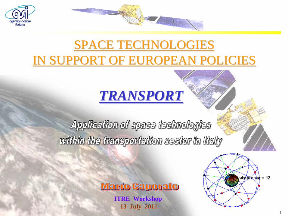
space technologies in support of european policies
TRANSCRIPT
1
ITRE WorkshopITRE Workshop13 July 201113 July 2011
SPACE TECHNOLOGIESSPACE TECHNOLOGIES IN SUPPORT OF EUROPEAN POLICIES IN SUPPORT OF EUROPEAN POLICIES
TRANSPORTTRANSPORT
2
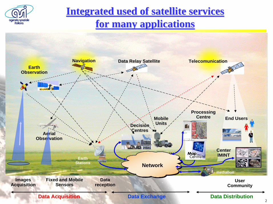
Fixed and MobileSensors
Data Relay Satellite
UserCommunity
Data Acquisition Data Exchange Data Distribution
Datareception
ETS unit
AerialObservation
MobileUnits
ImagesAcquisition
Networkmediation
EarthStations
ProcessingCentre
Center IMINT
End UsersDecisionCentres
Integrated used of satellite services Integrated used of satellite services for many applicationsfor many applications
NavigationEarth
Observation
Telecomunication
3
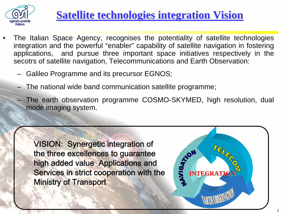
Satellite technologies integration VisionSatellite technologies integration Vision
• The Italian Space Agency, recognises the potentiality of satellite technologies integration and the powerful “enabler” capability of satellite navigation in fostering applications, and pursue three important space initiatives respectively in the secotrs of satellite navigation, Telecommunications and Earth Observation:
– Galileo Programme and its precursor EGNOS;
– The national wide band communication satellite programme;
– The earth observation programme COSMO-SKYMED, high resolution, dual mode imaging system.
INTEGRATIONINTEGRATION
VISION: Synergetic integration of the three excellences to guarantee high added value Applications and Services in strict cooperation with the Ministry of Transport
4
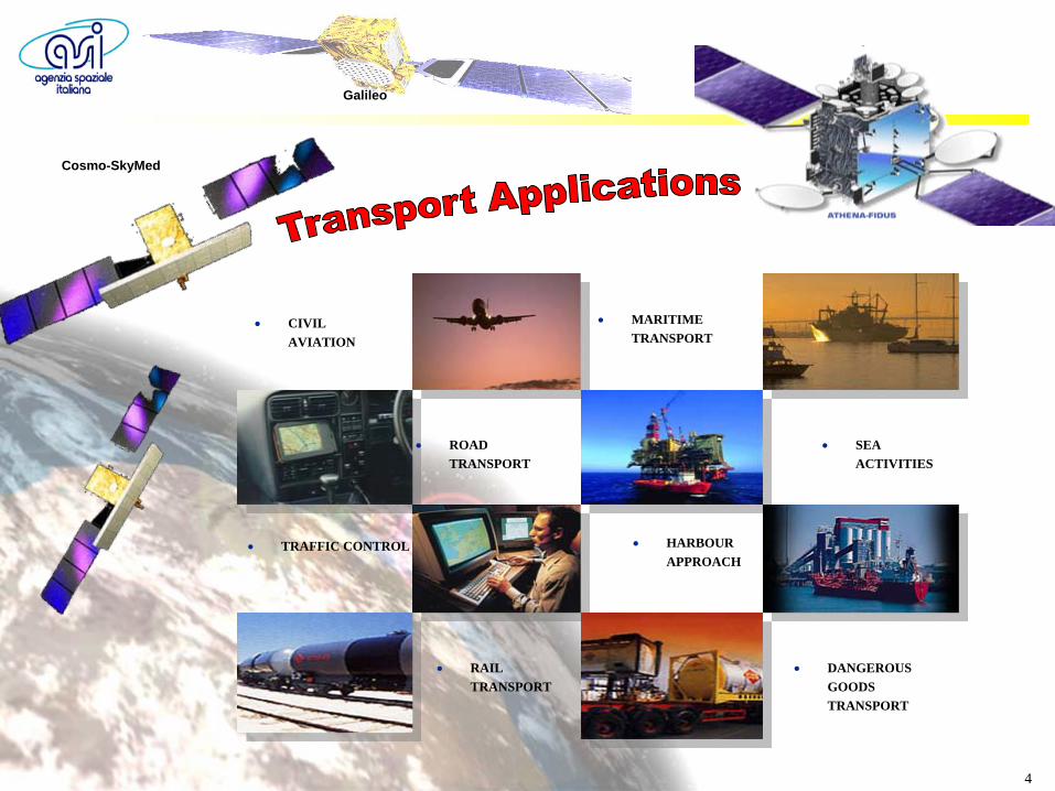
Cosmo-SkyMed
Galileo
CIVIL AVIATION
ROAD TRANSPORT
TRAFFIC CONTROL
MARITIME TRANSPORT
SEA ACTIVITIES
HARBOUR APPROACH
DANGEROUS GOODS TRANSPORT
RAIL TRANSPORT
5
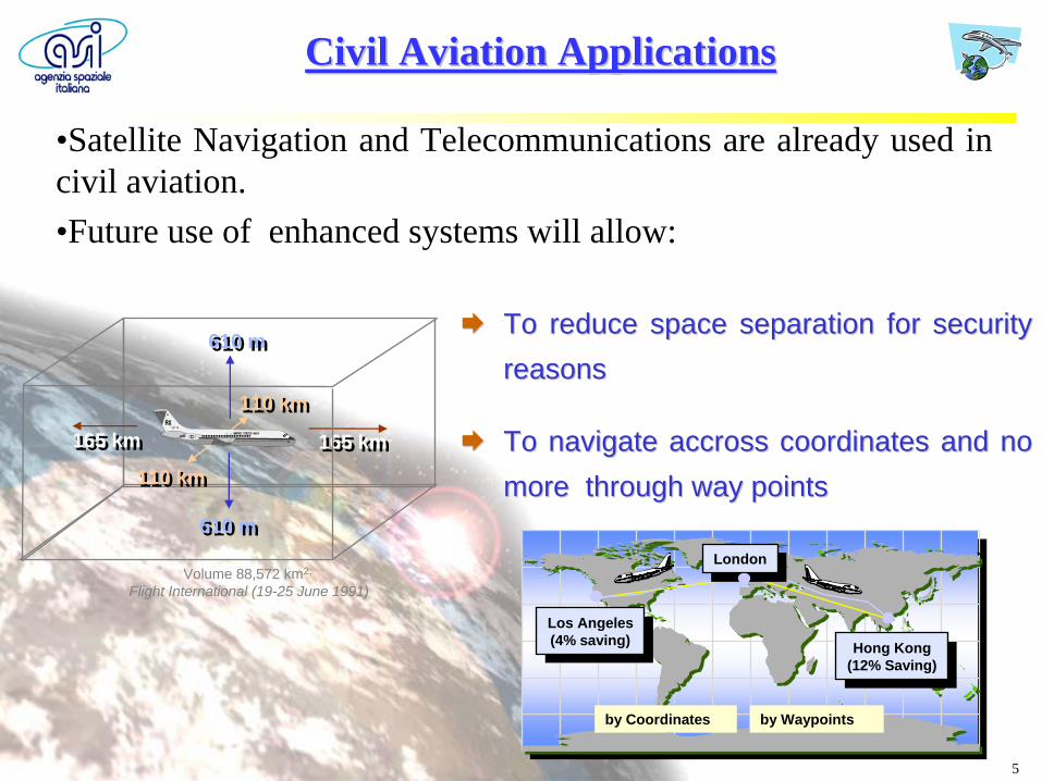
Civil Aviation ApplicationsCivil Aviation Applications
•Satellite Navigation and Telecommunications are already used in civil aviation.•Future use of enhanced systems will allow:
To reduce space separation for security To reduce space separation for security reasonsreasons
To navigate To navigate accrossaccross coordinates and no coordinates and no more through way pointsmore through way points
LondonLondon
Hong Kong(12% Saving)
Hong Kong(12% Saving)
Los Angeles(4% saving)
Los Angeles(4% saving))
by Coordinates by Waypoints
165 km165 km 165 km165 km
110 km110 km
110 km110 km
610 m610 m
610 m610 m
Volume 88,572 km2;
Flight International (19-25 June 1991)
6
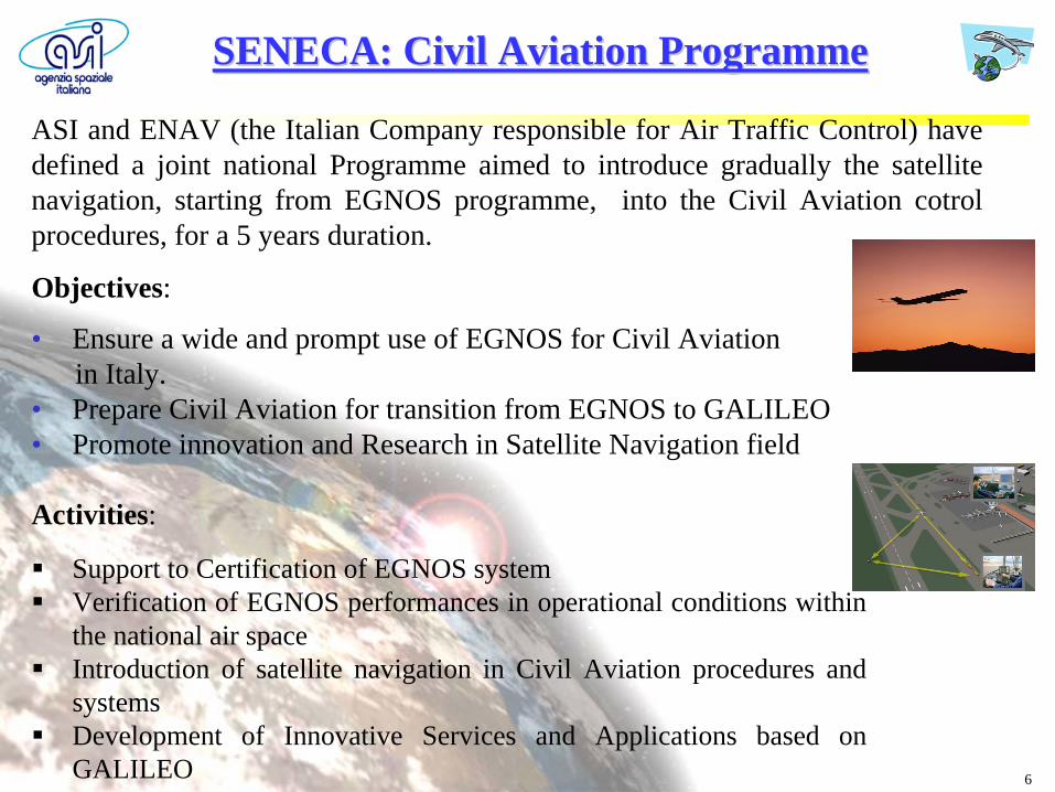
ASI and ENAV (the Italian Company responsible for Air Traffic Control) have defined a joint national Programme aimed to introduce gradually the satellite navigation, starting from EGNOS programme, into the Civil Aviation cotrol procedures, for a 5 years duration.
SENECA: SENECA: CivilCivil Aviation Aviation ProgrammeProgramme
Objectives:
• Ensure a wide and prompt use of EGNOS for Civil Aviationin Italy.
• Prepare Civil Aviation for transition from EGNOS to GALILEO• Promote innovation and Research in Satellite Navigation field
Activities:
Support to Certification of EGNOS system
Verification of EGNOS performances in operational conditions within the national air space
Introduction of satellite navigation in Civil Aviation procedures and systems
Development of Innovative Services and Applications based on GALILEO
7
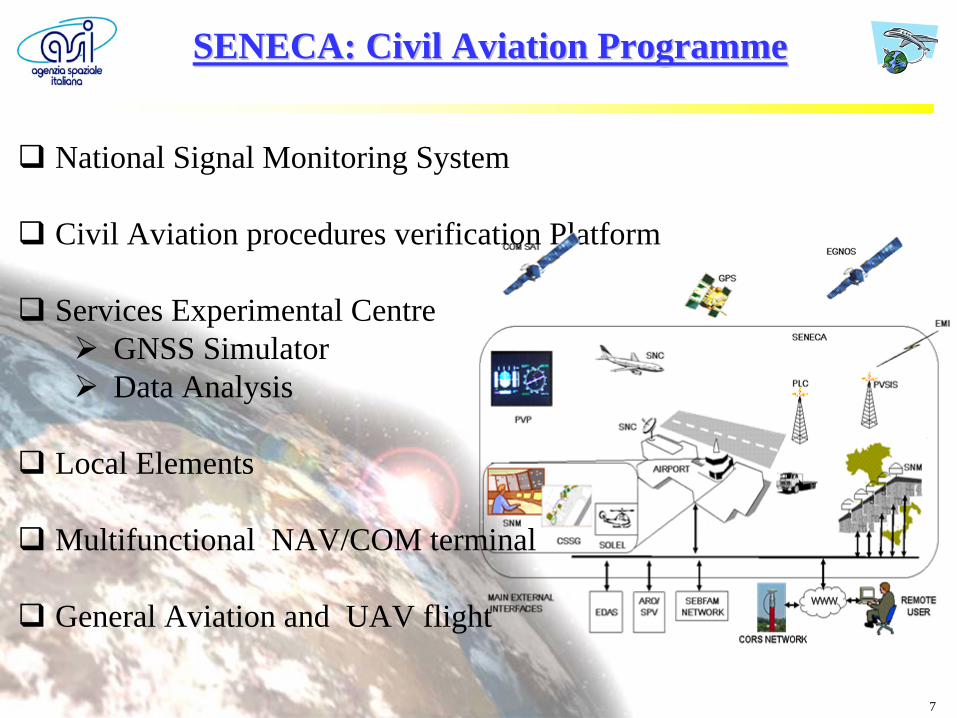
National Signal Monitoring System
Civil Aviation procedures verification Platform
Services Experimental Centre GNSS Simulator Data Analysis
Local Elements
Multifunctional NAV/COM terminal
General Aviation and UAV flight
SENECA: SENECA: CivilCivil Aviation Aviation ProgrammeProgramme
8
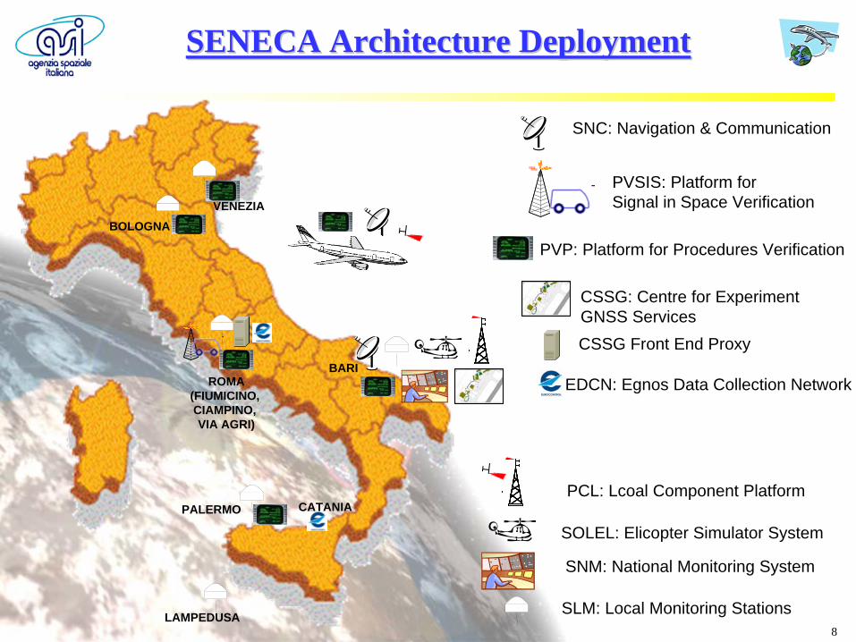
SNC: Navigation & Communication
SLM: Local Monitoring Stations
PVSIS: Platform forSignal in Space Verification
PVP: Platform for Procedures Verification
SOLEL: Elicopter Simulator System
SNM: National Monitoring System
CSSG: Centre for ExperimentGNSS Services
PCL: Lcoal Component Platform
CSSG Front End Proxy
EDCN: Egnos Data Collection NetworkBARI
CATANIAPALERMO
LAMPEDUSA
ROMA(FIUMICINO, CIAMPINO, VIA AGRI)
VENEZIABOLOGNA
SENECA SENECA ArchitectureArchitecture DeploymentDeployment
9
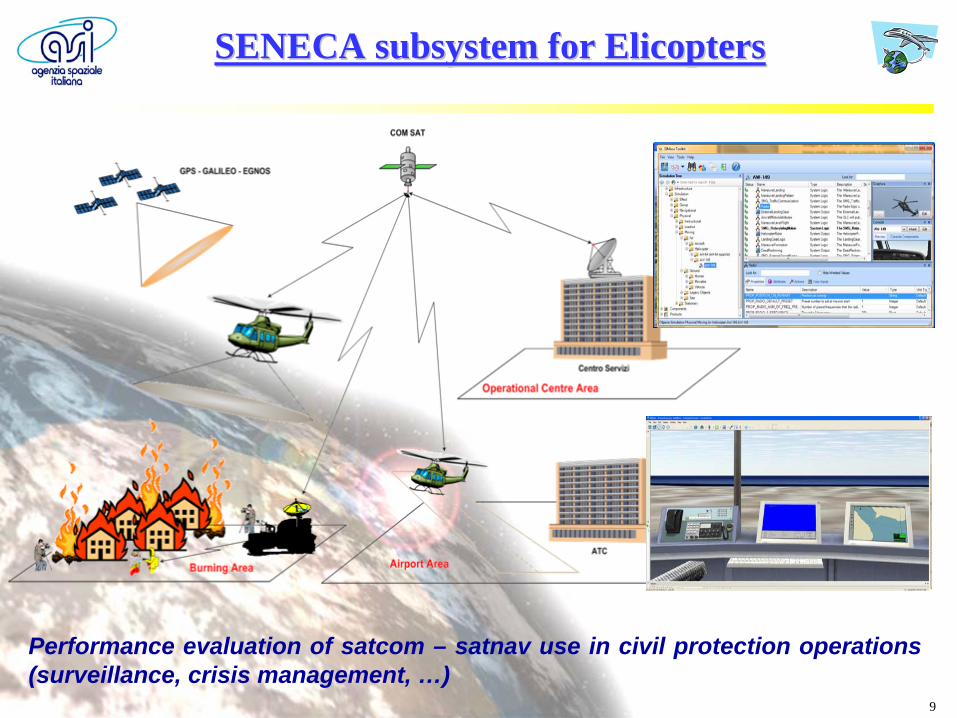
Performance evaluation of satcom – satnav use in civil protection operations (surveillance, crisis management, …)
SENECA SENECA subsystemsubsystem forfor ElicoptersElicopters
10
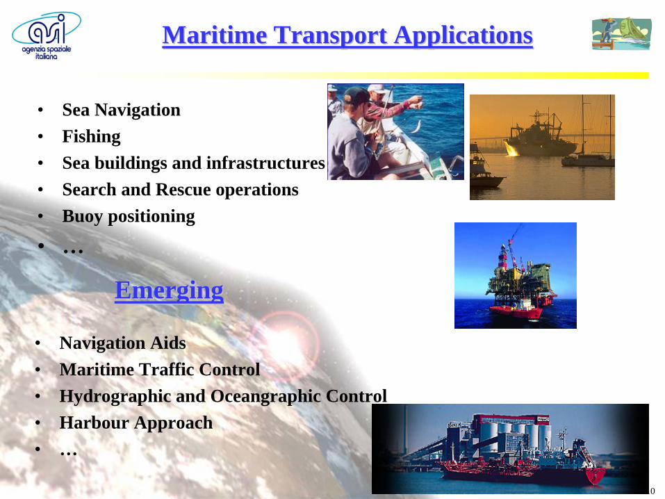
Maritime Transport ApplicationsMaritime Transport Applications
• Sea Navigation• Fishing• Sea buildings and infrastructures• Search and Rescue operations• Buoy positioning
• …
• Navigation Aids• Maritime Traffic Control• Hydrographic and Oceangraphic Control• Harbour Approach• …
EmergingEmerging
11
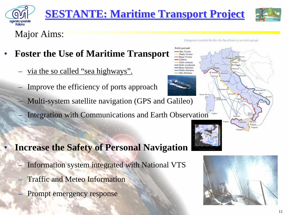
SESTANTE: SESTANTE: MaritimeMaritime TransportTransport ProjectProject
Major Aims:
• Foster the Use of Maritime Transport
– via the so called “sea highways”.
– Improve the efficiency of ports approach
– Multi-system satellite navigation (GPS and Galileo)
– Integration with Communications and Earth Observation
• Increase the Safety of Personal Navigation
– Information system integrated with National VTS
– Traffic and Meteo Information
– Prompt emergency response
12
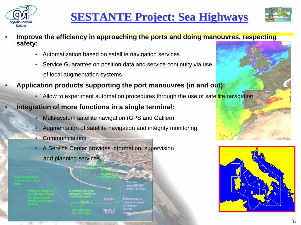
SESTANTE Project: SESTANTE Project: SeaSea HighwaysHighways• Improve the efficiency in approaching the ports and doing manouvres, respecting
safety:• Automatization based on satellite navigation services
• Service Guarantee on position data and service continuity via use
of local augmentation systems
• Application products supporting the port manouvres (in and out):• Allow to experiment automation procedures through the use of satellite navigation
• Integration of more functions in a single terminal:• Multi-system satellite navigation (GPS and Galileo)
• Augmentation of satellite navigation and integrity monitoring
• Communications
• A Service Center provides information, supervision
and planning services.
13
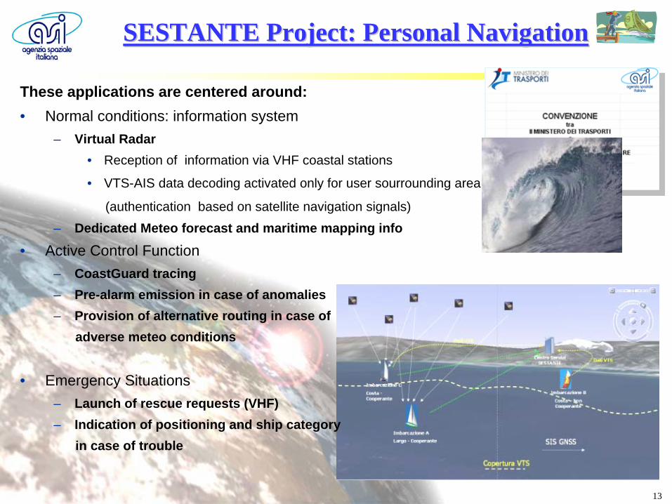
SESTANTE Project: Personal SESTANTE Project: Personal NavigationNavigation
These applications are centered around:• Normal conditions: information system
– Virtual Radar• Reception of information via VHF coastal stations
• VTS-AIS data decoding activated only for user sourrounding area
(authentication based on satellite navigation signals)– Dedicated Meteo forecast and maritime mapping info
• Active Control Function– CoastGuard tracing– Pre-alarm emission in case of anomalies– Provision of alternative routing in case of
adverse meteo conditions
• Emergency Situations– Launch of rescue requests (VHF)– Indication of positioning and ship category
in case of trouble
14
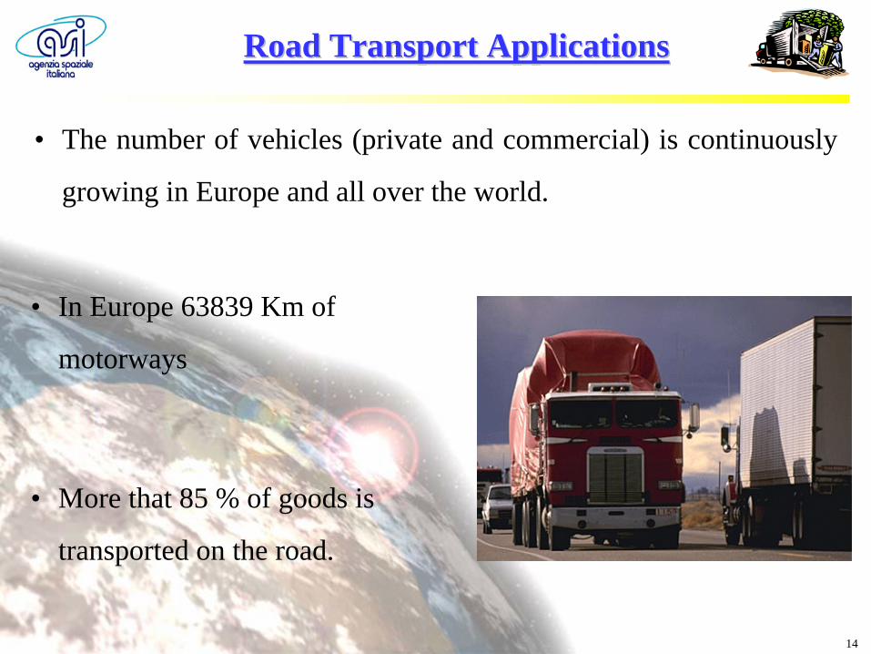
Road Transport ApplicationsRoad Transport Applications
• The number of vehicles (private and commercial) is continuously
growing in Europe and all over the world.
• In Europe 63839 Km of
motorways
• More that 85 % of goods is
transported on the road.
15
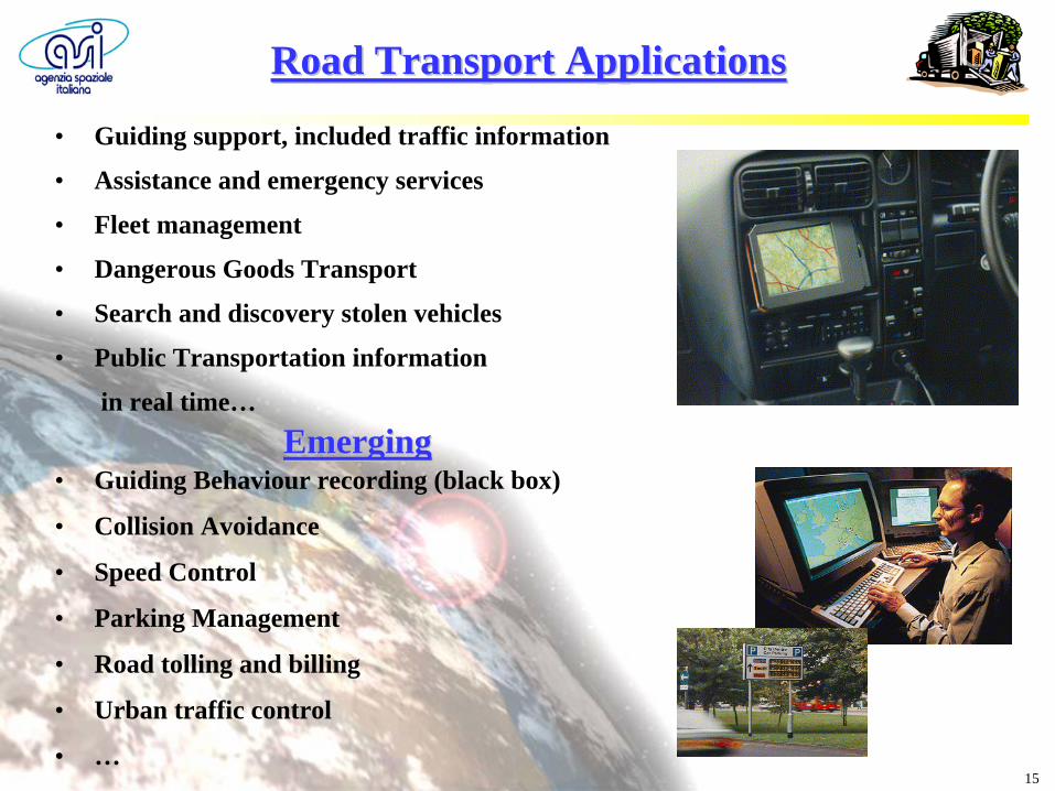
• Guiding support, included traffic information
• Assistance and emergency services
• Fleet management
• Dangerous Goods Transport
• Search and discovery stolen vehicles
• Public Transportation information
in real time…
Road Transport ApplicationsRoad Transport Applications
• Guiding Behaviour recording (black box)
• Collision Avoidance
• Speed Control
• Parking Management
• Road tolling and billing
• Urban traffic control
• …
EmergingEmerging
16
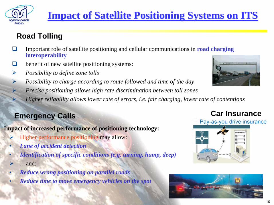
Important role of satellite positioning and cellular communications in road charging interoperability
benefit of new satellite positioning systems:
Possibility to define zone tolls
Possibility to charge according to route followed and time of the day
Precise positioning allows high rate discrimination between toll zones
Higher reliability allows lower rate of errors, i.e. fair charging, lower rate of contentions
Road Tolling
Car Insurance
Impact of Satellite Positioning Systems on ITSImpact of Satellite Positioning Systems on ITS
Emergency CallsImpact of increased performance of positioning technology:
Higher performance positioning may allow:• Lane of accident detection• Identification of specific conditions (e.g. turning, hump, deep)
…and:• Reduce wrong positioning on parallel roads• Reduce time to move emergency vehicles on the spot
17
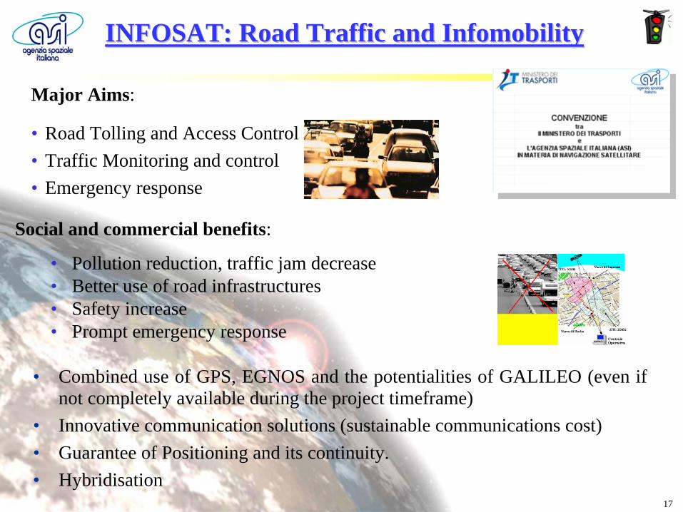
INFOSAT: Road INFOSAT: Road TrafficTraffic and and InfomobilityInfomobility
Social and commercial benefits:
• Pollution reduction, traffic jam decrease• Better use of road infrastructures• Safety increase• Prompt emergency response
Major Aims:
• Road Tolling and Access Control• Traffic Monitoring and control• Emergency response
• Combined use of GPS, EGNOS and the potentialities of GALILEO (even if not completely available during the project timeframe)
• Innovative communication solutions (sustainable communications cost)• Guarantee of Positioning and its continuity.• Hybridisation
18
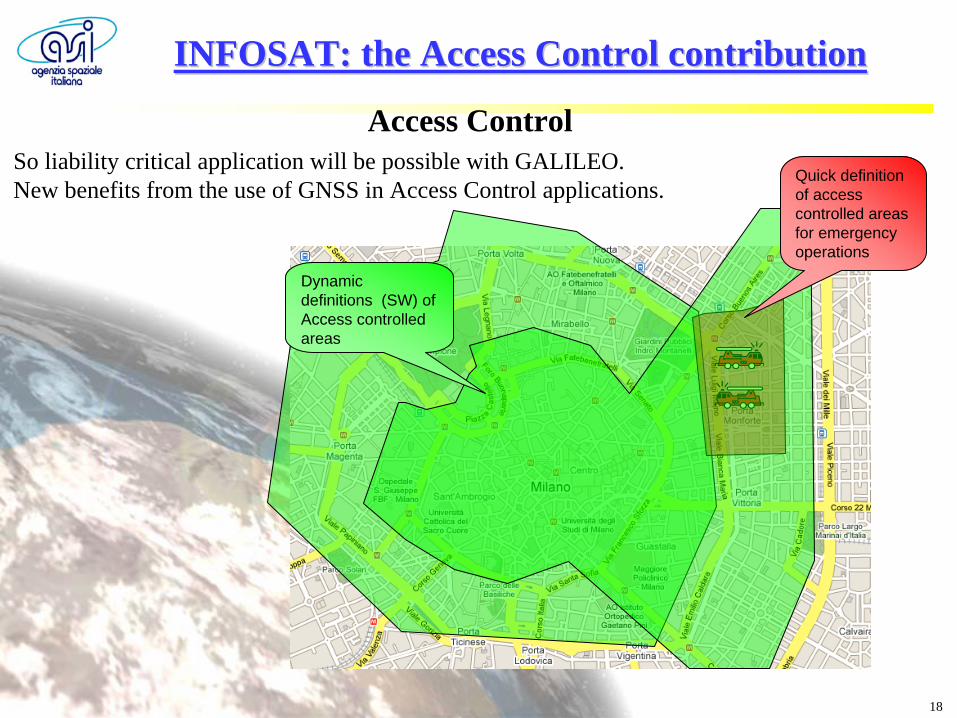
Dynamic definitions (SW) of Access controlled areas
Quick definition of access controlled areas for emergency operations
Access ControlSo liability critical application will be possible with GALILEO. New benefits from the use of GNSS in Access Control applications.
INFOSAT: the Access Control contributionINFOSAT: the Access Control contribution
19
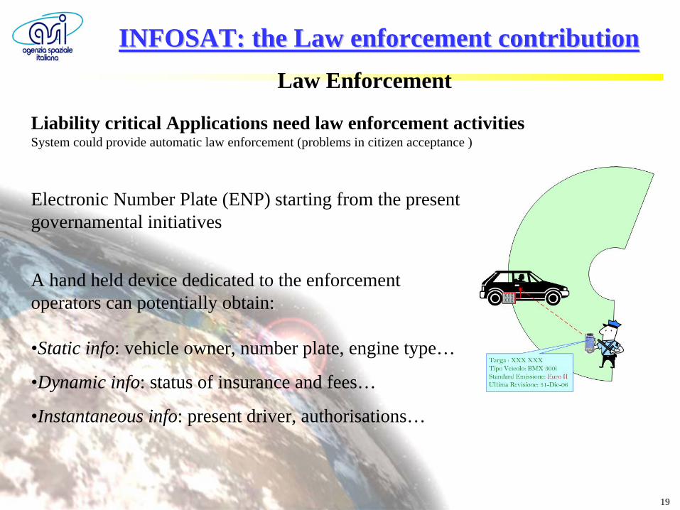
Law Enforcement
Liability critical Applications need law enforcement activities System could provide automatic law enforcement (problems in citizen acceptance )
Electronic Number Plate (ENP) starting from the present governamental initiatives
A hand held device dedicated to the enforcement operators can potentially obtain:
•Static info: vehicle owner, number plate, engine type…
•Dynamic info: status of insurance and fees…
•Instantaneous info: present driver, authorisations…
INFOSAT: the Law enforcement contributionINFOSAT: the Law enforcement contribution
20
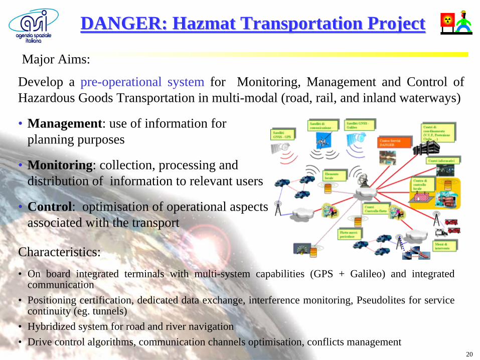
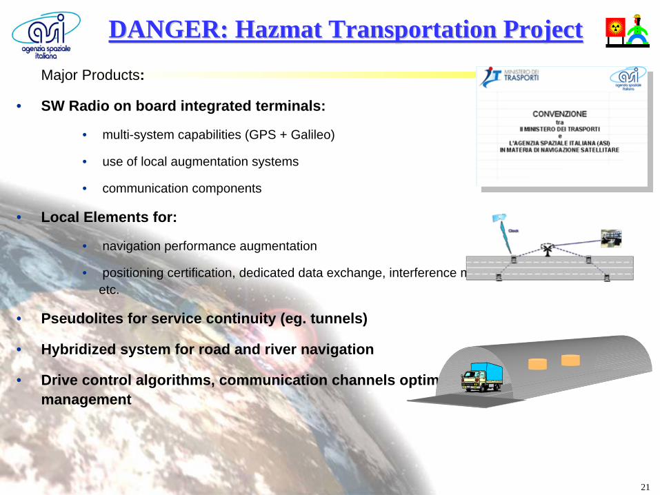
Develop a pre-operational system for Monitoring, Management and Control of Hazardous Goods Transportation in multi-modal (road, rail, and inland waterways)
• Management: use of information for planning purposes
• Monitoring: collection, processing and distribution of information to relevant users
• Control: optimisation of operational aspects associated with the transport
Major Aims:
Characteristics:• On board integrated terminals with multi-system capabilities (GPS + Galileo) and integrated
communication• Positioning certification, dedicated data exchange, interference monitoring, Pseudolites for service
continuity (eg. tunnels)• Hybridized system for road and river navigation• Drive control algorithms, communication channels optimisation, conflicts management
DANGER: DANGER: HazmatHazmat TransportationTransportation ProjectProject
21
Major Products:
• SW Radio on board integrated terminals:
• multi-system capabilities (GPS + Galileo)
• use of local augmentation systems
• communication components
• Local Elements for:
• navigation performance augmentation
• positioning certification, dedicated data exchange, interference monitoring, assisted services, etc.
• Pseudolites for service continuity (eg. tunnels)
• Hybridized system for road and river navigation
• Drive control algorithms, communication channels optimisation, conflicts management
DANGER: DANGER: HazmatHazmat TransportationTransportation ProjectProject
22
23
Add on slides
24
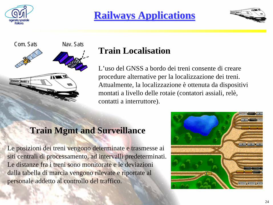
Railways Applications Railways Applications
Train Localisation
L’uso del GNSS a bordo dei treni consente di creare procedure alternative per la localizzazione dei treni.Attualmente, la localizzazione è ottenuta da dispositivi montati a livello delle rotaie (contatori assiali, relè, contatti a interruttore).
Train Mgmt and Surveillance
Le posizioni dei treni vengono determinate e trasmesse ai siti centrali di processamento, ad intervalli predeterminati. Le distanze fra i treni sono monitorate e le deviazioni dalla tabella di marcia vengono rilevate e riportate al personale addetto al controllo del traffico.
Nav. SatsCom. Sats
25
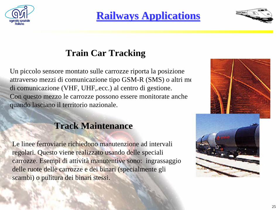
Train Car Tracking
Un piccolo sensore montato sulle carrozze riporta la posizione attraverso mezzi di comunicazione tipo GSM-R (SMS) o altri mezzi di comunicazione (VHF, UHF,.ecc.) al centro di gestione.Con questo mezzo le carrozze possono essere monitorate anche quando lasciano il territorio nazionale.
Track Maintenance
Le linee ferroviarie richiedono manutenzione ad intervali regolari. Questo viene realizzato usando delle speciali carrozze. Esempi di attività manutentive sono: ingrassaggio delle ruote delle carrozze e dei binari (specialmente gli scambi) o pulitura dei binari stessi.
Railways Applications Railways Applications
26
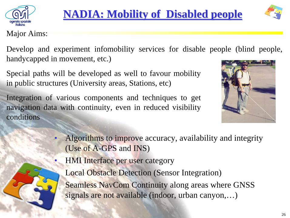
NADIA: Mobility of Disabled peopleNADIA: Mobility of Disabled peopleMajor Aims:
Develop and experiment infomobility services for disable people (blind people, handycapped in movement, etc.)
Special paths will be developed as well to favour mobility in public structures (University areas, Stations, etc)
Integration of various components and techniques to get navigation data with continuity, even in reduced visibility conditions
• Algorithms to improve accuracy, availability and integrity (Use of A-GPS and INS)
• HMI Interface per user category• Local Obstacle Detection (Sensor Integration)• Seamless NavCom Continuity along areas where GNSS
signals are not available (indoor, urban canyon,…)
27
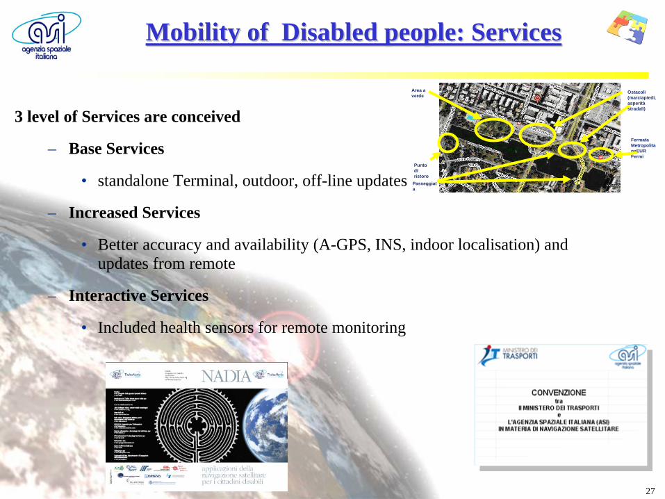
3 level of Services are conceived
– Base Services
• standalone Terminal, outdoor, off-line updates
– Increased Services
• Better accuracy and availability (A-GPS, INS, indoor localisation) and updates from remote
– Interactive Services
• Included health sensors for remote monitoring
Mobility of Disabled people: ServicesMobility of Disabled people: Services
Passeggiat a
Area a verde
Punto di ristoro
Ostacoli (marciapiedi, asperità stradali)
Fermata Metropolita naEUR Fermi