southern maine beach profile monitoring volunteer manual
TRANSCRIPT
1
Southern Maine
Beach Profile Monitoring Volunteer Manual
Mapping the State of Maine’s Beaches
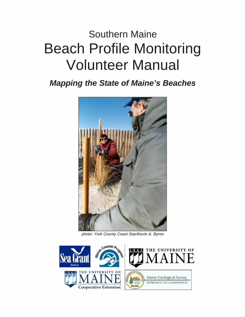
photo: York County Coast Star/Kevin A. Byron

2
TABLE OF CONTENTS INTRODUCTION............................................................................................. 3
Program Background................................................................................... 3
The Geology of Southern Maine’s Beaches............................................... 3
Level of Development on Southern Maine Beaches.................................. 4
Planning for Maine's Beaches..................................................................... 5
SO YOU THINK YOU WANT TO MONITOR?.............................................. 8
VOLUNTEER AND STAFF POSITION DESCRIPTIONS............................. 9
Volunteer Monitoring.................................................................................... 9
Data Entry Volunteer ................................................................................... 9
Volunteer Team Leader............................................................................. 10
Program Coordinator................................................................................. 10
Geologists at Maine Geological Survey and University of Maine............ 11
METHOD....................................................................................................... 12
Beach Profiling Method Summary ............................................................ 12
Step by Step Instructions for the Emery Method of Beach Profiling ....... 12
PROFILING SCHEDULE.............................................................................. 15
QUICK CHECKLIST FOR BEACH PROFILING ......................................... 17
VOLUNTEER APPLICATION....................................................................... 19
VOLUNTEER LIABILITY WAIVER............................................................... 20
UNIVERSITY OF MAINE SYSTEM PHOTO RELEASE AGREEMENT.... 21
COASTAL GEOLOGY, OCEANOGRAPHY, AND GULF OF MAINE WEB SITES ............................................................................................................ 23
Appendix 1: Photo instructions for your beach Appendix 2: Field data sheets

3
INTRODUCTION
Program Background
The sandy beaches in southern Maine are one of the state's primary tourist attractions, as well as important habitats for wildlife. Beaches are dynamic features, however, that respond to a variety of forces. Because of growing population and increase in development along the coast in the past several decades, it is necessary to study and understand changes that are occurring in these systems. It is generally believed that the quality of Maine's sand beaches is declining due to encroachment by over development and the rising level of the sea. The public generally does not notice that these important resources are slowly eroding, however, until property and buildings are at immediate risk. Numerous court cases and distrust between the local citizens and scientists/government regulators are the result of these strict laws needed to protect our beach resources.
In an attempt to create a more productive working relationship between coastal citizens and government regulators, Maine Sea Grant, UM Cooperative Extension, Maine Geological Survey and Maine Coastal Program are supporting a beach profile monitoring program that involves collaboration with beach stake holders. Trained volunteers are currently making topographic profiles of 15 important barrier systems in southern Maine. Each beach contains two to four profile transects and the volunteers use the Emery Method of beach profiling. They start from a surveyed monument and simultaneously collect the data on a monthly basis. In addition, moored wave/current meters offshore are collecting meteorological data. Changes in the topographic profiles are a result of external forcing mechanisms, the volume of sand in the barrier system, and the volume of sand available to the barriers. By combining this data, it is possible to determine how individual beaches respond to a variety of meteorological changes depending on their level of development and the volume of sand contained in, or available to each beach.
The Geology of Southern Maine’s Beaches
Barriers are most common along continental margins where small to moderate tidal ranges are dominant (less than 13 feet or 4 meters). Relative sea-level change and sediment supply govern the formation of barriers. In addition to these two factors, tidal wave regime and the regional geology maintain the changing systems and are responsible for the barrier's slope and elevation characteristics. The glaciated New England coast harbors more barrier systems than the mid-Atlantic region, but the total barrier length is less and the distribution more sporadic. Paraglacial coasts are defined as those on or adjacent to formerly ice-covered terrain, where glacially excavated land-forms or glacier-transported sediments have a recognizable influence on the character and evolution of the coast and nearshore deposits. The coast of Maine falls into this category, and it contains over 200 small barrier systems (Kelley, 1987).

4
Curved embayments with intervening headlands characterized the Southwest compartment, which extends from the Piscataqua River, New Hampshire, to Cape Elizabeth, Maine. Meta-sedimentary rocks (from sediments or modified sediments), punctuated by several igneous rock masses (granite for example), compose the bedrock. The embayed coast is a result of differential weathering of rocks, underlying structural trends, and the glacial processes that dominated the area in the past. Because of process-response mechanisms, the Southwest coastal compartment contains a variety of barrier systems.
Level of Development on Southern Maine Beaches
The level of development varies for the beaches involved in the project (see table at the end of this section). Some are highly developed, while other have been uninfluenced by humans. Before decisions can be made on beach management practices and beach nourishment projects, it is necessary to understand how each beach responds to natural forces. A beach that is developed will likely respond very differently than one that is undeveloped. Therefore, it is important to monitor the changes on individual beaches, rather than making assumptions from results on nearby beaches. How does the topographic profiling fit in? The profiles show how the beach topography changes from month to month, over the course of the year, and from year to year. Using the maximum and minimum profiles, a volume of sand that either eroded or accreted on the beach can be calculated. This volume changes the elevation of the beach in an area called the sweep zone. By comparing local variability in the sweep zones of beaches, scientists can better understand local sand budgets that build summer berms (beach blanket space) for recreation and evaluate beach nourishment needs. Are Maine's sand beaches eroding? Sand beaches comprise only about 1% of Maine’s coastline, or less than 35 miles, mostly located along the southern Maine coast, south of Cape Elizabeth. There are very few natural beach and dune systems in southern Maine, and even these show some signs of slow erosion and landward migration driven by sea-level rise. With the exception of a few locations were sand is accumulating because of the influence of jetties, all of Maine’s beaches are experiencing erosion. The severity of beach erosion in southern Maine has been qualitatively estimated by the Maine Geological Survey. Further quantitative analysis by MGS is leading to more site-specific erosion data. In a general assessment shown in the table below erosion characteristic are separated into three categories.
• Highly erosional shorelines have erosion rates that might exceed two feet per year, have high reinforced seawalls along the frontal dune, are in need of

5
beach replenishment to replace eroded sand, and have no recreation opportunities for about half the tidal cycle. About 10% of Maine’s beaches are highly erosional.
• Moderately erosional beaches have chronic erosional problems, characteristically have seawalls that are impacted by storm waves annually, or, if natural, have chronic dune scarps and frontal dune erosion. Many beaches in this category have gravel berms and most have limited recreation opportunities at high tide. About 50% of beaches are moderately erosional.
• Slightly erosional beaches have slow erosion rates or variable erosion and accretion rates, often have a sandy summer berm and seasonal exchanges of sand with the offshore, have a fairly large frontal dune, usually have no seawalls and offer recreation opportunities at all tide levels. About 40% of southern Maine beaches fit the slightly erosional category.
For a fact sheet on risks associated with developing a home or business within Maine’s sand dune system, along with related links for more information, see “Suitability of the Dunes for Development,” by Maine State Marine Geologist Stephen Dickson at: http://www.state.me.us/doc/nrimc/pubedinf/factsht/marine/develop.htm. Most development along Maine's beaches requires a permit from the Maine Department of Environmental Protection under the Natural Resources Protection Act. See http://www.state.me.us/dep/blwq/docstand/nrpapage.htm and http://www.maine.gov/dep/blwq/topic/dunes/index.htm for more information. A Shoreland Zoning permit from your town or city may also be required.
Planning for Maine's Beaches
Beach Erosion Task Force In late 1997 through 1998, Southern Maine property owners, shoreline business owners, municipal staff, and environmental groups joined state agencies in a multi-stakeholder process to identify common ground, avoid future conflicts, and establish increased protection for Maine’s sand beaches. Ongoing concerns regarding beach erosion, property at risk, endangered and threatened species habitat, public access and regulation of shoreline development prompted the formation of the stakeholder group. The group’s report, “Improving Maine's Beaches,” was published in 1998. Recommendations included both continued planning and implementation activities in the following categories: erosion, environmental monitoring, economic analysis, flood insurance claims data, hazard disclosure requirements, and regional beach management planning. You can download Improving Maine's Beaches here: www.maine.gov/spo/mcp/downloads/improving_maine's_beaches/improving_maine's_beaches.pdf ]. Regional Beach Management Plans The Maine Beaches report (discussed above) recommended that regional groups be formed to create management plans for shared sand beach systems. Beach plans were

6
intended to create a common agenda for management of shared sand beach systems. Both the Saco Bay Plan (Saco, Old Orchard Beach and Scarborough) and Wells Bay plan (Wells and Kennebunk) were completed and adopted by participating towns. The plans include the following types of recommendations: changes to state regulations, creation of new regional advisory boards, creation of new funding mechanisms, creation of new monitoring programs and public education programs, modification of jetties, and creation of state beach nourishment policies. The Southern Maine Regional Planning Commission, with support from the Maine Coastal Program, provides staffing for the regional planning process. A complete summary of activities, including copies of completed regional plans can be found at http://www.smrpc.org/coastalpage.htm Source: http://www.maine.gov/spo/mcp/projects/weathering_storm.php

7
Status of Southern Maine's Sand Beaches
Profiled Beach Name Development Status*
Replenishment History Erosional Status**
ü Willard high none (considered in 1982) slight ü Higgins high none moderate ü Scarborough low none slight ü Western low none moderate Pine Point high dune construction, 1956 slight ü East Grand high none slight
Old Orchard Beach high none slight
Ocean Park medium none slight ü Kinney Shores medium none slight ü Ferry Beach,
Saco medium none moderate
Camp Ellis medium 1919, 1969, 1970, 1978,1982, 1992, 1996
high
Hills medium 1989 moderate ü Fortune's Rocks medium none moderate ü Goose Rocks medium none slight ü Goochs high 1985 high Parsons none moderate low
Crescent Surf low none moderate ü Laudholm low none moderate ü Drakes Island high 2000-01 moderate ü Wells high 1990, 1991, 2000-01 moderate ü Ogunquit low dune restoration 1974-75 moderate
Short Sands medium none moderate ü Long Sands high none high
*Development status represents an average of both the front and back dunes. **Categories of slight, moderate and high are as defined in the paragraph preceding the table. Source: Maine Geological Survey

8
SO YOU THINK YOU WANT TO MONITOR?
WHY MONITOR?
Have a specific problem. (Determine cause and decide whether regulation or enforcement is needed.)
Need or want info in current status and future trends.
DECIDE WHAT TO MONITOR
Land Use • Erosion • Sedimentation • Wetlands • Boating (marinas) • Animals and Plants
Living Resources • Submerged Aquatic
Vegetation • Fish Catch Statistics • Fish Kills • Shellfish Harvest • Shellfish Health • Plankton • Bacteria
General • Weather • Rainfall • Rain pH
EROSION
WHERE TO MONITOR (Site Location)
Southern Maine Beach Profiling Sites Willard, Higgins, Scarborough, Western/Ferry, East Grand, Kinney Shores, Fortunes, Rocks, Goose Rocks, Goochs, Laudholm, Drakes Island, Wells, Ogunquit, Long Sands

9
VOLUNTEER AND STAFF POSITION DESCRIPTIONS
Beach Profiling could not happen without volunteers. Here is a list of all the program participants, both volunteer and staff members.
Volunteer Monitoring
Purpose: To conduct Beach Profile Monitoring on a monthly basis in support of the Southern Maine Beach Profiling Program. As part of a team, use a simple survey technique to accurately measure the beach profile:
• Help with beach profiling once per month. • Stay in contact with team leader. • Assist team leader with finding a replacement when you are unable to do
monitoring on your scheduled date. • Assist team leader with various tasks when able.
Time Frame: Twelve months of the year at low tide during the recommended profiling dates provided through the Program Coordinator. Qualifications:
• Interest in helping to monitor the beach. • Ability to work as part of a team.
Training: New volunteers will receive appropriate training from team leader or program coordinator. Benefits:
• Opportunity to meet people from your community with similar interests. • A chance to participate in a project that will provide data on southern Maine’s
beaches for a better understanding of how beaches are changing.
Data Entry Volunteer
Same description as above, except this person will need internet access in order to enter profiling data into an online database. This data goes directly to the Maine Geological Survey, and allows the team to view graphs of their beach profiles. The data entry volunteer does not necessarily go out to the beach to collect the field data with their team, and may volunteer entirely from home or wherever they may have internet access.

10
Volunteer Team Leader
Purpose: To provide coordination and organizational support to team members. Responsibilities:
• Regular contact with Program Coordinator. • Assist Program Coordinator with volunteer recruitment needs. • Coordinating team members schedules to conduct monthly profiling. • Tracking supplies and contacting Program Coordinator for refills. • Forward completed data sheets to the Data Entry Volunteer every month and
mail original field data sheets to Maine Geological Survey. If possible, the team leader will make photocopies of data sheet. Also, mail finished, single -use cameras to a processor in Bangor (all associated costs are covered by the program), or if using digital camera, e-mail jpg’s to Maine Geological Survey.
Time Frame: Once per month sampling, year round. Qualifications:
• Strong communication skills. • Interest in helping monitor the beach. • Ability to lead and work as part of a team.
Training: New leaders will receive appropriate training from the program coordinator. Benefits:
• Opportunity to meet people from your community with similar interests. • A chance to participate in a project that will provide data on southern Maine’s
beaches for a better understanding of how beaches are changing. • An opportunity to strengthen communication and organizational skills.
Program Coordinator
Purpose: To oversee the operation of the volunteer monitoring program. Responsibilities:
• Coordinate 15 teams of volunteers working in the program. • Recruit, train, support team leaders and team members. • Regular contact with team leader, most often via email. • Provide team leaders with supplies, training, assistance with volunteer
recruitment and annual schedule for recommended profiling dates. • Available on demand for questions and field visits.
Time Frame: Year-round.

11
Qualifications: • Excellent communication, organizational and leadership skills. • Able to work with people of diverse backgrounds. • Experience working with volunteers. • Genuine interest in Maine’s Southern Beaches.
Training: Professional development as appropriate.
Geologists at Maine Geological Survey and University of Maine
Purpose: To oversee the scientific and technical aspects of the volunteer monitoring program. Geologists at the Maine Geological Survey install and maintain the benchmark stakes at each beach. In addition, they interpret, archive and report on the status of Maine’s beaches to the state, local and community members.
Responsibilities: • Install and maintain benchmark structures at each beach. • Train staff and volunteers as needed. • Provide fund .. .. of quality assurance to volunteer-gathered data. • Analyze, interpret and archive data. • Report annually on the status of monitored beaches to program volunteers and
any other regulatory agencies. • Report biannually on the status of monitored beaches at the Maine Beaches
Conference.

12
METHOD
Beach Profiling Method Summary
Beach profiling is a simple survey technique used to measure the contour of a beach. Very basic equipment, made from two 1.5 meter rods connected by a 3 meter rope, is used to create a line-of-sight with the horizon. The difference in elevation between the two poles defines the topographic change on that segment of the beach. The number resulting from this change is recorded as a single data point. These data points are recorded at regular intervals down the beach, from the frontal dune (or seawall) to the low water mark. When these data points are connected, they create a graphic depiction of the contour of the beach or the beach profile. A limitation of this method is its dependence on the visibility of the horizon. If clouds, fog, haze or rain obscure the horizon, then profiling should not be conducted that day and should be rescheduled. Single-use cameras or digital cameras are also used to photograph the beach at a few established points every month. Long-term beach monitoring data is the first step to understanding complex beach processes. This information, combined with ocean current and wave data, helps scientists to better understand how fast and why our beaches are changing.
Step by Step Instructions for the Emery Method of Beach Profiling
Overview Maine Geological Survey has set a metal stake or pin in the ground as a control point for each profile line. The same control point is reused for all profiling and is the starting point of all measurements. A second pin or in some cases object (such as a utility pole, tree, chimney, etc.) is used also. These two reference points define a line to follow to measure a beach profile. At these control points, it o ften helps to place a temporary marker post that rises up from the dune or above a seawall to maintain a line-of-sight down on the beach.
1. Begin Notes. Fill in the top part of the log sheet. Include names of people in the team profiling that day, the date, time, profile name and number, beach location, etc.
2. Record Stake Height. Measure the height of the ground in relation to the top of
the control point with the numbers (scale) up. If the ground is below the top of the control point, the rod will be held upside down, and the vertical number recorded will be negative. The person holding this rod should stand off the profile line for the next step.
3. Set Rod 1. Stand the end of one profile rod (Rod 1) on the ground next to the
control point with the numbers (scale) up. The person holding this rod should stand off the profile line for the next step.

13
4. Set Rod 2. The second person takes Rod 2 toward the ocean. Looking back
toward land and Rod 1, this lead person places Rod 2 (with scale up) on the profile line using the control points as a guide. Pick a horizontal distance of a meter (or other suitable distance if obstacles are in the way) as a spacing between the two poles. Use a graduated rope to do this and be careful to hold both poles straight up and down while setting Rod 2 in place.
5. Measure and Record. From the landward pole, the first person sights the horizon
and the top of the lower of the two rods. This line-of-sight will intersect part way up the other rod. Read the elevation number marked on the other rod that is in line with the pole top and the horizon. Keep both poles vertical when reading! Note that sometimes the reading will come from Rod 1 and sometimes from Rod 2. This is because the ground may slope down or up and may change which pole is higher at different places on the beach profile line. When the ground slopes down toward the ocean, the forward rod (Rod 1) will be lower, and a negative [-] number is assigned to the vertical reading off of Rod 1. when the ground slopes up looking toward the ocean, the forward rod will be higher, and a positive [+] number is assigned to the reading. In this case, the number is read off the forward rod (Rod 2). So moving forward on the profile, uphill is [+] and downhill is [-]. Always use either a + or – before the number. It takes careful attention to get this right on each measurement. A single error will make the rest of the data plot incorrectly on a graph. Record the elevation change and horizontal distance between poles on the log sheet. Also note any features at the forward rod (such as edge of dune, slope change, water line, etc.) in the Notes column on the log sheet.
6. Move Ahead. After the notes are taken, move Rod 1 to the same “footprint”
occupied by Rod 2. Take care to walk next to the profile line, not on top of it. The person at Rod 2 should wait for Rod 1 to come up alongside Rode 2 in order to be certain of getting the position correct. After Rod 1 is in the place of Rod 2, the forward rod can be moved ahead another one to three meters and placed on the ground in line with Rod 1 and the original control point(s). The job of the lead person is to be sure each forward move stays on the line. Rod 2 must be set down on the ground keeping the rope level.
7. Repeat Steps 6 and 7. Measure, Record, & Move. Continue to move ahead,
repeat these steps all the way to the water. As you go, everyone on the team should look ahead for features to stop on and measure. If some feature, perhaps the edge of the dune, does not occur at a horizontal interval of one meter, then make the horizontal distance smaller. For example, if the dune edge is only 0.6 m from the last measurement, move the forward pole ahead only that far. On the next measurement move ahead only 0.4 (or 1.4) m in order to get back on a spacing of 1 m intervals. Keeping a set interval in whole meters will help with data analysis later.

14
8. Stop at the Water. Make a measurement that includes the water line. In the notes column of the log sheet abbreviate it W.L. and record the TIME it was measured. Because the height of the tide is changing, the time of the reading is important. Estimate the place on the beach where the water level would be without the waves, the still water level. There is no need to measure how far up the beach the swash is going at the time of the measurement.
9. Continue On (Optional). The process can be continued into the water if teams
want to. This is optional and not necessary. In cold water there is a risk of hypothermia. In rough seas there is a risk of getting hit by breaking waves. Do not take chances. Always keep your personal safety and that of your team members in mind. A few extra points on a graph are not work the risk of personal injury.
10. Final Reading. At the last measurement, record the time finished in the Notes
column on the log sheet.
11. Photograph the Beach. Refer to the Photo Instructions for your beach found in the following section.
12. Pack Up. Gather up all the gear, including any posts back at the control points,
notes, and field gear. The profile is done! The original reference on Emery beach profiling is: Emery, K.O., 1961, A simple method of measuring beach profiles: Limnology and Oceanography, v. 6, p. 90-93. Source: Maine Geological Survey, Department of Conservation, 22 State House Station, Augusta, ME 04333-0022

15
PROFILING SCHEDULE
Profiling is conducted once a month, coinciding with one of the lowest tides of the month (in order to expose as much of the beach profile as possible). Teams profile 12 months of the year, with the winter months being the most critical as the strong seas associated with winter storms can result in dramatic changes on the beach profile in a very short time. Most beaches have profiling lines established at 4 points on the beach. Depending on the placement of these 4 points, the width of the beach and the weather, a complete profiling event make take as little as 1 hour to over two hours. SOUTHERN MAINE BEACH PROFILE MONITORING PROGRAM 2005 Monitoring Schedule Please note:
• The times listed are approximated low tides. Depending on how long it takes your team to profile all the lines on your beach, you will probably want to begin profiling 1/2 to 1 hour prior to low tide.
• The dates and times listed below are recommendations. While our goal is to have profiling conducted during some of the lowest tides of the month, this is sometimes not possible. Dates recommended are chosen to accommodate working schedules, daylight hours, holidays, etc.
• If you find that your team will not be able to profile on during the recommended time period, please try to select a data close to those recommended (for example, the Thursday before or the Monday after the recommended dates). It is fine if your team will need to profile a week or so later than the recommended dates because that data is better than no data. But please let me know if this will need to happen (646-1555 x115 or [email protected])
2005
JAN Fri Sat Sun 14 15 16 8 AM 9 AM 10 AM FEB Fri Sat Sun 11 12 13 7 AM 7:45 AM 8:30 AM MARCH Fri Sat Sun 4 5 6 11:30 AM 12:30 PM 12:45 PM

16
APRIL Fri Sat Sun 15 16 17 11 AM 12 PM 12:15 PM MAY Fri Sat Sun 13 14 15 9:45 AM 10:30 AM 11:15 AM JUNE Fri Sat Sun 24 25 26 7:30 AM 8:30 AM 9:30 AM JULY Fri Sat Sun 22 23 24 6:30 AM or PM 7:30 AM 8:15 AM AUG Fri Sat Sun 19 20 21 7 AM 7:45 AM 8:30 AM SEPT Fri Sat Sun 23 24 25 9:45 AM 10:45 AM 11:45 AM OCT Fri Sat Sun 21 22 23 8:30 AM 9:15 AM 10:15 AM NOV Fri Sat Sun 18 19 20 7:30 AM 8:15 AM 8:45 AM DEC Fri Sat Sun 9 10 11 11:45 AM 12 noon 1:15 PM

17
QUICK CHECKLIST FOR BEACH PROFILING
Essential Supplies • Profiling rods • At least 4 data sheets and clipboard • Camera (digital camera if your team has one, or single use camera) • Sign with the name of the beach and the date if you are using a single use camera
(you can tape this on the back of your clipboard). • Appropriate clothing, (gloves, hats, boots for winter; sunscreen for summer.) • Bring gloves and long pants if poison ivy is present in dunes. • Parking permit, if accessing your profile lines requires use of a municipal lot.
Program staff will help you obtain any necessary permits.
Weather and Safety Requirements • Is the horizon visible? • Is the weather safe for profiling? Safety is our first priority. Avoid excessive wind
chills, icy conditions, bad ozone days, or other dangerous conditions. • Profiling dates can be flexible if conditions do not allow safe, accurate profiling. • Be sure team members know who to contact in case of an emergency.
Tips for Recording Your Data on Paper and in Pictures • Fill out all of the information at the top of the sheet. Don’t forget the units you are
working in (cm for vertical, m for horizontal). • Make your first measurement from the front stake. This will be the first vertical data
point, with zero as the horizontal point. Remember the back stake is a “backup” if we lose the front.
• When recording your measurements, downhill is negative, uphill is positive. • As you are moving down the line of profile, keep notes of anything unusual or
something that is not easily identifiable from the profile logs (ex. High tide line ). Also, walk next to the profile line, not on top of it.
• Draw rough sketch of each profile, noting significant features (see back of datasheet).
• Refer to the Photo Method sheet for specific instructions for your beach. Record on your data sheet the profile line number, exposure numbers and direction of the shot if using a single use camera.
After Profiling • Make sure your data is received by the program. Confirm that the data entry
volunteer receives and enters the data via the web. After data entry, mail the data sheets to Maine Geological Survey in the pre-paid envelopes provided. You may make a copy for you team to keep if you would like.
• If using a digital camera, name your pictures appropriately, and e-mail them to Maine Geological Survey (see photo instructions). If using a single use camera, when the roll of film is finished, mail it in the pre-paid, pre-addressed padded envelopes to Bangor Photo. Make sure there is a pre-processing card in the envelope, as well as a slip that provides Bangor Photo with contact information.

18

19
VOLUNTEER APPLICATION
Date of application: ________________________ Name: Address: Phone: Email: What is the best time to contact you during the day or evening? How did you find out about our organization? Do you have any experience or relevant training in relation to our project (Please note that no experience is necessary this is just good information for our files and helps us understand our volunteers better)? Please briefly describe why you are interested in our program: Is there any time of year that profiling once a month would be a problem for you? Profiling happens at different times of the day. The team leader will pick a weekday or weekend time to profile depending on the schedules of team members. Are you available for profiling during the week? Are you available for profiling on the weekends? Is there any time during the day that you are not available to profile? Thank you for taking the time to fill out this form. You will be contacted within two weeks by our volunteer coordinator concerning this application. Please call us if you do not hear from us within this time period.

20
VOLUNTEER LIABILITY WAIVER
The Undersigned __________________________ , does hereby acknowledge and assumes the risk of participation in any and all activities for the Southern Maine Beach Profiling Project at any and all locations where profiling activities take place, including but not limited to accepting a ride from a fellow volunteer and offering to drive fellow volunteers to and from profiling sites. He/she does hereby acknowledge that he/she will release Maine Sea Grant Extension, its officers, staff members, volunteers, advisors, property owners, and/or agents in any location where profiling activities are conducted, of and from all claims which may hereafter develop or accrue to them on account of injury, loss or damage, which may be suffered by said individual or to any property, because of any matter, thing, or condition, negligence or default whatsoever, and they hereby assume and accept the full risk and danger of any hurt, injury or damage which may occur through or by reason of any matter, thing or condition, negligence or default, or any person or persons whatsoever. It is further agreed and understood that he/she shall maintain in full force and effect, a policy of insurance covering medical treatment and all related costs in the event of an injury to him/her as a result of his/her participation in any and all profiling activities as aforesaid. He/she also agrees that if he/she does not maintain in full force and effect a policy of insurance, he/she is still liable for medical treatment and all related costs in the event of an injury to him/her as a result of his/her participation in any and all activities involving the Southern Beach Profiling Project as aforesaid. The person executing this release acknowledges that there is a valid consideration to executing this release. The invalidity of any statement or waiver of rights above under local, state, or federal law does not invalidate any other statement or waiver of rights above. Emergency Information Please notify the following individual(s) immediately in the event of a medical emergency. Name ___________________________ Relationship __________________ Street Address _________________________________________________ City, State, Zip _________________________________________________ Phone Number (day) __________________ (evening) __________________ Any special medical conditions or medications that emergency personnel should be aware of:______________________________________________________ Dated this _______ day of _____________________________ (date) Signature of Participant ______________________Date of Birth _____________

21
UNIVERSITY OF MAINE SYSTEM PHOTO RELEASE AGREEMENT
I, _____________________________, hereby grant and authorize the University of Maine System, acting through the University of Maine, (hereinafter UMS) its employees and agents to make use of, license or assign the use o f, my image, appearance, likeness, voice and/or photograph, and other reproductions of any of these, in still photographs, videotapes, publications, audio, sound recordings, web sites, electronic and other media and/or motion pictures, (hereinafter all of which are included in the term “Material”) and to do so with or without mention of my name. I understand and agree that I am to receive no compensation of any kind, monetary or otherwise, on account of or arising from the production, publication, recording, rebroadcasting, or other use of such Material. UMS shall have complete ownership of the Material produced or published and shall have the exclusive right and license to make such use of that Material as it wishes, including, but not limited to the right of performance, display, reproduction and distribution in all media, and the right to create, perform, display and distribute derivative works of the Material. I agree to indemnify and hold UMS, the University, its employees and agents, harmless from and against any and all claims, damages, lawsuits, judgments, and expenses, including reasonable attorneys’ fees, that UMS may become liable to pay or defend arising out of or caused by any matter or material furnished or spoken by me in connection with my appearance. I hereby release UMS, its employees and agents from all expenses, claims and liabilities incurred by me arising out of or in connection with my appearance and/or the use of the Material, except to the extent that those expenses, claims or liabilities are the direct result of the negligent acts or omissions of UMS, the University, its employees or agents. This agreement shall be governed and construed according to the laws of the State of Maine. If under 18, must be signed by parent or guardian DATE: SIGNATURE: PLEASE PRINT NAME: ADDRESS: PHONE: IF APPLICABLE, SIGNATURE OF PARENT OR GUARDIAN

22

23
COASTAL GEOLOGY, OCEANOGRAPHY, AND GULF OF MAINE WEB SITES
This page is available in electronic format from Beach Profiling program staff.
Shore Stewards Site for Beach Profiling Data Entry http://www.mainecoastdata.org/
Maine Geological Survey Home Page http://www.state.me.us/doc/nrimc/mgs/mgs.htm
U. Maine, Dept. of Earth Sciences http://www.geology.um.maine.edu/
Southern Maine Beach Profiles http://www.geology.um.maine.edu/beach/
National Weather Service – Marine Conditions and Tides http://www.erh.noaa.gov/er/gyx/marine_weather.shtml
Gulf of Maine Ocean Observing System (GoMOOS) http://www.gomoos.org/
Maine Floodplain Management Program http://www.state.me.us/spo/flood/
Maine Sea Grant Program http://www.seagrant.umaine.edu/
Maine Coastal Program - SPO http://www.state.me.us/spo/mcp/
Southern Maine Regional Planning Commission http://www.smrpc.maine.org/index.html
US Army Corps of Engineers, New England District. http://www.nae.usace.army.mil/
Wells National Estuarine Research Reserve http://www.wellsnerr.org/
Beach Nourishment: a Guide for Local Government Officials, CSC http://www3.csc.noaa.gov/beachnourishment/
The Dune Book (mentions beach scraping), Rogers and Nash, SC Sea Grant http://www.ncseagrant.org/files/dune_booklet.pdf
Beach Nourishment and Protection, NAS http://books.nap.edu/openbook/0309052904/html/index.html

24