some dam – hydro news - stanford...
TRANSCRIPT

3/10/2017
i
Dams:(A sight to see.)Drone captures mesmerizing footage of ‘Glory Hole’ spillway at Monticello Dam in Calif. February 21, 2017 http://twitchy.com/gregp-3534/2017/02/21/drone-captures-mesmerizing-footage-of-glory-hole-spillway-at-monticello-dam-in-calif/
Thanks to wet weather in California,water in the Lake Berryessa reservoirat the Monticello Dam overflowed itsiconic bell-shaped spillway for the firsttime in 10 years, much to the delightof onlookers and visitors. Check itout:
Copy obtained from the National Performance of Dams Program: http://npdp.stanford.edu
Some Dam – Hydro News TM
And Other Stuff
1
Quote of Note: “Success is te sum of smal eforts, repeatd day in and day out.” - Robert Colier, writr
Some Dam - Hydro News Newsletter Archive for Current and Back Issues and Search: (Hold down the Ctrl key when click on this link) http://npdp.stanford.edu/
Under Partners/Newsletters on left Click on Link (Current issue or View Back Issues)
“Good wine is a necessity of life.” - -Thomas JeffersonRon’s wine pick of the week: 2015 Mollydooker Syrah & Shiraz (Other than French) "The Boxer" “ No nation was ever drunk when wine was cheap. ” - - Thomas Jefferson
Although ABC News refers to the spillway as “Morning Glory,” most other news sources and locals simply refer to it as Lake Berryessa’s “Glory Hole”: It’s even that way on Google maps: California’s Bureau of Reclamation urged visitors to take caution while visiting the Glory Hole: he Bureau of Reclamation expects the reservoir at Lake Berryessa to reach 440 feet of elevation sometime in the next few days and will begin flowing into the Glory Hole spillway due to high levels of precipitation and runoff into the reservoir. Visitors are encouraged to use caution in and around the reservoir during this time. Drone footage captures the "Morning Glory" spillway in California overflowing for the first time in over 10 years. https://twitter.com/ABC/status/834085297046462464?ref_src=twsrc%5Etfw
(That’s why you always have to inspect and stay vigilant.)Aging dams vulnerable; engineers learn from structural failuresBy Henry Brean, Las Vegas Review-Journal, February 22, 2017, bouldercityreview.com
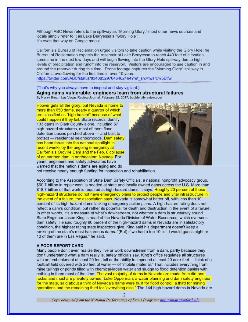
Hoover gets all the glory, but Nevada is home tomore than 650 dams, nearly a quarter of whichare classified as “high hazard” because of whatcould happen if they fail. State records identify133 dams in Clark County alone, including 67high-hazard structures, most of them flooddetention basins perched above — and built toprotect — residential neighborhoods. Dam safetyhas been thrust into the national spotlight inrecent weeks by the ongoing emergency atCalifornia’s Oroville Dam and the Feb. 8 collapseof an earthen dam in northeastern Nevada. Foryears, engineers and safety advocates havewarned that the nation’s dams are aging and donot receive nearly enough funding for inspection and rehabilitation.
According to the Association of State Dam Safety Officials, a national nonprofit advocacy group, $60.7 billion in repair work is needed at state and locally owned dams across the U.S. More than $18.7 billion of that work is required at high-hazard dams, it says. Roughly 20 percent of those high-hazard structures do not have emergency plans to protect people and vital infrastructure in the event of a failure, the association says. Nevada is somewhat better off, with less than 10 percent of its high-hazard dams lacking emergency action plans. A high-hazard rating does not reflect a dam’s condition, but rather its potential for death and destruction in the event of a failure. In other words, it’s a measure of what’s downstream, not whether a dam is structurally sound.State Engineer Jason King is head of the Nevada Division of Water Resources, which oversees dam safety. He said roughly 90 percent of the high-hazard dams in Nevada are in satisfactory condition, the highest rating state inspectors give. King said his department doesn’t keep a ranking of the state’s most hazardous dams. “(But) if we had a top 10 list, I would guess eight or 10 of them are in Las Vegas,” he said.
A POOR REPORT CARDMany people don’t even realize they live or work downstream from a dam, partly because they don’t understand what a dam really is, safety officials say. King’s office regulates all structures with an embankment at least 20 feet tall or the ability to impound at least 20 acre-feet — think of afootball field covered with 20 feet of water — of “mobile material.” That includes everything from mine tailings or ponds filled with chemical-laden water and sludge to flood detention basins with nothing in them most of the time. The vast majority of dams in Nevada are made from dirt and rocks, and most are privately owned. Luke Opperman, a water planning and dam safety engineer for the state, said about a third of Nevada’s dams were built for flood control, a third for mining operations and the remaining third for “everything else.” The 144 high-hazard dams in Nevada are
Copy obtained from the National Performance of Dams Program: http://npdp.stanford.edu2

inspected annually by licensed engineers. Another 113 significant-hazard dams are inspected every three years and about 400 low-hazard dams are inspected every five years.“And there’s probably another 100 that don’t meet our criteria (for a dam) that we keep an eye on anyway,” King said.
The state relies on just 11 people to conduct inspections, seven of whom are licensed engineers and four of whom work full time for the Division of Water Resources. In its 2013 national infrastructure report card, the American Society of Civil Engineers gave Nevada’s dams a D+ grade, citing state staffing levels and funding for dam safety at about half of the national average. The same report gave the nation as a whole a D for its dams. Since then, Nevada has added more inspectors and assigned engineers from other departments to conduct dam checks. Gov. Brian Sandoval’s recommended budget for 2018-19 includes three additional engineers for the water division.
FROM ‘FAIR’ TO FAILUREInspections alone do not guarantee safety. State regulators examined the Twenty-One Mile Dam in northeastern Elko County in late July and did not identify any problems requiring immediate attention. They rated the low-hazard earthen dam in “fair” condition and gave the owner a list of recommended improvements to be made within three years. On Feb. 8, the agricultural dam gaveway amid heavy rain and snowmelt in the area. No one was killed or injured, but floodwaters washed out a section of state Route 233 and left railroad tracks dangling in the air near the Utah state line, about 25 miles away. Rushing water and damaged roads have so far kept regulators from determining why the remote dam failed.\ “We are planning to do an investigation as soon as physically possible,” said Eddy Quaglieri, engineering manager for the state dam safety program.An inspection letter from last year warned of seepage, debris and plants clogging the spillway andmature vegetation covering and possibly weakening the embankment at Twenty-One Mile Dam.Then there is the overall age of the structure, which was built in 1929. “Those old dams are vulnerable,” King said.
STILL STANDING TALLLuckily, Nevada’s largest and most iconic dam seems to be aging pretty well. The risk of a failure at Hoover Dam is “very, very low,” according to Nathaniel Gee, dam safety program manager for the U.S. Bureau of Reclamation on the lower Colorado River. The 82-year-old structure undergoes a visual inspection every quarter and a more detailed yearly examination. “It takes almost an entire week to do the annual inspection,” Gee said. Every four years or so, engineers descend on Black Canyon to go over every inch of the dam. For those reviews, Gee said, inspectors don scuba gear to check submerged portions of the structure and use ropes to rappel into the spillways and penstocks, or floodgates. They also conduct a full risk analysis using updated information about the area’s geology, seismology and hydrology. Between inspections, the structure is monitored by automated sensors and the human “dam tenders” trained to spot signs of trouble, Gee said. Hoover certainly saw its share of problems early on. As Lake Mead was filling for the first time in the late 1930s, sizable leaks began to develop between the dam andthe canyon walls, prompting a nine-year drilling operation to seal the faults and fissures. That work was still underway in 1941 when the lake was intentionally filled to overflowing to test Hoover’s emergency outlets. The water hammered down the spillways with such force that it chewed through the thick concrete lining and into the bedrock underneath. Subsequent engineering changes improved the performance of the spillways, but the structures were damaged again in 1983, when record flows on the Colorado caused Lake Mead and Lake Powell to overflow. The spillways at Lake Powell’s Glen Canyon Dam sustained severe damage that year. Gee said that anytime a dam or one of its components fails, it provides lessons that engineers can use in future designs and existing facilities. He expects the industry to learn a lot from what’s been happening at Northern California’s Oroville, the nation’s tallest dam, where the main spillway collapsed and the emergency spillway nearly failed, triggering a mass evacuation downstream on Feb. 12.
Copy obtained from the National Performance of Dams Program: http://npdp.stanford.edu3
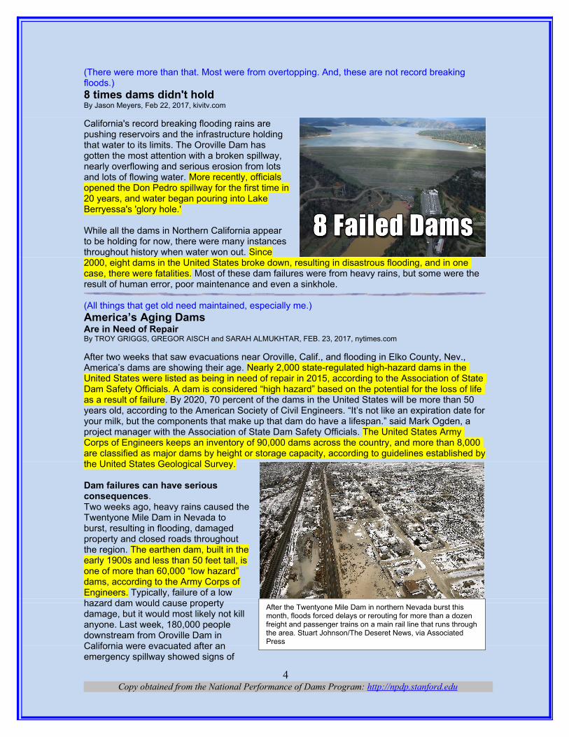
(There were more than that. Most were from overtopping. And, these are not record breaking floods.)8 times dams didn't holdBy Jason Meyers, Feb 22, 2017, kivitv.com
California's record breaking flooding rains arepushing reservoirs and the infrastructure holdingthat water to its limits. The Oroville Dam hasgotten the most attention with a broken spillway,nearly overflowing and serious erosion from lotsand lots of flowing water. More recently, officialsopened the Don Pedro spillway for the first time in20 years, and water began pouring into LakeBerryessa's 'glory hole.' While all the dams in Northern California appearto be holding for now, there were many instancesthroughout history when water won out. Since2000, eight dams in the United States broke down, resulting in disastrous flooding, and in one case, there were fatalities. Most of these dam failures were from heavy rains, but some were the result of human error, poor maintenance and even a sinkhole.
(All things that get old need maintained, especially me.)America’s Aging DamsAre in Need of RepairBy TROY GRIGGS, GREGOR AISCH and SARAH ALMUKHTAR, FEB. 23, 2017, nytimes.com After two weeks that saw evacuations near Oroville, Calif., and flooding in Elko County, Nev., America’s dams are showing their age. Nearly 2,000 state-regulated high-hazard dams in the United States were listed as being in need of repair in 2015, according to the Association of State Dam Safety Officials. A dam is considered “high hazard” based on the potential for the loss of life as a result of failure. By 2020, 70 percent of the dams in the United States will be more than 50 years old, according to the American Society of Civil Engineers. “It’s not like an expiration date foryour milk, but the components that make up that dam do have a lifespan.” said Mark Ogden, a project manager with the Association of State Dam Safety Officials. The United States Army Corps of Engineers keeps an inventory of 90,000 dams across the country, and more than 8,000 are classified as major dams by height or storage capacity, according to guidelines established bythe United States Geological Survey.
Dam failures can have seriousconsequences.Two weeks ago, heavy rains caused theTwentyone Mile Dam in Nevada toburst, resulting in flooding, damagedproperty and closed roads throughoutthe region. The earthen dam, built in theearly 1900s and less than 50 feet tall, isone of more than 60,000 “low hazard”dams, according to the Army Corps ofEngineers. Typically, failure of a lowhazard dam would cause propertydamage, but it would most likely not killanyone. Last week, 180,000 peopledownstream from Oroville Dam inCalifornia were evacuated after anemergency spillway showed signs of
Copy obtained from the National Performance of Dams Program: http://npdp.stanford.edu4
After the Twentyone Mile Dam in northern Nevada burst this month, floods forced delays or rerouting for more than a dozen freight and passenger trains on a main rail line that runs throughthe area. Stuart Johnson/The Deseret News, via Associated Press
failing. What Happened at the Oroville Dam Built in the 1960s and more than 16 times the height of the Nevada dam, Oroville was listed as a high hazard dam. Had it not been for the speed of theresponse last week, there could have been severe flooding of the surrounding area. “The larger dams are being watched very carefully. The smaller dams don’t enjoy that level of scrutiny,” Mr. Ogden said.
The U.S. would need to spend billions to repair public and private dams.In 2016, the Association of State Dam Safety Officials estimated that it would cost $60 billion to rehabilitate all the dams that needed to be brought up to safe condition, with nearly $20 billion of that sum going toward repair of dams with a high potential for hazard. In 2015, Representative Sean Patrick Maloney, Democrat of New York, introduced the Dam Rehabilitation and Repair Act,an amendment to the National Dam Safety Program Act, to provide grant assistance to rehabilitate publicly owned dams that fail to meet minimum safety standards.\ The bill is still pending, but it would not apply to a majority of the dams in the United States because more than half of them are privately owned. Oroville Dam is owned by the State of California, but the Twentyone Mile Dam is owned by Winecup Gamble Ranch, a cattle operation in northeastern Nevada.
While most legislation involves inspection and rehabilitation, hazardous dams that have outlived their usefulness can also be removed. “The very fact that you are blocking a river and allowing a reservoir to fill up with millions of gallons of water presents a risk,” said Bob Irvin, the president of American Rivers, an environmental conservation and advocacy organization. The group has partnered with the State of Maryland to remove the Bloede Dam, built in 1907, where several people have drowned over the years. Nationwide, 1,384 dams had been removed from 1912 through 2016, according to the nonprofit American Rivers. A majority of those dams were removed within the last two decades, with 72 removed in 2016. Note: A copy of the National Inventory of Dams was provided by Investigative Reporters and Editors. This copy was then checked against a list of removed dams provided by American Rivers. Sources: U.S. Geological Survey, the American Society of Civil Engineers, the Nevada Division of Water Resources, the Association of State Dam Safety Officials, American Rivers, and the U.S. Army Corps of Engineers (National Inventory of Dams)
(If the gates don’t work, you could lose a dam.)Shasta Dam drum gates opened for first time in 19 yearsBy: Haleigh Pike, Feb 23, 2017, krcrtv.com
For the first time in 19 years, the Shasta Damdrum gates were opened Wednesday. TheU.S. Bureau of Reclamation opened the gatesso they could test the spillway. The last time allthree drum gates were opened was in 1998.
(Everybody should have a Cadillac.)Despite Oroville Crisis, California Has The "Cadillac" Of State Dam Safety Programs By BEN ADLER • FEB 21, 2017, mynspr.org
The state of California missed one of its two annual Oroville Dam inspections last year. It has one field engineer for every 57 dams it must inspect. And there’s a potential conflict of interest in how the state inspects dams. Yet despite those concerns, California’s dam safety inspection program – which is drawing increased scrutiny after last weekend’s Oroville Dam crisis – is considered the best in the nation. “Everybody is understaffed and underfunded, “says Lori Spragens, who runs
Copy obtained from the National Performance of Dams Program: http://npdp.stanford.edu5
the Association of State Dam Safety Officials.“Every other state is more understaffed andunderfunded.” She says other states look toCalifornia. “They are actually what weconsider the Cadillac version of a state damsafety program.” You might think it’s a heavyworkload for 22 field engineers to inspect1,250 dams. But Oklahoma, which has morethan 4,600 dams, spent less than $200,000 ondam safety as of a few years ago. Californiaspends $13 million. “They obviously havesome areas that probably need someimprovement, including some of theiremergency action planning procedures,“ Spragens says. “But as far as technical abilities as dam safety engineers, inspectors, they are definitely excellent.”
Of course, because California assesses fees on dam owners to fund inspections, and because the state Department of Water Resources owns Oroville and several dozen other dams, the state is charging – and inspecting – itself. But Bruce Blanning, who runs the union that represents the dam inspectors, says there’s no conflict of interest. “I’ve never heard any concerns from our members that Oroville or any other facility wasn’t being inspected as often or as thoroughly as it should be,” says Blanning, the executive director of Professional Engineers in California Government. Nevertheless, the Department of Water Resources only inspected Oroville once lastyear; it was supposed to be inspected twice. A Democratic Assemblyman has just introduced a bill that would require closer inspections of dam spillways.
(Got to get the junk out of the way.)Officials to stop California dam's outflow to clear debrisBy The Associated Press, walb.com, 2/27/17
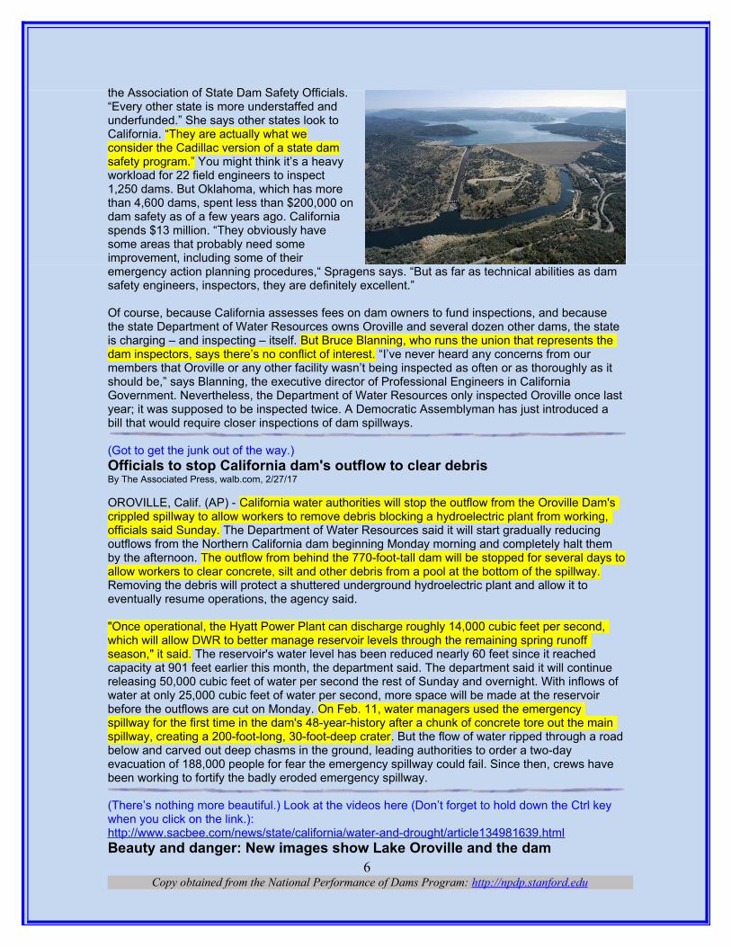
OROVILLE, Calif. (AP) - California water authorities will stop the outflow from the Oroville Dam's crippled spillway to allow workers to remove debris blocking a hydroelectric plant from working, officials said Sunday. The Department of Water Resources said it will start gradually reducing outflows from the Northern California dam beginning Monday morning and completely halt them by the afternoon. The outflow from behind the 770-foot-tall dam will be stopped for several days toallow workers to clear concrete, silt and other debris from a pool at the bottom of the spillway. Removing the debris will protect a shuttered underground hydroelectric plant and allow it to eventually resume operations, the agency said.
"Once operational, the Hyatt Power Plant can discharge roughly 14,000 cubic feet per second, which will allow DWR to better manage reservoir levels through the remaining spring runoff season," it said. The reservoir's water level has been reduced nearly 60 feet since it reached capacity at 901 feet earlier this month, the department said. The department said it will continue releasing 50,000 cubic feet of water per second the rest of Sunday and overnight. With inflows of water at only 25,000 cubic feet of water per second, more space will be made at the reservoir before the outflows are cut on Monday. On Feb. 11, water managers used the emergency spillway for the first time in the dam's 48-year-history after a chunk of concrete tore out the main spillway, creating a 200-foot-long, 30-foot-deep crater. But the flow of water ripped through a roadbelow and carved out deep chasms in the ground, leading authorities to order a two-day evacuation of 188,000 people for fear the emergency spillway could fail. Since then, crews have been working to fortify the badly eroded emergency spillway.
(There’s nothing more beautiful.) Look at the videos here (Don’t forget to hold down the Ctrl key when you click on the link.):http://www.sacbee.com/news/state/california/water-and-drought/article134981639.htmlBeauty and danger: New images show Lake Oroville and the dam
Copy obtained from the National Performance of Dams Program: http://npdp.stanford.edu6
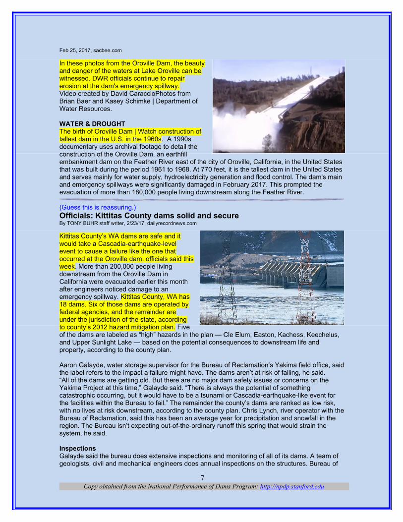
Feb 25, 2017, sacbee.com
In these photos from the Oroville Dam, the beautyand danger of the waters at Lake Oroville can bewitnessed. DWR officials continue to repairerosion at the dam's emergency spillway.Video created by David CaraccioPhotos fromBrian Baer and Kasey Schimke | Department ofWater Resources. WATER & DROUGHT The birth of Oroville Dam | Watch construction oftallest dam in the U.S. in the 1960s. A 1990sdocumentary uses archival footage to detail theconstruction of the Oroville Dam, an earthfillembankment dam on the Feather River east of the city of Oroville, California, in the United States that was built during the period 1961 to 1968. At 770 feet, it is the tallest dam in the United States and serves mainly for water supply, hydroelectricity generation and flood control. The dam's main and emergency spillways were significantly damaged in February 2017. This prompted the evacuation of more than 180,000 people living downstream along the Feather River.
(Guess this is reassuring.)Officials: Kittitas County dams solid and secure By TONY BUHR staff writer, 2/23/17, dailyrecordnews.com
Kittitas County’s WA dams are safe and itwould take a Cascadia-earthquake-levelevent to cause a failure like the one thatoccurred at the Oroville dam, officials said thisweek. More than 200,000 people livingdownstream from the Oroville Dam inCalifornia were evacuated earlier this monthafter engineers noticed damage to anemergency spillway. Kittitas County, WA has18 dams. Six of those dams are operated byfederal agencies, and the remainder areunder the jurisdiction of the state, accordingto county’s 2012 hazard mitigation plan. Fiveof the dams are labeled as “high” hazards in the plan — Cle Elum, Easton, Kachess, Keechelus, and Upper Sunlight Lake — based on the potential consequences to downstream life and property, according to the county plan.
Aaron Galayde, water storage supervisor for the Bureau of Reclamation’s Yakima field office, saidthe label refers to the impact a failure might have. The dams aren’t at risk of failing, he said.“All of the dams are getting old. But there are no major dam safety issues or concerns on the Yakima Project at this time,” Galayde said. “There is always the potential of something catastrophic occurring, but it would have to be a tsunami or Cascadia-earthquake-like event for the facilities within the Bureau to fail.” The remainder the county’s dams are ranked as low risk, with no lives at risk downstream, according to the county plan. Chris Lynch, river operator with theBureau of Reclamation, said this has been an average year for precipitation and snowfall in the region. The Bureau isn’t expecting out-of-the-ordinary runoff this spring that would strain the system, he said.
InspectionsGalayde said the bureau does extensive inspections and monitoring of all of its dams. A team of geologists, civil and mechanical engineers does annual inspections on the structures. Bureau of
Copy obtained from the National Performance of Dams Program: http://npdp.stanford.edu7

Reclamation staff from Denver also do internal inspections every four years. The bureau has instruments monitoring dams 24 hours a day and collecting data. “The bureau has enough checksand balances in place so that issues and potential issues will be caught before they end up being like this Oroville dam,” he said. “We’ve got directives and standards that tell us when to do things and what to do and we abide by them to keep the water where it is supposed to be which is upstream in the reservoirs.” The bureau also keeps a cushion in the reservoir based on potential flows to prevent flooding, Galayde said. It monitors snowpack and tracks weather patterns to know exactly how much water will be moving through the system.
“We’re always looking at it to manage the water as frugally as possible. There is no way we’re going to waste water because it is such a precious commodity, but we do have to work in a safetyfactor in the reservoirs,” he said. The dams in Kittitas County are getting old, but are well built, Galayde said. “Cle Elum’s construction has good geology. It is in a sense one of the tightest damswe have in our inventory. It just is a good glacial foundation area to put a dam. It is really nice,” hesaid. The Oroville dam in California is unusual in how much water it holds back, Galayde said. It isthe tallest dam in the country at 700 feet. “Its inflows are enormous its outflows are enormous. It isa unique monster and it sounds like they missed some warning signs,” he said.
Wanapum DamIn 2014 the Wanapum Dam’s spillway on the Columbia River formed a two-inch, 65-foot long crack, said Chuck Allen, Grant PUD public affairs officer. It took the Grant County Public Utility District more than a year to fix the dam and reinforce the spillway. The utility district had to install 35,200-foot long tendons into the bedrock and 69 anchor bars. “The spillway is even stronger nowthan when it was built,” Allen said. The crack formed because of a calculation error made in the dam’s original design, he said. The engineers did not use enough concrete or steel to withstand 50 years of pressure and tension from the water behind the dam. An event like at the Oroville dam could not happen at Wanapum because the two dams are completely different, he said. The Oroville is a high dam that holds back a lot of water, while the Wanapum is on a river.“There is a high dam that holds back a lot of water and then there is also a run-of-the-river dam, which lets the water flow through it. It doesn’t hold water back to a large degree,” Allen said.The Columbia River watershed headwaters come from the Canadian Rockies, he said. Kittitas County may be having a wet winter, but it doesn’t mean the Wanapum Dam will see high flows from the mountains.
County planKittitas County Undersheriff Clay Myers said the county has a broad hazard response plan in place in case of a flood event. The county cannot make 10,000 plans for every type of event, Myers said. Instead the county has procedures in place for any type of hazard. The plan involves everyone from the county auditor to state representatives. “It’s kind of like a fire, there is a full process ... we’ve had enough events here that it works well,” he said. The Bureau of Reclamation has maps outlining what would happen if a dam failure did occur, Myers said. The extent of the damage depends on the time of year, the weather and many factors. A wintertime dam failure would be much different than in the spring when the reservoirs Dam failures also don’t happen like in the movies, he said. A crack doesn’t appear and then the dam just goes. Dam failures can happen gradually, giving people time to evacuate.
(Almost got all the junk out of the way.)Oroville Dam Power Plant May Reopen This Week03/01/2017 | by Thomas Overton, powermag.com
The Edward Hyatt hydroelectric plant at the damaged Oroville Dam in northern California, shut down earlier this month after its spillway nearly collapsed, may reopen soon, officials with the California Department of Water Resources (DWR) said on March 1. The plant was forced to shut down after severe erosion from the dam’s spillway deposited large amounts of concrete, rock, anddebris in the channel, causing water levels to rise to the point that the plant’s turbines were unable to operate (Figure 1).
Copy obtained from the National Performance of Dams Program: http://npdp.stanford.edu8
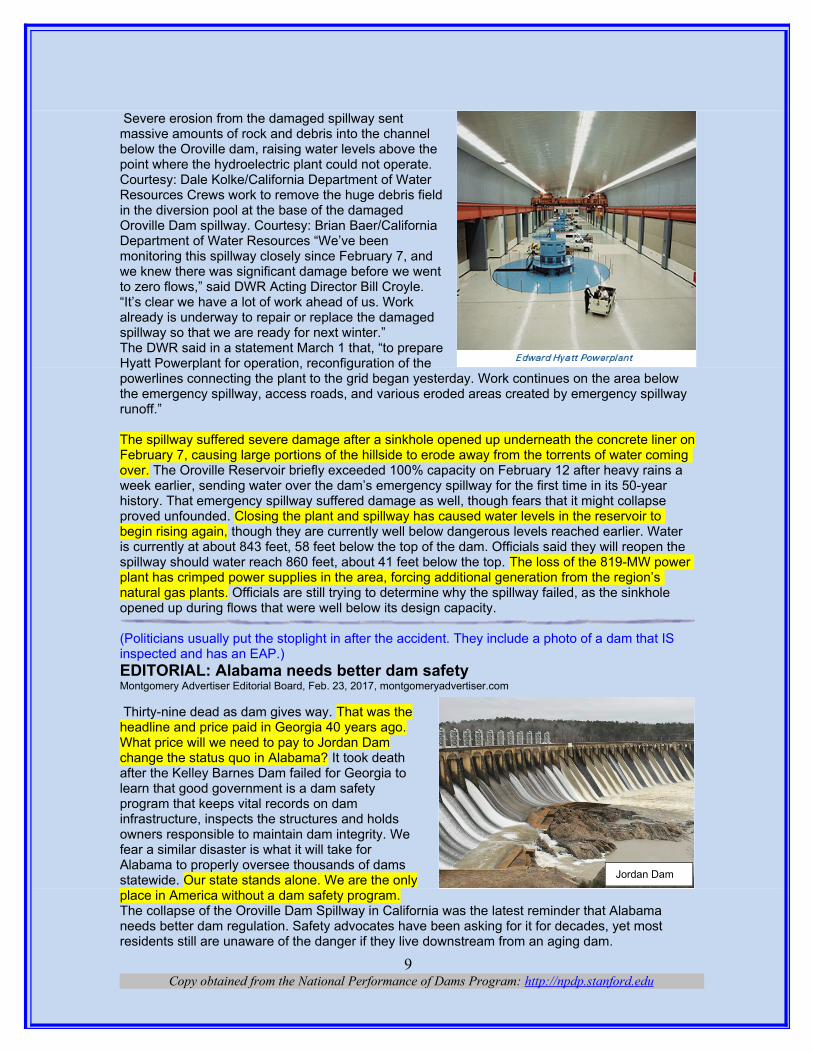
Severe erosion from the damaged spillway sentmassive amounts of rock and debris into the channelbelow the Oroville dam, raising water levels above thepoint where the hydroelectric plant could not operate.Courtesy: Dale Kolke/California Department of WaterResources Crews work to remove the huge debris fieldin the diversion pool at the base of the damagedOroville Dam spillway. Courtesy: Brian Baer/CaliforniaDepartment of Water Resources “We’ve beenmonitoring this spillway closely since February 7, andwe knew there was significant damage before we wentto zero flows,” said DWR Acting Director Bill Croyle.“It’s clear we have a lot of work ahead of us. Workalready is underway to repair or replace the damagedspillway so that we are ready for next winter.”The DWR said in a statement March 1 that, “to prepareHyatt Powerplant for operation, reconfiguration of thepowerlines connecting the plant to the grid began yesterday. Work continues on the area below the emergency spillway, access roads, and various eroded areas created by emergency spillway runoff.”
The spillway suffered severe damage after a sinkhole opened up underneath the concrete liner onFebruary 7, causing large portions of the hillside to erode away from the torrents of water coming over. The Oroville Reservoir briefly exceeded 100% capacity on February 12 after heavy rains a week earlier, sending water over the dam’s emergency spillway for the first time in its 50-year history. That emergency spillway suffered damage as well, though fears that it might collapse proved unfounded. Closing the plant and spillway has caused water levels in the reservoir to begin rising again, though they are currently well below dangerous levels reached earlier. Water is currently at about 843 feet, 58 feet below the top of the dam. Officials said they will reopen the spillway should water reach 860 feet, about 41 feet below the top. The loss of the 819-MW power plant has crimped power supplies in the area, forcing additional generation from the region’s natural gas plants. Officials are still trying to determine why the spillway failed, as the sinkhole opened up during flows that were well below its design capacity.
(Politicians usually put the stoplight in after the accident. They include a photo of a dam that IS inspected and has an EAP.)EDITORIAL: Alabama needs better dam safetyMontgomery Advertiser Editorial Board, Feb. 23, 2017, montgomeryadvertiser.com
Thirty-nine dead as dam gives way. That was theheadline and price paid in Georgia 40 years ago.What price will we need to pay to Jordan Damchange the status quo in Alabama? It took deathafter the Kelley Barnes Dam failed for Georgia tolearn that good government is a dam safetyprogram that keeps vital records on daminfrastructure, inspects the structures and holdsowners responsible to maintain dam integrity. Wefear a similar disaster is what it will take forAlabama to properly oversee thousands of damsstatewide. Our state stands alone. We are the onlyplace in America without a dam safety program.The collapse of the Oroville Dam Spillway in California was the latest reminder that Alabama needs better dam regulation. Safety advocates have been asking for it for decades, yet most residents still are unaware of the danger if they live downstream from an aging dam.
Copy obtained from the National Performance of Dams Program: http://npdp.stanford.edu9
Jordan Dam
(It could be, but will it?)California’s Oroville Dam problems could be learning experience in WestfieldBy Dan Desrochers, February 23, 2017, wwlp.com
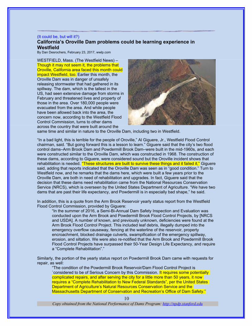
WESTFIELD, Mass. (The Westfield News) – Though it may not seem it, the problems thatOroville, California area faced this month couldimpact Westfield, too. Earlier this month, theOroville Dam was in danger of unsafelyreleasing stormwater that had gathered in itsspillway. The dam, which is the tallest in theUS, had seen extensive damage from storms inFebruary and threatened lives and property ofthose in the area. Over 180,000 people wereevacuated from the area. And while peoplehave been allowed back into the area, theconcern now, according to the Westfield FloodControl Commission, turns to other damsacross the country that were built around thesame time and similar in nature to the Oroville Dam, including two in Westfield.
“In a bad light, this is terrible for the people of Oroville,” Al Giguere, Jr., Westfield Flood Control chairman, said. “But going forward this is a lesson to learn.” Giguere said that the city’s two flood control dams–Arm Brook Dam and Powdermill Brook Dam–were built in the mid-1960s, and each were constructed similar to the Oroville Dam, which was constructed in 1968. The construction of these dams, according to Giguere, were considered sound but the Oroville incident shows that rehabilitation is needed. “These structures are built to survive these things and it failed it,” Gigueresaid, adding that reports indicated that the Oroville Dam was seen as in “good condition.” Turn to Westfield now, and he remarks that the dams here, which were built a few years prior to the Oroville Dam, are both in need of rehabilitation and upgrades. In fact, Giguere said that the decision that these dams need rehabilitation came from the National Resources Conservation Service (NRCS), which is overseen by the United States Department of Agriculture. “We have twodams that are past their life expectancy, and Powdermill is in especially bad shape,” he said.
In addition, this is a quote from the Arm Brook Reservoir yearly status report from the Westfield Flood Control Commission, provided by Giguere:
“In the summer of 2016, a Semi-Bi-Annual Dam Safety Inspection and Evaluation was conducted upon the Arm Brook and Powdermill Brook Flood Control Projects, by [NRCS and USDA]. A number of known, and previously unknown, deficiencies were found at the Arm Brook Flood Control Project. This included leaf debris, illegally dumped into the emergency overflow causeway, fencing at the waterline of the reservoir, property encroachment, blocked drainage culverts, swampification of the emergency spillway, erosion, and siltation. We were also re-notified that the Arm Brook and Powdermill Brook Flood Control Projects have surpassed their 50-Year Design Life Expectancy, and requirea “Complete Rehabilitation”.”
Similarly, the portion of the yearly status report on Powdermill Brook Dam came with requests for repair, as well:
“The condition of the Powdermill Brook Reservoir/Dam Flood Control Project is `considered to be of Serious Concern by this Commission. It requires some potentially complicated repairs, and after serving the city for a little more than 50 years, it now requires a “Complete Rehabilitation to New Federal Standards”, per the United States Department of Agriculture’s Natural Resources Conservation Service and the Massachusetts Department of Conservation and Recreation’s Office of Dam Safety.”
Copy obtained from the National Performance of Dams Program: http://npdp.stanford.edu10

These concerns, according to Giguere, should not wait.“This is something the city has to address. The federal government will be here at some point to tell us to fix it, the state government will be here at some point,” Giguere said. And while the city has been fortunate in recent history, Giguere cautions people that this is something that should belooked at, especially now that an incident happened and nationwide focus will be on this and the history of Westfield. According to Giguere, up until the flood of 1955, the city had flooded roughly every five to 10 years. In addition, the entire downtown area of the city is a natural floodplain, he said. To go even further, if a major flood did occur, Giguere said that it could damage portions of the Massachusetts Turnpike in the area, Routes 202 and 10 and also portions of the railroad system in the city. However, in order to address this problem the city may need financial help fromthe federal government, which according to Giguere has been on hold at the federal level. If the city were to fix the problem on its own, Giguere said the conservative estimates from the NRCS put the city’s cost between $10 million to $20 million. Regardless of how it is done though, Giguere believes it needs to be done. “Floods happen. There will be another flood,” he said. “Whether the structures can withstand it is the question.”
(Not a pretty picture.)What lessons should we learn from Oroville Dam drama? By Foon Rhee , Associate editor, editorial writer and Viewpoints editor, FEBRUARY 24, 2017, sacbee.com The state Division of Safety of Dams wascreated after the 1928 collapse of the St.Francis Dam in Southern California killedmore than 450 people, destroyed 900houses and swept away 24,000 acres offarmland. The state strengthened itsregulations after a 1963 dam break killedfive and washed away dozens of homes inthe Baldwin Hills neighborhood of LosAngeles. Let’s hope it doesn’t take another disasterto do something meaningful on dam safety. On Friday, Gov. Jerry Brown announced a four-point plan that includes spending $437 million on flood control and emergency response, requiring emergency plans for all dams, enhancing dam inspections and seeking federal action and funding.
Legislative leaders also say California must buttress its water and flood control systems, but it can’t be just talk again. Senate President Pro Tem Kevin de León is pushing to add $500 million for flood protection grants to a proposed $3 billion bond measure in 2018 and has called for oversight hearings on flood protection next week. The renewed focus on dam safety is a good thing. So is the attention brought by the Oroville Dam drama to the broader problem of how we have let our infrastructure fall apart with spotty maintenance and lack of money for repairs. Just like nervous homeowners who live near dams, it turns out that the state needs its own kind offlood insurance.
BY THE NUMBERSA look at the status of state-regulated dams in selected states:State High-hazard % of total damsCalifornia 678 54.2Arizona 108 41.8Colorado 407 23.2Nevada 153 22.3Oregon 77 17.9Washington 186 17.8Source: Association of State Dam Safety Officials
Copy obtained from the National Performance of Dams Program: http://npdp.stanford.edu11

(Risking their lives for OT and the money.)On the Front Lines at Oroville Dam: Little Sleep, Lots of OTBy Craig Miller, February 24, 2017, kqed.org
When the first alarms went out earlier this monththat Oroville Dam’s emergency spillway mightcollapse, a “small city” sprang up almost overnighton the hillsides flanking the imperiled dam.Wartime metaphors also came to mind. “This is onthe scale of a battlefield,” said Eric See, a publicinformation officer with the state’s Department ofWater Resources, who says he’s never seenanything like this. See gave Cal Fire, the stateagency more accustomed to tackling wildfires,much of the credit for the rapid mobilization. “Theycame in and set up overnight,” says See, witheverything from food trucks and generators, totelephone connections, to portable showers. All of this is supporting nearly 500 people on scene, including a hundred construction workers, give or take, who’ve been doing the grunt work 24-7 to make the critical repairs to the crippled spillway. On a hillside staging area above the south end of Oroville dam, huge yellow dump trucksfull of rocks rumble in with their loads, one right behind another, while in the air above, Blackhawk
helicopters swoop in, lifting 4,000-pound bags of stone and gravel like raptors grabbing mice from a field. So rapid is the cycle of ferrying fill material across the dam to the spillway that two helicopters often arrive for new loads within a minute of each other. The helicopters are some of the same ones that spend summers dropping buckets of water on wildfires. The work is pretty similar, according to Evan Welsch, a mechanic with Red Bluff-based P.J. Helicopters, except now instead of water buckets, they’re hauling bags of gravel and sand. The choppers have been placing those “super-
sacks.” as they’re called, into huge gashes carved out when Oroville’s lake waters topped the emergency spillway two weeks ago, and tore down the earthen slope into the Feather River below. “Some of the bags have big rocks, some of ‘em have sand, some have gravel,” says Mike Starcher, whose quarry, Sierra Silica, has been supplying much of the material. “It just depends on where the geologists want to layer ‘em in there.” Like See, Starcher, whose company has beenpart-owner of Sierra Silica for 15 years, also says he’s never seen anything like this deployment — 2000 bags and counting, just from his operation. And each one hadto be filled and transported by workers who knew they could be riskingtheir lives by remaining at quarries just down river. “There are sometough folks in this town,” says Starcher. He shrugs off the scant amountof sleep he’s had, saying “there are guys out here who have gone 30hours on end without any.” One of them is Reggie Gaston, who waszipping around on a forklift, lining up sacks where choppers couldsnatch them up. When Gaston’s wife and four kids were evacuated tohigh ground, he stayed behind, knowing the work he was doing couldsave his town from catastrophe. “Yeah, they were pretty worried,” headmits. “They wanted me to come home and I said, ‘I can’t.'” ButGaston says there was no pressure to stay on the job. “Bosses were
Copy obtained from the National Performance of Dams Program: http://npdp.stanford.edu12

concerned,” he recalls. “They said family comes first, but if you feel like they’re safe, we can use some help.” At the peak of the frenzy last week, crews were pouring fill material into the ravaged spillway at the rate of 40 truckloads an hour. Though 100,000 cubic yards of rock, sand and gravel had gone into shoring up the spillway by Tuesday evening of this week (picture 100,000 pickup trucks lined up), it’s a job that is still far from finished. “Right now we’re fighting the winter, fighting the rain, fighting the water,” says Gaston. “Hopefully by summertime or spring the rain has died down enough and dam has dropped down enough where they can actually fix the problem.” As for Starcher, he had to miss spending Valentines Day with his two girls, Claire and Catherine, whom he calls “Beeps.” So he took a can of red spray paint to two of the giant white bags of gravel and made them a valentine selfie; big red heart on one, their names on the other. His valentine will become part of the new, reinforced spillway. Gaston, who’s spent most of his 30 years as an Oroville resident, never thought the nearly 800-foot-high dam looming above them would end up menacing his family and neighbors. “Not really,” he admits. “But I have to say it is a man-made item. Man-made items do fall—and they do fail.”
(Flood control at work.)How does Indian Rock Dam protect York? By Teresa Boeckel, ydr.com, Feb. 25, 2017
But when heavy rain falls, the normally tranquilwest branch of the Codorus Creek can turn into araging river. Indian Rock Dam, which willcelebrate its 75th anniversary later this year, helpsto impound the water during heavy rains toprevent flooding in the City of York, PA andsurrounding municipalities. The dam was built inthe 1940s because of flooding that damaged thecity in 1933.It's a dry dam, meaning a pool of water is notbeing held behind it at all times. When a streamgauge at Zinns Quarry reaches 9.5 feet, the gatesare closed, and the dam impounds the waterbehind it. The reservoir, when full, would extendnearly 8 miles, back to Spring Grove.
Most of the land in the reservoir is owned by the dam and leased out. The state Game Commission leases the majority of it, and it's open for public hunting. Tropical Storm Agnes in 1972 was the biggest storm to challenge the dam. The flood water rose to just 18 feet from the top of the dam. It's the only time the flood water has risen so high that it flowed into the spillway, which functioned as designed. The last time the gates were used was in February 2016 because of minor flooding from a big snowstorm, head dam operator Steven Young said. Dam safety has been in the news after officials in Oroville, California feared that an emergency spillway there could fail after recent heavy rain and snow. In response, the officials released more water down the main spillway to avoid a disaster. No dams were listed by the state Department of Environmental Protection as being unsafe in York County, according to the county's 2013 Hazard Mitigation Plan. "I think we're well-prepared for a flood event of that magnitude," Young said of another storm like Agnes.
How Indian Rock Dam is inspectedIndian Rock Dam, which is operated by the U.S. Army Corps of Engineers, passed its most recentmajor inspection without deficiencies, said Chris Gardner, a spokesman for the U.S. Army Corps of Engineers. The big inspection is done every five years, and the last one was done in the fall of 2012. A team of engineers – including geotechnical, mechanical and structural – inspect the dam,generally over a two-day period, said Steve Brown, chief of flood risk management for the
Copy obtained from the National Performance of Dams Program: http://npdp.stanford.edu13

Baltimore District of the Army Corps. They will use a hammer to tap on the side of the spillway to see if any hollow spots exist. Depending on the severity, they might have to come back to fix those areas. Other things they look for are any exposed rebar. "When you have aging infrastructure, looking for this stuff every five years, you're going to build a history, and that's what we then put in for our budget packages," he said. Other inspections are done annually, and visual inspections are done on a daily basis, Gardner said. The flood gates are inspected annually by a licensed contractor, Young said. And each year, one of the gates is removed to be disassembled, repaired, cleaned and painted. The work includes repacking the roller bearings with grease. It is done to ensure the gates are operating as they should be. Repairs have been made to the dam over the years. In 1996, for example, the majority of the concrete on the spillway was redone, Young said. Soon, a bridge abutment over the dam will be repaired.
Taking care of the dam also requires clearing debris away from it. "Usually after a major flood event, it's piled up," Young said. "It takes a good week to take it out." Young said he was surprised the first time at the size of trees that float down during flooding. Some are so big that 90-ton cranes can't pick them up in one piece. When the dam is impounding water, it also closes roads in the area, including Route 616, Indian Rock Dam and Woodberry roads. Gates are closedto prevent drivers from heading into the flood waters. While the dam has helped to prevent flooding downstream, residents still should be prepared for an emergency, Gardner said. Other tributaries feed into the Codorus, and localized storms could pose a flooding threat, Brown said. Young can recall one time when he received a call from a mayor about flooding in the city. It wasn't raining at Indian Rock Dam. Dam has helped to keep the city safeIn the 1800s, before the dam was built, the Codorus Creek would swell to half a mile wide, said Michael Shanabrook, emergency planning specialist with the City of York. Flood control prevention has come a long way, he said. After Agnes, which marks its 45th anniversary in June, storm water pumps were added to help get rid of flood water. The storm sewers backed up duringAgnes, causing flooding in the city. "Indian Rock Dam has done a really good job of keeping the city safe," Shanabrook said.
Fast factsHere are some numbers to consider with Indian Rock Dam:
3: Number of flood gates at Indian Rock Dam42: Percentage of the flow controlled into the main branch of the Codorus Creek2.5 feet: Depth of the creek on a normal day9.5: Feet on the stream gauge that prompts the gates to be closed.94: Square miles of drainage area for the dam.83 feet: Height of the dam65 feet: Depth the water would be at spillway elevation.5.5: Millions of dollars spent to build Indian Rock Dam`54: Millions of dollars in damage that has been prevented from major stormsSource: Army Corps of Engineers
(All the states are thinking dam safety for now.)Fatal 1996 incident was 'wake-up call' for NH dam safetyBy SHAWNE K. WICKHAM, New Hampshire Sunday News, Feb. 25, 2017, unionleader.com
Ask Steve Doyon about a fatal dam collapse in Alton 21 years ago and he instantly recalls the victim's name: "Lynda Sinclair." "I'll never forget it," he said. "There are some things in your professional career that you just can't forget, and that's one of the things." Doyon is the administrator of the dam safety and inspection section at the state Department of Environmental Services. He's been a dam safety engineer for 30 years. On March 13, 1996, a privately owned earthen dam on Meadow Pond failed, sending a 10-foot wall of water and giant chunks of ice rushing through an Alton neighborhood. Lawrence and Lynda Sinclair lived below the dam and tried to flee. He drove his tractor-trailer; she took their pickup truck. The surge of water damaged 17 homes and a wide section of Route 140, tumbling Lawrence Sinclair's big truck into a deep
Copy obtained from the National Performance of Dams Program: http://npdp.stanford.edu14

void. From the cab, he watched as his wife's vehicle wasswept away. Her body was found six days later in theMerrymeeting River. She was 48 years old. A local pastor saidthe Sinclairs had planned to renew their vows at a 21stwedding anniversary party the day after the accident.
Doyon recalls getting a phone call from state police that night.By the time he got to the scene, the Meadow Pond reservoirhad emptied, he recalled. "There was just a stream runningthrough the bottom of the breach." And downstream, he said,"You could see the bark ripped off all the trees up to 10 to 15feet off the ground." An investigation into the collapse foundflaws in the dam's design and construction. It was neverrebuilt. Reached by phone recently, Lawrence Sinclairdeclined to talk about the tragedy. Doyon says what happenedback then was "a wake-up call" for New Hampshire.
Hazard levelsMost of the state's 2,600 dams - 78 percent - are privately owned. Twelve percent are owned by municipalities, 8 percent by the state, 1 percent by the federal government and less than 1 percent by public utilities, according to DES. The "vast majority" of dams here are classified as "non-menace" dams, Doyon said. But 150 dams are classified as "high hazard," meaning their failure would likely lead to a loss of human life, according to Doyon. Most of them are owned by the state, cities or towns; 38 are privately owned. At some dams, a potential failure would trigger evacuations, according to Doyon. These include the Moore Reservoir Dam in Littleton and Comerford Dam in Monroe, both owned by TransCanada, and the state-owned Murphy Dam in Pittsburg. The impact zone for the 193-foot-tall Moore Dam, he said, reaches all the way south to Hinsdale. "That's almost the entire length of the Connecticut River," Doyon said. And failure of theMoore dam could cause other downstream dams to fail, he said. There are also 157 "significant hazard" dams in New Hampshire; where a failure could lead to "major economic loss to structuresor property" and damage to major roads, according to DES. DES requires most owners of high- and significant-hazard dams to file Emergency Action Plans with the state, detailing the potential extent of downstream flooding, emergency actions to be taken upon indication of an impending dam failure or unsafe condition, and notification plans. The Federal Energy Regulatory Commission oversees utility-owned dams; federal inspectors check those annually. Doyon and his team of three engineers inspect the rest on a regular basis. High-hazard dams are inspected every two years, significant-hazard dams every four years and lower-hazard dams every six years.
Paying for repairsDam owners are notified of inspection results and given a time frame in which to complete any needed repairs. The cost of repairs and upgrades falls entirely on the owners. Keene will spend nearly $4 million over the next three years to upgrade three city-owned dams, according to City Engineer Don Lussier. Two of them, the Babbidge Reservoir and Woodward Pond dams, which provide the city's water supply, are actually in neighboring Roxbury. Several years ago, the state passed new regulations for high-hazard dams, Lussier said. "You have to be able to demonstrate that the dam can safely pass two-and-a-half times the flow that would result from a 100-year floodevent," he said. The Babbidge dam will undergo upgrades this summer, Lussier said. The city's Goose Pond dam is scheduled for improvements next year, and the Woodward project is set for 2019. Keene has been proactive in maintaining its dams, Lussier said. "I think what's really drivingit is a keen awareness that our water supply depends on the viability of those dams." The city is also committed to "climate resiliency," he said. "That's just part of the culture here in Keene." Woodward is 105 years old; Babbidge was built in 1931 and "served admirably for a long time," he said. "But they have to be cared for and loved and maintained." There are no matching state orfederal funds for dam upkeep, Lussier noted. "That is 100 percent local money," he said. "That's kind of the challenge."
Copy obtained from the National Performance of Dams Program: http://npdp.stanford.edu15
Dams are regional assets, providing water and recreational resources for many communities, Lussier said. "If I could wave my magic wand, I would love to see some participation from the state and federal government in the cost of meeting these new, higher design standards," he said. Doyon said he thinks New Hampshire does "a pretty good job" of regulating dams. But the lack of funding is a challenge, he acknowledged. Engineers have to consider the effects of climate change as they figure out what a dam should be able to withstand, he said. A dam rated as a non-menace dam when it was built in the 1970s could now be classified as a high-hazard structure. And when it's a private owner, he said, "It's not an easy conversation to have." Doyon said he hopes that fines collected for non-compliance could someday be used for low-interest loans to help other owners bring their dams into compliance.
Failure scenariosThe most likely dam failure, Doyon said, is a spillway that can't handle the amount of water coming. "And when that happens, water starts going places you didn't intend it to go." That's what caused a spillway at a massive California dam to erode earlier this month, forcing nearly 200,000 residents downstream to evacuate. Doyon's been watching the California situation closely. "I'm a dam nerd," he acknowledged. In New England, the biggest concern is heavy rainfall on top of a deep snowpack that melts too quickly, Doyon said. Engineers from DES and the Army Corps of Engineers have been taking snowpack measurements since January, tracking the amount of water it contains to calculate potential risk. The worst-case scenario is the kind of flooding that hit New Hampshire in 2005 to 2007, Doyon said. "I think those are the scariest types of events," he said. "You have so many people in the path of danger and you have so many more dams that potentially could be stressed beyond their limitations." What happened in Alton 21 years ago was a deadly reminder of what water can do, Doyon said. Too often, people attempt to flee floodwaters in a vehicle, he said. "It's just a big box of air on rubber tires," he said. "When the water gets beneath the wheels, cars float." "Moving water is extremely powerful, and people don't give it enough credit," he said.
(Look at these photos.)http://www.dailymail.co.uk/news/article-4263640/California-dams-outflow-stopped-clear-debris.html
Hydro: (Only hydropower news so far.)2017 Helly Hansen Hydropower 4 Sailing Shoe Jet Black 10832
Copy obtained from the National Performance of Dams Program: http://npdp.stanford.edu16
Water: (Sounds like a political statement. Need more storage.)Can we get some dam storage?BY TONI BUTERO/MATTOS NEWSPAPERS, February 23, 2017, westsideconnect.com
Another week of wet weather brought a flurry of releases from dams in Northern California, putting our already swollen rivers and creeks into monitoring and warning stages for flooding. Tuesday was especially eventful around these parts, with editor Dean Harris running from one flooded creek to the next. Watching the flows of water out of Don Pedro Dam and the Orestimba Creek overflowing again I get increasingly angry about the fact that we are wasting so much waterthat could be captured to help our farmers and state. Where does all this abundance of water go? Well, most of it flows right through our river system and out to the Pacific Ocean. Some will filter through the soil to help replenish our aquifer, which is badly needed after all the groundwater pumping which was necessary during the drought. Throughout the growth of California one area of our infrastructure has been badly neglected, namely our water system. Our needs have seriously outpaced what was once an example of thoughtful and forward infrastructure planning. This winter is showing all of California what happens when you ignore your own backyard while off dreaming about bullet trains and sanctuary cities. A local farmer out checking Orestimba Creekon Monday figured that four days of flows, like we saw that afternoon, would be enough to irrigate all of the land in the Del Puerto Water District for a full year.Del Puerto has received a zero allotment (or next to it) of water for the last couple of years, and this whole fiasco has got to have many of the farmers in the district shaking their heads every time they get word of another dam overflowing.
Local monitoring stations from the Department of Water Resources clocked the Orestimba Creek at a peak flow of 9,440 cubic feet per second earlier this week. By comparison Oroville was releasing 110,000 CFS last week with the emergency spillway, Don Pedro was releasing 11,000 cubic feet per second on Monday and the Anderson Dam in Morgan Hill was releasing about 4,000 cubic feet per second. That’s a lot of water for a state that is dry most of the year!Here is where I start to worry about needing blood pressure medication. Imagine the sheer volume of water being lost. Not just water, but already captured water with a multitude of purposes, like keeping people alive, healthy and fed. You know, nothing important! It is the height of insanity that our state continues a pace towards some supposed environmental utopia where the Central Valley is returned to the arid desert that it was before the time of water districts and junior rights. San Joaquin Valley dirt grows almost every fruit and vegetable known to man, and grows them well if you just add water. Maybe we should alert the water board that the land, after exploring its “identity,” has found its “true self” as a food-growing mecca. Perhaps then, someone in Sacramento would actually listen and farmers in the Central Valley could get back to growing food rather than trying to lobby some faceless bureaucrat for more water.
Assemblyman Adam Gray and Congressman Jeff Denham have both been trying to come up withsolutions at the state and federal levels. Local advocacy groups have sprouted up, like Worth Your Fight (look for them on social media or worthyourfight.org) to fight water and environmental regulations like the Bay-Delta Plan from the State Water Board. The time has come to restore some sanity in our state. Unfortunately, the current crop of leadership in Sacramento doesn’t garner any confidence. Instead of marshaling the power of one of the world’s largest economies and helping smaller communities, our regulators and elected officials continue to offer water solutions that overwhelmingly benefit environmentalists and fisheries. Having some dams built in California would do much to ease the burdens on ag in the valley and population centers
Copy obtained from the National Performance of Dams Program: http://npdp.stanford.edu17

throughout the state. What message does it send that we live in a state whose leaders believe that this is not a higher priority than saving a bait fish? I know, it’s a rhetorical question.
Other Stuff: (We don’t have hydropower like you.)Las Vegas Is 100% Powered By This Type Of Energy — Is Your City?February 25, 2017, By Ian Carey, thealternativedaily.com “We can brag that the city, this city of Las Vegas, is one of the few cities in the entire world that can boast using all of its power from a green source,” said Las Vegas Mayor Carolyn Goodman tothe press. She continued to say that Las Vegas is now a “world leader in sustainability.”
The city’s energy conservationLas Vegas is powered by renewable energy.The majority of the energy will be sourced fromsolar energy through the city’s partnership with NVEnergy. The company’s new solar plant is locatedjust outside of Las Vegas (in Boulder City). It willplay a large role in supplying the city with clean,renewable solar power. Energy conservation hasalso played a role; the city has reduced its energyconsumption by 30 percent in recent years. LasVegas is also a renewable energy producer. Thecity utilizes pretty much any available space tocollect energy from the sun. Las Vegas has putsolar panels up around the city hall plaza, on top oftheir wastewater treatment plan and on rooftops ofcity-owned buildings. The city is also using “solar shade canopies” at city parks. This is all to generate as much renewable energy as possible.
Up next: hydroelectric powerThe city is also expected to receive a smaller percentage of their energy from hydroelectric powerin the near future as well. While hydroelectric power can disturb local ecosystems and waterways,it is still a renewable source of energy. It’s one that does not require the use of fossil fuels. The city proudly announced on their tumblr page (yeah, tumblr!) that their carbon footprint is now backto the size of what it was in 1950. That’s a pretty impressive feat. Las Vegas does have somewhat of a geographical advantage over other areas in terms of solar energy production. But still, this is a big deal!
Will the casinos follow suit?Las Vegas casinos are moving towards renewableenergy. Unfortunately, the new energy plan does notmean every slot machine, casino and drive-thrumarriage window is also running on renewables. Itcovers any energy used in city-owned buildings orinfrastructure, such as street lamps. Still, it’s a prettyremarkable task for such a booming city. And manyof the casinos hope to join the city shortly in the 100-percent renewable energy-powered club. Many casinos have followed the city’s lead and installed solar panels on rooftops. Even without government subsidy or feed-in-tariff programs, the hot Nevada sun has been a safe investment for Las Vegas business owners. MGM Resorts boasts that they produce enough solar energy to power 1,000 homes for a year.
Copy obtained from the National Performance of Dams Program: http://npdp.stanford.edu18
Everything owned by the city of Las Vegas is now powered by renewable energy. Thanks to a new solar plant in Boulder City, all of the city property will operate sustainably, from the public buildings to the street lamps.

“It’s no accident that we put the array on top of a conference center. This is good business for us,”said chief sustainability officer for MGM Resorts, Cindy Ortega. “We are looking at leaving the power system. And one of the reasons for that is we can procure more renewable energy on the open market.”
Casinos want to leave the power gridMGM resorts and many other casinos are now in a position to power operations through the solar power they generate on their own. Or, casinos can supplement that energy from many nearby California and Nevada-based solar farms. The problem is that if all of the big energy consumers inNevada begin to leave the power grid, it will cause rate hikes for others who do not. “They need to maintain the grid. You cannot let these utilities go bankrupt or else every business in the city dies,” said Bill Ellard from the American Solar Energy Society. If MGM resorts and others want to leave the power grid, it may cost them millions in taxes to do so.
Other cities switching to renewable energyAmerican cities like Las Vegas are using morerenewable energy. Las Vegas is not the first city tomake the switch to renewable energy. Burlington,Vermont, Greensburg, Kansas and Aspen, Coloradohave already done so. Many other cities across theU.S. are on the way to achieving exactly what LasVegas has. Here are a few examples of citiesworking towards being powered completely byrenewables:• Georgetown, Texas – aiming for 2017• San Jose, CA- aiming for 2022• San Francisco, CA – aiming for 2030• East Hampton, NY – aiming for 2030• Rochester, MN – aiming for 2031• San Diego, CA – aiming for 2035The city of New York, which perhaps never sleeps due to excessive light pollution, is hoping to power 50 percent of the city-owned infrastructure with renewables by 2030.
Encourage your city to go with green powerDo you know what percentage of your city’s energy comes from clean and renewable sources? Inmany of the above examples, politicians chose to push forward a path towards a sustainable future because of demands and concerns from their constituents. If there is not a push in your area to get your city-owned property powered by renewables, then perhaps you could be the one to start the pushing. It wouldn’t take more than five minutes to contact your city councilor or mayor’s office. Then you can find out your city’s energy plan. Doing so could be the first step to your city developing a plan to switch to renewables.
Copy obtained from the National Performance of Dams Program: http://npdp.stanford.edu19

iThis compilation of articles and other information is provided at no cost for those interested in hydropower, dams, and water resourcesissues and development, and should not be used for any commercial or other purpose. Any copyrighted material herein is distributed withoutprofit or payment from those who have an interest in receiving this information for non-profit and educational purposes only.