solutions, inc. (“psi pb nepa eis cdua
TRANSCRIPT

1
JAMES T. HAYES WRITTEN DIRECT TESTIMONY
I am James T. Hayes, President and Principal Environmental Planner at Planning
Solutions, Inc. (“PSIˮ).
I received two A.B. degrees (one as an Earth and Planetary Science major and the other
as an International Development major) in 1989 from Washington University in St. Louis. I
have worked in the environmental consulting field since the early 1990s with various firms,
including PB Americas, Inc. (aka Parsons Brinckerhoff; “PBˮ), in Honolulu and San Francisco
before joining PSI in April 2015. My duties and responsibilities at PSI include supervising a
team of professionals primarily engaged in the preparation of environmental documents and
permit applications for infrastructure projects in the State of Hawaiʻi. The projects we typically
work on include compliance with a wide variety of local, state, and federal regulations, including
HRS Chapter 343 and the National Environmental Policy Act (“NEPAˮ). A copy of my
curriculum vitae was submitted as Exhibit A-35. Exhibit A-36 contains demonstratives I
prepared to aid in my testimony.
In July 2008, PB was retained by the TMT Observatory Corporation (the predecessor
entity to TMT International Observatory LLC) to prepare an Environmental Impact Statement
(“EISˮ) (Exhibits A-2, A-3, A-4, A-5). I served as PBʼs project manager in connection with the
preparation of the EIS for the Thirty Meter Telescope project (“TMT Projectˮ or “Projectˮ).
After completing work on the EIS for the TMT Project I assisted with preparation of the
Conservation District Use Application (“CDUAˮ) (Exhibit A-1) and have visited the Mauna Kea
summit region periodically, most recently on October 6, 2016.1
1 As part of my work preparing the EIS and CDUA, I reviewed, among other things, thedocuments that were submitted as Exhibits A-1, A-2, A-3, A-4, A-5, A-6, A-48, A-51, A-54, A-70, A-71, A-76 through A-91, A-103 through A-105, A-108 through A-110.

2
The Environmental Impact Statement Process
The TMT Project has complied with the EIS process required under Hawaiʻi Revised
Statutes (“HRSˮ), Chapter 343 (Environmental Impact Statement Law) and Chapter 200 of Title
11, Hawaiʻi Administrative Rules (“HARˮ) (Department of Health, Environmental Impact
Statement Rules).
First, advertisements were placed in the local newspapers informing the public that an
EIS Preparation Notice/Environmental Assessment (“EISPN/EAˮ) was forthcoming. The
EISPN/EA prepared pursuant to HRS Chapter 343 was issued for the Project on September 23,
2008. Six scoping meetings were held around the island of Hawaiʻi and one was held on Oʻahu.
On May 23, 2009, the Draft EIS for the Project was issued for public and agency review, and
seven public meetings were held to receive comments from the public and agencies during the
45-day review period, which ended on July 7, 2009. The Projectʼs Final EIS was prepared to
respond to the comments received during the Draft EIS review period, and was issued on May 8,
2010. Exhibits A-3, A-4, A-5. The Governor of Hawaiʻi accepted the Final EIS as detailed in a
letter dated May 19, 2010. Exhibit A-6.
Visual and Aesthetic Resources
Section 3.5, pages 3-80 through 3-104 of the TMT Final EIS (Exhibit A-3), discusses the
visual and aesthetic resources and potential Project impacts to those resources. With respect to
cumulative impacts, both the existing level (pages 3-217 and 3-218) and potential future level
(pages 3-230 through 3-232) are discussed in Section 3.16 of the Final EIS. In addition the EIS’
discussion of the Project’s visibility in the summit region (Section 3.5.3, page 3-99 through 3-
100), Figure 2 has been developed to summarize the Project’s distance and visibility from select
known and possible cultural practices areas.
3
A number of techniques were used to assess the visual resources and potential TMT
Project impacts. These included:
Reviewing community plans that discuss visual resources, including the Hawaiʻi
County General Plan (County of Hawaiʻi, 2005), and the South Kohala Development
Plan (County of Hawaiʻi, 2008).
Reviewing the existing level of cumulative impacts of the existing observatories.
Determining the “viewshedˮ of the TMT Observatory.
Evaluating the “viewplanesˮ of the areas within the TMT viewshed.
Performing a silhouette analysis.
Preparing photo simulations.
The results of these assessments are described below.
These methods were described in the Project’s EISPN and further detailed in the Draft
EIS along with the results. Input was sought on the methods and results during the review
periods for those documents, including at seven public meetings around the state. Certain
individuals and groups who are now petitioners in this contested case received those documents
and/or attended the meetings. No input was received suggesting other/additional methods be
employed to evaluate the visual impact of the Project.
Plans
The Hawaiʻi County General Plan identified the following views that include Mauna
Kea:
View of Mauna Kea and Mauna Loa from Pahoa-Keaʻau, Volcano-Keaʻau Roads,
and various Puna subdivisions;
Viewpoint of Hilo Bay with Mauna Kea in background; and

4
Mauna Kea State Park area.
The South Kohala Development Plan recommends the strategy to “protect the puʻu of
Waimea that have cultural, historical and visual importanceˮ and which have “grand views of
Mauna Kea.ˮ
Existing Level of Cumulative Impacts.
At the time the EIS was prepared, and currently, there were and are 11 observatories on
Mauna Kea within the Astronomy Precinct.2 The 11 observatories and the attributes that affect
their visibility are listed in Table 1 below. Some of these existing observatories are visible from
locations around the island such as Hilo, Honokaʻa, and Waimea; the viewshed of each
observatory, i.e., the percent of the island's land area from which the observatory is potentially
visible, is listed in Table 1. On the west coast of the island, the existing observatories appear
most visible at sunset, when they are lit by the setting sun; on the east coast they appear most
visible at sunrise. Considering all existing observatories together, at least one observatory is
visible from roughly 43 percent of the island's land area.
Table 1: Existing Observatory Visual and Aesthetic AttributesObservatory 2000 Master
Plan SittingArea
GroundElevation(feet)
DomeHeight (feet)
DomeColor
Viewshed(%)
Subaru B 13,578 141 Metallic 20Keck B 13,603 111 White 17IRTF B 13,652 53 Aluminum 14CFHT A 13,726 125 White 35Gemini A 13,764 151 Aluminum 39UH 2.2m A 13,784 80 White 36UKIRT A 13,762 61 White 26UH Hilo 0.9m A 13,727 20.25 White 15CSO C 13,362 63 Metallic 5JCMT C 13,390 100 White 7
2 The Astronomy Precinct is comprised of 525 acres of land located within the Mauna KeaScience Reserve (“MKSR”). The entire 10,288 acre MKSR is designated as a Resourcesubzone. Although astronomy is an expressly permitted use within the MKSR Resourcesubzone, the University of Hawai‘i has confined astronomy facilities to the Astronomy Precinct.
5
Observatory 2000 MasterPlan SittingArea
GroundElevation(feet)
DomeHeight (feet)
DomeColor
Viewshed(%)
SMA C 13,279 - 13,400 45 NA 2
The existing development on Mauna Kea does not block or obstruct any of the identified
views in the County of Hawaiʻi General Plan or the South Kohala Development Plan. The
existing observatories are, however, visible within the viewplanes from Hilo, Waimea, and the
summit. Overall, the existing level of the cumulative visual impact from past projects at the
summit is considered to be substantial, significant, and adverse. This assessment of the existing
level of cumulative visual impact is consistent with the Final Environmental Impact Statement
for the Outrigger Telescopes Project, which, in Section 4.2.14.4, page 4-119, states: “The visual
impacts of past and present astronomy-related activities in the MKSR have been substantial.ˮ
TMT Observatory Viewshed
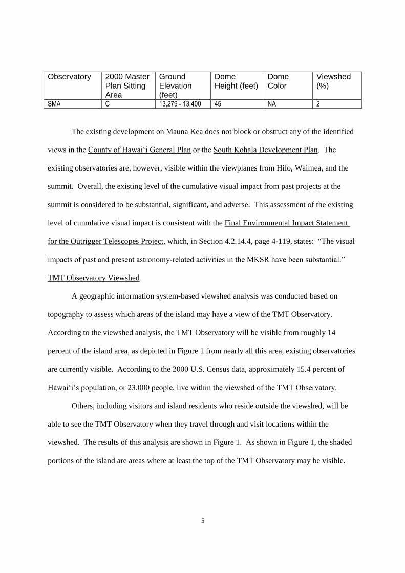
A geographic information system-based viewshed analysis was conducted based on
topography to assess which areas of the island may have a view of the TMT Observatory.
According to the viewshed analysis, the TMT Observatory will be visible from roughly 14
percent of the island area, as depicted in Figure 1 from nearly all this area, existing observatories
are currently visible. According to the 2000 U.S. Census data, approximately 15.4 percent of
Hawaiʻi’s population, or 23,000 people, live within the viewshed of the TMT Observatory.
Others, including visitors and island residents who reside outside the viewshed, will be
able to see the TMT Observatory when they travel through and visit locations within the
viewshed. The results of this analysis are shown in Figure 1. As shown in Figure 1, the shaded
portions of the island are areas where at least the top of the TMT Observatory may be visible.

6
Figure 1: Viewshed and Primary View Analysis

7
Viewplanes
Representative viewpoints within the northern portion of the island were identified as
places that are of visual significance. See Exhibits A-54, A-109, A-110. The viewpoints and the
direction of the primary view from each viewpoint are mapped in Figure 1 and Error!
Reference source not found. summarizes which of the viewpoints the TMT Observatory would
be at least partially visible. The primary view is the direction of view that is the primary
attraction at the viewpoint. Typically, near the ocean the ocean is the primary view, and away
from the ocean the mountains are the primary view.
Based on this assessment, the TMT Observatory will be visible in the primary view
direction only from the area around Waimea. Of the island's population, 5.5 percent, or 8,100
people, reside within the area around Waimea and may be able to see the TMT Observatory.
No portion of the TMT Observatory will be visible from the Mauna Kea summit or Lake
Waiau (viewpoint 17, Figure 1). In addition, as illustrated in Figure 2, the observatory will not
be visible from Pu‘u Līlīnoe or the Keanakāko‘i Adze Quarry. It will, however, be visible from
locations in the northern portion of the summit region, including Pu‘u Poli‘ahu, from which it
will be partially visible, and Pu‘u Pohaku as summarized on Figure 2.

8
Figure 2: Distance from Cultural Practice Areas to Proposed TMT Observatory
The TMT Observatory will not interfere with views of the sunrise, sunset, the shadow of
Mauna Kea, or the Southern Cross constellation from any of the identified viewpoints.
Furthermore, the TMT Observatory will not interfere with view of these events or resources
unless the observer is located in close proximity to the observatory structure.
Silhouette Analysis
For the 13 viewpoints where the TMT Observatory may be visible, a silhouette analysis
was conducted to determine whether the view of the Observatory will be a full or partial
silhouette against the sky, or whether it will be seen against the backdrop of Mauna Kea. Table 2
summarizes the silhouette analysis for the TMT Observatory and the potential long-term impact
to visual and aesthetic resources.

9
Table 2: Summary of TMT Observatory Silhouette Analysis
Viewpoint LocationVisible in silhouette?No Partial Full
1 Hualālai Resort -- 164 feet (50 m) --2 Pu‘u Waawaa -- 58 feet (17 m) --3 Big Island Country Club -- 82 feet (25 m) --4 Waikoloa/Mauna Lani -- 164 feet (50 m) --5 Hāpuna Beach N/A, TMT Observatory not visible6 Puukohola Heiau -- 164 feet (50 m) --7 DHHL Kawaihae at Route 250 X -- --8 Route 250 Pu‘u Overlook X -- --9 DHHL Lalamilo -- 49 feet (15 m) --10 Waimea Park -- 89 feet (27 m) --11 DHHL Pu‘u Kapu -- 98 feet (30 m) --12 DHHL Waikoloa-Waialeale -- 164 feet (50 m) --13 Waipio Valley Lookout N/A, TMT Observatory not visible14 Honoka‘a -- 82 feet (25 m) --15 Laupāhoehoe Point N/A, TMT Observatory not visible16 Mauna Kea Summit N/A, TMT Observatory not visible17 Lake Waiau N/A, TMT Observatory not visible18 North ridge of Kūkahau‘ula X -- --
Photo Simulations.
In compliance with Comprehensive Management Plan (“CMPˮ) (Exhibit A-9)
Management Action FLU- 4, visual renderings of the Project setting were prepared.
Views from Lower Elevation Developed Areas
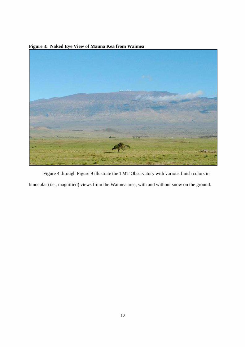
When assessing the views from the lower elevation developed areas, photo simulations of
the TMT Observatory were created using photographs of the summit of Mauna Kea that were
taken with a 600 mm/5.6 telephoto lens resulting in a “binocular viewˮ - i.e., a magnified view,
simulating what the TMT Observatory would look like if seen through binoculars. This
binocular view was done because in typical 50 mm lens photographs simulating a “naked eye
view, ˮ the TMT Observatory was barely visible due to the distance between the location where
the photograph was taken (where the bulk of potential viewers reside) and the location of the
TMT Observatory. An example of the naked eye view (i.e., a 50 mm lens photograph) of Mauna
Kea from Waimea is shown in Figure 3.
10
Figure 3: Naked Eye View of Mauna Kea from Waimea
Figure 4 through Figure 9 illustrate the TMT Observatory with various finish colors in
binocular (i.e., magnified) views from the Waimea area, with and without snow on the ground.

11
Figure 4: Simulation of TMT Observatory, Aluminum-Like Finish – “Binocular” Viewfrom Waimea with no Snow
Photo Credit: CFHT
Figure 5: Simulation of TMT Observatory, White Finish – “Binocular” View fromWaimea with no Snow
Photo Credit: CFHT

12
Figure 6: Simulation of TMT Observatory, Brown Finish – “Binocular” View fromWaimea with no Snow
Photo Credit: CFHT
Figure 7: Simulation of TMT Observatory, Aluminum-Like Finish – “Binocular” Viewfrom Waimea with Snow
Photo Credit: Charles R. West Photography

13
Figure 8: Simulation of TMT Observatory, White Finish – “Binocular” View fromWaimea with Snow
Photo Credit: Charles R. West Photography
Figure 9: Simulation of TMT Observatory, Brown Finish – “Binocular” View fromWaimea with Snow
Photo Credit: Charles R. West Photography
These simulations from Waimea illustrate that the TMT Observatory will be below the
summit of Mauna Kea and the existing observatories. From the view presented, the lower

14
portion of the TMT Observatory will be obscured behind a rise of Mauna Kea and located in
front of one of the domes of the existing Keck or Subaru Observatory. Roughly the top 90 feet
of the observatory dome will be visible from the Waimea area, as listed for viewpoints 9, 10, and
11 in Table 2. These simulations show that the reflective aluminum-like finish appears less
obtrusive than the white finish when there is no snow.
Similar simulations were also prepared for views from Honokaʻa and Waikoloa village.
These are shown in Figure 10 and Figure 11, respectively, and are also binocular (i.e., magnified)
views.
Figure 10: Simulation of the TMT Observatory, Aluminum-Like Finish – “Binocular”View near Honoka‘a

15
Figure 11: Simulation of the TMT Observatory, Aluminum-Like Finish – “Binocular”View from Waikoloa
Photo Credit: Charles R. West Photography
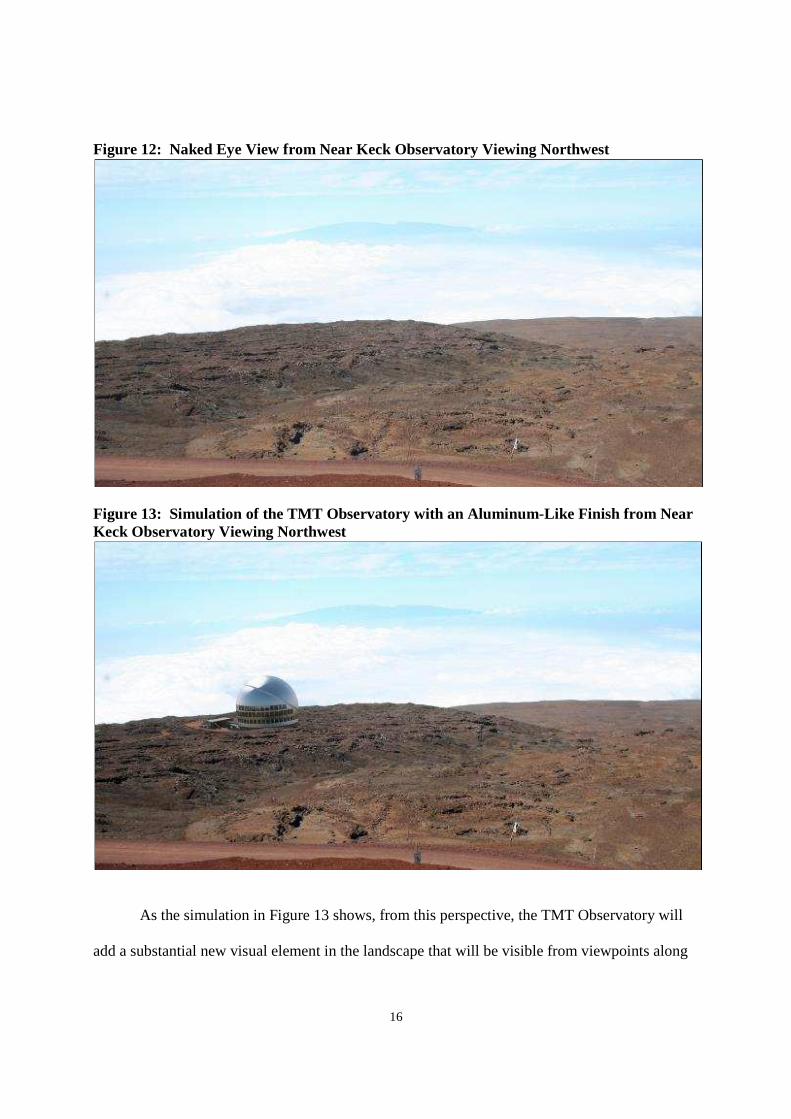
Views within the Summit Region
The TMT Observatory will not be visible from the summit of Mauna Kea, viewpoint 16,
or Lake Waiau, viewpoint 17. It will be visible from other locations within the summit region,
primarily the northern plateau and the northern ridge of Kūkahauʻula where the Subaru, Keck,
IRTF, and CFHT observatories are located, viewpoint 18 (Figure 1) and other locations on the
north side of Maunakea (Figure 2). Figure 12 shows the current view from near the Keck
Observatory, viewpoint 18, looking to the northwest, looking over the northern plateau and the
TMT Observatory 13N site. Figure 13 is a simulation of the TMT Observatory with an
aluminum-like finish from the same viewpoint.
16
Figure 12: Naked Eye View from Near Keck Observatory Viewing Northwest
Figure 13: Simulation of the TMT Observatory with an Aluminum-Like Finish from NearKeck Observatory Viewing Northwest
As the simulation in Figure 13 shows, from this perspective, the TMT Observatory will
add a substantial new visual element in the landscape that will be visible from viewpoints along

17
the northern ridge of Kūkahauʻula and by people as they travel within the northern portion of the
summit region, including Puʻu Poliʻahu. Currently, views from the northern ridge of
Kūkahauʻula are already dominated by views of observatories, including Subaru, Keck, IRTF,
and CFHT observatories, which are located on the northern ridge; all the existing observatories
are also visible from the top of Puʻu Poliʻahu. In addition, TMT's lower elevation and its size
and height mean it will not block the view of Maui from the ridge or Pu‘u Poli‘ahu (Figure 14
and Figure 15).
Figure 14: View Angle from Pu‘u Poli‘ahu toward Haleakalā

18
Figure 15: Simulation of the TMT Observatory, Aluminum-Like Finish from Pu‘uPoli‘ahu
The majority of visitors to the summit region and cultural practitioners visit the eastern
ridge of Kūkahauʻula and the Kūkahauʻula summit, not the northern ridge of Kūkahauʻula. This
is presumably because (a) the area near the UH 2.2m observatory on the eastern ridge is the
highest vehicle-accessible point, roughly 135 higher than the northern ridge; (b) parking is
available near the UH 2.2m observatory; (c) the UH 2.2m observatory is near the Kūkahauʻula
summit trailhead; and (d) the Kūkahauʻula summit is the highest place in Hawai‘i and the
Pacific. Since 2013, OMKM has discouraged visitors from hiking to the Kūkahauʻula summit.
Nevertheless, visitors continue to ascend the summit as well as cultural practitioners. Therefore,
the eastern ridge and summit remain the most visited areas of the summit region. The TMT
Observatory will not be visible from the UH 2.2m Observatory or the Kūkahauʻula summit.
Mitigation Measures.
The primary mitigation measures to address the visibility of the TMT Observatory are:
Location. The location of the TMT Observatory significantly reduces the Projectʼs
potential visual impacts. Because the location proposed for the TMT Observatory is
north of and below the summit of Mauna Kea, it will be substantially less visible than

19
if it were to be placed in a more visible location, such as on the summit ridge or on a
puʻu.
Design. The telescope itself has been designed to be as short as possible for one with
a 30-meter primary mirror by using a focal ratio3 of f/1.0, which allows for the
smallest dome feasible. The primary mirror is closer to the surrounding ground
surface than other observatories on Mauna Kea. In addition, the enclosure has been
designed to fit very tightly around the telescope, leaving just enough room for a
person, only about 20 inches, between the telescope and the dome (Figure 16). This
results in a dome with a diameter of 216 feet and total height of approximately 180
feet. If the TMT Observatory were to use a more traditional mirror-to-dome size,
such as that of the Keck Observatory, it would result in a dome with a diameter of
364 feet, almost twice that of the current design (Figure 17).
Figure 16: Overview of TMT and Dome Design
3 Focal ratio (f/) is defined as the ratio of the focal length of the mirror to its diameter.

20
Figure 17: Comparison of Observatory Dome Sizes to Telescope Focal Ratios
Color. The color, or coating, of the dome enclosure has substantial visual
implications. The coating of the dome enclosure will be an aluminum-like coating,
similar to that used on the Subaru Observatory. In general, an aluminum-like coating
reflects the morning sunrise and evening sunset light and stands out during those
periods; however, during most of the day, the coating reflects the sky and reduces the
visibility of the observatory.
Support Building. The support building is relatively small and low relative to the
size of the dome and telescope, and would only be visible from viewpoints relatively
close to the Project site. Its design further incorporates features to reduce its visibility
from the Kūkahau‘ula historic property. The building will be lava-colored to blend

21
with its surroundings, and the employee parking areas will not be visible from
Kūkahau‘ula.
Visual Impact of the TMT Observatory in Context of Existing Conditions
The standard industry practice for conduct a visual impact analysis is to consider the
context of the proposed land use. In other words, the impact of the proposed Project must be
assessed in the context of the Mauna Kea Astronomy Precinct. The Astronomy Precinct is not a
bare mountaintop with no telescope structures. Rather, there are 11 other observatories in the
Astronomy Precinct. The TMT Observatory will not substantially obstruct or block existing
views of Maunakea from around the island of Hawai‘i. The TMT Observatory will be visible
from only about 14 percent of the island area. The new area where the TMT Observatory will be
visible and where currently none of the existing observatories can be seen is approximately only
1.2 percent of the area of the island. Furthermore, the TMT Observatory will be visible to only
about 15.4 percent of the population, and the great majority of those residents already can see
one or more observatories from their residences. Therefore, while the TMT Observatory will be
a new visual element among the existing observatories, it does not substantially alter the current
overall visual impact of the Astronomy Precinct area.
In addition to residents within the TMT viewshed, the TMT Observatory will be visible
to other island residents and visitors when they travel within the TMT viewshed (Figure 1),
including travel along roads and stops at viewpoints. The Projectʼs visual impact is perceived by
some to be significant; however, in the context of the existing observatories and the fact that the
TMT Observatory will not block or substantially obstruct the identified views and viewplanes of
the mountain, which is the applicable significance criteria in § 11-200-12 of the HAR, the
Projectʼs visual impact will be less than significant.

22
Furthermore, the TMT Project incorporates mitigation measures to minimize the visual
impact of the Project to the extent practicable to meet the project’s scientific objectives. Due to
its design and location, the TMT Observatory will be at a lower elevation than other
observatories in the MKSR, minimizing its viewshed. The Project has numerous design
elements—e.g., the dome’s tight fit around the telescope, aluminum-like finish, and color of the
road pavement—to further minimize its visual impact.
Cumulative Visual Impact of Development in the Mauna Kea Summit Region
Although the existing observatories within the MKSR also do not block or substantially
obstruct the identified views and viewplanes of the mountain, the Final EIS for the Outrigger
Telescopes Project assessed that the current level of cumulative impact – i.e., without the TMT
Project – as being “substantial.” This NEPA assessment is based on at least some of the
observatories being visible from most locations within the MKSR and from many off-mountain
locations including Hilo, Waimea, and Honokaa. The EIS prepared for the TMT Observatory
adopted the Outrigger Project’s NEPA assessment concluding that the existing visual impact is
“substantial, significant, and adverse.”
The five observatories built prior to 1980 (UH Hokukea, UH 2.2m, IRTF, CFHT, and
UKIRT) that remain present are located on the summit ridges. Each of those observatories
contributed an incremental visual impact to the cumulative visual impact of the ones that came
before it (if any). The accumulation of those five increments resulted in at least one observatory
being visible across roughly 43 percent of the island, including within the MKSR, Hilo, Waimea,
and Honoka‘a, and may have been considered a substantial cumulative visual impact. Since that
time additional observatories have been built (i.e., Keck, Subaru, Gemini), each adding an
additional increment to the cumulative impact, which may have already been considered

23
substantial. The incremental increase in cumulative visual impact due to the TMT Project will
be minimized to the extent practicable as outlined above, will be less than significant, and
includes:
The addition of the TMT Observatory into the view of Mauna Kea that currently
includes one or more (typically 6 or 7) existing observatories from 12.8 percent of the
island area, including the northern summit area, Waimea, and Honoka‘a.
The expansion of the land area from which at least one observatory can be seen from
43 percent to 44.2 percent of the island, a 1.2 percent increase within which only a
portion of the TMT Observatory will be visible.
When the Project is combined with the existing conditions in the MKSR, the cumulative
visual impact of development on and near the summit of Mauna Kea will continue to be
significant. However, because the current level of cumulative impact - i.e., without the Project –
has already been assessed to be significant, the cumulative visual impact of the Astronomy
Precinct will be substantially the same even if the TMT Observatory is not built. Hazardous and
Solid Waste
As detailed in Section 3.8.3 of the Final EIS, like the other existing observatories, normal
operations and maintenance of the TMT Observatory will utilize vehicle and generator fuel,
alcohols used for optics and general cleaning, liquid adhesives for optics bonding, various metals
used for coating deposition materials, lubricants, hydraulic fluid, glycol coolants, and small
quantities of acids, paints, and solvents. No mercury will be used by the TMT Observatory. The
Observatory will utilize a secondary containment area, which will be inspected daily for leaks, to
store all hazardous materials or wastes. Fuel storage and piping will also be double-walled and

24
be equipped with leak monitors. Therefore, the chance of a spill entering the surrounding
environment is negligible.
As described in Section 3.8.3 of the Final EIS, like many of the other observatories,
mirror washing will be the primary maintenance activity associated with the TMT Observatory.
It should be clearly noted that the mirror washing wastewater will not be a hazardous waste.
However, the TMT Observatory has been designed to ensure that the possibility of mirror wash
wastewater entering the surrounding environment will be negligible. The TMT Observatory
design includes a separate mirror laboratory for mirror washing. The laboratory is designed to
collect waste from the mirror washing and coating area floor drain and laboratory sinks into
double contained piping. The piping will drain by gravity to a holding tank. The tank will either
be double walled or will be placed in a concrete basin. The tank will be sized to accommodate at
least one week's worth of normal use. Each point of exit from the mirror stripping area will have
a trench drain that will drain to the storage tank. All exposed concrete in areas of chemical use
will have a chemical resistant coating applied.
A leak detection system will be installed and will monitor the double contained pipes and
tank. A level control system will monitor the tank and be equipped with an overfill alarm in the
event that the level in the tank reaches 90 percent capacity. The waste collected from the mirror
washing process will be removed and transported off site for treatment and disposal. It is
estimated that such removal will occur approximately once a month, and the likelihood of an
accident is slight. To minimize the potential for an accidental spill while wastes are in transit
down the mountain to the proper disposal site, no tank or containers being transported will be
filled to the top. To further ensure the safe transport and disposal of hazardous waste, the TMT

25
Observatory will utilize only EPA-permitted and licensed contractors to transport hazardous
wastes.
Also, in compliance with existing regulations and requirements, a Spill Prevention and
Response Plan (“SPRPˮ) will be developed and implemented. This plan is described in detail in
Section 3.8.3, pages 3-128 through 3-130, of the Final EIS. Exhibit A-3. Both the SPRP and the
engineering measures (such as double-walled pipes) will protect against the release of chemicals
or fuel to the environment. The SPRP will require inspections to ensure that systems are
working properly, no leaks are occurring, and any necessary maintenance measures are taken.
The SPRP will also spell out protocols for proper handling, storage, use, and disposal of liquid
and solid materials and wastes.
As a result of the Project's design plus implementation of the plans and programs and
built-in safeguards detailed in the Final EIS, all designed to comply with applicable rules and
requirements, the TMT Observatory's impact related to hazardous materials and hazardous waste
will be negligible. The possibility of an accidental release to the environment of any hazardous
materials or waste is extremely remote.
As detailed in the Final EIS, with regard to Solid Waste, the Project will (a) collect all
solid waste in secured and covered storage containers and truck it down the mountain for proper
disposal at an off-site disposal facility; (b) implement a Materials Storage/Waste Management
Plan, a component of which will be the SPRP; and (c) implement a Waste Minimization Plan
that will include an annual audit to identify waste produced by the Project and how that waste
could be reduced, reused, or recycled; among other mitigation measures. Implementation of
waste minimization practices during design has eliminated the use of mercury Project-wide.

26
These measures would be implemented during both construction and operational phases of the
Project.
During the construction phase of the Project there is a greater potential for impacts from
solid waste and materials. Several components of the Waste Management Plan will address the
construction phase specifically, including the following requirements:
All large shipments will be repacked at the Port Staging Area so that only essential
packing material is used for final transportation to the construction site. This will
reduce the volume of waste generated at the construction site.
Outdoor trash receptacles will be secured to the ground and have attached lids that are
secured to the receptacles and plastic liners so that the receptacle, its lid, and its
contents will not blow away and the contents will not be exposed to storm water.
Hazardous materials, fuel, and wastes will be stored in designated areas in containers
suitable and appropriate for storing such materials according to applicable rules and
regulations. Storage areas will be located away from storm water and other water
resources.
Construction materials and supplies will be covered with heavy tarps; steel cables
attached to anchors that are driven into the ground may also be used to hold materials
down. Materials will be secured at the close of each work day, and throughout the
day during periods of high wind.
Mandatory compliance with existing regulations and requirements will ensure that the
Project will not result in a significant impact to the environment due to its solid and hazardous
waste management. The implementation of the identified mitigation measures, such as the
Waste Minimization Plan, will further reduce the Project's potential impacts.

27
Noise
Section 3.13, pages 3-173 through 3-181 of the Final EIS, discusses Mauna Kea's sonic
environment and potential Project impacts. (Exhibit A-3). The cumulative impacts to the sonic
environment, both the existing level (page 3-223) and potential future level (page 3-237), are
discussed in Section 3.16 of the Final EIS, and will be less than significant.
The noise generated by the TMT Observatory during a typical day will be the result of
the heating, ventilation, and air conditioning (“HVACˮ) equipment. This equipment will be
located inside the observatory facility. The HVAC units are designed to cool the dome in the
daytime. Exhaust will be discharged to the northwest, away from the visitor area and the
summit. Other noise-producing equipment includes an emergency standby generator that will be
used only when power is not available from HELCO and briefly during periodic testing.
At night, the HVAC equipment will continue to operate to keep scientific instruments at
their required operating temperatures. The motors used to rotate and open the dome will be the
only source of additional noise at night, unlike during the day, which experiences visitor traffic
and various other sources of additional noise. Those motors will be located inside the
observatory building and enclosed by the structure's walls. The walls will provide for a
substantial reduction in sound transmission, so the motors are not expected to be audible from
outside the building.
Applying the noise standards contained in HAR § 11-46, the noise generated by the TMT
Observatory will be below the daytime Class A allowable limits (55 dBA) at a distance of 270
feet from the HVAC system and below the nighttime Class A allowable limits (45 dBA) at a
distance of 850 feet from the system. Therefore, anyone standing at least 270 feet from the TMT
Observatory HVAC system during the day will not be exposed to noise levels exceeding the

28
Class A daytime standard. Areas beyond 850 feet from the TMT Observatory HVAC exhaust
output will not experience noise levels exceeding the Class A nighttime standard. All identified
noise-sensitive areas in the summit region, including the trailhead and summit of Pu'u
Wēkiu/Kūkahauʻula, Lake Waiau, and Puʻu Līlīnoe, are more than 850 feet from the TMT
Observatory HVAC system. Operation of the TMT Project will also not contribute to a
noticeable increase in noise levels at the identified recreational sites in the surrounding area
recognized as sensitive to noise.
Overall, the Project will not detrimentally affect the ambient noise levels or result in a
substantial degradation of environmental quality in noise-sensitive areas, and therefore it will
result in a less than significant impact. Nevertheless, the Project will implement mitigation
measures, including:
HVAC equipment will be placed indoors. By placing the equipment indoors, the
noise associated with HVAC equipment motors, evaporators, and condensers will be
significantly reduced. Therefore, the radius of the area exposed to noise levels
greater than the Class A standard will also be reduced.
Openings between the interior of the observatory and outdoors, such as air intake
locations, will be furnished with measures to reduce noise discharging outside of the
observatory, such as acoustical louvers.
The implementation of the mitigation measures identified will serve to further reduce the
noise associated with the Project.
Public Access, Trails, and Recreational Activities
The Project will not have any direct effects on public access, and instead, will likely
improve public access to the Northern Plateau. As shown in Figure 18 below, there are no trails

29
in the vicinity of the proposed TMT Observatory site. The nearest known customary trail
(Mauna Kea - ʻUmikoa Trail) is approximately a mile to the south-southeast. Even the limited
amount of road construction that is required for the TMT Project would be more than four-tenths
of a mile from the Mauna Kea - ʻUmikoa Trail. The distance, and the fact that existing
topography blocks views from the trail toward the proposed new facilities, means there is no
potential for Project-related work at those locations to adversely affect public access.
The only period and location where Project-related activities within the Conservation
District (other than the use of existing roads) would come close to existing trails is during
construction where the modem trail around the western side of Puʻu Haukea intersects the Mauna
Kea Access Road. That point is a short distance south of the Batch Plant site that would be used
during construction of the Project. While the Batch Plant site is utilized for the TMT Project
construction, it will be visible to trail users, just as it has been during the construction of some
existing Mauna Kea telescopes. This would not deny anyone access to the trail and so is not a
direct effect, although it does have the potential to alter trail users' experience slightly for the
period the Batch Plant site is in use by the TMT Project contractor. No known recreational
activities, including snow play, occur in the vicinity of the TMT Project site. Therefore, with the
exception of the indirect effect on trail users discussed above, the TMT Project will have little to
no effect on recreational activities.

30
Figure 18: TMT Access Way and Nearest Trails
Any minor, temporary effect on trail usersʼ experience will be more than offset by the
long-term indirect benefits from the public education and cultural awareness efforts that the
University of Hawaiʻi Office of Mauna Kea Management intends to undertake. As part of the
CMP, a Public Access Plan (PAP) for the UH Management Areas on Mauna Kea was prepared
that addresses overall access to the summit area.4 With existing programs and the
implementation of the concepts presented in the CMP and PAP, including the ranger program
(which promotes health and safety on Mauna Kea, protects the mountain's cultural, natural, and
scientific resources, and provides interpretive services to visitors) and increased education
4 A Final Environmental Assessment for the CMP was filed on April 23, 2009. Exhibit A-51.

31
programs, the impact to cultural and recreational resources by visitors and employees should be
reduced relative to current conditions. Furthermore, the TMT Project calls for the partial
renaturalization of the Batch Plant site following completion of construction, which in the long
term should improve conditions in the vicinity of the modern trail.
Natural Resources
The CMP (including its sub-plan, the Natural Resource Management Plan) and studies
conducted during preparation of the EIS for the TMT Project provide detailed descriptions of the
natural resources, for both the floral and faunal biotic elements, in the alpine stone desert
ecosystem above 12,800 feet on Mauna Kea, where Area E, the TMT Access Way, and the Batch
Plant are located. See Exhibits A-9, A-10, A-11. The plant community in this ecosystem
consists of several species of mosses and lichens.
The only resident faunal species in the Alpine Stone Desert ecosystem above 12,800 feet
are arthropods. At least 10 confirmed resident species of indigenous Hawaiian arthropod species
have been collected near the summit, including: wekiu bugs (Nysius wekiuicola), lycosid wolf
spiders (Lycosa sp.), two sheetweb spiders (genus Erigone), two mites (Family Aystidae and
Family Eupodidae: both species unknown), two springtails (Family Entomobryidae: two
species unknown), a centipede (Lithobius sp.), and a noctuid moth (Agrotis sp.). Several other
indigenous Hawaiian species have also been collected near the summit, but their resident status
is unconfirmed. Additional arthropod species, non-indigenous to Hawai‘i, are thought to be
resident to the summit area cinder cones. One of the indigenous arthropods, the wekiu bug
(which was observed along the TMT Access Way near the summit cones), was previously
proposed as a candidate species for Federal listing under the Endangered Species Act. The
USFWS chose not to list it, indicating they did not feel the species was in danger of extinction

32
currently or likely to be in danger of extinction in the future throughout all or a significant
portion of its range. Wekiu bugs live only in loose cinder habitats on the cinder cones above
11,715 feet on Mauna Kea. They are generally concentrated on the cinder cones in the summit
area, but also utilize other habitats.
Studies performed to support the TMT EIS and other University studies on Mauna Kea
have not identified species unique to the Project area. This is why, on page 3-72 of the Final
EIS, it is stated: “Overall, the displacements will not have a significant impact on biological
resources because species and habitat of these areas are not unique to the Project sites and are
found elsewhere on Mauna Kea and/or on other islands in Hawaiʻi.ˮ Overall, the displacement
of roughly 6 acres of the alpine stone desert lava flow habitat is less than significant because that
area represents less than 0.5 percent of that habitat available within the summit region.
This includes the Douglas' bladder fern, which is present in the Astronomy Precinct but
also occurs throughout the Mauna Kea Science Reserve, on Maui, and on the eastern slopes of
Mauna Loa. The Project did coordinate with the United States Fish and Wildlife Service
regarding the fern and other resources but received no specific feedback regarding Project
impacts or objections to the Project, but suggested several measures to minimize potential
impacts. The Project has implemented the suggestions of the USFWS.
Below is a brief list of measures the TMT Project has proposed to mitigate any potential
adverse impacts on natural resources. A more comprehensive description of these measures can
be found in Section 3.4 of the TMT Final EIS.
Arthropods will be monitored in the area of the Access Way prior to, during, and for
two years after construction of the TMT Access Way.
33
Management Action NR-6: In accordance with CMP management action NR-6, the
TMT Project will develop and implement a Cultural and Natural Resources Training
Program. This program, detailed in Section 3.4.3 of the TMT Final EIS, will require
that TMT personnel receive an annual orientation regarding natural resources.
Management Action NR-2: In accordance with CMP management action NR-2, the
TMT Project will develop and implement an Invasive Species Prevention and Control
Program prior to the start of construction. This program, detailed in Section 3.4.3 of
the TMT Final EIS, will outline steps to be taken to avoid the potential impacts
associated with invasive species.
Management Action FLU-6: In accordance with CMP management action FLU-6,
the TMT Project will develop and incorporate a habitat mitigation plan into its
planning process for construction activities. The TMT Access Way has been
designed to limit disturbance and displacement of sensitive habitat; the existing
roadway will be paved where adjacent to sensitive habitats to reduce dust-related
impacts and construction-phase mitigation measures will be implemented to reduce
potential impacts to sensitive habitat.
Ride Sharing: The TMT Project will implement a Ride-Sharing Program that will
limit vehicle trips to the summit to about 9 per day, including pickup and deliveries.
Dust generated along unpaved section of the Mauna Kea Access Road and the TMT
Access Way will be reduced relative to the number of trips reduced by the program.
Cumulative Impacts
Section 3.16, pages 3-207 through 3-253 of the Final EIS, discusses cumulative impacts
in detail, including the existing level of cumulative impacts and the potential future level.
34
As summarized in Section 3.16.6, page 3-243 of the Final EIS, the cumulative impacts to
certain resources of past and existing development in the Astronomy Precinct have already been
substantial, significant, and adverse; the addition of the Project will result in only limited,
incremental impacts, and will not result in any new significant or adverse impacts: "From a
cumulative perspective, the impact of past, present, and the Project together with other
reasonable foreseeable future actions on cultural, archaeological, and historic resources is
substantial, significant, and adverse. The cumulative impact to geologic resources in the
astronomy precinct has been substantial, significant, and adverse. The cumulative impact to the
alpine shrublands and grasslands and mamane subalpine woodlands has also been substantial,
significant, and adverse, primarily due to grazing by hoofed animals. The magnitude or
significance of cumulative impact to the alpine stone desert ecosystem is not yet fully
determined.
“The cumulative socioeconomic impact is substantial and beneficial.ˮ
“In general, the Project will add a limited increment to the level of cumulative impact,
but would not tip the balance of any specific cumulative impact from a less than significant level
to a significant level.ˮ
TMT Project Mitigation Measures
The various mitigation measures and management actions that the TMT Project will
implement are briefly described in Exhibit A-71. A more comprehensive recitation of these
mitigation measures and actions can be found in the TMT Final EIS, CDUA, and TMT
Management Plan appended to the CDUA as Exhibit B. Exhibits A-1, A-2, A-3, A-4, A-5. These
mitigation measures and management actions have been considered throughout the Project
planning process and incorporated into the Project design and construction plans.
