soil judging guideguide - home | nrcs the new hampshire soil judging guide acknowledgements 2...
TRANSCRIPT

NNeeww HHaammppsshhiirree AAssssoocciiaattiioonn ooff CCoonnsseerrvvaattiioonn DDiissttrriiccttss
Soil Judging Soil Judging GuideGuide
The New Hampshire

2
THE NEW HAMPSHIRE SOIL JUDGING GUIDE
ACKNOWLEDGEMENTS The NH Association of Conservation Districts wishes to acknowledge the following organizations for their support of New Hampshire’s soil judging effort. USDA – Natural Resources Conservation Service
Future Farmers of America Students
NH Association of Conservation Districts
UNH Cooperative Extension
Society of Soil Scientists of Northern New England
Private Consulting Soil Scientists
Conservation District Managers
Reprinted September 2001 Revised March 1995 Revised March 1996

3
THE NEW HAMPSHIRE SOIL JUDGING GUIDE
ACKNOWLEDGEMENTS ..........................................................................................2
Introduction.........................................................................................................4 The Goals of the NH Soil Judging Contest____________________________________________________4 The Use of This Guide ____________________________________________________________________5
PART 1 – Physical Features of the Soil....................................................................6 Soil Profile and Soil Layers ________________________________________________________________6 Texture ________________________________________________________________________________7
Hardpan _______________________________________________________________________________9 Permeability ____________________________________________________________________________9 Natural Soil Drainage Class _______________________________________________________________10 Bedrock (ledge) ________________________________________________________________________12 Slope _________________________________________________________________________________12 Surface Stoniness_______________________________________________________________________13 Parent Material _________________________________________________________________________14
PART II – LIMITATIONS FOR SELECTED USES.......................................................16 Five Uses _____________________________________________________________________________16 Soil Conditions _________________________________________________________________________17
PART III – BEST USE...........................................................................................19
PART IV – IMPORTANT FARMLAND......................................................................20
New Hampshire Soil Judging Scorecard................................................................21
APPENDIX..........................................................................................................23 General Information and Rules ____________________________________________________________23 For More Information ___________________________________________________________________24

4
INTRODUCTION
Dirt, ground, earth, soil – common names for the remarkably useful loose stuff that forms at the interface of the Earth’s rocky crust and the atmosphere. You can find soil almost anywhere on the Earth except on steep, rugged mountains, areas of perpetual ice and snow, and in extreme deserts. Because soil is so common, people take it for granted. But, much of our life’s activities and pursuits are related to and influenced by the behavior of the soil around us. Life as we know it would not exist without soil. That makes it critical to understand soil, it’s importance, and how to manage soil and other natural resources in light of soil properties and behavior. What is soil? The answer depends on who you are asking. In engineering and construction, soil is the usual name for earth that can be excavated without blasting. Geologists commonly use the term soil for a layer of weathered, unconsolidated material on top of bedrock. To soil scientists, soil is unconsolidated mixture of mineral and organic material at the surface of the earth that serves as a natural medium for growing plants. Most soils take a very long time to form. They form from rocks and sediments (parent materials) that have disintegrated and decomposed through the action of weather and organisms. The five factors that control the formation of soils are:
• Climate • Organisms • Topography (slope, aspect, relief) • Parent Material • Time
As mentioned above, soils perform many functions that are important to all of us. A healthy soil performs five critical functions. Soil:
• Filters and cleans our water • Acts as a medium for plant growth and habitat for organisms • Stores and regulates water flow • Is an engineering/structural medium • Helps recycle nutrients and organic materials
The Goals of the NH Soil Judging Contest You are taking an important step in understanding our soil resources by participating in New Hampshire Soil Judging. The purpose of this contest is to help make you aware of and understand some common characteristics that affect uses of the soil, and how some land uses may be considered better than others based on soil features.

5
The primary intent of the New Hampshire Soil Judging Contest is educational – to teach soil characteristics and soil properties and how they affect selected uses. The competition aspect of the contest is a secondary intent, but it does provide a mechanism and motivation for learning about soils. For this reason, (STUDENTS WILL BE PERMITTED TO USE THIS GUIDE DURING THE CONTEST). The Use of This Guide The soil properties, soil conditions, and soil uses in this guide provide a brief overview; the definitions and information are not intended to be all encompassing – they simply provide a brief discussion of the subject covering most situations that will introduce participants to the idea of soil judging. If more detailed information is needed, the County Conservation Districts do have a list of professional soil scientists throughout the state who are available to serve as volunteer coaches for schools participating in the contest. The remainder of this guide is organized into two sections – a section (colored pages) that describes the physical features of the soil, the limitations for selected uses, the best uses based on the limitations, important farmland considerations; and how to measure and judge these things. The second section is a one page scorecard. The narrative section is organized in the same way as the scorecard. It is suggested that as you read the narrative section, you also follow along on the scorecard to better understand the terms on the scorecard and how to complete the scorecard. To further assist you, the scorecard in this guide has been filled out for a fictitious soil. Each part of the scorecard builds on information obtained in the previous part. (Professional soil scientists use similar methodology in their work.) Please be sure you understand the information in one part before proceeding to the next.

6
PART 1 – PHYSICAL FEATURES OF THE SOIL Soil Profile and Soil Layers (See scorecard, Part 1 ) When a pit is excavated in the soil, the soil profile is exposed on the sides of the pit. The profile is a vertical cross section through layers of soil that occur roughly parallel to the soil surface. For the purposes of this contest, three major layers will be used – the surface layer, subsoil layer, and the substratum layer. (In detailed soil studies, soil scientists usually divide each of these layers into several sublayers, or horizons). The surface layer (topsoil) contains the most organic matter and furnishes the most favorable conditions for biologic and chemical activity. This layer is usually black, dark brown, gray brown, or a similar color. Roots are generally abundant. In many New Hampshire soils, it is usually only a few inches thick, except where the soil has been plowed or received other disturbances, in which case, the surface layer may have occurred years ago and the site may now be reforested. The subsoil layer starts at the bottom of the surface layer and generally is 12 to 24 inches in thickness. It is a layer in which organic matter, nutrients, and chemicals that have leached down into the soil from the surface layer accumulate. This layer is usually
yellowish brown, reddish brown, grayish brown, sometimes gray, or similar colors. Roots are generally common, but not nearly as abundant as in the surface layer. The substratum layer starts at the bottom of the subsoil layer and extends to a depth of 60 inches. This soil material contains little organic matter and, compared to the surface and subsoil layers, relatively few nutrients for plants. This layer is usually brownish gray, olive gray, or similar colors. Roots are not common in this layer. (This layer is also referred to as the parent material, and is the material, in most cases, from which the surface and subsoil layers developed). These three layers will occur in nearly every soil profile in New Hampshire. However, if bedrock (ledge) occurs within 60 inches of the soil surface,
Su
bst
ratu
m
Su
bso
il
Su
rfa
ce
7
the substratum layer and sometimes the subsoil layer, may not be present.
Soil Layer
Usual Thickness
Common Colors*
Roots*
Surface 2-12” Blacks Dark Browns Gray Browns
Abundant
Subsoil 12-24” Reds Browns Yellows
Common
Substratum Grays Browns Olives
Few or None
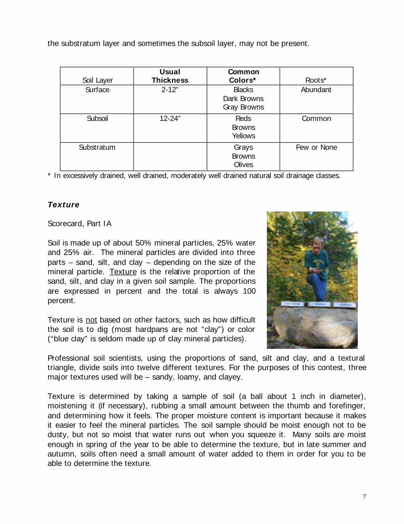
* In excessively drained, well drained, moderately well drained natural soil drainage classes. Texture Scorecard, Part IA Soil is made up of about 50% mineral particles, 25% water and 25% air. The mineral particles are divided into three parts – sand, silt, and clay – depending on the size of the mineral particle. Texture is the relative proportion of the sand, silt, and clay in a given soil sample. The proportions are expressed in percent and the total is always 100 percent. Texture is not based on other factors, such as how difficult the soil is to dig (most hardpans are not “clay”) or color (“blue clay” is seldom made up of clay mineral particles). Professional soil scientists, using the proportions of sand, silt and clay, and a textural triangle, divide soils into twelve different textures. For the purposes of this contest, three major textures used will be – sandy, loamy, and clayey. Texture is determined by taking a sample of soil (a ball about 1 inch in diameter), moistening it (if necessary), rubbing a small amount between the thumb and forefinger, and determining how it feels. The proper moisture content is important because it makes it easier to feel the mineral particles. The soil sample should be moist enough not to be dusty, but not so moist that water runs out when you squeeze it. Many soils are moist enough in spring of the year to be able to determine the texture, but in late summer and autumn, soils often need a small amount of water added to them in order for you to be able to determine the texture.

8
There are three texture groups used on the scorecard. The following is a brief description of what they feel and act like when rubbed between the thumb and forefinger: Sandy soils feel very gritty, are not sticky, and when squeezed do not hold together in a ball. Sandy soils leave very little stain on the fingers. They do not form a ribbon when squeezed between the thumb and forefinger. Clayey soils do not feel gritty, are very sticky, and form a ball when squeezed. A fingerprint will remain on the ball. Clayey soils will stain the fingers. They will form a long ribbon when squeezed between the thumb and forefinger. The ribbon has a smooth surface. Clayey soil texture are usually found only in the Seacoast region of New Hampshire. Loamy soils feel moderately gritty to smooth (butter-like), are not sticky, and form a ball when squeezed. Loamy soils will stain the finders. They may form a short (up to 1 inch long) ribbon when squeezed between the thumb and forefinger, and if so, the ribbon will have a flaky surface.

9
Texture Feel Gritty
Sticky Form a Ball
Form a Ribbon
Stain Fingers
Sandy Very No No No No Loamy Moderately No Yes Short Yes Clayey No Very Yes Long Yes Hardpan
Scorecard, Part IB In New Hampshire, a hardpan occurs in the substratum layer of some glacial till soils. If a hardpan occurs, it always occurs in the substratum layer of only glacial till soils. However, not all substratum layers in glacial till soils are hardpans. Hardpans may have any soil texture, but are usually loamy. They occur in soils that have any natural soil drainage class. To determine if a substratum layer is a hardpan, compare the firmness of the substratum and subsoil layers. To perform this comparison, a small knife is recommended. Poke the knife into the subsoil and then the substratum in several different places. Compare the difficulty of inserting the knife. If the insertion of the knife into the substratum layer is significantly more difficult than the subsoil layer, then the substratum is hardpan. If a knife is not available, this comparison can be done by squeezing a small clod from each of the layers between the thumb and forefinger to determine the firmness. If the clod crushes easily, when squeezed, the layer is not a hardpan; if the clod crushes suddenly when squeezed (like a small explosion) or if it takes a lot of pressure to crush the clod, the layer is a hardpan. Permeability Scorecard, Part IC The permeability of a soil layer is the rate at which air and water move downward through the layers. This rate is determined by two soil features: 1) the soil texture and 2) the presence of a hardpan in the substratum layer. Soil layers with clayey textures have slow permeability, those with loamy textures have moderate permeability, and those with sandy textures have rapid permeability. The only exception to this rule is if the substratum is a hardpan, in which case the permeability is slow regardless of the texture.
10
Texture Permeability* Clayey slow Loamy moderate Sandy rapid
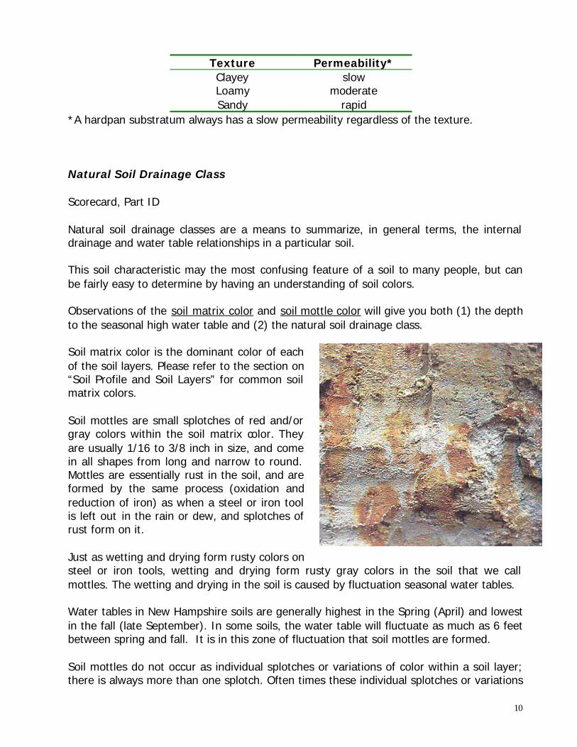
*A hardpan substratum always has a slow permeability regardless of the texture. Natural Soil Drainage Class Scorecard, Part ID Natural soil drainage classes are a means to summarize, in general terms, the internal drainage and water table relationships in a particular soil. This soil characteristic may the most confusing feature of a soil to many people, but can be fairly easy to determine by having an understanding of soil colors. Observations of the soil matrix color and soil mottle color will give you both (1) the depth to the seasonal high water table and (2) the natural soil drainage class. Soil matrix color is the dominant color of each of the soil layers. Please refer to the section on “Soil Profile and Soil Layers” for common soil matrix colors. Soil mottles are small splotches of red and/or gray colors within the soil matrix color. They are usually 1/16 to 3/8 inch in size, and come in all shapes from long and narrow to round. Mottles are essentially rust in the soil, and are formed by the same process (oxidation and reduction of iron) as when a steel or iron tool is left out in the rain or dew, and splotches of rust form on it. Just as wetting and drying form rusty colors on steel or iron tools, wetting and drying form rusty gray colors in the soil that we call mottles. The wetting and drying in the soil is caused by fluctuation seasonal water tables. Water tables in New Hampshire soils are generally highest in the Spring (April) and lowest in the fall (late September). In some soils, the water table will fluctuate as much as 6 feet between spring and fall. It is in this zone of fluctuation that soil mottles are formed. Soil mottles do not occur as individual splotches or variations of color within a soil layer; there is always more than one splotch. Often times these individual splotches or variations

11
are a result of other soil processes that are not caused by a fluctuation water table. When soil mottles that are caused by a fluctuating water table do occur, there is always more than one; they are separated from each other by distances of about ½ to 6 inches; and there may be upwards of 60 per square foot of soil profile. To determine the depth to the seasonal high water table at any time of the year, use the location of the mottles in the soil profile, not the location of the water table. For example, if you identify mottles between depths of 14 and 45 inches in the soil profile, and the observed water table is at 50 inches, the depth to the seasonal high water table is 14 inches. Not every soil will have mottles within the soil profile you will observe (generally to a depth of 60 inches). Every soil, however, will fall into one of the six natural soil drainage classes. Observations of the soil matrix color and the depth to mottles will give you the natural soil drainage class. The six (6) natural soil drainage classes used are: Excessively Drained (ED) Well Drained (WD) Moderately Well Drained (MWD) Somewhat Poorly Drained (SWPD) Poorly Drained (PD) Very Poorly Drained (VPD)
12
ED WO MWO SWPD PD VPD
Depth to mottles (inches) >60 40-60 15-40 12-15 6-12 0-6
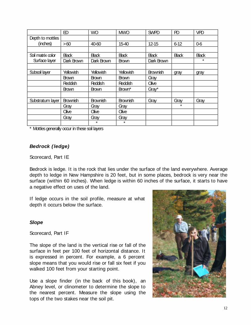
Black Black Black Black Black Black Soil matrix color Surface layer Dark Brown Dark Brown Brown Dark Brown * Subsoil layer Yellowish Yellowish Yellowish Brownish gray gray Brown Brown Brown Gray Reddish Reddish Reddish Olive Brown Brown Brown* Gray* Substratum layer Brownish Brownish Brownish Gray Gray Gray Gray Gray Gray * Olive Olive Olive Gray Gray Gray * * * Mottles generally occur in these soil layers Bedrock (ledge) Scorecard, Part IE Bedrock is ledge. It is the rock that lies under the surface of the land everywhere. Average depth to ledge in New Hampshire is 20 feet, but in some places, bedrock is very near the surface (within 60 inches). When ledge is within 60 inches of the surface, it starts to have a negative effect on uses of the land. If ledge occurs in the soil profile, measure at what depth it occurs below the surface. Slope Scorecard, Part IF The slope of the land is the vertical rise or fall of the surface in feet per 100 feet of horizontal distance. It is expressed in percent. For example, a 6 percent slope means that you would rise or fall six feet if you walked 100 feet from your starting point. Use a slope finder (in the back of this book), an Abney level, or clinometer to determine the slope to the nearest percent. Measure the slope using the tops of the two stakes near the soil pit.

13
HOW TO MAKE A SLOPE FINDER
(1) Mount the prepared slope finder sheet included with this guide on a 9x12 inch board.
The preprinted slope finder on the inside back cover of this guide may be mounted, or copies may be made on a good copy machine. Either ½-inch thick plywood or ¾-inch lumber may be used. The thicker board, however, is recommended so that the nails can be securely attached.
(2) Place three “finishing nails” (small heads) at the points indicated on the slope finder.
Attach a large nut or similar weight to one end of a string (about 20” long). Attach the free end of the string to the nail at the top of the slope finder board. Attach the string in order that the weight swings freely a few inches below the edge of the board.
HOW TO USE A SLOPE FINDER
(two illustrations) The following procedures are recommended with two students of about the same height working together. (1) One student should stand at thet op and the other student at the bottom of the
slope to be measured. Both students should be near the slope stakes. (2) Using two nails in the lower part of the board, aim across the two nails on the eye
level of the other student. The percent slope may be determined by either sighting up or sighting down the slope. It is not necessary to know the distance between the students.
(3) The string with the weight should swing free from the slope finder board. Care
should be taken in reading the percent slope on windy days. (4) When the weight has stopped swinging, pinch the string against the board. The
percent slope (number of feet fall or rise in 100 feet) may then be read directly from the slope finder.
NOTE: ONE STUDENT CAN USE THE SLOPE FINDER BY AIMING THE TWO NAILS ACROSS THE TOPS OF THE SLOPE STAKES. Surface Stoniness
Scorecard, Part IG Stones are 10 to 24 inches in size (diameter).
14
Within a 100 foot radius around the soil pit, measure the distance between the centers of two stones in several places. Calculate the average distance between the stones. Not all soils have surface stones. Parent Material Scorecard, Part IH Parent material is the raw material from which a soil is developed, and is often named by the method in which that material was deposited on the landscape. For the purposes of this contest, five parent materials are used: flood plain sediments, glacial outwash, glacial lake bed sediments, marine (seabed) sediments, and glacial till. In New Hampshire,the last four were deposited when the last continental glacier was melting 10,000 to 14, 000 years ago. The flood plain sediments were deposited after that, and continue to be deposited every time a stream overflows its banks and floods the adjacent land. Each type of parent material has certain physical soil features that serve as clues to its identification. Floodplain sediments- Soil profiles in this parent material generally have loamy textures in the subsoil layer (sometimes sandy) and either loamy or dandy textures in the substratum layer. Gravelly layers may also occur in the substratum. There are no surface stones. The substratum layer is not a hardpan. Soil profiles in floodplain sediments may contain (1/4 to 3 inches thick) darker colored layers that are high in organic material. These soils are normally adjacent to streams on nearly level landscapes. Floodplain sediments are and continue to be deposited by floodwaters from nearby streams. The age of these sediments ranges from a few hundred years to as recent as the last flood. Glacial outwash- Soil profiles in this parent material generally always have sandy textures in both the subsoil and substratum layers. Sometimes the subsoil texture is loamy. Gravelly layers may also occur in the subsoil and substratum. Gravel, if present, is usually round in shape. There are no surface stones. The substratum layer is not a hardpan. The sand and gravel in these profiles may be arranged in thin layers ranging in thickness from ¼ to 5 inches. Glacial outwash deposits were deposited by moving water that melted from glaciers. They were the floodplains of 10,000 to 14,000 years ago. Glacial lakebed sediments- Soil profiles in this parent material have loamy textures in the subsoil and substratum layers. Substratum layers do not contain gravel, and they are

15
not a hardpan. There are no surface stones. The substratum layer usually has thinner (1/8 to ½ inch thick) horizontal layers within it. Glacial lakebed sediments were deposited as the mud on the bottom of lakes that existed when the last continental glacier was melting 10,000 to 14,000 years ago. Marine (seabed) sediments- Soil profiles in this parent material have clayey textures in the subsoil and substratum layers; the subsoil occasionally has loamy textures. Substratum layers do not contain gravel, and they are not a hardpan. There are no surface stones. Marine (seabed) sediments were deposited as mud in the tidal flats that existed about 12,000 to 14,000 years ago. Glacial till- Soil profiles in this parent material generally have loamy textures in the subsoil layer (sometimes sandy), and either loamy or sandy textures in the substratum layer. Gravelly layers do not occur in the substratum. There are surface stones; if they have been picked so that the land could be used for agriculture, there are usually stone walls or stone piles nearby. The substratum layer may be a hardpan; if so, this hardpan may consists of thin (1/6 to ¼ inch) plates with a horizontal orientation. Throughout the soil profile there is usually a mixture of gravel, stones and boulders in any proportion. Glacial till is material deposited under the glacial ice during the advance and retreat of the last continental glaciation. -physical soil features table- Parent Material
Subsoil Texture Substratum Texture Surface Stones
Gravelly Substratum
Hard Pan
Clayey Loamy Sandy Clayey Loamy Sandy Floodplain A S S S No S No Outwash S A A No S No Lakebed A A No No No Seabed A S A No No No Till A S S Yes No Yes 1 A= Almost always S= Sometimes 1/ All soils with a hardpan substratum are glacial till, but not all glacial till soils have hardpan.

16
PART II – LIMITATIONS FOR SELECTED USES Scorecard, Part II This soil physical features identified in Part I of the scorecard are the major soil features that affect the five uses for which you will judge. Use the information in table 2 to determine on the scorecard the soil conditions that result in a moderate or severe limitation (use restriction) for the five uses. Five Uses A homesite with a basement is a one to three story structure intended for year round use by a single family. The foundation is reinforced concrete built on undisturbed soil at a depth of five feet. The soil conditions that would adversely affect the excavation, construction, and maintenance cost of the house are to be indicated on the scorecard. A septic system is a waste disposal system for the homesite. It consists of a tank and a subsurface system of tile or perforated pipe that distributes the waste into the natural soil at a depth of 24 to 60 inches. Indicate on the scorecard the soil conditions that would adversely affect the absorption of the waste into the soil, as well as the construction and maintenance of the septic system. Row crops are annual agricultural crops grown either continuously or in rotation with grasses and/or legumes. Indicate on the scorecard soil condition that would adversely affect the operation of all equipment necessary to obtain the crop, and soil conditions that would result in excessive erosion, poor crop yields, and limit the choice of row crop species. Hayland crops are continuously grown crops of grasses and/or legumes. Indicate on the scorecard the soil conditions that would adversely affect the operation of all equipment necessary to obtain the crop and soil conditions that would result in excessive erosion, poor crop yields, and limit the choice of row crop species. Woodland is hardwood and/or softwood tree species grown for timber and pulpwood. Indicate on the scorecard the soil conditions that have an adverse affect on seedling conditions that have an adverse affect on

17
seedling mortality, erosion hazard, windthrow hazard, and the operation of rubber tired skidders for harvesting. -Table 2- TABLE 2 Soil Conditions that Cause Limitations for Selected Uses USE à
Homesite with basement
Septic Systems
Row Crops
Hayland Crops
Woodland
SOIL CONDITIONS Yes, if Yes, if Yes, if Yes, if Yes, if Flooding Flood plain sediment (parent material) ------ ------ Depth to bedrock (ledge)
< 60 inches
< 60 inches
< 20 inches
< 20 inches
< 20 inches
Depth to seasonal High water table
< 60 inches
< 60 inches
< 24 inches
< 24 inches
< 24 inches
Permeability Substratum layer (septics)
-------
Slow or rapid
-------
-------
-------
Subsoil layer (crops)
-------
-------
slow
slow
-------
Slope >8%
>8%
>3%
>8%
>15%
Surface Stones < 1.5 feet apart
< 1.5 feet apart
< 80 feet apart
< 80 feet apart
< 1.5 feet apart
Texture of surface -------
-------
Sandy or clayey
sandy
Sandy or clayey
> means “greater than” < means “less than”
Soil Conditions Flooding occurs only on those soils developed in floodplain sediments. Flooding is a severe limitation for homesites and the operation of a septic system. It is not feasible to attempt to overcome the flooding problem for these uses. Flooding does not affect the use of the soil for hayland crops, or woodland. Flooding usually does not occur during the growing or harvest season of row crops and hayland crops, but if flooding occurs in harvested row crop fields that have been left bare, erosion may occur. Flooding is usually of short duration, so its affect on woodland management and harvesting activities is minimal. Depth to Bedrock (ledge): Ledge within 60 inches of the soil surface affects the ease of construction of a homesite with a basement, and within 40 inches becomes a severe restriction. Ledge within 60 inches of the soil surface affects the thickness of the soil available for purifying the waste water from a septic system; ledge within 40 inches is a severe problem that is difficult to overcome. Ledge within 20 inches of the soil surface affects the rooting depth and available water capacity of the soil for row crops, hayland crops and woodland, resulting in decreased yields. Ledge affects the choice of crops and tree species and is a windthrow hazard in woodlands. Ledge within 10 inches is a severe problem.

18
Depth to seasonal high water table: A water table within 60 inches of the soil surface affects the ease of excavation, construction of, and maintenance cost of a homesite with a basement, and within 30 inches becomes a severe restriction. Water tables within 60 inches of the soil surface affect the thickness of unsaturated soil available for purifying wastewater from a septic system leach field. Water tables within 48 inches of the soil surface are a severe problem. Water tables within 24 inches of the soil surface affect the rooting depth, choice of row and hayland crops, reduce yields, and reduce the ease of operation of planting and harvesting equipment for agriculture and forestry. Water tables within 20 inches of the soil surface are a severe limitation for woodland harvesting equipment. A permeability of slow or rapid in the substratum layer is a severe limitation to the operation of a septic system leach field. The slow permeability results in wastewater moving too slowly, restricting its downward movement into the soil. A rapid permeability results in wastewater moving too quickly downward, which may allow unpurified wastewater to pollute the ground water or nearby surface waters. A slow permeability in the subsoil layer is a severe limitation for row and hayland crops. The slow permeability results in poor internal drainage, causing decreased crop yields, restricted crop choices and increased crop choices and increased costs associated with tillage. A slope of 8 to 15 percent affects the ease of excavation and construction of a homesite with a basement and a septic system. Slopes greater than 15 percent are a severe limitation. For row crops, slopes of 3 to 15 percent result in an increased erosion hazard, and affect the ease and safety of planting, tillage, and harvesting equipment. Slopes greater than 15 percent are a severe limitation for row crops. For hayland crops, slopes of 8 to 15 percent affect the ease and safety of operating farm equipment. Slopes of greater than 25 percent are a severe limitation. For woodland, slopes of 15 to 35 percent result in an increased erosion hazard during planting and harvesting activities and affect the ease and safety of operating equipment. Slopes of greater than 35 percent are a severe limitation for woodland use. Surface Stones have a severe impact on the ease of operating equipment for the construction of a homesite or a septic system if the stones are less than 1.5 feet apart. For now crops and hayland crops, surface stones 25 to 80 feet apart are a moderate limitation for the ease of equipment operation. Surface stones less than 25 feet apart are a severe limitation. Surface stones less than 1.5 feet apart are a severe limitation for the operation of woodland equipment. Surface textures that are sandy or clayey have adverse affects on plant growth and/or ease of operation of equipment. For row crops and hayland crops, sandy surface textures reduce the water holding capacity of the soil, which affects the choice of crop species and reduces yields. Clayey surface textures become hard when dry and form clods if cultivated when too wet. This also results in reduced row crop yields. For woodland, sandy surface textures reduce the water holding capacity of the soil. This results in high seedling mortality. Sandy and clayey surface textures both adversely affect the operation of woodland equipment.

19
PART III – BEST USE Scorecard, Part III Just because a soil has a limitation for a particular use, doesn’t mean that it cannot be used for that purpose. The limitation simply means that it will take extra time, money, or materials to use the soil in a successful manner. A soil may have several limitations for a particular use and few or no limitations for another use. With this in mind, a landowner may still decide on the first use knowing it will cost more in time, money and/or materials However, for the purposes of this contest, the “Best Use” for the land will be the use with the fewest restrictions on Part II of the scorecard. (The fewest number of yeses). For example, if homesites has three yeses, septics three, row crops four, hayland two, and woodland one, the best use would be woodland. Keep in mind that there may be more than one best use.

20
PART IV – IMPORTANT FARMLAND
Scorecard, Part IV Prime farmland is the land best suited for producing food, feed, forage, fiber, and oilseed crops. It has the soil quality, growing season, and moisture supply necessary to produce sustained high yields of crops at a minimum cost when treated and managed according to modern farming methods. The physical features of the soil used in this contest to determine whether a soil is prime farmland are: (a soil must have all these features to be considered prime farmland). 1. Loamy texture – in both the surface and subsurface layers. 2. Moderate permeability in both the surface and subsoil layers. 3. Depth to seasonal high water table that is greater than 30 inches. 4. Natural soil drainage class of well drained or moderately well drained. 5. Depth to bedrock that is greater than 60 inches. 6. Slopes less than 5 percent. 7. Surface stones greater than 80 feet apart.

NEW HAMPSHIRE SOIL JUDGING SCORECARD
PART I: PHYSICAL FEATURES OF SOIL E. Depth of bedrock (ledge): ______ inches or >60 inches (5 points)
F. Slope: ______ Percent (5 points) A. Texture (check one for each layer) (5 points)
Clayey Loamy Sandy G. Surface stoniness (check only one) (5 points)
Surface Stones <1.5’ apart Subsoil Stones 1.5’ to 3’ apart Substratum Stones 3-25’ apart Stones 25-80’ apart B. Is the Substratum layer a hardpan? (5 points) Stones >80’ apart
YES NO
C. Permeability (check one for each layer) (5 points)
H. Parent Material (check only one) (5 points)
Slow Moderate Rapid Floodplain sediments Marine (seabed sediments) Surface Glacial outwash Glacial till Subsoil Glacial lakebed sediments Substratum D. Natural Soil Drainage Class 1. Depth to seasonal high water table:________ inches or >60 inches (5 points) 2. Check only one (5 points)
Excessively drained >60” Well drained 40-60” Moderately well drained 15-40” Somewhat poorly drained 12-15” Poorly drained 6-12” Very poorly drained 0-6”
Score Part I _______ Score Part II _______
Score Part III _______ Score Part IV _______
Total ________
Site (Pit) Number ___________ Contestant Number _________ Name ____________________ School ____________________

22
PART II: LIMITATIONS FOR SELECTED USES OF THE SOIL Indicate with a check mark if the soil conditions listed result in a limitation (use restriction) for these five (5) uses. Use the physical features identified in Part I, and Table 2 in the Guide to answer either Yes or No for each soil condition.
USE à Homesite with basement
Septic Systems
Row Crops Hayland Crops Woodland
SOIL CONDITIONS Yes : No Yes : No Yes : No Yes : No Yes : No Flooding : : : Depth to bedrock : : : : :
: : : : : Depth to seasonal high water table : : : : :
: :
Permeability subsoil layer substratum layer : Slope : : : : : Surface stones : : : : : Texture of surface : : :
PART III: BEST USES What is the best use or uses for the land around the soil pit? Use the answers in Part II to determine best use. (5 points for each correct answer).
PART IV: IMPORTANT FARMLAND 1.) Prime farmland soils have all the following physical features. Indicate with a check mark the physical features of this soil. Use the physical features identified in Part I to answer either yes or no (5 points for each correct answer).
BEST USE Yes No Yes No PHYSICAL FEATURES Homesite Loamy texture in surface layer Septic System Loamy texture in subsoil layer Row Crops Moderate permeability in surface layer Hayland Moderate permeability in subsoil layer Woodland Depth to seasonal high water table greater than 30 inches Well drained or moderately well drained Depth to bedrock (ledge) greater than 60 inches Slope less than 5 percent Surface stones greater than 80 feet apart
2. Is this soil prime farmland? (5 points) YES NO

APPENDIX General Information and Rules
1. Teams will consist of four students. 2. Schools may have any number of students participating, but only two teams (eight
students) from each school will compete for the prizes. The two teams and names of students will be determined before the contest begins.
3. It is anticipated that individual as well as team awards/prizes will be presented at
the end of the contest.
4. Four soil profiles (pits) will be judged. The pits will be a short walk from each other.
5. Students and teachers should not converse or help each other in any manner during the judging at the pits or the walks between the pits. (An exception is made when it is necessary for two students to measure slope or distance between surface stones).
6. A section of the soil profile will be marked in each pit for students to observe.
Please do not disturb this section so that the students following can also observe this undisturbed profile.
7. Students will be expected to make some of their soil observations in the soil pit.
8. Two stakes will be set in the ground near each soil pit for students to use to
measure slope.
9. One scorecard will be completed for each soil profile. Scorecards will be turned into the soil pit monitor for scoring after the allotted time (generally 20 minutes per profile for judging.
10. Scorecards will be given to each student when they arrive at the soil pit to be
judged.
11. To alleviate congestion in the soil pit, samples of each of the (three) soil layers will be provided for students to determine texture.
12. The soil surface (from which depth measurements are made) will be indicated in
each pit. Also indicated will be the breaks between the three soil layers.
13. Schools from out of state are invited to compete in this contest. Individual awards/prizes will be given to out of state students i.e. certificate of participation or

24
individual high score, but team awards/prizes will only be given to New Hampshire schools.
14. The contest will be held regardless of weather. There will be no rain dates.
15. Students are permitted to use this guide during the contest.
Suggested Equipment needed to judge: 1. A device to measure slope. 2. Clipboard, pencil or pen. 3. Ruler or tape measure at least 60 inches long. 4. Waterproof footwear. 5. Rag or paper towels to clean hands. 6. Small blade knife (less than 3 inches) a knife with a rigid blade is recommended. Knives with hinged blades can fold back on your fingers when examining the soil. An old butter knife or even a spoon can be used. 7. A way to measure distances of at least 100 feet. 8. A small container (less than 8 ounces) of water 9. Raingear, if weather dictates. For More Information If this guide does not have a loose-leaf insert listing individuals willing to coach, your Conservation District has a list of professional soil scientists who are willing to serve as volunteer coaches for schools participating in the contest. These coaches are located throughout New Hampshire and have volunteered their time and knowledge to assist. It is recommended that there bee coaching assistance before the contest.