social safeguards due diligence report · pdf filesocial safeguards due diligence report ......
TRANSCRIPT
Social Safeguards Due Diligence Report
December 2016
IND: Madhya Pradesh District Roads II Sector Project Prepared by the Madhya Pradesh Roads Development Corporation, Government of India for the Asian Development Bank.

CURRENCY EQUIVALENTS As of December 7, 2016
Currency unit – Indian Rupee (Rs) INR 1.00 = $ 0.015
$ 1.00 = 67.9
ABBREVIATION ADB Asian Development Bank
AP Project Affected Persons CSC Construction Supervision Consultant
DPR Detailed project report
EA Executing agency
FGD Focus Group Discussion GOI Government of India
GoMP Government of Madhya Pradesh
GRC Grievance redress committee
GRM Grievance redress mechanism IA Implementing Agency
IP Indigenous People
IPPF Indigenous People’s Planning Framework
IR Involuntary Resettlement MDR Major District Road
MPRDC Madhya Pradesh Roads Development Corporation
PIU Project Implementation Unit
PWD Public Works Departments
R&R Resettlement and Rehabilitation
RF Resettlement Framework RoW Right of Way
SDDR Social Safeguard Due Diligence Report
SPS Safeguard Policy Statement 2009
TCS Typical Cross Section This Social Safeguard Due Diligence Report is a document of the borrower. The views expressed herein do not necessarily represent those of ADB's Board of Directors, Management, or staff and may be preliminary in nature. In preparing any country program or strategy, financing any project, or by making any designation of or reference to a particular territory or geographic area in this document, the Asian Development Bank does not intend to make any judgments as to the legal or other status of any territory or area.

TABLE OF CONTENTS
I. PROJECT BACKGROUND ................................................................................................. 1
II. SUBPROJECT COMPONENTS AND DESIGN CRITERIA ................................................. 2
III. SUBPROJECT SCREENING AND CATEGORIZATION ..................................................... 3
IV. CONSULTATION AND PARTICIPATION ..........................................................................14
V. INSTITUTIONAL ARRANGEMENT ....................................................................................17
VI. GRIEVANCE REDRESS MECHANISM .............................................................................17
VII. GENDER ISSUE UNDER THE PROJECT .........................................................................18
VIII. CONCLUSIONS AND RECOMMENDATIONS...................................................................19
APPENDICES Appendix 1: List of Proposed Road Sections and Packages .....................................................21 Appendix 2: Involuntary Resettlement Impact Categorization Checklist ....................................23 Appendix 3: Indigenous Peoples Impact Categorization Checklist ............................................24 Appendix 4: Record of Public Consultations ..............................................................................26 Appendix 5: GRM Document Shared with DPS during Consultation .........................................32 LIST OF TABLES Table 1: Selected Non-Sample Road Subproject under Phase -V .............................................. 1 Table 2: Subproject wise details of the Public consultation .......................................................14 Table 3: Summary of Issues Discussed during Consultations and Measures Taken to address these Issues ..............................................................................................................................16 LIST OF FIGURES Figure 1: Typical Cross Section ................................................................................................. 3 Figure 2: Grievance Redress Mechanism .................................................................................18


1
I. PROJECT BACKGROUND
1. The Government of Madhya Pradesh (GOMP) has been using a combination of budgetary, PPP, and ADB financing, to improve road network in Madhya Pradesh. ADB has supported numerous state highways and rural roads. However, the intermediate tiers, major district roads (MDRs), have not been specifically targeted for improvement resulting in overall poor road network connectivity. MDRs form the key linkage between rural, peri-urban and urban areas, and have to be essentially developed to complete state road connectivity. GoMP has now proposed to improve the MDRs through the Madhya Pradesh District Connectivity Sector Project (the Project) financed by ADB1. The Project will improve transport connectivity in the state by rehabilitating and upgrading major district roads (MDRs). The Project constitutes (i) rehabilitating and upgrading about 1530 km of MDRs; (ii) improving road maintenance and asset management; and (iii) developing an efficient accident response system. MPRDC specifically, targeting MDRs to form key linkage between rural, semi-urban and urban areas and complete state road connectivity. The Executing Agency (EA) will be the GoMP acting through the Madhya Pradesh Road Development Corporation (MPRDC) and the IAs will be the 10 Project Implementation Units (PIUs). 2. The Project will improve the 54 subproject roads identified by MPRDC. The list of all 54 road sections identified for Phase-5 are provided in Appendix-1.Since the project will follow a sector loan modality, 9 subprojects roads with 250 km length were selected to screen significance of potential social safeguard issues and determine the scope of mitigation measures to address these issues. This due diligence report covers assessment of thirty nine non- sample MDRs totalling about 1040.47 km road length. The construction period for all roads under the project will include a 12 – 24 month construction period and a 5 years performance based maintenance period.
Table 1: Selected Non-Sample Road Subproject under Phase -V
S.N. Road Name District Division MPRDC
Length (Kms)
1 Garpahera-Dhamoni Sagar Sagar 35.331
2 Barodiya-Dhamoni Sagar Sagar 19.808
3 Noniya-Madanpur Sagar Sagar 1.813
4 Samnapur –Bilhara-Nanhi Devri-Narayanpur
Sagar Sagar 45.48
5 Khurai-Rajwas Sagar Sagar 31.82
6 Kesali-Sahajpur Sagar Sagar 15.06
7 Maharajpur-Sahajpur Sagar Sagar 24.45
8 Khapatiya-Banspahadi Road Chhatarpur Sagar 24.47
9 ChattarpurBikrampur-Rajnagar Chhatarpur Sagar 10.23
10 Rajnagar-Bachhon Chhatarpur Sagar 23.847
11 Bariya Choki-Lugasi-Garhimalhara Chatarpur Sagar 15.54
12 Bamitha-Dumra Chhatarpur Sagar 28.06
13 Bhatura – Bhadapur - Barrakhurd Road Satna Rewa 20.05
14 Teonthar Sankargarh Rewa Rewa 14.6
15 Baheradabar-Piarahi-Jadkud Rewa Rewa 19.7
16 Naigarhi-Garh Road Rewa Rewa 14.14
1 The loan is 3189-IND: Madhya Pradesh District Connectivity Sector Project.

2
S.N. Road Name District Division MPRDC
Length (Kms)
17 Chitrangi-Garhwa Road Singrauli Rewa 22.67
18 Anooppur-Jaitpur Road Shahdol Rewa 36.66
19 Gohparu-Rasmohni-Budhar (Via Bathiya) Road
Shahdol Rewa 39.49
20 Pasgarhi-Deori-Janakpur Shahdol Rewa 23.49
21 Sohagpur-Manpur Road Umaria Rewa 59.4
22 Rampayali-Garra Chaouki Road Balaghat Jabalpur 27.56
23 Khailanji-Agasi Road Balaghat Jabalpur 28.96
24 Laalbarra-Samnapur Road Balaghat Jabalpur 8.4
25 Sitapthor-Mahkepaar -Goreghat Road Balaghat Jabalpur 23.04
26 Chaurai-Panjara Chand Road Chhindwara Jabalpur 17.22
27 Chand-Bichhua-Khamarpani-Rangari Road Chhindwara Jabalpur 59.3
28 Bawai Barha Sukhakhairi Road Narsinghpur Jabalpur 23.57
29 Kareli Singpur Dangidhana Road Narsinghpur Jabalpur 32.86
30 Gadarwara-Gotetoria Road Narsinghpur Jabalpur 13.57
31 Bhorasa- Mallhargarh Road Vidisha Bhopal 20.132
32 Mungawali- Mahargarh Road Ashok Nagar Gwalior 16.723
33 Piprod-Thuban Road Ashok Nagar Gwalior 7.74
34 Belai-Karila Mata Mandir Road Ashok Nagar Gwalior 17.72
35 Narwar-Chittari-Amola Road Shivpuri Gwalior 26.33
36 Sirsod-Picchore Road Shivpuri Gwalior 31.34
37 Khatakeya-Beenaganj-Dehri-Parsana Road Guna Gwalior 70.79
38 Bijwad-Khategaon Road Dewas Ujjain 55.17
39 Sanver-Chandravatiganj-Gautampura Road Indore Indore 33.94
Source: Detailed Project Report (DPR), MPRDC
3. As a part of project preparation, detailed social impact assessment has been carried out for all thirty nine non-sample subprojects. This Social Due Diligence Report (SDDR) is based on the review of final detailed design report and social assessment of individual subprojects carried out during the project preparation. A Resettlement Framework (RF) and an Indigenous People’s Planning Framework (IPPF) is already prepared for the entire project under Madhya Pradesh District Roads I Sector Project to guide the preparation of non-sample subprojects. The RF and IPPF are prepared in compliance with relevant policies and regulations of the Government of India, GoMP, and the ADB Safeguard Policy Statement 2009 (SPS).
II. SUBPROJECT COMPONENTS AND DESIGN CRITERIA
4. The subproject activities involve improvement of existing major district roads within available RoW. The road widening activities primarily will comprise of raising the embankment at certain locations and its stabilization including construction of retaining wall if required, especially near water bodies overlay on the existing carriageway, junction improvement, and construction of minor bridges, culvert and RCC drain in built-up section. 5. The existing Right of Way (RoW) of the subproject roads varies from 12 to 20 meters, which is not properly demarcated on ground. Keeping in view the unavailability of the uniform RoW and existing ribbon development along the subproject roads, multiple design criteria are adopted to ensure avoidance of any adverse impacts to the roadside settlers. It is confirmed

3
that no additional land will be acquired under any of the subproject and therefore the standard design criteria adopted for the subproject roads are the following:
Proposed carriageway for the open area will be from 5.5 meter to 7.0 meter depending on the availability of the land.
Proposed carriageway for the built-up area will be from 3.75 meter to 5.5 meter depending on the availability of land.
Proposed pavements will be concrete one and width of shoulders and provision of drains will be accommodated within the existing RoW.
6. The typical cross sections (TCS) in built-up area, rural areas, and overlay locations are shown in Figure 1.
Figure 1: Typical Cross Section
III. SUBPROJECT SCREENING AND CATEGORIZATION
7. Based on the review of detailed design report and social assessment report for individual subprojects, summary findings of these thirty nine subprojects are presented below: A. Sagar Division

4
8. Garpahera – Dhamoni Road: The subproject road falls in Sagar district of Madhya Pradesh. The project road takes off from old NH-26 and travers a distance of 35.331 kms covering habitations like Kulahadi, Garhpahera, Magwasi, Madhiya, Bilhani, Bohrol and Dhamoni etc and ends at Dhamoni village. Land use pattern found in corridor of road subproject is predominantly agricultural, habitation & forest. Existing road is a single-lane road with asphalt pavement. Carriageway varies from 3.0 m to 3.75 m along the entire stretch with earthen shoulder both sides and formation width varies from 5 to 7.30 and available ROW is 12-20m. Proposed subproject widening proposal is limited within the existing formation width in the settlement area and available RoW in the open area. The subproject will not have any negative impacts on its roadside properties. 9. Barodiya - Dhamoni Road: The subproject road falls in Sagar district of Madhya Pradesh. The project road takes off from old NH-26 and travers a distance of 19.808 kms covering habitations like Bikor Kalan, Nauniya, Saji, Salaiya Kalan etc and ends at Dhamoni village. Land use pattern found in corridor of road subproject is predominantly agricultural, habitation & forest. Existing road is a single-lane road with asphalt pavement. Carriageway varies from 3.0 m to 3.75 m along the entire stretch with earthen shoulder both sides and formation width varies from 5 to 7.30 and available ROW is 12-20m. Proposed subproject widening proposal is limited within the existing formation width in the settlement area and available RoW in open area. The subproject will not have any negative impacts on its roadside properties. 10. Noniya - Madanpura Road: The subproject road falls in Sagar district of Madhya Pradesh. The Project Road starts at Nauniya village and ends at U.P. Border. The total design length is 1.813 kms. Land use pattern found in corridor of road subproject is predominantly agricultural, forest and habitation. Existing road is a single-lane road with asphalt pavement. Carriageway varies from 3.0 m to 3.75 m along the entire stretch with earthen shoulder both sides and formation width varies from 5 to 7.30 and available RoW is 12 m. Proposed subproject widening proposal is limited within the existing formation width in the settlement area and available RoW in open area. The subproject will not have any negative impacts on its roadside properties. 11. Samnapur – Bilhera – Nanhi Devri - Narayanpur Road: The subproject road falls in Sagar district of Madhya Pradesh. The project road starts at T junction on NH-26 (Malthon - Narsingpur Road) near Samnapur village and passes through Natrrni, Bilhara, Tapara, Bhohara, Khamariya, Nanhi Devri, Bhusora, Guari, Patoye, Semra and Narayanpur. Total length as per the design is 45.480 kms. Land use pattern found in corridor of road subproject is predominantly agricultural, habitation & forest. Existing road is a single-lane road with asphalt pavement. Carriageway varies from 3.0 m to 3.75 m along the entire stretch with earthen shoulder both sides and formation width varies from 5 to 7.30 and available ROW is 12-20m. During the due diligence visit, it was found that due to the subproject widening proposal as per the detailed project report, some structures were coming within the proposed widening area. However, after discussion with the EA, the widening proposal was reviewed and the drawings were revised to fully avoid the impacts by integrating engineering solutions while ensuring road safety standards and financial/economic viability were maintained. The revised subproject widening proposal is limited within the existing formation width in the settlement area and available RoW in open area. The subproject will not have any negative impacts on its roadside properties. 12. Khurai- Rajwas Road: The subproject road is situated in Sagar district, Central part of Madhya Pradesh State. The subproject road takes off from Rajwas town at 0.00Km 'Y'-Junction of Lalitpur to Sagar of NH 26 and ends at Khurai town at 31.82 Km 'T' Junction of Bina- Sagar

5
road section of NH-26A. It starts from Rajwas and passes through Rodi, Bamhori, Tigara, Laloi, Chekri, Belakheda, Imaliya, Binatha, Ujneth, Mudiya, Dugah Kala, Nagda, Simariya Ghat, Dhanora, Khurai Villages. Land use pattern found in corridor of road subproject is predominantly agricultural, habitation & forest. Existing road is a single-lane road with asphalt pavement. Carriageway varies from 3.0 m to 3.75 m along the entire stretch with earthen shoulder both sides and formation width varies from 5 to 7.30 and available RoW is 12-20m. Proposed subproject widening proposal is limited within the existing formation width in the settlement area and available RoW in open area. The subproject will not have any negative impacts on its roadside properties. 13. Kesli - Shajapur Road: The subproject road starts from T junction on Gorjhamer-Tada Road in Sagar district of Madhya Pradesh and passes through Ghana, Chowka, Sahajpur and ends at T junction on MDR Kesli - Devri Road. The length of subproject road proposed for improvement is 15.058 kms. Land use pattern found in corridor of road subproject is predominantly agricultural, habitation & forest. Existing road is a single-lane road with asphalt pavement. Carriageway varies from 3.0 m to 3.75 m along the entire stretch with earthen shoulder both sides and formation width varies from 5 to 7.30 and available ROW is 12-20m. Proposed subproject widening proposal is limited within the existing formation width in the settlement area and available RoW in open area. The subproject will not have any negative impacts on its roadside properties. 14. Maharajpur - Sahajpur Road: The subproject road falls in Maharajpur village in Sagar district of Madhya Pradesh. The start point is at km. 287 T junction on NH-26, (Sagar-Narsinghgarh Road), and after passing through Maharajpur, Simariya, Dobhi, Rasena Devri, Pakwara, Saraivan, Nevaikala and Sahejpur villages ends at Shajpur village connecting MDR (Kesli-Devri Road). The entire project road length for improvement is 24.447 kms. Land use pattern is predominantly agricultural, habitation & forest. Existing road is a single-lane road with asphalt pavement. Carriageway varies from 3.0 m to 3.75 m along the entire stretch with earthen shoulder both sides and formation width varies from 5 to 7.30 and available ROW is 12-20m. Proposed subproject widening proposal is limited within the existing formation width in the settlement area and available RoW in open area. The subproject will not have any negative impacts on its roadside properties. 15. Khapatiya- Banspahadi Road: The subproject road is an MDR in Chhatarpur district of Madhya Pradesh. The project road starts from Khapatiya village at T junction on Chattarpur - Laundi (Lavkush Nagar) road and ends at km.24.500 to Mahoba village. The design length is 24.47 kms. Land use pattern found in corridor of road subproject is predominantly agricultural, habitation & forest. Existing road is a single-lane road with asphalt pavement. Carriageway varies from 3.0 m to 3.75 m along the entire stretch with earthen shoulder both sides and formation width varies from 5 to 7.30 and available RoW is 12-20m. Proposed subproject widening proposal is limited within the existing formation width in the settlement area and available RoW in open area. The subproject will not have any negative impacts on its roadside properties. 16. Chattarpur – Vikrampur Rajnagar Road: The subproject road is an MDR in Chhatarpur district of Madhya Pradesh. The existing road is passing through major villages like Bikarmpur, Bhuska, Choubar, Kaithan ke Porva, Baye and Ranipura etc and end at T junction on MDR Ganj – Rajnagar Road. The design length is 10.23 kms. Land use pattern found in corridor of road subproject is predominantly agricultural, habitation & forest. Existing road is a single-lane road with asphalt pavement. Carriageway varies from 3.0 m to 3.75 m along the entire stretch with earthen shoulder both sides and formation width varies from 5 to 7.30 and

6
available RoW is 12-20m. Proposed subproject widening proposal is limited within the existing formation width in the settlement area and available RoW in open area. The subproject will not have any negative impacts on its roadside properties. 17. Rajnagar - Bachhon Road: The subproject road is located in Chhatarpur district of Madhya Pradesh. The project road starts from Rajnagar Village at T junction and ends at Bachhon village on PWD, Sagar Border. The total design length is 23.847 kms. The road covers villages like Bandargarh, Bila, Kurela and Rajnagar. Land use pattern found in corridor of road subproject is predominantly agricultural, habitation & forest. Existing road is a single-lane road with asphalt pavement. Carriageway varies from 3.0 m to 3.75 m along the entire stretch with earthen shoulder both sides and formation width varies from 5 to 7.30 and available RoW is 12-20m. Proposed subproject widening proposal is limited within the existing formation width in the settlement area and available RoW in open area. The subproject will not have any negative impacts on its roadside properties 18. Bariya Choki-Lugasi-Garhimalhara: The subproject road is an MDR in Chhatarpur district of Madhya Pradesh. The project road starts from Bariya and ends at km.15.540 to Garhalhara village. Land use pattern found in corridor of road subproject is predominantly agricultural, habitation & forest. Existing road is a single-lane road with asphalt pavement. Carriageway varies from 3.0 m to 3.75 m along the entire stretch with earthen shoulder both sides and formation width varies from 5 to 7.30 and available RoW is 12-20m. Proposed subproject widening proposal is limited within the existing formation width in the settlement area and available RoW in open area. The subproject will not have any negative impacts on its roadside properties 19. Bamitha – Dumra road: The subproject road is located in Chhatarpur district of Madhya Pradesh. The road starts at Bamitha villages and passes through villages like Rajnagar, Khajwa, Nand, Daharra, Maniya, Devkaliya etc and ends at junction on Chattarpur – Laundi Road. The design length is 28.06 kms. Land use pattern found in corridor of road subproject is predominantly agricultural, habitation & forest. Existing road is a single-lane road with asphalt pavement. Carriageway varies from 3.0 m to 3.75 m along the entire stretch with earthen shoulder both sides and formation width varies from 5 to 7.30 and available RoW is 12-20m. Proposed subproject widening proposal is limited within the existing formation width in the settlement area and available RoW in open area. The subproject will not have any negative impacts on its roadside properties B. Rewa Division 20. Bhatura – Bhadpur - Barrakhurd Road :The subproject road falls under Satna district of Madhya Pradesh and takes off at the junction of Maihar-Barhi Road (SH-11) at Bhadpur & Passing through Bhadpur, Barroh, Salaiya, Ajmain, Bandhi, Gharewai and Bhatura settlements terminates Satna District broder near Bhatura Village. The project road in the entire stretch traverses through plain, rolling & hilly terrain. The proposed length of the road for improvement is 20.05 kms. . Land use pattern is predominantly agricultural, habitation & forest. Existing road is a single-lane road with asphalt pavement. Carriageway varies from 3.0 m to 3.75 m along the entire stretch with earthen shoulder both sides and formation width varies from 5 to 7.30 and available ROW is 12-20m. Proposed subproject widening proposal is limited within the existing formation width in the settlement area and available RoW in open area. The subproject will not have any negative impacts on its roadside properties.
7
21. Teonthar Shankargarh Road : The subproject road takes off from Teothar village & terminates at Km.22.97 at Shankargarh in Rewa district of Madhya Pradesh.The total length of the project road as per agreement is 22.97 km while actual design length is 14.60 Km. Land use pattern is predominantly agricultural & forest. There are few scattered village settlements along the project road i.e Naigarhi, Deorisengar, Bandhwa, Belakamod and Sigti Kalan.. Existing road is a single-lane road with asphalt pavement. Carriageway varies from 3.0 m to 3.75 m along the entire stretch with earthen shoulder both sides and formation width varies from 5 to 7.30 and available ROW is 12-20m. Proposed subproject widening proposal is limited within the existing formation width in the settlement area and available RoW in open area. The subproject will not have any negative impacts on its roadside properties. 22. Baheradabar – Piprahi - Jadkhud Road : The subproject road in Rewa district of Madhya Pradesh starts from Mauganj - Sidhi Road (MP-MDR-43-16) in Baheradabar and after passing through Beharadabar, Udaypur, Adaipur, Harri Pratap Singh, Saradvan, Hardu , Piprahi etc villages terminates by Making T Intersection with Hanumana - Bahri Road (SH-52) in Piprahi Town. The project road in the entire stretch traverses through hilly and rolling terrain. The total length of the road for proposed improvement is 15.00 kms. Land use pattern is predominantly agricultural, habitation & forest. Existing road is a single-lane road with asphalt pavement. Carriageway varies from 3.0 m to 3.75 m along the entire stretch with earthen shoulder both sides and formation width varies from 5 to 7.30 and available ROW is 12-20m. Proposed subproject widening proposal is limited within the existing formation width in the settlement area and available RoW in open area. The subproject will not have any negative impacts on its roadside properties. 23. Naigarhi-Garh Road: The subproject, road section falls under Rewa district of Madhya Pradesh. The Project Road- Naigarhi Garh Road starts at NH-27 from Naigarhi village & terminates at Km.14.147 at Garh village.Total length of the project road as per agreement is 14.00 km. Actual design length is 14.147 Km. Land use pattern is predominantly agricultural & forest. There are few scattered village settlements along the project road i.e Naigarhi, Deorisengar, Bandhwa, Belakamod and Sigti Kalan.. Existing road is a single-lane road with asphalt pavement. Carriageway varies from 3.0 m to 3.75 m along the entire stretch with earthen shoulder both sides and formation width varies from 5 to 7.30 and available ROW is 12-20m. Proposed subproject widening proposal is limited within the existing formation width in the settlement area and available RoW in open area. The subproject will not have any negative impacts on its roadside properties. 24. Chitrangi-Garhwa Road: The subproject road section falls in Singrauli District in eastern part of Madhya Pradesh. Total length of the project as per agreement is 28.80 km. Actual Design length is 22.670 Km. The Project Road starts from Chitrangi village & terminates at Km.22.670 at Garhwa. Land use pattern is predominantly agricultural & forest. There are few scattered village settlements along the project road i.e. Lalmati, Duara, Mohgadi, Ghoghara, Rajabar, Garhwa. Existing road is a single-lane road with asphalt pavement. Carriageway varies from 3.0 m to 3.75 m along the entire stretch with earthen shoulder both sides and formation width varies from 5 to 7.30 and available ROW is 12m. Proposed subproject widening proposal is limited within the existing formation width in the settlement area and available RoW in open area. The subproject will not have any negative impacts on its roadside properties. 25. Anuppur-Jaitpur Road : The subproject road in Shahdol district of Madhya Pradesh starts at Km 190/8 of NH-78 and passes through Khada, Rampur, Girwa, Dongariya tola, Badgawa, Sindhli, Karrawan, Khamhi dol, Chakodiya, Kotri, katma villages and Jaitpur Town and terminates by Making T Intersection with MDR at Km 43+000 near Jaitpur Bus stand. The

8
project road in the entire stretch traverses through plain terrain. The total project length is 36.66 kms. Land use pattern is predominantly agricultural, habitation & forest. Existing road is a single-lane road with asphalt pavement. Carriageway varies from 3.0 m to 3.75 m along the entire stretch with earthen shoulder both sides and formation width varies from 5 to 7.30 and available ROW is 12-20m. Proposed subproject widening proposal is limited within the existing formation width in the settlement area and available RoW in open area. The subproject will not have any negative impacts on its roadside properties. 26. Gohparu Rasmohni Budhar (Via Bathiya) Road : The subproject road fall under Shahdol district of Madhya Pradesh and takes off from Km 159/8 of Shahdol-Anuppur (NH-78) road in Budhar Town and passes through Budhar, Pakrariya, Mahudagaon, Jarwahi, Nimha, Channoudi, Bahgarh, Lakhan Tola, Bhatiya, Bhishampur, Madsa, Patera Tola and Rasmohni villages and terminates in Rashmohni . The proposed length for improvement is 39.49 kms. The entire stretch traverses through plain terrain. Land use pattern is predominantly agricultural, habitation & forest. Existing road is a single-lane road with asphalt pavement. Carriageway varies from 3.0 m to 3.75 m along the entire stretch with earthen shoulder both sides and formation width varies from 5 to 7.30 and available ROW is 12-20m. Proposed subproject widening proposal is limited within the existing formation width in the settlement area and available RoW in open area. The subproject will not have any negative impacts on its roadside properties. 27. Pasgarhi – Deori - Janakpur Road : The subproject road starts from Sidhi-Beohari Road (SH-55) at Pasgarhi village in Shahdol district of Madhya Pradesh and Passes through Pasgarhi, Bagbari, Paprendi, Deori, Bandhatola, Nakuni, Rampurwa, Majhigawan and Sukhad villages and terminates at the Y junction of Beohari-Rewa Road (SH-9) near Kubari Village. The project road in the entire stretch traverses through plain and rolling terrain. The proposed length for improvement is 23.49 Kms. Land use pattern is predominantly agricultural, habitation & forest. Existing road is a single-lane road with asphalt pavement. Carriageway varies from 3.0 m to 3.75 m along the entire stretch with earthen shoulder both sides and formation width varies from 5 to 7.30 and available ROW is 12-20m. Proposed subproject widening proposal is limited within the existing formation width in the settlement area and available RoW in open area. The subproject will not have any negative impacts on its roadside properties. 28. Sohagpur-Manpur Road: The subproject road falls under Umaria and Shahdol districts of Madhya Pradesh and starts at Km 2/2 of Rewa - Shahdol (SH-9) near Sohagpur Town. Traversing a distance of 59 kms through Konhi, Merkhi, Bakeli, Odri, Vautra, Chouri, Khulhari village, Chhapra, Bijauri, Kathar villages and Manpur town the road terminates at Bandhavgarh - Jaisinghnagar Road in Manpur Town. The project road in the entire stretch traverses through plain terrain. The design length of this section for improvement 59.40 kms. Land use pattern is predominantly agricultural, habitation & forest. Existing road is a single-lane road with asphalt pavement. Carriageway varies from 3.0 m to 3.75 m along the entire stretch with earthen shoulder both sides and formation width varies from 5 to 7.30 and available ROW is 12-20m. Proposed subproject widening proposal is limited within the existing formation width in the settlement area and available RoW in open area. The subproject will not have any negative impacts on its roadside properties. C. Jabalpur Division 29. Rampayali- Garrachouki Road : The subproject road segment of MDR – 42-16 identified for Improvement and Up gradation from Rampayli to Garra Chowki via of Rampayli, Kanhar Tola, Amai, Chikhla Sale Badi, Yerwa Ghat, Miragpur, sanwar and Garra Villages for a

9
length of about 27.560 Kms in Balaghat district of Madhya Pradesh. The road primarily runs in E-W direction and connects districts viz, Balaghat, Jabalpur, Katni, Damoh and other important Blocks and Tehsil Headquarters located enroute. This MDR segment serves as the artery provides connectivity to State Highway No 54 in Madhya Pradesh State. Land use pattern found in corridor of road subproject is predominantly agricultural, habitation & forest. Existing road is a single-lane road with asphalt pavement. Carriageway varies from 3.0 m to 3.75 m along the entire stretch with earthen shoulder both sides and formation width varies from 5 to 7.30 and available RoW is 12-20m. Proposed subproject widening proposal is limited within the existing formation width in the settlement area and available RoW in open area. The subproject will not have any negative impacts on its roadside properties 30. Khairlanji-Agasi Road: The subproject road is located in district of Balaghat in Madhya Pradesh and connects SH 271 to SH 54. The Project Road Khairlanji-Agasi Road starts at Khairlanji & terminates at Km.28.958 at Agasi Total length of the project as per agreement is 29.00 kms while actual design length is 28.958 Kms. Land use pattern along the project road corridor is predominantly agricultural & forest. There are few scattered village settlements along the project road i.e. Jam, Bhanjiya Dand, Saleteka, Jarah Mohgaon, Khadakpur and Dongariya. Existing road is a single-lane road with asphalt pavement. Carriageway varies from 3.0 m to 3.75 m along the entire stretch with earthen shoulder both sides and formation width varies from 5 to 7.30 and available ROW is 12-20m. Proposed subproject widening proposal is limited within the existing formation width in the settlement area and available RoW in open area. The subproject will not have any negative impacts on its roadside properties. 31. Laalbarra-Samnapur Road: The subproject road takes off from Lal-Barra village at Major junction and terminates at 8.43 Km at Samnapur village in Balaghat district of Madhya Pradesh. The project road is an important connecting road between SH-26 and SH 11.Total length of the project as per agreement is 8.7 km while actual design length is 8.43 Km. Land use pattern along the project road corridor is predominantly agricultural & forest. There are few scattered village settlements along the project road i.e. Amoli, Bamhani, and Magardarra. Existing road is a single-lane road with asphalt pavement. Carriageway varies from 3.0 m to 3.75 m along the entire stretch with earthen shoulder both sides and formation width varies from 5 to 7.30 and available ROW is 12-20m. Proposed subproject widening proposal is limited within the existing formation width in the settlement area and available RoW in open area. The subproject will not have any negative impacts on its roadside properties. 32. Sitapathor-Mahkepaar -Goreghat Road: The subproject road starts at Sitapathor village and ends at Goreghat after traversing a length of 16.65 kms in Balaghat district of Madhya Pradesh. Total length of the project as per agreement is 18.50 kms while actual design length is 16.656 Km. Land use pattern along the project road corridor is predominantly agricultural & forest. There are few scattered village settlements along the project road i.e. Kanhadgaon, Sukali, Kosamba, Goreghat. Existing road is a single-lane road with asphalt pavement. Carriageway varies from 3.0 m to 3.75 m along the entire stretch with earthen shoulder both sides and formation width varies from 5 to 7.30 and available ROW is 12-20m. Proposed subproject widening proposal is limited within the existing formation width in the settlement area and available RoW in open area. The subproject will not have any negative impacts on its roadside properties. 33. Chand- Bichhua- Khamarpani Road: The subproject road is existing MDR in Chhindwara district of Madhya Pradesh. The road starts from Km 0+000 at TJunction with SH-26 (L/s Seoni & R/s Chhindwara) in Chaurai Village and terminates at T-Junction on SH-54 (Km. 18/4, L/s Bonkatta-Tumsar& R/s Katang). The road covers Barelipar, KhootPipariya, Rajalwadi,

10
Panjara, Badiwada, BhandPipariya Villages enroute. Total design length of the project road is 59.3 kms. The road primarily runs in North to South-West direction and connects districts viz, Jabalpur, Chhindwara, Seoni and other important Blocks and Tehsil Headquarters located enroute. This MDR segment serves as the artery provides connectivity to National Highway i.e. NH-69A and State Highway SH -26 in Madhya Pradesh State. Land use pattern found in corridor of road subproject is predominantly agricultural, habitation & forest. Existing road is a single-lane road with asphalt pavement. Carriageway varies from 3.0 m to 3.75 m along the entire stretch with earthen shoulder both sides and formation width varies from 5 to 7.30 and available RoW is 12-20m. Proposed subproject widening proposal is limited within the existing formation width in the settlement area and available RoW in open area. The subproject will not have any negative impacts on its roadside properties 34. Chaurai-Panjara-Chand Road: The subproject road segment of MDR – 40 – 10 identified for Improvement and Up gradation from Chaurai to Chand via Barelipar, Khoot Pipariya, Rajalwadi, Panjara, Badiwada, Bhand and Pipariya Villages in Chhindwara district of Madhya Pradesh. Total design length for improvement is 17.22 Km. The road primarily runs in North to South-West direction and connects districts viz, Jabalpur, Chhindwara, Seoni and other important Blocks and Tehsil Headquarters located enroute. This MDR segment serves as the artery provides connectivity to National Highway i.e. NH-69A and State Highway SH -26 in Madhya Pradesh State. Land use pattern found in corridor of road subproject is predominantly agricultural, habitation & forest. Existing road is a single-lane road with asphalt pavement. Carriageway varies from 3.0 m to 3.75 m along the entire stretch with earthen shoulder both sides and formation width varies from 5 to 7.30 and available RoW is 12-20m. Proposed subproject widening proposal is limited within the existing formation width in the settlement area and available RoW in open area. The subproject will not have any negative impacts on its roadside properties 35. Bawai Barha Sukhakhairi Road: The subproject road starts at SH-22 from Aamdhana & terminates at Km.24.00 at Sukhakhairi village in Narsingpur district of Madhya Pradesh. Total length of the project as per agreement is 28.80 km while actual design length is 23.57.00 Km. Land use pattern is predominantly agricultural & forest. There are few scattered village settlements along the project road i.e Sukha Khairi, Singhpur, Basuriya, Barha, Adegaon Khurd. Existing road is a single-lane road with asphalt pavement. Carriageway varies from 3.0 m to 3.75 m along the entire stretch with earthen shoulder both sides and formation width varies from 5 to 7.30 and available ROW is 12-20m. Proposed subproject widening proposal is limited within the existing formation width in the settlement area and available RoW in open area. The subproject will not have any negative impacts on its roadside properties. 36. Kareli Singpur Dangidhana Road: The subproject road is located in Narsingpur district of Madhya Pradesh. The Project Road takes off at SH-43 from Kareli & terminates at Km.30.30 at Dangidhana village. Total length of the subproject road as per agreement is 30.30 km while actual design length is 32.864 Km. Land use pattern is predominantly agricultural & forest. There are few scattered village settlements along the project road i.e Singhpur, Dangidhana, Khurpa, Niwari, Amgaon and Nawalgaon. Existing road is a single-lane road with asphalt pavement. Carriageway varies from 3.0 m to 3.75 m along the entire stretch with earthen shoulder both sides and formation width varies from 5 to 7.30 and available ROW is 12-20m. During the due diligence visit, it was found that due to the subproject widening proposal as per the detailed project report, some structures were coming within the proposed widening area. However, after discussion with the EA, the widening proposal was reviewed and the drawings were revised to fully avoid the impacts by integrating engineering solutions while ensuring road safety standards and financial/economic viability were maintained. The revised subproject

11
widening proposal is limited within the existing formation width in the settlement area and available RoW in open area. The subproject will not have any negative impacts on its roadside properties. 37. Gadarwada- Gotetoria Road: The subproject road is located in Narsinghpur district of Madhya Pradesh. The road starts at Km 0+000 at Chichali Tiraha (Junction) with City road (Km. 1/4, L/s Railway Station & R/s Gadarwada) in Gadarwada and terminate at Km. 20+020 at T-Junction with PMGSY Road (R/s Gotetoriya) in Gotetoriya Village. The design length for improvement is taken as 13.57 kms.The population of Chichili Tiraha, Rajendra Babuward, Magarmuha, Sookha Khairi, Tendu Kheda, Gotetoriya will get directly benefited by Implementation of this project Road. . Land use pattern found in corridor of road subproject is predominantly agricultural, habitation & forest. Existing road is a single-lane road with asphalt pavement. Carriageway varies from 3.0 m to 3.75 m along the entire stretch with earthen shoulder both sides and formation width varies from 5 to 7.30 and available RoW is 12-20m. Proposed subproject widening proposal is limited within the existing formation width in the settlement area and available RoW in open area. The subproject will not have any negative impacts on its roadside properties D. Bopal Division 38. Bhorasa - Mallhargarh Road: This subproject road starts from T junction on SH-14 (Sironj Kurwai Road) and ends at Mallhargarh village T junction on Mungaoli Road in Vidisha district of Madhya Pradesh. The road Passes through habitations like Bhorasa, Padriya and Mallhargarh. The total design length of the road is 20.132 kms. . Land use pattern found in corridor of road subproject is predominantly agricultural, habitation & forest. Existing road is a single-lane road with asphalt pavement. Carriageway varies from 3.0 m to 3.75 m along the entire stretch with earthen shoulder both sides and formation width varies from 5 to 7.30 and available ROW is 12-20m. During the due diligence visit, it was found that due to the subproject widening proposal as per the detailed project report, some structures were coming within the proposed widening area. However, after discussion with the EA, the widening proposal was reviewed and the drawings were revised to fully avoid the impacts by integrating engineering solutions while ensuring road safety standards and financial/economic viability were maintained. The revised subproject widening proposal is limited within the existing formation width in the settlement area and available RoW in open area. The subproject will not have any negative impacts on its roadside properties. E. Gwalior Division 39. Mungawali- Malhargarh Road: The subproject road segment of MP – MDR – 08 - 04 is situated in Ashoknagar District of Madhya Pradesh. The project road starts from Km 0+000 at T Junction with Imli Chouraha in Mungawali town, and terminates at Km 16+723 on Malhargarh - Bhorasa Road in Malhargarh Village. The Major settlement enroute are Mungawali, Dhichari Village, Khutiya Bamore Village, Bilheru village, Malhergarh village This MDR segment serves as the artery provides connectivity to two State Highways i.e. MP-SH-19 in Madhya Pradesh State. Land use pattern found in corridor of road subproject is predominantly agricultural, habitation & forest. Existing road is a single-lane road with asphalt pavement. Carriageway varies from 3.0 m to 3.75 m along the entire stretch with earthen shoulder both sides and formation width varies from 5 to 7.30 and available RoW is 12-20m. Proposed subproject widening proposal is limited within the existing formation width in the settlement area and available RoW in open area. The subproject will not have any negative impacts on its roadside properties.

12
40. Piprod- Thouban Road: The subroject road is MP–MDR–08-05 known as Piprod – Thuban Road situated in AshokNagar District of Madhya Pradesh. The Project Road starts from Thubanji village and terminates at Km 7.74 at T junction in chanderi village. The major settlements enroute are Piprod village, Barodiya Pacchor village, Thuban village. Land use pattern found in corridor of road subproject is predominantly agricultural, habitation & forest. Existing road is a single-lane road with asphalt pavement. Carriageway varies from 3.0 m to 3.75 m along the entire stretch with earthen shoulder both sides and formation width varies from 5 to 7.30 and available RoW is 12-20m. Proposed subproject widening proposal is limited within the existing formation width in the settlement area and available RoW in open area. The subproject will not have any negative impacts on its roadside properties. 41. Belai – Karela Mata Mandir Road: The subproject road is MP–MDR–08-09 known as Belai–karila mata mandir Road and is situated in Ashoknagar District of Madhya Pradesh. The Ashoknagar district is located in the northern part of Madhya Pradesh, between the rivers Sindh and the Betwa. The subproject road starts from Km 0+000 at T Junction on SH-19 Ashoknagar - Vidisha Road and terminates at Km 18+400 with Karila Mandir Road in Kaila Village. The design length of the road is 17.72 kms. Important settlement enroute are Bila Khedi, Pathariya, Phutera, Kani Khedi, Mudra Khana, Rampura Muhal and Peplakheda. Land use pattern found in corridor of road subproject is predominantly agricultural, forest and habitation. Existing road is a single-lane road with asphalt pavement. Carriageway varies from 3.0 m to 3.75 m along the entire stretch with earthen shoulder both sides and formation width varies from 5 to 7.30 and available RoW is 12 m. Proposed subproject widening proposal is limited within the existing formation width in the settlement area and available RoW in open area. The subproject will not have any negative impacts on its roadside properties. 42. Nawar- Chhiteri- Amola Road: The subproject road segment of MP-MDR–07-18 identified for Improvement and Up gradation from from Km 0+000 at T-Junction with Satanwara – Narwar Road and terminates at at Km 26+334 on Amola Road NH-27 (Km – 1323, Kota – Kanpur Road) in Shivpuri district of Madhya Pradesh. The road is existing MDR passing through Kodar, Tharkheda, Amol Patha, pathar, Rajgarh Villages. The total design length of the project road is 26.334 Km. Land use pattern found in corridor of road subproject is predominantly agricultural, habitation & forest. Existing road is a single-lane road with asphalt pavement. Carriageway varies from 3.0 m to 3.75 m along the entire stretch with earthen shoulder both sides and formation width varies from 5 to 7.30 and available RoW is 12-20m. Proposed subproject widening proposal is limited within the existing formation width in the settlement area and available RoW in open area. The subproject will not have any negative impacts on its roadside properties. 43. Sirosod- Pichhore Road: The subproject road segment of MP-MDR–06-10 identified for Improvement and Up gradation in Shivpuri district of Madhya Pradesh.The project road starts from Km 0+000 at T-Junction on NH-27 (Km-1333, L/s Kanpur, R/s Kota) in Sirsod, and terminates at Km 32+200 with SH-19 (Km 0+000) on existing MDR in Pichhore town, Shivpuri District. The road is passing through Sirsod, Khod, SajhoraGhao, Manpur, NayaKheda, BonthiGhao, Pagra, DhalaGhao, Salaiya and Jaray, Villages. The total design length of the project road is 31.34 Km.This MDR segment serves as the artery provides connectivity to two State Highways i.e. MP-SH-19 and MP-NH-27 in Madhya Pradesh State. Land use pattern found in corridor of road subproject is predominantly agricultural, habitation & forest. Existing road is a single-lane road with asphalt pavement. Carriageway varies from 3.0 m to 3.75 m along the entire stretch with earthen shoulder both sides and formation width varies from 5 to 7.30 and available RoW is 12-20m. Proposed subproject widening proposal is limited within the

13
existing formation width in the settlement area and available RoW in open area. The subproject will not have any negative impacts on its roadside properties. 44. Khatakiya- Kumbhraj –Chanchora Road: The subproject road segment of MP-MDR–06-10 identified for Improvement and Up-gradation from from T intersection at Khitkiya Village on NH 3 and terminates at Binaganj on NH-3. Second Section start from Chahoda and terminates at Binaganj. Another section of road starts near from Dehri Village and terminates near at Parsana village on Maksudangarh Villlage covering total length of 73.300 km. The design length for improvement is 70.79 kms. Important settlement enroute are Mudara, Kumbhraj, Jatkhede, Mohanpur, Badod, Nathukapura, Pipalradikala, Sayani, Bakanya, Mragwas, Vatavda, Dumdumpura, Chahoda, Dehri, Vebhakheri,, Bapcha, Rarai and Lalpura. This MDR segment serves as the artery provides connectivity to two State Highways i.e. MP-SH-19 and MP-NH-3 in Madhya Pradesh State. Land use pattern found in corridor of road subproject is predominantly agricultural, habitation & forest. Existing road is a single-lane road with asphalt pavement. Carriageway varies from 3.0 m to 3.75 m along the entire stretch with earthen shoulder both sides and formation width varies from 5 to 7.30 and available RoW is 12-20m. Proposed subproject widening proposal is limited within the existing formation width in the settlement area and available RoW in open area. The subproject will not have any negative impacts on its roadside properties F. Ujjain Division 45. Bijwad-Khategaon Road: The Project Road starts at Bijwad village (NH-59A) in Dewas district of Madhya Pradesh. The road passes through habitations like Sunrel, Badhawa, Lohartappar, Gajakhedi, Kantaphod, Loharda, Teesramil, Haripura, Satwas, Atwas, Jhabriya, Gardee, Pipalkota, Indiranagar, Dhaily, Ajnas, Agarda etc. and ends at Khategaon town again on NH-59A. The total length of the project road is 55.17 kms. Land use pattern is predominantly agricultural, habitation & forest. Existing road is a single-lane road with asphalt pavement. Carriageway varies from 3.0 m to 3.75 m along the entire stretch with earthen shoulder both sides and formation width varies from 5 to 7.30 and available ROW is 12-20m. Proposed subproject widening proposal is limited within the existing formation width in the settlement area and available RoW in open area. The subproject will not have any negative impacts on its roadside properties. G. Indore Division 46. Sanver-Chandravatiganj-Gautampura Road: The subproject road is located in Indore district of Madhya Pradesh. The project road starts at existing MP-MDR-15-14 at Sanver Rotary & terminates at Gautampura village. Total length of the project as per agreement is 35.00 km while actual Design length is 33.398 Km. Land use pattern along the project road corridor is predominantly agricultural & forest. There are few scattered village settlements along the project road i.e. Sanver, Panchola, Mala Khedi, Budhanya Panth, Dharmat, Padlya, Ghadoda, Gautampura. Existing road is a single-lane road with asphalt pavement. Carriageway varies from 3.75 m -4 m along the entire stretch with earthen shoulder both sides and formation width varies from 5 to 7.30 and available ROW is 12-20m. Proposed subproject widening proposal is limited within the existing formation width in the settlement area and available RoW in open area. The subproject will not have any negative impacts on its roadside properties. 47. The subproject roads have been evaluated and categorized using the prescribed ADB Involuntary Resettlement (IR) Checklist (Appendix 2) and Indigenous People (IP) Checklist (Appendix 3). The thirty nine non-sample subprojects evaluated are classified as category ‘C’

14
from IR and IP point of view. This categorization was primarily based on the following considerations:
Proposed subproject roads are existing roads and upgrading activities are limited to the available RoW.
Proposed subproject road improvement works will not involve any land acquisition or cause any adverse impacts on the roadside communities.
Proposed subproject road does not have any negative impacts on indigenous people in terms of loss of land, livelihood, and other assets.
IV. CONSULTATION AND PARTICIPATION
48. Public consultations were held early and throughout the subproject preparation stages to allow the incorporation of relevant views of the stakeholders in the final project design, mitigation measures, implementation issues, and enhance the distribution of benefits. During the project preparation stage, 123 focus group discussions (FGDs) were organized within these thirty nine non-sample subprojects involving 2164 participants. Participation of women was ensured equally in all the FGDs held. Table 2 show the details of the public consultations carried out along various road sections.
Table 2: Subproject wise details of the Public consultation
S. No.
Name of the Road Section
Number of villages covered
Date of Consultation Number of
Participants
From To Male Female Total
1 Garpahera-Dhamoni 4 20/03/2016 21/03/2016 28 23 52
2 Barodiya-Dhamoni 3 22/03/2016 23/03/2016 18 28 46
3 Noniya-Madanpur 1 23/03/2016 23/03/2016 5 10 15
4 Samnapur –Bilhara-Nanhi Devri-Narayanpur
5 30/03/2016 31/03/2016 22 38 60
5 Khurai-Rajwas 6 27/02/2015 01/10/2015 49 50 99
6 Kesali-Sahajpur 2 26/03/2016 27/03/2016 9 17 26
7 Maharajpur-Sahajpur 4 24/03/2016 25/03/2016 28 29 57
8 Khapatiya-Banspahadi Road
2 28/03/2016 29/03/2016 12 17 29
9 ChattarpurBikrampur-Rajnagar
3 10/03/2016 14/03/2016 16 31 47
10 Rajnagar-Bachhon 4 14/03/2016 19/03/2016 23 35 58
11 Bariya Choki-Lugasi-Garhimalhara
2 15/03/2016 15/03/2016 10 14 28
12 Bamitha-Dumra 4 14/03/2016 15/03/2016 25 34 59
13 Bhatura – Bhadapur - Barrakhurd Road
2 03/10/2014 03/10/2014 - - 24
14 Teonthar Sankargarh 3 17/03/2016 17/03/2016 - - 31
15 Baheradabar-Piarahi-Jadkud
2 02/10/2014 03/10/2014 - - 70
16 Naigarhi-Garh Road 3 26/03/2016 26/03/2016 - - 26
17 Chitrangi-Garhwa Road 3 14/03/2016 14/03/2016 - - 30
18 Anooppur-Jaitpur Road 4 14/01/2015 15/01/2015 - - 157
19 Gohparu-Rasmohni-Budhar (Via Bathiya) Road
6 31/12/2014 01/01/2015 - - 284
20 Pasgarhi-Deori-Janakpur 3 06/09/2014 06/09/2014 - - 107
21 Sohagpur-Manpur Road 4 15/01/2016 16/01/2016 - - 105
22 Rampayali-Garra Chaouki Road
3 16/07/2014 16/07/2014 17 28 45

15
S. No.
Name of the Road Section
Number of villages covered
Date of Consultation Number of
Participants
From To Male Female Total
23 Khailanji-Agasi Road 5 26/04/2016 26/04/2016 - - 78
24 Laalbarra-Samnapur Road 3 25/04/2016 25/04/2016 - - 34
25 Sitapthor-Mahkepaar -Goreghat Road
1 27/04/2016 27/04/2016 - - 18
26 Chaurai-Panjara Chand Road
2 17/07/2014 17/07/2014 15 10 25
27 Chand-Bichhua-Khamarpani-Rangari Road
2 17/07/2014 17/07/2014 15 10 25
28 Bawai Barha Sukhakhairi Road
5 21/04/2016 21/04/2016 - - 62
29 Kareli Singpur Dangidhana Road
5 19/04/2016 19/04/2016 - - 62
30 Gadarwara-Gotetoria Road
2 10/07/2014 10/07/2014 22 15 37
31 Bhorasa- Mallhargarh Road
2 01/04/2016 02/04/2016 14 14 28
32 Mungawali- Mahargarh Road
1 16/03/2016 16/03/2016 18 11 29
33 Piprod-Thuban Road 1 15/03/2016 15/03/2016 9 3 12
34 Belai-Karila Mata Mandir Road
1 18/03/2016 18/03/2016 9 4 13
35 Narwar-Chittari-Amola Road
1 11/03/2016 11/03/2016 17 7 24
36 Sirsod-Picchore Road 1 12/03/2016 12/03/2016 14 5 19
37 Khatakeya-Beenaganj-Dehri-Parsana Road
1 14/03/2016 14/03/2016 15 8 23
38 Bijwad-Khategaon Road 9 06/10/2016 08/10/2016 41 55 96
39 Sanver-Chandravatiganj-Gautampura Road
8 27/01/2016 29/01/2016 - - 124
Source: Field surveys during DPR preparation, 2014-2016
49. The local communities’ responses to the subproject are summarized below and details are provided in Table 3.
(i) Project Awareness: The majority of the beneficiary, especially men communities were found aware of the Project activities.
(ii) Effects on business and living conditions: Almost all of the community expect a positive impact of the sub-project in terms of improved living standards.
(iii) Job Opportunities: The communities requested to be hired for unskilled to semi- skilled jobs during the construction and operation of the project activities. In such case, priority will be given to women headed households identified during socioeconomic survey.
(iv) Provision of Drainage: almost all the villagers reside along the road has made request of appropriate and effective drainage system.
(v) Road Safety: traffic on the existing road is low but after improvement, traffic will increase and will be a major issue of road safety; therefore road safety measures are necessary.
(vi) Road Quality: villagers are not sure about the quality because of past experience; local people should be involved in quality check and monitoring.

16
Road must be up to the standards and road should be constructed within given time.
Table 3: Summary of Issues Discussed during Consultations and Measures Taken to
address these Issues Date and Location Issues Discussed Measures to be Taken Participant
At 123 villages along the subproject roads during field surveys between July 2014 and April 2016
People are facing acute problem related to poor condition of the road.
Where the road passing through the settlements there should be provision of Speed breakers
Suggestion viz. (i) design shall take into hydrological aspects into consideration (ii) minimal loss of structures and provision of jobs to land losers
Local people informed that present road in some sections of this area submerges during normal rainfall also. Adequate measures shall be taken to avoid water logging during normal rainfall.
They suggested that existing alignment shall also be improved and maintained properly
Suggestion viz., Minimal loss of structures, Adequate rehabilitation and resettlement measures
The local community stressed on adequate safety provisions to be made along the road.
Proposed widening and strengthening of the road will provide better level of services in terms of improved riding quality and smooth traffic flow
There will be considerable reduction in the number of accident and level of pollution
Accessibility to social health and educational infrastructure will increase through all-weather road.
Generation of employment during construction phase of the road.
The discussion generate considerable awareness of the project
As the proposed road shall be widened one, it shall provide an efficient public transportation system besides ensuring reduction in congestion level
The non-title holders shall also be compensated as per ADB guidelines.
Drainage system is mention in built-up area and earthen drainage for rural area.
Road safety features like traffic signs, Overhead Sign Boards, Road Illumination, Delineators, pavement marking, pedestrian path and rumble strips has been included in the design.
Total 2164 participants including women
Participants included local villages, affected people, school teachers, farmers, shop owners, women groups etc.
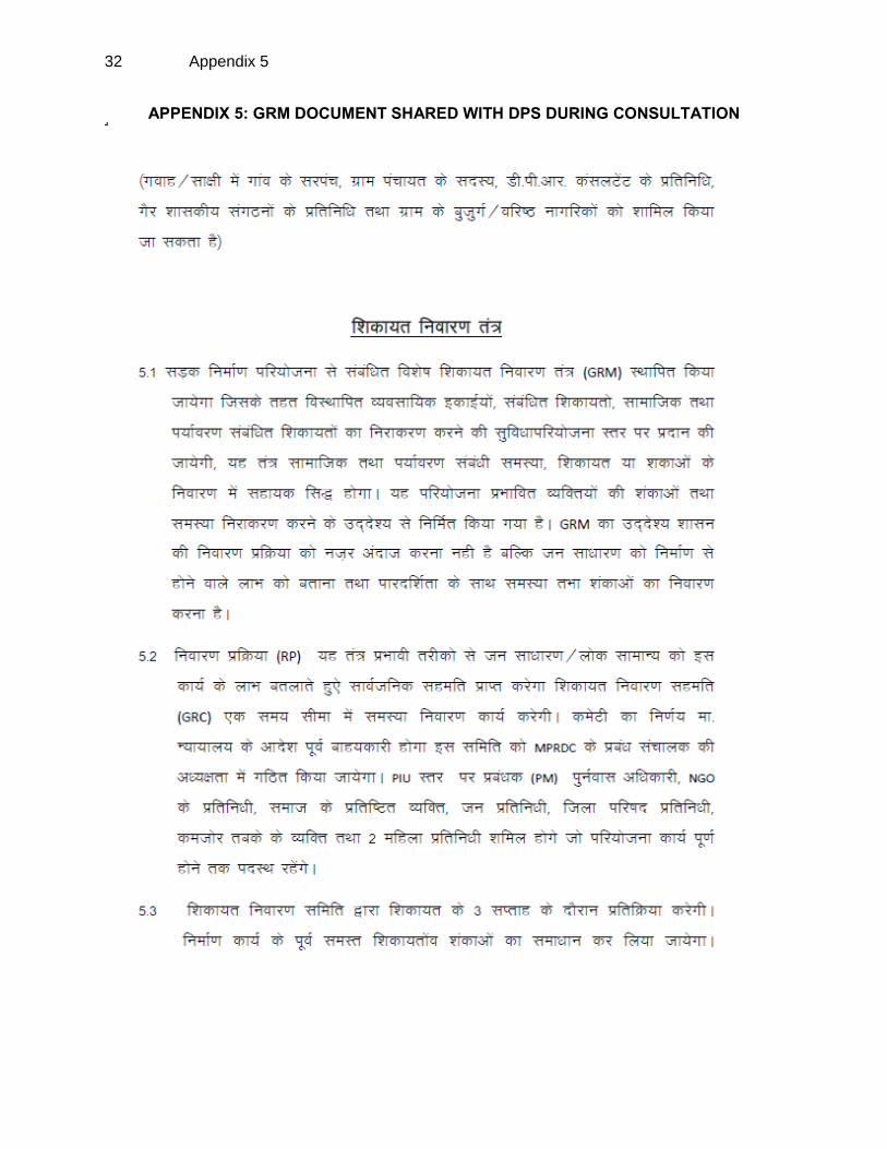
50. The sample of Participants list and Public Consultation photographs are attached in Appendix 4. In addition information on the GRM procedures and formats in local language (Hindi), which was shared with the local people during consultation are provided in Appendix-5.
17
V. INSTITUTIONAL ARRANGEMENT
51. The Executing Agency for the project is GoMP through MPRDC. MPRDC is wholly owned by GoMP and has been equipped with adequate capacity to implement the project. A General Manager (GM) at MPRDC headquarter has been designated as person in charge for project implementation. The Environmental and Social Cell at MPRDC headquarters, reporting to the General Manager, will be responsible for ensuring compliance with environmental and social safeguards of project roads. MPRDC has seven division offices (Bhopal, Jabalpur, Sagar, Gwalior, Ujjain, Indoor, Seoni, and Rewa) acting as Project Implementation Units (PIUs), each headed by a Divisional Manager (Tech.) will be responsible for project road implementation in the field. MPRDC will engage Construction Supervision Consultants (CSC) to act as the engineer for the construction contracts. The Social and R&R Expert from CSC will assist the PIUs for managing social and R&R activities under the project.
VI. GRIEVANCE REDRESS MECHANISM
52. The grievances related to the implementation of the subprojects, particularly regarding the social issues will be acknowledged, evaluated, and responded to the complainant with corrective action proposed. Grievance Redress Cell (GRC) will be established at the MPRDC state level and at the PIU level to assure accessibility for Affected Persons. The GRCs are expected to resolve grievances of the eligible persons within a stipulated time. The decision of the GRCs will be binding, unless vacated by the court of law. The grievance redress mechanism is given in Figure 2. 53. Complaints may be lodged directly to the contractor or CSC or PIU at the site level. To the extent possible efforts will be made by the contractor, CSC or PIU to address these complaints immediately on site. Only those complaints that cannot be addressed immediately at the site level will be submitted to the Grievance Redress Committee (GRC). The respective receiver of the complaint will make necessary assistance for completing the complaint form or lodging a written complaint to illiterate complainants. 54. The GRC will continue to function, for the benefit of the DPs, during the entire life of the project including the five year maintenance period. The composition of this two-tire GRC will be as per the following:
The State level GRC will comprise of the:
i) General Manager, MPRDC, Bhopal ii) Superintended Engineer, PWD, Bhopal iii) DGM, MPRDC, Bhopal iv) Manager (Environment & Social), MPRDC, Bhopal
The PIU level GRC will comprise of the:
i) Divisional Manager from MPRDC ii) Executive Engineer, local PWD office iii) A representative from local NGOs or a local person of repute and
standing in the society, elected representative from respective Zila Parisad.

18
iv) Two representative from affected people including vulnerable groups and women from a relevant agency which could be from the government, or NGO or local community
Figure 2: Grievance Redress Mechanism
VII. GENDER ISSUE UNDER THE PROJECT
55. During the FGD, the women members expressed the view, that construction of road will definitely ease the trouble, especially during the monsoon. Better quality road will help students, especially girls to attend schools. The bicycle journey to school will become comfortable for them. Improved road will increase women’s mobility, especially those who go for distance
Complaints by individuals, Groups, or institutions
Complaints by People’s representatives: political, religious,
community
Step 1 GRC Secretary at divisional Level
(Complaints to GRC in written form
Step 1 GRC meeting
Step 2 GRC meeting
at State l Level
Decision of Step 2 GRC – Convey the decision to Public / Chairman and other members of Step
1GRC
Decision to be taken within 3
week of receipt of complaint
Decision to be taken within 3
week of receipt of complaint
GRC process ends
Simple issues
Complex issues
6 Weeks

19
unskilled jobs, local markets, and health centres etc. Due to better road, visit of health staff, especially ANM and school teacher will increase. 56. Women’s contribution to the project area economy is very low because of under estimation of the role of women in various sectors of economy. There are differences in men’s and women’s pay, unequal access to stable employment. Women are engaged in “hidden work” unpaid but economically necessary in the domestic, agriculture and informal sectors. 57. Information on Access to and Control over certain important aspects; such as Resources, Markets and Socio Cultural, were obtained from the respondents. It is revealed that while women have access to almost all resources and services, the controls are primarily in the hands of men only. 58. Women use the road for transport of water, fuel, farm inputs and products, animal fodder, and building materials as well as their participation in rural production are significant. Improved road will provide them ease in movement and time saving.
VIII. CONCLUSIONS AND RECOMMENDATIONS
59. The assessment of non-sample subprojects reveals that the improvement work will be limited to the existing RoW and will not involve any additional land acquisition or have any impact on non-titleholders. The design options considered for the subprojects have fully avoided any negative impacts on road site settlers and property owners. To avoid impacts, the road design and improvement work is further limited to existing formation width in settlement areas. These 39 non-sample subprojects assessed under the project are classified as Category C projects with regards to involuntary resettlement and indigenous people according to ADB SPS-2009. 60. The Resettlement Framework (RF) and Indigenous Peoples Planning Framework (IPPF) prepared under the project will further guide the management of social safeguard issues during subproject implementation. The following specific actions are proposed to be implemented during the subproject construction period.
During the implementation any impacts identified under the subprojects will be addressed and mitigated as per the entitlement matrix provided under the project RF.
The EA will ensure that contractor engaged undder the subprojects will finalise the construction camps in consultation with the local community and execute formal lease for the land under utilization.
Equal wages will be paid for men and women workers engaged under the subproject construction work.
The contractor will take all necessary safety measures during costruction for commuters and workers.
To ensure easy access to the registration of grievance by the DPs, PIU should include arrangement of receiving it at contractor camp.
A semi-annaual progress report will be submitted by the EA to ADB on management of social safeguard issues under the project.
The Project RF has provision of assistance for temporary livelihood loss and in case during the implementation, any such impacts are identified and the DPs will offer to forgo these small assistance amount against the positive impacts

20
resulted from the improved road, an memorandum of understanding (MoU) will be signed by both the parties and the details of such process will be documented in the semi-annual monitoring report and submitted to ADB.

Appendix 1 21
APPENDIX 1: LIST OF PROPOSED ROAD SECTIONS AND PACKAGES
S.No. Package District Name of Road Length (in Km)
Length of Package (in Km)
1
1 Guan Khatakia to Suthaliya via NH-3, Kumbhraj, Barod, Mragwas, Batawda, Chanchoda, Binaganj, Teligaon
87 87
2 2 Shivpuri Sirsod– Pichhore 33 59
3 Shivpuri Narwar– Chitori to Amola 26
4 3 Ashok Nagar Mungawali– Malahargarh 17 64
5 Ashok Nagar Piprod– Thubon 8
6 Ashok Nagar Belai– Kareela Mata Mandir 18
7 Vidisha Bhounrasa– Malhargarh 21
8 4 Indore Sanwer– Chandravatiganj– Gautampura
35 55
9 Indore Kshipradwa– Budhi– Barlai– Solsindi– Khandakhedi– Jamodi– Maharajganj– Baloda– Rajod– Panod– Sanwer
20
10 5 Narsinghpur Gadarwara– Gotetoria 20 74
11 Narsinghpur Babai– Barha-Sukhakhairi 24
12 Narsinghpur Kareli– Singhpur– Dangidhana 30
13 6 Sagar Maharajpur– Sahajpur 25 84
14 Sagar Samnapur– Bilehra– Nanhi Deori– Narayanpur
45
15 Sagar Kesali– Sahajpur 14
16 7 Sagar Gadpera– Dhamoni 35 90
17 Sagar Barodiya– Dhamoni 20
18 Sagar Nauniya– Madanpura 3
19 Sagar Khurai– Rajwas 32
20 8 Panna Shahnagar– Hardua via Thepa Bori 40 40
21 9 Chhatrpur Bariya Choki– Lugasi 16 101
22 Chhatrpur Rajnagar to Dumra (Part of Bamitha– Dumra)
26
23 Chhatrpur Rajnagar– Bachhon 24
24 Chhatrpur Khaparia Banspahari 24
25 Chhatrpur Chhatarpur– Rajnagar– Vikrampur 11
26 10 Seoni Barghat– Kanhiwada 21 77
27 Seoni Dharna– Aata– Dondiwada– Dharmakua
26
28 Balaghat Waraseoni– Katangi 30
29 11 Balaghat Rampayali– Garra Choki 26 78
30 Balaghat Khairlanji– Agasi 25
31 Balaghat Laalbarra– Samnapur 9
32 Balaghat Seetapathor– Mahkepaar– Goreghat 18
33 12 Mandla Barela– Niwas 46 46
34 13 Chhindwara Chourai– Panjara– Chand 19 68
35 Chhindwara Chand– Bichhua– Khamarpani 37
36 Chhindwara Reymond chowk (Teenkheda) to Saikheda
12
37 14 Rewa Tyonthar– Shankargarh 23 111
38 Rewa Bahera– Dabar– Piparahi– Jadkud 15
39 Rewa Naigarhi– Gurh 14

22 Appendix 1
S.No. Package District Name of Road Length (in Km)
Length of Package (in Km)
40 Rewa Chakghat– Hanumana 59
41 15 Satna Kharamseda– Kirhai– Ramgarh 39 76
42 Satna Jharkua– Raigaon– Karsara 24
43 Satna Bhatura– Bhadpur– Barakhurd 12
44 16 Sidhi, Singroli Chitrangi to Sinhawal 84 113
45 Singroli Chitrangi– Garhwa 29
46 17 Singroli Parsona– Mada 24 109
47 Singroli Ramgarh– Mada 23
48 Singroli Jhurai– Sarai 35
49 Singroli Harfari Khaira– Misirgawan via Shivpurva
27
50 18 Umaria Sohagpur– Manpur 59 59
51 19 Shahdol Anooppur– Jaitpur 26 84
52 Shahdol Gohparu– Rasmohni– Budhar (via Bathiya)
33
53 Shahdol Pasgarhi– Deori– Janakpur 25
54 20 Dewas Bijawar– Kataphod– Satwaas– Khategaon
56 56
Total 1530 1531
Note: Totals may not exactly match because of rounding

Appendix 2 23
APPENDIX 2: INVOLUNTARY RESETTLEMENT IMPACT CATEGORIZATION CHECKLIST Probable Involuntary Resettlement Effects
Yes No
Not Known
Remarks
Involuntary Acquisition of Land
1. Will there be land acquisition? ✔
2. Is the site for land acquisition known? Not Required
3. Is the ownership status and current usage of land to be acquired known?
Not Required
4. Will easement be utilized within an existing Right of Way (ROW)?
✔
5. Will there be loss of shelter and residential land due to land acquisition?
✔
6. Will there be loss of agricultural and other productive assets due to land acquisition?
✔
7. Will there be losses of crops, trees, and fixed assets due to land acquisition?
✔
8. Will there be loss of businesses or enterprises due to land acquisition?
✔
9. Will there be loss of income sources and means of livelihoods due to land acquisition?
✔
Involuntary restrictions on land use or on access to legally designated parks and protected areas
10. Will people lose access to natural resources, communal facilities and services?
✔
11. If land use is changed, will it have an adverse impact on social and economic activities?
✔
12. Will access to land and resources owned communally or by the state be restricted?
✔
Information on Displaced Persons:
Any estimate of the likely number of persons that will be displaced by the Project?
[✔ ] No [ ] Yes
If yes, approximately how many? ______________________
Are any of them poor, female-headed households, or vulnerable to poverty risks?
[✔ ] No [ ] Yes
Are any displaced persons from indigenous or ethnic minority groups?
[✔ ] No [ ] Yes

24 Appendix 3
APPENDIX 3: INDIGENOUS PEOPLES IMPACT CATEGORIZATION CHECKLIST
KEY CONCERNS (Please provide elaborations
on the Remarks column) YES NO
NOT KNOWN
Remarks
A. Indigenous Peoples Identification
1. Are there socio-cultural groups present in or use the project area who may be considered as "tribes" (hill tribes, schedules tribes, tribal peoples), "minorities" (ethnic or national minorities), or "indigenous communities" in the project area?
✔
2. Are there national or local laws or policies as well as anthropological researches/studies that consider these groups present in or using the project area as belonging to "ethnic minorities", scheduled tribes, tribal peoples, national minorities, or cultural communities?
✔
3. Do such groups self-identify as being part of a distinct social and cultural group?
✔
4. Do such groups maintain collective attachments to distinct habitats or ancestral territories and/or to the natural resources in these habitats and territories?
✔
5. Do such groups maintain cultural, economic, social, and political institutions distinct from the dominant society and culture?
✔
6. Do such groups speak a distinct language or dialect? ✔
7. Has such groups been historically, socially and economically marginalized, disempowered, excluded, and/or discriminated against?
✔
8. Are such groups represented as "Indigenous Peoples" or as "ethnic minorities" or "scheduled tribes" or "tribal populations" in any formal decision-making bodies at the national or local levels?
✔
B. Identification of Potential Impacts
9. Will the project directly or indirectly benefit or target Indigenous Peoples?
✔
10. Will the project directly or indirectly affect Indigenous Peoples' traditional socio-cultural and belief practices? (e.g. child-rearing, health, education, arts, and governance)
✔
11. Will the project affect the livelihood systems of Indigenous Peoples? (e.g., food production system, natural resource management, crafts and trade, employment status)
✔
12. Will the project be in an area (land or territory) occupied, owned, or used by Indigenous Peoples, and/or claimed as ancestral domain?
✔
C. Identification of Special Requirements Will the project activities include:
13. Commercial development of the cultural resources and knowledge of Indigenous Peoples?
✔
14. Physical displacement from traditional or customary lands? ✔
15. Commercial development of natural resources (such as minerals, hydrocarbons, forests, water, hunting or fishing grounds) within customary lands under use that would impact the livelihoods or the cultural, ceremonial, spiritual uses that define the identity and community of Indigenous Peoples?
✔

Appendix 3 25
KEY CONCERNS (Please provide elaborations
on the Remarks column) YES NO
NOT KNOWN
Remarks
16. Establishing legal recognition of rights to lands and territories that are traditionally owned or customarily used, occupied or claimed by indigenous peoples?
✔
17. Acquisition of lands that are traditionally owned or customarily used, occupied or claimed by indigenous peoples?
✔

26 Appendix 4
APPENDIX 4: RECORD OF PUBLIC CONSULTATIONS
Public Consultation in Lalmati Village on Chitrangi-Garhwa Road
Public Consultation in Sigati Kala Village on Naigarhi-Garh Road
Group Discussion in Janeh Village on Teothar Shankargarh Road
FGD in Basuriya Village on Bawai Barha Sukhakhairi Road
Discussion with villagers in Singpur Village on Kareli-Singpur-Dangidhana Road
FGD with villagers in Jam Village Khairlanji-Agasi Road
FGD with villagers in Bamhani Village on Lal-Barra-Samnapur Road
FGD with villagers in Goreghat Village on Sitapathar-Mahkepar-Goreghat Road

Appendix 4 27
FGD with women folk in Bangela Village on Rajwas-khurai Road
FGD with villagers in Bhatewara (Bhatura) Village on Bhatura – Bhadapur - Barrakhurd Road
Consultation with women folk in Mungawali Village on Mungawali-Malhargarh Road
Consultation with villagers in Bhorasa Village on Bhonrasa-Malhargarh Road
Consultation with women folk in Gadpahera Mohal Village on Gadpahera – Dhamoni Road
Consultation with women folk in Rajnagar Village on Chattarpur – Vikrampur Rajnagar Road

28 Appendix 4
B. ATTENDANCE SHEET

Appendix 4 29

30 Appendix 4

Appendix 4 31
32 Appendix 5
APPENDIX 5: GRM DOCUMENT SHARED WITH DPS DURING CONSULTATION

Appendix 5 33

34 Appendix 5