shepherds canyon trail guide
TRANSCRIPT
8/3/2019 Shepherds Canyon Trail Guide
http://slidepdf.com/reader/full/shepherds-canyon-trail-guide 1/2
Shepherd’s Canyon in MayRound Trip - two and a quarter miles
Elevation - 600 foot climb
Shepherd’s Canyon is west of Martinez, on Carquinez Scenic Dr, at Ozol, the Navy’s inac-
tive fuel depot. There is parking outside the fire gate. On the other side of the gate is a tiny
meadow, wet and marshy in winter-spring, dry adobe hard as a rock in the hot summer.
The meadow is covered with Narrow-Leaved Milkweed and Spiny Clot bur by late sum-
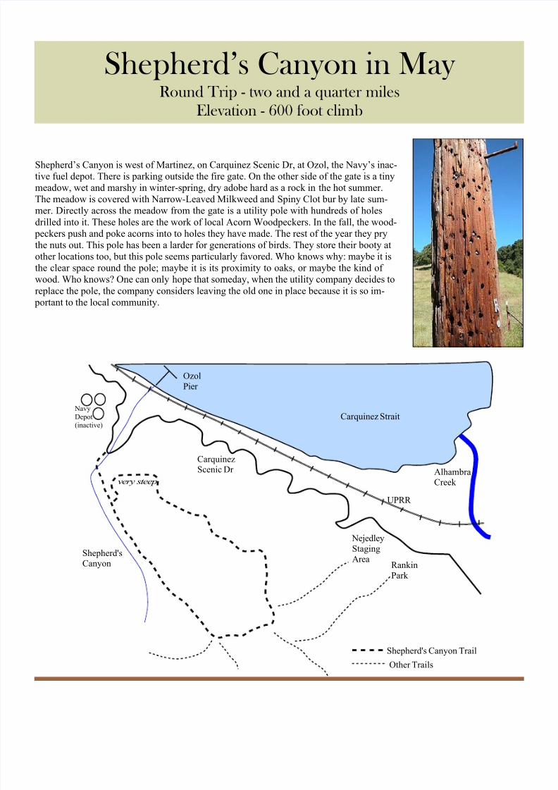
mer. Directly across the meadow from the gate is a utility pole with hundreds of holes
drilled into it. These holes are the work of local Acorn Woodpeckers. In the fall, the wood-
peckers push and poke acorns into to holes they have made. The rest of the year they pry
the nuts out. This pole has been a larder for generations of birds. They store their booty at
other locations too, but this pole seems particularly favored. Who knows why: maybe it is
the clear space round the pole; maybe it is its proximity to oaks, or maybe the kind of
wood. Who knows? One can only hope that someday, when the utility company decides toreplace the pole, the company considers leaving the old one in place because it is so im-
portant to the local community.
Carquinez Strait
UPRR
CarquinezScenic Dr
Rankin
Park
Nejedley
Staging
AreaShepherd'sCanyon
Ozol
Pier
Navy
Depot(inactive)
AlhambraCreekvery steep
Shepherd's Canyon Trail
Other Trails
8/3/2019 Shepherds Canyon Trail Guide
http://slidepdf.com/reader/full/shepherds-canyon-trail-guide 2/2
The fire road crosses the seasonal creek and follows the
creek up the canyon. Not far up the road, a second road
comes in from the left, down a steep hill. This second road
is the return loop. Late in the summer, hikers sometimes
prefer reversing the loop direction and hiking up this steephill rather than hiking down. As the summer heat dries out
the soil, a layer of loose soil forms over the hard clay be-
low. The loose soil acts like little ball bearings. This slope
then becomes very slippery, despite being bone dry.
Continuing up the canyon, the road slopes upward as it
approached the head of the canyon. The rounded slopes of
the ridge are on the left side. The tree covered creek bed is
below the road on the right. The canyon is small, the wa-
tershed is tiny, and the run of the creek is short. The winter
water does not last long enough to support a riparian envi-
ronment. Oaks, Bay Laurels, and Buckeyes shade thecreek. If there were enough year-around moisture for a ri-
parian environment, Alders, Sycamores, and Fremont Cot-
tonwoods (Poplars) would also be found. There is one
large Cottonwood just inside the gate at the start of the
trail. It may have been growing before the railroad altered
the shore, and before the highway builders created the auto
road, and before the Navy developed its fuel depot. This
tree certainly hints that at one time the meadow area was
wetter.
At the top of the canyon, the hiker turns left. There is a
sort of cross roads at this point. Continuing straight or
turning right, the hiker will be stopped by the boundary of
the East Bay Regional Parks. On the left is a large patch of
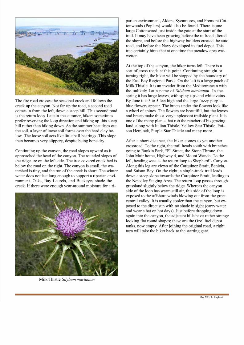
Milk Thistle. It is an invader from the Mediterranean with
the unlikely Latin name of Silybum marianum. In the
spring it has large leaves, with spiny tips and white veins.
By June it is 3 to 5 feet high and the large fuzzy purple-
blue flowers appear. The bracts under the flowers look like
a whorl of spines. The flowers are beautiful, but the leaves
and bracts make this a very unpleasant trailside plant. It is
one of the many plants that rob the rancher of his grazingland, along with Italian Thistle, Yellow Star Thistle, Poi-
son Hemlock, Purple Star Thistle and many more.
After a short distance, the hiker comes to yet another
crossroad. To the right, the trail heads south with branches
going to Rankin Park, “F” Street, the Stone Throne, the
John Muir home, Highway 4, and Mount Wanda. To the
left, heading west is the return loop to Shepherd’s Canyon.
Along this leg are views of the Carquinez Strait, Benicia,
and Suisun Bay. On the right, a single-track trail leads
down a steep slope towards the Carquinez Strait, leading to
the Nejedley Staging Area. The return loop passes throughgrassland slightly below the ridge. Whereas the canyon
side of the loop has warm still air, this side of the loop is
exposed to the offshore winds blowing out from the great
central valley. It is usually cooler than the canyon, but ex-
posed to the direct sun with no shade in sight (carry water
and wear a hat on hot days). Just before dropping down
again into the canyon, the adjacent hills have rather strange
looking flat round shapes; these are the Ozol fuel depot
tanks, now empty. After joining the original road, a right
turn will take the hiker back to the starting gate.
May 2005, db Shepherds
Milk Thistle Silybum marianum