sendai earthquake ne japan march 11, 2011 -...
TRANSCRIPT
Sendai Earthquake NE Japan
March 11, 2011
Some explanatory slides Bob Stern, Dave Scholl, others
updated March 14 2011
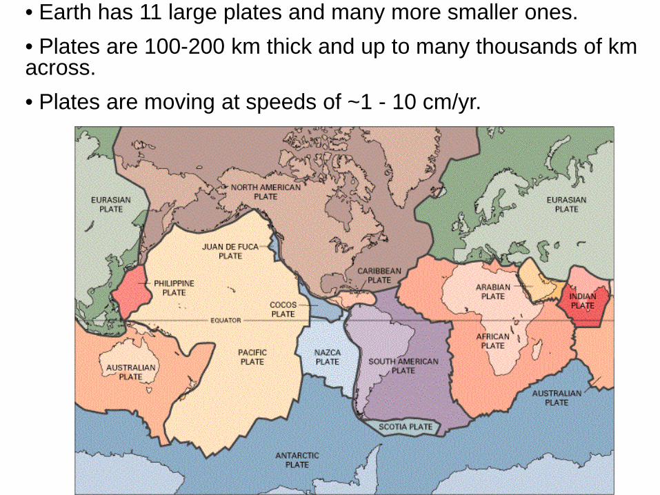
• Earth has 11 large plates and many more smaller ones. • Plates are 100-200 km thick and up to many thousands of km across. • Plates are moving at speeds of ~1 - 10 cm/yr.
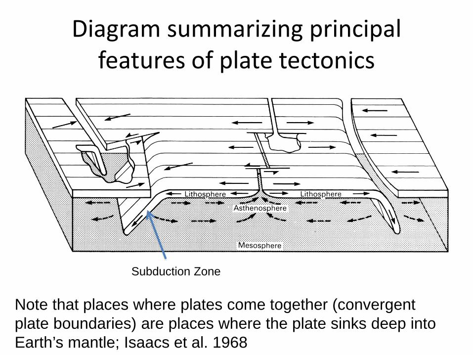
Diagram summarizing principal features of plate tectonics
Note that places where plates come together (convergent plate boundaries) are places where the plate sinks deep into Earth’s mantle; Isaacs et al. 1968
Subduction Zone
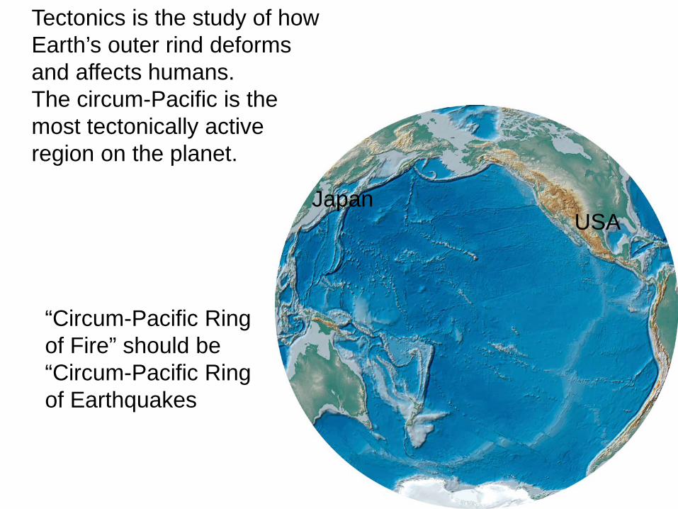
Tectonics is the study of how Earth’s outer rind deforms and affects humans. The circum-Pacific is the most tectonically active region on the planet.
“Circum-Pacific Ring of Fire” should be “Circum-Pacific Ring of Earthquakes
USA Japan
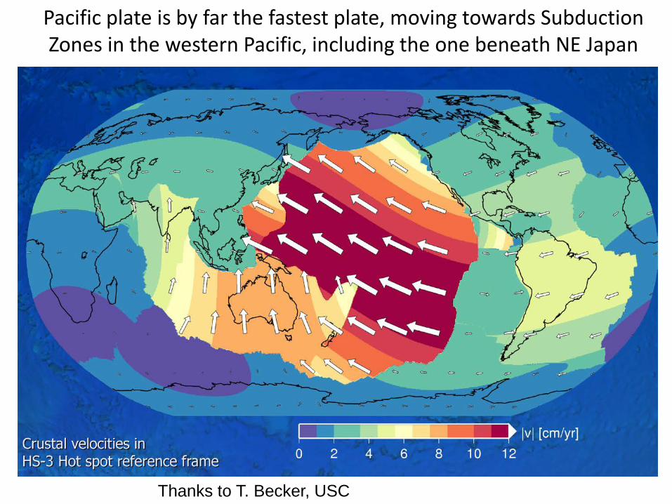
Pacific plate is by far the fastest plate, moving towards Subduction Zones in the western Pacific, including the one beneath NE Japan
Thanks to T. Becker, USC
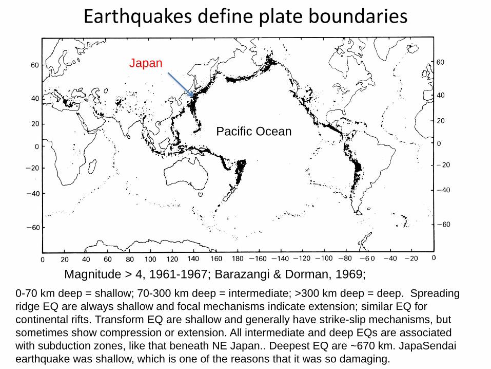
Earthquakes define plate boundaries
0-70 km deep = shallow; 70-300 km deep = intermediate; >300 km deep = deep. Spreading ridge EQ are always shallow and focal mechanisms indicate extension; similar EQ for continental rifts. Transform EQ are shallow and generally have strike-slip mechanisms, but sometimes show compression or extension. All intermediate and deep EQs are associated with subduction zones, like that beneath NE Japan.. Deepest EQ are ~670 km. JapaSendai earthquake was shallow, which is one of the reasons that it was so damaging.
Magnitude > 4, 1961-1967; Barazangi & Dorman, 1969;
Japan
Pacific Ocean
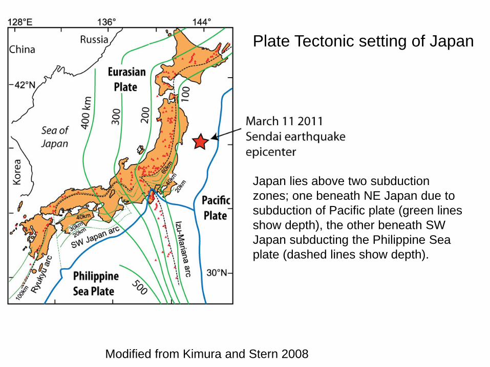
Modified from Kimura and Stern 2008
Japan lies above two subduction zones; one beneath NE Japan due to subduction of Pacific plate (green lines show depth), the other beneath SW Japan subducting the Philippine Sea plate (dashed lines show depth).
Plate Tectonic setting of Japan
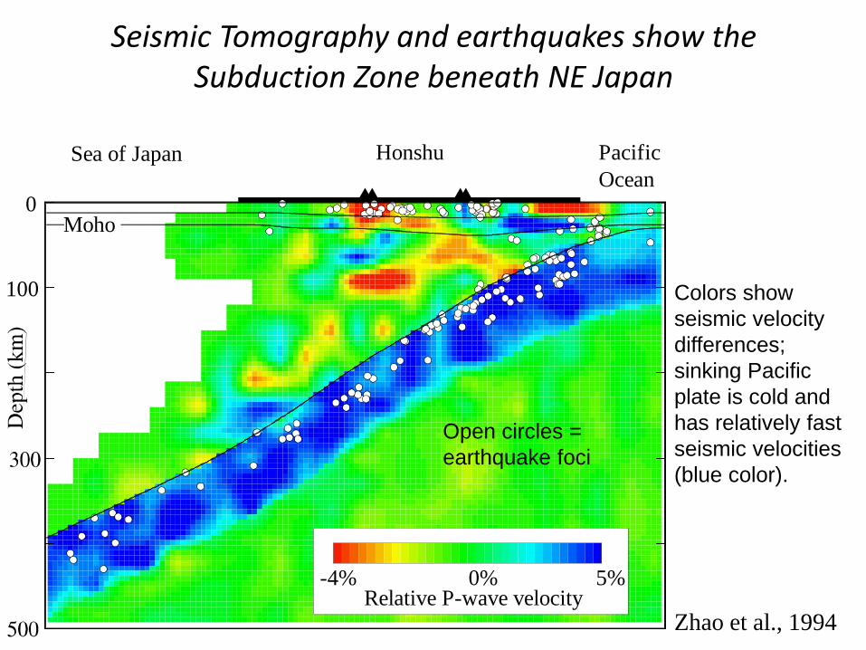
Seismic Tomography and earthquakes show the Subduction Zone beneath NE Japan
Zhao et al., 1994
Sea of Japan Pacific Ocean
Moho0
100
Relative P-wave velocity-4% 0% 5%
Honshu
Open circles = earthquake foci
Colors show seismic velocity differences; sinking Pacific plate is cold and has relatively fast seismic velocities (blue color).
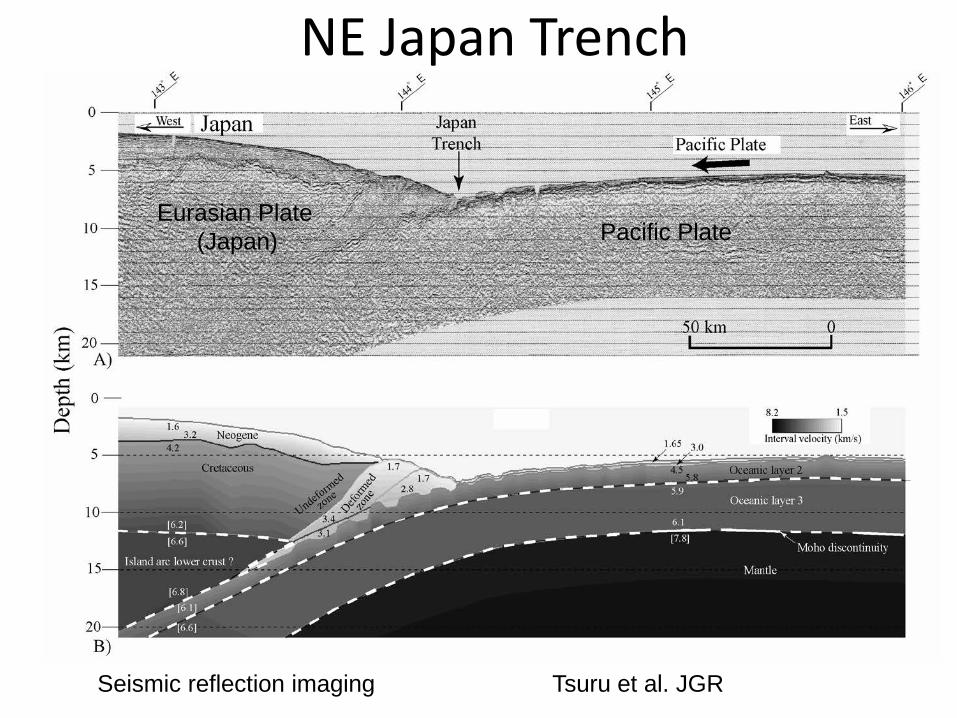
NE Japan Trench
Tsuru et al. JGR
Pacific Plate Eurasian Plate (Japan)
Seismic reflection imaging
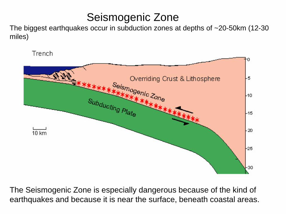
The Seismogenic Zone is especially dangerous because of the kind of earthquakes and because it is near the surface, beneath coastal areas.
Seismogenic Zone The biggest earthquakes occur in subduction zones at depths of ~20-50km (12-30 miles)
Washington Post
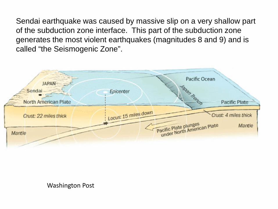
Sendai earthquake was caused by massive slip on a very shallow part of the subduction zone interface. This part of the subduction zone generates the most violent earthquakes (magnitudes 8 and 9) and is called “the Seismogenic Zone”.
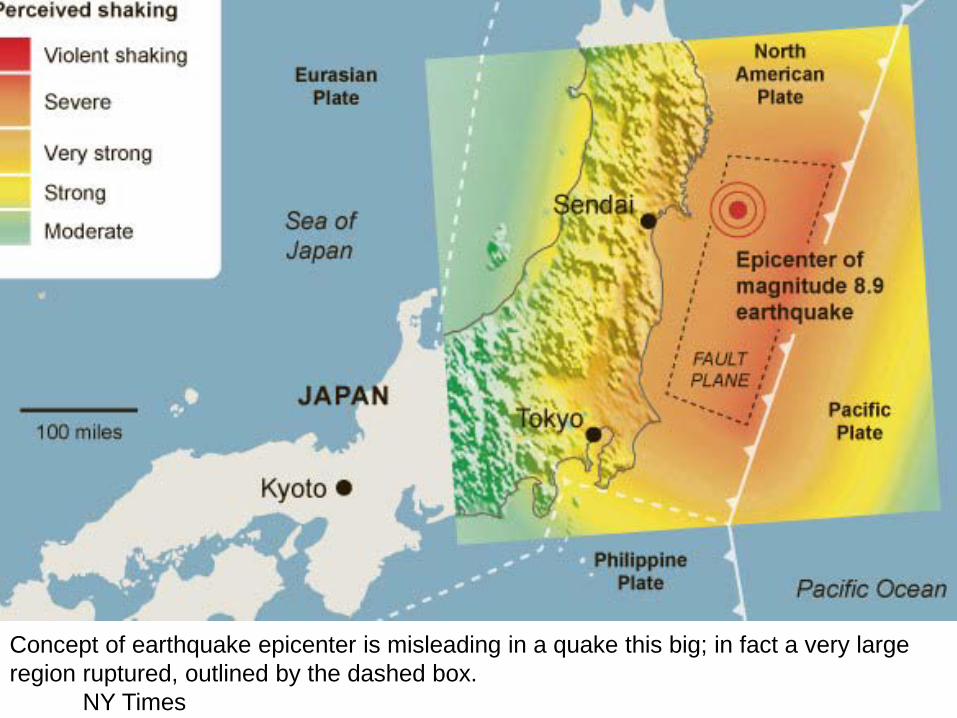
Concept of earthquake epicenter is misleading in a quake this big; in fact a very large region ruptured, outlined by the dashed box. NY Times
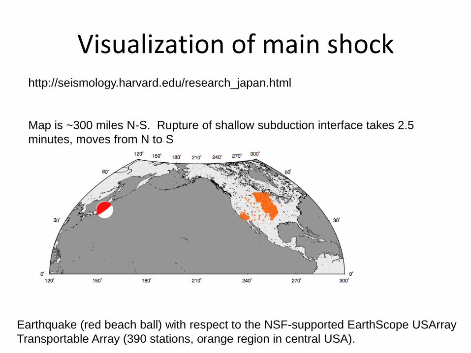
Visualization of main shock http://seismology.harvard.edu/research_japan.html Map is ~300 miles N-S. Rupture of shallow subduction interface takes 2.5 minutes, moves from N to S
Earthquake (red beach ball) with respect to the NSF-supported EarthScope USArray Transportable Array (390 stations, orange region in central USA).
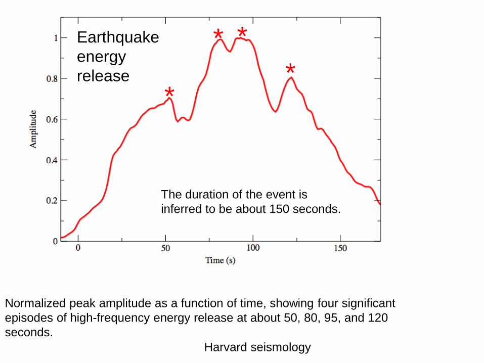
Earthquake energy release
Normalized peak amplitude as a function of time, showing four significant episodes of high-frequency energy release at about 50, 80, 95, and 120 seconds.
The duration of the event is inferred to be about 150 seconds.
*
* * *
Harvard seismology
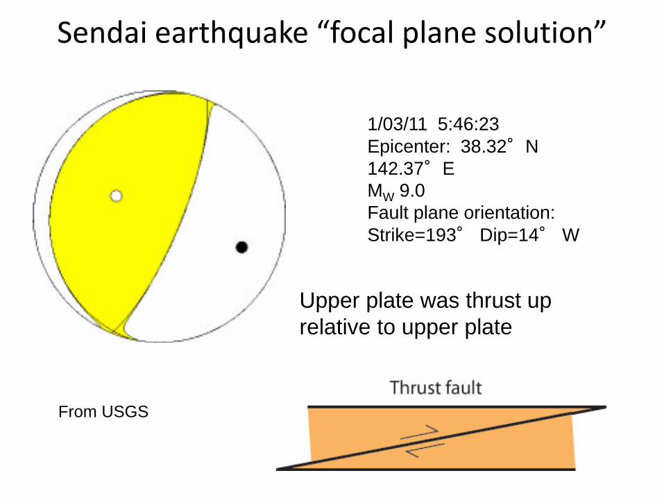
Sendai earthquake “focal plane solution”
1/03/11 5:46:23 Epicenter: 38.32°N 142.37°E MW 9.0 Fault plane orientation: Strike=193° Dip=14° W
From USGS
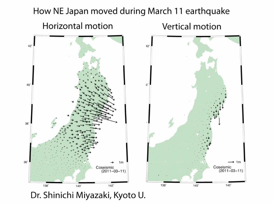
Upper plate was thrust up relative to upper plate
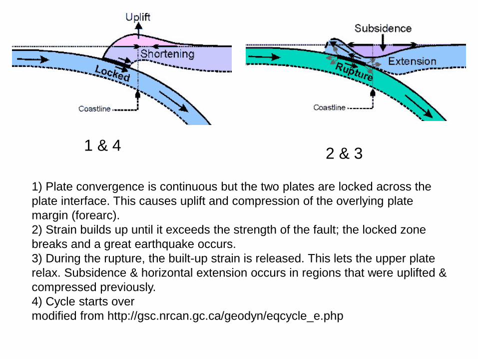
1) Plate convergence is continuous but the two plates are locked across the plate interface. This causes uplift and compression of the overlying plate margin (forearc). 2) Strain builds up until it exceeds the strength of the fault; the locked zone breaks and a great earthquake occurs. 3) During the rupture, the built-up strain is released. This lets the upper plate relax. Subsidence & horizontal extension occurs in regions that were uplifted & compressed previously. 4) Cycle starts over modified from http://gsc.nrcan.gc.ca/geodyn/eqcycle_e.php
1 & 4 2 & 3
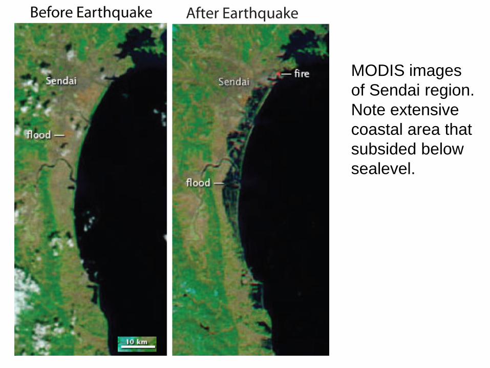
MODIS images of Sendai region. Note extensive coastal area that subsided below sealevel.
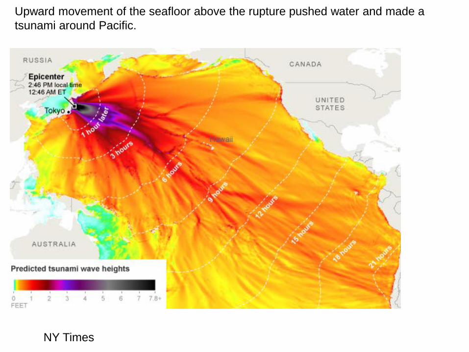
Upward movement of the seafloor above the rupture pushed water and made a tsunami around Pacific.
NY Times
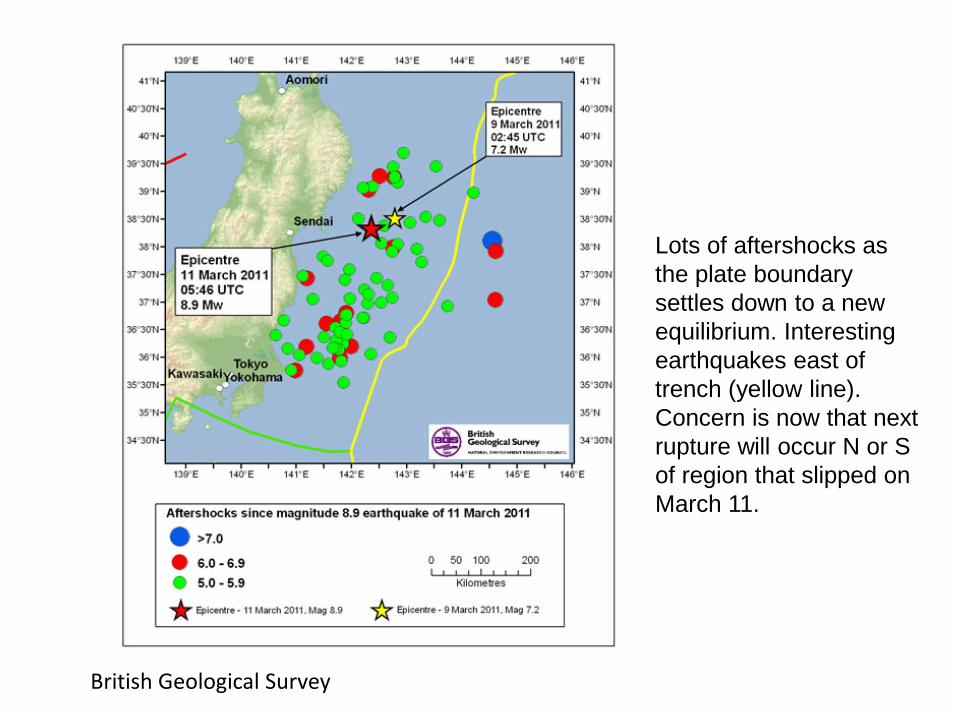
British Geological Survey
Lots of aftershocks as the plate boundary settles down to a new equilibrium. Interesting earthquakes east of trench (yellow line). Concern is now that next rupture will occur N or S of region that slipped on March 11.

“Roughly 80 % of all great megathrust earthquakes (Mw>8.5) occur along subduction zones where the downgoing plate has thick sediments (>1-2 km thick in the trench). Subduction of such a thick sediment layer smooths out the interface between the two plates. This favors the long, lateral continuation of rupturing that is characteristic of giant megathrust events (Ruff, 1989).
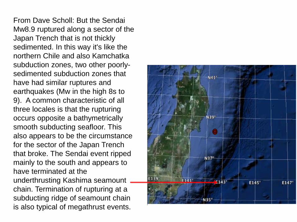
From Dave Scholl: But the Sendai Mw8.9 ruptured along a sector of the Japan Trench that is not thickly sedimented. In this way it's like the northern Chile and also Kamchatka subduction zones, two other poorly-sedimented subduction zones that have had similar ruptures and earthquakes (Mw in the high 8s to 9). A common characteristic of all three locales is that the rupturing occurs opposite a bathymetrically smooth subducting seafloor. This also appears to be the circumstance for the sector of the Japan Trench that broke. The Sendai event ripped mainly to the south and appears to have terminated at the underthrusting Kashima seamount chain. Termination of rupturing at a subducting ridge of seamount chain is also typical of megathrust events.