securing public spaces with exploratory 3d viewshed and
TRANSCRIPT
Securing Public Spaces with Exploratory 3D Viewshed and Line of Sight AnalysisChris Delaney, Law Enforcement Technical Engineer, Esri


Vision and Value of 3D GIS in Tactical OperationsEnable data-driven event using a 3D city model as the point of organization
Indicators
3D Basemap
Plans
Assets
MANAGEDATA IN 3D
1PRE-EVENT PLANNING
2
TACTICAL PLANNING & RESPONSE
3SURVEILLANCE & COUNTER-SURVEILLANCE
4
Threat Landscape

Use-cases• Direct communication sight lines between
buildings• Visibility to regularly-spaced positions along a
road
Line of Sight
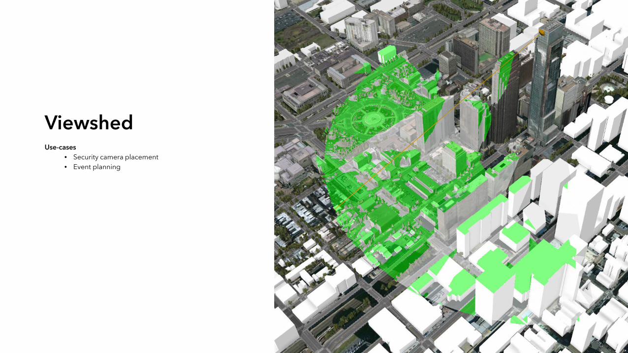
Use-cases• Security camera placement• Event planning
Viewshed

Use-cases• Explosion potential impact / public safety• Visibility shadows
View Dome

Vision and Value of 3D GIS in Tactical OperationsEnable data-driven event using a 3D city model as the point of organization
Indicators
3D Basemap
Plans
Assets
MANAGEDATA IN 3D
1PRE-EVENT PLANNING
2
TACTICAL PLANNING & RESPONSE
3SURVEILLANCE & COUNTER-SURVEILLANCE
4
Threat Landscape

https://go.esri.com/3D_Webinar_NSPSS3D for Tactical Planning