section 3.1 aesthetics and visual resources 3.1.1...
TRANSCRIPT
Cannabis Land Use Ordinance and Licensing Program Final Environmental Impact Report 3.1-1 December 2017
Section 3.1 Aesthetics and Visual Resources
3.1.1 Introduction This section evaluates potential impacts related to aesthetics and visual resources from cannabis activity sites in Santa Barbara County with implementation of the Cannabis Land Use Ordinance and Licensing Program (Project). The existing setting includes a description of scenic vistas, visual quality, and visual character of Santa Barbara County. Impacts are assessed on a comparison of the existing conditions with the cannabis activities that have the potential to impact visual character or quality. Project impact determinations are based on consistency with California Environmental Quality Act (CEQA) thresholds, County Visual Aesthetic Impact Guidelines, and County policies and regulations.
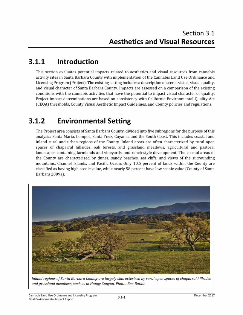
3.1.2 Environmental Setting The Project area consists of Santa Barbara County, divided into five subregions for the purpose of this analysis: Santa Maria, Lompoc, Santa Ynez, Cuyama, and the South Coast. This includes coastal and inland rural and urban regions of the County. Inland areas are often characterized by rural open spaces of chaparral hillsides, oak forests, and grassland meadows, agricultural and pastoral landscapes containing farmlands and vineyards, and ranch-style development. The coastal areas of the County are characterized by dunes, sandy beaches, sea cliffs, and views of the surrounding mountains, Channel Islands, and Pacific Ocean. Only 10.5 percent of lands within the County are classified as having high scenic value, while nearly 58 percent have low scenic value (County of Santa Barbara 2009a).
Inland regions of Santa Barbara County are largely characterized by rural open spaces of chaparral hillsides and grassland meadows, such as in Happy Canyon. Photo: Ben Botkin

County of Santa Barbara
Section 3.1 Aesthetics and Visual Resources
Cannabis Land Use Ordinance and Licensing Program Final Environmental Impact Report 3.1-2 December 2017
Open lands within the Los Padres National Forest and Vandenberg Air Force Base contribute to the rural aesthetic; however, these regions have been excluded from the Project area because they are federally owned and not subject to County zoning ordinance requirements.
Santa Barbara County Scenic Values Mapping Scenic values mapping within the County of Santa Barbara Comprehensive Plan Open Space Element identifies the visual quality of lands as seen from major roadways and edges of developed areas. Scenic areas are defined by features from the Conservation Element that can generally be regarded as having high levels of scenic quality and visual interest. Such areas include rivers, streams, watersheds, reservoirs, and selected vegetative communities. Steep slopes and high elevation are included for their potential to provide scenic vistas. The Open Space Element describes three general levels of scenic value:
• High: Warrant strong consideration for open space designation and preservation.
• Moderate: Advisability of prescribing special design standards, and subjecting plans to design review by the Planning Commission before development is permitted.
• Low: No standards put forth for protection in the Open Space Element.
The Open Space Element designates travel routes for scenic quality based upon destination routes and traffic capacity, as well as scenic value; major roadways were evaluated and identified for their scenic values and are included in the Open Space Element. The County deems travel corridors of high scenic value to be worthy of prime consideration for scenic highway designation, while moderate travel corridors warrant careful development, if development is permitted.
Santa Barbara County Scenic Highways Highway travel gives residents and visitors great exposure to the County’s visual attributes. At present there are three state highways in the County that have been officially designated as State Scenic Highways: Highway 1 between the intersection of US Highway 101 and Las Cruces and the City of Lompoc, the entire length of Highway 154, and Highway 101 from the City of Goleta’s western boundary to Route 1 at Las Cruces (Caltrans 2017; County of Santa Barbara 2009b). Portions of other state highways traversing the County are in the state’s master plan of highways eligible for a Scenic Highway designation. These eligible highways may become official State Scenic Highways when the County implements a plan of preservation. State-designated Eligible Scenic Highways within inland areas of Santa Barbara County include:
• Highway 33 from the junction of Highway 166 traversing south into Ventura County;
Travel routes through inland areas of Santa Barbara County, such as Highway 154 and US Highway 101, serve as scenic corridors within rural agricultural landscapes with backdrops of mountainous topography. Photo: County of Santa Barbara
County of Santa Barbara
Section 3.1 Aesthetics and Visual Resources
Cannabis Land Use Ordinance and Licensing Program Final Environmental Impact Report 3.1-3 December 2017
• Highway 166 from the junction of Highway 33 west through Santa Barbara and San Luis Obispo counties to its junction with US Highway 101;
• US Highway 101 throughout its entire length in Santa Barbara County; and
• Highway 150 from its junction with US Highway 101 east into Ventura County (County of Santa Barbara 2009b).
Light and Glare New sources of lighting can be a nuisance to sensitive viewers through light spill, or can create an ambient light glow that emanates upward and diminishes views of the clear night sky. If uncontrolled, light spill and ambient light glow can disturb wildlife in natural habitat areas. Glare can cause an unwanted and potentially objectionable sensation as observed by a viewer as they look toward a surface that creates glare. Glare can be caused by a direct light source (direct glare) or, more commonly, by the reflection of the sun, moon, or artificial light source from a reflective surface (reflective glare).
The Project area is both rural and urban. The primary sources of light and glare differs between rural and urban areas. The primary sources of light in urban areas include interior building lighting, landscape lighting, security lighting, illuminated signs, streetlights, vehicles, and airplanes. Sources of glare in these areas include windows and reflective building materials such as metal roofs, as well as vehicles and airplanes.
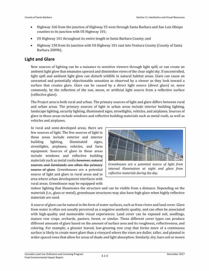
In rural and semi-developed areas, there are few sources of light. The few sources of light in these areas include exterior and interior building lighting, illuminated signs, streetlights, airplanes, vehicles, and farm equipment. Sources of glare in these areas include windows and reflective building materials such as metal roofs; however, natural sources and farmlands are often the primary source of glare. Greenhouses are a potential source of light and glare in rural areas and in area where urban development interfaces with rural areas. Greenhouse may be equipped with indoor lighting that illuminates the structure and can be visible from a distance. Depending on the materials (i.e., glass or metal), greenhouse structures may also have high glare when highly reflective materials are used.
A source of glare can be natural in the form of water surfaces, such as from rivers and land cover. Glare from water is often not usually perceived as a negative aesthetic quality, and can often be associated with high-quality and memorable visual experiences. Land cover can be exposed soil, seedlings, mature row crops, orchards, pasture, forest, or similar. These different cover types can produce different amounts of glare based on the amount of surface area and its roughness, reflectiveness, and coloring. For example, a glossier leaved, low-growing row crop that forms more of a continuous surface is likely to create more glare than a vineyard where the vines are duller, taller, and planted in wider spaced rows that allow for areas of shade and light absorption. Similarly, dry, bare soil or mown
Greenhouses are a potential source of light from internal illumination at night and glare from reflective materials during the day.

County of Santa Barbara
Section 3.1 Aesthetics and Visual Resources
Cannabis Land Use Ordinance and Licensing Program Final Environmental Impact Report 3.1-4 December 2017
grain fields can be much lighter, hence more reflective, than wet, bare soil or a green grain field. Areas that tend to produce the least amount of glare are areas of natural vegetation.
Lastly, light and glare can be affected by the absence of vegetation, because vegetation acts to screen and filter light and soften the intensity of glare. For example, in areas of intense development that lack mature landscaping or where land has been denuded of natural vegetation for agriculture, there will be a notable increase in light and glare when compared to areas of development with mature landscaping or natural, vegetated areas.
3.1.2.1 Existing Visual Character of the Project Area
Santa Maria Region The Santa Maria Valley is contained within the Santa Maria River to the north and the Casmalia and Solomon Hills to the south, which creates a valley that opens towards the Pacific Ocean. The visual character of the Santa Maria Valley is largely agricultural and distant views of the surrounding mountains and foothills are available across open fields and grazing lands. The region also contains the San Antonia Antonio Creek, Cuyama River, and Sisquoc River which form to become the Santa Maria River and add to the scenic value of the region. The region also supports urban and suburban areas including the cities of Santa Maria and Guadalupe, and the unincorporated communities of Orcutt, Garey, Sisquoc, Tepusquet, and Casmalia.
The Rancho Guadalupe Dunes Park, Guadalupe Dunes Preserve, Paradise Beach County Park, Waller Park, and Point Sal State Beach Park are some of the prominent scenic resources that attract visitors to the region. The entire Guadalupe-Nipomo Dune complex is recognized as a National Natural Landmark. The topography and visual appearance of the area is characterized by undulating tan-colored dunes, which are spotted with dune vegetation of contrasting shades of darker greens and browns. From the tops of larger dunes, views of agricultural uses to the east and sandy beaches and the Pacific Ocean to the west are available.
While the region is known for its semi-rural, ranch-style ambience, the scenic quality is identified in the Comprehensive Plan Open Space Element as having low scenic value. The Santa Maria-Orcutt area in particular has the lowest percentage of high scenic value land in the County. However, moderate and high scenic values can be found to the east towards the Sierra Madre Mountains and Los Padres National Forest (County of Santa Barbara 2009a). Eligible State Scenic Highway US Highway 101 runs through this region.
Lompoc Region The Purisima, Santa Rita, Santa Rosa, and White Hills, as well as the Santa Ynez River have the highest scenic value in the Lompoc region. The region also includes the incorporated city of Lompoc, and the unincorporated communities of Vandenberg Village and Mission Hills. Oak forests, chaparral vegetation, and the topography of the Santa Rita Hills make up the majority of rural landscapes. Agricultural lands of low to moderate scenic value border Lompoc to the east and west. These lands support mostly row crops and vineyards. River Park, the western portion of the Gaviota State Park, and Jalama Beach County Park are some of the prominent scenic resources that attract visitors to the region.
Designated State Scenic Highway 1 traverses north-south through the Lompoc Valley, with its State Scenic Highway status terminating in the City of Lompoc. Highway 1 in this portion is a scenic corridor

County of Santa Barbara
Section 3.1 Aesthetics and Visual Resources
Cannabis Land Use Ordinance and Licensing Program Final Environmental Impact Report 3.1-5 December 2017
winding through low-lying peaks and foothills of the Santa Ynez Mountains. Other scenic roadways include Highway 246, Santa Rosa Road, and Drum Canyon Road; these roads contain moderate to high quality agricultural landscapes and open spaces. Some of the primary scenic resources within the region include La Purisima Mission State Park, Burton Mesa Ecological Preserve, and La Purisima Golf Course.
Santa Ynez Region The Santa Ynez Region has the highest percentage of high scenic value land in the County (County of Santa Barbara 2009a). Much of this high scenic value land corresponds with the numerous creeks, river, and hills in the northern portion of the valley. The Santa Ynez Valley is defined by the San Rafael Mountains to the north and east, the Santa Ynez Mountains to the south, and the Purisima Hills to the west. The character of the valley is largely distinguished by ranchette, rural, agricultural, and open space uses that surround distinct urbanized communities. This region encompasses urban developed areas include the Cities of Buellton and Solvang, the Chumash Reservation, and the townships of Los Olivos, Santa Ynez, and Ballard.
The rural, scenic qualities unique to the Santa Ynez Valley are highly valued by the County’s residents and visitors. Visually scenic features include the varying topography of peaks, valleys and ridgelines, the Santa Ynez River and its tributaries traversing east-west across the valley floor, oak woodlands, grassland meadows, rural agricultural landscapes, ranches, and vineyards. Nojoqui Falls County Park, Lake Cachuma, Zaca Lake Station, Sedgewick Natural Reserve, and the Santa Ines Mission are some of the prominent scenic resources that attract many visitors to this region.
Travel routes provide the broadest range and greatest visual access to the various aesthetic resources within the Santa Ynez Valley, offering important viewing areas and scenic corridors. The designated State Scenic Highway 154, and eligible State Scenic Highway US Highway 101 are two of the main thoroughfares through the Santa Ynez Valley. Other major scenic roadways passing through rural and agricultural areas include Highway 246, Happy Canyon Road, Foxen Canyon Road, Ballard Canyon Road, and Zaca Station Road. Panoramic views, ridgelines, oak forests, and chaparral vegetation are common elements that influence the aesthetic quality of these roads. Important scenic areas have been identified along US Highway 101 just south of Buellton, near the interchange between Highway 154 and along US Highway 101, Highway 154 near the intersection of Highway 246, and the Rural and Inner-Rural Areas west of Buellton on Highway 246 (County of Santa Barbara 2009c). The San Antonio Creek riparian corridor is a significant scenic resource that winds through the valley parallel
Los Alamos contains high quality pastoral, agricultural, and natural landscapes situated before backdrops of the Solomon and Purisima Hills. Photo: Amec Foster WheelerRita Bright

County of Santa Barbara
Section 3.1 Aesthetics and Visual Resources
Cannabis Land Use Ordinance and Licensing Program Final Environmental Impact Report 3.1-6 December 2017
to the designated State Scenic Highway US Highway 101 to the east of Los Alamos, and Highway 135 to the west. Views of the creek from roadways are mostly obstructed by vegetation.
In addition to high quality scenic views, the rural nature of the Santa Ynez Valley and lack of light pollution allows for clear views of the nighttime sky and unique opportunities for astronomical observations. This quality is of value to residents within the Santa Ynez Valley and regionally in Santa Barbara County.
Cuyama Region The Cuyama Valley Region consists of the Cuyama Valley and the unincorporated communities of Cuyama and New Cuyama. Views from these communities are of agricultural land, rural residential structures, and vacant land. The ridgelines of the Caliente Range and Sierra Madre Mountain and foothills can also be seen. The varying topography, ridgelines, and canyons associated with the Sierra Madre Mountain Range provide visual interest to the flat valley floor.
The scenic quality of the site is identified in the General Plan Open Space Element as having low scenic value, while high scenic values exist towards the Sierra Madre Mountains and foothills and Cuyama River (County of Santa Barbara 2009a).
Highway travel gives residents and visitors great exposure to the County’s visual attributes. There are two eligible highways. They include State Route 33 from the junction of State Route 166 south into Ventura County and State Route 166 from the junction of State Route 33 west through Santa Barbara and San Luis Obispo counties to its junction with Highway 101. State Route 166 from Cuyama to Twitchell Reservoir is designated as Scenic Level One, Segment Category 4 which is defined as most scenic, having minor capacity, and a secondary destination route (County of Santa Barbara 2009a).
South Coast Region This region consists largely of well-developed urban areas along the coast from Goleta to Carpinteria, which includes the incorporated cities of Santa Barbara, Goleta, and Carpinteria, and the unincorporated communities of Gaviota, Goleta Valley, Hope Ranch, Mission Canyon, Toro Canyon, Montecito, and Summerland. The City of Carpinteria is bordered to the north by the foothills of the Santa Ynez Mountains which produces dramatic views of the mid-and upper-elevations of the mountains throughout Carpinteria. The Pacific Ocean and the Carpinteria Marsh are located on the southern border of the City. These features are mainly visible from adjacent locations, though expansive views of the Santa Barbara Channel and the Channel Islands are gained from upslope parts of the valley.
The South Coast Region includes coastal areas from Gaviota in the north to Carpinteria in the south, characterized by views of the Pacific Ocean and the Santa Ynez Mountains. Photo: County of Santa Barbara
County of Santa Barbara
Section 3.1 Aesthetics and Visual Resources
Cannabis Land Use Ordinance and Licensing Program Final Environmental Impact Report 3.1-7 December 2017
Much of the Gaviota Coast is rural agricultural land. The undeveloped areas are primarily chaparral, coast live oak woodland and riparian habitats consistent with both the southern California coastal regions and the Santa Ynez Mountains. Arroyo Hondo, Arroyo Quemado, and Refugio Canyon are a few of the many watersheds that provide scenic value.
Both urban and rural areas in the South Coast Region have distant views of the northern-most Channel Islands (i.e., Santa Cruz, Santa Rosa, and San Miguel) on clear days, especially from higher elevation ridges and hillsides, and scenic views of the Pacific Ocean. Scenic value is also derived from the dozens of creeks, tributaries, and watersheds which drain the foothills and southern faces of the Santa Ynez Region. In addition, the South Coast Region supports the greatest amount of State Parks, natural preserves, and beaches, which are some of the prominent scenic resources that attract visitors to the region. These include the eastern portion of Gaviota State Park, Nojoqui Falls Park, Arroyo Hondo Preserve, Refugio State Beach, El Capitan State Beach, Goleta Beach Park, Hope Ranch Beach, Arroyo Burro Beach County Park, Butterfly Beach, Lookout Park, Toro Canyon Park, Carpinteria Salt Marsh Nature Park, and Rincon Beach Park.
The officially designated State Scenic Highways are Highway 101 from the City of Goleta’s western boundary to Route 1 at Las Cruces and Highway 154, which provides access between the City of Santa Barbara and the communities of the Santa Ynez Valley over the Santa Ynez Mountain Range. The two highways eligible for a Scenic Highway Designation are Highway 101 which traverses the entire region from southeast to northwest, and Highway 150 which merges into Highway 101 at the easternmost boundary of the region.
Viewer Groups and Visual Sensitivity
Residents and Other Land Owners
The rural residences viewer group includes all permanent and seasonal residents within agricultural and rural inland regions of the County. Rural residents could be highly sensitive to changes in views within the Project area because they generally experience views with relatively less dense development than urban areas, within the context of panoramic views of open lands. Urban residents could be sensitive to further reduced scenic views. Both rural and urban residents could be sensitive to introduction of substantial new development such as greenhouses, hoop structures, and related use of night lighting in close proximity to their homes.
Motorists and Cyclists
Residents, commuters, recreationists, and freight haulers compose both local and regional traffic passing through the County. At standard roadway speeds, motorists’ views of individual parcels along roadways are of moderate duration. Views for cyclists would be of greater duration within visually scenic surroundings. Motorists on smaller, local roadways would have slightly longer views of the surrounding landscape due to slower travel speeds. Motorists and cyclists would be sensitive to changes in the Project area as the passing landscape may be familiar to users of the local road network; users could be sensitive to physical changes to that landscape.
Visitors and Recreationists
Visitors come to Santa Barbara County for purposes of tourism, wine-tasting, beach going, bicycling, hiking, equestrian, cultural events, and other recreational activities. Visitors and recreationists using trails, visiting County or State Parks, or using other outdoor facilities are considered a sensitive group.

County of Santa Barbara
Section 3.1 Aesthetics and Visual Resources
Cannabis Land Use Ordinance and Licensing Program Final Environmental Impact Report 3.1-8 December 2017
This group would be susceptible to physical changes to the surrounding landscape, where a change in the quality of visual resources can diminish the experience for these users.
3.1.3 Regulatory Setting The aesthetics and visual resource analysis was conducted in conformance with the goals and policies of state and local regulations, as discussed below.
3.1.3.1 State
California Scenic Highway Project California’s Scenic Highway Project was designed to preserve and protect scenic highway corridors. Jurisdictions nominating a Scenic Highway for official designation have in place or adopt ordinances to preserve the scenic quality of the corridor, including policies to preserve scenic resources through land use regulations, site planning, control of outdoor advertising (including a ban on billboards), grading, and measures to direct structural design and appearance (California Streets and Highways Code § 260 et seq.). Designated and eligible Scenic Highways within Santa Barbara County are described above in Santa Barbara County Scenic Highways.
California Coastal Act Coastal Act Policy 30251 identifies scenic and visual qualities of coastal areas as a resource of public importance. It states that permitted development shall be sited and designed to protect views to and along the ocean and scenic coastal areas, and, where feasible, to restore and enhance visual quality in visually degraded areas. New development in highly scenic areas such as those designated in the California Coastline Preservation and Recreation Plan prepared by the Department of Parks and Recreation and by local government shall be subordinate to the character of its setting.
3.1.3.2 Local
County of Santa Barbara Comprehensive Plan The County of Santa Barbara Comprehensive Plan’s Land Use, Open Space, Environmental Resource Management, and Scenic Highways Elements contain descriptions, policies, and goals that both recognize scenic qualities and provide guidance for their protection. The intent of these plans and policies is to promote protection of important visual resources and ensure that new development is compatible with the community and the surrounding environment.
Land Use Element
The Land Use Element is a means by which more orderly development and consistent decision making can be accomplished. The land uses proposed within the Land Use Element, and depicted on land use maps, are to be used to guide the public and the decision-makers as to what uses are appropriate if and when development occurs. The question of whether that development can occur at any given time is based on a site-specific evaluation of the Project's overall impact on available resources, public services, and environmental factors.

County of Santa Barbara
Section 3.1 Aesthetics and Visual Resources
Cannabis Land Use Ordinance and Licensing Program Final Environmental Impact Report 3.1-9 December 2017
Applicable Visual Resource Policies
Policy 1: All commercial, industrial, and planned developments shall be required to submit a landscaping plan to the County for approval.
Policy 2: In areas designated as rural on the land use plan maps, the height, scale, and design of structures shall be compatible with the character of the surrounding natural environment, except where technical requirements dictate otherwise. Structures shall be subordinate in appearance to natural landforms; shall be designed to follow the natural contours of the landscape; and shall be sited so as not to intrude into the skyline as seen from public viewing places.
Policy 3: In areas designated as urban on the land use plan maps and in designated rural neighborhoods, new structures shall be in conformance with the scale and character of the existing community. Clustered development, varied circulation patterns, and diverse housing types shall be encouraged.
Policy 5: Signs shall be of size, location and appearance so as not to detract from scenic areas or views from public roads and other viewing points.
Open Space Element
The Open Space Element identifies the County’s scenic beauty as a principal factor in the attraction of visitors and residents, and evaluates the visual quality of natural resources, travel corridors, and parameters of urban and rural areas within the County. The Open Space Element employs a scenic values model to map visual quality, and uses factors of development intensity, siting, natural features, and vegetation as criteria for the protection of visual resources. Significant visual resources as noted in the Open Space Element include:
• Scenic highway corridors
• Parks and recreational areas
• Views of coastal bluffs, streams, lakes, estuaries, rivers, watersheds, mountains, and cultural resource sites
• Scenic areas
Environmental Resources Management Element
The Environmental Resources Management Element (ERME) presents the County’s policies for air quality, biology, surface and ground water resources, noise, and visual resources protection. The ERME additionally provides maps with categorized areas to direct future development. For instance, within “Category C” areas, areas of high scenic value and scenic corridors are noted, and urbanization could only be permitted in appropriate instances, subject to project plan review and imposition of specific conditions to protect against hazards and to preserve the integrity of the land and environment.
Scenic Highway Element
The Scenic Highway Element of the Comprehensive Plan presents the County’s policies and procedures for scenic highways and their designation. This element specifically presents the County’s scenic highway goals, evaluation standards, preservation measures, and procedures for obtaining official “Scenic Highway” designation for state and county roads in the County. The County’s Scenic

County of Santa Barbara
Section 3.1 Aesthetics and Visual Resources
Cannabis Land Use Ordinance and Licensing Program Final Environmental Impact Report 3.1-10 December 2017
Highway Element contains preservation measures for eligible scenic routes (County of Santa Barbara 2009a). Such measures include the application of the Design Control Overlay District to require design review of structures or other development, additional grading and landscaping regulations, and control of outdoor signage.
Community Plans Projects within areas that are subject to the following community plans would be subject to visual protection goals and policies of the respective plan:
• Eastern Goleta Valley Community Plan
• Gaviota Coast Plan
• Goleta Community Plan
• Los Alamos Community Plan
• Mission Canyon Community Plan
• Montecito Community Plan
• Orcutt Community Plan
• Santa Ynez Valley Community Plan
• Summerland Community Plan
• Toro Canyon Plan
County of Santa Barbara Local Coastal Program (LCP) The LCP is required by the California Coastal Act to govern projects in the Coastal Zone. The County’s LCP includes the Coastal Land Use Plan and the Coastal Zoning Ordinance, which implements the Coastal Land Use Plan.
Coastal Land Use Plan (CLUP)
The purpose of the CLUP is to protect coastal resources, provide greater access and recreational opportunities for the public’s enjoyment, while allowing for orderly and well-planned urban development and the siting of coastal-dependent and coastal-related industry. The CLUP establishes land uses within the coastal zone. The other elements of the County’s Comprehensive Plan are applicable within the coastal zone; however, where conflicts exist, the LCP takes precedence. The plan includes numerous policies applicable to development projects. Sections 3.4.3 and 3.4.4 of the County of Santa Barbara CLUP provide policies that protect coastal visual resources. These policies are intended to help implement the Coastal Act at the County level. Section 3.4.4 focuses on visual resource protection in the View Corridor Overlay, specifically vistas from scenic Highway 101.
Policy 4-2: All commercial, industrial, planned development, and greenhouse projects shall be required to submit a landscaping plan to the County for approval.
Policy 4-3: In areas designated as rural on the land use plan maps, the height, scale, and design of structures shall be compatible with the character of the surrounding natural environment, except where technical requirements dictate otherwise. Structures shall be subordinate in appearance

County of Santa Barbara
Section 3.1 Aesthetics and Visual Resources
Cannabis Land Use Ordinance and Licensing Program Final Environmental Impact Report 3.1-11 December 2017
to natural landforms; shall be designed to follow the natural contours of the landscape; and shall be sited so as not to intrude into the skyline as seen from public viewing places.
Policy 4-4: In areas designated as urban on the land use plan maps and in designated rural neighborhoods, new structures shall be in conformance with the scale and character of the existing community. Clustered development, varied circulation patterns, and diverse housing types shall be encouraged.
Policy 4-9: Structures shall be sited and designed to preserve unobstructed broad views of the ocean from Highway 101, and shall be clustered to the maximum extent feasible.
Policy 4-10: A landscaping plan shall be submitted to the County for approval. Landscaping when mature, shall not impede public views.
Policy 4-11: Building height shall not exceed one story or 15 feet above average finished grade, unless an increase in height would facilitate clustering of development and result in greater view protection, or a height in excess of 15 feet would not impact public views to the ocean.
Coastal Zoning Ordinance (CZO) The CZO is applicable to the unincorporated coastal zone. It implements the CLUP by classifying and regulating the uses of land, buildings, and structures in the coastal zone.
Sections 35-77A, C-1 - Limited Commercial, 35-102F CA – Carpinteria Overlay District, 35-131 Agricultural Sales, and Section 35-144 Ridgeline and Hillside Development Guidelines state that the intent of the development standards is to ensure compatibility with surrounding land uses in order to protect visual resources.
Section 35-93 TC – Transportation Corridor states that to the maximum extent feasible, all development, including expansions of U.S. Highway 101, shall incorporate provisions for landscaping to preserve the scenic and visual amenities which exist along the affected transportation corridor, or to replace such landscaping with comparable scenic and visual amenities. To the extent feasible, the existing historic landscaping scheme shall be preserved and maintained.
Section 35-102F.9 Development Standards for Greenhouses and Related Development states:
A. Prior to approval of a Coastal Development Permit for any greenhouse, related development, packing and shipping facility, shade or hoop structure, within the CA Overlay District, the proposed development shall meet the following development standards where applicable.
1. A landscaping plan shall be required which provides, to the maximum extent feasible, visual screening of all structures and parking areas from all adjacent public roads and view corridors. The landscape plan shall include the following:
a. The landscaping plan shall consist of plants which will reasonably screen the development within five years and which are compatible with the surrounding visual character of the area.
b. Landscaping within front setbacks shall gradually increase in height away from public roadways. Solid wall fencing shall not be relied upon as a primary means of screening. Solid wall or chain-link security fencing shall be screened from public view corridors by dense landscaping and/or covered with attractive climbing vines.

County of Santa Barbara
Section 3.1 Aesthetics and Visual Resources
Cannabis Land Use Ordinance and Licensing Program Final Environmental Impact Report 3.1-12 December 2017
c. Where structures are proposed in existing orchards or adjacent to windrows, perimeter trees shall be preserved to the maximum extent feasible in order to provide visual screening along adjacent public roadways. Remnant orchard trees shall be maintained in good condition to ensure that trees do not become hosts for pests or diseases.
d. Landscaping, fences, and walls shall not impede views of scenic areas from public roads, parks, beaches, or other public viewing areas.
Landscaping shall be maintained for the life of the project. The applicant shall post a performance security to ensure that landscaping provides adequate screening within five years. If landscaping is removed or substantially altered, a revised landscape plan shall be submitted to Planning and Development for substantial conformity review with the original conditions of approval and replacement landscaping shall be installed and maintained.
7. Exterior lighting shall be for specific safety purposes only and shall be hooded/shielded to minimize the spread of light off-site and to minimize impacts to the rural nighttime character.
8. To the extent feasible, new greenhouse development and packing and shipping facilities shall be oriented with the roof axis aligned from north to south to reduce glare impacts.
14. Packing and distribution facilities shall be subject to Board of Architectural Review. The size, height, design, and appearance shall be compatible with the rural character of the area.
16. All new or retrofit greenhouse or plant protection structures shall include a mechanized blackout screen system within growing areas to prevent interior night lighting from being visible outside the structure. If the applicant does not intend to use night lighting, the project description for individual greenhouse projects shall clearly state that night lighting within growing areas shall not occur.
18. Greenhouse development shall be sited and designed to minimize adverse impacts on scenic areas, and public views of the ridgelines and natural features visible from public roadways or other public viewing areas to the maximum extent feasible. If there is no feasible building site location on the proposed project site where development would not be visible, then the development shall be sited and designed to minimize impacts on scenic areas and public views of ridgeline and natural features visible from scenic highways or public viewing areas, through measures including, but not limited to, siting development in the least visible portion of the site, reducing maximum height standards, breaking up the mass of new structures, clustering new structures with existing greenhouse development along the edges of the properties to maintain maximum through-view corridor, and incorporating landscape elements.
19. Avoidance of impacts to visual resources through site selection and design alternatives is the preferred method over landscape screening. Landscape screening, as mitigation of visual impacts shall not substitute for project alternatives including re-siting, or reducing the height or bulk of the greenhouse development.
Section 35-102F.4 – Development Cap for Greenhouses and Greenhouse Related Development. Within Area A of the CA Overlay District, no more than 2.75 million square feet of new greenhouses, greenhouse related development, packing and shipping facilities, and hoop structures may occur after the date of adoption of this overlay district. For the purpose of calculating this development cap, all
County of Santa Barbara
Section 3.1 Aesthetics and Visual Resources
Cannabis Land Use Ordinance and Licensing Program Final Environmental Impact Report 3.1-13 December 2017
greenhouses, packing and shipping facilities, hoop structures, and greenhouse related development (including associated paved parking and driveways, and associated accessory structures [e.g., boiler rooms, storage sheds, etc.]) shall be included. Shade structures shall not be calculated towards the cap. Structures that are legalized during the amnesty period (Section 35-102F.7.2) shall not be calculated towards the development cap.
County of Santa Barbara Land Use and Development Code (LUDC) The LUDC, Chapter 35 Zoning of the Santa Barbara County Code, includes development standards protecting visual resources. Section 35.30.120 (Outdoor Lighting) of the LUDC provides restrictions on outdoor lighting to protect against spillover onto adjacent properties and to minimize interference with vehicular traffic on private/public streets from lighting. The LUDC contains height and size limits, including guidelines for development that regulate the design of future development, in some cases, through review of project plans by the regional Board of Architectural Review (BAR). The North County BAR (NBAR) has review authority over the Santa Maria Project region, and the northern half of the Lompoc and Cuyama Project regions. The Central County BAR (CBAR) reviews projects in the Santa Ynez Project region, the western half of the South Coast Project region, the southern half of the Lompoc Project region, and the southwest quarter of the Cuyama Project regions, The South County Bar (SBAR) reviews projects in the southeast quarter of the Cuyama Project region and the eastern half of the South Coast Project region, excluding the area that is subject to the Montecito Community Plan. The Montecito BAR (MBAR) reviews projects in the area that is subject to the Montecito Community Plan.
35.21.050 Development Standards for Agricultural Zones
Development in AG-I and AG-II zones must be compatible with the character of the surrounding natural environment, subordinate in appearance to natural landforms, and sited so that it does not intrude into the skyline as seen from public viewing places. At a minimum, development must comply with the following design standards. This applies to small agricultural accessory structures in the AG-II zone in the inland area (Section 35.42.020) and agricultural employee dwellings (Section 35.42.030).
1. Exterior lighting shall be for safety purposes only and shall comply with the following requirements:
(a) Light fixtures shall be fully shielded (full cutoff) and shall be directed downward to minimize impacts to the rural nighttime character.
(b) To the extent feasible, lighting shall be directed away from habitat areas, nearby residences, public roads and other areas of public use.
2. Building materials and colors (earth tones and non-reflective paints) compatible with the surrounding natural environment shall be used to maximize the visual compatibility of the development with surrounding areas.
Agricultural product sales must also be compatible with surrounding land uses in order to protect and maintain visual resources (Section 35.42.050). Specifically, impacts from exterior lighting, including signs, shall be reduced as stated above.
Further, Section 35.21.060 Permit Requirements and Development Standards for Specific Land Uses in the Gaviota Coast Plan Area states that development of land located on property zoned AG-II within
County of Santa Barbara
Section 3.1 Aesthetics and Visual Resources
Cannabis Land Use Ordinance and Licensing Program Final Environmental Impact Report 3.1-14 December 2017
the Gaviota Coast Plan area be compatible with surrounding land uses in order to protect visual resources. This includes agricultural processing facilities (Section 35.42.040).
Agricultural zones have height limits to protect views. Within AG-I zones, there is a 35-foot maximum for residential structures, and no limits otherwise. Within AG-II zones, there is no height limit for coastal areas, a 35-foot height limit for residential structures, and no limit otherwise in inland areas. For Ag-II and AG-II, there is a 25-foot height limit for residential structures in the Toro Canyon Plan area.
35.24.020 Development Standards for Commercial Zones
Scenic resources are protected through comprehensive site planning in C-V zones. Allowable uses within C-1 zones are to be compatible with neighboring residential uses and C-3 zones are to be compatible with adjacent uses. This includes protection from negative impacts from lighting. To protect views, the height limit for C-1 zones is 25 feet for coastal areas, 35 feet for inland, and 25 feet for residential structures only in the Toro Canyon Plan area. The height limit for C-2, C-3, and CM-LA zones is 35 feet. For C-V zones, the height limit inland is 35 feet, but to not exceed 2 stories on a site surrounded by residential zoning.
35.25.050 Development Standards for Industrial Zones
No offensive glare generated by or resulting from the use on any lot, other than motor vehicles or lighting fixtures, shall be detectable at any point along the property line of, or outside of the lot where the use is located in M-1 zones. To protect views, there is a height limit of 35 feet for the M-RP zone, and 45 feet for M-1, M-2, and M-CR zones.
35.26.050 Development Standards for Mixed Use (MU) Zones
Any allowed use within a MU zone shall not, by reason of its lighting adversely affect other land uses within or adjoining the development. Further, the lighting associated with any nonresidential use in a MU zone is compatible with any residential use located in the vicinity. To protect views, the height limit for MU zones is 35 ft.
35.28.070 Development Standards for Critical Viewshed Corridor (CVC) Overlay Zone
These policies apply to the visually critical nearfield viewsheds of the Gaviota Coast Plan area located to the north and south of Highway 101. For structures, all exterior lighting must comply with the same requirements listed in Section 35.21.050 Development Standards for Agricultural Zones. CVC zone also has additional requirements for screening, landscaping, ocean views, and structure height.
Screening: Development must be screened to the maximum extent feasible as seen from public viewing places. Screening shall be achieved to the maximum extent feasible through adherence to the Site Design Hierarchy within the Gaviota Coast Plan Design Guidelines.
Landscaping: Landscaping, not including any agricultural crop or orchard, when mature, cannot obstruct public views of the mountains or the ocean.
Ocean views: Development must be sited and designed to preserve unobstructed broad views of the ocean from Highway 101, and be clustered to the maximum extent feasible.
Structure height:
County of Santa Barbara
Section 3.1 Aesthetics and Visual Resources
Cannabis Land Use Ordinance and Licensing Program Final Environmental Impact Report 3.1-15 December 2017
(1) The height of any structure located south of Highway 101 may not exceed 15 feet unless an increase in height would facilitate clustering of development and result in greater view protection, or a height in excess of 15 feet would not impact public views to the ocean.
(2) Visible portions of structures located on lots having unobstructed broad view of the ocean must be designed so that any intrusions into the view of the ocean, as seen from public viewing areas, is minimized to the maximum extent feasible.
(3) The height and/or scale of development must be harmonious with the surrounding area.
(4) The appearance of the development must not be undesirable or unsightly.
35.28.150 Highway 101 Corridor (HC) Overlay Zone
The HC overlay zone includes areas along Highway 101 in the South Coast urbanized area. Each project must be evaluated to determine the potential of the proposed development to impact the visual qualities of the area. To the maximum extent feasible, all development, including expansions of Highway 101, must incorporate provisions for landscaping to preserve the scenic and visual amenities which exist along the affected transportation corridor, or to replace such landscaping with comparable scenic and visual amenities.
35.28.175 Scenic Corridor – Mission Canyon (SC-MC) Overlay Zone
The overlay zone is designed to protect the visual resources of the gateway entrance to Mission Canyon along Mission Canyon Road. Fences, gates, gateposts, and walls must be designed and constructed of natural materials.
35.28.210.H Toro Canyon Plan Area
The outside lighting of all non-agricultural structures must be minimized. Outside lighting must be shielded, downward-directed low-level lighting consistent with Toro Canyon’s rural and semi-rural character. To minimize visual and aesthetic impacts, the total vertical height of any graded slopes for a project, including the visible portion of any retaining wall above finished grade, must not exceed 16 vertical feet. Additionally, the visible portion of a retaining wall above finished grade must not exceed a height of 6 ft.
35.30.060 Design Compatibility Standards A. Rural. Within Rural areas as designated on the Comprehensive Plan maps, the height, scale, and design of each structure must be compatible with the character of the surrounding natural environment, as determined by the review authority, except where the review authority determines that technical requirements dictate otherwise. Structures must be subordinate in appearance to natural landforms, designed to follow the natural contours of the landscape, and sited so as not to intrude into the skyline as seen from public viewing places.
B. Urban and Existing Developed Rural Neighborhoods (EDRNs). Within Urban areas and EDRNs (Inland area) or Rural Neighborhoods (Coastal Zone) as designated on the Comprehensive Plan maps, new structures must conform to the scale and character of the existing community. Clustered development, varied circulation patterns, and diverse housing types are encouraged.
Section 35.30.070, Fences and Walls, states that:
(a) Light fixtures shall be fully shielded (full cutoff) and shall be directed downward to minimize impacts to the rural nighttime character.

County of Santa Barbara
Section 3.1 Aesthetics and Visual Resources
Cannabis Land Use Ordinance and Licensing Program Final Environmental Impact Report 3.1-16 December 2017
(b) To the extent feasible, lighting shall be directed away from habitat areas, nearby residences, public roads and other areas of public use.
Section 35.30.120, Outdoor Lighting, states that:
(a) All exterior lighting shall be hooded and no unobstructed beam of exterior light shall be directed toward any area zoned or developed residential.
(b) Lighting shall be designed so as not to interfere with vehicular traffic on any portion of a street.
(c) Light trespass and glare shall be reduced to the maximum extent feasible through downward directional lighting methods.
(d) Within the Gaviota Coast Plan Area, all lighting fixtures shall be installed at the lowest height required to achieve the design purpose of the lighting fixture.
35.34.070 Development Standards for Resort/Visitor Serving Commercial (C-V) Zone
Landscape plans in the CV zone must include an adequate buffer comprised of fencing, walls, plant materials, or any combination thereof, adjacent to any portion of a lot line that abuts a residential zone to protect adjacent properties from impacts of lighting.
35.36.80 Parking and Loading Standards
Parking areas serving uses operating at night must be adequately lighted. Lighting must be directed away from adjoining residences. Section 35.36.090, Standards for Agricultural Zones and Uses, describes that parking shall be visually screened from adjacent public roads and view corridors to the maximum extent feasible in the Carpinteria Agricultural (CA) overlay zone.
Montecito Land Use and Development Code
35.424.040 Development Standards for Commercial Zones
Scenic resources are protected through comprehensive site planning in CV (resort/visitor serving commercial) zones. Section 35.434.070, Commercial Zones Landscaping Requirements, states that an adequate buffer area with a minimum width of 10 ft. comprised of fencing, walls, plant materials, or any combination thereof, shall be provided adjacent to any portion of a lot line that abuts a residential zone to protect adjacent properties from impacts of lighting and to provide separation between residential and commercial uses in CV zones. The height limit in CV zones is 35 ft. or 2 stories.
35.428.070 Development Standards for Montecito Hillside (H-MON) Overlay Zone – Inland Area The Montecito Hillside (H-MON) overlay zone is intended to preserve, enhance, and protect the visual and biological importance and natural mountainous setting of areas of Montecito that are steeply sloped and visually prominent.
35.430.090 Design Compatibility Standards for All Land Uses Structure height: For lots located within the View Corridor (VC) Overlay, the height of a structure is measured by the vertical distance between the average finished grade and the uppermost point of the structure directly above that grade.

County of Santa Barbara
Section 3.1 Aesthetics and Visual Resources
Cannabis Land Use Ordinance and Licensing Program Final Environmental Impact Report 3.1-17 December 2017
35.434.080 Design Development Standards for the Transportation Corridor (TC) zone – Coastal Zone To the maximum extent feasible, development, including expansions of the U.S. Highway 101, must incorporate provisions for landscaping to preserve the scenic and visual amenities that exist along the affected transportation corridor, or to replace landscaping with comparable scenic and visual amenities. To the extent feasible, the existing historic landscaping scheme must be preserved and maintained.
35.436.080 Development Standards for Agricultural Zones
Onsite parking for greenhouses, and other plant protection structures, must be screened from the view of adjacent public streets.
3.1.4 Environmental Impact Analysis This section discusses the potential aesthetics and visual resource impacts associated with the proposed Project. The loss, alteration, or obstruction of visually significant features, or the introduction of disparate features that conflict with the existing visual character and quality of the Project area, may be considered significant aesthetic and visual effects.
3.1.4.1 Thresholds of Significance
CEQA Guidelines Appendix G of the 2017 CEQA Guidelines identifies the following four circumstances that can lead to a determination of significant visual impact:
• The Project has a substantial adverse effect on a scenic vista.
• The Project substantially damages scenic resources, including, but not limited to, trees, rock outcroppings, and historic buildings within a State Scenic highway.
• The Project substantially degrades the existing visual character or quality of the site and its surroundings. (This may include loss of major onsite landscape features, or degradation by change of character when placed in the context of existing surroundings.)
• The Project creates a new source of substantial light or glare, which would adversely affect day or nighttime views in the area.
County of Santa Barbara Environmental Thresholds and Guidelines The County Aesthetics and Visual Resources Impact Guidelines that are set forth in the Santa Barbara County Environmental Thresholds and Guidelines Manual (County of Santa Barbara 2008, revised July 2015) provide guidance in determining the importance of visual resources. The subjective nature of aesthetic impacts is discussed, and questions are presented which guide visual impacts analyses, rather than provide a defined significance threshold. Affirmative answers to the following guiding questions would indicate potentially significant impacts to visual resources.
County of Santa Barbara
Section 3.1 Aesthetics and Visual Resources
Cannabis Land Use Ordinance and Licensing Program Final Environmental Impact Report 3.1-18 December 2017
1a. Does the Project area have significant visual resources by virtue of surface waters, vegetation, elevation, slope, or other natural or man-made features which are publicly visible?
1b. If so, does the proposed Project have the potential to degrade or significantly interfere with the public’s enjoyment of the site’s existing visual resources?
2a. Does the Project have the potential to impact visual resources of the Coastal Zone or other visually important area (i.e., mountainous area, public parks, urban fringe, or scenic travel corridor)?
2b. If so, does the Project have the potential to conflict with the policies set forth in the County’s Coastal Land Use Plan (CLUP), the Comprehensive Plan, or any applicable community plan to protect the identified views?
3. Does the Project have the potential to create significant adverse aesthetic impacts through obstruction of public views, incompatibility with surrounding uses, structures, or intensity of development, removal of significant amounts of vegetation, loss of important open space, substantial alteration of natural character, lack of adequate landscaping, or extensive grading visible from public areas?
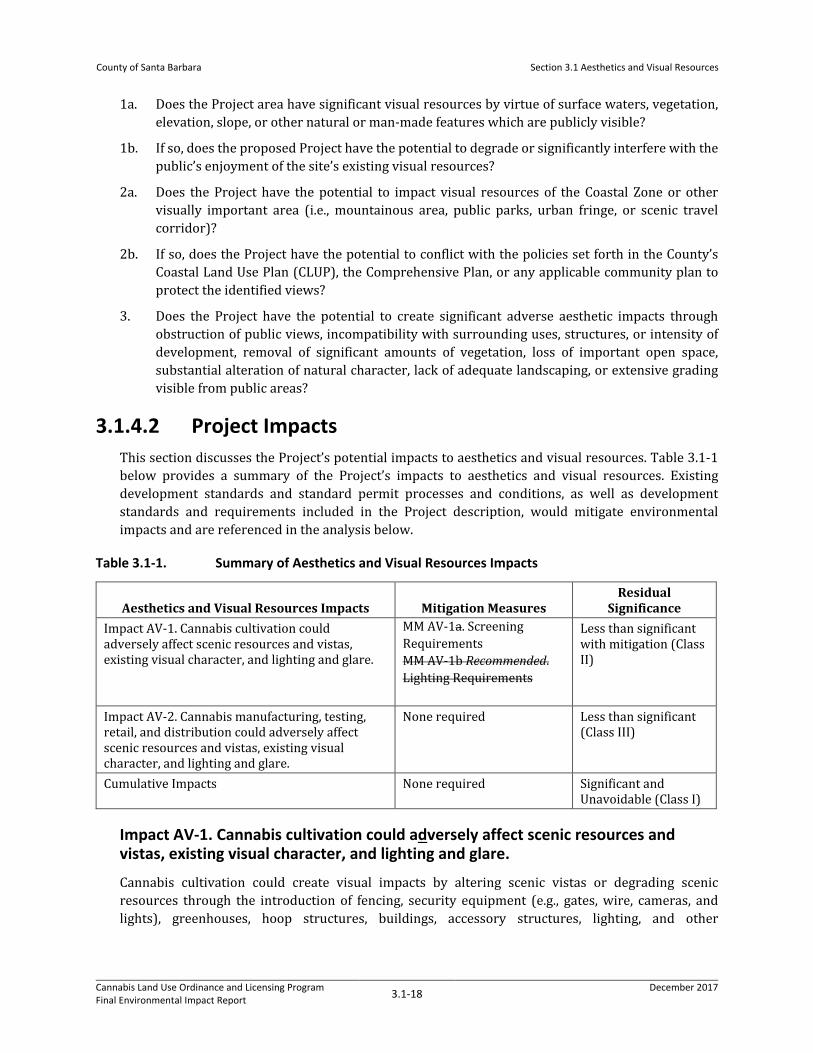
3.1.4.2 Project Impacts This section discusses the Project’s potential impacts to aesthetics and visual resources. Table 3.1-1 below provides a summary of the Project’s impacts to aesthetics and visual resources. Existing development standards and standard permit processes and conditions, as well as development standards and requirements included in the Project description, would mitigate environmental impacts and are referenced in the analysis below.
Table 3.1-1. Summary of Aesthetics and Visual Resources Impacts
Aesthetics and Visual Resources Impacts Mitigation Measures Residual
Significance Impact AV-1. Cannabis cultivation could adversely affect scenic resources and vistas, existing visual character, and lighting and glare.
MM AV-1a. Screening Requirements MM AV-1b Recommended. Lighting Requirements
Less than significant with mitigation (Class II)
Impact AV-2. Cannabis manufacturing, testing, retail, and distribution could adversely affect scenic resources and vistas, existing visual character, and lighting and glare.
None required Less than significant (Class III)
Cumulative Impacts None required Significant and Unavoidable (Class I)
Impact AV-1. Cannabis cultivation could adversely affect scenic resources and vistas, existing visual character, and lighting and glare.
Cannabis cultivation could create visual impacts by altering scenic vistas or degrading scenic resources through the introduction of fencing, security equipment (e.g., gates, wire, cameras, and lights), greenhouses, hoop structures, buildings, accessory structures, lighting, and other
County of Santa Barbara
Section 3.1 Aesthetics and Visual Resources
Cannabis Land Use Ordinance and Licensing Program Final Environmental Impact Report 3.1-19 December 2017
development directly related to cannabis cultivation. Cannabis cultivation could occur throughout the County within zoning districts that are eligible under the Project.
While licenses would be issued for properties distributed throughout the County, the registry data demonstrates that most cannabis businesses would seek licensing in the Lompoc and South Coast Region, which are characterized by a wide range of visual resources. The South Coast includes panoramic views of the Pacific Ocean and its shoreline as well as expansive near- and mid-range views of the Santa Ynez Mountains and its front country drainages. The South Coast setting is uniquely situated between a scenic segment of the Transverse Range of California, which is oriented in an east to west direction and parallels the ocean. Eligible lands within the Cuyama, Los Alamos, Lompoc, and Santa Ynez Valleys have near-, mid-, and distant-range views of numerous mountain ranges, including the Sierra Madre, Santa Ynez, San Rafael mountain ranges, and notably scenic views of the Solomon, Purisima, and Lompoc Hills from eligible lands. The degree of visual impacts would be heavily reliant on the siting and design of cannabis cultivation sites relative to viewsheds and visual resources; however, cultivation activities could alter landscapes whether in valley regions or in elevated topographic regions, given the extensive network of public viewsheds including parks, mountain vistas, highways, roadways, bikeways, and trails.
There is existing demand for approximately 4 million additional square feet of cannabis cultivation Countywide; however, the Project does not include a limit on cultivation and individuals could exceed this amount. Based on registry data, approximately 57 percent of cultivation would occur primarily under mixed-light conditions inside greenhouses or agricultural hoop structures, 41 percent would occur primarily outdoors under direct sunlight with minimal or no supplemental artificial lighting, and 3 percent would occur entirely indoors. In particular, new outdoor cultivation, as well as greenhouses and hoop structures for cannabis cultivation activities, may result in ancillary development such as fencing, removal of vegetation, topographical changes with site grading, introduction of new sources of light or glare, and some conversion of undeveloped or undisturbed rural lands, thereby potentially affecting naturally scenic features and public views. Nevertheless, a majority of potential cannabis activities are anticipated to occur on existing agricultural lands and inside existing agricultural and industrial structures as outdoor and indoor/greenhouse grows, as further described herein.
Outdoor Grows
Outdoor grows are expected to be more common in the Lompoc, Cuyama, Santa Ynez, and Santa Maria regions, as these regions contain the greatest acreage and number of parcels eligible for cultivation. With cultivation license types permitted on agricultural lands, the introduction of fencing, accessory structures, lighting, and other development directly related to cannabis activities may result in conversion of open field agricultural lands to more industrial-scale agricultural uses, which may result in substantial alteration to the existing landscape. These regions contain large amounts of open agricultural landscapes, orchards, and open space. Development associated with cannabis activities, which could be visible from a distance, may incrementally disrupt such landscapes, but would generally be consistent with the character and scale of agricultural development in the vicinity.
Associated development could also reduce the scenic value and public’s enjoyment of eligible and designated Scenic Highways and the mountainous areas within these regions. Additionally, because any outdoor cultivation is would be required to be completely screened from view of any public area, the use of fencing may alter the textures and forms of the existing setting and further reduce the scenic values of these areas, as discussed further below. Further, cannabis cultivation in these regions may

County of Santa Barbara
Section 3.1 Aesthetics and Visual Resources
Cannabis Land Use Ordinance and Licensing Program Final Environmental Impact Report 3.1-20 December 2017
require vegetation clearing, grading, and other site preparations (e.g., utility trenching, drainage improvements, and access roads), which could occur in publicly visible areas. Collectively, development associated with cannabis cultivation would have the potential to significantly alter the visual character of these regions, though such development would be similar in the range of impacts that occur from existing agricultural operations in scenic areas.
Greenhouses, Indoor Grows, and Hoop Structures
Greenhouses and indoor grows may require clearing and grading to create level pads, which could result in changes to existing visual character and topography, as well as the incremental loss of open space and conversion of undeveloped land. Construction of new buildings for greenhouse, hoop structure, and indoor grows would potentially be visible from public viewing areas, such as Scenic Highways and public parks, and could obstruct scenic views of the Pacific Ocean, mountains, foothills, rivers, and creeks within the County. However, design criteria in the LUDC, MLUDC, CLUP, and CZO provide guidelines for siting development when proposed in a potentially scenic area to reduce visual inconsistencies between new development and the existing character of scenic resources.
Greenhouses are currently used for cultivation in County, particularly within the eastern-most portions of the South Coast region surrounding the City of Carpinteria, which supports one of the largest and most concentrated agricultural greenhouse districts in the County. As stated in the CA Overlay regulations set forth in CZO Sections 35-102F.2 through 102F.5, the total amount of new greenhouse area that could be constructed in unincorporated Carpinteria is limited, and the LUDC greenhouse development standards limit development of greenhouse development to 20,000 square feet in this area. Given the existing permitting requirements that apply to greenhouse development in the County, it is unlikely that the Project would result in extensive new greenhouse development.
Alternatively, agricultural hoop structures provide a semi-enclosed sheltered environment for cannabis cultivation that is are relatively simple to install and are less costly than greenhouse development. Currently, hoop structures are subject to development permits under existing zoning requirements., except in Within the CA Overlay, hoop structures greater than 500 feet require a Conditional Use Permit, subject to Section 35-102F.5.b of the CZO. Hoop structure development is expected to increase to support cannabis cultivation, as supported by the Registry data that indicates a generally high level of interest in this method of cultivation. The Registry suggests there could be approximately 416 acres (51 percent of the 730-acre total increase) of new mixed-light cultivation distributed on agricultural land throughout eligible areas of the County, some of which may be located within hoop or shade structures. Hoop structures, due to their flexible building properties, are often located on variable slopes from hillsides to valley floors. The reflective quality of the hoop and shade structures are often visible from distances given their light color contrast with natural landscapes and semi-tubular form. This development would have the potential to increase glare and substantially change the visual character of agricultural lands from row crops to structural development. Hoop structures are not permitted to include lighting, per County Code, as further discussed below.
Limited greenhouse development and widespread implementation of hoop structures have the potential to obstruct or degrade the view of the County’s scenic resources, interfere with the public’s enjoyment of visually important areas (e.g., mountainous areas and scenic travel corridors), and have the potential to conflict with the policies set forth in the CLUP and Comprehensive Plan. Thus, the impact of such structures and facilities to aesthetic and visual resources is potentially significant. MM AV-1a, Screening Requirements, set forth below, would address this impact.

County of Santa Barbara
Section 3.1 Aesthetics and Visual Resources
Cannabis Land Use Ordinance and Licensing Program Final Environmental Impact Report 3.1-21 December 2017
Lighting
Cultivation may also introduce a new source of nighttime lighting into rural regions that typically experience little light pollution and generally maintain dark night skies. Nighttime operations of indoor or greenhouse grows using light suppression and artificial light sources may require lighting within buildings and within outdoor structures. Lighting integrated into greenhouses may be highly visible from distant ranges if located within public viewsheds; however, the County does not permit lighting within hoop structures, so cannabis cultivation within hoop structures would not have adverse aesthetic effects from lighting.
The Project states requires that all lighting shall be shielded to prevent light trespass into the night sky and/or glare onto lots other than the lots that constitute the cultivation site or rights-of-way, and that greenhouses using artificial light shall be completely shielded between sunset and sunrise. This requirement would eliminate the potential for light spillover from cultivation using artificial light during the night within greenhouses. This would be particularly important to control light spillover from greenhouse operations; indoor cultivation would be better situated to control light and glare within the building. The Project development standards require that any outdoor light used for parking areas and/or loading areas, or for security, shall be oriented in a manner to be fully shielded, downlit, and direct light rays below the horizontal plane of the light source, to minimize generation of light or glare. Additionally, the LUDC, MLUDC, and CZO would further regulate artificial lighting. However, lighting from cultivation using light deprivation and/or artificial lighting below a rate of 25 watts per square foot (i.e., potential hoop structures) is not specifically addressed. Thus, lighting from cannabis activities may would have a potentially less than significant impact to aesthetic and visual resources. MM AV-1b, Lighting Requirements, described below, would ensure that structures with artificial lighting are consistent with the County’s mixed-light license that requires the use of light suppression systems, and would avoid impacts to aesthetics and visual resources from new lighting.
Ancillary Development
Ancillary development for cannabis cultivation would potentially alter the existing character near each cultivation site. Associated infrastructure to cannabis activity sites could involve grading for building pads, roads, and driveways, in addition to grading and site preparation activities required for cannabis cultivation, similar to other agricultural operations. Such grading and site preparation would have the potential to change the topography of the site and may be visible from scenic roads or public vistas.
Ancillary development would be subject to the Comprehensive Plan policies and LUDC, MLUDC, and CZO regulations, which address protection of scenic resources and provide standards including structural height, setbacks, building coverage, and design review to ensure compatibility with scenic resources in the surrounding area and to address aesthetic and visual resource impacts.
Any development of a cannabis activities site would be subject to separate permit and environmental review processes as needed to ensure compliance with existing County regulations and policies and state law. Permit clearance for any site development would be a required prerequisite to licensing of a cannabis activity site. The application of existing design criteria and guidelines to avoid siting cannabis-related development in publicly visible or scenic areas would reduce indirect impacts from inconsistencies with the existing visual character of the surrounding area in any of the five general regions, particularly related to road and driveway widening, as well as utility extension.
As described above, cannabis cultivation activities provided under the Project may have potentially significant impacts to aesthetic and visual resources; however, the Project’s proposed development

County of Santa Barbara
Section 3.1 Aesthetics and Visual Resources
Cannabis Land Use Ordinance and Licensing Program Final Environmental Impact Report 3.1-22 December 2017
criteria and restrictions would assist in the protection of visual resources and scenic views. The Project would require review for new cannabis cultivation development with greater ability to evaluate, avoid, and mitigate potential visual impacts prior to permitting sites on a case-by-case basis. This approach would improve design, siting, and visual screening of new cannabis cultivation development. Additionally, the Comprehensive Plan, LUDC, MLUDC, and CZO, include siting requirements and design standards that address preservation of scenic views and/or designated special scenic areas to ensure development is compatible with existing aesthetic and visual resources.
Potentially significant impacts may arise from ancillary development such as fencing. The Project states that approved fencing shall be permanent and shall not consist of materials such as tarps, dust guard fencing, privacy netting, or polyethylene plastic. Section 35-102F.9 of the CZO requires that any greenhouse, related development, packing and shipping facility, shade or hoop structure within the CA Overlay District screen solid walls and chain-link fencing from public view corridors by dense landscaping and/or covered by attractive climbing vines, and that solid wall fencing shall not be relied upon as a primary means of screening. Though this protects against scenic degradation from certain types of materials used for fencing, opaque, chain linked, and barbed wire fencing could be built outside of the CA Overlay District. Because fencing has the potential to degrade or obstruct scenic views outside of the CA Overlay District, the Project may would have a potentially significant impact on aesthetic resources and MM AV-1a, Screening Requirements, would be required.
Impact AV-2. Cannabis manufacturing, testing, retail, and distribution could adversely affect scenic resources and vistas, existing visual character, and lighting and glare.
Visual impacts could occur where licensed cannabis product manufacturing, testing, retail, and distribution facilities are constructed or expanded within an area of scenic resources or value, particularly if the facilities were to introduce new sources of light or glare that would change the existing character of the landscape. Cannabis manufacturing and distribution would be licensed in commercial or manufacturing structures located within industrial/commercial and agricultural zoning districts. All manufacturing and distribution uses would be subject to setback and siting requirements of the LUDC, MLUDC, and CZO, as applicable. Of all regions, the Cuyama Region is not anticipated to experience a large amount of activity. Additionally, because nonvolatile manufacturing would also be permitted on commercial areas, these activities could occur over a larger area of eligibility.
Cannabis retail and distribution would be primarily eligible within commercial areas of the County, of which the most eligible area is located in the Santa Maria (368 acres), Santa Ynez (210 acres), and South Coast (157 acres) regions. Cannabis testing would be allowed in heavy commercial and manufacturing zoning districts, of which the majority is located within the Santa Maria region (1,922 acres), followed by limited amounts in the South Coast (145 acres) and Santa Ynez (114 acres) regions that would be eligible for testing facilities. Retail and testing uses would be subject to setback and siting restrictions of the LUDC, MLUDC, and CZO, as applicable. While cannabis activities may most commonly occur within existing buildings, construction of new buildings could occur, with potential for associated direct impacts. The degree of these impacts would be heavily reliant on the siting and design relative to viewsheds and visual resources.
Cannabis-related development for manufacturing, testing, and retail/distribution would be required to comply with the design review standards of the County LUDC, MLUDC, and/or CZO that would reduce visual impacts associated with cannabis activities, including standards to signage/advertising

County of Santa Barbara
Section 3.1 Aesthetics and Visual Resources
Cannabis Land Use Ordinance and Licensing Program Final Environmental Impact Report 3.1-23 December 2017
and lighting. The LUDC specifies that exterior lighting shall be hooded and no unobstructed beam of exterior light shall be directed toward any area zoned or developed residential. Additionally, light trespass and glare shall be reduced to the maximum extent feasible through downward directional lighting methods, and shall be designed so as not to interfere with vehicular traffic on any portion of a street. There cannot be offensive glare in industrial zones, lighting cannot adversely affect other land uses in mixed use zones, and lighting impacts must be minimized in commercial and agricultural zones. This would reduce the visual impacts associated with cannabis manufacturing, testing, retail, and distribution such that development associated with these uses would not substantially degrade the visual character in County.
As described in Impact AV-1, site preparation activities for manufacturing, commercial, or ancillary buildings and support facilities could potentially change the existing character of scenic resources in the vicinity of each cultivation site, such as with potential conversion of undeveloped land. The Project would potentially allow for development of buildings to serve cannabis manufacturing uses in scenic areas and within areas visible from scenic roads or public vistas. However, cannabis manufacturing, testing, retail, distribution or ancillary agricultural building development, including potential greenhouses, warehouses, and commercial buildings, would be subject to the Comprehensive Plan policies, LUDC, MLUDC, CZO, and proposed Project regulations that address scenic resources and existing visual character as those previously described in Impact AV-1 for cannabis cultivation. Where necessary, the County would review cannabis licenses and associated permits to ensure compliance with the policies of the Comprehensive Plan and applicable zoning regulations. These regulations require proposed sites in scenic areas to be evaluated against the context of their unique environment with criteria for structure height, setbacks, and design to protect scenic resources in the surrounding area. Therefore, indirect impacts associated with aesthetics and visual impacts under the Project would be considered less than significant (Class III).
3.1.4.3 Cumulative Impacts As described in Section 3.0 Environmental Impact Analysis, the cumulative setting for the Project involves a variety of policies and initiatives in the region of Santa Barbara County. Impacts of the Project along with pending and current legislative planning projects, and pending development projects, form the cumulative impacts analysis. The County is considering amending the LUDC to allow hoop structures up to 20 feet without a zoning permit, affecting the inland areas of the County (County of Santa Barbara 2017). Additionally, unlimited cultivation area licenses (Type 5 license) may be permitted starting in 2023. By increasing the height of hoop structures that are not subject to design review and allowing unlimited cannabis cultivation area, the potential for a substantially greater number of hoop structures with greater mass, scale, and height could further impact scenic resources under the Project.
Cumulative impacts associated with the Project would include potential changes to scenic resources and existing visual character associated with increased canopy cover, hoop structure, and greenhouse build out with additional acreage for ancillary development, combined with proposed development under other County plans and projects that would also potentially change local scenic resources or the existing character of the area. Further, any proposed development could be sited in areas that are publicly visible or within proximity of a scenic road or highway.
Grading for building pads, roads and driveways, and development of infrastructure from new cannabis activities and pending projects in the County could change the existing character of the surrounding landscape or occur on areas that are publicly visible. Even though cannabis-related

County of Santa Barbara
Section 3.1 Aesthetics and Visual Resources
Cannabis Land Use Ordinance and Licensing Program Final Environmental Impact Report 3.1-24 December 2017
development would need to comply with existing County policies and regulations, potential acreage of Project-related future development in combination with other County projects and plans is unknown. Although specific projects may be consistent with the policies and regulations that address aesthetic and visual resources, full buildout of cannabis-related projects at currently unknown locations, may be found towould potentially contribute considerably on a cumulative basis. Impacts resulting from changes to scenic resources and existing character would therefore be significant and unavoidable (Class I).
3.1.4.4 Proposed Mitigation Measures MM AV-1. Screening Requirements. To reduce direct visual impacts associated with hoop structures and ancillary development for cannabis cultivation, such as fencing, a provision shall be included in the Project to give discretion to the Planning Director to determine on a case-by-case basis the appropriate type of screening for a licensed grow site (e.g., height, materials, design, and location) in compliance with the land use entitlement (e.g., LUP, CDP, or CUP). To the maximum extent feasible, screening for cannabis cultivation sites shall consist of natural barriers and deterrents to enable wildlife passage, prevent trespass from humans, and shall be visually consistent, to the maximum extent possible, with surrounding lands. Screening requirements shall be noted on final permitting conditions and any site plans. The applicant shall submit screening plans to the County for review and approval to ensure appropriateness of proposed screening (e.g., use of natural materials or compatibility of proposed fence’s color with surroundings) prior to issuance of a cultivation license. The applicant shall demonstrate to the County through a site visit or photographs compliance with any screening requirements and that all perimeter screening is in place as required prior to cultivation activities.
Requirement and Timing. The Planning Director shall determine the appropriate The Screening Plan shall be part of the Landscape Plan. The applicant shall submit the Landscaping Plan to the County Planning and Development Department with submittal of all other license and permit application materials. The Planning Director shall determine whether screening proposed is appropriate and adequate; if not, the Landscaping Plan shall be updated by the applicant at the direction of the Planning Director. The County shall review and approve the Landscape Plan as part of permit approval prior to issuance of a cannabis cultivation license.
Monitoring. The County Planning and Development Department, with concurrence from the Planning Director, shall review and approve the Landscape Plan prior to issuance of a land use permit and cultivation license. The County, including code enforcement staff, shall ensure landscaping is installed consistent with the Plan during construction phases. The County shall conduct one subsequent review of the site landscaping within 5 years of approval to ensure landscaping is maturing consistent with the Landscape Plan.
3.1.4.5 Residual Impacts Impact AV-1. With the implementation of MM AV-1, Screening Requirements, impacts to visual resources from cannabis cultivation structures, including fencing and other development, would be reduced, resulting in residual visual impacts that would be less than significant with mitigation (Class II).
Impact AV-2. As discussed above, visual impacts would be less than significant (Class III).