santa clara county general plan · pdf filebook b santa clara county general plan charting a...
TRANSCRIPT
Book B
Santa Clara County GENERAL PLAN
Charting a Course for Santa Clara County’s Future: 1995-2010
COUNTY OF SANTA CLARA • PLANNING OFFICE • 70 WEST HEDDING STREET, SAN JOSE, CA 95110
ADOPTED: DECEMBER 20, 1994
Santa Clara County Board of Supervisors
Supervisor Michael Honda, District 1 (Chair) Supervisor Zoe Lofgren, District 2 Supervisor Ron Gonzales, District 3 Supervisor Rod Diridon, District 4 Supervisor Dianne McKenna, District 5
Santa Clara County Planning Commission
Betsy Shotwell, Chair Tom Kruse Chuck Reed Pat Sausedo Ann Shiraishi Tom Tanner
(See inside back cover for General Plan Review Advisory Committee and Staff Rosters)
CONTENTS OVERVIEW
Book A:
Part 1: Introduction and Overview User's Guide Executive Summary Vision of the General Plan County Profile
Part 2: Countywide Issues & Policies Growth and Development Economic Well-Being Housing Transportation Parks and Recreation Resource Conservation Safety and Noise Governance
Book B:
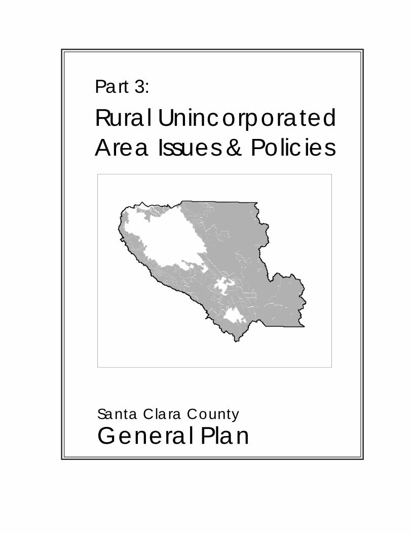
Part 3: Rural Unincorporated Area Issues & Policies
Growth and Development Housing Transportation Parks and Recreation Resource Conservation Safety and Noise Land Use Policies
Part 4: Urban Unincorporated Area Issues & Policies
General Land Use Management Stanford University
Part 5: South County Joint Area Plan
Part 6: Appendices
Dedication
This plan is dedicated to the memories of Donald McGaffin and Ralph Brown.
TABLE OF CONTENTS – Book B
Santa Clara County General Plan
Part 1: Introduction and Overview (see Book A) Part 2: Countywide Issues & Policies (see Book A)
Part 3: Rural Unincorporated Area Issues & Policies Growth and Development Chapter ...................................................................K-1 Housing Chapter .............................................................................................. L-1 Transportation Chapter ................................................................................... M-1 Parks and Recreation Chapter ........................................................................ N-1
Regional Parks and Public Open Space Lands Trails and Pathways Scenic Highways
Resource Conservation Chapter ..................................................................... O-1 Water Supply, Quality, & Watershed Management Habitat & Biodiversity Agriculture & Agricultural Resources Mineral Resources Heritage Resources Scenic Resources
Safety and Noise Chapter ................................................................................P-1 Noise Natural Hazards Aviation Safety Waste Water Disposal
Land Use Policies ........................................................................................... Q-1 Resource Conservation Areas ................................................................... Q-1
Baylands Agriculture Hillsides Ranchlands Open Space Reserves Existing Regional Parks Other Public Open Lands
Rural Residential Areas ........................................................................... Q-11 Other Land Uses ...................................................................................... Q-12
Major Educational & Institutional Uses Public Facilities Major Gas & Electric Utilities Transportation Facilities Roadside Services Solid Waste Disposal Sites
Special Area Policies ............................................................................... Q-17 (cont'd).
Table of Contents – Book B
Santa Clara County General Plan
Part 3: Rural Unincorporated Area Issues & Policies Land Use Policies (continued)
Special Area Policies ................................................................................ Q-17 New Almaden Historical Area Los Gatos Watershed Area Los Gatos Hillside Specific Plan San Martin Planning Area Monterey Highway Use Permit Area Guadalupe Watershed Area of Critical Environmental Concern City of Morgan Hill Urban Growth Boundary (UGB) Area West Valley Hillsides Preservation Area
Addendum to Land Use Policies: Site-Specific Amendments .................. Q-31
Part 4 Urban Unincorporate Area Issues & Policies General Land Use Management Chapter ........................................................ R-1 Stanford University Chapter - superseded by 2000 Stanford Community Plan (published separately; amended 12/12/2000, File#: 7165-07-81-99GP
Part 5: South County Joint Area Plan ................................................................. T-1 Overview Urban Growth and Devlopment Economic Development Job/Housing Balance Education Infrastructure Infrastructure: Sewers/Sanitation Water Supply Water Quality Hazardous Materials and Waste Management Intergovernmental Coordination Infrastructure: Transportation Flood Control Local Drainage Agriculture Development Hazards/ Environmental Safety Open Space and Recreation Rural/Urban Land Use San Martin Coyote Valley Truck Stops Potential Intergovernmental Agreements Future Joint Planning
Part 6: Appendices Appendix #1: State Mandaded General Plan Elements ................................... U-1 Appendix #2: General Plan Administration ...................................................... V-1 Appendix #3: Open Space “Action Program” .................................................. W-1 Appendix #4: Housing Element Update 2015-2022 ......................................... X-1
Part 3: Rural Unincorporated Area Issues & Policies
Santa Clara County General Plan

Growth and Development Rural Unincorporated Area Issues and Policies
Summary ................................................................................................................K-1
Background .............................................................................................................K-1
Strategies, Policies and Implementation .................................................................K-2
Strategy #1: Preserve the Resources and Character of Rural Lands ...............K-2
Strategy #2: Develop Special Area Plans for Appropriate Areas ......................K-5
Strategy #3: Ensure Environmentally-Safe and Aesthetic Hillside Development ................................................................................K-7

Growth & Development
Rural Unincorporated Area Issues and Policies
K-1
Summary
In keeping with the countywide urban development policies and growth management strategies adopted by the cities and the County of Santa Clara, the basic strategies or policy directions for land management in the rural unincorporated area are:
Strategy #1: Preserve the Resources and Character of Rural Lands
Strategy #2: Develop Special Area Plans for Appropriate Areas
To fulfill those policies, the General Plan provides only for non-urban, low density uses in the rural unincorporated areas of the County. Secondly, special districts may not provide service levels which are inconsistent with planned uses and densities of a given area. Thirdly, special area plans are encouraged for areas which would benefit from more detailed policies and implementation measures, such as those which must resolve problematic, areawide development constraints, or areas of mutual interest to multiple jurisdictions. Finally, where desirable, rural area design guidelines may be applied to preserve rural character and reduce environmental impacts of development.
Background
RELEVANCE OF COUNTYWIDE “URBAN DEVELOPMENT POLICY” TO RURAL AREAS
The joint urban development policies of the County, cities, and Local Agency Formation Commission (LAFCO) provide for the maintenance of cities’ Urban Service Area boundaries and determine the types of lands typically excluded from urbanization.
This set of policies, often referred to simply as the “joint urban development policies” of the county, have been in effect for nearly two decades. (The overall rationale for the county’s growth management strategy is more fully explained in the chapter on Growth & Development for Countywide Issues and Policies).
The major provisions of the joint urban development policies include:
• urban development only within cities’ USAs under cities’ jurisdiction;
• areas not suitable for urbanization excluded from USAs; and,
• expansion of the urbanized area only in a timely, efficient manner, as cities are capable and willing to provided needed urban services without undermining service levels to existing development.
In keeping with long-standing Urban Service Area policies, the countywide growth management strategies also call for achieving more balanced, compact development within existing urbanized areas. These policies are intended not only to help reduce the need for urban expansion in accommodating future growth, but also for consistency with the following:
• making the most efficient use of existing urban infrastructure;
• increasing the feasibility of transit system development; and
• increasing the proximity of housing and employment.
IMPLICATIONS FOR RURAL UNINCORPORATED AREA LAND USE AND DEVELOPMENT
The overall growth management strategy outlined in the Countywide Issues and Policies section of the General Plan forms the context for land use and development in the rural unincorporated areas. In particular, those joint strategies and policies have major implications for County land use policy with respect to:
• the range of allowable uses and densities generally permitted outside USAs;
• the degree of control over the use of special districts; and
• provision for various types of highly specialized land uses.
Growth & Development
Rural Unincorporated Area Issues and Policies
K-2
Strategies, Policies and Implementation
The basic strategies for managing rural unincorporated area growth and development consist of the following:
Strategy #1: Preserve Resources and Character of Rural Lands
Strategy #2: Develop Special Area Plans for Appropriate Areas
Strategy #1: Preserve the Resources and Character of Rural Lands
Two of the County’s primary goals in governing growth and development in rural unincorporated areas are to preserve natural resources and to preserve the rural character of lands not suitable or intended for urban development. To those ends, the first strategy encompasses policies which: a. allow only non-urban, low density uses
outside cities’ USAs; b. maintain strict controls over the use of
special districts serving rural unincorporated development; and
c. make limited provision for highly specialized uses.
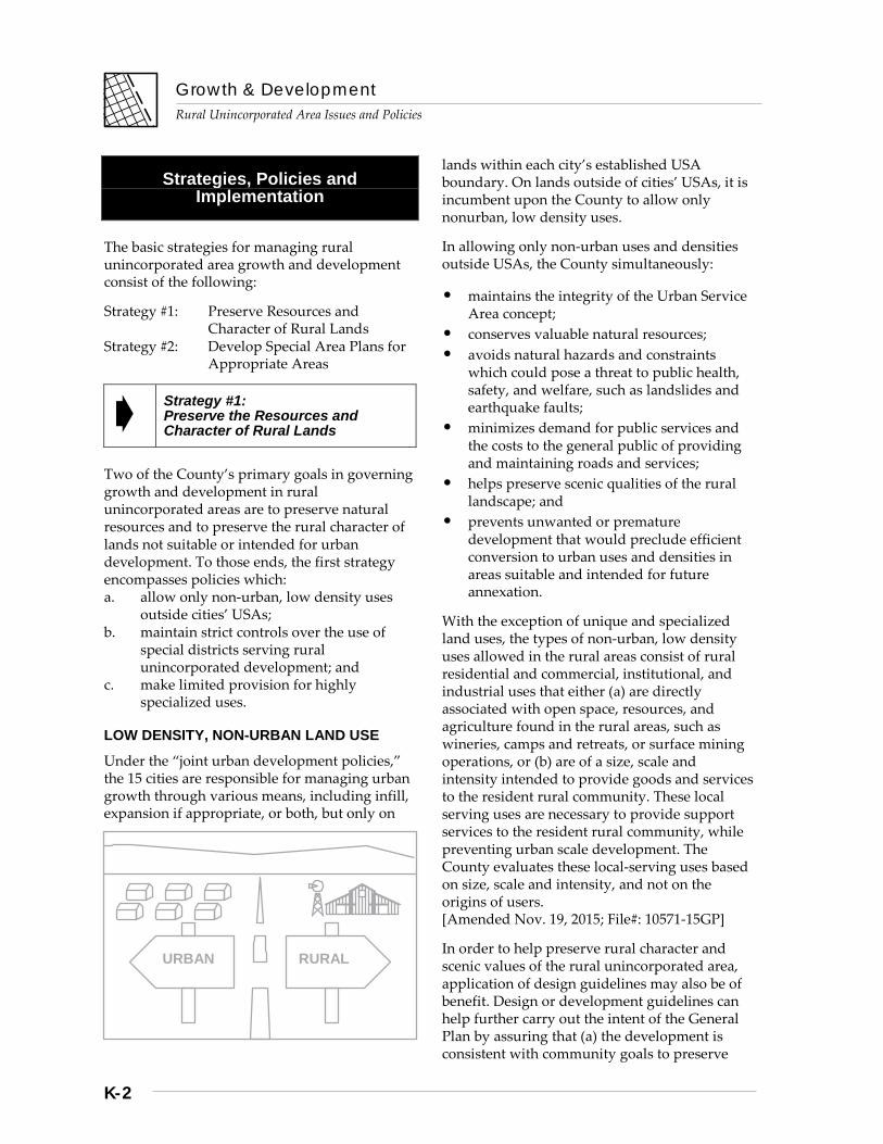
LOW DENSITY, NON-URBAN LAND USE
Under the “joint urban development policies,” the 15 cities are responsible for managing urban growth through various means, including infill, expansion if appropriate, or both, but only on
lands within each city’s established USA boundary. On lands outside of cities’ USAs, it is incumbent upon the County to allow only nonurban, low density uses.
In allowing only non-urban uses and densities outside USAs, the County simultaneously:
• maintains the integrity of the Urban Service Area concept;
• conserves valuable natural resources; • avoids natural hazards and constraints
which could pose a threat to public health, safety, and welfare, such as landslides and earthquake faults;
• minimizes demand for public services and the costs to the general public of providing and maintaining roads and services;
• helps preserve scenic qualities of the rural landscape; and
• prevents unwanted or premature development that would preclude efficient conversion to urban uses and densities in areas suitable and intended for future annexation.
With the exception of unique and specialized land uses, the types of non-urban, low density uses allowed in the rural areas consist of rural residential and commercial, institutional, and industrial uses that either (a) are directly associated with open space, resources, and agriculture found in the rural areas, such as wineries, camps and retreats, or surface mining operations, or (b) are of a size, scale and intensity intended to provide goods and services to the resident rural community. These local serving uses are necessary to provide support services to the resident rural community, while preventing urban scale development. The County evaluates these local-serving uses based on size, scale and intensity, and not on the origins of users. [Amended Nov. 19, 2015; File#: 10571-15GP]
In order to help preserve rural character and scenic values of the rural unincorporated area, application of design guidelines may also be of benefit. Design or development guidelines can help further carry out the intent of the General Plan by assuring that (a) the development is consistent with community goals to preserve
URBAN RURAL
Growth & Development
Rural Unincorporated Area Issues and Policies
K-3
rural character; (b) is not obtrusive or in conflict with the architecture of its surroundings; and, (c) minimizes other potential environmental impacts.
CONTROL OF SPECIAL DISTRICTS
A related matter involves strict control over the use of special districts to provide essential services to development in rural unincorporated areas. In keeping with the overall intent of the urban development policies, it is critical that urban services such as municipal water and sewer not be made available outside cities’ USAs by means of special districts or assessment districts.
Exceptions to the general policy have been necessary in the past to remedy problems such as areawide septic system failures, well contamination, or simple well failure. For example, water supply in much of the Lexington Basin is by means of piped distribution, a result of extensive well failures due to a number of factors, but in part to the limited groundwater supplies in the area and the large number of small, non-conforming parcels with residential development which predates current land use policy.
In another case, ongoing groundwater monitoring in the South Valley, where high levels of nitrates have been found in various portions of the groundwater basin, should help focus attention of particular problem areas and help prevent a more serious areawide problem from occurring.
In conclusion, land use policies should take into account the constraints of a given area and not allow development densities which will predictably result in the need for utility extensions. However, if any future extensions of such services prove necessary to solve an areawide problem, they must be limited to only the capacity necessary to serve existing and planned levels of development, as determined by the Land Use Plan. Potentially growth-inducing infrastructure extensions that would not be consistent with the planned density of development in rural unincorporated areas cannot be permitted.
LIMITED PROVISION FOR UNIQUE OR VERY SPECIALIZED LAND USES
There may be occasions or particular circumstances when the public interest is served by permitting a specialized, unique land use which would otherwise not be considered consistent with overall land use in rural unincorporated areas. In allowing some limited flexibility for accommodating unique situations, the General Plan should not be misconstrued to encourage applications for fairly routine land uses which seek a location outside cities’ jurisdiction, but which are not consistent with the overall land use policies and zoning districts for rural unincorporated areas. Two examples help illustrate the type of land uses which could be considered under such a policy.
For example, United Technologies Corporation (UTC) has since before the adoption of the 1980 General Plan operated a rocket testing facility in the ranchlands area east of Coyote Valley. This land use requires a type of remote setting removed from urban areas, due to the obvious noise pollution and the potential for very damaging explosions. This land use is not one for which provision should be made anywhere in areas designated Ranchlands, due to a variety of potentially adverse environmental impacts and concerns; however, the use and circumstances of its location are both unique.
To the extent that (a) the public interest is served by allowing a necessary land use, and (b) regulatory controls are adequate to prevent harm to the environment or surrounding land uses, there is reason to consider allowing such a use to be continued in rural unincorporated areas, through the use permit process.
A second example might be large scale truck stops. These are uses not easily sited in or near urbanized areas, but for which there is arguably a need, one that can possibly be fulfilled in a rural setting. Although such uses are not as unique as UTC’s specialized testing facilities, there isn’t likely to be as much replication of large scale truck stops as, for example, commercial dry cleaners, a fairly common urban area land use. With adequate land use policy and regulatory controls, a truck stop could be located within a rural unincorporated area and
Growth & Development
Rural Unincorporated Area Issues and Policies
K-4
near a major thoroughfare without being incompatible with surrounding area uses or undermining the integrity of the general plan policies and zoning district regulations which govern land use for the general area.
In the future, other highly specialized or unique land uses which require a remote or rural setting could, under these General Plan policy provisions, be given due consideration, as long as there are adequate procedures for public input and appeal.
Policies and Implementation
R-GD 1 Strategies and policies for managing land use and development in the rural unincorporated areas include the following: 1. Preserve the resources and rural character of
lands outside Urban Service Areas (USAs). 2. Develop special area plans for areas that
require or would benefit from more detailed planning and policies.
R-GD 2 For lands outside cities’ Urban Service Areas (USAs) under the County’s land use jurisdiction, only non-urban, low density uses shall be allowed.
R-GD 3 Land uses and development permitted under County jurisdiction shall be consistent with the following major County policies: a. conservation of natural resources; b. avoidance of natural hazards and the
prevention of pollution which could pose a threat to public health, safety, and welfare;
c. minimizing demand for public services and costs to the general public of providing and maintaining services;
d. preservation of rural character, rural lifestyle opportunities, and scenic resources;
e. preservation of agriculture; and f. preventing unwanted or premature
development that would preclude efficient conversion to urban uses and densities in areas suitable and intended for future annexation.
R-GD 4 The rural character of land use and development within rural unincorporated areas shall be maintained and enhanced through application of land use controls and by special area development guidelines, where appropriate.
R-GD 5 Very limited provision should be made for highly specialized or unique land uses which otherwise would not be considered in conformance with General Plan policies, so long as the use: a. is entirely dependent on rural or remote
settings; b. is compatible with surrounding land uses; c. will not have serious environmental
impacts; d. will not reduce existing service levels or
overburden planned service capacities; and e. is unique or without precedent-setting
potential which could be used to undermine the integrity of the General Plan or zoning district applicable to the area in which it is proposed to be located.
R-GD 6 Urban types and levels of services shall not be available outside of cities’ Urban Service Areas from either public or private service providers.
R-GD 7 In rural unincorporated areas, if there is an unpreventable areawide problem which can only be solved by extension of services by special district, assessment district, or private utility, then this form of service may be approved, with the following restrictions: a. the amount of increased service capacity
will not exceed the identified need and the planned level of development; and
b. the level of service capacity is consistent with that of other services provided or planned for the area.
R-GD 8 No development proposal may be approved in areas requiring services provided by a special district, assessment district, or other private service provider, unless the needed services will be available to the development at the time of the development’s approval.
Growth & Development
Rural Unincorporated Area Issues and Policies
K-5
Implementation Recommendations
R-GD(i) 1 Determine need for design guidelines as appropriate and necessary to preserve rural character. (eg: San Martin Area Design Guidelines)
R-GD(i) 2 Explore and develop more adequate mitigation of school impacts resulting from rural development subject to discretionary approvals by the County.
Strategy #2: Develop Special Area Plans for Appropriate Areas
GENERAL USES OF SPECIAL AREA PLANS
Special area plans have been prepared and adopted for a number of localities since the 1980 GP was adopted. Special area plans are typically of two major types. First, there are special area plans that address particular land use or development issues of concern primarily to County government. The most notable recent example is the San Martin Area Plan, adopted as part of the County’s General Plan in 1983. The second type of special area plan addresses issues or areas of concern to multiple jurisdictions, usually in the form of joint city/County plans for a given area. The South County Joint Area Plan, adopted as part of the general plans of the County, Gilroy, and Morgan Hill in 1988 is an example of such a special area plan.
SPECIAL PLANS FOR SOLVING AREAWIDE CONCERNS OR DEVELOPMENT CONSTRAINTS
Another of the most common uses of special area plans is to address and resolve a particular set of development constraints that otherwise make it very difficult to review and approve development proposals on a case-by-case basis. Examples of such constraints could include areawide septic system limitations which require different density or minimum lot size standards, drainage problems, such as those common to the San Martin area, and geologic and seismic conditions which create difficulties
in defining allowable building sites, common to the foothills of the Diablo Range and the Santa Cruz Mountains.
Other uses of special area plans might be to resolve issues of mutual concern to multiple jurisdictions. These joint area plans might be used to ensure the compatibility of development allowed by all jurisdictions in a given area, such as in hillside areas or valley lands at the urban fringe.
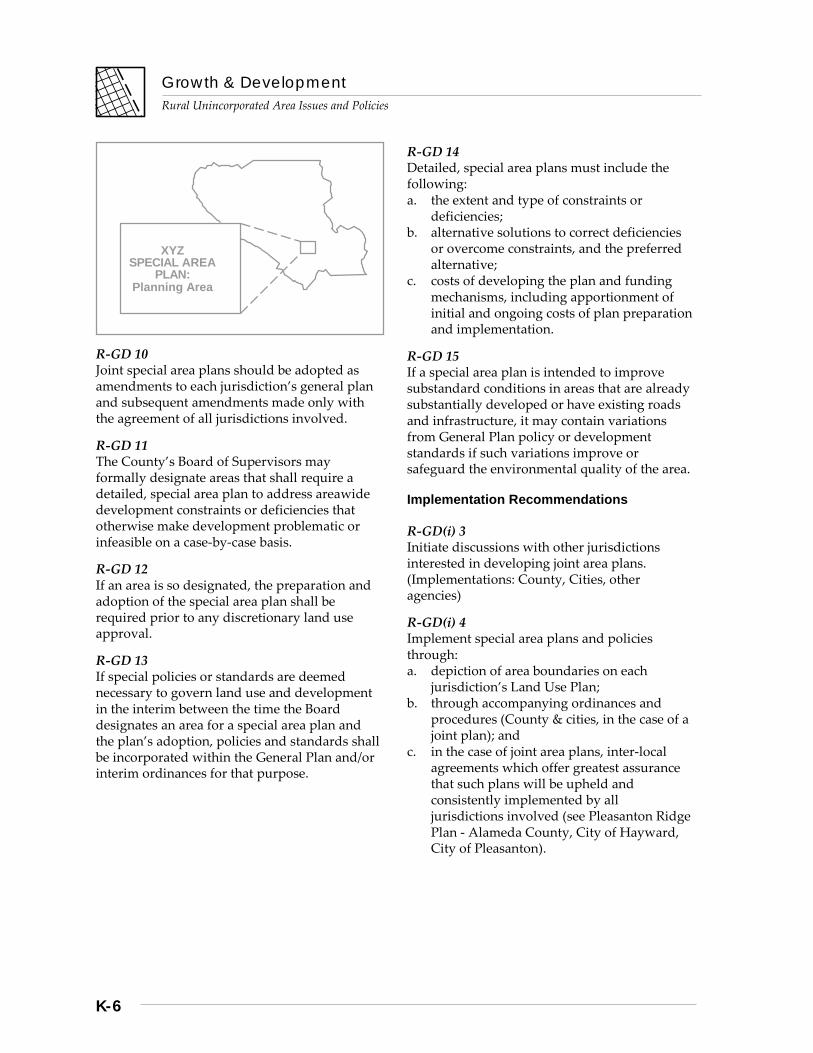
In any case, special area plans should be prepared with the involvement of all affected jurisdictions and agencies, landowners, and the full breadth of public interests appropriate to the resolution of the issues involved. If needed, the area plan should be implemented by means of special area boundary designations on the General Plan Land Use map and accompanying ordinances or procedures.
Policies and Implementation
R-GD 9 Special area plans should be developed and employed for rural unincorporated areas that require or would benefit from more detailed planning, policies, and implementation measures, such as: a. areas subject to critical development
constraints, deficiencies, or other special circumstances which render individual development proposals difficult or infeasible to process and approve;
b. joint planning for areas of mutual interest or concern to multiple jurisdictions, such as joint hillside development plans or interurban/ greenbelt areas;
c. designated areas of “critical environmental concern” as described under CEQA law, or areas likely to be adversely affected by cumulative development impacts;
d. areas formally designated as historic or agricultural preserves; and
e. areas designated for natural resource conservation, such as significant natural habitat areas, water supply watersheds, or scenic preservation areas.
Growth & Development
Rural Unincorporated Area Issues and Policies
K-6
R-GD 10 Joint special area plans should be adopted as amendments to each jurisdiction’s general plan and subsequent amendments made only with the agreement of all jurisdictions involved.
R-GD 11 The County’s Board of Supervisors may formally designate areas that shall require a detailed, special area plan to address areawide development constraints or deficiencies that otherwise make development problematic or infeasible on a case-by-case basis.
R-GD 12 If an area is so designated, the preparation and adoption of the special area plan shall be required prior to any discretionary land use approval.
R-GD 13 If special policies or standards are deemed necessary to govern land use and development in the interim between the time the Board designates an area for a special area plan and the plan’s adoption, policies and standards shall be incorporated within the General Plan and/or interim ordinances for that purpose.
R-GD 14 Detailed, special area plans must include the following: a. the extent and type of constraints or
deficiencies; b. alternative solutions to correct deficiencies
or overcome constraints, and the preferred alternative;
c. costs of developing the plan and funding mechanisms, including apportionment of initial and ongoing costs of plan preparation and implementation.
R-GD 15 If a special area plan is intended to improve substandard conditions in areas that are already substantially developed or have existing roads and infrastructure, it may contain variations from General Plan policy or development standards if such variations improve or safeguard the environmental quality of the area.
Implementation Recommendations
R-GD(i) 3 Initiate discussions with other jurisdictions interested in developing joint area plans. (Implementations: County, Cities, other agencies)
R-GD(i) 4 Implement special area plans and policies through: a. depiction of area boundaries on each
jurisdiction’s Land Use Plan; b. through accompanying ordinances and
procedures (County & cities, in the case of a joint plan); and
c. in the case of joint area plans, inter-local agreements which offer greatest assurance that such plans will be upheld and consistently implemented by all jurisdictions involved (see Pleasanton Ridge Plan - Alameda County, City of Hayward, City of Pleasanton).
XYZ SPECIAL AREA
PLAN: Planning Area
Growth & Development
Rural Unincorporated Area Issues and Policies
K-7
Strategy #3: Ensure Environmentally-Safe and Aesthetic Hillside Development
The vast majority of lands in County jurisdiction outside cities are hillside lands with slopes varying between approximately 10-75%. The Diablo Range and its eastern foothills flank the Santa Clara Valley on the east, and the Santa Cruz Mountains and foothills flank the valley lands on the western side of the County. Within these areas, development through subdivision and through single-site approvals has occurred over time under evolving land use controls. Each development is evaluated with regard to the particular geologic and seismic hazards that may exist, fire hazards, slope constraints and access issues, and septic system suitability, among other development issues.
The policies, regulations, and ordinance provisions that govern aspects of private development have evolved over time to address issues raised by various development projects, both individually and collectively. The Grading Ordinance, for example, was instituted in 1964, with modifications in 1972 to address emerging environmental and land use-related issues, with subsequent revisions again in 1978 and 2002. Regulations for single building sites as part of the County Ordinance Code were also amended in 1990 to address issues discussed in the General Plan relating to development of land over 30% average slopes.
This sub-section of the Growth & Development Chapter for Rural Unincorporated Area Issues and Policies is intended to provide context, explanation, and clarification of County policies for rural hillside development concerning grading and terrain alteration issues, development proposed on steep slopes over 30%, ridgeline development issues, and related matters. It serves as an overview of some of the more generally encountered hillside development issues and as a basis for development regulations, particularly, the use of Design Review zoning districts, Grading Approvals, Single Building Site Approvals, Site Approvals on slopes exceeding 30%, and subdivision approvals. Each type of process
plays a role in ensuring safe, environmentally sensitive, and aesthetic development.
In recent years, the amount of rural hillside development has been relatively stable. Building activity varies with economic cycles. Since 1995, total rural area building permit activity for new homes has ranged between approximately 35 to 125 new homes per year. The average for the last ten years has been approximately 60-65 per year. Given the visibility, site characteristics, location, and sensitivity of hillside development issues, a moderate number of new homes or structures can have a disproportionate aesthetic effect, depending on size, design, and visual impacts.
USE OF DESIGN REVIEW ZONING DISTRICTS AND PROCEDURES
Single-family residences remain the most common use of existing parcels in the rural and hillside areas. They are defined in the Zoning Ordinance as an allowable use permitted as a matter of right on most existing legal lots. Subdivision regulations, single building site approvals, geologic review, and grading permit requirements are necessary prerequisites of safe and properly-designed land development. Design Review complements other forms of land use approvals, provides flexibility, and allows for a level of discretionary review and approval of conditions to mitigate visual and other impacts of development.
Design Review has been a procedure employed by many cities for some time, either for architectural review of new development in urban residential neighborhoods, or to address hillside development. Santa Clara County established Design Review zoning in the late 1980s, specifically to provide a form of discretionary approval to encourage excellence of development, secure the purposes of the zoning ordinance and general plan, and to ensure all reasonable steps were taken to mitigate adverse impacts of development, including visual impacts.
Initial application of “-d, Design Review Zoning Districts” was limited to certain areas of development, such as along the Santa Teresa Ridge or Los Gatos hills, or as a specific condition of subdivision approval. It has also
Growth & Development
Rural Unincorporated Area Issues and Policies
K-8
been required for development within 100 feet of named scenic roads, which previously was subject to Architecture & Site Approval.
In 1994, the County adopted the current General Plan, and addressed a number of general environmental and scenic resource protection goals for hillside areas. The revised General Plan included an implementation recommendation to identify areas of greatest sensitivity to visual impacts of development and the application of design review requirements, including but not limited to hillsides, ridgelines, scenic transportation corridors, and other areas.
In the mid-1990s, the County revised the Design Review regulations of the Zoning Ordinance to make provision for Design Review combining districts with distinctive goals, policies, and standards, enumerated with numerical subscripts, such as –d1, -d2, and so forth. The first such use of the provision was the establishment of the “-d1” district for the west valley hillsides in 1997. The “-d2” district was established for the Milpitas hillsides in 1999. Each was an outcome of discussions and collaborative planning studies between affected cities and the County, as well as extensive community input.
With respect to hillside areas, the County General Plan has long emphasized that the hillsides surrounding the urbanized area should not be subject to urban levels of development. A related goal is that the generally natural appearance of the hillsides should be preserved as much as possible through allowance for low density residential use, acquisition of public parks and open space lands, and mitigating visual impacts of development. The term “viewshed” has evolved in planning vocabulary to describe the hillsides that ring the urbanized area of the valley floor. Over time, the focus of General Plan policies has made it a priority to conserve as much as possible those hillsides immediately visible from the valley floor, where the vast majority of the urban population resides.
Consequently, land use regulations such as Design Review have historically been applied for the most part to the hillsides up to and including the first ridge, such as along the Santa
Teresa Hills, Milpitas hillsides, and similar areas. In the west valley hills, the “-d1” Design Review district was originally applied to lands visible from certain defined vantage points within the cities of Monte Sereno, Cupertino, Los Gatos, and Saratoga. It extends slightly further up into the hillsides, but not fully to the Santa Cruz Mountains summit area bounding Santa Cruz County.
In 2002, the Board established the Viewshed and Greenbelt Study as a legislative initiative, directing that a more comprehensive application of Design Review for hillside protection be evaluated, along with a review of the adequacy of existing standards. Prior to that date, only a small percentage of the hillsides immediately visible from the valley floor had Design Review zoning. With the completion of the viewshed planning study, Design Review zoning is proposed to apply to all areas of the primary viewshed most immediately visible from the valley floor. These lands generally include areas of highest visibility within approximately 1-2 miles of the valley floor.
Another key aspect of planning and land use controls is to apply reasonable standards and requirements, afford necessary flexibility for private land use and development, and ensure consideration of private property rights. To address these issues, the County has proposed for consideration: a. expanded small project exemptions, b. simplified procedures for moderate sized
homes through a tiered review system (proposed Tier 1 administrative review for primary residences up to 5,000 sq. ft.),
c. exempting basement floor area from floor area definitions, and
d. modified regulations and guidelines to provide greater allowance for “design-friendly” features, such as porches, decks, eaves and other architectural designs that minimize visual impacts, reduce apparent bulk, and provide articulation and variety.
With regard to the largest and potentially most visible new homes and structures in the primary viewshed areas, a “Tier 3” level of review is proposed. In addition to review of siting alternatives that would reduce the visibility of
Growth & Development
Rural Unincorporated Area Issues and Policies
K-9
such large structures, this level of review would include a Planning Commission hearing, instead of administrative, or staff-level public hearings.
Policies and Implementation
R-GD 16 Goals and policies of the General Plan recognize the development constraints, issues, and sensitivity of the hillsides of Santa Clara County for new development. The goals of the General Plan, outlined in the Open Space Action Program, are to prevent further urban uses and development outside cities, conserve wildlife habitat, avoid natural hazards, and preserve the generally natural appearance of the hillsides as much as possible.
R-GD 17 Design Review Zoning Districts, including Design Review Guidelines, shall apply to primary viewshed areas most immediately and directly visible from the valley floor, lands up to and including the first ridge, or those within approximately one to two miles distance from the edge of the valley floor.
R-GD 18 Design Review Zoning Districts may be differentiated to effect distinctive goals, policies, and standards, as appropriate.
R-GD 19 Application of design review guidelines, landscaping standards, retaining wall design requirements, and related matters should reasonably relate to the goals of the General Plan and Zoning Ordinance, address the impacts of a project, and take into account the size of the structure, and the site-specific characteristics involved.
GRADING AND TERRAIN ALTERATION
With nearly every hillside development, there is a certain amount of grading necessary for creating a building pad, contouring roads or driveways, or excavation to situate a residence or structure within a hillside location. Grading policies have evolved from the basic regulation of engineering aspects to include erosion controls, drainage and water quality issues,
impacts to neighboring properties, environmental impacts, and aesthetics.
Where no other land use approval is required, a Grading Approval functions much as does building site approval, evaluating the location of a proposed structure, the amounts and extent of proposed grading, and the interplay of siting other necessary improvements, such as access roads and septic systems.
County Grading Ordinance regulations are vitally important for a variety of reasons: (a) to ensure the integrity of structures in graded areas; (b) to minimize potential dangers to neighboring properties; (c) to minimize or avoid environmental damage, erosion, and other impacts, with appropriate mitigations; and (d) to enable grading only if consistent with an approved or allowable land use. Inherent in these and related goals is a concern that grading outcomes fit with the natural conditions of the land as much as possible, avoid unnecessary alteration and expense, and complement or improve the aesthetics of land development.
Where permit requirements are not followed or ignored, unregulated grading can cause slope and structural failure, major erosion, landslides, detrimental effects on immediate neighbors, and other environmental impacts. Some of the most egregious examples have resulted in major loss of vegetation and trees, stream damage, and adverse road impacts.
For many years, County grading policies have been articulated only in terms of the basic findings necessary for approval of a grading permit. These are stated within the Grading Ordinance, part of the County Ordinance Code, and in the County’s Standards and Policies Manual for Land Development. As grading and terrain alteration issues have become more critical over time, grading policies and findings need to be augmented and articulated through the General Plan.
The findings necessary for grading approvals are as follows: a. proposed grading must be related to a
presently permissible land use on the property;
Growth & Development
Rural Unincorporated Area Issues and Policies
K-10
b. the proposed grading is necessary for establishment and conduct of the use; and,
c. the design, scope, and location of the grading is appropriate for the use and causes minimum disturbance to the terrain and natural features of the land.
The thrust of these findings is that only the minimum grading and terrain alteration should be approved to enable reasonable use and development of a property. Excessive grading is both unnecessarily expensive to perform and maintain, and increases the potential impacts to the environment, necessitating more significant mitigation efforts. Where grading is involved, experience has shown that the principles of avoidance and prevention of impacts is less costly to the public and private property owners.
Policies and Implementation
R- GD 20 Grading and terrain alteration to conduct lawful activities and use of property should conserve the natural landscape and resources, minimize erosion impacts, protect scenic resources, habitat, and water resources. Grading should not exacerbate existing natural hazards, particularly geologic hazards.
R-GD 21 For grading, terrain alteration, or other work that is subject to a grading permit, the grading approval shall be required concurrently with any other required land use authorization or discretionary, conditional permit review process. Grading approval shall not precede other requisite land use or development approvals, including building permit issuance.
R-GD 22 The amount, design, location, and the nature of any proposed grading may be approved only if determined to be: a. appropriate, justifiable, and reasonably
necessary for the establishment of a allowable use;,
b. the minimum necessary given the various site characteristics, constraints, and potential
environmental impacts that may be involved, and,
c. that which causes minimum disturbance to the natural environment, slopes, and other natural features of the land.
R-GD 23 Proposals to balance cut and fill amounts where such grading would exceed that which is deemed minimally necessary and reasonable for the site may be considered based on environmental impacts, the ability of the site to accommodate the additional fill without causing additional adverse impacts, the remoteness of the site, the overall amount of material that would otherwise need to be removed from the site, and the impacts of any truck traffic that could be involved, including travel distances, local road impacts, safety, noise, dust, and similar issues.
R-GD 24 Where an existing parcel contains multiple possible building or development sites, and where one or more possible site requires less grading, with less overall environmental and visual impacts, greater economy of access roads or other site improvements, and better achieves matters of public health and safety, grading approval may be granted only for the alternative which minimizes grading amounts and is deemed otherwise suitable with respect to other development issues, regulations, and conditions of reviewing agencies. Buildings should also be designed to respect and conform with existing topography of site as much as possible, using stepped designs and multiple levels rather than an expansive single story floor plan on only one level.
R-GD 25 Grading associated with roads, bridges, retain-ing walls, or similar improvements related to access requirements should not create a signify-cant visual scar or impact to the environment. a. Grading proposals for driveways and roads
should generally follow natural terrain and contours to maximum extent feasible. Requirements and conditions for erosion control, landscaping or plantings, retaining wall design, and other design features may be imposed where necessary to ensure that
Growth & Development
Rural Unincorporated Area Issues and Policies
K-11
completed work blends as harmoniously as possible with the natural environment and landscape.
b. Use of native and drought tolerant species for the above purposes should be employed for at least 50% or more of the design.
R‐GD 26 Where proposed grading is associated with a potential subdivision or single building site approval in hillside areas, that which is deemed excessive, non‐essential grading is strongly discouraged and shall not be generally permit‐ted, unless exceptional circumstances warrant further consideration. Examples may include, but are not limited to excessive grading to create the largest possible building pads, envelopes, or yards; to remove hilltops and/or flatten steep ridges; to create multiple driveways serving individual parcels, or wider than necessary driveways; and similar proposals.
R‐GD 27 Grading and excavation to situate a residence or other structure within a hillside to reduce visual impacts is encouraged, in accordance with due consideration of geologic issues, structural integrity, and other pertinent design features and lot characteristics.
DEVELOPMENT ON STEEP SLOPES
Development experience and County policy have long addressed issues related to develop‐ment proposed on steep slopes. Much of the hillsides of Santa Clara County evidence signify‐cant slopes, ranging in many areas from 30% to over 70%. Due to the geology, soil composition, faults, natural springs, and drainage within many of these areas, hillsides can be relatively fragile landscape, despite appearances.
A 30% slope is approximately a 1:3 ratio of rise over run (height change over vertical distance). Although such slopes may seem to pose minimal difficulties for development, for certain aspects of land development, such as septic system drainfields, storm drainage, or roads or driveways, such slopes present additional challenges for location and design of land development. Septic system design standards and area must be increased to account for steeper slopes, and road design and grading for
emergency vehicle access becomes more problematic, particularly for long driveways.
Over the recent decades, owners and developers have selected and developed those lots that were less problematic or less expensive to develop. Increasingly over time, the development proposed and evaluated for conformance with County goals, policies, and development regulations is on more challenging parcels. In some instances, these constraints can be overcome, with proper engineering and additional costs. In some cases not. Not all sites have the ability to accommodate a septic system, and some are so steep and rugged that access is difficult or nearly impossible to design to meet minimum road standards for emergency vehicles. The more challenging or constrained the site, often there is greater disturbance to the natural landscape and resulting visual impacts.
The Building Site Approval process and regulations are contained in Chapter II of Section C12 of the Ordinance Code for Subdivisions and Land Development. Building Site Approval and Grading Approvals are the most common prerequisites for a new home or secondary dwelling construction in the rural hillside areas. Simply stated, site approval is the process of evaluating whether, and under what specific conditions, a lot may be improved for residential use. Its purpose is to address development of lots that were not created by a typical modern subdivision process, whereby issues of access and other improvements would have already been determined and approved through the subdivision application.
In 1990, the County modified its single building site approval regulations to address applications for development on slopes equal to or exceeding 30%. As amended, it required evaluation and approval through a public hearing and increase‐ed the application submittal requirements. The purpose is to address and implement policies of the General Plan that discouraged development on slopes 30% or greater unless conformance with applicable standards could be well demon‐strated. Also, the criteria or findings on which approvals are granted require that all relevant concerns of a particular site must be integrated within the design solution, and reasonable
Growth & Development
Rural Unincorporated Area Issues and Policies
K-12
concerns of all neighboring property owners be addressed. The noticing requirement includes all property within 300 feet of the parcel boundary.
At a minimum, building site approval on slopes of 30% or greater should be based on such criteria as the following: a. demonstrated conformance to all applicable
standards and conditions of referral agencies, such as the Fire Marshal, County Geologist, Land Development Engineering, Department of Environmental Health, and other affected agencies, such as the Santa Clara Valley Water District;
b. an appropriate design which successfully integrates and addresses the various requirements and conditions of development;
c. an evaluation of whether the development proposal and related improvements cannot be located on portions of the lot with less average slope and/or greater development suitability; and
d. that the overall site design, including but not limited to access road, retaining walls, architectural quality, landscaping, grading and erosion control, are in harmony with the natural landscape, vegetation, and topo‐graphy, and reasonably mitigate visual impacts of development.
Lastly, because these provisions of site approval involving steep slopes have only been applied in certain zoning districts, the County should also consider whether it is logical and appropriate to apply these requirements to the other districts where average slopes generally range from 30% and higher. For example, the “RR, Rural Residential” Zoning District applies in a number of hillside areas, not just the valley lands of San Martin, but the regulations and procedures described in this section have not been applied to date. The County should periodically evaluate its procedures and regulations to determine appropriate application to similarly situated parcels.
Policies and Implementation
R‐GD 28 Due to the prevalence of steeply sloping land, geologic, seismic, and other natural hazards, soil characteristics, and other development issues, including the need for adequate access and on‐site wastewater treatment, the County discourages development on slopes of 30% or greater and shall thoroughly evaluate development proposals on such steep slopes to secure the public health, safety, and welfare.
R‐GD 29 Single building site approval on slopes of 30% or greater shall be evaluated and approved, cond‐itionally approved, or denied by the Zoning Administrator or designated decision‐making body. A public hearing shall be required, and notice provided to owners of all property within 300 feet of the subject property.
R‐GD 30 In considering Building Site Approval applica‐tions for development on slopes of 30% or greater, the decision‐maker shall base decisions on the following criteria and findings: a. demonstrated conformance with all appli‐
cable standards and conditions of reviewing or responsible agencies;
b. successful integration of design solutions satisfying the requirements of responsible agencies and reviewers;
c. consideration and determination that the proposed use, structures, and related im‐provements cannot be located on portions of the lot with less average slope and/or generally better development suitability;
d. an overall site design, including but not limited to access road, retaining walls, architectural quality, landscaping, grading and erosion control, that is in harmony with the natural landscape, vegetation, and topography, and reasonably mitigates visual impacts of development.
Growth & Development
Rural Unincorporated Area Issues and Policies
K-13
Implementation Recommendations
R‐GD(i) 5 Evaluate and consider expanding the applic‐ability of Building Site Approval regulations pertaining to development on slopes of 30% or greater to those other base zoning districts where average slopes of 30% or greater are prevalent.
R‐GD(i) 6 Evaluate the expanded use of pre‐application meetings for single building sites, grading permits, and design review, as appropriate, to identify development issues, discuss potential conditions and mitigations, and provide earlier notice to property owners regarding County requirements and procedures.
[Note: Text and policies of Strategy #3, Ensure Environmentally‐Safe and Aesthetic Hillside Development, Development on Steep Slopes, revised by amendment adopted 12‐06‐16, Effective 01‐12‐17, File # 10674‐16GP].
RIDGELINE AND HILLTOP DEVELOPMENT
The issues of ridgeline and hilltop development are integrally related to policies and standards governing grading, terrain alteration, and devel‐opment on steep slopes. County policy over time has evolved to generally discourage ridgeline development where subdivision and lot creation are concerned, because approval of new lots through subdivision affords a degree of choice in terms of lot configuration and possible building envelope locations. With existing lots, depending on size and location, lot character‐istics, and access, the choice of building loca‐tions can be more limited. However, grading policies and requirements of the County do not permit maximum grading and terrain alteration to enable residential or other land uses on an existing lot where clear and suitable alternatives exist that reduce or minimize grading.
Ridge and hilltop locations are often considered more valuable for the views they afford. Market‐ing and perceptions of lot value are correlated with whether the highest elevations on a given lot are suitable or possible building sites. In many locales, a hillside or ridgeline location is considered prestigious. It should also be noted
that for some parcels, a ridge building site can prove to be the most or only suitable place for a structure or home.
There is a significant amount of variability in topography and ridgelines within the County. Along the eastern Diablo Range, prominent ridges run generally parallel to the Santa Clara Valley floor, from northwest‐to‐southeast. In the Santa Cruz Mountain Range, there is the dominant ridge (the Summit Road area) that divides Santa Clara County from San Mateo and Santa Cruz Counties. However, there are also intervening lower ridge areas that have other ridges or hillsides as their backdrop, and these can be oriented in many directions. There are also other topographical variables. Ridgelines may be narrow and steep, or in some cases relatively broad and flat. Topographically, ridges delineating drainage areas can be mapped with a fair degree of precision, but what is perceived to be a ridge or crestline area by the human eye depends to an extent on the vantage point, distance or proximity, and perspective.
With regard to new subdivision proposals, County policy has been that land should be subdivided such that building sites are not located on ridgelines, if possible. This policy reflects the need to consider other site‐specific constraints, such as geologic or landslide areas, steep slopes, oak woodlands and other sensitive habitat areas, and streams that may pose substantial limitations on where parcels and building sites may be located. If no other more suitable locations than a ridge area are as feasible, ridge or hilltop locations may be proposed and evaluated through the subdivision process, including environmental review pursuant to requirements of the California Environmental Quality Act.
Where alternatives are limited, ridgeline building sites proposed through a subdivision can often be mitigated such that they do not create a major negative visual impact from the valley floor. Specific, careful location choices, building heights, façade lengths, landscaping, and façade materials and color choices can significantly mitigate visual impacts. Distance from the valley floor also needs to be taken into

Growth & Development
Rural Unincorporated Area Issues and Policies
K-14
consideration. The more remote the subdivision from the valley floor, the greater the mitigating effects of distance and perspective. Design Review zoning, delineation of building envelopes, and other more specific subdivision conditions of approval may be used to mitigate visual impacts.
With regard to existing legal lots of record, County policies have stated that structures on ridgelines must be designed, landscaped, situated, or otherwise mitigated so that they do not create a major negative visual impact when viewed from the valley floor. This policy statement originates with the 1980 General Plan, and implicitly, provides a certain allowance for a ridgeline or hilltop location, provided all necessary land development standards and requirements are met, such as for access, and the visual impact is not significant.
Alternatively, some jurisdictions prohibit new development on ridges or hilltops if there are feasible options, with some establishing actual prohibitions on development within certain vertical distances of the elevation of a defined ridgeline. The larger the lot, typically the more options for building sites. Conversely, for small lots, in the range of 0.5 acres to approximately 2 acres, siting options may not exist.
Consequently, whatever degree of policy restrictiveness is adopted with regard to ridgeline development on existing legal lots, there is a need to take into account whether reasonable, suitable alternatives exist other than at or near a ridge. The County must also evaluate consistency with other land development requirements for access suitable for emergency vehicles, septic system functionality, habitat or stream protection, and similar factors. In some instances, grading policies and permit findings may determine that a ridgeline location is appropriate, and in other instances, current grading policies and findings would not allow a ridgeline or hilltop location, if alternatives would demonstrably reduce grading and better comply with the General Plan and Grading Ordinance requirements.
Lastly, a significant number of residences and other structures have been legally constructed and located on ridges or ridge areas over time.
Property owners’ concerns regarding the ability to rebuild in the event of a fire, earthquake, or other natural disaster or casualty should be taken into account. Similar policies and regulations have been established as part of the Single Building Site regulations, and as part of the “‐d1” Zoning District.
Policies and Implementation
R‐GD 31 Ridgelines and ridge areas have special significance for both public policy and private interests. Ridgeline and hillside development that creates a major negative visual impact from the valley floor should be avoided or mitigated, particularly for those areas most immediately visible from the valley floor. Ridgeline development policy should also take into account the need to allow reasonable use and development of private land.
R‐GD 32 For subdivision proposals, land should be subdivided in such a way that building sites are not located on ridgelines, if possible, taking into consideration other development constraints and issues. Where ridgeline locations are proposed, alternatives shall be evaluated to determine relative development suitability. If ridgeline or hilltop locations prove to be more suitable and less visually obtrusive than alternatives, reasonable mitigations for significant, adverse visual impacts may include, but are not limited to: a. careful locations of building sites; b. tree and vegetation retention, and use of
additional landscaping, as appropriate; c. building height, façade length, and similar
dimensional limitations; and, d. use of natural materials, colors, and design
features that blend with the natural surroundings and reduce apparent bulk.
Growth & Development
Rural Unincorporated Area Issues and Policies
K-15
R‐GD 33 For existing legal lots, the County encourages the consideration of alternatives to ridgeline or hilltop locations. Where grading policies and permit findings are involved, building sites may only be approved where consistent with the grading policies of the General Plan and the permit requirements and findings of the Grading Ordinance.
R‐GD 34 For existing legal lots, if a ridgeline or hilltop location is a potentially suitable location for development, consistent with grading or other land development policies and regulations, due to the particular geologic circumstances, access needs, or other suitability characteristics of the lot, the following conditions or mitigations to visual impacts of development shall be considered and applied through applicable land use and development approvals, as necessary and appropriate: a. landscaping and vegetation retention, as
appropriate, b. color and material choices that blend with
the natural surroundings, and c. any other similar requirements or
mitigations that reasonably relate to the degree of visual impact. [Note: Where Design Review zoning applies or is required by condition of subdivision or other approval, such requirements will be addressed through the applicable Design Review procedure].
R‐GD 35 In applying and implementing Design Review requirements, the County shall also take into account such factors as distance from the valley floor, existing vegetation, intervening slopes and hillsides, and other factors that tend to mitigate visual impact of hillside development.
R‐GD 36 Legally constructed homes and other buildings located on a ridgeline or hilltop that are destroyed by casualty, such as fire, earthquake, or other natural disaster, may be rebuilt in their existing location. Applicable provisions of the County’s single building site approval regulations regarding exemptions from site approval shall apply.
*****************
[For related policies, see also the Scenic Resources Section of the Resource Conservation Chapter, Book B].
[Note: Text and policies of Strategy #3, Ensure Environmentally‐Safe and Aesthetic Hillside Development, adopted by amendment 8‐29‐06, File # 8630‐00‐00‐06GP].

L-1
Housing Rural Unincorporated Area Issues and Policies
NOTE: The Housing Chapter of Part 3, Rural Unincorporated Issues and Policies, of Book B of the 1995-2010 Santa Clara County General Plan has been superseded in its entirety by the County of Santa Clara Housing Element Update 2015-2022.
The Housing Element Update is Appendix 4, Part 6, Book B of the General Plan.
(Adopted June 10, 2014. File 7764-10GP).


Transportation Rural Unincorporated Area Issues and Policies
Summary ............................................................................................................... M-1
Background ............................................................................................................ M-1
Strategies, Policies and Implementation ................................................................ M-4
Strategy #1: Anticipate and Plan for Future Transportation Demand .............. M-4
Strategy #2: Provide for Non-Motorized Circulation in Rural Residential Communities ............................................................................... M-5
Strategy #3: Facilitate the Use of Commute Alternatives ................................ M-6
Strategy #4: Assure the Maintenance and Safety of Rural Roads .................. M-7
Strategy #5: Preserve and Enhance Scenic Qualities Adjacent to County Roadways ................................................................................... M-8
Strategy #6: Anticipate Future Airport Needs and Impacts .............................. M-9

Transportation
Rural Unincorporated Area Issues and Policies
M-1
Summary
While the policies contained in the Rural Unincorporated Area Transportation Chapter may focus primarily on conditions and opportunities that are unique to rural areas, they share the same overall objectives of the policies in the Countywide Transportation Chapter. The intent of both sets of policies is to ensure a transportation system that is:
• balanced among several modes, rather than auto-dependent;
• well-integrated, so as to encourage the use of various travel modes; and
• adequate to meet current and future mobility needs.
RURAL TRANSPORTATION AS PART OF A COUNTYWIDE SYSTEM
To successfully address rural area circulation needs, transportation plans must recognize a range of factors unique to the non-urban environment of Santa Clara County. At the same time, those plans must also be consistent with countywide growth and development policies.
Although this chapter focuses primarily on surface transportation (i.e., roads and highways, as well as transit, pedestrian, equestrian, and bicycle facilities), it also addresses issues related to the siting or expansion of airport facilities in rural areas.
RURAL AREA TRANSPORTATION STRATEGIES
Strategies for accommodating and managing rural unincorporated transportation needs include the following:
Strategy #1: Anticipate and Plan for Future Transportation Demand
Strategy #2: Provide for Non-Motorized Circulation in Rural Residential Communities
Strategy #3: Facilitate the Use of Commute Alternatives
Strategy #4: Assure the Maintenance and Safety of Rural Roads
Strategy #5: Preserve and Enhance Scenic Qualities Adjacent to Scenic Rural Roads
Strategy #6: Anticipate Future Airport Needs and Impacts
Background
RURAL AREA TRANSPORTATION PLANNING
The transportation plan for Santa Clara County includes a Highway Element, Commuter Elements, Transit Elements and Regional Transportation Plan Elements. A more complete discussion of these is presented in the Countywide Transportation Chapter. This chapter (Rural Unincorporated Transportation) of the General Plan will however only address those roads and facilities which are separate from urban systems.
Successfully planning for, and maintenance of, an adequate and safe rural unincorporated area transportation system will require that the County both identify existing deficiencies and accurately assess the transportation demands of projected development. Most rural roads are now adequate to handle traffic generated by current land use policy. If, as time goes by, the cities and the County revise their land use plans to reflect changing conditions and needs of the community, the County must also update its transportation plans to ensure that rural area roadways remain safe and adequate to meet need.
ASSESSING CURRENT AND FUTURE SYSTEM NEEDS
Before we can begin to address the demands which future development may place on the road system which serves the rural area, we need to determine how well the system is meeting our current needs. One approach to accurate assessment of current conditions is a comparison between design standards to which existing roads were built and the volume/type of vehicular traffic they now experience.
Transportation
Rural Unincorporated Area Issues and Policies
M-2
Most rural roadways in the unincorporated area currently function acceptably. However, some rural roads are now carrying considerable amounts of traffic from adjacent incorporated residential areas; much higher volumes than those for which they were originally planned. Other concerns center on types of vehicles using the roads. Advances in automotive engineering have made large, non-commercial vehicles commonplace. These vehicles (i.e., motor homes and recreational vehicles) are much larger and heavier than most rural area roads were designed to carry on a regular basis.
A thorough assessment of current roadway conditions and demands should be performed as a preliminary step to a comprehensive plan for rural area transportation.
PLANNING FOR FUTURE TRANSPORTATION NEEDS
Both State law and common sense dictate that County transportation and land use plans be consistent with one another. The transportation system should be planned and maintained so that it can safely and efficiently accommodate the development allowed by the General Plan.
Currently, basic development decisions regarding road improvements, timing of right-of- way dedication, road standards and other considerations are guided by several agencies using an array of separate documents developed at different times. In some cases, these documents were produced more than a decade ago and have never been updated to reflect changed conditions.
To facilitate coordinated planning and decision making regarding transportation improvements, the County should evaluate the feasibility of consolidating these documents into a single, formal Rural Unincorporated Area Transportation Plan. Once in place, such a plan would make it a great deal simpler to ensure uniform implementation and consistency with other County plans.
Future uses may be proposed for more intensive developments in rural areas, particularly related to recreation (i.e. recreational vehicle parks, resorts, conference facilities). Such uses may
create unanticipated levels or types of traffic which exceed the limits which can be safely or economically accommodated by the existing or planned roadway system. Similarly, special area plans and plans for rural facilities, whether public and private, should be evaluated for their impacts on the existing and planned rural area transportation system. The Rural Area Transportation Plan can then be updated, needed improvements identified, and necessary mitigations made as development proceeds.
TRANSPORTATION PLANNING FOR RURAL RESIDENTIAL AREAS
There are a number of existing rural residential areas in unincorporated Santa Clara County, such as San Martin. While these communities are developed at much lower densities than typical of urban residential areas, they do pose their own unique transportation concerns.
Most rural residential areas developed in a piecemeal fashion, unrelated to any master plan for the road system they would ultimately need. As a consequence, the road system in these areas is sometimes incomplete and/or inadequate. Detailed circulation plans should be developed for these rural residential areas. Such plans will clearly identify both existing and foreseeable transportation problems, and outline steps to resolve them. These steps can then be integrated into County roadway plans and improvement programs.
COMMUTE ALTERNATIVES
Unlike less developed rural areas where residents are primarily engaged in agriculture, many residents in the rural residential areas travel to jobs in urban areas. To support efforts aimed at reducing traffic congestion and air pollution the County should seek more efficient means of connecting these residents with commute alternatives (i.e., CalTrain, Santa Clara County Transit District buses, bikeways, and others).
Transportation
Rural Unincorporated Area Issues and Policies
M-3
COORDINATED TRANSPORTATION PLANNING WITH CITIES
Subdivisions of property which are outside the annexed area of a city but within its sphere of influence are submitted to the County for approval. Roadways proposed to serve these subdivisions should be reviewed for conformance with the adjacent cities’ transportation plans. To the extent feasible, the County should ensure that parcel configuration and right-of-way alignments are consistent with those plans. It is important, however, that such efforts be carried out in a manner which does not promote urbanization in advance of annexation.
The County should also coordinate with the cities to identify possible impacts of city development on the rural, unincorporated transportation system. Urban development within cities affects rural roadways when, in an effort to find less congested alternatives to urban streets, city residents use rural roads to bypass traffic.
SCENIC AND NATURAL RESOURCE PRESERVATION
The County should continue to seek out opportunities to improve the quality of the transportation experience for Santa Clara travelers through scenic preservation and visual improvements. Land surrounding much of the rural county roadway system is largely undeveloped. This open land serves many important ecological and aesthetic functions.
As development pressures increase in the areas adjacent to rural roadways, it will become more important to include consideration of aesthetic, historic and natural amenities along roadways in future decisions regarding roadway development. Some roadways in the County are candidates for visual improvements. These improvements may include landscaping as well as historic structure repair and renovation.
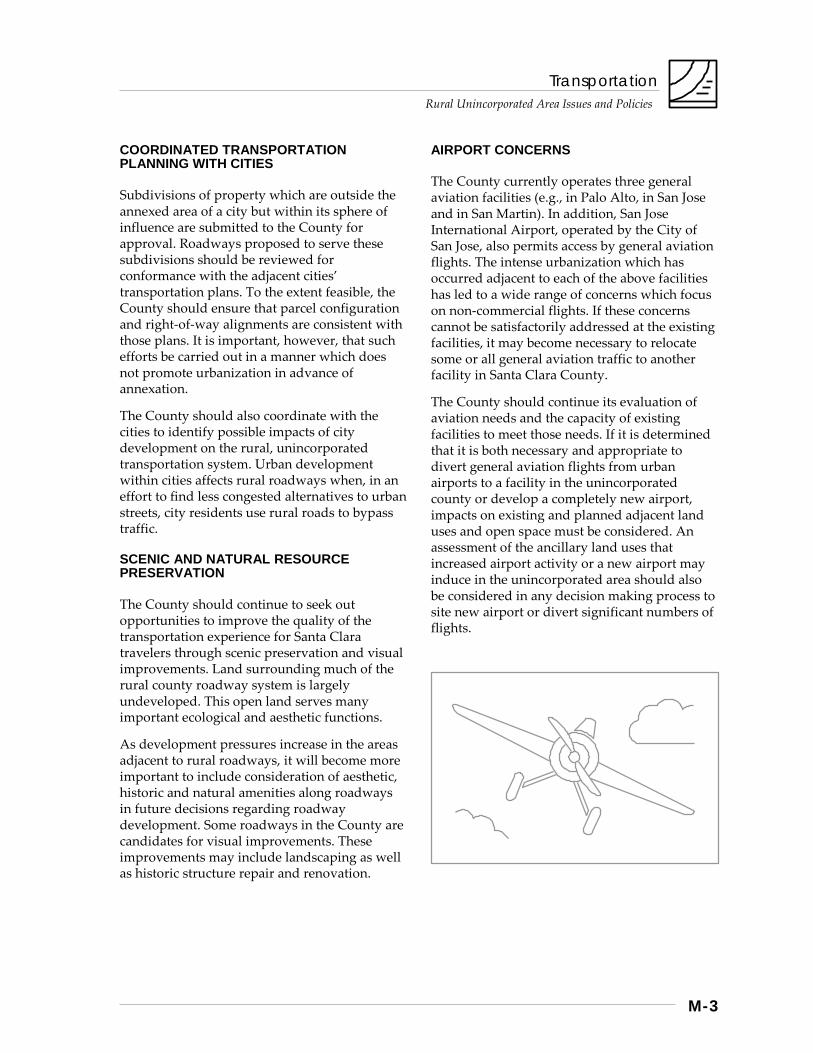
AIRPORT CONCERNS
The County currently operates three general aviation facilities (e.g., in Palo Alto, in San Jose and in San Martin). In addition, San Jose International Airport, operated by the City of San Jose, also permits access by general aviation flights. The intense urbanization which has occurred adjacent to each of the above facilities has led to a wide range of concerns which focus on non-commercial flights. If these concerns cannot be satisfactorily addressed at the existing facilities, it may become necessary to relocate some or all general aviation traffic to another facility in Santa Clara County.
The County should continue its evaluation of aviation needs and the capacity of existing facilities to meet those needs. If it is determined that it is both necessary and appropriate to divert general aviation flights from urban airports to a facility in the unincorporated county or develop a completely new airport, impacts on existing and planned adjacent land uses and open space must be considered. An assessment of the ancillary land uses that increased airport activity or a new airport may induce in the unincorporated area should also be considered in any decision making process to site new airport or divert significant numbers of flights.
Transportation
Rural Unincorporated Area Issues and Policies
M-4
Strategies, Policies and Implementation
While they are primarily focused on rural area transportation needs, the strategies below include policies and implementation measures which supplement those in the Countywide Transportation chapter. Consequently, they will also help us achieve a number of objectives included in the Vision of the General Plan.
The strategies below encourage and emphasize:
• planning for a safe and adequate rural area transportation system;
• the inclusion of different modes of transportation, rather than being focused solely on the automobile; and
• roadway development which is sensitive to environmental and aesthetic qualities.
Strategy #1: Anticipate and Plan for Future Transportation Demand
Ensuring adequate and safe rural unincorporated area roads will require that the County fully assess existing conditions and project future transportation demands as accurately as possible. Meeting current and future needs may necessitate the consolidation of existing ordinances, standards, plans and studies into a coherent Rural Unincorporated Area Transportation Implementation Plan. Once compiled, this plan should be periodically evaluated to ensure consistency between the County’s and cities’ land use plans.
As an initial step toward ensuring consistency, identified rights-of-way (ROW) should be set aside at the time a project is approved. This will ensure that the ROW will be available when the time for road development arrives. It will also minimize the financial and environmental costs of roadway construction on adjacent homes by allowing the developer to account for future roadway widening in the original site design of the home.
County transportation plans need to accommodate both unincorporated lands which are likely to remain unincorporated for the foreseeable future and those within cities spheres of influence which have a higher probability of annexation. For those rural residential areas that are likely to remain unincorporated, detailed circulation plans should be developed to identify and resolve both existing and foreseeable circulation problems.
For projects within a city’s sphere of influence, whether inside or outside of the urban service area, the city’s transportation plan should be considered. This consideration should include analysis to determine project impacts on rural unincorporated roads as well as an evaluation to ensure, to the extent feasible, that parcel and ROW alignment conform to those proposed by the cities’ plans.
Policies and Implementation
R-TR 1 Transportation and land use plans for rural areas should be complimentary. The rural roadway system should be designed and planned to accommodate probable, long term development of the surrounding land uses, as designated on the County General Plan Land Use Map, as well as probable through traffic from neighboring and other communities.
R-TR 2 Transportation plans for facilities in the rural unincorporated areas should be periodically reviewed and revised.
R-TR 3 Future width line right-of-ways should be reserved to allow future roadway expansions based on planned long term development.
R-TR 4 Detailed local circulation plans should be developed for rural residential areas where needed.
Transportation
Rural Unincorporated Area Issues and Policies
M-5
R-TR 5 When subdivisions are proposed in rural unincorporated areas which are planned for eventual annexation and development by the city, the roadway network within the subdivision should be consistent with the overall city circulation plan for these areas.
Implementation Recommendations
R-TR(i) 1 Consolidate applicable existing ordinances, standards, plans and studies into a formal “Rural Unincorporated Transportation Implementation Plan”. (Implementors: County)
R-TR(i) 2 Conduct periodic review and revision of the “Rural Unincorporated Transportation Implementation Plan”. (Implementors: County)
R-TR(i) 3 Obtain appropriate right-of-way dedications or reservations for future roadway and bikeway facilities to serve adjacent development at the time of project approval. (Implementors: County)
R-TR(i) 4 Condition proposed rural unincorporated subdivisions, intended for annexation to a city, to comply with existing city circulation plans. (Implementors: County)
R-TR(i) 5 Survey and identify areas which may possibly need more detailed transportation planning and improvements, and investigate funding sources to make the improvements. (Implementors: County)
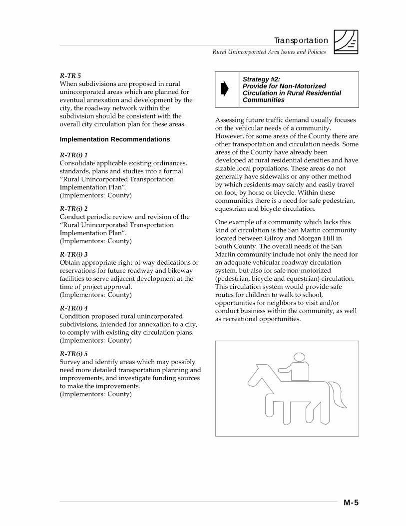
Strategy #2: Provide for Non-Motorized Circulation in Rural Residential Communities
Assessing future traffic demand usually focuses on the vehicular needs of a community. However, for some areas of the County there are other transportation and circulation needs. Some areas of the County have already been developed at rural residential densities and have sizable local populations. These areas do not generally have sidewalks or any other method by which residents may safely and easily travel on foot, by horse or bicycle. Within these communities there is a need for safe pedestrian, equestrian and bicycle circulation.
One example of a community which lacks this kind of circulation is the San Martin community located between Gilroy and Morgan Hill in South County. The overall needs of the San Martin community include not only the need for an adequate vehicular roadway circulation system, but also for safe non-motorized (pedestrian, bicycle and equestrian) circulation. This circulation system would provide safe routes for children to walk to school, opportunities for neighbors to visit and/or conduct business within the community, as well as recreational opportunities.
Transportation
Rural Unincorporated Area Issues and Policies
M-6
Policies and Implementation
R-TR 6 Pathways and/or sidewalks which would provide safe, non-motorized circulation routes (i.e. pedestrian, equestrian and bicycle) should be provided within identified rural residential areas.
Implementation Recommendations
R-TR(i) 6 Identify appropriate areas within the rural unincorporated areas to develop non-motorized circulation plans. (Implementors: County)
R-TR(i) 7 Prepare pedestrian / equestrian / bicycle plans for San Martin and other appropriate areas. (Implementors: County)
R-TR(i) 8 Condition development proposals in the rural unincorporated area to allow for the development of safe pedestrian, equestrian and bicycle facilities. (Implementors: County)
Strategy #3: Facilitate the Use of Commute Alternatives
Although the rural area population is generally not large, certainly in comparison to urban areas, many rural area residents commute to jobs in cities. As part of efforts to reduce countywide traffic congestion and improve air quality, rural area commuters should also encouraged to use alternatives to the single occupant vehicle. Improvements which may promote transit use include adequate parking, bike lockers and adequate pedestrian access.
Consideration should also be given to encouraging business uses within walking distance of transit facilities which provide basic commuter needs. These needs may include, but would not be limited to, grocery shopping, fast food restaurants, cleaners and day care.
The Countywide Transportation Plan, T-2010, identifies the unincorporated community of San Martin and parts of rural South County as a high priority for rail and highway improvements. As the implementation of an integrated countywide transportation system proceeds, new facilities will likely be planned for rural areas traversed by components of that system. CalTrain and bus transfer stations, park-and-ride lots, bikeways and other elements of the system will gradually take shape as years go by. Adequate measures should be taken to ensure that critical sites and ROWs are set aside as development occurs.
Policies and Implementation
R-TR 7 Encourage carpooling, use of transit and other commute alternatives by those rural residents who work in or travel to urban areas.
R-TR 8 Future transportation facility sites, ROWs, and other critical elements of planned countywide and local transportation systems should be dedicated and improved as development proceeds.
Implementation Recommendations
R-TR(i) 9 Locate park and ride lots in appropriate locations within rural areas to encourage carpooling and bus use by those rural residents with destinations in urban areas. (Implementing Agency: Transit District)
R-TR(i) 10 Provide appropriate facilities at the San Martin CalTrain Station to encourage use by South County commuters. (Implementing Agency: Transit District)
R-TR(i) 11 During development review, dedicate and improve critical sites and alignments identified in transportation plans. (Implementing Agency: County)
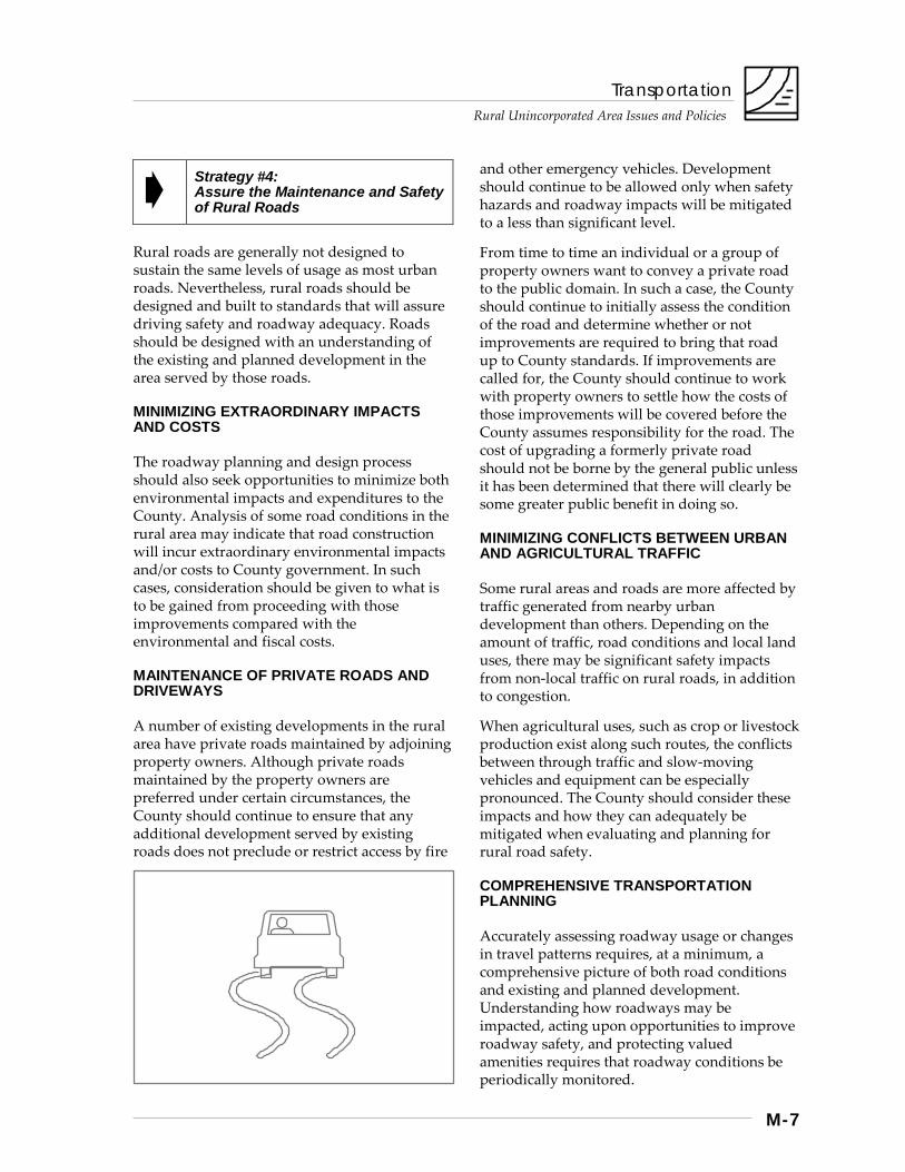
Transportation
Rural Unincorporated Area Issues and Policies
M-7
Strategy #4: Assure the Maintenance and Safety of Rural Roads
Rural roads are generally not designed to sustain the same levels of usage as most urban roads. Nevertheless, rural roads should be designed and built to standards that will assure driving safety and roadway adequacy. Roads should be designed with an understanding of the existing and planned development in the area served by those roads.
MINIMIZING EXTRAORDINARY IMPACTS AND COSTS
The roadway planning and design process should also seek opportunities to minimize both environmental impacts and expenditures to the County. Analysis of some road conditions in the rural area may indicate that road construction will incur extraordinary environmental impacts and/or costs to County government. In such cases, consideration should be given to what is to be gained from proceeding with those improvements compared with the environmental and fiscal costs.
MAINTENANCE OF PRIVATE ROADS AND DRIVEWAYS
A number of existing developments in the rural area have private roads maintained by adjoining property owners. Although private roads maintained by the property owners are preferred under certain circumstances, the County should continue to ensure that any additional development served by existing roads does not preclude or restrict access by fire
and other emergency vehicles. Development should continue to be allowed only when safety hazards and roadway impacts will be mitigated to a less than significant level.
From time to time an individual or a group of property owners want to convey a private road to the public domain. In such a case, the County should continue to initially assess the condition of the road and determine whether or not improvements are required to bring that road up to County standards. If improvements are called for, the County should continue to work with property owners to settle how the costs of those improvements will be covered before the County assumes responsibility for the road. The cost of upgrading a formerly private road should not be borne by the general public unless it has been determined that there will clearly be some greater public benefit in doing so.
MINIMIZING CONFLICTS BETWEEN URBAN AND AGRICULTURAL TRAFFIC
Some rural areas and roads are more affected by traffic generated from nearby urban development than others. Depending on the amount of traffic, road conditions and local land uses, there may be significant safety impacts from non-local traffic on rural roads, in addition to congestion.
When agricultural uses, such as crop or livestock production exist along such routes, the conflicts between through traffic and slow-moving vehicles and equipment can be especially pronounced. The County should consider these impacts and how they can adequately be mitigated when evaluating and planning for rural road safety.
COMPREHENSIVE TRANSPORTATION PLANNING
Accurately assessing roadway usage or changes in travel patterns requires, at a minimum, a comprehensive picture of both road conditions and existing and planned development. Understanding how roadways may be impacted, acting upon opportunities to improve roadway safety, and protecting valued amenities requires that roadway conditions be periodically monitored.
Transportation
Rural Unincorporated Area Issues and Policies
M-8
There is currently no such comprehensive transportation plan for unincorporated Santa Clara County. To achieve these and other objectives mentioned in this chapter, the County should evaluate the feasibility of consolidating the applicable existing roadway ordinances, standards, plans and studies into a single, comprehensive “Rural Unincorporated Transportation Implementation Plan.” Such a plan will promote consistency in decision making and allow easier updating of plans, policies and maps as circumstances change.
Policies and Implementation
R-TR 9 Rural roads should be designed and built to standards that will assure driving safety and provide access for emergency vehicles.
R-TR 10 As existing substandard County roadways are improved to current county standards, environmental and economic constraints should be taken into consideration.
R-TR 11 New development which would significantly impact private or public roads, should be allowed only when safety hazards and roadway deterioration will be mitigated to a less than significant level.
R-TR 12 Rural road maintenance programs should be adequately funded.
Implementation Recommendations
R-TR(i) 12 Appropriate County standards should be used to evaluate roadways proposed for construction. (Implementors: County)
R-TR(i) 13 County roadway standards should be updated/ revised regularly to reflect current roadway conditions and vehicle fleet composition, including bicycles. (Implementors: County)
R-TR(i) 14 Monitoring and assessment of existing County roadways should continue to create a regularly updated repair list. (Implementors: County)
Strategy #5: Preserve and Enhance Scenic Qualities Adjacent to County Roadways
Roadways in the County serve multiple purposes. The most obvious of these is, of course, transporting people and goods from one destination to another. Another function of our roadways is to provide recreation and an opportunity to appreciate the scenic values within rural areas.
ENSURING SCENIC PRESERVATION AS DEVELOPMENT OCCURS
A scenic highway, expressway or rural country road provides an opportunity for more than travel with arrival as its only objective. Some roads within the County are, or have the potential to be, scenic and provide pleasant alternatives to the monotony of high speed, freeway travel.
In rural areas of Santa Clara County, procedures and standards should be established which balance the safety, environmental and aesthetic impacts of roadway development. The natural resources of an area serve many purposes. Watershed management, wildlife habitat and aquifer protection are just a few of the many benefits from adequate resource protection. But as traffic increases along a rural roadway, safety concerns intensify. The standard response to ensuring roadway safety and adequacy is usually to widen and/or straighten the roadway. In many rural areas, this type of remediation can cause more harm to natural and scenic resources than the good it provides. (Further discussion of the scenic highway concept can be found in the Rural Unincorporated Resource Conservation Chapter.)
Transportation
Rural Unincorporated Area Issues and Policies
M-9
PRESERVING THE RURAL CHARACTER OF SAN MARTIN
San Martin is a rural residential community which is focused on a village dating back to the early 1900s. This community, surrounded by large farms and orchards, retains a pastoral country character. San Martin offers an ideal opportunity for preserving elements of the rural county character cherished by many area residents. The County should work with local property owners to establish guidelines which will preserve valued aesthetic qualities along San Martin roadways as development occurs.
Policies and Implementation
R-TR 13 Maintain and enhance the scenic quality of county roadways.
R-TR 14 Environmental impacts of roadway construction and expansion should be mitigated to a less than significant level.
Implementation Recommendations
R-TR(i) 15 Develop design guidelines for the San Martin community which address landscaping, setbacks and scenic preservation along County roads. (Implementors: County)
R-TR(i) 16 Explore the applicability of the San Martin design guidelines to other areas of the county. (Implementors: County)
R-TR(i) 17 The County should continue to prepare environmental assessments which address but are not be limited to natural resource and scenic impact(s) of proposed roadway projects. These assessments should identify mitigations available to reduce any impacts to a less than significant level. Identified mitigation measures should be incorporated into project design. (Implementors: County)
Strategy #6: Anticipate Future Airport Needs and Impacts
General aviation facilities in the North County have, for the last decade, been facing pressures from various sources. Concerns regarding the safety of Reid-Hillview, the closure of Moffet Field, and increased traffic at San Jose International have led airport planners to consider alternate sites for much of the North County traffic. Candidate sites have included locations in Coyote Valley, and unincorporated area sites.
Pressures to relocate the traffic from North County facilities are likely to continue. If areas in the unincorporated County continue to be considered for new or expanded airport facilities, such planning needs to take a number of factors into consideration.
Among these are: • current and long-term countywide aviation
needs and facilities capacity; • impacts on existing and planned land uses
adjacent to proposed sites; and • potential for creating open space buffers
around new airport facilities to protect public safety and minimize noise and other environmental impacts.
In addition to the land required for airport facilities and mitigation of safety concerns, airport planning should not ignore the ancillary buildings and uses which would support the airport. These ancillary uses may include, but would not be limited to, administration buildings, control towers, repair and fueling facilities, crew and freight facilities, as well as amenities for passengers and visitors. How these facilities will be provided and how they would impact surrounding properties should be part of the site-evaluation process.

Transportation
Rural Unincorporated Area Issues and Policies
M-10
Policies and Implementation
R-TR 15 If new or expanded airports are needed in the rural areas, they should be located where they are safe and compatible with surrounding land uses.
R-TR 16 Assure that necessary ancillary uses can be appropriately located to new or expanded airports.
Implementation Recommendations
R-TR(i) 18 Studies of the potential expansion of existing airports or construction of new airports in rural unincorporated areas should include, but not be limited to, considerations of: a. Long-term countywide aviation needs and
facilities capacity; b. Potential alternative locations or expansion
sites; c. Impacts on existing and planned adjacent
land uses; and d. The potential for creating open space buffers
around the airport facilities to protect public safety, and minimize noise impacts.
(Implementors: County)
R-TR(i) 19 Plans developed for expansion of existing airports or locations of new airports should include adequate land adjacent to the airport to safely locate necessary ancillary land uses. (Implementors: County)
Parks and Recreation Rural Unincorporated Area Issues and Policies
Introduction ............................................................................................................ N-1 Summary Background
Regional Parks and Public Open Space Lands ..................................................... N-4 Background Strategies, Policies and Implementation ......................................................... N-5
Strategy #1: Develop Parks and Public Open Space Lands Strategy #2: Improve Accessibility Strategy #3: Balance Recreational and Environmental Objectives Strategy #4: Facilitate Interjurisdictional Coordination Strategy #5: Encourage Private Sector and Non-Profit Involvement
Trails and Pathways ............................................................................................. N-10 Background Strategies, Policies and Implementation ....................................................... N-11
Strategy #1: Plan for Trails Strategy #2: Provide Recreation, Transportation, and Other Public
Trail Needs in Balance with Environmental and Land Owner Concerns
Strategy #3: Implement the Planned Trails Network Strategy #4: Adequately Operate and Maintain Trails Strategy #5: Establish Priorities Strategy #6: Facilitate Inter-Jurisdictional Coordination
Scenic Highways .................................................................................................. N-24 Background Strategies, Policies and Implementation ....................................................... N-24
Strategy #1: Designate Scenic Highways Strategy #2: Protect Scenic Highway Corridors Strategy #3: Develop Complimentary Recreation Facilities

Parks and Recreation
Rural Unincorporated Area Issues and Policies
N-1
Introduction
Summary
Through the remainder of this century and into the next, population growth, demographic change, and increasing urban intensification in Santa Clara County will be creating a growing demand for recreation. Public demand will increase both for parks and open space areas within and adjacent to the urban area, as well as for recreation areas in more natural settings that provide a welcome contrast to the fast pace and pressures of urban life.
Meeting this growth in recreation demand will be particularly challenging due to the limited public funding likely to be available during this period, and due to the need to balance recreation and environmental protection objectives to avoid the overuse and eventual destruction of the natural resources of our parks and public open space lands.
This chapter addresses three types of areas and facilities that can contribute both to meeting future recreation demand and to maintaining the county’s natural resources and beauty:
• Regional Parks and Public Open Space Lands,
• Trails, and • Scenic Highways.
The general strategies outlined for each of these areas are as follows:
Regional Parks and Public Open Space Lands Strategy #1: Develop parks and public open
space lands Strategy #2: Improve accessibility Strategy #3: Balance recreation and
environmental objectives Strategy #4: Facilitate interjurisdictional
coordination Strategy #5: Encourage private sector
Involvement
Trails and Pathways Strategy #1: Plan for trails Strategy #2: Implement the planned trail
network Strategy #3: Facilitate interjurisdictional
coordination Strategy #4: Balance recreation,
environmental, and landowner concerns
Scenic Highways Strategy #1: Designate scenic highways Strategy #2: Protect scenic highway cooridors Strategy #3: Develop complimentary
recreational facilities
Background
THE VISION OF “A NECKLACE OF PARKS”
The basic foundation for the “Regional Parks, Trails, and Scenic Highways Plan” within the County’s General Plan was established in the late 1960s when a blue ribbon citizen advisory committee was established to develop a blueprint for the expansion of the county’s regional park system. [see sidebar next page]
Growth in the regional park system had not kept pace with the county’s rapid population growth during the previous two decades, and community leaders felt it was important that a bold, long term plan be developed to remedy the recreational deficiencies that existed and to preserve significant open space resources that were threatened by the rapid pace of the sprawling development the county was then experiencing.
The regional parks, trails, and open space system envisioned in the plan they developed was often referred to as “a necklace of parks.” It consisted of a series of major regional parks located in the foothills and mountains around the valley, similar to pearls on a necklace. These regional park “pearls” were intended to preserve, and make available for public recreation, examples of the county’s finest natural resources. Recreational trails and scenic highways were proposed to link these regional parks with one another as well as to provide access from the valley floor.

Parks and Recreation
Rural Unincorporated Area Issues and Policies
N-2
On the valley floor, the plan envisioned major streamside park chains — visual and recreational ribbons of green — passing through the urban area, providing recreation opportunities in themselves and also serving as important trail linkages to the nearby foothill, mountain, reservoir, and baylands parks.
Over the intervening decades, their far-sighted vision of “a necklace of parks” has gradually moved toward becoming a reality as expansion
and development of the County’s regional park system, the cities’ park systems, and the open space preserve system of the Midpeninsula Regional Open Space District have occurred.
Although progress toward its completion may slow during the mid-1990s due to funding limitations, the vision remains alive as a positive blueprint for meeting current and long term recreation needs and for preserving portions of our county’s unique open space heritage.
The Regional Parks, Trails, and Scenic Highways Plan Map
The current “Regional Parks, Trails, and Scenic Highways Plan” (hereafter referred to simply as the “Parks Plan”) is a separately-published map that is an officially adopted part of the County’s General Plan.* As its name implies, it contains information about three kinds of recreational facilities: regional parks, trails, and scenic highways. The Parks Plan performs the following important roles and functions with regard to each of its three basic components. Regional Parks:
• Show the proposed countywide regional parks system, including “existing”** parks and public open space lands and the general locations of areas proposed for future public acquisition by the County and other public agencies.
• Provide the basis for expenditure of County Parks Charter Funds (i.e. expenditures of County Parks Charter funds for land acquisition must conform to the Plan)
• Provide a basis for interjurisdictional coordination and cooperation in the provision of parks and open space facilities of countywide significance
Trails:
• Shows the proposed countywide trail network, including “existing”** trails and the general locations of corridors within which future trails are proposed for implementation by the County and other public agencies. [Note: The proposed trails network shown on the Parks Plan is
currently being reviewed by a special Trails Plan Committee established by the Board of Supervisors.]
• Provides a basis for interjurisdictional coordination and cooperation in the provision of trails of countywide significance
• Serves as the basis for County trail easement dedication requirements when development occurs in unincorporated areas within trail corridors shown on the Plan
• With a few exceptions, does not indicate proposed bicycle lane system. [note: The County Transportation Agency is currently updating the county Bikeways Plan.]
Scenic Highways:
• Identifies local roads designated as scenic highways, as well, as existing and proposed state scenic highways
• Indicates scenic roads in unincorporated rural areas subject to special scenic highway ordinance regulations and development reviews
Notes: * The original printed, multicolored version
of this map is out of print; black-and-white photocopied versions are available from the County Parks Department.
** The most recent version of this map was printed in 1980 and does not reflect public parks and open space acquisitions nor trails developed since then.
Parks and Recreation
Rural Unincorporated Area Issues and Policies
N-3
GROWTH IN RECREATION DEMAND AND DIVERSITY
Although implementation of the “necklace of parks” may slow somewhat, recreation demand in Santa Clara County will continue to increase through the remainder of this century and into the next in response to a number of factors, including:
• population growth, generally; • growth in the population of seniors with
more leisure time; and • the accessibility of local recreation areas.
Between 1995 and 2010, Santa Clara County’s population is projected to increase by more than 209,000 people — an increase roughly equivalent to the current populations of Santa Clara and Sunnyvale combined.
As the population grows, it will also be aging, which will mean that seniors with more leisure time available will constitute a larger part of our population. Due to public consciousness about fitness and health in recent decades, these seniors are likely to be healthier and more recreationally active longer in their lives than seniors of previous generations.
Growth in recreation demand is likely also to be driven by the supply of parks and open space lands that are easily accessible from the county’s urban areas. Residents of Santa Clara County have a number of regional parks and other public open space lands that are only a short drive, hike, or bicycle ride from major residential and employment centers. This close proximity of public recreation areas helps account for why, according to State Parks Department surveys, northern California residents participate in outdoor recreation activities at higher rates than do residents of southern California where regional parks and other public open space lands tend to be farther away.
Growth in recreation demand is also likely to be accompanied by continued increasing diversity in the array of forms of public recreation. Just as the last decade has witnessed the emergence and growing popularity of various new types of recreation activity (e.g. off road bicycling,
skateboarding, roller blading, etc.), the next decade will probably bring additional new forms of recreation as well. New developments in technology are likely to create new forms of recreation activity, as well as enabling persons of all physical capabilities to engage in a broader array of recreational activities.
Along with this increasing diversity of recreational activity will come the challenges of coping with pressures to create or set aside areas for these new forms of recreation as well as managing the conflicts that may arise among various recreational user groups seeking to use the same lands or facilities for different activities.
THE RECREATION CONSEQUENCES OF URBAN INTENSIFICATION
As Santa Clara County’s population grows and as future growth is directed primarily into existing urban areas, selective portions of our cities will be evolving from predominantly suburban to more urban character. This will be particularly true along transit corridors, near downtowns, and near major employment centers.
This selective urban intensification is likely to have two significant, and somewhat contradictory, impacts on parks and recreation demand. It will, first of all, focus greater attention on the need to provide parks and open space within easy access of these new urban centers to assure that they have the recreational amenities necessary to become livable urban communities.
Parks and Recreation
Rural Unincorporated Area Issues and Policies
N-4
High urban land costs, however, will generally preclude the acquisition of large parcels of land to create traditional, large urban parks. Consequently, more emphasis is likely to be given to: • planned open space within larger scale;
mixed use developments; • smaller, neighborhood parks; and • the completion of urban streamside and
baylands park chains.
Linear parks passing through the urban area, such as those being developed along the Guadalupe River, Coyote Creek, Los Gatos Creek, and Stevens Creek can be implemented to a large degree on existing publicly-owned lands. Similarly, continued parks and recreation development within the large band of contiguous, publicly-owned lands in the baylands provides an opportunity for creation of a major, interconnected system of parks and public open space preserves adjacent to the urban area.
Second, as more people live within urban centers, the pressure to provide additional areas for parks and open space where people can escape the urban area to more natural surroundings in search of relaxation and recreation will also increase.
Both of these trends will create competing pressures for the allocation of limited parks and open space funds, and will create the need for local officials to try to achieve an appropriate balance between expenditures for close-in urban parks and for parks and open space lands in more natural, rural settings.
Regional Parks and Public Open Space Lands
Background
Opportunities for outdoor recreation amid the natural beauty and splendor of the California landscape are important ingredients contributing to the quality of life enjoyed by county residents. As Santa Clara County’s urban area has expanded and its population has grown to more than one-and-a-half million people, the need to provide areas for existing and future County residents to get away from the pressures of the urban area to more natural settings where they can relax and enjoy closer contact with nature has increased greatly.
Santa Clara County has been blessed with a great diversity of natural resources and scenic beauty, ranging from the salt marshes of the baylands, to the rolling, oak-studded foothills, to the majestic redwood groves of the Santa Cruz Mountains, to the numerous flowing streams. These varied open space areas are part of a priceless legacy, an environmental heritage which must be preserved for the use and enjoyment of both present and future generations.
Many of the county’s natural areas are being protected and made available to residents through public acquisition as parks or open space preserves by a number of different agencies, including the County Parks Department, various city parks departments, the Midpeninsula Regional Open Space District, the State Parks Department, and the San Francisco Bay National Wildlife Refuge.
As the county’s population continues to grow, the growth in recreation demand will put increasing pressures on these parks and open space lands. A major challenge over the duration of this decade will be how to accommodate this increasing demand without overusing and ultimately degrading the natural resources that draw people to seek recreation on these lands.
Parks and Recreation Rural Unincorporated Area Issues and Policies
N-5
Compounding this challenge will be the fiscal crises that state and local governments are currently experiencing, which will likely mean that there will be less money available to purchase additional parks and public open space lands, and possibly less money to pay for the development, operation, and maintenance of existing parks and open space lands.
Strategies, Policies and Implementation
Given the above factors, the basic strategies concerning regional parks and public open space lands consist of the following:
Strategy #1: Develop Parks and Public Open Space Lands
Strategy #2: Improve Accessibility Strategy #3: Balance Recreational and
Environmental Objectives Strategy #4: Facilitate Interjurisdictional
Coordination Strategy #5: Encourage Private Sector and
Non-Profit Involvement
Strategy #1: Develop Parks and Public Open Space Lands
The major focus of local parks and open space agencies over the foreseeable future is likely to be upon developing and managing their existing parks and open space preserves, rather than the purchase of substantial additional lands. Primary emphasis will be on developing additional recreational facilities to make existing lands serve more visitors.
Those additional land purchases that do occur are likely to be purchases that help round out the boundaries of existing parks and open space preserves or that complete missing links between them. (The Santa Clara County Open Space Authority, created in 1992, may become an exception to the previous generalizations about land acquisition, once it obtains a funding source.)
Although the short term future may not look particularly bright in terms of additional parks and open space purchases, it is important not to lose sight of the substantial progress that has been made during the last two decades toward realization of the vision of a necklace of regional parks and public open space lands surrounding the urban area and accessible by trails and streamside park chains. Further progress, however incremental, toward fulfillment of that dream will still provide lasting benefits for current and future generations.
Policies and Implementation
R-PR 1 An integrated and diverse system of accessible local and regional parks, scenic roads, trails, recreation facilities, and recreation services should be provided.
R-PR 2 Sufficient land should be acquired and held in the public domain to satisfy the recreation needs of current and future residents and to implement the trailside concept along our scenic roads.
R-PR 3 The County’s regional park system should: a. utilize the county’s finest natural resources
in meeting park and open space needs; b. provide a balance of types of regional parks
with a balanced geographical distribution; c. provide an integrated park system with
maximum continuity and a clear relationship of elements, using scenic roads, bikeways and trails as important linkages; and
d. give structure and livability to the urban community.
R-PR 4 The public open space lands system should: a. preserve visually and environmentally
significant open space resources; and b. provide for recreation activities compatible
with the enjoyment and preservation of each site’s natural resources, with trail linkages to adjacent and nearby regional park lands.
Parks and Recreation
Rural Unincorporated Area Issues and Policies
N-6
R-PR 5 Water resource facilities, utility corridors, abandoned railroad tracks, and reclaimed solid waste disposal sites should be used for compatible recreational uses, where feasible.
R-PR 6 The countywide regional parks plan should periodically be reviewed and revised to reflect current conditions, anticipated future needs, long term goals, and new opportunities.
Implementation Recommendations
R-PR(i) 1 An assured, predictable source of annual funding should continue to be provided for regional park acquisition, development, and maintenance.
R-PR(i) 2 Consideration, in parks and open space land acquisition planning and decision making, should be given to the open space preservation priorities proposed by the Open Space Preservation 2020 Task Force.
R-PR(i) 3 Establish a program to review and revise the countywide regional parks plan.
Strategy #2: Improve Accessibility
Another important focus for local agencies over the remainder of this decade should be that of improving public access to and within parks and public open space lands.
One target of local efforts should be to improve access to regional parks and open space lands via modes other than the automobile. This means improving access via public transit, as well as providing trails and pathway access for pedestrians, runners, bicyclists and equestrians, as means of reducing traffic congestion and improving air quality.
Within regional parks and open space lands, more attention needs to be given to making facilities and programs more accessible to all
members of our population, including those who may have physical limitations.
Our diverse population includes people of a wide range of ages and physical capabilities, each of whom is entitled to experience the wonders of our natural environment and the benefits of outdoor recreation on our public lands. To make these benefits more widely available, public parks and open space planning needs to become more creative in preparing master plans, developing new facilities, and redesigning existing facilities to make them more accessible to persons of all physical capabilities. The accessibility of recreation programs, too, must be improved.
Policies and Implementation
R-PR 7 Opportunities for access to regional parks and public open space lands via public transit, hiking, bicycling, and equestrian trails should be provided. Until public transit service is available, additional parking should be provided where needed.
R-PR 8 Facilities and programs within regional parks and public open space lands should be accessible to all persons, regardless of physical limitations, consistent with available financial resources, the constraints of natural topography, and natural resource conservation.
Implementation Recommendations
R-PR(i) 4 Provide public transit service to major regional parks, and develop hiking, bicycling, and equestrian trails to provide access to regional parks from the urban area to provide alternatives to private automobiles for access to recreation. (Implementors: County, Cities, Midpeninsula Regional Open Space District, State of California, Santa Clara Valley Water District)

Parks and Recreation Rural Unincorporated Area Issues and Policies
N-7
R-PR(i) 5 Design, and redesign where necessary, facilities and programs within regional parks and public open space lands to be accessible to all persons, regardless of physical limitations, consistent with constraints of the natural landscape and natural resources of each site. Include accessibility considerations in the development of site master plans.
Strategy #3: Balance Recreational and Environmental Objectives
Management and development of Santa Clara County’s regional parks and other public open space lands requires a careful balance between the sometimes conflicting objectives of providing for public recreation and preserving and enhancing the resources and processes of our natural environment.
The scenic beauty and natural resources of those lands closest to the urban area, because of their attractiveness and accessibility, often face the greatest recreational pressures. An estimated 500,000 people per year, for example, make use of the trails at Rancho San Antonio near Cupertino. The Los Gatos Creek Trail and the trails of the Palo Alto and Mountain View baylands are examples of other popular and heavily used recreation areas within or at the edge of the urban area.
As existing public recreation areas become more crowded, the pressures to develop additional recreational areas and facilities will increase.
Since funds for acquisition of additional parks and public open space lands are likely to be quite limited for the foreseeable future, the most logical way to try to keep up with growth in recreation demand will be to provide additional recreational facilities on existing public lands.
In working to meet that growing demand, we must be careful not to overdevelop or overuse these lands to the point where their natural resources are seriously degraded and the quality of the recreational experience is substantially diminished. Care must particularly be taken to preserve and protect natural resources unique to these sites so that they will also be available for future generations to experience and enjoy. Additionally, park planning and development should be sensitive to potential impacts on adjacent property owners.
Policies and Implementation
R-PR 9 The parks and recreation system should be designed and implemented to help attain open space and natural environment goals and policies.
R-PR 10 Recreation facilities and activities within regional parks and public open space lands should be located and designed to be compatible with the long term sustainability of each site’s natural and cultural resources, with particular attention to the preservation of unique, rare, or endangered resources (including historic and archeological sites, plant and animal species, special geologic formations, etc.).
R-PR 11 Park planning and development should take into account and seek to minimize potential impacts on adjacent property owners. NR-
Parks and Recreation
Rural Unincorporated Area Issues and Policies
N-8
PR 12 Parks and trails in remote areas, fire hazard areas, and areas with inadequate access should be planned to provide the services or improvements necessary to provide for the safety and support of the public using the parks and to avoid negative impacts on the surrounding areas.
R-PR 13 Public recreation uses should not be allowed in areas where comparable private development would not be allowed, unless consistent with an adopted park master plan.
R-PR 14 Privately-owned recreational land uses and facilities within rural unincorporated areas, including but not limited to golf courses, campgrounds, recreational vehicle (RV) parks, and similar uses, should be compatible with the landscape and resources of the areas in which they are proposed. To ensure such compatibility, potentially significant impacts often associated with such land uses should be avoided or reduced to less than significant levels, including: a. water demand; b. traffic generation; c. wastewater generation and disposal; d. alteration of natural topography, drainage
patterns, habitat, or vegetative cover; e. use of harmful chemicals, such as pesticides,
and herbicides; f. riparian area or heritage resource impacts; g. loss of prime soils or other impacts upon
local agriculture; h. visual impacts; and, i. impacts on public services and facilities,
including schools. [Amended Dec. 5, 1995; File#: 6010-95GP]
R-PR 15 In addition to review of environmental impacts, review of proposed golf courses and ancillary uses shall also take into account the following; a. any pertinent joint City-County area plans; b. applicable land use or other general plan
policies of the proximate city(s); c. the location of the proposed site relative to
city Urban Service Areas; and d. the intended scale or "service area" of the
proposed golf course (i.e. intended to
primarily serve a local community or intended to serve users from a larger service area).
Implementation Recommendations
R-PR(i) 6 Include resource management plans within the master plans for individual regional parks and public open space lands. (Implementors: County, Cities, Midpeninsula Regional Open Space District, Santa Clara County Open Space Authority, State Parks Department, San Francisco Bay National Wildlife Refuge)
R-PR(i) 7 In conformance with the California Environmental Quality Act (CEQA), prepare environmental assessments for proposed master plans and development projects within regional parks and public open space lands. (Implementors: County, Cities, Midpeninsula Regional Open Space District, Santa Clara County Open Space Authority, State Parks Department, San Francisco Bay National Wildlife Refuge)
R-PR(i) 8 Develop formal environmental guidelines for review of proposed golf course designs.
Strategy #4: Facilitate Interjurisdictional Coordination
Numerous agencies are involved, either directly or indirectly, in the provision of public parks and open space lands in Santa Clara County, including city and County parks departments, the Midpeninsula Regional Open Space District, the State Parks Department, the San Francisco Bay National Wildlife Refuge, the Santa Clara Valley Water District, various local school districts, and the recently established Santa Clara County Open Space Authority.
Over the coming decade, coordination among these agencies is likely to become increasingly more important, due to:
Parks and Recreation Rural Unincorporated Area Issues and Policies
N-9
• Increased emphasis on completing streamside park chains through the urban area, which pass through multiple jurisdictions and involve lands owned by several different public agencies.
• Outward expansion of the urban area to the point where some County parks that were established as rural parks years ago when lands around them were largely undeveloped are now surrounded by urbanization, thus creating opportunities for city/County cooperation in the management of these park lands.
• Budget problems faced by local parks and open space agencies, which can be alleviated somewhat by reducing costs through joint operating agreements (e.g. when two different agencies own lands in close proximity to one another, it may be cheaper for one to contract with the other to manage their lands jointly, rather than for each of them to manage their own lands individually).
To respond to these opportunities and necessities for interjurisdictional cooperation it may be necessary to establish formal mechanisms (e.g. coordinating committees) and agreements among various agencies to acquire, develop, and manage the regional parks and public open space system proposed in this plan.
Policies and Implementation
R-PR 16 Parks and recreation system planning, acquisition, development, and operation should be coordinated among cities, the County, State and Federal governments, school districts and special districts, and should take advantage of opportunities for linkages between adjacent publicly owned parks and open space lands.
R-PR 17 The provision of public regional parks and recreational facilities of countywide significance both in urban and rural areas shall be the responsibility of county government.
R-PR 18 The provision of neighborhood, community, and citywide parks and recreational facilities should be the responsibility of the cities and other appropriate agencies.
Implementation Recommendations
R-PR(i) 9 Seek adoption of the County’s Regional Parks Plan by the cities to facilitate interjurisdictional cooperation in implementing the Plan. (Implementors: County, Cities)
R-PR(i) 10 Establish joint programs or other procedures for identifying and capitalizing upon potential opportunities for joint land acquisition, development and/or management of parks and open space lands. (Implementors: County, Cities, Midpeninsula Regional Open Space District, Santa Clara County Open Space Authority, Santa Clara Valley Water District, State Parks Department, San Francisco Bay National Wildlife Refuge)
Strategy #5: Encourage Private Sector and Non-Profit Involvement
Public parks and open space agencies do not have sufficient funding resources, lands, nor mandates to provide for all forms of outdoor recreation. Consequently some outdoor recreation needs may have to be met by the private sector or by non-profit organizations.
In Santa Clara County, facilities such as horse stables and recreational vehicle (RV) parks are provided almost exclusively by the private sector. Provision of these and other such private recreational facilities should be encouraged in appropriate locations, provided that they are of the proper scale and design for their surroundings.
Parks and Recreation
Rural Unincorporated Area Issues and Policies
N-10
In addition, nonprofit organizations and volunteers have provided valuable services to parks and open space agencies, and thus to the public as well, through a variety of activities ranging from aiding in land acquisition efforts, to running interpretive programs, to building and maintaining trails. These kinds of efforts should also be encouraged.
Increasing opportunities for public recreation may also be available if nonprofit organizations that own recreational lands make them available for appropriate public use when they are not in use by their members
Policies and Implementation
R-PR 19 The private sector and non-profit organizations should be encouraged to provide outdoor recreational opportunities. In rural areas, private recreational uses shall be low intensity.
R-PR 20 Individual citizens, community organizations, and businesses should be encouraged to aid in regional parks and open space acquisition, development, and maintenance.
R-PR 21 The potential for encouraging nonprofit organizations that own recreation lands to make them available for appropriate public use should be explored.
Implementation Recommendations
R-PR(i) 11 Identify potential outdoor recreation needs that could be met by businesses and/or non-profit organizations. Encourage businesses and nonprofit organizations to provide for these needs in appropriate locations.
R-PR(i) 12 Establish a program to solicit support from individual citizens, community organizations, and businesses to aid in regional parks acquisition, development, and maintenance. (Implementor: County)
Trails and Pathways
Background
THE ROLES OF TRAILS
Trails in Santa Clara County serve the following roles:
• Outdoor Recreation: The activity of walking is consistently ranked the highest in terms of participation. Bicycling, and in particular mountain bicycling, continues to increase in popularity. Horseback riding has been, and continues to be, a strongly supported heritage of Santa Clara County. This is particularly true for the rural residents of the unincorporated areas of the County. The Countywide Trails Master Plan focuses only on non-motorized trail uses.
• Transportation: Trails provide an alternative form of travel to get to work or school, to go shopping, or to get to any number of other destination points including local and regional parks and open space preserves. For all county residents, trails, as an alternative to the private automobile, are energy-efficient, reduce reliance on fossil-fuels and benefit air quality.
• Education: To many individuals trails are also a means to an end. This is especially true for outdoor science teachers representing all levels of our educational system. Trails provide access to and through nature’s outdoor laboratories.
• Public Health and Physical Well-being: Trail use supports exercise of any desired degree. Activities involving exercise are both healthy for the individual and reduce health care costs.
• Social and Economic Well-being: The positive benefits of well-managed trails on local economies and increased property values near trails in urban areas is well documented.
• Alternative Emergency Access and Egress: The subdivision of properties and intensification of land uses within wildland areas of the County
Parks and Recreation Rural Unincorporated Area Issues and Policies
N-11
increases the need for providing and maintaining emergency access/egress routes. Trails can serve as access routes in and out of an area blocked by fire, landslide, flood, or trafic
Strategies, Policies and Implementation
Strategy #1: Plan for Trails
URBAN AREA TRAILS
Within the urban area of northern Santa Clara County, trails are currently limited to primarily: • a few streamside park chains that are
gradually emerging along Los Gatos, Coyote, Penitencia, Alamitos, and Stevens Creeks, and the Guadalupe River;
• a growing network of trails within and between the parks and public open space lands of the baylands; and
• bike lanes on city streets.
Expansion of the system of marked bicycle routes and related facilities to encourage bicycling within the urban area will come primarily from efforts to reduce traffic congestion and improve air quality. Growth of the recreational trail network within the urban area will come primarily from extension of streamside and baylands park chains.
RURAL AREA TRAILS
In the county’s rural areas, most existing trails are located within publicly-owned parks and open space lands. Although some progress has been made in recent years, opportunities for hiking, bicycling, or horseback riding from one park to another or from the urban area to rural parks and open space preserves are still limited because a majority of the lands are in private ownership. Some existing rural trails are located on private lands, where trail easements have been purchased, donated, or dedicated as a condition of development approval for the lands they pass through. Typically, such trails are located near the edge of the property, when topography permits. While examples of public trail easements on private lands do exist, their numbers are relatively few.
History of Trails Planning in Santa Clara County
Planning for trails has been an integral part of land use planning in Santa Clara County for at least the past 30 years. In the late 1950s and early 1960s, plans were developed to provide hiking and bicycling trails as part of park chains proposed along most of the major streams that flow through the Santa Clara Valley, including Coyote Creek, the Guadalupe River, and Stevens Creek. Some of these proposed trails and parkways only now are becoming realities, much later and at much greater public expense than would have been necessary had they been implemented earlier. In the early 1970s, a countywide network of recreation trails was included in the County’s Regional Parks Plan. In 1974, the Santa Clara County Planning Policy Committee (PPC), the predecessor of the current intergovernmental
Council (IGC), created a Trails and Pathways Subcommittee to develop a countywide trails and pathways master plan. The plan prepared by the Trails and Pathways Subcommittee was adopted by the PPC in 1978 and was subsequently incorporated into the “Regional Parks, Trails, and Scenic Highways Plan” in the Santa Clara County General Plan in 1980. As the General Plan was being revised from 1991-94, a Trails Plan Advisory Committee was established by the County Board of Supervisors to review and update both the planned countywide trail routes and trail policies. The recommendations of that Committee, which concluded its review in mid-1995, were adopted and relevant portions incorporated within the General Plan as of November 14, 1995. For further understanding of the Trail Plan Advisory Committee's intent for the Countywide Trail Master Plan, refer to the Preamble, p. N-12.
Parks and Recreation
Rural Unincorporated Area Issues and Policies
N-12
Trails in areas with substantial rural residential development can be important components of local circulation systems, providing safe, offroad, pedestrian and equestrian access. In rural areas along the County road system, as in many rural residential communities like Los Altos Hills, trails effectively serve a similar
function to sidewalks in urban areas. In areas with substantial rural residential development, the primary users and beneficiaries of most of these trails are likely to be local residents.
Both the recreational and circulation functions of trails will become even more important as
Preamble Trails Master Plan Advisory Committee
The Spirit of the Countywide Trails Master Plan Update
The spirit of the 1995 Countywide Trails Master Plan Update is one of cooperation and respect for divergent viewpoints. A collective goal of the plan update is that this plan will direct the County’s trail implementation efforts well into the twenty-first century with a balanced regard for the public good and individual desires for privacy. The Trails Master Plan Update affects a trails route map and policies for a countywide system that has been part of the County’s General Plan since 1980. This update, and the Advisory Committee of citizens that authored it, embodies a spirit of collaboration. For this plan to realize the County’s vision of providing a network of trails that connects cities to one another, connects cities to the County’s regional open space resources, connects County parks to County parks, and connects the northern and southern urbanized regions of the County, the plan identifies a contiguous trail system. To accomplish this objective, planned trails necessarily traverse lands in both public and private ownership. With an eye toward accommodating the burgeoning need for trail opportunities for a rapidly growing and urbanizing population, this plan’s policies clearly recognize that a significant portion of the proposed trail system passes through, along, or close to private lands. The intent of the plan’s policies, therefore, is to direct the County as it incrementally implements the plan while adhering to these five beliefs: • to build a realistic trail system that
effectively meets the needs of County residents;
• to respect private property rights through due process in the detail planning and design of trails;
• to provide responsible trail management; inform the trail user that the idea of “shareduse” includes respecting adjacent land uses;
• to accept responsibility for any liability arising from the public’s use of County trails; and
• to implement trails involving private property only when the landowner is a willing participant in the process.
By following these beliefs while implementing the trails section of the General Plan, the County will, over time, build an effective system of trails that gains momentum as it grows and also build trust in government. It is the Trails Plan Advisory Committee’s hope that their hard work and dedicated two-year effort in updating the Countywide Trails Master Plan is not an exercise in futility. When followed, this plan and its policies will ensure the way the master plan is used will balance the public good with private property rights. When followed, this plan also provides multiple benefits - physical and mental health, recreation, relaxation, transportation, education - to all the future generations of Santa Clara County residents. Achieving such goals requires ongoing support and mutual cooperation from all sides: agencies, landowners, and communities. Respect for others must be the rule of the trail. This respect must permeate all aspects of trails planning, from its inception as part of the General Plan, through the acquisition of land, through the design and construction process, and all the way through operations, maintenance, and use.
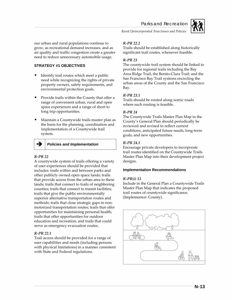
Parks and Recreation
Rural Unincorporated Area Issues and Policies
N-13
our urban and rural populations continue to grow, as recreational demand increases, and as air quality and traffic congestion create a greater need to reduce unnecessary automobile usage.
STRATEGY #1 OBJECTIVES
• Identify trail routes which meet a public need while recognizing the rights of private property owners, safety requirements, and environmental protection goals.
• Provide trails within the County that offer a range of convenient urban, rural and open space experiences and a range of short to long trip opportunities.
• Maintain a Countywide trails master plan as the basis for the planning, coordination and implementation of a Countywide trail system.
Policies and Implementation
R-PR 22 A countywide system of trails offering a variety of user experiences should be provided that includes: trails within and between parks and other publicly owned open space lands; trails that provide access from the urban area to these lands; trails that connect to trails of neighboring counties; trails that connect to transit facilities; trails that give the public environmentally superior alternative transportation routes and methods; trails that close strategic gaps in non-motorized transportation routes; trails that offer opportunities for maintaining personal health; trails that offer opportunities for outdoor education and recreation; and trails that could serve as emergency evacuation routes.
R-PR 22.1 Trail access should be provided for a range of user capabilities and needs (including persons with physical limitations) in a manner consistent with State and Federal regulations.
R-PR 22.2 Trails should be established along historically significant trail routes, whenever feasible.
R-PR 23 The countywide trail system should be linked to provide for regional trails including the Bay Area Ridge Trail, the Benito-Clara Trail; and the San Francisco Bay Trail systems encircling the urban areas of the County and the San Francisco Bay.
R-PR 23.1 Trails should be routed along scenic roads where such routing is feasible.
R-PR 24 The Countywide Trails Master Plan Map in the County’s General Plan should periodically be reviewed and revised to reflect current conditions, anticipated future needs, long-term goals, and new opportunities.
R-PR 24.1 Encourage private developers to incorporate trail routes identified on the Countywide Trails Master Plan Map into their development project designs.
Implementation Recommendations
R-PR(i) 13 Include in the General Plan a Countywide Trails Master Plan Map that indicates the proposed trail routes of countywide significance. (Implementor: County).
Parks and Recreation
Rural Unincorporated Area Issues and Policies
N-14
R-PR(i) 14 Work with interested groups (including but not limited to: affected landowner groups; trail interest groups; and organizations representing persons with disabilities) in developing recommendations for specific design and management plans. The recommendations should be consistent with County, State, and Federal design and management regulations (see Countywide Trails Master Plan - Design and Management Guidelines), and reflective of environmental and safety constraints, community needs and the needs of the various user groups. (Implementor: County).
R-PR(i) 14.1 Label historically significant trails, scenic route trails, and regional trail links as such on the Countywide Trails Master Plan Map. (Implementor: County).
R-PR(i) 14.2 Periodically, or concurrent with updating the General Plan, update the Trails Section of the General Plan. Modifications to the Countywide Trails Master Plan Map should take into account: additions to the existing trail system; acquired trail rights-of-way; and any new, proposed or modified trail alignments. Modifications to the General Plan text should take into account: long-term community needs and goals for trails; environmental constraints; and potential impacts on adjacent lands. (Implementor: County).
R-PR(i) 14.3 Monitor proposed development, including General Plan amendments and zoning changes, and/or subdivision of properties with proposed trail routes, and work with property owners and/or their representatives to preserve the integrity of the proposed trail route in their project design. (Implementors: County, Cities, MROSD, SCCOSA, SCVWD)
Strategy #2: Provide Recreation, Transportation, and Other Public Trail Needs in Balance with Environmental and Land Owner Concerns
A major purpose of trails is to provide opportunities for the public to engage in recreational activities such as walking, hiking, jogging, bicycling, and horseback riding through areas where they can experience Santa Clara County’s varied natural environments. To assure that the resources that provide the basis for these recreational experiences are available to future generations as well, it is important that recreational trails be carefully located, designed, and maintained so that their impact on the landscape and the resources they traverse is minimized.
In some instances, such as where particularly sensitive resources or habitats are involved, it may be necessary for trails to be located so that they bypass such areas or can be managed so that trail use is limited during times when recreation would interfere with resource values (e.g. seasonal closure of trails near sensitive bird nesting areas during the mating season). In other instances, such as with agricultural spraying, certain occupational uses of adjacent lands may also necessitate specific trail location criteria or temporary closure.
Of particular importance to the County and cities within it are streamside areas that are usually scenic amenities providing a pleasant environment for trails. They are also, however, important wildlife habitat areas which are relatively fragile and can be easily damaged or disrupted. As with many of the streamside park chain proposals shown in the County’s General Plan, trails near streams should receive detailed study prior to implementation. In areas with extensive residential development or in environmentally sensitive areas, it may be necessary to route trail segments away from creeks to avoid conflicts.
Whether located on public or private lands, trails are sometimes a cause of concern to adjacent property owners. Among the issues of
Parks and Recreation Rural Unincorporated Area Issues and Policies
N-15
concern to land owners are litter, trespass, vandalism, security, fire, and liability. Many of these concerns are addressed at the detailed phase of planning and design. Therefore, the property owner’s concern extends to how the trail alignment, design, operations, and management come about. The desire to be an active participant in the design and management planning of a trail route is a keen one. After all, the property owner whose land is crossed by or is adjacent to a public trail experiences the results of the trails on a day-to-day basis.
STRATEGY #2 OBJECTIVE
• Ensure that trails planning accommodates public recreation and other needs while recognizing the rights of private property owners, the need for safety and the requiements of environmental protection.
Policies and Implementation
R-PR 25 Trail routes shall be located, designed and developed with sensitivity to their potential environmental, recreational, and other impacts on adjacent lands and private property.
R-PR 26 As provided for in the Resource Conservation Chapter, trails shall be located to recognize the resources and hazards of the areas they traverse, and to be protective of sensitive habitat areas such as wetlands and riparian corridors and other areas where sensitive species may be adversely affected.
R-PR 27 Trail Routes or Regional Staging Areas shown on the Countywide Trails Master Plan Map in areas currently designated on the County General Plan Land Use Map as Agriculture shall not be required (including easements) or developed outside of County road rights-of-way until or unless: 1. the land use designation is amended to a
non-Agriculture designation, or
2. there is specific interest or consent expressed by a willing property owner/seller.
Where there is a specific interest or consent expressed by a willing property owner/seller, trails in areas with prime agricultural lands shall be developed in a manner that avoids any significant impact to the agricultural productivity of those lands.
R-PR 28 Trail Routes or Regional Staging Areas shown on the Countywide Trails Master Plan Map in areas currently designated as Ranchland on the County General Plan Land Use Map and actively used for ranching or other agricultural purposes shall not be required (including easements) or developed outside of County road rights-of-way until or unless: 1. The County is notified of a non-renewal of
Williamson Act contract affecting the land on which the trail route or regional staging area would be located;
2. such time as the active ranching and/or agricultural use has been permanently abandoned;
3. the land use designation is amended to a non-ranchland designation, or
4. there is specific interest or consent expressed by a willing property owner/seller.
R-PR 28.1 Trail Routes or Regional Staging Areas shown on the Countywide Trails Master Plan Map in areas currently designated as Hillside on the County General Plan Land Use Map and actively used for ranching or other agricultural purposes shall not be required (including easements) or developed outside of County road rights-of-way until or unless: 1. the County is notified of a non-renewal of
Williamson Act contract affecting the land on which the trail route or regional staging area would be located;
2. such time as active ranching and/or agricultural use has been permanently abandoned; or,
3. there is specific interest or consent expressed by a willing property owner / seller.

Parks and Recreation
Rural Unincorporated Area Issues and Policies
N-16
Implementation Recommendations
R-PR(i) 15 During trail design, notify and coordinate with affected landowners to incorporate measures into trail design and related management policies to accommodate the privacy, security and liability concerns of the landowner. Such measures could include, but are not limited to: fencing or barrier planting that discourages trespassing; signage; scheduling of maintenance; patrol scheduling; and indemnity agreements to protect the landowner and affected landowners from liability for injuries to trail users. (Implementors: County, Cities, MROSD, SCCOSA).
R-PR(i) 15.1 Prior to developing any new trail route for public use, prepare design and management plans that ensure provision of services necessary to provide for the safety and support of trail users and affected landowners, and respond to the unique safety and use concerns associated with highway safety, traffic operations, public transit, and businesses such as quality water source development, intensive agriculture, grazing, mining, railroads, and defense research and testing industries. (see Countywide Trails Master Plan - Design and Management Guidelines). (Implementors: County, Cities, MROSD, SCCOSA).
R-PR(i) 15.2 Develop design guidelines to ensure that new trails meet established safety standards and minimize user conflicts. (see Countywide Trails Master Plan - Design and Management Guidelines). Prior to developing new trail routes for public use, ensure that services and improve
improvements necessary for the safety and support of the public using the trail are provided. Such services and improvements should contain, at a minimum, adequate parking, potable water supply and sanitary facilities, and emergency telephones and access. Reasonable police and fire protection shall be available. (Implementors: County, Cities, MROSD, SCCOSA, SCVWD).
R-PR(i) 15.3 Develop design guidelines that ensure sensitive species and the habitats they rely on shall be protected, and where possible enhanced, by trail development and trail use (see Countywide Trails Master Plan - Design and Management Guidelines). (Implementor: County).
R-PR(i) 15.4 Provide a footnote on the Countywide Trails Master Plan Map that repeats the above policies relating to areas currently designated as Agriculture, Ranchland, r Hillside on the County General Plan Land Use Map. (Implementor: County).
Strategy #3: Implement the Planned Trails Network
SUCCESS BASED ON PERSEVERANCE
The Los Gatos Creek Trail has taken more than 25 years to develop to its current state extending nearly all the way from Lexington Reservoir to the Willow Glen area of San Jose. It is one of the most popular and heavily-used trails for both recreation and transportation in Santa Clara County. Its very existence is the result of foresight, hard work, and perseverance over a long period of time by local government officials, parks and planning commissioners, agency staff, property owners and dedicated citizens who have had the vision to see the benefits of completing such a trail and have devoted their energies to seeing it accomplished.
Most of the trails in the proposed countywide network of trails are not planned to reach the level of use or popularity that the Los Gatos Creek Trail currently enjoys, but each trail route
Parks and Recreation Rural Unincorporated Area Issues and Policies
N-17
is still important for the functions it performs in its particular location. And each trail will be completed only if local government officials make the decisions necessary to transform these trail proposals from lines on plan maps to tangible, usable trails in the community.
USE OF MULTIPLE IMPLEMENTATION TOOLS
Implementation of the planned trail network will require the use of a variety of tools for acquisition, development, operations and maintenance. For example, some of the tools for obtaining trail routes include: • construction of trails on existing public
lands, possibly involving joint use agreements with public agencies other than parks and open space agencies (e.g. flood control agencies, highway departments, school districts, etc.);
• purchase of additional lands or trail easements;
• obtaining gifts of trail easements from property owners;
• requesting dedication of trail easements as development occurs along proposed trail routes;
• development fees or assessment districts; • use of volunteer efforts, non-profit
organizations, and land trusts; and • other innovative means for preserving and
implementing proposed trail alignments.
Which of these tools is most appropriate in a particular situation will necessarily depend upon the special circumstances of that situation.
STRATEGY #3 OBJECTIVE
• Successfully implement the trails plan in a manner that reflects current and future opulation patterns and the recreation and other needs of County residents.
Policies and Implementation
R-PR 29 The proposed countywide trail network should be implemented using a variety of methods that take advantage of acceptable implementation opportunities as they arise.
R-PR 29.1 The County shall coordinate with landowners whose property may be affected by proposed trails identified on the Countywide Trails Master Plan Map to include the landowner’s interests and concerns related to trail implementation when detail design and management plans are prepared.
R-PR 30 Trail routes shown on the Countywide Trails Master Plan Map that cross privately-owned lands shown as Agriculture, Ranchland or Hillside on the General Plan Land Use Map will only be acquired from a willing property owner/seller.
R-PR 30.1 Information shall be made available to landowners from whom trail easement dedications may be required or requested concerning laws that limit landowner liability.
R-PR 30.2 The County shall support amending state legislation that limits the liability of landowners immediately adjoining public trails for injuries to trail users to include language that defines entry for a recreation purpose to include any entry upon property from a public trail designated in a City or County General Plan. The text of the existing state law protecting property owners from liability to recreational users of private property is included in the appendix to the Santa Clara County Trails Master Plan Update. (Implementor: County).
R-PR 30.3 In coordination with the County Parks and Recreation Department, cities, public entities, organizations, and private citizens should be encouraged to implement the trails plan where practical and feasible.
Parks and Recreation
Rural Unincorporated Area Issues and Policies
N-18
R-PR 30.4 Development projects proposed on lands that include a trail as shown on the Countywide Trails Master Plan Map may be required to dedicate and/or improve such trail to the extent there is a nexus between the impacts of the proposed development and the dedication/ improvement requirement. The dedication/ improvement requirement shall be roughly proportional to the impacts of the proposed development. (Board of Supervisors Trail Easement Dedication Policies and Practices, Jan. 1992)
R-PR 31 Annexation of lands that include trails shown on the Countywide Trails Master Plan Map shall be conditioned on the annexing jurisdiction’s adoption of relevant County trail plans and implementation of regional trail routes.
R-PR 31.1 Trails shall be considered as development projects when on private land.
Implementation Recommendations
R-PR(i) 16 Prepare implementation plans indicating the proposed methods to be used to obtain, develop, operate, and maintain individual trail routes or trail segments. Revise these plans, as needed, to respond to new opportunities that may arise. (Implementors: County, Cities, MROSD, SCCOSA).
R-PR(i) 16.1 As a high priority, establish an evenly-balanced review committee, reasonably representative of the cultural diversity of the community, composed of property owners and trail interests, appointed by the Board of Supervisors to work with County staff to analyze the feasibility and acceptability of specific methods available to fund trail acquisition, development, operations, and maintenance including but not limited to the following: 1. user fees for recreational services including
equipment rentals, parking and use of facilities (e.g. picnic areas, etc.);
2. gasoline, hotel or other tax increment for trail implementation;
3. Landscaping and Lighting Act assessment district financing;
4. development fee and/or dedication requirements based on the impact of proposed new development on trail needs;
5. encouraging and accepting gifts; and 6. creating incentives for trail dedication and
improvement through density bonuses and transfer of development credits.
(Implementor: County).
R-PR(i) 16.2 Take all steps necessary to implement acceptable funding methods approved by the Board of Supervisors (e.g. completion of studies pursuant to Government Code section 66000), development and adoption of ordinance(s), surveys, and elections, as necessary. (Implementors: County, Cities, MROSD, SCCOSA).
R-PR(i) 16.3 Notify landowners in unincorporated County areas whose property may be affected by a proposed trail route identified as “high priority” on the Countywide Trails Master Plan Map. Said landowners shall be informed of the process to be used in determining whether to proceed with acquisition, and consulted to determine their interests and concerns related to the proposed trail. If the County determines, based on its evaluation of trail needs and acquisition priorities, available funding, and other factors, that it wishes to purchase land along a proposed trail route, the County shall notify the affected landowners and initiate a dialogue regarding the County’s proposed acquisition. (Implementor: County).
R-PR(i) 16.4 Indemnify all grantors of trail easements and other owners of lands immediately adjoining County trails from liability for injuries suffered by users of the adjoining trails. The indemnity shall not apply to injuries caused by a landowner’s willful or malicious conduct. The indemnity shall include the costs of defending the landowner against all liability claims brought by users of County trails as well as the costs of damage awards and other costs associated with such claims. (Implementor: County).
Parks and Recreation Rural Unincorporated Area Issues and Policies
N-19
R-PR(i) 16.5 Provide funding and technical assistance for the completion of studies pursuant to Government Code section 66000, surveys, engineering reports, ordinances and other technical efforts that are prerequisites to trail funding mechanisms. (Implementors: County, Cities, MROSD, SCCOSA).
R-PR(i) 16.6 Establish “Friends of the Santa Clara County Trails Plan” (Friends), comprising a balance of property rights advocates and supporters of trails, to assist the County Parks and Recreation Department in implementing the trails plan. Programs the Friends would have responsibility for could include, but not be limited to: 1. a corporate endowment fund; 2. an “adopt-a trail” program; 3. educational programs; 4. other fund-raising activities; 5. promoting bond issues to fund acquisition; 6. providing information and technical
services to neighborhoods along trail routes; 7. trail maintenance, construction and patrol
activities; and 8. utilization of volunteer trail patrol. (Implementor: County).
R-PR(i) 16.7 Condition the development of new trails for public use on the availability of adequate resources in conformance with adopted trail management guidelines (see Countywide Trails Master Plan - Design and Management Guidelines). (Implementor: County).
R-PR(i) 16.8 Accept and require, to the extent necessary to mitigate the impacts of the proposed development, trail and pathway easements, right-of-way dedications and/or improvements as part of land development approvals in areas planned for inclusion in the countywide trail system of the General Plan. (Implementors: County, Cities).
R-PR(i) 16.9 Negotiate conditions in annexation agreements to assure the implementation and maintenance of regional trail routes. (Implementors: County, Cities, LAFCO).
R-PR(i) 17 Review proposed trails for their potential environmental impacts in accordance with the California Environmental Quality Act. (Implementor: County).
R-PR(i) 17.1 Prior to trail development, ensure that all regulations and guidelines applicable to trails have been met, including noticing requirements as set forth in the Countywide Trails Master Plan - Trail Design and Management Guidelines. (Implementor: County).
R-PR(i) 17.2 Decisions made by the County Parks and Recreation Department concerning trail outes and regional staging areas may be appealed to the Board of Supervisors. (Implementor: County).
Strategy #4: Adequately Operate and Maintain Trails
EFFICIENCY, EFFECTIVENESS, SAFETY AND SECURITY
Trails, when managed and used properly, become an amenity. However, it may take only one example of failure to jeopardize public support for trails. One aspect of a trail system that is often not discussed because it represents ongoing and real costs, but is every bit as important as siting and design to the trail user, property owner, and surrounding community, is the trail’s operations and maintenance. A well-maintained trail encourages use which, in turn, discourages misuse. Many of the fears of nearby residents and potential trail users about trails are alleviated with staff presence and care.
INVOLVING VOLUNTEERS
As the trail network grows and as public trail use increases, the challenge of patrolling and maintaining these trails will also increase, perhaps faster than the resources of the public parks and open space agencies responsible for them. To help assure that trails remain usable and safe, public agencies may need to rely more
Parks and Recreation
Rural Unincorporated Area Issues and Policies
N-20
on individual volunteers as well as nonprofit organizations (including trail user groups) for assistance in building and maintaining trails.
STRATEGY #4 OBJECTIVE
• Operate and maintain trails so that user safety, resource conditions, and adjacent land uses are not compromised.
Policies and Implementation
R-PR 32 Trails shall be temporarily closed when conditions become unsafe or environmental resources are severely impacted. Such conditions could include soil erosion, flooding, fire hazard, environmental damage, or failure to follow the specific trail management plan (see Countywide Trails Master Plan - Design and Management Guidelines).
R-PR 32.1 Levels-of-use and types-of-use on trails shall be controlled to avoid unsafe use conditions or severe environmental degradation.
R-PR 32.2 The County Parks and Recreation Department shall provide adequate ongoing maintenance of its trail system.
R-PR 32.3 Neighborhood volunteers and other groups should be encouraged to provide trail support services ranging from “trail watch” and clean up activities to annual maintenance and construction.
R-PR 33 Use of motorized vehicles on trails shall be prohibited, except for wheelchairs, maintenance, and emergency vehicles.
R-PR 34 All trails should be marked. Signed information should be provided to encourage responsible trail use. Appropriate markers should be established along historically significant trail routes.
R-PR 34.1 Maps and trail guides should be made available to the public to increase awareness of existing public trails.
Implementation Recommendations
R-PR(i) 18 Develop a monitoring program for use by the lead agency in evaluating current conditions and determining whether or not new trails or trail management programs, including maintenance, reconstruction, education and use regulations, are effective in addressing user conflicts, safety issues and environmental impacts; and recommending changes if necessary. (Implementors: County, Cities, MROSD, SCCOSA).
R-PR(i) 18.1 Based upon trail monitoring, develop guidelines for procedures to temporarily close trails and implement steps necessary to correct problems requiring closure. (Implementors: County, Cities, MROSD, SCCOSA, SCVWD).
R-PR(i) 18.2 Assign responsibility for the maintenance of County-owned trails to the County Parks and Recreation Department unless other trail managing organizations agree to assume the responsibility for maintenance consistent with County policies and guidelines. (Implementors: County, Cities, MROSD, SCCOSA, Transportation Agency, SCVWD).
R-PR(i) 18.3 Condition the authorization of County funds to Cities for implementing trails shown on the Countywide Trails Master Plan Map on their ability to operate and maintain the trail based on applicable County policies and guidelines (see Countywide Trails Master Plan - Design and Management Guidelines). (Implementors: County, Transportation Agency).
R-PR(i) 18.4 Provide information and technical services to neighborhoods surrounding trails on how to establish adopt-a-trail groups. (Implementors: County, Cities, MROSD, SCCOSA, SCVWD, CDRP, SFBNWR, non-profit organizations).
Parks and Recreation Rural Unincorporated Area Issues and Policies
N-21
R-PR(i) 18.5 Design trail access points to ensure that off-road motorized vehicles do not use trails except for maintenance and emergency purposes or wheelchair access. (Implementor: County).
R-PR(i) 18.6 Develop trail design criteria that discourage inappropriate use of trails. (see Countywide Trails Master Plan - Design and Management Guidelines). (Implementor: County).
R-PR(i) 18.7 Clearly sign trails. Provide trail users with information regarding property rights in order to minimize public/private use conflicts and trespassing. (Implementors: County, MROSD, SCCOSA, CDRP, SFBNWR, non-profit organizations).
R-PR(i) 18.8 Publish and periodically update maps and guides to exsting public trails and pathways. (Implementors: County, Cities, MROSD, SCCOSA, CDRP, SFBNWR, non-profit organizations).
Strategy #5: Establish Priorities
A LONG TERM PROCESS
Realization of a countywide trail network and the individual trails within it is a challenging, lengthy, and delicate process that will take many years to accomplish. In many instances, it will quite literally be a gift that one generation provides to the next.
Developing a trail network is like putting together a jig-saw puzzle — it must be accomplished one piece at a time as opportunities arise. No government agency currently has or is ever likely to have in the near term all the money that might be required to go out and purchase all the land and/or easements needed to implement all of a major trail. Consequently, the implementation of countywide trails will have to continue to take place over a long period of time, using a variety
of processes, on a case-by-case basis, as opportunities arise and resources are available.
SHORT-TERM HORIZONS
Regardless of how long it takes to see a trail idea become a reality, the value of completing a pre-defined, specific goal in the short term by creating a new trail that becomes a useful and viable part of the community is considerable. One success story only builds momentum for the next. Given limited discretionary funds for public trails, focused priorities help to use those funds wisely.
STRATEGY #5 OBJECTIVE
Prioritize trals for acquisition and development in a manner that provides the maximum benefit given the available public and private resources.
Policies and Implementation
R-PR 35 Trail routes shown on the Countywide Trails Master Plan Map should be prioritized. (see Trail Priorities).
R-PR 35.1 Criteria used to prioritize trail routes shall include: need for trail uses; compatibility of the trail route with adjoining property; trail usefulness; complexity of land acquisition; opportunities for a large number of users; safety concerns; financial considerations; need for trail settings; and opportunities for a sense of remoteness.
Implementation Recommendations
R-PR(i) 19 Maintain a list of prioities for trail acquisition and development through purchase, dedication or other means. (Implementors: County, Cities, MROSD, SCCOSA).
Parks and Recreation
Rural Unincorporated Area Issues and Policies
N-22
Strategy #6: Facilitate Inter-Jurisdictional Coordination
Implementation of the countywide system of trails will require substantial effort and cooperation among the fifteen cities, the County, and various other agencies. Most of the proposed trails pass through several jurisdictions. Within the urban area, most of the proposed trails run alongside major streams, thus making the Santa Clara Valley Water District an important agency in the implementation of these trails.
Examples of successful inter-jurisdictional cooperation in the provision of recreational trails within the urban area already exist. Along Los Gatos Creek, for example, the cities of Los Gatos, Campbell, and San Jose, the County, the Santa Clara Valley Water District, and local school districts have worked together to create several miles of continuous hiking and bicycling trails linking parks and recreation areas along the way.
An important first step toward further implementation of a countywide trail system would be for the cities and other appropriate jurisdictions to incorporate the proposed trail system into their local plans, if they have not already done so. A next step would be for these jurisdictions to establish coordinating committees to work out the details for implementing particular segments of the countywide trail system. The way the Los Gatos Creek Trail has been implemented over the past few years provides a good model of how such cooperation and coordination of effort can be accomplished.
STRATEGY OBJECTIVE
• Coordinate trails planning within the County as well as with adjacent jurisdictions.
Policies and Implementation
R-PR 35.2 Trail planning, acquisition, development, and management of trail routes shown on the Countywide Trails Master Plan Map should be coordinated among the various local, regional, state and federal agencies which provide trails or funding for trails.
R-PR 35.3 Trail acquisition responsibilities should be established on a project-by-project basis, and should be coordinated with all jurisdictions involved in each trail route.
R-PR 35.4 Public improvement projects, such as road widenings, bridge construction, and flood control projects, that may impact existing or proposed trails should be designed to facilitate provision of shared use.
Implementation Recommendations
R-PR(i) 20 Establish a Countywide Trails Technical Staff Group overseen by the County Parks and Recreation Department, with representation from participating county, city, special districts, and other agencies, for the purpose of coordinating the implementation of the County’s trails plan and policies in a manner that is compatible with each participating jurisdiction’s needs and desires and is reflective of the guidelines for implementing the countywide trail system. (see Countywide Trails Master Plan - Design and Management Guidelines). Among other duties, the Staff Group should be charged with the following: 1. establishment of consistent trail designs that
benefit the user and affected properties; 2. coordination of specific trail routes’ siting
and design; 3. recommendations to appropriate agencies
for creation of joint powers agreements for the acquisition, development and maintenance of specific trail routes;
Parks and Recreation Rural Unincorporated Area Issues and Policies
N-23
4. development of implementation and management plans for inter-jurisdictional trail routes; and
5. prioritization of trail routes for funding purposes.
(Implementors: County, Cities, MROSD, SCCOSA, Transportation Agency, SCVWD, CDRP, CDF).
R-PR(i) 20.1 Develop agreements for funding, interagency planning, acquisition, development and maintenance of countywide trails and trail segments with cities where the City has adopted relevant provisions of the Countywide Trails Master Plan and commits to implement and maintain a priority trail route. (Implementors: County, Cities, MROSD, SCCOSA, Transportation Agency, SCVWD).
R-PR(i) 20.2 Organize periodic meetings with adjacent cities and counties to coordinate the completion and management of regional trails which extend beyond County lines. (Implementors: County, Cities, MROSD, SCCOSA, SFBNWR)
R-PR(i) 20.3 Encourage the adoption of appropriate portions of the Countywide Trails Master Plan Map of the County’s General Plan as part of local general plans, parks and open space master plans, and public facilities plans. (Implementors: County, Cities, MROSD, SCCOSA, Transportation Agency, SCVWD, LAFCO).
R-PR(i) 20.4 As additional public open space is acquired in the County, work with the appropriate entities to determine whether additional regional trail routes within the open space acquired should be identified on the Countywide Trails Master Plan Map as proposed trail routes. Propose amendments to the Countywide Trails Master Plan Map accordingly. (Implementors: County, Cities, MROSD, SCCOSA, SCVWD)
Note: The Trails & Pathways Section of the Parks & Recreation Chapter of the General Plan, Book B for Rural Unincorporated Area Issues & Policies was amended November 14, 1995, to supersede the previous section in its entirety. {File 6095-00--00-95GP}
Parks and Recreation
Rural Unincorporated Area Issues and Policies
N-24
Scenic Highways
Background
THE FUNCTIONS OF SCENIC HIGHWAYS
The scenic roads of Santa Clara County serve a variety of purposes of fundamental importance:
• Some of them provide access from the urban area to parks and public open space lands in the foothills and mountains, and thus contribute to the quality of the recreation experience of urban dwellers seeking escape to the beauty and tranquility of the county’s natural areas.
• Some serve as major transportation corridors into the county and thus give travelers and tourists entering the county their first impression of the county.
• Some are major commute routes and thus provide scenic relief to harried commuters.
• Others are minor roads that serve as the access to rural areas and are part of the landscape enjoyed by rural residents.
OVERVIEW OF SCENIC HIGHWAYS IN THE COUNTY
Santa Clara County has long been a leader in the establishment of scenic highway systems in California and has officially recognized the scenic and recreational values of the county’s roads in previous elements of the General Plan. As long ago as 1939, the County established scenic setbacks and enacted development regulations and architectural review procedures to protect the scenic character of the landscape along the county’s highways. In the 1960s, the County was a leader in a four-county effort to try to establish the Skyline Scenic Recreation Route in the Santa Cruz Mountains from San Francisco to Monterey County.
The County’s General Plan considers scenic highways to be important links in the county’s recreation and transportation systems and proposes three basic strategies to protect and enhance them, ranging from designation, to protection, to development of complimentary facilities. The process of establishing scenic highways generally involves two basic steps: a. designating the highway as scenic; and b. applying appropriate controls to assure the
protection of scenic resources along the designated route.
In some instances, a third step of developing complimentary recreation facilities (e.g. rest stops, turnouts at scenic vistas, etc.) may also be involved. The sequence in which the first two steps are taken may vary, depending upon whether a local or a state highway is involved.
Strategies, Policies and Implementation
Strategy #1: Designate Scenic Highways
The scenic highway system addressed in this Plan includes County-designated scenic highways and State-designated scenic highways. It does not include the many urban roads designated as scenic by individual cities.
ELEMENTS OF THE SANTA CLARA COUNTY SCENIC ROAD SYSTEM
The Scenic Road System of Santa Clara County includes three basic classifications: • state scenic routes within the county (which
includes all state highways currently designated by the state as scenic highways or proposed for such designation);
• county scenic routes, which includes scenic freeways (those not proposed for state scenic highway designation) and expressways, scenic arterial routes, and scenic rural roads; and
• local roads requiring scenic protection.
Parks and Recreation Rural Unincorporated Area Issues and Policies
N-25
DESIGNATING SCENIC HIGHWAYS
State scenic highways are officially designated in a two part process, requiring action by both the State and the local jurisdiction. First, the state highway must be placed on the “California Master Plan of State Highways Eligible for Official Scenic Highway Designation” by the State Legislature, an action usually initiated locally. Then it must be designated a state scenic highway by CalTrans, following a CalTrans study to evaluating the geographic extent of the scenic corridor that should be protected and the adequacy of the local jurisdiction’s scenic highway protection program.
[See sidebars for more complete descriptions of state scenic highway designation process and the current status of highways proposed for state scenic highway designation.]
County designation of local scenic highways, particularly in rural unincorporated areas, is generally a much simpler process, since it involves only action by the County to designate it on its scenic highways plan map. (County designated routes may be included in the State system, even though they are not state highways.) Designation of scenic highways passing through urban areas is somewhat more complex since it may also require designation by various cities as well.
The State Scenic Highway Designation Process
Step 1: Placing a Nomination on the State Master Plan List
Establishing an officially-designated state scenic highway is a two part process. First, the state highway must be placed on the “California Master Plan of State Highways Eligible for Official Scenic Highway Designation” by the State Legislature. This is usually initiated by local action in cooperation with local members of the State Legislature. State scenic highways are intended to be “complete highways”: • safe for rapidly moving traffic, • designed to fit the landscape, and • provided with appropriate vista points,
turnouts, and rest facilities. Land use is to be planned and controlled within an officially recognized scenic corridor. The “corridor” is simply the land area which can be seen from the road. Step 2: Enacting Local Protections In the second step, the local jurisdiction establishes the boundaries of the scenic highway corridor and prepares a local protection program. This protection program is subject to CalTrans review and approval. CalTrans then evaluates the adequacy of the local scenic highway protection program and makes a determination regarding official designation.
A road in the State Master Plan is officially designated as a scenic route only after it has been determined that the road and the right-of way meet the state’s “scenic highway standards” and that the scenic corridor of the road has been given adequate protection for the preservation of its scenic resources. Bringing the roads up to the scenic highway standards is the responsibility of the State; providing corridor protection is up to local governments. For its part, the local jurisdiction must develop a plan and implementation program for the protection of the scenic corridor. State law requires that the locally-adopted “scenic highway protection program” include, at a minimum, the following: • regulations governing land use and
density of development; • procedures for detailed land and site
planning; • controls over outdoor advertising,
including prohibition of off-site signs; • regulations governing earthmoving and
landscaping; and • procedures and regulations relating to the
design and appearance of structures and equipment.
Parks and Recreation
Rural Unincorporated Area Issues and Policies
N-26
Policies and Implementation
R-PR 36 Local and state roads and highways traversing Santa Clara County’s scenic rural and urban areas should be designated and protected as local or state scenic highways.
R-PR 37 A system of scenic roads should be designated linking the urban area with the rural and open space areas, with careful consideration of fire risk, hazards, and protection of natural resources.
R-PR 38 The County’s scenic highways plan should be reviewed and revised periodically.
Implementation Recommendations
R-PR(i) 21 Designate, as official scenic highways, all Santa Clara County roads shown in the “California Master Plan of Scenic Highways Eligible for Official Scenic Highway Designation”. (Implementor: State Legislature)
R-PR(i) 22 Add the following highways to the State Master Plan for Scenic Highways and designate them as official State scenic highways: a. the South Valley Freeway (Highway 101); b. Hecker Pass Highway (Highway 152); c. Highway 17 from Los Gatos to Campbell; d. Freeway 680; and e. the portion of Freeway 280 between
Highway 17/880 and Highway 101. (Implementors: State Legislature, CalTrans)
R-PR(i) 23 Designate as scenic highways in the County’s General Plan those roads warranting scenic highway status. (Implementors: County)
R-PR(i) 24 Seek city scenic highway designations for those freeways and expressways designated in the County’s General Plan as scenic highways. (Implementors: County, cities)
Strategy #2: Protect Scenic Highway Corridors
Although designation of scenic highways may, in some cases, involve both local jurisdictions and the State, the responsibility for protecting scenic highways once they are designated lies exclusively with the local jurisdictions that have the authority to control land use along these scenic highways.
Local ordinances to protect scenic highways generally include a combination of: controls over signs and billboards (including prohibition of off-site signs), setbacks of development from the highway, and review and conditioning of the design of proposed development to assure compatibility.
Policies and Implementation
R-PR 39 The natural scenery which exists along many of Santa Clara County’s highways should be protected from land uses and other activities which would diminish its aesthetic qualities.
R-PR 40 Land use should be controlled along scenic roads so as to relate to the location and functions of these roads and should be subject to design review and conditions to assure the scenic quality of the corridor.
R-PR 41 The visual integrity of the scenic gateways to the South County (Pacheco Pass, Hecker Pass, Route 101 south of Gilroy, and a Coyote greenbelt area north of Morgan Hill) should be protected.
R-PR 42 The Skyline Scenic Recreation Route should be completed in accordance with the recommendations of the four-county Joint Powers Committee, including development of a riding and hiking trail system along the route, and acquisition of a 100-foot right-of-way for the unpaved section of the route from Loma Prieta Road to Mount Madonna Park.
Parks and Recreation Rural Unincorporated Area Issues and Policies
N-27
R-PR 43 Signs should be strictly regulated, with off-site signs and billboards prohibited along scenic routes.
R-PR 44 Access and commercial development along scenic expressways should be limited to prevent strip commercial development.
R-PR 45 New structures should be located where they will not have a negative impact on the scenic quality of the area, and in rural areas they should generally be set back at least 100 feet
from scenic roads and highways to minimize their visual impact.
R-PR 46 Landscaping with drought-resistant native plants should be encouraged adjacent to scenic roads and highways.
R-PR 47 Activities along scenic highways that are of a substantially unsightly nature, such as equipment storage or maintenance, fuel tanks, refuse storage or processing and service yards, should be screened from view.
Scenic Highway Designations in the County’s General Plan
The Santa Clara County Scenic Road System The Scenic Road System of Santa Clara County consists of all present and proposed state scenic routes within the county and county scenic routes. County scenic routes include scenic freeways and expressways, scenic arterial routes, and scenic rural roads. In addition to the scenic road system, local roads requiring scenic protection are included. Freeways and expressways have been included in the County Scenic Road System to give recognition to several outstanding examples of urban road design, and to promote the protection of scenic surroundings of notable urban and rural routes. The expressways and freeways included in the County Scenic Road System are situated in scenic areas, have had careful landscaping treatment which enhances their scenic value, or they are combined with existing or planned linear parks. Scenic arterial routes form the foundation of the County Scenic Road System. They afford the motorist beautiful vistas from good quality roads which are planned to provide appropriate public facilities for both the enjoyment of the scenery and the comfort of the driving public. For the most part these are not individual roads but groups of interconnecting roads which allow continuous movement through significant portions of the county. Many connect with the state scenic routes. And along with such state routes as Skyline and Hecker Pass Highway, the scenic arterials offer the best combinations of scenic
beauty, environmental variety, road quality and planned public facilities that the county can offer. Scenic rural roads include a great variety of settings, road conditions, and local circumstances. In scenic quality many of these roads fully equal the scenic arterial routes and the state scenic highways, but each road has a flaw. Some are dead-end roads, some have no present public facilities or public points of access off the road itself, some fail to connect with other scenic roads, several are extremely narrow, some follow dangerously tortuous paths, and some have substandard paving conditions. Many of the roads connect to the scenic arterial routes and offer pleasant side trips. As road conditions are improved and as the regional parks plan is implemented, some of the roads may be reclassified as scenic arterial routes. Other Local Scenic Roads In addition to the scenic roads and routes above, Santa Clara County has a number of very scenic local roads for which there are no park plans or other plans for public facilities. Road conditions for these local roads range from good to very poor. Many are dead-end roads intended only to serve those living along the sides of the roads. These roads are included in this plan in recognition of their scenic aspects and the need for protection of their scenic setting. All local roads included in this report have already been given scenic zoning or have previously been identified as scenic routes in elements of the General Plan.
Parks and Recreation
Rural Unincorporated Area Issues and Policies
N-28
Implementation Recommendations
R-PR(i) 25 Apply appropriate land use and sign controls to lands adjacent to scenic highways to protect the visual integrity of the scenic corridor. (Implementors: County, cities)
Strategy #3: Develop Complimentary Recreation Facilities
The enjoyment of scenic highways, particularly in rural areas, can be enhanced by the provision of public facilities that enable motorists to stop and rest, enjoy the views available from scenic vista points, and possibly even picnic in a scenic setting. These facilities can often be planned and developed in conjunction with public parks and open space lands adjacent to scenic roads.
Policies and Implementation
R-PR 48 County parks and other publicly owned open space lands along scenic routes should be designed to provide view sites, turnouts, rest stops, picnic grounds, and other facilities oriented toward users of the scenic roads.
R-PR 49 Further improvements to scenic roads should emphasize driving safety and parking for trailheads and rest stops, while minimizing alterations of the landscape.
R-PR 50 Litter collection facilities should be provided and maintained at turnouts and view sites along scenic routes.
R-PR 51 Hiking, bicycling, and horseback riding trails should be provided along scenic roads where they can be provided safely and without significant adverse environmental impacts. Bicycling facilities should be provided by edge marked shoulders and improved surfaces on paths.
R-PR 52 Scenic routes which are historic routes into or through the county should be so designated and historic sites and features along them identified and enhanced where appropriate.
Implementation Recommendations
R-PR(i) 26 Consider the development of recreation facilities to serve the needs of motorists on adjacent scenic roads when preparing master plans for individual parks and public open space lands. (Implementors: County, Midpeninsula Regional Open Space District, State Parks Department)
R-PR(i) 27 Include the development of facilities (such as rest stops, vista points, etc.) to serve the needs of motorists when preparing master plans for major widenings or realignments of existing state scenic highways and state highways in the Master Plan of State Highways Eligible for Official Scenic Highway Designation. (Implementors: CalTrans)
Parks and Recreation Rural Unincorporated Area Issues and Policies
N-29
Current Status of Proposed State Scenic Highways in Santa Clara County
Categories of Existing and Proposed State Scenic Highways Existing and proposed state scenic highways in Santa Clara County may be grouped into three categories:
• state highways that have been officially designated as State Scenic Highways;
• state highways that have been included in the “California Master Plan of State Highways Eligible for Official Scenic Highway Designation”, but have not yet been officially designated as state scenic highways; and
• state highways that are proposed by the County to become state scenic highways but have not yet been added to the California Master Plan of State Highways Eligible for Official Scenic Highway Designation” and thus are not yet eligible to be designated as state scenic highways.
Existing State Scenic Highways Only two routes in Santa Clara County have been officially designated as State Scenic Routes: 1. Route 35, the Skyline Scenic Recreation
Route, northern end Skyline Boulevard, State Route 35, is one of the most important scenic highways in the State system, and in past years received the greatest amount of attention among the scenic routes in Santa Clara County. Skyline Boulevard is part of a great scenic route which now follows the crest of the Santa Cruz Mountains from Highway 17 in Santa Clara County to San Francisco, and which could one day be extended to the south to connect with Hecker Pass Highway at Mount Madonna County Park. State corridor studies have been completed in the county from Highway 17 north. The northernmost portion in Santa Clara County (i.e. from the Santa Cruz-San Mateo County boundaries to the Santa Clara-San Mateo County boundary has been officially designated as a state scenic route (as has the remainder of the route in San Mateo County north to Highway 92).
2. Route 9, Congress Springs Road and Los
Gatos-Saratoga Road State Route 9 runs from Los Gatos to Saratoga, then turns into the Santa Cruz Mountains under the name of Congress Springs Road, and winds its way up to Skyline Boulevard. All of Route 9 is in the State Master Plan. All of Route 9 within Santa Clara County has been given recognition as a scenic road, as well as official designation as a State Scenic Route. A four-foot wide bicycle lane has been built along the uphill side of Congress Springs Road.
Highways on State Master Plan, But Not Yet Designated as State Scenic Highways Five additional routes in Santa Clara County are now in the State’s Master Plan, but have not been officially designated as State Scenic Routes: 1. Route 17, from Los Gatos to the Santa
Cruz County Line Highway 17 is both a scenic route and a very heavily traveled portion of the State Highway system. Unlike Skyline or Route 9, Highway 17 does not offer the motorist a road for recreational driving. Highway 17 provides an unusually dramatic approach to the urban portion of the Bay Area. It connects with the Skyline Scenic Recreation Route, passes Lexington Reservoir, and links the Bay Area with the recreational areas of the Santa Cruz County Coast. Official designation of the route awaits action by the State.
2. Route 152, the Pacheco Pass Highway This busy highway is one of the most dramatically scenic gateways into Santa Clara County. The County is currently actively seeking official State designation of this road as a state scenic highway.
3. Route 156, Hollister Road A short segment of Route 156 is within Santa Clara County. This scenic route runs from its intersection with Pacheco Pass Highway south into San Benito County and Hollister.
(Cont'd. on next page)
Parks and Recreation
Rural Unincorporated Area Issues and Policies
N-30
(Cont'd. from previous page) 4. Route 280, Junipero Serra Freeway
The portion of Route 280 from San Francisco to its intersection with Highway 17 in San Jose is in the State Master Plan, but none of it is officially designated as a scenic route. Route 280 is one of the nation’s most beautiful freeways, and clearly deserves the protection afforded by scenic designation. The design of Route 280 established a precedent for state freeways, particularly in introducing new concepts in bridge design and in sensitivity to the landscape.
5. Route 35, the Skyline Scenic Recreation Route, southern end As indicated above, Skyline Boulevard, State Route 35, from Highway 17 north is already on the State Master Plan. The portion between Highway 17 and the Santa Cruz-San Mateo County boundary has not yet been designated as a state scenic highway because local scenic highway protection programs have not been submitted for approval by Santa Cruz and Santa Clara Counties.
Routes Proposed to be Added to the State Master Plan The State’s Master Plan can only be changed by State legislative action. Four additional state routes in Santa Clara County that deserve attention by the State Legislature are: 1. Route 101, the South Valley Freeway
The South Valley Freeway, which is one of the major transportation arteries between northern and southern California, passes through lands that remain primarily in agricultural and rural residential uses. State scenic designation and land use protection by the County and the cities of Gilroy, Morgan Hill, and San Jose can help preserve the scenic character of this corridor as future development occurs.
2. Route 152, Hecker Pass Highway Hecker Pass Highway from Gilroy west to Mount Madonna Park and the Santa Cruz County line is an important scenic road connecting the County with the Watsonville area and Monterey Bay. The route is presently in the State Master Plan within Santa Cruz County.
3. Route 680-Route 280 The southern half of San Francisco Bay is nearly ringed by state scenic routes. Route 280 is in the State Master Plan from the Bay Bridge in San Francisco to Highway 17/880 in San Jose. In the East Bay, Routes 24 and 680 from a link from Oakland to the Alameda-Santa Clara County line. All that remains to complete the route is the inclusion of the Santa Clara County portion of 280 from Highway 17/880 to Highway 101 and the inclusion of all of Route 680 from Highway 101 to Alameda County.
4. Route 17, from Los Gatos to Campbell The portion of Route 17 from Los Gatos to the point where the freeway crosses over Los Gatos Creek near Campbell Avenue parallels the Los Gatos Creek Trail and park chain. Completion of this park will greatly enhance the setting of Route 17. Scenic route designation by the state would further add to the efforts to beautify this portion of the county.
Resource Conservation Rural Unincorporated Area Issues and Policies
Introduction ............................................................................................................ O-1 Summary Background Overall Strategies and Policies ..................................................................... O-3
Water Supply, Quality, & Watershed Management ................................................ O-7 Background Strategies, Policies and Implementation ..................................................... O-11
Strategy #1: Require Adequate Water Quantity and Quality Prior to Development Approval
Strategy #2: Reduce Water Quality Impacts of Rural Land Use and Development
Strategy #3: Develop Comprehensive Watershed Management Plans
Habitat & Biodiversity ........................................................................................... O-16 Background Strategies, Policies and Implementation ..................................................... O-20
Strategy #1: Improve Current Knowledge and Awareness of Habitats and Natural Areas
Strategy #2: Protect the Biological Integrity of Critical Habitat Areas
Strategy #3: Encourage Habitat Restoration Wherever Possible Strategy #4: Evaluate the Effectiveness of Project Mitigations as
Required Under CEQA
Agriculture & Agricultural Resources ................................................................... O-32 Background Strategies, Policies and Implementation ..................................................... O-33
Strategy #1: Inventory, Map, and Monitor the Status of Agricultural Lands
Strategy #2: Maintain Stable Long Range Land Use Patterns Strategy #3: Enhance the Long Term Economic Viability of
Agriculture
Mineral Resources ............................................................................................... O-39 Background Strategies, Policies and Implementation ..................................................... O-41
Strategy #1: Ensure Continued Availability of Mineral Resources Strategy #2: Mitigate the Environmental Impacts of Extraction and
Transport Strategy #3: Reclaim Sites for Appropriate Subsequent Land
Uses
(cont'd).
Resource Conservation Rural Unincorporated Area Issues and Policies
Heritage Resources.............................................................................................. O-45
Background Strategies, Policies and Implementation ..................................................... O-46
Strategy #1: Inventory and Evaluate Heritage Resources Strategy #2: Prevent or Minimize Adverse Impacts on Heritage
Resources Strategy #3: Restore, Enhance, and Commemorate Resources
Scenic Resources ................................................................................................ O-49 Background Strategies, Policies and Implementation ..................................................... O-50
Strategy #1: Maintain Rural Densities That Help Conserve Scenic Resources
Strategy #2: Limit Development Impacts on Highly Significant Scenic Resources
Resource Conservation Rural Unincorporated Area Issues and Policies
O-1
Introduction
Summary
The types of natural and heritage resources with which Santa Clara County is blessed are quite numerous and diverse. This chapter of the General Plan for rural unincorporated area issues and policies addresses the following subjects:
1. Water Supply, Quality, & Watershed Management
2. Habitat & Biodiversity 3. Agriculture & Agricultural Resources 4. Mineral Resources 5. Heritage Resources 6. Scenic Resources
Although conservation and preservation are common themes to each of these major issues, the diversity of subjects addressed under Resource Conservation requires specific strategies and policies to be tailored to each type of resource. For certain sections, issues and strategies vary significantly from those raised in the Countywide Issues and Policies part of the Plan; in others, the issues and strategies vary primarily in emphases and policy elaboration. As a general rule, the issue-specific strategies and policy directions found in each section of the chapter adhere to the following overall five-part strategy for resource conservation and management:
Strategy #1: Improve and Update Current Knowledge and Awareness of Resources
Strategy #2: Emphasize Pro-active, Preventive Measures
Strategy #3: Minimize or Compensate for Adverse Human Impacts
Strategy #4: Restore Resources Where Possible
Strategy #5: Monitor the Effectiveness of Required Mitigations
Background
RESOURCE VALUES AND SIGNIFICANCE
Natural Resources
Most of the resources discussed in this chapter have multiple values. Examples are groundwater basins, a diversity of habitats, excellent agricultural soils and climate, and scenic resources, among others. Their significance includes:
• ecological value, the value inherent to natural processes regardless of any particular utility to humanity;
• functional value, the value or utility we as humans derive from a resource or from a healthy, well-functioning environment in general, such as the capacity for soils to purify wastewaters through natural percolation processes, or the role of forests and the Bay in regulating the region’s temperate climatic conditions;
• economic value, the commodity value of various resources, such as crops from agricultural lands, timber, water, and mineral deposits, among others; and
• aesthetic and/or recreational value, the value we place on the visual or spiritual quality, beauty, and possible recreational use of our natural environment, all of which contributes greatly to our sense of place and the quality of life unique to this area or region as compared to others.
HERITAGE RESOURCES
These resources include historical sites and structures, heritage trees, and archeological and paleontological sites. Many of these resources also have multiple values:
• scientific value; the potential to increase our knowledge of the natural world, through preservation and analysis of paleontological sites, for example;
Resource Conservation
Rural Unincorporated Area Issues and Policies
O-2
• cultural/historical value, the potential to preserve the historical context from which our current culture and built environment has evolved, as well as to learn from past experience; and
• “sense of place” value, the potential to give to our surroundings a unique identity which contributes to our sense of well-being and distinguishes Santa Clara County from other areas.
PRIVATE AND PUBLIC SECTOR ROLES IN RESOURCE MANAGEMENT
Private Sector Roles
The ‘private sector’ is a term which refers to a highly diverse set of groups, businesses, and individual rural property owners, all of whom have a particular role with regard to resource management of rural unincorporated lands. For the rural unincorporated areas, it primarily includes: • farm owners and their collective
organizations, as well as those employed in agricultural industries;
• rural landowners of large properties in the more remote portions of the Diablo Range and southern Santa Cruz Mountains areas, often employed in ranching and livestock raising, mineral resource extraction, and other large scale enterprises;
• commercial, retail, and industrial business owners and operators; and
• rural landowners of generally smaller residential properties, such as the ”ranchettes” common in the South Valley areas.
There are as many important roles for the private sector in resource management and protection as there are individual interests and types of rural property owners. For many of the types of resources addressed in this Plan, private rural landowners and businesses play an extremely important and sometimes unique role. In fact, private rural landowners whose livelihood depends on the natural resources of the land know as well, if not better than most, that the land and its resources are vital not only to the present but also to the future.
Farmers and ranchers in particular know that if their children are to have an opportunity to pursue similar livelihoods, the responsibility to properly manage and conserve the resources on which they depend is primarily theirs. In fact, in many cases, the role of the public sector is one of assisting and encouraging private landowners in resource conservation. Assistance may be in the form of technical advice, interpreting the complex laws regarding resources, providing incentives for retaining lands in agricultural and open space uses, and through regulation of land use, such as preventing further spread of development incompatible with agricultural activities, for example.
Public Sector Roles
The roles of the public sector in resource management vary widely depending on many factors. Some public agencies may provide only a technical advisory capability, while others are involved in any or all of the following: • formulating policy regarding resources; • providing incentives for resource
conservation; • implementing ordinances and regulations;
or • acquiring and managing real property, such
as for parks and open space reserves.
Federal, state and local agencies may share authority over a particular resource, particularly water resources, thus complicating management and coordination efforts.
Resource Conservation Rural Unincorporated Area Issues and Policies
O-3
The Role of Local Governments in Implementing State and Federal Mandates
Many if not most functions of Santa Clara County and other local jurisdictions regarding land use, environmental, and development regulations are the result or extension of existing state and federal legislation regarding land use, resource conservation and protection. Therefore, for local governmental agencies and private interests alike, the legal mandates of the state and federal governments are inescapable. State-mandated General Plan laws, the Clean Water Acts, Endangered Species Acts, and many other legislative initiatives provide the direction and the regulatory framework with which local agencies must abide.
The County must incorporate the mandates from the State and the Federal governments in both the formation of land use policies and in the review of individual development projects, two of the primary areas in which the County addresses resource management issues. The California Environmental Quality Act, or CEQA, requires, for example, that all projects that are not exempt be subject to an environmental assessment which identifies potential significant adverse impacts upon the natural and the built environment resulting from a project. As part of the process of environmental review, CEQA guidelines require projects be assessed for the maximum possible impact, or “worst case scenario,” upon such resources as water quality, habitat, air quality, traffic, and many other environmental issues.
Environmental policies and regulations are necessary to provide uniform standards and guard against worst-case scenarios. Thus given the necessity of such controls, one of the most important and overlooked functions of local public agencies with a role to play in environmental protection is to apply the laws equitably, to ensure that those regulated understand the purposes of the regulations, and whenever possible, to work cooperatively with those affected to achieve the purposes of environmental regulations rather than to simply apply restrictions and sanctions.
Overall Strategies
MEETING THE CHALLENGES TO RESOURCE CONSERVATION
Balancing Growth and Resource Conservation and Management
California’s urban regions continue to grow in population. Santa Clara County’s continued economic development, population growth, and physical development are the backdrop to the ongoing efforts of all involved to safeguard the quality of the natural environment and manage its resources—an important aspect of maintaining the overall quality of life for residents of the county and the region.
Stewardship Principles as a Foundation for Resource Management
The cornerstone of resource conservation and management efforts should be a commitment to the guiding principles of “stewardship.” The ultimate goal of stewardship is to ensure that future generations are endowed with the same wealth of resources and natural beauty that we currently enjoy, through:
• conservation of non-renewable resources; • prudent use and replenishment of
renewable resources; • understanding and respect for the
environment’s capacity to withstand pollution and absorb human impacts; and
• preserving natural diversity and irreplaceable resources which should be the heritage of each successive generation.
Increasing Emphasis on Cooperative, Multi-Faceted Approaches
At the onset of the national environmental protection movement more than three decades ago, environmental controls and regulations such as the federal and state Clean Water Acts, Endangered Species Acts, and the California Environmental Quality Act (CEQA), were the first major attempts by Congress and the states to protect the public’s interest in a safe and
Resource Conservation
Rural Unincorporated Area Issues and Policies
O-4
healthy environment. Today, federal, state and local agency resource conservation strategies continue to evolve from a strictly regulatory approach to one that has many facets, but all of which involve increasingly cooperative efforts between the private and public sectors.
Greater emphasis on combined regulatory and cooperative conservation efforts is of benefit to both public and private sectors, given the current state of the economy and the practical and financial limitations of purely regulatory approaches. However, improved cooperation alone will not substitute for needed state and local policies and ordinances governing land use, development, and environmental impact mitigation.
Balancing Public and Private Interests
Policies and regulations regarding resource management and conservation inevitably impose restrictions on businesses, industries, and the use of private lands, as well as on public agencies. Legislation of any kind, whether it is in the form of local zoning laws or state environmental legislation, always involves tension between the interests of the public and private sector. In seeking to conserve and manage natural and heritage resources, society must always seek the proper balance between the desires and rights of individuals and the goals and needs of the community as a whole.
The goal of protecting environmental resources has long been an important one to residents of Santa Clara County, and it is likely to remain so in the future. As resource planning and decision- making to protect the county’s rural areas occur, the interests and concerns of the
landowners in these areas need to be taken into consideration. The participation in decision-making by rural property owners should be an integral part of the process of defining and implementing policies about rural land use and resource management.
OVERALL STRATEGY RATIONALE AND BENEFITS
The Need For A Multi-Faceted Approach to Resource Management
Given the challenges to resource conservation, the diversity of natural resource issues involved, ranging from water quality to mineral resource deposits, and the increasing demands placed upon our resources to sustain our modern society, the General Plan sets forth the following overall strategy, or approach, for resource management. The overall strategy reflects current trends toward a more comprehensive, multi-faceted approach to resource management, and by necessity, is somewhat general, providing the basis for each of the issue-specific strategies outlined in subsequent sections of this chapter.
Its components include the following major strategies or overall policy directions:
1. Improve and Update Current Knowledge and Awareness of Resources
2. Emphasize Pro-active, Preventive Measures 3. Minimize or Compensate for Adverse
Human Impacts 4. Restore Resources Where Possible 5. Monitor the Effectiveness of Required
Mitigations
Not every one of the above strategies or approaches to resource management will necessarily apply to each type of resource addressed within this chapter of the General Plan. To provide further elaboration and explanation, each is listed and briefly described below as to its rationale and intent.
1. Improve and Update Current Knowledge and Awareness of Resources
Improved knowledge and understanding of the location, value and relative scarcity of resources,
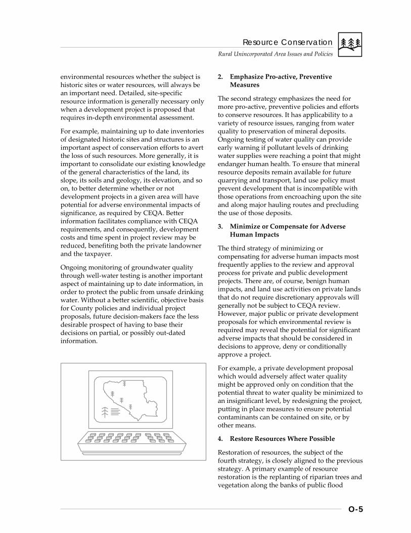
Resource Conservation Rural Unincorporated Area Issues and Policies
O-5
environmental resources whether the subject is historic sites or water resources, will always be an important need. Detailed, site-specific resource information is generally necessary only when a development project is proposed that requires in-depth environmental assessment.
For example, maintaining up to date inventories of designated historic sites and structures is an important aspect of conservation efforts to avert the loss of such resources. More generally, it is important to consolidate our existing knowledge of the general characteristics of the land, its slope, its soils and geology, its elevation, and so on, to better determine whether or not development projects in a given area will have potential for adverse environmental impacts of significance, as required by CEQA. Better information facilitates compliance with CEQA requirements, and consequently, development costs and time spent in project review may be reduced, benefiting both the private landowner and the taxpayer.
Ongoing monitoring of groundwater quality through well-water testing is another important aspect of maintaining up to date information, in order to protect the public from unsafe drinking water. Without a better scientific, objective basis for County policies and individual project proposals, future decision-makers face the less desirable prospect of having to base their decisions on partial, or possibly out-dated information.
2. Emphasize Pro-active, Preventive Measures
The second strategy emphasizes the need for more pro-active, preventive policies and efforts to conserve resources. It has applicability to a variety of resource issues, ranging from water quality to preservation of mineral deposits. Ongoing testing of water quality can provide early warning if pollutant levels of drinking water supplies were reaching a point that might endanger human health. To ensure that mineral resource deposits remain available for future quarrying and transport, land use policy must prevent development that is incompatible with those operations from encroaching upon the site and along major hauling routes and precluding the use of those deposits.
3. Minimize or Compensate for Adverse Human Impacts
The third strategy of minimizing or compensating for adverse human impacts most frequently applies to the review and approval process for private and public development projects. There are, of course, benign human impacts, and land use activities on private lands that do not require discretionary approvals will generally not be subject to CEQA review. However, major public or private development proposals for which environmental review is required may reveal the potential for significant adverse impacts that should be considered in decisions to approve, deny or conditionally approve a project.
For example, a private development proposal which would adversely affect water quality might be approved only on condition that the potential threat to water quality be minimized to an insignificant level, by redesigning the project, putting in place measures to ensure potential contaminants can be contained on site, or by other means.
4. Restore Resources Where Possible
Restoration of resources, the subject of the fourth strategy, is closely aligned to the previous strategy. A primary example of resource restoration is the replanting of riparian trees and vegetation along the banks of public flood
Resource Conservation
Rural Unincorporated Area Issues and Policies
O-6
control projects which employ “modified flood plain” techniques. Rehabilitation of historic structures for “adaptive reuse” is another example of this strategy, in which a structure of historic value is retained rather than demolished by restoring it for a modern use, such as retail or commercial trade.
5. Monitor the Effectiveness of Required Mitigations
CEQA requires monitoring the effectiveness of mitigations required for some projects, such as sedimentation controls, visual screening, or tree re-planting. It is important as a follow-up activity to a development approval, in order to ascertain whether mitigations actually work and whether to continue to employ them. Again, it is important to note that typically only those activities that require permit approvals are subject to environmental mitigation requirements.
Although resources for performing such monitoring efforts are typically scarce, the importance of monitoring in general, and especially for resources such as water quality, should not be underestimated. Avoiding costly and unnecessary mistakes and cleanup efforts is only possible when there is adequate knowledge on which to base preventive measures.
The Future of Our Resources Depends on Current Actions
In conclusion, resource conservation can enrich us in many ways, by preserving valuable mineral commodities needed for the regional economy, by preserving the integrity of ecological systems and wildlife habitat, and by preserving the natural beauty of our surroundings. Whether future generations inherit an environment of integrity and sustainability, or merely a world of compounded environmental problems, will in part be determined by decisions and choices of the present. As with all land use and environmental policies and regulations enacted in the public interest, care should be taken to balance the public’s interest in resource conservation with the concerns and interests of those most directly affected by those policies and regulations.
Policies and Implementation
R-RC 1 Natural and heritage resources shall be protected and conserved for their ecological, functional, economic, aesthetic, and recreational values. 1. Rural open lands not suitable or intended
for urbanization should not be included cities’ current Urban Service Areas or long term urban growth plans. Urban open lands intended for open space uses, such as parks or conservation, should be protected from adverse environmental impacts.
2. Heritage resources shall be preserved to the maximum extent possible for their scientific, cultural, and “sense of place” values.
R-RC 2 The County shall provide leadership in protecting and restoring valuable natural resources, such as wetlands, riparian areas, and others, for County-owned lands and by means of multijurisdictional endeavors.
R-RC 3 Multiple uses of public lands intended for open space and conservation shall be encouraged so long as the uses are consistent with the objectives of resource management and conservation. For resources of critical concern, such as habitat for threatened or endangered species, priority shall be given to conservation of the resource.
R-RC 4 For both public and private lands in rural unincorporated areas, the overall strategy for resource management and conservation shall be to: a. Improve and update current knowledge of
resources; b. Emphasize pro-active, preventive measures; c. Minimize or compensate for adverse human
impacts; d. Restore resources where possible; and, e. Monitor the effectiveness of required
mitigations.
Resource Conservation Rural Unincorporated Area Issues and Policies
O-7
R-RC 5 Public and private development projects shall be evaluated and conditioned to assure they are environmentally sound, do not degrade natural resources, and that ll reasonable steps are taken to mitigate potentially adverse impacts.
R-RC 6 Public and private efforts to acquire open space lands shall be supported for the protection of the natural environment.
R-RC 7 Planning and decision-making regarding resource management and conservation in rural areas of the county, when they occur, should be undertaken with the participation of rural property owners and other who may be most directly affected by policies and actions.
Water Supply, Quality, & Watershed Management
Background
RURAL AREA WATER SUPPLY
Valley Floor Areas
Properties in South Santa Clara Valley lands outside cities most often draw their domestic water supply from individual or shared private wells, and from private water systems usually supplied from a system of wells. Water yields from wells in the flat valley areas are fairly dependable, due to the presence of deep groundwater aquifers. Although quantity of water supplies has not traditionally been problematic, assuring the quality of those supplies has become more difficult over time. (see also Health & Safety Chapter, Wastewater Disposal section).
Hillside and Mountainous Areas
Water supply for lands in the more remote, mountainous regions of the unincorporated area is much less dependable. In mountainous areas, groundwater • is held in soils; • flows through the deposits underlying
streams; • flows in the sub-surface layers above
underlying bedrock; and • is trapped in fractures of the bedrock itself.
Most mountain area soils are relatively thin, stream deposits shallow, and bedrock fractures of a very limited capacity to hold water. As a consequence, reserves of groundwater supplies are more limited throughout the Santa Cruz and Diablo mountain ranges than for the valley areas. Property owners who seek a year-round water supply from mountain area wells often find that several wells must be drilled before finding one that meets minimum requirements for sustainable yield and quality.
Resource Conservation
Rural Unincorporated Area Issues and Policies
O-8
Seasonal rainfall patterns also affect available supplies. If a well’s water source is from fractures in bedrock that primarily contain water from the rainy season, by the end of spring the natural recharge rate can be insufficient to replenish the supply, significantly reducing the well’s yield. By end of summer, even during normal rainfall years, wells may run dry.
More importantly, mountain wells tend to deliver less quantity of water over the long term than initially, and drilling additional wells can often deplete the limited reserves of existing wells. Some previously divided parcels find no water supply meeting minimum requirements at all. (see also sidebar on Cumulative Water Supply Impacts) When well water supplies run low, the quality of the water may also be affected. Mineral and sulfur content may increase, depending on the composition of the water-bearing rock and soils.
Effects of Drought and Seismicity on Water Supply in Mountainous Areas
Mountain communities and more sparsely settled areas may suffer severe water shortages and even complete loss of water supply during short-term drought. Seismic activity can also change underground geology and eliminate supply. Should wells dry up, water must either be trucked in or piped from private water companies that obtain their supplies from valley wells. Trucking water is an inconvenient, expensive solution for private landowners, but one which is at times necessary. The cost of extending piped water services is often insupportable by residents alone.
Cumulative Rural Water Supply Impacts from Development
As development continues, new private wells may be installed to serve individual properties. Depending on the location and depth to which each well is drilled, there may be an effect on the flows of other wells in the vicinity. Although this phenomenon is more often the case in mountainous areas with limited groundwater supplies, it may also occur in valley areas with normally reliable water sources, depending on underground geology. The dilemma for policy and decision-makers is a difficult one that has several dimensions. Even for an area such as the central Santa Cruz Mountains, which is known to have limited groundwater supplies, it is not possible to accurately define the problem’s causes or probability: • impacts may not become evident for some
time after a number of development approvals have been made in a given area;
• reduced flows in established wells may not be caused solely by the drilling of new wells, given the other factors involved, such as limited natural water supplies, seasonal precipitation effects, and geology;
• extensive and very costly well drilling and testing would be needed to determine existing capacities.
With limited information available, decision-makers are not in a position to constrain development in a given area to less than that which would be allowed by the zoning regulations on the basis of suspected water supply limitations. If for instance there are many developable lots in an area that could be affected by the problem, how would one determine which properties would be allowed to develop and to what intensity? Determining precise boundaries of the affected area would also be difficult and controversial. On the other hand, to allow the maximum amount of development permissible in areas with limited and unreliable groundwater supplies could very well lead to hardships for those property owners who are the first to lose their water supply. Moreover, it could create the need to extend piped water supply to entire areas of rural development which lose their local well water supplies, if trucking in water supplies is infeasible. Extending services such as piped water supply is in direct contradiction of fundamental County policy prohibiting urban types and levels of services outside cities’ Urban Service Areas. Now and for the foreseeable future, the County will have to rely upon existing policies requiring large minimum parcel sizes and low overall densities to avoid exceeding rural area water supplies.
Resource Conservation Rural Unincorporated Area Issues and Policies
O-9
Water Shortage and Fire Hazard
Perhaps no other problem related to water supply in the rural unincorporated area is as great as the threat of wildfire. Lack of dependable water supplies for individual residences not only threatens safety of the residents, their property, and nearby communities, but can also contribute to widespread destruction of forests and vegetation necessary to safeguard water quality throughout a watershed. (For further elaboration refer to the Health and Safety chapter section of Fire Hazards.)
Long Range Land Use Planning Implications of Limited Rural Water Supplies
If losses of rural water supply were rare events, there would be few reasons for public concern. For example, given the limited population and development common to the Diablo Range areas, dependability of rural water supplies for that region have generally not been an issue. On the other hand, the more dense development and the number of legal, but substandard lots common to the Santa Cruz Mountain areas create much greater potential for areawide loss of water supply to a large number of residents over time, something especially of concern for future residents.
In such cases, the solution may be expensive and controversial extensions of water services to areas outside cities’ Urban Service Area boundaries. Policies adopted in 1980 requiring that new development demonstrate adequate water supply and policies governing the densities of rural areas can help prevent such problems, but may not eliminate them if primarily the result of pre-1980 General Plan land use policy. [see Cumulative Rural Water Supply sidebar for further explanation.]
WATER QUALITY AND WATERSHED MANAGEMENT
A great variety of potential pollution sources and related issues are included under the general heading of water quality for rural unincorporated areas. Listed briefly, the major types include:
• waste water disposal from septic systems; • erosion and sedimentation; • agricultural runoff, including runoff from
livestock operations; • commercial and industrial activities that use
potentially contaminating materials, including transport and leakage from storage tanks; and
• cumulative impacts from development and other general nonpoint sources of pollution.
Environmental factors include: • the quality of any waste waters involved,
which varies considerably; • soil composition and the presence of fissures
or cracks within bedrock; • vegetative types, such as riparian or
grasslands; • proximity of pollution sources to surface
waters or areas prone to flooding; • percolation rates of soils and depth to
groundwater; • precipitation rates; and • steepness of slopes.
Addressing within the General Plan the many potential sources of pollution that exist should not be construed to mean that problems are necessarily pervasive or recurrent. Depending on the levels of pollution and the frequency of occurrence, some pollution sources may have very minor impacts over time; whereas, even isolated instances of highly concentrated toxic materials coming into contact with ground water basins could have severe consequences.
Another aspect of water quality is that some pollutant sources affect primarily groundwater quality, more so than surface waters, and vice-versa, but many pollution sources have potential to impact all aspects of the hydrological system under certain limited conditions. For example, hazardous materials which leak off-site into a stream environment or flood prone area may be introduced directly to surface waters and wildlife and also be conveyed to groundwater aquifers through natural percolation or the existence of dry wells, which were once extensively used to increase infiltration of runoff and manage drainage. Similarly, septic system effluent may degrade groundwater basins, if, for example, sewage infiltrates the aquifer before it

Resource Conservation
Rural Unincorporated Area Issues and Policies
O-10
is adequately treated by its percolation through the soil structure.
Septic System Waste Water Disposal
The vast majority of rural unincorporated area development utilizes septic systems to treat and dispose of sanitary waste. The ability of septic systems to adequately treat and safely dispose of the waste water depends on a number of factors:
• the design and maintenance of the septic system, including adequate parcel size and leachfield size;
• soil characteristics and slope; and • the amount and rate of precipitation and
depth to groundwater.
Although most septic systems function adequately, saturated soils, steep slopes, or other geologic conditions may occasionally create circumstances which cause the septic system to malfunction, allowing pollutants to reach groundwater basins or surface waters. Even under conditions which allow a well-designed, well maintained system to perform adequately, it is possible that the concentration of systems in a given area, combined with the area’s subsurface geology and hydrology, may result in a cumulatively adverse impact upon water quality. Testing of well water quality in some areas is necessary to monitor pollutant levels given the number of septic systems and other potential pollution sources. (see also the Wastewater Disposal section of the Health & Safety Chapter for Rural Unincorporated Areas).
Localized Well Water Quality Problems
Well contamination has occurred in both mountainous areas and valley areas. Wells located too close to septic systems and other wastewater disposal systems have at time posed water quality problems for rural area residents. For example, in the late 1970s, a persistent pattern of polluted wells was discovered in the Los Gatos watershed area. Well closures are often the result. The San Martin area of South County has also experienced increased levels of groundwater contamination, particularly nitrate levels. Discovery of high nitrates levels there prompted an areawide study of water quality.
Erosion and Sedimentation
Erosion is a natural phenomenon which is most common in the rural hillside areas of the county during the rainy season. The prevalence of fragile soils and steep slopes only increases the potential for erosion. When the land’s vegetative cover is cleared for development, road construction, or other land use, the potential is there to further increase erosion and sedimentation. County grading restrictions and development standards serve to minimize and control erosion, but alteration of vegetative cover, natural contours and drainage courses tends to increase and concentrate runoff, with possible impacts on stream environments and siltation of reservoirs. Increased siltation of reservoirs can impose public costs for dredging and changes in reservoir maintenance and operations.
Additional impacts of increased erosion and sedimentation may include: • loss of productive topsoils for agricultural
uses; • increased erosion along stream banks and
reduced water quality of flowing streams and the waters of San Francisco Bay and Monterey Bay;
• higher nutrient concentrations in streams and reservoirs, leading to algae increases and degraded water quality; and
• decreased percolation capability for groundwater recharge.
Resource Conservation Rural Unincorporated Area Issues and Policies
O-11
Agricultural and Livestock Sources
Agricultural sources generally consist of nitrogen-based fertilizers, herbicides, pesticides, other chemicals used to produce crops, as well as the organic wastes from livestock. Each can be controlled through commonly used management techniques, such as controlled application of agricultural chemicals and fertilizers, detention of runoff from livestock areas, and other means, but certain amounts of these pollutants are inevitably introduced to surface waters and groundwater basins.
Hazardous and Toxic Materials Used in Commercial and Industrial Processes
Vehicle dismantlers, automobile repair, and other commercial or light industrial uses that store or use potentially hazardous substances occur less frequently in the rural unincorporated areas, but are a potential source of pollution nonetheless. Leaking tanks, spills, and even illegal dumping and illicit storm drain connections may occur with potential to contaminate both surface waters and the groundwater basin. Unlicensed vehicle dismantlers, for example, may evade environmental regulations for a time until brought into compliance. (For more information and policies concerning hazardous materials management, refer to the Health & Safety chapters of the General Plan).
Nonpoint Source Pollution
Most of the pollution from storm water runoff, also referred to as “nonpoint source pollution,” originates within the urbanized areas of the county, where contaminant sources and impervious surfaces are more prevalent. However, virtually the same range of pollutant sources exist, but to a much lesser extent, in the rural unincorporated areas, such as:
• motor fuels, lubricants and other fluids that leak from vehicles onto roads and parking lots;
• organic wastes and nutrients, from livestock, pets, and litter;
• sediment from erosion; • construction-related pollutants such as
concrete and paints; and
• agricultural chemicals, heavy metals from combustion, and detergents and solvents.
Nonpoint source pollution can be most effectively controlled by eliminating or reducing the source of the pollutants and by means of engineering methods which prevent the conveyance of pollutants to surface waters.
Strategies, Policies and Implementation
Land use, development, and water quantity/ quality issues are integrally related. Furthermore, with the variety of issues to be addressed in the rural unincorporated areas, a number of general approaches or strategies must be employed to ensure that water quantity and quality are maintained and that watershed resources are protected:
Strategy #1: Require Adequate Water Quantity and Quality Prior to Development Approval
Strategy #2: Reduce Water Quality Impacts of Rural Land Use and Development
Strategy #3: Develop Comprehensive Watershed Management Plans
Policies and Implementation
R-RC 8 The strategies for assuring water quantity and quality for the rural unincorporated areas shall include: 1. Require adequate water quantity and
quality as a pre-condition of development approval.
2. Reduce the water quality impacts of rural land use and development.
3. Develop comprehensive watershed management plans.
Resource Conservation
Rural Unincorporated Area Issues and Policies
O-12
Strategy #1: Require Adequate Water Quantity and Quality Prior to Development Approval
To allow development of a nature and density greater than that which can be accommodated by groundwater supplies obtained through individual wells is to invite or aggravate a variety of problems. Undependable water supplies cause difficulties for individual property owners and households, severely limits fire fighting capabilities, and increases the probability that water supply must eventually be obtained through costly and controversial infrastructure extensions, contrary to overall General Plan policy for areas outside cities’ Urban Service Areas (USAs). To help prevent future problems of this nature, new development must demonstrate that adequate water quantity and quality standards can be met before it can obtain approval.
Policies and Implementation
R-RC 9 Development in rural unincorporated areas shall be required to demonstrate adequate quantity and quality of water supply prior to receiving development approval.
Strategy #2: Reduce Water Quality Impacts of Rural Land Use and Development
There are a number of general means by which water quality impacts of rural land use and development can be reduced or avoided. These may include: • ensuring that the general range of land uses
encouraged under the major rural area planning designations, such as Hillsides, Agriculture, Ranchlands, and Rural Residential are compatible with conservation and resource management policies;
• working cooperatively with rural landowners and farmers to improve water quality;
• managing land uses that have the most hazard potential, such as certain commercial and light industrial uses, by avoiding unsafe locations and preventing off-site impacts;
• avoiding excessive concentrations of septic systems;
• retaining riparian areas intact to prevent pollutants from entering the stream; and
• limiting the conveyance of pollutants from landfills and other land uses to surface and ground waters.
Most rural unincorporated lands are designated one of four major land use categories, Hillsides, Ranchlands, Agriculture or Rural Residential. Within each of these categories, certain types of land uses are allowed or encouraged, such as low density residential development, crop cultivation, ranching, and other uses compatible with the resources of these areas. Uses and densities which are compatible with or which are consistently related to the kinds of natural resources found in these areas help promote conservation of the resources and minimize the water quality impacts that more intensive, potentially harmful uses might otherwise create.
Secondly, rural area land uses that pose the highest hazard potential are those commercial and light industrial activities which of necessity deal with hazardous or toxic substances. These are generally permissible only in limited locations, such as the Use Permit Areas of San Martin, and in the vicinity of Monterey Road. They are generally not allowed within the Ranchlands or Hillsides areas of the county. Even though such uses are necessary, most are allowed only with a use permit, providing that their proposed location and operation will not pose a significant risk of degrading water quality.
For example, some uses such as waste disposal and transfer facilities, may be appropriate and allowed in some locations, but not others, unless potential hazards can be mitigated. Of particular concern are the kinds of areas most vulnerable to water pollution, areas having prime percolation capabilities (river wash and alluvial soils) near streams and reservoirs, and critical habitat areas, such as upland wetlands and riparian zones. Some commercial uses may also
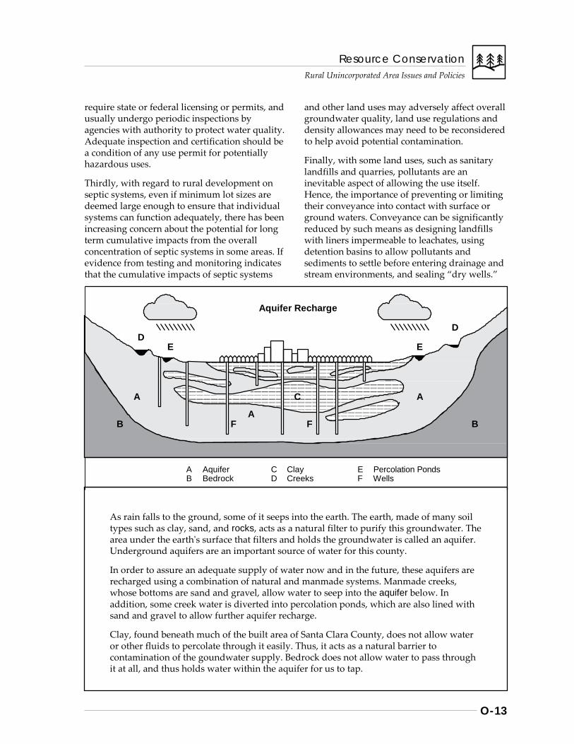
Resource Conservation Rural Unincorporated Area Issues and Policies
O-13
require state or federal licensing or permits, and usually undergo periodic inspections by agencies with authority to protect water quality. Adequate inspection and certification should be a condition of any use permit for potentially hazardous uses.
Thirdly, with regard to rural development on septic systems, even if minimum lot sizes are deemed large enough to ensure that individual systems can function adequately, there has been increasing concern about the potential for long term cumulative impacts from the overall concentration of septic systems in some areas. If evidence from testing and monitoring indicates that the cumulative impacts of septic systems
and other land uses may adversely affect overall groundwater quality, land use regulations and density allowances may need to be reconsidered to help avoid potential contamination.
Finally, with some land uses, such as sanitary landfills and quarries, pollutants are an inevitable aspect of allowing the use itself. Hence, the importance of preventing or limiting their conveyance into contact with surface or ground waters. Conveyance can be significantly reduced by such means as designing landfills with liners impermeable to leachates, using detention basins to allow pollutants and sediments to settle before entering drainage and stream environments, and sealing “dry wells.”
As rain falls to the ground, some of it seeps into the earth. The earth, made of many soil types such as clay, sand, and rocks, acts as a natural filter to purify this groundwater. The area under the earth's surface that filters and holds the groundwater is called an aquifer. Underground aquifers are an important source of water for this county.
In order to assure an adequate supply of water now and in the future, these aquifers are recharged using a combination of natural and manmade systems. Manmade creeks, whose bottoms are sand and gravel, allow water to seep into the aquifer below. In addition, some creek water is diverted into percolation ponds, which are also lined with sand and gravel to allow further aquifer recharge.
Clay, found beneath much of the built area of Santa Clara County, does not allow water or other fluids to percolate through it easily. Thus, it acts as a natural barrier to contamination of the goundwater supply. Bedrock does not allow water to pass through it at all, and thus holds water within the aquifer for us to tap.
Aquifer Recharge
D D
E E
A C A
A B F F B
A Aquifer C Clay E Percolation Ponds B Bedrock D Creeks F Wells
Resource Conservation
Rural Unincorporated Area Issues and Policies
O-14
Dry wells are holes once drilled in the ground to increase infiltration of runoff and alleviate local drainage problems. However, dry wells unintentionally serve as conduits for the contaminants in surface runoff, allowing runoff to directly enter groundwater aquifers, without benefit of the natural cleansing actions of percolation through the soil. Conveyance of pollutants commonly found in surface runoff can also be considerably reduced by limiting the amount of impervious surfaces in the immediate vicinity of streams and reservoirs.
Policies and Implementation
R-RC 10 For lands designated as Resource Conservation Areas (Hillsides, Ranchlands, Agriculture, and Baylands) and for Rural Residential areas, water resources shall be protected by encouraging land uses compatible and consistent with maintenance of surface and ground water quality. 1. Uses that pose a significant potential hazard
to water quality should not be allowed unless the potential impacts can be adequately mitigated.
2. The amounts of impervious surfaces in the immediate vicinity of water courses or reservoirs should be minimized.
R-RC 11 Areas with prime percolation capabilities shall be protected to the maximum extent possible, and placement of significant pollution sources within such areas shall be avoided.
R-RC 12 Excessive concentrations of septic systems shall be avoided, especially in areas vulnerable to groundwater contamination or in which normal functioning may be impaired by hydrologic constraints.
R-RC 13 Sedimentation and erosion shall be minimized through controls over development, including grading, quarrying, vegetation removal, road and bridge construction, and other uses which pose such a threat to water quality.
R-RC 14 Use and disposal of agricultural chemicals, such as fertilizers, pesticides and herbicides, shall be managed to minimize the threat of water pollution.
R-RC 15 Commercial and industrial uses such automobile dismantlers, waste transfer disposal facilities, light industries, uses requiring septic systems, and other uses that have the greatest potential for pollution shall not be located within the vicinity of streams, reservoirs, or percolation facilities where contaminants could easily come in contact with flood waters, high groundwater, flowing streams, or reservoirs. Such uses shall be required to reduce any threat of contamination to an insignificant level as a condition of approval.
R-RC 16 New or expanded solid waste disposal sites shall be located, designed and managed to prevent leachates from conveying pollutants to groundwater basins.
R-RC 17 Dry wells should be located and effectively sealed to prevent pollutants in surface runoff from easily infiltrating groundwater basins.
Implementation Recommendations
R-RC(i) 1 Support continued water quality monitoring and protection programs of SCVWD and other government agencies (examples: Wellhead Protection Program, Santa Clara Valley Nonpoint Source Pollution Control Program).
R-RC(i) 2 Require that land uses which pose a major threat to water quality be approved only on condition that adequate long term state and federal safety standards are monitored and maintained. Consider revocation of use permit if standards are violated.
Resource Conservation Rural Unincorporated Area Issues and Policies
O-15
R-RC(i) 3 Integrate storm water quality protection requirements into development site plan and construction permit approvals.
(See also Health & Safety Chapter for more detailed issues and policies regarding hazardous materials management).
Strategy #3: Develop Comprehensive Watershed Management Plans
There are 10 reservoirs in Santa Clara County operated by the Santa Clara Valley Water District (SCVWD). For most of these reservoirs, the drainage basin or watershed lies primarily in rural unincorporated areas. The amount of land owned and managed by the District surrounding these reservoirs is relatively small. Development and land use proposals within reservoir watersheds are reviewed by the affected agencies and jurisdictions, and every effort is made to minimize the potential adverse environmental impacts of each proposal. However, without an adequate basis of knowledge and specific policies for each distinct watershed area, there is currently no means of assessing and controlling for cumulative impacts resulting from individual projects which are approved.
Cumulative impacts may affect the watershed lands themselves, reservoir water quality, and reservoir operations. Two factors which heighten the need for comprehensive watershed management planning are (1) the need to meet water quality standards without incurring added treatment costs, and (2) the need to balance water quality objectives with recreational, residential, and other uses of the watershed lands.
Policies and Implementation
R-RC 18 Comprehensive watershed management plans should be join tly developed to assure that cumulative impacts upon water quality, reservoir operations, and watershed resources are assessed, avoided or adequately mitigated.
Implementation Recommendations
R-RC(i) 4 Participation in the ongoing watershed management projects of the Santa Clara Valley Water District (SCVWD) and San Francisco Public Works Dept. (Implementors: County, rural landowners, SCVWD, City/County of San Francisco, other agencies)
Resource Conservation
Rural Unincorporated Area Issues and Policies
O-16
Habitat & Biodiversity
Background
HABITAT TYPES AND SIGNIFICANCE
Santa Clara County contains many distinct types of habitat, supporting a variety of plant and animal species, some of which are threatened or endangered by extinction. Predominant among the county’s major habitat types are the following, and within each of these major classifications are many more sub-types, each supporting a particular mix of interdependent species:
• the various Bayland habitats, • riparian and freshwater habitats, • grassland/savanna habitats, and • chaparral, mixed woodland, and evergreen
forest areas.
What follows are brief descriptions of the primary habitat types of importance in Santa Clara County.
Baylands Habitats
Baylands habitats include the waters of San Francisco Bay itself, estuaries, mud flats, salt marsh, and salt evaporation ponds. Hundreds, if not thousands of bird species rely on these various habitats either year-round or on a seasonal basis. In addition, the baylands provide habitat for several species of threatened or endangered birds and mammals, such as the clapper rail and salt marsh harvest mouse.
Riparian and Freshwater Habitats
Freshwater habitats include flowing streams, riparian areas, freshwater marshes, and lentic zones (ponds and reservoirs). Some habitat types are more rich in the diversity of species they support than others. In California and the western U.S. as a whole, riparian areas contain perhaps the greatest diversity of species of any major habitat type. Riparian areas provide habitat not only for native anadromous fish
(trout and steelhead) and other aquatic species, but also provide water supply to many other species, density of vegetation for adequate cover and protection, migration routes, and food sources. Some streams still have limited steelhead runs, and vegetation along the stream provides insects as a food source and maintains proper water temperature for such fish species’ spawning areas.
Listed briefly, riparian vegetation and ecosystems function to: • provide feeding and nesting areas for many
birds and mammals; • provide movement corridors for wildlife; • provide shaded spawning habitat for native
fish species such as steelhead; • prevent soil erosion; • preserve water quality by filtering
pollutants from runoff before it enters surface waters;
• minimize sediment buildup in reservoirs; • preserve stream banks from collapse; • reduce flows and store flood waters; and • provide aesthetic and recreational
enjoyment.
Therefore, habitat conservation is important not only for ecological reasons, but also for the many indirect benefits it provides, such as protecting water supply resources.
Grassland/Savanna Habitats
These habitats include grasslands common to valley floors, hillsides and ridge areas where moisture is limited, as well as the oak savannah communities common in the foothills. Perhaps most sensitive of the natural communities found in such areas are the areas of serpentine soils, which foster native vegetation and provide critical habitat for numerous threatened and endangered species found in no other areas, such as the Bay Checkerspot butterfly and various native flowers.
Chaparral, Woodland, and Forest Habitats
These habitats include chaparral, mixed evergreen forests, redwood forests, foothill woodlands consisting of oak and other hardwood species, and closed-cone pine forests.
Resource Conservation Rural Unincorporated Area Issues and Policies
O-17
“Threatened and Endangered Species in Santa Clara County, 1992”
Animal Species: Status American Peregrine falcon Endangered (US & CA) Southern Bald Eagle Endangered (US & CA) Californian black rail (bird) Threatened (CA) California brown pelican Endangered (US & CA) California clapper rail (bird) Endangered (US & CA) Bank swallow Threatened (CA) California least tern Endangered (US & CA) Least Bell’s vireo (bird) Endangered (US & CA) Bay checkerspot butterfly Threatened (US) Salt marsh harvest mouse Endangered (US & CA) San Joaquin kit fox Endangered (US) Threatened CA
Plant Species: Status Coyote ceanothus Proposed Endangered (US) S.C. Valley dudleya Proposed Endangered (US) Hoover’s button celery Proposed Endangered (US) Marin dwarf flax Proposed Threatened (US) Metcalf Cyn. jewelflower Proposed Endangered (US)
These lands provide important habitat to most of the state’s vertebrate species. Oak woodlands and oak savannah, in particular, provide highly productive habitats for such species as black-tailed deer, wild turkey, and quail, which are of considerable economic benefit to ranchers, wildlife watchers and sportsmen, in addition to their ecological value.
MAJOR CHALLENGES TO CONSERVATION OF HABITAT
Minimizing Development Impacts
Impacts on habitat and biodiversity in Santa Clara County and the region result from both natural and human causes. Since the earliest human populations inhabited the area to the present, alteration of the natural features of the landscape has been an ongoing occurrence, including: • conversion to urbanization of most of the
northern valley floor, including filling of wetlands for other uses;
• conversion for agricultural crop cultivation; • alteration of natural drainage and
watersheds for flood control; and
• introduction of non-native species which have replaced or diminished some native species, such as the eucalyptus tree, European grasses, and the non-native red fox, which preys on shorebirds common to wetlands areas.
Although many of these impacts would have been unavoidable over time in accommodating a human population of over 1.5 million, many impacts could have been substantially reduced or avoided, had there been greater foresight and understanding of the impacts. The challenge for now and the future is to identify and conserve as much of the remaining areas of natural habitat as possible, prevent avoidable impacts, and minimize potential impacts as we accommodate our further growth and development.
Understanding Natural Impacts and Responses
To be sure, habitat and natural communities are also impacted by natural occurrences, such as drought, pestilence, plant diseases, flooding, and wildfire. However, it should be understood that the dynamic nature of most healthy,
Resource Conservation
Rural Unincorporated Area Issues and Policies
O-18
functioning ecosystems makes them capable of withstanding or adapting to such influences, even those of violent and widespread nature. For example, wildfire may force species to migrate to unaffected areas, given the possibility, without substantial impact to those species. For those areas impacted by forest fires, even fires that destroy stands of late-successional trees, regeneration occurs almost immediately, and provides new types of early-successional vegetation that may be quite beneficial to wildlife such as deer and other foraging animals. Fire itself is necessary for some plant species to propagate and germinate seeds.
Balancing Public and Private Interests
It must also be recognized that private landowners within the rural unincorporated areas of Santa Clara County are entitled to develop or use their lands in conformance with policies and ordinances. The intent of policy directions and strategies for maintaining habitat and enhancing natural communities is to more effectively conserve these natural resources without unnecessary restrictions on private land uses and development, through more cooperative approaches to avoid or reduce possible impacts. Trends In Habitat Conservation
‘Biodiversity’ and the Need to Preserve Locally- and Regionally-Significant Habitat
‘Biodiversity’ is the term most used in recent years to describe, in a general way, the diversity of species which exist on a world-wide basis. In fact, it refers to the diversity of life at several different levels, including that of ecosystems, species, and the genetic pool. The breadth of this definition–from ecosystem to gene pool–reflects the fact that species survive within and depend on a “community” of other species, both plant and animal, and that even small disturbances to the community or ecosystem on which species depend may threaten their survival. It also reflects the importance of genetic diversity, both manifest and latent, that could be needed for adaptation and survival.
Attention to the loss of ‘biodiversity’ on a worldwide basis has to date focused most intensely on the rapidly increasing extinction rates of species found in equatorial rainforests. However, local habitat losses of a more incremental nature also have a cumulative impact upon biodiversity and the benefits we as human beings derive from a healthy functioning environment. These benefits include, just to name a few: • maintenance of the oxygen-carbon dioxide
exchange cycle; • maintenance of the food chain, which for
example helps control pest populations; and • discoveries of medicinal values of plants
and animals.
It is generally well known that the grizzly bear, California’s state symbol, ironically is extinct in California. Many more species within the state and Bay Area are listed each year by the state and federal government as either rare (plants only), threatened, endangered, or candidates for listing as species nearing extinction. And for every species that becomes locally extinct due to loss or degradation of habitat within parts of Santa Clara County, there is that much greater chance that cumulative habitat loss over time will lead to total extinction of individual species.
The Trend Towards Protecting Natural Communities versus Individual Species Only
Recently, trends in species and habitat preservation have begun to shift from attempting to rescue endangered species one-at-a-time to a more holistic approach which attempts to preserve biodiversity through large areas of functioning, intact natural communities, or ecosystems. This shift has several important advantages over the previous approach: • it not only improves the chances of saving
threatened species, it also should help prevent other species from becoming endangered;
• it will be more successful and cost-effective than restoring species brought to the brink of extinction; and
• it better provides for cooperative, multijurisdictional, and regional conservation planning over the currently fragmented approach.

Resource Conservation Rural Unincorporated Area Issues and Policies
O-19
Cooperative Planning Benefits Both Public and Private Interests
One example of multi-jurisdictional efforts to achieve biodiversity preservation on a regional scale is the state’s Natural Communities Conservation Planning program (NCCP), which initially focused upon preserving natural areas of coastal sage scrub in portions of San Diego, Orange, Riverside, Los Angeles, and San Bernadino counties. The planning area involved covers approximately 6,000 acres. The two goals of the program are: • to preserve native habitat for many
threatened and endangered species indigenous to the region through the designation of multi-species reserves, and
• to allow for compatible land use and private development, rather than to preclude it through a maze of regulation and restrictions.
Regional conservation plans such as this provide one of the most useful paradigms available for local governments to fulfill federally- and state-mandated conservation programs. Although complex to prepare on a regional basis, multi-species habitat conservation plans of large and small scale represent an improvement over the previous “species-by-species” approach, which often resulted in litigation and community polarization, pitting environment against development in a “win or lose” situation. As more species are formally listed by the federal and state agencies as threatened or endangered with extinction, the need for cooperative efforts and “win-win” approaches at the local, regional, state and federal level is expected to increase over time.
Habitat Management in Santa Clara County
In Santa Clara County, the habitat types and natural communities which would most benefit from enhanced conservation efforts include riparian areas, bay wetlands, and others, such as areas of serpentine soils, on which most of the threatened or endangered species that occur within the County depend (see table below).
It is anticipated that more species will be listed or proposed for listing during 1993 and 1994 as a result of judicial rulings. At least four more plant species are among those identified for listing in Santa Clara County. All four depend upon serpentine soils. Vertebrate species proposed for listing as endangered species, among other, include the red-legged frog and western pond turtles.
Many of these species are found in locations designated by the state as “Significant Natural Areas,” or SNAs, areas characterized by the existence of:
• extremely rare or endangered species, • groups or ensembles of species, • high diversity of species, or • the best known example of a type of natural
community.
A prime example in Santa Clara County, as previously mentioned, is the large area of serpentine soils and its related natural grasslands communities. In all, twenty-eight (28) such SNAs have been identified by the California Dept. of Fish and Game (CDFG) within Santa Clara County, but not all of the County, much less the state, has been studied. As more information is obtained from private organizations, environmental assessments of proposed development, and other sources, the inventory of SNAs is updated by the state and made available to local jurisdictions.
Resource Conservation
Rural Unincorporated Area Issues and Policies
O-20
Endangered Species Act and Local Implementation The Federal Endangered Species Act was passed in 1973 and has since been amend-ed and reauthorized at various times. Its primary purposes are to conserve ecosys-tems on which endangered species depend and to provide a program for the conserve-ation of each such endangered or threat-ened species. The California Endangered Species Act (CESA) was passed in 1984 to provide the state Dept. of Fish and Game the authority to review projects for impacts upon species listed by the California law. It augments federal law with more stringent require-ments and standards. Lists of threat-ened and endangered species are updated periodically. Jurisdictions, agencies and individuals are affected by these Acts if listed species occur on a property proposed for a development project. Projects which could adversely im-pact such species must either (a) be mod-ified to avoid any “taking” of a species by harming it or its habitat, or (b) obtain state and federal permits to allow the project and any “incidental take” deemed unavoidable. Violations of either law may result in fines and imprisonment. The permits involved may be issued pur-suant to the development of a “Habitat Conservation Plan” (HCP) for the project area. Such plans may be specific to an individual property or to a larger area. It should describe the area and the bound-aries of the HCP, the species in question, mitigation and monitoring aspects, and funding necessary to implement the plan. Both state and federal agencies involved with habitat preservation have made a more concerted effort in recent years to require local governments to more rigorously en-force the provisions of these laws. Local governments may do so in two basic ways: (1) ensuring governmental agencies and individuals do not violate the provisions of the Acts by providing adequate project re-view; and (2) developing Habitat Conserv-ation Plans on a sub-regional and regional scale to address habitat preservation needs. These plans are developed with the involve-ment of lead federal and state agencies. [For more information concerning implem-entation of the Endangered Species Acts as specifically related to rural areas, refer to the Rural Unincorporated Area Issues & Policies section of the General Plan].
Strategies, Policies and Implementation
Habitat and biodiversity for Santa Clara County can be maintained and enhanced through the following approaches or strategies:
Strategy #1: Improve Current Knowledge and Awareness of Habitats and Natural Areas
Strategy #2: Protect the Biological Integrity of Critical Habitat Areas
Strategy #3: Encourage Habitat Restoration Wherever Possible
Strategy #4: Evaluate the Effectiveness of Project Mitigations as Required Under CEQA.
The desire for effective statewide growth management reflects among other things an attempt to balance two of the state’s most critical needs: • the need to accommodate the state’s
expected population and economic growth; and
• the need to protect the open space and natural resource areas vital to the state’s environment and quality of life.
Recent efforts to reach consensus on statewide growth management have sought a compromise solution that will discourage urbanization of areas with natural constraints or critical resource value, such as geologic constraints and natural habitat areas, and encourage urban development in areas where impacts will be less significant. The current jointly-adopted growth management policies of the cities and County of Santa Clara are consistent with that emerging statewide policy direction, and the strategies for conserving habitat and biodiversity further build upon that basis.
There is significant concern that the next 20-25 years will be crucial if California and the nation are to adequately protect remaining habitat and biodiversity. Cooperatively implementing the strategies and policies most appropriate at the local and regional level will not only contribute to conservation efforts at the state and national level, but also will permit private landowners to
Resource Conservation Rural Unincorporated Area Issues and Policies
O-21
exercise land use and development rights without further significant loss of habitat resources. These approaches should be more fair to all interests, more cost-effective, and enhance overall quality of life.
Policies and Implementation
R-RC 19 Habitat types and biodiversity within Santa Clara County and the region should be maintained and enhanced for their ecological, functional, aesthetic, educational, medicinal, and recreational importance.
R-RC 20 Strategies and policies for maintaining and enhancing habitat and biodiversity should include the following : 1. Improve current knowledge and awareness
of habitats and natural areas. 2. Protect the biological integrity of critical
habitat areas. 3. Encourage habitat restoration wherever
possible. 4. Evaluate the effectiveness of project
mitigations as required under CEQA.
R-RC 21 Critical habitat areas should be excluded from cities’ Urban Service Areas unless retained in non-urban uses, and rural unincorporated development should be designed to avoid or mitigate impacts upon habitat and natural areas.
R-RC 22 Recreational uses of public lands proposed within areas of natural habitat should be limited to those kinds and intensities of activities that are compatible with preserving natural vegetation and wildlife and which very minimally disturb overall habitat value: 1. Examples of low intensity activities that
may be allowed include limited hiking, horseback riding, picnicking, camping, and interpretative study.
2. For critical habitat areas, uses and activities should not be allowed to create a significant impact; if necessary, facilities for such activities should be limited to those of a
very primitive, non-disruptive nature only or precluded from such areas.
3. Nesting and breeding areas potentially affected by such activities should be seasonally closed to recreational use.
Strategy #1: Improve Current Knowledge and Awareness of Habitats and Natural Areas
Adequate, accurate, and up-to-date information concerning the natural resources of the county’s rural areas is essential for informed land use planning and decision-making. State law, in fact, requires that local general plans and environmental reviews conducted under CEQA (California Enviornmental Quality Act) be based on such information.
Natural resource information can serve both to help identify and preserve critical resource areas and to enable development in appropriate areas to proceed without unnecessary delays or expense. Without that information, significant irreplacable resources may be lost, and decisions may be made based upon supposition rather than objective facts.
Areawide resource information such as vegetative patterns typically is obtained from sources such as aerial photographs and satellite imagery. Site-specific resource information, such as that required to evaluate the potential environmental impacts of individual proposed development projects, is typically obtained from on-site studies conducted as part of the review process required under CEQA. Where more specific areawide information is needed for special planning studies, it should be obtained with the cooperation of local landowners.
As with the demographic data needed for planning within urban areas where conditions are constantly changing, information regarding natural resources in rural areas must also be kept current to reflect changes in environmental conditions that result both from natural processes and from the impacts of development.
Resource Conservation
Rural Unincorporated Area Issues and Policies
O-22
Policies and Implementation
R-RC 23 Knowledge and mapping of habitat resources within the rural unincorporated areas should be improved to provide an accurate basis for: a. reviewing proposed projects that require
discretionary approvals or permits; b. assessing environmental impacts for projects
subject to CEQA; c. identifying critical habitat resources; and d. cooperative conservation planning efforts.
R-RC 24 Areas of habitat richest in diversity, of particularly fragile ecological nature, or necessary for preserving threatened or endangered species should receive special consideration for preservation as open space and protection from development impacts. Examples include baylands and riparian areas, serpentine geology, and other critical habitat areas identified by local legislative bodies.
Implementation Recommendations
R-RC(i) 5 Further develop and maintain the ongoing GIS (geographic information system) database to include information on habitat types which can be shared among local, regional, state and federal agencies (eg: Natural Diversity Data Base, Lands and Natural Areas Program, cities, state and federal agencies).
R-RC(i) 6 Encourage and assist volunteer organizations and Conservation Districts in promoting habitat conservation and best management practices.
R-RC(i) 7 Encourage private landowners to utilize existing non-fee services of state and local agencies to assess natural resources prior to submitting development applications.
R-RC(i) 8 Establish criteria needed to help define areas considered to be of critical habitat value. (Implementors: County, local and state agencies, other affected jurisidictions)
Strategy #2: Protect the Biological Integrity of Critical Habitat Areas
The policies of the General Plan under this strategy are listed according to major habitat classification. It involves two related concepts, encouraging : 1. conservation of natural habitat areas intact,
to avoid fragmentation and disturbance; and 2. maintenance of migratory corridors and
linkages between natural areas to compensate for fragmentation.
Conserving areas intact as much as possible is the primary aspect of this strategy, to avoid fragmentation and potential development impacts to habitat resources in the first place. A second aspect currently being promoted by the scientific community, state and federal agencies involves maintaining corridors or linkages between areas of fragmented habitat. Nationwide, these conservation strategies are being viewed as the key to effective conservation planning between the public and private sectors.
Established policies of the County of Santa Clara regarding wetlands and riparian areas already incorporate the first principle. Land use policies that currently require open space dedication provide another opportunity to conserve natural areas intact, by designing projects to avoid or minimize fragmentation of natural habitat, and by clustering development in locations which have the fewest adverse impacts. These concepts should be encouraged on the part of public and private development projects, especially when critical habitat areas are involved.
Conserving linkages and migratory corridors is an emerging concept worthy of further study in Santa Clara County and the region. In theory, linkages or “corridors” compensate for fragmentation of habitats by permitting travel and interaction of species between non-contiguous areas. They also limit the isolation of small populations of a species threatened with local extinction. It is already well understood that stream environments function as migratory pathways for many terrestrial species, further reinforcing the County’s existing stream protect
Resource Conservation Rural Unincorporated Area Issues and Policies
O-23
tion policies. Further study would be beneficial in order to better understand the possible use of linkage concepts on a local basis. (See policies, end of Strategy 2)
BAYLANDS HABITATS
Depletion of baylands habitat has figured prominently in the history of the development of the San Francisco Bay region as a whole. Vast areas of the South Bay have been filled for development, diked for mineral extraction in the form of evaporation ponds, and used for solid waste landfills. This fact underscores the importance of protecting and enhancing the areas that remain in a relatively natural state, not just for the ecological values of the various Bayland habitats, but also for their scenic and recreational uses.
As such, the types of uses consistent with this overall goal of protecting the resource values of the Baylands are limited to habitat such as the National Wildlife Refuge, recreational uses, aquaculture, and other uses which do not adversely impact the ecological values of the remaining habitat areas. (See also Land Use Plan - Baylands designation policies).
Policies and Implementation
R-RC 25 Wetlands habitats of San Francisco Bay shall be preserved and enhanced.
R-RC 26 Within wetlands areas, allowable uses shall be limited to those which cause little or no adverse
impacts, possibly including: a. natural ecological functions, such as bay
waters, sloughs, marshes and flats, preserved in open space;
b. salt ponds; c. small piers, walkways, and wildlife
observation areas; d. trail-related uses, such as walking, bicycling,
and, horseback riding as compatible with resource preservation;
e. fishing, boating, swimming, and limited hunting;
f. aquaculture; g. marinas; and h. nature centers or other facilities for the
study and appreciation of natural resources.
R-RC 27 There shall be no filling or alteration of wetlands areas except for such alterations which enhance habitat resources. Construction of small levees, piers, or walkways for public use and education may be allowed. If construction of any type will result in significant loss of habitat or alteration of wetlands hydrology, mitigations shall be required.
R-RC 28 New marina locations in wetland areas should be considered only after upland alternatives have been determined infeasible. If new marinas are proposed, they shall not be allowed to create a net loss of habitat, through mitigation that requires creation or restoration of wetlands as compensation for losses incurred. Discontinued marinas shall be a priority for wetlands restoration and other uses compatible with habitat preservation.
R-RC 29 No new or expanded landfill sites shall be approved which would adversely affect wetlands habitat. Closed landfills should be used as parks or open space compatible with habitat preservation goals.
R-RC 30 Land uses in areas adjacent to the Baylands should have no adverse impact upon wetlands habitats or scenic qualities of the Baylands. Uses adjacent to the National Wildlife Refuge should be compatible with the Refuge.
Resource Conservation
Rural Unincorporated Area Issues and Policies
O-24
RIPARIAN AND FRESHWATER HABITATS
Riparian habitat areas are some of the richest lands in ecological, scenic, educational, and recreational values to be found. Unfortunately, due to urbanization and development which have necessitated flood control projects and other modifications, little in the way of natural riparian areas remains. Within the rural unincorporated areas, those riparian zones which are still within a relatively natural state represent a precious commodity, one that deserves protection and restoration where feasible.
One of the principal means available for protecting riparian habitat and streams themselves from the effects of land use and development is the concept of buffer areas. Within a designated area, depending upon the condition of the stream environment, land use and development activities are controlled to minimize the impacts upon hydrology and riparian vegetation. Buffer areas can also prove useful in minimizing flood impacts and in limiting uses in proximity of streams which have been altered to some extent, in the event that some amount of riparian area restoration is later attempted.
Guidelines for the extent of the buffer area as described in County policies are flexible, but recommend that, at a minimum, an area of 150 feet on either side of the stream be preserved if the area is largely still in a natural state. Some riparian areas may be more or less extensive, and in such cases, review of development proposals must take the circumstances of each individual project into account. The objective remains to provide protection commensurate with the extent of the existing riparian area, which varies with elevation, terrain, and other factors.
Another protection measure or concept of growing importance is the design of flood control projects that incorporate aspects of natural riparian flood plains and habitat. Where both flood control and habitat conservation objectives can be combined, such projects are far more desirable than those which completely alter the steam channel and associated vegetation.
Streams, rivers, creeks, and drainages in rural areas perform important functions to recharge groundwater basins and to a certain extent, accommodate or attenuate stormwater flows. For projects subject to discretionary review and approval, site design and development on lands near streams should not adversely limit the capacity of the land to perform these natural functions. Streams, rivers and creeks subject to flooding are identified in maps of Flood Hazards contained in the Health and Safety Chapter, Natural Hazards section [pp. P-22.1 - 22.2].
Lastly, it is not enough that riparian habitat be conserved, but also that it be accessible to the wildlife that depend on it. Fencing or other impediments that prevent access by wildlife to the stream environment may defeat the purpose of efforts to conserve the resource. This aspect of riparian protection is an important consideration in circumstances involving proposed trails that would require security fencing to prevent trail users from trespassing on private lands. Future trail studies and implementation measures should carefully weigh the potential impacts to wildlife of fencing that might restrict access to the stream.
Policies and Implementation
R-RC 31 Natural streams, riparian areas, and freshwater marshes shall be left in their natural state prov-iding for percolation and water quality, fish-eries, wildlife habitat, aesthetic relief, and edu-cational or recreational uses that are enviro-nmentally compatible. Streams which may still provide spawning areas for anadromous fish species should be protected from pollution and development impacts which would degrade the quality of the stream environment.
R-RC 32 Riparian and freshwater habitats shall be protected through the following general means: a. setback of development from the top of the
bank; b. regulation of tree and vegetation removal; c. reducing or eliminating use of herbicides,
pesticides, and fertilizers by public agencies;
Resource Conservation Rural Unincorporated Area Issues and Policies
O-25
d. control and design of grading, road construction, and bridges to minimize environmental impacts and avoid alteration of the streambed and stream banks (free-span bridges and arch culverts, for example); and
e. protection of endemic, native vegetation.
R-RC 33 Public projects shall be designed to avoid damage to freshwater and stream environments.
R-RC 34 In flood plains which are not already developed, land uses shall be restricted to avoid the need for major flood control projects which would alter stream flows and vegetation.
R-RC 35 Flood control modifications to be made in streams that have substantial existing natural areas should employ flood control designs which enhance riparian resources and avoid to the maximum extent possible significant alteration of the stream, its hydrology, and its environs.
R-RC 36 In cluster residential developments or other projects where open space dedication is required, the stream, riparian areas, and freshwater marshes should be included within the restricted open space area of the project or protected by other enforceable mechanisms, such as deed restrictions or conservation easements.
R-RC 37 Lands near creeks, streams, and freshwater marshes shall be considered to be in a protected buffer area, consisting of the following: 1. 150 feet from the top bank on both sides
where the creek or stream is predominantly in its natural state;
2. 100 feet from the top bank on both sides of the waterway where the creek or stream has had major alterations; and
3. In the case that neither (1) nor (2) are applicable, an area sufficient to protect the stream environment from adverse impacts of adjacent development, including impacts upon habitat, from sedimentation, biochemical, thermal and aesthetic impacts.
R-RC 38 Within the aforementioned buffer areas, the following restrictions and requirements shall apply to public projects, residential subdivisions, and other private non-residential development: a. No building, structure or parking lots are
allowed, exceptions being those minor structures required as part of flood control projects.
b. No despoiling or polluting actions shall be allowed, including grubbing, clearing, unrestricted grazing, tree cutting, grading, or debris or organic waste disposal, except for actions such as those necessary for fire suppression, maintenance of flood control channels, or removal of dead or diseased vegetation, so long as it will not adversely impact habitat value.
c. Endangered plant and animal species shall be protected within the area.
R-RC 39 Within areas immediately adjacent to the stream buffer area, new development should minimize environmental impacts on the protected buffer area, and screening of obtrusive or unsightly aspects of a project should be considered as a means of preserving the scenic value of riparian areas.
R-RC 40 Where new roads, clustered residential development, or subdivisions are proposed in proximity of streams and riparian areas, they should be designed so that: a. riparian vegetation is retained; b. creeks and streams remain open and
unfenced; and c. there is adequate separation of new roads and
building sites from the stream environment.
R-RC 41 Where trails and other recreational uses are proposed by adopted plans to be located in the vicinity of streams and riparian areas or reservoirs, trail alignments and other facilities should be placed on the fringe of the riparian buffer area or at an appropriate distance to avoid disturbance of the stream or vegetation. 1. Environmental impacts from development
or use of the facility shall be effectively mitigated.
2. Fencing should not restrict access by wildlife to the stream environment.
Resource Conservation
Rural Unincorporated Area Issues and Policies
O-26
Implementation Recommendations
R-RC(i) 9 Improve knowledge and mapping of the extent of natural riparian areas and streams. a. Explore potential usefulness and limitations
of riparian area protection ordinances adopted by neighboring jurisdictions. (Implementors: County, cities, state and federal agencies)
b. Explore potential for cooperative, educational, non-regulatory measures (e.g. "Riparian Values Education Roundtable") to inform the public of and encourage riparian area conservation.
R-RC(i) 10 Setback requirements and/or performance standards necessary to protect the riparian corridor and associated water resources from degradation should be devised relating to new development. At a minimum, standards should be set for building setbacks, sewerage and other pipelines, septic systems roads and recreational trails, logging, and agricultural activities. The present regulations should be compared with these standards, and where necessary, revisions recommended to present regulations.
R-RC(i) 11 Develop cooperative educational efforts to address the potential impacts that domesticated animals may have on riparian areas.
R-RC(i) 12 As part of cooperative educational efforts to protect riparian resources, evaluate appropriate criteria for the type of screening or fencing used for reducing impacts.
R-RC(i) 13 Evaluate the need for policies establishing buffer areas around reservoirs with provisions similar to those required within stream buffer areas. (Implementors: County Planning and Parks Depts., SCVWD, state agencies)
GRASSLANDS, WOODLAND AND FOREST HABITATS
Grasslands and Oak Savannah
Grasslands, chaparral, and mixed grasslands/ oak savannah habitats make up a significant amount of the overall landscape of the rural unincorporated areas, especially in foothill areas and throughout the Diablo Range. Some of these are natural communities based on serpentine soils, which support native grasses and various threatened or endangered species which depend on this particular type of habitat for survival. Oak savannah habitat is characterized primarily by grasslands accompanied by sparse stands of oaks and other hardwoods.
Livestock grazing has long been a primary use of the grasslands and oak savannahs, especially the more remote and expansive areas of the Diablo Range and southern Santa Cruz Mountains. The use continues today to a more limited extent than in the past, providing for sustainable, productive use of these lands. Grazing not only provides for an economic use of lands typically not well suited for urbanization, but also helps reduce the buildup of vegetative matter that can provide fuel for wildfires. If not overgrazed, soil cover disruption, erosion and other environmental impacts are minimized.
For public park lands and other open space reserves which lease grazing rights, the management of livestock and grazing practices is fairly rigorous, in order to minimize conflicts between grazing, resource conservation, and recreational uses. For example, for regional parks that allow grazing uses, the County has adopted a Grazing and Livestock Policy, which requires that all aspects of livestock grazing be carefully managed.
Woodlands, Forests, and Commercial Timber Harvesting
The varied topography, slope and rainfall patterns of Santa Clara County allow for numerous forest habitats, such as the: • coniferous forests, including redwood,
Douglas fir, cedars and pines; • stands of mixed hardwoods; and • various oak woodlands.
Resource Conservation Rural Unincorporated Area Issues and Policies
O-27
The coniferous forests of the Santa Cruz range include those species of highest commercial value for timber harvesting, including redwoods, Douglas fir, various pines, and cedars. Hardwood groves are generally considered non-commercial, due both to species physiology and sparser distribution within the woodland areas they populate.
In terms of ecological value, forests and woodlands represent one of our greatest renewable natural resources. Wildlife studies, for example, show that hardwood ecosystems support a large number of breeding wildlife species. In particular, oak woodlands provide primary habitat for over 300, or roughly 50%, of the state’s vertebrate species. In addition to their ecological value as habitat, forests and woodlands of various kinds conserve soil and protect watersheds, stabilize micro-climates, and provide scenic and recreational values, in addition to production of commercial timber and firewood.
Commercial timber harvests come under the jurisdiction of the California Department of Forestry and Fire Protection (CDF). It enforces the Forest Practice Rules, which implement the provisions of the Z’berg-Nejedly Forest Practice Act of 1973. Extensive commercial timber harvests in the more densely vegetated Santa Cruz Mountains peaked long ago, and only a few applications are now received annually. Some limited harvesting occurs in the Diablo Range, but it is generally not of a commercial scale.
Commercial timber harvesting is now more highly regulated in California than anywhere else in the nation, and regulations applicable to the Santa Cruz mountains are more restrictive still. Issues of primary concern include:
• erosion and sedimentation controls; • prohibition of clear cutting in favor of
selective cutting which maintains the tree canopy;
• conservation of habitat and scenic values; • preserving the mix of species in mixed
hardwood forests for maximum diversity of habitat value;
• use of cutting techniques that foster regeneration without replanting; and
• minimizing noise, aesthetic, traffic safety, and land instability impacts to surrounding properties.
Non-Commercial Timber Harvesting and Tree Removal
Non-commercial timber harvesting and tree removal occurs in rural unincorporated areas under several different scenarios:
• clearing for subdivision and building site preparation, including for existing singlesite development;
• firewood harvesting for personal or limited commercial use;
• increasing pasture acreage for livestock grazing; and
• alleviating potentially dangerous situations.
Tree cutting for non-commercial timber harvests is governed by the provisions of the zoning ordinance for lands in Hillside and Ranchlands areas. Specifically, no more than 10 percent of healthy mature trees may be cut on a given property in a year, in addition to other quantified restrictions. More extensive harvesting may require a County special permit, use permit, or state CDF permit, in the event that certain numbers trees designated as commercial species are involved.
Status of Oak Woodlands and Other Hardwoods Statewide
In recent years, there has been increasing concern statewide over the loss of hardwoods, particularly oaks. Not only are hardwoods being lost due to development and urbanization, but in some regions, regeneration has not been as successful as in the past. One reason for concern is that oak woodlands typically thrive at low-to-moderate elevations and on gently sloping terrain, areas which also have greater development potential than those with steeper slopes and land instability constraints.
To better address these concerns, a statewide management strategy is being developed by the State Board of Forestry. It has recommended, for example, that for areas where hardwood forests are most threatened, extensive tracts of oak woodlands and other hardwoods be preserved intact, to avoid fragmentation, a phenomenon
Resource Conservation
Rural Unincorporated Area Issues and Policies
O-28
which greatly reduces the amount and quality of undisturbed, or “interior” habitat beneficial to wildlife. (see figure) The State Board also stresses the growing importance of cutting techniques that increase regeneration and of replanting on both private and public lands, if regeneration fails to keep pace with losses.
Status of Oak Woodlands and Other Hardwoods in Santa Clara County
Currently, the status of most oak woodlands and other hardwood species in Santa Clara County seems secure overall. Despite a few isolated instances in which permitted harvest rates have been violated, private landowners have generally recognized the ecological as well as economic values of maintaining hardwood habitats. For large properties, in particular, permitted, non-commercial harvest rates are not often approached, given the vast acreages of oak woodlands involved, and the limited commercial viability of harvesting for firewood.
Land use policy can also be highly instrumental in guiding the location of development, roads and utilities to avoid fragmenting extensive woodland areas. The County’s current minimum parcel sizes, development clustering incentives, and open space planning and acquisition, are a few of the most common methods for avoiding large scale tree removal resulting from public and private projects. In other jurisdictions, transfer of development rights (TDR) from critical resource areas to other areas more capable of accommodating development has also been employed. Finally, environmental assessments and project mitigation requirements will continue to play a major role in promoting conservation, especially when rare species, such as the valley oak are involved.
Therefore, it is unlikely that in the near future there will be significant overall impacts to hardwood habitats throughout most of the rural unincorporated areas. Of course, development on smaller, legal non-conforming parcels has been and will continue to be of some concern in instances which involve removing a higher percentage of trees for approved building sites.
If future studies or other evidence becomes available indicating a change in the status of oak and other hardwood habitats, currently allowable harvest rates and policies affecting tree cutting should be reconsidered.
Old Growth Redwoods
Finally, an often overlooked aspect of habitat conservation is the existence of remaining old growth redwood trees in scattered sites of the more remote areas of the County. For example, some old growth redwoods still exist among the secondary stands that now populate the Santa Cruz Mountains. These majestic remnants are living reminders of a time before European settlers inhabited California, when mature old growth redwoods predominated the Coastal Ranges. The very few which have survived past periods of intense logging should receive special recognition and protection from cutting.
Policies and Implementation
R-RC 42 County government shall through its regulations and the design of public projects achieve soil conservation and minimize erosion.
R-RC 43 Large scale grading and clearing of land should not be allowed if it will significantly degrade valuable habitat or impair surface water quality.
R-RC 44 Healthy, mature specimen trees should be protected from cutting.
R-RC 45 Use of off-road vehicles in areas of fragile soil and during the rainy season shall be discouraged.
Resource Conservation Rural Unincorporated Area Issues and Policies
O-29
R-RC 46 Best forestry practices as defined under the Forest Practice Rules shall be employed for control of commercial timber harvesting, including: a. selective harvesting and maintenance of tree
canopy; b. enforcement of erosion controls and
minimizing other forms of land instability; c. protection of wildlife habitat and scenic
values; d. maintenance of the existing mix of tree
species in mixed forests; and e. mitigation of off-site impacts upon
neighboring properties, such as noise, traffic safety, visual impact, and other factors.
R-RC 47 Impacts from new development on woodland habitats should be minimized by encouraging: a. clustering of development to avoid critical
habitat areas, where clustering is permitted; b. inclusion of important habitat within open
space areas for project requiring open space dedication;
c. siting and design of roads, utility corridors and other infrastructure to avoid fragmentation of habitat; and
d. acquisition or avoidance of critical habitat areas.
R-RC 48 Limited firewood collecting for personal use and private sale not requiring use of heavy equipment shall be encouraged for beneficial removal of dead or downed trees. Landowners should consider retaining some portion of dead or downed trees that are of habitat value and that pose no safety risks.
R-RC 49 Retention and planting of native plant species shall be encouraged, especially for landscape uses.
R-RC 50 Preservation of old growth trees, especially redwoods, shall be encouraged through improved public awareness and commemoration, where appropriate.
Implementation Recommendations
R-RC(i) 14 Encourage measures to improve the habitat value of grasslands through a cooperative, educational program.
R-RC(i) 15 Encourage compliance with current ordinances governing allowable rates of timber harvesting through Conservation Districts and enhanced awareness among landowners of local and State CDF regulations regarding timber harvests.
R-RC(i) 16 Inform landowners of circumstances in which tree cutting is subject to state Dept. of Forestry permit, as stated under regulations of Cal. Dept. of Forestry & Fire Protection (CDF).
MAINTAINING WILDLIFE MIGRATION CORRIDORS AND HABITAT LINKAGES
The importance of riparian corridors for terrestrial wildlife migration has been acknowledged for some time. The scientific community more recently has been asserting the importance of maintaining habitat linkages and wildlife migration corridors other than just streamside corridors. Large scale open space reserves and park lands are not always a feasible conservation mechanism, and many areas of forest habitat may already be fragmented by roads, developments, and other infrastructure. Given those circumstances, the question remains to what extent habitat fragmentation is actually a problem within the rural unincorporated areas of Santa Clara County.
The use of policies regarding this aspect of habitat conservation planning should be based on information and documentation which can substantiate the extent of the problem, rather than upon conservation theory alone. Therefore, the policies proposed within the General Plan at this time acknowledge the potential importance of wildlife migration corridors and habitat linkages even though their applicability may be limited to certain species and areas on a case-by-case basis.

Resource Conservation
Rural Unincorporated Area Issues and Policies
O-30
Policies and Implementation
R-RC 51 Preservation of habitat linkages and migration corridors should be encouraged where needed to allow for species migration, prevent species isolation, and otherwise compensate for the effects of habitat fragmentation.
R-RC 52 For rural area development proposals subject to open space dedication requirements and adjacent to other open space lands, the County shall encourage project design which maximizes the contiguity of undeveloped, open space areas, reducing fragmentation of habitat.
Implementation Recommendations
R-RC(i) 17 Utilize updated mapping and information on natural areas and habitats to identify and assess the potential need for maintaining migration corridors and habitat linkages.
R-RC(i) 18 Explore the use of acquisition, conservation easements, or cluster development dedication requirements wherever feasible to maximize contiguity of open space areas.
Strategy #3: Encourage Habitat Restoration Wherever Possible
Strategy 3 promotes habitat restoration in appropriate circumstances. Prime candidates for restoration include wetlands and riparian areas. For example, in the South Valley, many miles of streams have been altered over time, for flood control, water supply, and private development. Today, flood control projects increasingly combine ways to retain riparian vegetation and natural stream channels while also accomplishing necessary flood control engineering. Whether flood control engineering is planned for a particular stream or not, existing and ongoing riparian inventories should be used to determine the most logical and desirable candidate areas for riparian restoration.
Some restoration measures may be accomplished on a project-by-project basis through project design and environmental assessment. Larger-scale restoration efforts, involving multi-jurisdictional efforts, may at times also be desirable from a public policy standpoint, but funding for necessary planning and implementation is usually unavailable. In some cases, purchasing conservation easements may be the most desirable and effective method of assisting restoration for larger areas. Such
Impact of Habitat Fragmentation on Wildlife Diversity
Equal areas, but less interior habitat
Interior Habitat Exterior Habitat
Although "edge habitats" between vegetative types are especially rich in numbers and kinds of wildlife, "interior habitats" generally contribute more to wildlife diversity than edge habitats. Since the distance that edge habitat penetrates the habitat piece remains the same regardless of the parcel size, the smaller the habitat piece, the greater the percent of edge Source: "A Planner's Guide for Oak Woodlands"
Resource Conservation Rural Unincorporated Area Issues and Policies
O-31
actions may be appropriate to land trusts, such as the Nature Conservancy, or to local open space districts, such as Mid-Peninsula Regional Open Space District, or the Santa Clara County Open Space Authority, at such time funds become available.
Policies and Implementation
R-RC 53 Restoration of habitats should be encouraged and utilized wherever feasible, especially in cases where habitat preservation and flood control, water quality, or other objectives can be successfully combined.
R-RC 54 Restoration of stream channels and riparian areas should be encouraged wherever feasible. Multiple uses, such as for recreational trails, should be considered so long as habitat and other ecological values are preserved.
R-RC 55 Studies should be made to determine the need for reforestation of areas previously subjected to clear-cutting.
Implementation Recommendations
R-RC(i) 19 Participate in riparian inventory and mapping programs of SCVWD, other cities, agencies and groups to identify riparian areas which could be candidates for restoration programs with either public or private landowners.
Strategy #4: Evaluate the Effectiveness of Project Mitigations as Required Under CEQA
CEQA requires mitigations that are part of conditional project approvals be monitored and evaluated for effectiveness over time. If some mitigations proposed for projects are less effective than others, alternatives should be chosen. In effect, CEQA monitoring requirements function as part of the feedback loop informing public agencies of the value of mitigations over time.
Information concerning the effectiveness of riparian restoration efforts could lead, for example, to improvements in restoration planning. As is often the case, staff resources on the local, state, and federal level are a limiting factor in efforts to comply with state mandates of this kind. However, mitigation monitoring has an important role to play in determining the types of mitigations used in the future and the kinds of environmental impacts projects may have for which new mitigations must be developed.
Policies and Implementation
R-RC 56 Specific mitigations required for new development for conserving habitat should be monitored as required by state law to assess their effectiveness and the need for improved mitigations for future projects.
Resource Conservation
Rural Unincorporated Area Issues and Policies
O-32
Agriculture & Agricultural Resources
Background
THE ECONOMIC ROLE OF AGRICULTURE
Not long ago agriculture was the predominant economic enterprise in Santa Clara County. Now that industrialization has eclipsed agriculture in terms of the overall economy, many residents are less aware of its continued importance, particularly to the economy of the South County area, and the cities of Morgan Hill and Gilroy. Growing, processing, and distributing agricultural products remains a fundamental element of this region’s economy and employment base.
The County’s agricultural soils and growing climate are some of the best in the world, making it possible to grow a multitude of crops. The total estimated production value of agricultural crops in 1991 was estimated to be over $150,000,000. Nursery crops, mushrooms, cut flowers, fruits, nuts, berries, vegetables and grains are all grown within Santa Clara County.
Two of the most important trends in recent years include intensification and specialization of agriculture in Santa Clara County. As evidence, the three individual crops of highest reported value in 1991 were nursery crops, mushrooms, and cut flowers. Such crops use less land, but frequently involve higher capital investment costs and labor costs, depending on the crop type.
OTHER IMPORTANT FUNCTIONS OF AGRICULTURE
Agriculture should not be viewed merely as a type of interim use for lands to be ultimately developed in urban land uses. On lands for which more intensive or developed uses are not suitable, agriculture may not only be the most appropriate or “highest” use, but as a type of unimproved, open space land use, agriculture requires far less in the way of government
services than it usually provides in local revenues.
Agriculture and the remaining supply of valuable agricultural lands are not only of great economic importance, but also provide:
• an inexpensive, locally-grown supply of many types of food, close to a growing urban area of 1.5 million consumers;
• scenic value and recreational use; and • diminished threat to life and property in
areas prone to flood hazards.
All urban areas of the U.S. depend upon the non-urban, agricultural regions for daily food supply. As the supply of prime farmlands nationwide decreases, and as the costs of growing and transporting food supplies over great distances increase, the importance of retaining a local supply of agricultural lands becomes more critical over time.
MEETING THE CHALLENGES TO AGRICULTURAL PRESERVATION
There are many challenges to the long term viability of agriculture and preservation of agricultural lands—not the least of which is continued prospects for urban expansion. The challenges most relevant to the rural unincorporated areas under County land use jurisdiction include:
• existing patterns of incompatible land use (as illustrated by the intrusion of new residential development and subsequent nuisance claims against previously existing agricultural activities);
• high land values; and • the lack of an adequate supply of affordable
agricultural worker housing.
Conversion of agricultural lands to urban uses from the 1950s to the 1970s occurred on a vast scale; whereas, in more recent years, such conversions have been of a smaller, more incremental nature. However, as the supply of prime lands dwindles, and as the industry itself further contracts, the cumulative effect of even these incremental reductions becomes propor- tionately greater over time. In the distant future, the agricultural economy may be so transformed
Resource Conservation Rural Unincorporated Area Issues and Policies
O-33
as to become virtually unrecognizable. However, in the foreseeable future, the agricultural sector remains a significant contributor to the County’s overall economy. County policies should recognize and promote agriculture’s long term viability.
Strategies, Policies and Implementation
The strategies for preserving agriculture and agricultural lands for the rural unincorporated areas reiterate those defined in the Countywide
portion of the Plan. Whereas the major focus of the Countywide policies was to avoid or limit premature conversion of agricultural lands due to urban expansion, the primary focus of the policies governing Rural Unincorporated Areas is to provide stable land use patterns and limit incompatible uses. These policies are for the most part defined under strategy 2, below.
Strategy #1: Inventory, Map, and Monitor the Status of Agricultural Lands
Strategy #2: Maintain Stable Long Range Land Use Patterns
Strategy #3: Enhance the Long Term Economic Viability of Agriculture
Farmland Mapping & Monitoring Program
The state’s Farmland Mapping and Monitoring Program (FMMP) is performed by the Office of Land Conservation, Department of Conservation. It was established in 1982 to carry on the mapping efforts begun in 1975 by the U.S. Dept. of Agriculture to map and monitor the status of the nation’s farmlands. It provides information on the status of agricultural lands statewide every two years, as reported from local sources for each county. The definitions of various kinds of farmlands are as follows:
Prime Farmland Lands with the best combination of physical and chemical features able to sustain long term production of agricultural crops. Must be supported by developed irrigation water supply that is dependable and of adequate quality during the growing season. [Note: To be included in this category, the land must have been used for the production of irrigated crops at some time during the last four years].
Farmland of Statewide Importance Lands similar to Prime Farmland but with minor shortcomings, such as greater slopes or with less ability to store moisture.
Unique Farmland Lands of lesser quality soils used for production of the state’s leading cash crops. Usually irrigated, these lands may include
non-irrigated orchards or vineyards as found in some climatic zones in California.
Farmlands of Local Importance Lands of importance to the local agricultural economy, as determined by each county’s Board of Supervisors and a local advisory committee. In Santa Clara County, these lands include small orchards and vineyards primarily in the foothill areas, as well as land cultivated as dry cropland for grains and hay.
Grazing Land Lands on which the existing vegetation is suited to the grazing of livestock. This category is unique to California in farmland classifications, and was developed with the state’s Cattlemen’s Association and other interested groups. Minimum mapping unit is 40 acres.
Urban and Built Up Land Lands occupied by structures with a density of at least 1 unit per 1.5 acres, or 6 structures per 10 acres.
Water Areas Bodies of water of at least 40 acres.
Other Lands Lands not belonging to any other category as defined.
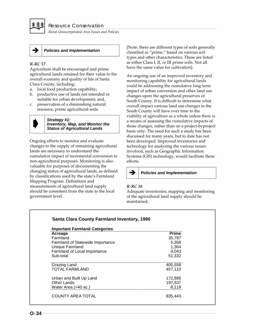
Resource Conservation
Rural Unincorporated Area Issues and Policies
O-34
Policies and Implementation
R-RC 57 Agriculture shall be encouraged and prime agricultural lands retained for their value to the overall economy and quality of life of Santa Clara County, including: a. local food production capability; b. productive use of lands not intended or
suitable for urban development; and, c. preservation of a diminishing natural
resource, prime agricultural soils.
Strategy #1: Inventory, Map, and Monitor the Status of Agricultural Lands
Ongoing efforts to monitor and evaluate changes to the supply of remaining agricultural lands are necessary to understand the cumulative impact of incremental conversion to non-agricultural purposes. Monitoring is also valuable for purposes of documenting the changing status of agricultural lands, as defined by classifications used by the state’s Farmland Mapping Program. Definitions and measurements of agricultural land supply should be consistent from the state to the local government level.
[Note: there are different types of soils generally classified as “prime,” based on various soil types and other characteristics. These are listed as either Class I, II, or III prime soils. Not all have the same value for cultivation].
An ongoing use of an improved inventory and monitoring capability for agricultural lands could be addressing the cumulative long term impact of urban conversion and other land use changes upon the agricultural preserves of South County. It is difficult to determine what overall impact various land use changes in the South County will have over time to the viability of agriculture as a whole unless there is a means of assessing the cumulative impacts of those changes, rather than on a project-byproject basis only. The need for such a study has been discussed for many years, but to date has not been developed. Improved inventories and technology for analyzing the various issues involved, such as Geographic Information Systems (GIS) technology, would facilitate these efforts.
Policies and Implementation
R-RC 58 Adequate inventories, mapping and monitoring of the agricultural land supply should be maintained.
Santa Clara County Farmland Inventory, 1990
Important Farmland Categories Acreage Prime Farmland 35,787 Farmland of Statewide Importance 5,358 Unique Farmland 1,364 Farmland of Local Importance 9,043 Sub-total 51,332 Grazing Land 405,558 TOTAL FARMLAND 457,110 Urban and Built Up Land 172,895 Other Lands 197,537 Water Area (>40 ac.) 8,119 COUNTY AREA TOTAL 835,443

Resource Conservation Rural Unincorporated Area Issues and Policies
O-35
Implementation Recommendations
R-RC(i) 20 Continued local government participation in statewide Farmland Mapping Program, and application of GIS technology. {Implementors: County, cities, State}
R-RC(i) 21 Support preparation of a cumulative impact analysis of projected losses due to permanent conversion of South County agricultural lands to other uses. {Implementors: South Valley cities, LAFCO, County}
Strategy #2: Maintain Stable Long Range Land Use Patterns
Lack of stable, reliable land use patterns makes continuation of agriculture an even more difficult challenge than it already is. In particular, it is important that policies for agricultural areas: • prevent fragmentation of sizeable
agricultural areas; • maintain adequate minimum parcel sizes
large enough to support agricultural uses; and
• allow other land uses supportive or compatible with agriculture that contribute to its long term viability.
For example, land use patterns which create the juxtaposition of agricultural operations and residential development are a disservice to both agriculture and residential property owners. More so than some types of rural commercial land uses, residential development especially can be adversely affected by the noise, dust, odors and other negative impacts of agricultural operations. Even when the agricultural land uses have been long established in an area, farm owners and operators are often subjected to claims of nuisance by neighboring homeowners, once residential development is introduced. For these reasons, further intrusion of residential and other uses that are incompatible with agriculture should be prevented. [Note: Agricultural employee housing may be allowed which is not necessarily intended for permanent
occupation. Such housing should be considered as a necessary supportive use.]
However, where such inconsistencies may already exist, other approaches are needed. “Right-to-farm” legislation has been adopted by other states and localities which limit the liability agricultural land uses that predate neighboring residential land use. Adequate real estate disclosure requirements are often employed to reduce the potential for such nuisance claims. Mediation services may also reduce the potential impacts to farm owners subjected to nuisance claims. These tools may help alleviate problems for farmers in this one area of difficulty, but they should not take the place of sound land use policies that can help prevent such incompatibilities from occurring in the first place.
Finally, there has long been concern that the areas of South County considered to have the greatest long term viability for agriculture should be formally preserved from development. These generally include the areas south and east of Gilroy and other areas which could support urban buffer concepts between South County cities and the village of San Martin. However, to date, the resources and methodology for carrying out these goals have not been developed through joint planning for the areas of greatest concern. Possibilities include the concepts of purchase and transfer of development rights as compensation to landowners, provision of incentives to encourage long term preservation, and other alternatives. Studies of the feasibility of such methods should be undertaken as a joint responsibility of the cities, the County, the LAFCO, and the farming community.
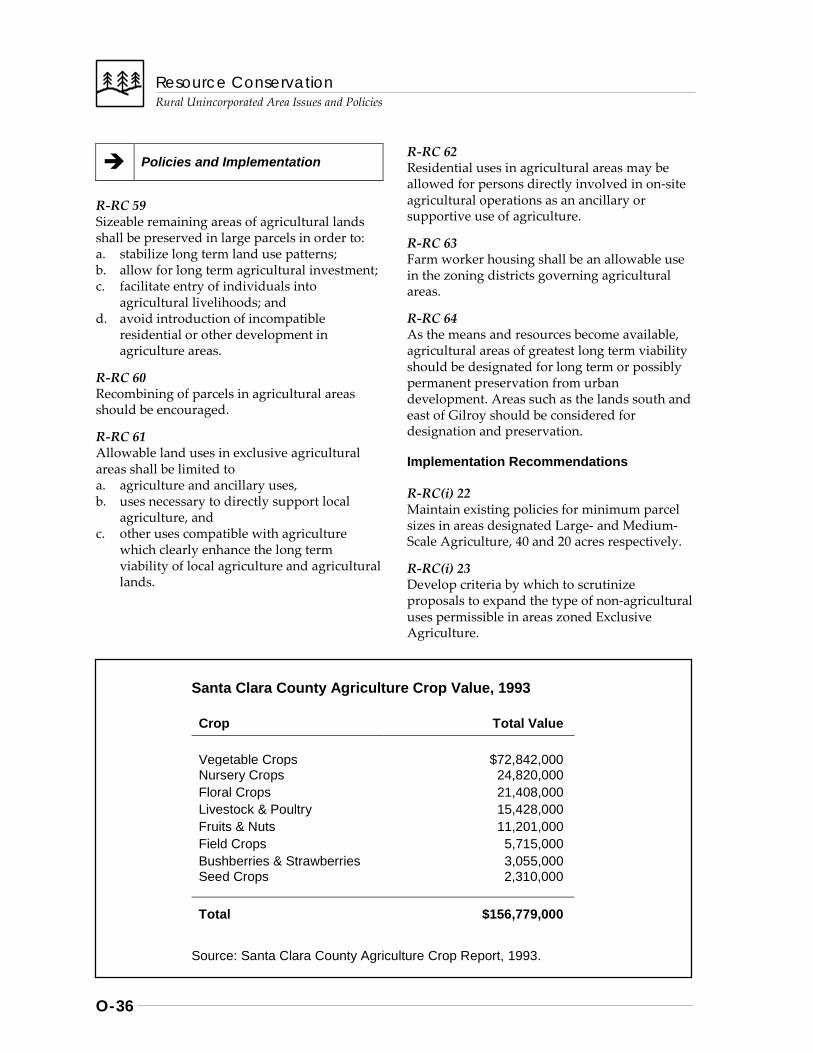
Resource Conservation
Rural Unincorporated Area Issues and Policies
O-36
Policies and Implementation
R-RC 59 Sizeable remaining areas of agricultural lands shall be preserved in large parcels in order to: a. stabilize long term land use patterns; b. allow for long term agricultural investment; c. facilitate entry of individuals into
agricultural livelihoods; and d. avoid introduction of incompatible
residential or other development in agriculture areas.
R-RC 60 Recombining of parcels in agricultural areas should be encouraged.
R-RC 61 Allowable land uses in exclusive agricultural areas shall be limited to a. agriculture and ancillary uses, b. uses necessary to directly support local
agriculture, and c. other uses compatible with agriculture
which clearly enhance the long term viability of local agriculture and agricultural lands.
R-RC 62 Residential uses in agricultural areas may be allowed for persons directly involved in on-site agricultural operations as an ancillary or supportive use of agriculture.
R-RC 63 Farm worker housing shall be an allowable use in the zoning districts governing agricultural areas.
R-RC 64 As the means and resources become available, agricultural areas of greatest long term viability should be designated for long term or possibly permanent preservation from urban development. Areas such as the lands south and east of Gilroy should be considered for designation and preservation.
Implementation Recommendations
R-RC(i) 22 Maintain existing policies for minimum parcel sizes in areas designated Large- and Medium- Scale Agriculture, 40 and 20 acres respectively.
R-RC(i) 23 Develop criteria by which to scrutinize proposals to expand the type of non-agricultural uses permissible in areas zoned Exclusive Agriculture.
Santa Clara County Agriculture Crop Value, 1993
Crop Total Value
Vegetable Crops $72,842,000 Nursery Crops 24,820,000 Floral Crops 21,408,000 Livestock & Poultry 15,428,000 Fruits & Nuts 11,201,000 Field Crops 5,715,000 Bushberries & Strawberries 3,055,000 Seed Crops 2,310,000
Total $156,779,000
Source: Santa Clara County Agriculture Crop Report, 1993.
Resource Conservation Rural Unincorporated Area Issues and Policies
O-37
R-RC(i) 24 Evaluate the various means available for long term or possibly permanent preservation of lands designated as agricultural preserves, including: a. transfer, purchase or dedication of
development rights; b. cumulative impact mitigation fees (Sonoma,
Alameda Counties’ programs provide examples);
c. acquisition by the County’s Open Space Authority;
d. provision of incentives to encourage preservation; and
e. establishment of land trusts or land banking to hold ownership of permanently protected lands.
R-RC(i) 25 Support “Right to Farm” regulations.
Strategy #3: Enhance the Long Term Economic Viability of Agriculture
Today, agricultural profitability is affected more by matters of international trade competition and currency rates than ever before. To the extent that local actions and policies can be useful, efforts to enhance the economic viability of agriculture should be considered an equally important aspect of agricultural preservation. These include marketing and promotional efforts, tax relief, technical support, and other areas of endeavor such as provision of affordable agricultural employee housing (see Rural Unincorporated Areas Housing Chapter).
Williamson Act contracts are used in California to conserve open space and agricultural lands by providing property tax reductions in return for agreements with landowners to keep the land in agriculture or its natural state. Once contracts are in place, landowners must apply for nonrenewal in order to become eligible to subdivide or change the use of the land to one other than those allowed under Williamson Act contracts, also referred to as the Williamson Act Compatible Uses List. Under most situations, contracts are not fully terminated for ten years from the approval of application for non-renewal, unless a request for immediate contract cancellation is approved by the Board of Supervisors.
The following table indicates the total amount of acreage within the County overall under Williamson Act Contract in a given year and the number of acres for which applications for nonrenewal have been submitted. Since 1987-88, the acreage under non-renewal applications has increased from roughly 8,000 to 24,000 acres.
If, as trends seem to indicate, Williamson Act contracts alone do not provide sufficient incentive to preserve agricultural and other non-urban lands, then there may be little that the County can do to discourage or reverse the trend towards increased acreages in non-renewal. Requests for immediate contract cancellations may also increase. In response the County should continue to promote Williamson Act Land Conservation contracts and discourage cancellations.
Agriculture should remain a productive and important part of the overall economy of the county and the region. Increasing attention and
Acres in Active Williamson Contracts and in Non-Renewal, 1987-1993
Year Active Contracts Non-Renewals 1987-88 357,207 7,856 1988-89 357,133 8,026 1989-90 357,502 8,457 1990-91 348,373 17,631 1991-92 337,242 25,649 1992-93 339,770 24,033
Source: County Assessor’s Office
Resource Conservation
Rural Unincorporated Area Issues and Policies
O-38
priority should also be given to other local efforts to enhance the economics of agriculture. Despite the vast array of national and international influences on agriculture, the effectiveness of local and regional actions should not be discounted. Eliminating unnecessary regulation and reducing the economic impact of necessary regulations are ongoing objectives of the agricultural community. The County and the farming community should together review the efforts of other jurisdictions in this regard and other measures to enhance the competitiveness of local agriculture.
Policies and Implementation
R-RC 65 The long term economic viability of agricultural activities shall be maintained and enhanced by promoting: a. improved markets for locally-grown
products; b. Williamson Act provisions for property tax
relief; c. use of innovative, more cost-efficient
growing techniques; d. review of the economic impacts of
regulation and other means of enhancing competitiveness; and
e. adequate agricultural worker housing.
R-RC 66 Williamson Act contracts for the preservation of agriculture and agricultural lands should be promoted and maintained. Requests for immediate contract cancellation should be denied except in cases of unusual circumstances or hardship.
Implementation Recommendations
R-RC(i) 26 Explore the use of marketing and other means of enhancing economic viability found successful in other similarly-situated jurisdictions.
R-RC(i) 27 Evaluate patterns of annual Williamson Act non-renewal activity for eventual impact upon agricultural lands, utilizing GIS capabilities.
R-RC(i) 28
Evaluate economic impacts of federal, state and local regulation of agriculture.
R-RC(i) 29 Explore public/private sector efforts to maintain or provide new affordable housing for agricultural workers (see Housing Chapter for Rural Unincorporated Area Issues & Policies)
R-RC(i) 30 Establish an agricultural competitiveness task force to: a. identify changing conditions, challenges,
and opportunities for for local agriculture; b. identify conditions necessary to maintain
the long term viability of agriculture; c. recommend specific actions for enhancing
the agriculture’s long term viability.
Resource Conservation Rural Unincorporated Area Issues and Policies
O-39
Mineral Resources
Background
TYPES AND SIGNIFICANCE OF MINERAL RESOURCES
Types of Mineral Resources
Mineral resources of significance found and extracted in Santa Clara County include construction aggregate deposits lime stone, and, to a lesser extent, salts derived from evaporation ponds at the edge of San Francisco Bay. Primary issues regarding construction aggregates are those of ensuring their availability, minimizing environmental impacts, and reclamation of quarry sites and similar operations.
Significance of Mineral Resources
Construction aggregates, such as sand, gravel, and crushed stone, have many purposes, including road and building construction. For a growing, highly urbanized area such as Santa Clara County, ensuring adequate supplies of such materials from local sources is of fundamental importance to the economy of the county and region. Because transport costs are a significant aspect of overall supply and pricing, it is imperative that local mineral resource supplies be conserved for maximum long term availability. As sand and gravel deposits in the Bay Area have been nearly depleted, it has become necessary to rely primarily upon crushed stone for construction aggregates.
Mineral Resource Inventory
There are a number of mineral resource deposits in Santa Clara County which are of regional or state-wide significance, as determined by state agencies. Eight (8) are currently being quarried.
PLANNING FOR MINERAL RESOURCE PRESERVATION
Land Use Compatibility
Land use planning to preserve local mineral resources and ensure their future availability must: (a) protect existing and potential sites from development that would preclude mineral extraction, and (b) assure that quarry access routes also remain available to large transport vehicles.
Additional issues having major policy implications include the need to minimize adverse environmental impacts of extraction operations and transport, as well as the need to adequately plan for and execute reclamation plans for sites no longer used for extraction. Finally, newly proposed sites should not be incompatible with surrounding land uses.
Minimizing Environmental Impacts
Extraction operations and transport are often accompanied by a variety of adverse environmental impacts, some of which are unavoidable or cannot be fully mitigated. Some of the major impacts include disruption of drainage patterns, increased erosion and pollution, removal of topsoil and vegetation, habitat loss, air pollution, increased traffic volumes and hazards, noise, and road surface damage. Proposals to expand existing sites or create new quarries should be thoroughly evaluated to determine whether environmental impacts can be reduced to an acceptable level, balancing the need for the resource with alternatives to the proposed activity.
Resource Conservation
Rural Unincorporated Area Issues and Policies
O-40
Recycling to Supplement Supply
One method of extending the useful life of a quarry operation and increasing the supply of these non-renewable resources is to allow the recycling of concrete, asphalt, and dirt. Recycling operations might involve the conversion of concrete to base rock, the breakdown of asphalt for reuse in roads, or the stockpiling of topsoil for future on-site reclamation programs or sale for landscaping use off-site. Recycling facilities could be established either in conjunction with quarry operations or as separate facilities located in areas of the County designated for heavy industrial use. An additional benefit of recycling is the resulting reduction in the volume of material being deposited in the area’s solid waste landfills, thus extending the useful life of those facilities.
Increased truck traffic resulting from the transportation of recyclable materials to the site for processing would be the primary environmental impact of recycling centers. Other impacts might include noise arising from the sorting, crushing, or other processing of recycled materials; air pollution in terms of increased dust, odors, or airborne debris; and the need to remove waste, such as steel reinforcing bars, remaining from the recycling operation.
The potential impacts of recycling operations can be mitigated by locating such operations as close as possible to main roads and by allowing recycling operations only in areas that are adequately buffered from adjacent land uses. Careful evaluation of each proposed recycling operation will insure that all potential environmental impacts are adequately addressed prior to approval.
Reclamation Issues
Reclamation of discontinued extraction sites is another major aspect of environmental impact mitigation. Reclamation plans not only make it possible to restore the site as much as possible for appropriate, subsequent uses, but also lessens the potential for long term environmental damage resulting from unreclaimed quarries. Reclamation of quarries also provides benefits in terms of public safety and aesthetics.
Reclamation of salt evaporation ponds involves related, but somewhat different issues. Salt ponds are created by levees. If discontinued for extraction purposes, future uses of the areas should be consistent with the resource conservation goals, objectives and policies intended to preserve the baylands environment in its natural state.
Table: Quarries in Operation on Unincorporated Lands in Santa Clara County (1992)
Quarry Name (Owner/Operator) Street and Applicable City Location
1. Azevedo (Raisch) Hillsdale Ave.; San Jose Inside Urban Service Area 2. Curtner (De Silva) Scott Creet Rd.; Milpitas Inside Urban Service Area 3. Lexington (West Coast Lime Kiln Cyn. Rd. Outside Urban Service Area
(West Coast Aggregates) 4. Permanente (Kaiser Cement) Permanente Rd.; Cupertino Inside Urban Service Area 5. Polak (Granite Rock) Monterey Rd. Outside Urban Service Area 6. Serpa (Raisch) Old Calaveras Rd.; Milpitas Inside Urban Service Area 7. Stevens Creek Stevens Cyn. Rd. Outside Urban Service Area 8. Swenson Calaveras Rd.; Inside Urban Service Area
Resource Conservation Rural Unincorporated Area Issues and Policies
O-41
Strategies, Policies and Implementation
The variety of issues and concerns associated with preserving and managing mineral resource extraction require a comprehensive set of strategies and policies. As outlined by the General Plan, this approach consists of three basic strategies:
Strategy #1: Ensure Continued Availability of Mineral Resources
Strategy #2: Mitigate Environmental Impacts of Extraction and Transport
Strategy #3: Reclaim Sites for Appropriate Subsequent Land Uses
Policies and Implementation
R-RC 67 Local supplies of mineral resources should be recognized for their importance to the local, regional, and state economy. Strategies for preserving and managing mineral resources include: a. ensuring continued availability of mineral
resources to meet long term demand; b. mitigating environmental impacts of
extraction and transportation; and c. reclaiming sites for appropriate subsequent
land uses.
R-RC 67.1 The mineral resource maps listed below that are contained within State Department of Conservation, Division of Mines and Geology Open File Reports 99-01, 96-03, and 88-19 are hereby incorporated by reference within the Santa Clara County General Plan:
1. DMG Open File Report 88-19 contains only one map, “Mineral Land Classification of the A. J. Raisch Paving Company San Bruno Canyon Greenstone Deposits, October 1988.”
2. DMG Open File Report 96-03: A. Mineral Land Classification Maps:
1. “Generalized Mineral Land Classifi-cation Map of the South San Fran-cisco Bay Production-Consumption Region, 1996.” [scale 1:125,000]
2. “Revised Mineral Land Classification Map: Aggregate Resources Only, South San Francisco Bay Production-Consumption Region, 1996,” for the following USGS quadrangles: a. Milpitas Quadrangle b. Mindego Hill Quadrangle c. Mountain View Quadrangle
B. Designated Areas Update Maps: “Regionally Significant Construction Aggregate Resource Areas in the South San Francisco Bay Production Consumption Region, 1996,” for the following USGS quadrangles: 1. San Jose East Quadrangle 2. Calaveras Reservoir Quadrangle 3. Milpitas Quadrangle 4. Los Gatos Quadrangle 5. Cupertino Quadrangle 6. Mindego Hill Quadrangle
3. DMG Open File Report 99-01: A. Mineral Land Classification Maps:
1. “Generalized Mineral Land Clas-sification Map of the Monterey Bay Production-Consumption Regions, North Half, 1999.” [scale 1:100,000]
2. “Revised Mineral Land Classifica-tion Map: Aggregate Resources Only, Monterey Bay Production- Consumption Region, 1999,” for the following USGS quadrangles: a. Chittenden Quadrangle b. Morgan Hill Quadrangle
B. Designated Area Update Maps: “Regionally Significant Construction Aggregate Resource Areas in the Monterey Bay Production Consumption Region, 1999,” for the following USGS quadrangles: 1. Gilroy Quadrangle 2. Mount Madonna Quadrangle 3. Pacheco Peak Quadrangle 4. Chittenden Quadrangle
[Amended Aug. 7, 2001; File#: 3415-01GP]
Resource Conservation
Rural Unincorporated Area Issues and Policies
O-42
Strategy #1: Ensure Continued Availability of Mineral Resources
Mineral resource deposits of construction aggregates are a finite, non-renewable resource. The locations of these resources are determined by geologic factors. If they are to be made available to meet the long term needs of the local and regional economy, jurisdictions must not preclude their availability by allowing incompatible adjacent land uses.
Certain types of land use are generally incompatible with mineral extraction operations. These tend to be those land uses which introduce large numbers of people and vehicles into an area with a quarry or which contribute to the traffic levels on quarry haul routes. Examples of incompatible land uses include high density residential developments and intensive industrial, commercial, and institutional uses. Residential areas may experience problems with noise, dust, and traffic generated by the quarry, and may be disturbed by the quarry’s visual appearance. Users of public facilities or commercial establishments would likely experience conflicts with quarry truck traffic. Intensive industrial uses would not likely be affected by noise or dust generated by a quarry, but would contribute to the number of trucks using a particular route.
Land uses which tend to be more compatible with extraction operations are those that introduce little additional traffic to quarry haul routes and are less likely to be impacted by the noise, dust, and appearance of extraction operations. Compatible uses include heavy industrial development, recreation areas, open space, agricultural uses, and grazing. Very low density residential (one unit per 10 acres) is acceptable adjacent to existing quarry operations. However, to increase land use compatibility for siting new quarries, the average lot size for adjacent residential uses should be more than 10 acres and consistent with the underlying zoning district. New sites
should be planned, located, and maintained to mitigate negative impacts, such as increased traffic, noise, and pollution on surrounding land uses.
Access must also be preserved by minimizing development along haul routes which could make it infeasible to use the route for transport. Like other “locally unwanted land uses” (LULUs), mineral resource sites can be nuisance-causing land uses; however, like landfills, they are a necessary use that must be accommodated with a minimum of disruption.
Policies and Implementation
R-RC 68 Current and future demand for mineral resources in Santa Clara County, particularly construction aggregates, should be ensured by the following means: a. inventorying existing sites, as well as
identifying and properly designating potential sites for protection measures;
b. preserving deposits and access routes; c. increased use of recycled material; and d. development of new quarry sites.
R-RC 69 Existing sites and access routes for regionally-significant resources should be protected from incompatible land uses and development that would preclude or unnecessarily limit resource availability.
R-RC 70 When making land use decisions involving mineral resource areas of state or regional significance, decisions about alternative land uses should be carefully balanced against the importance of the mineral deposits to their market region as a whole.
R-RC 71 Potential mineral resource areas in addition to those that are currently state-designated zones should be identified to augment diminishing supplies available from existing quarries.
Resource Conservation Rural Unincorporated Area Issues and Policies
O-43
Strategy #2: Mitigate the Environmental Impacts of Extraction and Transport
ENVIRONMENTAL IMPACTS OF MINERAL EXTRACTION ACTIVITIES
Mineral resource extraction operations are often accompanied by adverse environmental impacts, some of which can not be fully mitigated. Such impacts include alterations in topography and drainage patterns, removal of vegetation, disruption of topsoil, the generation of noise and dust, additional traffic and associated hazards, change in the visual appearance of the land, increased erosion, destruction of wildlife habitat, reduction in surface water quality, and increased energy consumption.
Mining of alluvial sources can result in impacts on stream bank stability, channel location and gradient, sedimentation downstream, and groundwater recharge. Major riparian areas, important habitat for many species of birds and animals, may be disrupted. Fishery resources may be disrupted by stream bed siltation, destruction of pool and riffle areas, and instream crossings.
Increased truck traffic along haul routes is the most problematical impact of quarry operations. Truck traffic affects not only adjacent property owners, but all users of the routes. Traffic generated by quarries not only increases the volume of traffic and noise levels on the roads, but may create safety hazards or contribute to the breakdown of roads not designed to withstand the weight of such heavily loaded vehicles.
ENVIRONMENTAL MITIGATIONS
Many of the impacts associated with mining will require special or carefully applied mitigation measures due to the unique nature of this type of operation. Because of the types of activities undertaken at quarries, buffer zones, including landscaping and open space preservation techniques, also are valuable mitigations. Best management practices, such as sedimentation
basins are often necessary also. Encouraging the extraction of mineral deposits nearest the main roads and requiring haulers to use designated truck routes serves to minimize the traffic impacts.
In some cases it may not be possible to mitigate adverse impacts such as visual appearance or increased truck traffic to insignificant levels. In other cases, reducing truck traffic during daylight hours by hauling at night increases noise impacts. Should that be the case, decision-makers would need to weigh the significant, unmitigatible impacts against the regional need for the resource.
REVIEW OF MINERAL EXTRACTION PROPOSALS
As quarries are proposed, the potential impacts on both the environment and surrounding land uses will be thoroughly evaluated through the use permit process and the accompanying environmental review required by the California State Environmental Quality Act (CEQA). The use permit/environmental review process will allow the decision-makers the opportunity to objectively review proposed quarries and to gather public input on the potential impacts.
In conjunction with the use permit required for a proposed quarry operation, a reclamation plan must also be filed (as required by state law). This plan identifies the method for restoring the land for a subsequent use once the quarry operation is completed. The plan must also contain specific information about the site, the mineral commodity being mined, the mining method, and the specifics of the proposed reclamation program. Subsequent uses may range from park land to residential development. It is important to note that reclamation/rehabilitation efforts start from the day the quarry operation begins and conformance with the reclamation plan is monitored by the County’s Architectural and Site Approval Committee throughout the life of the quarry.
PROPOSAL OF NEW QUARRY SITES
New quarry operations proposed in Santa Clara County will be subject to the policies and standards of the General Plan. As mentioned
Resource Conservation
Rural Unincorporated Area Issues and Policies
O-44
earlier, each will require an approved reclamation plan. Should the quarry operators choose to include recycling as part of their operation, they will be required to so specify at the outset of the permit process, allowing the potential impacts to be evaluated as part of the use permit. Should the new quarry be located outside of a State-designated mineral resource area, the quarry operator may wish to contact the State Mines and Geology Board to initiate the process of having their deposit considered for State-designation.
Policies and Implementation
R-RC 72 Environmental Impact Reports shall be mandated for new quarries or for significant expansions of existing quarries not located in the State-designated resource sectors. Borrow pits and similar short term quarries shall be subject to an environmental assessment and may require an environmental impact report.
R-RC 73 The extraction of mineral resources, including sand and gravel, should be carefully conditioned and regulated to mitigate potential adverse environmental impacts, including mitigation measures for potential increases in siltation and/or pollution of water resources in order to adequately protect the local water supply.
R-RC 74 Alternatives to proposed quarry sites should be thoroughly investigated in the Environmental Impact Report, and reasons for rejection should be clearly justified.
R-RC 75 New quarrying activities should be discouraged where significantly visible from the Valley floor, where screening techniques can not minimize the visual impact of the quarry operation, and/or where later rehabilitation of the site will not reduce the remaining visual impacts to a less than significant level.
R-RC 76 Any new quarry should incorporate adequate buffers and screening within its boundaries to protect existing and future uses on adjacent lands.
R-RC 77 Noise impacts to residences along haul routes should be reduced to the maximum extent possible. Sound barriers should be erected where necessary to minimize truck noise impacts on private residences located near quarry access points to public roads.
R-RC 78 Access to new quarry sites should make maximum use of major thoroughfares, such as expressways, freeways, and designated truck routes, avoiding impacts upon local-serving routes. Where feasible, alternatives to truck transport should be encouraged.
R-RC 79 Recycling of concrete, asphalt, dirt, and other materials should be encouraged where appropriate, both at quarry sites and at locations in other parts of the County.
Implementation Recommendations
R-RC(i) 31 Study need for ordinance provisions applicable to state-designated and future quarry sites. {Refers to “-m combining zone” proposal of 1988 Mineral Resources Element Amendment}
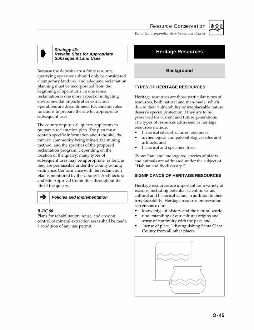
Resource Conservation Rural Unincorporated Area Issues and Policies
O-45
Strategy #3: Reclaim Sites for Appropriate Subsequent Land Uses
Because the deposits are a finite resource, quarrying operations should only be considered a temporary land use, and adequate reclamation planning must be incorporated from the beginning of operations. In one sense, reclamation is one more aspect of mitigating environmental impacts after extraction operations are discontinued. Reclamation also functions to prepare the site for appropriate subsequent uses.
The county requires all quarry applicants to prepare a reclamation plan. The plan must contain specific information about the site, the mineral commodity being mined, the mining method, and the specifics of the proposed reclamation program. Depending on the location of the quarry, many types of subsequent uses may be appropriate, as long as they are permissible under the County zoning ordinance. Conformance with the reclamation plan is monitored by the County’s Architectural and Site Approval Committee throughout the life of the quarry.
Policies and Implementation
R-RC 80 Plans for rehabilitation, reuse, and erosion control of mineral extraction areas shall be made a condition of any use permit.
Heritage Resources
Background
TYPES OF HERITAGE RESOURCES
Heritage resources are those particular types of resources, both natural and man-made, which due to their vulnerability or irreplaceable nature deserve special protection if they are to be preserved for current and future generations. The types of resources addressed as heritage resources include: • historical sites, structures, and areas; • archeological and paleontological sites and
artifacts; and • historical and specimen trees.
[Note: Rare and endangered species of plants and animals are addressed under the subject of “Habitat and Biodiversity.”]
SIGNIFICANCE OF HERITAGE RESOURCES
Heritage resources are important for a variety of reasons, including potential scientific value, cultural and historical value, in addition to their irreplaceability. Heritage resource preservation can enhance our: • knowledge of history and the natural world, • understanding of our cultural origins and
sense of continuity with the past, and • “sense of place,” distinguishing Santa Clara
County from all other places.
Resource Conservation
Rural Unincorporated Area Issues and Policies
O-46
For example, preservation of archeological sites provides valuable insights into the lives of people and their cultures for which there is no other evidence. Preservation of historic rural settings provides tangible evidence of the conditions under which people have lived through the state’s varied history.
CHALLENGES TO HERITAGE RESOURCE PRESERVATION
The challenges to preserving heritage resources are numerous, including: • destruction from natural hazards, such as
seismic activity and natural decay; • demolition to prepare for new development; • inadequate financial support for preserving
and maintaining resources; or • lack of knowledge, appreciation, or respect.
Strategies to overcome these and other challenges must try to address not only the various mechanisms available to preserve resources, but also public attitudes and awareness of their value.
Strategies, Policies and Implementation
The general approach to heritage resource protection outlined by the General Plan consists of three basic strategies:
Strategy #1. Inventory and Evaluate Heritage Resources
Strategy #2. Prevent, or Minimize, Adverse Impacts on Heritage Resources
Strategy #3. Restore, Enhance, and Commemorate Resources as Appropriate
Policies and Implementation
R-RC 81 Heritage resources within the rural unincorporated areas of Santa Clara County shall be preserved, restored wherever possible, and commemorated as appropriate for their scientific, cultural, historic and place values.
R-RC 82 The following strategies should provide overall direction to efforts to preserve heritage resources: 1. Inventory and evaluate heritage resources. 2. Prevent, or minimize, adverse impacts on
heritage resources. 3. Restore, enhance, and commemorate
resources as appropriate.
Historic Heritage Commission and Review Process The County’s Historic Heritage Commission is an eleven member body appointed by the Board of Supervisors. It was established in 1972 by County ordinance to promote and encourage appreciation, recognition and preservation of heritage resources. The Commission is advisory to the Board and all County agencies: • in all matters pertaining to historic sites,
buildings, events, documents and artifacts related to County history;
• on nominations for State Points of Historical Interest, California Landmarks, and the National Register of Historical Places; and
• on any and all matters referred to it by the Board of Supervisors.
The Commission also reviews plans and applications for properties located in the following districts: a. Historic Conservation District, which
includes New Almaden H1 Zoning District;
b. Portuguese Orchard H2 District; c. 1939 World’s Fair Japanese Buildings
(Sakai Property) H3 District; and d. any additional Historic Districts
approved by the Board of Supervisors.
Resource Conservation Rural Unincorporated Area Issues and Policies
O-47
Strategy #1: Inventory and Evaluate Heritage Resources
Inventories of heritage resources serve several purposes: • to document the existence of identified
resources and their location; • to help evaluate the significance, quality,
and protective status of the resources; • to form the basis for recommendations that
resources of various kinds be included in local or national inventories;
• to insure that local decision-makers adequately consider heritage resource conservation; and
• to publicize and increase awareness of the value of heritage resources.
Policies and Implementation
R-RC 83 The County’s Heritage Resources data base shall be maintained and used to review private development projects and guide the design of public projects.
R-RC 84 Heritage resource acquisition, preservation, restoration, and interpretation projects eligible for funding with County Parks Charter Funds are identified in the "Santa Clara County Heritage Resources Inventory" adopted by the Board of Supervisors.
Implementation Recommendations
R-RC(i) 32 Update the listings of heritage trees in the Heritage Resources Inventory.
Strategy #2: Prevent or Minimize Adverse Impacts on Heritage Resources
Irreplaceable resources may be lost or damaged due to accidental or natural forces, such as earthquake damage, but losses due to carelessness, ignorance, or inadequate safeguards should be actively discouraged. Historic and specimen trees deserve the same kind of special consideration given to historic sites, structures and districts. Preventing losses to heritage resources, given their irreplaceable nature, should take precedence wherever possible over attempts to compensate or minimize the impact.
However, when loss or damage to such resources is unavoidable, impacts should be mitigated to the maximum extent possible. For example, if a historic home cannot be saved from a proposed development project, there may be a possibility that it could be moved. In another example, a grove of heritage trees may be proposed for removal due to a road widening or other development project. (Heritage trees are often designated in the inventory as those which were plantings by early settlers, such as those planted along the original roads between missions for shade trees. Other heritage trees might include very mature, old growth native species, such as redwoods or oaks). Route selection and placement alternatives may be able to preserve some if not all of the resource. If an area as a whole is a candidate for preservation, historic districts may be employed to conserve heritage resources.
Policies and Implementation
R-RC 85 No heritage resource shall knowingly be allowed to be destroyed or lost through a discretionary action (zoning, subdivision site approval, grading permit, building permit, etc.) of the County of Santa Clara unless: a. the site or resource has been reviewed by
experts and the County Historic Heritage Commission and has been found to be of insignificant value; or
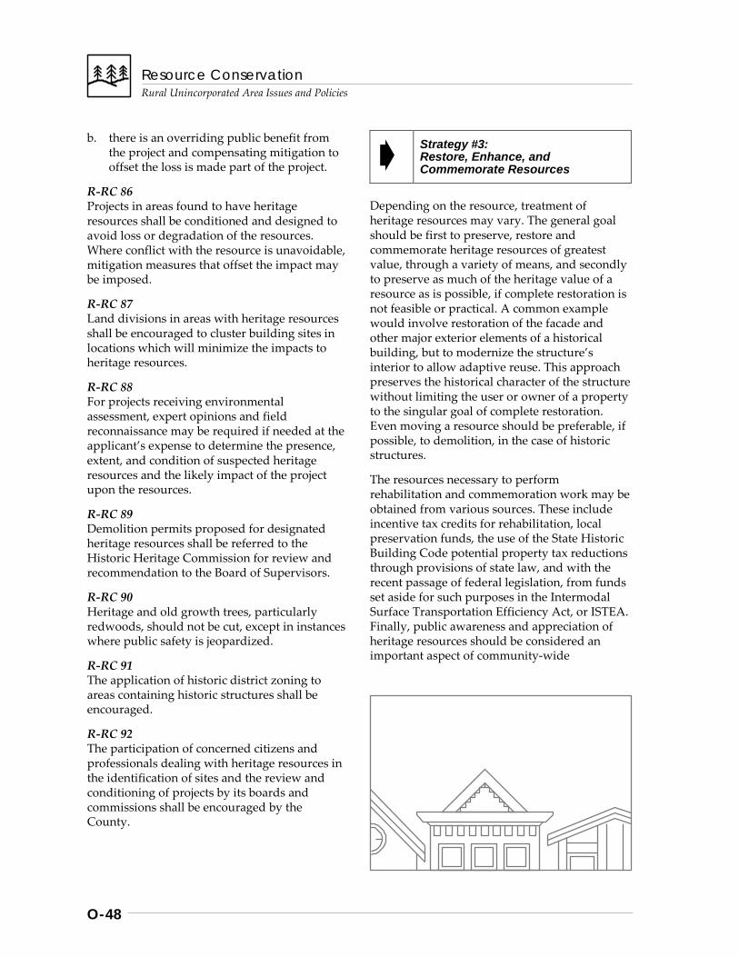
Resource Conservation
Rural Unincorporated Area Issues and Policies
O-48
b. there is an overriding public benefit from the project and compensating mitigation to offset the loss is made part of the project.
R-RC 86 Projects in areas found to have heritage resources shall be conditioned and designed to avoid loss or degradation of the resources. Where conflict with the resource is unavoidable, mitigation measures that offset the impact may be imposed.
R-RC 87 Land divisions in areas with heritage resources shall be encouraged to cluster building sites in locations which will minimize the impacts to heritage resources.
R-RC 88 For projects receiving environmental assessment, expert opinions and field reconnaissance may be required if needed at the applicant’s expense to determine the presence, extent, and condition of suspected heritage resources and the likely impact of the project upon the resources.
R-RC 89 Demolition permits proposed for designated heritage resources shall be referred to the Historic Heritage Commission for review and recommendation to the Board of Supervisors.
R-RC 90 Heritage and old growth trees, particularly redwoods, should not be cut, except in instances where public safety is jeopardized.
R-RC 91 The application of historic district zoning to areas containing historic structures shall be encouraged.
R-RC 92 The participation of concerned citizens and professionals dealing with heritage resources in the identification of sites and the review and conditioning of projects by its boards and commissions shall be encouraged by the County.
Strategy #3: Restore, Enhance, and Commemorate Resources
Depending on the resource, treatment of heritage resources may vary. The general goal should be first to preserve, restore and commemorate heritage resources of greatest value, through a variety of means, and secondly to preserve as much of the heritage value of a resource as is possible, if complete restoration is not feasible or practical. A common example would involve restoration of the facade and other major exterior elements of a historical building, but to modernize the structure’s interior to allow adaptive reuse. This approach preserves the historical character of the structure without limiting the user or owner of a property to the singular goal of complete restoration. Even moving a resource should be preferable, if possible, to demolition, in the case of historic structures.
The resources necessary to perform rehabilitation and commemoration work may be obtained from various sources. These include incentive tax credits for rehabilitation, local preservation funds, the use of the State Historic Building Code potential property tax reductions through provisions of state law, and with the recent passage of federal legislation, from funds set aside for such purposes in the Intermodal Surface Transportation Efficiency Act, or ISTEA. Finally, public awareness and appreciation of heritage resources should be considered an important aspect of community-wide
Resource Conservation Rural Unincorporated Area Issues and Policies
O-49
preservation efforts. The public need not merely be resigned to the loss of heritage resources over time if there is improved awareness of the available safeguards and incentives.
Policies and Implementation
R-RC 93 Heritage resources should be restored, enhanced, and commemorated as appropriate to the value and significance of the resource. All historic rehabilitation activities should comply with the Secretary of Interior’s Standards for Rehabilitation
R-RC 94 Public awareness and appreciation of existing heritage resources and their significance should be enhanced through community organizations, neighborhood associations, the educational system, and governmental programs.
Implementation Recommendations
R-RC(i) 33 Utilize all financial resources available, including those from federal ISTEA and income tax credits for rehabilitation of designated heritage resources.
R-RC(i) 34 Encourage and support efforts by local historians, educational institutions and others interested in recording oral histories and documenting the lives of the people of Santa Clara County who also make up an important but often overlooked part of the County’s heritage.
Scenic Resources
Background
DIVERSITY OF SCENIC RESOURCES
Santa Clara County has a diversity of natural settings and landscapes unequaled in the Bay Area. Coastal mountain ranges to the west of the valley, lushly vegetated with evergreen forests, and the oak chaparral of the Diablo Range on the east together frame an urban landscape which itself has a wide variety of settings and amenities. Add to all this the beauty of its natural rivers and streams, the wetlands near the Bay’s edge, and urban parks and architecture of distinction, and there is little reason to wonder why so many have found it an attractive, hospitable place to live.
VALUE OF SCENIC RESOURCES
At one time, much of the valley lands were in agricultural uses, particularly orchards and many other flowering crops. Now mostly urbanized, the north valley is home to roughly 9 out of 10 county residents, with an overall population exceeding 1.5 million. As our urban environment and economy continue to grow and intensify in development, the psychological, recreational, and spiritual value of natural and man-made beauty grow also.
The largely undeveloped hillsides visible from the valley floor, and the other scenic characteristics of the area help distinguish Santa Clara County from its neighboring counties and cities, furthermore enhancing the overall attractiveness and competitiveness of the county’s economy. Attractive, restful urban park and open space settings also improve the livability of the immediate environment in which most of us spend the majority of our lives. Without such resources, overall quality of life in Santa Clara County would be greatly diminished.
Resource Conservation
Rural Unincorporated Area Issues and Policies
O-50
For all the natural beauty available to residents and visitors of this vast state, it may be most important to preserve the beauty and scenic quality of the resources closest to us. All persons deserve the opportunity in their everyday lives to realize the inherent beauty of nature, on both a grand and small scale, without having to travel great distances from home to do so. The goals and policies of all jurisdictions in Santa Clara County should be to ensure such opportunities to all residents, regardless of socio-economic status, and to ensure that future residents may also enjoy the scenic and aesthetic qualities of our surroundings.
Strategies, Policies and Implementation
The strategies for preserving scenic resources of the rural unincorporated areas consist of the following:
Strategy #1: Maintain Rural Densities That Help Conserve Scenic Resources
Strategy #2: Limit Development Impacts on Highly Significant Scenic Resources
Policies and Implementation
R-RC 95 The scenic and aesthetic qualities of both the natural and built environments should be preserved and enhanced for their importance to the overall quality of life for Santa Clara County.
R-RC 96 The general approach to scenic resource preservation for the rural unincorporated areas consists of the following strategies: 1. Minimize scenic impacts in rural areas
through control of allowable development densities.
2. Limit development impacts on highly significant scenic resources, such as, ridgelines, prominent hillsides, streams, transportation corridors and county entranceways.
Strategy #1: Maintain Rural Densities That Help Conserve Scenic Resources
Through the General Plan and zoning ordinance, Santa Clara County seeks to preserve rural character and conserve scenic resources. For example, residential subdivisions in Hillsides areas are encouraged to cluster development and to maintain 90% or more of the land in permanent, undeveloped open space. Minimum parcel sizes in agriculture areas are 20 and 40 acres, for medium and large scale agriculture, respectively. These policies not only minimize significant environmental impacts and conserve open space, but also help preserve the scenic qualities of the landscapes themselves.
Policies and Implementation
R-RC 97 Scenic qualities of the rural areas of Santa Clara County shall be maintained and enhanced through existing land use and development policies. Development compatible with scenic resource conservation should be encouraged.
Strategy #2: Limit Development Impacts on Highly Significant Scenic Resources
General policies governing allowable uses and densities in rural areas do not preclude the need at times for special policies and measures to conserve scenic resources of special significance, such as prominent hillsides and ridgelines highly visible from the valley, riparian areas, scenic transportation corridors, and county entranceways. Development of inappropriate design, location, scale or density can have a disproportionately greater impact upon highly visible, prominent areas, such as ridgelines.
Major entryways or “gateways” to the County also deserve special consideration for scenic conservation and signage appropriate to the characteristics of the land and the area in general. For example, the scenic quality of major south County entranceways should be
Resource Conservation Rural Unincorporated Area Issues and Policies
O-51
preserved to enhance residents’ and visitors’ appreciation of the area and its attractions. Informational signs compatible with the scenic resources of the area could be used to promote the area’s attractions. Sound walls erected to minimize noise impacts along major thoroughfares may not be compatible with the enjoyment of scenic resource. All in all, there are many reasons to be proud of the scenic qualities of the rural areas, further reinforcing the importance of efforts to retain their scenic value.
Policies and Implementation
R-RC 98 Hillsides, ridgelines, scenic transportation corridors, major county entryways, stream environments, and other areas designated as being of special scenic significance should receive utmost consideration and protection due to their prominence, visibility, and overall contribution to the quality of life in Santa Clara County.
R-RC 99 There shall be no new billboards approved on unincorporated lands.
R-RC 100 Signs allowable under the provisions of the zoning ordinance should be harmonious with the character of the area in which they are located and should be of the highest design standards.
R-RC 101 Roads, building sites, structures and public facilities shall not be allowed to create major or lasting visible scars on the landscape.
R-RC 102 Structures on ridgelines must be located, constructed or landscaped so that they do not create a major negative visual impact from the Valley floor. Land should be divided in such a way that building sites, if possible, are not located on ridgelines.
R-RC 103 Development in rural areas should be landscaped with fire resistant and/or native plants which are ecologically compatible with the area.
Implementation Recommendations
R-RC(i) 35 Consider scenic areas of special prominence, visibility, or other special significance as high priorities for acquisition by the appropriate open space district (Implementors: MROSD or the County’s Open Space Authority).
R-RC(i) 36 Protect the scenic value of the following major County thoroughfares and entranceways through state scenic highway designation, including: a. Pacheco Pass (152 east of Gilroy), b. Hecker Pass (152 west of Gilroy), and c. Route 101 (from the San Jose City limits
south to the San Benito County border).
R-RC(i) 37 Provide entranceway signs compatible with scenic qualities of the area that welcome travelers to the County and indicate major points of interest.
R-RC(i) 38 Identify those areas of greatest sensitivity to visual impacts of development and apply design review requirements to development occurring within those areas (i.e., the “-d” combining district), where not already required as a condition of building site approval. [Not to apply to areas designated Ranchlands east of Hwy. 101 for which building site approval is not currently required.]
[For policies concerning protection of scenic transportation routes, refer to the Rural Unincorporated Parks & Recreation Chapter, Scenic Highways section].

Safety and Noise Rural Unincorporated Area Issues and Policies
Introduction .............................................................................................................P-1 Summary Background Overall Strategies ..........................................................................................P-2
Noise .......................................................................................................................P-3 Summary Background Strategies, Policies, and Implementation .......................................................P-8
Strategy #1: Minimize Noise Conflict Strategy #2: Minimize Exposure to Airport Noise
Natural Hazards .................................................................................................... P-10 Summary Background Strategies, Policies and Implementation ...................................................... P-19
Strategy #1: Inventory Hazards And Monitor Changing Conditions Strategy #2: Maintain Low Resident Population Densities Within
High Hazard Areas Strategy #3: Design, Locate And Regulate Development To Avoid
Or Withstand Hazards • Geologic and Seismic Hazards • Fire Hazards • Flood Hazards
Strategy #4: Reduce The Magnitude Of The Hazard, If Possible Strategy #5: Provide Public Information Regarding Natural
Hazards
Aviation Safety ...................................................................................................... P-26 Summary Background Strategies, Policies, and Implementation ..................................................... P-27
Strategy #1: Limit Population Densities And Land Uses Within Designated Safety Zones
Strategy #2: Regulate Structures And Objects Which Could Be Hazardous Or Distracting To Air Navigation
(cont’d).

Safety and Noise Rural Unincorporated Area Issues and Policies
Waste Water Disposal .......................................................................................... P-28 Summary Background Strategies, Policies, and Implementation .................................................... P-35
Strategy #1: Ensure The Long-Term Reliability Of On-Site Wastewater Systems
Strategy #2: Prevent Wastewater Contamination of Groundwater Supplies
Strategy #3: Monitor Groundwater Quality
Safety and Noise
Rural Unincorporated Area Issues and Policies
P-1
Introduction
Summary
This Chapter of the General Plan addresses a range of rural area public health and safety issues. While at first glance they may seem so diverse as to be unrelated, on closer examination it becomes clear that they all touch on aspects of natural and built environments which are critical to sustaining the quality of life for rural residents. As in the Countywide Chapter, this chapter includes policies which are intended to minimize potential human or environmental injury and property damage.
The Safety Element of the General Plan is one of seven mandatory elements identified in State Government Codes addressed General Plan requirements. The Code directs local governments to evaluate the natural and built environment for potential hazards and, to the extent possible, assess and describe the risk factors of the most threatening of those hazards. Sections of this chapter, combined with those in the Countywide chapter, are intended to satisfy those requirements.
The chapter includes the following sections:
• Noise, • Natural Hazards, • Aviation Safety, and • Waste Water Disposal.
[Amended Aug. 25, 2015; File#: 10184-11GP, Air Quality Section superseded by Health Element, Air Quality and Climate Change Section; chapter title changed from Health and Safety to Safety and Noise.]
Background
ESTABLISHING ACCEPTABLE LEVELS OF RISK
The General Plan guidelines point out that the safety element should contribute to land use policies and standards by relating the type and intensity of land use relative to estimated levels of risk, and to the availability of services and facilities to ensure safety.
Risk, by definition, implies assessing the probable outcome of development actions in relation to likely future events. Clearly, assessing “level of risk” implies a degree of imprecision given our incomplete knowledge of the future. Nonetheless, the guidelines recognize that this can be done in broad yet useful terms by comparing the likelihood of specific events to “unreasonable” levels of risk.
PERFECT SAFETY IS UNATTAINABLE
The concept of acceptable versus unreasonable risks recognizes that perfect safety is unattainable or so confining and costly as to be undesirable even if approached. Extremely unacceptable risks are relatively easy to determine, for example, buildings should not be placed on known active faults. Likewise, few would question the wisdom of standards of construction required to insure a high degree of safety in schools and hospitals.
The guidelines recognize that other risk situations which requires some local controls and regulation are less clearly definable. In some cases an exact and clear definition of acceptable risk is impossible. The solution in such cases must not only avoid unnecessary risk, but also must be economically and socially acceptable.
Safety and Noise
Rural Unincorporated Area Issues and Policies
P-2
MINIMIZING PUBLIC COSTS
The County and other public agencies are unable to guarantee that any development will not, at some point in the future, be adversely affected by the hazards identified in this chapter. Hazards, by their nature, defy precise prediction. The ideal would be to divert new development from areas with high hazard potential and the policies of this chapter strive to achieve that objective. Problems arise however in areas where risk is more difficult to assess (i.e., residential development in areas far removed from fire and medical facilities) but there is enough evidence to raise doubts concerning the safety of residents or visitors under specific circumstances.
In some instances, where there is a significant factual question about whether a particular development has sufficiently mitigated risks from hazards to an “acceptable” level, the property owner may wish to proceed despite the existence of such a factual question. In such cases, it is important to consider potential costs to public agencies which may occur should disaster strike future residents or visitors of the project. The public costs of providing emergency services and disaster relief should be assessed and made a part of the decision making process.
RELATIONSHIP OF CHAPTER TO VISION
The Health and Safety Chapter policies address all the major themes and several goals of the Vision of the General Plan. By encouraging the development in the appropriate urban and rural locations, the policies strive to create Balanced Growth. The attention to minimizing risks for people and property addresses objectives for Livable Communities and Social Well-Being. The economic dimensions of adequately planned waste management facilities, and accessible health services underscore community concerns for overall Economic Well-Being.
Overall Strategies
AVOIDING RISKS
The strategies and policies in this chapter are intended to discourage development which will place residents, employees and visitors in unreasonable or avoidable high risk situations. Through these policies and the related Land Use Map policies, the County seeks to limit the range of land uses allowed in hazardous situations in order reduce the number of people and buildings exposed to high risk.
The policies focus attention on and encourage cooperation in developing effective, economically feasible implementation procedures which do not unduly burden local businesses and individual households. The policies are also intended to minimize potential for undue financial burden on the County, and other public agencies by avoiding development which is likely to incur unusually high public service or disaster relief costs.
PREVENTION, MITIGATION, AND PREPAREDNESS
Strategies common to all sections include:
• Preventing exposure to dangerous conditions - First and foremost, the strategies encourage us minimize to the extent feasible the likelihood that harm will come to either people or the environment.
• Minimizing danger when exposure is unavoidable - Living in our complex, modern society entails certain risks. Where we have determined a certain level of risk is appropriate, we should use the appropriate measures to ensure that level is not exceeded.
• Being prepared for disaster - Despite our best efforts, disasters will nonetheless occur. We must prepare for these occasions in ways which will minimize death and injury, and ensure swift restoration of normalcy.
Safety and Noise
Rural Unincorporated Area Issues and Policies
P-3
Noise
Summary
All citizens are entitled to a peaceful and quiet environment, free from unnecessary and annoying levels of noise. Noise has been shown to interfere with speech, sleep and mental concentration, induce stress and headaches, and disrupt overall efficiency and enjoyment of life. It is, therefore, in the public interest that the County and the cities evaluate techniques and develop policies which provide for an environment free from noise which may be hazardous to public health and well-being. Santa Clara County strives to ensure an environment for all residents that is free from noise that jeopardizes public health and well-being. Toward that end, the strategies in this section focus on two principal areas:
• Minimizing Noise Conflicts, and • Minimizing Exposure to Airport Noise
Background
Noise is unwanted sound. The impacts of noise can be annoying and physically harmful. Exposure to intense noise may lead to irreversible hearing damage, and may induce other health problems due to stress. The effects of noise build up over time, so it is necessary to deal not only with the level of sound but also the duration of exposure.
COEXISTING WITH NOISE
Where noise sources are a given, the ideal situation would be complete separation of noise- sensitive uses from noise-generating sources. However, real world conditions make it difficult to isolate all noise sources. Consequently, all new uses are evaluated for potential noise impacts on existing uses and for their sensitivity to existing noise sources which may already be affecting the site. The new use generally bears
the burden of ensuring that it is compatible with existing uses.
Measures to Mitigate Noise Impacts
Where the potential for significant noise impacts exists, buffers can be placed between noise sources and existing or proposed development. This approach is most effective in large scale, mixed use or planned developments. Such techniques include locating noise sensitive buildings away from noise sources and using the natural topography or intervening buildings to shield noise sensitive uses. There are also a number of techniques to minimize interior noise, including site planning, architectural design and construction standards, and noise barriers.
Within areas identified as being impacted by noise, projects should be designed to be compatible with the specific types of noise which affect the site the most. In the case of airports, such noise is the loudest aircraft that normally uses the airport. In the case of roads, the maximum noise levels are those of large trucks traveling at the speed limit.
Noise Impacts at the Urban Fringe
The techniques described above can mitigate noise impacts only so far. Some noise impacts are more difficult to mitigate than others. A growing source of noise-based conflicts in rural unincorporated areas is the mix of essentially suburban residential development with active agriculture. Many new rural area homeowners, particularly recent urban transplants, appear to be surprised by the sights, smells and sounds which have always been apparent to farm families. Although initially attracted to the area by what they perceived to be a “farm” lifestyle, they have shown a degree of intolerance for the noise and dust generated by heavy farm equipment and the extreme hours crop maintenance demands. Their discomfort has led to a rise in citizen complaints and citations of farmers and machine operators.

Safety and Noise
Rural Unincorporated Area Issues and Policies
P-4
Most of these incidents have occurred at the fringe of the urban area as development expands into what are active farming areas. Although County land use policies generally discourage non-farm related housing in agricultural areas, some housing for urban workers has occurred there. For many reasons, friction between new and existing land uses at the urban fringe may be largely unavoidable.
Noises Appropriate to the Rural Area
Some types of noises are common and appropriate to the rural area. Noise producing land uses such as farming activities, quarrying operations, and a range of transportation types are typical of rural agricultural areas. New uses carry the burden of proving they are compatible with existing uses and with long term projected uses in the area. The County should carefully assess the compatibility of non-farm-related uses
before allowing such uses to expand into active farming areas.
Reducing Noise Conflicts
A variety of options do exist for reducing friction between farm and non-farm uses. Principal among these would be to inform prospective buyers that they are purchasing property adjoining or near to active farm operations and that this necessarily places them within range of the noise of tractors and other vehicles on or traveling to and from the fields. Farmers, too, must strive to be good neighbors by keeping noise to a minimum. Community contacts which will bring these two groups together will enhance mutual understanding and the opportunity to develop more effective and more feasible solutions to noise abatement. If not, dispute resolution services should be made available as a less costly alternative to litigation.
Measuring Noise
Three common measures of sound form the basis of County standards discussed in this section: Day-Night Average Sound Level (DNL), Community Noise Equivalent Level (CNEL), and A-weighted Sound Level (dB). The level of sound that impacts a property varies greatly during the day. As an example, the sound near an airport may be relatively quiet when no airplane is taking off or landing, but will be extremely loud as a plane takes off. In order to deal with these variations, several noise indices have been developed which measure how loud each sound is, how long it lasts, and how often the sound occurs. The indices express all the sound occurring during the day as a single average level, which if it occurred all day would convey the same sound energy to the site. The sound indices most commonly used to describe environmental noise are the Day-Night Average Sound Level (DNL) and the Community Noise Equivalent Level (CNEL). When calculating the 24-hour average of sound in an area, these two indices respond to the community’s preference for a quieter environment in the evening and nighttime hours by assigning penalties to noises which
occur during those specified hours prior to calculating the average. Both indices place a 10 dB penalty on all noises occurring from 10:00 p.m. to 7:00 a.m. The CNEL calculation varies in that it also places a 5 dB penalty on noise events during evening hours (7:00 p.m. to 10:00 p.m.). The two systems yield generally similar results and are used interchangeably. In this General Plan, noise standards are expressed as DNL levels, as recommended by the Environmental Protection Agency (EPA) for community noise planning. Santa Clara County’s Airport Land Use Commission expresses its standards in terms of CNEL values, as is commonly practiced in California. Sound is measured in decibels (dB) using a special meter. The decibel scale of sound is logarithmic. Each increase of 10 dB means that the acoustical energy is multiplied by 10 - a sound of 70 dB is 10 times as intensive as one of 60 dB. However, the relative loudness of sound as perceived by the human ear does not closely match the actual relative amounts of sound energy. For example, while 70 dB is physically 10 times as intensive as 60 dB, listeners tend to judge it as only twice as loud.

Safety and Noise
Rural Unincorporated Area Issues and Policies
P-5
MAJOR NOISE SOURCES
Noise sources are divided into two categories: stationary sources and mobile sources. Stationary sources emanate from a single point. Mobile sources are those that move around or can’t be attributed to a single point (i.e. a plane in flight). As one moves away from a sound source, the sound level gradually decreases or attenuates. Aside from distance, a sound may be attenuated by objects which shield a potential receiver from unwanted sound.
In 1974, the County conducted a survey to determine the areas most impacted by noise. The study found that the major areas affected by noise are those located near transportation— streets, freeways, rail lines, and airports. The County has previously identified areas experiencing noise levels of 55 dB DNL or greater as “noise impact areas”. Noise impact areas exist in connection with all of the identified sources.
In general, the lands not affected by transport-ation had readings in the 40 to 55 DNL range, with remote parks having readings in the very
Safety and Noise
Rural Unincorporated Area Issues and Policies
P-6
low range below 40 DNL. In rural areas, general noise levels are low but specific noises are often extremely annoying (i.e., blasting from quarries, shooting ranges, power boats, and off-road vehicles may disturb the serenity of an area without significantly affecting the day-long average readings of the DNL scale.)
Noises generated by transportation are by far the most significant and persistent countywide. The affected areas along freeways and near airports have been mapped by the State of California, by the County Transportation Agency, and by the Airport Land Use Commission (ALUC). In addition, the County noise survey indicated a pattern of noise impact along several county highways. (Updated noise contour maps for areas along major transportation corridors are available for review in the County Planning Office).
AIRPORT NOISE
ALUC Plan and Land Use Regulations
Ensuring compatibility between aircraft noise and various types of land uses is one of the primary functions of the Airport Land Use Commission (ALUC). The ALUC’s Land Use Plan for Areas Surrounding Santa Clara County Airports (ALUC Plan) includes a detailed discussion of the types of noise generated by aircraft, how the noise environment around airports is measured, how noise compatibility standards were established, and the steps being taken to control airport noise.
Several types of noise are common in the vicinity of airports. Noise generated during take-off and landing operations is most commonly the focus of neighborhood concerns, but other types of aircraft-generated noise can be a problem. Planes in flight, engine “run-up”, the low frequency “rumble” of jet aircraft, or helicopter noise can be intrusive to some individuals.
The Community Noise Equivalent Level (CNEL) contours have been mapped and are used to evaluate the compatibility of various types of land uses within the noise environment surrounding the airport. These contours are also called noise zones and illustrate the reduction in
acoustical energy which can be expected to occur as sound travels away from the airport.
There are however, limitations to using just the CNEL values in this case. CNEL measures noise over a 24 hour period, placing a 5 dB penalty on noises occurring from 7:00 p.m. to 10:00 p.m. and a 10 dB penalty on all noises occurring from 10:00 p.m. to 7:00 a.m. Single events may be 40 or 50 dB higher than the overall average of sounds in a given area and therefore constitute a nuisance even though the CNEL is acceptable.
The majority of complaints originating from outside of the designated noise impact areas surrounding our airports are related to single events, rather than the overall operation of the airport. Similarly, people living further from the airport than those within the 60-65 CNEL contour may hear a lower level of sound from aircraft operations, but be more irritated by it because the sound lasts longer at their location. Weather conditions can also change where sound travels. For this reason, Single Event Noise Exposure Levels (SENEL) may also be calculated for airports such as San Jose International Airport. The combination of the average noise environment as shown by the CNEL and the single event levels gives a better understanding of the noise environment that will be encountered by a proposed land use and, thus, provides a better basis for decision making.
Sources of Airport Noise
There are five airports in Santa Clara County, one of which is located in the rural unincorporated area. The San Martin Airport, previously named South County Airport, is located in the unincorporated area of San Martin, between the cities of Gilroy and Morgan Hill.
San Martin Airport is a Basic Utility II airport and occupies 179 acres. A Basic Utility II airport means that it can service about 75% of the single-engine and small twin-engine airplanes used for personal and business purposes. A Basic Utility II airport can also serve some small business and air taxi-type twin-engine airplanes.
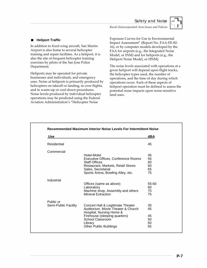
Safety and Noise
Rural Unincorporated Area Issues and Policies
P-7
Heliport Traffic
In addition to fixed wing aircraft, San Martin Airport is also home to several helicopter training and repair facilities. As a heliport, it is also the site of frequent helicopter training exercises by pilots of the San Jose Police Department.
Heliports may be operated for private businesses and individuals, and emergency uses. Noise at heliports is primarily produced by helicopters on takeoff or landing, in over flights, and in warm-up or cool-down procedures. Noise levels produced by individual helicopter operations may be predicted using the Federal Aviation Administration’s “Helicopter Noise
Exposure Curves for Use in Environmental Impact Assessment” (Report No. FAA-EE-82-16), or by computer models developed by the FAA for airports (e.g., the Integrated Noise Model, or INM) and for heliports (e.g., the Heliport Noise Model, or HNM).
The noise levels associated with operations at a given heliport will depend upon flight tracks, the helicopter types used, the number of operations, and the time of day during which operations occur. Each of these aspects of heliport operation must be defined to assess the potential noise impacts upon noise-sensitive land uses.
Recommended Maximum Interior Noise Levels For Intermittent Noise
Use dBA
Residential 45
Commercial Hotel-Motel 45 Executive Offices, Conference Rooms 55 Staff Offices 60 Restaurant, Markets, Retail Stores 60 Sales, Secretarial 65 Sports Arena, Bowling Alley, etc. 75
Industrial Offices (same as above) 55-60 Laboratory 60 Machine shop, Assembly and others 75 Mineral Extraction 75
Public or Semi-Public Facility Concert Hall & Legitimate Theater 30 Auditorium, Movie Theater & Church 45 Hospital, Nursing Home & Firehouse (sleeping quarters) 45 School Classroom 50 Library 50 Other Public Buildings 55
Safety and Noise
Rural Unincorporated Area Issues and Policies
P-8
Strategies, Policies, and Implementation
The strategies below affirm the County’s intent to continue its efforts to ensure an environment for all unincorporated area residents that is free from unwanted noise which jeopardizes their health and well-being.
The State has researched the impacts of differing noise levels on a variety of land uses, as have the Federal government and local jurisdictions. Based on those studies, noise standards for interior living spaces have been incorporated into a County Noise Ordinance. Standards for multifamily units are also incorporated into both State Law -Title 24 and the Uniform Building Code (UBC). The UBC standards have been adopted by the County.
Strategy #1: Minimize Noise Conflict
Given that many types of land uses must coexist in the unincorporated county, the challenge for planning is to achieve maximum compatibility. Land use planning and development review must carefully evaluate the noise producing potential of new development. Where that potential exceeds acceptable limits, steps must be taken to minimize impacts on both existing and projected surrounding uses.
Parts of the rural Santa Clara County are developed, although at very low density. Many rural residents have chosen to live in these areas precisely for the quiet character. New uses proposed for such areas need to be carefully assessed for the noise inducing potential. Adequate distancing alone can often mitigate most noise impacts which would otherwise be intolerable in more densely developed areas. However, further measures may be necessary to ensure that the quality of life for residents is not unduly degraded.
Conversely, the noise of tractors and other farm machines are common in rural agricultural areas. In the interests of sustaining long term agriculture, a major economic as well as a land use objective for the County, it is important that noise-sensitive, non-agricultural uses be kept away from farming areas or that noise buffering measures be integrated into those non-agricultural projects.
Policies and Implementation
R-HS 1 Significant noise impacts from either public or private projects should be mitigated.
R-HS 2 The County should seek opportunities to minimize noise conflicts in the rural areas.
R-HS 3 New development in areas of noise impact (areas subject to sound levels of 55 DNL or greater) should be approved, denied, or conditioned so as to achieve a satisfactory noise level for those who will use or occupy the facility (as defined in “Noise Compatibility Standards for Land Use” and “Maximum Interior Noise Levels For Intermittent Noise”).
Implementation Recommendations
R-HS(i) 1 Project design review should assess noise impacts on surrounding land uses. (Implementor: County)
R-HS(i) 2 Where necessary, require appropriate noise mitigations. (Implementor: County)
R-HS(i) 3 Prohibit construction in areas which exceed applicable interior and exterior standards, unless suitable mitigation measures can be implemented. (Implementors: County)
Safety and Noise
Rural Unincorporated Area Issues and Policies
P-9
R-HS(i) 4 Require project-specific noise studies to assess actual and projected dB noise contours for proposed land uses likely to generate significant noise. (Implementors: County)
R-HS(i) 5 Take noise compatibility impacts into account in developing local land use plans. (Implementors: County)
R-HS(i) 6 Incorporate acoustic site planning into the design of new development, particularly large scale, mixed use, or master planned development, through measures which may include: a. separating noise sensitive buildings from
noise generating sources; b. using natural topography and intervening
structure to shield noise sensitive land uses; and
c. adequate sound reduction within the receiving structure.
(Implementors: County, architects and developers)
R-HS(i) 7 Support continued contacts (i.e., a task force, public education, speaking opportunities) between farming and non-farming interests toward enhancing the compatibility of rural area uses. (Implementors: County, Farm Bureau, farming interests, community and real estate industry representatives)
Strategy #2: Minimize Exposure to Airport Noise
With regard to airports, the Airport Land Use Commission (ALUC) is charged with providing guidance to local jurisdictions to insure that land uses established in the vicinity of airports are compatible with the noise environment. The primary vehicle for this guidance is the ALUC Plan. In determining appropriate uses for areas adjacent to county airports, ALUC has given serious consideration to noise, particularly noise which might interfere with speech or sleep, and those noises which might lead to excessive stress.
State law mandates that the County’s general plan be consistent with local ALUC Plans. The most effective way to ensure consistency is to defer to ALUC policies and standards for development on or adjacent to airports in the rural unincorporated area.
Policies and Implementation
R-HS 4 Land uses approved by the County and the cities shall be consistent with the adopted policies of the Santa Clara County Airport Land Use Commission's Comprehensive Land Use Plan.
Implementation Recommendations
R-HS(i) 8 Adhere to the adopted policies and standards in the Santa Clara County Airport Land Use Commission's Comprehensive Land Use Plan when making decisions regarding land use adjacent to airports.
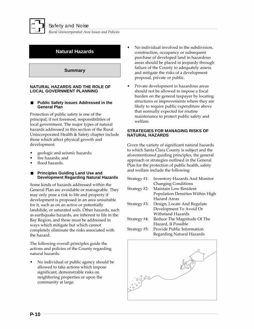
Safety and Noise
Rural Unincorporated Area Issues and Policies
P-10
Natural Hazards
Summary
NATURAL HAZARDS AND THE ROLE OF LOCAL GOVERNMENT PLANNING
Public Safety Issues Addressed in the General Plan
Protection of public safety is one of the principal, if not foremost, responsibilities of local government. The major types of natural hazards addressed in this section of the Rural Unincorporated Health & Safety chapter include those which affect physical growth and development:
• geologic and seismic hazards; • fire hazards; and • flood hazards.
Principles Guiding Land Use and Development Regarding Natural Hazards
Some kinds of hazards addressed within the General Plan are avoidable or manageable. They may only pose a risk to life and property if development is proposed in an area unsuitable for it, such as on an active or potentially landslide, or saturated soils. Other hazards, such as earthquake hazards, are inherent to life in the Bay Region, and these must be addressed in ways which mitigate but which cannot completely eliminate the risks associated with the hazard.
The following overall principles guide the actions and policies of the County regarding natural hazards:
• No individual or public agency should be allowed to take actions which impose significant, demonstrable risks on neighboring properties or upon the community at large.
• No individual involved in the subdivision, construction, occupancy or subsequent purchase of developed land in hazardous areas should be placed in jeopardy through failure of the County to adequately assess and mitigate the risks of a development proposal, private or public.
• Private development in hazardous areas should not be allowed to impose a fiscal burden on the general taxpayer by locating structures or improvements where they are likely to require public expenditure above that normally expected for routine maintenance to protect public safety and welfare.
STRATEGIES FOR MANAGING RISKS OF NATURAL HAZARDS
Given the variety of significant natural hazards to which Santa Clara County is subject and the aforementioned guiding principles, the general approach or strategies outlined in the General Plan for the protection of public health, safety and welfare include the following:
Strategy #1: Inventory Hazards And Monitor Changing Conditions
Strategy #2: Maintain Low Resident Population Densities Within High Hazard Areas
Strategy #3: Design, Locate And Regulate Development To Avoid Or Withstand Hazards
Strategy #4: Reduce The Magnitude Of The Hazard, If Possible
Strategy #5: Provide Public Information Regarding Natural Hazards
Safety and Noise
Rural Unincorporated Area Issues and Policies
P-11
Background
LAND INSTABILITY HAZARDS
The most significant types of general geologic hazards, or hazards of land instability, that affect the rural unincorporated areas are:
• slope instability, such as landslides, mudslides, and soil creep;
• expansive clays; • peat and other highly organic soils; and • Bay muds and saturated soils.
In some instances, hazards of land instability may occur or increase in severity in association with the effects of an earthquake, saturation during prolonged heavy rains, and other factors. Each is briefly discussed below for its potential impacts upon development.
Slope Instability: Landslides and Soil Creep
The two major types of slope instability addressed within the General Plan are landslides and soil creep. Though related phenomena, landslide potential is generally of greater concern to land use and development planning, because it poses a greater hazard to development and infrastructure. Much of the east foothills of the Diablo Range are subject to slope instability, as are much of the Santa Cruz Mountains, which are generally steeper than the Diablo Range.
Landslide potential is one of the most significant types of land instability that affects development in the rural area, especially in the steeper areas of the county. Much of the rural unincorporated area is characterized by moderate-to-steep slopes. Depending on the steepness of the slopes, the soils, and the underlying geology, among other factors, there may be little or no tendency for slope failure, or active landslides may be fairly common.
The popular connotation of the term ‘landslide’ is one of catastrophic events such as debris flows or “rock slides.” However, the typical active landslide may move fairly slowly, but inexorably, downhill at a rate of a few inches per year, potentially taking roads, driveways, utilities, and structures with them over the long term. In the short term, structures on active landslides may suffer foundation damage, structural separation, uneven settlement, damage to water pipes and other utilities, and other effects that cumulatively pose a major risk to life and property.
On the other hand, soil creep is a form of slope failure characterized by very slow, differential downhill settlement of a slope over a given area. Soils “creep” downhill due to differential rates of expansion and contraction and simply due to gravity. On most slopes steep enough to experience soil creep, the depth of material is not thick enough nor the rate of creep rapid enough to pose a significant hazard to development. However, creep rates of 0.5 inches per year have been observed on slopes as low as 8 degrees, or about 15%.
Active landslides may be confined to a relatively small geographic area, or consume hundreds of acres. Landslides may also vary considerably in thickness. If the overall rate of movement is significant and the mass and thickness of the slide is very great, there may be no cost effective engineering solution that can stabilize the part of the slope on which the building or improvement is located. In such cases, the only feasible and safe solution is an alternative location for development.
In other situations, such as with soil creep, geologic studies may indicate that with only a few simple engineering modifications, such as reinforcing walls and drainage improvements, it may be possible to stabilize a slope and build without jeopardizing lives, the structures themselves or potentially incurring long term maintenance costs. Nevertheless, as a general rule, active landslides have proven to be unsuitable building sites.
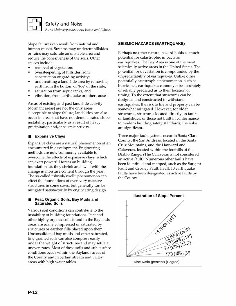
Safety and Noise
Rural Unincorporated Area Issues and Policies
P-12
Slope failures can result from natural and human causes. Streams may undercut hillsides or rains may saturate an unstable area and reduce the cohesiveness of the soils. Other causes include: • removal of vegetation; • oversteepening of hillsides from
construction or grading activity; • undercutting a landslide area by removing
earth from the bottom or ‘toe’ of the slide; • saturation from septic tanks; and • vibration, from earthquake or other causes.
Areas of existing and past landslide activity (dormant areas) are not the only areas susceptible to slope failure; landslides can also occur in areas that have not demonstrated slope instability, particularly as a result of heavy precipitation and/or seismic activity.
Expansive Clays
Expansive clays are a natural phenomenon often encountered in development. Engineering methods are now commonly available to overcome the effects of expansive clays, which can exert powerful forces on building foundations as they shrink and swell with the change in moisture content through the year. The so-called “shrink/swell” phenomenon can effect the foundations of even very massive structures in some cases, but generally can be mitigated satisfactorily by engineering design.
Peat, Organic Soils, Bay Muds and Saturated Soils
Various soil conditions can contribute to the instability of building foundations. Peat and other highly organic soils found in the Baylands areas are easily compressed or saturated by structures or earthen fills placed upon them. Unconsolidated bay muds and other saturated, fine-grained soils can also compress easily under the weight of structures and may settle at uneven rates. Most of these soils and sub-surface conditions occur within the Baylands areas of the County and in certain stream and valley areas with high water tables.
SEISMIC HAZARDS (EARTHQUAKE)
Perhaps no other natural hazard holds as much potential for catastrophic impacts as earthquakes. The Bay Area is one of the most seismically active areas in the United States. The potential for devastation is compounded by the unpredictability of earthquakes. Unlike other potentially catastrophic phenomenon, such as hurricanes, earthquakes cannot yet be accurately or reliably predicted as to their location or timing. To the extent that structures can be designed and constructed to withstand earthquakes, the risk to life and property can be somewhat mitigated. However, for older structures, structures located directly on faults or landslides, or those not built in conformance to modern building safety standards, the risks are significant.
Three major fault systems occur in Santa Clara County, the San Andreas, located in the Santa Cruz Mountains, and the Hayward and Calaveras, located within the foothills of the Diablo Range. (The Calaveras is not considered an active fault). Numerous other faults have been identified and mapped, such as the Sargent Fault and Crosley Fault. In all, 10 earthquake faults have been designated as active faults by the County.
Illustration of Slope Percent Rise Ratio (percent) {Degree}
Safety and Noise
Rural Unincorporated Area Issues and Policies
P-13
Effects of Earthquakes
When an earthquake occurs, waves of energy are transmitted through the earth, resulting in a variety of seismic effects, including:
• ground motion or shaking, • ground failure, • surface rupture or displacement along
faults, and • water movements due to earthquakes.
Each of these creates the potential for extensive and costly damage to buildings, infrastructure, and for loss of life. Under conditions of saturated soils, common during the winter rainy season, the effects of earthquakes and seismically-induced landslides are greatly increased.
The most recent earthquake to affect the Bay Area was the Loma Prieta quake of 1989. It measured 7.1 on the Richter scale, a moderate- to-heavy quake, and caused 62 fatalities and over $6 billion damage. It occurred near a segment of the San Andreas Fault which extends roughly from Watsonville northwest to Los Gatos. The epicenter was removed from major population centers, but it caused extensive damage to masonry structures in such places as Los Gatos, Santa Cruz, and Watsonville, as well as causing the collapse of the Cypress Structure along I-880 in Oakland, among other notable impacts.
Since that time, the United State Geological Survey, in conjunction with other scientists, have forecast that there is a 67% chance for at least one earthquake of magnitude 7 or higher in the San Francisco Bay Area between 1990 and 2020. If the forecast proves accurate, and an earthquake occurs closer to population centers, the effect on major urban areas is expected to be far more pronounced than that of Loma Prieta, and most current residents of Santa Clara County will experience it within their lifetimes.
Ground Shaking
Ground shaking is the term used to describe the phenomenon most readily associated with earthquakes. Depending on the magnitude
Earthquake Magnitudes and Events
The most recent earthquake in the Bay Area to do significant damage was Loma Prieta in 1989, which registered 7.1 in magnitude on the Richter scale. Magnitude is measured by instruments which record the amplitude of various types of energy waves transmitted by the earthquake and the “g” forces of acceleration caused by the earthquake. The Richter scale is the most commonly used to describe the scale of an earthquake. The scale is logarithmic, meaning that an earthquake of magnitude 7 creates ground motion roughly 10 times greater than one of magnitude 6, and a quake of magnitude 8, like the 1906 earthquake (8.3), creates ground motion 100 times greater than a 6. The logarithmic nature of the scale tends to obscure the fact that a magnitude 7 quake generates roughly 30 times the energy of an event of magnitude 6. Consequently, the 1906 earthquake, assumed to be well over magnitude 8, generated 900 to 1000 times the energy of a magnitude 6 earthquake. Quakes of magnitude 8 may result from fault ruptures over several hundred miles and affecting more than one segment of a fault, whereas lesser magnitude quakes tend to result from fault ruptures of more localized nature. Forecasters predict that another quake like the 8.3 event of 1906 is not as likely in the next 30 years as one of 7.0 to 7.5 magnitude in the Bay Area. Nevertheless, even another 7.0 or 7.1 quake like Loma Prieta will cause much more damage and loss of life if the epicenter is located closer to urban areas than Loma Prieta. Loma Prieta serves notice that our preparedness and response capabilities will be severely tested by such a seismic event.
of the earthquake and the distance from the epicenter, shaking may be experienced as a violent shuddering or rocking motion or the gentlest of nudges. Displacement of the earth may be vertical, horizontal, in rolling waves, or in combinations given the intensity of the quake and the geology and soils of the area. The duration of the ground shaking also affects the extent of structural damage, although less so for buildings constructed to modern seismic standards. Aftershocks may occur for several days that closely approximate the energy of
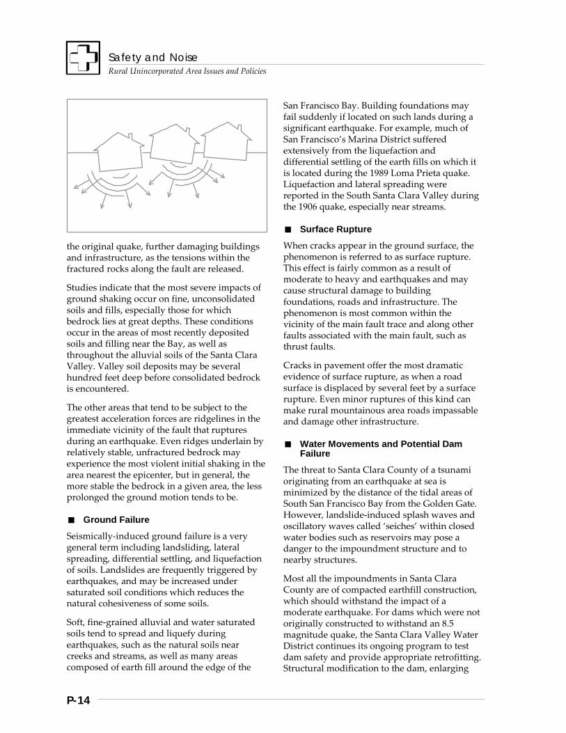
Safety and Noise
Rural Unincorporated Area Issues and Policies
P-14
the original quake, further damaging buildings and infrastructure, as the tensions within the fractured rocks along the fault are released.
Studies indicate that the most severe impacts of ground shaking occur on fine, unconsolidated soils and fills, especially those for which bedrock lies at great depths. These conditions occur in the areas of most recently deposited soils and filling near the Bay, as well as throughout the alluvial soils of the Santa Clara Valley. Valley soil deposits may be several hundred feet deep before consolidated bedrock is encountered.
The other areas that tend to be subject to the greatest acceleration forces are ridgelines in the immediate vicinity of the fault that ruptures during an earthquake. Even ridges underlain by relatively stable, unfractured bedrock may experience the most violent initial shaking in the area nearest the epicenter, but in general, the more stable the bedrock in a given area, the less prolonged the ground motion tends to be.
Ground Failure
Seismically-induced ground failure is a very general term including landsliding, lateral spreading, differential settling, and liquefaction of soils. Landslides are frequently triggered by earthquakes, and may be increased under saturated soil conditions which reduces the natural cohesiveness of some soils.
Soft, fine-grained alluvial and water saturated soils tend to spread and liquefy during earthquakes, such as the natural soils near creeks and streams, as well as many areas composed of earth fill around the edge of the
San Francisco Bay. Building foundations may fail suddenly if located on such lands during a significant earthquake. For example, much of San Francisco’s Marina District suffered extensively from the liquefaction and differential settling of the earth fills on which it is located during the 1989 Loma Prieta quake. Liquefaction and lateral spreading were reported in the South Santa Clara Valley during the 1906 quake, especially near streams.
Surface Rupture
When cracks appear in the ground surface, the phenomenon is referred to as surface rupture. This effect is fairly common as a result of moderate to heavy and earthquakes and may cause structural damage to building foundations, roads and infrastructure. The phenomenon is most common within the vicinity of the main fault trace and along other faults associated with the main fault, such as thrust faults.
Cracks in pavement offer the most dramatic evidence of surface rupture, as when a road surface is displaced by several feet by a surface rupture. Even minor ruptures of this kind can make rural mountainous area roads impassable and damage other infrastructure.
Water Movements and Potential Dam Failure
The threat to Santa Clara County of a tsunami originating from an earthquake at sea is minimized by the distance of the tidal areas of South San Francisco Bay from the Golden Gate. However, landslide-induced splash waves and oscillatory waves called ‘seiches’ within closed water bodies such as reservoirs may pose a danger to the impoundment structure and to nearby structures.
Most all the impoundments in Santa Clara County are of compacted earthfill construction, which should withstand the impact of a moderate earthquake. For dams which were not originally constructed to withstand an 8.5 magnitude quake, the Santa Clara Valley Water District continues its ongoing program to test dam safety and provide appropriate retrofitting. Structural modification to the dam, enlarging
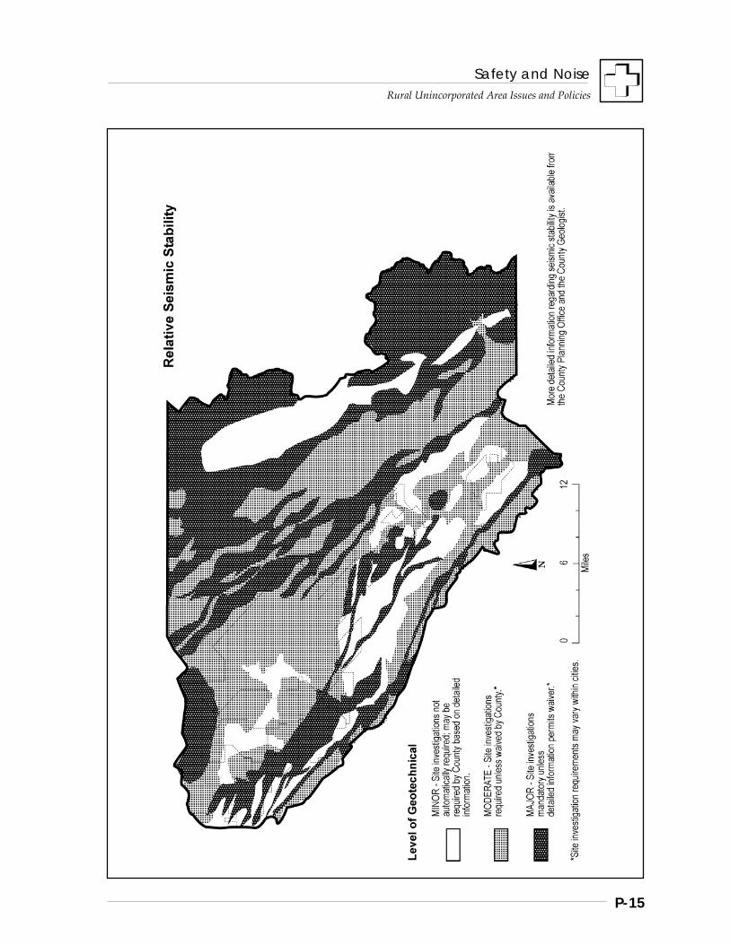
Safety and Noise
Rural Unincorporated Area Issues and Policies
P-15
Safety and Noise
Rural Unincorporated Area Issues and Policies
P-16
spillways, and even reducing the maximum water level are means being employed to assure dam safety.
FIRE HAZARDS
Fire is a naturally-occurring phenomenon with a constructive role to play in the natural ecology of much of California. It regulates understory brush and vegetation growth, provides new growth on which many wildlife may feed, and in the case of some conifers, is required in order for cones to release their seeds and allow reproduction. Most fires in Santa Clara County’s rural areas are the result of human causes, such as arson, careless cigarette disposal, or even sparks from motor vehicles or other power tools or equipment.
Relative Fire Hazard Ratings for the Rural Unincorporated Areas
Much of the mountainous areas of Santa Clara County are considered “high or extreme fire hazard areas,” due to a variety of factors, including:
• climatic factors, such as rainfall, humidity, and wind patterns,
• the amount of naturally-occurring “fuel” for fires, such as brush, dead trees, and grasses that ignite easily and burn hotly;
• steepness of slopes; and • inaccessibility and lack of available water
supplies for fire suppression.
The “fire season” in California usually begins in May or June, when vegetation has dried out from winter rains and growth, and it extends through November or such time as the first seasonal rains occur. The time of greatest danger is usually during the late summer and early fall, when heat and very low relative humidity create conditions ideal for the spread of wildfire. During this period, daily alerts or warnings may be issued of high fire danger, cautioning the public to curtail activities which could cause damaging wildfires.
Many existing residential communities in the rural unincorporated areas are located in areas of extreme fire hazards. In the Bay Areas, the most recent event to demonstrate the awesome
destructive potential of wildfire in high hazard areas was the Oakland Hills fire of 1991. In addition to the many fatalities, over 3,000 homes were destroyed. The fires were of such a magnitude and ferocity they were beyond the control of local fire-fighting capabilities.
Several areas of Santa Clara County are also similarly situated, including the Lexington Hills residential area above Lexington Reservoir. Although population and building densities in these rural communities are less than in the Oakland Hills area, the hazard potential is similar, and in some of the more remote mountainous areas of the county, access and water supply are even more restricted.
Fire Protection Services
The major fire hazard scenarios of concern to protection agencies are residential fires that start in the home with potential to spread to outlying areas and neighboring structures, and wildfires in natural areas which may pose a threat to life and property. The major limitations upon fire-fighting capabilities within the rural areas are limited accessibility, long travel distances and response times, and water supply limitations.
Protection services are distributed among five main service providers: • Saratoga Fire District; • Central Fire District; • Los Altos Fire District; • South County Fire District; and • the California Department of Forestry, who
provides services from approximately May through November of each year for areas unprotected by service districts. These areas are referred to as “State Responsibility Areas”, or SRAs.
In addition, the County administers the Weed Abatement program as part of the overall effort to reduce fire potential.
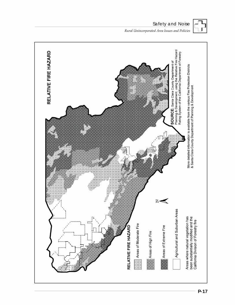
Safety and Noise
Rural Unincorporated Area Issues and Policies
P-17
Safety and Noise
Rural Unincorporated Area Issues and Policies
P-18
FLOOD HAZARDS
A variety of flood hazards pose a threat to public safety and property, such as: • stormwater flooding, • tidal flooding along the Bay, and • inundation due to dam failure.
Stormwater Flooding
Stormwater flooding has been a long and continuing problem for much of the County ever since permanent settlement of the valley floor began. In the rural unincorporated areas, the most extensive flood problems occur in the South County, where well over half of the valley floor would be inundated by a 100-year, or 1% flood, including much of San Martin. Flood waters do not have to resemble torrential flows to produce great economic losses. The damage to utilities, roads, building foundations, crops and other properties can be significant from even a foot of standing water.
Generally poor drainage in local areas has also been a major issue over time. Drainage and flood control facilities for the South County continue to be constructed by the Santa Clara Valley Water District as funding permits, but many areas still experience persistent drainage problems.
Tidal Flooding
Part of the North County is subject to saltwater flooding from the Bay. Tidal flooding may occur due to levee failure or overtopping as a result of exceptionally high tides, and/or excessive precipitation. Its severity may be increased in areas that have subsided due to overdrafting of groundwater basins. The levees used to create salt evaporation ponds provide some protection from tidal flooding, and historically, there has been little impact from tidal flooding as far inland as Alviso or the San Jose/Santa Clara Water Pollution Control Plant. Over the long term, were sea levels to rise due to global warming, the potential for tidal flooding could become more significant.
Inundation Due to Dam Failure
Inundation due to dam failure may create major life and property losses in the area immediately downstream from the dam. The areas affected by such catastrophes have been mapped by the Santa Clara Valley Water District. Strengthening and modifications to dams and spillways that will ensure the structural safety of the reservoirs in Santa Clara County is an ongoing effort of the Water District. For the rural areas, open space uses, such as agriculture, are generally prescribed for areas subject to potential inundation from dam failure.
MAJOR PUBLIC POLICY OBJECTIVES REGARDING NATURAL HAZARDS
Protecting Public Safety and Property
Chief among public policy objectives is of course the protection of life and property from natural hazards. Primary examples include building codes intended to increase the ability of struc-tures to withstand earthquakes; flood control projects; and public safety agencies’ capability to respond adequately to hazards when they occur.
Minimizing Fiscal Impacts of Hazards
Of secondary but considerable importance is the issue of fiscal impacts of natural hazards to the County and the taxpayers. In times of fiscal strain, local governments are placed under even greater burdens by the costs of responding to major fires, floods, or earthquake-induced damages. Therefore it is important that land use policies help minimize the potential fiscal impacts of natural hazards, which are of several types: • ongoing maintenance and repair costs, such
as the costs of maintaining roads that are located in areas repeatedly impacted by landslides;
• emergency response costs, such as rescue operations, fire suppression activities, equipment costs, and staff overtime costs; and
• post-emergency or disaster costs, such as building inspection operations, rebuilding public infrastructure, and loss of govern-mental revenue from reduced sales and property tax.
Safety and Noise
Rural Unincorporated Area Issues and Policies
P-19
Strategies, Policies and Implementation
Given the prevalence of natural hazards common to many portions of the rural unincorporated areas of Santa Clara County, the General Plan contains the following strategies or major policy directions to protect public health and safety:
Strategy #1: Inventory Hazards And Monitor Changing Conditions
Strategy #2: Maintain Low Resident Population Densities Within High Hazard Areas
Strategy #3: Design, Locate And Regulate Development To Avoid Or Withstand Hazards
Strategy #4: Reduce The Magnitude Of The Hazard, If Possible
Strategy #5: Provide Public Information Regarding Natural Hazards
Policies and Implementation
R-HS 5 Strategies for reducing the threat of natural hazards to life and property within rural unincorporated areas shall be to: 1. Inventory hazards and monitor changing
conditions. 2. Maintain low resident population densities
within high hazard areas. 3. Design, locate and regulate development to
avoid or withstand hazards. 4. Reduce the magnitude of the hazard, if
possible. 5. Provide public information regarding
natural hazards.
Strategy #1: Inventory Hazards And Monitor Changing Conditions
Adequate documentation of natural hazard areas, such as flood plains, active landslide areas, fault traces, and high fire hazard areas is essential for purposes of determining
appropriate densities for general areas and for determining the appropriate placement of structures such as schools, homes, landfills, and other land uses.
Although some natural features change very little over time, such as the location of fault traces, others must be regularly updated. For example, as new flood control projects are completed, some areas previously subject to a 100 year flood may be removed from that classification. As conditions change, the County’s inventories and mapping must be updated to provide an adequate basis for decision-making.
Policies and Implementation
R-HS 6 Inventories and mapping of natural hazards shall be adequately maintained for use in planning and decision-making, including: a. Relative Seismic Stability Map; b. Composite Geologic Hazards Map; c. Soil Creep; d. Saturated, Unstable Soils; e. Slope Maps; f. Flood Hazards maps; g. Relative Fire Hazard Rating; h. Dam Failure Inundation Areas maps; i. Airport Safety Zones; and j. closed Solid Waste Disposal Sites.
Flood Hazards mapping includes those required by AB 162 as developed from required sources, including FEMA flood maps, California Department of Water Resources (DWR), and the Santa Clara Valley Water District (SCVWD).
Implementation Recommendations
R-HS(i) 9 Support ongoing efforts to develop and convert hazard-related spatial data to GIS digital format.
Safety and Noise
Rural Unincorporated Area Issues and Policies
P-20
Strategy #2: Maintain Low Resident Population Densities Within High Hazard Areas
Given the hazards and topography of the more mountainous regions of the County, it is not uncommon to find that an individual parcel in the rural areas is subject to a variety of natural hazards. For example, most of the mountainous areas are classified as high or extreme fire hazard areas and many areas also contain geologic or seismic hazards. In the South Valley, areas are prone to regular flooding or poor localized drainage that are also least stable during earthquakes.
To minimize risks to resident populations in high hazard areas, the General Plan prescribes relatively low densities of development throughout the rural areas. Limited accessibility is a primary factor. Access in some of the more remote areas is often limited to narrow, dead end roads. In the event of a wildfire or earthquake which closes access roads, large areas may be isolated from assistance other than by air. Emergency response times are increased, and evacuation plans may be impossible to implement. Other concerns, as mentioned in the Summary of this section, involve public financial responsibility for maintaining and repairing roads and other infrastructure which may traverse hazardous areas, such as fault traces or active landslides. In the event that such roads or utilities suffer major damage and have to be repaired or relocated, major unplanned public expenses may be the result.
Policies and Implementation
R-HS 7 Areas of significant natural hazards, especially high or extreme fire hazard, shall be designated in the County’s General Plan as Resource Conservation Areas, with generally low development densities in order to minimize public exposure to risks associated with natural hazards and limit unplanned public costs to maintain and repair public infrastructure.
R-HS 8 Areas of persistent flooding and areas of potential inundation from dam failure shall generally be designated for agricultural land uses or other suitable open space use.
Strategy #3: Design, Locate And Regulate Development To Avoid Or Withstand Hazards
Beyond the issue of general land use densities, the design, construction, and location of development can in many cases significantly reduce the risk associated with some natural hazards. Building codes play a major role in assuring the safety of structures from seismic hazards, and subdivision design can avoid placement of building sites within areas subject to slope failure or other geologic constraints. The general policies of the County listed below provide the basis for more detailed policies that follow which address specific types of hazards.
Policies and Implementation
R-HS 9 Development in rural unincorporated areas affected by natural hazards should be designed, located, and otherwise regulated to avoid or reduce associated risks to an acceptable level: 1. In areas of highest potential hazard, such as
floodways, active landslides, fault traces, and airport safety zones, no new habitable structures shall be allowed.
2. In other areas of lesser hazards, there shall be no major structures for involuntary occupancy, such as schools, hospitals, correctional facilities or convalescent centers.
R-HS 10 In all hazard areas, projects shall be designed and conditioned to avoid placement of structures and improvements where they would: a. be directly jeopardized by hazards; b. increase the hazard potential; and/or, c. increase risks to neighboring properties.
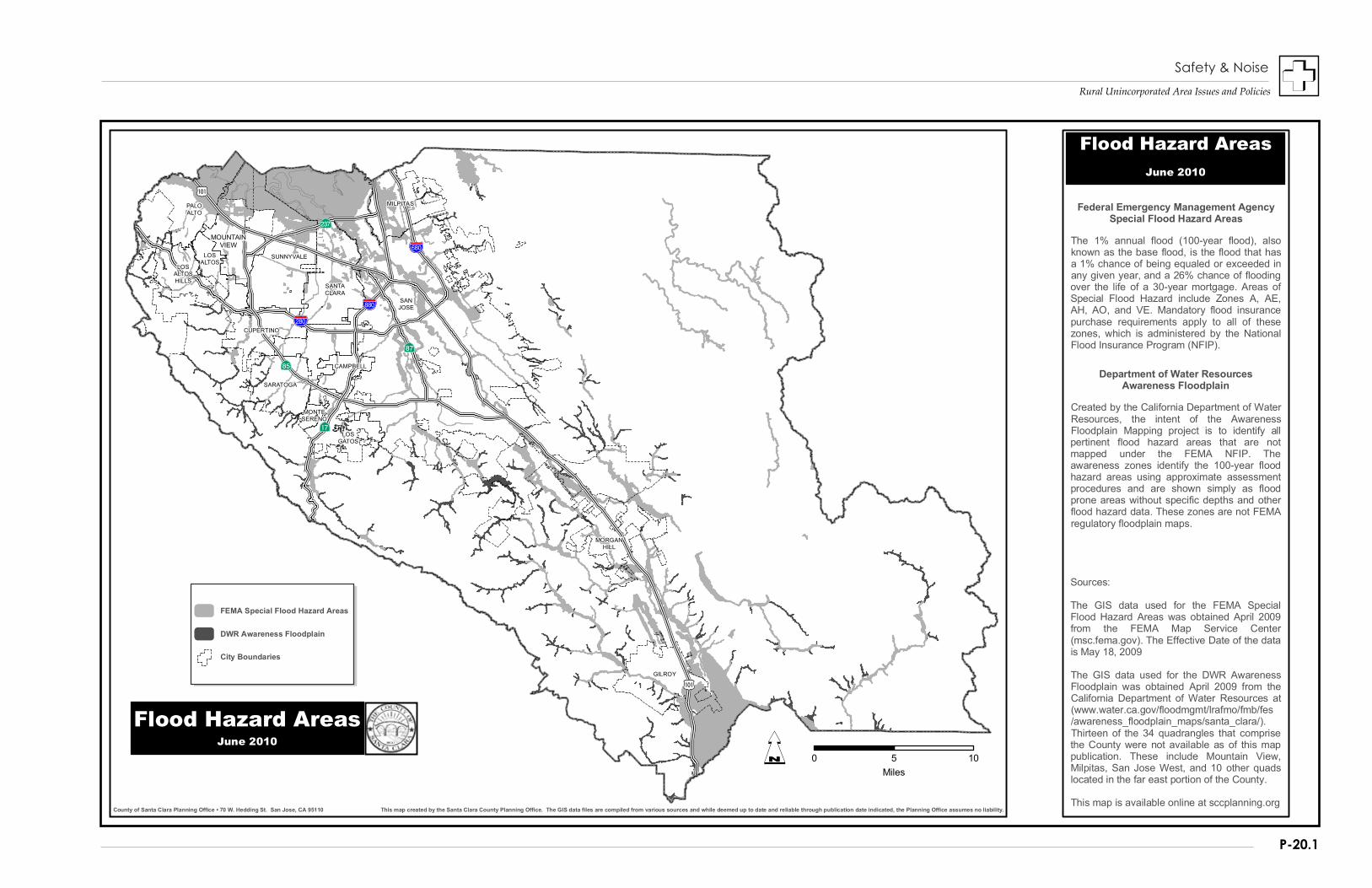
Rural Unincorporated Area Issues and Policies
P-20.1
MOUNTAINVIEW
MILPITAS
GILROY
MORGANHILL
MONTESERENO
SARATOGA
CAMPBELL
CUPERTINO
LOSALTOSHILLS
LOSALTOS
SANTACLARA
SUNNYVALE
PALOALTO
LOSGATOS
SANJOSE
This map created by the Santa Clara County Planning Office. The GIS data files are compiled from various sources and while deemed up to date and reliable through publication date indicated, the Planning Office assumes no liability.County of Santa Clara Planning Office • 70 W. Hedding St. San Jose, CA 95110
IÆ
%&j(
AË
%&p(
%&t(
?¾
?Â
?â
IÆ
Q 0 5 10Miles
City Boundaries
DWR Awareness Floodplain
FEMA Special Flood Hazard Areas
Flood Hazard AreasJune 2010
Sources:
The GIS data used for the FEMA SpecialFlood Hazard Areas was obtained April 2009from the FEMA Map Service Center(msc.fema.gov). The Effective Date of the datais May 18, 2009
The GIS data used for the DWR AwarenessFloodplain was obtained April 2009 from theCalifornia Department of Water Resources at(www.water.ca.gov/floodmgmt/lrafmo/fmb/fes/awareness_floodplain_maps/santa_clara/).Thirteen of the 34 quadrangles that comprisethe County were not available as of this mappublication. These include Mountain View,Milpitas, San Jose West, and 10 other quadslocated in the far east portion of the County.
This map is available online at sccplanning.org
The 1% annual flood (100-year flood), alsoknown as the base flood, is the flood that hasa 1% chance of being equaled or exceeded inany given year, and a 26% chance of floodingover the life of a 30-year mortgage. Areas ofSpecial Flood Hazard include Zones A, AE,AH, AO, and VE. Mandatory flood insurancepurchase requirements apply to all of thesezones, which is administered by the NationalFlood Insurance Program (NFIP).
Created by the California Department of WaterResources, the intent of the AwarenessFloodplain Mapping project is to identify allpertinent flood hazard areas that are notmapped under the FEMA NFIP. Theawareness zones identify the 100-year floodhazard areas using approximate assessmentprocedures and are shown simply as floodprone areas without specific depths and otherflood hazard data. These zones are not FEMAregulatory floodplain maps.
Federal Emergency Management AgencySpecial Flood Hazard Areas
Department of Water ResourcesAwareness Floodplain
Flood Hazard AreasJune 2010
Safety & Noise

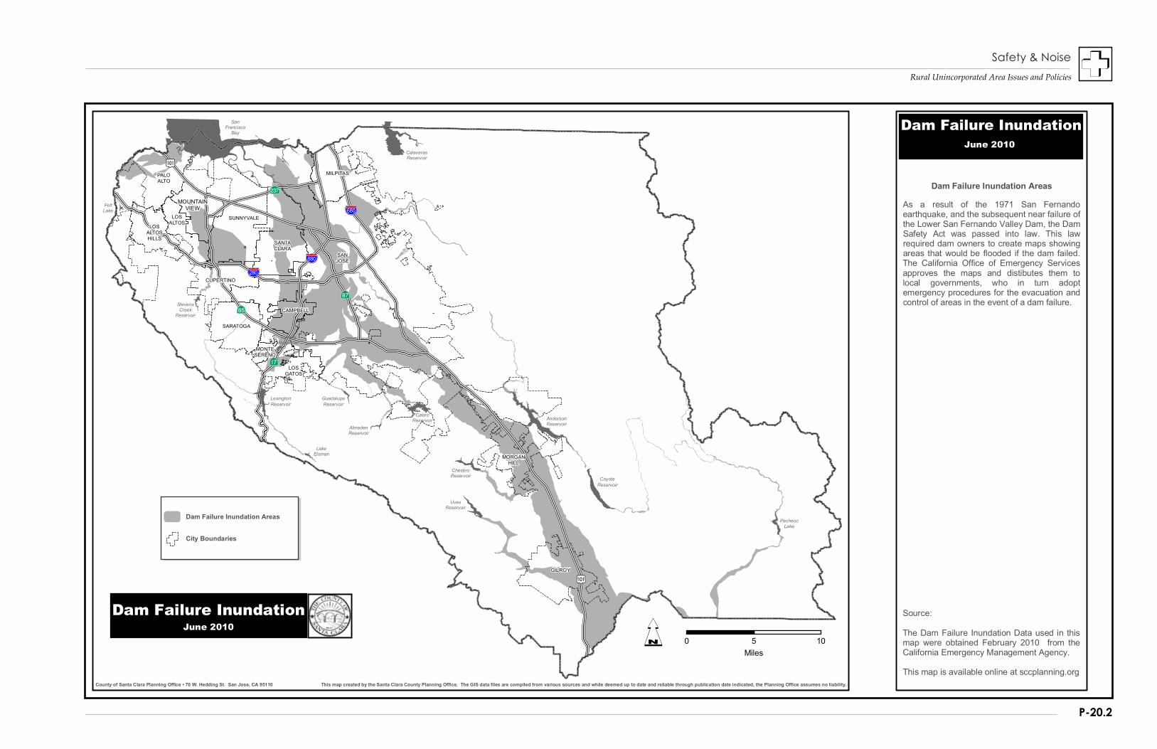
Rural Unincorporated Area Issues and Policies
P-20.2
MOUNTAINVIEW
MILPITAS
GILROY
MORGANHILL
MONTESERENO
SARATOGA
CAMPBELL
CUPERTINO
LOSALTOSHILLS
LOSALTOS
SANTACLARA
SUNNYVALE
PALOALTO
LOSGATOS
SANJOSE
CalaverasReservoir
FeltLake
LakeElsman
StevensCreek
Reservoir
VasonaReservoir
AndersonReservoir
GuadalupeReservoir
CaleroReservoir
AlmadenReservoir
ChesbroReservoir
CoyoteReservoir
PachecoLake
LexingtonReservoir
UvasReservoir
SanFrancisco
Bay
This map created by the Santa Clara County Planning Office. The GIS data files are compiled from various sources and while deemed up to date and reliable through publication date indicated, the Planning Office assumes no liability.County of Santa Clara Planning Office • 70 W. Hedding St. San Jose, CA 95110
IÆ
%&j(
AË
%&p(
%&t(
?¾
?Â
?â
IÆ
Q 0 5 10Miles
Dam Failure Inundation Areas
Dam Failure InundationJune 2010
City Boundaries
Source:
The Dam Failure Inundation Data used in thismap were obtained February 2010 from theCalifornia Emergency Management Agency.
This map is available online at sccplanning.org
As a result of the 1971 San Fernandoearthquake, and the subsequent near failure ofthe Lower San Fernando Valley Dam, the DamSafety Act was passed into law. This lawrequired dam owners to create maps showingareas that would be flooded if the dam failed.The California Office of Emergency Servicesapproves the maps and distibutes them tolocal governments, who in turn adoptemergency procedures for the evacuation andcontrol of areas in the event of a dam failure.
Dam Failure Inundation Areas
Dam Failure InundationJune 2010
Safety & Noise

Safety and Noise
Rural Unincorporated Area Issues and Policies
P-21
R-HS 11 Proposals for General Plan amendments, zone changes, use permits, variances, building site approvals, and all land development applications subject to environmental assessment shall be reviewed for the presence of hazardous conditions, utilizing the best, most up-to-date information available. If a development proposal would require a major investment or addition to public infrastructure in areas subject to high hazards, objective estimates of the probable public costs of maintaining and repairing the infrastructure should be provided to decision-makers.
R-HS 12 Proposals shall be conditioned as necessary to conform with County General Plan policies on public safety. Projects which cannot be conditioned to avoid hazards shall be conditioned to reduce the risks associated with natural hazards to an acceptable level or shall be denied.
R-HS 13 Where needed to adequately assess the hazards of a proposal, the County shall require on-site investigations and analysis by certified professionals.
GEOLOGIC AND SEISMIC HAZARDS
The policies of the General Plan regarding the design, location and regulation of development to withstand geologic and seismic hazards take into consideration the following concepts:
• The more critical the structure is to public safety, such as police stations, or the more intense the land use, such as hospitals or other high occupancy structures, the greater are the restrictions on appropriate design and location.
• When land characteristics are present which may compound the risk associated with geologic and seismic hazards, such as steep slopes, saturated soils, or other factors, the design, location and construction of development must address the site-specific conditions identified through the review process.
Policies and Implementation
R-HS 14 Critical structures and infrastructure vital to the public health, safety, and general welfare, such as water supply facilities, other utilities, police and fire stations, and communications facilities, shall not be located in areas subject to significant impacts from geologic or seismic hazards unless there is no feasible alternative site. Projects shall be designed to mitigate any seismic hazards associated with their sites.
R-HS 15 No structure proposed for involuntary occupancy, such as schools, hospitals or correctional facilities, and no structure proposed for high voluntary occupancy, such as theaters, churches, or offices shall be approved in areas of high geologic or seismic hazard.
R-HS 16 No new building site shall be approved on a hazardous fault trace, active landslide, or other geologic or seismic hazard area that poses a significant risk.
R-HS 17 Subdivisions shall be designed to minimize placement of road and other improvements on unstable lands and shall demonstrate suitable, stable building sites approved by the County Geologist.
R-HS 18 Clustered development projects shall concentrate home sites on lands not subject to geologic or seismic hazards.
R-HS 19 In areas of high potential for activation of landslides, there shall be no avoidable alteration of the land or hydrology which is likely to increase the hazard potential, including: a. saturation due to drainage or septic systems; b. removal of vegetative cover; and c. steepening of slopes or undercutting the
base of a slope.
Safety and Noise
Rural Unincorporated Area Issues and Policies
P-22
R-HS 20 Lands where soils are in a continually saturated condition should not be used for structural purposes or filled with heavy earth fills due to their inherently weak and unstable nature. Uses requiring septic systems in such areas should not be allowed.
R-HS 21 Proposals involving potential geologic or seismic hazards shall be referred to the County Geologist for review and recommendations.
FIRE HAZARDS
Access, water supply, building materials, and vegetation removal are the four main areas of concern in protecting development from fire hazard in the rural unincorporated areas. Each has a critical role to play in fire safety.
Access Issues
Adequate access has several key dimensions. Lack of alternative access to development located on dead end roads may result in fire- fighting equipment being unable to reach its destination entirely. Roads that are impassable to firefighting equipment due to substandard surfaces, tight corners, steep grades, or bridges of inadequate structural integrity are also problematic.
Private roads are less likely to meet County standards for these aspects of road design and construction, and even if rural roads are passable, response times are generally longer due to the lower average speeds possible on rural roads. Response times to some of the more steep and remote areas even in the best of conditions may be 30 minutes to an hour and a half, far too long for fire-fighting services to be of any help to a residential fire.
Water Supply Issues
Water supply is the second major issue. The amount of water that can be brought to a site in a tanker truck is very limited. Rural private development most often utilizes on-site wells and storage tanks for water supply, for both domestic use and fire protection. Seasonal variation in water supply, broken or leaking
water lines, and electrical failures can render homes defenseless if fire fighters arrive only to find there is no water supply with which to combat the fire. Making matters worse, some older homes and structures may not meet present development standards and safety code requirements.
Building Requirements
Currently, rural unincorporated area development must comply with the County’s fire code and safety code requirements for, among other things, minimum water delivery rates and pressure for fire suppression purposes. If development in high fire hazard areas is unable to demonstrate that it can meet the County’s flow requirements, mitigation measures, such as automatic sprinkler systems in particular, are required, especially in light of the typically excessive emergency response times. Other mitigation measures may also be required.
Using fire retardant building materials and clearing flammable vegetation from the vicinity of the structure or residence are also extremely important. Uniform building codes now require fire retardant roofing materials in high fire hazard areas, but siding materials and decks also provide opportunities for fires to spread from surroundings to structures, and vice-versa.
Clearances and "Defensible Space"
Equally critical is the concept of “defensible space.” In the case of a wildfire that threatens a rural hillside home, the presence of overhanging tree limbs, dead or overgrown brush close by, and flammable landscaping increase the structure’s vulnerability to fire and provide no space within which fire fighters may work to prevent the house from catching fire. In the case that a fire starts within the home, built up vegetation immediately surrounding the structure increases the likelihood that the fire may spread to the surrounding area. County fire codes require that vegetation be cleared and managed within approximately 30-50 feet of a residence or other development, and that overhanging branches be removed.
Safety and Noise
Rural Unincorporated Area Issues and Policies
P-23
Earthquakes and Fire Hazards
Finally, it should also be noted that earthquakes pose the single greatest threat to rural areas subject to high fire hazards, because the ground shaking and other seismic effects may sever water connections, topple or empty storage tanks, and break natural gas lines. Inspections following the Loma Prieta earthquake in 1989, for example, discovered that many storage tanks were emptied as a result of broken connections and other causes, rendering structures defenseless to fire hazards.
Policies and Implementation
R-HS 22 Adequate access and water supplies for fire safety shall be required for all new development, including building sites, subdivisions, and clustered development.
R-HS 23 Areas for which inadequate access is a general concern, either due to lack of secondary access, dead-end roads of excessive length, and substandard road design or conditions, should be examined to determine if there are means by which to remedy the inadequacies. Such means may include: a. specific local area circulation plans to
establish alternative access; b. specific roadway improvements to remedy
hazardous situations, financed by those most benefited by the improvements; and
c. traffic routing and controls to discourage the use of such roads by non-residents.
R-HS 24 Dead-end roads shall not be extended unless in the judgment of the Fire Authority, such extensions will serve to reduce the risks from fire hazards in the affected area.
R-HS 25 High intensity uses, such as theaters, motels, restaurants, schools, etc. and uses requiring the handling, transfer, storage or disposal of significant amounts of flammable or hazardous materials shall be allowed only in areas having year-round fire protection and adequate water supply systems.
R-HS 26 For communities in areas of high or extreme fire hazard that have developed under development densities greater than generally allowed under current General Plan policies, water systems with hydrants should be provided wherever feasible.
R-HS 27 The County should encourage the use of fire-retardant building materials and landscaping not already required by County development and building codes when new development and rebuilding are proposed in areas of high or extreme fire hazard.
R-HS 28 Development projects shall be reviewed by the County Fire Marshall’s Office for safety code compliance and should also be referred if necessary to the appropriate fire protection authority or district for further review and recommendations.
FLOOD HAZARDS
Flooding can cause hazards to structures, costly property damage, interruptions of public services, and malfunctioning of septic systems, among other impacts. To minimize such impacts, the County and the Santa Clara Valley Water District regulate development in flood prone areas in conformance with Federal flood insurance program requirements.
Policies and Implementation
R-HS 29 Land uses in federally-designated flood plains shall be restricted through development regulations, and regulation of development in flood plains shall require structures for human occupancy to minimize the risks associated with flood hazards.
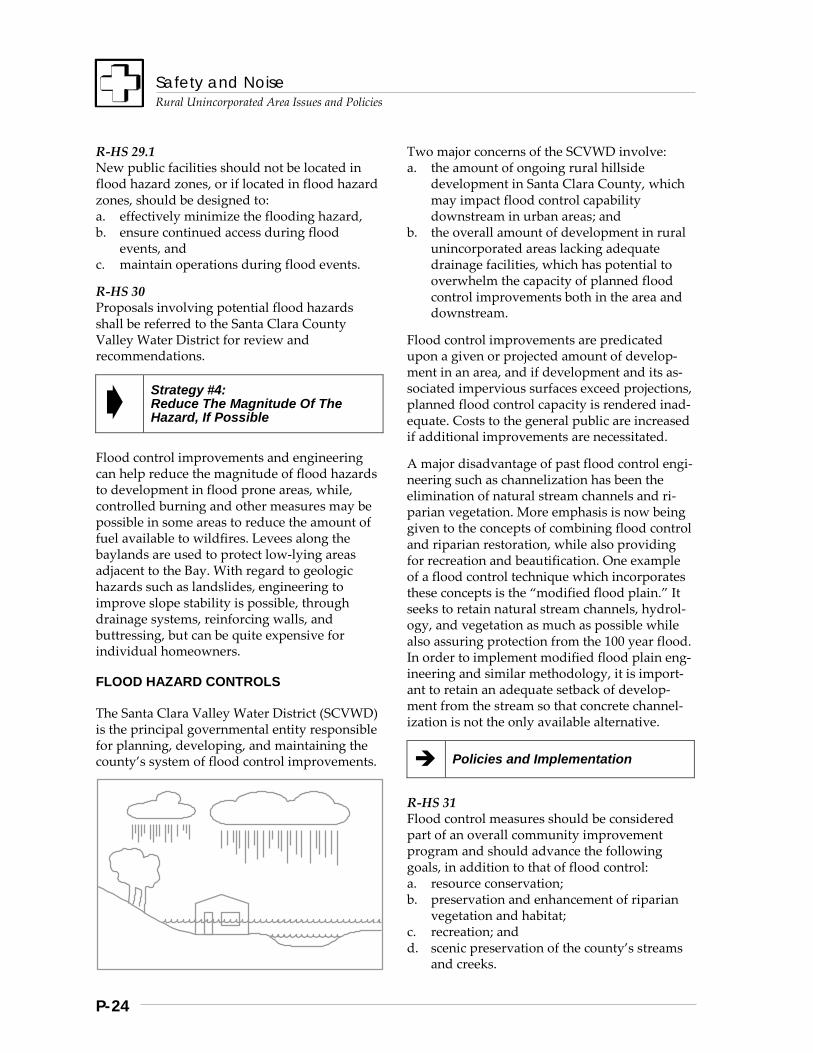
Safety and Noise
Rural Unincorporated Area Issues and Policies
P-24
R-HS 29.1 New public facilities should not be located in flood hazard zones, or if located in flood hazard zones, should be designed to: a. effectively minimize the flooding hazard, b. ensure continued access during flood
events, and c. maintain operations during flood events.
R-HS 30 Proposals involving potential flood hazards shall be referred to the Santa Clara County Valley Water District for review and recommendations.
Strategy #4: Reduce The Magnitude Of The Hazard, If Possible
Flood control improvements and engineering can help reduce the magnitude of flood hazards to development in flood prone areas, while, controlled burning and other measures may be possible in some areas to reduce the amount of fuel available to wildfires. Levees along the baylands are used to protect low-lying areas adjacent to the Bay. With regard to geologic hazards such as landslides, engineering to improve slope stability is possible, through drainage systems, reinforcing walls, and buttressing, but can be quite expensive for individual homeowners.
FLOOD HAZARD CONTROLS
The Santa Clara Valley Water District (SCVWD) is the principal governmental entity responsible for planning, developing, and maintaining the county’s system of flood control improvements.
Two major concerns of the SCVWD involve: a. the amount of ongoing rural hillside
development in Santa Clara County, which may impact flood control capability downstream in urban areas; and
b. the overall amount of development in rural unincorporated areas lacking adequate drainage facilities, which has potential to overwhelm the capacity of planned flood control improvements both in the area and downstream.
Flood control improvements are predicated upon a given or projected amount of develop-ment in an area, and if development and its as-sociated impervious surfaces exceed projections, planned flood control capacity is rendered inad-equate. Costs to the general public are increased if additional improvements are necessitated.
A major disadvantage of past flood control engi-neering such as channelization has been the elimination of natural stream channels and ri-parian vegetation. More emphasis is now being given to the concepts of combining flood control and riparian restoration, while also providing for recreation and beautification. One example of a flood control technique which incorporates these concepts is the “modified flood plain.” It seeks to retain natural stream channels, hydrol-ogy, and vegetation as much as possible while also assuring protection from the 100 year flood. In order to implement modified flood plain eng-ineering and similar methodology, it is import-ant to retain an adequate setback of develop-ment from the stream so that concrete channel-ization is not the only available alternative.
Policies and Implementation
R-HS 31 Flood control measures should be considered part of an overall community improvement program and should advance the following goals, in addition to that of flood control: a. resource conservation; b. preservation and enhancement of riparian
vegetation and habitat; c. recreation; and d. scenic preservation of the county’s streams
and creeks.
Safety and Noise
Rural Unincorporated Area Issues and Policies
P-25
R-HS 32 Flood control improvements should be designed to maintain streams channels and environments in their natural state wherever possible and restore the natural environment where it has been altered by past activities. Wherever possible, adequate setbacks should be maintained to allow for flood control engineering which maintains the natural environment as much as possible.
FIRE HAZARD REDUCTION AND RISK MANAGEMENT
It is also possible to reduce area wide fire hazards to a limited extent. With over 80-150 tons of fuel per acre in portions of rural Santa Clara County, the natural fire hazard is substantial. Controlled burning is one way to reduce fuel loads and the magnitude of the fire hazard to a given area. Ironically though, as population and development increase in a given area, controlled burning becomes less feasible, and increased fuel loading in turn serves to increase the threat to life and property from wildfire. The densely vegetated areas of the central Santa Cruz Mountains are an example, where the communities of residential development have developed over time on lots much smaller than would be allowed under current development policies.
Other means of reducing the fuel load available to wildfire, such as brush clearance by mowing and other mechanical means, are often cost-prohibitive, but may become necessary to reduce fire hazards. In other areas where livestock grazing is an allowed use, grazing can also serve to control the amount of fuel available to fires that occur in grasslands areas. Weed abatement on private lands is currently a service of the County Fire Marshall’s Office. It provides additional risk reduction by ensuring that vegetation is adequately controlled.
Policies and Implementation
R-HS 33 For areas where it may be appropriate, fire protection agencies and districts should utilize controlled burns and other forms of vegetation
management to reduce the build up of vegetative matter and the potential fire hazard within an area.
Strategy #5: Provide Public Information Regarding Natural Hazards
As a public service of vital importance, local governments and public safety agencies should strive to maintain public awareness of the threat of natural hazards. This service may be accomplished through information publications, emergency preparedness events, involvement of local media, and through the system of public education. Many of the activities which best protect the public must be the responsibility of individuals, such preparing ones’ home in the event of major earthquake; however, it is also important that the general public understand and support infrastructure improvements, emergency response capability, and land use planning which enhance public safety.
In addition, the County has the obligation to try to ensure that future property owners are aware of hazards of residing in the rural unincorporated areas. Real estate transaction disclosure requirements help inform subsequent property owners of the risks, regulations and obligations they may face, depending on the location.
Policies and Implementation
R-HS 34 Public awareness of the prevalence and risks of natural hazards should be maintained and enhanced by activities and programs of the County, safety service providers, and through the educational system.
R-HS 35 Known hazard information should be reported as part of every real estate transaction in accordance with state law.
Safety and Noise
Rural Unincorporated Area Issues and Policies
P-26
Aviation Safety
Summary
Aviation for both commercial and general civilian purposes is important to the economy and general public of Santa Clara County. Each airport in the County has an airport-specific Comprehensive Land Use Plan that provides policies for safety, height, and noise for the populations in the vicinity of airports.
The Santa Clara County General Plan and any development proposals governed by it must be consistent with ALUC Plans and recommendations unless specifically overridden by two-thirds vote of the legislative body. These major strategies include the following:
Strategy #1: Limit Population Densities and Land Uses within Designated Safety Zones
Strategy #2: Regulate Structures and Objects Which Could Be Hazardous or Distracting to Air Navigation
Background
AIRPORTS IN RURAL UNINCORPORATED SANTA CLARA COUNTY
The San Martin Airport (formerly named South County Airport) lies within the community of San Martin, and along with Moffett Field, is the only airport located in unincorporated Santa Clara County. It is located west of Highway 101 between San Martin Avenue to the north and Church Avenue to the south. It provides primarily for general civilian recreational aviation.
Although aviation is a relatively safe mode of travel, especially commercial aviation, accidents do occur, threatening the safety of travelers and the population on the ground. However, aviation accidents tend to occur in predictable patterns, which makes it possible to afford a
greater measure of safety to the general public through protective land use planning.
MOST COMMON TYPES OF AVIATION ACCIDENTS
Most aviation accidents are the result of adverse meteorological conditions, pilot error, and/ or mechanical failures. The principal types of accidents occur for the most part on approach and landing; upon takeoff and immediately thereafter; and in a pattern clustered along the center line of the runway, whether in takeoff or landing. Accidents in mid-air during other phases of air travel are far less common.
ROLE OF THE ALUC CLUP FOR LAND USE SURROUNDING AIRPORTS
Airport Land Use Commissions, or the ALUCs, were established by state legislation in 1970 for all counties having airports both public and private, including the Federal Airport at Moffett Field, with a military tenant. One of the main responsibilities of the ALUC is to minimize the risks to the general public from aviation hazards through land use planning and development review for areas included in “airport influence boundaries (AIA).”
The General Plan Land Use element of Santa Clara County and any other jurisdiction with airports must be consistent with the adopted ALUC Comprehensive Land Use Plans for land use surrounding airports. The principal strategies to increase aviation safety employed by ALUC plans involve:
• limiting population densities and types of land uses in designated safety zones extending from each end of a runway; and • regulating the height of structures or objects which could pose hazards to air navigation, especially those in the direct flight path of aircraft.
Other areas of the ALUC’s regulatory authority involve minimizing potential distractions to pilots, such as sources of light or glare, and limitations on above-ground storage of hazardous materials.
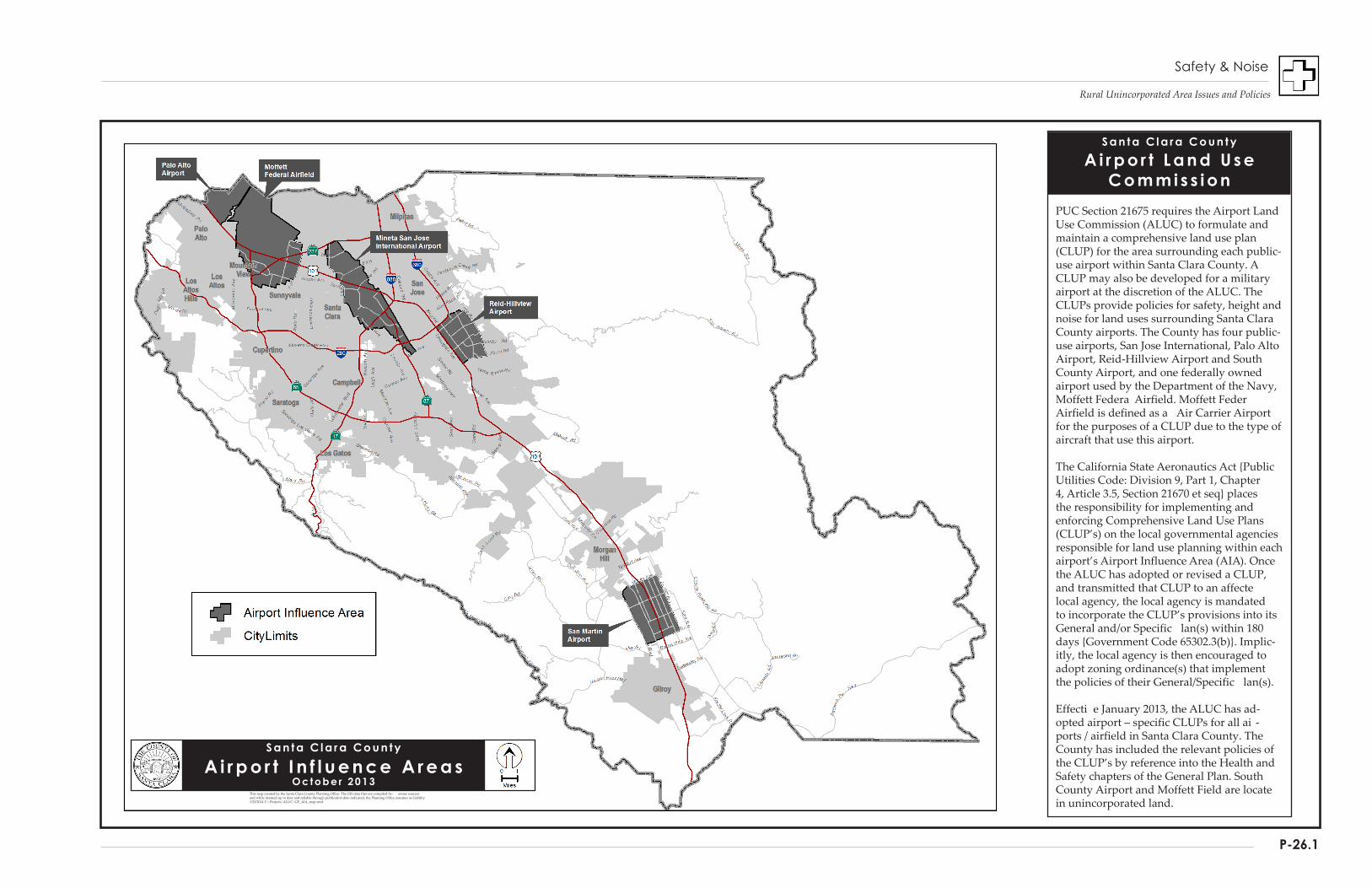
Rural Unincorporated Area Issues and Policies
P-26.1
S a n t a C l a r a C o u n t y
A i r p o r t L a n d U s e C o m m i s s i o n
PUC Section 21675 requires the Airport Land Use Commission (ALUC) to formulate and maintain a comprehensive land use plan (CLUP) for the area surrounding each public-use airport within Santa Clara County. A CLUP may also be developed for a military airport at the discretion of the ALUC. The CLUPs provide policies for safety, height and noise for land uses surrounding Santa Clara County airports. The County has four public-use airports, San Jose International, Palo Alto Airport, Reid-Hillview Airport and South County Airport, and one federally owned airport used by the Department of the Navy, Moffett Federa Airfield. Moffett FederAirfield is defined as a Air Carrier Airport for the purposes of a CLUP due to the type of aircraft that use this airport.
The California State Aeronautics Act {Public Utilities Code: Division 9, Part 1, Chapter 4, Article 3.5, Section 21670 et seq} places the responsibility for implementing and enforcing Comprehensive Land Use Plans (CLUP’s) on the local governmental agencies responsible for land use planning within each airport’s Airport Influence Area (AIA). Once the ALUC has adopted or revised a CLUP, and transmitted that CLUP to an affectelocal agency, the local agency is mandated to incorporate the CLUP’s provisions into its General and/or Specific lan(s) within 180 days {Government Code 65302.3(b)}. Implic-itly, the local agency is then encouraged to adopt zoning ordinance(s) that implement the policies of their General/Specific lan(s).
Effecti e January 2013, the ALUC has ad-opted airport – specific CLUPs for all ai -ports / airfield in Santa Clara County. TheCounty has included the relevant policies of the CLUP’s by reference into the Health and Safety chapters of the General Plan. South County Airport and Moffett Field are locatein unincorporated land.
S a n t a C l a r a C o u n t y
A i r p o r t I n f l u e n c e A r e a s O c t o b e r 2 0 1 3
This map created by the Santa Clara County Planning Office. The GIS data files are compiled fro arious sources and while deemed up to date and reliable through publication date indicated, the Planning Office assumes no liability1/23/2014 Y:\Projects\ALUC\GP_AIA_map.mxd
Safety & Noise

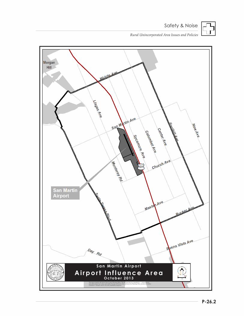
Rural Unincorporated Area Issues and Policies
P-26.2
S a n M a r t i n A i r p o r t
A i r p o r t I n f l u e n c e A r e a O c t o b e r 2 0 1 3
This map created by the Santa Clara County Planning Office. The GIS data files are compiled fro arious sources and while deemed up to date and reliable through publication date indicated, the Planning Office assumes no liability1/23/2014 Y:\Projects\ALUC\GP_AIA_SanMartin_map.mxd
Safety & Noise

Safety and Noise
Rural Unincorporated Area Issues and Policies
P-27
Although the ALUC reviews land use and dev-elopment of each affected jurisdiction within the “Airport Influence Areas (AIAs)" for conformity with ALUC policies, recommendations to the jurisdictions have only advisory authority. If a jurisdiction wishes to “override” the decision of the ALUC, it may do so only with a two-thirds vote of its legislative body.
Once the CLUP is adopted, local jurisdictions must incorporate the CLUP into its General Plan. The Santa Clara County ALUC has prepared and adopted five airport-specific Comprehensive Land use Plans, including one for Reid Hillview Airport (2007), South County (San Martin) Airport (2008), Palo Alto Airport (2009), San Jose International Airport (2011), and Moffett Field (2012).
In 2013, the County of Santa Clara amended the General Plan to be consistent with the adopted San Martin Airport CLUP, including amendments updating appropriate sections of the General Plan following adoption of all five of the CLUPs.
To achieve consistency, as recommended by the ALUC in each of the CLUP’s, the County has incorporated the San Martin Airport AIA into the General Plan and the CLUP policies by reference. The map on P-28.1 shows the location of each of the Airports located within Santa Clara County. The map on P-28.2 shows the Airport Influence Area (AIA) for San Martin Airport, located within the rural unincorporated area.
Strategies, Policies, and Implementation
As outlined in the ALUC's Comprehensive Land Use Plans for airport safety, the general approaches to minimizing aviation hazards include the following strategies:
Strategy #1: Limit Population Densities And Land Uses Within Designated Safety Zones
Strategy #2: Regulate Structures And Objects Which Could Be Hazardous Or Distracting To Air Navigation
Policies and Implementation
R-HS 36 General strategies for airport safety in Santa Clara County include the following: a. Limit population densities and land uses
within designated safety zones. b. Regulate structures and objects which could
be hazardous or distracting to air navigation.
Strategy #1: Limit Population Densities And Land Uses Within Designated Safety Zones
Limiting the number of people exposed to typical aviation accidents is the primary objective of the first strategy. The larger the zone designated for limited population and land uses the greater the degree of protection. In fact, ALUC-established safety zones extend beyond the areas required by FAA regulations with the intent not only to protect aircraft on approach and departure, but to provide maximum protection to ground populations.
Low density land uses, such as agricultural lands, parks, storage areas, parking lots, single-story warehousing, and similar uses are those generally allowed in designated safety zones.
Policies and Implementation
R-HS 37 Land use designations and development proposals within the ALUC Airport Influence Areas for the rural unincorporated areas of Santa Clara County shall be consistent with ALUC's Comprehensive Land Use Plans for airport safety.
Safety and Noise
Rural Unincorporated Area Issues and Policies
P-28
Strategy #2: Regulate Structures And Objects Which Could Be Hazardous Or Distracting To Air Navigation
Ensuring that aircraft have a safe space to operate in and that persons occupying nearby structures are equally protected are the primary objectives of the second strategy. To that end, height restrictions are imposed in areas surrounding airports affected by takeoff and landing. These restrictions provide an extra margin of safety and minimize potential distractions to pilots. The ALUC-established restrictions are based on FAA regulations.
Other types of land uses that may be regulated are those which could result in significant distraction or confusion of pilots. These include land uses that may create reflections, glare, dust or steam, hazardous lighting, electrical interference, attract large flocks of birds, or other visibility-reducing or distracting phenomena.
Policies and Implementation
R-HS 38 Santa Clara County shall comply with ALUC height restrictions and other regulations intended to ensure operational safety of aircraft and the safety of those occupying nearby buildings.
R-HS 39 Land uses, structures, and objects which could distract, confuse, or otherwise contribute to pilot error shall not be allowed within the vicinity of airport operations.
Waste Water Disposal
Summary
The vast majority of County residents and businesses located within the County’s urban areas rely on municipal sewers and special sanitary districts to provide centralized wastewater treatment and disposal services. However, the majority of the unincorporated County is located outside city Urban Service Areas and sanitary districts, where wastewater disposal is achieved by means of on-site wastewater treatment systems. Consistent with countywide urban growth management policies, lands outside cities’ Urban Service Areas and sanitary districts will continue to rely upon on-site wastewater treatment systems indefinitely. The most common conventional systems are also known as septic systems or on-site wastewater treatment systems (OWTS), using tanks and drain lines to dispose of and treat effluent.
A septic system is an underground wastewater treatment system used to treat and disperse wastewater on-site. With some exceptions, most homes, farms, and businesses in rural unincorporated Santa Clara County treat and disperse waste water through a conventional OWTS. Construction standards and performance expectations for these standard tank and drain field systems have evolved over time because they are no longer seen as a temporary means of achieving sanitary wastewater treatment and dispersal. Furthermore, alternative OWTS technologies provide additional options to serve community needs where conventional OWTS may not be feasible due to certain kinds of site constraints, or where modifications are necessary to repair failing systems.
This section of the Rural Unincorporated Health and Safety Chapters identifies issues regarding on-site wastewater treatment and disposal systems, protection of water quality, and the policies with which those concerns may be addressed.
Safety and Noise
Rural Unincorporated Area Issues and Policies
P-29
STRATEGY DIRECTIONS
Several chapters in the General Plan include development policies intended to protect watersheds, and surface and groundwater supplies. The strategies in this section focus on the long term maintenance of a safe and clean supply of water by: • Ensuring the Long Term Reliability of On-
Site Wastewater Systems; • Preventing Waste Water Contamination of
Surface and Groundwater Supplies; and • Monitoring Surface and Groundwater
Quality.
GROUNDWATER PROTECTION IN RURAL UNINCORPORATED AREAS
The integrity of the groundwater system is a countywide concern. The County identifies the protection of groundwater aquifers as a major issue in rural, unincorporated area development. Interested readers should refer also to the Resource Conservation Chapter: Rural Unincorporated Area Issues and Policies for additional discussion of groundwater protection strategies.
Background
LONG-TERM RELIANCE ON SEPTIC TANK SYSTEMS
In years past, septic tank systems were seen as a temporary wastewater disposal solution. It was perceived that eventually municipal sewer services would replace septic systems as development expanded outward from previously urbanized areas, particularly valley lands. For some parts of rural unincorporated Santa Clara County, this may still prove to be true, particularly for those undeveloped areas adjacent to city urban service areas, where managed urban expansion may occur through urban service area expansion approvals. However, most rural properties will continue to rely upon on-site wastewater treatment systems (OWTS) for a variety of reasons, described further below.
Chiefly, countywide growth management policies provide for only low density, non-urban uses outside city urban service areas. Secondly, many of the lands outside cities and urban service areas are mountainous, and the sheer size of this geographic area, over 500,000 acres, makes traditional municipal sewer services impractical and cost-prohibitive. Geologic and other natural constraints have reinforced policy and public sentiments toward curbing urban sprawl, creating more compact urban communities and maintaining the agrarian, rural character of the remaining largely undeveloped open spaces. Consequently, if rural development occurs at all in what are now the farms and ranch lands of South County, the Diablo Range, and the Santa Cruz Mountains, it will be very low density and widely dispersed.
This perspective of future rural area development potential has led environmental health professionals and policy makers to rethink the purpose, design and long term operational requirements for on-site waste water treatment facilities in those areas. The intent is to ensure that policies and standards are in place which will assure that OWTS function reliably over the long term to adequately safeguard public health and environmental health.
NATURAL CONDITIONS AFFECTING SEPTIC SYSTEMS
Challenges to Treatment System Engineering
There are many parts of the rural county with geologic, hydrologic and other natural characteristics that challenge OWTS designers and engineers. Soil texture and structure on a site can significantly affect the operation of some OWTS. Similarly, leachfield systems on steep slopes greater than 20% can present problems for slope stability and system operation. Areas that have a high seasonal or year-around groundwater table have the potential to saturate the leachfield trenches, which can compromise the operation and effectiveness of the OWTS and possibly contaminate surface and subsurface water.
Safety and Noise
Rural Unincorporated Area Issues and Policies
P-30
Conventional On-Site Wastewater Treatment Systems
The typical conventional on-site wastewater treatment system consists of a 1,500 gallon tank and a series of drain lines (leach lines). Sanitary wastes from a residence or other use drain into the tank, where solid material settles to the bottom, and other materials, such as grease or oils that are lighter than water, float to the surface. The mass of solids is retained and stored in the tank, where microbes decompose it and reduce its volume. The non-degradable residues that accumulate over time must be periodically removed by pumping, usually once every 3-5 years. The effluent drains through the outlet of the tank into the drain lines, where it undergoes further treatment by microbes and filtration as it percolates through the soil. The area occupied by the drain lines is also referred to as a leach field. The drain lines are configured and constructed according to regulations and standards in a series of parallel lines down slope from the tank, making up the drain field. The actual length of drain lines, their depth, the amount of separation required between them, and the number of lines depends on the amount of wastewater generated by the use, the nature of the soils, and the slope of the land. Each drain line consists of a level trench which is at 18-36 inches wide and 3-8 feet in depth. At least 12 inches of clean drain rock is placed in the bottom of the trench, and a 4 inch diameter perforated drain pipe is placed on top of the rock, with an additional 2 inches of drain rock added over the pipe. Filter fabric is placed over the rock and pipe assembly to prevent soil from clogging the rock or the trench bottom, and at least 12 inches of earthen fill is placed on top of the paper or fabric. There is flexibility in the design and configuration of a drainfield, given site-specific constraints and the technology and materials to be used. When design specifications are met, the system should be capable of accommodating the maximum volumes of effluent expected to be generated from the residence or other land use, and the microorganisms in the leach field and soil should provide effective treatment and removal of wastes from the effluent.
The County maintains stringent standards for percolation rates and for all aspects of drain field design, construction and location on a building site in order to assure that (a) effluent is adequately treated; (b) that groundwater basins are not contaminated; (c) that the effluent does not contaminate the ground surface or surface waters; and that (d) effluent introduced into sloping areas does not result in slope instability or failure. Areas with high water tables, unsuitable percolation rates, or unstable geology are considered unsuitable for development with conventional on-site wastewater treatment systems, and permits are not granted for use of conventional on-site wastewater treatment systems under those conditions. However, such parcels may be able to utilize a form of alternative wastewater treatment technology. [see sidebar on Alternative OWTS] For conventional systems, the County further requires that dual leaching systems be installed, each of which is 100% of the total size required to serve the use. A diversion valve is installed so that the flow of effluent may be directed from one field to the other. This allows each field to “rest” while the other field is in use. During this resting period, the microbes that tend to accumulate and clog the soil have time to decompose. The result is that the field recovers much of its ability to effectively treat and dispose of the effluent. Proper care of conventional OWTS requires that (a) the leachfields are alternated annually to provide the proper “rest” period; (b) excessive water usage, such as that caused by interior plumbing leaks or excessive irrigation over the drain field, is avoided; and (c) that the septic tank is pumped every 3-5 years as needed. The sparing use of household chemicals and the installation of water saving devices, such as low flow shower heads and toilets, will also extend the life of the system, as well as improve performance. In conclusion, adherence to County regulations and proper routine maintenance should ensure that conventional on-site wastewater treatment systems can continue to be relied upon to serve the wastewater disposal needs of most of the land uses allowed within the rural unincorporated areas.

Safety and Noise
Rural Unincorporated Area Issues and Policies
P-31
On-Site wastewater treatment systems require careful design and installation, and periodic maintenance to ensure consistent effective operation. Certain soil conditions may affect the siting of the system and post-installation routine maintenance requirements, and may impact the effective lifespan of the system.
Soil Permeability
Rural area soil permeability varies dramatically from one location to another. Soil permeability can be measured by calculating percolation rates. These rates define the ability of soils to absorb and transmit water, critical factors in determining appropriate system design and siting standards.
Soil percolation rates slower than 120 minutes per inch or faster than one minute per inch are considered unsuitable for any type of OWTS. Rates slower than 120 minutes per inch result from soils with poor permeability, potentially allowing minimally treated wastewater to reach the surface and be exposed to human or animal contact. Soils with rates faster than an inch per minute transmit waste water too quickly for natural biologic and chemical filtration processes to remove harmful contaminants. This raises the possibility that untreated waste water could reach groundwater aquifers.
The U. S. Soil Conservation Service has defined and mapped general percolation rates for soils throughout the county. Portions of the rural unincorporated area contain soils which have either undesirably slow or fast percolation rates, requiring alternative design requirements or prohibiting the use of conventional OWTS. Soil percolation testing is performed on proposed development sites to more accurately determine percolation rates for individual parcels.
Slope and Soil Characteristics
The slope of the property is another site characteristic which can impact proper leach field functioning. Additionally, soils in mountainous areas are more likely to contain large amounts of impervious rock and less depth of soil to bedrock than flatter, valley areas.
Under certain conditions, if a leach field is constructed on steep slopes where there is an underlying layer of dense clay, rock, or other impervious material near the surface, the effluent may flow above the impervious layer to the surface and run unfiltered down the slope face. The effluent could potentially contaminate any surface waters with which it may come into contact. To address this issue, leach fields proposed on steep slopes require a slope stability and/or geotechnical analysis to ensure there would be no break-through of effluent or degradation of the hillside if an OWTS were installed.
High Groundwater
Parts of the rural unincorporated area experience high groundwater and/or poor seasonal drainage. These areas include parts of South County, particularly those areas south and east of Morgan Hill and Coyote Valley. Water tables are frequently very high along the sides of creeks, particularly in the early spring. Protection of seasonal high groundwater is extremely important since water quality in general can be degraded when untreated waste water is mixed directly with surface or near-surface water and is drawn into any of the numerous aquifer recharge areas located along rural area creeks.
MONITORING RURAL AREA WATER QUALITY AND CONTAMINATION
Well Testing Programs
Several studies have found that nitrate levels in some wells exceed the federal drinking water standard of 45 parts per million of nitrate. Nitrate concentrations exceed 100 ppm in several rural area locations. Most of those wells are clustered toward the southern end of the Llagas Basin. While the data is inconclusive with regard to the exact source of the nitrate contamination in each well, there is adequate data to prompt local officials to intensify well testing programs throughout the South County area.
The Santa Clara Valley Water District (District) has primary responsibility for managing the groundwater basin to ensure its viability as a long term potable water supply. The District,
Safety and Noise
Rural Unincorporated Area Issues and Policies
P-32
working with other local agencies, is concerned with the elevated nitrate levels in the Llagas Basin and, as a result, has implemented a comprehensive program to identify the scope, extent and sources of contamination in South County groundwater supplies.
Tracking the Sources of Contamination
For the rural area population now served by OWTS, most of these systems are outcomes of County-regulated design, permits, and installation. Therefore, most can be assumed to be functioning satisfactorily. However, there have been and will likely continue to be instances of system failure, as systems age, if they are neglected, or when they are compromised. The variable nature of soil composition and the unpredictability of the movement of water within groundwater aquifers can complicate efforts to identify the sources of water contaminants.
For example, contaminants from a failing OWTS may never actually impact the property owner’s well, while adjoining or even distant property owners may experience contamination in their wells. Variables which complicate tracking down the source of contaminating agents include site-specific soil conditions, existence of perched groundwater, weather events, and the rate that specific pollutants move through the soil. Pollutants found in a well today may actually be the result of contaminants released into the environment long ago.
The uneven distribution of contaminated wells and the vagaries of subsurface groundwater and contaminant movement are among two primary factors which figure heavily in current and planned District programs to identify the sources and extent of groundwater contamination in the Llagas Basin.
Health Threats Posed By Waste Water Contamination
To operate effectively, on-site wastewater treatment systems must be designed to utilize either the intrinsic properties of the soil or be augmented with some other mechanism for removing potential pollutants from the wastewater. Pollutants present in wastewater
include suspended solids, pathogenic organisms, oxygen-demanding organic chemicals, phosphates, sulphates, chlorides, and nitrates. Design of the leach field to capitalize on bacterial decomposition (which takes place in the upper few feet of the soil) is critical to system effectiveness. The design objective is to remove all disease-causing pollutants before they can contact ground or surface waters.
Contaminants associated with septic system failure include nitrate salts, fecal microorganisms and viruses. Bacteria and viruses can cause many human diseases. Fecal coliform is an indicator that there is a problem with human or warm-blooded animal waste (from pets, wild animals, human sewage) present in the water. Viruses are highly persistent in wastewater and may remain a viable means of infection for months after their entry into the wastewater.
Another potential contaminant that can come from septic systems is nitrogen. Nitrogen can also be introduced into the environment in from fertilizers and manure. If the nitrogen level of well water is too high, the water can potentially be hazardous to infants in their first six months of life. Nitrogen in lower concentration levels can also contribute to contamination that leads to increased enrichment of nutrients in rivers, streams, or estuaries. This can cause algae blooms and loss of dissolved oxygen, detrimental to plants and animals in estuarine waters.
EVOLUTION OF ON-SITE WASTEWATER TREATMENT SYSTEMS
Conventional On-Site Wastewater Treatment Systems (OWTS)
OWTS technology has evolved significantly since sealed tank and drain-field systems began replacing cesspools in the 1950s and 1960s. Not only has conventional system design been improved, but alternative wastewater treatment design and technologies have improved in design and reliability. The predominant design for most rural properties is the conventional tank and drain field, commonly known as a septic system [see sidebar, “Conventional Residential Septic Systems”].
Safety and Noise
Rural Unincorporated Area Issues and Policies
P-33
The design for conventional OWTS is relatively simple, reliable, and works on most parcels that do not have geologic or hydrologic constraints. Permitting by the Department of Environmental Health involves a review of site conditions, soils testing, and system design consistent with prescribed standards, with no requirement for an operating permit. The only recommended maintenance is to utilize the diversion valves installed on most systems to “rest” each independent leach field area annually, and to pump the solids from the septic tank every 3-5 years. For these reasons, conventional OWTS will likely remain the most common on-site means of disposing of wastewater for both residential and non-residential uses in the rural unincorporated area.
Alternative Waste Water Disposal Systems
Where the land area available for a conventional OWTS on a parcel of land is limited, or soil conditions are poor (e.g., high seasonal groundwater table or bedrock), property owners may need to consider a modified on-site wastewater treatment system, also known as an alternative on-site wastewater treatment system. Alternative OWTS use pre-treatment of septic tank effluent before it is discharged to the soil of a drain field or mound. These pre-treatment systems include either the use of sand, peat, or textiles as a medium where filtration and biological degradation of fine solids, pathogens, and nutrients occur. Other types of pre-treatment units use oxygen to break down organic matter. Because these aerobic treatment units decompose organic solids quickly, the wastewater leaving the system is cleaner.
With either of these alternative technologies, filters or aerobic treatment units, more contaminants are removed prior to dispersal in the drain field. Consequently, the size of the drain field may be reduced. Alternative OWTS also include a variety of approaches to drain field design, which offer flexibility in where the drain field can be located on a parcel [see sidebar, “Alternative Waste Water Systems”].
Alternative Systems for On-Site Wastewater Disposal Alternative on-site wastewater treatment systems include supplemental treatment systems and various types of dispersal methods used in place of or as a variation of a conventional gravity leaching trench located on a parcel. The most common types of supplemental treatment are intermittent and recirculating sand filters and various types of proprietary systems, including media filters and aerobic treatment units. Alternative dispersal methods include shallow pressure distribution trenches, mound systems, at-grade systems, raised sand beds, and subsurface drip dispersal. Compared to conventional on-site systems, alternative systems generally have additional mechanical and electrical equipment (such as pumps, blowers, timers, alarms, etc.), that increase the need for inspection and maintenance. Some, but not all, alternative systems can provide a means of reducing the total footprint of an on-site wastewater treatment system where suitable land area is a significant constraint. The County’s On-Site Wastewater Treatment Systems ordinance permits alternative systems authorized by the Director of Environmental Health for the repair or upgrading of any existing on-site system and for new construction on any legally created parcel where: (a) it is determined that sewage cannot be disposed of in a sanitary manner by a conventional septic tank–disposal field system; or (b) the Director determines that an alternative system would provide equal or greater protection to public health and the environment than a conventional septic tank-disposal field system. Types of alternative systems permitted are limited to those identified in the On-Site Systems Manual for which siting and design standards have been adopted. All alternative systems can only be installed by a contractor licensed by the State Contractors License Board qualified to install OWTS. Final approval of alternative system proposals are at the discretion of the Director in cases where a serious question is raised concerning public health hazards or water quality degradation which may result from the proposed installation. This allows the Director to exercise additional discretion on the side of caution in special cases.
Safety and Noise
Rural Unincorporated Area Issues and Policies
P-34
Community Wastewater Treatment Systems Another type of wastewater treatment system, more similar to a centralized sanitary sewage treatment facility, is a “Community Wastewater Treatment System.” These are sometimes referred to as a “small engineered” waste water system or “package treatment plant,” which is designed to serve larger groups of residences or non-residential uses, as opposed to an on-site system designed to serve a single residence or other non-residential use. Most “package treatment plants” are usually designed to handle more than 2,500 gallons of effluent per day (roughly equivalent to the output of five single family homes) and are considerably more costly and complex than the conventional or alternative on-site wastewater systems designed to serve an individual property. Due to their complexity, engineered or “package” systems are regulated by the State and may require oversight by a state-certified wastewater treatment facility operator. Unlike large-scale, municipally operated sewage plants, engineered or “package” plants are typically privately financed and maintained through a form of special district, such as a community services district. They may also employ a range of water treatment technologies other than those normally found at municipal facilities. Unlike on-site septic systems, package treatment plants are directly regulated by the Regional Water Quality Control Boards, which issue waste discharge permits per state requirements (WDRs). In Santa Clara County, particularly for rural unincorporated areas, policies strictly limit the use of such package or engineered systems to situations remedying areawide failures of on-site wastewater treatment systems on existing residentially developed parcels, to ensure consistency with overall countywide land use and development policies. Otherwise, on a case-by-case basis, where all other land use and development policies are met, a non-residential use may be approved for utilization of a small engineered system, where conventional or alternative on-site systems are constrained or may not prove as effective or long-lasting as necessary.
There are many undeveloped rural area parcels that will never be able to meet standards for conventional OWTS. Generally, these are substandard parcels on steep slopes, some with bedrock at or very close to the surface. Others may have high groundwater, drainage problems, or limited space. Still more may be composed entirely of soils that do not percolate properly. Those who wish to develop such sites, whether for residential or non-residential purposes, may be able to overcome these physical limitations by taking advantage of a variety of alternative on-site wastewater treatment technologies. In addition, because most alternative system designs can remove contaminants from effluent prior to dispersal to the drain field, they can be used to augment conventional OWTS design in cases where either the drain field is losing effectiveness or where the OWTS may have been constructed prior to the requirement for setbacks to groundwater and surface water bodies, such as lakes and creeks.
Alternative OWTS also provide environmental benefits that can make them attractive to property owners, even in cases where a conventional OWTS system is feasible. As noted above, alternative systems can remove contaminants from effluent prior to dispersal to the drain field, providing added assurance that groundwater quality will not be degraded. In addition, alternative systems may require less land area and offer flexibility in drain field design, potentially reducing ground disturbance and helping to avoid impacts to environmental resources, such as creeks and trees.
Because alternative OWTS are more complex than conventional OWTS, and involve additional components such as electric pumps, filters, and electronic controllers that can fail, they require routine monitoring, maintenance, and reporting by a person certified in inspecting these systems. Unlike conventional systems, the Department of Environmental Health requires an operating permit to provide the basis for verifying system performance and ensuring ongoing maintenance.

Safety and Noise
Rural Unincorporated Area Issues and Policies
P-35
Strategies, Policies, and Implementation
The strategies, policies and implementation measures described below are intended to prevent or minimize wastewater contamination of the County’s water supplies. Given the vast scale of the County’s rural areas, and the diverse nature and age of development in many parts of the rural county, preventing adverse impacts to groundwater and surface waters can be a challenge. However, with proper standards for conventional systems and alternative system technologies, additional groundwater protection can be achieved, furthering the goal of protecting public and private drinking water sources.
Strategy #1: Ensure The Long-Term Reliability Of On-Site Wastewater Systems
There are a number of important factors that impact the reliability of on-site wastewater treatment systems over the long term, such as comprehensive design standards and County Ordinance Code provisions. These standards and provisions are periodically reviewed and updated utilizing current scientific studies and for consistency with requirements of the State Water Resources Control Board, to ensure that systems are installed with the most reliable design standards available. Requiring appropriate OWTS monitoring and maintenance are also important, as is property owner knowledge of ongoing operation and maintenance responsibilities.
For most properties, conventional OWTS will be utilized for their lower cost of installation, permitting, and ongoing maintenance and inspection needs and are a proven technology that is reliable and safe to public health and the environment. However, both conventional and alternative system technologies play a role in ensuring that OWTS can function reliably for the foreseeable future where urban services such as municipal wastewater systems are neither prescribed nor feasible for the more sparsely populated rural areas of the county.
Strategy #2: Prevent Wastewater Contamination of Groundwater Supplies
For Santa Clara County, a primary responsibility is ensuring the continued safety of rural area residents, farms and businesses who are, by and large, completely dependent on wells for fresh water supplies. Beyond the needs of rural area users, residents and businesses countywide are also highly dependent for their drinking water supplies on the integrity and quality of the system of groundwater aquifers beneath Santa Clara and Llagas Valleys. These aquifers serve as groundwater water conduits and storage for a substantial portion of the urban population. The county has a responsibility to maintain the quality of this water supply resource to the greatest extent feasible through its land use and development policies.
EFFECTIVE PROTECTIVE MEASURES
To maintain water quality, the cities, County, State Department of Public Health, Regional Water Quality Control Boards and the Santa Clara Valley Water District already have many laws, policies, standards, and enforcement procedures in place to safeguard this critical supply of water. Implementing and enforcing County regulations necessarily impose certain financial and other obligations on individual property owners and businesses, such as OWTS permitting and maintenance costs.
While these obligations may be unavoidable, the objective of protecting public health is one of the County’s highest priorities. The County’s responsibility is to develop the most fair and effective regulatory measures. By continuing to work closely with concerned citizens, affected business and farming interests, and water quality professionals; practical and cost-effective regulations can be implemented and unnecessary or unduly burdensome measures avoided. For example, making greater provision for alternative on-site wastewater treatment systems is a positive development. However, with those allowances there are additional oversight, permit, and maintenance requirements to ensure the County balances public and private interests.

Safety and Noise
Rural Unincorporated Area Issues and Policies
P-36
PREVENTING WASTE WATER CONTAMINATION
One very effective way to ensure long term protection of surface and ground water supplies is to minimize the opportunities for wastewater to contaminate those supplies in the first place. The County’s fundamental urban development policy, that urban development should occur within cities and be served by community municipal wastewater systems, is key to achieving that objective.
Some development is appropriate for and will occur in the rural area. As long as that development is appropriately located and is low density and low intensity in character, cleansing and filtering actions of the natural environment will safely treat the wastewater from conventional and alternative treatment systems. To achieve this, certain conditions will need to be met. Sites with geologic, soil or hydrologic conditions that impair efficient septic system operation must be avoided. The design and construction of septic systems must assure effective long term operation.
Equally important to the long term effectiveness of septic systems is proper maintenance by property owners. Failure to periodically maintain septic systems can result in poor performance and increased pollutant output. (see sidebar on conventional system design requirements). The County should periodically take measures to ensure adequate awareness and understanding of property owners’ obligations for proper long term care of on-site wastewater treatment systems. The following policies help serve the mutually reinforcing strategies of ensuring long term reliability of OWTS and protecting groundwater quality.
Policies and Implementation
R-HS 40 Urban land uses shall be located only in cities and served by centralized wastewater treatment systems.
R-HS 41 To minimize the likelihood of surface or groundwater contamination, and to avoid the need for urban levels of services and infrastructure, allowable density of development in the rural unincorporated area will be maintained at very low density.
R-HS 42 All new conventional on-site wastewater treatment systems shall be located only in areas where: a. there is reasonable assurance that they will
function effectively over a long period; b. they can be designed to have a minimum
negative impact on the environment; and c. they will not contaminate wells, or surface
and groundwater supplies.
R-HS 43 No on-site wastewater treatment system, either conventional or alternative systems, shall be allowed where site characteristics impede their operation, including: a. a. high seasonal groundwater conditions; b. soils with wastewater percolation rates less
than one minute per inch or greater than 120 minutes per inch;
c. limited depth to bedrock; or d. slopes in excess of 20% without appropriate
studies.
R-HS 44 Alternative on-site wastewater treatment systems may be allowed for residential and non-residential uses appropriate for the rural areas, providing: a. a. the County has approved a program and
ordinances which ensures that the system’s long term maintenance, operating, monitoring and permitting costs are provided for by the owner of the property;
b. the system is approved by the Department of Environmental Health demonstrating safe and effective long term operation;
c. the system includes adequate measures to prevent malfunction or environmental damage in the event of system or electrical failure, if dependent on electrical power supply for pumps or other equipment;
d. the system is appropriate to the site for which it is proposed;
Safety and Noise
Rural Unincorporated Area Issues and Policies
P-37
e. the system is in compliance with all the other pertinent County policies and regulations, as well as Regional Water Quality Control Board waste water discharge requirements; and,
f. the density or intensity of allowable use is otherwise consistent with the County’s General Plan, Zoning Ordinance, and other applicable ordinances and development standards.
R-HS 45 On individual rural parcels where conventional on-site wastewater treatment systems have failed and cannot be replaced or repaired, alternative on-site wastewater treatment systems shall be choice of remedial technology, provided system standards can be met and required permits are obtained.
R-HS 46 Conventional, alternative, or other engineered wastewater treatment systems shall not be allowed to serve two or more individual residential properties, except for those circumstances where they are determined to be the only possible solution to an area-wide pattern of on-site wastewater treatment system failures in an area of existing residences on existing legal parcels. In such circumstances, where an existing or expected public health emergency has been determined, and appropriate administrative procedures have been followed, the County may authorize the establishment of a community-serving conventional or other type of wastewater treatment system to remediate the area’s pattern of system failure, provided that the use of individual on-site wastewater treatment systems have been evaluated and conclusively found to provide an insufficient remedy.
Implementation Recommendations
R-HS(i) 10 Periodically review land development and onsite wastewater treatment system ordinance and technical standards for areas which must rely on conventional or alternative on-site wastewater systems so as to ensure proper design and functioning, take advantage of improvements in technology and professional
practices, to minimize potential for negative environmental impacts, and to maximize the useful life of such systems. (Implementors: County Department of Environmental Health and Department of Planning and Development)
R-HS(i) 11 Monitor and report the number of new alternative on-site wastewater systems permitted on a periodic basis as part of program implementation and ongoing evaluation of such technologies. . (Implementors: County Department of Environmental Health and Department of Planning and Development)
R-HS(i) 12 Encourage proper use and long term maintenance of conventional and alternative on-site wastewater treatment systems through educational means and real estate transfer disclosure of property owner responsibilities, including publications and educational programs. (Implementors: County Department of Environmental Health, and Department of Planning and Development)
Strategy #3: Monitor Groundwater Quality
On-going programs to monitor groundwater quality will enhance the likelihood that contaminants will be identified before they enter the aquifers or before substantial damage to water quality has occurred. . Monitoring programs will also aid local agencies in identifying the source of contaminants and take the appropriate steps to mitigate them.
Long-term monitoring of groundwater quality will enable the County and other agencies to implement programs to protect and enhance water quality in areas threatened by pollution. Understanding the source or cause of water contamination may also enable officials to develop effective remediation strategies to restore groundwater sources which have been compromised.
Safety and Noise
Rural Unincorporated Area Issues and Policies
P-38
INTER-AGENCY COOPERATION
County staff has established positive working relationships with the staff of the Regional Water Quality Control Board, the Santa Clara Valley Water District, and local water suppliers. This spirit of cooperation makes the work of all these agencies more effective and more productive, thus serving the interests of all county residents. County staff should continue to look for opportunities to enhance these working relationships with the objectives of developing more consistent standards and regulations and ultimately maximizing the productivity of each agency.
Policies and Implementation
R-HS 47 The long-term viability and safety of surface and groundwater supplies countywide shall be protected from contamination to the highest degree feasible.
R-HS 48 To enhance the effectiveness of each agency’s efforts to protect local surface and groundwater quality, the County should encourage cooperation between the regional and local water agencies, sharing of information, and appropriate ongoing water quality monitoring efforts.
Implementation Recommendations
R-HS(i) 13 Collaborate among County departments and state and local agencies to ensure current surface and groundwater monitoring complies with applicable state laws and standards regarding on-site wastewater treatment systems, including AB885. (Implementors: County Dept. of Environmental Health, Dept. of Public Health, Regional Water Quality Control Boards, Santa Clara Valley Water District)
R-HS(i) 14 Maintain and enhance agency efforts to develop or convert to GIS digital format all data relating to soil and groundwater characteristics which affect the operation of conventional or
alternative on-site wastewater treatment systems. (Implementors: County Department of Environmental Health and Department of Planning and Development)
R-HS(i) 15 Offer low cost laboratory access for groundwater and well-water testing. (Implementors: County Public Health Laboratory)
Land Use Policies Rural Unincorporated Area Issues and Policies
Resource Conservation Areas ............................................................................... Q-1 Baylands ....................................................................................................... Q-1 Agriculture .................................................................................................... Q-2 Hillsides ........................................................................................................ Q-3 Ranchlands .................................................................................................. Q-8 Open Space Reserves ............................................................................... Q-10 Existing Regional Parks .............................................................................. Q-10 Other Public Open Lands ........................................................................... Q-10
Rural Residential Areas ....................................................................................... Q-11
Other Land Uses .................................................................................................. Q-12 Major Educational & Institutional Uses ....................................................... Q-12 Public Facilities ........................................................................................... Q-13 Major Gas & Electric Utilities ...................................................................... Q-13 Transportation Facilities ............................................................................. Q-15 Roadside Services ...................................................................................... Q-15 Solid Waste Disposal Sites ......................................................................... Q-16
Special Area Policies ........................................................................................... Q-17 New Almaden Historical Area ..................................................................... Q-17 Los Gatos Watershed Area ........................................................................ Q-17 Los Gatos Hillside Specific Plan ................................................................. Q-19 San Martin Planning Area ........................................................................... Q-19 Monterey Highway Use Permit Area ........................................................... Q-26 Guadalupe Watershed Area of Critical Environmental Concern ................. Q-27 City of Morgan Hill Urban Growth Boundary (UGB) Area .......................... Q-28 West Valley Hillsides Preservation Area ..................................................... Q-30
Addendum to Land Use Policies: Site-Specific Amendments .............................. Q-31
Implementation Recommendations - General ...................................................... Q-33
A H
R

Land Use Policies
Rural Unincorporated Area Issues and Policies
Q-1
H A
R
Resource Conservation Areas
Description and Intent
R-LU 1 The term “Resource Conservation Areas” refers to a general category of land uses that consists of the following specific land use designations or classifications: a. Baylands; b. Agriculture; c. Hillsides; d. Ranchlands, Agricultural; e. Open Space Reserve; f. Regional Parks, Existing; and g. Other Public Open Space Lands.
R-LU 2 Rural unincorporated lands outside cities’ Urban Service Areas that are not designated ‘Rural Residential’ or other specialized land uses shall be designated as a type of ‘Resource Conservation Area.’ These lands consist primarily of the mountains and foothills, Bay wetlands and lowlands, and valley agricultural lands.
R-LU 3 The general intent of each ‘Resource Conservation Area’ designation is to encourage land uses and densities appropriate to the rural unincorporated areas that also: a. help preserve rural character; b. conserve natural, scenic, and cultural
resources; c. protect public health and safety from
natural and man-made hazards; d. preserve agriculture and prime agricultural
soils; e. protect watersheds and water quality; f. enhance air quality; and g. minimize the demand for and cost of public
services and facilities.
R-LU 3.1 Resource Conservation Area designations and other rural land use designations provide for low density residential and non-residential uses consistent with retaining the rural characteristics of the land and preserving natural resources and the functions of those resources, including
streams and other drainage features. Areas most prone to flood hazards are designated for agricultural, open space, and low density residential uses. Maps showing FEMA Special Flood Hazard Areas, DWR Awareness Floodplains, and Dam Failure Inundation areas are included on pages P-22.1 and P-22.2 of the rural Health & Safety Chapter.
Baylands
Description and Intent
R-LU 4 The Baylands are of major environmental importance for the climate and the quality of life within the county. Current uses include the National Wildlife Refuge, parks, salt ponds, marshes, public solid waste disposal facilities, wildlife habitat for rare, endangered and locally unique plants and animals, public educational facilities and harbors.
Allowable Uses
R-LU 5 The edges of the San Francisco Bay shall be preserved and restored as open space. Allowable uses shall include: a. bay waters and sloughs; b. marshes, wetlands and wetlands restoration; c. salt extraction; d. wildlife habitat; e. open space preserves; f. small piers and walkways; g. wildlife observation; and h. recreational uses, such as walking,
horseback riding, bicycling, fishing, boating, education, swimming, limited hunting, aquaculture, and marinas.
Development Policies
R-LU 6 There shall be no filling of wetlands except for very limited construction of small levees, piers, or walkways necessary for the public use or study of the baylands.
Land Use Policies
Rural Unincorporated Area Issues and Policies
Q-2
H A
R
R-LU 7 No new or expanded waste disposal sites shall be approved, and existing sites shall be converted into parks or open space when terminated for waste disposal.
Agriculture
Description and Intent
R-LU 8 Santa Clara County is enriched by a special combination of the very finest soils, a very favorable, dependable growing climate, and generally adequate water supplies. Lands in agricultural uses contribute to the economy and quality of life enjoyed by county residents. This combination of factors makes it highly desirable that certain lands be preserved for their intrinsic value as agricultural land and for productive agricultural land uses.
R-LU 9 For those areas of greatest long term viability for agriculture and highest quality soils, permanent preservation as agricultural land is the ultimate goal. Other areas are designated ‘Agriculture’ in order to: a. encourage productive use of lands not
currently planned for city development, or b. preserve lands in agricultural uses where
physical limitations, such as frequent flooding or high ground water conditions, make them unsuitable for other uses.
(see also Resource Conservation chapter, “Agriculture” section)
R-LU 10 Lands designated ‘Agriculture’ include those having Class I, II, and III soils which generally have been in agricultural production and where agricultural uses are most appropriate.
Allowable Uses
R-LU 11 Allowable land uses shall be limited to: a. agriculture and ancillary uses; b. uses necessary to directly support local
agriculture; and c. other uses compatible with agriculture
which clearly enhance the long term viability of local agriculture and agricultural lands.
R-LU 12 No use permit or other application may be approved for the purpose of establishing a golf course/country club with the “agricultural preserve,” consisting of those lands designated “Agriculture-Large Scale” south and east of the city of Gilroy.
R-LU 13 Prior to making a decision as to whether to approve any golf course that might be proposed on lands designated “Agriculture” outside of the “agricultural preserve,” the County shall conduct a study to establish specific policies and criteria for the development of golf courses within agricultural areas. The study should evaluate environmental and land use impacts including but not limited to: a. compatibility with agriculture; b. effects on prime soils; c. water supply and quality issues; d. public service and infrastructure demands;
and e. growth-inducing potential.
Allowable Densities
R-LU 14 For areas designated ‘Agriculture-Large Scale,’ minimum parcel sizes shall be no less than 40 acres.
R-LU 15 For areas designated ‘Agriculture-Medium Scale,’ minimum parcel sizes shall be no less than 20 acres.
Land Use Policies
Rural Unincorporated Area Issues and Policies
Q-3
H A
R
Hillsides
Description and Intent
R-LU 16 Hillsides: Mountainous lands and foothills unsuitable and/or unplanned for annexation and urban development. Lands so designated shall be preserved largely in natural resource related and open space uses in order to: a. support and enhance rural character; b. protect and promote wise management of
natural resources; c. avoid risks associated with the natural
hazards characteristic of those areas; and d. protect the quality of reservoir watersheds
critical to the region’s water supply.
R-LU 17 These lands also contain such important resources as grazing lands, mineral deposits, forests, wildlife habitat, rare or locally unique plant and animal communities, historic and archeological sites, and recreational and scenic areas of regional importance, which serve to define the setting for the urbanized portions of Santa Clara County. Given the importance of these lands to the county’s overall quality of life, allowable uses shall be consistent with the conservation and wise use of these resources and levels of development shall be limited to avoid increased demand for public services and facilities.
Allowable Uses
R-LU 18 All allowable uses must be consistent with the basic intent of the 'Hillside' designation. The range of allowable uses shall be limited to: a. agriculture and grazing; b. mineral extraction; c. parks and low-density recreational uses and
facilities; d. land in its natural state; e. wildlife refuges; f. very low density residential development;
and
g. commercial, industrial, or institutional uses, which by their nature 1. require remote, rural settings; or 2. which support the recreational or
productive use, study or appreciation of the natural environment.
Development Policies – Residential Density
R-LU 19 The standard allowable density of residential development shall be that of one dwelling unit per 160 acres, unless the development is proposed as a “cluster development.” If development is proposed as a residential cluster, the allowable density shall be as determined by the “20-160 acre variable slope-density formula.” Residential development proposals must be designed as a cluster in order to utilize the 20- 160 acre variable slope-density formula. (see illustration of 20-160 slope-density formula) a. If the average slope of the parcel is 10% or
less, the average area per dwelling unit shall be 20 acres.
b. If the average slope of the parcel is 50% or above, the average area per dwelling unit shall be 160 acres.
Cluster Residential Development – Requirements for Developed Area and Mandatory Open Space Dedication
R-LU 20 Proposed cluster residential developments shall adhere to the following: 1. Developed Area: the building envelopes for
all residences and the locations of all other permitted uses proposed as accessory structures shall be specified in the design, the combined area of which shall not exceed 10% of the gross acreage of the site: a. if the property is under Land
Conservation (Williamson Act) contract, the contract must be canceled or modified to exclude the portion of the site that is to be developed;
b. no individual parcel created for residential development shall be less than 2 acres in size;
(cont'd.)
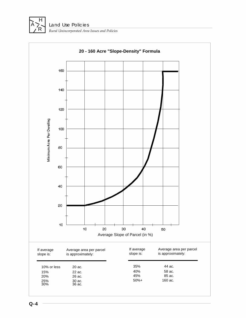
Land Use Policies
Rural Unincorporated Area Issues and Policies
Q-4
H A
R
Average Slope of Parcel (in %)
20 - 160 Acre "Slope-Density" Formula
If average Average area per parcel If average Average area per parcel slope is: is approximately: slope is: is approximately:
10% or less 20 ac. 35% 44 ac. 15% 22 ac. 40% 58 ac. 20% 26 ac. 45% 85 ac. 25% 30 ac. 50%+ 160 ac. 30% 36 ac.
Land Use Policies
Rural Unincorporated Area Issues and Policies
Q-5
H A
R
2. Open Space: it is mandatory that no less than 90% of the land area shall be preserved permanently as open space through dedication of an open space or conservation easement precluding any future development: a. those portions of the land permanently
preserved as open space shall be configured as large, contiguous and usable areas;
b. the open space may be dedicated through easements over portions of individually-owned parcels or may be configured as separate parcels owned in common or individually;
c. the open space area shall be privately controlled and not accessible to the public unless the area is deeded to a public agency or entity willing to undertake responsibilities of ownership, maintenance, and public access [designated trail corridors may traverse such areas if proposed as part of the Regional Parks, Trails, and Scenic Highways Plan]; and
d. land uses allowed within the area dedicated as permanent open space shall be limited to agricultural or other limited resource-related uses, and to non-commercial recreational facilities of an ancillary nature to the cluster residential development and for use by residents only.
Design Principles for Cluster Residential Subdivision Proposals
R-LU 21 Design of the cluster development shall incorporate the following basic principles: 1. Site layout shall demonstrate efficiency in
the location and length of roadways, driveways, and other basic infrastructure improvements or extensions.
2. Roads shall be of adequate design, capacity, and construction to accommodate traffic associated with the development safely, efficiently, and with minimal long term maintenance needs.
3. The locations of roads, building sites, septic system leach fields, or other major features of development must be accurately identified on the proposed subdivision map, and they shall: a. avoid areas of natural hazards and
avoid adverse impacts upon natural and heritage resources.
b. be required to mitigate or reduce potentially significant adverse environmental impacts to an insignificant level, particularly regarding water quality, through such means as adequate setbacks from water resources, avoidance of areas with high percolation rates and/or high ground water tables.
4. Building sites and access roads should be located such that areas of the site which pose a significant hazard, such as landslides, very steep slopes, fault traces, or floodways, are placed within the portion of the site that is dedicated as permanent open space.
5. Roads, building sites, and other facilities shall not be allowed to create major, lasting visible scars on the landscape.
6. Structures on or near ridgelines shall be located, constructed, and/or landscaped so that they do not create a significant adverse visual impact as seen from the Valley floor.
Residential Development Policies – One Time 2-Lot Subdivisions
R-LU 22 Two Lot Subdivisions: For any two-lot subdivision of land, the average area per dwelling unit shall be as determined by the variable slope-density formula, and neither a cluster permit nor dedication of permanent open space shall be required, provided that:
a. the parcel in question was not itself created after 1980; and
b. any subsequent subdivision of the two lots so created shall adhere fully to the density and development requirements of the General Plan and all applicable County ordinances.
Land Use Policies
Rural Unincorporated Area Issues and Policies
Q-6
H A
R
Development Policies – Los Gatos Watershed
R-LU 23 Los Gatos Watershed: Significant portions of the area within the Los Gatos (Lexington Reservoir) Watershed are divided into patterns of small, non-conforming parcels. 1. These lands are not and shall not be
designated “Rural Residential” or other similar designation of increased density, on account of the multitude of existing, severely substandard development conditions and the prevalence of many unresolvable development constraints.
2. All portions of the Los Gatos Watershed shall be designated ‘Hillsides’ and development on existing parcels shall be required to meet the standards and policies of the County General Plan and the provisions of applicable County ordinances.
3. Further policy guidance is provided by means of the Los Gatos Watershed Land Use Policies (see Special Areas Policies section).
Development Policies – Steep Slope Areas
R-LU 24 New development, whether through subdivision or on existing, legal parcels (“single-site development”) shall not be allowed on building sites in excess of 30% average slope unless: a. the proposed site is a more feasible, suitable
location for development than alternative locations on the parcel proposed for development; and
b. technical feasibility and environmental impact have been assessed and demonstrated through required studies, tests, and analyses of site conditions and characteristics.
Development Policies – Non-Residential Development Densities
R-LU 25 Non-residential land uses allowed in ‘Hillsides’ areas shall be of a generally low density or low intensity nature, depending on the use, as is consistent with the basic intent of the Hillsides designation to preserve the resources and rural character of the land. Non-residential uses shall: a. avoid or minimize any potentially
significant adverse environmental impacts; b. provide adequate access to safely
accommodate potential traffic without significantly impacting local transportation routes;
c. demonstrate no significantly increased risks associated with natural hazards;
d. not create adverse visual impacts as viewed from the Valley floor or from adjacent public recreational areas; and
e. cause no significant increase in the demand for public services or infrastructure, including potential impacts on school districts.
R-LU 26 For recreational, commercial, or other uses which permit or involve overnight accommodations for temporary guests, allowable densities and the design of development shall also adhere to the following principles: a. proposed densities must be consistent with
the scale of the allowed recreational or commercial use, if applicable;
b. design and appearance shall blend harmoniously with the natural setting; and
c. development shall be located, and if possible, clustered within the minimum area necessary to accommodate it, in order to avoid or reduce the need for improvements and minimize any potential environmental impacts.
Land Use Policies
Rural Unincorporated Area Issues and Policies
Q-7
H A
R
R- LU 27 Land uses proposed for inclusion within the Hillside zoning ordinance may be evaluated for conformity with the intent of this land use designation by various measures of land use intensity, including but not limited to: a. waste water generation rates; b. traffic generation rates; c. extent of grading, vegetation removal,
drainage modifications, or other alteration of the natural environment;
d. noise or other nuisance potential; and e. growth-inducing potential.
Development Policies – Non-Residential Open Space Preservation
R-LU 28 For all uses allowed in Hillsides areas other than agricultural and single-family residential land uses, open space preservation by means of easement dedication may be required in order to: a. protect the public health, safety and general
welfare; b. prevent or mitigate potentially significant
adverse environmental impacts; and/or c. to create perimeter areas that adequately
buffer neighboring properties from adverse off-site impacts of the proposed land use.
R-LU 29 The nature and duration of an open space or conservation easement shall be commensurate with: a. the nature of the land use; b. the duration to which that use has been entitled through County permitting procedures; and c. the extent of alterations made to the natural landscape.
R-LU 30 Land uses which do not receive a permanent entitlement should not be required to dedicate open space or conservation easements of permanent nature, unless required as a mitigation for alterations made to the natural landscape.
Development Policies - RV Parks
R-LU 31 Recreational vehicle (RV) parks shall primarily serve the needs of the traveling public for short term accommodations. a. At least sixty-five (65%) percent of all spaces
within an RV park shall be designed for and designated as short-term occupancy spaces (i.e., fewer than 30 days);
b. Twenty-five (25) percent of the total number of spaces may accommodate stays of up to one-hundred eighty (180) days;
c. Ten (10) percent of the total number of park spaces may accommodate stays of up to three-hundred sixty (360) days.
[Amended Dec. 5, 1995, File#: 6010-95GP; and August 5, 1997, File#: 6010-96GP]
*************
Policy R-LU 32 deleted. See NOTE below.
*************
R-LU 33 Recreational vehicle park development should conform to the adopted policies, ordinances and design guidelines of the County of Santa Clara.
*************
NOTE: Policies R-LU 32 and 34 were deleted by an amendment to the General Plan adopted Dec. 5, 1995. [File #: 6010-00-00-95GP]
*************
Land Use Policies
Rural Unincorporated Area Issues and Policies
Q-8
H A
R
Ranchlands
Description and Intent
R-LU 35 Ranchlands: Lands predominantly used as ranches in rural unincorporated areas of the county, remote from urbanized areas and generally less accessible than other mountain lands. Important resources include reservoir watersheds for regional water supply, grazing lands, mineral resources, forests and wildlife habitat, rare or locally unique plant and animal communities, historic and archeological sites, and recreational and scenic areas of importance that also serve to define the setting for the urban areas.
R-LU 36 The general intent of the Ranchlands designation is to maintain the existing conditions of very low intensity uses, rural lifestyle, and limited public access. Development policies shall protect and enhance the continued use of the land for ranching.
R-LU 37 Population shall be held to a minimum, and land uses shall be of a nature and intensity which do not require higher levels of public services than those presently provided.
R-LU 38 Subdivision and parcel creation data, including the issuance of certificates of compliance, shall be collected and monitored. If subdivision activity reaches the thresholds established by the policies of the General Plan, Ranchlands policies shall be evaluated for possible revision.
Allowable Uses
R-LU 39 The primary use shall be ranching. Other allowable uses shall be: a. agriculture; b. low intensity recreational uses; c. mineral extraction; d. land in its natural state; e. hunting; f. wildlife refuges; g. very low density residential development;
and h. very low intensity commercial, industrial, or
institutional uses, provided that they primarily support ranching activities or the enhancement, protection, study or appreciation of the natural resources of the area.
Development Policies – General Principles for Ranchlands Areas
R-LU 40 General principles governing development and land division in Ranchlands areas shall be as follows: 1. No large ranches shall be allowed to fully
divide into small parcels. 2. The function of allowed subdivisions shall
be for the following, provided that very little population is added to Ranchlands areas: a. help ranchers trade land; b. raise capital in times of need; c. help settle estates; and d. provide for family divisions.
3. The right of ranchers to build residences and to divide “Williamson Act” property under the terms of existing Land Conservation contracts is affirmed.
4. There shall be a limit to the number of parcels created within the Ranchlands area.
5. The rural character of the area shall not be changed, and land use decisions shall prevent an influx of people into the Ranchlands area

Land Use Policies
Rural Unincorporated Area Issues and Policies
Q-9
H A
R
Development Policies – Allowable Densities
R-LU 41 Density of development in areas designated ‘Ranchlands’ shall be determined by application of the “20-160 acre variable slope-density formula,” or, if not employed, 160 acres per dwelling unit. 1. Clustering of development in Ranchlands
shall not be allowed. 2. The minimum parcel size shall in no case be
less than 20 acres.
Development Policies – Subdivision and Parcel Creation Limitations
R-LU 42 Individual subdivision proposals in Ranchlands areas shall be subject to the following limitations: 1. At the time of the application, the entire area
of contiguous land holdings owned by the applicant shall be included in the application, even though the proposed subdivision may only affect a portion of that area.
2. Major subdivisions of 5 lots or more shall be discouraged.
3. No subdivision of land into parcels less than 160 acres shall be approved for a land holding where the division would result in the approval of more than four lots within the holding during any three year period.
R-LU 43 Cumulative land division activity shall be limited for areas designated Ranchlands, according the following provisions: 1. The ‘Ranchlands’ shall be separated into two
geographic areas, Area A to the north of Coe State Park, and Area B to include the remainder of the ‘Ranchlands’.
2. Within Area A: a. no more than 40 parcels that are less
than 160 acres each may be created in any calendar year;
b. no more than 75 parcels that are less than 160 acres each may be created in any three consecutive years; and
c. no more than 20 parcels may be created which are greater than 160 acres each in any calendar year.
3. Within Area B: a. no more than 20 parcels may be created
that are less than 160 acres each in any calendar year;
b. no more than 38 parcels may be created that are less than 160 acres each in any consecutive three years; and
c. no more than 10 parcels greater than 160 acres each may be created in any calendar year.
4. Parcels created without obtaining building site approval are restricted from use as building sites, as indicated on the approved subdivision map, and shall count towards the total of the number of parcels which may be created according the aforementioned limitations, subsections (b) and (c).
Development Policies – Road and Access Requirements
R-LU 44 Ranch roads serving the internal needs of the ranches may be of gravel or hard dirt surface, and of widths suitable for ranching uses. Such roads shall not be considered acceptable for the purpose of subdivision approval unless they meet all applicable County standards regarding access for the Ranchlands areas. Routine maintenance of ranch roads shall not require grading permits provided that road alignments are not changed.
Land Use Policies
Rural Unincorporated Area Issues and Policies
Q-10
H A
R
Open Space Reserves
Description and Intent
R-LU 45 Open Space Reserve (OSR) lands include rural unincorporated areas contiguous to a city Urban Service Area (USA) for which no permanent land use designation was applied pending future joint studies by affected jurisdictions of desired long term land use patterns.
Development Policies - Allowable Uses
R-LU 46 Allowable uses shall consist of agriculture and open space uses.
R-LU 47 No commercial, industrial, or institutional uses shall be allowed.
Development Policies - Allowable Densities
R-LU 48 No parcels of less than 20 acres shall be created.
Future Resolution of Long Term Land Use
R-LU 49 For lands within the vicinity of the City of Gilroy designated OSR, joint studies should be conducted to resolve and define: a. areas to be reserved for future urban
growth; b. areas to be reserved for long term
agricultural use; and c. other planning objectives identified within
the South County Joint Area Plan deemed appropriate to the OSR areas.
R-LU 50 For lands within the vicinity of the City of San Jose designated OSR, joint studies should be conducted to define and resolve issues of mutual interest for the South Almaden Valley and nearby hillsides areas.
Existing Regional Parks
Description and Intent
R-LU 51 The Regional Parks designation is applied to park lands of the County, Cities, State of California, and United States government agencies which serve a region-wide population.
Allowable Uses and Development Policies
R-LU 52 For applicable policies pertaining to these lands, refer to the Parks & Recreation chapter of the General Plan.
Other Public Open Lands
Description and Intent
R-LU 53 The Other Public Open Lands designation is applied to lands in Open Space which are owned by various public agencies for purposes other than public parks and general recreational use. The lands are owned by such agencies and entities as the United States, the State of California, City and County of San Francisco, Regents of the University of California, Santa Clara Valley Water District, City of Palo Alto, and others.
Allowable Use Policies
R-LU 54 While some areas so designated may be open to public access, others are not available for access or use by the general public, except on a permit basis.
R-LU 55 Midpeninsula Regional Open Space District lands are mostly undeveloped and open to the public without permits.
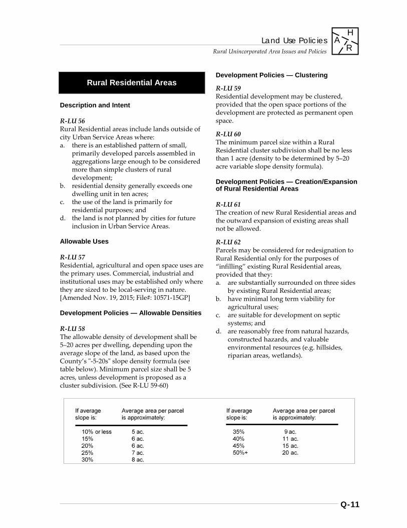
Land Use Policies
Rural Unincorporated Area Issues and Policies
Q-11
H A
R
Rural Residential Areas
Description and Intent
R-LU 56 Rural Residential areas include lands outside of city Urban Service Areas where: a. there is an established pattern of small,
primarily developed parcels assembled in aggregations large enough to be considered more than simple clusters of rural development;
b. residential density generally exceeds one dwelling unit in ten acres;
c. the use of the land is primarily for residential purposes; and
d. the land is not planned by cities for future inclusion in Urban Service Areas.
Allowable Uses
R-LU 57 Residential, agricultural and open space uses are the primary uses. Commercial, industrial and institutional uses may be established only where they are sized to be local-serving in nature. [Amended Nov. 19, 2015; File#: 10571-15GP]
Development Policies — Allowable Densities
R-LU 58 The allowable density of development shall be 5–20 acres per dwelling, depending upon the average slope of the land, as based upon the County’s "-5-20s" slope density formula (see table below). Minimum parcel size shall be 5 acres, unless development is proposed as a cluster subdivision. (See R-LU 59-60)
Development Policies — Clustering
R-LU 59 Residential development may be clustered, provided that the open space portions of the development are protected as permanent open space.
R-LU 60 The minimum parcel size within a Rural Residential cluster subdivision shall be no less than 1 acre (density to be determined by 5–20 acre variable slope density formula).
Development Policies — Creation/Expansion of Rural Residential Areas
R-LU 61 The creation of new Rural Residential areas and the outward expansion of existing areas shall not be allowed.
R-LU 62 Parcels may be considered for redesignation to Rural Residential only for the purposes of “infilling” existing Rural Residential areas, provided that they: a. are substantially surrounded on three sides
by existing Rural Residential areas; b. have minimal long term viability for
agricultural uses; c. are suitable for development on septic
systems; and d. are reasonably free from natural hazards,
constructed hazards, and valuable environmental resources (e.g. hillsides, riparian areas, wetlands).
Land Use Policies
Rural Unincorporated Area Issues and Policies
Q-12
H A
R
Other Land Uses
Major Educational & Institutional Uses
Description and Intent
R-LU 63 The Major Educational and Institutional Uses designation is applied to lands belonging to a university, religious order, or private institution, used as a place of learning, an academic reserve for future university use, a seminary, or a research facility.
STANFORD UNIVERSITY LANDS - see 2000 Stanford Community Plan
*************
Note: Policies R-LU 64 through R-LU 69 pertaining to Stanford University Lands have been deleted from the General Plan. With the adoption of the 2000 Stanford Community Plan, they have been superseded by the Land Use Chapter of the Community Plan. [Note: The 2000 Stanford Community Plan is an adopted part of the General Plan, but it is published as a separate document]. [Amended Dec. 12, 2000; File#: 7165-99GP]
*************
OTHER EDUCATIONAL AND INSTITUTIONAL USES
Description
R-LU 70 Colleges, astronomical observatories, seminaries, and private educational facilities.
Allowable Uses and Development Policies
R-LU 71 New or expanded facilities shall provide all services necessary for their operations and shall be compatible with the land uses in the area in which they are located.
Land Use Policies
Rural Unincorporated Area Issues and Policies
Q-13
H A
R
Public Facilities
R-LU 72 The ‘Public Facilities’ designation is applied to lands located outside city Urban Service Areas owned or operated by federal, state, or local government for governmental purposes. Lands under this designation include, but are not limited to uses and facilities such as county government centers, United States government lands, including those used for defense and other research installations, and other facilities of the state, federal or local governments. [Amended June 10, 2014; File#: 7764-14GP]
Major Gas & Electric Utilities
R-LU 73 The County’s major gas and electric distribution system should be: a. adequate to meet the projected energy needs
of the people of Santa Clara County; and b. compatible with the environmental
resources and scenic qualities of the County.
R-LU 74 In locating major gas and electric transmission distribution facilities, the primary environmental considerations shall be to minimize aesthetic impacts and to avoid developed residential and/ or public recreation areas. Major electric transmission lines should be located and designed in accordance with the following principles: 1. Route selection should avoid ridgelines and
follow the natural flow and rhythm of land forms as much as possible.
2. Routes should not cross scenic roads at points where lines will be visible for long distances.
3. Minimum height structures should be used to reduce visual impacts where the additional structures which result are not objectionable.
4. Vegetation should be used for screening where it will not interfere with a facility’s operation.
5. Design, appearance, and paint selection should reduce visual impact.
6. If natural vegetation need not be removed in order to provide adequate service access and passable rights of way, it should be maintained and enhanced to control erosion and minimize visual impacts. Vegetation which could pose a threat to the transmission line should not be retained.
R-LU 75 Electric substations and gas control and metering stations shall be located, designed, and landscaped to fit as inconspicuously and harmoniously as possible into the area in which they are required. Locations along scenic roads and heavily traveled highways should be avoided.
R-LU 76 The multiple use of transmission line rights-of- way for riding and hiking trails, pedestrian walkways, landscaped greenways, parking areas, and parks shall be encouraged, provided that there is no threat to public health and safety.
R-LU 77 All proposals for new major transmission lines and distribution facilities shall require an application for a General Plan Amendment to the Gas & Electric Utilities Plan map. Proposals shall be evaluated for conformance with the policies of the General Plan concerning major gas and electric utilities. 1. New major transmission lines are not
required to secure a use permit in addition to a General Plan Amendment.
2. New distribution and transmission facilities such as substations must secure use permits, in addition to a General Plan Amendment, unless the land on which the facility is proposed is not within the regulatory jurisdiction of the County.
[Note: For Major Gas & Electric Utilities to which these policies apply, refer to "Major Gas & Electric Utilities Map" of the General Plan.]
Land Use Policies
Rural Unincorporated Area Issues and Policies
Q-14
H A
R
Definitions
Hydro Generating Plant An electric generating station where power is produced by the pressure or force of falling water driving the generating unit.
Steam-Electric Generating Plant An electric generating station where steam produced by using fossil or nuclear fuels, or obtained from geothermal sources, is used to drive the generating units.
Electric Transmission Substation An assembly of equipment, which is part of a power system for transmitting electric energy, consisting of suitable transformers and switching equipment which can interconnect high voltage transmission lines of the same system or between systems at the same or different voltages. These substations interconnect, transform and control the flow of power through the transmission system.
Electric Transmission Line A line designed to carry large blocks of electric energy at a voltage of 50 kv or above from generating stations, between points of interchange, between transmission substations, to distribution substations or to large individual customers. Generally these voltages are 60 kv, 70 kv, 115 kv, 230 kv or 500 kv.
Electric Distribution Substation An assembly of equipment which is part of a power system for distributing electric energy where energy at high voltage is received normally from a transmission line and is transformed to a lower voltage for distribution in the surrounding area.
Electric Distribution Line A line with a primary voltage below 50 kv emanating from an electric distribution substation for the purpose of distributing electric energy in the area around the substation or a line with secondary voltage below 500 volts for general customer use.
Electric Service Drop or Run Conductors, either overhead or underground, from the secondary distribution line (normally below 500 volts) to the customer’s service point.
Gas Regulating Station An assembly of equipment installed for the purpose of automatically reducing and regulating the pressure in the downstream pipeline or main to which it is connected.
Gas Mixer Station An assembly of equipment installed to mix supplies of gas from different sources for the purpose of controlling hearing values.
Gas Transmission Line A pipe installed for the purpose of transmitting gas from a source or sources of supply to one or more distribution centers or to one or more large volume customers or to interconnect sources of supply. In typical cases transmission lines differ from distribution mains in that they operate at higher pressures, they are longer, and the distance between connections is greater.
Gas Distribution Trunk Main A pipe installed to convey gas from a transmission line to or between one or more distribution mains. It may operate at or above distribution main pressure.
Gas Distribution Main A pipe installed in a community to convey gas to individual services or other mains.
Gas Service Run The pipe and appurtenances that run between a main or pipeline and the customer’s meter.
Land Use Policies
Rural Unincorporated Area Issues and Policies
Q-15
HA
R
Transportation Facilities
R‐LU 78 The Transportation Facilities designation is applied to airports, bus facilities, and storage yards for road maintenance equipment and supplies.
R‐LU 79 New public transportation facilities shall be compatible with the land uses in the areas in which they are located and consistent with the County’s General Plan.
R‐LU 80 Proposed County transportation facilities shall be subject to the same requirements for minimizing visual and aesthetic impacts as those required of private development.
Roadside Services
Description and Intent
R‐LU 81 Roadside Services shall consist of a limited number of private facilities and businesses serving the motoring public in dispersed locations.
R‐LU 82 The number, type, and location of roadside services shall be limited in order to: a. protect scenic and environmental resources; b. prevent traffic hazards on rural roads; c. exclude uses which should more
appropriately be located in cities; d. prevent strip commercial development; e. minimize demands for the provision of
urban services in rural areas; and f. avoid incompatibilities with adjacent land
uses.
Allowable Uses
R‐LU 83 Allowable uses within the “Roadside Services” designation shall be uses serving the current motoring public, including: a. restaurants; b. motels; c. recreational facilities which require a rural
setting; d. wine tasting rooms; e. farmers markets; f. gas stations g. single‐family residences, one per lot,
incidental to and necessary to support a legally established and permitted primary non‐residential use; and,
h. other similar non‐residential uses, as defined by the Zoning Ordinance.
[contʹd. next page]
Land Use Policies Rural Unincorporated Area Issues and Policies
Q-16
H A
R
Development Policies
R‐LU 83.1 The minimum lot size for the establishment of new Roadside Services land use designations and for subdivision of land designated Roadside Services shall be five (5) acres. [Amended Policies R-LU 83 and 83.1 Sept. 12, 2017; File#: 10992-17GP]
R‐LU 84 Proposals for new or expanded Roadside Service designations or uses shall be reviewed and mitigated for their individual and cumulative impacts upon: a. scenic and environmental resources;b. traffic levels and traffic hazards;c. demands for public services;d. adjacent land uses; and,e. potential for growth‐inducing impacts.
Development Policies - RV Parks
R‐LU 85 Recreational vehicle (RV) parks shall primarily serve the needs of the traveling public for short term accommodations. a. At least sixty‐five (65%) percent of all spaces
within an RV park shall be designed for anddesignated as short‐term occupancy spaces(i.e., fewer than 30 days);
b. Twenty‐five (25) percent of the total numberof spaces may accommodate stays of up toone‐hundred eighty (180) days;
c. Ten (10) percent of the total number of parkspaces may accommodate stays of up tothree‐hundred sixty (360) days.
[Amended Dec. 5, 1995; File#: 6010‐95GP; and Aug. 5, 1997; File#: 6010‐96GP]
************* NOTE: Policies R‐LU 86‐87 were deleted by an amendment to the General Plan adopted Dec. 5, 1995. [File#: 6010‐95GP]
*************
R‐LU 88 Recreational vehicle park development should conform to the adopted policies, ordinances and design guidelines of the County of Santa Clara.
Solid Waste Disposal Sites
R‐LU 89 New or expanded solid waste disposal sites (landfills) shall be allowed only if in conformance with the General Plan and compatible with surrounding land uses.
R‐LU 90 New, existing and inactive disposal sites shall be designated on the Land Use Plan. 1. New sites may be allowed only if issued a
use permit and if they comply with all stateand local regulations regarding operationsand reclamation.
2. Expansions of existing landfills must applyfor modification of the existing use permitand reclamation plans.
R‐LU 91 Once the use of a solid waste disposal site has been terminated, the site shall be reclaimed for subsequent allowable open space uses, including, but not limited to parks, preserves, or other waste management‐related uses (composting, transfer sites, etc.).
R‐LU 92 No solid waste disposal site shall be used for residential development or any structures for human occupancy.
R‐LU 93 New landfill sites may not be located in the Baylands or in other environmentally critical areas.
Land Use Policies
Rural Unincorporated Area Issues and Policies
Q-17
H A
R
*************
NOTE: Policies R-LU 94-96 regarding the "Industrial Facilities" land use designation were deleted by an amendment to the General Plan adopted Dec. 4, 2007. [File #: 9392-00-00-06GP]
*************
Special Area Policies
New Almaden Historical Area
R-LU 97 The New Almaden Historical Area, a nationally registered historic site, shall be preserved under the provisions of the special Historical Conservation Zoning District (H1) applied to the area.
Los Gatos Watershed Area
Area Boundaries
R-LU 98 The Los Gatos Watershed includes all the land in Santa Clara County which drains into the Lexington Reservoir below Lake Elsman.
General Plan Designation
R-LU 99 The Los Gatos Watershed is designated ‘Hillsides.’
Development Standards
R-LU 100 Given the severe problems of fire protection, including water supply and pressure, access and service; domestic water supply and quality; general watershed quality; erosion; road maintenance; circulation and road safety; geological hazards; and protection of the natural environment; in the portions of the Los Gatos Watershed with lots of 10 acres or less, no new building shall be permitted and no building sites created or new lots created except with the strictest adherence to County standards and criteria.
Land Use Policies
Rural Unincorporated Area Issues and Policies
Q-18
H A
R
R-LU 101 Variances to zoning setbacks shall be allowed only when it can be found that there will be no adverse traffic safety or health impact. Setback variances are not intended to be used to secure building site approval for otherwise unbuildable parcels.
Commercial Land Use
R-LU 102 Commercial uses should be limited to those properties currently serving commercial functions.
R-LU 103 If commercial land uses are needed in the future, they should be located near existing commercial uses.
R-LU 104 New commercial land uses should be Neighborhood Commercial, permitting uses which satisfy local day-to-day needs and do not result in additional traffic from outside the Los Gatos Watershed.
R-LU 105 No commercial development such as motels and restaurants which generate high levels of sanitary waste shall be allowed to develop on septic systems.
R-LU 106 Prior to establishment or expansion of a commercial use, assured, dependable and adequate water pressure shall be demonstrated as appropriate to the specific use.
Industrial Land Use
R-LU 107 No new industrial uses shall be approved.
Non-Conforming Parcels In County Ownership
R-LU 108 The County should retain ownership of any non-conforming parcels acquired as a result of tax delinquency unless the parcels can be merged with adjacent developed parcels and/or unless an open space easement is applied to the parcel.
Logging
R-LU 109 There shall be no commercial logging within those areas that are primarily residential and where lots are generally less than 10 acres. Within these areas, limited tree harvesting not requiring heavy equipment shall be allowed, taking not more than 10 percent of the existing board-feet in any five year period.
Deficiencies
R-LU 110 The County shall seek correction of substandard health and safety related conditions at the time of resale of dwellings.
Land Use Policies
Rural Unincorporated Area Issues and Policies
Q-19
H A
R
Los Gatos Hillside Specific Plan
R-LU 111 The jointly adopted ‘Los Gatos Hillside Specific Plan’ shall serve to implement the provisions of the Land Use Element of the Santa Clara County General Plan for those lands included within the Study Area Boundary of the Specific Plan. Refer to the Specific Plan (not contained within the General Plan) for the allowable uses and densities permitted for each sub-area of the lands governed by the Specific Plan. 1. All policy provisions of the Specific Plan
shall be deemed compatible with the County’s General Plan.
2. For areas governed by the “20-160 acre variable slope density formula,” development must fully conform to Hillsides policies concerning clustering of residential development and open space dedication.
R-LU 112 Urban development shall not occur outside of city jurisdiction. Unincorporated land within the Urban Service Area of the Town of Los Gatos and which is suitable for urban development: a. should be annexed at a time consistent with
the development schedule of the city; and b. shall conform to the city’s General Plan.
San Martin Planning Area
Area Boundaries
R-LU 113 The San Martin Planning Area boundary encompasses the area between Maple Avenue on the North; Masten Avenue on the South; the East Foothills and West Foothills (excluding those areas annexed to Morgan Hill). It excludes that part of the current study area which lies west of Monterey Road and between the hill crest north and paralleling California Avenue and West Middle Avenue. [see map p. Q-21] [Amended Mar. 9, 1999; File#: 7200-98GP]
General Policies
R-LU 114 San Martin is a rural unincorporated community governed by the County Board of Supervisors. Furthermore, San Martin should be viewed as a distinct geographic entity, unique within the rural unincorporated areas of Santa Clara County and having a unique rural identity and character within the South County area. Care should be taken to prevent premature commitment of land for uses which would restrict future options for the community. In order to best preserve future options for the San Martin community and environs, San Martin shall remain a rural community, predominantly nonurban and residential in nature. [Amended Mar. 9, 1999; File#: 7200-98GP]
R-LU 114.1 Policies, permit decision-making, and other matters subject to the discretion of the County and Board of Supervisors shall also take into consideration the desire and intent of the community to preserve and enhance the character, identity, and importance of the village core area of San Martin, being that area most central to the distinct identity of San Martin. [Amended Mar. 9, 1999; File#: 7200-98GP]
Land Use Policies
Rural Unincorporated Area Issues and Policies
Q-20
H A
R
R-LU 114.2 In keeping with the general policies governing San Martin, no further introduction of Roadside Services land use designations within the San Martin Planning Area shall be permitted, unless through subsequent amendment to this policy or subsequent to and in conformance with the adoption of a master land use and infrastructure plan referred to in policy R-LU 117. Limited modification of the Industrial and/or Commercial Use Permit Area boundaries may be considered through the General Plan amendment process, if consistent with the following principles and criteria: a. Proposed modifications would not conflict
with residential uses or be inconsistent with the primarily rural residential and agricultural land use patterns of San Martin;
b. Proposed modifications to expand a Use Permit Area boundary would be limited to parcels immediately adjacent to the existing boundaries; and
c. Proposed modifications would not likely cause significantly increased traffic from outside the community or other objectionable impacts to the area or surrounding properties.
[Amended Mar.9, 1999; File#: 7200-98GP; Mar. 20, 2007; File#: 1323-06GP]
R-LU 114.3 The intent of policy R-LU 114.2 is to limit the extent of possible expansion of the Use Permit Area boundaries. Future expansion proposals, whether through successive incremental applications for General Plan amendments or through proposals for a significant number of boundary expansions in any given yearly application filing period, may indicate a need to re-evaluate policy enabling limited expansion through privately initiated applications. The County may at any time suspend acceptance of such applications, or require additional planning analysis and recommendations regarding the long term implications and cumulative impacts of such boundary modification proposals, or both. The County may refuse to accept for processing a privately-initiated application for a General Plan amendment not deemed substantially consistent with fundamental or applicable goals and policies of the General Plan, including those for
the San Martin Planning Area, and Policies R-LU 114.2 and R-LU 114.3, in particular. [Amended Mar. 20, 2007; File# 1323-72-32-06GP]
R-LU 115 The density and location of future land divisions should reflect the recommendations of the San Martin Area Water Quality Study (1981) and take into consideration subsequent studies of ground water quality.
R-LU 116 The County endorses the concept of community participation by residents and property owners in the decisions affecting San Martin. For that purpose, there shall be a San Martin Planning Advisory Committee whose members are appointed by the Board of Supervisors to represent the community and to advise the Planning Department, Planning Commission, and others in matters of interest to the community. [Amended Mar. 9, 1999; File#: 7200-98GP]
Master Plan as a Prerequisite to Significant Land Use or Intensity Changes
R-LU 117 Prior to any significant increase in the types or densities of land use in the San Martin area, a master plan addressing both land use and infrastructure issues must be prepared and adopted by the Board of Supervisors. Projects considered "significant" would be those that a. involve changes to the minimum lot sizes
allowed in the San Martin area or b. some expansion or intensification in the
types of uses currently allowed in either the rural residential areas or those zoned for commercial and industrial uses.
The master utility/infrastructure component of this plan would include provision for fire protection, street improvements, a unified water distribution system, a wastewater management system (sewers), and area-wide drainage improvements. Methods of financing the master-planned improvements and designation of the government entities which would administer and operate certain of the improvements should be included in the adopted plan.
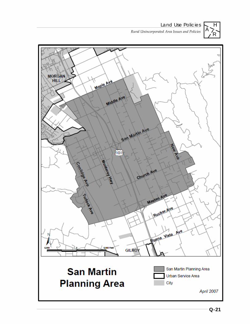
Land Use Policies
Rural Unincorporated Area Issues and Policies
Q-21
H A
R
[MAP]
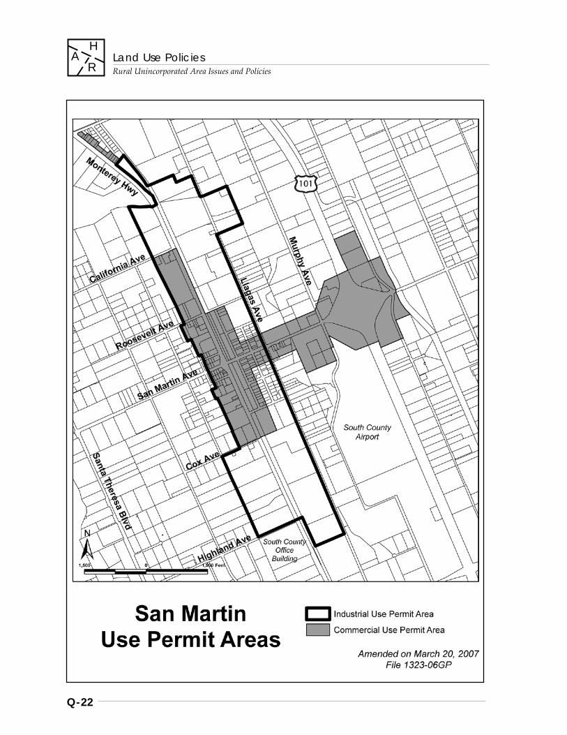
Land Use Policies
Rural Unincorporated Area Issues and Policies
Q-22
H A
R
Land Use Policies
Rural Unincorporated Area Issues and Policies
Q-23
H A
R
R-LU 117.1 Connections to sewers in the San Martin area will be subject to the following conditions: a. No sewer connections will be allowed for
private projects in the San Martin area until such time as an area-wide plan for infrastructure has been approved by the Board of Supervisors.
b. Public facilities and services operated by either a public or non-profit agency may be granted a sewer connection without being required to develop a master utility/infrastructure plan if it can be found that such a connection would not induce significant growth within the community.
[R-LU 117 amended and R-LU 117.1 adopted May 9, 1995; File # 5967-95GP]
R-LU 118 Any future development plan of San Martin should include street landscaping standards, setback and sign standards, historical resource policies, policies for undergrounding public utilities, and policies regarding other improvements.
Non-Residential Design Guidelines
R-LU 119 Non-residential development in the San Martin Planning Area shall conform to adopted development and design guidelines for the San Martin Community contained within the “San Martin Integrated Design Guidelines.” [Amended Nov. 19, 2015; File#: 10571-15GP]
Industrial Use Permit Area
R-LU 120 The intent of the Industrial Use Permit Area is to make provision for the maintenance and development of such light industrial uses as are of benefit to the community and environs through the appropriate discretionary permitting procedures. Such uses are allowed in addition to any of those uses which may be allowed within the applicable General Plan designation and zoning district. a. a. Light industrial uses may be located only
within the Industrial Use Permit Area Boundary. [See map p. Q-22]
b. New or significantly expanded uses may be
established and conducted only upon issuance of a use permit and architecture and site approval.
c. Heavy industrial uses shall not be allowed. [Amended Dec. 5, 1995; File #: 6009-95GP; Mar. 9, 1999; File#: 7200-98GP]
R-LU 120.1 In the vicinity of Llagas Creek, particularly in areas of highly permeable soils, industrial uses should be situated and designed to prevent any form of harmful waste discharges into the creek. These uses should be light industrial in character and have low water usage. The value of the riparian habitat and the beauty of the creek should be maintained and enhanced. [Amended Mar. 9, 1999; File#: 7200-98GP]
R-LU 121 New or significantly expanded industries may be allowed on septic systems only if they can comply with the current regulations of the County Septic System Ordinance.
R-LU 122 New or significantly expanded industrial uses may be allowed only if served by hydrants and water supply in sufficient volume and pressure for fire suppression.
R-LU 123 New or significantly expanded industrial uses may be allowed only if they can be adequately drained by a storm drainage system. On-site surface coverage should be limited to a small percentage of the total lot area in order to not create significant volumes of runoff waters.
Land Use Policies
Rural Unincorporated Area Issues and Policies
Q-24
H A
R
Commercial Use Permit Area
R-LU 124 The intent of the Commercial Use Permit Area is to make provision for the maintenance and development of such commercial uses as are of benefit to the community and environs through the appropriate discretionary permitting procedures. Such uses are allowed in addition to any of those uses which may be allowed within the applicable General Plan designation and zoning district. New or significantly expanded uses may be permitted only on property within the boundary of the San Martin Commercial Use Permit Area and upon issuance of a use permit and architecture and site approval. [See map p. Q-22] [Amended Mar. 9, 1999; File#: 7200-98GP]
R-LU 125 In vicinity of Llagas Creek, particularly in the areas of highly permeable soils, commercial uses should be situated and designed to prevent any form of harmful waste discharge in the creek. The value of the riparian habitat and the beauty of the creek should be maintained and enhanced. [Amended Dec. 5, 1995; File #: 6009-95GP; Mar. 9, 1999; File# 7200-98GP]
R-LU 126 Eligibility of certain properties for commercial development should be based on consideration of their location, traffic flow, and proximity to residential and other commercial uses, among other factors. Proposed uses which contribute to the enhancement of the commercial village core area shall be encouraged. [Amended Mar. 9, 1999; File#: 7200-98GP]
R-LU 127 New commercial land uses within the commercial or industrial use permit areas shall be sized to be of a local-serving nature, with the exception of properties immediately adjacent to the San Martin Avenue / Highway 101 freeway interchange that are east of Murphy Avenue, where uses may be allowed which are not necessarily of a local-serving nature. Local- serving uses shall be defined as only those uses
which provide support services for agriculture or commercial needs of the residents of San Martin. [Amended Dec. 5, 1995; File #: 6009-95GP; Mar. 9, 1999; File#: 7200-98GP; Nov. 19, 2015; File#: 10571-15GP]
R-LU 128 All development in freeway interchange areas shall rigorously comply with the San Martin Non-Residential Development and Design Guidelines, and shall be designed to enhance the scenic quality of Highway 101.
R-LU 129 Those types of commercial uses which generate high volumes of sanitary waste waters, for example motels and restaurants, should not be allowed to develop on septic tanks, unless provision can be made for special treatment devices in conjunction with and compliance with County septic tank regulations and specific approval by the Regional Water Quality Control Board officials. No new septic systems should be developed in the highly permeable soils of Llagas Creek. [Amended Dec. 5, 1995; File #: 6009-95GP]
R-LU 130 New or significantly expanded commercial uses may be allowed only if they can be served by an adequate storm drainage system.
R-LU 131 Prior to establishment or expansion of a commercial use, an assured, dependable, and adequate water supply both in volume and pressure for fire suppression shall be demonstrated for the specific use.
R-LU 132 Future extensive development of commercial land uses should only occur when the full range of service infrastructure has been provided. The standards and guidelines for the amount of commercial land use would be established in conjunction with an urban density land use and development plan for the area.
Land Use Policies
Rural Unincorporated Area Issues and Policies
Q-25
H A
R
R-LU 133 Criteria should be established to allow cottage-type industry (defined as commercial type uses that are somewhat more intense than home-occupations and less intense than those generally requiring a use permit) outside of the Commercial and Industrial Use Permit areas designated herein.
Public and Quasi-Public Uses
R-LU 134 County expansion of or new County facilities in San Martin requiring either construction or relocation should be reviewed with local residents and property owners prior to being established in the community.
R-LU 135 Prior to changing any policies regarding the South County Airport, constructing new airport facilities, or modifying existing airport structures, the proposed changes should be reviewed with residents and property owners of the San Martin Area. [Amended Dec. 5, 1995; File #: 6009-95GP]
Residential Land Uses
R-LU 136 Residential land use and development patterns shall remain the preferred and predominant use pattern in the San Martin Planning Area. Establishment of allowed non-residential uses in areas of existing or planned rural residential land use should be allowed only with the utmost consideration for the potential adverse impact of such uses upon the residential character and quality of life of the community. [Amended Dec. 5, 1995; File #: 6009-95GP; Mar. 9, 1999; File#: 7200-98GP]
R-LU 137 Within the established commercial/industrial use permit areas a residential use may be continued or developed on the same parcel as an industrial or commercial use so long as there is adequate area for construction and maintenance of separate septic systems for each use on the parcel.
Allowable Densities and Minimum Parcel Sizes
R-LU 138 The density of development for lands designated ‘Rural Residential’ within the San Martin Area shall be as determined by the “5-20 acre variable slope density formula,” unless such lands have been determined to be of less than 10% average slope and officially zoned "RR- 5Ac." accordingly. [Amended Mar. 9, 1999; File#: 7200-98GP]
R-LU 139 The density of development for lands designated other than ‘Rural Residential’ within the San Martin Planning Area shall be determined by the allowable densities of their base General Plan land use designation.
R-LU 140 Residential development within the Rural Residential Areas of San Martin shall be allowed to cluster, provided that the open space portions of the development are protected as permanent open space. The minimum parcel size within a rural residential cluster subdivision shall be no less than 1 acre.
Agricultural Land Uses
R-LU 141 Agricultural uses should be encouraged to continue.
R-LU 142 New development should be compatible with existing agricultural uses.
R-LU 143 New and expanded intensive agricultural uses which have the potential for generating significant volumes of organic waste discharges may be permitted subject to use permit (i.e. mushroom farms, dairies, animal feed lots, poultry farms).
Land Use Policies
Rural Unincorporated Area Issues and Policies
Q-26
H A
R
Areas of Special Environmental Concern
R-LU 144 Within the San Martin area, certain areas are defined as being of particular concern for development activity. These include lands within federal floodways, within Special Flood Hazard Rate Zones, and lands with soils of high permeability. The following policies are intended to address land use and development within such areas of San Martin. [Amended Dec. 5, 1995; File #: 6009-95GP]
R-LU 145 In the areas of Federal Floodways and Soils of High Permeability activities permitted should be limited to those specific uses which: a. do not provide the potential for contamination of surface runoffs; b. will not require additional septic systems; and c. will not add potential for generating significant volumes of organic liquid wastes or nitrates to the ground water aquifers.
R-LU 146 For the purposes of these policies, soils of high permeability are defined as those with permeability rates exceeding 6 inches per hour as delineated on the maps of Soils of Santa Clara County, 1968. [Amended Dec. 5, 1995; File #: 6009-95GP]
R-LU 147 In the area designated a Special Flood Hazard in the National Flood Insurance Program, any development shall comply with special regulations regarding the construction and improvement of structures, mobile homes, water and sewer systems adopted by the County Board of Supervisors in order to minimize flood damage and potential contamination of surface waters.
Scenic Highway
R-LU 148 The portion of Highway 101 (South Valley Freeway) in San Martin should be considered a scenic highway.
Monterey Highway Use Permit Area
Use Permit Area Boundaries
R-LU 149 The Monterey Highway Use Permit Area shall consist of properties with access to and fronting on Monterey Road from Metcalf Road south the county boundary, excluding the Urban Service Areas of the cities of San Jose, Morgan Hill, and Gilroy and lands within the San Martin Commercial and Industrial Use Permit Areas.
Land Uses
R-LU 150 While the predominant land use in the rural unincorporated areas of South County is agriculture, the County recognizes that there are along Monterey Road, within the areas designated ‘Agriculture’ and ‘Rural Residential,’ established, non-agricultural land uses serving the South County community. It is the policy of the County that they continue within the ‘Agriculture’ and ‘Rural Residential’ land use designations so that the needs of the South County may be served, provided that their legal status is secured in conformance with the following policies.
R-LU 151 Legally established land uses fronting Monterey Highway, south of Metcalf Road, in areas designated ‘Agriculture’ and ‘Rural Residential’ shall continue as allowable uses by right or by use permit, depending on the regulations governing their original establishment. To protect the area from undesirable strip commercial development, additional service uses will not be extended along Monterey Road.

Land Use Policies
Rural Unincorporated Area Issues and Policies
Q-27
H A
R
Expanding or Modifying Legal Uses
R-LU 152 Legal uses established as of January 1, 1985, may be expanded or modified through the use permit application process, with Architectural and Site Approval conditions to be included within the use permit, if it is found that the expanded or modified use: a. is essential or desirable to the public
convenience or welfare of the South County community;
b. will not cause significant adverse impact upon the environment;
c. will not be detrimental to the public health, safety, and general welfare;
d. is compatible with the surrounding area; e. will be upgraded to and can meet the
requirements and standards of all applicable regulating agencies and ordinances; and
f. will improve such conditions as traffic safety, water quality and drainage, working conditions for on-site workers, and the visual quality of the environment.
[This policy shall not apply to off-site advertising].
Establishing Legality of Auto-Storage and Sales Uses
R-LU 153 Auto storage and sales uses on abandoned auto-related land use sites fronting Monterey Road between Kirby and Madrone Avenues may be approved through the Use Permit application process, with Architectural and Site Approval, if it is found that the use: a. does not include automobile dismantling;
and b. conforms with the criteria (a) – (f) in Policy
R-LU 150.
R-LU 154 Any land use not legally established as of January 1, 1984, or for which legal status has not been granted through a use permit application made before December 31, 1985, shall be discontinued. Application to legalize such uses through a use permit shall not be accepted.
************
NOTE: Former policies R-LU 155-164 regarding the "East Foothills Policy Area" were deleted by an amendment to the General Plan adopted March 21, 1995. [File #: 5934-00-00-94GP]
************
Guadalupe Watershed Area of Critical Environmental Concern
R-LU 165 Lands within “Hicks Road-Upper Guadalupe Creek Watershed” area as delineated within the Land Use Plan map shall be designated as an “Area of Critical Environmental Concern” as established in state law.
R-LU 166 The Guadalupe Reservoir and its watershed lands are a critical component of the region’s water supply system. Given the variety of environmental factors and constraints common to the area, such as geologic and seismic concerns, limited fire protection, critical wildlife habitat, high erosion potential, steep slopes, and septic system limitations, among others, all applications shall be reviewed for potential adverse cumulative impacts upon the environment, in order to preserve the integrity of natural resources and to minimize long term financial liability to the public of maintaining various services and facilities, including costs associated with reservoir maintenance and water supply treatment.
Land Use Policies
Rural Unincorporated Area Issues and Policies
Q-28
H A
R
City of Morgan Hill Urban Growth Boundary (UGB) Area
Policies – Description and Intent
R-LU 167 Establish and maintain a long term urban growth boundary for the City of Morgan Hill, in order to: a. differentiate lands within the Morgan Hill
SOI intended for future urbanization from those intended to remain rural and unincorporated over an approximately 25 year time period;
b. provide greater stability of future land use patterns than is currently provided by the existing “short term” urban service area (USA) boundaries;
c. indicate the preferred extent and direction of the city’s future urban expansion and capital improvements planning, consistent with the city’s general plan;
d. encourage compact and concentric urban growth and development;
e. promote fiscal responsibility, cost-effective service delivery, and the city’s ability to plan for and adequately maintain urban services over time;
f. provide for an adequate land supply necessary for sustainable economic growth;
g. compensate for the impacts of the city’s historical patterns of urban growth;
h. achieve greater compatibility of land use planning and decision-making for lands of mutual interest to the City and County; and,
i. provide additional certainty to rural landowners needed for purposes of planning investments and maintaining viable agricultural operations.
Policies – UGB Maintenance, Administration, and Coordination
Objectives: • Maintenance of a stable UGB location and
the creation of a dependable, rational process for considering changes to the UGB.
• Added certainty to planning endeavors and long term land use patterns.
• Demonstrable consistency with city and County General Plans.
R-LU 168 Ensure that future proposals to modify the UGB are evaluated according to the considerations which guided its initial establishment, particularly stability and dependability factors. Utilize established criteria, findings or other prerequisites, such as the need to ensure an adequate inventory of available land for accommodating projected growth (approximately 25 years), as the basis for evaluating any proposals to expand the UGB. Make no provision to reconsider the UGB location more frequently than on a 10 year basis unless triggered by the established criteria, findings, or prerequisites.
Action Items: see R-LU(i) 12 and 13
R-LU 169 Ensure the consistency of all future proposals to modify the UGB location with applicable policies of the City’s and County’s General Plan, particularly concerning countywide urban growth management.
R-LU 170 Consider modifications to the UGB location only in conjunction with a comprehensive City General Plan land use element update, which occurs on an approximately 10 year interval, unless triggered by the established criteria, findings, or prerequisites, to ensure coordination between relevant land use planning issues and growth management considerations.
Objective: • Consistency of the UGB with current growth
management policy and Urban Service Area expansion procedures.
R-LU 171 Allow urban service area (USA) expansions only within the long term UGB and for lands with urban designations; the timing and extent of USA expansion shall remain consistent with established USA expansion policies and ordinances.
Land Use Policies
Rural Unincorporated Area Issues and Policies
Q-29
H A
R
R-LU 172 Consider reversion of residentially-designated lands outside the city limits and UGB to nonurban designations, through a comprehensive land use element update.
Objective: • Adequacy of City/County coordination and
concurrence on changes to UGB.
R-LU 173 Acknowledge and formally recognize the location of the UGB as adopted by the City of Morgan Hill for use with the applicable Special Area land use policies of the County of Santa Clara pertaining to land use within the UGB and Sphere-of-Influence.
R-LU 174 Ensure that County staff and decision-makers have adequate opportunity to participate in the evaluation of proposals to modify the UGB—the relative level of participation to be in keeping with the geographic scale or impact of proposed UGB changes (i.e., major revisions imply more significant role for joint City/County coordination; very minor or insignificant modifications would imply a potentially less significant role for joint City/County coordination).
R-LU 175 Policies, criteria, and methodology for considering changes to the UGB should be developed by the city in consultation with the County. These policies and criteria should be reasonable and consistent with the goals, precedent, and spirit of the current South County Joint Area Plan. Future modifications to the UGB should be considered using the methodology developed in consultation with the County and should include opportunity for County review and comment concerning proposed modifications, in accordance with jointly adopted policies and implementation recommendations of the City and County.
Action Item: see R-LU(i) 14
Policies – Land Use and Development Within the UGB
Objective: • The ability of the City to efficiently and
appropriately develop lands within the UGB in accordance with its General Plan, as urban expansion is warranted.
R-LU 176 Avoid land uses and development which would potentially conflict with future annexation and the optimal utilization of lands within the UGB. Allow only those interim uses which are consistent with intended future development.
R-LU 177 Retain current large minimum parcel sizes, and promote agricultural and open space uses on unincorporated lands within the UGB.
R-LU 178 Avoid premature road or infrastructure extensions that might conflict with optimal street configurations and development patterns within the UGB.
R-LU 179 Limit the introduction of any intensive commercial, industrial, or institutional uses.
R-LU 180 Prohibit the introduction of Roadside Services land use designations.
Policies – Land Use and Development Outside the UGB
Objective: • Maintenance of current County General
Plan policy encouraging agricultural and open space uses and prohibiting uses of an urban density, intensity or nature.
R-LU 181 Maintain the County’s commitment to agricultural, open space, and other allowable non-urban uses and densities, consistent with the intent of the Resource Conservation land use designations. Current minimum parcel sizes, development standards, and guidelines applicable to rural unincorporated lands should remain in effect.
Land Use Policies
Rural Unincorporated Area Issues and Policies
Q-30
H A
R
R-LU 182 Minimize potential land use conflicts between urban uses within the UGB and lands adjacent to the growth boundary.
Action Item: see R-LU(i) 15
Objective: • Maintain and enhance economic viability of
non-urban lands to remain under County land use jurisdiction, wherever possible.
R-LU 182. 1 Explore and implement as feasible various measures to enhance the economic viability of agriculturists, as called for in the County’s General Plan (e.g.: Competitiveness Task Force)
Action Item: see R-LU(i) 16
R-LU 183 Promote the use of expanded home occupations for rural landowners and agriculturists, within the parameters of the County’s zoning ordinance.
R-LU 184 Coordinate measures to enhance economic viability of non-urban land uses, particularly agriculture, being considered in conjunction with related planning efforts in which the County is a participant.
R-LU 185 Prohibit the introduction of Roadside Services land use designations within the Sphere-of- Influence of the City of Morgan Hill. [Amended Sept. 10, 1996; File #: 6274-96GP]
***********
Note: Policies R-LU 186 - 196 relating to the City of San Jose Urban Growth Boundary (UGB) Area have been set aside by resolution of the Board of Supervisors December 9, 1997, until further notice.
***********
West Valley Hillsides Preservation Area
The West Valley Hillsides Joint Planning Review was a collaborative planning project involving the West Valley cities of Cupertino, Monte Sereno, Saratoga, Los Gatos and the County. It was established to protect the scenic appearance of the West Valley hillsides (the foothills of the Santa Cruz Mountains) most visible from the valley floor.
This project originated from a proposal for a “Western Santa Clara County Foothills Subregional Planning Project” that was submitted to the Association of Bay Area Governments (ABAG) for staff and financial support in November 1994. Despite the ABAG decision not to award the grant to this project, the participating jurisdictions continued their efforts to achieve their joint planning goals. The major goal of the project was to protect the predominantly natural visual character of the West Valley Hillsides.
The Joint Planning Review proposes the following four basic strategies for the preservation of the natural visual character of the hillsides:
• Develop joint land use principles/objectives • Limit expansion of urban development into
hillside areas • Minimize the visual impacts of hillside
development • Provide mechanisms for resolution of future
hillside land use issues
The cities have agreed to delineate long term growth boundaries that will serve to minimize further urban encroachment into the hillsides. In return, the County has assured the cities that the development it allows outside their urban service areas will be appropriate for rural hillside areas and will have minimal visual impacts when viewed from the valley floor.
The following policies are based on and serve to reinforce existing general plan policies of the County and the West Valley cities. These policies are not intended to supersede existing policies.
Land Use Policies
Rural Unincorporated Area Issues and Policies
Q-31
H A
R
Joint Planning and Land Use Policies
R-LU 197 The natural beauty of the West Valley hillsides area should be maintained for its contribution to the overall quality of life of current and future generations.
R-LU 198 New development in the West Valley hillsides area should be located and designed to minimize its visibility from the valley floor.
R-LU 199 New land uses within the West Valley hillsides area should be limited to non-urban uses that are compatible with the preservation of the natural appearance of the hillsides.
R-LU 200 Urban development and the extension of urban services should be limited to those areas most suitable for urban development. Further substantial expansion of the urban area into the West Valley hillsides should be discouraged.
R-LU 201 The West Valley cities and the County should work cooperatively to maintain the natural appearance of the West Valley hillsides and should establish procedures for resolving inter-jurisdictional land use issues that may arise in this area.
Long Term Growth Boundary Policies
R-LU 202 The West Valley cities should delineate and adopt long term growth boundaries indicating lands to which they are willing to provide urban services within approximately the next 20-30 years in order to help: a. preserve the predominantly natural
character and natural resources of hillsides by preventing urban development from encroaching into them.
b. reinforce fundamental policies concerning the appropriate location of urban development
c. protect public health and safety by preventing urban development in hazardous areas.
R-LU 203 The County will maintain current General Plan land use designations and prohibit uses of an urban density, intensity or nature outside the long term growth boundaries and in lands within the long term growth boundaries that are outside the urban service area.
[Implementation Recommendations, p. Q-34]
[Amended Nov. 19, 1996; File #: 6403-96GP]
Addendum to Land Use Policies: Site-Specific Amendments
The following policies prescribe land use for the particular site specified by each policy. Numbering matches that on the legend of the Land Use Plan for Site-Specific Amendments.
R-LU-A: 1 Pfeiffer The lower parcel of two existing parcels commonly known as the Pfeiffer Property located in the Santa Teresa Hills shall be designated “Rural Residential” with a lot size of one to five acres per dwelling unit. This parcel lies generally below the 15% slope line and is surrounded by existing lots at a density of one acre. In addition to the findings required under the State Subdivision Map Act and the Santa Clara County Ordinance Code any subdivision proposal for the property shall be subject to the following: a. Development must be clustered in a manner
which would minimize any impact on the sloping terrain.
b. A maximum of 14 lots could be created on the property with no lot being less than one acre.
c. Appropriate trail links would be provided through both the upper and lower portions of the property if such trail links would establish a needed connection to the upper ridge in accordance with County park trail requirements. [December, 1981]
Land Use Policies
Rural Unincorporated Area Issues and Policies
Q-32
H A
R
R-LU-A: 2 Denhart That property commonly known as the Denhart Subdivision located in the Santa Teresa Hills shall be designated “Rural Residential” with a lot size of 2.5 acres per dwelling unit. This designation conforms to existing land uses in the Denhart Subdivision. [December, 1981]
R-LU-A: 3 Alvarez That property commonly known as the Alvarez property located on the northeast side of Miguelita Road, south of Crothers Road and Alum Rock Park, shall be subject to the East Foothills Area Policy; provided, that notwithstanding the “Hillside” designation, the property shall be subject to division into a maximum of four lots. [June, 1982]
R-LU-A: 4 Gassett That 8.95 acre parcel commonly known as the Gassett property, located on Crothers Road near Peacock Gap Drive shall be designated “Rural Residential” to allow for division of the property into no more than three lots. [April, 1983]
R-LU-A: 5 Carey Avenue / Kazizki The 465 acres of property located east of Carey Avenue, approximately between Tennant and Maple Avenues, designated “Rural Residential” shall have a maximum density of 20 acres per dwelling unit. [November, 1982]
R-LU-A: 6 Willis That property commonly known as the Willis property located at the intersection of Buena Vista Avenue and the South Valley Freeway shall be designated “Open Space Reserve - Industrial Use Allowed.” Industrial uses shall be limited to the production of precast concrete walls. [November, 1983]
R-LU-A: 7 Aiassa (1984) That property commonly known as the Aiassa property, located northeast of Mt. Pleasant Road between Faud Land and Westview Drive, shall be designated “Rural Residential” with a five parcel maximum subdivision density. [June, 1984]
**************
NOTE: Policy R-LU-A:8 Sakai regarding the Sakai property was deleted by an amendment to the General Plan adopted April 21, 2009 [ File #: 2196-79-17-08GP-08Z ]
**************
R-LU-A: 9 Fellows That property commonly known as the Fellows property, located on the north side of Madrone Avenue between Monterey Highway and Santa Teresa Blvd., shall be subject to division into a maximum of two lots, with no lot to be less than 2.5 acres. [December, 1988]
R-LU-A: 10 Silvera That property commonly known as the Silvera property, located on the north side of Denio Avenue between Radtke Avenue and the South Valley freeway, shall be designated ‘Open Space Reserve’. Allowable uses are agricultural, open space, and on a maximum of five (5) acres of the subject property, the short-term storage of recreational vehicles, campers and boats that are in operational condition. [December 13, 1988]
R-LU-A: 11 Aiassa (1990) That property commonly known as the Aiassa property on Mt. Hamilton Road between Garcol Drive and Roseview Drive shall be designated ‘Hillsides,’ with a three-parcel maximum subdivision density. The minimum parcel size shall be 9 acres {total acreage is 27 acres}. [September 18, 1990]
Land Use Policies
Rural Unincorporated Area Issues and Policies
Q-33
H A
R
R-LU-A: 12 Hixon / "Ace Storage" The property known as the Hixon property, located at the north side of McKean Road, between Harry Road and San Vicente Ave., shall be designated ‘Open Space Reserve’ and the allowable uses for this property shall consist of Agriculture, Open Space, and short term storage of recreational vehicles, campers, storage containers, and boats that are in operational condition, as an interim use. [December 14, 1993]
R-LU-A: 13 Della Maggiora For the property known as the Della Maggiora property, located south of Hecker Pass Road, east of Watsonville Road, and south of Bodfish Creek, the land use designation shall be ‘Rural Residential’ in order to allow the subdivision of an 18.9 acre parcel into no more than two residential lots of no less than four acres, with a permanent open space easement of approximately six acres. [December 14, 1993]
R-LU-A: 14 Grant The property known as the Grant property, located on the west side of Watsonville road, south of the intersection with Uvas Road, shall be designated ‘Rural Residential’ in order to allow for the subdivision of a 13.5 acre parcel into no more than three residential lots, with a lot size of no less than three acres. [April, 1994]
R-LU-A: 15 Vogt The land commonly known as the Vogt property located along Leavesley Rd. shall be designated by the Land Use Map as Hillsides, and shall be allowed to subdivide into no more than five (5) lots, each lot no less than 40 acres in size. One single family house shall be allowed on each parcel. No less than 90% of the total acreage shall be dedicated for agriculture and permanent open space. [July, 1992]
Implementation Recommendations - General
R-LU (i) 1 Undertake rezoning of parcels for which zoning districts currently applied are not consistent with County General Plan land use designations.
R-LU (i) 2 Review uses permitted in ‘A’ zoning district for conformity with General Plan policies governing allowable uses in areas designated ‘Agriculture.’
R-LU (i) 3 Revise zoning ordinance section 37-12 in conformance with clarifications to Monterey Hwy. Use Permit area policies, if necessary.
R-LU (i) 4 Evaluate possible use of incentives to encourage clustering of Rural Residential subdivision and development proposals.
R-LU (i) 5 Develop detailed procedures for notifying landowner, determining parcel eligibility, and making applications for rezonings under East Foothills Area Policy during the one-year period prior to the deletion of the policies.
R-LU (i) 6 Conduct a study of issues related to Recreational Vehicle (RV) parks in rural areas, to address at a minimum: a. the changing roles of RV parks in rural areas b. establishing a maximum allowable density
for RV parks; c. analyzing the feasibility and
appropriateness of establishing minimum parcel size requirements and limits on the total number of units allowed in one RV park;
d. analyzing the impacts and implications of RV parks in rural areas serving as long term, low cost housing;
e. proposing mitigation measures to address the identified impacts of RV parks.
Land Use Policies
Rural Unincorporated Area Issues and Policies
Q-34
H A
R
R-LU (i) 7 Explore the potential feasibility and effectiveness of establishing a program for ‘Hillsides’ viewshed parcel consolidation and clustering incentives. a. Define the pilot study area(s) with patterns
of existing, non-conforming, contiguous parcels to which the program could apply.
b. Develop regulations to encourage parcel consolidation and cluster incentives.
c. Based upon results of the pilot area implementation, modify if necessary and expand the program to additional areas.
[Note: for further elaboration on the intent and details of the recommendation, refer to Open Space 2020 recommendation on which this is based].
R-LU (i) 8 Conduct a review of the uses permitted in the 'Hillside' zoning ordinance for conformity with General Plan policies governing allowable uses in areas designated 'Hillsides.'
R-LU (i) 9 Review and revise the 'Hillside' zoning ordinance to specify the maximum permissible sizes of facilities allowed in conjunction with golf courses, including clubhouses, overnight accommodations, and restaurants.
R-LU (i) 10 Review and revise the 'Hillside' zoning ordinance to more precisely define the nature and allowable densities of retreats, guest ranches, and similar uses involving overnight accommodations.
R-LU (i) 11 Conduct an annual survey of each recreational vehicle (RV) park in the rural unincorporated area to determine: a. the number of RVs that stayed at the park
for more than 30 days during the past year; and,
b. for those RVs that stayed more than 30 days, 1. the number of days they stayed, and 2. the number of school age children living
within them.
[Amended Dec. 5, 1995; File #: 6010-95GP]
Implementation Recommendations - City of Morgan Hill Urban Growth Boundary
R-LU(i) 12 Establish explicit, objective planning criteria, findings, or prerequisites that will serve as the basis for considering proposals to modify the location of the UGB. These may include but are not limited to standards for adequate land supply reserves, availability and levels of urban services, consistency with circulation and other plan elements, demographic projections, and resource conservation criteria. (Implementor: City of Morgan Hill and County of Santa Clara)
R-LU(i) 13 Compare actual and assumed growth rates at five year intervals and re-establish a 25 year land supply if the available supply within the long term UGB falls to less than approximately 20 years of developable land. (Implementor: City of Morgan Hill)
R-LU(i) 14 Develop consistent, coordinated procedures to implement and maintain the UGB. (Implementor: City of Morgan Hill and County of Santa Clara)
R-LU(i) 15 Establish a referral process for unincorporated project proposals and General Plan or zoning interpretation issues which might be incompatible with the goals, objectives and policies of the Morgan Hill/Santa Clara County long term UGB. (Implementor: County of Santa Clara)
R-LU(i) 16 Support and affirm the County’s Right-to-Farm Ordinance and adopt a local Right to Farm Ordinance to apply to those areas within the Morgan Hill city limits. (Implementor: City of Morgan Hill and County of Santa Clara)
***********
Note: Implementation Recommendations R-LU(i) 17-24 relating to the City of San Jose Urban Growth Boundary (UGB) Area have been set aside by resolution of the Board of Supervisors December 9, 1997, until further notice.
Land Use Policies
Rural Unincorporated Area Issues and Policies
Q-35
H A
R
Implementation Recommendations - West Valley Hillsides Preservation Area
R-LU (i) 25 Revise existing or adopt new development standards in hillside areas visible from the valley floor within the West Valley cities.
R-LU (i) 26 Require design review for development proposed on portions of the hillsides that are visible from the valley floor within the West Valley cities.
R-LU (i) 27 Revise the existing design guidelines applicable to areas where design review is required.
R-LU (i) 28 Define and limit the allowable intensity of uses which involve overnight accommodations including golf courses, lodges, retreats and hostels.
R-LU (i) 29 Define and limit the allowable intensity of local-serving industrial/commercial uses, institutional and other non-residential uses.
R-LU (i) 30 Develop enhanced referral and comment procedures for development projects proposed within the West Valley hillsides

Part 4 Urban Unincorporated Area Issues & Policies
Santa Clara County General Plan

General Land Use Management
Urban Unincorporated Area Issues and Policies
Summary ............................................................................................................... R-1
Background ............................................................................................................ R-1
Strategies, Policies and Implementation ................................................................ R-4
Strategy #1: Promote Eventual Annexation .................................................. R-4
Strategy #2: Ensure Conformity of Development With Cities’ General Plans ........................................................................................ R-6
Strategy #3: Provide Services as Efficiently and Equitably as Possible ....... R-7
Note: The preceding illustration of the locations of certain unincorporated areas
within city Urban Service Areas is not intended to be definitive or all-inclu- sive. Policies of this chapter apply to all such lands whether depicted or not.

General Land Use Management Urban Unincorporated Area Issues and Policies
R-1
Summary
This section of the General Plan addresses the issues of general land use management and development within urban unincorporated areas of Santa Clara County, i.e., unincorporated lands within the cities’ Urban Service Area boundaries. These areas consist primarily of “pockets” or islands of unincorporated land surrounded by incorporated territory, most of which are fully developed, and some areas of not fully developed lands at the periphery of the incorporated areas.
The major policy directions or “strategies” defined by the General Plan for the urban unincorporated areas are to:
Strategy #1: Promote Eventual Annexation Strategy #2: Ensure Conformity of
Development with Cities’ General Plans
Strategy #3: Provide services as Efficiently and Equitably as Possible
The strategies and policies included in this chapter build upon those of the 1980 General Plan, emphasizing that urban unincorporated islands and pockets should be eventually annexed to cities. However, the revised strategies and policies reflect a conscious shift from some of the approaches articulated in the 1980 Plan that relied on the use of disincentives or somewhat punitive approaches to promoting annexation of urban unincorporated lands. Examples of such negative approaches include policies that the County apply substantially more restrictive zoning districts than would a city, to discourage unincorporated development from occurring, and setting County development fees higher than city fees for similar types of development in the island areas, or “pockets.”
The revised strategies and policies encourage all interested parties to work cooperatively with each other, including the cities, the County, citizens and any special districts involved in providing services to urban unincorporated residents and businesses, in order to develop long term plans for the urban unincorporated
areas that will facilitate their eventual annexation. Although some areas may not annex in the near future, the long term goal remains for all lands within cities’ Urban Service Areas to eventually become incorporated by the surrounding city. In the interim, it is incumbent upon the County to ensure that land use and development within these areas conforms with that which is prescribed by the applicable city’s general plan and that services are provided in the most efficient and equitable manner possible.
Background
RELEVANCE OF THE COUNTYWIDE “URBAN DEVELOPMENT POLICIES”
The jointly-adopted, countywide “urban development policies” of Santa Clara County have now been in place for two decades. These growth management policies, which require that urban development occur only within cities’ Urban Service Areas and under city land use jurisdiction, were adopted in the early 1970s in response to unprecedented urban growth during the 1950s and 1960s. Earlier, in 1967, the Board of Supervisors adopted a policy which directed landowners to annex to a city if they intended to develop their land for urban uses. This policy was followed in 1971 with a local LAFCO policy that all urban development should occur within cities, and that each city must define an “urban service area” map (see side bar).
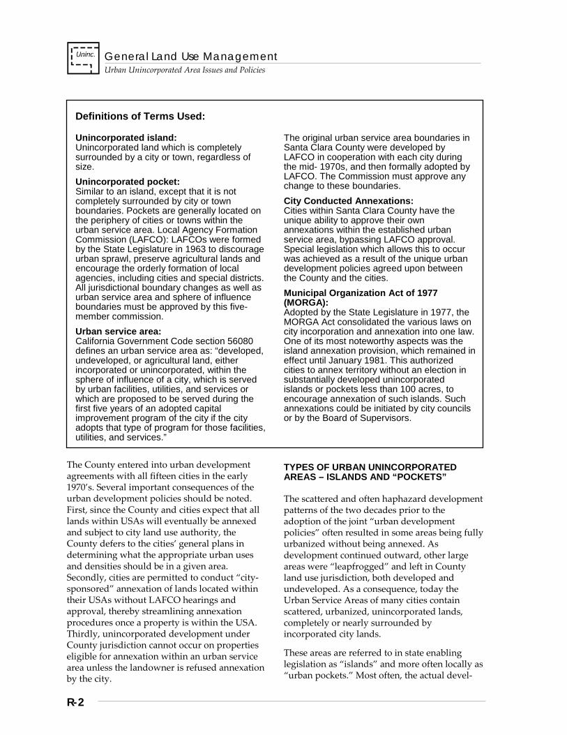
General Land Use Management
Urban Unincorporated Area Issues and Policies
R-2
Definitions of Terms Used:
Unincorporated island: Unincorporated land which is completely surrounded by a city or town, regardless of size. Unincorporated pocket: Similar to an island, except that it is not completely surrounded by city or town boundaries. Pockets are generally located on the periphery of cities or towns within the urban service area. Local Agency Formation Commission (LAFCO): LAFCOs were formed by the State Legislature in 1963 to discourage urban sprawl, preserve agricultural lands and encourage the orderly formation of local agencies, including cities and special districts. All jurisdictional boundary changes as well as urban service area and sphere of influence boundaries must be approved by this five-member commission. Urban service area: California Government Code section 56080 defines an urban service area as: “developed, undeveloped, or agricultural land, either incorporated or unincorporated, within the sphere of influence of a city, which is served by urban facilities, utilities, and services or which are proposed to be served during the first five years of an adopted capital improvement program of the city if the city adopts that type of program for those facilities, utilities, and services.”
The original urban service area boundaries in Santa Clara County were developed by LAFCO in cooperation with each city during the mid- 1970s, and then formally adopted by LAFCO. The Commission must approve any change to these boundaries. City Conducted Annexations: Cities within Santa Clara County have the unique ability to approve their own annexations within the established urban service area, bypassing LAFCO approval. Special legislation which allows this to occur was achieved as a result of the unique urban development policies agreed upon between the County and the cities. Municipal Organization Act of 1977 (MORGA): Adopted by the State Legislature in 1977, the MORGA Act consolidated the various laws on city incorporation and annexation into one law. One of its most noteworthy aspects was the island annexation provision, which remained in effect until January 1981. This authorized cities to annex territory without an election in substantially developed unincorporated islands or pockets less than 100 acres, to encourage annexation of such islands. Such annexations could be initiated by city councils or by the Board of Supervisors.
The County entered into urban development agreements with all fifteen cities in the early 1970’s. Several important consequences of the urban development policies should be noted. First, since the County and cities expect that all lands within USAs will eventually be annexed and subject to city land use authority, the County defers to the cities’ general plans in determining what the appropriate urban uses and densities should be in a given area. Secondly, cities are permitted to conduct “city-sponsored” annexation of lands located within their USAs without LAFCO hearings and approval, thereby streamlining annexation procedures once a property is within the USA. Thirdly, unincorporated development under County jurisdiction cannot occur on properties eligible for annexation within an urban service area unless the landowner is refused annexation by the city.
TYPES OF URBAN UNINCORPORATED AREAS – ISLANDS AND “POCKETS”
The scattered and often haphazard development patterns of the two decades prior to the adoption of the joint “urban development policies” often resulted in some areas being fully urbanized without being annexed. As development continued outward, other large areas were “leapfrogged” and left in County land use jurisdiction, both developed and undeveloped. As a consequence, today the Urban Service Areas of many cities contain scattered, urbanized, unincorporated lands, completely or nearly surrounded by incorporated city lands.
These areas are referred to in state enabling legislation as “islands” and more often locally as “urban pockets.” Most often, the actual devel-
General Land Use Management Urban Unincorporated Area Issues and Policies
R-3
opment of the “pockets” generally pre-dates the institution of the countywide urban development policies in the early 1970s.
The pockets range in size from several blocks to whole neighborhoods or communities. Some of the larger urban pockets, such as the Burbank or Cambrian areas within San Jose, have long maintained a distinct history and enduring sense of community identity. Other pockets, although smaller and primarily residential in nature, also share a strong sense of neighborhood identity. In other cases, residents of some of the smaller pocket areas identify more or less with the larger municipality in which they are located.
The County and the cities recognize the importance of maintaining the historical attributes and sense of community shared by many of the urban unincorporated pockets, and it is the intent of this General Plan that the physical and social environments of these areas be maintained and enhanced, where possible, in conjunction with the other major objectives outlined in the strategies of this chapter of the Plan.
ANNEXATION HISTORY OF POCKETS
The larger pockets have remained unincorporated over time despite past city annexation attempts, and even despite state laws which allowed forced annexations from 1977-1980 (see sidebar on the Municipal Organization Act, or MORGA). In some instances, past annexation attempts have been unsuccessful due to strong resistance from unincorporated residents and businesses. For example, before 1978, property taxes were generally lower in the unincorporated areas than in the incorporated areas.
Although implementation of Proposition 13 has virtually eliminated discrepancies between incorporated and unincorporated area property tax rates, it is still a common misconception that property taxes will rise upon annexation. In other more rare instances, residents supported annexation, but were faced with a city’s opposition due to the capital costs of required infrastructure improvements.
URBAN SERVICE PROVISION ISSUES
In general, it has been more difficult and expensive for the County to serve the urban unincorporated areas than it would have been for the surrounding cities, by virtue of the fact that the areas are dispersed through a metropolitan area of several hundred square miles and due to the variety of conditions encountered. For example, for some pocket or island areas, the County contracts with a city police department for such services, whereas in other cases the County Sheriff’s office provides basic security services.
Historically, it has not been the role of the County government to fully provide urban services and infrastructure, as evidenced by the absence of a County public works department. Furthermore, since the joint urban development policies were instituted, County, LAFCO, and city policies have emphasized that the only governmental entities that will be responsible for urban services are the cities and special districts, under the guidance of the Local Agency Formation Commission of the County.
As a result, the County has very few mechanisms or resources for providing and maintaining urban infrastructure and services. The picture is further complicated by the inefficiencies of having to ensure services are provided for the many small, widely scattered areas that are surrounded or substantially surrounded by cities. Consequently, it is common that the residents of such areas generally receive lower levels of urban services than the surrounding city residents. In other cases, residents of urban unincorporated areas may utilize certain types of city-provided services, such as parks and libraries, for which they pay no property taxes to support.
To minimize the complexities and inequities of urban service provision, the adopted policies of the County, the cities and LAFCO state that urban islands and pockets should be annexed, just as undeveloped lands intended for future urbanization within the USA should be when development occurs. However, without improved cooperation between the jurisdictions Rand the residents involved, and joint planning to help resolve or minimize issues that have
General Land Use Management
Urban Unincorporated Area Issues and Policies
R-4
delayed annexation in the past, some pockets may remain unincorporated for some time to come. Such long range planning efforts will be needed not only to bring some unincorporated areas into conformance with the policies, plans and development standards of the surrounding cities, but as a matter of simply trying to maintain the quality of life for residents until such time as annexation is possible.
Strategies, Policies and Implementation
The General Plan contains three basic strategies or overall policy directions for managing land use and development in the urban unincorporated areas. They consist of the following:
Strategy #1: Promote Eventual Annexation Strategy #2: Ensure Conformity of
Development with Cities’ General Plans.
Strategy #3: Provide Services as Efficiently and Equitably as Possible
Strategy #1: Promote Eventual Annexation
A basic premise of the countywide joint urban development land use policies is that urban development shall occur only in cities, which have the capability of providing urban services to their residents and businesses. Planning for and providing services to urban development is the responsibility of the cities in cooperation with the special districts involved, such as sanitation, waste collection and disposal, and school districts. As such, it is intended that any lands included within the Urban Service Area of a city eventually be annexed.
Annexation of existing urban unincorporated areas or “pockets” benefits both the County and cities, in that it simplifies and reduces the expense of providing urban services to the many scattered urban unincorporated areas, and because the cities then receive property taxes from those areas, which help pay for services heretofore used by the residents before
annexation, such as libraries and parks. Residents and businesses also gain a voice in city government issues, and communities gain representation on the City Council.
Finally, although some island residents may perceive that it is not presently in their interest to become integrated with the surrounding city, ultimately, the long term, comprehensive planning capabilities needed to maintain and enhance the built environment will only be available from the cities and special districts, in coordination with the County. Replacing and updating urban services and infrastructure, such as roads and sewers, rehabilitating and upgrading the aging housing stock, and maintaining other aspects of the built environment, not to mention social and community service needs, are formidable tasks, and not without financial costs.
These are tasks for which the County alone will not have the resources needed. Eventually, the County, the cities, special districts, and residents of the presently urban unincorporated islands will need to work together to a far greater extent than in the past to accomplish these necessary objectives, in order to maintain the livability of their communities and neighborhoods. Improving the physical and social environment through cooperative planning, even with the ultimate goal of facilitating eventual annexation, should not be considered in conflict with other valid objectives, such as retaining a strong sense of community or neighborhood identity.
Policies and Implementation
U-LM 1 Urban unincorporated areas within city Urban Service Areas should eventually be annexed into the city.
U-LM 2 The quality, integrity, and community identity of existing residential and commercial areas in urban unincorporated areas should be maintained and, where possible, enhanced.

General Land Use Management Urban Unincorporated Area Issues and Policies
R-5
U-LM 3 To facilitate eventual annexation and improve overall quality of life, various land use planning and other related studies should be conducted in cooperation with the applicable surrounding city for those large urban unincorporated areas that are unlikely to be annexed in the short term future.
U-LM 4 Cities should have the opportunity to annex individual parcels eligible for “city-conducted” annexation prior to the submittal of significant land development applications for those parcels.
U-LM 5 If a parcel is eligible for annexation, certain applications may not be accepted by the County for processing unless accompanied by a statement from the applicable city indicating annexation was considered and denied. Such applications include: a. development applications for new
residences or other new development (architectural and site approval, building permit, or building site approval); and
b. subdivisions, use permits or zoning district changes.
Implementation Recommendations
U-LM(i) 1 Develop special area plans to bring urban pockets into general compliance with city plans, policies and development standards over time. (Implementors: Cities, County, LAFCO, local residents and property owners)
U-LM(i) 2 Elicit the cooperation and support of cities, community leaders and special district representatives in developing and implementing long range plans intended to facilitate annexation. (Implementor: County, Cities)
U-LM(i) 3 Develop and distribute information on the implications and consequences of annexation, in order to dispel misconceptions that annexation will cause higher property taxes. (Implementor: Cities and LAFCO, with County participation, as appropriate)
U-LM(i) 4 Prepare informational brochures and community newsletters regarding annexation and related issues for distribution to residents and property owners , and make public presentations available to community council other neighborhood meetings in the unincorporated island areas. (Implementor: Cities and LAFCO, with County participation, as appropriate)
U-LM(i) 5 Evaluate and simplify the annexation process where possible, and develop a streamlined application for annexing developed urban islands and pockets. (Implementor: Cities and LAFCO, with County participation, as appropriate).
U-LM(i) 6 Work toward making the annexation process affordable to residents and inform them how they can lower their annexation fees by bringing together more neighbors to share fees. (Implementor: Cities, with County participation, as appropriate)
U-LM(i) 7 Develop incentives for applicants to include neighboring parcels in their proposals, such as a “finder’s fee reduction” for successfully including more neighbors in an annexation action. (Implementor: Cities, with County participation, as appropriate)
U-LM(i) 8 Provide necessary technical support and expertise to residents of islands and pockets during the preparation of annexation applications, including environmental work and mapping. (Implementor: Cities, LAFCO)

General Land Use Management
Urban Unincorporated Area Issues and Policies
R-6
Strategy #2: Ensure Conformity of Development With Cities’ General Plans
Within cities’ Urban Service Areas, the County does not apply any General Plan designation or classification of prescriptive land uses or densities to unincorporated parcels. Instead, allowable land uses and densities are determined by the applicable city’s general plan. This arrangement reflects one aspect of the division of authority between the cities and the County under the jointly-adopted countywide “urban development policies.” Assuming that all urban unincorporated areas will eventually be annexed by the cities, it is appropriate that the city which will have ultimate jurisdiction over an area have the ongoing authority to plan for what are presently unincorporated areas.
The responsibilities of the jurisdictions (County and city) are fairly straightforward. For urban unincorporated lands ineligible for annexation or for which annexation has been refused or deferred, the County is obligated to administer current planning functions, such as permit processing, zoning administration, and code enforcement; whereas, each city addresses through its general plan the long range planning issues of land use, density and other issues.
In order to ensure that development permitted under County jurisdiction is generally in conformance with what would be permitted according to each city’s general plan, the County applies zoning districts and development regulations compatible with the applicable city’s general plan designation. Given the variety and complexity of some cities’ development regulations, it is infeasible for the County to attempt to administer the actual regulations of the cities.
When there are differences between County and city development regulations of some consequence, such as for setbacks, building height and bulk restrictions, or other standards, the County may be able to adjust its standards to minimize those inconsistencies. In any case, the County strives to work cooperatively with the applicant, the city and other interested parties to ensure that the resulting development
is as consistent as possible with the policies and regulations of the city involved and will not present future problems for either the property owner, the city, or adjacent residents.
Policies and Implementation
U-LM 6 County land use and development regulations within a city Urban Service Area shall be generally compatible with the applicable city’s general plan designations and accompanying policies.
U-LM 7 Subdivisions, use permits and zone changes for unincorporated property within a city Urban Service Area shall conform with the applicable land use and density criteria of the city’s general plan.
U-LM 8 County zoning, land development, and building regulations should be designed and administered to: a. preserve and enhance the quality of existing
urban unincorporated areas; and b. maintain community identity, through
heritage resource preservation, conservation of historic structures and places, and other similar measures.
General Land Use Management Urban Unincorporated Area Issues and Policies
R-7
U-LM 9 In cases where significant differences exist between County and city development standards (i.e. setbacks, height, bulk regulations), resulting in potentially inappropriate development or conflicts, the County should consider adjusting or modifying its ordinances and standards to minimize problems and achieve greater conformance with city standards.
U-LM 10 No applications for subdivisions, use permits or zone changes for property within any city’s Urban Service Area may be accepted by the County for processing unless it is accompanied by a statement from the applicable city affirming city general plan conformance.
Implementation Recommendation
U-LM(i) 9 Review all present County zoning districts applied within Urban Service Areas and compare with applicable city general plan designations. Identify significant inconsistencies and if needed, rezone inappropriately zoned areas to zoning districts that conform with city general plans.
U-LM(i) 10 Inform cities of County general plan conformance policies so that policies and authority are fully understood by city staff and officials.
U-LM(i) 11 Evaluate County and city development standards and regulations for possible inconsistencies of significance and modify County regulations where necessary to rectify or minimize the impacts of inconsistencies. {relates to policy 6}
Strategy #3: Provide Services as Efficiently and Equitably as Possible
Although joint County, city, and LAFCO policies promote the annexation of urban “pockets,” partly on the basis that urban services are most efficiently provided by cities, in reality many developed urban unincorporated areas may not be annexed in the immediately foreseeable future. In the interim, the County should ensure that necessary urban services and facilities are provided as efficiently and cost-effectively as possible to these areas. Not only does the County have a responsibility to provide basic levels of urban services to urban unincorporated area residents, but by maintaining and upgrading existing services and facilities, the County and the cities facilitate the ultimate annexation of these areas.
Nevertheless, it remains difficult for local governments to pay for basic urban services, much less improve upon them, in light of outcomes of Prop 13. Since the passage of Proposition 13 in 1978, new funding sources have become virtually non-existent, due to the 2/3 voter approval requirement for new taxes and reduced growth in property tax revenues overall. Because it is recognized that cities should not be expected to provide services without compensation, the financial burden falls to the County. Therefore, cooperation among jurisdictions to explore creative, cost effective measures becomes the only option to costly provision of services in the unincorporated urban areas.
General Land Use Management
Urban Unincorporated Area Issues and Policies
R-8
Policies and Implementation
U-LM 11 Urban services shall be provided to residents and businesses of unincorporated urban areas in the most efficient, cost effective and equitable manner possible, using cooperative efforts by all jurisdictions involved.
U-LM 12 Increased levels of service within the urban unincorporated areas should be provided on a cost recovery basis whenever possible.
U-LM 13 Cities should not be expected to provide urban services, either directly or indirectly, to urban unincorporated areas unless through contractual arrangements or as part of improvements to area services or infrastructure that are of recognized benefit to both unincorporated and incorporated areas.
U-LM 14 In order to anticipate long term service and infrastructure needs and to facilitate the eventual annexation of urban unincorporated areas, the County, LAFCO, cities, and urban unincorporated area residents should cooperatively explore and develop long term plans for urban service provision, integration of services, and infrastructure maintenance and replacement, where appropriate.
Implementation Recommendation
U-LM(i) 12 Contracts with the cities should be arranged whenever practical, to provide service to islands or pockets which are inefficient for the sheriff or fire protection districts to serve. (Implementor: County, Cities)
U-LM(i) 13 Consult with individual cities and sanitation/ sanitary districts towards the long term integration of small-scale sewer systems into larger systems, where appropriate, to improve delivery of sewer services.
U-LM(i) 14 Develop street master plans and development standards and policies that are compatible with those of the surrounding cities in the unincorporated islands and pockets. (Implementor: County)
U-LM(i) 15 Develop storm drain master plans and standards that are compatible with those of the cities for any storm drainage system which must connect to a city system. (Implementor: County)
U-LM(i) 16 The County should require dedicated easements for roads, sewers and utilities that are compatible with city pre-zoning and master plans.
U-LM(i) 17 Explore the use of Community Development Block Grant funds (CDBG) and other Federal or State funds to finance needed improvements in major unincorporated islands and pockets.
S-1
Stanford University Urban Unincorporated Area Issues and Policies
NOTE: The Stanford University Chapter of the 1995-2010 Santa Clara County General Plan has been superseded in its entirety by the adoption of the 2000 Stanford Community Plan. The Stanford Community Plan, adopted December 12, 2000, is published and made available as a separate document. [Amended Dec. 12, 2000; File#: 7165-99GP]

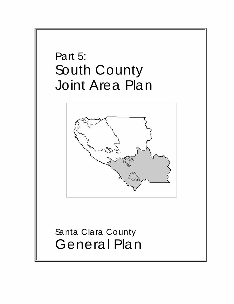
Part 5: South County Joint Area Plan
Santa Clara County General Plan

South County Joint Area Plan
Overview ................................................................................................................. T-1
Urban Growth and Devlopment .............................................................................. T-1 Economic Development .......................................................................................... T-2 Job/Housing Balance .............................................................................................. T-3 Education ................................................................................................................ T-4 Infrastructure ........................................................................................................... T-5 Infrastructure: Sewers/Sanitation ............................................................................ T-6 Water Supply .......................................................................................................... T-6 Water Quality .......................................................................................................... T-7 Hazardous Materials and Waste Management ...................................................... T-9 Intergovernmental Coordination ............................................................................ T-10 Infrastructure: Transportation ................................................................................ T-11 Flood Control ........................................................................................................ T-11 Local Drainage ...................................................................................................... T-12 Agriculture ............................................................................................................. T-13 Development Hazards/ Environmental Safety ..................................................... T-14 Open Space and Recreation ................................................................................. T-16 Rural/Urban Land Use .......................................................................................... T-19 San Martin ............................................................................................................ T-21 Coyote Valley ........................................................................................................ T-22 Truck Stops ........................................................................................................... T-23 Potential Intergovernmental Agreements .............................................................. T-23 Future Joint Planning ............................................................................................ T-24

South County Joint Area Plan Policies
T-1
Overview
Policies
SC 0.1 The South County Policies are adopted by this (County or City), jointly with (the other two jurisdictions), as the South County Joint Area Plan. The South County Joint Area Plan is a mutual statement of policies for community development and environmental management. It is intended to achieve harmony and cooperation among the South County three jurisdictions, and consistency between their adopted policies.
SC 0.2 The South County Joint Area Plan is the integrated policy framework within which the three jurisdictions shall undertake compatible implementing actions, such as more specific General Plan amendments, ordinance revisions, administrative procedures, project review, and contractual agreements between the jurisdictions.
SC 0.3 The South County Joint Area Plan shall apply to the incorporated and unincorporated areas south of the Morgan Hill - San Jose boundary agreement line approved by LAFCO, as indicated in the accompanying map. The Joint Area Plan also includes policies relating to the Coyote Valley, since it is within the Morgan Hill Unified School District and has an impact upon the South County due to its strategic location.
SC 0.4 While some of the policies in the Joint Area Plan are worded more generally than in the General Plan, since they are composites of policies in the three jurisdictions’ General Plans, other policies are more specific or address issues not previously addressed. All of the policies are intended to express a common approach by the three jurisdictions to the South County area. The policies in the Joint Area Plan are not intended to weaken any policy in the General Plans of any of the jurisdictions; therefore, if the wording of a policy in the Area Plan varies from that of a policy in this General Plan, the more restrictive wording shall apply.
Urban Growth and Development
Policies
SC 1.0 The three jurisdictions’ existing general plans should be continued as the basis for joint policy in the South County, since County, since they are in general agreement on most topics and will accommodate the projected growth to 2005. By that time, the number of South County residents is expected to increase more than two-fold and employment more than four-fold. Effective joint planning should be continued, since Santa Clara County is a fast-growing region, drawing large amounts of industry and people, and the pressures for growth are likely to continue beyond that date.
SC 1.1 The general plans of the two Cities and the County do not need to be revised at this time to accommodate projected growth to 2005. Revisions may be necessary, however, to properly respond to changing community goals and needs.
SC 1.2 Since urban development will continue beyond 2005, it is important to consider the potential general patterns of future growth now, before the pressures for urbanization are unmanageable. Both the areas needed for future urban development and the areas to be kept in long-term rural land uses or open space should be identified.
SC 1.3 Conditions of population/employment growth and land development in the South County and surrounding regions should be regularly monitored: a. to assess the effect of the jobs/housing
balance in North County and in adjacent Counties on the South County community,
b. to assess the demand for additional urban development in South County, and
c. to determine when it would be appropriate to plan for more extensive urban development in the South County.
South County Joint Area Plan Policies
T-2
SC 1.4 Development of the urban growth monitoring program should be undertaken immediately. The role of each jurisdiction in implementing the program should be specified, and responsibility for overall coordination should be assigned. The program should consider the conditions that would make new urban growth desirable as well as the conditions that would call for limitations on urban growth. On the basis of these conditions, the program should establish criteria which would trigger planning for new urban growth. It should also provide for maximum feasible integration with other monitoring programs.
SC 1.5 In using information developed through the urban growth monitoring program, consideration should be given to potential long-term development patterns and to areas which are to be kept in long-term rural use or open space. Where appropriate, specific plans should be prepared jointly between the South County jurisdictions.
SC 1.6 The South County jurisdictions should use information generated from urban growth and jobs/housing monitoring programs to develop a strategic planning process to maintain a balanced South County community. It would be a basis for facilitating long-range infra-structure and urban service planning and minimizing urban development pressure on land which is expected to remain in agricultural, open space or other low-intensity use.
SC 1.7 Urban development should occur in the cities in an orderly and contiguous pattern, managed and scheduled consistent with the ability to provide public facilities and services. Land uses in rural areas should be low-intensity and limited in number. Public services to rural areas should be appropriately limited.
SC 1.8 Urban growth should be managed and scheduled consistent with the ability to provide public facilities and services, such as sewer capacity, water, transportation, schools, public safety and other urban services.
SC 1.9 Urban growth should occur in an orderly and contiguous pattern, within designated urban service areas and encouraging infill of vacant urban land.
SC 1.10 Urban development should occur only in the cities and where the full array of urban services can be provided.
SC 1.11 Those public services which are provided to rural areas by the County or special districts should be provided at a minimum level.
SC 1.12 Expansion of urban service areas and annexations should be based on general plans and be consistent with the Cities’ schedules for development and extension of services.
Economic Development
Policies
SC 2.0 Economic development should be diversified. Cities should encourage types of economic development which address identified community needs (City and County areas) and which are planned so as to minimize negative impacts.
SC 2.1 Economic development should promote community self-sufficiency in jobs, housing and services, and should address the needs of all socio-economic segments of the community, creating employment to support the needs of South County residents.
South County Joint Area Plan Policies
T-3
SC 2.2 A diversified economic base should be promoted in order to provide a variety of job types and skills and to insulate the local economy from possible economic downturns. Agriculture should be encouraged as an appropriate part of the economic mix.
SC 2.3 In considering which industries to promote, attention should be given to their impacts on economic development, jobs/housing balance, transportation, energy, public services, water and air quality, and natural and heritage resources. Recognizing the strong interrelationship between industrial growth, jobs/housing balance and transportation system capacity, information generated from monitoring programs should be used to assess the demand created by industrial development for additional housing and transportation improvements, as well as the impacts on water and air quality and on natural and heritage resources.
Job/Housing Balance
Policies
SC 3.0 In the South County communities, jobs and housing should be balanced to minimize increases in housing costs, traffic congestion and commute time and to optimize economic balance and capacity to provide services.
SC 3.1 The South County Cities and the County should seek to attain and maintain a reasonable balance between jobs within each City’s incorporated area and housing within each City’s Boundary Agreement Area through the use of: a. general plan land use designations, b. zoning and other land use controls, c. growth rate controls on housing and job
growth, d. sewer capacity allocations, and e. policies to attract industry that will hire
local residents.
SC 3.2 The South County communities should provide housing at a range of costs that meet the needs of all sectors of the workforce. Housing should be distributed among the communities so as to achieve an appropriate population balance and equitable distribution of public services.
SC 3.3 The ratio of jobs to housing should be monitored as development proceeds so that appropriate policies to maintain balance can be implemented, since the three jurisdictions’ existing plans, while generally adequate to accommodate the forecast urban growth to 2005, will result in a surplus of jobs relative to housing units.
SC 3.4 The Cities of Morgan Hill, Gilroy and San Jose, and the County should monitor the jobs/housing balance in South County and the Coyote Valley.
SC 3.5 Each city should adjust its respective jobs/ housing balance as its City Council directs, while continuing to monitor the cumulative impacts of individual communities’ development decisions.
SC 3.6 The jobs/housing monitoring program should develop a workable definition of jobs/housing balance, criteria for assessing the effectiveness of remedial actions, and a process for investigating areawide transportation improvements or traffic management programs which will address the effects of jobs/housing imbalance. The role of each jurisdiction in implementing the program should be specified and responsibility for overall coordination should be assigned. Jobs/housing monitoring should be integrated with other monitoring programs to the maximum extent feasible.
South County Joint Area Plan Policies
T-4
SC 3.7 If actions to correct imbalances are not undertaken or if the jobs/housing monitoring program determines that they are ineffective, the Cities should undertake additional transportation improvements, traffic management programs, and housing programs to offset impacts of higher housing costs on persons with lower incomes.
SC 3.8 The County should retain its policy that urban development and jobs should be provided within cities; the County should not seek to balance jobs and housing within the unincorporated area.
SC 3.9 The South County community should work with the City of San Jose to minimize impacts of San Jose’s Coyote Valley development on the jobs/housing balance of South County.
SC 3.10 If the jobs/housing imbalance in rural areas of South County results in increasing costs for service provision and declining revenues available to cover these costs, the Cities and the County should discuss ways to mitigate the impacts.
Education
Policies
SC 4.0 Community development and school development should be coordinated to optimize educational goals and enhance the school’s role as a community resource.
SC 4.1 The school districts, the County, and the Cities of San Jose, Morgan Hill and Gilroy should keep each other informed of growth - and development- related school issues. Joint meetings should be held as needed to plan for needed school expansions resulting from new development.
SC 4.2 The pattern and timing of growth should be controlled in a way that allows the school districts to plan and finance facilities in an orderly fashion.
SC 4.3 Development should be coordinated with the scheduling of capital funds for schools.
SC 4.4 Development approvals should be conditioned on the availability of schools.
SC 4.5 To allow school facilities to be used most efficiently and to minimize busing needs, residential development should occur in areas which are served by existing schools. To accomplish this, contiguous residential development and infill development within built-up areas should be encouraged.
SC 4.6 Where appropriate, planning should promote the concept of the neighborhood school, which provides education to the children in the neighborhood and serves as a resource facility to the residents.
SC 4.7 The Cities, school districts and other community and social agencies should coordinate to mobilize additional resources to deal with issues which impact the role of schools, such as drugs, job training and teenage pregnancy, so that these are adequately dealt with during periods of rapid growth or change.
SC 4.8 Sites for new schools should be carefully selected to optimize educational goals.
SC 4.9 In order to avoid de facto segregation in schools, housing for low and moderate income families should be planned throughout the South County where urban services are available. Concentration of such housing in any one area shall be avoided.
South County Joint Area Plan Policies
T-5
SC 4.10 Where appropriate, parks and schools should be located together to optimize their multiple use as community facilities.
SC 4.11 Additional funding methods should be developed for needed school facilities, since present school financing methods are inadequate and projected growth could more than double school enrollment by 2005.
SC 4.12 The jurisdictions should continue active lobbying for state legislation to continue to allow collection of impact fees from industrial and commercial projects.
SC 4.13 The jurisdictions should work with other local governments and the private sector to evaluate the adequacy of available funding and to develop innovative financing techniques.
SC 4.14 Development impact fees should continue to be collected on new construction to the extent allowed by law.
SC 4.15 Development impact fees should be commensurate with the cost of the public improvements generated by new development, in accordance with state law.
SC 4.16 The use of Mello/Roos funds to provide schools for the expansion planned by San Jose in the Coyote Valley should be investigated.
SC 4.17 The Redevelopment agencies and appropriate Board of Education should negotiate to determine if it is appropriate to use Redevelopment Act contributions to assist schools.
SC 4.18 When appropriate, industrial and commercial development should be required to provide mitigations for school impacts in accordance with state law.
Infrastructure
Policies
SC 5.0 Infrastructure needs should be identified and their development coordinated to minimize costs and to support achievement of community goals.
SC 5.1 Cities should provide an urban level of services and facilities to urban areas. Strategies that help achieve this objective and are already partially or fully in use include: a. requiring that the timing and location of
future urban development be based upon the availability of public services and facilities,
b. requiring new development to pay all of the incremental public service costs which it generates, and,
c. requiring developers to dedicate land and/ or pay to offset the costs relating to the provision and expansion of public services and facilities.
South County Joint Area Plan Policies
T-6
Infrastructure: Sewers/Sanitation
Policies
SC 6.0 Expansion of the joint Gilroy/Morgan Hill sewage treatment plant should proceed, since additional sewer capacity is a prerequisite for further urban development and urban development is most appropriately served by sanitary sewer systems. Septic systems should be used only for low-intensity uses where they will not have a negative impact on the environment.
SC 6.1 The total capacity for the Gilroy/Morgan Hill Wastewater Treatment Facility, its timing for completion, and configuration should be consistent with these South County policies for the overall growth of the South County. a. The Cities of Gilroy and Morgan Hill should
determine the best method to increase and fund their sewer treatment capacity in order to facilitate development that is consistent with their general plans.
b. The facility should be funded in a manner which considers the financing needs of other infrastructure in the South County.
SC 6.2 The County and the two Water Districts should assist in the Cities’ wastewater treatment program if feasible and agreed to by the participants.
SC 6.3 San Martin’s sewage treatment needs should be determined with consideration given to the implications of: economics, population, land use, environmental concerns and the governmental status of San Martin. TSC
SC 6.4 Beyond the proposals for which land use designations have been approved and for which alternative sewage treatment and disposal systems (other than septic tanks) have been approved in concept (Casa de Fruta, Nob Hill Family Park and the Kalend Truck stop), no new land uses requiring the use of alternative sewage treatment and disposal systems should be permitted until a reliable track record for the type of system has been documented and conditions for ongoing safe and effective operation have been established.
Water Supply
Policies
SC 7.0 New development should not exceed the water supply, and management of water should be made more efficient through appropriate means, such as watershed protection, percolation, reclamation, and conservation.
SC 7.1 Programs to identify and seal abandoned and unused wells should be continued, as such wells may be prime sources for transferring contaminants from the upper to lower aquifer.
SC 7.2 The South County jurisdictions should develop a program to track existing water quality, water supply and water flow monitoring programs. This information should be used to evaluate current regulations and procedures, and to assess the need for new monitoring programs or for revisions or consolidation of existing programs. SC
South County Joint Area Plan Policies
T-7
SC 7.3 Each jurisdiction and agency pumping water from wells should be responsible for knowing the demand that its well pumping imposes on the direction of flow of water and how it affects others that are pumping from the same aquifer, and to prevent any adverse impacts on existing groundwater contamination problems.
SC 7.4 All jurisdictions and agencies pumping water from wells should cooperate in managing the aquifer so as to preserve the natural ecology of the region, securing the aquifer’s utility as a water resource and ensuring the water’s quality.
SC 7.5 Streambeds and other appropriate percolation areas should be protected.
SC 7.6 There should be continuing coordination among the South County jurisdictions and the Santa Clara Valley Water District to assure that the South County will get sufficient deliveries of San Felipe water as needs require.
SC 7.7 The water district should continue developing programs to assure effective management of the water resources, such as well monitoring, percolation of imported water, reclamation and conservation.
SC 7.8 New development should not exceed the water supply, and use of water should be made more efficient through appropriate means, such as conservation and reclamation.
SC 7.9 The development of water reclamation facilities should be encouraged, where feasible, in order to make reclaimed water available to help meet the growing needs of the South County region.
Water Quality
Policies
SC 8.0 Water quality should be protected from contamination, and should be monitored to assure that present policies and regulations are adequate. Such uses as waste facilities, septic systems and industries using toxic chemicals should be prohibited where polluting substances may come in contact with groundwater, floodwaters, and creeks or reservoir waters.
SC 8.1 Land use policies should be continued that limit the number of individual septic systems in areas vulnerable to groundwater contamination, because of the potential for cumulative degradation of water quality.
SC 8.2 In areas where future development is expected to be served by sewers, large lot policies (which allow minimal development and limited numbers of septic systems) should be continued. This approach increases the feasibility of designing future urban density subdivisions with smaller lots, which are more efficient for sewers in terms of service and cost.
SC 8.3 In the unincorporated area current County policies regarding septic systems and land use should be continued with no lessening of standards.
SC 8.4 Groundwater and surface water quality conditions throughout the South County should be monitored to determine if changes in regulations regarding septic systems and land use are needed.
South County Joint Area Plan Policies
T-8
SC 8.5 Protection of groundwater quality requires continued caution in the siting of landfills and transfer stations and rigorous enforcement of local and regional regulations.
SC 8.6 Continued caution should be taken as to the siting of landfills, the construction of landfills (i.e., they should have clay liners, etc.), and the waste allowed in a sanitary landfill in South County so as not to create hazards to groundwater quality.
SC 8.7 Solid waste and hazardous waste transfer stations should be sited and operated so as to minimize hazards to ground and surface water quality.
SC 8.8 Regulations relating to solid waste disposal should continue to be rigorously enforced by the local jurisdictions and by the Regional Water Quality Control Boards.
SC 8.9 Periodic household hazardous waste collection programs and other related activities should occur on a regular basis in order to limit the types and amounts of hazardous waste entering the ordinary waste stream.
SC 8.10 The jurisdictions in South County should work jointly and with other jurisdictions to achieve a balance between potential negative impacts and the benefits associated with the location of solid waste disposal sites and transfer stations.
SC 8.11 Properties located in areas that have soils with rapid water percolation shall be protected from future development in order to ensure existing water quality. Such development should not begin until preceded by the inclusion within the Cities’ and County’s Hazardous Materials Storage Ordinance a section specifically related to high percolation rates. TSC
8.12 Commercial and industrial developments proposed to be located in areas that have soils with rapid water percolation should be permitted only under the strict safety limitations as may be required by the Cities’ and/or County’s Hazardous Materials Specialists.
SC 8.13 In order to provide greater protection of the aquifers which supply drinking water to the South County, special consideration should be given to the management of contaminants (e.g., hazardous materials, sanitary effluents) in groundwater recharge areas where no protective aquitard layer exists.
SC 8.14 Each agency and jurisdiction responsible for well monitoring should continue to monitor wells and provide results to a central agency (yet known) which would coordinate the data and make it available to all jurisdictions and agencies.
SC 8.15 Programs for monitoring private wells should continue to expand the scope of testing by including tests of more wells and including tests on constituents not yet tested in private wells (i.e., volatile organics, bacteriological, radiological, etc.), and periodic retesting of selected private wells.
South County Joint Area Plan Policies
T-9
Hazardous Materials and Waste Management
Policies
SC 9.0 A program of regular inspections and monitoring to ensure compliance with local, state and federal regulations should be continued in order to reduce the risks associated with the use and handling of hazardous materials and wastes.
SC 9.1 The Joint Powers Pretreatment Program for industrial and commercial hazardous material users and/or hazardous waste generators should continue to be implemented in the two cities and coordinated as appropriate with MOU inspections, HMSO regulations, and implementation of applicable state laws.
SC 9.2 The Cities’ Hazardous Materials Specialists and Pretreatment Inspectors, and the County Health Department should continue to inspect regularly activities that store and/or use hazardous materials, including above-ground and underground storage tanks and related equipment, to ensure compliance with each City’s and the County’s Hazardous Materials Storage Ordinance (HMSO).
SC 9.3 There should be regular inspections of those facilities which store hazardous waste on site for less than 90 days, a time period for which a hazardous materials storage permit is not required. This inspection could be enforceable via the Memorandum of Understanding between State Department of Health Services (DOHS) and County Health Department whereby the County Health Department would act as an agent of DOHS in enforcing this provision. In order to develop maximum efficiency in overall inspection programs, the Cities’ Hazardous Materials Specialists and Pretreatment Inspectors may conduct inspections on behalf of the County Health Department.
SC 9.4 Submittal of a hazardous materials handling plan should be a prerequisite for developments requiring zone changes, use permits, etc.
SC 9.5 In order to minimize potential hazards, generators of hazardous waste should be required to use on-site pretreatment prior to discharging treated waste effluent into the sewer system. The methods may include neutralization, precipitation and oxidation.
SC 9.6 Programs to encourage source reduction and waste minimization by smaller firms which generate hazardous wastes in South County should be initiated by the County and Water District.
SC 9.7 Vehicles and other equipment that may threaten the quality of water from leaking fuel tanks or oil spills should be removed from the site and/ or repaired.
SC 9.8 Public education regarding hazardous materials and waste management should be coordinated and implemented among the local jurisdictions (Morgan Hill, Gilroy, the County), local agencies (SCVWD, GWCD, RWQCBs, etc.) and local groups (League of Women Voters, Lions Club, etc.).
SC 9.9 During the implementation of “AB 2185” (Calif. Health and Safety Code Chap. 6.95 Division 20 Section 25500 et seq) and successor legislation in South County, every effort should be made to achieve maximum integration between newly mandated actions and elements and ongoing programs (e.g., Hazardous Waste Generator inspections, Hazardous Materials Storage Ordinances and controls and pretreatment), particularly as they apply to: a. coordinated permit and fee structure, b. coordinated inspections, c. emergency response (“business”) plans, d. training programs, e. evacuation requirements, and f. information requirements.
South County Joint Area Plan Policies
T-10
SC 9.10 The transportation of hazardous materials and wastes should be monitored to reduce risks and ensure notification of South County Cities in the event of a leak or spill.
SC 9.11 The South County jurisdictions should require that they receive reports from the Department of Transportation and the California Highway Patrol regarding spills or leaks on the highway.
SC 9.12 If a spill occurs while transporting hazardous materials or waste in one of the Cities or the County, the other jurisdictions should be notified by that jurisdiction immediately.
SC 9.13 The Cities and County should consider designating specific transportation routes for the conveyance of hazardous materials and waste, if the jurisdiction desires hazardous materials and waste to be transported on routes other than designated truck routes. Such controls should be consistent with the areawide emergency response plan prepared under AB 2185/2187.
SC 9.14 The County should implement a Memorandum of Understanding (MOU) between the Department of Health Services (DOHS) and the County Health Department, whereby the County would act as an agent in requiring hazardous material users and waste generators to provide annual records and in monitoring the haulers of hazardous materials and waste.
SC 9.15 To reduce the risk involved in transporting hazardous waste and to decrease the volume of waste that must be disposed of, generators of hazardous waste should be encouraged to use on-site pretreatment, such as: neutralization, precipitation and oxidation.
SC 9.16 A program to identify and abandon dry wells which have been used to dispose of contaminants should be initiated.
Intergovernmental Coordination
Policies
SC 10.0 Intergovernmental coordination between the Cities, the County and local agencies should be considered as an effective means of resolving issues of concern and investigating the feasibility of compatible standards, ordinances and enforcement procedures.
SC 10.1 The two Regional Water Quality Control Boards that have jurisdiction in South County should reach agreement upon compatible water quality standards for South County and consistent approaches to implementing the State Board’s nondegradation policy, as compatible standards and consistent approaches would be less confusing to developers and owners of land and to jurisdictions which must carry out the Regional Boards’ regulations.
SC 10.2 Close coordination should be maintained between the following agencies and organizations which share jurisdiction and interest relative to South County’s water supply and water quality: the two Regional Water Quality Control Boards, the Water District, County Health Department, County Executive’s Office, County Planning Office, Gilroy Planning Department, Morgan Hill Planning Department, and the San Martin Planning Committee.
SC 10.3 Where appropriate, the Regional Water Quality Boards, the Cities, County and other local agencies should have compatible ordinances (i.e., HMSOs), standards (i.e., septic tank and alternative treatment and disposal methods), and enforcement procedures (i.e., implementing “AB 2185” [Calif. Health and Safety Code Chap. 6.95 Division 20 Section 25500 et seq], etc.) regarding water quality so that there is no advantage for a company to locate in an area with lower standards.

South County Joint Area Plan Policies
T-11
Infrastructure: Transportation
Policies
SC 11.0 A balanced transportation system should be developed which integrates various transportation modes with existing and proposed land uses and assures access to all.
SC 11.1 A balanced transportation system should be provided which assures access to all, and which integrates all appropriate modes of transportation into an effectively functioning system, including such modes as auto, ridesharing, public transit, bicycling and walking.
SC 11.2 The transportation system should be compatible with existing and proposed land uses and should promote environmental objectives, such as safe and uncongested neighborhoods, energy conservation, reduction of air and noise pollution, and the integrity of scenic and/or hillside areas.
SC 11.3 Bicycling and walking should be promoted as alternate transportation modes for their contribution to health and the reduction of energy consumption and pollution.
SC 11.4 Public transit should be expanded as needed to meet the changing needs of the area for local and regional access, including such methods as bus, dial-a-ride, paratransit and rail, where appropriate.
SC 11.5 Planning for land use and transportation development should be integrated. The timing, amount, and location of urban development should be consistent with the development of the transportation system capacity, and land uses should be designed to promote use of appropriate transportation modes.
SC 11.6 Options for future transportation facilities should be preserved in advance of development by such means as identification of routes, reservation of rights-of-way, setback of development to accommodate future width lines, and limiting of access along future major arterials.
SC 11.7 The Cities and the County should improve coordination and cooperation on all South County transportation planning.
SC 11.8 The recommendations of the Transportation- 2000 Program, particularly as they relate: to rail connections between South County and North County and to right-of-way-reservation along major north-south corridors in South County, should be carefully reviewed by South County jurisdictions.
Flood Control
Policies
SC 12.0 Since flooding affects substantial areas of South County, and the flood control projects now being constructed are designed to protect only existing developed and planned urban areas, land development should be managed by the three jurisdictions to mitigate flooding problems and minimize the need for local public funding for additional flood control and local drainage facilities. Flood damage in South County should be minimized through a combination of actions. In flood-prone areas, inappropriate development should be prevented through land use planning, urban development policies and land use regulations. Areas which are developed or planned for development should be protected by the construction of flood control facilities. Development should be managed through advanced planning and design standards to minimize off-site flooding and drainage problems.
South County Joint Area Plan Policies
T-12
SC 12.1 Highest priority for construction of flood protection facilities should be given: a. first, to areas of existing development
subject to the highest potential flood damage;
b. then, to undeveloped areas planned for urban development which would be subject to the highest potential of flood damage;
c. then, to agricultural lands; and d. finally, to other undeveloped areas.
SC 12.2 If federal and state funds are not available for future flood control facilities and such facilities must be funded locally, those property owners who would benefit from and those who contribute to the need for such facilities should pay the cost.
SC 12.3 Developers whose proposed projects would induce downstream flooding should be required to provide mitigation to eliminate the flood- inducing impacts of their projects.
SC 12.4 Streamside development should be designed in such a way as to facilitate maintenance of the waterway and protection of the environment and riparian areas. Careful consideration should be given to the use of streets to separate urban streamside development from the waterway consistent with Santa Clara Valley Water District recommended streamside street designs.
SC 12.5 If development is to be allowed in flood-prone areas, flood control facilities or appropriate flood-proofing should be provided prior to or in conjunction with development at developers’ expense.
SC 12.6 Where other mitigations do not solve the flooding problem, raising individual foundations (padding up structures) may be a solution; however, its use must be restricted in order to minimize the cumulative effects on adjacent areas.
SC 12.7 The Cities and the County should require mitigation of any stormwater runoff produced by development that occurs beyond that described in the l98l General Plans of the County and the Cities as of 1982.
SC 12.8 All local development should provide appropriate mitigations of off-site impacts. These may include: limiting runoff to pre-development levels and/or complete solutions to flooding and local drainage problems in the vicinity of the development. Methods may include: detention (storing runoff temporarily and then releasing it) or retention (storing runoff on-site for percolation).
SC 12.9 Careful consideration should be given to the cumulative effects of development which would drain into the upper reaches of Llagas Creek and other creeks in order to avoid the need for channelization and consequent destruction of its riparian vegetation and natural habitat.
Local Drainage
Policies
SC 13.0 Local drainage problems in South County should be minimized by preventing inappropriate development in areas which are prone to drainage problems and by using design standards and advanced planning to manage development. Developers of individual projects should be required to mitigate off-site on-site impacts and, where appropriate, to install local drainage facilities which would contribute to an eventual areawide solution to the local drainage problems, preferably in the context of a master plan for local drainage which should be developed jointly by the Cities and the County.
South County Joint Area Plan Policies
T-13
SC 13.1 Since County maintenance is limited to maintaining local storm drainage facilities which may affect County roads, any additional storm drain-related maintenance beyond that which is currently provided will require additional funding from residents and/or developers.
SC 13.2 Those residents who benefit from as well as those who contribute to the need for local drainage facilities should pay for them.
SC 13.3 The County and Cities should require a storm water management plan for each development. This plan, which would be presented early in the development stage, would describe the design implementation and maintenance of the local drainage facilities.
SC 13.4 The Cities and the County should coordinate in the development of a master plan for local drainage. The master plan should include consideration of the interface between unincorporated areas and the city drainage systems.
SC 13.5 Each development should provide mitigations of off-site and on-site impacts, as appropriate. These mitigations may include limiting runoff to pre-development levels and/or complete solutions to local drainage problems in the vicinity of the development or downstream. Methods may include detention or retention, with appropriate protection of groundwater quality.
SC 13.6 Development should be designed to conserve soil and avoid erosion.
Agriculture
Policies
SC 14.0 Agriculture should be continued and supported since it contributes to the local economy and helps to delineate urban boundaries. Among other benefits, it is the most productive use for land which is not immediately planned for urban development. More effective methods of support and preservation should be developed. The County and the Cities should reaffirm their commitment to long - term maintenance of agricultural land uses and to agriculture as an economic enterprise in South County.
SC 14.1 The County and the Cities should take positive action to encourage agriculture by supporting policies favorable to agriculture.
SC 14.2 Agricultural lands should be protected from encroachment by incompatible land uses and the economic viability of agriculture should be maintained using a variety of methods, such as: contiguous urban development, the designation as agricultural lands those lands which are outside of urban areas, minimum lot size designations in agricultural areas, the limitation of land uses in agriculturally designated areas to agriculture and uses necessary for the support of agriculture, and the encouragement of direct marketing methods.
SC 14.3 The County and the Cities should establish areas for the permanent preservation of agricultural lands and programs to accomplish that objective, such as exclusive agricultural zoning, transfer of development rights (TDR) programs, and right-to-farm legislation.
South County Joint Area Plan Policies
T-14
SC 14.4 Some prime agricultural lands in South County (particularly within the prime agricultural areas east and south of Gilroy) should be preserved for agricultural use through appropriate agricultural land preservation tools, such as exclusive agricultural zoning, transfer of development rights (TDR) programs, and right-to-farm legislation.
SC 14.5 The County should continue the A-20 and A-40 minimum lot size designations in the agricultural area.
SC 14.6 The expansion of the “uses compatible with agriculture” category in County zoning ordinances and Williamson Act policies should be approved only when such additional uses will clearly contribute to the long-term viability of agriculture.
SC 14.7 The County and the Cities should plan for further urban growth to occur in areas which will avoid encroachment into those agricultural lands with the greatest long-term potential to remain economically viable.
SC 14.8 The conversion of agricultural land which has been designated for urban growth should occur in an orderly manner to retain the stability and viability of remaining agricultural lands as long as possible.
SC 14.9 The cities should use their policies for urban service area extensions and utility extensions to guide urban growth away from long-term agricultural areas.
SC 14.10 The policies of the Local Agency Formation Commission (LAFCO) should guide urban development away from those agricultural areas with the greatest potential for long-term economic viability.
SC 14.11 In order to separate agricultural from urban activities, and to minimize land use conflicts, buffers should be established between viable agricultural areas and urban expansion areas. Activities in these buffer zones should be limited to uses which are compatible with both agricultural and urban activities. Specific uses should be defined through an open intergovernmental process.
SC 14.12 The range of activities permitted in agricultural areas of South County should be determined through an intergovernmental process. Allowed uses should reflect the range of activities which are necessary to promote the continued economic viability of agriculture in South County.
Development Hazards/ Environmental Safety
Policies
SC 15.0 New development should avoid hazardous and sensitive areas, and should occur only where it can be built without risking health and safety. New habitable structures should not be allowed in areas of highest hazard such as floodways, active landslides, active fault traces, and Airport safety zones. In areas of less risk, development should be limited and designed to reduce risks to an acceptable level. Hillsides should be protected, and development should be carefully controlled on steep slopes; when hillside land is developed, it should be done with minimum disruption of topography and vegetative cover. Natural streamside areas should be left in a natural state.
SC 15.1 The South County jurisdictions should develop a process for sharing information relating to development activity in areas of geological concern.
South County Joint Area Plan Policies
T-15
SC 15.2 Development in hazardous areas should be: a. kept to a minimum by encouraging low-
density, low-intensity uses and the types of uses least disruptive to the soil and vegetative cover;
b. regulated in such a way that it minimizes disruption of the environment and does not trigger or accelerate the hazardous processes which exist in South County;
c. prohibited on known active landslides and limited in areas where such development might initiate sliding or be affected by sliding on adjacent parcels.
d. prohibited in areas where increased runoff from the addition of impervious surfaces and drainage would increase the probability of downslope landsliding, or where additional projects would add to the cumulative effect of increased runoff, unless a downslope drainage improvement plan has been approved; and
e. clustered, with dwellings grouped on the least hazardous portion of the property.
SC 15.3 Development in less hazardous areas should be limited and designed to reduce risks to an acceptable level.
SC 15.4 Development in fire hazard areas should be minimized. When development is permitted, it should be planned and constructed so as to reduce exposure to fire hazards and to facilitate fire suppression efforts in the event of a wildfire. Actions which increase fire risk, such as increasing public access roads in fire hazard areas, should be avoided because of the great environmental damage and economic loss associated with a large wildfire.
SC 15.5 Development should be prohibited in floodways and regulated in floodplains to minimize flood damage and be consistent with the federal flood insurance program and Santa Clara Valley Water District regulations.
SC 15.6 Development should be limited along the shores of reservoirs which can be expected to sustain damage from seismically-induced seiche waves.
SC 15.7 The current policy restricting development in areas of poor accessibility should continue. Development should not be allowed in areas where access is provided by a single road that could be damaged by faulting or landslides, or where access could be cut off by wildfires, trapping residents or workers. Development may be allowed in areas where a second improved access road has been provided for emergency escape. Also, alternative north-south access roads should be developed through the South County for use in the event that the South Valley Freeway is damaged in a major earthquake.
SC 15.8 Natural streamside and riparian areas should be left in their natural state, in order to preserve their value as percolation and recharge areas, natural habitat, scenic resources, recreation corridors and for bank stabilization. If flood control projects needed to protect presently existing development make this infeasible, disruption should be minimized, maintaining slow flow and stable banks through design and other appropriate mitigation measures.
SC 15.9 Wildlife, rare and endangered plants and animals, and heritage resources should be identified and protected from loss and destruction.
SC 15.10 Existing development regulations should be continued, with monitoring to determine their effectiveness. Policy changes should be made only after review by all three jurisdictions.
South County Joint Area Plan Policies
T-16
SC 15.11 Current County policies in regard to management of hazardous areas should be maintained, and all information regarding hazardous areas should be updated to reflect current knowledge. Experience with hazardous areas in South County should be continually monitored to determine if policies and regulations need to be changed.
SC 15.12 The Cities and County should enforce and maintain: a. current zoning and land development
ordinances and policies restricting development on hillsides to low-density, low-intensity uses, and
b. strict grading and building regulations to minimize instability of sloping areas and reduce public costs associated with maintaining roads and utilities on unstable slopes.
SC 15.13 Geotechnical investigations should be required on all projects in unstable areas, including areas of expansive soils, prior to construction to insure that the potential hazards are identified and can be properly mitigated. A contract should be negotiated: a. with the State Department of Mines and
Geology for completion of a study of the Santa Cruz Mountains from the southern county border to the New Almaden area (approximate cost: $l0,000 per year for 3 years), and
b. between the Cities and a consulting geologist for the review of development projects in potentially hazardous areas (costs could be covered by a fee to developers).
SC 15.14 An agreement concerning the nature of each jurisdiction’s participation in the programs and an appropriate cost-sharing structure should be worked out between the County and the Cities of Morgan Hill and Gilroy.
SC 15.15 A public education program should be initiated which would: a. increase awareness of the safety hazards
present in South County, b. provide information on mitigation
techniques, and c. strengthen public support for adopted
policies which might restrict development in hazardous areas.
Open Space and Recreation
Policies
SC 16.0 The wide variety of open space areas in the South County should be preserved and maintained. Greenbelts should delineate and provide contrast to the urban areas of the South County cities. A system of city and regional parks should be linked by pedestrian ways, trails and streamside park chains. Implementation of the Llagas and Uvas Creeks as major streamside park chains should be actively promoted. A variety of methods should be used to retain open space and, at the same time, respect the needs and rights of property owners.
SC 16.1 The South County includes a variety of types of open space areas, including: the Valley floor, stream corridors, lands around reservoirs, lands adjacent to scenic highways, the valleys, and the mountain areas beyond the foothills. Of these geographic areas, stream corridors lands around reservoirs, lands which provide greenbelts for the cities, and significant hillside features should receive highest priority for preservation as open space.

South County Joint Area Plan Policies
T-17
SC 16.2 Geographic areas which should be considered for the location of future regional parks in South County include: the valley floor, stream corridors, lands around reservoirs, lands adjacent to scenic highways, the foothills adjacent to South County, the intermountain valleys, and the mountain areas beyond the foothills. Of these geographic areas, stream corridors and lands around reservoirs, lands which provide greenbelts for the cities and significant hillside features should be given highest priority for future regional park locations.
SC 16.3 A system of neighborhood, community, citywide and regional parks should be developed, linked where feasible by pedestrian ways, trails and pathways and streamside park chains. Where appropriate, parks should be located adjacent to other community facilities, such as schools, to optimize the multiple use of public open space facilities.
SC 16.4 A system of scenic roads and trails should be developed linking the urban area with the rural and open space areas, with careful consideration of fire risk, hazards, and protection of natural resources.
SC 16.5 All plans for scenic roads, trails, and park lands which require right-of-way dedication should, upon adoption, be prepared in detail and distributed to interested parties, neighboring jurisdictions and those agencies which are responsible for implementation.
SC 16.6 The visual integrity of the scenic gateways to the South County (Pacheco Pass, Hecker Pass, Route 101 south of Gilroy, and a Coyote greenbelt area north of Morgan Hill) should be protected.
SC 16.7 High priority should be placed on: a. implementation of safe on-road bicycle
routes through bike lane striping and signage and widening of roadway shoulders where necessary;
b. acquisition of roadside rights-of-way for pedestrian and equestrian trails and pathways and bicycle routes;
c. acquisition of streamside areas for pedestrian and equestrian trails and pathways, particularly where the streamsides remain a natural state; and
d. implementation of streamside trails in a manner which respects adjacent private property rights and preserves natural resources.
SC 16.8 The hillside/mountain areas to the east and the west should be limited to low-intensity rural uses compatible with open space in order to maintain their integrity as the South County’s major scenic and natural resources. The Preservation 2020 Task Force recommendations should be used in that context.
SC 16.9 Intergovernmental agreements between the County and the Cities, such as specific plans, should be implemented to address land use and development policies for hillside areas, including the visual effects of hillside development on the ridge-lines.
SC 16.10 Riparian systems, streamsides and floodways should be maintained in open space or related open space uses such as wildlife habitat, recreation or agriculture. Implementation of the Llagas and Uvas Creeks as major streamside park chains should be actively promoted.
SC 16.11 Access to creeks should be of sufficient width to accommodate trails, flood control access and protection of riparian habitat.
South County Joint Area Plan Policies
T-18
SC 16.12 Proposed trails along Llagas, Uvas and Pacheco Creeks and the Pajaro River should be implemented and connected to the rest of the countywide trail system.
SC 16.13 Greenbelts should define the urban areas of the South County Cities. The northern boundary of Morgan Hill should be defined by a Coyote Valley greenbelt comprised of agricultural uses, rural estates and the Coyote Park chain. A similar area should be maintained between Morgan Hill and Gilroy to maintain community identity.
SC 16.14 A greenbelt should be established between San Jose and Morgan Hill in the Coyote Valley.
SC 16.15 The area between Morgan Hill and Gilroy should be studied for the purpose of establish-ing a greenbelt with such land uses as low-density rural residential, agricultural activities such as row crops, and recreation areas.
SC 16.16 The land uses appropriate within a greenbelt should be determined by joint planning activities of South County Cities and the County, and might include: a. low-density residential development, b. public parks and recreation areas, c. privately-operated recreation areas, d. agriculture, and e. other appropriate uses which may be
determined.
SC 16.17 A variety of open space preservation tools should be used to protect open space in South County, including: a. public acquisition, b. land use regulation, c. planning and urban development policy, d. economic incentives to landowners, e. open space easements, f. transfer of development rights, g. planned cluster development, h. assessment districts, and i. dedication of additional lands upon
development.
SC 16.18 The recommendations of the Preservation 2020 Task Force should be widely disseminated for review and comment by the South County cities and residents prior to their adoption by the Board of Supervisors.
SC 16.19 The South County jurisdictions should pursue further coordinated action as well as effective individual action to achieve successful implementation of the South County’s open space and recreation goals and objectives.
SC 16.20 The South County cities should: a. retain important open space lands through
planning for orderly, staged urban development;
b. acquire and develop city and neighborhood parks, providing just compensation for the taking of private lands;
c. implement portions of trail systems and streamside park chains within their boundaries;
d. plan and regulate land use to avoid hazardous areas and protect critical natural resources;
e. designate future open space areas on their General Plans; and,
f. participate in the development of regional open space preservation programs.
SC 16.21 The County should: a. acquire and develop regional parks in the
South County, providing just compensation for the taking of private lands;
b. protect open space resources by regulating land use to prevent the introduction of uses incompatible with open space resource preservation within legally permissible limits, and preserve open space through planning, regulation, acquisition and/or development rights transfer programs;
c. plan and regulate land use to avoid hazardous areas and protect critical natural resources; and
d. continue to provide property tax relief via the Williamson Act to landowners who agree to maintain their lands in open space uses.
South County Joint Area Plan Policies
T-19
SC 16.22 The South County Cities and the County together should: a. establish policies and implementation plans
for greenbelts between cities, and b. identify and help establish a viable source of
funding for acquiring and developing regional parks and pathways and, open space.
SC 16.23 The Preservation 2020 Task Force recommendation for using planned cluster development to preserve open space may be an appropriate mechanism for protecting South County’s prime viewsheds and should be further investigated.
Rural/Urban Land Use
Policies
SC 17.0 [None]
SC 17.1 The County should continue its adopted land use policies for the unincorporated area in the South County in order to: a. promote a productive, primarily agricultural
rural area; b. balance the needs of rural residents and
landowners and the needs for effective natural resource management, enhanced rural scenic quality, and lands for planned urban growth, rural activities, and long-term open space.
SC 17.2 The County and the Cities should promote the long-term stability of their policies for land use and urban growth so that individuals, organizations, and appropriate entities can make rational decisions about long term land use and investment.
SC 17.3 The existing County/Cities referral process for review and comment on land use proposals should be enhanced by including a set of mutually agreed-upon criteria for analyzing land use proposals in the unincorporated area. The criteria would focus the review process on mutually-defined issues relating to rural land use decisions, while allowing for consideration of other concerns when appropriate.
Note: The Committee has prepared a draft process and criteria to implement this recommendation.
SC 17.4 The same referral process should be adapted by the three jurisdictions for review and comment on proposed major changes in city land use policy and for major city-area projects or expansions. The review should focus on area-wide objectives, such as jobs-housing balance, open space protection, and provision of infrastructure.
Note: The Committee has prepared a draft process and criteria to implement this recommendation.
SC 17.5 The Advisory Committee should have a process by which it will review projects of regional significance and projects referred to it by other agencies. The Advisory Committee’s review should provide the lead agency, or agency having decision-making jurisdiction with input relative to the South County Joint Area Plan and issues of concern to the South County community.
Note: The Committee has prepared a process to implement this recommendation.
SC 17.6 If it is determined that a use proposed for the unincorporated area is needed in the South County, but would be more appropriately located in a city, then the use should not be located in the unincorporated area, but instead located in the City providing there is or could be sufficient and appropriately zoned land.
South County Joint Area Plan Policies
T-20
SC 17.7 The three jurisdictions should work together to assure that appropriately located sites are available for land uses which primarily serve the urban population but have difficulty finding urban sites for various reasons. a. The three jurisdictions should identify
suitable areas for necessary land uses which are difficult to site, based on estimates of long-term needs and appropriate locational criteria.
b. While some of these land uses may best be located in a City, others may be appropriate in the unincorporated area.
c. Whether such uses are to be approved in a City or the County, appropriate screening, landscaping, and other mitigations should be required to assure that they improve the site and neighborhood.
d. The locating of such land uses should be done consistent with the provisions of state law regarding planning and environmental review and with the adopted policies and review procedures of the three jurisdictions and their South County Joint Planning Advisory Committee.
SC 17.8 The three jurisdictions should agree on the infrastructure and public services needed for future urban development, their location and timing, and how the costs and revenues associated with planned development should be apportioned among the three jurisdictions.
SC 17.9 Consistent with the Preservation 2020 Program, a. consideration should be given to land uses
that will result in permanent preservation of substantial areas of open space;
b. new land uses should be consistent with programs which the three jurisdictions develop to maintain greenbelts between Morgan Hill and San Jose, and between Morgan Hill, San Martin, and Gilroy.
c. the three jurisdictions should further define the appropriate land uses for greenbelts and methods of implementation that address conflicts between private property rights and public objectives.
SC 17.10 The South County jurisdictions should develop a process to anticipate and manage the cumulative impacts of land use. The process should include: a. agreement by the three jurisdictions on what
are the critical environmental and other community impacts which are likely to have cumulative significance (eg: groundwater, quality drainage, traffic, rural visual appearance, solid waste, and sewage disposal).
b. agreement on feasible methods for monitoring and evaluating changed conditions regarding these impacts periodically (eg: a summary “State of the South County” report at two-year intervals).
c. agreement on suitable thresholds and methods for considering when new policies may be appropriate to deal with changing conditions so that undesirable cumulative impacts can be prevented.
d. use of the above material in the review of land use proposals.
SC 17.11 In order to maintain the environmental quality and appearance of the rural area, the County should: a. consider adopting additional guidelines for
the siting and landscaping of some types of rural land uses, and/or
b. consider adopting such guidelines for certain areas, in addition to the San Martin area where design guidelines have already been adopted (eg: greenbelt areas, and scenic corridors like Pacheco Pass, Hecker Pass, and Paradise Valley-Watsonville Road.)
c. continue to strengthen the consistent and fair enforcement of regulations relating to land use and maintenance.
SC 17.12 The Cities should also review their design guidelines relating to urban development at the edge of the rural area for compatibility with overall objectives for the area.
South County Joint Area Plan Policies
T-21
SC 17.13 The three jurisdictions should jointly review their land use and development standards for compatibility on the valley floor where appropriate. (eg: hazardous materials handling, major traffic way development, streamside development dedication). The review should also include hillside and ridgeline development standards compatibility, where appropriate.
SC 17.14 Since expectations of tax revenue may unduly influence land use decisions, resulting in less desirable land use patterns and competition among jurisdictions for control over territory, a. the elected and chief administrative officials
of the three jurisdictions should consider agreements regarding sharing of tax-base, revenues, and service provision as an element in joint land use planning;
b. net cost/revenue should be considered in land use planning and in the review of large scale proposals.
SC 17.15 In implementing these recommendations, consideration must be given to the limited funding and staff resources of the three jurisdictions.
San Martin
Policies
SC 18.0 For the current period, San Martin should remain an unincorporated, predominantly rural-residential community governed by the County Board of Supervisors. Current land use and septic regulations for San Martin should be continued with no lessening of restrictions, and conditions should be monitored to determine if changes are advisable. If, in the future, urbanization is recommended for San Martin, a wastewater management program should be developed which includes mechanisms for implementation and financing.
SC 18.1 Current County land use and septic system policies for San Martin should be continued with no lessening of restrictions.
SC 18.2 Land uses generating discharges which are high in volume or high in nitrates, organic materials or other problem chemicals should be restricted.
SC 18.3 Existing County policies regarding the density of development and the discharge of wastes should remain in effect.
SC 18.4 Groundwater and surface water quality conditions in the San Martin area should be monitored to determine if changes in current policies regarding septic systems and land use are needed.
SC 18.5 If, in the future, higher intensities of development are recommended for San Martin, proposals should be prepared regarding a wastewater management system for the area and how it should be organized.
SC 18.6 Funding alternatives for financing the rehabilitation of existing water distribution facilities in San Martin should be explored.
SC 18.7 All future County facilities located in San Martin should be designed, landscaped, and maintained to be compatible with their surrounding environment.
SC 18.8 Existing County facilities in San Martin should be reviewed to ensure compatibility with their surrounding environment.
SC 18.9 Development around the South County Airport should adhere to Airport Land Use Commission (ALUC) Policies.
South County Joint Area Plan Policies
T-22
SC 18.10 For the current period San Martin should remain an unincorporated, predominantly rural-residential community governed by the County Board of Supervisors. Issues of its future level of development and form of governance should be resolved by community residents, the County, the Cities, and affected special districts.
SC 18.11 The Local Agency Formation Commission (LAFCO) should continue to exclude San Martin from the Spheres-of-Influence of Morgan Hill and Gilroy.
SC 18.12 While San Martin remains unincorporated, the Cities of Gilroy and Morgan Hill should continue to provide LAFCO and the County with constructive comments on decisions and policies relating to San Martin.
SC 18.13 The South County Cities and the County should explore possibilities for resolving San Martin’s issues and problems through formal intergovernmental agreements.
SC 18.14 The existing County General Plan policies regarding development densities and the location of commercial and industrial uses in San Martin should remain in effect. If, in the future, changes are recommended, they should be allowed only after a special area plan and an implementation program for San Martin have been developed and adopted.
SC 18.15 A study of the potential costs and impacts associated with each of the future governmental alternatives for San Martin should be conducted. These alternatives should include: incorporation, creation of sanitation or other service districts, and establishment of a municipal advisory council. The findings of the study should be disseminated widely throughout the San Martin area prior to any decisions regarding its future governance.
SC 18.16 If, in the future, changes in the level of development or form of governance are recommended for San Martin, a special area plan and an implementation program should be prepared for the San Martin area. This plan should be prepared with input from the Cities of Gilroy and Morgan Hill, and the San Martin Planning Committee.
Coyote Valley
Policies
SC 19.0 Anticipated impacts on the South County resulting from development in Coyote Valley should be reviewed and addressed by the affected jurisdictions, both individually and through cooperative action.
SC 19.1 Staff of the Cities of Morgan Hill and Gilroy, the County and the School Districts of Morgan Hill and Gilroy should meet periodically with the staff of the City of San Jose to determine the impacts of Coyote Valley development on the South County and to recommend appropriate responses for each jurisdiction.
SC 19.2 Specific attention should be given by the jurisdictions to identify appropriate mitigations to impacts on the education/school system, since quality of education is a primary objective of the South County community.
SC 19.3 The jurisdictions should develop a plan and specific measures for preserving a major greenbelt area between San Jose and Morgan Hill.
SC 19.4 LAFCO in reviewing proposed actions in the Coyote Valley should consider jobs/housing balance, school impaction, and implementation of the Coyote Greenbelt.
South County Joint Area Plan Policies
T-23
SC 19.5 The County should proceed to implement its Monterey Road policy in the Coyote Valley to upgrade or abate the existing uses. Careful attention should be given to all uses being considered along Monterey Road in the proposed Coyote Greenbelt area.
Truck Stops
Policies
SC 20.0 Truck stops should be located near major truck routes, and because of their demand for higher levels of police and fire protection, and the nature and range of activities they generate, proposals to develop truck stops should be thoroughly evaluated for a variety of locational, environmental, fiscal, and safety-related considerations, as outlined in Policy 20.1.
SC 20.1 Proposals to develop truck stops should be evaluated for: a. access from major highways, b. compatibility with existing or future
adjacent land uses, c. potential safety hazards, and availability of
adequate water supplies for fighting fires, d. potential impacts on groundwater and
surface water quality, e. environmental constraints, f. public costs and revenues related to the
proposal, g. availability of other truck serving facilities
in Santa Clara County and neighboring counties,
h. growth inducing impacts, i. proximity of the project to major trucking
routes and the projects ability to provide services to the maximum number of truckers,
j. need for sewer facilities, k. need for and availability of police and fire
services, and l. need for hazardous materials management.
SC 20.2 The draft policies contained in the Appendix A to the Truck Stop Siting Report (and as Appendix C to this report) are recommended as a guide for the evaluation of truck stop proposals. These draft policies should be referred to appropriate agencies and organizations for their review and comment.
SC 20.3 The Committee’s recommended policies and criteria for the evaluation of proposed truck stop development in South County should be reviewed and adopted by the three jurisdictions.
SC 20.4 Those truck stops which are allowed within the cities of the South County should be located near major trucking routes in an area which will serve the maximum number of truckers, thereby minimizing the need for additional truck serving facilities and minimizing the impacts of truck traffic on the community.
Potential Intergovernmental Agreements
Policies
SC 21.1 The South County Cities and the County should continue to build upon their existing agreements and work in concert with neighboring jurisdictions, school districts and agencies in order to further the coordination and cooperation which has already begun.
SC 21.2 The South County Cities and the County should: a. Review and prioritize the recommendations
of the South County Joint Planning Advisory Committee, with particular attention to those recommendations requiring joint action in order to identify which are appropriate for intergovernmental agreements.
b. Review the various available types of intergovernmental agreements and proceed with those agreements which are determined to be appropriate.
South County Joint Area Plan Policies
T-24
SC 21.3 The South County jurisdictions should pursue consistent, coordinated and vigorous enforcement of adopted codes, to ensure that uneven enforcement will not lead to a concentration of activities in any one area of the South County.
Future Joint Planning
Policies
SC 22.1 An ongoing Joint Planning Advisory Committee, composed of officials and citizens from the three jurisdictions, should be established. The committee should: a. serve as forum where the local
governments, the districts and the residents can work together to solve common problems and to recommend agreement on community objectives and the actions required to accomplish them,
b. make recommendations on matters referred by the sponsoring jurisdictions and identify issues to be brought to the sponsors for consideration,
c. address issues which were not addressed within the original charge of the first project, and
d. advise on the progress of the sponsors joint implementation programs.
SC 22.2 Each year the Committee should have an agenda limited to a very few high priority topics that may be resolved within a year’s schedule, and it should be charged to recommend topics to the sponsors for consideration in the next year’s agenda. Staff should be provided by participating agencies as appropriate to the topics in the annual work program.
SC 22.3 Topics recommended for next phase of joint planning: • Completion of rural/urban land use policies
and coordination of develop ment standards (completion of the Committee’s work on the Urban/Rural report, with particular attention to developing criteria for appropriate uses for land designated rural, land designated urban, and lands in transition).
• Intergovernmental Fiscal Issues • Economic Development in a Community
Context (investigation of alternative methods for initiating a strategic economic development planning process in the context of desired community character and quality of life).
• North-south automobile circulation in South County (resolution of: (1) alignment and designation of Santa Teresa Blvd, and (2) right-of-way use and treatment of Monterey Road, and (3) analysis of the cumulative effects of incremental development activity in the South County on the South Valley Freeway, Monterey Road and Santa Teresa Blvd).
• Development of monitoring programs as defined in South County program recommendations.
Part 6: Appendices
Appendix #1: State Mandaded General Plan Elements ............... U-1
Appendix #2: General Plan Administration .................................. V-1
Appendix #3: Open Space “Action Program” .............................. W-1
Appendix #4: Housing Element Update 2015-2022 ..................... X-1
Santa Clara County General Plan

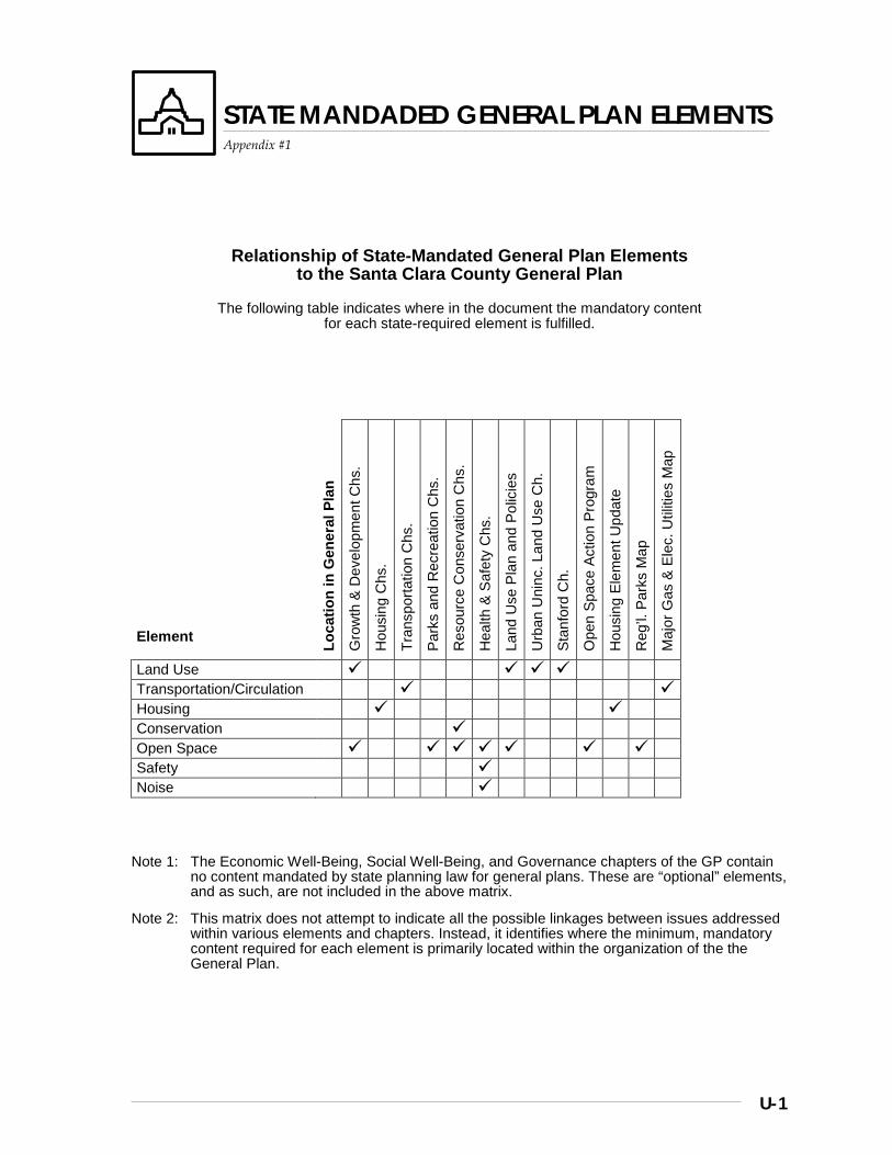
U-1
STATE MANDADED GENERAL PLAN ELEMENTS
Appendix #1
Relationship of State-Mandated General Plan Elements to the Santa Clara County General Plan
The following table indicates where in the document the mandatory content for each state-required element is fulfilled.
Element Lo
catio
n in
Gen
eral
Pla
n
Gro
wth
& D
evel
opm
ent C
hs.
Hou
sing
Chs
.
Tran
spor
tatio
n C
hs.
Park
s an
d R
ecre
atio
n C
hs.
Res
ourc
e C
onse
rvat
ion
Chs
.
Hea
lth &
Saf
ety
Chs
.
Land
Use
Pla
n an
d Po
licie
s
Urb
an U
ninc
. Lan
d U
se C
h.
Stan
ford
Ch.
Ope
n Sp
ace
Actio
n Pr
ogra
m
Hou
sing
Ele
men
t Upd
ate
Reg
’l. P
arks
Map
Maj
or G
as &
Ele
c. U
tiliti
es M
ap
Land Use
Transportation/Circulation Housing
Conservation
Open Space Safety
Noise
Note 1: The Economic Well-Being, Social Well-Being, and Governance chapters of the GP contain no content mandated by state planning law for general plans. These are “optional” elements, and as such, are not included in the above matrix.
Note 2: This matrix does not attempt to indicate all the possible linkages between issues addressed within various elements and chapters. Instead, it identifies where the minimum, mandatory content required for each element is primarily located within the organization of the the General Plan.

V-1
GENERAL PLAN ADMINISTRATION
Appendix #2
Introduction
The effectiveness of a General Plan in achieving the vision upon which it is based is dependent in large measure upon how well the plan is implemented and administered.
Four basic strategies are proposed for administration of the County’s General Plan:
Strategy #1: Promote Effective Implementation of the General Plan
Strategy #2: Keep the General Plan Up-to- Date and Relevant
Strategy #3: Ensure Community Involvement in Decisions Affecting the General Plan
Strategy #4: Administer Amendment Proposals in Timely and Efficient Manner
Strategies, Policies and Implementation
Strategy #1: Promote Effective Implementation of the General Plan
Adoption of a new or revised general plan is not the end of a process, but rather just the beginning of an ongoing implementation process that must continue throughout the life of the plan if the vision of the plan is to be achieved.
Some implementation of the plan occurs naturally through the day to day activities of the County, such as those involving review of development applications that are submitted. Other implementation requires special effort in the form of follow-up studies, drafting of new ordinances, or coordination of efforts with other agencies and jurisdictions who have the authority to help in the plan’s implementation.
By whatever mechanism General Plan implementation occurs, it is generally more effective if there is a formal process for (a) periodically monitoring and reporting on progress toward implementation and (b) establishing priorities among the many different candidate activities needed to successfully implement the plan.
The policies and implementation recommendations that follow provide the framework for assuring effective implementation of the plan by other means, monitoring implementation progress, setting priorities, and allocating the resources necessary to carry out appropriate implementation activities.
Policies and Implementation
A-GP 1 The County shall actively promote the ongoing implementation of its General Plan by County agencies and, as appropriate, by other government agencies, community organizations, businesses, and residents of the community.
A-GP 2 Proposed land use and related decisions of the County, other local governments, and other agencies which may significantly affect the goals of the General Plan should be reviewed for consistency with this Plan.
A-GP 3 The County shall work with state and federal legislators and agencies to further the achievement of the goals and policies of this Plan.
A-GP 4 Progress toward the implementation of the County’s General Plan shall be monitored and periodically reported to County decision makers, the cities, other appropriate agencies, and the community at large.
A-GP 5 Information necessary to assess community conditions and foster appropriate actions shall be maintained and made available to County decision makers and the community at large.
General Plan Administration
Appendix #2
V-2
REPOR
A-GP 6 The County’s General Plan and its implementing ordinances and regulations shall be administered in conformance with State mandates.
A-GP 7 The policies of the 1994 Draft General Plan shall take effect upon the date of adoption by the Board of Supervisors and shall be applied to all pending applications for privately-initiated General Plan Amendments and other applications requiring discretionary land use and development approvals.
Implementation Recommendations
A-GP(i) 1 Distribute the County’s General Plan to appropriate County agencies and decision makers and, as appropriate, to other government agencies and decision makers, community organizations, businesses, and residents of the community
A-GP(i) 2 Prepare an annual report to the Board of Supervisors regarding: a. the status of the General Plan and progress
toward its implementation; and b. actions recommended to be included in the
coming year’s work program and budget to further implement the Plan.
A-GP(i) 3 Maintain and disseminate information concerning current and projected future county conditions, including demographic, economic, and environmental resource data.
Strategy #2: Keep the General Plan Up-to-Date and Relevant
As time passes and conditions change, it is important that the General Plan and its various components be periodically reviewed to determine whether they still accurately reflect community conditions and desires and point the way for effectively meeting the challenges and opportunities of the future.
From time to time, a comprehensive review and revision of the plan may be necessary and appropriate. Such comprehensive reviews, however, can be costly and time consuming. The need for and extensiveness such reviews can be reduced somewhat by lesser but more frequent efforts to evaluate the plan to determine whether individual parts or policies of the plan are in need of review and revision. In this way, the plan can be kept up to date through a series of less intensive, more affordable projects and activities.
Policies and Implementation
A-GP 8 The County’s General Plan and its individual components shall be periodically reviewed for their continuing relevance to state and federal mandates, as well as community conditions, goals, and needs, and shall be revised in whole or in part when necessary to reflect significant changes in these conditions or mandates.
Implementation Recommendations
A-GP(i) 4 Include in the annual General Plan report to the Board of Supervisors: (a) an assessment of the current appropriateness of the Plan and its various components, and (b) recommendations for sections or policies suggested for review and revision, when necessary, based on changing community conditions and needs, as well as changes in state and federal mandates.
General Plan Administration
Appendix #2
V-3
REPOR
Strategy #3: Ensure Community Involvement in Decisions Affecting the General Plan
For a General Plan to serve as a meaningful blueprint for the future of a community and accurately reflect the aspirations of its residents, it is imperative that a broad range of community interests and perspectives be represented in its preparation, review, and adoption, as well as in its ongoing implementation.
Establishing public participation processes that are truly representative of a county as large, diverse, and dynamic as Santa Clara County is and will continue to be a challenging task. It will require conscientious efforts to create advisory committees, when appropriate, that reflect the community’s diversity.
Since it is virtually impossible however to create reasonable sized advisory committees that reflect all perspectives within the community, it will also require public outreach efforts to provide opportunities for additional members and voices of the public to be heard who also have a stake in the county’s future.
Policies and Implementation
A-GP 9 Broad public awareness and participation shall be assured in the review, revision, and adoption of the County’s General Plan, as well as in decisions involving proposed amendments to the Plan, and in the adoption or modification of ordinances and other regulations affecting the implementation of the Plan.
A-GP 10 The productive role of community associations shall be recognized and their continuing participation in the planning process shall be promoted.
Strategy #4: Administer Amendment Proposals That Are Consistent with Plan Goals In a Timely and Efficient Manner
The County annually provides opportunities for private individuals to propose amendments to change the General Plan land use designations and/or policies affecting their lands. Applications for General Plan amendments are accepted during one period each calendar year so that the Board of Supervisors and the public can consider the cumulative implications and impacts of the various amendments proposed for the Plan.
Depending upon the complexity and scale of the project proposed, the length of time that passes between the time an amendment application is accepted for processing and the time the Board holds a final hearing to determine whether a particular amendment will be approved can range anywhere from six months for simple amendments to several years for complex, controversial proposals.
It is in the best interests of both the public and the applicants that final decisions regarding general plan amendment proposals be made in a timely manner. This requires not only efficient processing by staff, but also a conscientious effort by the applicant to provide necessary information and studies in a timely fashion.
In addition to timely processing of amendment proposals, it is also important that the General Plan amendment processes and decisions maintain the integrity of the Plan’s basic goals and policies and not become an easy means of circumventing them.
General Plan Administration
Appendix #2
V-4
REPOR
By reviewing each General Plan amendment application and determining whether to accept it before it is processed by staff, the Board of Supervisors is able to screen out proposals that it feels are inconsistent with the overall goals and policies of the Plan. Such screening also helps avoid the waste of public and private resources that would be involved in the processing of amendment proposals that are so at odds with the policies of the Plan that they have little likelihood of getting approved, or if approved, would raise serious legal questions regarding the internal consistency of the Plan that is required by law.
Policies and Implementation
A-GP 11 Privately initiated General Plan amendment proposals shall be accepted for processing only if it is determined by the Board of Supervisors that their proposed uses, locations, scale, and nature are substantially consistent with the basic goals and policies of this Plan. [Note: Acceptance of a GP amendment application for processing shall in no way be construed to indicate any commitment to or likelihood of its being ultimately approved by the Board of Supervisors]
A-GP 12 Privately initiated applications for amendments to the General Plan shall be considered only during the annual review of the Plan so that the cumulative impact of proposed amendments may be assessed collectively.
A-GP 13 The County shall refuse to accept any applications for General Plan amendments for property with any known violations of law that would seriously affect the public health, safety, and welfare of the community.
A-GP 14 The Department of Planning and Development shall cease processing an application for a General Plan amendment if, during the processing of the application, it is determined that an outstanding, unabated violation exists on the property that seriously affects the public health, safety, and welfare of the community.
A-GP 15 There shall be an appeals process whereby an applicant may appeal to the Board of Supervisors the refusal of the Department of Planning and Development to accept or continue processing a General Plan amendment application where a violation exists or is found on the property. If the Board of Supervisors determines that the violation is not significant enough to pose serious hazards to the health, safety, and welfare of Santa Clara County residents, it may direct the Department to accept or continue processing the application.
A-GP 16 The County shall make decisions regarding the approval of privately initiated General Plan amendment proposals in a timely manner, consistent with the complexity of the proposed amendment and contingent upon the timely submittal of necessary information and studies by the applicant.
A-GP 17 Applicants for privately initiated General Plan amendments shall be encouraged to pursue the prompt disposition of their proposals by submitting necessary information and studies in a timely manner.
General Plan Administration
Appendix #2
V-5
REPOR
Implementation Recommendations
A-GP(i) 5 Present applications for privately initiated General Plan amendments to the Board of Supervisors for determination of whether they will be accepted for processing.
A-GP(i) 6 Maintain and periodically revise a formal schedule and procedures for the annual acceptance and processing of publicly and privately initiated General Plan amendments.
A-GP(i) 7 Include in the annual General Plan report to the Board of Supervisors information concerning recently filed and other pending privately initiated General Plan amendments, and estimates of when they might be brought to the Board of Supervisors for decisions.
A-GP(i) 8 Establish procedures for determining when a proposed General Plan amendment application shall be considered to have been abandoned due to lack of effort by the applicant to submit in a timely fashion the information and studies necessary to bring the proposal to the Board of Supervisors for a decision.

W-1
OPEN SPACE “ACTION PROGRAM”
Appendix #3
Introduction
Summary
The purposes of this section (appendix) of the GP are to explain the concepts and requirements of state law concerning the “open space” elements of local general plans and more specifically, how the County of Santa Clara’s General Plan fulfills the requirement for an Open Space Element “Action Program.” The background information sections which follow this introduction provide the basic context for the “action program,” described in more detail afterwards.
To better enable users of the GP to see the totality of the County’s approach to open space planning, this appendix compiles and summarizes the following aspects of the many chapters and sections of the Plan that address the subject:
1. key strategies and policies for open space preservation;
2. existing implementation measures being employed; and
3. recommended implementation measures the legislative body intends to pursue in implementing the strategies and policies of the General Plan.
The latter, #3, represents the “Action Program” as required and defined by state law. With this compilation, users of the Plan should also be able to better understand how each particular recommendation contained in the “Action Program” fits into the overall scheme of existing strategies and implementation.
Background
STATE LAW REQUIREMENTS FOR OPEN SPACE ELEMENTS
State law defines open space as any area of land or water that is essentially unimproved and devoted to one or more types of open space use(s), specifically including open space for:
• natural resource preservation (e.g. wildlife habitat);
• managed production of resources (e.g. prime soils, timber lands, or mineral deposits;
• outdoor recreation (e.g. historic areas, parks for beach and river access, trails); and
• public health and safety (active fault and landslide areas).
The requirements for open space elements established by the legislature reflect the vital importance the state has placed upon open space planning and preservation at the local government level. State law emphasizes the importance of open space preservation to the economy of the state. It furthermore asserts that premature and/or unnecessary conversion of open space land to urban uses is not in the public interest, and that in the face of continuing population growth pressures, local open space planning is of paramount importance to maintaining and enhancing California’s overall quality of life (paraphrases Govt. Code sections 65561 and 65562).
Consequently, the open space elements of local general plans must not only contain strategies and policies for the preservation of open space (the “open space plan”), but also must contain as part of that plan an “action program,” or set of implementation measures and recommenda-tions specifically intended to carry out the general strategies and policies of the jurisdiction for open space preservation.
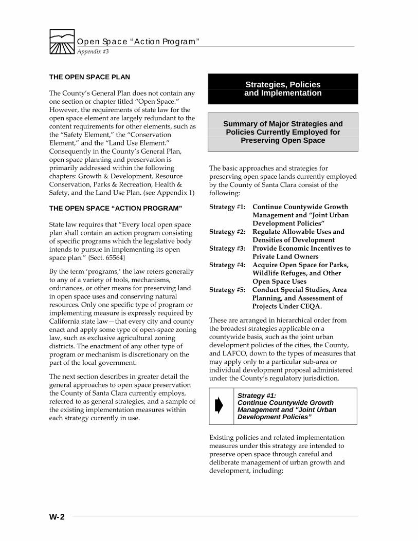
Open Space “Action Program”
Appendix #3
W-2
THE OPEN SPACE PLAN
The County’s General Plan does not contain any one section or chapter titled “Open Space.” However, the requirements of state law for the open space element are largely redundant to the content requirements for other elements, such as the “Safety Element,” the “Conservation Element,” and the “Land Use Element.” Consequently in the County’s General Plan, open space planning and preservation is primarily addressed within the following chapters: Growth & Development, Resource Conservation, Parks & Recreation, Health & Safety, and the Land Use Plan. (see Appendix 1)
THE OPEN SPACE “ACTION PROGRAM”
State law requires that “Every local open space plan shall contain an action program consisting of specific programs which the legislative body intends to pursue in implementing its open space plan.” {Sect. 65564}
By the term ‘programs,’ the law refers generally to any of a variety of tools, mechanisms, ordinances, or other means for preserving land in open space uses and conserving natural resources. Only one specific type of program or implementing measure is expressly required by California state law—that every city and county enact and apply some type of open-space zoning law, such as exclusive agricultural zoning districts. The enactment of any other type of program or mechanism is discretionary on the part of the local government.
The next section describes in greater detail the general approaches to open space preservation the County of Santa Clara currently employs, referred to as general strategies, and a sample of the existing implementation measures within each strategy currently in use.
Strategies, Policies and Implementation
Summary of Major Strategies and Policies Currently Employed for
Preserving Open Space
The basic approaches and strategies for preserving open space lands currently employed by the County of Santa Clara consist of the following:
Strategy #1: Continue Countywide Growth Management and “Joint Urban Development Policies”
Strategy #2: Regulate Allowable Uses and Densities of Development
Strategy #3: Provide Economic Incentives to Private Land Owners
Strategy #4: Acquire Open Space for Parks, Wildlife Refuges, and Other Open Space Uses
Strategy #5: Conduct Special Studies, Area Planning, and Assessment of Projects Under CEQA.
These are arranged in hierarchical order from the broadest strategies applicable on a countywide basis, such as the joint urban development policies of the cities, the County, and LAFCO, down to the types of measures that may apply only to a particular sub-area or individual development proposal administered under the County’s regulatory jurisdiction.
Strategy #1: Continue Countywide Growth Management and "Joint Urban Development Policies”
Existing policies and related implementation measures under this strategy are intended to preserve open space through careful and deliberate management of urban growth and development, including:
Open Space “Action Program”
Appendix #3
W-3
• USA concepts intended to encourage infill and compact development and to discourage premature and unnecessary urban expansion; and
• balanced, orderly growth according to each city’s ability to provide adequate services and facilities.
For a more complete explanation of the strategies and policies pertaining to this aspect of open space preservation, refer to the Growth & Development Chapter of the General Plan.
Strategy #2: Regulate Allowable Uses and Densities of Development
Existing policies and related implementation measures under this strategy are intended to preserve open space through control over the type, density, and location of development within the rural unincorporated areas outside cities’ USA boundaries, including, but not limited to:
• types of uses limited to those appropriate to the rural areas;
• very low density residential and non-residential development standards, typically 20 acres per dwelling / min. parcel size, at a minimum, and ranging up to 160 acres per DU, as average slope increases;
• mandatory clustering of development and open space dedication requirements within areas designated “Hillsides”;
• prohibition of development for human occupancy within active fault traces;
• stream buffer guidelines; • exclusive agricultural zoning; and • prohibition of major subdivisions (> 4
parcels) within areas designated ‘Ranchlands.”
For a fuller explanation of the strategies and policies pertaining to these aspects of open space preservation, refer to the following chapters of the General Plan for Rural Unincorporated Areas: Growth & Development, Resource Conservation, Health & Safety, and Land Use Plan.
Strategy #3: Provide Economic Incentives to Private Land Owners
The primary type of economic incentive program for open space preservation is the County’s participation in the state’s Land Conservation Contract (or Williamson Act) legislation. Essentially, a landowner’s participation in this program provides a reduced property tax assessment in return for land retained in an open space use as defined and approved by the local jurisdiction.
For a fuller explanation of the strategies and policies pertaining to this aspect of open space preservation, refer to the Resource Conservation Chapter of the General Plan, and Section C-13 of the County’s Land Development Regulations.
Strategy #4: Acquire Open Space for Parks, Wildlife Refuges, and Other Open Space Uses
Existing policies and related implementation measures under this strategy are intended to preserve open space through land acquisition, including:
• Parks Charter fund for purchase of lands to be included in the County’s system of regional parks;
• trail system planning and implementation; and
• multi-jurisdictional planning and funding of such projects as the Guadalupe River Park.
For a fuller explanation of the strategies and policies pertaining to this aspect of open space preservation, refer to the Countywide Parks & Recreation Chapter of the General Plan.
Open Space “Action Program”
Appendix #3
W-4
Strategy #5: Conduct Special Studies, Area Planning, and Assessment of Projects Under CEQA.
Existing policies and related implementation measures under this strategy are intended to preserve open space through various special area plans, studies, and the environmental assessment of development projects of all kinds, including:
• the Open Space Preservation 2020 Task Force Report, 1987, a multi-jurisdictional, cooperative study of the open space preservation priorities of the County;
• special area studies and policies for environmentally sensitive lands, such as the Los Gatos Watershed, Upper Guadalupe Watershed Area of Critical Environmental Concern, New Almaden Historical Area;
• mapping of known natural hazard areas and natural resource areas, such as active landslides, and prime agricultural soils, respectively;
• environmental assessments and Impact Reports (EIRs) for development projects under the authority of CEQA, the California Environmental Quality Act; and
• requirements that development proposals involving intensification of land use in areas proposed as urban buffer or “greenbelt” areas by the South County Joint Area Plan offer dedication of open space as partial mitigation for development impacts.
For a fuller explanation of the strategies and policies pertaining to this aspect of open space preservation, refer to the Rural Unincorporated Growth & Development Chapter, Health & Safety Chapter, CEQA Guidelines, and South County Greenbelt Study, among other references.
Summary of “Action Program:” Recommended Measures Proposed
To Augment Existing Strategies
The following implementation recommendations are proposed for the purpose of augmenting existing implementation measures described in the previous section. They are arranged according to the general strategies outlined in the previous section. The recommendations are drawn from two sources, (1) those that have been approved as part of various chapters of the Plan by the General Plan Review Advisory Committee, and (2) recommendations contained in the Open Space Preservation 2020 Task Force report which directly relate to the former.
As such, this list of recommendations, once adopted by the Board of Supervisors, represents the “action program” of specific measures the County’s Board of Supervisors intends to pursue in implementing the open space preservation strategies and policies of the General Plan.
Strategy #1: Continue Countywide Growth Management and "Joint Urban Development Policies”
1.1 Joint studies and agreements with cities
for establishing and maintaining “Long Term Urban Growth Boundaries” (UGBs). {C-GD (i) 5}
Open Space “Action Program”
Appendix #3
W-5
Strategy #2: Regulate Allowable Uses and Densities of Development
2.1 Undertake in full compliance with all legal
requirements the rezoning of lands for which the zoning district is identified as inconsistent with the applicable General Plan Land Use designation. {R-LU(i) 1}
2.2 Review uses permitted within the “A, Exclusive Agriculture” zoning district for conformity with the range of allowable uses defined in the General Plan for areas designated “Agriculture.” {R-LU(i) 2}
2.3 Establish an agricultural competitiveness task force to study and recommend ways of maintaining and enhancing the long term viability of agriculture. {R-RC(i) 30}
2.4 Setback requirements and performance standards necessary to protect riparian corridors and water resources should be devised regarding new development, including building setbacks, setbacks for sewerage and other pipelines, septic systems, roads and recreational trails, logging, and agricultural activities. The present regulations should be compared with these standards, and where necessary, revisions should be made to existing policies and regulations. {R-RC(i) 10}
2.5 Explore potential for a cooperative, educational, non-regulatory measures (e.g.: “Riparian Values Education Roundtable”) to inform and encourage riparian area conservation. {R -RU(i) 9(b)}
2.6 Identify those areas of greatest sensitivity to visual impacts of development and apply design review requirements to development occurring within those areas (i.e., the “-d” combining district), where not already required as a condition of building site approval. [Not to apply to areas designated Ranchlands east of Hwy. 101 for which building site approval is not currently required.] {R-RC(i) 38}
Strategy #3: Provide Economic Incentives to Private Land Owners
3.1 Utilize mapping and analysis capabilities
of the County’s Geographic Information System (GIS) to track and report upon Williamson Act contract non-renewal activity.
3.2 Evaluate the nature and potential effectiveness of incentives to encourage private landowners to take advantage of existing policies and regulations for clustering of development. {R-LU(i) 4}
Strategy #4: Acquire Open Space for Parks, Wildlife Refuges, and Other Open Space
4.1 Utilize Open Space 2020 acquisition
guidelines and priorities in reviewing and revising the County’s Regional Parks and Scenic Highways Plan, and in conjunction with the Open Space Authority’s land acquisition planning, to maximize the effectiveness of acquisition expenditures. {see OS 2020, p. III-4, #3 and #4}
4.2 Identify ground water recharge and watershed lands of highest priority for possible open space acquisition. {see OS 2020, p. III-6, #6}

Open Space “Action Program”
Appendix #3
W-6
Strategy #5: Conduct Special Studies, Area Planning, and Assessment of Projects Under CEQA.
5.1 Explore and develop joint area studies,
plans, and agreements for areas of mutual interest to multiple jurisdictions, such as South Almaden Valley and Hillsides, hillside lands within SOI of the City of Cupertino, and others. {R-GD(i) 3 and 4; see also OS 2020, p. III-7, #10}
5.2 Explore funding for and development of Regional Habitat Conservation Plans (RHCPs) with interested jurisdictions and appropriate state and federal agencies. {CW-RC(i) 11-12}
5.3 Participation of the County with the Santa Clara Valley Water District, other affected governmental agencies, and rural area land owners in the District’s “Comprehensive Reservoir Management Plan” program. {R-RC(i) 4}
5.4 Mapping and storage of spatial data regarding known natural hazards and critical resources on Geographic Information Systems technology to facilitate data maintenance and public dissemination of information (e.g. geologic hazard data, Farmland Mapping Program data, historical sites inventories, archeological and paleontological sites, etc.) {R-HS(i) 9, and various implementation recommendations from Resource Conservation and Health & Safety chapters}
5.5 Explore establishment of a viewshed protection program for ‘Hillside’ areas, utilizing the parcel consolidation and clustering incentive recommendations of Open Space 2020 as a basis for the program. {R-LU(i) 7}

X-1
Housing Element Update 2015-2022 Appendix #4
Page is replaced with the Housing Element PDF

GENERAL PLAN REVIEW ADVISORY COMMITTEE:
County Board of Supervisors
Dianne McKenna, Committee Chair Mike Honda, Committee Vice-Chair
County Planning Commissioners
Ralph Brown Edith Edde Betsy Shotwell
Community-at-Large Members
George Chiala Bob Reese Adam Escoto Kenneth Rodrigues Nancy Gee Frank Rodriquez Don Incardona Cindy Rubin Jeff Lee Patrick Standifer Bob Levy David Takamoto Fu-Mei Liang Brian Walsh Rex Lindsay Susie Wilson Andy Lucero Walter Wilson Vicki Moore Donald Wolfe Tomas Moran Ken Yeager Kathy Chavez-Napoli
City Council Representatives*
Seat 1: Judy Stabile
Seat 2: Robert Johnson
Seat 3: Connie Rogers Leonard Hale
Seat 4: Bob Dougherty Marshall Goldman Lauralee Sorensen Barbara Winckler
Note: Four seats on the advisory committee were allocated to city council representatives appointed by the Santa Clara County Cities’ Association. Some of these representatives were unable to serve for the entire duration of the program. Where more than one councilmember is listed for one seat, they are listed in order of service, with the most recent member listed first.
STAFF:
Department of Planning and Development Administration
Leode G. Franklin, Director Robert L. Sturdivant, Chief Planning Officer
Principal Staff of the Santa Clara County General Plan Review Program
Don Weden, Senior Planner, Comprehensive Planning Section
Bill Shoe, Associate Planner
Contributing Staff - Comprehensive Planning Section and Support Staff
Donald McGaffin, Associate Planner Kathryn Studwell, Associate Planner Maureen Driggs, Assistant Planner Haiyan Zhang, Assistant Planner Andrea Boyd Ball, Assistant Planner Kitty Yau, Planning Technician Lisa Barba, Support Staff Laura Schibler, Support Staff
Other Contributing Staff
Hugh Graham, Senior Planner, Development Review Section
Jaunell Waldo, Associate Planner Patrick Murphy, Associate Planner Janet Cochrane, Associate Planner Autumn Arias, Executive Staff,
Santa Clara County Local Agency Formation Commission (LAFCO)
Jim Reilly, Associate Planner Jim Lewis, Deputy County Counsel John Gibbs, Assistant to Supervisor McKenna Cathy Ming-Hyde, Assistant to Supervisor
Honda
Acknowledgements
The Program staff would also like to thank the many individual staff members of other agencies who contributed to the production of the revised Santa Clara County General Plan.
