riverside hospital link preliminary preferred design
TRANSCRIPT
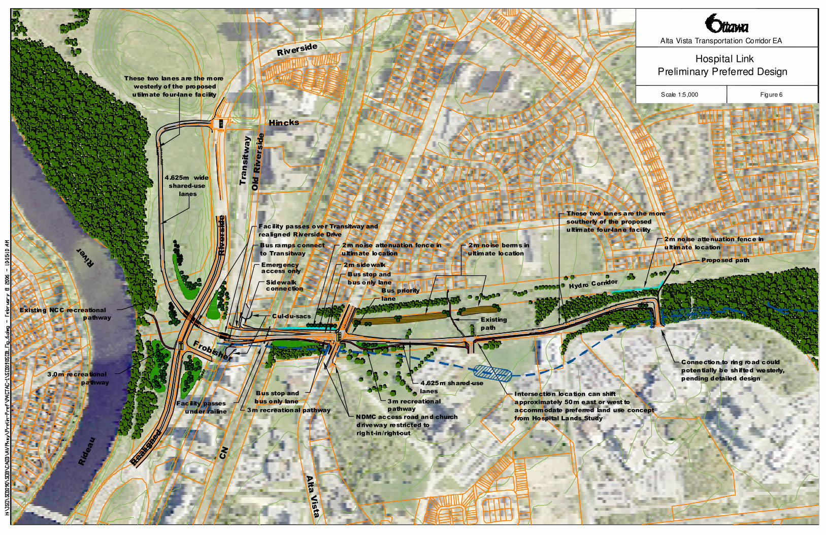
Hospital Link
Preliminary Preferred Design
Figure 6
Alta Vista Transportation Corridor EA
Scale 1:5,000
CN
Hincks
Alta Vista
Transitway
Rideau
Old Riversi de
Frobisher
Riverside
Sidewalkconnection
Cul-du-sacs
Emergency access only
Bus priority
lane
Bus stop and
bus only lane
2m sidewalk
Bus ramps connect
to Transitway
Facility passes over Transitway and
realigned Riverside Drive
Existing
path
2m noise berms in
ultimate location
2m noise attenuation fence in
ultimate location
2m noise attenuation fence in
ultimate location
These two lanes are the more
westerly of the proposed
utilmate four-lane facility
4.625m wide
shared-use
lanes
Existing NCC recreational
pathway
3.0m recreational
pathway
Bus stop and
bus only lane
Intersection location can shift
approximately 50m east or west to
accommodate preferred land use concept
from Hospital Lands StudyNDMC access road and church
driveway restricted to
right-in/right-out
3m recreational
pathway
Connection to ring road could
potentially be shifted westerly,
pending detailed design
Proposed path
Hydro Corridor
4.625m shared-use
lanes
Facility passes
under railine 3m recreational pathway
These two lanes are the more
southerly of the proposed
ultimate four-lane facility
Realigned
Riverside
River