risk management for land - clsa · 24 risk management for land surveyors
TRANSCRIPT

Article by Richard Hertzberg, CPCU, ARMon page 24
CHANGE SERVICE REQUESTEDThe California SurveyorP.O. Box 9098Santa Rosa, CA 95405-9990
Risk Management
for Land
Surveyors
Article by Jose Luis Gomez P.E., P.L.S. on page 14
City of Chula Vista SurveyorsGet on the Map
CLSA-WFPS C
onference 2007 Info and
Registratio
n form
on page 30


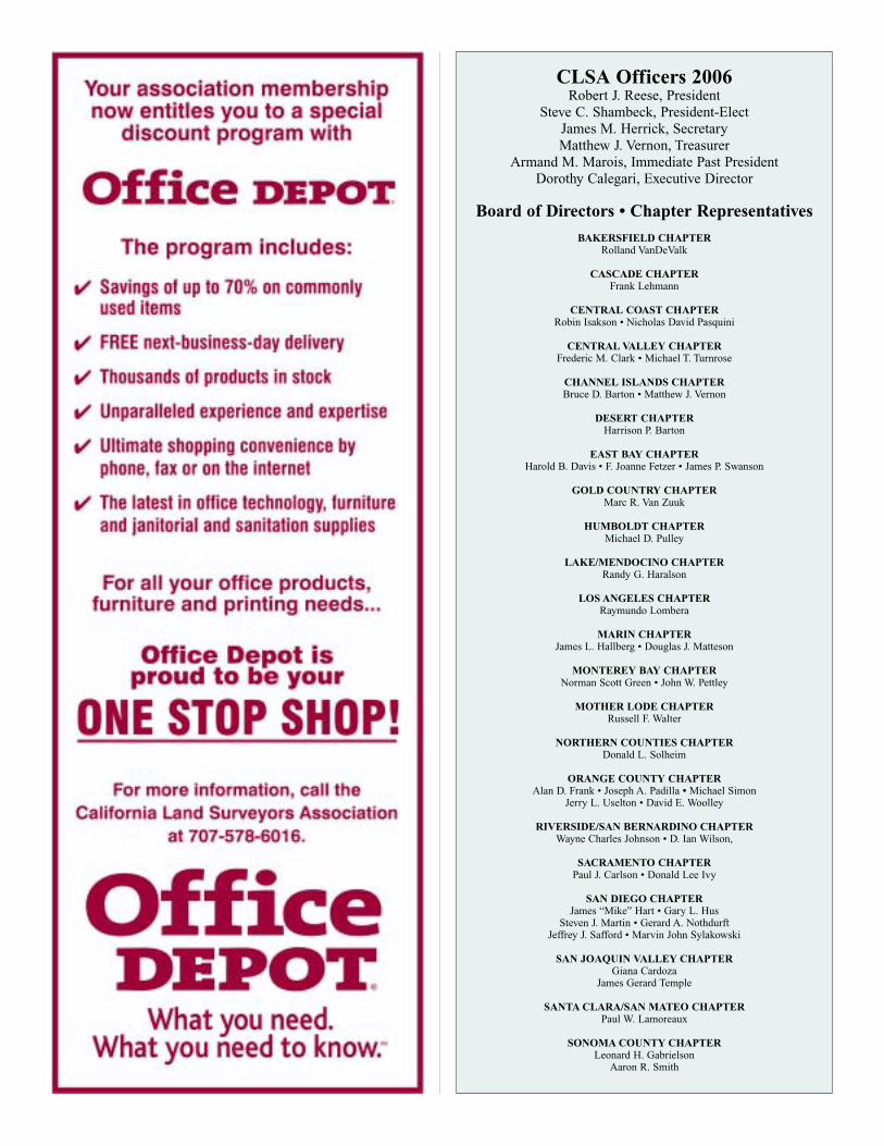
CLSA Officers 2006Robert J. Reese, President
Steve C. Shambeck, President-ElectJames M. Herrick, SecretaryMatthew J. Vernon, Treasurer
Armand M. Marois, Immediate Past PresidentDorothy Calegari, Executive Director
Board of Directors • Chapter Representatives
BAKERSFIELD CHAPTERRolland VanDeValk
CASCADE CHAPTERFrank Lehmann
CENTRAL COAST CHAPTERRobin Isakson • Nicholas David Pasquini
CENTRAL VALLEY CHAPTERFrederic M. Clark • Michael T. Turnrose
CHANNEL ISLANDS CHAPTERBruce D. Barton • Matthew J. Vernon
DESERT CHAPTERHarrison P. Barton
EAST BAY CHAPTERHarold B. Davis • F. Joanne Fetzer • James P. Swanson
GOLD COUNTRY CHAPTERMarc R. Van Zuuk
HUMBOLDT CHAPTERMichael D. Pulley
LAKE/MENDOCINO CHAPTERRandy G. Haralson
LOS ANGELES CHAPTERRaymundo Lombera
MARIN CHAPTERJames L. Hallberg • Douglas J. Matteson
MONTEREY BAY CHAPTERNorman Scott Green • John W. Pettley
MOTHER LODE CHAPTERRussell F. Walter
NORTHERN COUNTIES CHAPTERDonald L. Solheim
ORANGE COUNTY CHAPTERAlan D. Frank • Joseph A. Padilla • Michael Simon
Jerry L. Uselton • David E. Woolley
RIVERSIDE/SAN BERNARDINO CHAPTERWayne Charles Johnson • D. Ian Wilson,
SACRAMENTO CHAPTERPaul J. Carlson • Donald Lee Ivy
SAN DIEGO CHAPTERJames “Mike” Hart • Gary L. Hus
Steven J. Martin • Gerard A. Nothdurft Jeffrey J. Safford • Marvin John Sylakowski
SAN JOAQUIN VALLEY CHAPTERGiana Cardoza
James Gerard Temple
SANTA CLARA/SAN MATEO CHAPTERPaul W. Lamoreaux
SONOMA COUNTY CHAPTERLeonard H. Gabrielson
Aaron R. Smith

Winter 2006/075
The quarterly publication of the California Land SurveyorsAssociation, Inc. and is published as a service to the land surveying pro-fession of California. It is mailed to all Licensed Land Surveyors in theState of California as well as to all members of the California LandSurveyors Association, Inc. The California Surveyor is an open forum forall Surveyors, with an editorial policy predicated on the preamble to theArticles of Incorporation of the California Land Surveyors Association,Inc. and its stated aims and objectives, which read:
“Recognizing that the true merit of a profession is determined by thevalue of its services to society, the California Land Surveyors Associationdoes hereby dedicate itself to the promotion and protection of the profes-sion of land surveying as a social and economic influence vital to the wel-fare of society, community, and state.”
“The purpose of this organization is to promote the common goodand welfare of its members in their activities in the profession of land sur-veying, to promote and maintain the highest possible standards of profes-sional ethics and practices, to promote professional uniformity, to promotepublic faith and dependence in Land Surveyors and their work.”
PERSONNELOWNER
California Land Surveyors Association, Inc.
CENTRAL OFFICEP.O. Box 9098, Santa Rosa, CA 95405-9990
E-Mail address: [email protected] Homepage: www.californiasurveyors.org
EDITORJohn P. Wilusz, PLS, PE
ASSISTANT EDITORDave Ryan, PLS
ART DIRECTION Media 94
ADVERTISINGCommercial advertising is accepted by The California Surveyor.
Advertising rates and information can be obtained by contacting CLSACentral Office, P.O. Box 9098, Santa Rosa, CA 95405, (707) 578-6016,Fax (707) 578-4406. Circulation: 4,800.
EDITORIAL MATERIALAll articles reports, letters, and contributions are accepted and will
be considered for publication regardless of the author’s affiliation with theCalifornia Land Surveyors Association, Inc. Contributions should beemailed to [email protected]. We can accept WordPerfect orMicrosoft Word files. We can accept ASCII text files or word processorfiles from the following programs: WordPerfect or Microsoft Word.
EDITOR’S ADDRESSJohn P. Wilusz, PLS, PE
P.O. Box 6089Auburn, CA 95604
E-mail: [email protected]
DEADLINE DATESSpring . . . . . . . .February 10 Summer . . . . . . .May 10Fall . . . . . . . . .August 10 Winter . . . . . . . .November 10
Articles, reports, letters, etc., received after the above mentioneddate will be considered for the next edition.
Opinions expressed by the editor or individual writers are not nec-essarily endorsed by the California Land Surveyors Association Officers orits Board of Directors. Original articles may be reprinted with due creditgiven to the source and written notification to the California LandSurveyors Association, unless otherwise noted.
Inside This Issue:
On The Cover:Risk Management for LandSurveyors
Features:Lessons from the MastersBy: John “Steve” Parrish, PLS . . . . . . . . . . . . . . . . . . . . . .10
City of Chula Vista Surveyors Get on the Map
By: Jose Luis Gomez P.E., P.L.S. . . . . . . . . . . . . . . . . . . . .14
My Total Station Battery has Alzheimer’s…
And That’s A Good Thing!!By: Arthur Dias, B.Sc. . . . . . . . . . . . . . . . . . . . . . . . . . . . .16
CLSA Book Review
Chaining the Land Second Edition, Revised . .18
Title Research 101By: John P. Wilusz, PLS, PE . . . . . . . . . . . . . . . . . . . . . . .20
Risk Management for Land SurveyorsBy: Richard Hertzberg, CPCU, ARM . . . . . . . . . . . . . . . . . .24
SMA Expert Q&ABy: Mike Durkee, ESQ . . . . . . . . . . . . . . . . . . . . . . . . . . . .28
Department:From the Editor . . . . . . . . . . . . . . . . . . . . . . . . . . . .6President’s Message . . . . . . . . . . . . . . . . . . . . . . . . .8Welcome New Members . . . . . . . . . . . . . . . . . . . . .19Tech Tips . . . . . . . . . . . . . . . . . . . . . . . . . . . . . . . .26CLSA-WFPS Conference info/ Registration fom . . . . . .30Index to Advertisers . . . . . . . . . . . . . . . . . . . . . . . .19Crossword Puzzle . . . . . . . . . . . . . . . . . . . . . . . . . .36CLSA Remembers Dick Hogan, PLS . . . . . . . . . . . . .38CLSA Publication Order Form . . . . . . . . . . . . . . . . . .40CLSA Membership Application Form . . . . . . . . . . . . .42Sustaining Members . . . . . . . . . . . . . . . . . . . . . . . .44

www.californiasurveyors.org6
By: John P. Wilusz, PLS, PE
From the Editor
Areal estate agent called my office and asked for help locating a propertyline. His client had recently contracted with an engineer for soils testing,
and he wanted to be sure the testing, and future leach field, would be on hisclient s land. The property was a parcel described by deed and had not previ-ously been surveyed of record. I explained the level of effort, and legal require-ments, that would be involved in the work. I also provided a range within whichmy fee would likely fall. The real estate agent did not like the range. No needto go to all that trouble , he assured me. Compass work would sufficebecause his client only needed something approximate . I sensed the unlikeli-hood of our coming to terms. Well then, do you know someone who is handywith a compass , said I. I know how to use a compass , he chirped, but, Mr.Wilusz, you have no idea of the liability involved.
Actually, I do. In our profession we cannot hide from risk, but we can learnhow to manage it. Vista International Insurance Brokers, CLSA s endorsedinsurance broker, has offered to provide the California Surveyor with a columndevoted to risk management for land surveyors. In this issue you will find a gen-eral overview of the subject, with future columns dedicated to answering yourrisk management questions. There is much to consider when building a suc-cessful loss prevention program, but it all boils down to one thing: It is easier toavoid a lawsuit than it is to win one. Submit your risk management questions toCentral Office and start sleeping easier.
In this issue we are also testing the waters for another column. MichaelDurkee, Esq., has graciously offered to provide answers to your SubdivisionMap Act (SMA) questions. If you are involved in land development, from eithera public or private perspective, consider taking advantage of this valuableopportunity. Mike s knowledge of the SMA is superlative, and having attendedseveral of his seminars, I can tell you that his energy, enthusiasm and humormake a dry subject fun. Submit your questions to Central Office and prepareto win your next SMA battle.
In Chaining the Land , Second Edition, Bud Uzes describes the rich anddiversified history of our profession in California. It s a history populated withextraordinary people, Land Surveyors, who made vital contributions to theworld they lived in. It s a history we can be proud of. Now it s our turn to leavea similar legacy for those who will follow in our footsteps, the Land Surveyorsof tomorrow. You can help by joining the many fine people who contribute tothe success of this publication. The California Surveyor, and the future of ourprofession, depends on you. ❖

Winter 2006/07 7

My first two messages were crafted primarilyto update you on CLSA issues and my
activities as President; more like a newsletter thana message, if you will. But in thinking about thesubject matter for my third message, I decidedsomething different is in order.
My visits to the chapters last year asPresident-Elect allowed me to get a feel for whatmatters to you on a chapter by chapter basis. Thisyear, as President, I have had the opportunity tohear about issues that matter to Land Surveyorsthroughout the state, the nation, and even theworld. Aside from purely local matters (record ofsurvey fee structure, record of survey review,chapter participation), many of the larger issueswere very similar. So I will share my perspectiveon one of those subjects that you have in commonwith Land Surveyors everywhere. The absolutenumber one land surveying issue that wasbrought up over the last couple of years was…
PROFESSIONAL PRACTICESThere are unlicensed individuals who fla-
grantly violate the law by providing land sur-veying services (property corner location, con-struction staking, and geodetic positioning usingGPS, among other things). They continue to doso even while complaints to the California Boardof Registration for Professional Engineers andLand Surveyors (BPELS) are pending. Theycontinue even after enforcement action for thatvery violation! Another troublesome issue is thatoccasionally there are licensed Land Surveyorswho step outside the bounds of the ProfessionalLand Surveyors Act (PLSA). These violationssometimes include performing surveys withoutfiling the required maps or records, and thesetting of untagged monuments. Another profes-sional practice issue I heard about was licensedindividuals providing substandard practices.“Approximate” corners and boundary determina-tions based on poor evidence and procedureswere typical complaints.
What to do? Anything? Yes! I see twodistinct choices: 1) we can leave the complaintand enforcement process to BPELS and theDistrict Attorneys, or 2) we can do somethingourselves as professional, licensed LandSurveyors.
Choice number one has its drawbacks.Complaint review and enforcement by BPELS is
a time-consuming process, and to make mattersworse, there is no shortage of complaints againstlicensees. If BPELS makes a finding that,indeed, there is a violation of the PLSA, they turnit over to the local DAs. But the DAs have theirown workload with “real” criminals to prosecute.They understandably may see bona fide PLSAviolations (misdemeanors) as a low prioritycompared to felonies and other serious crimes.For whatever the reasons, the lack of a quickresponse system that provides justice and reliefcan be frustrating.
Our second choice is that we – that’s you,me, and the Land Surveyor next to you at yournext Chapter meeting - can all take action. OurAssociation itself can help. If your Chapter has alocal Professional Practice Committee (PPC),that’s excellent. At last count, nine Chapters haveimplemented a PPC at some level. SomeChapters even have joint PPCs with a local engi-neering group.
IF YOU DO HAVE A PPC get involved.Use it. Many other professions have self-regu-lating bodies that provide peer review. SomeLand Surveyors feel that filing a complaintagainst another Land Surveyor is like goingagainst a brotherhood. That’s bunk. If there is aserious violation and a complaint isn’t filed, thatis the real disservice to the public, the client, andthe Land Surveyors who do practice in compli-ance with the law. We’re familiar with acquies-cence in land surveying matters, but acquies-cence in unprofessional practice is tacit approvalof those unprofessional issues. It hurts us all.
PPC action need not be relegated to com-plaint resolution. If you have a complex issueregarding a surveying matter, or a questionregarding interpretation of laws or procedures,why not pose the question to other professionalsfor review? If nothing else, you will have a goodbenchmark of the local standard of care. Forthose Chapters that have them, local PPCs canresolve problems without the need to go anyfurther. I’ve been a member of the Central CoastChapter PPC for several years, and my experi-ence is that the group is conscientious, objectiveand interested in preserving a professionaldemeanor when it comes to Land Surveying.Nearly all complaints presented have beenresolved at the Chapter level to the satisfaction ofthe PPC, with no need for BPELS involvement.Everybody comes out ahead.
IF YOU DON’T HAVE A PPC, start one.We have a PPC at the Association level thatkeeps track of local PPCs and can tell you howeach one operates. If your Chapter is interested informing a PPC, you can consider various modelsof existing programs. Call CLSA’s Central Office
and they will put you in touch with folks who canget you more information. I’ve heard somepretty insubstantial reasons against PPCs -witch hunt, personal vendettas, self-interest,star chamber – none of which have any place ina well-structured PPC.
The benefits of a CLSA Chapter PPC aremany, among which are: 1) the public’s percep-tion that the Land Surveying profession does itsown quality control on professional issues; 2)review of Land Surveying issues by local LandSurveyors who will apply the local standard ofcare; 3) an immediate and responsive resourcefor complaints, whether submitted by the laypublic, a public agency or other Land Surveyors;4) sanction of action through a group of profes-sionals, rather than complaint by an individual.Another benefit is interest in Chapter activities.If your Chapter can offer a complaint processthat is respected by other professionals, they willcome to meetings to hear not only what issues arebeing brought up, but also how those issues arebeing resolved. At one of my Chapter visits lastyear, one of the more vocal opponents about for-mation of a PPC, who at the time wasn’t even aCLSA member, agreed to join CLSA and partic-ipate in a PPC if it were formed. Now there’s amembership recruitment mechanism!
The foundation of a CLSA Chapter PPC isinvolvement and investment. The PPC needs tohave a sufficient number of members so thatthere is a broad consensus of opinion about thematters considered. A PPC needs to recognizeconflict of interest and have the ability of amember to excuse him- or herself if that conflictexists. A PPC should limit itself to an objectivereview of violations of the Land Surveyors Act orother related professional issues, rather than themurkier subjective, or qualitative, determinationson professional products. The path toward reso-lution should be clearly prescribed to provide forbenefit of doubt, yet must have mile posts that, ifpassed with no response or resolution, lead to asanctioned next step. A possible last step in theabsence of resolution would be for the PPC itselfto file a complaint with BPELS. In my own dis-cussions with local attorneys, local assistant DAsand with BPELS, any matter that has beenreviewed by a group of professional LandSurveyors may have more expeditious treatment.
I believe if we are to rise to true professionalstature in the eyes of the public and the world, weneed to demonstrate that we, Land Surveyors,can, do and will keep its own house in order. Thehigher level of scrutiny and a higher standard ofperformance must not come from legislatedethics, or board rules, or statutes. It should comefrom us, from within our profession. ❖
www.californiasurveyors.org8
President’s MessageBy: Robert J. Reese, PLS - President


www.californiasurveyors.org10
Continued on next page
As a veteran surveyor of 43 years, I am fully aware of theimportant role of mentorship in our profession. I had sev-
eral good mentors in my early career and a few new ones atvarious stages since. Over the past decade, two giants havebeen my mentors, and have taught me innumerable lessons.They are, respectively, Roy Minnick and Bud Uzes.
Long admired for their knowledge, professionalism, wis-dom and tact, Roy and Bud have stood as icons in our pro-fession. As historians, teachers, and collectors of surveyingreferences and equipment, Roy and Bud served the public dili-gently, first as state employees, and later as private sectorexperts. They represented numerous clients in both civil andfederal courts and presented thoroughly researched and artic-ulately prepared expert testimony.
One unique experience involved a boundary dispute thatfound Roy and Bud on opposite sides of the issue being liti-gated. As fate would have it, I was asked to participate withRoy. The experience was especially rewarding for me, as Royguided me through evidence gathering, court exhibit prepara-tion and the psychology of expert witness testimony. A curioustwist was my being deposed, and later questioned in court, bya long-time friend, attorney John Briscoe. Adding to the expe-
rience were the numerous and challenging questions, posedby Bud, through attorney Briscoe. This case had all of theexcitement of the “Battle of the Titans”. Roy and Bud had sep-arate, though similar, plans for victory, each correctly antici-pating his opponent’s next move. In the end, attorney Briscoeand Bud won the Judge’s favor. Roy, however, felt confidentthat the case could have been reversed if allowed to beappealed. We’ll never know.
A couple of years later, Bud provided a workshop on thiscase. I contacted Bud, informing him that I wanted to attend,“just to keep him honest”. Before and during this workshop, Ilearned more about courtroom presentations, and evidencegathering, than I had learned in all my prior courtroom experi-ences combined. Bud invited me to dinner the night before,and the next day I sat in the front row. He not only told me howhe successfully won the case, but also shared valuable insightinto his research methods and courtroom presentation tech-niques. Bud is the only fellow professional I’ve met that couldbeat you in the race, and make you enjoy the loss.
It isn’t often that we get the privilege to work closely withthose we admire. However, at a subsequent workshop in 2004,I had such an opportunity with Bud. It proved to be a highlightin my career, as well as a delightful experience. We presentedthe background behind a case that was settled out of court –leaving both of us with a lot of questions and wondering whatdecision the judge would have made on behalf of our individ-ual clients. We corresponded frequently in preparation for theworkshop, and met personally to fine-tune the details. Onceagain, Bud’s breadth of experience quickly surfaced. A keyelement in his preparation for expert witnessing was hisexhaustive pursuit of evidence. Being the mentor that he was,he provided me with the accompanying textbook citations inorder to illustrate his philosophy. He also gave me the accom-panying list, which he developed, showing minimum researchsources and potential considerations for a thorough boundaryresolution. It is yet another example of Bud’s distinguishedlegacy, a legacy of devotion to the betterment of our profes-sion.
By: John “Steve” Parrish, PLS
Lessons from the Masters
L: Roy Minnick, PLS, 1937-2004R: Bud Uzes, PLS, 1934-2006

Duty of a Surveyor in California
"Although without final authority, the surveyor whenemployed on a resurvey must act as judge and jury, collectingthe evidence, hearing the testimony, interpreting the law andthen making a decision consistent therewith. Questions rela-tive to faulty surveys, obliterated monuments, contradictorytestimony, disputed boundaries, riparian rights, inconsistentdeed descriptions, erroneous plats, and legal decisions maybe involved."(Clark on Surveying and Boundaries, 2nd ed., introduction ix.)
Chandler v. Hibberd (1958) 165 Cal.App.2d 39
Majority Probability
In every case of property line determination, whetherphysical or record, it is absolutely necessary, for correct titleinterpretation, to assemble all the facts, record and survey,including possession control, concerning the property and itsboundaries; with this data, set up all the probable or possibletheories of position, considering fully the physical, engineer-ing, title and legal factors and their interrelation; ascertain asolution which will fit the majority of the analyses most closely.This is the theory of majority probability and normally will pro-duce the most satisfactory results. There are certain cases inwhich other factors will take the place of majority probability,
example: the fixing of a definite boundary line by agreementand deed; or decree of court determining a boundary by testi-mony and evidence or other matters stranger to the title or sur-vey and not of record. (William C. Wattles, Land Survey Descriptions, Los Angeles,
1956, §702, p. 79.)
The theory of majority probability (advanced by William C.Wattles in his book Land Survey Descriptions) whereby all fac-tors are balanced, giving each its proper weighted value, formsa logical approach to a complex deed problem. Mathematicalcorrectness, location of monuments, location and age of linesof possession, superiority of one call over another, previoussurvey records, the seniority of adjoiner deeds, common cus-toms of other surveyors, and all other factors must be exam-ined, weighted, and balanced to arrive at a proper location.(Brown’s Boundary Control and Legal Principles, 4th ed., §11.47, p. 294.)
John “Steve” Parrish, PLS, is an active author and lec-turer on the Public Lands Survey System. Retired after 31years with the United States Forest Service and Bureau ofLand Management, he is currently a project manager for TriState Surveying in Sparks, NV.
Winter 2006/0711
Continued on next page
Continued from previous page
DMC - DIGITAL MAPPING CAMERA

www.californiasurveyors.org12
Continued from previous page
Preliminary List of Survey Litigation Preparation Tasks -Minimum Research Sources and Potential Considerations
Prepared by Francois D. “Bud” Uzes, PLSProvided Courtesy of John “Steve” Parrish, PLS
California Surveyor 2006


www.californiasurveyors.org14
AMap compiled by the City Surveyors and the GIS Sectionwas chosen for inclusion in ESRI's 2005 Map Book,
Volume 20 and the World Wide Web. What started out as alocal inventory of the City’s Horizontal-Vertical Control net-work database, ended up being recognized as anInternational Map.
In 1995, City Surveyors, ‘custodians’ of survey monu-ments, filed Record of Survey (RoS) 14841 that officiallyestablished the foundation for the City’s Survey ControlNetwork. This Network was critical for the creation ofbase map layers planned for the city’s new GIS pro-gram. This was particularly important for it was recog-nized at the time that the city was entering an era of sig-nificant growth.
Subsequent to the RoS, a subdivision manual waswritten that incorporated the standards for the City’sSurvey Control network. In conjunction with the subdi-vision manual, the City of Chula Vista's municipal coderequires that development perpetuate and extend thecity's horizontal-vertical control to a one-half mile andone-quarter mile density.
The horizontal control is First Order-C category and thevertical control is Third Order. City survey staff, in partnershipwith GIS staff, designed an Access database to create eventthemes, which depict the current network on existing andplanned development. This six-month effort was subsequent-ly used to inform developers of their survey monumentsrequirements to the network. This map is intended to presentan illustrative depiction of the relationship of survey monu-ments to current and future residential growth in easternChula Vista.
The long-term goal of this endeavor was to make thisinformation available to the public via the city's Internet site.This long-term endeavor was accomplished in March 2006.The public web site depicts the City’s horizontal-vertical con-trol and makes the information available in a form. This hori-zontal-vertical control information is used to compile maps,improvement plans, and grading plans.
As in any project team, the following individuals wereinstrumental in this endeavor:
John Montes de Oca- LSIT, Survey Technician IILorenda Lee- GIS Specialist
Bob Blackwelder-Lead Programmer AnalystJack Hurlbut- GIS Specialist
The following are web site links to the Map Book volume& City web sites:
http://www.esri.com/mapmuseum/index.html
Horizontal/Vertical Control Networks
City of Chula Vista State and Local Government
In 1995, city surveyors, the cus-todians of survey monuments, filedRecord of Survey (RoS) 14841 thatofficially established the foundationfor the city's Survey Control Network.This network was critical for the cre-ation of basemap layers planned forthe city's new GIS program. It wasparticularly important because thecity was entering an era of significantgrowth at the same time.
http://209.242.148.132/public/Client/PublicKiosk1/index.html?appconfig=SurveyMon
By: Jose Luis Gomez P.E., P.L.S.
Continued on page 32
City of Chula Vista SurveyorsGet on the Map
Horizontal/Vertical Control NetworkChula Vista, California, USAJose Luis Gomez P.E., P.L.S. Data Source(s): General Services, Survey Services


www.californiasurveyors.org16
By: Arthur Dias, B.Sc.
Continued on next page
How many times have you heard the phrase, “My batterypack is holding a memory”? Being in the battery business,
this is something we hear all the time. This term is used toexplain the tendency of a rechargeable battery to rememberthe point up to which it was discharged over several cycles,before full discharge was attained. Subsequently, the batterybehaves as if this point is the point of full discharge. This is agenerally misunderstood phenomenon and a term often mis-used to explain various battery problems. There are manyscientific and theoretical explanations for why rechargeablebatteries behave poorly at times. But in a practical sense,these problems can be analyzed and addressed without hav-ing to have a degree in chemical engineering. So, if your bat-tery has “Alzheimer’s”, based on the explanation above; it’s agood thing.
“Memory Effect” is essentially caused when a recharge-able battery is recharged to full capacity, then used in the fieldto a point where the battery never reaches full discharge beforebeing placed on recharge again. For argument’s sake, let’simagine a battery being a container of sugar, where you fill itup and then use what you need before refilling it again. If youconstantly use only the top portion of the container and refill itwith new sugar, the remaining portion you have not touched ina while begins to get stale. The same is true for a battery. Theremaining charge you never allow the instrument to access,over time starts to stagnate.
Initially, the charge in a battery is at a uniform voltagethroughout the cells. The voltage begins to drop immediatelyafter removal from the charger. If all the charge in the battery isnot consumed before recharging, the portion that is leftunused continues to drop in voltage and becomes “stale”.Eventually, the voltage in this “stale” portion drops so low thatwhen your instrument is finished gobbling up all the “fresh”charge, it hits this “stale” portion like a brick wall. The instru-ment is confronted with a sudden drop in voltage, at a levelbelow the “low battery” indicator threshold. The battery cannotpower the instrument now without being recharged again.
The only way to recover the performance of the battery isto somehow remove that “stale” charge in the battery andrestore a fresh new charge. Unfortunately, some total stationmanufacturers have designed their instruments and chargersin a way that makes it almost impossible to correct this prob-lem. Chargers with a “discharge” function built in may not workto correct the problem at this point either. The low voltagepoint of stale charge will also cause the discharge operation tocease prematurely, leaving the stale charge still in the battery.In a case like this, a battery service shop with the properequipment, can analyze the battery, remove the stale chargeand solve the problem.
Trying to live with the problem will only make it worse andcan actually ruin the chances of correcting the problem at all.Just like the container of sugar example, eventually this stalepart will become so solid and entrenched in the battery that itwill permanently ruin that part of the battery and diminish itsability to accept a usable charge again. What also appears tohappen is that the portion of the battery that is able to receivefresh charge, now goes through many rapid cycles and ineffect “wears out” that portion of the battery prematurely. Youare now left with a container of hard packed stale sugar at the
bottom, with the top part of the container so worn out that itcan barely contain the new sugar you keep replenishing it with.
Here are several things that can be done to avoid thisproblem. Some I am sure you have heard before, but they arestill worth repeating.
1. Always fully discharge the battery each time you use itin the field. Number all your batteries and learn the run-time of each one through regular use. If you still carryenough battery power with you for the next day’s work,wait and use that all up before recharging again. Alwaysavoid recharging any batteries that have not been fully rundown.
2. At the first sign of a sudden decrease in performance,set that battery aside until returning to the office. At theoffice, put this problem battery back into the instrumentand set the instrument on a heavy battery demand opera-tion (like “tracking mode” measuring against a prism). Nowrun the instrument to the point where it shuts off on its ownfrom lack of battery power. Wait five minutes and repeatthe procedure. Repeat this until you feel the instrumenthas drained as much as possible from the battery. Nowput the battery on charge (preferably a slow charge, if yourcharger has that setting).
3. If storing the instrument away for a week or two, do notrecharge the battery until the night before it is needed inthe field again.
“Memory Effect” is essentially causedwhen a rechargeable battery is rechargedto full capacity, then used in the field to apoint where the battery never reaches full
discharge before being placed onrecharge again.
My Total Station Battery has Alzheimer’s…
And That’s A Good Thing!!

Winter 2006/0717
Continued from previous page
4. If storing the instrument for a month or two, or evenlonger, charge up the battery before storage and thenonce a month until the storage period is over. Every sec-ond month, fully discharge the battery before recharging.
5. Always let the battery reach room temperature beforerecharging. Excessively cold batteries will resist beingcharged and actually fool auto shut-off chargers intothinking the battery is fully recharged when in reality it isnot. When the battery is not allowed to fully recharge overmany cycles, you may end up with the same problem asthe “memory effect”.
Within the last few years, many instrument manufacturershave switched to Nickel Metal Hydride (NiMH) cells in theirbattery packs instead of the old industry workhorse, NiCd. Themain advantage of NiMH cells is the ability to hold much morecharge in the same size cell as the equivalent NiCd and theyare more environmentally friendly as well. NiMH cells have alsobeen touted as not having the memory effect problem of theNiCd cells. However, our experience has shown that this is notalways the case. Although they may resist the effect from tak-ing hold as easily as NiCds, the same maintenance procedureshould be followed…always fully discharge the battery beforerecharging again. NiMH cells also have one big drawbackcompared to their NiCd counterparts - their internal resistanceis higher.
The internal resistance of a cell will govern how read-ily it will accept a charge when applied, and how easily it willrelease that charge while maintaining it’s voltage whenrequired to do so. Internal resistance also explains why NiMHbattery packs sometimes get much warmer during rechargethan NiCds. Since internal resistance is a problem that getsworse with the age of the cell for both NiCd and NiMH, design-ing the instrument and charger to meet these demands is a dif-ficult balancing act, with some manufacturers having done abetter job at it than others.
A NiMH charger that is designed to charge the battery ina 10 to 14 hour period will always do a better job of topping upthe battery than a charger that is designed to do it in 2 to 3hours. The internal resistance of the battery will always forcethe charger to apply a higher voltage during recharging toovercome the resistance. This resistance is more pronouncedduring a fast charge procedure than during a slow charge.Eventually the charger is forced to such a high voltage that itassumes the battery is recharged and shuts off, never recharg-ing the battery to its full potential. As the NiMH battery getsolder, the problem gets worse. It is always best, if your fieldworking procedure allows for it, to choose a slow overnightcharger cycle. Many OEM chargers for NiMH cells offer bothfast and slow charge cycles. Also, chargers that monitor theinternal temperature of the battery during a fast charge seemto do the best job of recharging the NiMH batteries quickly.
Another point worth mentioning is the idea of replac-ing old NiCd cells in a pack with NiMH cells, during a re-cellprocedure. This is only recommended if you have just that onebattery to run your instrument. You must also be prepared toaccept that NiMH cells do not maintain original performancethrough as many cycles as NiCd cells. But since the NiMH
cells start out with the ability to hold much more charge thantheir NiCd counterparts, the advantages of the NiMH cells arestill something worth considering. Unfortunately, your old NiCdcharger may never properly recharge the NiMH cells to theirfull potential because it was not designed for the differentrequirements of the NiMHs. Even at less than 100% perform-ance, however, the greater capacity of the NiMH cells will gen-erally be realized if that battery is properly maintained from thebeginning. In reality though, many users will just add this NiMHbattery into a mix of other NiCd batteries being carried into thefield for the instrument. Our experience has found that in shortorder, the NiMH battery will get “lazy” and settle into a per-formance that is no better than if it had been re-celled usingNiCd cells. The advantages of converting to NiMH cells overthe original NiCd cells would be lost, not to mention, this “mis-fit” battery pack now has a diminished life cycle.
The final bit of advice I can give, similar to the advice weoften get from our own doctor: batteries stay healthier throughregular exercise on a daily basis!
Arthur Dias, B.Sc., is a founding partner of Dias & DiasElectronics and www.surveybattery.com. His company hasbeen repairing battery packs worldwide for surveying equip-ment for over 11 years now.

www.californiasurveyors.org18
Surveying in California has a rich and diversified history. Whilemany early surveyors became expert woodsmen and moun-
taineers, they were not really like most trappers and cowboys wholived a similar frontier life. Many of those in responsible chargewere among the best-educated men of their time, and were accus-tomed to the pleasures of a comfortable existence. The two-sidedworld to which they adapted was of their own choosing. Theyavidly chose an exhausting and exciting life of adventure in themarking and mapping of California s frontier lands. The tasksthey faced challenged their minds, ingenuity, skills and endurance.This differed from most other outdoor activities where technical,mathematical and drawing skills were rarely necessary.
When the first edition of Chaining the Land was publishedin 1977, it provided a unique insight into the work of California spioneer land surveyors. The long-awaited second edition delvesfurther into bringing together the people, tools, procedures andevents that contributed to the development of social order in theGolden State. Five new chapters have been added, increasing thetotal to twelve. The new chapters include biographical sketches ofpioneer surveyors, early geodetic surveys, military and geograph-ical surveys, railroad surveying and the accuracy expected in earlysurveys. This has ventured into early surveying practice andincludes a treatment of surveying and subdividing of governmentpublic lands in California, including the former and current incon-sistent practices of those charged with that work. The appendixhas grown from sixteen to twenty-seven documents.
For the land surveyor,the information in thisbook may prove useful forthe performance of profes-sional work. For example,knowing what measuringinstruments were available tothe 19th century surveyor, andthe precision to which they were capableof measuring, could be very important in analyz-ing the error of closure in an old survey. Another exampleis that cognizance of the fraudulent public land surveys is veryhelpful in the treatment of an unlocatable corner, which actuallymay never have been set. The old axiom retracing the footstepsof the original surveyor can best be done with knowledge of theoriginal surveyor, his abilities, instruments, hardships, dedication,reputation, and the directions under which he worked.
Surveyors, however, are not the only ones who will appreci-ate this book. Attorneys, geographers, title examiners, realtors,and students of land matters in California, will find it both inter-esting and informative. It is a pleasure to read, copiously illustrat-ed with historic photographs, and will be a welcome addition toyour bookshelf.
Published by, and available exclusively through:California Land Surveyors AssociationP.O. Box 9098Santa Rosa, CA 95405-9990
CLSA Book Review
Chaining the LandSecond Edition, RevisedA History of Surveying in California By Francois D. Bud Uzes, PLS

Winter 2006/0719
Welcome New CLSA Members
CORPORATEDouglas F. Banks, Lodi William R. Brown, Encino Daniel S. Cook, San Clemente John A. Erstad, Temple City Stephen J. Flatland, San Anselmo Balwinder S. Grewal, Antioch Gerry L. Hammond, Oakdale Jeremy M. Henry, Ventura William G. Hoff, Rancho Cucamonga Edwin T. Holbert, Rocklin Andrew J. Holloway, Tustin Danny F. Horn, Paso Robles Michael P. Jervis, West Covina James A. Kennedy, Big Bear City Steven J. Klein, Santa Rosa David E. Kraettli, Sacramento Hshing-Lung Lin, Riverside James McCann, Port, TX Isabel Out-of-State- Bruce Dale Mcclelland, Bakersfield James W. McPhee, Sacramento Roger A. Northern, Rough and Ready Steve N. Opdahl, Thousand Oaks Ron M. Overton, Hemet Jeffery K. Prober, Santa Barbara Victor M. Rasgado, Santa Maria Michael K. Reed, Porterville Fernando M. Rodriguez, Los Angeles John P. Schmidt, Meadow Valley Paul A. Seaboldt, Seal Beach Robert M. Shaffer, Ramona James Lee Smith, Cloverdale Randall S. Smith, Bakersfield Jeff S. Steffan, Oak Run David J. Stringer, Fair Oaks William E. Telling, Carmichael Thomas M. Thomsen, San Jacinto William Tipple, Santee David C. Triplett, West Sacramento Scott G. Wahl, Redding Dale Wilhelm, San Luis Obispo Jerry C. Woodrow, Redlands Piotr Zieba, San Ramon
ASSOCIATEJoseph J. Baljet, Lancaster George Barajas, Pasadena Kristopher Bourgeois, Pomona Michael Chiara, Sacramento Timothy J. Davis, Temecula Nathan M. Duffy, Costa Mesa Arlene K. Eyerman, Fallbrook Sean Finn, Benicia
Victor Flores, Alhambra Carolyn A. Fritchey, Murrieta John Gervais, Escondido Richard Gill, Carlsbad Robert Graves, Salinas Judson B. Haynes, Yuciapa Jeffrey Hitch, Murrieta Ryan Holm, Murrieta Chu Man Kow, Costa Mesa Serena Kubiak, Mountain View David McMillan, Riverside Dennis Odenbaugh, Victorville KC Offenberg, Costa Mesa Kevin C. Randall, Anaheim Douglas Rodgers, Castro Valley Michael Roser, Victorville Christopher A. Schendel, Concord Alfredo Sillas, Fillmore Collins Solomon, Murrieta Miguel A. Villasenor, Perris Fred Weaver, Desert Hot Springs Scott Wielt, Sacramento Jacob R. Wright, Downey
AFFILIATEDouglas Baruch, Hesperia Veronica L. Bojko, Sacramento James W. Campbell, Sacramento Joseph Couts, Escondido Roland Daggett, Redding Bruce Ing, Temecula Nicholas J. Kebbas, Temecula William Marshall, Davis Robert Monroe, Escondido John Strohminger, Carlsbad Jesse Zempel, Sacramento Sherrie J. Zimmerman, Sacramento
SUSTAININGCLE Engineering, Inc., Murrieta
STUDENTGregory M. Amoroso, North Hills Armando Avila, North Hills Alex Calder, Fresno Paul L. Fridley, Fresno Scott J. Haggai, North Hills Adrian Hagood, Long Beach Patrick Hanify, Barstow Robert Jones, Fresno Luis O. Lechuga, Pien Saul Melgarejo, Long Beach Deborah Talamantes, Simi Valley Gregory Templeton, West Sacramento
Become aMember
online at
www.californiasurveyors.org
Index To AdvertisersAerial Digital Images, Inc. (ADI) . . . . . . . . 37Allen Instruments & Supplies . . . . . . . . . . 13Allen Precision Equipment . . . . . . . . . . . 46Atlas Electronics, Inc. . . . . . . . . . . . . . . . .32Berntsen International, Inc . . . . . . . . . . . .25 C&C Aerial Mapping . . . . . . . . . . . . . . . .22California Surveying & Drafting . . . . . . . .48 Cartwright Aerial Surveys . . . . . . . . . . . .41 CBI Systems, Inc . . . . . . . . . . . . . . . . . . .45 CD Data . . . . . . . . . . . . . . . . . . . . . . . . . .41Data Tree . . . . . . . . . . . . . . . . . . . . . . . . .9Dias & Dias Electronics . . . . . . . . . . . . . .17Digital Mapping . . . . . . . . . . . . . . . . . . . .11HJW & Associaates . . . . . . . . . . . . . . . . .29Latitude Business Software . . . . . . . . . .3 Leica Geosystems . . . . . . . . . . . . . . . . . .15,35Lewis & Lewis . . . . . . . . . . . . . . . . . . . . .23 Office Depot (Member Benefit) . . . . . . . .4RBF Consulting . . . . . . . . . . . . . . . . . . . .34 Reese Water & Land Surveying . . . . . . . .22 Rick Engineering . . . . . . . . . . . . . . . . . . .7Santiago Canyon College . . . . . . . . . . . .27 Silver Shields System . . . . . . . . . . . . . . . .33 Software By D’Zign . . . . . . . . . . . . . . . . .7South Surveying Instruments, Inc. . . . . . .39 Surveyors Service Company (SERVCO) .2,47 Surv-Kap . . . . . . . . . . . . . . . . . . . . . . . . .22 TopCon . . . . . . . . . . . . . . . . . . . . . . . . . . .7 Trimble . . . . . . . . . . . . . . . . . . . . . . . . . . .21 Tri State Surveying, Ltd . . . . . . . . . . . . . .34 Vista International . . . . . . . . . . . . . . . . . . .34Westbrook Enterprise LLC . . . . . . . . . . . .29

www.californiasurveyors.org20
By: John P. Wilusz, PLS, PE
Interview with Timothy A. Hanson
Vice President and Chief Title Officer, Placer Title Company
P lacer Title Company is a full-service title and escrowoperation, serving Northern California from over 60
branch locations in 16 counties. Founded in PlacerCounty, California in 1973, it is now one of the largestindependent title agencies in the West, and the only inde-pendent title insurance company licensed in all 58California counties. On October 24, 2006, I met with TimHanson, Vice President and Chief Title Officer, at his officein Roseville.
JPW: Thank you for taking the time to meet with me, Tim.Since our professions are so interrelated, Land Surveyorswould benefit by some insight into what title companies are allabout. Can you give me an overview of what you do?
TAH: We as a title company are licensed to perform escrows,do title searches, and issue a title insurers insurance policy. Weassess title and make offers to our clients to insure them sub-ject to specific title policy exceptions and exclusions. It’s allabout managing risk, because if you’re trying to search a pieceof property for a perfect title, you’re almost never going tofind it. There will be a glitch someplace. There might be aproblem with the patent, or some defect that we insure over.Two title insurance companies can look at the same title andset different exceptions up in their policies based on the riskthey’re willing to take. As far as research goes, we typicallysearch tax records, real property records, recorded andunrecorded maps, and documents filed in municipal and supe-rior court, and bankruptcy court.
JPW: What kinds of maps do you use in your research?
TAH: We keep scanned copies of recorded maps, such assubdivision maps and records of surveys, and we use vendorsto organize the data. Our vendors have trained technicians inIndia who examine the maps and post information geograph-ically to our account. The underlying property is generally thefirst thing they look for, but other references, such as underly-ing sectionalized land, ranchos and filed maps, and owners’names are considered as well, if shown on the map. In thisway the maps are cross-referenced and we can execute asearch using different criteria. A good thing for surveyors tokeep in mind is that more information on their maps is betterthan less. This is especially true for records of surveys, whichdon’t necessarily impart constructive notice. If there’s a recordof survey on a piece of property we’re insuring, we want to beable to find it.
Our commercial departments have sectionalized land maps,swamp and overflowed lands maps, railroad maps, highwaymaps, flood maps; you name it. If we need information for asearch that we don’t have on hand, we rely on contacts we’vemade over the years with state and local agencies, railroads,BLM, or whatever, to obtain what we need. When necessary,we’ll go to the County, or the courthouse, to plug in any gaps.This could be particularly important for high liability transac-tions, or for properties that are not in well-defined areas. It justdepends.
JPW: What are your most important survey-related issues?
TAH: We’re very interested in physical conditions that mayprovide evidence of unrecorded real property interests, pre-scriptive rights and adverse use. We want to know aboutencroachments and lines of occupation that are in conflictwith record boundaries. There might be driveways, paths, andutilities serving adjacent properties without written easements.There might be fences that are not coincident with the prop-erty lines, property lines that pass through houses, or anynumber of things not disclosed of record, but that would beshown on a survey. If we don’t except these conditions frompolicy coverage, and someone suffers an actual loss from acovered matter as a result, we have to write a check.
JPW: Why do title companies want a copy of the parcel orfinal map prior to filing?
TAH: Because we want to know what we’re insuring. I had asituation where a client forgot to tell us he changed his parcelmap from three to four parcels. Among other things, that cre-ated access and easement issues that had significant conse-quences. We also like to review the technical data on the map.The quality of the map checking varies between counties, andeven the best map checker can miss something important. OrI may see something that I’d like to talk to the surveyor about.If there’s an issue, we want it resolved before the map is filed.If necessary, I’ll even walk the ground, with map in hand, tovisually inspect the property. In one case, which was in con-nection with a multi-million dollar policy, I found physical evi-dence of an old unrecorded easement that still encumberedthe land. Evidently, the surveyor didn’t see what I saw, and hedidn’t show the easement on the map. Although this lastinstance involved an ALTA/ACSM survey map and not a mapintended for recordation, the principle is the same. The moreeyes that review a map the better.
Continued on page 22
Title Research 101


www.californiasurveyors.org22
Continued from page 20
JPW: How did you get good at it?
TAH: As with anybody, in any business, it’s about taking a per-sonal stake in your work. Getting good at anything takes effort. Itdepends on how much you read, how much you study, how manyoutside sources and seminars you go to on your own time. I don’tknow of a chief title officer who got where he got by just comingto work, going home, and not applying himself.
JPW: Do you have any advice for surveyors?
TAH: Absolutely! Communicate with us. There’s no such thing astoo much communication. If you need more information for yourboundary resolution, the title officer will be more than happy tohelp. And it goes both ways because the surveyor may have infor-mation the title company does not have, not only about boundaryand encroachment issues, but also regarding the client’s intentionsfor the property. Even a client who does not deliberately withholdinformation may forget to tell us something important, or not real-ize the information is relevant. More information is always better.
JPW: That’s for sure, and the information you shared with metoday is a perfect example. Thank you! ❖
John P. Wilusz, PLS, PE is editor of the California Surveyorand is in private practice in Citrus Heights, CA.


www.californiasurveyors.org24
What does ‘risk management’
really mean?
Risk management entails an analysis of all your business expo-sures to the possibility of loss and determining how best to handlethose exposures. This can be done by avoiding risk (removing theexposure), reducing the risk (with loss control measures), transferringthe risk (with insurance), or retaining the risk (with deductibles or self-insurance strategies).
You say you’re very careful and know how to avoid risk and youdon’t need to worry about it. Well it’s good to be careful but you betterworry about risks that could damage you and your business and yourreputation.
Application of sound risk management practices will help you control your exposures and associatedcosts and add more profit to your bottom line.
You need to manage your risks and not let your risks manage you.
Reducing Risk
Risk management starts with identifying your specific risks and controlling them or at least not beingsurprised by them. You have to set your own unique standards, develop the policies, and document theprocedures that will reduce your exposure to loss. Your loss control program may include workplace andfield safety, office security, workstation ergonomics and employment practices.
You have to recognize what could happen that would hurt your business financially and physically. Youneed to anticipate what could put you out of business or make it very hard for you to do your work effi-ciently and cost effectively.
Risk Management Techniques
Risk management is asking yourself a bunch of ‘what if’ questions and trying to answer them.
Risk management is about care, quality and professional excellence.
First, you start by identifying and assessing the risks that you as a Land Surveyor face every day (dam-age to or theft of valuable equipment, field injuries, auto accidents) and some that you may never see (lossfrom earthquake, flood or fire).
Next, you have to determine your ability to deal with the risks you’ve identified. How much can youafford to lose? How much can you spend to replace or repair the anticipated damage? How much insur-ance do you need and can you afford it? Is there insurance to cover your risks?
Look carefully at your operations. Consider your property, inland marine, crime and premises liabilityexposures along with your professional liability (E&O), automobile liability, workers compensation andhealth insurance exposures. Don’t forget watercraft and aircraft exposure, either. Succession and retire-ment planning are worthwhile, too.
Risk Management
for Land
Surveyors
Continued on next page
By: Richard Hertzberg, CPCU, ARM
Winter 2006/0725
Once you identify your risks you have to decide how tohandle the exposures. Here’s how:
- Avoid the risks-don’t take the job or use a well-insured subcontractor to do the work
- Control the risks-be real careful how you work,implement safety training, know who you work for andwho works for you, review you losses and claims toprevent them from happening again
- Retain the risks-with self insurance or large insur-ance deductibles
- Transfer the risks-using insurance or indemnityagreements
- Monitor the results-with cost/benefit analysis to seeif your is successful.
Helpful Hints
Use checklists and exposure surveys to make sure yourrisk management and insurance program is being properlyimplemented.
— Always keep your insurance applications, summaries and policies handy.
— Make sure your subs carry adequate liability insurance.
— Always use written agreements. Make sure youhave limitation of liability clauses in those agreements.
— Implement your own quality control and safety procedures.
— Do drug testing. Get motor vehicle reports (MVRs)on your drivers.
— Have in-house continuing education programs.
Review all of your implemented risk procedures regu-larly and make sure they are working for you.
In most cases, you or the person you designate as riskmanager has to handle that function along with many otherwork duties, financial planning and budgeting.
When you throw in a little OSHA compliance, someclaims management, employee safety and security evalua-tions, contract management and disaster recovery plan-ning, you or your designee is very busy.
It’s your business. You love it and want to do it well withan eye to superb safety and risk control. Remember you arethe expert surveyor and being conscious of sound riskmanagement principles will make what you do and how youdo it more successful and profitable. ❖
Continued from previous page

www.californiasurveyors.org26
In Part 1 I discussed the finer “points” of standardizing yourrods. So, now that you have all the points on your rods stan-
dardized, there are two steps left to make your adjustable rodsand prisms interchangeable.
As discussed in Part 1, there are two types of rods, theadjustable and the non-adjustable. I’m not really concernedwith the non-adjustable rod here as the scale is set to read toa reference point on the rod (the flat part on the threadedpart) and you then add the vertical offset of whatever you puton top of the rod – GPS antenna or prism.
But, if your circumstances are like mine, your differentadjustable rods require different heights to place the center ofthe prism or the phase center of the GPS antenna at the sameheight as the scale reading on the rod.
PART 2 – STANDARDIZED RAW ROD HEIGHTS
The concept is to make adjustable rods the same height toreceive a standardized prism assembly and be at the height asshown on the rod scale.
First, determine a common rod height for all your rodsthat, when combined with a standardized prism assembly, willmeasure what the rod scale says if you change prisms. I decid-ed on a “raw rod height” that measures 5.60’ when the rodscale is set to 6.00’
First I set the rod to 6.00’ as read on the scale. I then meas-ured from the rod point to the surface where the prism assem-bly seats on the rod and added spacers to make it exactly 5.60’.Call this the “raw rod height”.
That means all my standardized prism assemblies wouldhave to measure exactly 0.40’ from the bottom of the prismmount to the center of the prism in order for the rod to meas-ure 6.00’ when the scale says 6.00’.
Since you cannot measure the raw rod height directly fromthe point (tapes bend), lay the rod on a flat, fairly level surfaceand provide a measuring point that is perpendicular from thepoint itself. My solution was to clamp a carpenter’s square tothe bench and use that as the measuring point as shown inPhoto 2-1. You ought to be able to get the desired raw rodheight to be within 0.003’.
I found that among acceptable spacers with a 5/8” diame-ter hole are plastic washers, brass or dense fiber oil pan drainwashers and nylon hex nuts. Metal washers, I found, were pret-ty inconsistent, but you might find one that is the right thick-ness. Get the 5/8” nylon washers and nuts at a good hardwarestore or online supplier. Get the brass washers from an autoparts store. Put the threaded nut on top to secure the spacersonto the rod. A useful tool to have when measuring spacerthickness is a digital caliper with read out to at least 0.001 inch-es or 0.1 millimeter. You can find them for about $20.
Photo 2-2 shows various spacers, Photo 2-3 shows spacersused on various rods to make the rod a fixed raw rod height of5.60’ when the rod scale reads 6.00’.
Once you get your rods all measuring 5.60’ when they areset to 6.00’ on the scale, the next step is to get all your prismassemblies standardized to a height of 0.40’.
PART 3 – STANDARDIZED PRISM HEIGHTS
The concept is to make prism assemblies the same heightso that when placed on a standardized rod, the total rodheight from tip to center of prism is what the scale reads.
I used 5/8” hex coupling nuts for the spacers since they areavailable at any decent hardware store and they’re cheap. But
Rod Heights PARTS 2 and 3
2-2
2-1
2-3
By: Robert J. Reese, PLS
Continued on next page

they are probably not the right length and they are manufac-tured with ends that are not perpendicular to the threadedportion. If the end is not at right angles to the axis of thethreaded portion, it can cause the prism to be off center up to0.01’. So you will have to machine the ends in a lathe (“facing”)or have a machine shop do it for you, and machine the spacerto the right length. There are male/female adapters availablein different lengths from survey supply manufacturers thatcould be used instead of making your own. Fortunately, mymachinist buddy Chuck let me use his lathe for about an houror so for the very modest price of a six-pack of cold ones oneweekend afternoon.
Cut a stub of 5/8” x 11” all-thread to about 1” long andscrew it about 1/2" into one end of the spacer so you can screwthe spacer into the prism yoke. I also drilled and tapped a 10-32 hole for a set screw to hold the stub in place.
Photo 3-1 shows prism assemblies with spacers on the bot-tom. Note that for different size prisms, there are, of course,different length spacers. Also note the set screw and stub in theend of the spacer. Photo 3-2 shows the spacer being “faced” ina lathe.
Since the manufactured height of a prism yoke is about0.255’, this means the hex spacer has to be 0.145’ long, but itwill vary between prism manufacturers.
Another thing to check is the “square” of the yoke. Afterdropping the rod a few times, the yoke might deform so thatthe center of the prism isn’t exactly over the center of thethreaded part. Makes good angular work a little tough. Even ifthe rod were perfectly plumb, a prism center off the verticalaxis of the rod by 0.01’ is 7 seconds at 300’.
Photo 3-3 shows one of the standardized prism assem-blies on top of a standardized rod, which is on top of a stan-dardized point.
Think this is a lot of work to go through for a rod that isaccurate (with a little patience) to about 0.003’? Maybe. Eachlittle systematic error might only be worth a penny, but if youadd enough pennies together, you get a dollar. ❖
Robert J. Reese, PLS, is CLSA President and owner of ReeseWater & Land Surveying Services, San Louis Obispo, CA
Winter 2006/0727
3-1
3-3
3-2
Continued from previous page

Q&A
www.californiasurveyors.org28
Facts:I have an existing 5 lot industrial parcel map with 4 build-
ings and a common area lot. Since the time the map wasfiled, our client has decided that all 4 building lots need toincrease by 2 feet in each direction. In order to do this, wewill need to adjust the lot lines of all 4 building parcels and thecommon area.
Questions and Answers:1. Can we do one lot line adjustment andadjust all 5 lots?
Under the old law, a Lot Line Adjustment was allowedbetween two or more existing adjacent parcels, where theland taken from one parcel is added to an adjacent parcel,and where a greater number of parcels than originally existedwas not proposed. The resulting parcels only had to conformto local zoning and building ordinances. The Lot LineAdjustment rules were changed approximately 5 years ago(Senate Bill 497, adopted in 2001). By its own terms, thenew law limits Lot Line Adjustments to "A lot line adjustmentbetween four or fewer existing adjoining parcels…" Gov.Code § 66412(d). As such, one Lot Line Adjustment appli-cation could not address 5 lots.
2. Can we do two [or more] lot line adjust-ments, adjusting Lots 1, 2, and the commonarea and then adjust Lots 3, 4, and the com-mon area again?
The answer to this question is much more involved and con-fused and ultimately hinges on the text of the local Map Actordinance. Under the old law, a Lot Line Adjustment wasallowed between two or more existing adjacent parcels,where the land taken from one parcel is added to an adjacentparcel, and where a greater number of parcels than original-ly existed was not proposed. The resulting parcels only had toconform to local zoning and building ordinances. Many com-mentators argued that Lot Line Adjustments under the oldlaw were "ministerial acts" outside the scope of CEQA andother regulations. When the law was changed (Senate Bill497, adopted in 2001), several questions arose regarding the
meaning of the new law, including the ones you raise.Unfortunately, no clarifying response from the Legislatureever took place. What we are left with is absolute confusion.In short, whether an owner may adjust the lines of five ormore existing parcels by filing a series of discrete applicationsfor four or less parcels is often contingent on the local MapAct ordinance. For example, some jurisdiction simply limiteach Lot Line Adjustment application to 4 parcels, but they
will allow multiple applications, thereby ultimately allowingthe adjustment of as many parcels as requested (through mul-tiple applications). In contrast, other jurisdictions allow only 4parcel adjustments (total) for the entire time the applicantowns the property! Under California law, a subdivider is pre-vented from evading the tentative and final map requirementsunder Section 66426 by making successive divisions of fouror fewer parcels each. Although this prohibition against“quartering” applies to the determination between whether aparcel map or tentative map is required, its application to LotLine Adjustments is unknown. The purpose of the anti-quar-tering rule appears to be founded on the idea that the tax-payer should be protected from undue burdens caused byimproper development. Since most Lot Line Adjustment arefor purposes other than development, the anti-quartering ruleshould not apply. There is nothing explicitly in the new lawthat prohibits multiple Lot Line Adjustment applications.
Unfortunately, different local agencies will likely have dif-ferent interpretations of the “four or fewer” requirement,thereby leading to inconsistent application of this requirementthroughout the state.
3. Is there another way to "adjust" the lineswithout having to do a tentative map andsubsequent parcel map?
I have heard of a couple of creative solutions. Becausethe new Lot Line Adjustment law has been inconsistentlyinterpreted and applied, some jurisdiction that want to allowmore than 4 lot line adjustments have elected to enact newlocal regulations that are not adopted within the scope of
SMA Expert
By: Mike Durkee, ESQ
Continued on next page

Winter 2006/0729
Q&ASMA Expert
the Lot Line Adjustment law's § 66412(d), butinstead are adopted under the city or county'spolice power, using Map Act § 66499.20 _when the land is held in common ownership. Iam not sure if that approach does not have pre-emption problems.
A more legally supportable approach maythis second alternative: I have heard that somejurisdiction have enacted "special" local regula-tions placed within their local Map Ordinancethat allow for the approval of a "no condition"parcel map or tentative/final map (depending onthe number of lots involved), if the proposal isfor the simple adjustment of existing lot lines(and not to allow new development). Under thisapproach, the new adjusted lots are shown onthe face of a new recordable map (parcel map orfinal map as the case may be), and pursuant tothe Map Act's §§ 66499.20 _ , upon recorda-tion, the relevant recorded map merges and re-subdivides the old lots, creating the new (adjust-ed) lots that are shown on its face. ❖
Continued from previous page

Rate: $169 (includes resort fee)
Cut Off Date: February 14th
Reservations: 800-542-6096
Parking: Complimentary
Transportation:Transportation to and from San Diego Airport
provided by Rancho Bernardo Inn. For shuttle reservations, call 800-542-6096
Registration Information Available in January Visit www.californiasurveyors.org for updated information
Featured Speakers:• Jerry Broadus• David Doyle• Wendy Lathrop• Steve Parrish


www.californiasurveyors.org32
Department sites: download survey data (link)http://www.chulavistaca.gov/City_Services/Administrative_Services/General_Services/Default.asp
http://www.chulavistaca.gov/City_Services/Development_Services/Engineering/Default.asp
Jose Luis Gomez, PLSCity of Chula Vista-Land Surveyor, Survey Section (3 years)
Supervise and direct 3-6 staff members & Land SurveyingConsultants responsible for Capital Improvement Projects.Determine boundary, preparation of right-of-way maps.Coordinate field data for aerial photogrammetry, topo graph-ic & design surveys, construction staking, and monumentpreservation. Administer Survey Service contract for threeon-call survey consultants. ❖
Continued from page 14


www.californiasurveyors.org34


www.californiasurveyors.org36
Ian Wilson, PLS is the president of Ian Wilson Land Surveying, Inc., in Temecula, CA. His practice specializes exclusively inboundary and topo surveys. He has worked in both private and public sectors for small firms in California and Caltrans, respec-tively. As well as being a licensed land surveyor, he and his wife, Laura, are newly certified SCUBA divers. They are looking for-ward to “getting wet” on future trips along coastal California and around the world.
#2
Crossword Puzzle By: Ian Wilson, PLS

Winter 2006/0737
Across1. Be prevented by one's own action4. Pertaining to the shore6. Top of a description7. Representation of a horizontal
section8. Map13. Line which crosses meridians at
constant angles14. Second name of glove
manufacturer of "established" fame
15. 40 sq rods17. Give up rights20. Closeness24. R=l26. And wife28. Legally qualified29. Intermediate31. Mine entrance33. Method of showing slopes35. Ci to flying height ratio36. Land catalogue first developed in
Adelaide, south Australia37. Without notice to any person38. Cone projection42. Square with sides approx.
192.5 feet45. Low support46. Dead end47. Possession of land under freehold48. 1 cm/sec/sec49. Give an immediate right to property50. Open51. Line of equal declination
Down2. Right to take profit from the land3. Area between two record surveys5. Concealed7. By word of mouth9. Enforcement of a lien10. Apparent displacement11. Part of e land description12. Sufficient in law16. Numerical quantity18. 1.5 feet19. Fixed object used to mark a corner21. Shadow caster22. Alluvial deposit23. Two curves touching25. Point in orbit farthest from sun27. Inexcusable delay in
asserting a right29. Tube projection30. Place on a map31. 160 sq rods32. In close contact34. Document of conveyance38. Recorded notice of a legal action39. Feudal GIS40. Inheritance from one's wife41. Shape of equal potential42. Sighting device with index
and reading tools43. Parcel of land44. Farm with barns
If you have an idea for a puzzle theme or a clue youwould like to include in an upcoming puzzle, email [email protected]
Key to CLSA puzzle #1(Surveyor Issue # 148)
www.californiasurveyors.org38
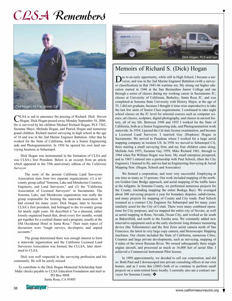
CLSA is sad to announce the passing of Richard Dick StevenHogan. Dick Hogan passed away Monday September 18, 2006.
He is survived by his children Michael Richard Hogan, PLS 7362,Suzanna Mayo, Melinda Hogan, and Patrick Hogan and numerousgrand children. Richard started surveying in high school at the ageof 16 and was in the 2nd Marine Engineer Battalion. After that heworked for the State of California, both as a Senior Engineeringaide and Photogrammetrist. In 1956 he opened his own land sur-veying business in Sebastopol.
Dick Hogan was instrumental in the formation of CLSA andwas CLSA s first President. Below is an excerpt from an articlewhich appeared in the 35th anniversary edition of the CaliforniaSurveyor.
The roots of the present California Land SurveyorsAssociation stem form two separate organizations: (1) a tri-county group called "Sonoma, Lake and Mendocino Counties,Engineers, and Land Surveyors," and (2) the "CaliforniaAssociation of Licensed Surveyors" in Sacramento. TheSonoma, Lake, and Mendocino organization was really thegroup responsible for forming the statewide association. Ithad existed for many years. Dick Hogan, later to becomeCLSA’s first president, had belonged to the tri-county groupfor nearly eight years. He described it "as a pleasant, ratherloosely organized bunch that, about every few months, wouldget together for a cocktail dinner and a program, usually at theOld Occidental Hotel in Santa Rosa." Their main topics ofdiscussion were "tough surveys, developers, and unpaidaccounts."
The group determined there was enough interest to forma statewide organization and the California Licensed LandSurveyors Association was formed, the CLLSA, later short-ened to CLSA.
Dick was well respected in the surveying profession and hiscommunity. He will be sorely missed.
To contribute to the Dick Hogan Memorial Scholarship fund Make checks payable to CLSA Education Foundation and mail to
PO Box 9098Santa Rosa, CA 95405
Memoirs of Richard S. (Dick) Hogan
Due to an early opportunity, while still in High School, I became a sur-veyor, and was in the 2nd Marine Engineer Battalion (with a survey-
or classification) in that 1943-46 wartime era. My strung out higher edu-cation started in 1946 at the San Bernardino Junior College and ranthrough a series of classes during my working career in Sacramento JC;classes at University of California, Berkeley; Santa Rosa JC, and wascompleted at Sonoma State University with History Major, at the age of55, I did not graduate, because I thought it time-wise unproductive to takethe last few units of Senior Class requirements. I continued to take nightschool classes on the JC level for selected courses such as computer sci-ence, art classes, sculpture, digital photography, and classes in ancient his-tory, all of my life. Between 1948 and 1955 I worked for the State ofCalifornia, both as a Senior Engineering aide, and Photogrammetrist workstatewide. In 1954, I passed the Cal state license examination, and becamea Licensed Land Surveyor. I married Gay (Hopkins) Hogan inSacramento. We moved to Pasadena where I worked for a large aerialmapping company in western US. In 1956 we moved to Sebastopol CA,there starting a small surveying firm, and my four children came along,Melinda Ann 1955, Suzanne Gay 1959, Mike Richard 1961, through to1964 when Pat William Hogan was born. My small enterprise prospered,and in 1965 I entered into a partnership with Paul Schoch, (then the CityEngineer). I learned to fly, and we had an Engineering-Surveying & AerialMapping firm. (Hogan, Schoch and Associates)
We formed a corporation, and were very successful. Employing atone time as many as 15 persons. Our work included mapping of the north-ern Golden Gate Bridge approach, and aerial mapping of the traffic lanesat the tollgates. In Sonoma County, we performed numerous projects forthe County, (including mapping the entire Bodega Bay). We averagedabout 200 surveying projects a year for boundary disputes, subdivisions,and many projects for mapping of County and City roads. Paul Schochresumed as a contract City Engineer for Sebastopol and for many yearssimilarly acted for the City of Cotati. There were many combined opera-tions for City purposes, and we mapped the entire city of Novato, as wellas aerial mapping in Reno, Nevada, Ocean City, and worked as far southas Bakersfield, and north to the Eureka area. We constantly added newinnovative equipment such as the early electronic long distance measuringdevice (the Tellerometer) and the first Zeiss aerial camera north of SanFrancisco, the latest in very large copy camera, and Stereoscopic Mappingmachines. Our clients included the State of California, numerous Cities,Counties and large private developments, such as surveying, mapping of4 miles of the lower Russian River. We owned subsequently three singleengine aircraft, and processed as much as 16,000 feet of aerial film. Iachieved a Commercial Instrument Pilot license.
In 1989 approximately, we decided to sell our corporation, and didso. Both Paul and I downscoped into private consulting offices at our ownhomes, and as I write this (2003) both of us continue to perform smallprojects on a semi-retired basis locally. I currently also am a contract sur-veyor for Sonoma County. ❖
CLSA Remembers
Dick Hogan, PLS at Jenner, CA
Dick Hogan, PLS and son


Winter 2006/0741

Discover the rich history of surveying in Californiawith this solidly researched second edition ofChaining the Land by the late renowned surveyorand author, Bud Uzes.
Chaining the Land is a comprehensive, colorfulcollection of early history of surveying in California.This new edition features an illustrated history ofsurvey instruments as well as biographical sketchesof pioneer surveyors, early geodedic surveys, militaryand geographical surveys and railroad surveying.
Chaining the Land is published by CLSA exclusively and is availablefor purchase only through CLSA’s Central Office.
CLSA CENTRAL OFFICE, P.O. Box 9098, Santa Rosa, CA 95405-9990E-Mail: [email protected] Web: www.californiasurveyors.org
AVAILABLE EXCLUSIVELY THROUGH CLSA
CHAINING THE LANDSECOND EDITION
www.californiasurveyors.org44
Sustaining Members
SUSTAINING MEMBERSHIPMembership in the California Land SurveyorsAssociation, Inc. as a Sustaining Member is open toany individual, company, or corporation who, by theirinterest in the land surveying profession, is desirous ofsupporting the purposes and objectives of thisAssociation. For information regarding SustainingMembership, contact:
CLSA Central OfficeP.O. Box 9098, Santa Rosa, CA 95405
Tel: (707) 578-6016 Fax: (707) 578-4406

Winter 2006/0745

www.californiasurveyors.org46