ride the wave! catherine maloney susan bogart cold spring harbor school district cold spring harbor,...
TRANSCRIPT


Ride the Wave!
Catherine MaloneySusan Bogart
Cold Spring Harbor School DistrictCold Spring Harbor, New York

Ride the Wave!
•What is the Volvo Ocean Race Around the World?
•Where can I find information about the Volvo Race?
•How can I use the Volvo Ocean Race in the classroom?
•How can I integrate the Volvo Ocean Race into my curriculum?
•What skills in technology will the class learn creating an
outcome reflecting its understanding of the ports of call.

What is the Volvo Ocean Race Around the World?
Imagine putting your class aboard a high-tech, seventy-foot sailboat and spending the school year vicariously racing six other boats on a 32,000 nautical miles spin around the world, visiting nine fascinating ports of call along the way!
The Volvo Ocean Race, sponsored by the Swedish auto maker, allows your students to follow the race, via the internet (www.volvooceanrace.org), plotting positions and reading action-packed e-mails from the crews, describing the problems faced daily in some of the world’s wildest waters! The internet has made it possible for my students to learn so much about geography, navigation, survival skills and develop respect for the cultural differences around the world.

Race Track for the Volvo Ocean Race Around the World2005-2006

Volvo Ocean Race Schedule – 2005-2006

How can I use the Volvo Race in my classroom?
Working in pairs, students visit www.volvooceanrace.org daily to read up-to-date news coverage, record position data and plot their boat on map in their ship logs. Boat tracking is color coded on a master map on the bulletin board, so once the students plot their boat’s latitude-longitude, they can compare their boat’s position to the other racers.
During opening exercises, students share the news from their boats. Depending on which leg is involved, news could relate to dismastings, rudder problems, sighting of sea-life, flying fish landing on decks, iceberg ahead, slippery decks, rough seas, injuries or damaged sails.

How can I integrate the Volvo Race in my curriculum?
Social StudiesCustoms, culturesLatitude/LongitudeDifferent maps, different usesTime ZonesHistory of sailing, exploration and trade
LiteratureGraham, Robin Lee, The DoveAvi, True Confessions of Charlotte DoyleAvi, WindcatcherFox, Paula, Slave DancerStevenson, R.L., Treasure IslandPaulsen, Gary, Voyage of the Frog
Newspapers, E-mails from skippers“Life at the Extreme,” Volvo Ocean Race 2005-2006 Biographical sketches of crew atww.volvooceanrace.org

MathEstimationMileage calculationsTime?Distance?SpeedConversion from Celsius to FarenheitGeometryCompass Rose, Degrees,AnglesAveragingProblem solvingElapsed Time CalculationsGraphing DataGrids and Coordinates
ScienceGlobal CommunicationsComputer technologyGlobal weather patternsWeather instrumentsAstronomyEcology/EnvironmentalSaving Long Island SoundSeasons and the HemispheresWind beltsOcean Currents
More Curriculum Connections

Health and Physical Fitness
NutritionFDA Food PyramidPhysical FitnessFirst Aid
Survival SkillsClothingNutrition at SeaRisk vs. AccomplishmentLeadership qualitiesCoping SkillsTime ManagementIn Crisis...Stop! Think! Action!
The ArtsSea ChantiesFolk SongsClassical Music...Debussy’s La MerMusic defining Port of Call
Creative OutcomesPort of Call Power PointsPoems celebrating the seaMusic Appreciation Around the World

What supplies do I need to set the stage for learning?
Computers with Internet Connection www.volvooceanrace.com www.googleearth.comGlobes, Atlases, Nautical Charts www.worldatlas.com Good for verifying accurate latitude/longitude for ports of call.Hand-out Booklet provides the following:Legs and DatesKeeping a Daily Log for one boatPlotting Map of the WorldPlotting Map for Leg 5 (Rio de Janeiro to Baltimore)Plotting Map for Leg 7 New York to Portsmouth, England)Logging Data SheetsCompass RoseSummary sheet for review of E-mails and newsPort of Call PowerPoint RequirementsAround Alone 1998-1999
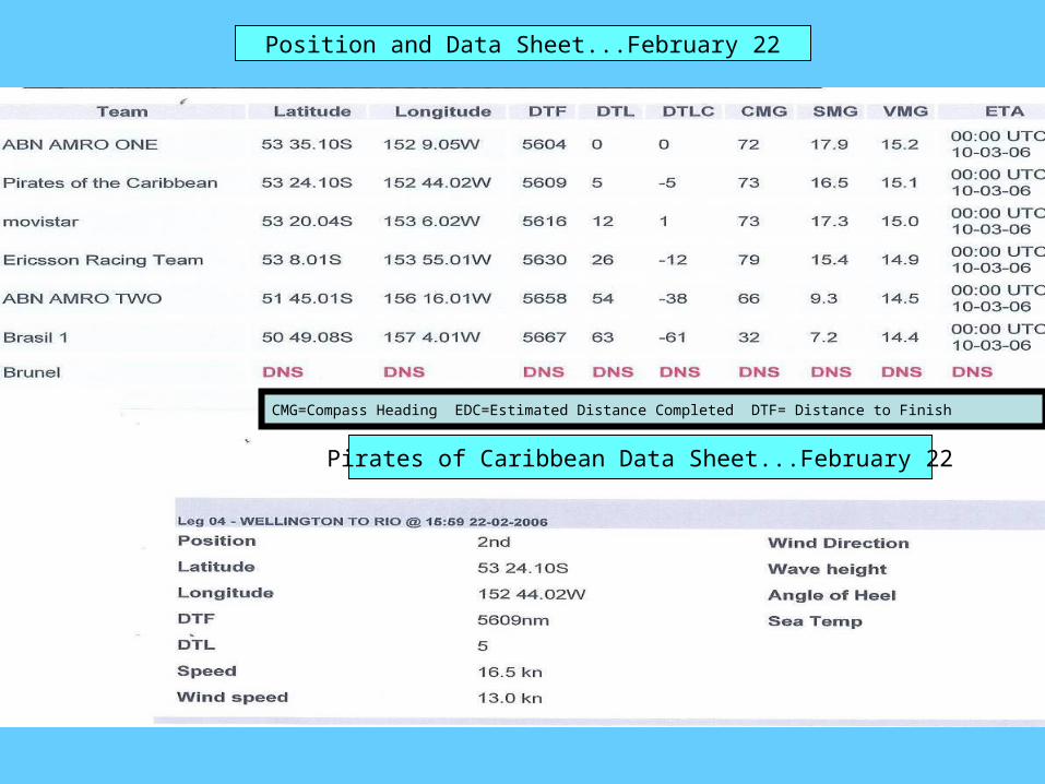
Position and Data Sheet...February 22
Pirates of Caribbean Data Sheet...February 22
CMG=Compass Heading EDC=Estimated Distance Completed DTF= Distance to Finish

Team Date
Rank Latitude Longitude DTF
Max. Speed
Wind Speed
Wind Dir.
Wave Hgt.
Sea Temp CMG
Volvo Ocean Race Data Sheet

Leg 4 – Wellington, New Zealand to Rio de Janeiro
N
E
S
W
Atlantic Ocean
80 s
20 s
0

Plotting SheetLeg 5
Rio de Janeiro to Baltimore

Leg 7 New York to Portsmouth, England

Think of all the treasure hunts you can set up on the playground so your students can practice using their compass skills!
The compass is also a great
tool for teaching angles.

Leg 5 – Rio de Janeiro to Baltimore/AnnapolisMarch 25
5,000 Nautical Miles
Daily Duties Aboard!
Log on to www.volvooceanrace.org. Record data on Daily Data SheetPlot your boat’s position on your Leg 5 mapUse your Daily Data Sheet to answer the following questions: 1. In what direction is your boat sailing? 2. How far is your boat from Rio de Janeiro? 3. How many nautical miles is the closest boat off your stern? 4. How far is your boat from the leader? 5. If your boat continues to sail at its present speed, on what date is your ETA (Estimated
Time of Arrival)? 6. What is your range of wind speed from March 25 to April 1? What reasons can you give
for the change in wind speed? 7. Review your log and create a T-Bar chart reflecting the relationship between the wind
speed and the speed of your boat. 8.Round out the DTF for the fleet, to the nearest ten.
9. What was the average speed of the fleet for today? 10. Through what body of water will you be sailing as you approach Baltimore? 11. Any news from your boat? Check E-mails and news releases. Record news on Comments sheet. 12. When your boat reaches Baltimore, create a headline and a lead paragraph summarizing the highlights of the events aboard your boat for leg 5. 13. Using information from your Daily Data Sheet, create a bar graph showing the distances covered by each boat by April 1.

Date
Name of Boat Comments
Volvo Ocean Race 2005-2006Comment Sheet
Leg______________
Check E-mails and news on www.volvooceanrace.org daily and summarize highlights.

Field Trips
Baltimore/Annapolis...May 5-7Family will travel to Baltimore and Annapolis to see the Volvo boats. After spending a day touring the sites in Baltimore, families will tour colonial
Annapolis, the Naval Academy and Annapolis Harbor. The highlight of the trip will be a walk across the Chesapeake Bay Bridge, where they will watch the boats take off on Leg 6 to New York City.
New York City...Boats will be at South Street Seaport from May 8-11 preparing for Leg 7, New York to Portsmouth, England.
Soundwaters...June 19Sail aboard an 80-foot, three-masted schooner, into Long Island Sound, where
students will get to hoist the sails, haul the fishing net, and learn about Long Island Sound’s ecology at the salt marsh and the water station.
They’ll sit silently for a while and listen to the waves slapping the hull, the sails snapping in the breeze, and they’ll hear the whistle of the wind through the halyards...great time to ” think poetry!”
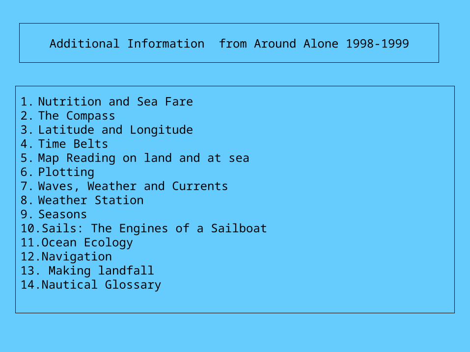
Additional Information from Around Alone 1998-1999
1. Nutrition and Sea Fare2. The Compass 3. Latitude and Longitude4. Time Belts5. Map Reading on land and at sea6. Plotting7. Waves, Weather and Currents8. Weather Station9. Seasons10.Sails: The Engines of a Sailboat11.Ocean Ecology12.Navigation13. Making landfall14.Nautical Glossary