revisits to known topeka shiner localities · revisits to known topeka shiner localities: further...
TRANSCRIPT

Revisits to Known Topeka Shiner Localities:
further evidence of decline in Minnesota
Brett C. Nagle
Division of Ecological and Water Resources
Minnesota Department of Natural Resources
March 2014
submitted to:
Richard J. Baker
Endangered Species Coordinator
Division of Ecological Resources
Minnesota Department of Natural Resources
500 Lafayette Road
St. Paul, Minnesota 55155

TABLE OF CONTENTS
ABSTRACT .................................................................................................................................................... 3
APPENDIX A: MAP 1: 2013 SITE REVISITS.
APPENDIX B: TABLE 1. DESCRIPTIONS OF 25 SITES REVISITED IN 2013, INCLUDING
INTRODUCTION ............................................................................................................................................. 4
METHODS ..................................................................................................................................................... 5
RESULTS ....................................................................................................................................................... 6
DISCUSSION .................................................................................................................................................. 6
LITERATURE CITED ..................................................................................................................................... 10
FIGURES ...................................................................................................................................................... 11
TOPEKA SHINER PRESENCE/ABSENCE INFORMATION FROM PREVIOUS VISITS
APPENDIX C: VOUCHER AND HABITAT PHOTOGRAPHS
2

ABSTRACT
Since 2004, the Minnesota Department of Natural Resources has monitored presence/absence of
the federally endangered Topeka shiner (Notropis topeka) at randomly selected sites within the
federally designated critical habitat. Throughout the first seven years of monitoring (2004-2010),
Topeka shiners were present at an average of 76.4% of randomly selected sites, although
surveyors in 2009 and 2010 noted an apparent decline in relative abundance at sites where the
species was present. Monitoring surveys conducted in 2010, 2012 and 2013 found the lowest to
date percentages of sites where the species was present (60%, 40%, and 30% respectively). This
shift in prevalence motivated a second set of surveys in 2013 to revisit sites from recent
monitoring surveys where the species was present in relatively high numbers. Results are
presented for presence/absences surveys at 25 known Topeka shiner localities. Of 25 sites that
were revisited in 2013, the species was present at 16 sites in low numbers relative to previous
visits. Results from this and previous sampling efforts are indicative of a decline in prevalence of
Topeka shiners in Minnesota. Standardization of catch effort at a set of permanent monitoring
sites in addition to the annual randomized site selection within the critical habitat is
recommended to further characterize Topeka shiner population dynamics in MN.
3

INTRODUCTION
In 2004, the Minnesota Department of Natural Resources began a program to monitor
populations of Topeka shiners within the state. Based upon recommendations from the Topeka
Shiner Recovery Team, a protocol was established to conduct a presence/absence survey of
Topeka shiners at twenty randomly selected reaches of stream from within the federally-
designated critical habitat in the Big Sioux and Rock River drainages in southwestern MN.
Surveys were conducted annually from 2004 to 2010 and Topeka shiners were found at an
average of 76.4% of sites over the seven year period (Ceas and Anderson 2004; Ceas and
Monstad 2005, 2006; Ceas and Plain 2007; Ceas and Larson 2008, 2009, 2010). These values
ranged from Topeka shiners present at 90% of the 20 randomly-selected reaches of streams in
2006, to 60% of sites in 2010. Although the annual percentage of sites where Topeka shiners
were present was relatively stable for the first six years of monitoring (Figure 1), surveyors
began to note a marked decline in relative abundance of the species as well as a decline in the
number of segments where the species was present (Figure 2) (Ceas and Larson 2009, 2010).
Results from monitoring surveys conducted in 2012 and 2013 provided further evidence
of a decline in prevalence; the percentage of segments where the species was present fell to 40%
and 30% respectively, the lowest recorded values since the monitoring began in 2004 (Nagle and
Larson 2013). At segments where Topeka shiners were present, they were observed in very low
numbers, with the majority of segments (10 of 14) represented by five or less individuals.
In response to rapidly declining numbers in annual randomized monitoring efforts, in
2013 an additional round of surveys was initiated to determine if known localities identified in
previous monitoring surveys still harbored populations of Topeka shiners. A set of known
localities from recent monitoring surveys (2008, 2009, and 2010) was selected and site revisits
4

were conducted to determine presence/absence. Results of these surveys are detailed in this
report and provide further evidence of a decline in the prevalence of Topeka shiners in
Minnesota.
METHODS
Topeka shiners were collected at 43 sites within the 60 randomly selected one-mile
segments visited in 2008-2010 (Ceas and Larson 2008, 2009, 2010) following the protocol first
implemented by Ceas and Anderson (2004). A set of 25 of these sites was selected to revisit.
Sites were selected to provide geographic coverage across the federally designated critical
habitat, and sites were prioritized where the surveyor’s qualitative assessment of Topeka shiner
relative abundance was ‘abundant’ or ‘common’ (see Ceas and Larson 2010 for a description of
relative abundance assessment). Of the 25 sites, ten were ranked as ‘abundant’, ten were ranked
‘common’, two were ranked ‘present’, and three were not ranked by the surveyor.
A handheld GPS unit was used to navigate to the coordinates of the capture sites from
previous monitoring surveys. Photographs of capture sites presented in Ceas and Larson (2008,
2009, 2010) were employed to aid in site location. Presence/absence surveys were conducted at
each site with a 15’x5’x1/8” pole seine. Due to habitat heterogeneity, sampling effort was not
standardized. Sites were sampled for approximately 30 minutes before Topeka shiners would be
considered absent. Surveys were conducted in July 2013 during periods of normal flow. See
Map1 and Table 1 for a complete list of site locations.
5

RESULTS
Topeka shiners were collected at 16 of the 25 previously-known localities. See Table 1
for a complete list of sites, Topeka shiner presence/absence, number of individuals sampled, a
brief description of the habitat, and information from the initial survey at each site. Topeka
shiners were observed in low numbers at several of the sites where they were present; five or less
individuals were collected at eight of the sixteen sites where they were present.
Plains topminnow (Fundulus sciadicus), is a Threatened Species in Minnesota. Although
survey efforts specifically targeted Topeka shiner localities, the two species have a shared habitat
preference and frequently co-occur in reaches of stream with low flow and off-channel areas
(Pflieger 1997). Plains topminnows were collected at two of the 14 sites that were sampled
within their range: a single individual at site 96-4 (Kanaranzi Creek), and a single individual at
site 97-1 (Poplar Creek).
DISCUSSION
The randomized stream segment selection employed in annual monitoring surveys (2004-
-2013) may result in some portion of the segments falling on reaches of stream that do not
contain suitable Topeka shiner habitat or in portions of the watershed that have not historically
harbored large populations of the species, yet the species was present at an average of over 75%
of these segments through 2010. Site revisits conducted in 2013 found the species present at only
64% (16/25) of localities previously known to harbor Topeka shiners in relatively high
abundance. Not only were site revisits unable to demonstrate presence of the species at nine of
the 25 known localities, few individuals (< 5) were captured at the majority of sites where they
were present. Ceas and Larson (2008, 2009) reported hundreds of individuals at some sites where
6

the species was particularly abundant, while intense survey efforts at over 65 sites in 2012-2013
yielded only 176 total individuals of Topeka shiners. These results, in conjunction with those
presented by Ceas and Larson (2010) and Nagle and Larson (2013) provide further evidence of a
rapid decline in the prevalence of Topeka shiners in Minnesota since 2009.
The nine known Topeka shiner localities where site revisits failed to document the
species’ presence were located on or near the main stem of the Rock River (88-1, 113-1, 123-1),
in the Pipestone Creek drainage (83-1, 84-1, 85-1), and in the Kanaranzi Creek drainage (96-4,
97-1, 98-2) (see Map 1). These latter two drainages are of particular concern, as these streams
have historically harbored large populations of Topeka shiners; both systems have shown marked
and dramatic declines in recent years.
Pipestone Creek
Throughout DNR monitoring efforts conducted from 2004-2010, Topeka shiners were
present at 100% (n=15) of randomly selected stream segments within the Pipestone Creek
drainage. In 2012 and 2013 monitoring efforts, four one-mile segments were surveyed in the
Pipestone Creek watershed, and the species was documented (three individuals) at only a single
site (146-6; Nagle and Larson 2013). Four sites, where Topeka shiners were considered to be
common and were collected in the first seine haul in 2008-2009 monitoring surveys, were
selected for revisits in 2013 (this report). Site revisits to these four localities documented the
species at only a single site (104-1): two individuals were collected among hundreds of sand
shiners (Notropis stramineus) and central stonerollers (Campostoma anomalum). Ceas and
Larson (2007) noted increasing levels of siltation at sites in the Pipestone Creek watershed
relative to previous years, which may be a factor in the observed decline in this system.
7

Kanaranzi Creek
Kanaranzi Creek has historically harbored a large and stable population of Topeka
shiners (Dahle 2001). Throughout monitoring efforts in 2004-2010, the species was present at
more than 80% (18/22) of randomly selected segments. However, a marked decrease in relative
abundance is apparent in recent years, as very few individuals were collected in 2009 and 2010
(Ceas and Larson 2009, 2010). Topeka shiners were present in five of the seven segments that
were surveyed in these years, but were observed in very low numbers; four of these segments
were represented by a single individual. Three known localities in the Kanaranzi Creek drainage
were selected for revisits in 2013, and Topeka shiners were not present at any of them.
Despite a general trend of decline across the Topeka shiner’s range in Minnesota, site
revisits conducted in 2013 confirmed the presence of remaining watersheds that appear to harbor
large, breeding populations of the federally endangered shiner, and nine of the sites that were
revisited exhibited comparable relative abundance to the initial visits. Topeka shiners were
collected in spawning condition in high abundance relative to other fish species at sites in the
West Branch of the Little Rock (119-1), Champepadan (95-1), and Beaver (91-1) Creek
drainages. Individuals in full spawning condition were only collected at sites that had some
amount of firm, course substrate available. Sites with deeply silted substrate at times yielded
high numbers of individuals, but none were observed in spawning condition.
Conclusions
As the monitoring protocol was designed to be a rapid assessment of then-stable (Dahle
2001; Hatch 2001) MN populations, presence/absence surveys were conducted with no
standardization of catch effort or enumeration of individuals collected. Given that results of
8

recent monitoring efforts have demonstrated a loss of stability in these populations, it is
recommended that further steps be taken to provide more quantitative documentation of Topeka
shiner distribution and abundance. A standardized catch effort conducted annually at a set of
permanent monitoring sites would provide a more detailed characterization of Topeka shiner
population dynamics in Minnesota. Further, annual characterization of habitats at these stations
could potentially correlate specific habitat alterations with Topeka shiner prevalence.
9

LITERATURE CITED
Ceas, P. A., and Y. C. Anderson. 2004. Results of a pilot monitoring project for Topeka shiners
in southwestern Minnesota. Minnesota Department of Natural Resources Report.
Ceas, P. A., and Y. A. Monstad. 2005. Results of a pilot monitoring project for Topeka shiners
in southwestern Minnesota: Year two. Minnesota Department of Natural Resources Report.
Ceas, P. A., and Y. A. Monstad. 2006. Topeka shiner monitoring in Minnesota: Year three.
Minnesota Department of Natural Resources Report.
Ceas, P. A., and A. M. Plain. 2007. Topeka shiner monitoring in Minnesota: Year four.
Minnesota Department of Natural Resources Report.
Ceas, P. A., and K. A. Larson. 2008. Topeka shiner monitoring in Minnesota: Year five.
Minnesota Department of Natural Resources Report.
Ceas, P. A., and K. A. Larson. 2009. Topeka shiner monitoring in Minnesota: Year six.
Minnesota Department of Natural Resources Report.
Dahle, S. P. 2001. Studies of Topeka shiner (Notropis Topeka) life history and distribution in
Minnesota. M.S. Thesis, University of Minnesota, St. Paul.
Hatch, J. T. 2001. What we know about Minnesota’s first endangered fish species: the Topeka
shiner. Journal of the Minnesota Academy of Science. 65:39-46.
61: 210-217.
Nagle, B.C. and K.A. Larson. 2013. Topeka shiner monitoring in Minnesota: 2012-2013.
Minnesota Department of Natural Resources Report.
Pflieger, W. L. 1997. The fishes of Missouri. Missouri Department of Conservation.
10

0
10
20
30
40
50
60
70
80
90
100
'04 '05 '06 '07 '08 '09 '10 '12 '13
Figure 1: Percentage of randomly selected stream segments where Topeka shiners were
captured, 2004-2013.
12
10
8
6
4
2
0 '06 '07 '08 '09 '10 '12 '13
Figure 2: Number of sites where Topeka shiners were considered ‘common’ or ‘abundant’:
2006-2013.
11

101 Broadway, Gilbert, MN
Map 1:
2013 site revisits 101-1
85-1 84-1
104-1
83-1
86-1
127-3
109-1
112-1
91-1
87-1
123-1
108-2 88-1
113-1
96-4
135-1
94-1
115-1
97-1
98-2
119-1
99-1
120-1
Topeka Shiners
Present
Topeka Shiners
Absent
95-1
Topeka Shiner
Critical Habitat

Table 1. Locations of the 25 sites that were revisited in 2013: a brief habitat description for each site,
information from prior visits during monitoring surveys, Lat/Long coordinates, and a "Common Location" descriptor
(approximate mileage & direction to nearest town/highways). Habitat type is an aproximate characterization of the specific
sample site: pooled areas along the stream channel ('pool'); low-flow reaches of stream and backwater habitats
along the main channel boundary ('in-channel/MCB'); ponds adjacent to the sample reach that are not connected to the
main channel of the stream ('pool, off-channel').
Site Stream Name County Township Name Habitat Type Latitude Longitude
83-1 South Branch Pipestone Creek
3 mi S Cazevovia Pipestone Troy in-channel/MCB 44.02348300 -96.36816800
2013 Visit:
Habitat Description:
Substrate:
No Topeka shiners captured.
Slowly flowing , 3m wide stream. Some submerged macrophytes,reed canary grass on banks.
Gravel, sand, silt. Silt deep on MCB.
Prior Visits Topeka shiners were common at this site in 2004, 2007, and 2008 surveys; they were sampled in the first
seine haul in all three visits. Surveyors noted an increase in siltation between 2004 and 2007 surveys.
Site
84-1
Stream Name
North Branch Pipestone Creek
at US Hwy 75, 5.5 mi N of Pipestone
County
Pipestone
Township Name
Troy
Habitat Type
pool
Latitude
44.08139100
Longitude
-96.30800700
2013 Visit:
Habitat Description:
Substrate:
No Topeka shiners captured.
Slowly flowing , 3-5m wide stream. Stream is deeply pooled downstream of bridge.
Thick algal mats and submerged vegetation. Segment appears to have been channelized
Gravel, silt, sand
2008 Visit Topeka Shiners were common and were captured on the first seine haul

Table 1 Continued
Site Stream Name County Township Name Habitat Type Latitude Longitude
85-1 North Branch Pipestone Creek
3 mi W of Holland Pipestone Grange pool 44.09503200 -96.25733500
2013 Visit:
Habitat Description:
Substrate:
No Topeka shiners captured.
Pooled area downstream of CR 8 bridge. Black bullhead very abundant, very few minnows.
Gravel, cobble, silt
Prior Visits Topeka shiners were common and were captured on the first seine haul in 2004 and 2008.
Site Stream Name County Township Name Habitat Type Latitude Longitude
86-1 Split Rock Creek
S end of S.R.C. State Park Pipestone Eden pool, off-channel 43.8919
at Co Hwy 20
2013 Visit: 3 Topeka shiners captured in approx 30 minutes of seining
Habitat Description: Stream is a series of interconnected pools. Sampled in off channel pool, ~15 m from stream.
Orangespotted sunfish extremely abundant in pool (>200 per seine haul).
Substrate: Boulder, silt, gravel
-96.3682
2008 Visit: Topeka shiners captured in first seine haul and were considered to be
"extremely abundant ( probably 100s in just the one pool)".

Table 1 Continued
Site Stream Name County Township Name Habitat Type Latitude Longitude
87-1 Poplar Creek
4 mi WSW of Edgerton Pipestone Elmer in-channel/MCB 43.86598500 -96.20459300
2013 Visit:
Habitat Description:
Substrate:
A single Topeka shiner captured in approx 30 minutes of seining
A sandy backwater along the main channel of the stream. Stream is a small (2-3m wide) meandering headwater.
Sand, gravel, silt
2008 Visit: Topeka Shiners were common and were captured on the first seine haul
Site
88-1
Stream Name
Rock River
0.5 mi W of Edgerton
County
Pipestone
Township Name
Osborne
Habitat Type
in-channel/MCB
Latitude
43.87779200
Longitude
-96.14987700
2013 Visit:
Habitat Description:
Substrate:
No Topeka shiners captured.
8m wide, sluggish stream. No perceptible flow. Sampled in a deeply silted oxbow.
deep (1m) silt over sand
2008 Visit: Topeka Shiners were common and were captured on the first seine haul
Site
91-1
Stream Name
Beaver Creek at Co Rd 8
County
Rock
Township Name
Mound
Habitat Type
pool
Latitude
43.688601
Longitude
-96.28943400
2013 Visit:
Habitat Description:
Substrate:
11 Topeka shiners captured in the first two seine hauls. Males were tuberculate and in spawning condition.
8-10m wide shallow, pooled area. No flow.
Gravel, silt, large cobble
2008 Visit: Topeka Shiners were abundant and were captured on the first seine haul

Table 1 Continued
Site Stream Name County Township Name Habitat Type Latitude Longitude
94-1 Elk Creek at Co Hwy 3, 1 mi W of Magnolia Rock Luverne in-channel/MCB 43.65984300 -96.09298500
2013 Visit:
Habitat Description:
Substrate:
3 Topeka shiners captured in approx 30 min of seining
3m wide stream with no perceptible flow. Deeply silted and mucky substrate.
Deep silt and muck (0.5m) over sand
2008 Visit: Topeka Shiners were abundant and were captured on the first seine haul
Site
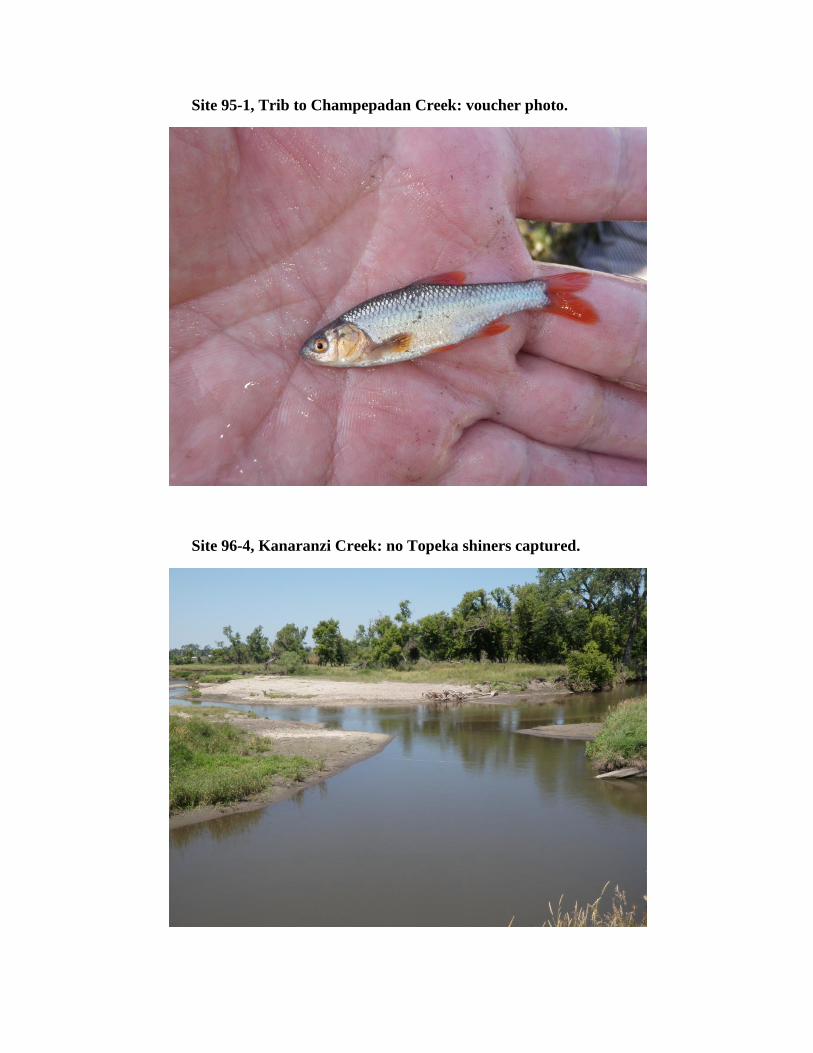
95-1
Stream Name
Trib to Champepadan Creek at Co Rd 8, 2.5 mi S of Kenneth
County
Rock
Township Name
Vienna
Habitat Type
pool
Latitude
43.71754700
Longitude
-96.08623300
2013 Visit:
Habitat Description:
Substrate:
12 Topeka shiners captured on first seine haul. Males were tuberculate and in spawning condition.
15 m wide pool at culvert at Co Rd 8.
Gravel, silt
2008 Visit: Topeka shiners were very abundant and were captured on the first seine haul.
Site
96-4
Stream Name
Kanaranzi Creek 4.5 mi SSW of Kanaranzi
County
Rock
Township Name
Kanaranzi
Habitat Type
in-channel/MCB
Latitude
43.51205300
Longitude
-96.09340700
2013 Visit:
Habitat Description:
Substrate:
No Topeka shiners captured.
Ample sandbars and backwater habitat along MCB.
Gravel, sand, silt (deep in off-channel areas)
2008 Visit: Topeka shiners were not common and were captured at the fourth sample site along the segment.
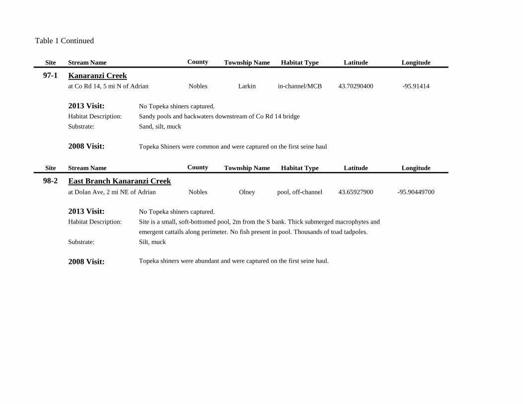
Table 1 Continued
Site Stream Name County Township Name Habitat Type Latitude Longitude
97-1 Kanaranzi Creek
at Co Rd 14, 5 mi N of Adrian Nobles Larkin in-channel/MCB 43.70290400 -95.91414
2013 Visit:
Habitat Description:
Substrate:
No Topeka shiners captured.
Sandy pools and backwaters downstream of Co Rd 14 bridge
Sand, silt, muck
2008 Visit: Topeka Shiners were common and were captured on the first seine haul
Site
98-2
Stream Name
East Branch Kanaranzi Creek
at Dolan Ave, 2 mi NE of Adrian
County
Nobles
Township Name
Olney
Habitat Type
pool, off-channel
Latitude
43.65927900
Longitude
-95.90449700
2013 Visit:
Habitat Description:
Substrate:
No Topeka shiners captured.
Site is a small, soft-bottomed pool, 2m from the S bank. Thick submerged macrophytes and
emergent cattails along perimeter. No fish present in pool. Thousands of toad tadpoles.
Silt, muck
2008 Visit: Topeka shiners were abundant and were captured on the first seine haul.

Table 1 Continued
Site Stream Name County Township Name Habitat Type Latitude Longitude
99-1 West Branch Little Rock Creek
4 mi WNW of Ransom Nobles Little Rock pool 43.55766100 -95.86343100
2013 Visit:
Habitat Description:
Substrate:
4 Topeka shiners captured in first seine haul
50m long pool downstream of bridge. No perceptible flow. Abundant filamentous algae.
Stream is 2-3m wide downstream of pool. Johnny darters very abundant.
0.5m silt over gravel and cobble
2008 Visit: Topeka shiners were collected on the first seine.
Site
101-1
Stream Name
Medary Creek
7.5 mi W of Lake Benton
County
Lincoln
Township Name
Verdi
Habitat Type
pool
Latitude
44.24785000
Longitude
-96.44218000
2013 Visit:
Habitat Description:
Substrate:
8 Topeka shiners captured: 2 in the first seine haul, 6 captured in second.
Extensive pool habitat upstream of bridge. Water was deep enough to hamper seining. Deep silt (0.5m) in
off-channel areas.
Cobble, gravel, muck
2009 Visit: Topeka shiners were captured on the first seine haul and were "extremely abundant".

Table 1 Continued
Site Stream Name County Township Name Habitat Type Latitude Longitude
104-1 North Branch Pipestone Creek
at Co Rd 76, 1.5 mi NE Cazenovia Pipestone Troy pool 44.07115000 -96.34819600
2013 Visit:
Habitat Description:
Substrate:
2 Topeka shiners captured: a single individual among >200 N. stramineus on the 3rd seine haul,
and the second individual was collected among hundreds of other minnows
(mostly Campostoma and N. stramineus ) in the fourth seine haul.
Long, shallow pool (7-10m wide) downstream of bridge upstream of small riffle. Little/no flow.
Firm. Gravel, sand, silt
2009 Visit: Topeka shiners were common and were collected on the first seine haul.
Site
108-2
Stream Name
Split Rock Creek
at Co Rd 51, 2 mi NE of Jasper
County
Pipestone
Township Name
Eden
Habitat Type
pool
Latitude
43.878304
Longitude
-96.379794
2013 Visit:
Habitat Description:
Substrate:
6 Topeka shiners captured in the first seine haul, despite boulders and large cobble.
Small, bouldered pool, connected to pooled area at bridge.
Gravel, cobble, boulders
2009 Visit: Topeka shiners were collected in the first seine haul of the second site.

Table 1 Continued
Site Stream Name County Township Name Habitat Type Latitude Longitude
109-1 Split Rock Creek
1 mi SW Jasper Rock Rose Dell pool 43.83360600 -96.41170100
2013 Visit:
Habitat Description:
Substrate:
5 Topeka shiners captured in third seine haul. Males were in spawning condition.
Side pool at bend in stream. No flow. Some sparse vegetation.
Gravel, sand, silt
2009 Visit: Topeka shiners were common and were captured on the first seine haul.
Site
112-1
Stream Name
Beaver Creek
5 mi NW of Luverne
County
Rock
Township Name
Mound
Habitat Type
pool
Latitude
43.70715200
Longitude
-96.28818400
2013 Visit:
Habitat Description:
Substrate:
6 Topeka shiners captured in first two tangled seine hauls; turbid water and irregular bedrock
substrate made seining difficult.
Shallow, sluggish stream with widened pools
Bedrock, silt
2009 Visit: Topeka shiners were abundant and were captured on the first seine haul.
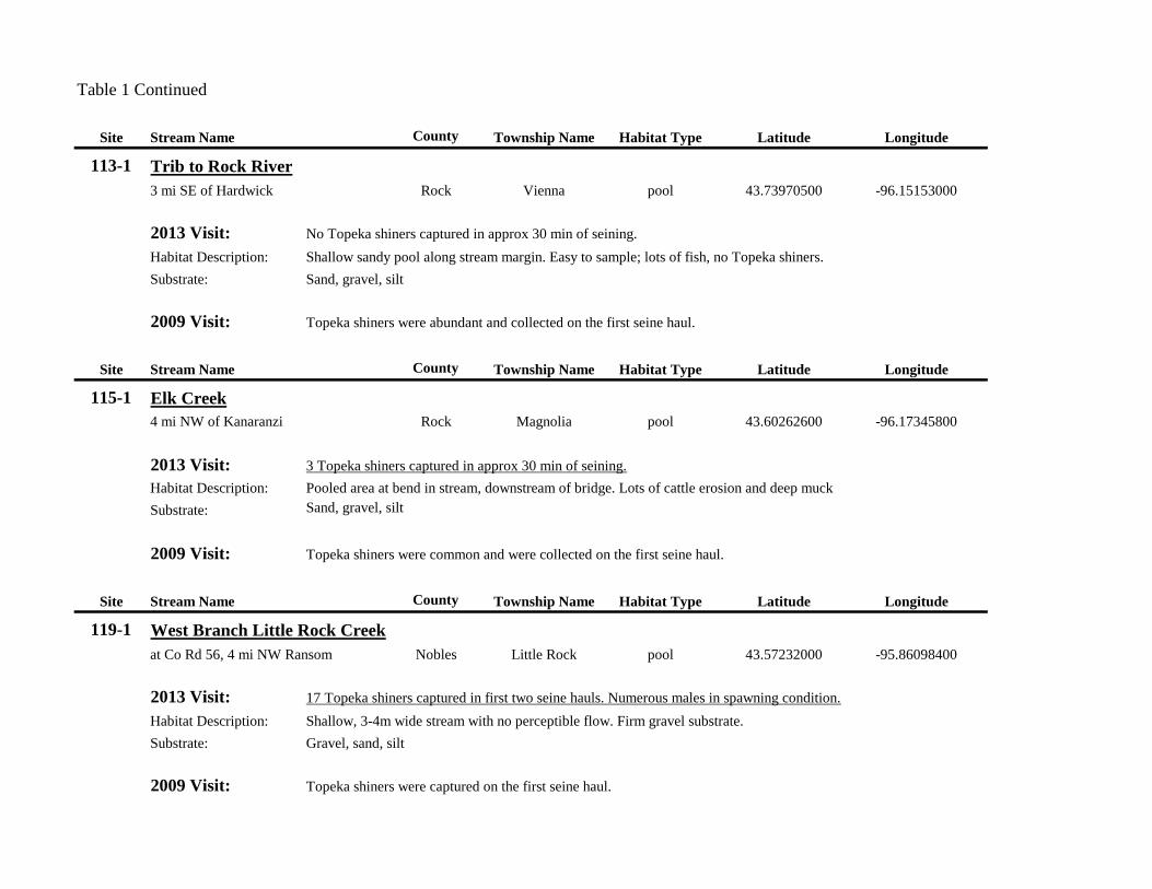
Table 1 Continued
Site Stream Name County Township Name Habitat Type Latitude Longitude
113-1 Trib to Rock River
3 mi SE of Hardwick Rock Vienna pool 43.73970500 -96.15153000
2013 Visit:
Habitat Description:
Substrate:
No Topeka shiners captured in approx 30 min of seining.
Shallow sandy pool along stream margin. Easy to sample; lots of fish, no Topeka shiners.
Sand, gravel, silt
2009 Visit: Topeka shiners were abundant and collected on the first seine haul.
Site
115-1
Stream Name
Elk Creek
4 mi NW of Kanaranzi
County
Rock
Township Name
Magnolia
Habitat Type
pool
Latitude
43.60262600
Longitude
-96.17345800
2013 Visit:
Habitat Description:
Substrate:
3 Topeka shiners captured in approx 30 min of seining.
Pooled area at bend in stream, downstream of bridge. Lots of cattle erosion and deep muck
Sand, gravel, silt
2009 Visit: Topeka shiners were common and were collected on the first seine haul.
Site
119-1
Stream Name
West Branch Little Rock Creek
at Co Rd 56, 4 mi NW Ransom
County
Nobles
Township Name
Little Rock
Habitat Type
pool
Latitude
43.57232000
Longitude
-95.86098400
2013 Visit:
Habitat Description:
Substrate:
17 Topeka shiners captured in first two seine hauls. Numerous males in spawning condition.
Shallow, 3-4m wide stream with no perceptible flow. Firm gravel substrate.
Gravel, sand, silt
2009 Visit: Topeka shiners were captured on the first seine haul.

Table 1 Continued
Site Stream Name County Township Name Habitat Type Latitude Longitude
120-1 West Branch Littler Rock Creek
2.5 mi W of Ransom Nobles Little Rock pool 43.54323400 -95.84751500
2013 Visit:
Habitat Description:
Substrate:
7 Topeka shiners captured in first two seine hauls.
Deeply silted pooled area downstream of bridge.
Deep silt (0.5m) over gravel
2009 Visit: Topeka shiners were common and were collected on the first seine haul.
Site
123-1
Stream Name
Rock River 4 mi N of Edgerton
County
Pipestone
Township Name
Osborne
Habitat Type
in-channel/MCB
Latitude
43.93561
Longitude
-96.1364
2013 Visit:
Habitat Description:
Substrate:
No Topeka shiners captured.
Very slowly flowing, 5m wide reach of stream
Gravel, sand, silt
2010 Visit: A single Topeka shiner was collected.
Site
127-3
Stream Name County Township Name
Willow Creek Pipestone Osborne
2.5 mi E South Dakota state line; 2.5 mi S Lincoln Co. line
Habitat Type
in-channel/MCB
Latitude
43.93561
Longitude
-96.1364
2013 Visit:
Habitat Description:
Substrate:
3 Topeka shiners captured in the first seine haul among >1000 Hybognathus hankinsoni
a 30m x 20m stock pond with sparse submerged macrophytes
muck, silt, sand
2010 Visit: Topeka shiners were abundant.

Table 1 Concluded
Site Stream Name County Township Name Habitat Type Latitude Longitude
135-1 Elk Creek
1.5 mi N of Magnolia
Rock Magnolia pool/off-channel 43.602626 -96.173458
2013 Visit:
Habitat Description:
Substrate:
1 Topeka shiner collected in approx 30 min of seining. Pimephales promelas was very abundant in this pool.
The landowner stated that this pond was completely dry in late summer 2012.
We briefly sampled in another pool that was connected to Elk Creek that was >3m deep and difficult to sample.
2 individuals were collected in a single seine-dip on the margin of the pool.
Approximately 20m x 30m off-channel pond, with soft substrate and sparse submerged vegetation.
Sand, muck
2010 Visit: Topeka shiners were abundant and were captured on the first seine haul.
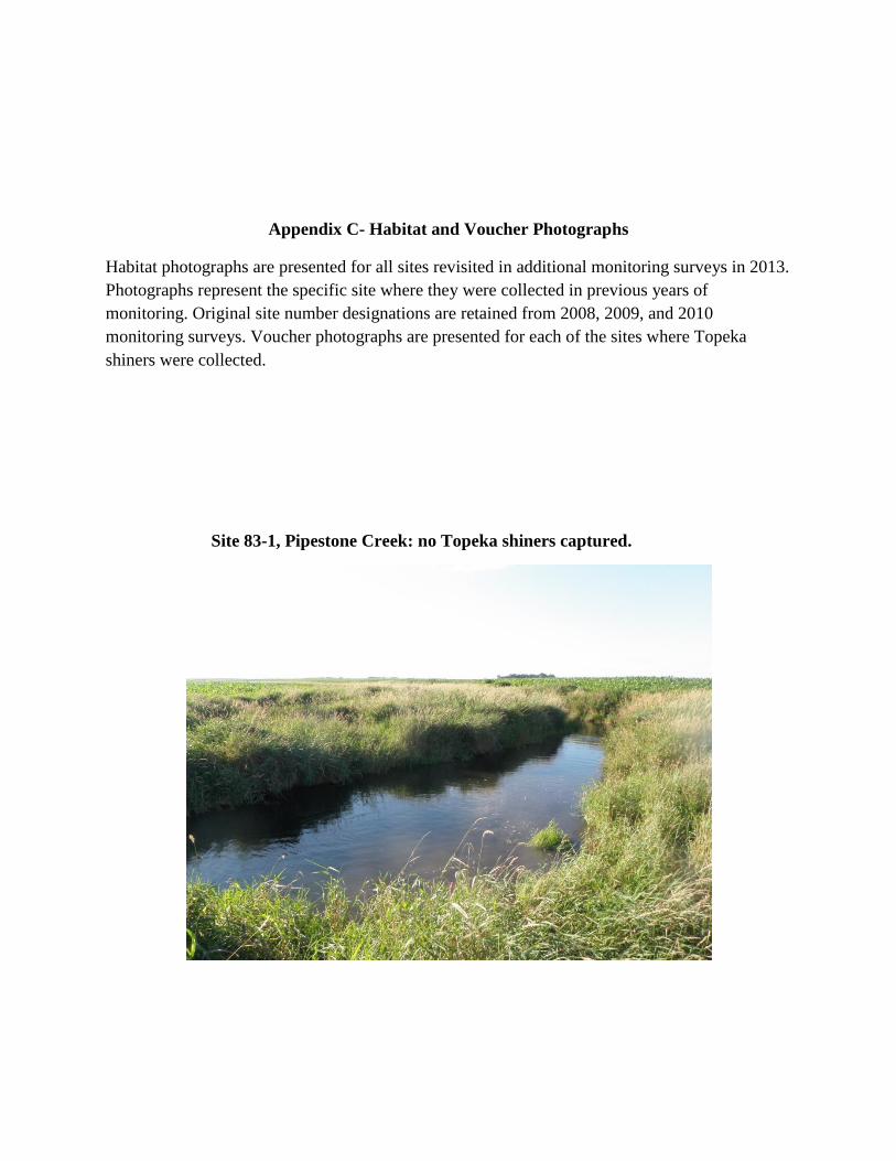
Appendix C- Habitat and Voucher Photographs
Habitat photographs are presented for all sites revisited in additional monitoring surveys in 2013.
Photographs represent the specific site where they were collected in previous years of
monitoring. Original site number designations are retained from 2008, 2009, and 2010
monitoring surveys. Voucher photographs are presented for each of the sites where Topeka
shiners were collected.
Site 83-1, Pipestone Creek: no Topeka shiners captured.
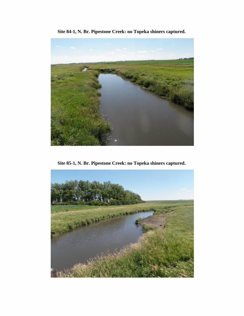
Site 84-1, N. Br. Pipestone Creek: no Topeka shiners captured.
Site 85-1, N. Br. Pipestone Creek: no Topeka shiners captured.

Site 86-1, N. Br. Pipestone Creek: habitat and voucher photos.

Site 87-1, Poplar Creek: habitat and voucher photos.

Site 88-1, Rock River: no Topeka shiners captured.
Site 91-1, Beaver Creek: habitat photo.

Site 91-1, Beaver Creek: voucher photo.
Site 94-1, Elk Creek: habitat photo.

Site 94-1, Elk Creek: voucher photo.
Site 95-1, Trib to Champepadan Creek: habitat photo.
Site 95-1, Trib to Champepadan Creek: voucher photo.
Site 96-4, Kanaranzi Creek: no Topeka shiners captured.

Site 97-1, Kanaranzi Creek: no Topeka shiners captured.
Site 98-2, E. Br. Kanaranzi Creek: no Topeka shiners captured.

Site 99-1, Little Rock Creek: habitat photo.
Site 99-1, Little Rock Creek: voucher photo.

Site 101-1, Medary Creek: habitat photo.
Site 101-1, Medary Creek: voucher photo.
Site 104-1, N. Br. Pipestone Creek: habitat photo.
Site 104-1, N. Br. Pipestone Creek: voucher photo.
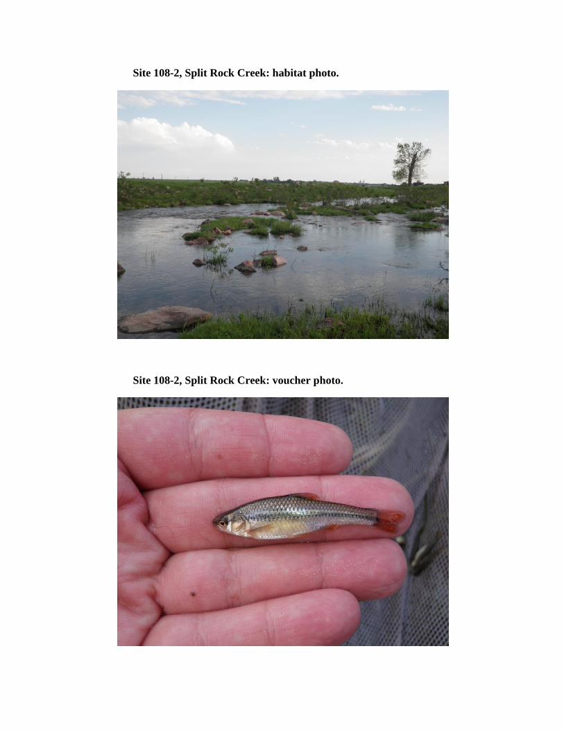
Site 108-2, Split Rock Creek: habitat photo.
Site 108-2, Split Rock Creek: voucher photo.
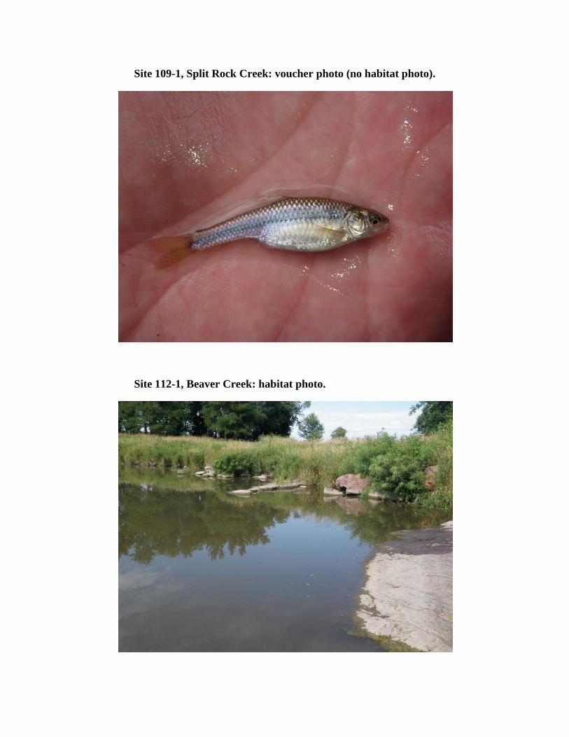
Site 109-1, Split Rock Creek: voucher photo (no habitat photo).
Site 112-1, Beaver Creek: habitat photo.
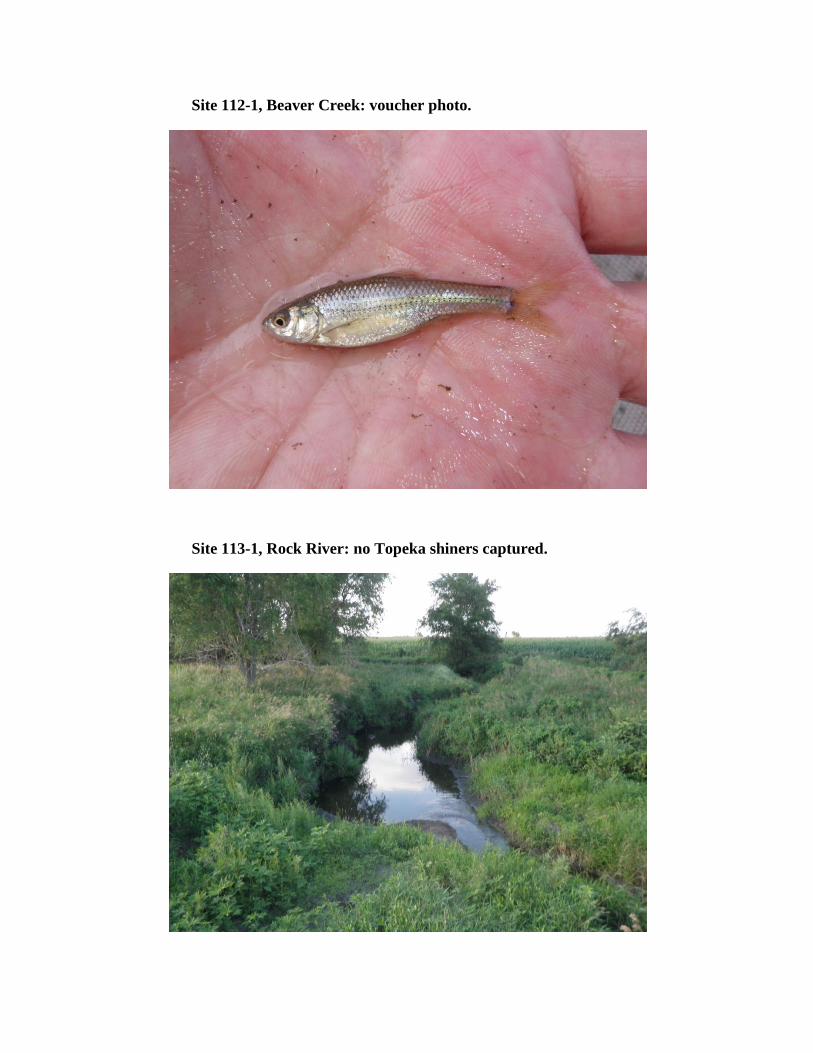
Site 112-1, Beaver Creek: voucher photo.
Site 113-1, Rock River: no Topeka shiners captured.
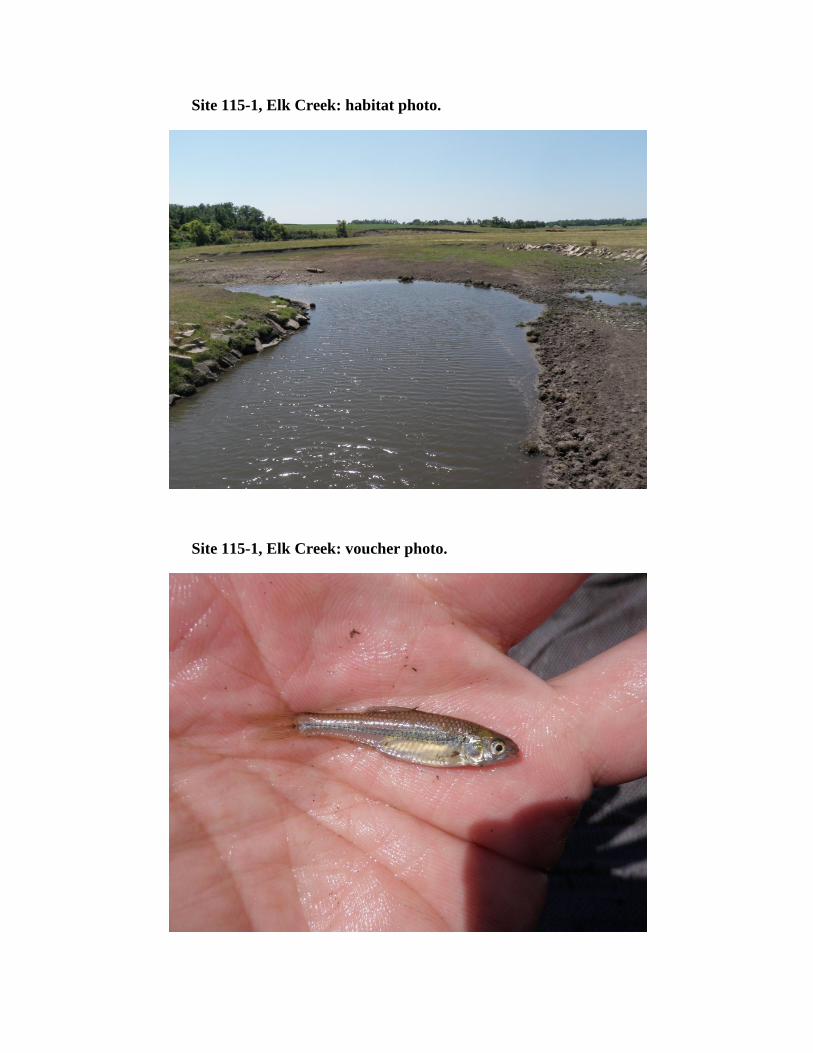
Site 115-1, Elk Creek: habitat photo.
Site 115-1, Elk Creek: voucher photo.
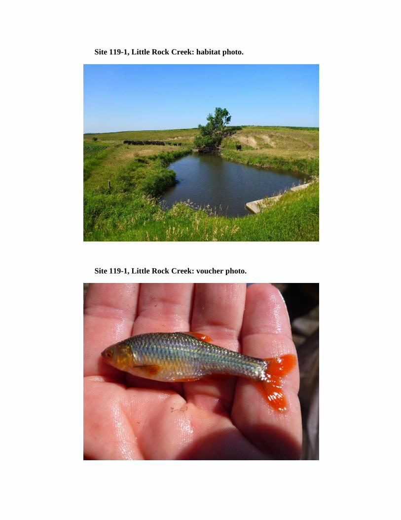
Site 119-1, Little Rock Creek: habitat photo.
Site 119-1, Little Rock Creek: voucher photo.
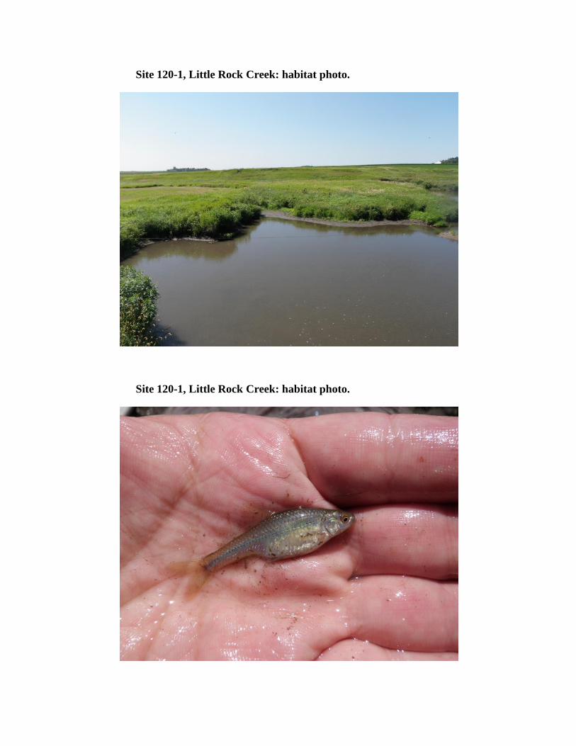
Site 120-1, Little Rock Creek: habitat photo.
Site 120-1, Little Rock Creek: habitat photo.
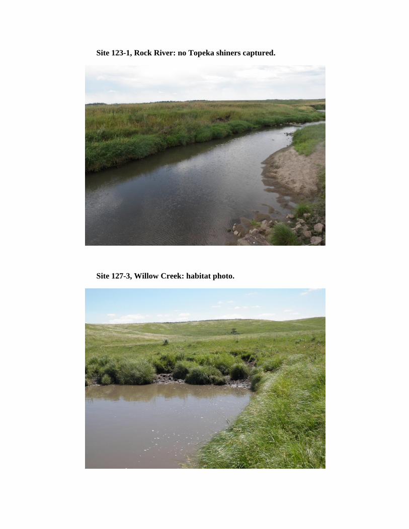
Site 123-1, Rock River: no Topeka shiners captured.
Site 127-3, Willow Creek: habitat photo.
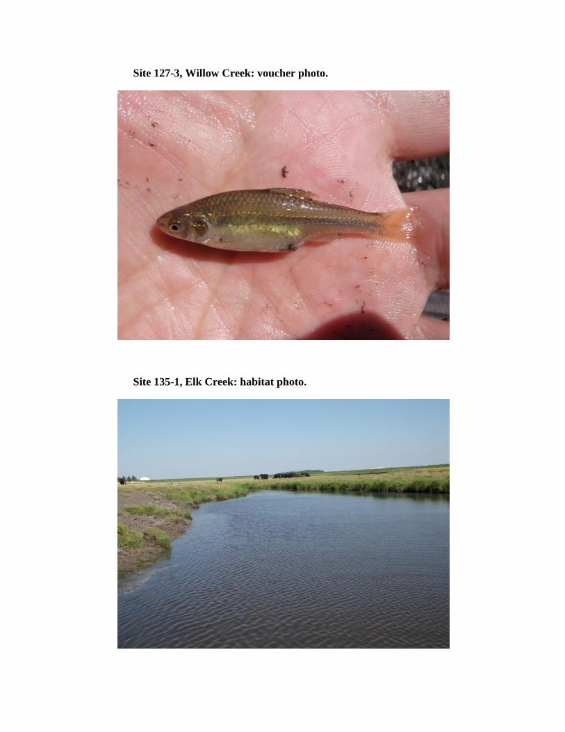
Site 127-3, Willow Creek: voucher photo.
Site 135-1, Elk Creek: habitat photo.

Site 135-1, Elk Creek: voucher photo.