review of desktop landfill gas investigation for 52 golf ......29327 lfg ra 52 golf rd, oakleigh...
TRANSCRIPT
5 Burwood Road
Hawthorn VIC 3122 P: (03) 9508 0100 F: (03) 9509 6125
E: [email protected] ABN: 12 142 106 581
7 December 2018 G0092:RPH
29327 LFG RA 52 Golf Rd, Oakleigh Sth-Rev01
Joe Khougaz
Golf Road Project Development
C/o VIMG
Level 27/367 Collins Street
Melbourne VIC 3000
Dear Joe,
Review of Desktop Landfill Gas Investigation for 52 Golf Road, Oakleigh South,
Victoria
Prensa Pty Ltd (Prensa) was engaged by Golf Road Project Development Pty Ltd (Golf Road Project
Development) on behalf of VIC Investments Management Group Pty Ltd (VIMG) to review the Desktop
Landfill Gas Investigation previously completed by Prensa for the property located at 52 Golf Road,
Oakleigh South (the Site). The review was requested to support a development plan application for
the Site.
1 Background
Golf Road Project Development plans to lodge a development plan application for the Site with the
City of Monash comprising residential development. Schedule 5 of the Development Plan Overlay
(DPO5) for the site requires a risk assessment detailing the risk of landfill gas migration from nearby
landfills.
Prensa has previously undertaken a landfill gas investigation of the Site for the Department of Treasury
and Finance (DTF), the former property owner (reference: Desktop Landfill Gas Investigation, 1 Beryl
Avenue, Oakleigh South, Victoria, March 2014). It is noted that 1-17 Beryl Avenue was the former
address and the Site is now identified as 52 Golf Road.
DTF was contacted by Prensa on 29 November 2018 and consent was provided by DTF on 4 December
2018 for use of the Desktop Landfill Gas Investigation by the current owner, Golf Road Project
Development. The report was prepared to specifically address the landfill gas risk at the proposed
development site and forms the basis of this review, which has also given consideration to
contemporary guidance.
G0092:RPH:29327 LFG RA 52 Golf Rd, Oakleigh Sth-Rev01 2 December 2018
2 Objective
The objective of this review was to assess whether the landfill gas investigation previously completed
by Prensa for the Site is still relevant for assessing landfill gas migration that may pose a potential
human health risk to future occupants and users of the Site with regards to its proposed residential
development.
3 Legislative Framework
In completing this review, Prensa gave consideration to the following regulatory framework:
Environmental Protection Act 1970;
State Environment Protection Policy (SEPP), Prevention and Management of Contamination of
Land, 2002;
EPA Victoria, Publication 1323.2, Landfill Licensing Guidelines, August 2011 (EPA1323.2); and
EPA Victoria, Publication 788.3, Siting, design, operation and rehabilitation of landfills, August
2015 (EPA788.3).
4 Landfill Gas Risk Assessment
The Desktop Landfill Gas Investigation previously completed by Prensa in 2014 has been attached to
this document. The following sections provide a review of its currency based on contemporary
guidance.
4.1 Technical Framework
It is noted that DPO5 requires a landfill gas risk assessment in accordance with the EPA Publication
788.1, Siting, design, operation and rehabilitation of landfills, August 2010 (EPA788.1). It is noted that
the EPA788.1 identified in DPO5 has been revised twice with the latest version being EPA Publication
788.3 dated August 2015 (EPA788.3). The updates to the document have not significantly altered the
manner in which landfill gas assessment is undertaken compared to that set out in EPA788.1.
However, the more recent version has been used as the basis for this assessment.
EPA788.3 provides guidance relating to the technical requirements for siting, design, operation,
management and monitoring of landfills in Victoria. Landfill operators and owners are expected to
meet the objectives and required outcomes by implementing the relevant best practice measures
described by the EPA788.3 as ‘suggested measures’. Further, EPA may require additional measures to
be undertaken to protect the environment.
The following elements of the EPA788.3 are considered to be relevant to the assessment of landfill
gas risk at the Site:
EPA788.3 specifies buffer distances to buildings and structures for Type 3 (solid inert waste) and
Type 2 (putrescible waste) landfills as 200 m and 500 m, respectively;
EPA788.3 identifies the following landfill gas action levels (hereafter referred to as EPA788.3
trigger levels):
o 1% v/v methane and 1.5% v/v carbon dioxide above background concentration within the
subsurface geology and subsurface services at the landfill boundary;
o 10,000 ppm of methane within the subsurface services on the landfill and within adjacent
areas;
G0092:RPH:29327 LFG RA 52 Golf Rd, Oakleigh Sth-Rev01 3 December 2018
o 5,000 ppm of methane within buildings and structures on the landfill and in adjacent areas
and 1% v/v methane within buildings.
The recommended method to evaluate the level of risk posed by landfill gas from an individual
site is to conduct a site-specific landfill gas risk assessment (LGRA). Guidance on how to complete
a LGRA is provided in the Landfill Licensing Guidelines (EPA Publication 1323.2, August 2011); and
Appendix 2 of the Landfill Licensing Guidelines sets out the basic landfill gas risk assessment
process as follows:
o Development of a conceptual model of the landfill and its surroundings;
o Hazard identification and risk screening; and
o Basic quantitative risk assessment.
These steps have been used to review the previous Desktop Landfill Gas Investigation undertaken by
Prensa in 2014.
4.2 Summary of Desktop Landfill Gas Investigation
The objective of the Desktop Landfill Gas Investigation previously completed by Prensa was to,
‘provide an indication of the potential for landfill gas to be present at the Site, which may represent a
potential risk to the proposed future residential use of the Site.’ Prensa considers that this objective is
still relevant to the current proposed residential development of the Site.
As part of the Desktop Landfill Gas Investigation, Prensa undertook the following:
Desktop review, including:
o Review of environmental assessment reports relating to the Site;
o Liaising with EPA Victoria and the City of Monash;
Site inspection and monitoring using a portable landfill gas monitor; and
Preparation of a report outlining the findings.
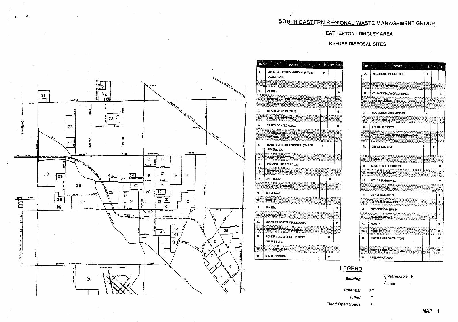
The desktop review identified a former sand quarry, alternatively identified as ‘the Cavanagh Sands
Quarry’ or the ‘Centre Road Quarry’, which was located on the corner of Centre and Warrigal Roads,
approximately 200 m southwest of the Site.
In summary, the Desktop Landfill Gas Investigation identified that the Cavanagh Sands Quarry was:
Used as a sand quarry;
Backfilled with “clean fill” according to City of Monash and “solid fill” – “inert” according to EPA
Victoria, following its closure. Filling appeared to have begun in the 1980s and was completely
backfilled by 1991;
Rezoned from an Industrial 1 Zone (IN1Z) to a Business 3 Zone (B3Z), in accordance with the City
of Monash planning scheme;
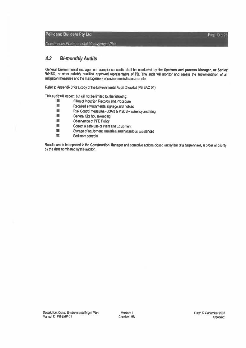
Redeveloped into a “Large Format Home Improvement Store and Supermarket” circa 2012, in
accordance with the rezoning information provided by City of Monash. The ‘Construction
Environmental Management Plan’, prepared by Pellicano Builders (2011) for the redevelopment
did not incorporate landfill gas collection or vapour mitigation systems, thereby indicating a low
potential for LFG generation or migration.
A conceptual site model was developed for the Site, including identification of source (potential landfill
at the former Cavanagh Sands Quarry), pathway (migration of methane through soil above
groundwater), and receptor (contractors and future residents).

G0092:RPH:29327 LFG RA 52 Golf Rd, Oakleigh Sth-Rev01 4 December 2018
Preliminary landfill gas monitoring was undertaken by Prensa using a hand held landfill gas meter at
the former Oakleigh South Primary School in January 2014. The monitoring reported non-detectable
concentrations of methane at the nine (9) locations sampled, which predominantly comprised
stormwater drains, service pits and a groundwater monitoring well at the Site.
Based on the site history review and landfill gas monitoring undertaken, Prensa considered it unlikely
that the Cavanagh Sands Quarry had been filled with putrescible wastes and considered the potential
was low for landfill gas to be present at the Site that would pose a potential health risk to future low-
density residential users of the Site.
4.3 Assessment of Previous Investigation
Due to the time since the Prensa investigation in 2014, a review and update of desktop resources was
completed. This included a review of publicly available information from EPA Victoria:
A search of EPA Victoria audit reports indicated that an environmental audit had not been
undertaken at the former Cavanagh Sands Quarry nor within the vicinity of the former Cavanagh
Sands Quarry since the 2014 review.
Prensa reviewed the interactive Victorian Landfills Register Map (https://nationalmap.gov.au) on
5 December 2018. The map identified one (1) solid inert landfill located at 19 - 71 Carroll Road,
Oakleigh South, approximately 800 m south-southeast of the Site. A search of the EPA interaction
portal indicated that a Post Closure Pollution Abatement Notice (PC PAN) had been issued to this
site on 6 September 2016.
Prensa reviewed the Priority Sites Register on 5 December 2018 (dated 31 October 2018). The
landfill located at Carroll Road was noted to be on the Priority Sites Register as a former landfill
requiring ongoing management. No other sites were listed in the vicinity of the Site.
A figure indicating the locations of the subsurface service monitoring was not provided in the Prensa
2014 investigation. Prensa submitted a ‘Dial Before You Dig’ (DBYD) application on 5 December 2018
for the area between the former quarry and the Site. A sewer main was identified to be running in a
northwest-southeast direction in between the landfill and the Site. Although no further information
was collected (e.g. depth to invert, construction details, age, etc.), it is considered likely that this
infrastructure would provide a preferential pathway for landfill gas migration. A copy of the DBYD
documentation issued by Melbourne Water has been attached to this document.
Prensa considers that the conceptual site model developed for the Site in the 2014 investigation is still
relevant.
Prensa undertook landfill gas monitoring from subsurface services and an onsite groundwater well in
2014. No figure was provided indicating monitoring locations. However, the locations were described
within the report text and are considered appropriate, providing coverage around boundaries of the
Site and within the Site itself.

G0092:RPH:29327 LFG RA 52 Golf Rd, Oakleigh Sth-Rev01 5 December 2018
In reviewing the source, pathway and receptor risk factors of the conceptual site model, the following
aspects mitigate the potential for unacceptable risk:
4.3.1 Source
The potential source of the landfill gas is approximately 30 years old. As waste degrades over time,
its ability to produce methane diminishes. Whilst the time will vary based on many factors, the
key period of landfill gas production is generally within 30 years of waste placement. As such the
likelihood of sites producing significant quantities of landfill gas that may migrate to the
development site is diminished and likely to be low;
Information suggests the landfill was backfilled with either clean fill or solid inert fill, both of which
have a low potential for methane gas generation; and
Redevelopment of the landfill circa 2012 did not incorporate landfill gas collection or vapour
mitigation systems, thereby indicating a low potential for landfill gas generation or migration
having been identified by the developer at that time.
4.3.2 Pathway
The distance to the Site from the Cavanagh Sands Quarry is approximately 200 m, which is the
buffer distance recommended for solid inert landfills;
The geology at the Site has been identified as Quaternary aged high level alluvium, which is
conducive to gas migration through the silty sand. The porous nature of the geology provides
opportunity for vertical migration of the landfill gas rather than lateral migration (towards the
Site);
Underground services have the potential to create a preferential pathway from the former
Cavanagh Sands Quarry towards or away from the Site. A sewer main identified to run between
the former quarry and the Site would likely provide a preferential pathway for landfill gas
migration (away from the Site);
Groundwater monitoring previously completed at the Site (reference: Prensa, Environmental Site
Assessment, August 2013) indicated that groundwater was shallow, with gauging data identifying
groundwater between approximately 2.2 to 3.3 m below ground level. This limits the ability for
landfill gas to migrate laterally in the subsurface soils; and
Landfill gas monitoring undertaken by Prensa in 2014 from subsurface services and groundwater
monitoring wells did not indicate the presence of landfill gas.
4.3.3 Receptor
The proposed future development comprises residential townhouses with no proposed basement
levels.

G0092:RPH:29327 LFG RA 52 Golf Rd, Oakleigh Sth-Rev01 6 December 2018
4.4 Summary
Based on the conceptual model and the review of the key risk factors presented above, Prensa
considers that the risk of landfill gas migration occurring and causing an unacceptable human health
or environmental impact on the proposed residential development at 52 Golf Road, Oakleigh South,
is low. As such, further landfill gas investigation or assessment is not considered warranted. This
conclusion is supported by:
The type (clean fill or solid inert) and significant age (approximately 30 years) of the placed waste;
The distance to the receptor;
The current development overlying the former quarry;
The presence of a sewer main between the former quarry and the Site;
The shallow depth of groundwater; and
The direct monitoring at the site providing no evidence of landfill gas migration to the site.
These lines of evidence suggest that there is unlikely to be a pathway for landfill gas migration towards
the Site.
5 Closing
Should you have any questions or queries regarding the report, please do not hesitate to contact me
on (03) 9508 0100.
Yours sincerely,
Rachael Hofmann
Senior Environmental Consultant
Prensa Pty Ltd
Attachments
Statement of Limitations.
DBYD documentation from Melbourne Water
Prensa, Desktop Landfill Gas Investigation, March 2014

G0092:RPH:29327 LFG RA 52 Golf Rd, Oakleigh Sth-Rev01 7 December 2018
Statement of Limitations
This document has been prepared in response to specific instructions from Golf Road Project Development to whom the report has been addressed. The work has been undertaken with the usual care and thoroughness of the consulting profession. The work is based on generally accepted standards, practices of the time the work was undertaken. No other warranty, expressed or implied, is made as to the professional advice included in this report.
The report has been prepared for the use by Golf Road Project Development and the use of this report by other parties may lead to misinterpretation of the issues contained in this report. To avoid misuse of this report, Prensa advise that the report should only be relied upon by Golf Road Project Development and those parties expressly referred to in the introduction of the report. The report should not be separated or reproduced in part and Prensa should be retained to assist other professionals who may be affected by the issues addressed in this report to ensure the report is not misused in any way.
Prensa is not a professional quantity surveyor (QS) organisation. Any areas, volumes, tonnages or any other quantities noted in this report are indicative estimates only. The services of a professional QS organisation should be engaged if quantities are to be relied upon.
Sampling Risks
Prensa acknowledges that any scientifically designed sampling program cannot guarantee all sub-surface contamination will be detected. Sampling programs are designed based on known or suspected site conditions and the extent and nature of the sampling and analytical programs will be designed to achieve a level of confidence in the detection of known or suspected subsurface contamination. The sampling and analytical programs adopted will be those that maximises the probability of identifying contaminants. Golf Road Project Development must therefore accept a level of risk associated with the possible failure to detect certain sub-surface contamination where the sampling and analytical program misses such contamination. Prensa will detail the nature and extent of the sampling and analytical program used in the investigation in the investigation report provided.
Environmental site assessments identify actual subsurface conditions only at those points where samples are taken and when they are taken. Soil contamination can be expected to be non-homogeneous across the stratified soils where present on site, and the concentrations of contaminants may vary significantly within areas where contamination has occurred. In addition, the migration of contaminants through groundwater and soils may follow preferential pathways, such as areas of higher permeability, which may not be intersected by sampling events. Subsurface conditions including contaminant concentrations can also change over time. For this reason, the results should be regarded as representative only.
Golf Road Project Development recognises that sampling of subsurface conditions may result in some cross contamination. All care will be taken and the industry standards used to minimise the risk of such cross contamination occurring, however, Golf Road Project Development recognises this risk and waives any claims against Prensa and agrees to defend, indemnify and hold Prensa harmless from any claims or liability for injury or loss which may arise as a result of alleged cross contamination caused by sampling.
Reliance on Information Provided by Others
Prensa notes that where information has been provided by other parties in order for the works to be undertaken, Prensa cannot guarantee the accuracy or completeness of this information. Golf Road Project Development therefore waives any claim against the company and agrees to indemnify Prensa for any loss, claim or liability arising from inaccuracies or omissions in information provided to Prensa by third parties. No indications were found during our investigations that information contained in this report, as provided to Prensa, is false.
Recommendations for Further Study
The industry recognised methods used in undertaking the works may dictate a staged approach to specific investigations. The findings therefore of this report may represent preliminary findings in accordance with these industry recognised methodologies. In accordance with these methodologies, recommendations contained in this report may include a need for further investigation or analytical analysis. The decision to accept these recommendations and incur additional costs in doing so will be at the sole discretion of Golf Road Project Development and Prensa recognises that that Golf Road Project Development will consider their specific needs and the business risks involved. Prensa does not accept any liability for losses incurred as a result of Golf Road Project Development not accepting the recommendations made within this report.

Assets may contain asbestos material and therefore works on these assets must be undertaken in accordance with OHS (asbestos) Regulations.
WAR
RIG
AL R
OAD
WAR
RIG
AL R
OAD
WAR
RIG
AL R
OAD
WAR
RIG
AL R
OAD
WAR
RIG
AL R
OAD
WAR
RIG
AL R
OAD
WAR
RIG
AL R
OAD
WAR
RIG
AL R
OAD
WAR
RIG
AL R
OAD
CENTRE ROADCENTRE ROADCENTRE ROADCENTRE ROADCENTRE ROADCENTRE ROADCENTRE ROADCENTRE ROADCENTRE ROAD
BOSSINGTON STREETBOSSINGTON STREETBOSSINGTON STREETBOSSINGTON STREETBOSSINGTON STREETBOSSINGTON STREETBOSSINGTON STREETBOSSINGTON STREETBOSSINGTON STREET
DAL
GAN
STR
EET
DAL
GAN
STR
EET
DAL
GAN
STR
EET
DAL
GAN
STR
EET
DAL
GAN
STR
EET
DAL
GAN
STR
EET
DAL
GAN
STR
EET
DAL
GAN
STR
EET
DAL
GAN
STR
EET
CARWELL COURT
CARWELL COURT
CARWELL COURT
CARWELL COURT
CARWELL COURT
CARWELL COURT
CARWELL COURT
CARWELL COURT
CARWELL COURTNORMA AVENUENORMA AVENUENORMA AVENUENORMA AVENUENORMA AVENUENORMA AVENUENORMA AVENUENORMA AVENUENORMA AVENUE
DER
MO
T ST
REE
TD
ERM
OT
STR
EET
DER
MO
T ST
REE
TD
ERM
OT
STR
EET
DER
MO
T ST
REE
TD
ERM
OT
STR
EET
DER
MO
T ST
REE
TD
ERM
OT
STR
EET
DER
MO
T ST
REE
T
PITT STREETPITT STREETPITT STREETPITT STREETPITT STREETPITT STREETPITT STREETPITT STREETPITT STREET
DEVOY STREETDEVOY STREETDEVOY STREETDEVOY STREETDEVOY STREETDEVOY STREETDEVOY STREETDEVOY STREETDEVOY STREET
MUR
UMBA
DRI
VE
MUR
UMBA
DRI
VE
MUR
UMBA
DRI
VE
MUR
UMBA
DRI
VE
MUR
UMBA
DRI
VE
MUR
UMBA
DRI
VE
MUR
UMBA
DRI
VE
MUR
UMBA
DRI
VE
MUR
UMBA
DRI
VE
TUDOR STREETTUDOR STREETTUDOR STREETTUDOR STREETTUDOR STREETTUDOR STREETTUDOR STREETTUDOR STREETTUDOR STREET
BERYL AVENUEBERYL AVENUEBERYL AVENUEBERYL AVENUEBERYL AVENUEBERYL AVENUEBERYL AVENUEBERYL AVENUEBERYL AVENUE
JOYC
E AV
ENU
EJO
YCE
AVEN
UE
JOYC
E AV
ENU
EJO
YCE
AVEN
UE
JOYC
E AV
ENU
EJO
YCE
AVEN
UE
JOYC
E AV
ENU
EJO
YCE
AVEN
UE
JOYC
E AV
ENU
E
RIL
EY S
TREE
TR
ILEY
STR
EET
RIL
EY S
TREE
TR
ILEY
STR
EET
RIL
EY S
TREE
TR
ILEY
STR
EET
RIL
EY S
TREE
TR
ILEY
STR
EET
RIL
EY S
TREE
T
ORANGE STREETORANGE STREETORANGE STREETORANGE STREETORANGE STREETORANGE STREETORANGE STREETORANGE STREETORANGE STREET
KENNEDY STREETKENNEDY STREETKENNEDY STREETKENNEDY STREETKENNEDY STREETKENNEDY STREETKENNEDY STREETKENNEDY STREETKENNEDY STREET
BARHOLME COURT
BARHOLME COURT
BARHOLME COURT
BARHOLME COURT
BARHOLME COURT
BARHOLME COURT
BARHOLME COURT
BARHOLME COURT
BARHOLME COURT
DELIA STREETDELIA STREETDELIA STREETDELIA STREETDELIA STREETDELIA STREETDELIA STREETDELIA STREETDELIA STREET
DEL
OS
STR
EET
DEL
OS
STR
EET
DEL
OS
STR
EET
DEL
OS
STR
EET
DEL
OS
STR
EET
DEL
OS
STR
EET
DEL
OS
STR
EET
DEL
OS
STR
EET
DEL
OS
STR
EET
BAKE
RS
RO
ADBA
KER
S R
OAD
BAKE
RS
RO
ADBA
KER
S R
OAD
BAKE
RS
RO
ADBA
KER
S R
OAD
BAKE
RS
RO
ADBA
KER
S R
OAD
BAKE
RS
RO
AD
BROOKS STREETBROOKS STREETBROOKS STREETBROOKS STREETBROOKS STREETBROOKS STREETBROOKS STREETBROOKS STREETBROOKS STREET
GO
LF R
OAD
GO
LF R
OAD
GO
LF R
OAD
GO
LF R
OAD
GO
LF R
OAD
GO
LF R
OAD
GO
LF R
OAD
GO
LF R
OAD
GO
LF R
OAD
LUN
TAR
RO
ADLU
NTA
R R
OAD
LUN
TAR
RO
ADLU
NTA
R R
OAD
LUN
TAR
RO
ADLU
NTA
R R
OAD
LUN
TAR
RO
ADLU
NTA
R R
OAD
LUN
TAR
RO
AD
CAM
ERO
N A
VEN
UE
CAM
ERO
N A
VEN
UE
CAM
ERO
N A
VEN
UE
CAM
ERO
N A
VEN
UE
CAM
ERO
N A
VEN
UE
CAM
ERO
N A
VEN
UE
CAM
ERO
N A
VEN
UE
CAM
ERO
N A
VEN
UE
CAM
ERO
N A
VEN
UE
LUN
TAR
LAN
ELU
NTA
R L
ANE
LUN
TAR
LAN
ELU
NTA
R L
ANE
LUN
TAR
LAN
ELU
NTA
R L
ANE
LUN
TAR
LAN
ELU
NTA
R L
ANE
LUN
TAR
LAN
E
972972972972972972972972972 978978978978978978978978978968968968968968968968968968
333333333
999999999
106710671067106710671067106710671067107710771077107710771077107710771077
106310631063106310631063106310631063
272727272727272727
323232323232323232
202020202020202020 282828282828282828
878787878787878787
191919191919191919 232323232323232323
353535353535353535
414141414141414141
444444444
888888888
121212121212121212
262626262626262626
393939393939393939
555555555
222222222 292929292929292929
343434343434343434
131313131313131313
333333333333333333
434343434343434343
111111111
316316316316316316316316316
181818181818181818
222222222222222222
363636363636363636
322322322322322322322322322
344344344344344344344344344
242424242424242424
838383838383838383
290290290290290290290290290
308308308308308308308308308
212121212121212121 252525252525252525
171717171717171717
141414141414141414
484848484848484848
373737373737373737
107107107107107107107107107
313131313131313131
777777777 111111111111111111
666666666
101010101010101010
697697697697697697697697697
693693693693693693693693693939393939393939393
685685685685685685685685685
691691691691691691691691691 105105105105105105105105105
709709709709709709709709709
713713713713713713713713713
689689689689689689689689689
303030303030303030
898989898989898989
109109109109109109109109109
679679679679679679679679679
959595959595959595
352352352352352352352352352
695695695695695695695695695312312312312312312312312312
117117117117117117117117117
999999999999999999
292292292292292292292292292
858585858585858585
334334334334334334334334334
107310731073107310731073107310731073
294294294294294294294294294
151515151515151515
919191919191919191
314314314314314314314314314
525252525252525252338338338338338338338338338
161616161616161616424242424242424242
818181818181818181
909090909090909090
777777777777777777
888888888888888888
107110711071107110711071107110711071
929292929292929292
103103103103103103103103103
348348348348348348348348348
356356356356356356356356356
103310331033103310331033103310331033
982982982982982982982982982
108310831083108310831083108310831083
326326326326326326326326326
78F178F178F178F178F178F178F178F178F1
78F278F278F278F278F278F278F278F278F2
78G178G178G178G178G178G178G178G178G1
78G278G278G278G278G278G278G278G278G2
69E1269E1269E1269E1269E1269E1269E1269E1269E1269G1269G1269G1269G1269G1269G1269G1269G1269G12
79C879C879C879C879C879C879C879C879C8
1 2
Overvie
w
Address: 52 Golf Road, Oakleigh South, VIC, 3167
DBYD Job No. 15416187DBYD Sequence Number: 78266761
Map Ref: Melways 78E1, 78F1, 78F2Date Supplied: 05/12/2018
1:2000
Sewer Assets Plan

Assets may contain asbestos material and therefore works on these assets must be undertaken in accordance with OHS (asbestos) Regulations.
WAR
RIG
AL R
OAD
WAR
RIG
AL R
OAD
WAR
RIG
AL R
OAD
WAR
RIG
AL R
OAD
WAR
RIG
AL R
OAD
WAR
RIG
AL R
OAD
WAR
RIG
AL R
OAD
WAR
RIG
AL R
OAD
WAR
RIG
AL R
OAD
DAL
GAN
STR
EET
DAL
GAN
STR
EET
DAL
GAN
STR
EET
DAL
GAN
STR
EET
DAL
GAN
STR
EET
DAL
GAN
STR
EET
DAL
GAN
STR
EET
DAL
GAN
STR
EET
DAL
GAN
STR
EET
DER
MO
T ST
REE
TD
ERM
OT
STR
EET
DER
MO
T ST
REE
TD
ERM
OT
STR
EET
DER
MO
T ST
REE
TD
ERM
OT
STR
EET
DER
MO
T ST
REE
TD
ERM
OT
STR
EET
DER
MO
T ST
REE
T
PITT STREETPITT STREETPITT STREETPITT STREETPITT STREETPITT STREETPITT STREETPITT STREETPITT STREET
TUDOR STREETTUDOR STREETTUDOR STREETTUDOR STREETTUDOR STREETTUDOR STREETTUDOR STREETTUDOR STREETTUDOR STREET
KENNEDY STREETKENNEDY STREETKENNEDY STREETKENNEDY STREETKENNEDY STREETKENNEDY STREETKENNEDY STREETKENNEDY STREETKENNEDY STREET
BARHOLME COURT
BARHOLME COURT
BARHOLME COURT
BARHOLME COURT
BARHOLME COURT
BARHOLME COURT
BARHOLME COURT
BARHOLME COURT
BARHOLME COURT
DELIA STREETDELIA STREETDELIA STREETDELIA STREETDELIA STREETDELIA STREETDELIA STREETDELIA STREETDELIA STREET
DEL
OS
STR
EET
DEL
OS
STR
EET
DEL
OS
STR
EET
DEL
OS
STR
EET
DEL
OS
STR
EET
DEL
OS
STR
EET
DEL
OS
STR
EET
DEL
OS
STR
EET
DEL
OS
STR
EET
GO
LF R
OAD
GO
LF R
OAD
GO
LF R
OAD
GO
LF R
OAD
GO
LF R
OAD
GO
LF R
OAD
GO
LF R
OAD
GO
LF R
OAD
GO
LF R
OAD
BERYL AVENUEBERYL AVENUEBERYL AVENUEBERYL AVENUEBERYL AVENUEBERYL AVENUEBERYL AVENUEBERYL AVENUEBERYL AVENUE
CAM
ERO
N A
VEN
UE
CAM
ERO
N A
VEN
UE
CAM
ERO
N A
VEN
UE
CAM
ERO
N A
VEN
UE
CAM
ERO
N A
VEN
UE
CAM
ERO
N A
VEN
UE
CAM
ERO
N A
VEN
UE
CAM
ERO
N A
VEN
UE
CAM
ERO
N A
VEN
UE
444444444
666666666
888888888
121212121212121212
161616161616161616
222222222
999999999
232323232323232323
272727272727272727
316316316316316316316316316
181818181818181818
322322322322322322322322322
343434343434343434 363636363636363636
141414141414141414
344344344344344344344344344
202020202020202020
318318318318318318318318318
320320320320320320320320320
242424242424242424
262626262626262626
282828282828282828
323232323232323232
171717171717171717212121212121212121
484848484848484848
505050505050505050
424242424242424242
444444444444444444222222222222222222
107107107107107107107107107
111111111111111111111111111
113113113113113113113113113
115115115115115115115115115
131313131313131313 151515151515151515
252525252525252525 292929292929292929 313131313131313131
333333333 555555555 777777777111111111111111111
328328328328328328328328328
332332332332332332332332332
111111111
333333333333333333
101010101010101010
324324324324324324324324324
353535353535353535
693693693693693693693693693
687687687687687687687687687
691691691691691691691691691 105105105105105105105105105
689689689689689689689689689
330330330330330330330330330
606060606060606060
109109109109109109109109109
695695695695695695695695695
117117117117117117117117117
999999999999999999
334334334334334334334334334
314314314314314314314314314
303030303030303030
191919191919191919
338338338338338338338338338
979797979797979797
959595959595959595
346346346346346346346346346
348348348348348348348348348
342342342342342342342342342
464646464646464646
101101101101101101101101101
525252525252525252
336336336336336336336336336
326326326326326326326326326
78E278E278E278E278E278E278E278E278E2
78F178F178F178F178F178F178F178F178F1
78F278F278F278F278F278F278F278F278F2
79C879C879C879C879C879C879C879C879C8
1 2
Address: 52 Golf Road, Oakleigh South, VIC, 3167
DBYD Job No. 15416187DBYD Sequence Number: 78266761
Map Ref: Melways 78E1, 78F1, 78F2Date Supplied: 05/12/2018
1:2000
Sewer Assets Plan

Assets may contain asbestos material and therefore works on these assets must be undertaken in accordance with OHS (asbestos) Regulations.
PITT STREETPITT STREETPITT STREETPITT STREETPITT STREETPITT STREETPITT STREETPITT STREETPITT STREET
BERYL AVENUEBERYL AVENUEBERYL AVENUEBERYL AVENUEBERYL AVENUEBERYL AVENUEBERYL AVENUEBERYL AVENUEBERYL AVENUE
JOYC
E AV
ENU
EJO
YCE
AVEN
UE
JOYC
E AV
ENU
EJO
YCE
AVEN
UE
JOYC
E AV
ENU
EJO
YCE
AVEN
UE
JOYC
E AV
ENU
EJO
YCE
AVEN
UE
JOYC
E AV
ENU
E
RIL
EY S
TREE
TR
ILEY
STR
EET
RIL
EY S
TREE
TR
ILEY
STR
EET
RIL
EY S
TREE
TR
ILEY
STR
EET
RIL
EY S
TREE
TR
ILEY
STR
EET
RIL
EY S
TREE
T
BARHOLME COURT
BARHOLME COURT
BARHOLME COURT
BARHOLME COURT
BARHOLME COURT
BARHOLME COURT
BARHOLME COURT
BARHOLME COURT
BARHOLME COURT
TERRIGAL AVENUE
TERRIGAL AVENUE
TERRIGAL AVENUE
TERRIGAL AVENUE
TERRIGAL AVENUE
TERRIGAL AVENUE
TERRIGAL AVENUE
TERRIGAL AVENUE
TERRIGAL AVENUE
BAKE
RS
RO
ADBA
KER
S R
OAD
BAKE
RS
RO
ADBA
KER
S R
OAD
BAKE
RS
RO
ADBA
KER
S R
OAD
BAKE
RS
RO
ADBA
KER
S R
OAD
BAKE
RS
RO
AD
GO
LF R
OAD
GO
LF R
OAD
GO
LF R
OAD
GO
LF R
OAD
GO
LF R
OAD
GO
LF R
OAD
GO
LF R
OAD
GO
LF R
OAD
GO
LF R
OAD
CAM
ERO
N A
VEN
UE
CAM
ERO
N A
VEN
UE
CAM
ERO
N A
VEN
UE
CAM
ERO
N A
VEN
UE
CAM
ERO
N A
VEN
UE
CAM
ERO
N A
VEN
UE
CAM
ERO
N A
VEN
UE
CAM
ERO
N A
VEN
UE
CAM
ERO
N A
VEN
UE
DELIA STREETDELIA STREETDELIA STREETDELIA STREETDELIA STREETDELIA STREETDELIA STREETDELIA STREETDELIA STREET
333333333
555555555
999999999
111111111111111111
131313131313131313
171717171717171717
191919191919191919
212121212121212121
252525252525252525
121212121212121212202020202020202020
282828282828282828
232323232323232323
444444444
666666666
888888888
161616161616161616
393939393939393939
222222222222222222
242424242424242424
777777777
222222222292929292929292929 313131313131313131
151515151515151515
181818181818181818
333333333333333333
111111111
262626262626262626
272727272727272727
484848484848484848
505050505050505050
424242424242424242
444444444444444444
141414141414141414
107107107107107107107107107
111111111111111111111111111
113113113113113113113113113
115115115115115115115115115
105105105105105105105105105
414141414141414141
606060606060606060
117117117117117117117117117
999999999999999999
525252525252525252
979797979797979797
101010101010101010
303030303030303030 323232323232323232
109109109109109109109109109
353535353535353535
464646464646464646
343434343434343434 383838383838383838
101101101101101101101101101
78F178F178F178F178F178F178F178F178F1
78F278F278F278F278F278F278F278F278F2
78G178G178G178G178G178G178G178G178G1
78G278G278G278G278G278G278G278G278G2
79C879C879C879C879C879C879C879C879C8
1 2
Address: 52 Golf Road, Oakleigh South, VIC, 3167
DBYD Job No. 15416187DBYD Sequence Number: 78266761
Map Ref: Melways 78E1, 78F1, 78F2Date Supplied: 05/12/2018
1:2000
Sewer Assets Plan

261‐271 Wattletree Road
Malvern VIC 3144
T: 9508 0100
F: 9509 6125
ABN: 12 142 106 581
Job No: 13991: Client No: D0003
Desktop Landfill Gas Investigation
1 Beryl Avenue
Oakleigh South, Victoria
Department of Treasury and Finance
March 2014

D0003:SPF:13991‐02 Oakleigh South i March 2014
Executive Summary
Prensa was engaged by the Department of Treasury and Finance (DTF) to undertake a desktop
landfill gas (LFG) investigation at former Oakleigh South Primary School, located at 1 Beryl Avenue,
Oakleigh South (the Site).
DTF intends to divest the Site and has applied to have the Site rezoned from Public Use‐Education to
residential as part of the divestment process. A letter was issued by EPA Victoria (EPAV) relating to
the proposed residential rezoning of the Site and its close proximity to the former Cavanagh Sands,
sand quarry. The letter noted that the “Schedule to the Development Plan Overlay (DPO) requires a
site assessment to be undertaken on these sites to confirm they are suitable for sensitive uses, prior
to the redevelopment for such uses.”
DTF requested a desktop investigation that would assess the potential for landfill gas (LFG) to exist at
the Site, based on the proposed residential development and in light of the comments provided
within the EPAV letter.
The objective of the desktop landfill gas investigation was to provide an indication of the potential
for landfill gas to be present at the Site, which may represent a potential risk to the proposed future
residential use of the Site.
Multiple investigations have previously been undertaken at the Site, predominantly relating to the
presence of two former underground storage tanks (USTs) on site. Following the removal of the
USTs, residual hydrocarbon impacted soil was found to remain on site. The soil was excavated and
bio‐remediated, prior to being disposed off‐site. Groundwater monitoring undertaken at the Site
reported non detectable concentrations of hydrocarbons, and minor concentrations of metals,
which were considered to be indicative of background concentrations. The most recent assessment
undertaken at the Site by Prensa, concluded that it was “considered unlikely that a statutory
environmental audit would be required due to the soil management program successfully
implemented at the Site.” Based on the review of the environmental assessments undertaken at the
Site, it is considered that the potential for contamination to be present at the Site which would
represent a health risk to future low density residential users of the Site is low.
A desktop review of the Cavanagh Sands quarry found minimal publicly available information
regarding its potential former use as a landfill. A review of historical aerial photographs indicated
that a sand quarry was located at the Cavanagh Sands property, potentially from as early as 1931.
Information provided by EPAV indicated that the property has been completely backfilled with inert
material since 1990. The City of Monash reported that the Cavanagh Sands property was operational
from 1940 and was filled using clean fill. The property has recently been redeveloped into a
homemaker centre, circa 2012.
Limited landfill gas monitoring was undertaken by Prensa using a hand held landfill gas meter at the
former Oakleigh South Primary School in January 2014. The monitoring reported non‐detectable
concentrations of methane at the nine (9) locations sampled, which predominantly comprised
stormwater drains, service pits and groundwater monitoring well at the Site.

D0003:SPF:13991‐02 Oakleigh South ii March 2014
In summary, the desktop landfill gas investigation identified that Cavanagh Sands was:
Used as a sand quarry;
Backfilled with “clean fill” according to City of Monash and “solid fill” – “inert” according to
EPAV, following its closure;
Rezoned from an Industrial 1 Zone (IN1Z) to a Business 3 Zone (B3Z), in accordance with the City
of Monash planning scheme;
Redeveloped into a “Large Format Home Improvement Store and Supermarket” circa 2012, in
accordance with the rezoning information provided by City of Monash. The ‘Construction
Environmental Management Plan’, prepared by Pellicano Builders (2011) for the redevelopment
did not incorporate landfill gas collection or vapour mitigation systems, thereby indicating a low
potential for LFG generation or migration.
Based on the site history review and limited landfill gas monitoring undertaken it is considered
unlikely that Cavanagh Sands was filled with putrescible wastes and the potential for landfill gas to
be present at the Site, which would pose a potential health risk to future low density residential
users of the Site is low.
D0003:SPF:13991‐02 Oakleigh South iii March 2014
Statement of Limitations This document has been prepared in response to specific instructions from Department of Treasury and Finance to whom
the report has been addressed. The work has been undertaken with the usual care and thoroughness of the consulting
profession. The work is based on generally accepted standards, practices of the time the work was undertaken. No other
warranty, expressed or implied, is made as to the professional advice included in this report.
The report has been prepared for the use by Department of Treasury and Finance and the use of this report by other
parties may lead to misinterpretation of the issues contained in this report. To avoid misuse of this report, Prensa advise
that the report should only be relied upon by Department of Treasury and Finance and those parties expressly referred to
in the introduction of the report. The report should not be separated or reproduced in part and Prensa should be retained
to assist other professionals who may be affected by the issues addressed in this report to ensure the report is not misused
in any way.
Prensa is not a professional quantity surveyor (QS) organisation. Any areas, volumes, tonnages or any other quantities
noted in this report are indicative estimates only. The services of a professional QS organisation should be engaged if
quantities are to be relied upon.
Sampling Risks
Prensa acknowledges that any scientifically designed sampling program cannot guarantee all sub‐surface contamination
will be detected. Sampling programs are designed based on known or suspected site conditions and the extent and nature
of the sampling and analytical programs will be designed to achieve a level of confidence in the detection of known or
suspected subsurface contamination. The sampling and analytical programs adopted will be those that maximises the
probability of identifying contaminants. Department of Treasury and Finance must therefore accept a level of risk
associated with the possible failure to detect certain sub‐surface contamination where the sampling and analytical
program misses such contamination. Prensa will detail the nature and extent of the sampling and analytical program used
in the investigation in the investigation report provided.
Environmental site assessments identify actual subsurface conditions only at those points where samples are taken and
when they are taken. Soil contamination can be expected to be non‐homogeneous across the stratified soils where present
on site, and the concentrations of contaminants may vary significantly within areas where contamination has occurred. In
addition, the migration of contaminants through groundwater and soils may follow preferential pathways, such as areas of
higher permeability, which may not be intersected by sampling events. Subsurface conditions including contaminant
concentrations can also change over time. For this reason, the results should be regarded as representative only.
Department of Treasury and Finance recognises that sampling of subsurface conditions may result in some cross
contamination. All care will be taken and the industry standards used to minimise the risk of such cross contamination
occurring, however, Department of Treasury and Finance recognises this risk and waives any claims against Prensa and
agrees to defend, indemnify and hold Prensa harmless from any claims or liability for injury or loss which may arise as a
result of alleged cross contamination caused by sampling.
Reliance on Information Provided by Others
Prensa notes that where information has been provided by other parties in order for the works to be undertaken, Prensa
cannot guarantee the accuracy or completeness of this information. Department of Treasury and Finance therefore waives
any claim against the company and agrees to indemnify Prensa for any loss, claim or liability arising from inaccuracies or
omissions in information provided to Prensa by third parties. No indications were found during our investigations that
information contained in this report, as provided to Prensa, is false.
Recommendations for Further Study
The industry recognised methods used in undertaking the works may dictate a staged approach to specific investigations.
The findings therefore of this report may represent preliminary findings in accordance with these industry recognised
methodologies. In accordance with these methodologies, recommendations contained in this report may include a need
for further investigation or analytical analysis. The decision to accept these recommendations and incur additional costs in
doing so will be at the sole discretion of Department of Treasury and Finance and Prensa recognises that that Department
of Treasury and Finance will consider their specific needs and the business risks involved. Prensa does not accept any
liability for losses incurred as a result of Department of Treasury and Finance not accepting the recommendations made
within this report.

D0003:SPF:13991‐02 Oakleigh South iv March 2014
Table of Contents
1 Introduction .................................................................................................................................... 1
2 Background ..................................................................................................................................... 1
3 Objectives........................................................................................................................................ 1
4 Scope of Works ............................................................................................................................... 1
5 Findings ........................................................................................................................................... 2
5.1 Site History Findings ................................................................................................................ 2
5.1.1 Report Reviews ............................................................................................................... 2
5.1.2 Online Review ................................................................................................................. 3
5.1.3 EPA Victoria ..................................................................................................................... 3
5.1.4 City of Monash ................................................................................................................ 4
5.2 Geology ................................................................................................................................... 4
5.3 Hydrogeology .......................................................................................................................... 5
5.5.1 Surface Water Receptors ....................................................................................................... 5
5.5.2 Groundwater Database search .............................................................................................. 5
5.4 Landfill Gas Monitoring ........................................................................................................... 6
6 Conceptual Site Model .................................................................................................................... 7
6.1 Site Specific Geology ............................................................................................................... 7
6.2 Potential Sources of Landfill Gas Contamination .................................................................... 7
6.3 Contaminants of Potential Concern ........................................................................................ 7
6.4 Transport Mechanisms and Exposure Pathways .................................................................... 7
6.5 Potential Receptors ................................................................................................................. 7
7 Significance of Results ..................................................................................................................... 8
8 Conclusion ....................................................................................................................................... 8
9 Application of this Report ............................................................................................................... 9
Appendix A: EPA Documents
Appendix B: Council Documents

D0003:SPF:13991‐02 Oakleigh South I March 2014
1 Introduction
Prensa was engaged by Department of Treasury and Finance (DTF) to undertake a desktop landfill
gas (LFG) investigation at former Oakleigh South Primary School, located at 1 Beryl Avenue, Oakleigh
South, Victoria (the Site).
2 Background
It was understood that DTF proposes to divest the Site, and as part of the divestment process has
applied for the Site to be rezoned from Public Use Zone‐Education to residential. EPA Victoria (EPAV)
prepared a letter ‘DEECD Surplus Land Rezoning Project’ addressed to the Department of Transport,
Planning and Local Infrastructure, dated 22 November 2013 (EPAV ref: 5003719), in relation to the
proposed re‐zoning. The letter related to the proposed rezoning of three former primary schools and
their close proximity to “Former sand quarries [that] have been historically used for land‐filling,
which has often included the filling of putrescible wastes”. Specifically in regards to the Site, the
letter stated that “Oakleigh South Primary School is located approximately 150 metres from the
‘Cavanagh Sands’ site”.
Furthermore, the letter noted that the “Schedule to the Development Plan Overlay (DPO) requires a
site assessment to be undertaken on these sites to confirm they are suitable for sensitive uses, prior
to the development for such uses”.
DTF requested a desktop LFG investigation be undertaken to assess the potential for landfill gas to
exist at the Site, based on the proposed residential redevelopment of the Site and in light of the
comments provided within the EPAV letter.
3 Objectives
The objective of the desktop landfill gas assessment is to provide an indication of the potential for
landfill gas to be present at the Site, which may represent a potential risk to the proposed future
residential use of the Site.
4 Scope of Works
As part of the Landfill Gas Investigation, Prensa undertook the following:
Review of environmental assessment reports relating to the Site;
LFG Desktop review, including liaising with EPAV and the City of Monash;
Site inspection and monitoring using a portable landfill gas monitor; and
Preparation of this report outlining the findings.
In completing the above tasks, Prensa undertook works in general accordance with the following:
Environment Protection Act, 1970;
State Environment Protection Policy (SEPP), Prevention and Management of Contamination of
Land, 2002;
National Environment Protection (Assessment of Site Contamination) Measure (NEPM) No.1
Amendment, 2013;
Victorian EPA Publication 788.1: Best Practice Environmental Management – Siting, Design,
Operation and Rehabilitation of Landfills, 2010;

D0003:SPF:13991‐02 Oakleigh South 2 March 2014
Australian Standard 4482.1, Guide to Investigation and Sampling of Sites with Potentially
Contaminated Soil, Part 1: Non‐volatile and Semi‐volatile compounds, 2005;
Australian Standard 4482.2, Guide to the Sampling and Investigation of Potentially
Contaminated Soil, Part 2: Volatile Substances, 1999;
Victorian EPA Publication 1416: Draft Landfill Gas Fugitive Emissions Monitoring Guidelines,
2011; and
EPA Publication 1270: Assessment of the Potential for Methane Gas Movement from Victorian
Landfills, 2009.
5 Findings
5.1 Site History Findings
5.1.1 Report Reviews
As part of the history review for former Oakleigh South Primary School, Prensa reviewed the
following documents, in light of the LFG investigation:
Beveridge Williams, Contamination Assessment Oakleigh South Primary School Beryl Avenue,
Oakleigh South, February 2000. The scope of this assessment included a limited site history
review and the establishment of four (4) boreholes. The report made no reference to the
potential for landfill gas to be present at the Site.
Beveridge Williams, Validation Sampling and Testing, Oakleigh South Primary School Beryl
Avenue, Oakleigh South, June 2002. The scope of the assessment included validation sampling
following the removal of two (2) underground storage tanks at the Site. The report did not make
a reference to the potential for landfill gas to be present at the Site.
Beveridge Williams, Contamination Assessment Oakleigh South Primary School Beryl Avenue,
Oakleigh South, May 2003. The report included a limited site history review and the
establishment of twenty (20) boreholes at the Site. No reference was made within the report to
the potential for landfill gas to be present at the Site.
Golder Associates Pty Ltd, Preliminary Contamination Assessment & Cost Estimate – DET Site,
Oakleigh South, 11 November 2005. The assessment reviewed the three (3) Beveridge Williams
reports and provided a cost estimate to undertake further work at the Site. No reference was
made within the report to the potential for landfill gas to be present at the Site.
HLA Envirosciences Pty Ltd (HLA), Environmental Site Assessment Former Oakleigh South Primary
School, Beryl Avenue, Oakleigh South, 1 December 2006. The assessment included the
establishment of seventeen (17) test pits. No reference was made within the report to the
potential for landfill gas to be present at the Site.
HLA, Groundwater Assessment Former Oakleigh Primary School, Beryl Avenue, Oakleigh South,
19 January 2007. The assessment included the installation of three (3) groundwater wells at the
Site and a groundwater monitoring event (GME). No reference was made within the report to
the potential for landfill gas to be present at the Site.
HLA, Additional Environmental Site Assessment Former Oakleigh South Primary School, Beryl
Street, Oakleigh, Victoria, 9 January 2008. The scope of the assessment included a site history
review, establishment of two (2) test pits and a GME. The report referred to the presence of a
disturbed area of land south west of the Site, which was present in the 1951 and 1963 aerial

D0003:SPF:13991‐02 Oakleigh South 3 March 2014
photographs, which may have been referring to the Cavanagh Sands quarry. No reference was
made within the report to the potential for landfill gas to be present at the Site.
Prensa, Phase 1 Preliminary Environmental Site Assessment – Former Oakleigh South Primary
School, Oakleigh South VIC 3167, August 2010. The scope of the assessment included a site
history review. The report referred to the presence of a quarry of landfill‐type feature in the
1950 and 1960 aerial photograph. No further reference was made in the reports to the
quarry/landfill feature. Re‐inspection of these photographs by Prensa indicated the potential
presence of a sand quarry in 1931 on the Cavanagh Sands property, although specific details
were difficult to discern based on the resolution of the 1931 photograph. The quarry was clearly
visible in the 1950 photograph, and appeared to have expanded to the east, south east from the
1931 aerial photograph. The quarry/landfill feature did not appear to be as deep in the 1984
aerial photograph, and appeared to have been completely backfilled by 1991. The Cavanagh
Sands property was converted into a homemaker centre and supermarket, sometime between
2010 and 2012.
Senversa, Review of Various Environmental Site Assessment Reports Former Oakleigh South
Primary School, 1 Beryl Avenue, Oakleigh South VIC 3167, 22 February 2012. The scope of the
assessment included a review of the previous environmental assessment reports relating to the
Site, with no reference made to the potential for landfill gas to be present at the Site.
Prensa, Environmental Site Assessment, 1 Beryl Avenue, Oakleigh South, Victoria, Revision 1,
August 2013. The scope of the review included a review of previous report, excavation of
residual contamination from the former USTs, validation sampling, installation of three (3)
groundwater monitoring wells and a GME.
Prensa, Site Development Management Plan, 1 Beryl Avenue, Oakleigh South, Victoria, August
2013. The management plan was developed following the identification of asbestos containing
material (ACM) debris with a soil stockpile on site. No reference was made within the
management plan for the potential for landfill gas to be present at the Site.
5.1.2 Online Review
A general online review was unable to source any information regarding the ‘Cavanagh Sands’
property in relation to its former use.
5.1.3 EPA Victoria
Prensa contacted EPAV to obtain information regarding the Cavanagh Sands property and also
reviewed several publicly available EPAV documents. The information obtained from EPAV included
the following:
EPAV provided Prensa with an untitled map from the South Eastern Regional Waste
Management Group of old landfills located within the Heatherton/Dingley area. The map
indicated that the Cavanagh Sands property was located on the north eastern corner of
Warrigal Road and Centre Road and that the landfill was reportedly filled with “inert waste”.
An untitled excel document provided by EPAV to Prensa indicated that the landfill closed before
1990. The geology at the property was listed as being unconsolidated sedimentary deposits,
predominantly comprised of sand. A groundwater well had reportedly been removed from the
property.

D0003:SPF:13991‐02 Oakleigh South 4 March 2014
A search of EPAV audit reports indicated that an environmental audit had not been undertaken
at the Cavanagh Sands property nor within the vicinity of the Cavanagh Sands property.
Prensa reviewed EPA Publication 1270 ‘Assessment of the potential for methane gas movement
from Victorian Landfills’ 2009, which assessed all licensed and formerly licensed landfills
recorded in the EPA’s database (a total of 260 landfills) for the potential for methane gas
migration. It was noted that the Cavanagh Sands property was not listed as a landfill assessed
within this publication.
A publicly available map on the EPA website titled ‘Clayton area current and closed Landfills and
Composters’ indicates the location of former and current landfills within the Clayton South,
Clarinda and Dingley areas. The map did not indicate that a landfill was formerly located at the
Cavanagh Sands property.
Prensa reviewed the Priority Sites Register (dated 31/01/2014) during February 2014. The
Cavanagh Sands was not noted to be on the Priority Sites Register. There were noted to be two
(2) Priority Sites within a 5 km radius of the subject Site, however, these were not related to
landfilling activities.
5.1.4 City of Monash
The City of Monash was contacted to obtain council documentation relating to the Cavanagh Sands
property. The City of Monash indicated the following:
Written information obtained from April Williams, Waste Services Project Officer of the City of
Monash, reported that the Cavanagh Sands quarry was operational from 1940 and was filled
using clean fill.
Publicly available council planning documents titled, ‘1041‐1049 Centre Road and 348‐350
Warrigal Road, Oakleigh South‐Large Format Home Improvement Store and Supermarket’ and
‘Amendment C87 to the Monash Planning Scheme ‐1041‐1049 Centre Road and 346‐350
Warrigal Road, Oakleigh South’ dated April 2009 were reviewed. The documents referred to the
proposal for the homemaker centre and required rezoning of the property. Within the planning
documents the Cavanagh Sands property was referred to as the ‘Centre Road Quarry.’
A ‘Construction Environmental Management Plan’ (CEMP) for 1041 Centre Road, Oakleigh
South, prepared by Pellicano Builders Pty Ltd, dated 17th December 2007, provided by the City
of Monash was reviewed. The CEMP made no reference to the Cavanagh Sands property being
a former quarry or the potential for the property to have been formerly used as a landfill.
5.2 Geology
Prensa reviewed the Geological Map Series Melbourne Map Sheet 1:63,360, No. 849, Zone 7,
Ringwood. The map identified Quaternary aged high level alluvium. The Site was also surrounded by
Quaternary‐aged sand ridges and sand hills.

D0003:SPF:13991‐02 Oakleigh South 5 March 2014
5.3 Hydrogeology
5.5.1 Surface Water Receptors
The closest surface water receptors to the Site were:
Various lakes within Huntingdale and Metropolitan Golf Course, located approximately 400 m
north, 1.1 km north east and 1.2 km north east;
A lake located within the Commonwealth Golf Club, located approximately 500 m south east;
Moorabbin Reservoir, located approximately 600 m west;
Karkarook Lake, located approximately 2.3 km south; and
Port Phillip Bay, located approximately 8.5 km south of the Site.
5.5.2 Groundwater Database search
A search of the Visualising Victoria’s Groundwater online database identified nine (9) registered
groundwater wells within a 600 m radius of the Site. A summary of the review of the groundwater
bores has been summarised in Table 1 below.
Table 1: Summary of Nearby Groundwater Bores
Bore ID Location Well Depth
(m) Use Lithology screened
81766 260 m south west 144.7 Fire fighting/
sports/general Sand and clay
WRK042476 280 m south east 144.70 Irrigation Sand and clay
WRK042470 480 m north east 91.50 Irrigation Sand and clay
116281 490 m south west 122.00 Irrigation Sand
WRK055378 550 m north west 6.00 Observation Clayey sands
142964 560 m north west 8.00 Investigation Sand and silty sand
WRK058371 560 m north west 6.00 Observation N/A
WRK058372 580 m north west 6.00 Observation N/A
WRK055379 580 m north east 6.00 Observation N/A
No standing water level data existed for the groundwater wells.

D0003:SPF:13991‐02 Oakleigh South 6 March 2014
5.4 Landfill Gas Monitoring
The former quarry to the south west of the Site (currently a Woolworths and Masters Home
Improvement Centre) was reportedly converted into a landfill following the quarry closure circa mid‐
1900’s. Closed landfills can continue to produce methane gas for many years following closure,
which can potentially migrate offsite through the local geology following a path of least resistance
into buildings and houses nearby.
Sarah Fitzpatrick and Holly Butler of Prensa, attended the former Oakleigh South Primary School site
on Thursday the 16th of January 2014 to conduct a landfill gas assessment. A hand held GFM410
landfill gas monitor was used to statistically measure oxygen, carbon dioxide and methane. Of
particular interest was the presence of methane gas, which is a known by‐product of landfill
decomposition, particularly where putrescible waste has been deposited.
Gas measurements were taken to assess for the presence of landfill related gases at the Site. A total
of nine (9) measurements were taken at, and adjacent to, the Site, as outlined in Table 2 below. The
landfill gas monitor did not register a concentration of methane at the monitored locations.
Table 2: Landfill Gas Monitoring Results
Location Methane (%) Carbon Dioxide (%) Oxygen (%)
Stormwater drain, Barkers Road boundary 0 0 20.8
Stormwater drain, south eastern portion
of the Site 0 4 17.3
Stormwater drain, Golf Road boundary 0 0.1 20.7
Concrete stormwater pit, centre of the Site 0 0 20.9
Stormwater pit, south western corner on
Beryl Avenue 0 0 21.1
Stormwater pit on northern boundary 0 0 21.1
Telstra pit, northern boundary 0 0 21
Stormwater pit, on Golf Road, near the
north western corner of the Site 0 0 21.1
Monitoring Well 8, located south eastern
portion of the Site 0 14.7 9.3

D0003:SPF:13991‐02 Oakleigh South 7 March 2014
6 Conceptual Site Model
6.1 Site Specific Geology
The geology at the Site has been identified as Quaternary aged high level alluvium, which is
consistent with field observations of silty sand.
6.2 Potential Sources of Landfill Gas Contamination
A potential off site source of landfill gas contamination is the former Cavanagh Sands property
located at 1041‐1049 Centre Road and 346‐350 Warrigal Road, approximately 200 m south west of
the Site at its closest point, which may have been used (albeit unlikely) a landfill.
6.3 Contaminants of Potential Concern
The potential contaminant of concern is methane, a known by product of landfill decomposition,
particularly where putrescible waste has been disposed.
6.4 Transport Mechanisms and Exposure Pathways
Methane can migrate through the soil profile, at varying depths above the ground water table.
Methane can migrate offsite following a path of least resistance through the geology into buildings
and houses nearby. The main potential exposure pathway for occupants of the Site is vapour
inhalation of methane gas.
6.5 Potential Receptors
The on‐site human receptors would include the following:
Contractors during the development of the Site; and
Users of the proposed future low density residential development.

D0003:SPF:13991‐02 Oakleigh South 8 March 2014
7 Significance of Results
Minimal historical information was available regarding the operation of a landfill at the former
Cavanagh Sands property, with information generally suggesting the quarry was backfilled with inert
material. Aerial photographs indicated that a sand quarry may have operated at the Cavanagh Sands
property as early as 1931. The Cavanagh Sands property was reported to have been filled with clean
fill and has been not been operational for twenty four (24) years, according to information provided
by EPAV and City of Monash. It was noted that the property has recently been developed into a
homemaker centre, circa 2012.
Additionally, limited landfill gas monitoring undertaken at former Oakleigh South Primary School did
not report concentrations of methane at the nine (9) locations sampled.
EPA Publication 788.1 ‘Siting, Design, Operation and Rehabilitation of Landfills,’ 2009, prescribes
buffer distances to manage landfill gas impacts from closed landfills. The buffer distance are
measured from the sensitive land use to the edge of the closest cell, or in the absence of knowledge
of the cell location, the premise boundary is used as the point of measurement. Publication 788.1
indicates that a 200 m buffer distance should be maintained from buildings or structures for a
minimum of 30 years post‐closure, for landfills filled with solid inert waste. It is noted that at its
closest point, the Site is located approximately 200 m from the Cavanagh Sands property.
Based on the site history information obtained, the limited landfill gas monitoring undertaken and
the distance from the Site to the Cavanagh Sand property, it is considered that the potential for
landfill gas to be present at the Site, which would pose a potential health risk to future low density
residential users of the Site is low.
8 Conclusion
Multiple investigations have been undertaken at the Site, predominantly relating to the presence of
two (2) former USTs on site. Following the removal of the USTs residual hydrocarbon impacted soil
was found to remain on site, in addition to odorous soil. The soil was excavated and bio‐remediated,
prior to being disposed of off‐site. Additionally, groundwater monitoring undertaken at the Site, did
not report concentrations of hydrocarbons, with only minor metal concentrations, considered to be
indicative of background concentrations, reported. The most recent assessment undertaken at the
Site concluded that it was “considered unlikely that a statutory environmental audit would be
required due to the soil management program successfully implemented at the Site.” Based on the
review of the environmental assessments undertaken at the Site, it is considered that the potential
for contamination to be present at the Site which would represent a health risk to future low density
residential users of the Site is low.
A desktop review of the Cavanagh Sands quarry found that minimal information was publicly
available regarding the use of the property as a landfill. Information provided by EPAV and the City
of Monash indicated that the property has been completely backfilled with inert material since 1990.
The property has recently been redeveloped in a homemaker centre, circa 2012.
Limited landfill gas monitoring was undertaken by Prensa using a hand held landfill gas meter at the
former Oakleigh South Primary School in January 2014. The monitoring reported non‐detectable
concentrations of methane at the nine (9) locations sampled, which predominantly comprised
stormwater drains, service pits and groundwater monitoring well at the Site.

D0003:SPF:13991‐02 Oakleigh South 9 March 2014
In summary, the desktop landfill gas investigation identified that Cavanagh Sands was:
Used as a sand quarry;
Backfilled with “clean fill” according to City of Monash and “solid fill” – “inert” according to
EPAV, following its closure;
Rezoned from an Industrial 1 Zone (IN1Z) to a Business 3 Zone (B3Z), in accordance with the City
of Monash planning scheme;
Redeveloped into a “Large Format Home Improvement Store and Supermarket” circa 2012, in
accordance with the rezoning information provided by City of Monash. The ‘Construction
Environmental Management Plan’, prepared by Pellicano Builders (2011) for the redevelopment
did not incorporate landfill gas collection or vapour mitigation systems, thereby indicating a low
potential for LFG generation or migration.
Based on the site history review and limited landfill gas monitoring undertaken it is considered
unlikely that Cavanagh Sands was filled with putrescible wastes and the potential for landfill gas to
be present at the Site, which would pose a potential health risk to future low density residential
users of the Site is low.
9 Application of this Report
The report should not be separated of reproduced in part and should be read in its entirety.
Prensa Pty Ltd
Sally Bonham Holly Butler
Principal Environmental Consultant Senior Environmental Consultant

D0003:SPF:13991‐02 Oakleigh South I March 2014
Appendix A: EPA Documents

ES552Henry St
ES45017 Carroll Road
EM28818Fraser Road LF
ES49849 Deals Rd LF
ES146 DinSans LF
ES419Victory Rd LF
EA63780Enviromix
ES20872Clayton
Regional LF
Old LF
Old LF
Old LF
Old LF
Old LF
Old LF
Old LF
NO7432Victory
Rd GWTS
Old LF
Old LF
Old LF
Old LF
Old LF
Old LF
0 0.8 1.6 2.4 3.20.4Kilometers� Clayton Area current and closed Landfills and Composters

D0003:SPF:13991‐02 Oakleigh South II March 2014
Appendix B: Council Documents

1
Holly Butler
To: Sarah Fitzpatrick
Subject: RE: Information regarding landfill gas sites
From: Sarah Fitzpatrick [mailto:[email protected]]
Sent: Wednesday, 29 January 2014 10:49 AM To: Butler
Subject: FW: Information regarding landfill gas sites
Sarah Fitzpatrick | HSE Consultant | Prensa Pty Ltd Office: 261-271 Wattletree Rd, Malvern VIC 3144 Postal Address: PO Box 2203, Wattletree Rd LPO, East Malvern VIC 3145 Phone: (03) 9508 0100 Mobile: 0401 637 344 Email: [email protected] | Web: www.prensa.com.au
property > environment > safety >
PRIVILEGED - PRIVATE AND CONFIDENTIAL DISCLAIMER
E-mail transmission cannot be guaranteed to be secure or error-free and e-mails may be interfered with, may contain computer viruses or other defects and may not be successfully replicated on other systems. The
sender does not give any warranties nor accept any liability in relation to any of these matters. If you have any doubts about the authenticity of an e-mail purportedly sent by us, please contact us immediately. If
you do not wish to receive further commercial electronic messages from prensa please send a reply email with the subject "UNSUBSCRIBE" in the heading
From: April Williams [mailto:[email protected]]
Sent: Thursday, 23 January 2014 11:58 AM
To: 'Sarah Fitzpatrick' Subject: RE: Information regarding landfill gas sites
Hi Sarah,
I have forwarded your questions to the relevant manager and this is his response:
I refer to your request regarding information on Talbot Road and 1041-1049 Centre Road. The Council operated
landfill at Talbot Road was filled between 1977 -78 with putrescible waste. This was a small landfill with monitoring
undertaken which showed no migration of gas at the boundaries. This was undertaken some 5 years ago. The
Centre Road/Warrigal site was operational from 1940 and was filled using clean fill.
In regards to your request for the development proposal for the sites, I have requested this information from our
Town Planning department. Some of these files are stored off-site, but when these are retrieved, I will be able to
provide you with information from the files.
Thanks,
April Williams
Waste Services Project Officer

2
Email: [email protected]
Phone: (03) 9518 3774
Fax: (03) 9518 3444
National Relay Service: 1800 555 660
380 Ferntree Gully Road, Notting Hill, VIC 3168
www.monash.vic.gov.au
From: Sarah Fitzpatrick [mailto:[email protected]]
Sent: Thursday, 16 January 2014 9:28 AM To: April Williams
Subject: Information regarding landfill gas sites
Hi April,
I am conducting a landfill gas assessment on behalf of a client, to determine if there is any risk of landfill gas at their
sites located near the two former landfills (outlined below). Information provided by the City of Monash, may be
included in the report to our client (which would not be a publicly available document), and will also help to form
our decision regarding whether there is a risk.
At present, I have minimal information regarding the former landfill sites, and would like to obtain any information
regarding the landfills, but in particular I would like to known how long (including the dates) that the landfills
operated for, and the type of waste that the landfills may have been filled with.
One landfill is located at Talbot Park, on Centre Road Oakleigh South. It appears that the Talbot Park area at this Site
may have been remediated, while the rest of the former quarry, which is located north and north west of the park,
appears to have been backfilled and abandoned.
The other site is located at 1041 – 1049 Centre Road, 346 and 348 – 350 Warrigal Road. It has recently been
redeveloped into a shopping centre, including a Masters and Woolworths. I understand that this area was rezoned
from industrial to business use prior to the redevelopment. The Site was formerly a sand quarry and may have
subsequently been used as a landfill. It may have been referred to as the ‘Cavanagh Sands’ site.
Any information that the City of Monash has regarding landfills at these sites would be appreciated.
Kind Regards,
Sarah Fitzpatrick | HSE Consultant | Prensa Pty Ltd Office: 261-271 Wattletree Rd, Malvern VIC 3144 Postal Address: PO Box 2203, Wattletree Rd LPO, East Malvern VIC 3145 Phone: (03) 9508 0100 Mobile: 0401 637 344 Email: [email protected] | Web: www.prensa.com.au
property > environment > safety >
PRIVILEGED - PRIVATE AND CONFIDENTIAL DISCLAIMER
E-mail transmission cannot be guaranteed to be secure or error-free and e-mails may be interfered with, may contain computer viruses or other defects and may not be successfully replicated on other systems. The
sender does not give any warranties nor accept any liability in relation to any of these matters. If you have any doubts about the authenticity of an e-mail purportedly sent by us, please contact us immediately. If
you do not wish to receive further commercial electronic messages from prensa please send a reply email with the subject "UNSUBSCRIBE" in the heading
This e-mail and any files transmitted with it are confidential and are intended solely for the use of the individual or entity to whom it is addressed. Any personal or sensitive information contained in this e-mail (and any attachments) must be handled in accordance with the Victorian Information Privacy Act 2000, or the Health Records Act 2001, as applicable. If you are not the intended recipient or the person responsible

3
for delivering the e-mail to the intended recipient, be advised that you have received this e-mail in error and that any use, dissemination, forwarding, printing, or copying of this e-mail and any file attachments is strictly prohibited. If you have received this e-mail in error, please immediately notify us by telephone at 03 9518-3555 or by reply e-mail to the sender. You must destroy the original transmission and its contents **********************************************************************

5.1 AMENDMENT C87 TO THE MONASH PLANNING SCHEME –1041 – 1049 CENTRE ROAD & 346 – 350 WARRIGAL ROAD, OAKLEIGH SOUTH
(TP343:AJ:RMK) Owner:- 1041 Centre Road Pty Ltd Applicant:- Spade Consultants Pty Ltd Ward : Oakleigh Responsible Director: Paul Kearsley Reason for Council Consideration: Strategic Planning/Amendment to the
Monash Planning Scheme
RECOMMENDATION
1. That the Minister for Planning be requested to authorise Council to prepare Amendment C87 to the Monash Planning Scheme to:
a. rezone the site at 1041 – 1049 Centre Road and 346 – 350 Warrigal Road, Oakleigh South from an Industrial 1 Zone (IN1Z) to a Business 3 Zone (B3Z); and
b. modify the existing Design and Development Overlay 1 (DDO1) for the land at 1041 – 1049 Centre Road and 348– 350 Warrigal Road, Oakleigh South to provide a 6 metres landscape buffer adjacent to both the north and east boundary; and
c. modify the Schedule to the B3Z-Business 3 Zone to allow the following leasable floor areas: -
• a maximum of 20,000 m2 for Office
• a minimum of 1,000 m2 for Restricted Retail
• a minimum of 500 m2 for Lighting shops
at 1041 – 1049 Centre Road and 348– 350 Warrigal Road, Oakleigh South.
2. That Amendment C87 be prepared as outlined in this report and, following authorisation by the Minister for Planning, be placed on public exhibition.
3. That following the completion of the public exhibition period a report be prepared that details all submissions received and provides further advice to Council in respect of Amendment C87.
PURPOSE OF THIS REPORT To consider rezoning of the site at 1041 – 1049 Centre Road and 346 – 350 Warrigal Road, Oakleigh South from IN1Z-Industrial 1 to B3Z-Business 3 to facilitate office type development and uses. [see Attachment 2].
BACKGROUND The amendment affects two properties. They are: -

• 1041 – 1049 Centre Road and 348 – 350 Warrigal Road, Oakleigh South (the former Centre Road Quarry); and
• 346 Warrigal Road, Oakleigh. Both properties are currently zoned IN1Z-Industrial 1, and are subject to the DDO1-Design and Development Overlay 1 provisions of the Monash Planning Scheme. The DDO1 is a built form control which regulates the setback of buildings from the street and residential boundaries, building heights, fencing and landscaping for new development proposals. 1041 – 1049 Centre Road is predominantly vacant land with a new warehouse building located near the Centre Road frontage, approved by planning permits TPA/34730 & TPA/35598 in February and December 2007. 346 Warrigal Road is occupied by an office building, approved by planning permit TPA/33181 issued in July 2005.
PROPOSAL The application to amend the Monash Planning Scheme proposes the following: -
• rezone the site at 1041 – 1049 Centre Road and 348 – 350 Warrigal Road, Oakleigh South from IN1Z-Industrial 1 to B3Z-Business 3.
• modify Clause 22.02 to exempt the site from being subject to the provisions of this clause. Clause 22.02 only applies to land within the Monash Technology Precinct, which is primarily located in Clayton. The Clause assists the development and operation of high technology, office and industrial land uses in the precinct.
• Modify the Schedule to the B3Z-Business 3 Zone to allow development of up to 20,000m2 of office and up to 6,000m2 of restricted retail on 1041 – 1049 Centre Road and 348 – 350 Warrigal Road, Oakleigh South.
Examination of the detail submitted with the Amendment highlighted the need to modify the amendment to include:-
• rezone the property at 346 Warrigal Road Oakleigh South from IN1Z-Industrial 1 to B3Z-Business 3.
• modify the existing Design and Development Overlay 1 (DDO1) provisions for the property at 1041 – 1049 Centre Road and 348 – 350 Warrigal Road, Oakleigh South, to require a landscape buffer, 6.0 metres wide, adjacent to the northern residential boundary and the eastern boundary abutting Council’s reserve.
The purpose of a Business 3 Zone is to encourage the integrated development of offices and manufacturing industries and associated commercial and industrial uses.
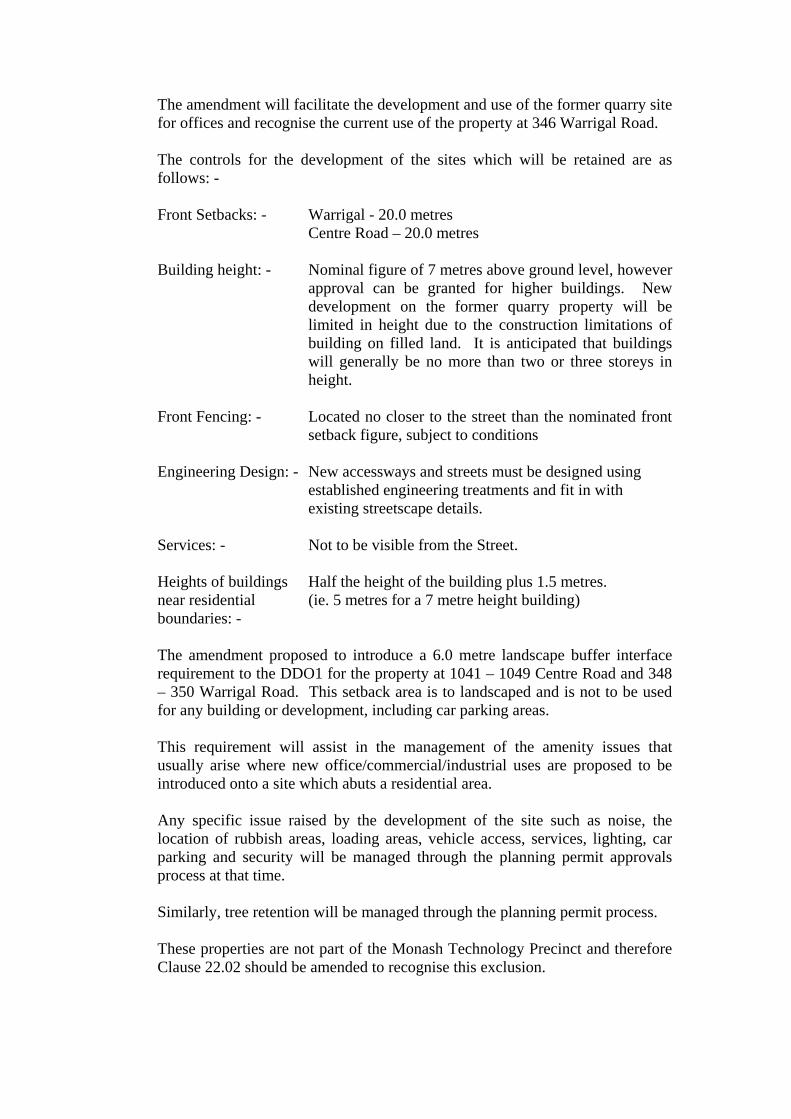
The amendment will facilitate the development and use of the former quarry site for offices and recognise the current use of the property at 346 Warrigal Road. The controls for the development of the sites which will be retained are as follows: - Front Setbacks: - Warrigal - 20.0 metres
Centre Road – 20.0 metres Building height: - Nominal figure of 7 metres above ground level, however
approval can be granted for higher buildings. New development on the former quarry property will be limited in height due to the construction limitations of building on filled land. It is anticipated that buildings will generally be no more than two or three storeys in height.
Front Fencing: - Located no closer to the street than the nominated front
setback figure, subject to conditions Engineering Design: - New accessways and streets must be designed using
established engineering treatments and fit in with existing streetscape details.
Services: - Not to be visible from the Street. Heights of buildings Half the height of the building plus 1.5 metres. near residential (ie. 5 metres for a 7 metre height building) boundaries: - The amendment proposed to introduce a 6.0 metre landscape buffer interface requirement to the DDO1 for the property at 1041 – 1049 Centre Road and 348 – 350 Warrigal Road. This setback area is to landscaped and is not to be used for any building or development, including car parking areas. This requirement will assist in the management of the amenity issues that usually arise where new office/commercial/industrial uses are proposed to be introduced onto a site which abuts a residential area. Any specific issue raised by the development of the site such as noise, the location of rubbish areas, loading areas, vehicle access, services, lighting, car parking and security will be managed through the planning permit approvals process at that time. Similarly, tree retention will be managed through the planning permit process. These properties are not part of the Monash Technology Precinct and therefore Clause 22.02 should be amended to recognise this exclusion.

In support of the amendment application a Preliminary Concept Plan has been submitted. [see Attachment 3] The Concept Plan shows vehicle access to both Warrigal and Centre Roads, a number of Office buildings, Restricted Retail (Peripheral Sales) buildings, car parking and landscape areas. It should be noted that this plan is not submitted for approval but it is only a Concept Plan showing one potential development option. It is provided for discussion purposes and to assist in consideration of the issue relevant to the proposed amendment. Referring to the table below, this Plan shows a total floor area for all uses of 19,868m2, including approximately 15,972m2 of office and approximately 3,896m2 of restricted retail.
Office Restricted
Retail Lighting shop
Concept Plan net floor areas
15,972m2 3,896m2 N/A
Applicant's proposed
net floor areas to zone schedule
max. 20,000m2 Max 6,000m2 N/A
Recommended net floor areas to
zone schedule max. 20,000m2 min. 1000m2 min. 500m2
Notwithstanding the concept plan, the applicant has formally requested the modification of the Schedule to the B3Z-Business 3 Zone to allow development of up to 20,000m2 of office. It is appropriate to nominate a limit on the total office floor area for the property at 1041 – 1049 Centre Road and 348 – 350 Warrigal Road, Oakleigh South to give everyone, the developer and local residents, some level of certainty about the potential development on the site. A Planning Permit is required for the use if the Schedule office floor area limit is exceeded. A Planning Permit is required for all development.
The Concept Plan, while not detailed to allow comprehensive assessment, has been examined and appears reasonable. Approximately 20,000m2 of floor area for the site appears to be appropriate.
Therefore it is considered that a limit of 20,000m2 for offices is appropriate for inclusion in the Schedule. This figure would provide the developer the opportunity to develop the site as per the concept plan, or alternatively, exclusively as an office park.

The Schedule also defines minimum floor areas for restricted retail premises and lighting shops to prevent the development of smaller retailing activities in the zone. There is no restriction on maximum floor areas for these uses.
The standard minimums specified in the schedule are 1000m2 for restricted retail and 500m2 for lighting shops. These figures are also considered to be appropriate for the subject site.
CONSULTATION The Public Exhibition process involved with the amendment will include: -
• Individual notice to surrounding property owners and occupiers. The extent of the notification proposed is detailed in Attachment 4.
• A public meeting, after normal work hours.
• Display advertisement in the a local newspaper circulating in the area
• Multiple large notices on the sites
• Notification to: - o Melbourne Water
o Vic Roads
o Minister for Planning
o Minister for Industry and State Development
o Minister for Water Environment and Climate Change, and
o Minister for Energy Industries and Resources
• Notice in the Government Gazette
AMENDMENT PROCESS The Planning Authority for an application for amendment to the Planning Scheme has the choice to either: -
• refuse to process the application, or
• proceed with the amendment process and place the amendment on public exhibition.
A determination to place an amendment on exhibition does not indicate approval or support for the amendment. The amendment is placed on exhibition, without commitment by Council, as to its final decision. Council has two (2) further opportunities to determine to abandon or refuse the amendment. I.e. Following exhibition of the amendment or after a Panel hearing, if required. Further consideration of the merits of the amendment proposal should be undertaken following the exhibition process when a greater understanding of the community’s interest and its response to the proposal has been received.
Authorisation is required from the Minister for Planning for the preparation and public exhibition of an amendment to a Planning Scheme.
POLICY CONSIDERATION Amendment C87 has been assessed against the objectives of the State and Local Planning Policy Framework including the Municipal Strategic Statement and Local Policy. The Amendment is considered to be complimentary to Clause 12 (Metropolitan Development), Clause 14 (Settlement) and Clause 17 (Economy) of the State Planning Policy Framework. The Amendment builds on and implements relevant areas of the Local Planning Policy Framework, including Clauses 21.03 (Strategic Framework Plan), 21.05 (Economic Development) and 21.07 (Industry). More specifically, it is supportive of: -
• Clause 21.03-3 as the proposed DDO1 will ensure appropriate development setbacks and reinforce the Garden City Character of the Municipality
• Clause 21.05-3 as it will facilitate employment opportunities and create an environment which will assist business growth.
• Clause 21.07-3 as it encourages the renewal and development of industrial land.
The Amendment is considered to be consistent with Melbourne 2030, and in particular: -
• Directions 1 – A more compact City.
• Direction 4 – A more prosperous place.
• Direction 5 – A great place to be.
CONCLUSION
It is recommended that Amendment C87 to the Monash Planning Scheme be placed on public exhibition following authorisation by the Minister for Planning.
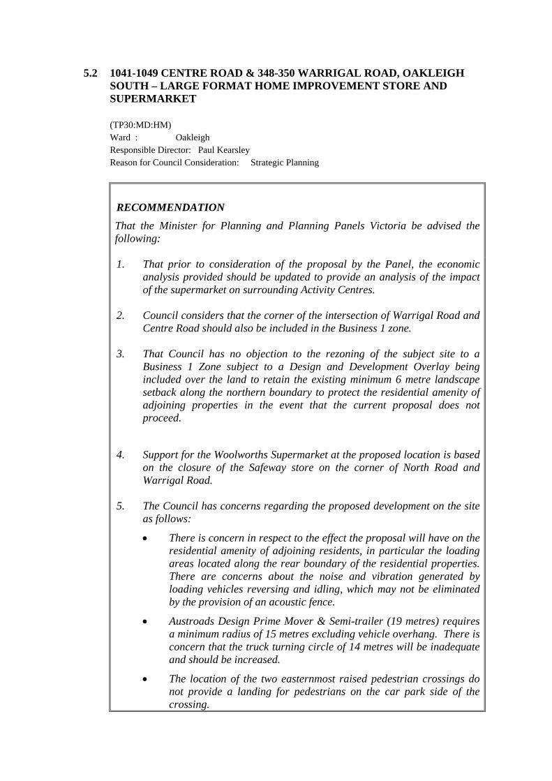
5.2 1041-1049 CENTRE ROAD & 348-350 WARRIGAL ROAD, OAKLEIGH SOUTH – LARGE FORMAT HOME IMPROVEMENT STORE AND SUPERMARKET
(TP30:MD:HM)
Ward : Oakleigh Responsible Director: Paul Kearsley Reason for Council Consideration: Strategic Planning
RECOMMENDATION That the Minister for Planning and Planning Panels Victoria be advised the following: 1. That prior to consideration of the proposal by the Panel, the economic
analysis provided should be updated to provide an analysis of the impact of the supermarket on surrounding Activity Centres.
2. Council considers that the corner of the intersection of Warrigal Road and Centre Road should also be included in the Business 1 zone.
3. That Council has no objection to the rezoning of the subject site to a Business 1 Zone subject to a Design and Development Overlay being included over the land to retain the existing minimum 6 metre landscape setback along the northern boundary to protect the residential amenity of adjoining properties in the event that the current proposal does not proceed.
4. Support for the Woolworths Supermarket at the proposed location is based on the closure of the Safeway store on the corner of North Road and Warrigal Road.
5. The Council has concerns regarding the proposed development on the site as follows:
• There is concern in respect to the effect the proposal will have on the residential amenity of adjoining residents, in particular the loading areas located along the rear boundary of the residential properties. There are concerns about the noise and vibration generated by loading vehicles reversing and idling, which may not be eliminated by the provision of an acoustic fence.
• Austroads Design Prime Mover & Semi-trailer (19 metres) requires a minimum radius of 15 metres excluding vehicle overhang. There is concern that the truck turning circle of 14 metres will be inadequate and should be increased.
• The location of the two easternmost raised pedestrian crossings do not provide a landing for pedestrians on the car park side of the crossing.
• Disabled parking bays outside the supermarket do not appear to provide a footpath for persons with disabilities to safely access the shopping centre.
• It is considered that the trolley bays are located too far away from the store entrances, particularly those associated with the home improvement store.
• It is suggested that the four car parks located within the landscaped area on the north side of the entrance roadway may create congestion and should be removed.
• Signalised intersections are proposed for both access points in Warrigal Road and Centre Road. There is concern that the traffic report suggests that exclusive left turn lane/slip lanes are not necessary on either road in order to be consistent with the existing crossovers adjacent to and opposite the site. This is not considered to be a significant argument against the provision of left turn lanes. The report also argues that these are not feasible to construct due to the narrow nature strip and the presence of fragile services within the nature strip. Similar developments located on Warrigal Road and Centre Road in the vicinity of this proposal (Bunnings at 1126 Centre Road and Safeway at Warrigal Road/North Road) have provided left turn slip lanes at their entrance points.
• The traffic report Section 4 identifies that there are existing uses which currently take access from Warrigal Road and Centre Road in the vicinity of the signals. These are proposed to be restricted to left-in/left-out movements on the approach and departure of the signalised intersections by way of modified line marking. There is no assessment of the impact of these proposed turn bans.
• The traffic report is considered to overestimate the “multi-trip” and “passing trade” factors in calculation traffic generation figures. A factor of 10% for multi-trip peak hour trip ends and an additional factor of 30% for “passing trade” applied to site generated traffic in peak hours are not substantiated and effectively reduce the calculated traffic impact on the adjacent roads. The RTA Guide to Traffic Generating Developments (2002) suggests a rate of 20% for shopping centres of this size.
• As the Centre Road access is proposed to be signalised, further consideration of the design of the intersection between the proposed internal roadway and the warehouse roadway is required.
6. It is considered that the following conditions should be included on any
permit issued in addition to the draft conditions proposed:
(i) Include in Condition 1: The recommendations as contained in the Acoustic Report prepared by Watson Moss Growcott Acoustics Pty Ltd dated 4 February 2010 must be incorporated into the proposed development and shown on the endorsed plans.

(ii) Include in Condition 1: gates be provided at the south-eastern corner of the Home Improvement Centre to avoid unauthorised access and potential “hoon” behaviour near the residential abuttal.
(iii) All deliveries to the site and collection of waste must only occur between the hours of 6am and 10pm seven days a week.
(iv) Replace Condition 17 with the following: Outdoor lighting must be designed, baffled and located to the satisfaction of the Responsible Authority to prevent any adverse effect on adjoining land.
(v) Insert the following drainage requirements under Condition 11 as follows: • Stormwater discharge is to be detained on site to the
predevelopment level of peak stormwater discharge. • Direct the entire site’s stormwater drainage to the south west
corner of the property where it must be collected and free drained via a pipe to the existing pit.
• All on-site stormwater is to be collected from hard surface areas and must not be allowed to flow uncontrolled into adjoining properties. The on-site drainage system must prevent discharge from the driveway onto the footpath. Such a system may include either: a) A trench grate (175mm minimum internal width) located
within the property; and/or b) Shaping the driveway so that water is collected in a grated
pit on the property; and/or c) Another Council approved equivalent.
(vi) Deletion of any conditions relating to the subdivision of the land.
BACKGROUND The subject land is a former quarry site located between Centre Road and Warrigal Road, Oakleigh South. The site is ‘L-shaped’ with frontage of 171 metres to Warrigal Road and 96 metres to Centre Road. Overall site area is approximately 7.8 hectares. See Attachment 1 for locality plan. The southern most part of the site, adjacent to Centre Road, is currently occupied by a large warehouse with the balance of the site being generally flat and devoid of any structures or vegetation. Surrounding development comprises a bus depot, warehouse/office development, fast food and bulky goods stores, local shops and conventional residential development located to the north of the site and along the south side of Centre Road. The Stan Riley Reserve is located to the east of the site. On 19 March 2009, Amendment C87 was gazetted which rezoned the subject site and the adjoining land through to the intersection, to a Business 3 Zone. A

schedule to the zone limits office floor space to a maximum of 20,000 square metres, restricted retail to a minimum floor area of 1,000 square metres and lighting shop to a minimum floor area of 500 square metres. General retail or ‘shop’ uses are prohibited under the Business 3 Zone. The Minister for Planning has been requested by Woolworths to assist in providing a coordinated and timely process for consideration of 12 new large format home improvement and hardware stores across Victoria, including a proposal at the subject site. The Minister for Planning considers that the proposed new stores are of State significance given their potential to deliver significant economic and employment benefits, as well as greater retail choice to the Victorian community by increasing retail competition in the sector. An Advisory Committee has been appointed by the Minister for Planning to advise on the suitability of the sites for development, including a strategic review of the appropriateness of any rezoning/proposed use in view of relevant State and Local Planning Policy Frameworks, the appropriate planning controls for any proposed amendments and whether a planning permit should be issued, including suggested permit conditions. See Attachment 2 for the Terms of Reference for the Advisory Committee.
PROPOSAL The proposal is for a Section 96A application to rezone and develop the land at the subject site. The proposed redevelopment of the land seeks the construction of a new Woolworths home improvement store and a supermarket with some speciality shops. In addition, the proposed rezoning of the land to a Business 1 Zone is to facilitate the proposed uses. The plans of the proposal show the following (Attachment 3): Home Improvement Store A large home improvement store comprising 13,443 square metres is proposed to be sited within the north eastern portion of the site. The trade section and garden nursery are located on either side of the main retail floor space which is dedicated to bulky goods and trade supplies. The breakdown of the floor area of each use within this component of the development is as follows:

Use Floor Area sqm
Restricted Retail/Trade Supplies 8042
Trade Section 2276
Nursery 1910
Back of House 874
Office Mezzanine 341
Total Floor Area 13,443
Supermarket and Speciality Shops
The proposed supermarket is proposed to be sited within the north western portion of the site adjacent to Warrigal Road. The supermarket comprises a total floor area of 3,800 square metres. A total of 10 speciality retail tenancies with a total area 1,100 square metres are proposed to be located around the forecourt area at the entrance to the supermarket. Access and Car Parking
A total of 629 car parking spaces are proposed within an at-grade car park on the site, which includes specialised parking for disabled persons, families and trailers. A total of 20 double sided bicycle rails are to be situated at the front of the supermarket and home improvement store for customers and a further 20 spaces located at the rear of the development for staff use. Vehicle access to the site is to be provided by a new signalised access to Warrigal Road, situated in the centre of the site’s western boundary. Secondary access is provided via the existing crossover from Centre Road, which will also be signalised. Loading Facilities
Loading facilities are to be provided at the rear of the proposed buildings, towards the site’s northern boundary. A loading dock suitable to accommodate two semi-trailers side by side is to be provided for the Home Improvement/Garden/Trade use. A recessed dock is to be provided at the rear of the proposed supermarket also suitable to accommodate a 17 metre heavy vehicle. A general loading area is to be available for use by the speciality stores with pedestrian access provided to each tenancy from the rear. A further loading area (delineated by line marking) is to be provided at the rear of the Trade building. The applicant advises that it is expected that commercial vehicles will enter the site via the proposed traffic signals, then utilise the circulation road to access the rear of the store and reverse into the dedicated dock. It is noted that the access road is located adjacent to the residential area.

It is proposed that all deliveries will be restricted to occurring between the hours of 6am and 10pm, seven days a week. Built Form and Layout
The proposed building is to be setback 6.2 metres from the Warrigal Road frontage. The existing warehouse building fronting Centre Road is to be retained and is setback 20 metres from the Centre Road frontage. A landscape setback of 6.17 metres has been provided along the northern boundary of the site, adjacent to the existing residential area to the north. Within this landscape setback an acoustic wall is proposed to be located 5.2 metres from the northern boundary. The acoustic wall has a height of 4.5 metres (opposite the loading area) and 4 metres high (opposite the home improvement centre). The internal circulation road accessing the loading area is located to the south of the acoustic wall/landscape area with the buildings then setback 13.45 metres from the northern boundary. A landscape setback of 6 metres is provided along the eastern boundary of the site. The total wall height of the northern elevation is approximately 7.2 metres. In the central section of the main building the plant equipment is proposed to be located on the roof and has a total height of 11.85 metres. The Warrigal Road façade is bookmarked at both corners with architectural elements, which feature lightweight translucent panel cladding that can be used for future business identification signage and general branding for the overall development. The prominent southern façade of the building represents the major active frontage of the development and faces onto the car parking area. The entrances to the building are identified through prominent architectural features (entry canopies) that will also contain the corporate signage for the supermarket and home improvement centre. These canopies have a total height of approximately 11.7 metres measured to the top of the parapet. Generally, the total wall height of the southern façade is approximately 7.8 metres. The entrance to the supermarket and associated speciality shops represents a defined feature of the southern elevation, with a raised wall height of approximately 9.3 metres and the addition of extensive glazing to the façade.
CONSULTATION The Department of Planning and Community Development has undertaken notification of the proposal to owners and occupiers of land abutting or adjoining the site. Referral authorities have also been notified and a newspaper notice was published in the Moorabbin Glen Eira Leader newspaper on 30 March.

Submissions are required to be received by Planning Panels -Victoria on Tuesday 4 May 2010.
ASSESSMENT The main matters for discussion are listed below. Rezoning
Under the current Business 3 Zoning a permit may be granted for the proposed restricted retail premises, trade supplies and gardening supplies, however, the use of the land for a ‘shop’, including a supermarket, is prohibited. In order to facilitate the approval of the whole of the development on the subject site, the Minister for Planning proposes to rezone the land to a Business 1 Zone. The purpose of the Business 1 Zone is to encourage the intensive development of business centres for retailing and other complementary commercial, entertainment and community uses. An Economic Report has been submitted with the application which analyses the economic issues associated with the rezoning of the site from Business 3 to Business 1 in respect to the home improvement component. The report indicates that the new store is likely to draw some business from beyond a 10km radius however the impact will be mitigated by growth in the market. Due to this growth in the market, impacts on competing retailers should not result in the closure of competitive retailers that are adequately serving the market. More importantly, the report indicates that the effect of the development on the established Activity Centre hierarchy will be minimal and will not impact on the role of any centre in the hierarchy. The economic analysis however, is incomplete as the report does not evaluate the supermarket component of the development nor the proposal that the existing supermarket is to be relocated from the corner of North and Warrigal Road. It is considered that the Department of Planning and Community Development should seek further information prior to the Panel Hearing to ensure all aspects of the proposal have been included in the analysis. Ultimately the strategic basis for the proposed amendment must also be underpinned by State and Local planning policy frameworks. In particular it is noted that the site is located at the confluence of three municipalities and accessible by local bus services with public transport links to Principal or Major Activity Centres. The centre has evolved in an ad hoc fashion with bulky goods/convenience restaurants in the Glen Eira side and a collection of shops in the Kingston side. It is considered that the proposed development of the subject site will provide the opportunity to consolidate the role of the centre and result in the precinct being consistent with the defining characteristics of a Neighbourhood Activity Centre, which is consistent with Clause 12 of the Monash Planning Scheme and Melbourne 2030.

Clause 21.06 of the Monash Planning Scheme highlights Council’s commitment to maintaining and enhancing the cosmopolitan range of business activity centres across the municipality to continue to meet community needs and preferences for retail, entertainment, office and other commercial services. The proposal facilitates the establishment of a new retail development on vacant land within an established retail precinct. Accordingly, the proposal will assist in achieving the objective to cluster retail activities and consolidate these uses within an existing activity centre and will implement key planning policy frameworks of the Monash Planning Scheme. However, in order for the area to develop in an orderly manner it is also considered prudent that some thought be given to rezoning the balance of the Business 3 land located at the intersection of Warrigal Road and Centre Road to Business 1 and the Minister should be advised accordingly. Setbacks
The proposed 6.2 metre setback to the Warrigal Road frontage is considered satisfactory and provides for an appropriate transition within the streetscape. It is noted that the Monash Planning Scheme does not specify setback requirements within a Business 1 Zone. Under the existing Business 3 zoning a 20 frontage setback is designated for both Warrigal and Centre Roads. However, given the proposed development will reinforce the retail and commercial nature of the area, the removal of the setback requirement is consistent with the objective to develop vibrant activity centres that provide a focal point for the community. The site falls significantly from Warrigal Road to a lower ground level which reduces the impact of the proposed building from the street. In addition, the retention of trees and addition of infill planting within the front setback will aid in softening the building when viewed from Warrigal Road. It is noted that approximately 100 canopy trees are to be planted throughout the car park area with additional canopy trees planted around the perimeter of the site. Although a Design and Development Overlay is not applicable for a Business 1 Zone under the Monash Planning Scheme, it is considered that the existing 6 metre setback requirement to the northern boundary should be retained and included in a new schedule to the Design and Development Overlay to ensure that the amenity of residential properties is maintained in the future in the event that the current application does not proceed. Traffic and Car Parking
A total of 629 car parking spaces are to be provided on site. Under the provisions of the Monash Planning Scheme the car parking rate for a shop is specified at 8 spaces to each 100 square metres of net floor area however it has been well documented and supported within the industry over recent years that a ratio below the planning scheme requirement is adequate for large free

standing shopping centres given the marked change in shopper habits and patterns resulting from the deregulation of shopping hours and the onset of internet shopping. Accordingly, a ratio of 5 spaces to each 100 square metres of net floor area is considered applicable and has been used by Council in other applications for supermarkets within the municipality. There is no specified rate for the home improvement store however Council has previously used a rate of 2.5 spaces to each 100 square metres of net floor area for restricted retail premises which is considered applicable in this case. Using the above rates, car parking for the proposal is required as follows.
Use Floor Area sqm Car Parking Requirement
No of Car Parking Spaces Required
Supermarket 3,800 5 spaces/100m2 190
Speciality Shops 1,100 5 spaces/100m2 55
Home Improvement Store(Restricted
Retail/Trade Supplies 13,443 2.5 spaces/100m2 336
Total 581
As a total of 629 car parking spaces are to be provided on site, a surplus of 48 car parking spaces is created. The Traffic Report submitted with the application indicates that there is potential for the surplus to be used in the future for the ‘Future Development Site 1’ which is located in the southwest corner of the site.
Overall it is considered that the provision of on-site car parking is considered satisfactory.
The proposal was referred to Council’s Traffic Engineers for comment and a number of concerns have been raised and are details as follows:
Site Access • Signalised intersections are proposed for both access points in Warrigal
Road and Centre Road. There is concern that the traffic report suggests that exclusive left turn lane/slip lanes are not necessary on either road in order to be consistent with the existing crossovers adjacent to and opposite the site. This is not considered to be a significant argument against the provision of left turn lanes. The report also argues that these are not feasible to construct due to the narrow nature strip and the presence of fragile services within the nature strip. Similar developments located on Warrigal Road and Centre Road in the vicinity of this proposal (Bunnings at 1126 Centre Road & Safeway at Warrigal Road/North Road) have provided left turn slip lanes at their entrance points.
• The traffic report Section 4 identifies that there are existing uses which currently take access from Warrigal Road and Centre Road in the vicinity
of the signals. These are proposed to be restricted to left-in/left-out movements on the approach and departure of the signalised intersections by way of modified line marking. There is no assessment of the impact of these proposed turn bans.
• The traffic report is considered to overestimate the “multi-trip” and “passing trade” factors in calculating traffic generation figures. A factor of 10% for multi-trip peak hour trip ends and an additional factor of 30% for “passing trade” applied to site-generated traffic in peak hours are not substantiated and effectively reduce the calculated traffic impact on the adjacent roads. The RTA Guide to Traffic Generating Developments (2002) suggests a rate of 20% for shopping centres of this size.
• As the Centre Road access is proposed to be signalised, further consideration of the design of the intersection between the proposed internal roadway and the warehouse roadway is required.
Car Parking • It is suggested that the four car parks located within the landscaped area
on the north side of the entrance roadway may create congestion and should be removed.
Loading facilities • The impact on adjacent residents to the proposed loading areas located
along their rear boundary is of concern. There are concerns about the noise and vibration generated by loading vehicles reversing and idling, which may not be eliminated by the provision of an acoustic fence. Practice has shown that imposing constraints on loading vehicles during night-time hours at other locations are usually beyond the operator’s control and have not overcome these issues.
• Austroads Design Prime Mover & Semi-trailer (19.0m) requires a minimum radius of 15.0m excluding vehicle overhang. There is concern that the truck turning circle of 14.0m will be inadequate and should be increased.
Pedestrians • The locations of the two easternmost raised pedestrian crossings do not
provide a landing area for pedestrians on the car park side of the crossing. • Disabled parking bays outside the supermarket do not appear to provide a
footpath for persons with disabilities to safely access the shopping centre. Amenity
Unfortunately the location of loading facilities for the complex are located north of the proposed building which is adjacent to the existing residential area and could lead to adverse amenity impacts. It is assumed that the reason for this location is due to the size requirements of the proposed building on the site which would be standard product for the company.
In order to counteract any amenity impacts the applicant is proposing to construct a 4 metre to 4.5 metre high acoustic fence located 5.2 metres from the northern boundary. An Acoustic Report submitted with the application indicates that noise control measures can be designed for the site to meet the noise limits as required under the State Environment Protection Policy no. N1 “ Control of Noise from Commerce, Industry and Trade (SEPP N-1). The acoustic fence is one of the measures highlighted in the report. Accordingly, conditions incorporating these measures should be included on any permit issued to ensure that noise generated by the development complies with the SEPP N-1. Deliveries are proposed to occur between 6am to 10pm seven days a week. As detailed in the traffic section above, there are concerns relating to the regulation of the hours of delivery and future enforcement. At the very least specific conditions should be included on any permit issued to stipulate and control delivery times and collection of waste to ensure the amenity of residents is protected. Details of proposed lighting on the site have not been provided and there is concern that if deliveries are to occur of an early morning and evening, then lighting could spill into residential properties. Any lighting should be designed and baffled to prevent overspill into the surrounding residential area. A copy of the draft conditions as proposed by the applicant are contained in Attachment 4.
CONCLUSION The proposed rezoning of the site to a Business 1 Zone and development of the land for a supermarket and home improvement store is considered satisfactory subject to a number of concerns being addressed prior to approval.