report for madura cattle grid replacement - der.wa.gov.au€¦ · main roads western australia...
TRANSCRIPT

Main Roads WesternAustralia
Report for Madura Cattle GridReplacement
Preliminary EnvironmentalImpact Assessment and
Environmental ManagementPlan
April 2011
61/26802/00/5859 Madura Cattle Grid ReplacementPreliminary Environmental Impact Assessment and Environmental Management Plan
Contents
1. Introduction 1
1.1 Project Location 1
2. Assessment Methodology 2
2.1 Preliminary Desktop Study 2
2.2 Statutory Referral Decisions 3
2.3 Site Investigation 3
3. Existing Environment 4
4. Assessment of Aspects and Impacts 5
5. Clearing of Native Vegetation 9
5.1 Avoiding, Minimising and Reducing the Impact of Clearing 9
5.2 Assessment against the Clearing Principles 9
5.3 Project Specific Requirements Relating to CPS 818/5 12
6. Stakeholder consultation 13
7. Environmental Management Plan 14
8. Monitoring 15
9. Auditing 16
10. Decision to Refer 17
11. Report limitations 18
12. References 19
Table IndexTable 1 Existing environment information 4Table 2 Aspects and Impacts 5Table 3 Assessment against the 10 clearing principles 9Table 4 Environmental Management Plan 3

61/26802/00/5859 Madura Cattle Grid ReplacementPreliminary Environmental Impact Assessment and Environmental Management Plan
Figure IndexFigure 1 Project Location 2Figure 2 Site Layout/ Clearing Boundaries 3Figure 3 Environmental Constraints 4
AppendicesA FiguresB Low Impact Environmental Screening ChecklistC Government Agency Managed Databases Search ResultsD Site PhotosE Environmental Management PlanF Main Roads Pastoral Revegetation Plan

161/26802/00/5859 Madura Cattle Grid ReplacementPreliminary Environmental Impact Assessment and Environmental Management Plan
1. Introduction
Main Roads Western Australia – Goldfields-Esperance Region (Main Roads) proposes to replace theMadura Cattle Grid (Grid) on the Eyre Highway at 559.3 SLK (Appendix A, Figure 1). The Grid is nearingthe end of its economical life and requires replacement. For the replacement of the Grid to occur, a sidetrack is required on the northern side of the Eyre Highway (Appendix A, Figure 2). The sidetrack will berehabilitated back to Main Roads specifications upon completion of the project.
The material for the sheeting of the sidetrack will be sourced from an existing gravel pit locatedapproximately 500 m west of the Madura roadhouse. No assessment of the gravel source area isrequired given that no new clearing or ground disturbance is necessary.
In accordance with Main Roads corporate environmental assessment and approvals process, a LowImpact Environmental Screening Checklist was completed (Appendix B). This Preliminary EnvironmentalImpact Assessment was required as the works involve clearing of native vegetation outside themaintenance zone. This report intends to fulfil this requirement. This report also intends to fulfil therequirements of Main Roads State-wide Project Purpose Clearing Permit (CPS 818/5) which is proposedfor use for the project.
1.1 Project LocationThe project area is located within the Shire of Dundas, 32 km east of Madura on the Eyre Highway(Appendix A, Figure 1).

261/26802/00/5859 Madura Cattle Grid ReplacementPreliminary Environmental Impact Assessment and Environmental Management Plan
2. Assessment Methodology
2.1 Preliminary Desktop StudyA preliminary assessment of the project and its potential constraints has been undertaken by reviewing anumber of government agency managed databases. Appendix C contains relevant government databasegenerated reports. The following sections provide a summary of the methodology used for each potentialenvironmental aspect associated with the project.
2.1.1 Threatened Flora, Fauna and Communities
The presence of Threatened Flora and Fauna and Threatened and Priority Ecological Communities(TECs & PECs) was determined by a search of the Department of Environment and Conservation (DEC)NatureMap (for threatened flora and fauna) and TEC and PEC databases.
2.1.2 Environmentally Sensitive Areas (ESAs) and Conservation Reserves
DEC’s Native Vegetation Map Viewer was used to determine the location of any ESAs and ConservationReserves (http://www.dec.wa.gov.au/content/view/2920/1572/1/1/).
2.1.3 Vegetation Type, Extent and Status
Vegetation associations were determined by examining the Shared Land Information Platform (SLIP)Natural Resource Management (NRM) database (http://spatial.agric.wa.gov.au/slip/). The nativevegetation association extent and status represented in the survey areas is drawn from Shepherd, et al.(2002).
2.1.4 Air Quality
The need for a local air quality assessment was determined using the criteria outlined in the Main Roadsenvironmental guideline, Air Quality(http://intranet/online/branches/environment/word/guide_air_quality.doc).
2.1.5 European Heritage
European heritage was examined by searching the Australian Heritage Places Inventory(http://www.heritage.gov.au) and the Heritage Council of Western Australia database(http://register.heritage.wa.gov.au/).
2.1.6 Aboriginal Heritage
A search of the Department of Indigenous Affairs’ (DIA) database (http://www.dia.wa.gov.au/Site-Search/Aboriginal-Heritage-Inquiry-System.aspx) was undertaken to determine whether the project areacontains or is located adjacent to any registered Aboriginal Heritage sites.
2.1.7 Wetlands
The location of wetlands within the project area was determined by examining DEC’s Wetland Base(http://spatial.agric.wa.gov.au/wetlands/).

361/26802/00/5859 Madura Cattle Grid ReplacementPreliminary Environmental Impact Assessment and Environmental Management Plan
2.1.8 Sensitive Water Resources
The Department of Water’s (DoW) Geographic Data Atlas(http://www.water.wa.gov.au/Tools/Maps+and+atlases/Geographic+data+atlas/default.aspx) wasexamined to determine whether the project area supported, or was adjacent to, any significant lakes,rivers, wetlands or proclaimed areas including public drinking water source areas (PDWSAs).
2.1.9 Contaminated Sites
The presence of contaminated sites in the project area was determined by examining DEC’scontaminated sites database (http://www.dec.wa.gov.au/content/view/5627/2295/).
2.1.10 Acid Sulphate Soils
A search of the Australian Soil Resources Information System (ASRIS) website(http://www.asris.csiro.au/mapping/viewer.htm) was conducted to determine the probability of theoccurrence of acid sulphate soils within the project area.
2.1.11 Weeds
Weeds were only considered a potential issue for the project if any Weeds of National Significance(WONS) or Declared Plants pursuant to the Agriculture and Related Resources Protection Act 1976 wererecorded in the project area during the site visit.
2.1.12 Dieback
Dieback was only considered a potential issue for the project if both the mean annual rainfall of the areais >400 mm, and if the project area resides below the 26th parallel.
2.2 Statutory Referral DecisionsThe decision whether to refer the project to the Commonwealth’s Department of Sustainability,Environment, Water, Population and Communities (DSEWPC) was based upon whether the projectwould impact upon matters of national environmental significance (refer to Appendix C– DSEWPC’sEPBC Act Protected Matters Database search). These matters of national environmental significance areassessed for impact in Section 4.
The decision whether to refer the project to the Western Australian Environmental Protection Authority(EPA) was based upon whether the project would be a “significant proposal” as defined by theEnvironmental Protection Act 1986. As a result, all potential environmental aspects relating to the projecthave been examined for their level of significance (refer Section 4).
2.3 Site InvestigationA site visit was carried out by the GHD’s Environmental Scientist, Casey Skalski, on the 10 April 2011 toexamine the general features of the project area. Site photos were taken and are included in Appendix D.

461/26802/00/5859 Madura Cattle Grid ReplacementPreliminary Environmental Impact Assessment and Environmental Management Plan
3. Existing Environment
Information relating to the existing environment of the project area has been summarised in Table 1below. This information has been compiled through both desktop assessments and the site visit.
Table 1 Existing environment information
Factor Value
VegetationAssociation
122
VegetationAssociationDescription
Succulent steppe with open low woodland; Acaia papyrocarpa over saltbush &bluebush
Vegetation Extent and Status
Pre-European Extent (ha) in HamptonIBRA subregion
Current Extent (ha) in Hampton IBRAsubregion
Current Extent(ha) 252377.905 252377.905
% Pre-EuropeanExtent Remaining 100.00% 100.00%
Topography/Geology^
Topography: The project area is flat.
Geology: The geology of the project area consists of carbonate-rich shelfdeposits; predominantly calcarenite and granule calcirudite with minor marginalsandstone.
Climate# Closest Meteorological Station with representative data: Eyre
Avg. Annual rainfall: 307.5 mm
Avg. Max Temp ranges: 18.1 0C (Jul) to 26.5 0C (Jan)
Avg. Min Temp ranges: 5.8 0C (Jul) to 16.1 0C (Feb)
Surrounding LandUse
Pastoral
Weed prevalence Low
^ Source: Department of Mines and Petroluem (2011)
# Source: Bureau of Meteorology (2011)

561/26802/00/5859 Madura Cattle Grid ReplacementPreliminary Environmental Impact Assessment and Environmental Management Plan
4. Assessment of Aspects and Impacts
A summary of all potential environmental aspects associated with the project and their subsequentassessment for environmental impact is provided in Table 2. Environmental constraints are mapped inFigure 3, Appendix A.
Please note: The project area is defined as the extent of the proposed clearing footprint shown in Figure2, Appendix A.
Table 2 Aspects and Impacts
Aspect Evaluation of Potential Impacts
Air quality Likely to be a minor issue during earth works only (due to generation of dust).Implementation of the project is not expected to cause significant increases intraffic volumes in the area meaning that long term air quality levels are notexpected to change. No major sensitive receivers are present within 10 km of theproject area. No significant impacts expected.
Dust Likely to be a minor issue during earth works. No major sensitive receivers arepresent within 10 km of the project area. No significant impacts expected.
Fauna The following nationally (DSEWPC) protected species and/or their habitat havebeen identified as potentially occurring within the project area (refer to Appendix Cfor further information):
Slender-billed Thornbill (western) (Acanthiza iredalei iredalei)
Malleefowl (Leipoa ocellata)
Mulgara (Dasycercus cristicauda)
Rainbow Bee-eater (Merops ornatus)
Great Egret, White Egret (Ardea alba)
White-bellied Sea-Eagle (Haliaeetus leucogaster)
Oriental Plover, Oriental Dotterel (Charadrius veredus)
Cattle Egret (Ardea ibis)
Given the relatively small amount of clearing involved (1.25 ha) and the largeareas of intact native vegetation surrounding the project area, no significantimpacts are expected to any nationally protected species of fauna. Most speciesshould be able to relocate to adjacent habitat, with the number of individualcasualties caused by clearing activities considered highly unlikely to be significant.No active nesting sites were observed in the proposed clearing area whencompleting the site visit. The proposed clearing method involves felling of treesbefore reducing (cutting up) and re-spreading in adjacent areas. This should assistin maintaining some of the habitat value offered by the proposed clearing area.

661/26802/00/5859 Madura Cattle Grid ReplacementPreliminary Environmental Impact Assessment and Environmental Management Plan
Aspect Evaluation of Potential Impacts
Vegetation –clearing
Vegetation clearing
A maximum of 1.25 ha of clearing of native vegetation is required to complete theproposed works. (For clearing boundaries, please refer to Figure 2 of Appendix A.)
A breakdown of proposed clearing is as follows:
Indicative clearing area – 1.25 ha
The material for the sheeting of the sidetrack will be sourced from an existinggravel pit located approximately 500 m west of the Madura roadhouse. Noassessment of the gravel source area is required given that no new clearing orground disturbance is necessary.
Vegetation condition
The condition of native vegetation in the project area ranges from degraded tovery good (using the Keighery scale (Keighery, 1994)). Vegetation was noted tobe degraded alongside the road. Vegetation condition improved to very good asthe distance from the road increased.
The Hampton IBRA subregion in which the project area is located, is considered tobe of Least Concern in terms of its regional extent with no apparent reduction inarea recorded from its pre-European extent (>50% pre-European extent exists andsubject to little or no degradation over a majority of this area.)
The native vegetation to be cleared does not occur within an ESA and no ESAsare located within 10km of the project area.
Significant Flora/ EcologicalCommunities
According to various database searches, there are no records of TECs or,Declared Rare Flora (DRF) located within the proposed clearing area. Thefollowing Priority Flora (PF) taxon has been recorded within 40 km of the projectsite:
Galium leptogonium (P3).
The following nationally (DSEWPC) protected species and/or their habitat havebeen identified as potentially occurring within 10 km project area (refer toAppendix C for further information):
Adenanthos eyrie (threatened).
It is unlikely that A. eyrie will occur in the project area as the species prefers sanddunes on cliffs which is not present in the project area.
The following PEC is located approximately 25 km from the project area:
‘Priority 1’ ecological community – ‘Subterranean faunal ecosystems ofNullabor caves’.
No significant impacts to any significant flora or ecological communities areexpected.
Vegetation –weeds
Weed prevalence within the proposed clearing areas is considered low butstandard weed hygiene measures should still be applied in order to limit the risk ofany further weed spread (Appendix E). No WoNS or Declared Plants pursuant tothe Agriculture and Related Resources Protection Act 1976 were identified in ornear the project areas during the site visit.

761/26802/00/5859 Madura Cattle Grid ReplacementPreliminary Environmental Impact Assessment and Environmental Management Plan
Aspect Evaluation of Potential Impacts
Vegetation –dieback
Dieback is not considered a potential issue for the project given that the projectarea receives less than 400 mm of average annual rainfall. (The nearestmeteorological station with representative data is Eyre with an average annualrainfall of 307.5 mm.)
Reserves /Conservationareas
The closest DEC managed reserve/conservation area to the project area is theNuytsland Nature Reserve (approximately 30 km south). Indirect impacts to thisReserve (e.g. breaking of habitat linkages etc.) are considered highly unlikely dueto the condition of the surrounding environment. No significant impacts areexpected.
The Great Western Woodland, a Natural Heritage Place, exists 80 km west of theproject area. No impacts as a result of the project are expected on the GreatWestern Woodland.
Heritage(European)
No potential significant European heritage sites were identified during the site visitnor are any sites listed in the relevant government databases.
No significant impacts are expected.
Aboriginalheritage
A search of DIA’s database revealed that there are two sites of Aboriginal heritagesignificance located within 20 km of the project area (Figure 3, Appendix A). Thesesites are not within with clearing boundary and are not within 10 km of the projectarea. No archaeological or ethnographic surveys are, therefore, considerednecessary. No significant impacts are expected.
Native Title Given the fact that works are confined to the road reserve and are relatively minorin nature, no actions in regards to native title are considered necessary.
Surfacewater/drainage
During the site visit, no drainage or surface run-off patterns were identified. As aresult, the project is considered highly unlikely to significantly disturb or interruptany surface water flows.
Wetlands No wetlands are located within 10 km of the project area. As a result, nosignificant impacts to wetlands are expected.
Groundwater Given that no dewatering or significant drainage modifications are required, nosignificant changes to the current groundwater level or quality are expected. Anywater required for construction purposes is likely to be minimal and will be theresponsibility of the contractor delivering the works to obtain.
Noise andvibration
No major sensitive local receivers are present within the immediate vicinity of theproject area. The works are not expected to significantly contribute to noise levelsat the nearest receivers (Madura township, 32 km west).
Visual amenity No significant impacts to visual amenity are expected.
Hazardoussubstances
Not considered relevant to the proposed works.
Contamination Given the relatively superficial nature of the required earthworks, there appears tobe a low risk of any significant contamination issues. No significant impacts areexpected.
Furthermore, any risk of contamination from site works will be addressed in theenvironmental management plan (Appendix E).

861/26802/00/5859 Madura Cattle Grid ReplacementPreliminary Environmental Impact Assessment and Environmental Management Plan
Aspect Evaluation of Potential Impacts
Salinity Although water required for construction activities is likely to come from a brackishto saline groundwater resource, significant impacts are not considered likely giventhe small amount of water required (<1,000kL), and the proposed areas ofapplication (road surface).
The proposed clearing is not considered likely to result in any significantgroundwater salinity issues given the fact that the surrounding landscape is nothighly cleared.
Acid SulphateSoils
According to a search of ASRIS, the occurrence of acid sulphate soils isconsidered to be “extremely low.” Furthermore, no dewatering or excavation belowthe water table is planned and therefore the risk of exposing or exacerbating acidsulphate soils is considered to be low. No significant impacts are expected.
EnvironmentallySignificantLandforms
No environmentally significant landforms were identified within 10 km of theproject areas when carrying out the site visits. The Hampton Tableland existsapproximately 2.5 km north of the project area. No significant impacts areexpected.
Statutory LandUse Planning /Adjacent LandUse
Expansion of the existing road reserve is not required. No significant impacts tosurrounding land uses are expected.

961/26802/00/5859 Madura Cattle Grid ReplacementPreliminary Environmental Impact Assessment and Environmental Management Plan
5. Clearing of Native Vegetation
Native vegetation for this project will be cleared using Main Roads State-wide Project Purpose ClearingPermit (CPS 818/5). Native vegetation describes all indigenous aquatic and terrestrial vegetation (livingor dead). The term does not include vegetation that was intentionally sown, planted or propagated unlessit was required under a statutory condition.
5.1 Avoiding, Minimising and Reducing the Impact of ClearingIn accordance with Condition 6 of CPS 818/5, the following measures are proposed in an effort to avoid,minimise and reduce the impact of clearing associated with the project:
All efforts will be made during clearing activities to avoid any unnecessary impacts to nativevegetation (e.g. marking of clearing lines, parking of machinery in already cleared areas etc.).
Cleared vegetation will be cut up and respread in redundant cleared area in order to help preventweed establishment and land degradation as well as to provide habitat and encourage naturalregeneration of the redundant areas.
5.2 Assessment against the Clearing PrinciplesIn accordance with condition 9 of CPS 818/5, the project has been assessed against the DEC’s 10clearing principles. The assessment has indicated that the project is not likely to be at variance with anyof the clearing principles.
Table 3 Assessment against the 10 clearing principles
Principle (a) Native vegetation should not be cleared if it comprises a high level of biologicaldiversity.
Assessment The proposed clearing area is not be considered to contain a high level of biologicaldiversity given its small size and the extensive areas of native vegetation in very goodor better condition that surround the project area. No priority flora were identified in theproposed clearing areas as a result of a desktop assessment of these areas.
One flora species of Commonwealth significance was noted to potentially occur withinthe project area. The proposed clearing will not impact upon this species (refer toTable 2).
One PEC was identified approximately 25 km south west of the project area:
‘Priority 1’ ecological community – ‘Subterranean faunal ecosystems of Nullaborcaves’.
It is unlikely that the proposed clearing will impact upon this PEC.
Conclusion The proposal is not likely to be at variance with this clearing principle.

1061/26802/00/5859 Madura Cattle Grid ReplacementPreliminary Environmental Impact Assessment and Environmental Management Plan
Principle (b) Native vegetation should not be cleared if it comprises the whole or a part of, oris necessary for the maintenance of, a significant habitat for fauna indigenous toWestern Australia.
Assessment Given the relatively small amount of clearing proposed and that the surroundingenvironment is virtually intact with its original vegetation remaining, no significantimpacts to native fauna or its habitat are expected. No active nesting sites wereobserved in the proposed clearing area when carrying out the site visit.
Conclusion The proposal is not likely to be at variance with this clearing principle.
Principle (c) Native vegetation should not be cleared if it includes, or is necessary for thecontinued existence of, rare flora.
Assessment No rare flora was identified within the proposed clearing areas as a result of a desktopassessment. The assessment did not identify any records of DRF within 40 km of theproposed clearing areas. It is therefore considered highly unlikely that any rare florawill be impacted by the proposed works.
Conclusion The proposal is not likely to be at variance with this clearing principle.
Principle (d) Native vegetation should not be cleared if it comprises the whole or a part of, oris necessary for the maintenance of a Threatened Ecological Community.
Assessment No TECs were identified as being within 50 km of the project area.
Conclusion The proposal is not at variance with this clearing principle.
Principle (e) Native vegetation should not be cleared if it is significant as a remnant of nativevegetation in an area that has been extensively cleared.
Assessment Vegetation within and adjacent to the project area is considered to be of LeastConcern, with approximately 100% remaining of the known Vegetation Association inthe Hampton IBRA subregion. The project area is not considered to containfragmented vegetation.
Vegetation within the study area is not considered to contain communities required tomaintain ecosystem services (e.g. hydrological processes).
Conclusion The proposal is not at variance with this clearing principle.
Principle (f) Native vegetation should not be cleared if it is growing in, or in association with,an environment associated with a watercourse or wetland.
Assessment No defined wetlands or water courses are located within the clearing boundaries, norwithin 10 km of the project area.
No groundwater dependent ecosystems occur within or adjacent to the project area
Conclusion The proposal is not at variance with this clearing principle.

1161/26802/00/5859 Madura Cattle Grid ReplacementPreliminary Environmental Impact Assessment and Environmental Management Plan
Principle (g) Native vegetation should not be cleared if the clearing of the vegetation is likelyto cause appreciable land degradation.
Assessment Erosion from wind or water is considered to be low. Much of the surrounding landsurface is well vegetated. The clearing of native vegetation is not expected to alter thequality or quantity of water run-off in or adjacent to the project area. Waterlogging andchanges to nutrient levels are not expected to be altered by the clearing of vegetationin the project area.
The clearing of vegetation is not considered to alter soil acidity in or adjacent to theproject area.
The clearing of vegetation is not considered to significantly alter the hydrologicalbalance and cause a change in the salinity either on- or off-site.
Conclusion The proposal is not likely to be at variance with this clearing principle.
Principle (h) Native vegetation should not be cleared if the clearing of the vegetation is likelyto have an impact on the environmental values of any adjacent or nearbyconservation area.
Assessment The project area is not adjacent to, or in the vicinity of a conservation reserve orprotected area. The closest conservation area is Nuytsland Nature Reserve, which issituated approximately 30 km south.
The project area occurs in a region where the vegetation extent is of Least Concern.Little fragmentation of vegetation has occurred.
The project area occurs in a region where the vegetation has not been significantlyaltered. The project area does not provide a buffer or outlier to a conservation area.Ecological linkages and corridors are not considered to be significantly altered by anyproposed clearing activities in the project area
Conclusion The proposal is not at variance with this clearing principle.
Principle (i) Native vegetation should not be cleared if the clearing of the vegetation is likelyto cause deterioration in the quality of surface or underground water.
Assessment The project area does not occur within a proclaimed Public Drink Water Supply Area.
The clearing of vegetation is not considered to cause an alteration to the quality ofgroundwater in or adjacent to the project area.
No groundwater dependent ecosystems occur in or adjacent to the project area.
The clearing of vegetation is not considered to cause an alteration to the quality ofsurface waters in or adjacent to the project area.
Conclusion The proposal is not at variance with this clearing principle.
Principle (j) Native vegetation should not be cleared if clearing the vegetation is likely tocause, or exacerbate, the incidence of flooding.
Assessment No significant change to the hydrology of the area is expected given the climate andtopography of the local area, and relatively superficial nature of the works. Naturalsurface water flow patterns will not be obstructed by the clearing meaning it is highlyunlikely that the works will cause or exacerbate the incidence of flooding in the area.
Conclusion The proposal is not likely to be at variance with this clearing principle.

1261/26802/00/5859 Madura Cattle Grid ReplacementPreliminary Environmental Impact Assessment and Environmental Management Plan
5.3 Project Specific Requirements Relating to CPS 818/5The project does include clearing for temporary works. As a result, a revegetation plan is required inaccordance with the conditions of CPS 818/5. Appendix F contains the Main Roads Revegetation forPastoral Areas.
No offsets or management strategies are required given that no variance with any of the ten clearingprinciples is considered likely to exist.

1361/26802/00/5859 Madura Cattle Grid ReplacementPreliminary Environmental Impact Assessment and Environmental Management Plan
6. Stakeholder consultation
Given the minor nature of the project, no stakeholder consultation is considered necessary.

1461/26802/00/5859 Madura Cattle Grid ReplacementPreliminary Environmental Impact Assessment and Environmental Management Plan
7. Environmental Management Plan
An Environmental Management Plan (EMP) has been developed for the project (Appendix E) taking intoaccount the assessments carried out above. The main aim of this EMP is to provide a management planto assist in minimising the environmental impacts of the activities associated with the proposed worksand to identify who is responsible for the implementation of any subsequent management strategies.This EMP is predominantly for the Main Roads Project Manager’s reference and provides basicrequirements for any Contractor produced EMP (subject to any conditions outlined in the actualContract). It may, however, be used to complement the contractor’s EMP.
The EMP will only address site-specific issues that were identified during the PEIA. The areas thatrequire special management will be addressed in terms of:
the timing of various management actions;
the topic (e.g. vegetation);
the objectives for each area;
the actions that are necessary to minimise the impact;
the responsible party for implementing the action; and
whether the action arose from external advice or is a Main Roads requirement.

1561/26802/00/5859 Madura Cattle Grid ReplacementPreliminary Environmental Impact Assessment and Environmental Management Plan
8. Monitoring
No environmental monitoring is considered necessary given the small scale of the project.

1661/26802/00/5859 Madura Cattle Grid ReplacementPreliminary Environmental Impact Assessment and Environmental Management Plan
9. Auditing
Audits against the EMP may be carried out depending on regional priorities and perceived risk. On-ground checking post-construction will be carried out as a minimum by the Main Roads Goldfields-Esperance Region Environment Officer.

1761/26802/00/5859 Madura Cattle Grid ReplacementPreliminary Environmental Impact Assessment and Environmental Management Plan
10. Decision to Refer
Given the small scale of the project, the low significance of its impacts to the surrounding environment,and the environmental management measures proposed, it is recommended that the project does notrequire referral to the EPA. It is also recommended that the project does not require referral to theDSEWPC as no items of national environmental significance were identified as likely to be significantlyimpacted by the proposed works.

1861/26802/00/5859 Madura Cattle Grid ReplacementPreliminary Environmental Impact Assessment and Environmental Management Plan
11. Report limitations
This report presents the results of a field visit and desktop assessment findings, prepared for the purposeof this commission. The data and advice provided herein relate only to the project described herein andmust be reviewed by a competent scientist before being used for any other purpose. GHD accepts noresponsibility for other use of the data.
Where reports, searches, any third party information and similar work have been performed andrecorded by others the data is included and used in the form provided by others. The responsibility forthe accuracy of such data remains with the issuing authority, not with GHD.
For these investigations GHD has conducted desktop data searches and a field survey. The conclusionsof this report were based on the information gathered during these investigations and thus reflect theenvironment of the project area at the time of survey. GHD accepts no responsibility for any variation inthe flora present in the project area due to natural and seasonal variability.
1961/26802/00/5859 Madura Cattle Grid ReplacementPreliminary Environmental Impact Assessment and Environmental Management Plan
12. References
BoM (2010). Climate Statistics for Australian Locations. (Online)http://www.bom.gov.au/climate/averages/tables/cw_011019.shtml. Accessed 08/04/2011
Department of Mines and Petroleum (2011) GeoView. (Online)http://mapserver.doir.wa.gov.au/GeoVIEW2/viewer.htm?Title=GeoVIEW.WA. Accessed 13/04/2011
Environmental Protection Agency (2009) Guide to EIA Environmental Principles, Factors and Objectives.(Online) http://www.epa.wa.gov.au/docs/1920_6%20EIA%20Guide%20Env%20Principles-Factors-Objectives_1-11-04.pdf. Accessed 16/03/2011
Keighery, B.J. (1994). Bushland Plant Survey: a Guide to Plant Community Survey for the Community.Wildflower Society of WA (Inc.) Nedlands, Western Australia.
Shepherd, D.P., Beeston, G.R., and A.J.M. Hopkins (2002). Native Vegetation in Western Australia –Extent, Type and Status. Resource Management Technical Report 249, Department of Agriculture,Western Australia.

161/26802/00/5859 Madura Cattle Grid ReplacementPreliminary Environmental Impact Assessment and Environmental Management Plan
Appendix A
Figures
Figure 1 – Project LocationFigure 2 – Site Layout/ Clearing BoundariesFigure 3 – Environmental Constraints

250,000
250,000
325,000
325,000
400,000
400,000
6,450
,000
6,450
,000
Figure 1
Job NumberRevision A
61-26802-00
G:\61\26802\GIS\Maps\MXD\61-26802-001.mxd
Map Projection: Transverse MercatorHorizontal Datum: Geocentric Datum of Australia
Grid: Map Grid of Australia 1994, Zone 52
0 6 12 18 24 303
Kilometers
LEGEND
o© 2011. While GHD has taken care to ensure the accuracy of this product, GHD and Landgate make no representations or warranties about its accuracy, completeness or suitability for any particular purpose. GHD and Landgate cannot accept liability of any kind(whether in contract, tort or otherwise) for any expenses, losses, damages and/or costs (including indirect or consequential damage) which are or may be incurred as a result of the product being inaccurate, incomplete or unsuitable in any way and for any reason.
Date 17 APR 2011
Main Roads Western AustraliaMadura Cattle GridReplacemen PEIA and EMP
Project Location
Data source: Landgate: Travellers Atlas 2004; GHD study area mga51 20110408. Created by: CSkalski
239 Adelaide Terrace Perth WA 6004 Australia T 61 8 6222 8222 F 61 8 6222 8555 E [email protected] W www.ghd.com.au
1:750,000(at A4)
Cattle Grid Location


MADURA CAVE.
JOES CAVE.
WALPET CAVE.
MULLAMULLANG CAVE.
325,000
325,000
350,000
350,000
375,000
375,000
6,475
,000
6,475
,000
Figure 3
Job NumberRevision A
61-26802-00
G:\61\2680200\GIS\Maps\MXD\61-2680200-G002.mxd
Map Projection: Transverse MercatorHorizontal Datum: Geocentric Datum of Australia
Grid: Map Grid of Australia 1994, Zone 52
0 2 4 6 8 101
Kilometers
LEGEND
o© 2011. While GHD has taken care to ensure the accuracy of this product, GHD, DEC, DIA and Landgate make no representations or warranties about its accuracy, completeness or suitability for any particular purpose. GHD, DEC, DIA and Landgate cannot accept liability of any kind(whether in contract, tort or otherwise) for any expenses, losses, damages and/or costs (including indirect or consequential damage) which are or may be incurred as a result of the product being inaccurate, incomplete or unsuitable in any way and for any reason.
Date 08 APR 2011
Main Roads Western AustraliaMadura Cattle GridReplacemen PEIA and EMP
Environmental Constraints
Data source: Landgate: Travellers Atlas 2004; GHD study area mga51 20110408. DEC: Madura GHD TecPecSearch Results 11042011 DIA: Aboriginal heritage clip 20110412 Created by: CSkalski
239 Adelaide Terrace Perth WA 6004 Australia T 61 8 6222 8222 F 61 8 6222 8555 E [email protected] W www.ghd.com.au
1:250,000(at A4)
Cattle Grid Location
Aboriginal Heritage Site
Priority Ecological CommunitiesP1- Priority Ecological Communities

561/26802/00/5859 Madura Cattle Grid ReplacementPreliminary Environmental Impact Assessment and Environmental Management Plan
Appendix B
Low Impact Environmental ScreeningChecklist


661/26802/00/5859 Madura Cattle Grid ReplacementPreliminary Environmental Impact Assessment and Environmental Management Plan
Appendix C
Government Agency Managed DatabasesSearch Results

161/26802/00/5859 Madura Cattle Grid ReplacementPreliminary Environmental Impact Assessment and Environmental Management Plan
Project Area

2 sites in a search box. The box is formed by these diagonally opposed corner points:
Search Criteria
Latitude Longitude
GDA94
-31° 44' 3" 127° 8' 30"
-32° 5' 23" 127° 34' 52"
Aboriginal Sites Database
Aboriginal Heritage Inquiry System
© Government of Western Australia Report created 08 Apr 2011 10:40:31. Identifier: 781775. Page 1

Aboriginal Sites Database
Aboriginal Heritage Inquiry System
N
M
F
No restriction
Male access only
Female access
Legend
S - Stored Data
C
O
V
Closed
Open
Vulnerable
[Reliable]
[Unreliable]
The spatial information recorded in the site file is deemed to be reliable, due to methods of capture.
The spatial information recorded in the site file is deemed to be unreliable due to errors of spatial data capture and/or quality of spatial information reported.
Restriction
Status
Access Coordinate Accuracy
Accuracy is shown as a code in brackets following the site coordinates.
Disclaimer
Aboriginal sites exist that are not recorded on the Register of Aboriginal Sites, and some registered sites may no longer exist. Consultation with Aboriginal communities is on-going to identify additional sites. The AHA protects all Aboriginal sites in Western Australia whether or not they are registered.
Index coordinates are indicative locations and may not necessarily represent the centre of sites, especially for sites with an access code “closed” or “vulnerable”. Map coordinates (Lat/Long) and (Easting/Northing) are based on the GDA 94 datum. The Easting / Northing map grid can be across one or more zones. The zone is indicated for each Easting on the map, i.e. '5000000:Z50' means Easting=5000000, Zone=50.
Spatial Accuracy
Copyright
Copyright in the information contained herein is and shall remain the property of the State of Western Australia. All rights reserved. This includes, but is not limited to, information from the Register of Aboriginal Sites established and maintained under the Aboriginal Heritage Act 1972 (AHA).
R - Registered Site
IA - Information AssessedSites lodged with the Department are assessed under the direction of the Registrar of Aboriginal Sites. These are not the final assessment.
Final assessment and decisions will be determined by the Aboriginal Cultural Material Committee (ACMC).
*Explanation of Assessment
Site boundaries may not appear on maps at low zoom levels
Sites Shown on Maps
I - Insufficient information
L - Lodged
Information lodged, awaiting assessment
Information Awaiting ACMC Decision Assessment Only
ACMC Decision Made
© Government of Western Australia Report created 08 Apr 2011 10:40:31. Identifier: 781775. Page 2

List of 2 Registered Aboriginal Sites with Map
Site ID Status Access Restriction Site Name Site Type Additional Info Informants Coordinates Site No.
2002 W01197Walpet Cave.OR Artefacts / Scatter 327633mE 6483665mN Zone 52 [Unreliable]
Archeological Deposit, Rockshelter
N
2003 W01198Joes Cave.OR Artefacts / Scatter 328633mE 6481664mN Zone 52 [Unreliable]
Archeological Deposit, Rockshelter
N
Aboriginal Sites Database
Aboriginal Heritage Inquiry System
© Government of Western Australia Report created 08 Apr 2011 10:40:31. Identifier: 781775. Page 3

Aboriginal Sites Database
Aboriginal Heritage Inquiry System
Copyright for base map information shall at all times remain the property of the Commonwealth of Australia, Geoscience Australia - National Mapping Division. All rights reserved.
Cadastre, Local Government Authority, Native Title boundary data copyright © Western Australian Land Information Authority trading as Landgate (2011).
Geothermal Application, Geothermal Title, Mining Tenement, Petroleum Application, Petroleum Title boundary data copyright © the State of Western Australia (DMP) (2011.4).
For further important information on using this information please see the Department of Indigenous Affairs’ Terms of Use statement at http://www.dia.wa.gov.au/Terms-Of-Use/
Selected Heritage Sites
Registered Sites
Town
Map Area
Search Area
Legend
© Government of Western Australia Report created 08 Apr 2011 10:40:31. Identifier: 781775. Page 4

Aboriginal Sites Database
Aboriginal Heritage Inquiry System
List of Other Heritage Places with Map
No results
© Government of Western Australia Report created 08 Apr 2011 10:40:31. Identifier: 781775. Page 5

Aboriginal Sites Database
Aboriginal Heritage Inquiry System
Copyright for base map information shall at all times remain the property of the Commonwealth of Australia, Geoscience Australia - National Mapping Division. All rights reserved.
Cadastre, Local Government Authority, Native Title boundary data copyright © Western Australian Land Information Authority trading as Landgate (2011).
Geothermal Application, Geothermal Title, Mining Tenement, Petroleum Application, Petroleum Title boundary data copyright © the State of Western Australia (DMP) (2011.4).
For further important information on using this information please see the Department of Indigenous Affairs’ Terms of Use statement at http://www.dia.wa.gov.au/Terms-Of-Use/
Selected Heritage Sites
Other Heritage Places
Town
Map Area
Search Area
Legend
© Government of Western Australia Report created 08 Apr 2011 10:40:31. Identifier: 781775. Page 6

Map Showing Registered Aboriginal Sites and Other Heritage Places
Aboriginal Sites Database
Aboriginal Heritage Inquiry System
© Government of Western Australia Report created 08 Apr 2011 10:40:31. Identifier: 781775. Page 7

Aboriginal Sites Database
Aboriginal Heritage Inquiry SystemMap Showing Registered Aboriginal Sites and Other Heritage Places
Copyright for base map information shall at all times remain the property of the Commonwealth of Australia, Geoscience Australia - National Mapping Division. All rights reserved.
Cadastre, Local Government Authority, Native Title boundary data copyright © Western Australian Land Information Authority trading as Landgate (2011).
Geothermal Application, Geothermal Title, Mining Tenement, Petroleum Application, Petroleum Title boundary data copyright © the State of Western Australia (DMP) (2011.4).
For further important information on using this information please see the Department of Indigenous Affairs’ Terms of Use statement at http://www.dia.wa.gov.au/Terms-Of-Use/
Selected Heritage Sites
Registered Sites
Other Heritage Places
Town
Map Area
Search Area
Legend
© Government of Western Australia Report created 08 Apr 2011 10:40:31. Identifier: 781775. Page 8
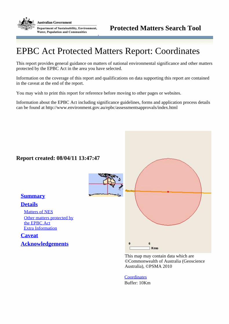
EPBC Act Protected Matters Report: CoordinatesThis report provides general guidance on matters of national environmental significance and other mattersprotected by the EPBC Act in the area you have selected.
Information on the coverage of this report and qualifications on data supporting this report are containedin the caveat at the end of the report.
You may wish to print this report for reference before moving to other pages or websites.
Information about the EPBC Act including significance guidelines, forms and application process detailscan be found at http://www.environment.gov.au/epbc/assessmentsapprovals/index.html
This map may contain data which are©Commonwealth of Australia (GeoscienceAustralia), ©PSMA 2010
CoordinatesBuffer: 10Km
Report created: 08/04/11 13:47:47
Summary
DetailsMatters of NESOther matters protected bythe EPBC ActExtra Information
Caveat
Acknowledgements
Protected Matters Search Tool

SummaryMatters of National Environmental Significance
This part of the report summarises the matters of national environmental significance that may occur in,or may relate to, the area you nominated. Further information is available in the detail part of the report,which can be accessed by scrolling or following the links below. If you are proposing to undertake anactivity that may have a significant impact on one or more matters of national environmental significancethen you should consider the Administrative Guidelines on Significance - seehttp://www.environment.gov.au/epbc/assessmentsapprovals/guidelines/index.html.
World Heritage Properties: None
National Heritage Places: 1
Wetlands of InternationalSignificance (RamsarWetlands):
None
Great Barrier Reef MarinePark:
None
Commonwealth Marine Areas: None
Threatened EcologicalCommunitites:
None
Threatened Species: 4
Migratory Species: 8
Other Matters Protected by the EPBC Act
This part of the report summarises other matters protected under the Act that may relate to the area younominated. Approval may be required for a proposed activity that significantly affects the environment onCommonwealth land, when the action is outside the Commonwealth land, or the environment anywherewhen the action is taken on Commonwealth land. Approval may also be required for the Commonwealthor Commonwealth agencies proposing to take an action that is likely to have a significant impact on theenvironment anywhere.
The EPBC Act protects the environment on Commonwealth land, the environment from the actions takenon Commonwealth land, and the environment from actions taken by Commonwealth agencies. Asheritage values of a place are part of the 'environment', these aspects of the EPBC Act protect theCommonwealth Heritage values of a Commonwealth Heritage place and the heritage values of a place onthe Register of the National Estate. Information on the new heritage laws can be found athttp://www.environment.gov.au/heritage/index.html
Please note that the current dataset on Commonwealth land is not complete. Further information onCommonwealth land would need to be obtained from relevant sources including Commonwealthagencies, local agencies, and land tenure maps.
A permit may be required for activities in or on a Commonwealth area that may affect a member of alisted threatened species or ecological community, a member of a listed migratory species, whales andother cetaceans, or a member of a listed marine species. Information on EPBC Act permit requirementsand application forms can be found at http://www.environment.gov.au/epbc/permits/index.html.
Commonwealth Lands: None
Commonwealth HeritagePlaces:
None
Listed Marine Species: 5

Whales and Other Cetaceans: None
Critical Habitats: None
Commonwealth Reserves: None
Report Summary for Extra Information
This part of the report provides information that may also be relevant to the area you have nominated.
Place on the RNE: None
State and Territory Reserves: None
Regional Forest Agreements: None
Invasive Species: 5
Nationally ImportantWetlands:
None
DetailsMatters of National Environmental Significance
National Heritage Places [ Resource Information ]
Name StatusNaturalGreat Western Woodlands ofWestern
Nominated place
Threatened Species [ Resource Information ]
Name Status Type of PresenceBIRDSAcanthiza iredalei iredaleiSlender-billed Thornbill(western) [25967]
Vulnerable Species or species habitat likely to occur within area
Leipoa ocellataMalleefowl [934] Vulnerable Species or species habitat likely to occur within area
MAMMALSDasycercus cristicaudaMulgara [328] Vulnerable Species or species habitat likely to occur within area
PLANTSAdenanthos eyreiToolinna Adenanthos [7763] Endangered Species or species habitat may occur within area
Migratory Species [ Resource Information ]
Name Status Type of PresenceMigratory Marine BirdsArdea albaGreat Egret, White Egret[59541]
Species or species habitat may occur within area
Ardea ibisCattle Egret [59542] Species or species habitat may occur within areaMigratory Terrestrial Species

Haliaeetus leucogasterWhite-bellied Sea-Eagle [943] Species or species habitat likely to occur within area
Leipoa ocellataMalleefowl [934] Vulnerable Species or species habitat likely to occur within area
Merops ornatusRainbow Bee-eater [670] Species or species habitat may occur within areaMigratory Wetlands SpeciesArdea albaGreat Egret, White Egret[59541]
Species or species habitat may occur within area
Ardea ibisCattle Egret [59542] Species or species habitat may occur within areaCharadrius veredusOriental Plover, OrientalDotterel [882]
Species or species habitat may occur within area
Other Matters Protected by the EPBC Act
Listed Marine Species [ Resource Information ]
Name Status Type of PresenceBirdsArdea albaGreat Egret, White Egret[59541]
Species or species habitat may occur within area
Ardea ibisCattle Egret [59542] Species or species habitat may occur within areaCharadrius veredusOriental Plover, OrientalDotterel [882]
Species or species habitat may occur within area
Haliaeetus leucogasterWhite-bellied Sea-Eagle [943] Species or species habitat likely to occur within area
Merops ornatusRainbow Bee-eater [670] Species or species habitat may occur within area
Extra Information
Invasive Species [ Resource Information ]
Weeds reported here are the 20 species of national significance (WoNS), along with other introducedplants that are considered by the States and Territories to pose a particularly significant threat tobiodiversity. The following feral animals are reported: Goat, Red Fox, Cat, Rabbit, Pig, Water Buffaloand Cane Toad. Maps from Landscape Health Project, National Land and Water Resouces Audit, 2001.Name Status Type of PresenceMammalsFelis catusCat, House Cat, Domestic Cat[19]
Species or species habitat likely to occur within area
Oryctolagus cuniculusRabbit, European Rabbit [128] Species or species habitat likely to occur within area
Vulpes vulpes

Red Fox, Fox [18] Species or species habitat may occur within areaPlantsCarrichtera annuaWard's Weed [9511] Species or species habitat likely to occur within area
Lycium ferocissimumAfrican Boxthorn, Boxthorn[19235]
Species or species habitat may occur within area
CaveatThe information presented in this report has been provided by a range of data sources as acknowledged atthe end of the report.
This report is designed to assist in identifying the locations of places which may be relevant indetermining obligations under the Environment Protection and Biodiversity Conservation Act 1999. Itholds mapped locations of World Heritage and Register of National Estate properties, Wetlands ofInternational Importance, Commonwealth and State/Territory reserves, listed threatened, migratory andmarine species and listed threatened ecological communities. Mapping of Commonwealth land is notcomplete at this stage. Maps have been collated from a range of sources at various resolutions.
Not all species listed under the EPBC Act have been mapped (see below) and therefore a report is ageneral guide only. Where available data supports mapping, the type of presence that can be determinedfrom the data is indicated in general terms. People using this information in making a referral may need toconsider the qualifications below and may need to seek and consider other information sources.
For threatened ecological communities where the distribution is well known, maps are derived fromrecovery plans, State vegetation maps, remote sensing imagery and other sources. Where threatenedecological community distributions are less well known, existing vegetation maps and point location dataare used to produce indicative distribution maps.
For species where the distributions are well known, maps are digitised from sources such as recoveryplans and detailed habitat studies. Where appropriate, core breeding, foraging and roosting areas areindicated under 'type of presence'. For species whose distributions are less well known, point locations arecollated from government wildlife authorities, museums, and non-government organisations; bioclimaticdistribution models are generated and these validated by experts. In some cases, the distribution maps arebased solely on expert knowledge.
Only selected species covered by the following provisions of the EPBC Act have been mapped:- migratory and- marine
The following species and ecological communities have not been mapped and do not appear in reportsproduced from this database:
- threatened species listed as extinct or considered as vagrants- some species and ecological communities that have only recently been listed- some terrestrial species that overfly the Commonwealth marine area- migratory species that are very widespread, vagrant, or only occur in small numbers.
The following groups have been mapped, but may not cover the complete distribution of the species:- non-threatened seabirds which have only been mapped for recorded breeding sites;- seals which have only been mapped for breeding sites near the Australian continent.
Such breeding sites may be important for the protection of the Commonwealth Marine environment.
Coordinates
127.32416 -31.91196

AcknowledgementsThis database has been compiled from a range of data sources. The department acknowledges thefollowing custodians who have contributed valuable data and advice:
-Department of Environment, Climate Change and Water, New South Wales-Department of Sustainability and Environment, Victoria-Department of Primary Industries, Parks, Water and Environment, Tasmania-Department of Environment and Natural Resources, South Australia-Parks and Wildlife Service NT, NT Dept of Natural Resources, Environment and the Arts-Environmental and Resource Management, Queensland-Department of Environment and Conservation, Western Australia-Department of the Environment, Climate Change, Energy and Water-Birds Australia-Australian Bird and Bat Banding Scheme-Australian National Wildlife Collection-Natural history museums of Australia-Museum Victoria-Australian Museum-SA Museum-Queensland Museum-Online Zoological Collections of Australian Museums-Queensland Herbarium-National Herbarium of NSW-Royal Botanic Gardens and National Herbarium of Victoria-Tasmanian Herbarium-State Herbarium of South Australia-Northern Territory Herbarium-Western Australian Herbarium-Australian National Herbarium, Atherton and Canberra-University of New England-Ocean Biogeographic Information System-Australian Government, Department of Defence-State Forests of NSW-Other groups and individuals
Environment Australia is extremely grateful to the many organisations and individuals who providedexpert advice and information on numerous draft distributions.
Please feel free to provide feedback via the page.Contact Us
Accessibility | | | | Disclaimer Privacy © Commonwealth of Australia HelpLast updated: Thursday, 16-Sep-2010 09:13:25 EST
Department of Sustainability, Environment, Water, Population and CommunitiesGPO Box 787Canberra ACT 2601 Australia+61 2 6274 1111 ABN
| |Australian Government

Page 1
NatureMap Species Report
Created By Guest user on 08/04/2011
Method Centre Buffer
'By Circle' 127°21' 14'' E,31°54' 14'' S 40km
Name ID Species Name Naturalised Conservation Code 1Endemic To QueryArea
1. 3213 Acacia anceps
2. 3262 Acacia cochlearis (Rigid Wattle)
3. 12672 Acacia cupularis
4. 3440 Acacia merrallii
5. 3473 Acacia oswaldii (Miljee)
6. 3481 Acacia papyrocarpa (Western Myall)
7. 12272 Acacia verricula
8. 24559 Acanthagenys rufogularis (Spiny-cheeked Honeyeater)
9. 24260 Acanthiza apicalis (Broad-tailed Thornbill (Inland Thornbill))
10. 24261 Acanthiza chrysorrhoa (Yellow-rumped Thornbill)
11. 24263 Acanthiza iredalei subsp. iredalei
12. -1576 Actitis hypoleucos
13. 25544 Aegotheles cristatus (Australian Owlet-nightjar)
14. 24860 Amphibolurus norrisi
15. 2378 Amyema melaleucae
16. 2380 Amyema miquelii (Stalked Mistletoe)
17. 2383 Amyema preissii (Wireleaf Mistletoe)
18. 24312 Anas gracilis (Grey Teal)
19. -6162 Angianthus sp.
20. 24561 Anthochaera carunculata (Red Wattlebird)
21. -1612 Anthus novaeseelandiae
22. 25528 Aphelocephala leucopsis (Southern Whiteface)
23. 24988 Aprasia inaurita
24. 24285 Aquila audax (Wedge-tailed Eagle)
25. 2992 Arabidella trisecta
26. -1578 Ardea modesta
27. 24610 Ardeotis australis (Australian Bustard) P4
28. 25566 Artamus cinereus (Black-faced Woodswallow)
29. 24353 Artamus cyanopterus (Dusky Woodswallow)
30. 64 Asplenium trichomanes (Maidenhair Spleenwort)
31. 2452 Atriplex cinerea (Grey Saltbush)
32. 11516 Atriplex nummularia subsp. spathulata (Old Man Saltbush)
33. 2481 Atriplex vesicaria (Bladder Saltbush)
34. 17950 Austrodanthonia caespitosa
35. 17236 Austrostipa drummondii
36. 17246 Austrostipa nitida
37. 17247 Austrostipa platychaeta
38. 32315 Barbula calycina
39. -1633 Barnardius zonarius
40. 24161 Bettongia lesueur subsp. graii (Burrowing Bettong, Boodie)
41. 24722 Cacatua leadbeateri (Major Mitchell's Cockatoo) S
42. 25598 Cacomantis flabelliformis (Fan-tailed Cuckoo)
43. 3002 Cakile maritima (Sea Rocket) Y
44. 24269 Calamanthus campestris (Rufous Fieldwren)
45. -1607 Calamanthus cautus
46. 3008 Carrichtera annua (Ward's Weed) Y
47. 2953 Cassytha melantha (Large Dodder-laurel)
48. 32462 Ceratodon purpureus subsp. convolutus
49. 24086 Cercartetus concinnus (Western Pygmy-possum, Mundarda)
50. -1624 Chalcites basalis
51. -1581 Chalcites lucidus
52. -1615 Chalcites osculans
53. 24186 Chalinolobus gouldii (Gould's Wattled Bat)
54. 24187 Chalinolobus morio (Chocolate Wattled Bat)
55. 25573 Charadrius bicinctus (Double-banded Plover)
56. 24377 Charadrius ruficapillus (Red-capped Plover)

Page 2
Name ID Species Name Naturalised Conservation Code 1Endemic To QueryArea
57. 25233 Christinus alexanderi
58. 24980 Christinus marmoratus (Marbled Gecko)
59. -1637 Chroicocephalus novaehollandiae
60. 24833 Cincloramphus cruralis (Brown Songlark)
61. -1620 Cinclosoma castanotum
62. 30956 Cinclosoma castanotus (Chestnut Quail-thrush)
63. 24289 Circus assimilis (Spotted Harrier)
64. 24774 Cladorhynchus leucocephalus (Banded Stilt)
65. 26677 Codium mamillosum
66. 25675 Colluricincla harmonica (Grey Shrike-thrush)
67. 24361 Coracina maxima (Ground Cuckoo-shrike)
68. 25568 Coracina novaehollandiae (Black-faced Cuckoo-shrike)
69. 29624 Corunastylis tepperi
70. 24416 Corvus bennetti (Little Crow)
71. 25592 Corvus coronoides (Australian Raven)
72. 24417 Corvus coronoides subsp. perplexus
73. -1666 Corvus sp.
74. 24671 Coturnix pectoralis (Stubble Quail)
75. 24420 Cracticus nigrogularis (Pied Butcherbird)
76. 25595 Cracticus tibicen (Australian Magpie)
77. 25596 Cracticus torquatus (Grey Butcherbird)
78. 7949 Cratystylis conocephala (Greybush)
79. 32341 Crossidium davidai
80. 30893 Cryptoblepharus buchananii
81. 30888 Cryptoblepharus pulcher subsp. clarus
82. 24878 Ctenophorus maculatus subsp. dualis
83. 24884 Ctenophorus pictus (Painted Dragon)
84. 30823 Ctenotus euclae
85. 25052 Ctenotus leonhardii
86. 25074 Ctenotus schomburgkii
87. 24435 Cuculus pallidus (Pallid Cuckoo)
88. 25091 Cyclodomorphus melanops subsp. siticulosus
89. 25673 Daphoenositta chrysoptera (Varied Sittella )
90. 24089 Dasycercus cristicauda (Crest-tailed Mulgara) T
91. 25247 Demansia psammophis subsp. psammophis
92. 11636 Dianella revoluta var. divaricata
93. 25607 Dicaeum hirundinaceum (Mistletoebird)
94. 32345 Didymodon australasiae
95. 32346 Didymodon torquatus
96. 4753 Dodonaea amblyophylla
97. 4780 Dodonaea stenozyga
98. 24470 Dromaius novaehollandiae (Emu)
99. 25300 Drysdalia mastersii (Master's Snake)
100. 25104 Egernia richardi
101. -1577 Egretta novaehollandiae
102. -1647 Egretta sacra
103. -1569 Eolophus roseicapillus
104. 24567 Epthianura albifrons (White-fronted Chat)
105. 24570 Epthianura tricolor (Crimson Chat)
106. 7180 Eremophila alternifolia (Poverty Bush)
107. 7198 Eremophila deserti
108. 7283 Eremophila weldii
109. 2514 Eriochiton sclerolaenoides (Woolly Bindii)
110. 14377 Erymophyllum ramosum subsp. ramosum
111. 10757 Eucalyptus brachycalyx (Gilja)
112. 5576 Eucalyptus calcareana (Nundroo Mallee)
113. 5624 Eucalyptus discreta
114. 17728 Eucalyptus diversifolia subsp. hesperia
115. 5662 Eucalyptus gracilis (Yorrell)
116. 5726 Eucalyptus oleosa (Giant Mallee)
117. 5764 Eucalyptus rugosa (Kingscote Mallee)
118. 5801 Eucalyptus yalatensis (Yalata Mallee)
119. 24368 Eurostopodus argus (Spotted Nightjar)
120. 25621 Falco berigora (Brown Falcon)
121. 25622 Falco cenchroides (Australian Kestrel)
122. 25623 Falco longipennis (Australian Hobby)
123. 11672 Frankenia sessilis var. sessilis
124. 25727 Fulica atra (Eurasian Coot)
125. 34216 Galium leptogonium P3
126. 24959 Gehyra variegata

Page 3
Name ID Species Name Naturalised Conservation Code 1Endemic To QueryArea
127. 4481 Geijera linearifolia (Oilbush)
128. 32381 Gemmabryum preissianum
129. 25530 Gerygone fusca (Western Gerygone)
130. 24735 Glossopsitta porphyrocephala (Purple-crowned Lorikeet)
131. 7535 Goodenia pinnatifida (Cutleaf Goodenia)
132. 24443 Grallina cyanoleuca (Magpie-lark)
133. 32386 Grimmia laevigata
134. 32473 Grimmia pulvinata var. africana
135. 2802 Gunniopsis calcarea
136. 25627 Haematopus fuliginosus (Sooty Oystercatcher)
137. 24487 Haematopus longirostris (Pied Oystercatcher)
138. 2187 Hakea nitida (Frog Hakea)
139. 6684 Halgania andromedifolia
140. 24295 Haliastur sphenurus (Whistling Kite)
141. 25114 Hemiergis initialis subsp. brookeri
142. 24961 Heteronotia binoei (Bynoe's Gecko)
143. 24491 Hirundo neoxena (Welcome Swallow)
144. -1642 Hydroprogne caspia
145. 24125 Lagorchestes hirsutus subsp. hirsutus (Rufous Hare-wallaby)
146. 24128 Lagostrophus fasciatus subsp. fasciatus (Bernier Is. Banded Hare-wallaby) T
147. -1641 Lalage sueurii
148. 25638 Larus pacificus (Pacific Gull)
149. 24557 Leipoa ocellata (Malleefowl) T
150. 34821 Lepidosperma sp. A2 Inland Flat (G.J. Keighery 7000)
151. 24218 Leporillus apicalis (Lesser Stick-nest Rat) X
152. 24219 Leporillus conditor (Greater Stick-nest Rat) T
153. 25124 Lerista baynesi
154. 25131 Lerista distinguenda
155. 25132 Lerista dorsalis
156. 24573 Lichenostomus cratitius (Purple-gaped Honeyeater)
157. 25659 Lichenostomus leucotis (White-eared Honeyeater)
158. 24576 Lichenostomus leucotis subsp. novaenorciae
159. 24577 Lichenostomus ornatus (Yellow-plumed Honeyeater)
160. 24581 Lichenostomus virescens (Singing Honeyeater)
161. 25661 Lichmera indistincta (Brown Honeyeater)
162. -1635 Lophochroa leadbeateri
163. 36375 Lysimachia arvensis (Pimpernel) Y
164. 24168 Macrotis lagotis (Bilby, Dalgyte) T
165. 2542 Maireana erioclada
166. 2568 Maireana trichoptera (Downy Bluebush)
167. 2570 Maireana turbinata
168. 24326 Malacorhynchus membranaceus (Pink-eared Duck)
169. 25652 Malurus leucopterus (White-winged Fairy-wren)
170. 24551 Malurus pulcherrimus (Blue-breasted Fairy-wren)
171. 31351 Malva preissiana
172. 4962 Malvastrum americanum (Spiked Malvastrum) Y
173. 24583 Manorina flavigula (Yellow-throated Miner)
174. 5922 Melaleuca lanceolata (Rottnest Teatree)
175. -1570 Melanodryas cucullata
176. 25663 Melithreptus brevirostris (Brown-headed Honeyeater)
177. 24736 Melopsittacus undulatus (Budgerigar)
178. 25184 Menetia greyii
179. 24598 Merops ornatus (Rainbow Bee-eater)
180. 2813 Mesembryanthemum crystallinum (Iceplant) Y
181. 25693 Microeca fascinans (Jacky Winter)
182. 3055 Microlepidium pilosulum (Hairy Shepherds Purse)
183. 8107 Minuria cunninghamii (Bush Minuria)
184. 25240 Morelia spilota subsp. imbricata (Carpet Python) S
185. 25188 Morethia adelaidensis
186. 25190 Morethia butleri
187. 25192 Morethia obscura
188. -1595 Morus serrator
189. 2412 Muehlenbeckia adpressa (Climbing Lignum)
190. 24223 Mus musculus (House Mouse) Y
191. 7291 Myoporum insulare (Blueberry Tree)
192. 30941 Nephrurus milii (Barking Gecko)
193. 6975 Nicotiana goodspeedii
194. 4366 Nitraria billardierei (Nitre Bush)
195. -1608 Northiella haematogaster
196. 24194 Nyctophilus geoffroyi (Lesser Long-eared Bat)

Page 4
Name ID Species Name Naturalised Conservation Code 1Endemic To QueryArea
197. 24196 Nyctophilus timoriensis subsp. timoriensis (Greater Long-eared Bat)
198. 15450 Olearia dampieri subsp. eremicola
199. 8140 Olearia muelleri (Goldfields Daisy)
200. 8146 Olearia ramosissima (Much-branched Daisy Bush)
201. 6723 Omphalolappula concava (Burr Stickseed)
202. 24137 Onychogalea lunata (Crescent Nailtail Wallaby, Wurrung) X
203. 24618 Oreoica gutturalis (Crested Bellbird)
204. 25679 Pachycephala pectoralis (Golden Whistler)
205. 25680 Pachycephala rufiventris (Rufous Whistler)
206. 25257 Parasuta spectabilis subsp. nullarbor
207. 25681 Pardalotus punctatus (Spotted Pardalote)
208. 24626 Pardalotus punctatus subsp. xanthopyge (Yellow-rumped Pardalote)
209. 25682 Pardalotus striatus (Striated Pardalote)
210. 24630 Pardalotus striatus subsp. westraliensis
211. 1762 Parietaria debilis (Pellitory)
212. 24648 Pelecanus conspicillatus (Australian Pelican)
213. -1640 Petrochelidon nigricans
214. 24659 Petroica goodenovii (Red-capped Robin)
215. 24667 Phalacrocorax sulcirostris (Little Black Cormorant)
216. 25699 Phalacrocorax varius (Pied Cormorant)
217. 24409 Phaps chalcoptera (Common Bronzewing)
218. 24098 Phascogale calura (Red-tailed Phascogale) T
219. 24596 Phylidonyris novaehollandiae (New Holland Honeyeater)
220. 25703 Podargus strigoides (Tawny Frogmouth)
221. 8180 Podolepis rugata (Pleated Podolepis)
222. 24909 Pogona nullarbor (Nullabor Bearded Dragon)
223. 24681 Poliocephalus poliocephalus (Hoary-headed Grebe)
224. 4815 Pomaderris forrestiana
225. 24683 Pomatostomus superciliosus (White-browed Babbler)
226. -1655 Psephotus varius
227. 25201 Pseudemoia baudini
228. 36137 Pseudocrossidium crinitum
229. 24236 Pseudomys fieldi (Shark Bay Mouse) T
230. 25259 Pseudonaja affinis subsp. affinis (Dugite)
231. 28000 Psora decipiens
232. 1688 Pterostylis mitchellii (Mitchell's Greenhood)
233. 1689 Pterostylis mutica (Midget Greenhood)
234. 2747 Ptilotus obovatus (Cotton Bush)
235. 2764 Ptilotus symonii
236. 32417 Ptychostomum angustifolium
237. -1625 Purnella albifrons
238. 24278 Pyrrholaemus brunneus (Redthroat)
239. 4964 Radyera farragei (Knobby Hibiscus)
240. 2580 Rhagodia crassifolia (Fleshy Saltbush)
241. 11254 Rhagodia preissii subsp. preissii
242. 24451 Rhipidura fuliginosa subsp. alisteri
243. 25614 Rhipidura leucophrys (Willie Wagtail)
244. 13293 Rhodanthe haigii
245. 11151 Rostraria pumila Y
246. 32426 Rosulabryum campylothecium
247. 2356 Santalum acuminatum (Quandong)
248. 2599 Sclerolaena brevifolia
249. 2609 Sclerolaena diacantha (Grey Copperburr)
250. 2625 Sclerolaena obliquicuspis (Limestone Bindii)
251. 2627 Sclerolaena patenticuspis (Spear-fruit Saltbush)
252. 2633 Sclerolaena uniflora (Two-spined Saltbush)
253. 8207 Senecio glossanthus (Slender Groundsel)
254. 25881 Senecio lacustrinus
255. 25889 Senecio spanomerus
256. -9718 Senna artemisioides subsp. artemisioides x filifolia Y
257. 25534 Sericornis frontalis (White-browed Scrubwren)
258. 16924 Sida spodochroma
259. 3070 Sisymbrium irio (London Rocket) Y
260. 30948 Smicrornis brevirostris (Weebill)
261. 7037 Solanum symonii
262. 16104 Stenopetalum saxatile
263. 25597 Strepera versicolor (Grey Currawong)
264. 12355 Swainsona affinis
265. 32437 Syntrichia antarctica
266. 32438 Syntrichia pagorum

Page 5
Name ID Species Name Naturalised Conservation Code 1Endemic To QueryArea
267. 24185 Tadarida australis (White-striped Freetail-bat)
268. 33923 Tartarus murdochensis (Murdoch Sink Cave Spider) T
269. 33925 Tartarus nurinensis (Nurina Cave Spider) T Y
270. 31492 Tecticornia disarticulata
271. 28065 Teloschistes chrysophthalmus
272. 4256 Templetonia retusa (Cockies Tongues)
273. 2822 Tetragonia eremaea
274. -1622 Thalasseus bergii
275. -1621 Thinornis rubricollis
276. 24844 Threskiornis molucca (Australian White Ibis)
277. 25519 Tiliqua rugosa
278. 25204 Tiliqua rugosa subsp. aspera
279. -8739 Tortella leucostega Y
280. -5643 Tortella rubripes
281. 12652 Trichanthodium skirrophorum
282. 19175 Triglochin sp. B Flora of Australia (P.G. Wilson 4294)
283. 30815 Tympanocryptis houstoni (Nullabor Earless Dragon)
284. 24386 Vanellus tricolor (Banded Lapwing)
285. 24206 Vespadelus regulus (Southern Forest Bat)
286. 11387 Vittadinia cervicularis var. cervicularis
287. 32455 Weissia controversa
288. 28108 Xanthoparmelia bellatula
289. 28172 Xanthoparmelia reptans
290. 28327 Xanthoparmelia semiviridis
291. 30455 Xanthoria elixii
292. 25765 Zosterops lateralis (Grey-breasted White-eye (Silvereye))
293. 4387 Zygophyllum billardierei (Coast Twinleaf)
294. 12359 Zygophyllum simile
Conservation CodesT - Rare or likely to become extinctX - Presumed extinctIA - Protected under international agreementS - Other specially protected fauna1 - Priority 12 - Priority 23 - Priority 34 - Priority 45 - Priority 5
1 For NatureMap's purposes, species flagged as endemic are those whose records are wholely contained within the search area. Note that only those records complying with the search criterion are included in the
calculation. For example, if you limit records to those from a specific datasource, only records from that datasource are used to determine if a species is restricted to the query area.

161/26802/00/5859 Madura Cattle Grid ReplacementPreliminary Environmental Impact Assessment and Environmental Management Plan
Appendix D
Site Photos

Figure 1 Looking at the cattle grid from the west to the east
Figure 2 Looking at the vegetation north of the cattle grid from the west to the east

Figure 3 Looking at the vegetation on the north western side of the cattle grid
Figure 4 Looking at the vegetation on the north eastern side of the cattle grid
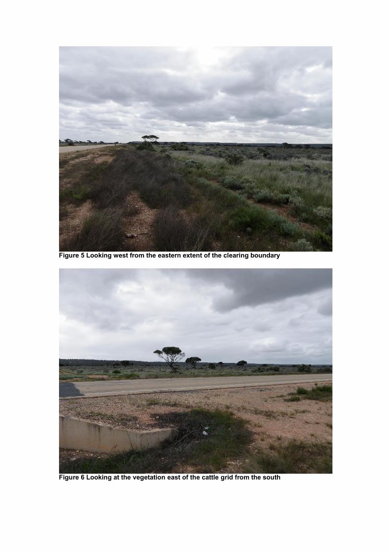
Figure 5 Looking west from the eastern extent of the clearing boundary
Figure 6 Looking at the vegetation east of the cattle grid from the south

Figure 7 Looking at the vegetation west of the cattle grid from the south

61/26802/00/5859 Madura Cattle Grid ReplacementPreliminary Environmental Impact Assessment and Environmental Management Plan
Appendix E
Environmental Management Plan

61/26802/00/5859 Madura Cattle Grid ReplacementPreliminary Environmental Impact Assessment and Environmental Management Plan
Table 4 Environmental Management Plan
Timing Topic Objective Action(s) ResponsibleParty
Advice
Main Roads Environmental Policy to becommunicated to all personnel.
All personnel to be informed of the environmentalaspects associated with the project prior toundertaking any works.
All phases ofconstruction
Induction / Start-up meeting /Progressmeetings
Create awareness in allpersonnel of the MainRoads EnvironmentalPolicy as well as theenvironmental aspectsassociated with the project.
Attendance / participation records for inductions /meetings to be kept. Such records mustdemonstrate adequate communication ofenvironmental policies and aspects.
Contractor Main Roads
All phases ofconstruction
VegetationClearing -Record-keeping
All projects should maintainthe required recordsrelating to clearing nativevegetation under CPS818/5.
Retain on records:
a copy of the PEIA,
a map showing the location where the clearingoccurred, recorded in an ESRI Shapefile,
the size of the area cleared (in hectares), and
the dates on which the clearing was done.
Main RoadsProjectManager
DEC
Contractor is to ensure that all equipment broughton to site is free of soil and vegetative material.Weed infested material is to be cleaned fromequipment prior to traversing areas of good orbetter quality native vegetation and prior to leavingthe work site.
All phases ofconstruction
WeedManagement
Ensure that the risk ofweed spread orestablishment is minimisedas far as is practicallypossible.
No weed infested material (e.g. spoil) to bestockpiled / moved adjacent to or within areas ofgood or better quality native vegetation.
Contractor Main Roads

61/26802/00/5859 Madura Cattle Grid ReplacementPreliminary Environmental Impact Assessment and Environmental Management Plan
Timing Topic Objective Action(s) ResponsibleParty
Advice
No weed infested material / spoil to be removed toland other than that vested within Main Roadswithout approval from the landowner / manager,Main Roads Project Manager and Main RoadsEnvironment Officer (unless removed to anapproved Shire waste disposal facility – e.g.rubbish tip).
Movement of soil will be avoided in wet conditions.
If imported soils and materials are to be used, theywill be certified weed free.
Any Declared Plant species located in the area willbe controlled in accordance with Sections 49and 51 of the Agriculture and Related ResourcesProtection Act 1976.
If during Project works, the Contractor uncoversany materials that could be considered significant toAboriginal people, Main Roads will immediatelycease works within 50 m of the material and notifyDepartment of Indigenous Affairs immediately.
Contractor –ceasing ofworks
Main RoadsProjectManager –obtaining ofapprovals
Main Roads / DIAAll phases ofconstruction
Aboriginal &EuropeanHeritage
“To ensure that changes tothe biophysicalenvironment do notadversely affect historicaland cultural associationsand comply with relevantheritage legislation” (EPA,2009).
If during Project works, the Contractor uncoversany human skeletal material, work shall ceasewithin 20 m of the material and it shall be reportedto the Police as soon as possible.
Contractor Main Roads

61/26802/00/5859 Madura Cattle Grid ReplacementPreliminary Environmental Impact Assessment and Environmental Management Plan
Timing Topic Objective Action(s) ResponsibleParty
Advice
The designated servicing area is to be bunded tocontain any spills or leaks or it will drain into atemporary sump. It is not to be located in an areaadjacent to drainage areas or watercourses /wetlands.
Emergency cleanup procedures shall beimplemented in the case of any spillage. These areto include the control of spilled material andremoval of contaminated soil to an approved Shirewaste disposal facility. Appropriate equipment is tobe available on site at all times in the case of a spill.
All waste oil is to be collected for disposal /recycling and any empty fuel / oil containers, usedfilters and waste hydraulic parts are to be collectedand stored in an allocated area before beingremoved to an approved Shire waste disposal /recycling facility.
All phases ofconstruction
Pollution andLitter
Ensure that the works aremanaged to a standard thatminimises pollution or therisk of pollution occurring.
The project area, including hardstand areas, are tobe kept in a tidy manner at all times. No littering isto be tolerated and an adequate number of rubbishbins are to be provided on site at all times.
Contractor Main Roads
Care is to be taken when clearing in order to avoiddeath of / injury to any native fauna. Any death of /injury to native fauna is to be reported to the MainRoads Project Manager immediately and theappropriate actions taken (e.g. contact DEC,RSPCA or Veterinarian).
All phases ofconstruction
Flora and Fauna “To maintain theabundance, diversity,geographic distribution andproductivity of flora atspecies and ecosystemlevels through theavoidance or managementof adverse impacts andimprovement in knowledge”(EPA, 2009).
Where possible, nests or nesting sites are to beavoided or relocated.
Both Main Roads / DEC

61/26802/00/5859 Madura Cattle Grid ReplacementPreliminary Environmental Impact Assessment and Environmental Management Plan
Timing Topic Objective Action(s) ResponsibleParty
Advice
Main Roads will seek to have the project clearingapproved under the Main Roads State-widePurpose Clearing Permit (CPS 818/5).
Main Roads
The areas to be cleared will be minimised bypreferentially using areas of existing disturbance,including existing access tracks and former materialpit areas. Where possible, removal of trees shouldbe avoided.
Areas to be cleared will be pegged prior tocommencing earthworks.
No vegetation outside the designated areas will beremoved during earthworks, construction oroperation.
Earthmoving equipment will be cleaned of soil andvegetation prior to entering and leaving the area tobe cleared.
Access tracks, vehicle parking and temporarymaterials storage will be located on existing clearedareas which incur minimum loss of trees andshrubs.
Material cleared will be utilised in rehabilitationworks where practicable.
Cleared vegetation will be used in site rehabilitationand erosion control via mulching, chipping or brushcover. Larger logs will be left on-site to provideadditional habitat.
Construction Clearing To reduce the impact ofproject related clearing onthe surroundingenvironment
Cleared vegetation will not be burnt on-site (as perAppendix F).
Contractor
Main Roads

61/26802/00/5859 Madura Cattle Grid ReplacementPreliminary Environmental Impact Assessment and Environmental Management Plan
Timing Topic Objective Action(s) ResponsibleParty
Advice
Stripped topsoil will be salvaged for use in siterehabilitation, where possible.
Materials and topsoil stockpiles will be located soas not to restrict or interfere with existing sitedrainage.
All equipment will be regularly maintained andserviced, including exhaust systems.
A speed limit of 20 km/hr will be enforced on thesite.
Smooth driving will be enforced, vehicles will not bepermitted to accelerate quickly.
Any complaints regarding dust, noise or vibrationare to be attended to and dealt with as soon aspossible.
Both Main RoadsConstruction Noise, Vibrationand Dust
To protect the amenity ofroad-users andconstruction staff fromnoise, vibration and dustimpacts resulting fromactivities associated withthe project area.
Dust from movement of vehicles will be managed atall times. This will include wetting down, roadsweeping, and the implementation of suitablespeed limits.
Contractor Main Roads
No fires shall be lit within the project area andstandard fire prevention methods (e.g. sparkarresting mufflers) are to be employed at all times.
Fire response equipment to be present and readilyavailable on site at all times.
Construction Fire Ensure that the fire riskassociated with theconstruction of the projectis minimised.
All machinery will be shut down during periods ofextreme fire hazard as advised by the DEC or MainRoads or the Shire of Dundas
Contractor Main Roads

61/26802/00/5859 Madura Cattle Grid ReplacementPreliminary Environmental Impact Assessment and Environmental Management Plan
Timing Topic Objective Action(s) ResponsibleParty
Advice
All machinery to be fitted with fire extinguishers.
Smoking on site will be controlled and all cigaretteswill be disposed of in an appropriate vessel.
Ensure that anyenvironmental incidentsthat occur during works donot have a significant orlong term impact on theenvironment.
Implement corrective and preventive actions inliaison with an environmental specialist and MainRoads Manager Environment where necessary.
Construction EnvironmentalIncidents
Ensure that the details ofany environmentalincidents are recorded inaccordance with corporaterequirements.
Complete and submit environmental incident reportforms in accordance with the Main Roads corporateprocedure 6707/042 Environmental IncidentReporting and Investigation. Environmental Incidentreport forms are available on the Main RoadsInternet site at http://www.mainroads.wa.gov.au/
UnderstandingRoads/Environment/Pages/incident_report.aspx
Both Main Roads
Construction Soil & ErosionManagement
Ensure that soil is managedin a way that preventsfuture land degradation anderosion.
Stripped topsoil that is not infested with weeds is tobe stockpiled separately and re-used on site.
Contractor Main Roads
Water required for project activities to be sourcedlegally and used in a sustainable manner.
Construction Ground andSurface WaterManagement
“To maintain the quantity ofwater so that existing andpotential environmentalvalues, includingecosystem maintenance,are protected” (EPA, 2009).
Water extraction activities to be carried out in a waywhich prevents the potential for contamination ofthe water source (e.g. bunding of pumpingequipment).
Contractor Main Roads

61/26802/00/5859 Madura Cattle Grid ReplacementPreliminary Environmental Impact Assessment and Environmental Management Plan
Timing Topic Objective Action(s) ResponsibleParty
Advice
All waste materials from the development are to becompletely removed from the site and disposed ofat an approved Shire waste disposal facility uponcompletion of works.
Contractor Main RoadsClean-up Ensure that the project areais left clean and tidy.
All remaining road building materials (e.g. gravel,aggregate) to be removed from the site uponcompletion of works to an approved stockpile site.
Both Main Roads
Post-Construction
All rubbish, materials heaps or other debris will beremoved.
Both Main Roads
Any compacted ground will be ripped or scarifiedwhere revegetation is required.
Site rehabilitation works will be conducted as perAppendix F.
If imported soils and materials are required, theywill be certified weed free.
Post-
Construction
Rehabilitation To ensure, as far aspracticable, thatrehabilitation achieves astable and functioninglandform which isconsistent with thesurrounding landscape andother environmental values.
All rubbish, materials heaps or other debris will beremoved.
Contractor Main Roads/ DEC
Note: “Both” refers to both the Main Roads Project Manager and Contractor.

61/26802/00/5859 Madura Cattle Grid ReplacementPreliminary Environmental Impact Assessment and Environmental Management Plan
Appendix F
Main Roads PastoralRevegetation Plan

MAIN ROADS Western Australia Generic Revegetation Plan for Pastoral Regions Page 1 of 2plan_reveg_pastoral.doc 14/12/2007
Main Roads WA – Revegetation Plan for Pastoral AreasCondition 14(e), CPS 818
Date: Unknown. Project: Unknown.
Manager: Main Roads WA.
Location andsize ofclearing:
For project areas located within the pastoral / rangelands region north of the agricultural area asdescribed in the Environmental Protection Authority’s Position Statement No.2.
Location andsize ofrevegetation:
Primarily for areas that were cleared for searching and extracting road building materials (e.g.borrow pits, etc.), and other project related temporary clearing.
Clearingdescription:
Machine clearing.
Revegetationdescription:
Replacement of topsoil material regeneration.
Reason forrevegetation:
Revegetation of temporary cleared areas, in accordance with condition 14 of clearing permitCPS 818.
Revegetation /rehabilitationrequirements:
Site preparation: All vegetation will be cleared from the works area and non-weed infested vegetation isstockpiled. Stockpiled vegetation will be placed in a manner that will prevent damage toadjacent vegetation by machinery. Weed infested vegetation will be disposed of at anappropriate site and not used for revegetation purposes. Burning of the cleared vegetation willnot be permitted.
Topsoil will be stripped to a maximum depth of 100mm, and will be stored in a weed free (asfar as possible) area, as close as possible to the area to be rehabilitated. Topsoil will be placedin windrows of less than 1.5m in height and reinstated as soon as practicable to maintainviability of in-situ seeds.
Weed control: Appropriate weed control will be carried out when weeds are present, both prior to topsoilstripping and where weeds become established on or between the stockpiled materials. Weedcontrol will take place prior to the respreading of topsoil to ensure weeds are killed and nottransported to other areas.
Control measures include the removal of weeds to an approved dumpsite, or treatment of weedssuch as by using herbicides mixed in accordance with manufacturer’s instructions and appliedby a licensed operator. Where practicable, weeds will be removed prior to or when they are inflower, and prior to seeding.
All machinery will be cleared of soil build up and vegetative material before entering andleaving the site to help minimise the transportation of weeds and their seeds.
Exposed areas such as bare batters and borrow pits shall be promptly rehabilitated to reduce thepotential for weed establishment. Where works are adjacent to good quality vegetation, whereweeds from within the project area are likely to spread to and result in environmental harm tothe adjacent area, those weeds will be controlled annually until 12 Dec 2011.

MAIN ROADS Western Australia Generic Revegetation Plan for Pastoral Regions Page 2 of 2plan_reveg_pastoral.doc 14/12/2007
Main Roads WA – Revegetation Plan for Pastoral AreasCondition 14(e), CPS 818
Regeneration /direct seeding /planting at anoptimal time:
The following rehabilitation works are undertaken on areas of disturbed earth requiringrehabilitation:
Topsoil is uniformly respread to a typical depth of 100mm over the project area. In projectareas where topsoil has not been removed and/or is not available, other substrate, such asgravel, may be substituted as a growth medium.
Project areas will be ripped to a minimum depth of 200mm deep with rip linesapproximately 300mm apart. Where slopes are present, rip lines shall follow naturalcontours.
The following rehabilitation works are undertaken at borrow / gravel pits:
Overburden and then topsoil will be uniformly and evenly spread over the disturbed areasof the pit. Depending on the slope of drainage lines within the pit, small swales from thetopsoil will be formed to reduce erosion velocities and encourage the deposition of seeds.
The whole of the existing pit floor, including drainage lines, will be ripped to a depth of300-500mm deep with rip lines between 500-800mm apart (if the material in the pit is ableto be ripped).
All stockpiled vegetation will be spread along the contour and the pit floor to help promoteseed deposition and to reduce erosion velocities.
Vegetationestablishmentperiod:
The vegetation establishment period is for at least twelve months following the completion ofthe works. During this period, maintenance and monitoring will be undertaken (see below).
Ongoingmaintenance andmonitoring:
After revegetation works, revegetated areas will be inspected annually for a minimum of twoyears to monitor and control weeds and to measure the effectiveness of revegetation works.
When unwanted weed foliage cover exceeds 25% after the initial two year period, furtheractions will be implemented to monitor and control these weeds. The additional monitoring andweed control will be conducted annually until 12 Dec 2010 or until the unwanted weed foliagecover falls below 25%, whichever is sooner.
Monitoringcommitments:
Post revegetation site inspections will be carried out annually for a minimum of two years tomonitor unwanted weeds and measure the effectiveness of revegetation works. Monitoring ofsites where unwanted weed foliage cover exceeds 25% after the initial two year period willcontinue annually until 12 Dec 2010 or until the unwanted weed foliage cover falls below 25%,whichever is sooner.
Managementcommitments:
Undertake annual weed control of unwanted weeds annually until 12 Dec 2011 or until theunwanted weed foliage cover falls below 25%, whichever is sooner.
Agenciesconsulted andsubmissionsreceived:
Nil.
