report for decommissioning of farm dam · report for decommissioning of farm dam ... a unified...
TRANSCRIPT

172 Tallawong Road Rouse Hill NE149.2-17
0
REPORT FOR DECOMMISSIONING OF FARM DAM
ADDRESS: 172 Tallawong Road Rouse Hill NSW
CLIENT: JS Architects Pty Ltd
DATE: 31 May 2017
REPORT NO: NE149.2-17
GEOTESTA PTY LTD | ABN 91851620815 | 44 Mary Parade, Rydalmere NSW 2116
Phone: 1300 852216 | Fax: 03 9562 9098 | email: [email protected]
172 Tallawong Road Rouse Hill NE149.2-17
1
TABLE OF CONTENTS 1. INTRODUCTION ............................................................................................................... 2
2. OBJECTIVES AND SCOPE ............................................................................................... 3
3. SITE DESCRIPTIONS ......................................................................................................... 4
3.1 Site Topography ............................................................................................................................ 4
3.2 Geology........................................................................................................................................... 4
3.3 Site Investigation ........................................................................................................................... 4
3.4 Site Hydrology .............................................................................................................................. 5
3.5 Dam Category ................................................................................................................................ 6
4. DECOMMISSIONING CONSIDERATIONS .................................................................. 7
4.1 Legal requirements and governance .......................................................................................... 7
4.2 Economic Evaluation and Social Aspect .................................................................................... 7
4.3 Environmental Considerations ................................................................................................... 7
4.4 Heritage .......................................................................................................................................... 7
5. SAFETY AND TECHNICAL FEASIBILITY .................................................................... 8
6. CONCLUSIONS AND RECOMMENDATIONS ........................................................... 9
6.1 Dewatering ..................................................................................................................................... 9
6.2 Landform and Earthwork ............................................................................................................ 9
6.3 Hydrological Consideration ........................................................................................................ 9
6.4 Land Use ......................................................................................................................................... 9
REFERENCES

172 Tallawong Road Rouse Hill NE149.2-17
2
1. INTRODUCTION
Geotesta was engaged by JS Architects Pty Ltd to undertake a study for
decommissioning of the exiting farm dam at 172 Tallawong Rd, Rouse Hills NSW.
As part of the development plan, the decommissioning and removal of the existing
farm dam is required to provide suitable ground for the development.
The dam is an elevated turkey’s nest dam constructed by cut and fill. The dam was
generally filled using the rainwater and used to water the cattle.
The aim of study is to ensure the decommissioning of the dam is undertaken in a safe
manner and removes any threat posed by the dam following the relevant legislations
and guidelines.
The decommissioning process shall consider functionality and safety, economy, social,
environmental, heritage, legal requirements and governance and technical aspects.

172 Tallawong Road Rouse Hill NE149.2-17
3
2. OBJECTIVES AND SCOPE
This study was conducted in general accordance with the ANCOLD guidelines,
Australian Standards, and relevant NSW legislations.
The following scope of works was undertaken to achieve the objectives of the
assessment:
A review of the geological information for the area
A site inspection
Assessment of the geotechnical site investigation
A summary report outlining the decommissioning considerations including:
Functionality and safety – assessing the dam’s current functionality and
safety, future development, as well as obligations, such as dam safety.
Economic – assessing the financial costs to decommission the dam.
Social – considering the community and the potential concerns
decommissioning may bring.
Environmental and heritage – looking at impacts of decommissioning on
natural flow regimes and water quality.
Historical significance and Indigenous culture.
Legal requirements and governance – recognising any legal obligations of the
existing dam and adhering to regulatory processes and approvals.
Technical feasibility – considering the ease and efficiency of proposed
decommissioning methods and related construction impacts.

172 Tallawong Road Rouse Hill NE149.2-17
4
3. SITE DESCRIPTIONS
3.1 Site Topography
The proposed site at 172 Tallawong Road Rouse Hill is gently sloping from west to
east with a maximum slope of 6%. The ground elevation ranges between RL66.0m and
RL55.0m.
The proposed site is covered with grass. Scattered trees were observed at the
perimeter of the site.
The dam itself is a turkey’s nest embankment dam made from the insitu soil by cut
and fill. The surface soil is product of shale weathering. The western batter is an
excavation into the natural ground while the eastern batter is built using the excavated
materials from the excavation. The embankment has a maximum height of 4m and is
built with an slope of 2H:1V.
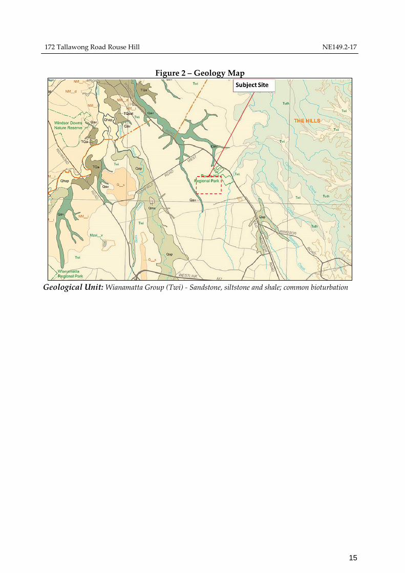
3.2 Geology
The geological origin of the soil profile was identified from our visual examination of
the soil samples, geotechnical experience, and reference to geological maps of the area.
The geological map of the area indicates that the site is underlain by Wianamatta
Group - Sandstone, siltstone and shale.
3.3 Site Investigation
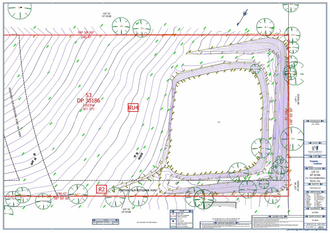
As part of geotechnical investigation work carried out on 22 May 2017, eight (8)
boreholes (BH1 to BH8) were drilled to a maximum depth of 4.5m shown on Figure 1.
Drilling indicated the site is covered by low plasticity clay overlying shale. BH4 was
drilled on the embankment encountering 4.5m of clay.

172 Tallawong Road Rouse Hill NE149.2-17
5
Figure 1 Site Investigation Boreholes
3.4 Site Hydrology
The study area is defined as the catchments of Killarney Chain of Ponds and First
Ponds Creek. These creeks flow in a northerly direction and form part of the Cattai
Creek catchment which eventually joins the Hawkesbury River between Richmond
and Sackville. Figure 2 shows the flood map of the area. Although the site slope directs
the surface water to the dam, the overall slope of the area is away from the dam.
Figure 2 Flood Map of Site Area
172 Tallawong Road Rouse Hill NE149.2-17
6
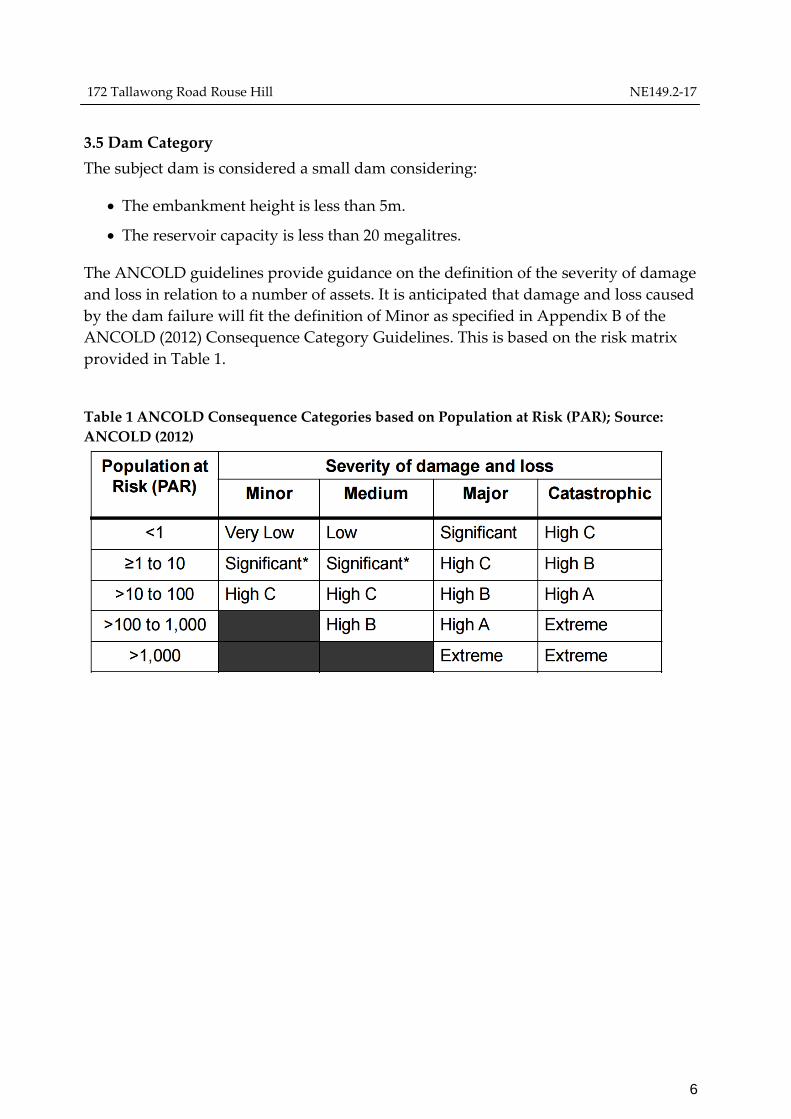
3.5 Dam Category
The subject dam is considered a small dam considering:
The embankment height is less than 5m.
The reservoir capacity is less than 20 megalitres.
The ANCOLD guidelines provide guidance on the definition of the severity of damage
and loss in relation to a number of assets. It is anticipated that damage and loss caused
by the dam failure will fit the definition of Minor as specified in Appendix B of the
ANCOLD (2012) Consequence Category Guidelines. This is based on the risk matrix
provided in Table 1.
Table 1 ANCOLD Consequence Categories based on Population at Risk (PAR); Source:
ANCOLD (2012)
172 Tallawong Road Rouse Hill NE149.2-17
7
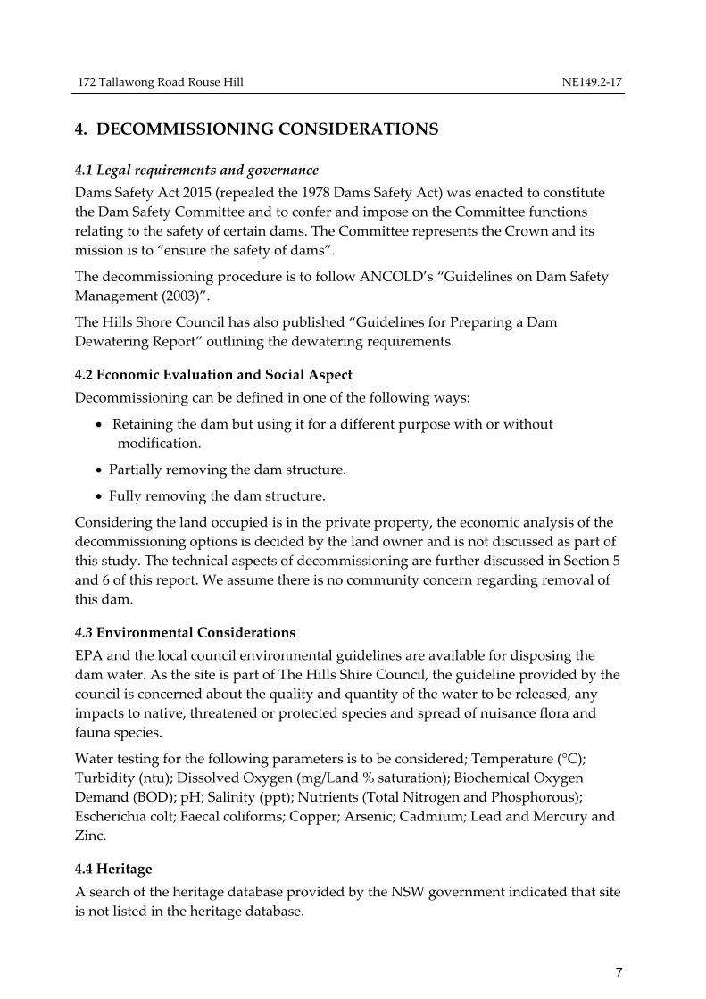
4. DECOMMISSIONING CONSIDERATIONS
4.1 Legal requirements and governance
Dams Safety Act 2015 (repealed the 1978 Dams Safety Act) was enacted to constitute
the Dam Safety Committee and to confer and impose on the Committee functions
relating to the safety of certain dams. The Committee represents the Crown and its
mission is to “ensure the safety of dams”.
The decommissioning procedure is to follow ANCOLD’s “Guidelines on Dam Safety
Management (2003)”.
The Hills Shore Council has also published “Guidelines for Preparing a Dam
Dewatering Report” outlining the dewatering requirements.
4.2 Economic Evaluation and Social Aspect
Decommissioning can be defined in one of the following ways:
Retaining the dam but using it for a different purpose with or without
modification.
Partially removing the dam structure.
Fully removing the dam structure.
Considering the land occupied is in the private property, the economic analysis of the
decommissioning options is decided by the land owner and is not discussed as part of
this study. The technical aspects of decommissioning are further discussed in Section 5
and 6 of this report. We assume there is no community concern regarding removal of
this dam.
4.3 Environmental Considerations
EPA and the local council environmental guidelines are available for disposing the
dam water. As the site is part of The Hills Shire Council, the guideline provided by the
council is concerned about the quality and quantity of the water to be released, any
impacts to native, threatened or protected species and spread of nuisance flora and
fauna species.
Water testing for the following parameters is to be considered; Temperature (°C);
Turbidity (ntu); Dissolved Oxygen (mg/Land % saturation); Biochemical Oxygen
Demand (BOD); pH; Salinity (ppt); Nutrients (Total Nitrogen and Phosphorous);
Escherichia colt; Faecal coliforms; Copper; Arsenic; Cadmium; Lead and Mercury and
Zinc.
4.4 Heritage
A search of the heritage database provided by the NSW government indicated that site
is not listed in the heritage database.

172 Tallawong Road Rouse Hill NE149.2-17
8
5. SAFETY AND TECHNICAL FEASIBILITY
We assume the dam will be fully removed as part of decommissioning. This method
involves removing the dam structure, and the spillway, with the aim of restoring the
site to conditions that existed before the dam’s construction. In addition to major
excavation works and a range of structural and additional features, this method may
require a sediment management strategy, as well as a site revegetation and
reinstatement plan depending on the size of the dam.
Considerations shall be given to stable landform and earthwork activity during the
decommissioning as further detailed in the recommendation section. As the dam is off-
site storage, no flooding risk is anticipated during the embankment removal.
However, the dewatering plan shall consider gradual release of water to maintain
some additional capacity during the embankment removal to prevent risk of slope
failure or flooding.
172 Tallawong Road Rouse Hill NE149.2-17
9
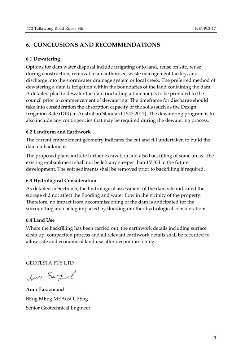
6. CONCLUSIONS AND RECOMMENDATIONS
6.1 Dewatering
Options for dam water disposal include irrigating onto land, reuse on site, reuse
during construction, removal to an authorised waste management facility, and
discharge into the stormwater drainage system or local creek. The preferred method of
dewatering a dam is irrigation within the boundaries of the land containing the dam.
A detailed plan to dewater the dam (including a timeline) is to be provided to the
council prior to commencement of dewatering. The timeframe for discharge should
take into consideration the absorption capacity of the soils (such as the Design
Irrigation Rate (DIR) in Australian Standard 1547:2012). The dewatering program is to
also include any contingencies that may be required during the dewatering process.
6.2 Landform and Earthwork
The current embankment geometry indicates the cut and fill undertaken to build the
dam embankment.
The proposed plans include further excavation and also backfilling of some areas. The
existing embankment shall not be left any steeper than 1V:3H in the future
development. The soft sediments shall be removed prior to backfilling if required.
6.3 Hydrological Consideration
As detailed in Section 5, the hydrological assessment of the dam site indicated the
storage did not affect the flooding and water flow in the vicinity of the property.
Therefore, no impact from decommissioning of the dam is anticipated for the
surrounding area being impacted by flooding or other hydrological considerations.
6.4 Land Use
Where the backfilling has been carried out, the earthwork details including surface
clean up, compaction process and all relevant earthwork details shall be recorded to
allow safe and economical land use after decommissioning.
GEOTESTA PTY LTD
Amir Farazmand
BEng MEng MEAust CPEng
Senior Geotechnical Engineer

172 Tallawong Road Rouse Hill NE149.2-17
10
DOCUMENT CONTROL
Date Version Report Prepared By: Report Reviewed by:
31 May 2017 NE149.2-17 Amir Farazmand
BEng MEng MIEAust CPEng
Senior Geotechnical Engineer
Stephen Darmawan
BEng MEng MIEAust CPEng
Principal Geotechnical Engineer
172 Tallawong Road Rouse Hill NE149.2-17
11
References
ANCOLD 2003a, Guidelines on Dam Safety Management, Australian National
Committee on Large Dams Incorporated, Australia
ANCOLD 2003b, Guidelines on Risk Assessment, Australian National Committee on
Large Dams Incorporated, Australia National Environment Protection Council,
December 1999 National Environment Protection (Assessment of Site Contamination)
Measure.
USBR 2008, A Unified Method for Estimating Probabilities of Failure of Embankment
dams by Internal Erosion and Piping, Guidance and Supporting Documents,
USBR, USACE, UNSW, URS, August 2008
Standards Australia, 2005. Guide to the sampling and Investigation of Potentially
Contaminated Soil, Part 1: Non-volatile and Semi-volatile compounds. AS 4482.1
DERM, 2007, Guidelines on Acceptable Flood Capacity for Dams, February 2007
Department of Environment and Resource Management (Formerly Natural Resources
and Water)
New South Wales Consolidated Acts, “Dams Safety Act 2015 Schedule 1”
The Hills Shire Council “Guidelines for Preparing a Dam Dewatering Report”
Victorian Government Department of Environment, Land, Water and Planning
“Decommissioning dams, A guide for dam owners”, December 2016
ANCOLD (2012), “Guidelines on the Consecunces Categories of Dams”
ANCOLD 2003, “Guidelines on Dam Safety Management (2003)”
Bureau of Meteorology Website, “www.bom.gov.au”
172 Tallawong Road Rouse Hill NE149.2-17
12
Information about This Report
The report contains the results of Soil and water quality Assessment conducted for a specific
purpose and client. The results should not be used by other parties, or for other purposes, as
they may contain neither adequate nor appropriate information.
Test Hole Logging
The information on the test hole logs (boreholes, test pits, exposures etc.) is based on a visual
and tactile assessment, except at the discrete locations where test information is available (field
and/or laboratory results). The test hole logs include both factual data and inferred
information.
Groundwater
Unless otherwise indicated, the water levels presented on the test hole logs are the levels of
free water or seepage in the test hole recorded at the given time of measuring. The actual
groundwater level may differ from this recorded level depending on material permeability
(i.e. depending on response time of the measuring instrument). Further, variations of this level
could occur with time due to such effects as seasonal, environmental and tidal fluctuations or
construction activities. Confirmation of groundwater levels, pheratic surfaces or piezometric
pressures can only be made by appropriate instrumentation techniques and monitoring
programmes.
Limitations
Professional advice and opinion provided in this report is for Metro Trains Melbourne
requesting the work in accordance with the agreed scope of work and is not to be relied on by
any other third party for any and all purposes except with the prior written consent of
Geotesta (which consent may or may not be given at its discretion).
Advice and interpretation is provided on the basis that subsequent site work will be
undertaken by Geotesta. Should other parties be engaged to implement recommendations
made by Geotesta, or undertake further assessment work on the site, Geotesta is not
responsible for how the information in this report is used by those other parties or any other
party.
A report is provided inclusive of all documentation sections, tables, figures and appendices
and should not be provided or copied in part without all supporting documentation for any
reason, because misinterpretation may occur.
Site assessments and validation studies identify actual sub-surface conditions only at those
points where samples are taken, and when they are taken. Data obtained from the sampling
and subsequent laboratory analyses are interpreted by geologists, engineers or scientists and
opinions are presented regarding the overall sub-surface conditions, the nature and extent of
groundwater, the likely impact on any proposed development and appropriate remediation
measures. Actual conditions between sampling locations may differ from those inferred
because no professional, no matter how qualified, and no sub-surface exploration program, no
matter how comprehensive, can reveal what is hidden below the ground surface. The actual
interface between materials may be far more gradual or abrupt than an assessment indicates.
Actual conditions in areas not sampled may differ from that predicted. Nothing can be done
to prevent the unanticipated. However, steps can be taken to help minimize the impact.

172 Tallawong Road Rouse Hill NE149.2-17
13
Sub-surface conditions can change by natural processes and site activities. This report
presents the conditions assessed at the time the investigation/validation study was
undertaken. Consequently, project decisions should not be based on environmental site
assessment or validation data that may have been affected by time. The consultant should be
requested to advise if additional testing is required.
This site has been assessed /validated for a particular proposed or existing land use based on
the limitations of the scope of works. No warranty or guarantee is made in regard to any other
use, only to the depth tested. Fill, soil, groundwater and rock to the depth tested on the site
may be fit for the specified use.
Interpretation of Results
The discussion or recommendations contained within this report normally are based on a site
evaluation from discrete test hole data. Generalised, idealised or inferred subsurface
conditions (including any geotechnical cross-sections) have been assumed or prepared by
interpolation and/or extrapolation of these data. As such these conditions are an interpretation
and must be considered as a guide only.
Change in Conditions
Local variations or anomalies in the generalised ground conditions do occur in the natural
environment, particularly between discrete test hole locations. Additionally, certain design or
construction procedures may have been assumed in assessing the soil-structure interaction
behaviour of the site. Furthermore, conditions may change at the site from those encountered
at the time of the geotechnical investigation through construction activities and constantly
changing natural forces.
Any change in design, in construction methods, or in ground conditions as noted during
construction, from those assumed or reported should be referred to GEOTESTA for
appropriate assessment and comment.
Reproduction of Reports
Where it is desired to reproduce the information contained in our geotechnical report, or other
technical information, for the inclusion in contract documents or engineering specification of
the subject development, such reproductions should include at least all of the relevant test
hole and test data, together with the appropriate standard description sheets and remarks
made in the written report of a factual or descriptive nature. Reports are the subject of
copyright and shall not be reproduced without the permission of Geotesta.
172 Tallawong Road Rouse Hill NE149.2-17
15
Figure 2 – Geology Map
Geological Unit: Wianamatta Group (Twi) - Sandstone, siltstone and shale; common bioturbation

172 Tallawong Road Rouse Hill NE149.2-17
16
SITE PHOTOGRAPHS
Location of borehole BH4

172 Tallawong Road Rouse Hill NE149.2-17
17