reálie anglicky mluvících zemí
TRANSCRIPT

Reálie anglicky mluvících zemí
Zpracováno v rámci projektu : „EU Peníze SŠ“, reg. číslo: CZ.1.07/1.5.00/34.0053
EU –OPVK VY_32_INOVACE_270
Datum vytvoření: 2012/2013
Autor: Mgr. Hana Svrčková
Škola: Střední průmyslová škola textilní, Liberec, Tyršova1, příspěvková organizace

Reálie anglicky mluvících zemí
10. The USA – Geography Výukové cíle:
Prohloubení znalostí o zeměpisu Spojených států
žáci se orientují v mapě USA, dovedou hovořit o zeměpisných údajích státu
Metodické poznámky:
během výuky pracují žáci s vlastní mapou Severní Ameriky, snímky 4 a 6 obsahují úkoly, řešení lze nalézt na dalších snímcích
na závěr zařazena kontrolní úloha
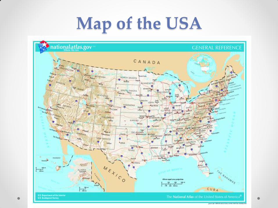
Map of the USA

Work with the map and find:
1. Where do the USA lie? (continent, neighbours)
2. Which oceans wash its coasts?
3. Where are the largest mountain ranges and which is
the highest mountain?
4. Which are the longest and biggest rivers and lakes?

Answer key 1
1. North America, Canada, Mexico
2. The Atlantic, The Pacific
3. The Appalachian Mountains, The Rocky Mountains,
4. The Mississippi, The Missouri, The Colorado,

Consult the map and say:
1. What is the capital?
2. Which are other largest cities?
3. What is the area of the country?
4. What is the climate like in various regions of the USA?
5. Which is the largest state and which state lies off the
American mainland?

Answer key 2.
1. Washington D.C.
2. Detroit, Chicago, Los Angeles, New York, San
Francisco, Boston, Philadelphia
3. The area is almost 10 mil sq km
4. The Climate varies: the most southern state –
Florida has got subtropical wet climate, the south-
west is hot and dry, the eastern coast has got
coastal mild climate, the Midwest has got mild
continental climate with cold winters.
5. Alaska, Hawaii
The regions
It is difficult to speak about the USA as one country,
because the 50 states are very diverse. We can
characterize several regions:
1. New England
2. The Mid-Atlantic region
3. The South
4. The Midwest
5. The Southwest
6. The Rocky Mountain region, Alaska
7. Hawaii
New England
• The north-east coast: Maine, New Hampshire,
Vermont, Massachusetts, Connecticut, Rhode
Island o Show these states on the map
• They are the oldest states, it is where the Pilgrims
settled
o Why are these places famous?
• Boston
• Harvard

The Mid-Atlantic Region o Show the states on the map:
• New Jersey, New York, Pennsylvania, West Virginia,
Delaware, Maryland
• Very densely populated states
• Important cities here are Philadelphia, Dover,
Washington D.C., Baltimore, Pitsburgh o Why are these places famous?
• The Hudson River Valley
• Niagara Falls
• The Appalachian region
The South o Find the states on the map:
• Virginia, North and South Carolina, Georgia, Florida,
Alabama, Tennessee, Kentucky, Mississippi, Louisiana,
Arkansas
• Warm climate, rich soil, economy based on
agriculture – cotton and tobacco plantations o Why are these places famous?
• Nashville, Memphis, New Orleans
• The Mississippi river
• Florida

The Midwest o Show the states on the map:
• Michigan, South Dakota, Missouri, Minesota
• Midwest is where the Wild West began
• major industrial cities – Chicago, Detroit, Cleveland,
Milwaukee o Show the places on the map and say why they are famous:
• Great Lakes area
• The Great Plains area – much of the farmland

The Southwest
o Show these states on the map:
• Texas, Oklahoma, Arizona, New Mexico, Nevada,
California
• Texas - humid lands, oil deposits
• Oklahoma – prairies
• Arizona and New Mexico – mountains and deserts,
home to many Indians and Hispanics
• Nevada - the driest state o What do you know about these places?
• Las Vegas, The Grand Canyon, Colorado River
• Los Angeles, San Francisco, Silicon Valley

The Rocky Mountains Region
and Alaska o Show the states on the map:
• Utah, Colorado, Wyoming, Montana, Idaho
• Washington, Oregon, Alaska
• The Rocky Mountains stretch from Alaska to northern
Mexico, have steep slopes, many peaks and valleys
• Rich in natural resources, natural beauty, less
populated states o What do you know about these places?
• Yellowstone NP, Salt Lake City, Aspen
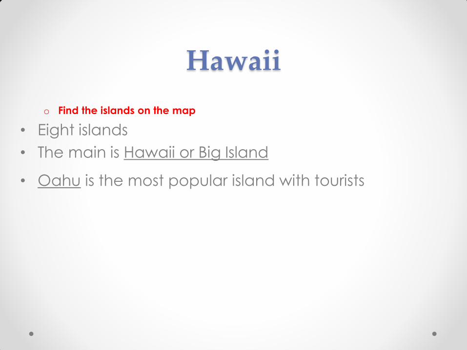
Hawaii
o Find the islands on the map
• Eight islands
• The main is Hawaii or Big Island
• Oahu is the most popular island with tourists

What do you know?
1. The Mississippi is one of the largest ______.
2. The largest state is ______.
3. The Atlantic Ocean washes the ______ coast of North
America.
4. The biggest city is _____.
5. In California, the climate is _________.
6. The oldest states of the USA belong to the region of
__________.

Answer key
1. Rivers
2. Alaska
3. Eastern
4. New York
5. dry, subtropical
6. New England

Použitá literatura • BORSBEY, Janet, SWAN, Ruth: Crossing Cultures, reálie anglicky mluvících
zemí. 1. vyd. Dubicko: INFOA. ISBN 978-80-7240-683-8
• BRENDLOVÁ, Světla: Reálie anglicky mluvících zemí, 2. dopl. Vyd. Plzeň: FRAUS.
ISBN 80-7238-307-8
• CUNNINGHAM, Sarah, MOOR, Peter: New Cutting Edge Intermediate
Student‘s Book. 3. vyd. 2007. Harlow: PEARSON EDUCATION LIMITED. ISBN – 13:
978-0-582-82517-8

Zdroje obrázků
• http://upload.wikimedia.org/wikipedia/commons/thumb/1/16/US_map_-
_geographic.png/621px-US_map_-_geographic.png