reclamation planning - ars.usda.gov planning consists of 2 main aspects: 1) pre-disturbance site...
TRANSCRIPT

RECLAMATION 101: COMPONENTS OF SUCCESSFUL RECLAMATION
RECLAMATION PLANNING
WYOMING RECLAMATION AND RESTORATION CENTER
Pete Stahl
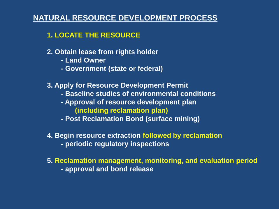
NATURAL RESOURCE DEVELOPMENT PROCESS
1. LOCATE THE RESOURCE
2. Obtain lease from rights holder
- Land Owner
- Government (state or federal)
3. Apply for Resource Development Permit
- Baseline studies of environmental conditions
- Approval of resource development plan
(including reclamation plan)
- Post Reclamation Bond (surface mining)
4. Begin resource extraction followed by reclamation
- periodic regulatory inspections
5. Reclamation management, monitoring, and evaluation period
- approval and bond release
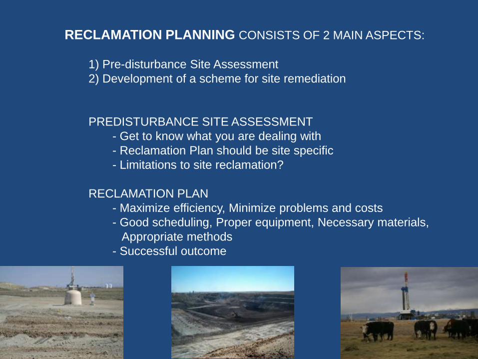
RECLAMATION PLANNING CONSISTS OF 2 MAIN ASPECTS:
1) Pre-disturbance Site Assessment
2) Development of a scheme for site remediation
PREDISTURBANCE SITE ASSESSMENT
- Get to know what you are dealing with
- Reclamation Plan should be site specific
- Limitations to site reclamation?
RECLAMATION PLAN
- Maximize efficiency, Minimize problems and costs
- Good scheduling, Proper equipment, Necessary materials,
Appropriate methods
- Successful outcome

BLM Wyoming Reclamation Policy:
A reclamation plan shall be developed for all surface disturbing activities and
will become part of the proposed action in the NEPA document.
The reclamation plan shall address short term stabilization to facilitate long
Term reclamation.
Reclamation Goals: 1. Short term goal: Immediately stabilize disturbed area and provide
conditions necessary to achieve long term goals.
2. Long Term Goals: Facilitate eventual ecosystem reconstruction to
maintain a safe and stable landscape and meet the desired outcomes
of the land use plan.

Successful Reclamation Puzzle

Reclaimed/Restored landscape in central Wyoming

Not Good Reclamation
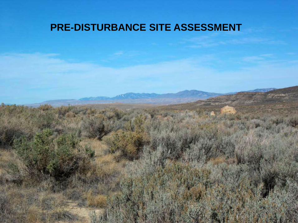
PRE-DISTURBANCE SITE ASSESSMENT

PREDISTURBANCE SITE ASSESSMENT
Location
Land and Mineral Ownership
Land Use Status
Climate (i.e., precipitation, growing season)
History, Archeology, etc.
Geology
Air Quality
Hydrology (surface and subsurface)
Soils Inventory - distribution of soil types
- identification of potentials problems
Vegetation Inventory - characterization of vegetation types
- production, cover, density
- species composition, diversity
Wildlife and Habitat

OBJECTIVES OF SITE ASSESSMENT
- Characterize site for future reference
- Estimate costs of site development and reclamation
- Determine site reclamation potential
-Selection of reference area
-Characterize the vegetation
-Determine soil salvage depth
-Identification of areas with Limited Reclamation Potential
- Identification of potential problems -shallow soils
-critical wildlife habitat
-weed problems
-threatened or endangered species

IMPORTANT SOIL INFORMATION
Soil Mapping or Survey Information (NRCS) Soil types and distribution
Soil Analyses from samples collected on site Texture, pH, EC, SAR, Organic Matter Content
Soil Factors potentially limiting plant growth
Depth of suitable plant growth material (soil salvage depth)
Avoid heavy clay materials, salty horizons,
sodic horizons, and high carbonate horizons

IMPORTANT VEGETATION INFORMATION
Cover Vegetative Cover, Total Ground Cover, Bare Ground
Production Total production, Herbaceous Production by Species
Density and Distribution Full shrubs, Sub-shrubs and Trees
Species Diversity
Species Composition
NRCS Ecological Site Descriptions

RECLAMATION PLAN

RECLAMATION PLAN
Topography Reconstruction
Topography, stream channels, drainages, impoundments
Topsoil Salvage, Storage and Replacement approach and schedule
depth of salvage
stockpiling method
Tillage
equipment
soil amendments
Revegetation approach and schedule
plant species selection (seed mix)
seedbed preparation
Seed sources
seeding methods
Erosion Control Practices
Weed Control Plan
Site Monitoring Schedule

RECLAMATION PLAN
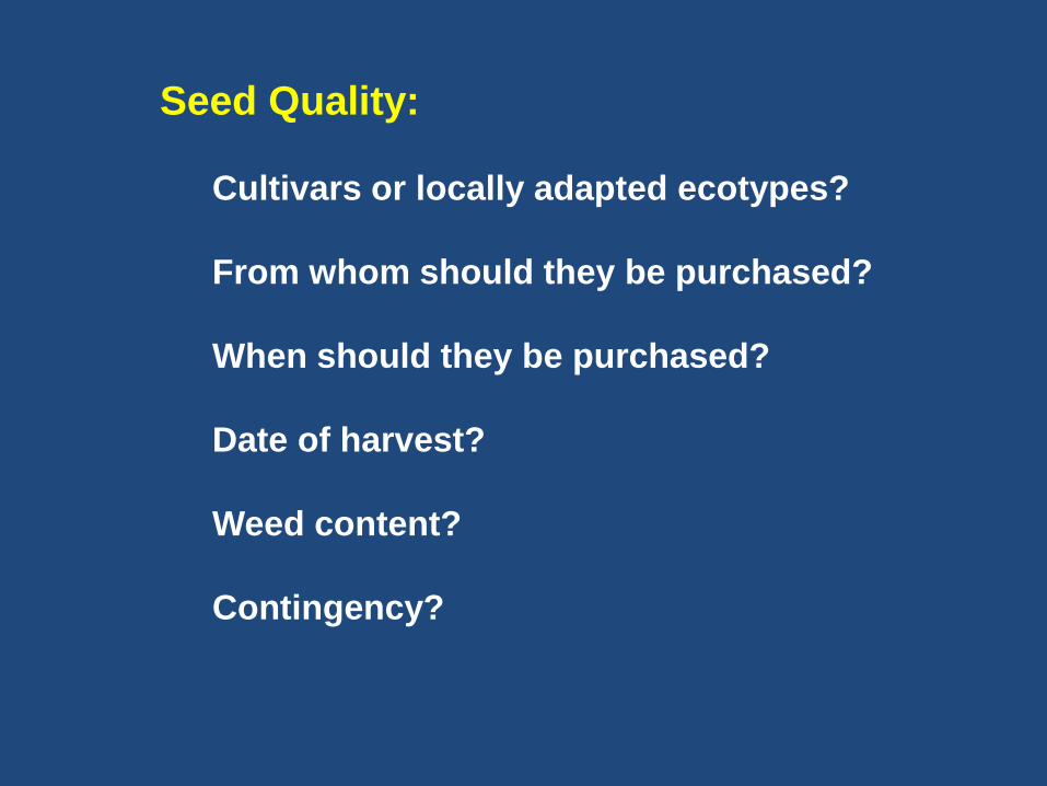
Seed Quality:
Cultivars or locally adapted ecotypes?
From whom should they be purchased?
When should they be purchased?
Date of harvest?
Weed content?
Contingency?

RECLAMATION PLAN
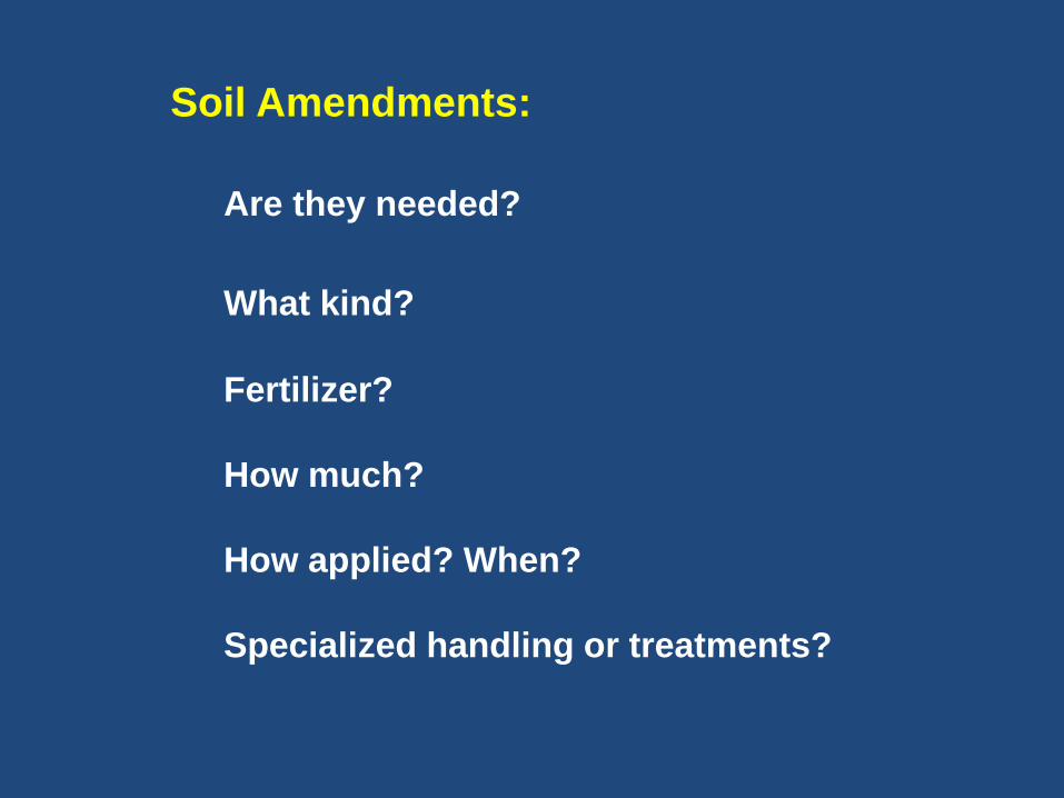
Soil Amendments:
Are they needed?
What kind?
Fertilizer?
How much?
How applied? When?
Specialized handling or treatments?

Reclamation at the Dave Johnson Coal Mine

Glenrock Coal Mine 1958