qgis workflows
DESCRIPTION
QGIS Workflows. QGIS and Python… like peanut butter and jelly. Peanut Butter (QGIS). It’s Smooth (all the basics of GIS) It’s Organic (by the people for the people) Grow your own (it is encouraged!). Jelly (Python). Everything tastes better with it Holds your sandwich together. Goals. - PowerPoint PPT PresentationTRANSCRIPT
QGIS Workflows
QGIS and Python… like peanut butter and jelly
Z-Pulley Inc2
Peanut Butter (QGIS)
• It’s Smooth (all the basics of GIS)• It’s Organic (by the people for the people)• Grow your own (it is encouraged!)
Z-Pulley Inc3
Jelly (Python)
• Everything tastes better with it• Holds your sandwich together
Z-Pulley Inc4
Goals
• Basic GIS (viewing and interacting with data)– Data Sources, Speed, and Projects
• Editing (creation and editing of data)– Creating and correcting data layers
• Leveraging (utilizing GRASS within QGIS)– Data path => QGIS -> GRASS -> QGIS
• Extending (smearing Jelly on your sandwich)– Python plugins… fTools, RefMap, Plugin Builder
• Embedding (new Jelly apps with QGIS inside)– Custom App Deployment… OpenOceanMap, QGISLite
Z-Pulley Inc5
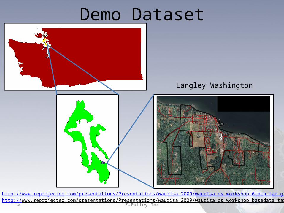
Demo Dataset
Langley Washington
http://www.reprojected.com/presentations/Presentations/waurisa_2009/waurisa_os_workshop_6inch.tar.gzhttp://www.reprojected.com/presentations/Presentations/waurisa_2009/waurisa_os_workshop_basedata.tar.gz
Z-Pulley Inc6
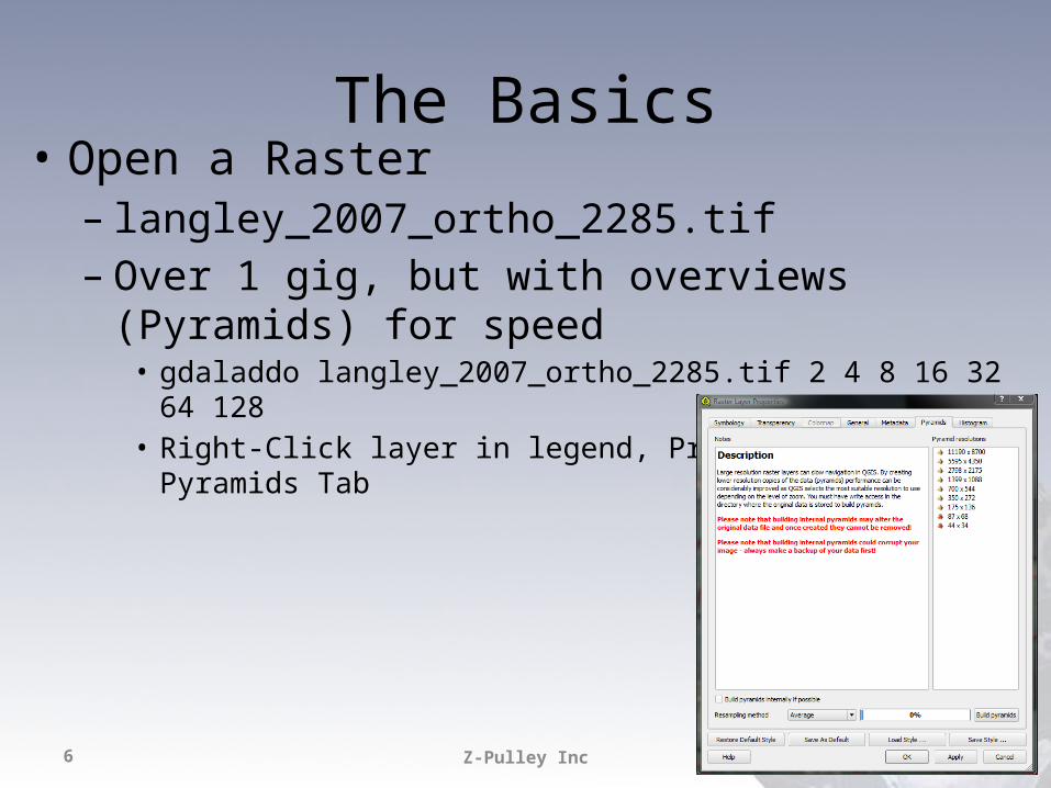
The Basics• Open a Raster– langley_2007_ortho_2285.tif– Over 1 gig, but with overviews (Pyramids) for speed
• gdaladdo langley_2007_ortho_2285.tif 2 4 8 16 32 64 128• Right-Click layer in legend, Properties, Pyramids Tab
Z-Pulley Inc7
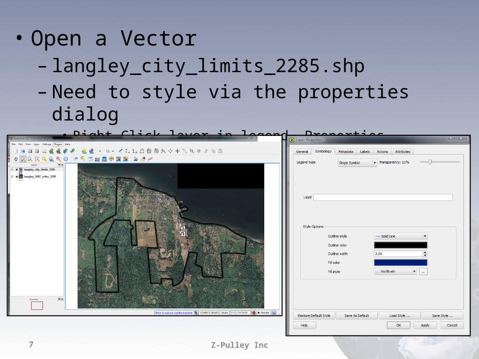
• Open a Vector– langley_city_limits_2285.shp– Need to style via the properties dialog
• Right-Click layer in legend, Properties, Symbology Tab
Z-Pulley Inc8
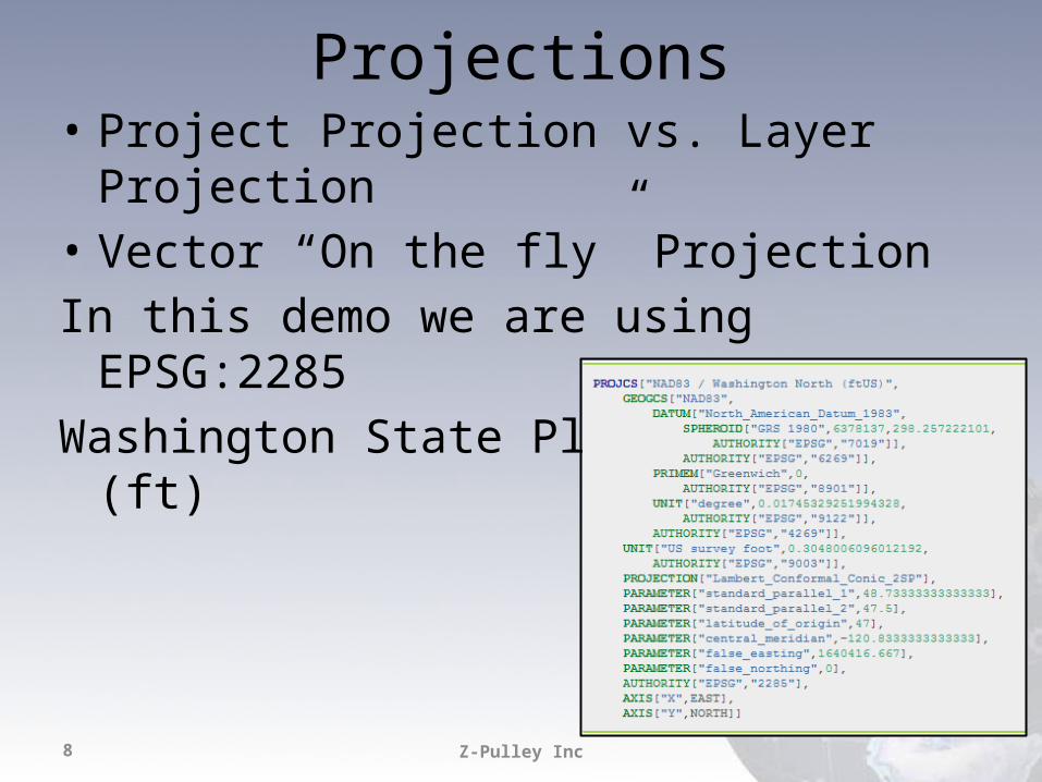
Projections• Project Projection vs. Layer Projection• Vector “On the fly” ProjectionIn this demo we are using EPSG:2285Washington State Plane North (ft)
Z-Pulley Inc9
Play with the data…
• Zoom, Pan, Identify• Open Attribute Tables• Select– Click on map– Query Builder in attribute table
• Label– Label tab in Properties Dialog
• Style– Modify and Save
Z-Pulley Inc10
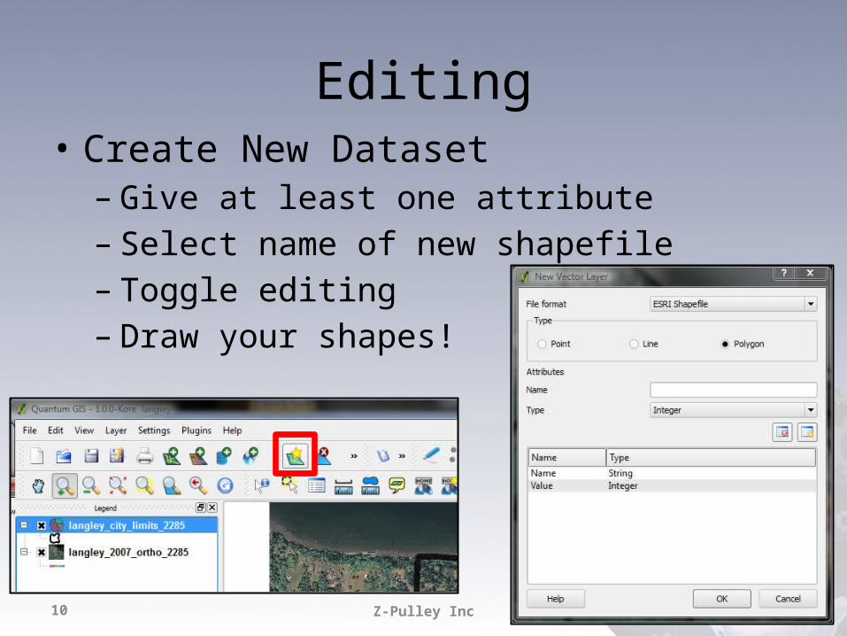
Editing• Create New Dataset– Give at least one attribute– Select name of new shapefile– Toggle editing– Draw your shapes!
Z-Pulley Inc11
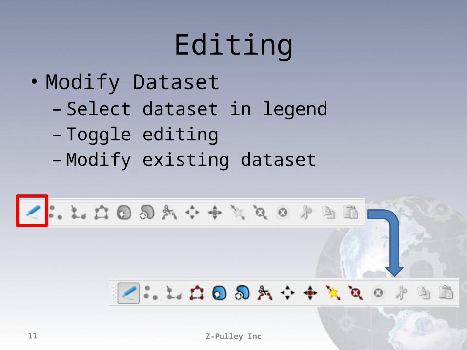
Editing• Modify Dataset– Select dataset in legend– Toggle editing– Modify existing dataset
Z-Pulley Inc12
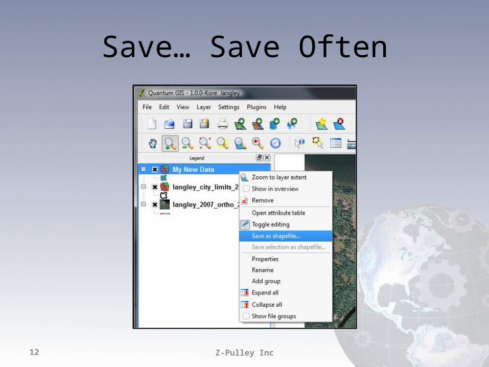
Save… Save Often
Z-Pulley Inc13
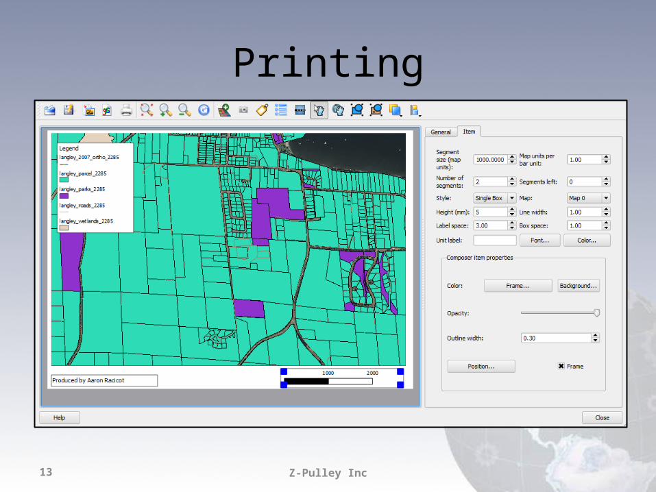
Printing
Z-Pulley Inc14
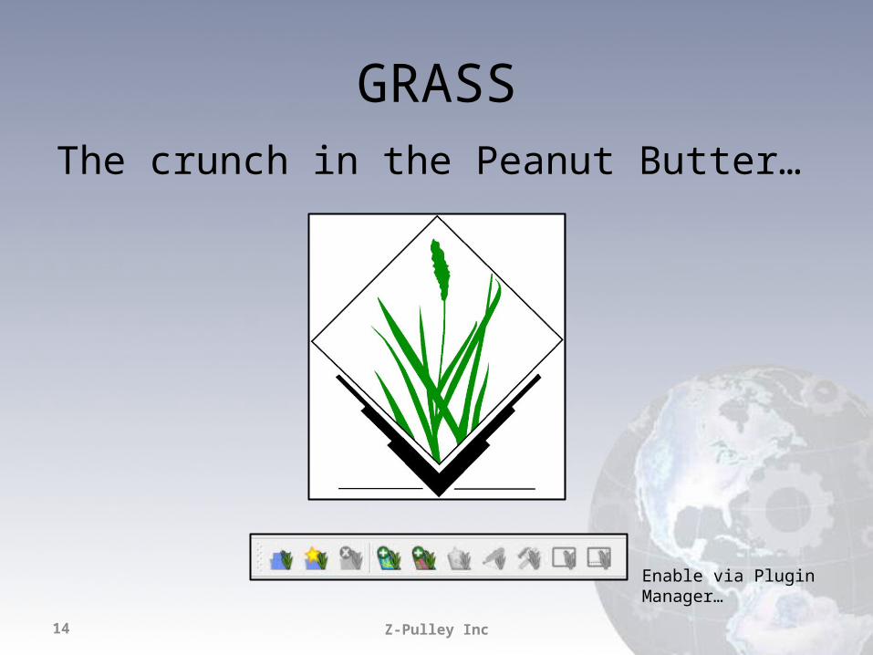
GRASSThe crunch in the Peanut Butter…
Enable via Plugin Manager…
Z-Pulley Inc15
Z-Pulley Inc16
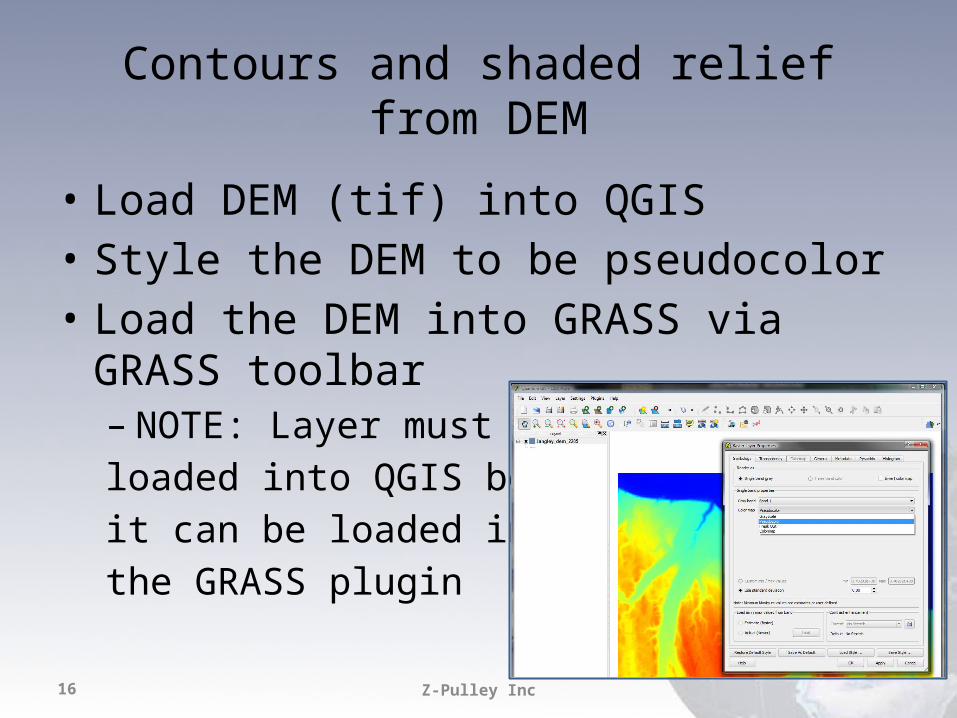
Contours and shaded relief from DEM
• Load DEM (tif) into QGIS• Style the DEM to be pseudocolor• Load the DEM into GRASS via GRASS toolbar– NOTE: Layer must beloaded into QGIS beforeit can be loaded intothe GRASS plugin

Z-Pulley Inc17
Shaded relief• Open GRASS Toolbox• Raster->Spatial Analysis->Terrain Analysis
• r.shaded.relief
Z-Pulley Inc18
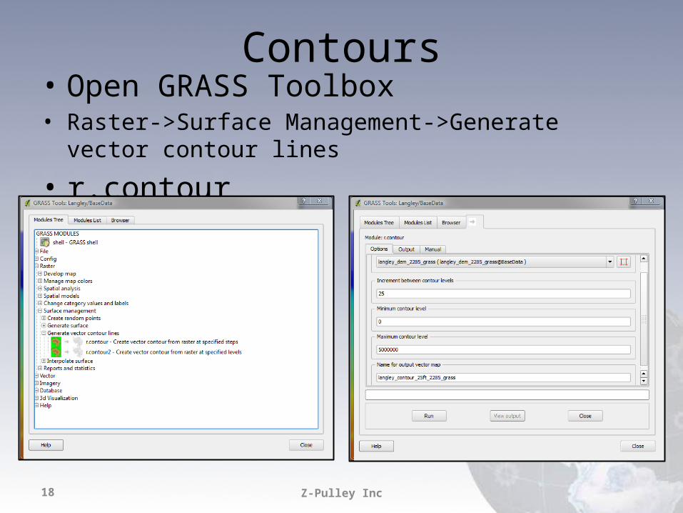
Contours• Open GRASS Toolbox• Raster->Surface Management->Generate vector contour lines
• r.contour
Z-Pulley Inc19
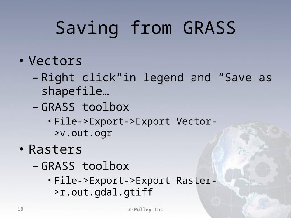
Saving from GRASS
• Vectors– Right click in legend and “Save as shapefile…”– GRASS toolbox• File->Export->Export Vector->v.out.ogr
• Rasters– GRASS toolbox• File->Export->Export Raster->r.out.gdal.gtiff
Z-Pulley Inc20
Extending
Slapping some Jelly on that dry sandwich…
fTools Python PluginCarson Farmer
Z-Pulley Inc21
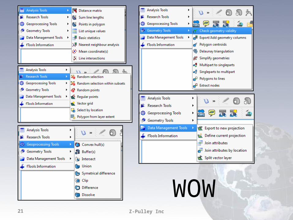
WOW
Z-Pulley Inc22
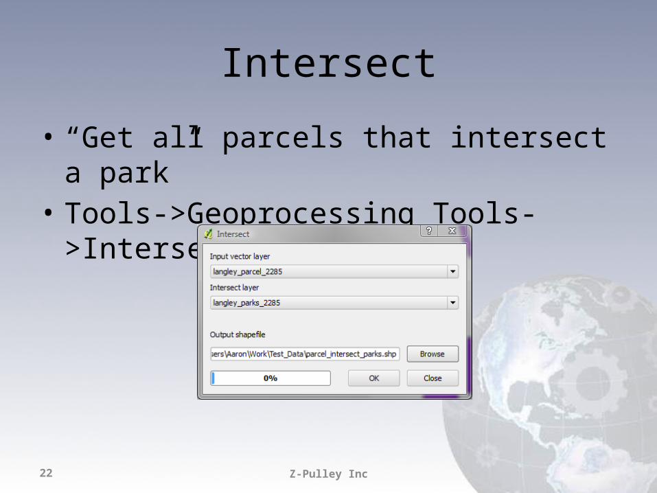
Intersect
• “Get all parcels that intersect a park”• Tools->Geoprocessing Tools->Intersect
Z-Pulley Inc23
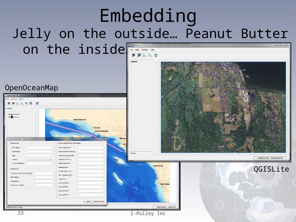
EmbeddingJelly on the outside… Peanut Butter on the inside…
OpenOceanMap
QGISLite
Z-Pulley Inc24
Other Formats
• Great support for PostGIS• GDAL Plugins supported (.sid, .ecw, etc.)• VRT’s are your friend
Z-Pulley Inc25
Things we are still searching for…
• Great print production– New work on composer– Integration with Mapnik
• More spatial functions in Core or Python… less reliance on GRASS
• Raster “on the fly” projection• Better labeling• Relative paths in project files• Many many many more …
Z-Pulley Inc26
ReferencesPyQGISBindings - http://wiki.qgis.org/qgiswiki/PythonBindings API - http://doc.qgis.org/head/classes.html QT API - http://doc.trolltech.com/4.5/index.html PyQT Docs - http://www.riverbankcomputing.co.uk/static/Docs/PyQt4/pyqt4ref.html SIP Docs - http://www.riverbankcomputing.co.uk/static/Docs/sip4/sipref.html
Official Plugin Repo - http://pyqgis.org/Plugin Builder - http://pyqgis.org/builder/plugin_builder.py
Z-Pulley Inc27
Help
• #qgis on freenode IRC• http://www.qgis.org/community/mailing-lists.html • http://www.qgis.org/index.php• http://blog.qgis.org/• http://forum.qgis.org/• https://trac.osgeo.org/qgis/