putlands magnetometry report
TRANSCRIPT

8/6/2019 Putlands Magnetometry Report
http://slidepdf.com/reader/full/putlands-magnetometry-report 1/12
An archaeological magnetometry survey of the Putlandsmoated site, Putlands Leisure Centre, Mascalls Court Road in
Paddock Wood, Kent
Abstract Geophysical investigations at the Putlands site in Paddock Wood did not identify
magnetic anomalies consistent with a moated site seen on pre-1850 mapping and
1960s air photos. Further study is recommended using other techniques.
1. Introduction
Volunteers carried out a magnetometry survey of part of the playing fields at Putlands
Leisure Centre, Mascalls Court Road in Paddock Wood in Kent on Saturday 21st May
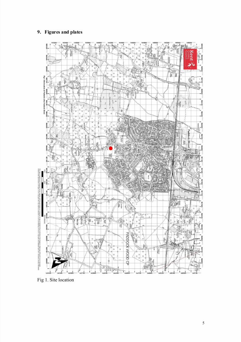
2011. The site is centred at NGR 566850 144178 (fig 1) .The work intended to
identify a moated site visible on the 1843 Brenchley tithe map and on 1960s aerial
photographs. This site is thought to represent a medieval homestead referred to as
Putlands. The tithe map and apportionment describe the site as ‘Moat House’ and
‘House Hop garden’ (Appendix 1), suggesting that a structure recently stood within
the moat.
Justification for survey
The survey methodology was limited by the availability of devices for the volunteers’
use. Magnetometry is often considered to be appropriate for rural sites with earth cut
features in sedimentary geologies (EH, 2008), such as was anticipated at the site.
Resistivity would also be an appropriate technique however, and can provide positiveresults where magnetometry does not.
2. Archaeological and historical background
The Putlands moated site (Kent HER ref. TQ 64 SE 6) would be one of a number of
similar sites in the Low Weald including the nearby Badsell Manor Farm, 1.2km west,
Moatlands, 1.1km to the south and Moat Plats, 1.1km east. All of these sites have a
stream-fed moat and/or earthworks elements still visible today and the last was the
subject of a limited watching brief in 1996 during a new pipeline project (Daniels,
1996).
The moated sites are complemented in the landscape by a number of non-moated
post-medieval farmsteads nearby. One of these is Putlands Farmhouse, a mid-
nineteenth century Grade II Listed complex, 280m north of the moat site. An
antecedent farm complex can be seen on the 1797 Ordnance Surveyors’ Sketches of
the area, as can a faint possible feature at the Putlands moat site itself to the south.
The site is shown clearly on the 1843 tithe map (Fig. 2) and the accompanying
apportionment also describes a house standing there (Appendix 1). The visible width
of the moat suggests that it was too narrow for defensive purposes and it would have
been better suited to keeping livestock in the enclosure and any thieves out (R Cockett, pers. comm.)
1
8/6/2019 Putlands Magnetometry Report
http://slidepdf.com/reader/full/putlands-magnetometry-report 2/12
By the time of the First Edition Ordnance Survey map in the 1860s, the Putlands moat
is no longer visible. A trackway that was shown respecting the moat on the tithe map
appears to have re-routed over the top of it (fig. 3) suggesting that the site was
backfilled in the mid-nineteenth century.
The survey site is known to have been farmland, including use as hop garden and
orchards before the modern leisure centre and its playing fields were created. There is
no visible evidence on the ground today for the site.
Putlands Leisure Centre received planning approval in 1988 and the playing fields
appear to have been consented around the same time, as part of a nearby residential
development (planning application ref. TW/86/00470/OUT). The application plans
show that the playing fields were created from orchard that was previously planted
there. It is currently unclear what degree of landscaping and ground disturbance took
place when the site was orchard, or what groundworks took place for the preparation
of the playing fields.
Geology and topography
According to the maps of the British Geological Survey, the site stands on Tunbridge
Wells Sand although a geological boundary with Weald Clay is shown only 60m
west. Topographically, the playing fields site rises up sharply to the west of the part
thought to contain the moat and other, slightly higher ground appears to surround it,
placing the moat on a lower-lying part of the site.
Overall, the ground slopes down from the High Weald in the south towards the River
Medway further north. A small stream valley nearby follows this gradient and may
have fed the Putlands moat. Today, it seems to turn west, away from the site before
passing it but superseded maps suggest that it once continued north towards Putlands
Farm and it may now in fact be culverted alongside or under the playing fields. The
site stands at around 25m OD and is covered by close cut grass recreation ground,
dotted with c. 20 year old trees around the edges.
Air photo interpretation
A brief examination of aerial photos of the site (KCC Heritage Conservation Group
holdings for 1946 and 1990 and Google Earth imagery for 2003, 2005 and 2007) was
carried out before the survey and did not provide any compelling cropmark evidence
for the moat.
A more intensive examination of all KCC air photo holdings after fieldwork identified
an enclosure on images from 1961 (fig 4) and 1967 (fig 5). The former image also
showed linear features possibly representing land division, tracks and/or drainage,
while the latter matches the tithe map’s depiction of the shape of the moat very
closely.
3. Methodology
A grid of side 40m was set up at the site, located over the anticipated location of themoat and any central features. This location was inferred from rectification of the tithe
2
8/6/2019 Putlands Magnetometry Report
http://slidepdf.com/reader/full/putlands-magnetometry-report 3/12
map on the modern OS and located on the ground by a local resident. A Geoscan
FM256 Fluxgate Gradiometer first acquired by the Valley of Visions HLF project and
now lent out by Kent County Council Heritage Conservation Group to volunteers was
used for the work.
Four adjoining 20m grids were laid out in a 2x2 square, and sampling within themwas carried out on 1m transects at 0.25m intervals, using a zig-zag walking pattern,
The data were immediately downloaded into Geoscan’s Geoplot software for
processing and rendering. One grid was truncated by the site boundary hedge. Two of
the four grids were surveyed twice, in one case in order to correct an error seen on
processing, and in another to confirm initial results. On further examination it was
deemed that only the two rescanned grid squares had produced results recognisable as
geophysical survey plots and the data from the first squares in the south of the grid
were discarded.
The anticipated assistance of a volunteer Ordnance Survey surveyor could not be
secured on the day and so the grid was located to the OS grid using topographic bestfit and triangulation from trees known to be visible on rectified air photos of the site
as no more solid features were within range.
Fieldwork and reporting were undertaken with reference to English Heritage guidance
only and not to a formal specification. The weather was bright and dry.
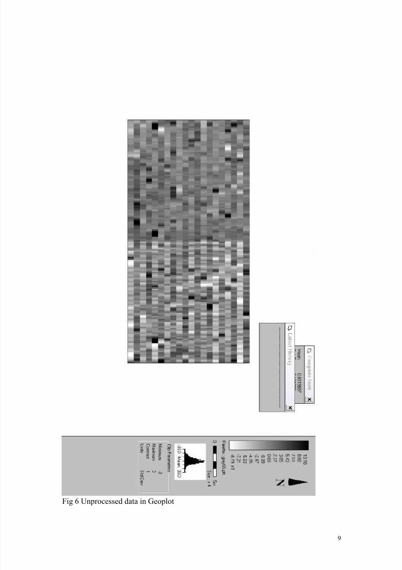
3. Results
The resulting plots did not show any cut features and indicate a homogenous
geological and pedological profile (Fig 6), with the occasional magnetic spikes visible
likely representing small buried iron objects of modern date (J Bryan, pers comm.).
No linear magnetic disturbance from buried underground services or a culverted
stream was identified.
4. Conclusions
No features that could be interpreted as relating to a moated enclosure were identified
in the survey and it is not clear whether one still survives at the site.The air photo
evidence indicates that remains were present until at least 1967 but it is possible thatagriculture and the development of the playing fields affected the survival of the site
subsequently. It should be borne in mind that magnetometry surveys can provide false
negative results however and a lack of geophysical anomalies “…cannot be taken toimply a lack of archaeological features…in such cases an alternative evaluation
procedure…should be considered ” (EH, 2008).
Recommendations
Further fieldwork in the form of intrusive trenching would most convincingly clarify
the question of whether the moat survived post-1967 and what impacts it sustained
from for example, farming and the creation of the playing fields. A resistivity survey
may also give more positive results for the particular local geology. Documentaryresearch on the history of the site and on the extent of the modern impacts at the site
3

8/6/2019 Putlands Magnetometry Report
http://slidepdf.com/reader/full/putlands-magnetometry-report 4/12
created by the construction of the playing fields may also be helpful. The 1769
Andrews, Dury and Herbert map for example may show the occupied moat site more
clearly and searches at the Centre for Kentish Studies would likely augment the
cursory background research undertaken for this report.
5. Confidence rating
A margin of error is anticipated in the location of the grid due to surveying difficulties
on site. The geophysical results may have been affected by modern landscaping
and/or dumping in the area of the moat, disturbing or masking any cut features. A
magnetically unresponsive geology, including backfilling of the moat with similar
material to the natural may also have not provided a strongly differential signal. This
type of backfill was identified at the Moat Plats site (Daniels).
Only a 20m x 40m survey area produced results, half of what was intended, and this
may have been too small to have intersected with a moat. A very narrow moat, with
its upper and wider horizons truncated may also have not been detected by themethodology employed.
6. Acknowledgements
The survey was undertaken by Jessica Bryan and Roger Cockett. Any errors in the
report are the responsibility of the author. Thanks are also extended to Teresa Hawtin
for her research in 2010, for initially planning the survey and also for carrying out
tithe map rectification. Gratitude is owed to the Heritage Conservation Group at KCC
for permitting use of the magnetometer.
7. Dissemination
A digital copy of this report is to be lodged with the Kent HER.
Adam Single, May 2011.
8. Bibliography
Daniels, AJ, Excavation of a Moated Site at Moat Platt, Church Road, Paddock
Wood Kent , unpublished report, January 1996
English Heritage, Geophysical Survey in Archaeological Field Evaluation, 2nd
Edition, 2008
4
8/6/2019 Putlands Magnetometry Report
http://slidepdf.com/reader/full/putlands-magnetometry-report 5/12
9. Figures and plates
Fig 1. Site location
5

8/6/2019 Putlands Magnetometry Report
http://slidepdf.com/reader/full/putlands-magnetometry-report 6/12
Fig 2. 1843 Brenchley tithe map extract overlain on modern OS 10k. The trapezoidal
moated site is shown between Mascall’s Pound and Putlands Leisure Centre, north of
the ‘27m’ label.
6

8/6/2019 Putlands Magnetometry Report
http://slidepdf.com/reader/full/putlands-magnetometry-report 7/12
Fig 3. Site and its surroundings on the First Edition OS, c.1865
7

8/6/2019 Putlands Magnetometry Report
http://slidepdf.com/reader/full/putlands-magnetometry-report 8/12
Fig 4. 1961 air photo extract
Fig 5. 1967 air photo extract
8
8/6/2019 Putlands Magnetometry Report
http://slidepdf.com/reader/full/putlands-magnetometry-report 9/12

8/6/2019 Putlands Magnetometry Report
http://slidepdf.com/reader/full/putlands-magnetometry-report 10/12
Fig 7 Processed magnetometry results located on background OS
10
8/6/2019 Putlands Magnetometry Report
http://slidepdf.com/reader/full/putlands-magnetometry-report 11/12

8/6/2019 Putlands Magnetometry Report
http://slidepdf.com/reader/full/putlands-magnetometry-report 12/12
Appendix 1 – 1843 Brenchley Tithe map and apportionment extract
12