published by the - railroad commission of · web viewpublished by the railroad commission of...
TRANSCRIPT

RAILROAD COMMISSION OF TEXAS
INFORMATION TECHNOLOGY SERVICES DIVISION
USER'S GUIDE
DIGITAL MAP INFORMATION
PUBLICATION NUMBER: OGA094

PUBLISHED BY THERAILROAD COMMISSION OF TEXAS
P.O. BOX 12967AUSTIN, TEXAS 78711
The Information Technology Services Division (ITS) developed this publication for the general public in response to inquiries concerning the availability of digital map data. Any request for assistance with using the manual will be given every consideration.
First Edition: January 2000Revised: July 2000Revised: October 2000Revised: November 2000Revised: January 2001Revised: January 2002Revised: January 2005Revised: November 2016Revised: June 2017
The Railroad Commission of Texas complies with Federal, and State laws applicable to race, religion, national origin, sex, and disability. Information is available upon request by calling (512)463-7288 or 1-800-735-2989 if special assistance is required.
Publication Number: OGA094

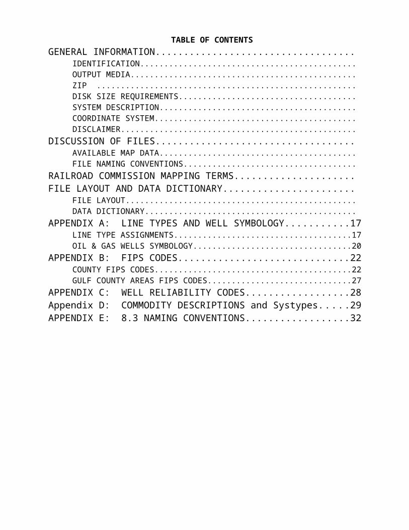
TABLE OF CONTENTSGENERAL INFORMATION...................................
IDENTIFICATION.............................................OUTPUT MEDIA...............................................ZIP ......................................................DISK SIZE REQUIREMENTS.....................................SYSTEM DESCRIPTION.........................................COORDINATE SYSTEM..........................................DISCLAIMER.................................................
DISCUSSION OF FILES...................................AVAILABLE MAP DATA.........................................FILE NAMING CONVENTIONS....................................
RAILROAD COMMISSION MAPPING TERMS.....................FILE LAYOUT AND DATA DICTIONARY.......................
FILE LAYOUT................................................DATA DICTIONARY............................................
APPENDIX A: LINE TYPES AND WELL SYMBOLOGY...........17LINE TYPE ASSIGNMENTS.....................................17OIL & GAS WELLS SYMBOLOGY.................................20
APPENDIX B: FIPS CODES..............................22COUNTY FIPS CODES.........................................22GULF COUNTY AREAS FIPS CODES..............................27
APPENDIX C: WELL RELIABILITY CODES..................28Appendix D: COMMODITY DESCRIPTIONS and Systypes.....29APPENDIX E: 8.3 NAMING CONVENTIONS..................32

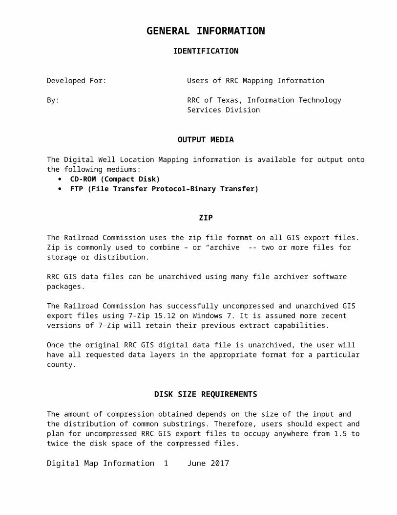
GENERAL INFORMATIONIDENTIFICATION
Developed For: Users of RRC Mapping Information
By: RRC of Texas, Information TechnologyServices Division
OUTPUT MEDIA
The Digital Well Location Mapping information is available for output onto the following mediums:
CD-ROM (Compact Disk) FTP (File Transfer Protocol–Binary Transfer)
ZIP
The Railroad Commission uses the zip file format on all GIS export files. Zip is commonly used to combine – or “archive” -- two or more files for storage or distribution.
RRC GIS data files can be unarchived using many file archiver software packages.
The Railroad Commission has successfully uncompressed and unarchived GIS export files using 7-Zip 15.12 on Windows 7. It is assumed more recent versions of 7-Zip will retain their previous extract capabilities.
Once the original RRC GIS digital data file is unarchived, the user will have all requested data layers in the appropriate format for a particular county.
DISK SIZE REQUIREMENTS
The amount of compression obtained depends on the size of the input and the distribution of common substrings. Therefore, users should expect and plan for uncompressed RRC GIS export files to occupy anywhere from 1.5 to twice the disk space of the compressed files.
Digital Map Information 1 June 2017
SYSTEM DESCRIPTION
The Railroad Commission of Texas exports double-precision map data from ARCSDE version 10.2. Exports are to Environmental Systems Research Institute’s (ESRI) shapefile (.SHP) format.
Shapefiles, developed by ESRI for use with its ArcMap software, store a feature’s geographic location and attribute information. The shapefile format is a collection of different files listed under the File Naming Conventions (II.3).
COORDINATE SYSTEM
The Railroad Commission exports all map data to the Geographic projection (Latitude/Longitude). The following parameters define the Geographic projection:
Projection: GeographicUnits: Decimal DegreesDatum: NAD27
DISCLAIMER
The digital mapping data described in this manual were generated by the Geographic Information System of the Railroad Commission of Texas and are provided for informational purposes only. Base map information was obtained directly from U.S. Geological Survey 7.5 minute quadrangle maps. Patent Survey lines from Texas General Land Office maps were interpreted as accurately as possible over the U.S. Geological Survey base. Oil and gas well data or pipeline data (if included) were obtained from public records of the Railroad Commission. The mapping system from which this data was extracted is currently under development and is continually being updated and refined. These data are intended solely for the internal use of the Railroad Commission, which makes no claim as to its accuracy or completeness. Users are responsible for checking the accuracy, completeness, currency, and/or suitability of this data.
Digital Map Information 2 June 2017
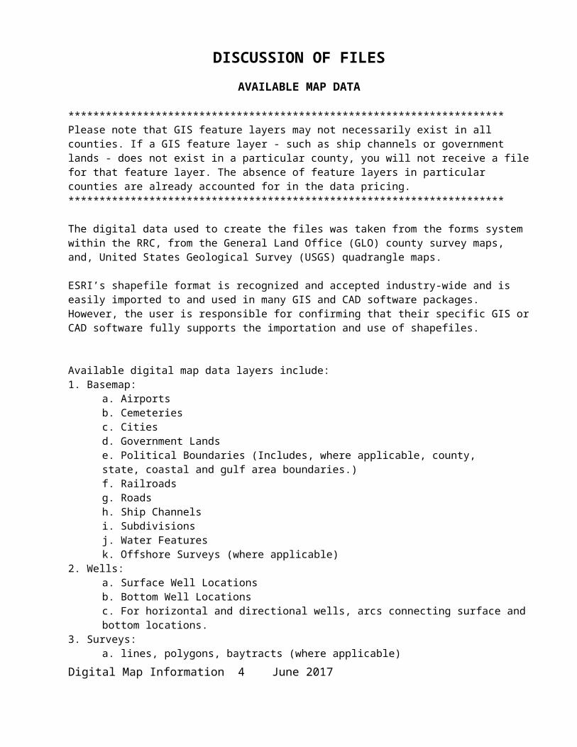
DISCUSSION OF FILES
AVAILABLE MAP DATA
**********************************************************************Please note that GIS feature layers may not necessarily exist in all counties. If a GIS feature layer - such as ship channels or government lands - does not exist in a particular county, you will not receive a file for that feature layer. The absence of feature layers in particular counties are already accounted for in the data pricing.**********************************************************************
The digital data used to create the files was taken from the forms system within the RRC, from the General Land Office (GLO) county survey maps, and, United States Geological Survey (USGS) quadrangle maps.
ESRI’s shapefile format is recognized and accepted industry-wide and is easily imported to and used in many GIS and CAD software packages. However, the user is responsible for confirming that their specific GIS or CAD software fully supports the importation and use of shapefiles.
Available digital map data layers include:1. Basemap:
a. Airportsb. Cemeteriesc. Citiesd. Government Landse. Political Boundaries (Includes, where applicable, county, state, coastal and gulf area boundaries.)f. Railroadsg. Roadsh. Ship Channelsi. Subdivisionsj. Water Featuresk. Offshore Surveys (where applicable)
2. Wells:a. Surface Well Locationsb. Bottom Well Locationsc. For horizontal and directional wells, arcs connecting surface and bottom locations.
3. Surveys:a. lines, polygons, baytracts (where applicable)
4. Pipelines:a. Pipelines – Abandonedb. Pipelines – Liquidc. Pipelines – Gas
Digital Map Information 3 June 2017

FILE NAMING CONVENTIONS
The archived shapefile(s) you will receive from the Railroad Commission are named as follows:
When ordering ALL DATA:1. The 1st three letters are “Shp”2. The county FIPS code follows the “Shp”3. All files have the suffix “.zip” Example:
a. County FIPS code 307 exported: Shp307.zip
When ordering BASEMAP DATA only:1. The 1st seven letters are “Basemap”2. The county FIPS code follows the “Basemap”3. All files have the suffix “.zip” Example:
a. County FIPS code 307 exported: Basemap307.zip
When ordering PIPELINE DATA only:1. The 1st eight letters are “pipeline”2. The county FIPS code follows the “pipeline”3. All files have the suffix “.zip” Example:
a. County FIPS code 307 exported: pipeline307.zip
When ordering SURVEY DATA only:1. The 1st four letters are “surv”2. The county FIPS code follows the “surv”3. All files have the suffix “.zip” Example:
a. County FIPS code 307 exported: surv307.zip
When ordering WELL DATA only:1. The 1st four letters are “well”2. The county FIPS code follows the “well”3. All files have the suffix “.zip” Example:
a. County FIPS code 307 exported: well307.zip
Digital Map Information 4 June 2017

A. Exports by County FIPS Code to ArcView Shapefiles:Each shapefiles will contain the following extensions (ext):<shapefile>.cpg - contains the code page information for the attributes.<shapefile>.dbf - contains a feature’s dBase attribute information.<shapefile>.prj - contains the feature’s projection file.<shapefile>.sbn - contains the feature’s spatial index format<shapefile>.sbx - contains the feature’s spatial index format<shapefile>.shp - contains a feature’s geometry.<shapefile>.shp.xml - contains a feature’s metadata.<shapefile>.shx - contains a feature’s geometry index.
1. Airport lines: air<fips_number>l.<ext>2. Cemetery lines: cem<fips_number>l.<ext>
polygons: cem<fips_number>p.<ext>3. City polygons: cit<fips_number>p.<ext>4. County Boundary
coastal polygons: cty<fips_number>g.<ext>gulf areas polygons: cty<fips_number>i.<ext>state polygons: cty<fips_number>k.<ext>
5. Government Land lines: gov<fips_number>l.<ext>6. Railroad lines: rail<fips_number>l.<ext>7. Road lines: road<fips_number>l.<ext>8. Ship Channel lines: ship<fips_number>l.<ext>9. Subdivision lines subd<fips_number>l.<ext>
label points: subd <fips_number>Labpt.<ext>10. Survey lines: surv<fips_number>l.<ext>
polygons: surv<fips_number>p.<ext>baytract polygons: surv<fips_number>b.<ext>abstract points: surv<fips_number>Abspt.<ext>label points: surv<fips_number>Labpt.<ext>
11. Water lines: watr<fips_number>l.<ext>polygons: watr<fips_number>a.<ext>
12. Wells:Surface Well points: well<fips_number>s.<ext>Bottom Well points: well<fips_number>b.<ext>Surface/Bottom lines: well<fips_number>l.<ext>
13. Pipelines lines: pipe<fips_number>l.<ext>14. Offshore Survey polys: offs<fips_number>a.<ext>
Digital Map Information 5 June 2017
RAILROAD COMMISSION MAPPING TERMSSurvey A survey is a certified measured description of a piece of land. The term sometimes refers to the land itself. In Texas, original surveys were performed as part of the patenting process whereby land was transferred from the public domain. These "patent surveys," recorded at the Texas General Land Office, constitute an official land grid for the State and are the basis for subsequent land surveys.
BlockA block is a defined set of original land surveys. A block has an identifying name and/or number, and surveys within it are usually consecutively numbered, mile-square sections. Land grants from the State of Texas to railroad companies were often patented in blocks and sections. The term block is also used as a unit of a subdivision, i.e., subdivision/block/lot.
SectionA section refers to a square land survey measuring exactly one mile on each side. Some of the land transferred from the public domain by the state of Texas was surveyed and patented in units of square miles. The Texas General Land Office officially considers these units sections. Also, it was common that larger land grants, such as school lands and capitol lands, were subsequently surveyed into square mile units for the convenience of sale; these surveys are also called sections. In addition, the term "section" is commonly used to describe surveys in a group that have been assigned consecutive survey numbers, even though some of them do not have the proper shape or size to truly be sections.
AbstractIn Texas, the term abstract refers to an original land survey describing an area transferred from the public domain by either the Republic of Texas or the State of Texas. These surveys are recorded in the "State Abstract of Land Titles," which is maintained by the Texas General Land Office. Each survey so recorded is assigned an abstract number, which is unique within the county in which the survey falls. Because Texas has never performed a uniform statewide land survey, these original surveys called "Patent Surveys" constitute the State's Official Land Survey System.
Digital Map Information 6 June 2017

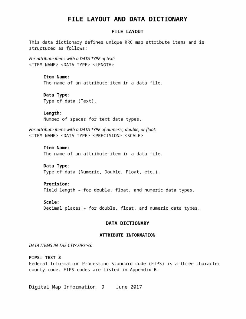
FILE LAYOUT AND DATA DICTIONARYFILE LAYOUT
This data dictionary defines unique RRC map attribute items and is structured as follows:
For attribute items with a DATA TYPE of text:<ITEM NAME> <DATA TYPE> <LENGTH>
Item Name: The name of an attribute item in a data file.
Data Type:Type of data (Text).
Length: Number of spaces for text data types.
For attribute items with a DATA TYPE of numeric, double, or float:<ITEM NAME> <DATA TYPE> <PRECISION> <SCALE>
Item Name: The name of an attribute item in a data file.
Data Type:Type of data (Numeric, Double, Float, etc.).
Precision: Field length – for double, float, and numeric data types.
Scale: Decimal places – for double, float, and numeric data types.
DATA DICTIONARY
ATTRIBUTE INFORMATION
DATA ITEMS IN THE CTY<FIPS>G:
FIPS: TEXT 3Federal Information Processing Standard code (FIPS) is a three character county code. FIPS codes are listed in Appendix B.
COUNTY_NAM: TEXT 14The county name is in upper case letters.
DATA ITEMS IN THE CTY<FIPS>I:
FIPS: TEXT 3Federal Information Processing Standard code (FIPS) is a three character county code. FIPS codes are listed in Appendix B.
Digital Map Information 7 June 2017

AREANAME: TEXT 50County name for a gulf area. County names are listed in Appendix B.
RAILROAD ATTRIBUTE INFORMATION
QUAD15M: TEXT 615 Minute Quadrangle number the rail line is in.
SUBDIVISION ATTRIBUTE INFORMATION
DATA ITEMS IN THE SUBD<FIPS>L:
QUAD15M_N: TEXT 6Quad number for subdivision – unused.
LTYPE_N: SMALLINT 4, 4Line type. All line types are listed in Appendix A.
DATA ITEMS IN THE SUBD<FIPS>Labpt:(use an invisible symbol to hide the pt)
TEXTSTRING: STRING 254Name of the subdivision.
FONTNAME: STRING 254 Font used to label.
FONTSIZE: DOUBLE 19, 8Size of the font.
ANGLE: DOUBLE 19, 8Angle used to label the point on.
JUST: STRING 2Justification of the label position.
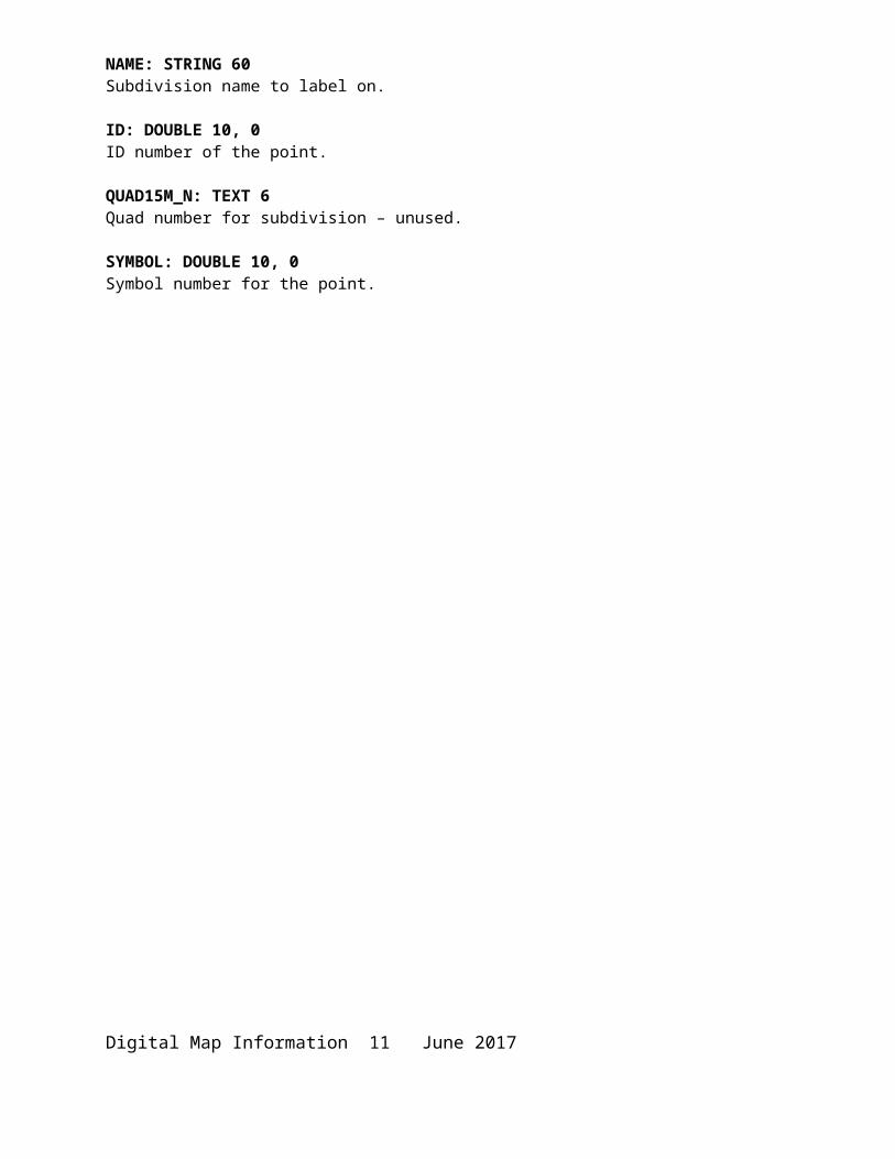
NAME: STRING 60Subdivision name to label on.
ID: DOUBLE 10, 0ID number of the point.
QUAD15M_N: TEXT 6Quad number for subdivision – unused.
SYMBOL: DOUBLE 10, 0Symbol number for the point.
Digital Map Information 8 June 2017

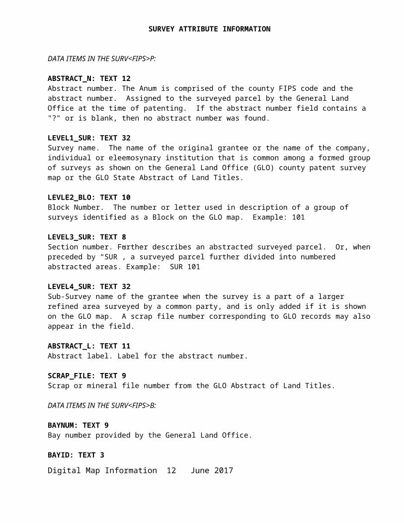
SURVEY ATTRIBUTE INFORMATION
DATA ITEMS IN THE SURV<FIPS>P:
ABSTRACT_N: TEXT 12Abstract number. The Anum is comprised of the county FIPS code and the abstract number. Assigned to the surveyed parcel by the General Land Office at the time of patenting. If the abstract number field contains a "?" or is blank, then no abstract number was found.
LEVEL1_SUR: TEXT 32Survey name. The name of the original grantee or the name of the company, individual or eleemosynary institution that is common among a formed group of surveys as shown on the General Land Office (GLO) county patent survey map or the GLO State Abstract of Land Titles.
LEVLE2_BLO: TEXT 10Block Number. The number or letter used in description of a group of surveys identified as a Block on the GLO map. Example: 101
LEVEL3_SUR: TEXT 8Section number. Further describes an abstracted surveyed parcel. Or, when preceded by “SUR”, a surveyed parcel further divided into numbered abstracted areas. Example: SUR 101
LEVEL4_SUR: TEXT 32Sub-Survey name of the grantee when the survey is a part of a larger refined area surveyed by a common party, and is only added if it is shown on the GLO map. A scrap file number corresponding to GLO records may also appear in the field.
ABSTRACT_L: TEXT 11Abstract label. Label for the abstract number.
SCRAP_FILE: TEXT 9Scrap or mineral file number from the GLO Abstract of Land Titles.
DATA ITEMS IN THE SURV<FIPS>B:
BAYNUM: TEXT 9Bay number provided by the General Land Office.
BAYID: TEXT 3Bay area name abbreviations.
TRACTNUM: TEXT 6Provided by the General Land Office.
DATA ITEMS IN THE SURV<FIPS>L:
LTYPE: SHORT NUMERIC Line type, all line types are given in Appendix A.
Digital Map Information 9 June 2017

QUAD15M: TEXT 615 Minute Quadrangle number the survey is in.
DATA ITEMS IN THE SURV<FIPS>Abspt: (use an invisible symbol to hide the pt)
SYMBOLID: DOUBLE 10, 0 Symbol ID of the symbol.
TEXTSTRING: STRING 254Survey abstract number.
FONTNAME: STRING 254 Font used to label.
FONTSIZE: DOUBLE 19, 8Size of the font.
ANGLE: DOUBLE 19, 8Angle used to label the point on.
JUST: STRING 2Justification of the label position.
NAME: STRING 10Survey abstract number to label on.
ID: DOUBLE 10, 0ID number of the point.
SYMBOL: DOUBLE 10, 0Symbol number for the point.
DATA ITEMS IN THE SURV<FIPS>Labpt: (use an invisible symbol to hide the pt)
TEXTSTRING: STRING 254Survey abstract name.
FONTNAME: STRING 254 Font used to label.
FONTSIZE: DOUBLE 19, 8Size of the font.
ANGLE: DOUBLE 19, 8Angle used to label the point on.
JUST: STRING 2Justification of the label position.
Digital Map Information 10 June 2017
NAME: STRING 10Survey abstract name to label on.
ID: DOUBLE 10, 0ID number of the point.
SYMBOL: DOUBLE 10, 0Symbol number for the point.
WATER ATTRIBUTE INFORMATION
DATA ITEMS IN THE WATR<FIPS>L:
QUAD15M: TEXT 615 Minute Quadrangle number the water is in.
DATA ITEMS IN THE WATR<FIPS>A:
LW_CODE: TEXT 1Identifies a polygon water (W).
WELL ATTRIBUTE INFORMATION
*****************************************************************For some historical wells, APINUM field may be blank due to the limited amount of research time to capture this information.*****************************************************************
BOTTOM WELLS - DATA ITEMS IN THE WELL<FIPS>B:
API: TEXT 8Three character county code with 5 character American Petroleum Institute (API) number. FIPS codes are listed in Appendix B.
API10: TEXT 10 Ten character field equivalent to APINUM minus the 2 digit STATE Code.
APINUM: TEXT 12The American Petroleum Institute (API) number of the wellbore in which the well is located. This 12-digit number includes a two-digit state code (Texas=42), an eight-digit API code, and a two-digit sidetrack code. (A sidetrack code identifies wells drilled from within a wellbore.)
BOTTOM-ID: DOUBLE 10 0 Bottom well identification number.
CWELLNUM: TEXT 6 Current well number as assigned by the operator.
OUT_FIPS: TEXT 1 If given the value “Y”, indicates a bottom well location in a county other than that indicated by the FIPS code portion of the API number.
Digital Map Information 11 June 2017

LAT27: DOUBLE 18 8 Latitudinal position of the well. Datum is 1927.
LONG27: DOUBLE 18 8 Longitudinal position of the well. Datum is 1927.
LAT83: DOUBLE 18 8 Latitudinal position of the well. Datum is 1983.
LONG83: DOUBLE 18 8 Longitudinal position of the well. Datum is 1983+.
RADIOACT: TEXT 1Whether the well is radioactive (if the bore contains any known radioactive material).
Y - well is radioactive.N - well is not radioactive.
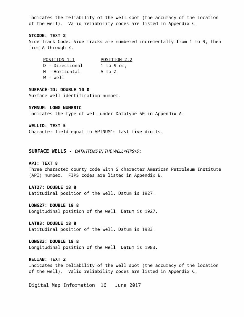
RELIAB: TEXT 2Indicates the reliability of the well spot (the accuracy of the location of the well). Valid reliability codes are listed in Appendix C.
STCODE: TEXT 2Side Track Code. Side tracks are numbered incrementally from 1 to 9, then from A through Z.
POSITION 1:1 POSITION 2:2D = Directional 1 to 9 or,H = Horizontal A to ZW = Well
SURFACE-ID: DOUBLE 10 0 Surface well identification number.
SYMNUM: LONG NUMERICIndicates the type of well under Datatype 50 in Appendix A.
WELLID: TEXT 5Character field equal to APINUM’s last five digits.
SURFACE WELLS - DATA ITEMS IN THE WELL<FIPS>S:
API: TEXT 8Three character county code with 5 character American Petroleum Institute (API) number. FIPS codes are listed in Appendix B.
LAT27: DOUBLE 18 8Latitudinal position of the well. Datum is 1927.
LONG27: DOUBLE 18 8Longitudinal position of the well. Datum is 1927.Digital Map Information 12 June 2017
LAT83: DOUBLE 18 8Latitudinal position of the well. Datum is 1983.
LONG83: DOUBLE 18 8Longitudinal position of the well. Datum is 1983.
RELIAB: TEXT 2Indicates the reliability of the well spot (the accuracy of the location of the well). Valid reliability codes are listed in Appendix C.
SURFACE-ID: DOUBLE 10 0Surface well identification number.
SYMNUM: LONG NUMERIC Indicates the type of well under Data type 50 in Appendix A.
WELLID: TEXT 5 Character field equal to APINUM’s last five digits.
WELL SURFACE/BOTTOM LINES - DATA ITEMS IN THE WELL<FIPS>L:
API: TEXT 8Three character county code with 5 character American Petroleum Institute (API) number. FIPS codes are listed in Appendix B.
API10: TEXT 10 The American Petroleum Institute (API) number of the wellbore in which the well is located. This 10-digit number is an eight-digit API code and a two-digit sidetrack code. (A sidetrack code identifies wells drilled from within a wellbore.)
BOTTOM-ID: DOUBLE 10 0 Bottom well identification number.
SURFACE-ID: DOUBLE 10 0 Surface well identification number.
STCODE: TEXT 2Side Track Code. Side tracks are numbered incrementally from 1 to 9, then from A through Z.
POSITION 1:1 POSITION 2:2D = Directional 1 to 9 or,H = Horizontal A to ZW = Well
Digital Map Information 13 June 2017
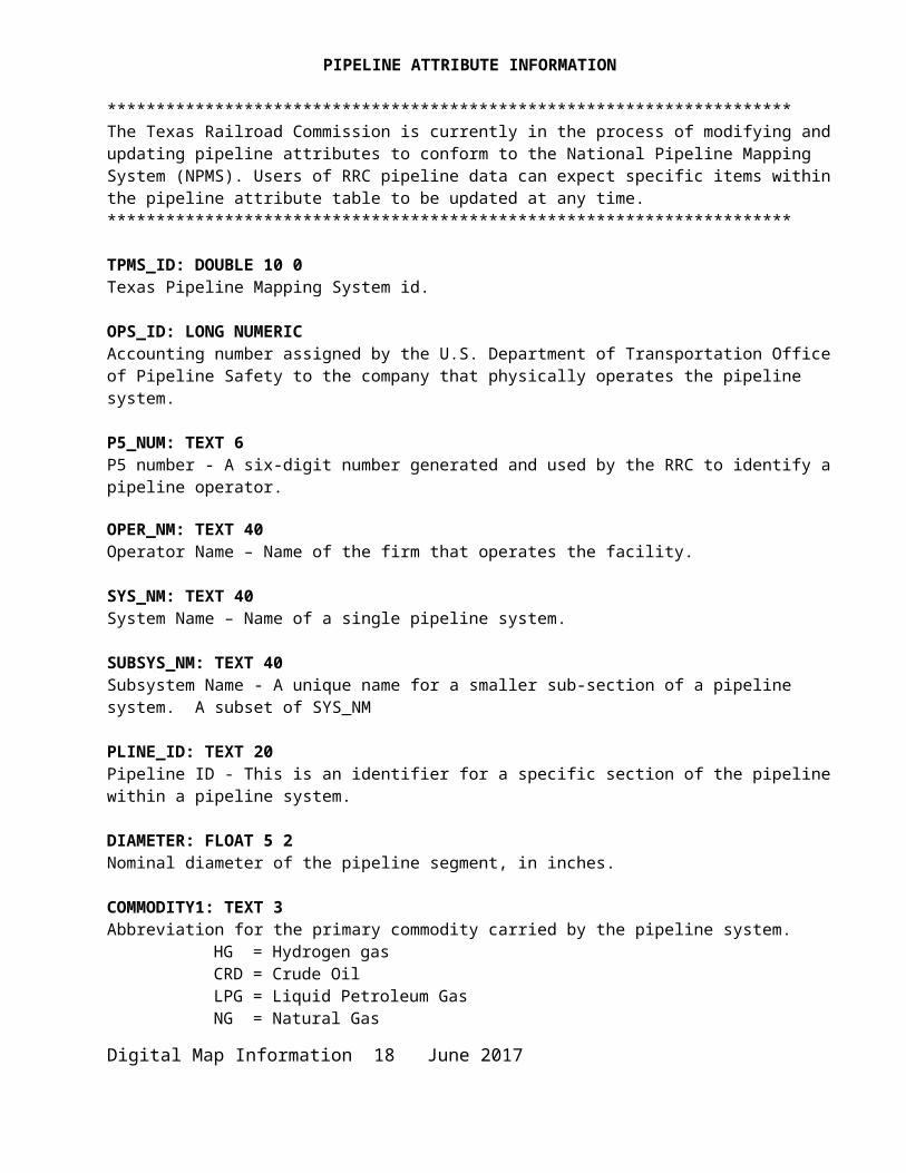
PIPELINE ATTRIBUTE INFORMATION
**********************************************************************The Texas Railroad Commission is currently in the process of modifying and updating pipeline attributes to conform to the National Pipeline Mapping System (NPMS). Users of RRC pipeline data can expect specific items within the pipeline attribute table to be updated at any time.**********************************************************************
TPMS_ID: DOUBLE 10 0 Texas Pipeline Mapping System id.
OPS_ID: LONG NUMERICAccounting number assigned by the U.S. Department of Transportation Office of Pipeline Safety to the company that physically operates the pipeline system.
P5_NUM: TEXT 6P5 number - A six-digit number generated and used by the RRC to identify a pipeline operator.
OPER_NM: TEXT 40Operator Name – Name of the firm that operates the facility.
SYS_NM: TEXT 40System Name – Name of a single pipeline system.
SUBSYS_NM: TEXT 40Subsystem Name - A unique name for a smaller sub-section of a pipeline system. A subset of SYS_NM
PLINE_ID: TEXT 20Pipeline ID - This is an identifier for a specific section of the pipeline within a pipeline system.
DIAMETER: FLOAT 5 2Nominal diameter of the pipeline segment, in inches.
COMMODITY1: TEXT 3Abbreviation for the primary commodity carried by the pipeline system.
HG = Hydrogen gasCRD = Crude OilLPG = Liquid Petroleum GasNG = Natural GasPRD = ProductAA = Anhydrous AmmoniaCO2 = Carbon DioxideNGL = Natural Gas LiquidsHVL = Highly Volatile LiquidEMT = Empty
Digital Map Information 14 June 2017

COMMODITY2: TEXT 3Abbreviation for the secondary commodity carried by the pipeline system. Same as Commodity1, except EMT is not valid.
COMMODITY3: TEXT 3Abbreviation for the tertiary commodity carried by the pipeline system. Same as Commodity1 except EMT is not valid.
CMDTY_DESC: TEXT 40Commodity Description - Descriptive information of the commodities carried by the pipeline system. Appendix D has a complete listing of specific products within the commodity categories.
INTERSTATE: TEXT 1Designates a pipeline as either inter or intrastate. “Y” indicates an interstate pipeline, “N” indicates an intrastate pipeline.
STATUS_CD: TEXT 1Status Code - Identifies the current status of the pipeline segment. “I” = in service, “B” = abandoned, “R” = retired.
QUALITY_CD: TEXT 1Quality Code - Operator’s estimate of the positional accuracy of the submitted pipeline segment. “E”=excellent: within 50 feet, “V”=very good: 50-300 feet, “G”=good: 301-500 feet, “P”=poor: 501-1000 feet, “U”=unknown.
T4PERMIT: TEXT 5RRC assigned five-digit pipeline permit number.
SYSTYPE: TEXT 1Abbreviation for the system type description.
G = Gas GatheringK = Carbon DioxideL = Crude GatheringO = Crude TransmissionP = Non_HVL Liquid ProductsQ = HVL ProductsT = Gas Transmission
See Appendix D for full listing of systypes.
COUNTY: TEXT 3The County FIPS code. FIPS codes are listed in Appendix B.
COM_CARRIER: TEXT 1Common Carrier - Declaration of common carrier or gas utility status.Y = it is a common carrier OR gas utilityN = it is neither
Digital Map Information 15 June 2017

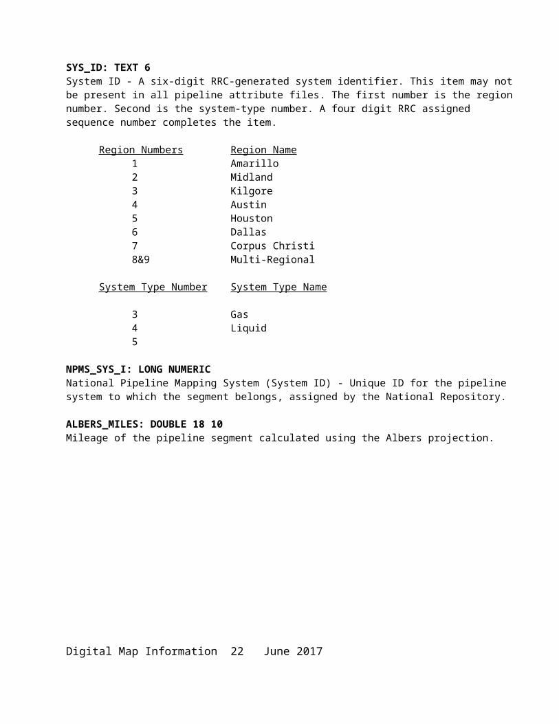
SYS_ID: TEXT 6System ID - A six-digit RRC-generated system identifier. This item may not be present in all pipeline attribute files. The first number is the region number. Second is the system-type number. A four digit RRC assigned sequence number completes the item.
Region Numbers Region Name1 Amarillo2 Midland3 Kilgore4 Austin5 Houston6 Dallas7 Corpus Christi8&9 Multi-Regional
System Type Number System Type Name
3 Gas4 Liquid5
NPMS_SYS_I: LONG NUMERIC National Pipeline Mapping System (System ID) - Unique ID for the pipeline system to which the segment belongs, assigned by the National Repository.
ALBERS_MILES: DOUBLE 18 10Mileage of the pipeline segment calculated using the Albers projection.
Digital Map Information 16 June 2017

APPENDIX A: LINE TYPES AND WELL SYMBOLOGYLINE TYPE ASSIGNMENTS
This appendix lists the line types. Line types are RRC defined data categories relevant to RRC mapping.
ORIGINAL LAND SURVEYS3 - County Boundary5 - Block Line6 - Overlap Block Lines7 - Survey, Section Lines8 - Abstract Division Lines10 - Creek11 - Coastline27 - River or Small Lake28 - Offshore Abstract Division29 - Offshore Tract, Survey Line30 - Offshore Block Line31 - Lake32 - Offshore Overlap Tract, Survey Line77 - Annotation Outline Arrow113 - Overlap Survey, Section Lines126 - Survey Annotation Outline
SUBDIVISION LINES9 - Subdivision Lot Line124 - Subdivision Outline125 - Subdivision Labor Line
Digital Map Information 17 June 2017
OIL & GAS WELLS (SYMNUM)2 Permitted Location3 Dry Hole4 Oil Well5 Gas Well6 Oil/Gas Well7 Plugged Oil Well8 Plugged Gas Well9 Canceled Location10 Plugged Oil/Gas Well11 Injection/Disposal Well12 Core Test13 Directional Surface Location15 Radioactive Well16 Sulfur Core Test17 Storage from Oil18 Storage from Gas19 Shut-In Well (Oil)20 Shut-In Well (Gas)21 Injection/Disposal From Oil22 Injection/Disposal From Gas23 Injection/Disposal From Oil/Gas24 Offshore Platform36 Geothermal Well73 Brine Mining Well74 Water Supply Well75 Water Supply from Oil76 Water Supply from Gas77 Water Supply from Oil/Gas78 Observation Well79 Observation from Oil80 Observation from Gas81 Observation from Oil/Gas86 Horizontal Drainhole87 Sidetrack Well Surface Location88 Storage Well89 Service Well90 Service from Oil91 Service from Gas92 Service from Oil/Gas103 Storage from Oil/Gas104 Injection/Disposal from Storage105 Injection/Disposal from Storage/Oil106 Injection/Disposal from Storage/Gas107 Injection/Disposal from Storage/Oil/Gas108 Observation from Storage109 Observation from Storage/Oil110 Observation from Storage/Gas111 Observation from Storage/Oil/Gas112 Service from Storage113 Service from Storage/Oil114 Service from Storage/Gas115 Service from Storage/Oil/Gas
Digital Map Information 18 June 2017

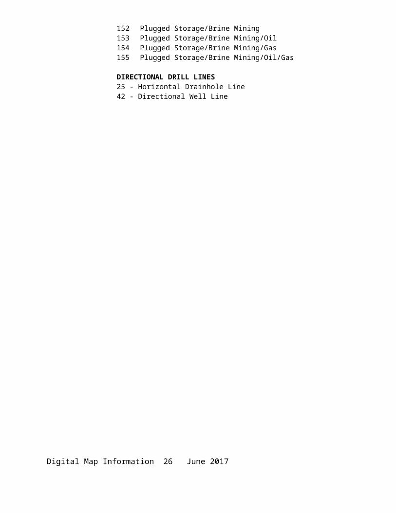
116 Plugged Storage117 Plugged Storage/Oil118 Plugged Storage/Gas119 Plugged Storage/Oil/Gas121 Brine Mining from Oil122 Brine Mining from Gas123 Brine Mining from Oil/Gas124 Injection/Disposal from Brine Mining125 Injection/Disposal from Brine Mining/Oil126 Injection/Disposal from Brine Mining/Gas127 Injection/Disposal from Brine Mining/Oil/Gas128 Observation from Brine Mining129 Observation from Brine Mining/Oil130 Observation from Brine Mining/Gas131 Observation from Brine Mining/Oil/Gas132 Service from Brine Mining133 Service from Brine Mining/Oil134 Service from Brine Mining/Gas135 Service from Brine Mining/Oil/Gas136 Plugged Brine Mining137 Plugged Brine Mining/Oil138 Plugged Brine Mining/Gas139 Plugged Brine Mining/Oil/Gas140 Storage/Brine Mining141 Storage/Brine Mining/Oil142 Storage/Brine Mining/Gas143 Storage/Brine Mining/Oil/Gas144 Inj/Disposal from Storage/Brine Mining145 Inj/Disposal from Storage/Brine Mining/Oil146 Inj/Disposal from Storage/Brine Mining/Gas147 Inj/Disposal from Storage/Brine Mining/Oil/Gas148 Observation from Storage/Brine Mining149 Observation from Storage/Brine Mining/Oil150 Observation from Storage/Brine Mining/Gas151 Observation from Storage/Brine Mining/Oil/Gas152 Plugged Storage/Brine Mining153 Plugged Storage/Brine Mining/Oil154 Plugged Storage/Brine Mining/Gas155 Plugged Storage/Brine Mining/Oil/Gas
DIRECTIONAL DRILL LINES25 - Horizontal Drainhole Line42 - Directional Well Line
Digital Map Information 19 June 2017
OIL & GAS WELLS SYMBOLOGYGRAPHICAL REPRESENTATION OF SYMNUM
Digital Map Information 20 June 2017

Digital Map Information 21 June 2017

APPENDIX B: FIPS CODES
COUNTY FIPS CODES
COUNTY FIPS CodeAnderson 001Andrews 003Angelina 005Aransas 007Archer 009Armstrong 011Atascosa 013Austin 015Bailey 017Bandera 019Bastrop 021Baylor 023Bee 025Bell 027Bexar 029Blanco 031Borden 033Bosque 035Bowie 037Brazoria 039Brazos 041Brewster 043Briscoe 045Brooks 047Brown 049Burleson 051Burnet 053Caldwell 055Calhoun 057Callahan 059Cameron 061Camp 063Carson 065Cass 067Castro 069Chambers 071Cherokee 073Childress 075Clay 077Cochran 079Coke 081Coleman 083Collin 085Collingsworth 087Colorado 089Comal 091Comanche 093
Digital Map Information 22 June 2017

Concho 095Cooke 097Coryell 099Cottle 101Crane 103Crockett 105Crosby 107Culberson 109Dallam 111Dallas 113Dawson 115Deaf Smith 117Delta 119Denton 121Dewitt 123Dickens 125Dimmitt 127Donley 129Duval 131Eastland 133Ector 135Edwards 137Ellis 139El Paso 141Erath 143Falls 145Fannin 147Fayette 149Fisher 151Floyd 153Foard 155Fort Bend 157Franklin 159Freestone 161Frio 163Gaines 165Galveston 167Garza 169Gillespie 171Glasscock 173Goliad 175Gonzales 177Gray 179Grayson 181Gregg 183Grimes 185Guadalupe 187Hale 189Hall 191Hamilton 193Hansford 195Hardeman 197Hardin 199
Digital Map Information 23 June 2017
Harris 201Harrison 203Hartley 205Haskell 207Hays 209Hemphill 211Henderson 213Hidalgo 215Hill 217Hockley 219Hood 221Hopkins 223Houston 225Howard 227Hudspeth 229Hunt 231Hutchinson 233Irion 235Jack 237Jackson 239Jasper 241Jeff Davis 243Jefferson 245Jim Hogg 247Jim Wells 249Johnson 251Jones 253Karnes 255Kaufman 257Kendall 259Kenedy 261Kent 263Kerr 265Kimble 267King 269Kinney 271Kleberg 273Knox 275Lamar 277Lamb 279Lampasas 281La Salle 283Lavaca 285Lee 287Leon 289Liberty 291Limestone 293Lipscomb 295Live Oak 297Llano 299Loving 301Lubbock 303Lynn 305
Digital Map Information 24 June 2017

McCulloch 307McLennan 309McMullen 311Madison 313Marion 315Martin 317Mason 319Matagorda 321Maverick 323Medina 325Menard 327Midland 329Milam 331Mills 333Mitchell 335Montague 337Montgomery 339Moore 341Morris 343Motley 345Nacogdoches 347Navarro 349Newton 351Nolan 353Nueces 355Ochiltree 357Oldham 359Orange 361Palo Pinto 363Panola 365Parker 367Parmer 369Pecos 371Polk 373Potter 375Presidio 377Rains 379Randall 381Reagan 383Real 385Red River 387Reeves 389Refugio 391Roberts 393Robertson 395Rockwall 397Runnels 399Rusk 401Sabine 403San Augustine 405San Jacinto 407San Pactricio 409San Saba 411
Digital Map Information 25 June 2017

Schleicher 413Scurry 415Shakelford 417Shelby 419Sherman 421Smith 423Somervell 425Starr 427Stephens 429Sterling 431Stonewall 433Sutton 435Swisher 437Tarrant 439Taylor 441Terrell 443Terry 445Throckmorton 447Titus 449Tom Green 451Travis 453Trinity 455Tyler 457Upshur 459Upton 461Uvalde 463Val Verde 465Van Zandt 467Victoria 469Walker 471Waller 473Ward 475Washington 477Webb 479Wharton 481Wheeler 483Wichita 485Wilbarger 487Willacy 489Williamson 491Wilson 493Winkler 495Wise 497Wood 499Yoakum 501Young 503Zapata 505Zavala 507
Digital Map Information 26 June 2017

GULF COUNTY AREAS FIPS CODES
GULF COUNTY AREAS FIPS CODE
South Padre Island-SB 600North Padre Island-SB 601Mustang Island-SB 602Matagorda Island-SB 603Brazos-SB 604Galveston-SB 605High Island-SB 606South Padre Island-LB 700North Padre Island-LB 701Mustang Island-LB 702Matagorda Island-LB 703Brazos-LB 704Brazos-S 705Galveston-LB 706Galveston-S 707High Island-LB 708High Island-S 709High Island-E 710High Island-E-S 711Mustang Island-E 712North Padre Island-E 713South Padre Island-E 714Sabine Pass 715
Digital Map Information 27 June 2017
APPENDIX C: WELL RELIABILITY CODESThe reliability of a well's location is determined by the source used to spot the well into the Well Location Database. Valid codes are:
RELIAB CODES10 Historic Map (non-RRC)15 RRC Hardcopy Map16 Spotted from Reliability Code 15 wells17 Location adjusted during survey maintenance20 WELLBORE Distances25 Unit or hearing plat, plat with form for another well, or
form for this well without a plat.30 Operator reported location (distances without plat or plat
without distances).40 Operator reported location (distances and plat).45 Field Inspection by RRC personnel.48 Spotted from Reliability Code 50 wells50 U.S.G.S. 7.5 minute quad or aerial photograph.55 Coordinates from operator.59 Coordinates – RRC personnel reported 2D GPS (Accuracy of 200
- 300 feet.)60 Coordinates – RRC personnel reported 3D GPS (Accuracy of
about 15 feet.)
Digital Map Information 28 June 2017

Appendix D: COMMODITY DESCRIPTIONS and Systypes
COMMODITY DESCRIPTION COMMODITY SYSTYPE Acetylene PRD QAcetylene Off Gas PRD TAlcohols PRD PAmmonia AA PAnhydrous Ammonia AA PAnhydrous HCL PRD PBenzenes PRD PBrine PRD YButanes HVL Q
ButadieneButane/ButyleneButane/DistillatesButane/PentaneButyleneIso-ButaneIsobutane
Carbon Dioxide CO2 KChemical Grade Propylene HVL QChlorine Gas PRD Q
Condensate NGL QSlop Oil Water
Crude CRD L (Gathering)
Crude CRD O (Transmission)O/GOilPetroleum
Cyclohexane PRD PDiesels PRD PDripolene HVL QEthanes HVL QEthlyene HVL QEthylene (Gas) PRD T
E/P Mix LPG QE/P PropaneEthane/PropaneEthane/Propane MixP/P MixEPBC
Feedstock HVL P
Digital Map Information 29 June 2017

Fuel Oil PRD PBistoneFuel GasFuel Oil/Natural GasFuel Oils/GasFuel Residum
Gasoline PRD PGasoline/Diesel/JetGasoline/Fuel OilsHigh Purity Ethane HVL QHydrogen Chloride PRD T
Hydrogen Gas HG TLiquid HydrogenPure H2Raw H2
Isobutane HVL QJet Fuel PRD PKerosene PRD P
LPG LPG QRaw LPG
Methanol/MTBE PRD PMTBE PRD PNatural Gas NG T (Transmission)Natural Gas NG G (Gathering)
Dry GasNaturalNatural Gas/CondSweet GasSynthesis
Natural Gas Liquids NGL QRefinery Off Gas
Nitrogen PRD POxygen PRD T
Oxygen/Nit.
Pentanes HVL Q
Propane HVL QMethyl PropanePropadienePropane/ButanePropane/LPGPropane/PropylenePropyne
Propylene HVL Q
Digital Map Information 30 June 2017

Propylene Oxide PRD PRefined Products PRD P
AcnylonitrileCutter StockCyclohexaneDeisohex StockDistillatesDripolineFeed GasHCL Acid AnhydrousHexeneHPGIsopreneMethanolMTBENapthaProductsRaffinateRPGTertiary Butyl AlcoholToluene
TBA PRD P
SYSTYPESA = Offshore (Liquids)B = Apartment ComplexesC = Compressor StationD = DistributionE = Interstate Transmission GasF = Non-Jurisdictional GatheringG = Gas GatheringH = Government (Housing Authority)I = LP Gas DistributionJ = Direct Sales CustomerK = Carbon Dioxide PipelinesO = Crude TransmissionM = Municipal DistributionN = City Not ServedL = Crude GatheringP = Product Lines (NOT Highly Volatile)Q = Other Liquid Lines (Highly Volatile)S = Municipal Supply LineT = TransmissionU = Underground Liquid StorageV = Underground Gas StorageW = Mobile Home ParksX = Liquefied Natural GasY = BrineZ = Offshore (Gas) Gathering
Digital Map Information 31 June 2017

APPENDIX E: 8.3 NAMING CONVENTIONSThe 8.3 naming convention stipulates that, exclusive of the filename suffix, a digital filename cannot be more than 8 characters long.
Although some computer operating systems and software programs accept file names longer than 8 characters, the Railroad Commission adheres to the 8.3 naming convention for a number of reasons.
1. ESRI, the manufacturer of ArcMap, suggests that their users adhere to the 8.3 naming convention for shapefiles. ESRI, in various ways and to various extents, codes its software to enforce compliance with the 8.3 naming convention.
2. All RRC GIS data are compressed. Unfortunately, some decompression software packages truncate long filenames such as, “county203l.shp” to meaningless names like, “county2~1.shp”
3. The Railroad Commission is committed to making its digital data accessible and usable to as wide an audience as possible. Adherence to the 8.3 naming convention ensures that at least one major hurdle of data portability is cleared.
Digital Map Information 32 June 2017