public participation - georgia...inform the public about the process, share preliminary assessment...
TRANSCRIPT
Public Participation Plan andSchedule for the 10th YearComprehensive Plan Update
Public Participationprepared for. CHEROKEE COUNTY, GA
prepared by. McBRIDE DALE CLARION
revised on. AUGUST 17, 2005

8/17/2005 1
Cherokee County Comprehensive Plan Public Participation Plan
PUBLIC PARTICIPATION PLAN
OVERVIEW Effective citizen involvement in a comprehensive plan can be achieved with efforts by a dedicated group of citizens and staff. Because the plan is a multi-year project dealing with long-range issues, it will be important for the process to be productive, thought provoking, and interesting to maintain the involvement of a diverse citizenry. The citizens must feel that their participation is making a difference and is a good use of their time in order to keep them active throughout the process. The following is the Plan for achieving broad and effective public participation in the development of the Cherokee County 10th Year Comprehensive Plan Update.
Objectives of the Plan There are three objectives that are important in a citizen outreach program:
The process must promote legitimate opportunities for the public to be actively involved in shaping the Plan;
The process should be designed to build community consensus and ownership in the Plan, so it is not perceived as a Plan written by a few people in a closed process; and
The process must provide information to people who are interested in knowing what is going on, but chose not to actively participate.
In order to accomplish these objectives, the citizen involvement effort should be continuous throughout the planning process. The County and its cities should recognize the importance of using a public participation process as a way to build consensus in the Plan and in building a constituency for the Plan. There will be many times over the years when the Plan will be tested and attempts will be made to deviate from, or ignore, the Plan. It will be difficult for Elected Officials to maintain the integrity of a Plan unless there is a constituency that will help to defend it.

8/17/2005 2
Cherokee County Comprehensive Plan Public Participation Plan
Elements of the Plan For the Cherokee County 10th Year Comprehensive Plan Update, the public participation will involve the following events:
1. A Countywide Kickoff Meeting;
2. Community Assessment Meetings/Town Hall Issue Forums-(5 open houses around the County);
3. A series of District Plan Workshops to identify local land use and planning issues -(5 meetings located around the County);
4. A workshop held in Woodstock;
5. Five supplemental meetings in Woodstock as needed, formats to be determined and advertised;
6. Citizens’ Roundtable Meetings (6-7 meetings);
7. ”Plan Cherokee” Educational Meetings (5 meetings);
8. Briefings with Elected Officials from all jurisdictions (7 meetings held throughout the process at key benchmarks); and
9. A series of District Plan Forums to present the draft Plan to the geographic areas prior to the final draft (5 meetings located around the County).
Publication and Notice of Events All events and meetings will be open to the general public and will be advertised in a paper of local circulation, posted on the Cherokee County official website and announced by email or mail to all citizens who request notification of Plan related events. The following are the specifics of the elements of the Public Participation Plan.

8/17/2005 3
Cherokee County Comprehensive Plan Public Participation Plan
Activity
Elected Officials' Briefing
Data CollectionBase Mapping
Market AnalysisLand Demand/Capacity
Initial Issues IdentificationPreliminary Vision
Citizens' Roundtable
Policy Development Assessment & Public Input
Goals / Vision Market/Demand/Capacity & Alternatives
Fiscal Impact Analysis Draft Land Use Plan
Market Validation Transportation & Community Facilities
Technical Subcommittees Draft Plan Finalization
Final Plan Preparation
ARC/DCA Review
Adoption
Cherokee County Comprehensive Plan Update
FLOW OF ACTIVITIES
Community Forums
Public Participation
Com
mun
ity
Age
nda
Com
mun
ity
Ass
essm
ent
Kick-Off Public HearingsCounty and each city
Public Information Meetings5 meetings around county
Plan
Rev
iew
&
Ado
ptio
n
5 meetings around county
Wrap-Up Public HearingsCounty and each city
Activity Public ParticipationElected
Officials'Briefing
8/17/2005 4
Cherokee County Comprehensive Plan Public Participation Plan
1. Countywide Kick-Off Meeting (first required public hearing)
A Kickoff Meeting was held on May 17, 2005 at the beginning of the Planning process to “unveil” the Planning process. This public hearing will be a joint public hearing for the unincorporated portion of the county, The City of Ball Ground, The City of Waleska, and the City of Woodstock. The meeting is intended primarily to inform the public about the process, share preliminary assessment data and outline public participation opportunities. As such, the meeting will be structured to be educational and informational. We anticipate a Power Point-style format that addresses the following items:
What a Comprehensive Plan is, what it attempts to accomplish, and
what its limits are. How this Plan will be developed and an overview of the work program. The City/County partnership approach to the Plan. Key Planning policy questions to be addressed by the Plan, as
identified in the Community Assessment such as: o The geographic pattern of new growth o The density and intensity of new growth o The timing of growth o The quality and character of growth o The relationship of growth to infrastructure and community
facilities o Economic development strategies and direction o The relationship of growth to the natural environment o Socioeconomic aspects of growth
Citizen involvement opportunities, specifically focusing on the public workshops and the role of the Plan Forum.
Timeframe/schedule including dates for transmittal to the regional development center.
8/17/2005 5
Cherokee County Comprehensive Plan Public Participation Plan
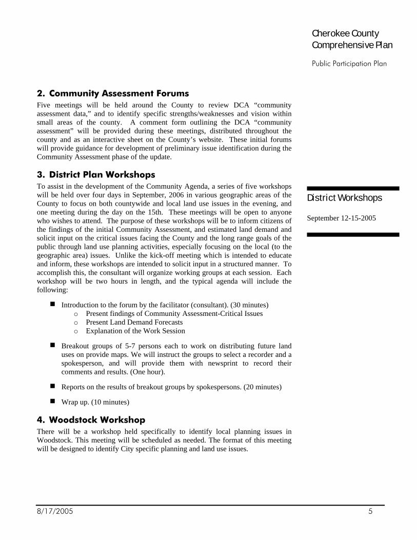
2. Community Assessment Forums Five meetings will be held around the County to review DCA “community assessment data,” and to identify specific strengths/weaknesses and vision within small areas of the county. A comment form outlining the DCA “community assessment” will be provided during these meetings, distributed throughout the county and as an interactive sheet on the County’s website. These initial forums will provide guidance for development of preliminary issue identification during the Community Assessment phase of the update.
3. District Plan Workshops To assist in the development of the Community Agenda, a series of five workshops will be held over four days in September, 2006 in various geographic areas of the County to focus on both countywide and local land use issues in the evening, and one meeting during the day on the 15th. These meetings will be open to anyone who wishes to attend. The purpose of these workshops will be to inform citizens of the findings of the initial Community Assessment, and estimated land demand and solicit input on the critical issues facing the County and the long range goals of the public through land use planning activities, especially focusing on the local (to the geographic area) issues. Unlike the kick-off meeting which is intended to educate and inform, these workshops are intended to solicit input in a structured manner. To accomplish this, the consultant will organize working groups at each session. Each workshop will be two hours in length, and the typical agenda will include the following:
Introduction to the forum by the facilitator (consultant). (30 minutes) o Present findings of Community Assessment-Critical Issues o Present Land Demand Forecasts o Explanation of the Work Session
Breakout groups of 5-7 persons each to work on distributing future land uses on provide maps. We will instruct the groups to select a recorder and a spokesperson, and will provide them with newsprint to record their comments and results. (One hour).
Reports on the results of breakout groups by spokespersons. (20 minutes)
Wrap up. (10 minutes)
4. Woodstock Workshop There will be a workshop held specifically to identify local planning issues in Woodstock. This meeting will be scheduled as needed. The format of this meeting will be designed to identify City specific planning and land use issues.
District Workshops September 12-15-2005

8/17/2005 6
Cherokee County Comprehensive Plan Public Participation Plan
5. Supplemental Woodstock Meetings The work program includes five meetings for the City of Woodstock. The primary objective of these meetings is to enable the consultant to determine the individual needs and issues within the City, and to assist in the development of the Community Agendas. The format and timing of these meetings is to be determined as needed to address specific concerns within the City, such as technical staff input, existing committee review (LCI, Downtown Development, etc), general public input as determined during the process. The agenda and time of meetings will be publicly advertised prior to each scheduled session to ensure the public has the opportunity to attend and comment on the determined agenda.
6. Citizens’ Committee Roundtable Meetings The best way to get a cross section of county residents and businesses to ensure that all interests are represented is the formation of a Citizens’ Committee. A stakeholder group of various interest groups from the County has been appointed by the Cherokee County Board of Commissioners and the City Councils to head up the backbone of the public involvement process. The Citizens’ Roundtable is all-inclusive with regard to groups—both organized and in general—that have an interest in the future development of Cherokee County. This group of 30 to 50 individuals will represent advocates and interests from each of the cities, business community, economic development agencies, housing interests, environmental concerns, homeowner groups, infrastructure groups (water & sewerage authority, Board of Education, DOT), and community leaders. Representatives from this group will also act as “communicators” between the Technical Advisory Subcommittees and the Roundtable as a whole. Six countywide citizen roundtable meetings will be held throughout the planning process at key benchmarks in the planning process. An additional meeting may be added in the fall of 2006. Although primary activities will specifically involve the stakeholder group, all meetings will be advertised on the web site and open to the general public. Meeting results will be documented as part of the overall public participation process in the comprehensive plan.
Citizen RT #1: This meeting will be held on August 31, 2005. The consultant will work with the committee to establish the protocol for meetings and the role of the committee in the overall planning process.
Citizen RT #2: This meeting will be held on September 28, 2005. The consultant will present assessments, data trends, and preliminary issues identified in the District Plan Workshops, and gather input on these topics from the committee members.
CRT Members
Mayors from each City
General Public/Citizens
Homeowner Associations
Cities
Planning Commissions
Board of Education
Recreation and Park Authorities
Real Estate
Chamber of Commerce
Developers
Water and Sewer Authority
Infrastructure Development
A list of individuals on the Citizen Roundtable Committee is attached.

8/17/2005 7
Cherokee County Comprehensive Plan Public Participation Plan
Citizen RT #3: This meeting will be held on December 7, 2005. The consultants will present data on the Market and Fiscal Analysis, and the Land Demand and Capacity Analyses to inform the committee members of the implications of these elements to the future of the County, and encourage the committee members to provide guidance on policy direction based on this information.
Citizen RT #4: This meeting will be held on February 22, 2006. The consultants will present the findings and implications of transportation and community facility assessments to the committee members and encourage them to provide guidance on policy direction based on this information.
Citizen RT #5: This meeting will be held on March 29, 2006. The consultants will present a draft of the Community Agenda for approval prior to submission to the regional development center.
Citizen RT #6: This meeting will be held on May 17, 2006. The consultant will present a draft of the land use patterns for the Plan and solicit input from the committee members.

8/17/2005 8
Cherokee County Comprehensive Plan Public Participation Plan
7. ”Plan Cherokee” Education Sessions The “Plan Cherokee” Education Sessions, “Plan Cherokee” will be supplemental to the roundtable meetings. The Plan Cherokee Group will sponsor education sessions on various Planning topics. The public is encouraged and invited to participate and learn about various topics. It is anticipated that several sessions will be held over the course of the Planning process to address a variety of issues relevant to the future of the County. These sessions will involve presentations by recognizable national, regional and local authorities and will be designed to promote dialogue on issues related to the growing community with an emphasis on Education, Alternatives and Solutions. Educational sessions include:
Metro Atlanta Quality Growth Task Force “Investing in Your Future,” Dr. Donald Ratajzak “Public Transit Options,” GRTA
Other session topics are to be announced.
8. Joint Elected Officials Briefings Eight briefing sessions will be held thought-out the Planning process. These sessions will be conducted by the consultant and will be used to inform the Elected Officials of Cherokee County, Woodstock and the other communities of the development of the Plan and the information gathered from the other citizen involvement activities. Except for the first and seventh briefing, all Elected Official briefings will follow the Citizen Committee meetings and include reports from these sessions.
Status Meeting: This meeting was held on May 17, 2005. The purpose of this briefing was to introduce the Elected Officials to the Planning Process. Key issues that will be addressed at this session include the following:
Coordination of the various jurisdictions; An overview of the Planning process, and key
events in the timeline; and The Public Participation Plan
JEO Briefing #1: This meeting will be held on August 16, 2005. The purpose
of this session with the Elected Officials will be to establish the role of the Citizen’s Roundtable committee in the planning process and inform the consultants about the various issues identified by the elected officials. This will be a preliminary step in the visioning and development of the Community Agenda.

8/17/2005 9
Cherokee County Comprehensive Plan Public Participation Plan
JEO Briefing #2: This meeting will be held on September 29, 2005. The consultant will present assessments, data trends, and preliminary issues identified in the District Plan workshops and comments from the CRT so that the officials can provide guidance on policy direction.
JEO Briefing #3: This meeting will be held on December 8, 2005. The consultant will present information from the Market and Fiscal Analysis and the Land Demand and Capacity Analysis, as well as input from the CRT on theses topics. The officials will be asked to provide guidance on policy direction based on this information.
JEO Briefing #4: This meeting will be held on February 23, 2006. The consultant will present the findings and implication of transportation and community facility assessments and the CRT input to the officials. The officials will be asked to provide guidance on policy direction based on this information.
JEO Briefing #5: This meeting will be held on March 30, 2006. The consultants will present a draft of the Community Agenda and solicit approval from the officials prior to transmission of the Agenda to the regional development center.
JEO Briefing #6: On May 18, 2006, the draft of the land use plan will be presented to the elected officials for discussion and comment.
JEO Briefing #7: This meeting will be held in the fall of 2006 upon completion of a public draft of the Plan. The consultants will present a draft of the Plan to the elected officials and solicit input and approval from them before conducting the final set of public District Plan Forums on the Draft Plan.

8/17/2005 10
Cherokee County Comprehensive Plan Public Participation Plan
9. District Plan Forums on Draft Plan The District Plan Forums on the Draft Plan will be a series of five meetings held over a three day period in October of 2006 to present the draft of the Plan and Implementation to the citizens in various districts of the County. The key elements of the Plan and implementation will be presented by the consultants with an emphasis on the elements related to the individual district. Unlike the first series of workshops this will be more of an educational format and input will be solicited through a question and answer session at the end of the presentations. The primary objective will be to allow the citizens a chance to comment on district specific issues in the draft before it is submitted to the local officials and regional development center. The meetings will be held in the same locations as the District Plan Workshops listed above.
CONCLUSION We believe this effort will provide opportunities for the citizens of Cherokee County to participate in the development of the update to the Comprehensive Plan. As the process unfolds, we can make decisions about how best to involve the community.

8/17/2005 11
Cherokee County Comprehensive Plan Public Participation Plan
CHEROKEE COUNTY 10TH YEAR COMPREHENSIVE PLAN UPDATE MILESTONE SCHEDULE
Jan Feb Mar April May June July Aug Sept Oct Nov Dec
2005 Staff Coordination Meeting (County/Cities)/PPP, Schedule Basic Inventories, Transportation, Market Analysis Phase I CRT--Introduction Meetings 17
JEO Status Meeting 17 Kick off-Public Hearings (County/Cities) 17
Plan Cherokee Education Meeting 25 JEO #1-Business Meeting 16 CRT #1-Business Meeting 31 Community Assessment Summary
Community Assessment Meetings (Town Hall Issue Forums)* ß ß
District Plan Workshops (Land Plan Game) (5)* 12-15
Woodstock Workshop Development Trends & Capacity
CRT #2--Assessment Data, trends, issues 28
JEO #2--Assessment Data, trends, issues 29
Plan Cherokee Education Meeting 26
Market Analysis II, Preliminary Fiscal Analysis Land use patterns & trends identification Transportation & CF Assessment
CRT #3--Market & Fiscal Analysis, LD&CA 7
JEO #3--Market & Fiscal Analysis, LD&CA 8
2006 Plan Cherokee Education Meeting 25
CRT #4--Transportation & Community Fac. 22
JEO #4--Transportation & Community Fac. 23
Development of Community Agenda
CRT #5--Community Agenda 29
JEO #5--Community Agenda 30
Land use alternatives and patterns Community Character Transportation and Land Use patterns
Plan Cherokee Education Meeting 26
CRT #6--Land Use Patterns 17
JEO #6--Land Use Patterns 18
Final Market and Fiscal Studies Final Transportation element, projects, maps Final Policy Development, Land Use Plan and Map Implementation Plan CRT #7-Final Review of Plan Elements, Comments JEO #7-Final Review of Plan Elements, Comments Fall ‘06 Finalize Public Review Draft Plan Community Forums (5) Final Public Review Draft
2007 Public Hearing-Transmittal ARC/DCA Review Public Hearing-Adoption
Joint Elected Officials JEO Advertised Public Participation Opportunities Citizens' Roundtable CRT
Tentative Dates-to be set Open, General Public Welcome Additional meetings may be scheduled for Woodstock as the need arises.

Joint Meeting - Citizens’ Roundtable and Steering Council
Cherokee County Comprehensive Plan Update 1
December 17, 2007
6:00 to 7:30 pm Meeting Comments Jury Assembly Room, Justice Center
Agenda: Final Comments on Draft Community Agenda
Note Takers: Jeff Watkins & Margaret Stallings
Committee Member Attendees:
Betty Callahan
Chuck Dean Dick Hall Debra Haynes Jerald Hill Dennis Jane
Charles Kirby Linda Ruggiero Brenda Sexton Roy Smith Deborah Wallace
Other Attendees:
Darla Alfredson Roy Alfredson Scott Barnes Donald B. Brooks Ed Cochran Marla Doss
Tom Hill Sarah Hill Chad Milford Joe Sewell Garland Stewart
Comments
Topic: Section 1: Introduction
Discussion: No Comments
Topic: Willoughby & Sewell Property
Discussion: Property represents roughly 2% of the land in Cherokee County With the proximity to L:ake Allatoona, it is not appropriate to show this area as Rural Places Please include our previous comments to the Board of Commissioners
Topic: Section 2: Community Vision
Discussion: 2.3 Core Issues - Policy under Following the Plan for Sustainable Growth – “Encourage mixed-use village developments to provide for a diversity of economic opportunities in a walkable environment.”
Q - Does the last policy mean that we are encouraging walkable environment throughout the county? A - This policy is aimed at creating the walkable development nodes around the county but not wholesale across rural areas where it would not be appropriate.

Joint Meeting - Citizens’ Roundtable and Steering Council
Cherokee County Comprehensive Plan Update 2
Topic: Section 3: Community Vision
Discussion: Zoning Decision Process with Character Areas C – Should add a subsection D under Step 6 to include the language from the Interim Land Use Policy that describes the consideration of surrounding land use and zoning, especially existing spot zoning, to allow zoning to be stepped-down from these areas that are inconsistent and provide a smooth transition.
C – What happened to the analysis of 100+ acre parcels for inconsistencies of zoning or land use? A – We produced that analysis and provided it to the Commissioners per their request. We plan to add that document to the Community Agenda Appendix. Essentially, we did not find any significant areas that were both inconsistent in zoning and land use. For example, there was a small cluster of zoned land around the Union Hill area but the actual land use was consistent with the Country Estates designation.
C – Would like to codify the full list of criteria that are used in zoning cases so that applicants are aware of them. (See attached email comments from Dennis Jane) A – The complete list is included in Article 18 of the Zoning Ordinance. This section was intended to relate specifically to the use of the Character Areas in the Zoning Process. It would be possible to add the full process either in this section or in Section 4 on Implementation. Character Area Summary Table C – Feel that we should change the “Suggested Zoning Districts” label to “Allowed Zoning Districts” to prevent legal challenges in the future. A – We used the term “Suggested” to allow some flexibility. “Allowed” is a term that is usually used in Zoning Ordinances, which are legal documents. The Community Agenda is a policy document so there is room for interpretation. C – Using “Suggested” still leaves too much leeway. Please consider another term that would be definitive and clear to people. Transitional Corridor Description Q – How is the more intense residential development in these corridors defined? It is not clear from the summary table what zoning districts would be appropriate. C – I thought there was language that described how the Transitional Corridors would be appropriate for residential zoning districts shown in the next more intense Character Area. I felt this mechanism worked well to provide the higher intensity that we were looking for. A – We received feedback that this part of the description was confusing and unclear so it was removed. We can be reworded and put back into this description. C – What happened to the ¼ mile distance off of the road that is part of the Interim Land Use Policy? Why have we changed the way these corridors are shown on the Future Development Map? A – The Transitional Corridors have bee represented numerous ways on the map over the last 2+ years. Initially they were shown at ¼ of a mile on either side but then we were asked to limit the area down to specific parcels not already part of existing residential subdivisions. Currently, the map shows a more conceptual dashed line on either side of the road. At the same time, we have refocused the description on parcels the front directly on these major roads and higher intensity residential with some reuse of existing homes for low-impact commercial and office uses. C – I appreciate the change to focus on reusing existing housing for limited commercial uses. Infrastructure Q – How come the plan does not reflect the sewer plant that will be built off of E. Cherokee? Shouldn’t the plan reflect the impact of this new infrastructure investment? A – We have committed to reviewing this plan once a year to recommend adjustments for those types of significant changes. Neighborhood Living Description Q – Didn’t we limit the Neighborhood Living Character Area to the Cities of Ball Ground and Waleska? A – We limited the Urban Core to just those cities but there are area of Neighborhood Living around Woodstock within the Growth Boundary. C – We need to confirm with Woodstock about some of those Neighborhood Living areas especially South of Hwy 92 near Trickum Road and Neese Road.

Joint Meeting - Citizens’ Roundtable and Steering Council
Cherokee County Comprehensive Plan Update 3
Community Village Description Q – Didn’t we limit the Community Village to 80,000 sqft per building? There seems to be some inconsistencies between the written description and what is shown in the summary chart. A – I believe you are correct. We will change the chart to read 80,000 sqft for Community Villages. Workplace Center Description Q – I am still having trouble with having both LI and high density residential in the description for this Character Area. Won’t this encourage more incompatible land use in this area and hamper economic development? A – The written description limits the high-density residential and retail to only an accessory use in this area. At the same time, the description spells out that the prime sites would reserved for the Industrial and Office uses that are desired. Regional Center Description C – I envisioned the regional center areas as more intensive than the open-air marketplace that is indicated in the description. It should include an enclosed mall and uses similar to Town Center. Perhaps more intense residential could be allowed to prevent the need for residential in the Workplace Center. A – In writing this description, we tried to take into account the major retail projects that are already underway within the Cities of Canton and Woodstock. We could look at enlarging the amount of Regional Center area that we have on the map, especially outside of Canton between old Hwy 5 and I-575. County-wide Greenspace Plan Q – How do you envision securing property for the Greenspace Plan that is listed as an implementation task? If a piece of property is shown as a high priority property for greespace, will that fact stand in the way a rezoning request? A – We envision securing greenspace through a variety means, such as outright purchase, conservation easements, transfer of development rights, etc. It will be up to the county to secure the land from private property owners. Otherwise, the property owners may exercise their rights to rezone and develop the property. Development Corridor Description C – I am concerned that the Development Corridor description encourages the redevelopment of existing residential subdivisions along Hwy 92. The description needs to recognize the existing overlay. A – On the Future Development Map, the Development Corridor areas have been trimmed around existing residential subdivisions. The description also focuses primarily on redevelopment of existing commercial in these areas. Walkablity and Connectivity C – I do not think that it is practical to encourage walkability in rural areas. In suburban areas, residents in existing subdivisions will object to pedestrian connections to other subdivisions. They have bought on a subdivision for the privacy. Existing subdivisions should not be connected by roads to new subdivisions because it would be unsafe for the elderly residents. A – We need to start somewhere to address the connectivity issue in our county. We need to get more out of our existing road infrastructure.
Next Steps: January 15, 2007 – Joint Public Hearing to transmit Community Agenda to DCA & ARC for review


Buzz & Jeff, My comments were related to page 33 "Zoning Decision Process with Character Areas". A clear procedural promise in our Plan underscores a commitment to the regulatory measures and other codified processes. The public must be assured in the Plan that zoning decisions will be made through clear steps to minimize subjective leaps. In conjunction with the steps involving the character areas priority consideration will be given to the following: 1. Assure compatibility and appropriateness to adjacent land use (variances by 2 or more zoning districts will require intense documentation). 2. Neighbor and public input will be a factor. 3. Agency statistical validation of acceptable levels of service will be documented including timelines and financials. If specific thresholds are not met, decisions should be postponed. 4. P&Z recommendation will be a factor. 5. The Post Commissioner's input will be a factor. 6. The BOC will concur that the rezoning adheres to our vision. Some of these points are elementary but we continue subjective decision making with bypasses and leaps of faith. Deviations should be rare and very clearly rationalized.. Dennis Jane

From: Chad Milford [mailto:[email protected]] Sent: Tuesday, December 18, 2007 1:16 PM To: Derek V. Good; Harry Johnston; Jim Hubbard; Jeff Watkins; Karen Mahurin; Buzz Ahrens Subject: Comments and concerns about the LUP Attached are my comments/concerns about the newest version of the LUP. I appreciate the opportunity to ask questions last night. It was a good meeting, I only wish more people could have been there but with the holiday approaching it's difficult. I have seen some very positive changes in the plan and I think with a few tweaks here and there I could even support it. I narrowed my list down to the 5 most important. Really, there is 1 most important and the other 4 are mostly supporting arguments for the 1st. I've yet to hear a good reason why Country Estates should be held to 2 acre minimums. If we can get R-40 added to this character area or even create a new character area for the part of that area that is largely undeveloped, I'll consider the plan a fairly decent compromise. As it is now, what's green is green and there is really not a significant difference between the two. Chad Milford List of Concerns for the New LUP 1.The map still shows 2 acre minimums covering at least 75% of undeveloped Cherokee. This will greatly affect property value in the southern, eastern, and western sections of Cherokee. There is no demand for executive housing right now. Inventories are huge. What will landowners in the county do with property if forced to sell and the executive housing market is saturated. Land value is too high to realistically expect a new buyer to continue farming large tracts. This leaves the property owner with no realistic future use. This is the largest problem with the new plan because it will adversely affect the most people. All our surrounding counties have minimum lot size on AG property at 1 acre. There is no reason in the world why we shouldn’t have the same reasonable use for our property. The following quote was taken from page 10 “an array of housing choices is important to address the diverse needs of the population within our communities.” I don’t see this possibility in hardly any places on the map with the exception of a few nodes and very limited R-40 and R-60. Here is a start but I think about 5% of the property in rural communities would fall in these nodes or character areas, the other 95% I’m guessing is being reserved for executive housing? Most of the 5% represented on the map is already zoned and/or developed which leads one to believe the map is not planning for reasonable growth but attempting to stop it. 2. The map does not represent what is here now. At the work session the commissioners had, it was agreed that anything zoned over 100 acres would be represented on the map. This was not done. How can we accurately plan for the future when we can’t even represent the present on a map? If existing zonings are not going to be represented on the map, then there needs to be some strong language in the document which states “what is here now” will weigh greatly on future re-zonings for neighboring properties even if these existing zonings are not represented on the map. This is where the pipe dream argument comes up because the map does not accurately

reflect what is existing. Debra Wallace touched on this at the beginning of last night’s meeting. I think this is something everyone can agree on. 3.The map does not reflect the growth patterns of surrounding counties. The majority of our development pressure will be coming from West Forsyth, North Fulton AKA Milton, and from the east side of Bartow. Cobb has already got the southwest section. Minimum development standards in Milton, Bartow, and West Forsyth call for 1acre lot sizes (or even less in Forsyth.) We can’t compete with our neighbors when the need to sell arises. I don’t see any evidence where these existing conditions are shown on the map or even described in the document. Large residential and commercial development will be placed on our county lines and we will have all the negative impact with none of the tax benefits. 4. The plan also ignores planned infrastructure such as sewer. The location of the proposed sewer plant on East Cherokee is colored green on the map. This alone is evidence planned infrastructure has been ignored. How can surrounding property not have sewer capability when the plant is located on the property? Realistically the entire water shed flowing to that plant should be colored yellow. 5.The plan almost ignores countless hours of community participation and input especially from the Eastern side of the county. The Community Agenda is virtually chocked full of quotes such as “Community agenda is the MOST important part of the plan, for it includes the Community’s vision for the future (page2)” “This joint plan was truly a bottoms up process (page 3)” Most of us didn’t know community meetings were being held and when they were held, some communities were high jacked by people coming in from other communities to decide what other communities should look like. Under Implementation Strategies on page 14 the following is said, “Create character areas that identify the characteristics that are important to the community.” I guess what I’m trying to say here is the plan says there was extensive community involvement and really after it’s all said and done there has been. The problem is, the majority of the involvement has been largely ignored and the plan makes it sound as if it represents the vision of the community. The vision of my community is not represented on the map.

Attached are a few comments on the Future Land Use Plan. Thank you for your time and all the hard work you put into this plan. Margaret, thanks for putting up with me. Thank you, Marla Doss Page 32 – Section 3.1-Future Development Map- “Provides for strong “edges” to stop residential and retail “creep” incompatible uses & denigration of infrastructure capacity.” Page 78 – Section 4.1 –“Comprehensive plan Consistency – “Character Areas, Nodes and corridors are not regulations, and therefore will allow flexibility during project review.” How can the plan have strong edges yet be flexible? Nodes and Corridors- Page 62- Hamlet- Lathemtown has been changed from Neighborhood Village to a Hamlet. Lathemtown has existing commercial and parcels already zoned General Commercial. Areas identified as Hamlets on the map such as Mica, Holbrook Campground and Birmingham Rd and Holbrook United Methodist Campground do not have any existing GC or the GC is on a much smaller scale than the Lathemtown Community. Lathemtown should be identified as Neighborhood Village. Holbrook Campground should not be in a development node. The majority of the Hamlet node at Holbrook Campground is over Holbrook United Methodist Campground. According to the deeds, the Campground can never be anything other than a United Methodist Campground. The definition of Hamlet (page 62) -” places where small–scaled commercial uses are arranged in a village-like setting. A Hamlet might include business such as a bank, restaurant, dry cleaner and gas station, and other similar “daily-needs” commercial uses to serve nearby residents”. Holbrook Campground can not be characterized as a “small- scaled, village like setting”. It is a church camp! It is only used once a year! Why not move the developmental node to the intersection where property can be developed in the future. The Map- The map does not reflect current zonings or developments. Character Areas -Country Estates should allow for 1 acre minimum lots. Suburban Growth was mysteriously changed to R-40, R-60 and R-80. In 2006 draft of the LUP the zoning districts for Suburban Growth were R-20, R-40, R-60, & R80. In the 2007 draft R-20 has been mysteriously deleted from the Suburban Growth suggested zoning districts. This change was made between the time of the last

Citizens’ Roundtable meeting and the first Steering Council meeting. No one has taken credit for the change. Macedonia Area- This community is in the Suburban Growth Character Area. The Macedonia area is already zoned and developed at a higher density (R-15 and R-20) than the Suburban Growth Zoning District allows.

Jerald Hill 109 Bridlewood Pass Ball Ground, Georgia 30107 December 27, 2007 L. B. Ahrens, Jr. Commission Chairman Cherokee County Board of Commissioners 90 North Street, Suite 310 Canton, Georgia 30114 Dear Buzz, Thank you for the opportunity to serve on the Comprehensive Plan Steering Council (CPSC). In response to your request, here are my comments on the planning documents dated December 4, 2007: As you know, I was appointed to the CPSC as a representative of Cherokee Citizens for Property Rights (CCPR). CCPR was formed in November of 2006 as a direct result of the October 2006 release of the Cherokee County LUP/M draft. Besides the content of the draft, one of the issues of greatest concern of CCPR was the lack of input that eastern Cherokee residents had in the planning process. While “community meetings” were held, they were so poorly publicized that the turnout was dismal. In some cases, people not even from the area were deciding the vision for the community. As far as the community input goes, the process met the letter of the law, but certainly not the spirit. Having said that, I do realize the community input portion of the planning process was conducted before you were elected to the board. From our previously stated objections, you also know that CCPR was very disappointed that a majority of the Steering Council members were slow growth activists. The exclusion of the municipalities and the Farm Bureau resulted in a Steering Council without roots in the county. To my knowledge, not one of the council members was a life‐long Cherokee County resident. From my perspective, the lack of balance and diversity of opinion on the Council is reflected in the proposed plan. From November 2006 to August 2007 CCPR held several community meetings. Attendance ranged between 100‐300 people at each meeting. A petition was signed by over 800 Cherokee County residents and presented to the Board of Commissions and the CPSC. Some issues in the petition were addressed in the recent work session, but there are others that still deserve consideration before the plan goes to DCA/ARC: As stated in the petition, “The Proposed Land Use Plan and Map are designed to stifle market‐driven growth in undeveloped areas, which will only cause more annexations, increased traffic bottlenecks and greater air pollution.” Furthermore: The map does not represent existing zoning. How can we accurately plan for the future when the present zoning is not on a map? If existing zonings are not going to be represented on the map, then there needs to be some strong language in the document which states “what is here

now” will weigh heavily on future re‐zonings for neighboring properties even if these existing zonings are not represented on the map. The map does not reflect the growth patterns of surrounding counties. The majority of our development pressure will be coming from West Forsyth, North Fulton (AKA Milton), and from the east side of Bartow. Minimum development standards in Milton, Bartow, and West Forsyth call for 1 acre lot sizes (even less in Forsyth). The plan ignores planned sewer and water infrastructure. The location of the proposed sewer plant on East Cherokee is colored green on the map. Clearly, planned infrastructure has been ignored. How can surrounding property not have sewer capability when the plant is located on the property? Realistically the entire water shed flowing to that plant should be colored yellow. I am attaching the CCPR petition and I request it be included in the appendix of the plan that is presented to the DCA/ARC. An expert’s opinion: At CCPR’s request, UGA economist Dr. Jeffrey Dorfman assessed the draft LUP/M. Dr. Dorfman is a professor of economics at UGA and a consultant on all facets of the economics of land use, growth, and development. He has published two books, over 50 journal articles, and numerous popular press pieces including op‐ed columns in the Atlanta Journal‐Constitution. He has consulted with counties, cities, school boards, non‐profits, and Fortune 500 companies on economics and statistical issues. In particular, he consults widely with local governments and developers on the economic and fiscal impact of growth and land use patterns. He has worked with eight of the twenty fastest growing counties in the U.S. As you know, Dr. Dorfman presented his findings at a CCPR community meeting in August which you and Post 2 Commissioner, Jim Hubbard, attended. In addition to several positive comments about the LUPM, Dr. Dorfman identified several areas that needed improvement:
• 2‐acre minimum lot sizes for 80% of the county • Too few commercial areas, and too concentrated in the southern end of the county • Not enough high density development • Lake area and potential value recognition
“Sprawl is expensive to service.” According to Dr. Dorfman, 2‐acre minimum lot sizes will only result in, “making the cost of local government higher…and eating up your farmland and undeveloped land faster.” Rather than preserve the rural character of Cherokee County, the proposed plan will only result in sprawl, and the cost of delivering services will be dramatically higher than with more density. The plan needs more commercial, and not just in south Cherokee. While the plan emphasizes commercial development in the south, it underestimates future needs at the borders. According to Dr. Dorfman, "If Forsyth puts in the businesses and Cherokee doesn't, they will get your tax dollars." He equated this to “stealing” your tax dollars as large residential and commercial developments placed just beyond county lines leave us with all the negative impact yet none of the tax benefits.

More density and more business in the plan would result in lower taxes in the county. “The same growth done more densely and contiguously saves both money, farmland, and provides environmental amenities.” Dr. Dorfman’s assessment is “Cost of service goes down by 50% of land savings (use half the land, save 25%).” “The area North of Lake Allatoona is restricted to very low density, yet this is the area where you could probably get the highest priced development.” Dr. Dorfman said this is “throwing away hundreds of millions of dollars of potential property value.” Likewise we will be throwing away millions in tax revenues that would result from development. As he put it, “Density restriction equals property tax restriction.” Dr. Dorfman had a lot more to say about the plan. I am attaching his notes, and I request they be part of the plan appendix that is presented to the DCA/ARC. As with any plan of this nature, there are strengths and weaknesses. Every interested party brings a point of view or personal agenda to the process. I believe the purpose of the plan is to prepare for growth. Others may see it as a tool to restrict growth. I also believe property rights must be protected. The scope of the plan should not be overreaching to the point of devaluing property values through overly restrictive zoning practices. Let us not turn our backs on one of the greatest traditions of Cherokee County: the belief in limited government and the protection of property rights, as promised in the Constitution of the State of Georgia:
Constitution of the State of Georgia, Article 1, Section 1: Paragraph I. Life, liberty, and property. No person shall be deprived of life, liberty, or property except by due process of law. Paragraph II. Protection to person and property; equal protection. Protection to person and property is the paramount duty of government and shall be impartial and complete. No person shall be denied the equal protection of the laws.
In light of all the above, I respectfully request the plan be modified in the following ways before going to the DCA/ARC:
1. Eliminate 2‐acre minimum lot sizes from the plan. 2. Encourage conservation subdivisions throughout the county. 3. Remove restrictions that will prohibit or discourage commercial development at the
county borderlines. With these changes, the county can grow the kind of density that prevents sprawl and lowers the cost of services. We could avoid an unreasonable and unnecessary devaluation of property throughout the county. The resulting commercial and residential development will generate tax revenues to pay for needed infrastructure. With these changes, less of our greenspace will be chewed up by houses spread out all over the county. Sincerely, Jerald Hill Clayton Community

Petition to Oppose Proposed Land Use Plan and Map
Page 1 of 2 12/18/2006
To: Cherokee County Commissioners, We, the people of Cherokee County Georgia, do hereby declare and affirm that the primary reason that government exists is to protect rights to life, liberty, and property. We oppose the use of emiminent domain, as well as the taking of the use of property through regulations or ordinances, when there is no material threat to other individuals or to the community. Therefore we, the undersigned do hereby repudiate the proposed Land Use Plan and map as it has failed to protect the rights of Cherokee County landowners. We reject this and any other Land Use Plan or map that takes away our property rights through the imposition of restrictive regulations. We reject restrictive elements of the plan such as:
• 200 feet setbacks that take away our right to use our own property. • Discouraging production-oriented agricultural activities such as “major cash-crop cultivation and animal
production (including cattle, sheep, swine, and poultry broilers or eggs).” • Denial of infrastructure to rural areas in terms of transportation and sewer improvements, as well as a
“low level of other public services such as fire, police and libraries.” • A county-wide public horse trail system that would be forced upon landowners. • Establishment of architectural and landscape design standards in commercial areas such as “variation in
building height, building mass, roof pitch, and changes in wall planes in order to mitigate the linear effect of a development.”
• Taking away our rights to use our property by imposing upon it regulations requiring it to be used for “scenic corridors” or county-wide open space and greenway plans.
• Imposing upon our use of our property any additional level of governmental control or regulation other than the zoning ordinances already in place in Cherokee County.
Furthermore we oppose the use of Character Areas as described in the plan, because the areas:
• Do not reflect current land use and preexisting or approved zoning. • Do not allow for sufficient transitional areas. • Will deter badly needed job-growth in our county. • Ignore growth patterns of surrounding counties. • Ignore growth patterns already present in Cherokee County. • Ignore planned infrastructure to be put in place by Cherokee Co. Water and Sewerage Authority.
We reject the Zoning Decision Process that will make rezoning requests even more cumbersome and bureaucratic than it is today. We further reject the notion that rural landowners should be forced to supply beautiful views and greenspace for others who neither own nor pay taxes on the property. The Proposed Land Use Plan and Map are designed to stifle market-driven growth in undeveloped areas, which will only cause more annexations, increased traffic bottlenecks and greater air pollution. Rather than the restrictive zoning methods in the Proposed Land Use Plan, we encourage the Board of Commissioners to use voluntary programs such as tax credits and land trusts to protect open space in Cherokee County. In conclusion, the citizens of Cherokee County petition the Cherokee County Board of Commissioners to abandon the proposed Land Use Plan, and encourage a new approach whereby private property rights are a fundamental element of the planning and zoning processes and procedures. The plan should be a guideline that allows flexibility for the inevitable and unforeseen changes that the future will bring. As such, the Land Use Plan and Map must not be rigid documents that planners hide behind when the citizen’s property rights are under attack.

Th Ch k C tThe Cherokee County Land Use Plan:Land Use Plan:
The Economics and ImpactsThe Economics and Impacts
Jeffrey H. Dorfman
8 2007, Dorfman Consulting, LLC

Why Manage Growth?Some growth will come to your city or county whether you want it or not.Some growth won’t come to your city or county no matter what you do.
Then there is a middle ground you can impactg ou d you ca pact
This part will decide your fate
8 2007, Dorfman Consulting LLC

Tax Revenue is Good, But …Many counties and cities think that growth and developmentmean an increasing tax baseand better financial health forand better financial health for the local government.
Unfortunately a growing tax base is not enough to guarantee financial health, you must get revenue to grow ffaster than expenditures.
8 2007, Dorfman Consulting LLC

Revenues to Cost by Land UseUsing res lts compiled b AFT theUsing results compiled by AFT, the national averages are:
Residential: $0.87Commercial/Industrial: $3 45Commercial/Industrial: $3.45Farm/Forest/Open: $2.70
These figures are $’s of revenue forThese figures are $’s of revenue for each $1 of expenditures.
8 2007, Dorfman Consulting LLC

Some Southeastern US Resultsdi iRevenue:Expenditure Ratios
$3 50
$2 50
$3.00
$3.50
Oconee
$2.00
$2.50 HallThomasCarroll
$1.00
$1.50 JonesCherokeeUnion (NC)
$0.00
$0.50
R id C F /f
Union (NC)Leon (FL)
8 2007, Dorfman Consulting LLC
Resid. Comm. Farm/for.

Cherokee County Tax BaseProperty ValueAcreage
Residential Business Agric.Residential Business Agric.
8 2007, Dorfman Consulting LLC

How to Change the NumbersD l t tt hDevelopment patterns have an impact on the cost of service delivery: sprawl is expensive to serviceservice.
The same growth done more d l d ti ldensely and contiguously saves both money, farmland, and provides environmental amenities.
Cost of ser ice goes do n bCost of service goes down by 50% of land savings (use half the land, save 25%).
8 2007, Dorfman Consulting LLC

Development PatternsSo if density and contiguitySo, if density and contiguity are good …
Minimum lot sizes are bad Except when they are really big for rural area
I fill d i t d l tInfill and in-town development are good
Infrastructure in place or cheaper to installp
Multifamily is good
8 2007, Dorfman Consulting LLC

Break-even Home ValuesBreak-even Home Values
3 kids
1 kid
2 kids NewtonCarrollCherokee
County
1 kid
0 200 400 600 800 1000 1200
1000 $
8 2007, Dorfman Consulting LLC
1000 $

County vs City vs SchoolsS t ( it ) b kSo county (or city) breaks even far before school system.
Even if we use 0.75 school kids per household Cherokee schools breakeven price is
d $250 000around $250,000.
State school construction rules force kids into trailers and schools out of cities (acreage minimums)
8 2007, Dorfman Consulting LLC

Good Things in the New PlanEfficient Use of Infrastructure (contiguity)Infill encouraged – Leapfrog discouragedHigh density in placesTDRs and easements includedTDRs and easements includedBusiness attraction strategyIncentives for good projectsIncentives for good projectsConservation subdivisions
8 2007, Dorfman Consulting LLC

Bad Things in the New Plan Street design standards are expensiveConnectivity is limitedCommercial areas seem few and southCould use more high densityCould use more high densityHow can you be rural and senior friendly?Does the plan recognize other counties?Does the plan recognize other counties?
8 2007, Dorfman Consulting LLC

Major IssuesMinimum lot sizes
Consideration for demand
2 acre country estates
Lake area and potential value recognition
8 2007, Dorfman Consulting LLC

Minimum Lot SizesMinimum lot sizes spread the same
lpeople over more land.Let infrastructure be the guide for density.
8 2007, Dorfman Consulting LLC

Consideration of DemandB t i tiBy restricting land use by typetype, location and density, the y,plan makes choices instead of consumers.
8 2007, Dorfman Consulting LLC

2 Acre Country Estates
8 2007, Dorfman Consulting LLC

Lake Area and Value Potential Th l t i t thThe plan restricts the area North of Lake Allatoona to very low density, but y y,this could be the most valuable property in the countycounty.
Density restriction = yproperty tax restriction
8 2007, Dorfman Consulting LLC

ConclusionsP tt d l l t t likPretty good plan, lots to likeProbably too much emphasis on rural h t th t ’t b d ith thi lcharacter that won’t be saved with this plan
Can be improved with modifications
All values have a price, so look at the t f th l th t th l illcost of the values that the plan will
impose.
8 2007, Dorfman Consulting LLC

(((((((((((((((((((((((((((((((((((((((((((((((((((((((((((((((((((((((((((((
((((((((((((((((((((((((((((((((((((((((((((((((((((((((((((((((((((((((((((((((((((((((((((((((((((((((((((((
((((((((((((((((((((((((((((((((((((((((((((((((((((((((((((((((((((((((((((((((((((((((((
((((((((((((((((((((((((((((((((((((((((((((((((((((((
((((((((((((((((((((((((((((((((((((((((((((((((((((((((((((((((((((((((((((((((((((((((
I-575 HW
Y
HICKORY RD
HICKORY FLAT HWY
MA
RIE
TTA
HW
Y
UNIVETER RD
SCO
TT R
D
I-575
RAM
P
HICKORY ST
RIDGE RD
MARIETTA RD
CUMMING HWYEAST M
AIN S
T
HO
LLY
SPR
ING
S P
KW
Y
TOO
NIG
H R
D
KNOX BRIDGE HWY
BUTTERWORTH RD
BELLS FERRY RD
WEST M
ARIETTA ST
I-575
MAIN ST EAST
BELLS FERRY RD
I-575
RAMP
I-575
RA
MP
I-575
RA
MP
I-575
HW
Y
I-575
RAMP
I-575 RAMP
I-575
RAM
P
I-575 RAMP
I-575
RA
MP
MAR
IETT
A RD
HO
LLY
SPR
ING
S P
KW
Y
Legend100 Year Flood Plane
Nodes
(((((((((((((((Country Crossroads
(((((((((((((((
Neighborhood Village
((((((((((((((((((((
Community Village
CorridorsScenic
Transitional
Development
Highway Business
Future Growth Boundaries
Cherokee Character AreasNatural Preserve
Rural Places
Country Estates
Suburban Growth
Suburban Living
Neighborhood Living
Bells Ferry LCI
Urban Living
Urban Core
Workplace Center
Waste Management
Woodstock Character AreasNatural Preserve
Community Facilities
Traditional Neighborhood
Neighborhood Village
Urban Village
Urban Core
Neighborhood Village Center
Community Village Center
Regional Activity Center
Workplace Center
Transit Oriented Development
Cherokee Future Development Map
DRAFTDRAFT
0 0.3 0.6 0.9 1.20.15Miles
.NOTICE:
THIS MAP WAS COMPILED FROM VARIOUS SOURCES. NO WARRANTIES OR REPRESNTATIONS
ARE EXPRESSED OR IMPLIED IN FACT OR IN LAW, INCLUDING WITHOUT LIMITATION THE IMPLIED WARRANTIES OFMERCHANTIABILITY AND FITNESS FOR A
PARTICULAR PURPOSE.
Drawing Prepared by:CHEROKEE COUNTY
PLANNING & ZONING DEPT.CANTON, GEORGIA
DATE: 10/2006

CUMMING
HWY
EASTC
HER
OKEE
DR
ARBORHILL
RD
UNIONHILL RD
OWENS STORE RD
HIGHTOWER RD
TRINITY CHURCH RD
OLD LATHEMTOWN RD
BALL
GROUNDHW
Y
BALL GROUND RD
AIRPORT DR
LegendMajor Roads
Tax Parcels
Commercial & Industrial Parcels
CorridorsTransitional
Development
Cherokee Character AreasNatural Preserve
Rural Places
Country Estates
Suburban Growth
Suburban Living
Waste Management
Future Development Map - Drawn by Macedonia Citizens
DRAFTDRAFT
0 0.5 1 1.5 20.25Miles
.NOTICE:
THIS MAP WAS COMPILED FROM VARIOUSSOURCES. NO WARRANTIES OR REPRESNTATIONS
ARE EXPRESSED OR IMPLIEDIN FACT OR IN LAW, INCLUDING WITHOUTLIMITATION THE IMPLIED WARRANTIES OFMERCHANTIABILITY AND FITNESS FOR A
PARTICULAR PURPOSE.
Drawing Prepared by:CHEROKEE COUNTY
PLANNING & ZONING DEPT.CANTON, GEORGIA
DATE: 04/2007

BALL GROUNDRD
CUMMING HWY
HIGHTOW
ERRD
ARBORHILL
RD
BIRMINGHAM RD
YELLOW
CR
EEKR
D
FRE
EH
OM
EH
WY
WILKIE RD
UNION HILL RD
CONNS CREEK RD
EASTC
HE
RO
KEED
R
TRINITY CHURCH RD
HO
LBR
OO
KC
AM
PG
RO
UN
DR
D
OWENS STORE RD
KINGRD
OLD
LATH
EMTO
WN
RD
HIGHTO
WER
TRL
LegendMajor Roads
Tax Parcels
Commercial & Industrial Parcels
Historical Commercial Use
Industrial
Community Village Node
Transitional Corridor
Natural Preserve
Rural Places
Country Estates
Suburban Growth
Alt. Future Development Map - Lathemtown & Free Home
DRAFTDRAFT
0 0.5 1 1.5 20.25Miles
.NOTICE:
THIS MAP WAS COMPILED FROM VARIOUSSOURCES. NO WARRANTIES OR REPRESNTATIONS
ARE EXPRESSED OR IMPLIEDIN FACT OR IN LAW, INCLUDING WITHOUTLIMITATION THE IMPLIED WARRANTIES OFMERCHANTIABILITY AND FITNESS FOR A
PARTICULAR PURPOSE.
Drawing Prepared by:CHEROKEE COUNTY
PLANNING & ZONING DEPT.CANTON, GEORGIA
DATE: 05/2007