public monuments and sacred mountains: observations on three
TRANSCRIPT

255
Public Monuments and Sacred Mountains: Observationson Three Formative Period Sacred Landscapes
DAVID C. GROVEuniversity of illinois, urbana-champaign
The origins of Mesoamerica’s monumental art lie in the Formative(Pre-Classic)1 period and are clearly attributable to the Gulf CoastOlmec. The magnificence of Olmec monuments has attracted schol-
arly inquiry for more than fifty years, but during that period the monumentshave been studied primarily as individual works of art. A purpose of the monu-mental art was presumably to communicate certain “messages” to its viewers,yet what those messages might be, and how the placement of the monumentswithin sites may have facilitated that communication, are issues that have re-ceived very little serious consideration.
I began to recognize the relevance of “message” and monument placementwhile directing the Chalcatzingo Archaeological Project in the 1970s.Chalcatzingo, in the highlands of Central Mexico, is one of several Formativeperiod centers outside of the Gulf Coast whose citizens began to create anddisplay Olmec-like monumental art after ca. 900 b.c. At the time we began ourresearch, 12 such stone monuments were known at Chalcatzingo, and an addi-tional 18 were discovered during our three years of fieldwork there (Grove andAngulo 1987). As each of these 18 carvings came to light, it became increas-ingly evident that their symbolic content was directly correlated with the areaof the site at which they had been displayed. For example, monuments carryingthe theme of rain and plant fertility are common to one particular site area,while those depicting rulership-related themes occur in a separate area (Grove
1 The terms Pre-Classic and Formative are generally interchangeable. Pre-Classic is usedprimarily in the Maya area, while Formative is more commonly used by North Americanscholars dealing with Central Mexican archaeology.
256
David C. Grove
1984: 449–468, 109–122; Grove 1987b: 431–432). The association of some ofthese monuments with mound architecture also indicated that the monumentswere an integral part of the site’s spatial organization. With the knowledge thatthe physical arrangements of many Mesoamerican sites may manifest someunderlying cosmological template (see below), the spatial distribution ofChalcatzingo’s monuments presented the opportunity to analyze the site inthat regard, that is, to gain an understanding of Chalcatzingo’s created “sacredlandscape.”
While many Mesoamerican scholars recognize that cosmological templatesmay have been a part of the spatial organization of Mesoamerican sites, thecosmological principles underlying the arrangement of any site are seldomself-evident, and relatively few scholars have therefore attempted to elucidatethose templates or the sacred landscapes they created. The major exception isfound in the work of researchers dealing with late Postclassic Central Mexicoand in particular the city of Tenochtitlán. Those analyses, which draw uponboth archaeological and ethnohistoric data, demonstrate that, in its major ar-chitecture, Tenochtitlán was laid out to conform to certain basic cosmologicalprinciples. The focus of Tenochtitlán’s sacred landscape was its symbolic sacredmountain, the coatepetl (literally, “serpent-hill”), the Templo Mayor. That pyra-mid was a cosmological pivot, and by extension Tenochtitlán itself was alsocognized by the Aztecs as the cosmological center of the universe (Broda,Carrasco, and Matos 1987: 56–58, 140–143; Elzey 1976: 319–320; Nicholson1990; Townsend 1982).
Tenochtitlán is merely the best-documented example today of aMesoamerican center laid out by its builders to manifest a sacred landscape (seealso Sugiyama [1993] for Teotihuacan and Ashmore [1989, 1992] for Copan,Quirigua, and Tikal). While public architecture plays a significant role in mostMesoamerican sacred landscapes, such landscapes may also have been definedin more subtle ways, such as through the placement of shrines or monumentson the natural or built landscape. It is particularly through the latter manifesta-tion that Chalcatzingo’s sacred landscape can be investigated.
An understanding of Chalcatzingo’s sacred landscape is relevant to severalimportant and long-standing questions about the nature of that site and itsoccupants. It is clear that Chalcatzingo’s monuments had been carved withinthe canons of Gulf Coast Olmec monumental art and that the sculptors atChalcatzingo had utilized a technology that likewise must have originated withthe Olmec. However, Chalcatzingo is located in Mexico’s central highlands,more than 400 mountainous km northwest of the Gulf Coast, and, with theexception of its monumental art, archaeologically the site is Central Mexican
257
Public Monuments and Sacred Mountains
in almost all aspects of its material culture (Grove 1987a: 435). Its inhabitantswere presumably linguistically2 and ethnically quite different from the GulfCoast Olmec. Therefore, in appraising the spatial distribution of Chalcatzingo’smonuments and architecture, some obvious questions emerge. Does that distri-bution follow a Gulf Coast Olmec template that was adopted along with themonument technology and artistic canons? Or is Chalcatzingo’s template dif-ferent, such that any Olmec elements it might contain were merely added to apreexisting (Central Mexican) sacred landscape at the site? Those questions areparticularly pertinent to understanding the nature of Chalcatzingo’s interac-tion with Gulf Coast Olmec sites.
To make such a comparison of organizational templates, it is obviously alsonecessary to reconstruct the Gulf Coast Olmec templates. As at Chalcatzingo,this can be done through an analysis of monument placements and architec-tural associations at the two best-documented Gulf Coast Olmec centers—LaVenta, Tabasco, and San Lorenzo Tenochtitlán, Veracruz. In carrying out thoseanalyses it is recognized that there are some inherent problems, but no more sothan with almost any other archaeological data. An initial concern in analyzingmonument placement is that of monument chronology. The monuments at thesites under consideration were apparently created and erected at differing timesduring a period of up to seven hundred years. Furthermore, during that timemany of those carvings were perhaps repositioned, mutilated, recycled (seeCyphers, this volume), or buried, and the sites themselves enlarged and modi-fied. Moreover, there is the basic problem of sampling, for in no case has anycenter been completely excavated to reveal all possible monuments.
This analysis is carried out to ascertain if viable patterns do exist, problemsnotwithstanding. It is aided by the fact that because sacred landscapes follow fun-damental cosmological templates, they tend to be conservative and maintained forcenturies. Thus, even though a site may have been physically rebuilt and modifiedover time, its cosmological template could have remained substantially unaltered.In fact, several interesting co-occurring patterns are observable at the three sitesunder discussion. Those patterns suggest that a basic template—the result of ad-herence to certain structuring principles—was operable at those sites, that thetemplate was long-lived (conservative), and that any site modifications and monu-ment repositionings over time probably reproduced the long-established template.
2 Although Nahuatl was the common language of Morelos in the sixteenth century,several linguists, including Hopkins (1984: 30–52) and Manrique Castañeda (1975: maps 5,7), have suggested that during the Formative period the peoples of Morelos and adjacentareas of Guerrero spoke a language of the Otomanguean family, a family common acrossCentral Mexico and the Oaxaca area.

258
David C. Grove
The following analyses focus primarily upon large and relatively immobilestone monuments. At both La Venta and Chalcatzingo those have restricteddistributions that form a zone of monumental art that I shall refer to in thischapter as the Major Monument Zone (MMZ). I do so to avoid using any termfor that zone that might be misunderstood or give the appearance of beingemic. Furthermore, this chapter deals only with monument placement and thereconstruction of the sacred landscape within that zone. What mundane usesthe MMZ may also have had at the sites under analysis is not discussed, particu-larly because in most instances that use remains to be archaeologically ascer-tained.
For clarity and space considerations, bibliographic citations for the indi-vidual monuments mentioned in this chapter are presented in an Appendix.
CHALCATZINGO’S MONUMENTS AND THEIR DISTRIBUTIONS
Chalcatzingo is one of only two pre-500 b.c. sites in Central Mexico withboth stone monuments and public mound architecture (e.g., Grove 1984, 1987c);the other site is Teopantecuanitlán, Guerrero (Martínez Donjuan 1982, 1985,1986; Grove 1989: 142–145).3 The Formative period village at Chalcatzingowas situated on a terraced hillside extending northward from the base of theCerro Chalcatzingo and the Cerro Delgado, two imposing mountains that riseabruptly from the floor of the Amatzinac Valley in eastern Morelos. Most of thesite’s 31 known monuments occur in three spatially distinct settings: two majorgroupings on the Cerro Chalcatzingo and a third major cluster on several lowerterraces within the settlement area (Fig. 1). Those three groupings define theMajor Monument Zone, and the few solitary monuments at the site will not beconsidered in this general analysis. All of Chalcatzingo’s monuments for whichstratigraphic context can be ascertained were erected during the late MiddleFormative Cantera phase, ca. 700–500 b.c. Those carvings that cannot be datedarchaeologically can also be assigned to the Cantera phase on stylistic grounds(Grove 1987b: 426–430; 1989: 132–142).
The Cerro Chalcatzingo Carvings
The Formative period occupants of Chalcatzingo, and indeed the Pre-Hispanicpeoples of eastern Morelos in general, most probably considered the CerroChalcatzingo to be a sacred mountain (see, e.g., Cook de Leonard 1967; Angulo
3 The Teopantecuanitlán data are still being prepared for publication by GuadalupeMartínez Donjuan, and Kent Reilly has been independently investigating that site’s sacredlandscape. I have therefore not attempted an analysis of Teopantecuanitlán for this chapter.

259
Public Monuments and Sacred Mountains
Fig. 1 Schematic view of Chalcatzingo, showing the platform mound (center) andmonument distribution. North is to the left. Drawing by Marie J. Zeidler and DavidGrove.
1987: 157; Grove 1972: 36; 1987b: 430–432). It is important to note in thisregard that the two groups of carvings specifically associated with that moun-tain are thematically “mythico-supernatural” (Grove 1984: 109–122).
Chalcatzingo’s most famous bas-relief, “El Rey” (Monument 1; Fig. 2), issituated high on the mountainside, where it is the principal carving in agroup of six bas-reliefs executed directly onto exposed rock faces there(Fig. 1). These reliefs occur adjacent to a natural watercourse for rainwaterrunoff, and rain is the major interrelating iconographic theme of thesemonuments. The “El Rey” carving depicts a personage seated within a largeniche that is represented by a sectioned quatrefoil. That half-quatrefoil ismarked with iconographic motifs that show it as the mouth of a supernaturalcreature and identify it as a “mountain cave.” Rain clouds with falling !-shapedraindrops hang over the cave, and similar raindrop motifs also decorate the

260
David C. Grove
Fig. 2 Chalcatzingo Monument 1, “El Rey.”
costume of the personage. “Mist” scrolls are shown emanating from the mouthof the cave.
The other five small reliefs (Monuments 6/7, 8, 11, 14, and 15) occur as alinear series running eastward from Monument 1. While each of these carvingsis slightly different in one or two minor details (Grove 1987b: table 27.1), theyall depict the same basic scene: a small saurian creature crouched atop a scrollmotif and peering upward at a rain cloud with falling !-shaped raindrops. Inthree of the five carvings a squash plant is depicted below the saurian and scroll.As Jorge Angulo (1987: 133) has noted, the linear arrangement of the bas-reliefssuggests that they may have composed a purposeful pictorial sequence. Becausethey are spaced several meters apart, it also means that they cannot be viewedsimultaneously as a group. To see them, a viewer must walk from carving tocarving, a positioning of monuments that I shall refer to throughout this chap-ter as a “processional arrangement.”
The cerro’s second cluster of carvings also consists of six bas-reliefs, but theyare executed on boulders and stone slabs on the talus slope at the foot of themountain (Fig. 1). Five of these carvings occur in a linear, spaced, processionalarrangement. They are relatively large carvings and primarily depict supernatu-

261
Public Monuments and Sacred Mountains
ral zoomorphic creatures dominating generalized human figures: a largereptilianlike creature grasping a human figure in its mouth (Monument 5); twofelines with supernatural features, pouncing with claws extended onto twoprostrate humans (Monument 4); a recumbent feline beside a cactuslike plant(Monument 3; Angulo [1987: 144] has discovered a probable subordinate hu-man figure in a damaged area of the carving); and a recently discovered carvingshowing a snarling feline atop a prone human figure (Monument 31; Fig. 3).These reliefs probably illustrate a sequence of mythical events important in thecosmogony of the peoples of Chalcatzingo.
The fifth relief (Monument 2), at the west end of the series, is best describedas depicting a ritual involving four human actors. Three of them are standingand masked; the fourth is seated, and his mask has been turned to the back ofhis head. The headdress worn by one of the standing participants in the ritualreplicates the motifs adorning the head of one of Monument 4’s felines. Thiscorrespondence suggests that the ritual scene was related in some manner tothe mythological events displayed by the other monuments in the sequence.
Fig. 3 Chalcatzingo Monument 31.

262
David C. Grove
A sixth talus carving, Monument 13, was found downhill from the largerboulder reliefs. It portrays a supernatural anthropomorphic being with a clefthead, seated within the quatrefoil mouth of a supernatural creature. The carv-ing is therefore iconographically similar to Monument 1, higher on the samehillside.
Monuments within the Habitation Zone (Fig. 1)
The hillside terracing begins at the base of the cerro’s talus slopes. TheFormative period settlement is situated on these terraces, and the uppermostmajor terrace (Terrace 1) was apparently a principal precinct of the Formativeperiod village. It was the location of Chalcatzingo’s major elite residence (PC-Structure 1), at its southern edge. Its northern edge is dominated by thesettlement’s largest public architectural construction, a massive 70 m long, 7 mtall Formative period earthen platform mound (PC-Structure 4). The platformmound and the elite residence on Terrace 1 are separated by a 1 ha “plaza” area.It is notable that no monumental art has been discovered within that plaza area.
At least one carving, Monument 9 (Fig. 4), had apparently been erected atopthe large platform mound (Grove and Angulo 1987: 124; Prindiville and Grove1987: 63). This large stone slab is decorated with a supernatural’s frontal facecreated by a quatrefoil mouth surmounted by eyes and eyebrow elements. Thecruciform center of the quatrefoil is hollow, and wear along the lower edge ofthe gaping mouth might have been caused during the monument’s ritual use asa passageway (Angulo 1987: 141; Grove 1984: 50).
The three terraces immediately downhill (north) from the imposing earthenplatform mound constitute the third major monument locality (Fig. 1). Each ofthese terraces (Terraces 6, 15, 25) is the location of a low stone-faced Canteraphase platform structure. The platform dimensions range from 15 to 20 m inlength and 0.5 to 1.3 m in height. A carved stela had been erected adjacent toeach platform: Monument 21 (Terrace 15), Monument 23 (Terrace 25), andMonument 27 (Terrace 6). Two additional stelae (Monuments 26 and 28) and around altar (Monument 25) were also uncovered on Terrace 6. Although mostof the five stelae had been mutilated, several were sufficiently intact to deter-mine that their bas-relief carvings depict individual personages. This emphasison displaying specific individuals, and later “decapitating” these monuments, isa major feature of Gulf Coast Olmec monumental art (e.g., Angulo 1987: 155;Grove 1981, 1987b: 423). Because these carvings deal with specific personages,probably the rulers of the site, I have classified the general theme of the monu-ments as “political” and “rulership” (Grove 1984: 49–68). The decapitated statueof a seated personage (Monument 16), found 60 years ago by Eulalia Guzmán

263
Public Monuments and Sacred Mountains
Fig. 4 Chalcatzingo Monument 9.
in a small gully that separates Terrace 6 and Terrace 15 (Guzmán 1934: fig.10, no. 6), is consistent with the rulership theme of that site area.
The rulership theme is further reiterated on Terrace 25 by the presence of alarge tabletop altar, Monument 22 (Fash 1987). Such altars are an importantmonument type at Gulf Coast centers and appear to have functioned symboli-cally as a ruler’s “throne” or seat of power (Coe and Diehl 1980: 294; Grove1973: 135; 1981: 64). Chalcatzingo’s Monument 22 is the only tabletop altarever discovered outside of a Gulf Coast Olmec center and is of further interestbecause it is situated within an unusual architectural feature, a large rectangular,stone-walled sunken patio (Fash 1987: figs. 7.1, 7.4).

264
David C. Grove
Such sunken patios constitute a sacred space that symbolically represents anentrance or interface to the infraworld, and thus the Monument 22 altar sitswithin that interface. Symbolic infraworld interfaces frequently occur in thearchitecture of Mesoamerican sites in forms such as sunken or enclosed plazaareas and ballcourts (e.g., Gillespie 1991: 339; Schele and Freidel 1991: 291). Alarge sunken walled patio contemporaneous with Chalcatzingo’s occurs atTeopantecuanitlán, Guerrero (Martínez Donjuan 1982, 1985, 1986). That cen-ter seems to have had significant ties with Chalcatzingo (Grove 1987b: 429;1989: 142–145) and may have been its closest regional peer during the MiddleFormative period. The present archaeological data suggest that such sunkenpatios may be an architectural form distinctive of Formative period CentralMexico (i.e., Teopantecuanitlán and Chalcatzingo).4
Chalcatzingo’s Sacred Landscape
The sacred landscape at Chalcatzingo combines natural sacred geography (i.e.,geographic features with sacred symbolism; e.g., Vogt 1981) with a constructedlandscape. The Cerro Chalcatzingo, at the southern periphery of the settlementarea, was clearly an integral part of the site’s cosmological template, for it is thelocation of two groups of mythico-supernatural carvings. These two groups ofcarvings communicated different messages. Cloud and rain symbols predomi-nate in the reliefs high on the hillside adjacent to a natural rainwater drainagechannel. On the other hand, depictions of zoomorphic supernaturals dominat-ing humans prevail in the reliefs on the talus at the base of the mountain.
The constructed landscape begins with Terrace 1 at the base of the talus slopes.This terrace was the location of an elite residence, and there is no evidence thatmonuments had ever been erected in this area. The site’s massive earthen platformmound delimits the northern (downhill) edge of the terrace, and a large quatrefoilsupernatural face (Monument 9), had apparently been erected atop the mound.The presence of two similar quatrefoil supernatural faces on the Cerro Chalcatzingo(Monuments 1 and 13), and the overall “mountain” symbolism of these quatrefoils(Angulo 1987: 140–142; Grove 1987b: 427), suggest that Monument 9’s placementon the massive earthen platform may have identified that platform mound as a“sacred mountain” within the site’s constructed landscape.
4 Ann Cyphers (this volume) reports evidence of a wall behind San Lorenzo Monu-ment 14, a large tabletop altar, and suggests the possibility that the wall is part of a sunkenpatio, a prospect that remains to be further tested archaeologically. Radiocarbon dates fromthe Teopantecuanitlán patio (Martínez Donjuan 1986: 77), suggest its earliest constructionphase may date to ca. 1400 b.c.

265
Public Monuments and Sacred Mountains
To the north, on the three terraces immediately beyond the platform mound(Terraces 6, 15, 25), are low stone-faced platforms and monuments depictingpersonages. Terrace 25 is also the location of a sunken patio and tabletop altar.Rulership is the dominant theme in monuments in this site sector.
A definite north-south spatial dichotomy is manifested in the monumentdistribution and themes at Chalcatzingo, and the northern and southern sec-tors of the site’s MMZ are physically separated by the great platform mound.Rulership monuments and stone-faced platforms occur in the sector north ofthat platform, and the mythico-supernatural carvings are in the sector to itssouth. In the far south, high on the natural sacred mountain, a “sky cave” en-trance to the otherworld is depicted (Monument 1), while its complementaryopposite, a sunken patio—an entrance to the earthly otherworld—is positionedin the far north. There is also a general symmetry to the north-south monu-ment placements. In terms of actual measured linear distance, the earthen plat-form that separates the northern and southern sectors is positioned midwaybetween the northernmost and southernmost carvings (Cerro ChalcatzingoMonuments 1 and 2–5, Terrace 25’s Monument 23).
LA VENTA’S MONUMENTS AND THEIR DISTRIBUTIONS
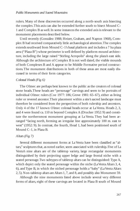
The easternmost Gulf Coast Olmec center, La Venta, situated on the humid,tropical coastal plains of Tabasco, is notable for its abundance of both stonemonuments and earthen mound architecture. La Venta’s complex of moundsextends for more than a kilometer and is dominated near its north end by oneof Middle Formative Mesoamerica’s largest pyramid structures, the 30 m tallMound C-1 (see González 1988: fig. 1; Adams 1991: map 3-2). Robert Heizer(1968: 15–21) was one of the first scholars to suggest that Mound C-1, builtatop a raised basal platform, symbolized a sacred mountain. Most of La Venta’s80 known monuments occur in and around the mound-plaza groups designated asComplexes A and B, immediately to the north and south of Mound C-1 (Fig. 5).
Complex A extends northward from the foot of Mound C-1’s basal plat-form. The enclosed plaza area of this architectural complex is renowned in thehistory of Olmec archaeology, for it has been the focus of nearly all the signifi-cant archaeological research conducted at La Venta prior to 1985. The 1942–43excavations of Stirling and Drucker (Drucker 1952) and the 1955 research ofDrucker, Heizer, and Squier (1959), both within Complex A, uncovered someof the most spectacular Olmec creations ever found. These included great bur-ied mosaic pavements, massive offerings of serpentine blocks, caches of jadecelts, and major tombs. The latter may be the graves of several of La Venta’s

266
David C. Grove
Fig. 5 La Venta, showing locations of Mound C-1 and Complexes A and B.Drawing by Marie J. Zeidler.
267
Public Monuments and Sacred Mountains
rulers. Many of these discoveries occurred along a north-south axis bisectingthe complex. This axis can also be extended further south to bisect Mound C-1 and Complex B as well. In some instances the extended axis is relevant to themonument placements described below.
Until recently (González 1988; Heizer, Graham, and Napton 1968), Com-plex B had received comparatively little archaeological attention. The complexextends southward from Mound C-1’s basal platform and includes a 7 ha plazaarea (“Plaza B”) whose perimeter is well defined by platform mound architec-ture, including the large raised “Stirling Acropolis” along the plaza’s east side.Although the architecture of Complex B is not well dated, the visible moundsof both Complexes B and A appear to be Middle Formative period construc-tions. The monument distributions in both of these areas are most easily dis-cussed in terms of their form categories.
Colossal Heads (Fig. 6)
The Olmec are perhaps best known to the public as the creators of colossalstone heads. These heads are “personage” carvings and seem to be portraits ofindividual Olmec rulers (Coe 1977: 186; Grove 1981: 65–67), either as livingruler or revered ancestor. Their placement within a site’s sacred landscape musttherefore be considered from the perspectives of both rulership and ancestors.Only 4 of the 17 known Olmec colossal heads occur at La Venta. Heads 2, 3,and 4 were found ca. 110 m beyond Complex A (Drucker 1952: 9) and consti-tute the northernmost monument grouping at La Venta. They had been ar-ranged “facing north, forming an irregular line approximately 100 m. east towest” (1952: 9). In contrast, the fourth, Head 1, had been positioned south ofMound C-1, in Plaza B.
Altars (Fig. 7)
Several different monument forms at La Venta have been classified as “al-tars,” sculptures that, as noted earlier, seem associated with rulership. Five of LaVenta’s nine altars are of the tabletop variety, large rectangular monumentsdistinguished by their projecting upper ledge and large frontal niche with aseated personage. Two subtypes of tabletop altars can be distinguished: Type A,which depict only the seated personage within the niche (La Venta Altars 3, 4,6), and Type B, in which the niched personage holds a “baby” (La Venta Altars2, 5). Non-tabletop altars are Altars 1, 7, and 8, and possibly also Monument 59.
Although the nine monuments listed above include several very differentforms of altars, eight of these carvings are located in Plaza B south of Mound

268
David C. Grove
Fig. 6 La Venta, the distribution of colossal heads. Drawing by Marie J. Zeidler.

269
Public Monuments and Sacred Mountains
Fig. 7 La Venta, the distribution of altars. Drawing by Marie J. Zeidler.

270
David C. Grove
C-1,5 and they comprise the majority of the major monuments displayed inthat large plaza area. Their distribution within the plaza is also informative. Thetabletop altars occur only at the north and south extremities of Plaza B, and inboth instances occur as Type A-and-B pairs. The southern pair, Altars 4 [TypeA] and 5 [Type B], are arranged on opposite sides of a low range mound (MoundD-8), where they are positioned so that they create an east-west alignmentwith a conical mound, D-1, in the plaza. That alignment seems deliberate andmay have demarcated the plaza’s southern limit. More than 400 m north, atthe upper edge of Mound C-1’s basal platform, are Altars 2 [Type B] and 3[Type A].
A special configuration also occurs in the altar pairs: the Type A and B altarswere positioned to face in opposite directions. Although this might be consid-ered as merely coincidental in the case of Altars 4 and 5, erected on oppositesides of Mound D-8, the same opposition occurs with Altars 2 and 3 on thebasal platform below Mound C-1, and it is more convincing there. Altar 2 facesonto Plaza B, and thus its frontal scene would have been visible to viewers onthe plaza. In contrast, Altar 3 was apparently positioned facing toward MoundC-1, and therefore its main imagery would not have been visible to thoseviewers. In both pairs, the Type B altars (personages holding babies) face towardthe plaza, and Type A altars face away from that area.
Spaced nearly equidistantly across Plaza B, between altar pairs 2-3 and 4-5,are Altars 1, 7, and 8. All occur east of the site’s north-south axis, except forsmaller Monument 59 found on Mound B-4 (Clewlow and Corson 1968: endmap). The wide (ca. 110 m) spacing between these various altars means thateven if the plaza area was an entirely open vista, the monuments neverthelesscould only have been viewed individually, suggesting that their positioningreflects a purposeful processional arrangement.
Stelae (Fig. 8)
Stelae are a monument form that appears to have gained importance onlylate in Olmec prehistory, at which time they became the medium for display-ing low-relief images of personages and supernaturals. La Venta’s three mostfamous stelae—Stelae 1, 2, and 3—all depict particular personages. Stelae 1 and3 were both found in Complex A north of Pyramid C-1. Stela 1, in relativelyhigh relief, depicts a personage standing within a rectangular niche that is marked
5 La Venta Altar 6 occurs outside the MMZ in Complex F (the “Cerro Encantada”), ca.700 m northwest of Complex A (González 1988: fig. 1; Adams 1991: map 3-2). Stylistically,it is a very late carving.

271
Public Monuments and Sacred Mountains
Fig. 8 La Venta, the distribution of stelae. Drawing by Marie J. Zeidler.

272
David C. Grove
iconographically as the mouth of a supernatural creature, that is, an otherworldentrance. It is notable that the stela had been erected a few meters west ofTomb C in alignment with that tomb’s large stone crypt grave (Drucker 1952:fig. 14). Stela 3, with a “narrative” scene showing two personages, was posi-tioned in the area of Complex A referred to as the “Ceremonial Court” andhidden behind the columnar basalt wall that enclosed that area. In contrast,Stela 2 was erected on Plaza B south of Mound C-1. There it was situatedadjacent to Colossal Head 1, and both monuments were openly displayed. Allthree stelae occur west of the site’s north-south axis.
Although Stelae 1, 2, and 3 are among the best known of La Venta’s monu-ments, several large green schist stelae have been found at the site but have notreceived the attention they deserve. These green schist stelae all occur in thePlaza B area, and all are carved with great supernatural faces (Fig. 9). One ofthese, Monument 58, had stood on Mound B-4 in Plaza B (Clewlow and Corson1968: end map). The more important pair, Monuments 25/26 and 27, wereerected at the southern base of great pyramid Mound C-1, where they arepositioned so that they flank the mound’s north-south axis. Monument 86(Stela 5), a recently discovered stela with a mythico-supernatural scene depict-ing four personages, one of whom is descending from the sky, stands betweenMonuments 25/26 and 27 (González 1988: fig. 1; 1994).
Other Carvings (Fig. 10)
Unlike the massive altars, stelae, and colossal heads, which are essentiallyimmobile, smaller carvings such as anthropomorphic statues were more readilyportable. Several of these could have been used in rituals or moved from placeto place, therefore the locations at which they were discovered are relevant inonly the most general terms. Those carvings for which provenience data areavailable primarily cluster around the periphery of Plaza B, including east ofthe plaza on the Stirling Acropolis. The virtual absence of small monuments inPlaza B itself suggests that none had been permanently displayed there.
A few smaller monuments were found in Complex A, primarily within theenclosed Ceremonial Court. Three additional carvings—Monuments 19, 20, and21—had been positioned north of Complex A near Colossal Heads 2, 3, and 4.
La Venta’s Sacred Landscape
The northern limit of the Major Monument Zone at La Venta is defined byColossal Heads 2, 3, and 4, and is separated from the southernmost monuments,Altars 4 and 5, by a distance of ca. 840 m. Mound C-1 is situated near themidpoint of that distribution, effectively separating the zone into a northern

273
Public Monuments and Sacred Mountains
Fig. 9 La Venta stela Monument 25/26.
and a southern sector. The majority of the principal monuments at thesite—seven altars, a stela, and a colossal head—were positioned in the south-ern sector within Plaza B. They are all monuments which by their very size,and by their placement in a processional arrangement in that large openarea, could visually communicate their iconographic messages to many view-ers at one time. The north end of Plaza B is dominated by the wide elevatedapron of Mound C-1’s basal platform, and it is therefore notable that theother architecture surrounding the plaza is likewise comprised of platformmounds, that is, mounds that in many instances could have functioned as

274
David C. Grove
Fig. 10 La Venta, the distribution of miscellaneous monuments.Drawing by Marie J. Zeidler.

275
Public Monuments and Sacred Mountains
elevated “stages” for rituals meant to be viewed by people gathered withinthe plaza. The southern sector of La Venta’s MMZ seems to be accessiblepublic space, an area in which rulership/personage monuments were dis-played in a processional arrangement, and thus an area in which public ritualactivities probably took place. Many of these rituals may have been related tothe monuments. Even the vast majority of the site’s smaller monuments forwhich there are provenience data are found on the east and west fringes ofComplex B.
In contrast, in the northern sector, the major objects and offerings in Com-plex A were not meant to be accessed or viewed. Complex A is a restrictedprecinct partially enclosed by long range mounds. It is an area of major tombs,and the elaborate offerings found there were buried and thus were not meant tobe viewed or accessed. Even the few monuments situated within Complex A,such as Stela 3, were not openly displayed but were hidden behind the largewall of columnar basalt pillars of the complex’s Ceremonial Court.
The cosmological meaning of the sacred landscape represented in the northernsector can be inferred from the presence of major tombs there: north is therealm of the ancestors and the past and probably also a sky realm.6 The place-ment of three colossal heads 110 m beyond Complex A, in the far north, isconsistent with that cosmological referent, for in the Middle Formative sacredlandscape represented at La Venta, these Early Formative period portrait carv-ings of Olmec rulers would indeed be the ancestors. The fact that these threeheads were not buried, but visible and positioned to create “an irregular lineapproximately 100 m. east to west” (Drucker 1952: 9), implies that they too hadbeen spaced in a processional arrangement and were meant to be viewed.
An interesting contrast is manifested in the positioning of the majormonuments openly displayed within the northern and southern sectors.Those in the southern sector are spaced along the central area of the sector,while tombs and buried offerings occur in the central area of the northernsector and the displayed monuments occur at that sector’s perimeter. Thatbasic north-south dichotomy, and the separation of those two sectors byMound C-1, the constructed “sacred mountain,” was clearly a significantaspect of La Venta’s template. However, the MMZ’s center-line axis also
6 A number of scholars have pointed out the association of north with the celestial/skyrealm in Classic Maya cosmology, and Ashmore’s (1989, 1992) analyses of Classic Mayasacred landscapes discuss that correlation very well. For a variety of reasons, aspects ofComplex A (and particularly the Ceremonial Court area) also seem to have associationswith a celestial otherworld. Susan Gillespie has called my attention to the association be-tween “north” and “the past” in some other Mesoamerican cosmologies.

276
David C. Grove
created an east and west division that produces a lesser pattern: altars arepositioned east of the axis and colossal heads and stelae west of it.
SAN LORENZO’S MONUMENTS AND THEIR DISTRIBUTIONS
San Lorenzo is situated 60 km inland from the Gulf of Mexico, atop a longplateau that rises ca. 50 m above the floodplains of the Coatzacoalcos andChiquito Rivers. The plateau area had been artificially built up in Olmec andpre-Olmec times to create a space more than 1,100 m long and up to 700 mwide (Coe 1968: 44–46; 1981: 119; Coe and Diehl 1980: 27–28, map 2). Thatremodeling of the hilltop required organization and planning, and was cer-tainly carried out for reasons that transcended the mundane: it arguably createdthe basic sacred landscape at San Lorenzo. More than sixty monuments havebeen found on the plateau, and several smaller sites situated several kilometersfrom the plateau—Tenochtitlán, Potrero Nuevo, Los Treinta, and El Azuzul—also have a few monuments (see Fig. 14). The monuments of these peripheralsites are discussed in a separate section of this chapter.
The reconstructible pattern of monument distribution at San Lorenzo ex-hibits some distinct differences from that of La Venta. Some of the variationmay be due to the fact that the sites are not completely contemporaneous. SanLorenzo has more Early Formative period monuments, such as colossal heads,while late Middle Formative period monuments, such as stelae, are rare there.Similarly, San Lorenzo lacks a major earthen mound comparable to La Venta’sC-1, and mound-plaza groups dating to the site’s Olmec occupation have notyet been distinguished there. Although the Group A mounds and the MoundC3-1 pyramid in the center of the San Lorenzo plateau have a layout reminis-cent of La Venta’s Complex A (see, e.g., Figs. 10–12), they seem to be EarlyPostclassic constructions (Coe and Diehl 1980: 29, 388, fig. 12). The possibleexceptions are one or two small mounds, exposed in stratigraphic cuts, thatmay have been constructed in the late Middle Formative period Palanganaphase (1980: 62–71, 200–201, figs. 44, 45). Finally, while the zones of monu-ment distribution at La Venta and Chalcatzingo comprise one-third or less ofthe total site areas there, the major monuments at San Lorenzo occur acrossnearly the entire upper surface of the plateau, and the MMZ and main site areaare essentially equivalent.7
7 Ann Cyphers’ current research at San Lorenzo (e.g., Cyphers, this volume; personalcommunication) indicates that the total site area is even greater, also encompassing theterraces and hillslopes below and beyond the upper surface of the plateau.

277
Public Monuments and Sacred Mountains
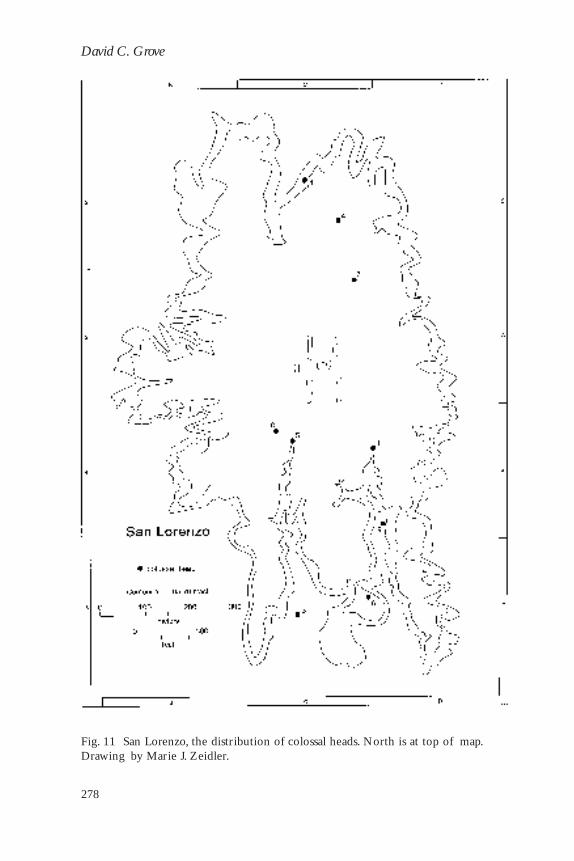
Colossal Heads (Fig. 11)
In 1994 San Lorenzo’s tenth colossal head was discovered. Only about halfof these heads occur in good archaeological contexts, however, and the remain-der have been found in the barrancas that have eroded into the plateau over thecenturies. Therefore, only general observations can be inferred from the posi-tioning of the heads.
Three of the heads (2, 4, and 7) occur in the northeastern quarter of the SanLorenzo plateau, and the other seven have been found along the sides of theSouth-Central Ridge (1, 3, 5, 6, 8, 9, 10). Colossal heads are absent in thenorth-central area of the plateau, creating an interval of separation between thenorthern and southern heads of more than 300 m. In both areas the individualheads are spaced more than 100 m from each other, perhaps again representinga processional arrangement, particularly in the cases of heads 2, 4, and 7 (north)and heads 1, 6, 9, and 10 (south).
Altars (Fig. 12)
Only two unequivocal tabletop altars have been found at San Lorenzo.Monument 20 (Type B) was found in the far northwest area of the plateau.Monument 14 (Type A) is positioned in the west-central sector of the site.Although separated by more than 400 m, these two altars are in a virtual north-south alignment.8
Evidence suggests that several other tabletop altars had also been displayedon the plateau at some time. Monument 18, in the southeastern corner of theSouth-Central Ridge, is apparently the basal fragment of a tabletop altar. Thestone’s low-relief carving depicts a pair of dwarfs, each with one upraised arm,as if to “support” the missing tabletop. Monument 60, on the east side of theplateau near head 1—and nearly due north of Monument 18—may likewise bea basal fragment. The most interesting evidence, however, is the astute observa-tion by James Porter (1989) that oddly sculpted areas on two of the site’s colos-sal heads (2 and 7) indicate that these monuments had been altars before beingrecarved into their present form.
Four other carvings have also been classified as altars at San Lorenzo: twolarge rectangular stone slabs, Monuments 8 and 51, and two “circular altars,”
8 It is also notable that while separated by almost one km, the northernmost and south-ernmost colossal heads, 4 (north) and 3 (south), are in a virtual north-south alignment, andheads 5 and 8 are positioned close to that alignment line. However, because of barrancaerosion, the discovery location of head 3 may be only approximate to its original positionon the plateau.
278
David C. Grove
Fig. 11 San Lorenzo, the distribution of colossal heads. North is at top of map.Drawing by Marie J. Zeidler.

279
Public Monuments and Sacred Mountains
Fig. 12 San Lorenzo, the distribution of altars. North is at top of map. Drawing byMarie J. Zeidler.

280
David C. Grove
Monuments 16 and 64. Both rectangular slabs are positioned in the same gen-eral east-west “latitude” of the plateau as the Monument 14 and 60 altars. Onthe other hand, the “circular altars” are located on the plateau’s Southwest Ridge.There they appear to be positioned along an extension of the north-southalignment formed by Monuments 14 and 20.
Other Carvings (Fig. 13)
The majority of smaller monuments on the plateau occur along the GroupC and D ridges, in the western-central sector of the site, away from most of themajor monuments. These smaller carvings consist primarily of anthropomor-phic and zoomorphic statues. Based upon her recent excavations of the GroupD Ridge, Ann Cyphers (this volume) suggests that monument recycling andrecarving took place in that site area, a function that may partly explain thelarge number of fragmentary and smaller monuments found there.
San Lorenzo’s Sacred Landscape
Even though San Lorenzo lacks a major mound, the north-south dichotomythat is basic to the organizational template at Chalcatzingo and La Venta isnevertheless present. The majority of the large monuments occur in the south-ern half of the plateau. The southern sector begins with an east-to-west band ofaltars (Monuments 8, 14, 51, 60) located just below the site’s midline. Sevencolossal heads occur to the south of these altars. There they are widely spacedand could have been viewed only one at a time. That fact, and the possiblelinear positioning of heads 1, 6, 9, implies that they are arranged processionally.As at La Venta, this southern sector was the area in which rulership/personagemonuments were displayed.
Only four major monuments are presently known in the entire northernsector, an altar (Monument 20; Type B) and three colossal heads. All these monu-ments were positioned near the outer limits of the northern sector. Only a fewtraces of possible Olmec period architecture occur in the extensive north-central area of the plateau, that is, the zone equivalent to the location of MoundC-1 and Complex A at La Venta,9 and these seem to date to the Late MiddleFormative period (Palangana phase) after San Lorenzo’s “apogee.” Whereas atLa Venta the elaborate tombs of Complex A helped identify north as symboli-cally the realm of “ancestors,” no such tombs have yet been discovered at San
9 Interestingly, the site’s modest Early Postclassic period Group A Mounds are positionedat the same equivalent template location as La Venta’s Mound C-1 and Complex A. Whileperhaps coincidental, it is as if their placement was governed by a very long-lived template.

281
Public Monuments and Sacred Mountains
Fig. 13 San Lorenzo, the distribution of miscellaneous monuments. North is at top of map.Drawing by Marie J. Zeidler.

282
David C. Grove
Lorenzo. Therefore, attributing a similar cosmological significance to that site’snorthern sector is more problematical.
As noted above, James Porter (1989) has observed that two colossal heads atSan Lorenzo had been recarved from their original monument form, altars.That physical transformation, from ruler’s “thrones” to ruler’s portrait heads,was a significant symbolic transformation as well. These conversions were pre-sumably carried out following the death of the rulers, that is, when they them-selves were transformed into ancestors. Therefore, it is perhaps meaningful thatprecisely these two heads, 2 and 7, were both positioned in the northern sector.Similarly, the heavily “mutilated” condition of the northern sector’s tabletopaltar (Monument 20) may perhaps reflect the initial stages of the recarvingprocess intended to convert that altar into another ancestral colossal head forthat sector.
Only generalized east-west differentiations appear in the monument pat-terns. In the western portion of the plateau a north-south line is created by thesite’s two tabletop altars, Monuments 14 and 20. If that line is used as a referent,almost all massive monuments—including all colossal heads—occur east of theline, while virtually all small monuments are found west of it.
THE SAN LORENZO PERIPHERY AND SACRED LANDSCAPE
The majority of the carvings at the sites peripheral to San Lorenzo—Tenochtitlán, Potrero Nuevo, El Azuzul, and Los Treinta (Fig. 14)—are the-matically different from those on the plateau. The exact nature of these sites,and of the positioning of their monuments in relation to mound groups, plazas,or other features, remains to be determined. Nevertheless, even lacking suchdata, these monuments aid in understanding San Lorenzo’s sacred landscape.
Seven of the twelve carvings at these sites depict felines, usually shown assnarling or in “dominating” positions over humans. For example, MatthewStirling (1955: 8) described Tenochtitlán Monument 1 as “an anthropomorphicjaguar seated on a human figure” and Potrero Nuevo Monument 3 as possiblyrepresenting “copulation between a jaguar and a woman.” However, as othershave noted, these carvings more likely represent aggression and domination(Davis 1978: 454; Medellín 1960: 95). Furthermore, two of the four monu-ments recently discovered at El Azuzul are snarling felines. In contrast, the fewfeline carvings found at San Lorenzo (e.g., Monuments 7, 37, 77) do not displayany aggressiveness.
Aggressive felines are clearly a major component of the peripheral monu-ments, but other carvings occur there as well. Potrero Nuevo Monument 2,one of the most frequently published of all Olmec monuments, is a tabletop

283
Public Monuments and Sacred Mountains
Fig. 14 San Lorenzo and its peripheral sites. Drawing by Marie J. Zeidler.
altar carved with the images of two supernatural dwarfs, their arms raised abovetheir heads as if supporting the tabletop. Furthermore, a few personage/rulershipstatues also occur at the peripheral sites (e.g., Los Treinta, Monument 5;Xochiltepec ejido monument).
The contrasts between the monuments at the actual site of San Lorenzo andthose on its periphery seem explainable by the general cosmology ofMesoamerican peoples, where an important distinction is made between cen-ter and periphery (see e.g., Hanks 1990: 306–307; Taggart 1983: 55–56). The

284
David C. Grove
center symbolizes inhabited space, the village, while the periphery is a place ofthe supernatural and of danger. As Taggart (1983: 55) explains: “The center isrepresented with words standing for the human community. . . . The centerrepresents the moral order. . . . It is juxtaposed against the periphery.” The latteris identified with the word “forest.” Encounters with the personified forces ofnature take place more often in the periphery. Within that paradigm, therefore,the carvings involving dwarfs, or jaguars dominating humans, pertain to theperiphery. Their locations—Tenochtitlán, Potrero Nuevo, and El Azuzul—like-wise place them on the actual spatial periphery of the main center, San Lorenzo.
Taggart (1983: 56) also makes the important observation that “present is tothe past as the center is to the periphery.” Therefore, the center/town/inhab-ited space represent the present and socio-cosmic order, while the periphery/forest/mountains symbolize the mythological past and disorder, chaos. Fromthat perspective, carvings depicting jaguars dominating humans—on both theGulf Coast and at Chalcatzingo—are portraying events of the mythologicalpast.
SUMMARIZING THE BASIC GULF COAST OLMEC TEMPLATE
This chapter has used a neutral etic category, the Major Monument Zone, toattempt to explore and elucidate the sacred landscapes at Chalcatzingo, La Venta,and San Lorenzo. The results suggest that the inhabitants of these three sites didposition monuments purposely to segment space and that there is some emicreality to the MMZ and its component sectors.
At La Venta the MMZ is located at the north end of the site’s extensive areaof architecture, while at San Lorenzo the MMZ comprises almost the entireupper surface of the plateau. Mound C-1 stands near the midpoint of La Venta’szone, while at San Lorenzo there is no central pyramid mound.10 Yet while the
10 The north-south linear size of the MMZ (i.e., the distance from northernmost tosouthernmost monuments) is ca. 1,000 m at San Lorenzo, and ca. 840 m at La Venta. Amathematical “midpoint” of that linear distance can obviously be calculated. I discussedthat mathematical midpoint in my presentation of this paper at Dumbarton Oaks, but toavoid overcomplicating the material I have not emphasized it in this chapter. Nevertheless,the results are intriguing, particularly for La Venta. Because the placement of La Venta’sHeads 2, 3, and 4 was not precisely measured (see Drucker 1952: 9), the midpoint can onlybe approximated. Those calculations disclose that while Mound C-1 visually separates thenorthern and southern sectors, the mound is definitely not positioned at the linear mid-point. Instead, the midpoint (and the east-west midline it creates) more likely falls on thelarge basal platform at the southern foot of Mound C-1, where the midline may have beendefined by the two small conical mounds that occur at the east and west corners of thebasal platform or by the southern (upper) edge of the platform (Figs. 5–9; also González 1988:

285
Public Monuments and Sacred Mountains
Fig. 15 The basic sacred landscape templates of Chalcatzingo, La Venta, and SanLorenzo. Drawing by Marie J. Zeidler and David Grove.
organization of La Venta and San Lorenzo may seem quite different, within theMMZ at both sites the patterns in the distribution of monument types, and inthe iconographic themes those carvings display, indicate that these sites actuallyshared fundamental structural similarities in the placement of their monuments,that is, a similar template (Fig. 15).
The most evident structural principle is that the MMZ area has distinctnorthern and southern halves (sectors), and at both San Lorenzo and La Ventathe majority of the monumental art was positioned in the southern sector. Theimages on these carvings relate to personages and rulership, and in the southernsectors they were openly displayed in processional arrangements in the sectors’central area. These carvings were unquestionably intended to be viewed. Thepredominance of displayed rulership monuments in this sector suggests that thissite area was associated with public rituals related in some manner to that theme.
In contrast, the northern sectors at La Venta and San Lorenzo are nearlydevoid of major displayed carvings; the few monuments erected in the northare positioned near those sectors’ outer edges rather than their central areas.However, even these northern carvings are again laid out in a processional
fig. 1; Adams 1991: map 3-2). If the linear midpoint was at all culturally relevant to thenorth-south dichotomy expressed in the sacred landscape, then the constructed “sacredmountain” (Mound C-1) lies just within the “ancestral” (northern) sector. Similar measure-ments suggest that Chalcatzingo’s main mound may also be positioned slightly asymmetri-cally and just within the “ancestral” sector.
———

286
David C. Grove
arrangement. The presence of tombs and buried offerings and the restricted(nonpublic) nature of much of the northern sector of La Venta suggest that, inthe Olmec template, north was cosmologically the region of the otherworld,ancestors, and the past.11
At present, an “ancestor” symbolism can be inferred only for San Lorenzo’snorthern sector, and such an attribution is complicated by the fact that thethree colossal heads displayed in the northern sector, together with the sevendisplayed in the south, may all have represented past rulers (ancestors). Never-theless, a mitigating factor may be that the San Lorenzo pattern reflects thedistribution of Early Formative monuments within the cosmological template,while the La Venta pattern represents the distribution of both Middle Forma-tive carvings and Early Formative colossal heads. Furthermore, the problemnoted above does not negate the template’s basic north-south dichotomy, northe fact that within the template the principal display of monuments occurs inthe southern sector.
At La Venta the primary mound, C-1, visually divides the northern andsouthern sectors. Large supernatural faces carved on stelae are displayed on thesouthern (public) side of the mound, where they are visible from Plaza B.These images may have visually designated that great mound as a symbolic“sacred mountain.” Although San Lorenzo lacks a comparable Formative pe-riod constructed sacred mountain anywhere on the plateau,12 the site’s basictemplate—the sacred landscape—is nonetheless similar.
The La Venta data are valuable for revealing the fundamental structural tem-plate of the MMZ, while it is through the monuments at the small sites sur-rounding San Lorenzo that the nature of the periphery in the Olmec sacred
11 It is worth noting that the main architectural components at La Venta extend beyondComplexes A and B to also include Complex D (see Adams 1991: map 3-2; González 1988:fig. 1). In fact, La Venta’s three enigmatic sandstone monuments (52, 53, 54) occur at thesouth end of Complex D in a possible east-west alignment with Mounds D-17 and D-19.In terms of linear measurements, the three complexes are essentially of equal size, and,although this study has focused on Complexes A and B, the entire grouping can also beperceived as a north-central-south triadic arrangement. The reader may be reminded, as Iam, of the somewhat similar triadic organization of Tikal’s Great Plaza area a millenniumlater: the North Acropolis and the burials of ancestral rulers/the Great Plaza with publicallydisplayed rulership monuments along its northern edge/the Central Acropolis elite resi-dential-administrative complex of ruling dynasty (e.g., Ashmore 1992).
12 Susan Gillespie has suggested to me that, in the sacred landscape of San Lorenzo, theentire plateau may have been regarded as a sacred mountain, thus perhaps obviating theneed for a major mound. If that was the case, the supernatural and domination carvingsfound at peripheral sites below the plateau would have been positioned around the “base”of that sacred mountain, in the same relative position as the domination scenes on the talusslopes of the Cerro Chalcatzingo.

287
Public Monuments and Sacred Mountains
landscape becomes clear. The relatively benign monuments of the San Lorenzoplateau stand in contrast to the domination (and dwarf ) carvings found atTenochtitlán, Potrero Nuevo, and El Azuzul. These distributions seem to re-flect the general Mesoamerican cosmological principle that the center sym-bolizes civilized space, whereas the periphery is the region of the supernatural,danger, and the mythological past.
CHALCATZINGO’S TEMPLATE: HOW OLMEC IS IT?
Beyond the obvious fact that Chalcatzingo’s monuments are executed ac-cording to Gulf Coast canons, the site’s organizational template also exhibitsseveral strong correspondences with the basic templates of La Venta and SanLorenzo (Fig. 15). For example, Chalcatzingo’s MMZ has distinct northern andsouthern sectors of approximately equal size. Also, as at La Venta, Chalcatzingo’ssectors are physically separated by the site’s major mound, and rulership monu-ments are displayed exclusively in one sector. Nevertheless, while Chalcatzingofollows many of the same structuring principles that operated at the Gulf CoastOlmec centers, it also executes those principles somewhat differently. The greatestand most explicit contrast is that directionality of the north-south dichotomyand the monument distribution pattern is reversed at Chalcatzingo. The site’srulership monuments are displayed in the northern sector, while it is the south-ern sector (Terrace 1 and others flanking the Cerro Chalcatzingo’s talus slopes)that is nearly devoid of monuments.
The cosmological symbolism of the southern sector at Chalcatzingo is un-clear. If it is “ancestral,” then it is notable (yet perhaps coincidental) that thesite’s most richly endowed elite burials come from atop the massive platformmound and from the elite residence on Terrace 1 (Merry de Morales 1987a:100–108; 1987b: 457–465). One such interment, Burial 3, found within a stonecrypt beneath the latter structure, had been entombed with a stone head (Monu-ment 17) severed from a “rulership” statue (1987a: 103–105), evidence suggest-ing that in life that person had served in a rulership capacity.
At La Venta and San Lorenzo, the few monuments in the “ancestral” sectoroccurred only along the margins of that sector. The talus carvings of the CerroChalcatzingo are situated in a somewhat analogous location, yet they are the-matically different. They are not images of ancestral personages, but depictzoomorphic supernaturals dominating humans. As such, they are most compa-rable in both theme and positioning to the domination carvings that occur atPotrero Nuevo, El Azuzul, and Tenochtitlán on the periphery of San Lorenzoplateau. The domination carvings at Chalcatzingo are also situated on the pe-riphery, at the base of the cerro (sacred mountain) and just beyond the con-structed landscape (see note 10).

288
David C. Grove
At the Gulf Coast Olmec centers there is no feature of sacred geographyexactly equivalent to the Cerro Chalcatzingo, nor are there any carvings di-rectly similar to “El Rey” (Monument 1) and the other rain-fertility carvingshigh on the hillside. Although the “El Rey” bas-relief shares important icono-graphic motifs with Altar 5 at La Venta (Grove 1989: 132–134), it exhibits anequally important dissimilarity. Monument 1 is characterized by a large quatre-foil supernatural face, as are Monuments 9 and 13. Significantly, such quatre-foils are not found in Gulf Coast Olmec monumental art. I have suggestedabove that the large supernatural faces of Chalcatzingo’s Monument 9 and LaVenta’s Monuments 25/26 and 27 marked their respective massive centralmounds as sacred mountains.13 While these carvings are similar in where theywere displayed and in their probable symbolic function, their supernatural im-ages are completely different. The closest regional and temporal analogs toChalcatzingo’s three quatrefoil faces are found in the sectioned-quatrefoil “hillglyph”/place glyph motifs that begin to be manifested in Late Formative pe-riod monumental art in Oaxaca (e.g., Caso 1965: fig. 15).
A further contrast occurs with Chalcatzingo’s tabletop altar, Monument 22.This Gulf Coast type monument is positioned near the far end of the rulershipsector, just as are Altars 4 and 5 at La Venta. However, Monument 22 is situatedwithin a sunken patio, an architectural form not yet shown to occur at GulfCoast Olmec sites. In addition, unlike its monolithic Gulf Coast counterparts,the Chalcatzingo altar is constructed of 20 large stone blocks, even thoughsuitable altar-sized boulders abound nearby (Fash 1987: 93). The altar’s iconog-raphy also diverges from Gulf Coast canons. Whereas the upper ledge ofGulf Coast altars is usually carved with an earth band composed of invertedU-elements, Monument 22’s upper ledge is decorated with a non-Olmec “elon-gated oblong” motif (Grove 1987b: 430, fig. 27.6).
The above examples help illustrate the eclectic nature of Chalcatzingo, itsmonumental art, and its sacred landscape. While the site’s carvings clearly havetheir roots and canons in Gulf Coast Olmec monumental art, and there is alsoa strong Gulf Coast component to the themes of some carvings, at Chalcatzingothose elements are united with motifs and traits that seem more common toCentral Mexico (Morelos, Guerrero, and Oaxaca; Grove 1989: 142–145), andtogether they are manifested within a template that is an inversion of the GulfCoast template.
13 It seems possible that the concept of erecting large supernatural faces on the publicside of a site’s main mound, as exemplified at La Venta and Chalcatzingo, may represent aMiddle Formative period antecedent to the great supernatural masks that adorn Late Pre-Classic Maya pyramids, such as at Cerros and Uaxactun.

289
Public Monuments and Sacred Mountains
Does Chalcatzingo’s template predate the appearance of the Gulf Coastelements? A point strongly favoring that possibility is that the earliest buildingstages of Chalcatzingo’s massive platform mound—the construction separatingthe north and south sectors—date to the Early Formative period (Amate phase;Prindiville and Grove 1987: 63), centuries before the site’s adoption of monu-mental art (ca. 700 b.c.) and/or other unequivocal evidence of interaction withthe Gulf Coast Olmec sites. This implies that Chalcatzingo’s basic organiza-tional template (i.e., a northern and southern sector separated by a midpointmound) was in place by ca. 1000 b.c. and that the Gulf Coast elements werelater incorporated into that existing sacred landscape.
FORMATIVE PERIOD SACRED LANDSCAPES AND FUTURE RESEARCH
The analyses of monument distributions at Chalcatzingo, La Venta, and SanLorenzo demonstrate that, in spite of the great physical differences betweenthese three centers, certain similar structuring principles nevertheless operated inthe positioning of their monuments and major public architecture. Furthermore,the distinctive distribution of particular monument types and monument themeswithin these sites implies a cosmological foundation to those structuring principles.Thus, through their mounds and monuments, Chalcatzingo, La Venta, and SanLorenzo manifest sacred landscapes as an important component of their builtenvironments. While this chapter has stressed the dichotomy present within theMMZ, nearly all the monuments of the MMZ deal in one way or another withrulership, past or present; they are thus essentially “historical.” In contrast, theperipheral monuments are more related to cosmology and the mythologicalpast, and the fact that such monuments were erected at sites on the periphery ofSan Lorenzo implies that a center’s sacred landscapes extended out to the sur-rounding communities as well. That extension may also be reflected in thecharacter of the monuments displayed at more distant secondary centers in thehinterlands of San Lorenzo, La Venta, and Laguna de los Cerros (for the latter,see Grove et al. 1993).
Because very little attention has been directed to the organizational prin-ciples of Formative period sites, it is presently difficult to ascertain which sharedfeatures of the three templates discussed above are perhaps pan-Mesoamericanor at least more common to a wide area of Mesoamerica and which might beinherently Gulf Coast Olmec. The dualistic organization of a site’s Major Monu-ment Zone area may be one of these more “pan-Mesoamerican” patterns.
Sacred landscapes seem to have been a significant characteristic ofMesoamerican sites from the Formative period on, although as noted at thebeginning of this chapter, the principles underlying the organization of any

290
David C. Grove
site are seldom self-evident. Elucidating the templates of the vast majority ofFormative period sites will be difficult, particularly in the absence of monu-mental art or other features that carry some interpretable cosmological signifi-cance. Nevertheless, the knowledge that sacred landscapes and organizationaltemplates may have been fundamental to the way Mesoamerican societies con-ceived of and arranged space has exciting potential as an analytical approachfor understanding more about these societies, their sites, and the distribution ofactivities within those sites.
Acknowledgments Over several years this study has benefited from discussionswith many people, including Wendy Ashmore, Rosemary Joyce, Joyce Marcus,and Kent Reilly. Susan Gillespie tirelessly read many drafts of this chapter andcontributed extremely valuable comments and insights. The students in my1993 graduate Olmec seminar, and particularly Anthony Vega, deserve creditfor the insight that Chalcatzingo Monument 9 marked that site’s major plat-form mound as a sacred mountain.

291
BIBLIOGRAPHY
Adams, Richard E. W.1991 Prehistoric Mesoamerica. University of Oklahoma Press, Norman.
Angulo V., Jorge1987 The Chalcatzingo Reliefs: An Iconographic Analysis. In Ancient Chalcatzingo
(David C. Grove, ed.): 132–158. University of Texas Press, Austin.
Ashmore, Wendy1989 Construction and Cosmology: Politics and Ideology in Lowland Maya
Settlement Patterns. In Word and Image in Maya Culture (W. Hanks and D.Rice, eds.): 272–286. University of Utah Press, Salt Lake City.
1992 Deciphering Maya Architectural Plans. In New Theories on the Ancient Maya(Elin C. Danien and Robert J. Sharer, eds.): 173–184. University MuseumMonograph 77. University Museum Symposium Series 3, University ofPennsylvania, Philadelphia.
Broda, Johanna, Davíd Carrasco, and Eduardo Matos Moctezuma1987 The Great Temple of Tenochtitlan: Center and Periphery in the Aztec World. University
of California Press, Berkeley.
Brüggemann, Jürgen, and Marie-Areti Hers1970 Exploraciones arqueológicas en San Lorenzo Tenochtitlán. Boletín del Instituto
Nacional de Antropología e Historia 39: 18–23. Mexico.
Caso, Alfonso1965 Zapotec Writing and Calendar. In Handbook of Middle American Indians (Robert
Wauchope and Gordon R. Willey, eds.) 3: 931–947. University of Texas Press,Austin.
Clewlow, C. William, Jr., and Christopher R. Corson1968 Appendix II: New Stone Monuments from La Venta, 1968. In Papers on
Mesoamerican Archaeology: 171–203. Contributions of the University ofCalifornia Archaeological Research Facility 5. Berkeley.
Clewlow, C. William, Jr., Richard A. Cowan, James F. O’Connell, and Carlos Benemann1967 Colossal Heads of the Olmec Culture. Contributions of the University of
California Archaeological Research Facility, 4. Berkeley.
Coe, Michael D.1968 San Lorenzo and the Olmec Civilization. In Dumbarton Oaks Conference on the
Olmec (Elizabeth P. Benson, ed.): 41–71. Dumbarton Oaks, Washington, D.C.1977 Olmec and Maya: A Study in Relationships. In The Origins of Maya Civilization
(Richard E. W. Adams, ed.): 183–195. School of American Research AdvancedSeminar Series, University of New Mexico Press, Albuquerque.
1981 San Lorenzo Tenochtitlán. In Supplement to the Handbook of Middle AmericanIndians, vol. 1: Archaeology (Victoria R. Bricker and Jeremy A. Sabloff, eds.):117–146. University of Texas Press, Austin.
Coe, Michael D., and Richard A. Diehl1980 In the Land of the Olmec, vol. 1: The Archaeology of San Lorenzo Tenochtitlan. University
of Texas Press, Austin.

292
David C. Grove
Cook de Leonard, Carmen1967 Sculptures and Rock Carvings at Chalcatzingo, Morelos. In Studies in Olmec
Archaeology: 57-84. Contr ibutions of the University of CaliforniaArchaeological Research Facility 3. Berkeley.
Cyphers Guillén, Ann1992 Exploraciones arqueológicas en San Lorenzo Tenochtitlán, Veracruz:
Temporada 1991. Boletín del Consejo de Arqueología, 1991: 65–66. InstitutoNacional de Antropología e Historia, Mexico.
1993 Escenas escultóricas olmecas. Antropológicas 6: 47–52. Universidad NacionalAutónoma de México.
1994a Three New Olmec Sculptures from Southern Veracruz. Mexicon 16: 30–32.1994b Olmec Sculpture and Architecture of the Azuzul Acropolis, Loma del Zapote,
Veracruz, Mexico. Research and Exploration 10 (3): 294–305. NationalGeographic Society, Washington, D.C.
1994c San Lorenzo Tenochtitlán. In Los olmecas en Mesoamérica ( John E. Clark,coord.): 43–67. Citibank, Mexico.
Davis, Whitney1978 So-Called Jaguar-Human Copulation Scenes in Olmec Art. American Antiquity
43: 453–457.
De la Fuente, Beatriz1973 Escultura monumental olmeca: catalogo. Instituto de Investigaciones Estéticas,
Universidad Nacional Autónoma de México.1992 Cabezas colosales olmecas. El Colegio Nacional, Mexico.
Drucker, Philip1952 La Venta, Tabasco: A Study of Olmec Ceramics and Art. Smithsonian Institution,
Bureau of American Ethnology, Bulletin 153. Washington, D.C.
Drucker, Philip, Robert F. Heizer, and Robert J. Squier1959 Excavations at La Venta, Tabasco, 1955. Smithsonian Institution, Bureau of
American Ethnology, Bulletin 170. Washington, D.C.
Elzey, Wayne1976 Some Remarks on the Space and Time of the “Center” in Aztec Religion. Estudios
de Cultura Náhuatl 12: 315–334. Universidad Nacional Autónoma de México.
Fash, William L., Jr.1987 The Altar and Associated Features. In Ancient Chalcatzingo (David C. Grove,
ed.): 82–94. University of Texas Press, Austin.
Gay, Carlo T. E.1972 Chalcacingo. International Scholarly Book Service, Portland.
Gillespie, Susan D.1991 Ballgames and Boundaries. In The Mesoamerican Ballgame (Vernon L.
Scarborough and David R. Wilcox, eds.): 317–345. University of ArizonaPress, Tucson.
González Lauck, Rebeca1988 Proyecto arqueológico La Venta. Arqueología 4: 121–165. Instituto Nacional
de Antropología e Historia, Mexico.

293
Public Monuments and Sacred Mountains
1994 La antigua ciudad olmeca en La Venta, Tabasco. In Los olmecas en Mesoamérica( John E. Clark, coord.): 93–111. Citibank, Mexico.
Grove, David C.1968 Chalcatzingo, Morelos, Mexico: A Re-Appraisal of the Olmec Rock Carvings.
American Antiquity 33: 468–491.1972 El Teocuicani: “Cantor Divino” en Jantetelco. Boletin (ser. 2) 3: 35–36. Instituto
Nacional de Antropología e Historia, Mexico.1973 Olmec Altars and Myths. Archaeology 26: 128–135.1981 Olmec Monuments: Mutilation as a Clue to Meaning. In The Olmec and Their
Neighbors (Elizabeth P. Benson, ed.): 49–68. Dumbarton Oaks, Washington,D.C.
1984 Chalcatzingo: Excavations on the Olmec Frontier. Thames and Hudson, London.1987a Chalcatzingo in a Broader Perspective. In Ancient Chalcatzingo (David C. Grove,
ed.): 434–442. University of Texas Press, Austin.1987b Comments on the Site and Its Organization. In Ancient Chalcatzingo (David
C. Grove, ed.): 420–433. University of Texas Press, Austin.1989 Chalcatzingo and Its Olmec Connection. In Regional Perspectives on the Olmec
(Robert J. Sharer and David C. Grove, eds.): 122–147. Cambridge UniversityPress, Cambridge.
Grove, David C. (ed.)1987c Ancient Chalcatzingo. University of Texas Press, Austin.
Grove, David C., and Jorge Angulo V.1987 A Catalog and Description of Chalcatzingo’s Monuments. In Ancient
Chalcatzingo (David C. Grove, ed.): 114–131. University of Texas Press, Austin.
Grove, David C., Susan D. Gillespie, Ponciano Ortíz C., and Michael Hayton1993 Five Olmec Monuments from the Laguna de los Cerros Hinterland. Mexicon
15 (5): 91–95.
Guzmán, Eulalia1934 Los relieves de las rocas del Cerro de la Cantera, Jonacatepec, Morelos. Anales
del Museo Nacional de Arqueología, Historia, y Etnografía (ser. 5) 1 (2): 237–251.Mexico.
Hanks, William F.1990 Referential Practice: Language and Lived Space among the Maya. University of
Chicago Press, Chicago.
Heizer, Robert F.1967 Analysis of Two Low Relief Sculptures from La Venta. In Studies in Olmec
Archaeology: 25–55. Contr ibutions of the University of CaliforniaArchaeological Research Facility 3. Berkeley.
1968 New Observations on La Venta. In Dumbarton Oaks Conference on the Olmec(Elizabeth P. Benson, ed.): 9–36. Dumbarton Oaks, Washington, D.C.
Heizer, Robert F., John A. Graham, and Lewis K. Napton1968 The 1968 Investigations at La Venta. In Papers on Mesoamerican Archaeology:
127–154. Contributions of the University of California Archaeology ResearchFacility 5. Berkeley.

294
David C. Grove
Hopkins, Nicholas1984 Otomanguean Linguistic Prehistory. In Essays in Otomanguean Culture History
( J. Kathryn Josserand, Marcus Winter, and Nicholas Hopkins, eds.): 25–64.Vanderbilt University Publications in Anthropology 31. Nashville.
León Perez, Ignacio, and Juan Carlos Sánchez Ibáñez1991–1992 Las gemelas y el jaguar del sitio El Azuzul. Horizonte 5–6: 56–60. Instituto
Veracruzano de Cultura, Veracruz, Mexico.
Manrique Castañeda, Leonardo1975 Relaciones entre las áreas linguísticas y las áreas culturales. In Balance y perspectiva
de la antropología de Mesoamerica y del Norte de México: antropología física, linguística,códices: 137–160. XIII Mesa Redonda, Sociedad Mexicana de Antropología,Mexico.
Martínez Donjuan, Guadalupe1982 Teopantecuanitlán, Guerrero: un sitio olmeca. Revista Mexicana de Estudios
Antropológicos 28: 128–133. Sociedad Mexicana de Antropología, Mexico.1985 El sitio olmeca de Teopantecuanitlán en Guerrero. Anales de Antropología: 215–
226. Universidad Nacional Autónoma de México.1986 Teopantecuanitlan. In Primer Coloquio de Arqueología y Etnohistoria del Estado
de Guerrero: 55–80. Instituto Nacional de Antropología e Historia y Gobiernodel Estado de Guerrero, Mexico.
Medellín Zenil, Alfonso1960 Monolitos ineditos olmecas. La Palabra y el Hombre 16: 75–97. Universidad
Veracruzana, Xalapa.
Merry de Morales, Marcia1987a Chalcatzingo Burials as Indicators of Social Ranking. In Ancient Chalcatzingo
(David C. Grove, ed.): 95–113. University of Texas Press, Austin.1987b Appendix C: The Chalcatzingo Burials. In Ancient Chalcatzingo (David C.
Grove, ed.): 343–367. University of Texas Press, Austin.
National Geographic Magazine1994 Olmec Head Emerges from a Mexican Ravine. National Geographic 186 (4):
xvii.
Nicholson, Henry B.1990 Late Pre-Hispanic Central Mexican (“Aztec”) Sacred Architecture: The
“Pyramid Temple.” In Circumpacífica: Festschrift für Thomas S. Barthel (BrunoIllius and Matthias Laubscher, eds.): 303–324. Peter Lang, Frankfurt am Main.
Piña Chan, Roman1955 Chalcatzingo, Morelos. Instituto Nacional de Antropología e Historia, Informes
4. Mexico.
Porter, James B.1989 Olmec Colossal Heads as Recarved Thrones: “Mutilation,” Revolution, and
Recarving. Res 17–18 (Spring–Autumn): 23–29.
Prindiville, Mary, and David C. Grove1987 The Settlement and Its Architecture. In Ancient Chalcatzingo (David C. Grove,
ed.): 63–81. University of Texas Press, Austin.

295
Public Monuments and Sacred Mountains
Schele, Linda, and David A. Freidel1991 The Courts of Creation: Ballgames and Portals to the Maya Otherworld. In
The Mesoamerican Ballgame (Vernon L. Scarborough and David R. Wilcox,eds.): 289–315. University of Arizona Press, Tucson.
Stirling, Matthew W.1943 Stone Monuments of Southern Mexico. Smithsonian Institution, Bureau of
American Ethnology, Bulletin 138. Washington, D.C.1955 Stone Monuments of the Rio Chiquito, Veracruz. Smithsonian Institution, Bureau
of American Ethnology, Bulletin 157: 1–23. Washington, D.C.1968 Three Sandstone Monuments from La Venta Island. In Papers on Mesoamerican
Archaeology: 35–39. Contributions of the University of California ArchaeologyResearch Facility 5. Berkeley.
Sugiyama, Saburo1993 Worldview Materialized in Teotihuacan, Mexico. Latin American Antiquity 4
(2): 103–129.
Taggart, James M.1983 Nahuat Myth and Social Structure. University of Texas Press, Austin.
Townsend, Richard F.1982 Pyramid and Sacred Mountain. In Ethnoastronomy and Archaeoastronomy in the
American Tropics (Anthony F. Aveni and Gary Urton, eds.): 37–62. New YorkAcademy of Sciences, Annals 385. New York.
Vogt, Evon Z.1981 Some Aspects of the Sacred Geography of Highland Chiapas. In Mesoamerican
Sites and World Views (Elizabeth P. Benson, ed.): 119–138. Dumbarton Oaks,Washington, D.C.

296
Appendix
Monument Illustrations: Primary Sources
CHALCATZINGO
Mon. 1 Angulo 1987: fig. 10.7, 10.8; Cook de Leonard 1967: fig. 2; Gay 1972: fig. 11;Grove 1968: fig. 1; Grove 1984: fig. 4, pl. iv; Grove and Angulo 1987: fig. 9.3;Guzmán 1934: fig. 3; Piña Chan 1955: photos 17, 18.
Mon. 2 Angulo 1987: fig. 10.13; Cook de Leonard 1967: fig. 1; Gay 1972: fig. 17;Grove 1968: fig. 3; Grove 1984: pls. ii, 9; Guzmán 1934: figs. 8, 9; Piña Chan1955: fig. 19, photos 15, 16.
Mon. 3 Cook de Leonard 1967: fig. 5, pl. 6; Gay 1972: pl. 9; Grove 1968: fig. 4; Grove1984: fig. 31, pl. v; Grove and Angulo 1987: fig. 9.10.
Mon. 4 Angulo 1987: figs. 10.16, 10.17; Cook de Leonard 1967: fig. 3, pls. 2–4; Gay1972: fig. 24; Grove 1968: fig. 5; Grove 1984: fig. 30, pl. vi; Grove and Angulo1987: fig. 9.11.
Mon. 5 Cook de Leonard 1967: fig. 4, pl. 5; Gay 1972: fig. 25; Grove 1968: fig. 6;Grove 1984: fig. 29; Grove and Angulo 1987: fig. 9.12.
Mon. 6/7 Angulo 1987: figs. 10.5, 10.6; Gay 1972: figs. 28, 30; Grove 1968: figs. 2a, 2b;Grove 1984: pl. 12; Grove and Angulo 1987: figs. 9.4, 9.5; Guzmán 1934: figs.6a,6b.
Mon. 8 Angulo 1987: fig. 10.2; Cook de Leonard 1967: pl. 7; Gay 1972: fig. 32; Grove1968: fig. 2c; Grove and Angulo 1987: fig. 9.6; Guzmán 1934: figs. 7a, 7b.
Mon. 9 Grove 1968: fig. 7; Grove 1984: fig. 8; Grove and Angulo 1987: fig. 9.17.
Mon. 11 Angulo 1987: fig. 10.1; Gay 1972: fig. 37; Grove and Angulo 1987: fig. 9.6.
Mon. 13 Angulo 1987: fig. 10.12; Grove 1984: fig. 32; Grove and Angulo 1987: fig.9.13.
Mon. 14 Angulo 1987: fig. 10.3; Grove 1984: pl. 15; Grove and Angulo 1987: fig. 9.7.
Mon. 15 Angulo 1987: fig. 10.4; Grove and Angulo 1987: fig. 9.8.
Mon. 16 Gay 1972: pl. 21; Grove 1984: pl. 19; Grove and Angulo 1987: fig. 9.18; Guzmán1934: figs. 12, 13.
Mon. 17 Grove 1984: pls. 25, 27; Grove and Angulo 1987: fig. 9.19.
Mon. 21 Angulo 1987: fig. 10.21; Grove 1984: fig. 12; Grove and Angulo 1987: fig.9.21.
Mon. 22 Fash 1987: fig. 7.4; Grove 1984: fig. 15, pls. vii, 23; 1987b: fig. 27.6.

297
Appendix
Mon. 23 Fash 1987: fig. 7.24.
Mon. 25 Grove and Angulo 1987: fig. 9.23.
Mon. 26 Grove and Angulo 1987: fig. 9.24.
Mon. 27 Angulo 1987: fig. 10.22; Grove 1984: fig. 10; Grove and Angulo 1987: fig.9.25.
Mon. 28 Angulo 1987: figs. 10.23, 10.24; Grove 1984: fig. 13.
Mon. 31 Unpublished.
LA VENTA
Head 1 (Mon. 1) Clewlow et al. 1967: figs. 2, 3, pls. 1, 2, 6a; Stirling 1943: pl. 42a.
Head 2 Clewlow et al. 1967: figs. 4, 5, pls. 3, 4, 5; Stirling 1943: pl. 43.
Head 3 Clewlow et al. 1967: figs. 6, 7, pls. 7, 8; Stirling 1943: pl. 42b.
Head 4 Clewlow et al. 1967: figs. 8, 9, pls. 6b, 9, 10; Stirling 1943: pl. 44.
Stela 1 Drucker, Heizer, and Squier 1959: pl. 56a; Stirling 1943: pl. 33a.
Stela 2 Drucker 1952: fig. 49; Heizer 1967: pl. 2, figs. 2, 3; Stirling 1943: pl. 34.
Stela 3 Drucker 1952: fig. 50; Drucker, Heizer, and Squier 1959: pl. 55; Heizer 1967:pl. 1, fig. 1; Stirling 1943: pl. 35.
Altar 1 Stirling 1943: pl. 36.
Altar 2 Stirling 1943: pl. 38c.
Altar 3 Stirling 1943: pl. 39.
Altar 4 Drucker, Heizer, and Squier 1959: pl. 56b; Stirling 1943: pls. 37, 38b.
Altar 5 Stirling 1943: pls. 40, 41.
Altar 6 Stirling 1943: pl. 38a.
Altar 7 De la Fuente 1973: 33.
Altar 8 González 1988: fig. 4.
Mon. 19 Drucker, Heizer, and Squier 1959: fig. 55, pl. 49.
Mon. 20 Drucker, Heizer, and Squier 1959: fig. 56, pl. 50.
Mon. 21 Drucker, Heizer, and Squier 1959: fig. 57, pl. 51a.
Mon. 25 Drucker, Heizer, and Squier 1959: fig. 59, pl. 53.
Mon. 26 Drucker, Heizer, and Squier 1959: fig. 60b, pl. 53.
Mon. 25/26 González 1988: 129.
Mon. 27 Drucker, Heizer, and Squier 1959: fig. 60a, pl. 54.

298
Appendix
Mon. 52 Stirling 1968: pl. 1.
Mon. 53 Stirling 1968: pl. 2.
Mon. 54 Stirling 1968: pl. 3.
Mon. 58 Clewlow and Corson 1968: pl. 13b.
Mon. 59 Clewlow and Corson 1968: pl. 13c.
Mon. 86 González 1994: figs. 6.9–6.11.
SAN LORENZO
Head 1 Clewlow et al. 1967: figs. 13–15, pls. 16–18; Coe and Diehl 1980: fig. 423;Stirling 1955: pl. 6.
Head 2 Clewlow et al. 1967: figs. 16–18, pls. 19–21; Coe and Diehl 1980: figs. 424,425; Stirling 1955: pl. 7.
Head 3 Clewlow et al. 1967: figs. 19–21, pls. 22–24; Coe and Diehl 1980: fig. 426;Stirling 1955: pl. 8.
Head 4 Clewlow et al. 1967: fig. 22–24, pls. 25–27; Coe and Diehl 1980: fig. 427;Stirling 1955: pls. 9, 10, 11a.
Head 5 Clewlow et al. 1967: figs. 25–28, pls. 28–31; Coe and Diehl 1980: fig. 428;Stirling 1955: pls. 12, 13.
Head 6 (Mon. 17) Clewlow et al. 1967: fig. 29, pls. 32, 36; Coe 1968: fig. 11; Coe andDiehl 1980: figs. 443, 444.
Head 7 (Mon. 53) Brüggemann and Hers 1970: fig. 29; de la Fuente 1992: fig. 1, pls.30–32.
Head 8 (Mon. 61) De la Fuente 1992: fig. 2, pls. 33, 34.
Head 9 (Mon. 67) De la Fuente 1992: pls. 35, 36.
Head 10 Cyphers 1994c: figs. 4, 14; National Geographic Magazine 1994: xvii.
Mon. 7 Coe and Diehl 1980: fig. 430.
Mon. 8 Coe and Diehl 1980: fig. 431.
Mon. 14 Coe and Diehl 1980: fig. 439.
Mon. 16 Coe and Diehl 1980: figs. 441, 442.
Mon. 18 Coe and Diehl 1980: figs. 446, 447.
Mon. 20 Coe and Diehl 1980: figs. 449, 451.
Mon. 37 Coe and Diehl 1980: figs. 471, 472.
Mon. 51 Coe and Diehl 1980: fig. 492.

299
Appendix
Mon. 60 Brüggemann and Hers 1970: fig. 22.
Mon. 64 Brüggemann and Hers 1970: fig. 28.
Mon. 77 Cyphers, this volume, fig. 2.
Mon. 3 Stirling 1955: pls. 25, 26a; Coe and Diehl 1980: fig. 497.
EL AZUZUL
Small feline Cyphers 1994b: fig. 11; León and Sánchez 1991–92: 57.
Large feline Cyphers 1993: figs. 8, 9; 1994a: fig. 1; 1994b: figs. 9, 12; this volume: fig. 7.
The three monument group
Cyphers 1993: fig. 7; 1994a: fig. 2; 1994b: fig. 5; this volume, fig. 6; León andSánchez 1991–92: 59.
LOS TREINTA
Mon. 5 Cyphers 1992: fig. 6; this volume, fig. 8.
POTRERO NUEVO
Mon. 2 Coe and Diehl 1980: fig. 496; Stirling 1955: pl. 23.
TENOCHTITLÁN
Mon. 1 Stirling 1955: pl. 2; Coe and Diehl 1980: fig. 499.
Mon. 6 Coe and Diehl 1980: 374, fig. 502.
XOCHILTEPEC EJIDO
Cyphers 1993: fig. 2; 1994a: fig. 4.