project no.: 265097 hombre - fp7 hombre project · “holistic management of brownfield...
TRANSCRIPT

Project co-funded by the EC withinthe Seventh Framework Programme
(2009-2012)
Project no.: 265097
HOMBRE
“Holistic Management of Brownfield Regeneration”
D 3.1: Decision support framework for the successful regenerationof brownfields
Due date of deliverable: 31.11.2012
Actual submission date: 19.12.2013
Start date of project: 01.12.2010 Duration: 48 Months
Deltares
Revision: final
Project co-funded by the European Commission within the Seventh FrameworkProgramme (2007-2013)
Dissemination LevelPU Public X
PP Restricted to other programme participants (including Commission Services)
RERestricted to a group specified by the consortium (including Commission
Services)
CO Confidential, only for members of the consortium (including the CommissionServices)

Page 2 of 64
Document Information
Title Decision support framework for the successful regeneration of brownfieldsLead Author Linda Maring (Deltares)
Contributors
Maaike Blauw, Rens van den Bergh, GeraldJan Ellen, Niels van Oostrom(Deltares), Elsa Limasset (BRGM), Uwe Ferber (Stadt+), Pierre Menger (Tecnalia),Martijn Smit (WUR), Katja Wendler (Dechema), Francesca Neonato (PN-Studio),Wojtek Irminski (Geologik), Paul Nathanail (University of Nottingham), RocíoBarros Garcia (Acciona)
DistributionReport Number D3.1
Document History
Date Version Prepared by Organisation Approved by Notes29/07/13 1.1 draft Maring Deltares First draft13/10/13 1.2 draft Maring Deltares First complete draft01/11/13 1.3 draft Maring/Blauw Deltares Final draft19/12/13 2.0 final Maring Deltares Final version
Acknowledgement
The work described in this publication was supported by the European Community’s SeventhFramework Programme through the grant to the budget of the HOMBRE project, GrantAgreement Number 265097.
Disclaimer
This document reflects only the authors’ views and not those of the European Community.This work may rely on data from sources external to the members of the HOMBRE projectConsortium. Members of the Consortium do not accept liability for loss or damage sufferedby any third party as a result of errors or inaccuracies in such data. The information in thisdocument is provided “as is” and no guarantee or warranty is given that the information isfit for any particular purpose. The user thereof uses the information at its sole risk andneither the European Community nor any member of the HOMBRE Consortium is liable forany use that may be made of the information.

Page 3 of 64
SummaryThis report describes the decision framework for the Brownfield Navigator (BFN), tofacilitate successful Brownfield regeneration. Next to regeneration, attention is also paid tothe emergence/ prevention of BFs. This decision support framework will be incorporated inthe software tool “the Brownfield Navigator” (BFN), the ultimate product of work package 3.The BFN is developed for a “municipal” target group as many BF cases start with theintervention of municipalities or regional authorities. Their actions, or inaction, have adecisive impact on the manner and pace at which brownfield land is brought back intobeneficial use, or the degree to which it might remain under-used or derelict.
The HOMBRE BFN supports the study of brownfield emergence/prevention and brownfieldregeneration processes by providing guidance and tools through the various managementphases of the land cycle and by map functionality, examples and documentation. Themanagement phases that are distinguished in the HOMBRE decision framework are:
1) Anticipating change (pre-BF);The concept of anticipating brownfield emergence using “early warning indicators(EWI)” is developed in HOMBRE. It aims at anticipating at an early stage if a locationis at stake of becoming a BF, so the obstacles for change are still surmountable. Forthe purposes of the BFN, a method for anticipating these changes has beenproposed. Based on a set of EWI, this method should allow for the mapping of areaswhich may be at risk of having brownfield emergence on various spatial scales(neighbourhoods, towns and possibly regional).
2) Planning the management and realisation (Regeneration. This phase can also be usedfor the planning of preventive actions of a pre-BF site);In the planning phase, stakeholders plan the transition towards the next use of a site.When value can be created and/or opportunities are foreseen that exceed the costsof regenerating the site while risks for regeneration are predictable, a site willprobably be redeveloped by the private sector (A-type BFs). When value cannoteasily be created for acceptable costs, a site will probably not redevelop andconsequently won’t transient to the next use phase unless a continuous flow ofresources is guaranteed, e.g. by funding subsidies from authorities (C-type BFs).When the added value of a site is doubtful and/or not easily predictable while costsare relatively high, a site can only be redeveloped by private and public partnerships(B-type BFs). HOMBRE investigated different concepts that might enableregeneration of B and C sites. In the BFN, for this phase, three different steps aredefined that can focus on different scales:1. Scoping: once consensus has been reached (by an initiative group) thatintervention is needed at a site, a first assessment is proposed to understand what is,and has been going on at the site and its surroundings (up to the regional scale). Datacollection is performed for a first generic determination focussed on the type of site.Also stakeholders are identified and how they should participate to support thetransition towards the new use phase.2. Opportunities: stakeholders define their ambitions and vision, thus needs ofthe site, and investigate (together) the opportunities of the site and region; with thisinformation scenarios are developed how these opportunities and needs can bereached. In this step, the different HOMBRE concepts on finding synergies, andopportunities are found. The HOMBRE input focuses e.g. on the opportunities forsoft re-use.

Page 4 of 64
3. Assessment: a design step where different scenarios from step 2 are assessed,choosing the most optimal scenario and setting up the redevelopment plan (towardsrealisation). In this step, HOMBRE technology trains for hard re-use are found.
3) Managing the realisation (the management and maintenance phase following a BFregeneration project).The last phase of the Land Management Cycle is “Managing the realisation” wherethe redevelopment plan developed in the previous phase is realized. One of the mainobstacles in redeveloping a site, is that redevelopment projects are often not (seenas) successful. This can have different reasons, for example when (maintenance)costs are higher than expected and/or goals set in the planning phase are(presumably) not met or realistic. Often criteria for success, service, and sustainabilityare not defined, monitored and evaluated, resulting in a scattering of decisions madeby individual stakeholders. By monitoring the indicators set in the planning phase at acentral point, the success of a project can be better determined. In HOMBRE toolsare developed, and will be entered in the BFN, to set up service and success criteria,forming these into indicators and how to monitor and evaluate these indicators. Italso makes the BF redeveloper aware of the possibility that the chosen indicators canshow signs that the site is changing again and losing its function, thus movingtowards the ‘anticipating change’ phase. This closes the land cycle again.
In each module of the BFN, different steps are defined in the BFN. In each step, several itemsare proposed, advising or providing guidance and / or tools. The steps and items are notnecessarily subsequent in their use. They can be used iteratively, simultaneously, or even leftout by the user. The objective of this decision support framework is not to make decisionsitself, but to support those, that have to make decisions by providing an overview of helpfulmodules, including visualization, information and tools. The BFN will therefore not replacethe BF manager, but gives insight in management phases, decisions and to stimulate the useof the (HOMBRE) highlights that research on BF regeneration has provided and that can addto the business as usual.
The Brownfield Navigator is at this moment only available as an online tool, developed usingonly open source tools and software. The development of the BFN is still work in progress. Inthe final year of the HOMBRE project (2014), the HOMBRE concepts will be furtherelaborated and tested and incorporated in the decision support framework and the BFN.

Page 5 of 64
Contents
1 Introduction and background ................................................................................. 61.1 Reports aim and scope ........................................................................................................................ 6
1.2 HOMBRE project ................................................................................................................................. 7
1.3 The Brownfield Navigator ................................................................................................................... 8
2 Hombre storyline ................................................................................................ 112.1 Introduction ...................................................................................................................................... 11
2.2 “Towards Zero Brownfields”: from problem to opportunity ................................................................ 13
2.3 Anticipating Change.......................................................................................................................... 17
2.4 Planning the transition and realisation .............................................................................................. 18
2.5 Managing the realisation: “Just do it”! .............................................................................................. 23
3 Decision support framework for regeneration of brownfield .................................. 253.1 The BFN divided in modules and project steps ................................................................................... 25
3.2 Module Anticipating change ............................................................................................................. 28
3.3 Module Planning the transition and realisation ................................................................................. 32
3.4 Module Managing the realisation ..................................................................................................... 53
3.5 Supporting items............................................................................................................................... 55
3.6 Technical information of the BFN ...................................................................................................... 57
4 Wrap up ............................................................................................................. 58
5 References.......................................................................................................... 60
Appendices ................................................................................................................ 64

Page 6 of 64
1 Introduction and backgroundThe main objective for WP3 is to provide better planning and more attractivecommunication technology that allows a more holistic appraisal of brownfield (BF)regeneration options and early stakeholder involvement. To choose optimal regenerationstrategies, technologies and approaches for BF regeneration, there is a need for moreelaborated and integrated decision making tools and processes during the planning phase ofa BF that help stakeholders to ‘navigate’ holistically towards a successful BF regeneration. Itis possible to assess the key environmental, economic and social aspects of BF regenerationscenarios in both local and regional contexts.
The BF Navigator therefore facilitates interactive stakeholder involvement, which helps topicture planning scenarios and balance the financial viability and conformity of planningobjectives with broader sustainability indicators. The BF Navigator is targeted in decisionmaking at the level of area planning, managing a portfolio of sites, or project planning. Withthe BF Navigator, stakeholders can visualize alternatives of development scenarios andregeneration plans, enabling them to design better balanced combinations of uses that willmeet planning objectives and indicators (quicker, cheaper and more sustainable).
1.1 Reports aim and scopeThis report describes the decision framework for the Brownfield Navigator (BFN), tofacilitate successful BF regeneration (version November 2013). The decision framework isdeveloped in HOMBRE work package 3, in close cooperation with the work of other workpackages (2, 4, 5 and 6). Next to redevelopment, the BFN will also pay attention to theemergence/ prevention of BFs. This decision support framework will be incorporated in thesoftware tool “the Brownfield Navigator” (BFN), the ultimate product of this work package.This report is the second deliverable of WP3 and follows on D 3.2: Software and procedureof the Brownfield Navigator. Deliverable 3.2 consisted of the first setup of the software andan accompanying report (Maring et al., 2013).In this report, the different chapters will lead the reader through the journey from theory ofexisting and newly developed concepts for BF regeneration and prevention towards anoutline of the Brownfield Navigator. The definite description (functional and technicaldesigns) of the BFN is not yet incorporated in this report because our journey has not endedyet. The final year of the HOMBRE project is the testing phase for the BFN (WP3.3November 2013 - November 2014). In this phase the different items within the BFN will befurther elaborated. The results of this phase will be elaborated in deliverable 3.3 “Evaluationon cases”.The BFN will be made available online after the tool has been tested.In this chapter (1) the reader finds some background to the HOMBRE project and theBrownfield Navigator. The remaining chapters cover the following:
Chapter 2 presents the overall HOMBRE storyline and HOMBRE concepts;Chapter 3 presents these concepts within the decision support framework for theBFN;Chapter 4 presents conclusions and makes recommendations for the development ofthe BFN and for the HOMBRE project;Chapter 5 presents a wrap up with some points of attention and future work;Appendices

Page 7 of 64
1.2 HOMBRE projectThe HOMBRE project’s overarching aim is to develop new approaches to improveBrownfield regeneration and prevention in terms of performance and sustainability in aholistic way. The HOMBRE project will show new opportunities to generate more value forprivate and public investors.HOMBRE’s strategic goal can be specified by the following research objectives:
Better understanding why, how, where and when BF’s are formed in order to avoidfuture BF’s , in different areas in the EU and in three main fields: urban, industrialand mining areas,Better planning and more attractive communication technologies, that allow moreholistic appraisal of BF regeneration options and early stakeholder involvement,Better operations, better implementation of state of the art technologies, anddevelopment of innovative technology combinations for more sustainable integratedBF regeneration,Better and more creative solutions for long-term land use of current and potentialfuture BF’s.
HOMBRE consists of different work packages (figure 1.1), from which WP3 focuses on thedevelopment of the Brownfield Navigator.
Figure 1.1 HOMBRE Work packages

Page 8 of 64
1.3 The Brownfield NavigatorSince Brownfield (BF) sites are in most cases difficult to redevelop for many reasons, it isnecessary to identify in an early stage how a particular BF site can be successfullyregenerated. To choose the best regeneration strategies, technologies and approaches forBF regeneration, there is a need for more elaborate guidance and integrated decisionmaking tools during the planning phase of a BF regeneration project, that will helpstakeholders to ‘navigate’ holistically towards a successful regeneration project.Following the Description of Work (Dow), the objectives of work package 3 BrownfieldNavigator are to provide better planning and more attractive communication technologiesthat allow for more holistic appraisal of BF regeneration options and early stakeholderinvolvement. WP 3 consists of three tasks:
Task 3.1.: Identification and integration of success indicators in DSS (D3.1decision support framework for BF regeneration).Task 3.2. Development of the BFN, an interactive spatially based IT decisionmaking tool (D3.2 BF Navigator software and procedure (Maring et al., 2013)Task 3.3 Testing of the BFN in case studies. This task will also be used foradapting and refining the software procedure (D3.3 Testing and evaluation due bymonth 48)
Figure 1.2 Example of an interactive design table with the BFN
In the HOMBRE description of work an ambitious but broad spectrum of functionalities isdescribed (box 1.1)

Page 9 of 64
Box 1.1 Objectives for the BFN from the description of workExisting planning tools for land cycle management and an interactive design table (figure1.2) will form the basis for the BFN. Using innovative information technologies in whichdecision support systems, geo information systems and tools are or can be integrated, it ispossible to assess the key environmental, economic and social aspects of BF regenerationscenarios in both local and regional contexts. The BFN is targeted in the support for decisionmaking at the level of managing a portfolio of sites, area planning, or project planning(chapter 2).The BFN is intended to support the management and the design of BF re-use across a fullrange of land uses in an integrated way. The BFN supports the design of suitable(combinations of) intervention, regeneration strategies and solutions to meet therequirements of the new use. In case there is no intention to develop any built environment(residential, commercial, infrastructural, etc.) in an area or on a site, the BFN will supportthe design of alternative or ‘soft’ re-use of the BF.Ultimately, the BFN will help to obtain an adequate BF regeneration concept. With the BFNstakeholders can visualize alternatives of development scenarios and regeneration plans,enabling them to design better balanced combinations of uses that will meet planningobjectives and indicators (quicker, cheaper and more sustainable). This will enhance theuptake of BF regeneration projects and therefore prevent urban sprawl.
This was specified to the following objectives for what the BFN should do: The BFN providesan online DSS framework with map functionality, examples and documentation. It has amodular set-up with in each module different steps along the land cycle (The land cycle isdescribed in chapter 2). Several items are given, advising or providing guidance and / ortools within each step of the BFN (table 1.1, Maring et al, 2013). The steps and items withinthem are not necessarily used subsequently. They can be used iteratively, simultaneously,or even left out if the user chooses this.
Table 1.1 Modules, steps and items in the BFNMODULES STEPS ITEMS
The modules of theBFN correspond withthe phases in the landmanagement cycle
Each modulecontains 1 or moresteps, that theuser needs to takewithin theregeneration
Each step contains several items. Items can betools, advice, a description. The items support thework of the user. Also some step-independentitems (overall items) are given, such as themapping and documentation function
All proposed items in the steps aim at facilitating interactive stakeholder involvement in BFregeneration projects and early warning for the emergence of BFs. They also aim at helpingthe stakeholders to picture possible planning scenarios. The conformity of the stakeholders’planning objectives with broader sustainability (people, planet and profit) indicators can beassessed with the proposed items. Chapter 3 presents the various BFN modules, steps andspecific built in items. Also an extra “module” is elaborated: the early warning for BFs. Thisnew HOMBRE concept was incorporated in the BFN set-up following HOMBREs overall goalto achieve better, cheaper and faster BF regeneration and ultimately, a zero brownfieldperspective.

Page 10 of 64
The BFN was developed for a “municipal” target group as many BF cases start withintervention of municipality or regional authority. Their actions, or inaction, have a decisiveimpact on the manner and pace at which brownfield land is brought back into beneficialuse, or the degree to which it might remain under-used or derelict. CABERNET (ConcertedAction on Brownfield and Economic Regeneration Network) already stated that there is astrong need for a brownfield specific strategic approach for regeneration on the localgovernment level. (Ferber et al., 2006-II) Also case stakeholders involved in the HOMBREproject are all working for municipalities.
If we speak in this document about “the user” of the BFN, note that this is not necessarilythe end-user or solely the municipality. It can be the moderator of the BFN (e.g. aconsultant) or even a group of stakeholders using the instrument. The BFN was not meantto be used for just one person/institution; it is a multi-stakeholder tool and prepares astructure for the dialog on BF prevention and regeneration. Several parts of the BFN cansupport, or be used in interactive stakeholder sessions.

Page 11 of 64
2 Hombre storylineThis chapter sets out the generic storyline of HOMBRE. It describes the HOMBRE ambition of“Zero Brownfields”, the different management phases and its key topics to enable this. Itdescribes also how in HOMBRE developed tools and concepts support this ambition. Thisstoryline is the backbone for the BFN decision support framework for the regeneration ofBrownfields (chapter 3). Parts of this storyline are also described in D2.1 ‘Early Warningindicators’ and D2.2. ‘Cost effective monitoring within the Circular Land ManagementFramework’ (Ellen et al, 2013-I and 2013-II). The concepts described in this storyline areelaborated in the different HOMBRE WPs and their deliverables.
2.1 IntroductionEurope is one of the most urbanised continents in the world. European cities and urbanareas are the engines of Europe's economic, social and cultural development. The historicand on-going expanse of European cities not only results from population growth, but alsofrom the change from agricultural to industrial to service-based economies, and theconcurrent attractiveness of an urban life style for a larger proportion of population. A cleardisadvantage of this development is the associated land degradation in its various forms,which is a fundamental and persistent problem in Europe. Land take and associated soilsealing lead to the loss of important soil functions, such as water infiltration, water storage,and food production.
Clearly, a more sustainable use of land is needed. The “Roadmap to a Resource EfficientEurope” (COM (2011) 571), sets the aim to achieve zero net land take by 2050. An importantcontribution to reaching this goal is the regeneration of brownfields (BFs) instead ofgreenfield development. For the definition of BFs HOMBRE uses the definition of the expertnetwork CABERNET (Concerted Action on Brownfield and Economic Regeneration Network):“BFs are sites that have been affected by former uses of the site or surrounding land; arederelict or underused; are mainly in fully or partly developed urban areas; requireintervention to bring them back to beneficial use; and may have real or perceivedcontamination problems” (Ferber et al., 2006-II).Though BFs are being redeveloped successfully, at the current pace more BFs are cominginto existence than are being redeveloped. In current practice BFs are often considered lost,due to absence of appropriate land management concepts, and taken out of the land usecycle when no long-term use is readily available. Land recycling should therefore be animportant part of land management strategy aimed at sustainable land use.
In the philosophy of circular land management, land is perceived as a resource that is incontinuous renewal. The concept looks to reduce the consumption of un-built land,including the land for associated infrastructure, through prioritizing inner-urbandevelopment over outward urban sprawl. This approach has been developed and tested inGermany (Preuß and Ferber, 2006) and incorporated into the practice of city planning inCentral Europe with the ERDF project CircUse: Circular Land Management1. The cyclicprocess encompasses planning, utilisation, cessation of use, abandonment and finallyreintroduction (Figure 2.1). Within this concept, BFs are a stage in the overall dynamicprocess of land use and they evolve to acquire beneficial use by revitalization.
1 http://www.circuse.eu/

Page 12 of 64
Figure 2.1. Visualization of the Circular land use management (Research group “Fläche imKreis”, 2005).
Changes in policy, governance and management practice do not simply start to happen. Ittakes time to change mind-sets and enhance awareness. It also needs to be supported byappropriate technological and decision support tools and underlying concepts. As alreadyoutlined by “The Concerted Action on Brownfield and Economic Regeneration Network”CABERNET, the current ease (and hence speed) at which BF sites are being redeveloped,depends largely on the perceived cost/benefit ratio of a redevelopment project (Type A, B, Csite; Fig 2.2). For type A sites, circular land use is realised through market mechanisms.Sustainable land management should ensure that all land is used well and facilitate that alsotype C sites move faster through the land use cycle (Ferber et al., 2006-II).
Figure 2.2 Schematic overview of A, B, C type BFs (Ferber et al, 2006-II)

Page 13 of 64
Currently in Europe it is unknown how many BF sites exist that are difficult to redevelop(sites type C) as each country has own definitions for BFs. A site can therefore be identifiedas a persistent BF in one country whereas in other countries the BF labelling remains absent.There are regions (e.g. Saxony/Germany, Thuringia/Germany) where around 60-70% ofbrownfield land has been categorized as hard to develop C sites as and both developers andlocal authorities avoid these in favour of A or B sites (www.brachflächenrevitalisierung-sachsen.de).
2.2 “Towards Zero Brownfields”: from problem to opportunityThe ambition of ‘Zero BFs’ can be aimed for by both regeneration and prevention of BF sites.For this, it is necessary that land is ‘mobilized' effectively through the land use cycle.Important part of the HOMBRE mission is that, both for currently stalled and new BFregeneration projects, sustainability aspects of the regeneration process itself and theprojected land use are integrally included in the decision making process. HOMBREtherefore focuses at strategies, technologies and solutions for BF management, thatemphasize the positive value of available resources and potential social, economic andenvironmental benefits.
The circular land use management cycle shown in figure 2.1, includes two perspectives: landuse and land management. To enable the HOMBRE ambition Zero BF’s, developed tools,strategies and concepts need to be linked to the different management stages in the landcycle. To obtain a better fit with the Zero BF perspective, the land use management cycle isadapted. In D2.2 ‘Cost effective monitoring within the Circular Land ManagementFramework’ (Ellen et al, 2013-II), two cycles concerning BF regeneration are developed anddefined: 1) the circular land use, from occupation perspective (Figure 2.3a), and 2) thecircular land management, from administrative management perspective (Figure 2.3b).
a
Risk of BF formation if not managed well
b
Figure2.3 Matching the Zero BF ambition a) Land use cycle from occupation perspective; b)Land management cycle from administration/management perspective.

Page 14 of 64
The land use cycle describes the different occupation stages of a site. There are two landuse stages: “in use” and “in transition”. The stage “in use” depends on two action stages:realisation and decommissioning. The land use cycle is dependent on actions based on theland management cycle. BFs may form when land is not well managed: when theresponsible stakeholder does not anticipate timely on the change of land use and does notstart to plan the transition phase. In the ambition of ‘Zero BFs’, BFs should be prevented tooriginate or when a BF emerges to shorten this stage to an acceptable period. The landmanagement phases may overlap each other as often several sites are managedsimultaneously or at one site different management phases can occur at the same time(Figure 2.4).
Figure 2.4. Overlapping land management stages at regional/portfolio scale.
In this chapter (paragraph 2.3-2.5), the three phases of the land management cycle areanalysed and described. For each phase the (generic) management challenges and optionsare determined. Although the outcome of the analysis is specific for each phase and case,the basic questions to be answered are essentially the same. These relate to:
Geographical and time scaleThe relevant geographical scales discerned vary from single site, to portfolio, to local,regional or larger areas (e.g. global). The time scale to be considered may vary with thedifferent perspectives associated with BF regeneration and the stakeholders that areinvolved. Each phase may have a different focus in scale, e.g. anticipating change is probablyon a larger spatial scale than planning the transition and realization of a site.
Stakeholder roles, responsibilities and liabilitiesThe stakeholder analysis not only involves the identification of relevant parties, but also theclarification of their roles (e.g. initiator, actor, beneficiary, financer, disadvantaged,authority, regulator, and interest group), responsibilities/powers, interests, objectives andliabilities. Furthermore, to create the needed support for BF regeneration, it is important forthe stakeholders to know from each other what their role, responsibility andinterest/expectation are.

Page 15 of 64
The liability gap presented in Figure 2.5 is a representation of a range of factors related toenvironmental liability that obstruct or restrain the ability or willingness of liability holdersto engage in the BF redevelopment process: these factors can be described as ‘obstacles’.However there are also factors that can encourage the engagement of liability holders in theBF development process: the project ‘drivers’. Maximising the effectiveness of these driversis a key to unlocking the potential for Brownfield development (Ferber et al., 2006-II).
Regulations and policies can either be a driver or blocker for BF redevelopment. The mainpolicies and regulations set by the EU that may have a positive or negative influence on theredevelopment are analysed and summarised in appendix E.
Figure 2.5 Amended CABERNET Stakeholder Model including the liability gap (NICOLEBrownfields Working Group from Ferber et al., 2006-II)
Key choices or decisionsThis forms the core of any decision framework: identifying what choices are at hand, whatquestions should be answered. This part of the analysis has a clear link to the stakeholderanalysis, as it should also be made explicit who has the responsibility and power to make theactual decision. Examples are the choice for a new land use, the time frame in which theexisting land use needs to cease, and connected issues, such as the choice for a feasibleremediation option. With the type of choice, a first list of options can already be available,but making such a long-list or short-list could well be one of the questions to be answered.
Key obstaclesIn a way, this is an extension of the key choices analysis. The idea is to identify whatprecludes the desired progress along the management cycle from being made. For examplecrucial information is difficult to obtain, an essential stakeholder is not on board or there aretechnical issues that need to be resolved. Lack of money should not be as such termed a keyobstacle as it actually means that no interested stakeholder, that could provide thefinancing in return for expected revenues, has yet been identified.

Page 16 of 64
For each phase and case, barriers for BF regeneration can be identified. However, eventhough barriers are case and phase specific, general barriers that often occur with BFredevelopment are identified in different literature (Davis (ed.), 2002; Alphenaar and Nauta,2011; Ferber et al., 2006-II, Nicole 2011):REGULATORY / LEGAL:
Legislation;(Complexity in) regulation;Clouded national, regional and local environmental and legal policies;Liability concerns;Ambiguous legal liability;Absence of identifiable and consistent clean-up standards;Difficult to assess potential risks;
ORGANISATIONALAbsence of a consistent redevelopment framework;Lack of concentrated expertise;Entrenched attitudes among regulators;Public opposition, acceptability of re-using BF land;Complexity land owners;Lacking sense of urgency;
ECONOMICALPotentially substantial capital costs (marketability of BF land);‘Insufficient financing’, no interested investors or insufficient communication;Limited demand for redeveloped sites ;Competition and availability Greenfield land;Effectiveness of transfer mechanisms.
Information needsBefore making any choices and decisions, information is needed. For each phase it must beclear what type of choice or decision is needed and what information is required to supportthe process. The first step in information assessment is to check whether or not therequired information is available and if stakeholders agree on the content of theinformation. If not, a new key choice emerges: do stakeholders need to collect the missinginformation in order to make a decision?
To determine where the tools, strategies and concepts developed in HOMBRE fit in theframework and to clarify the added value of HOMBRE concepts and tools two additionaltopics are analysed per management phase in this chapter:
HOMBRE solutionsThe (HOMBRE) concepts and technologies that could help overcome any of the keyobstacles, or could provide the necessary information are identified.

Page 17 of 64
Role of the BFNHere, the relevant BF Navigator tools are listed that can be employed in the specific phaseand situation. The role and items in the BFN are explained in more detail in chapter 3.Important roles of the BFN for all management phases are the visualization (GIS) of maps,the examples and the opportunity to documents what information is used, whatstakeholders are involved and in which role, what decision is made and why, and what areconsequences for future decision process. In this way a narrative of the BF and itsregeneration is set up.
During an internal HOMBRE workshop (HOMBRE Milestone 2.1; Frankfurt 2013) theseanalyses were made for the complete management cycle. The results of this workshop areshown in Appendix A-1.
As the focus of HOMBRE is to prevent or minimize the formation of BFs, the storyline startswith ‘anticipating change’, the phase where pre-BF phase where HOMBRE wants toanticipate on the formation of BFs to by using early warning indicators.
2.3 Anticipating ChangeSocial, economic and environmental changes often affect the needs and requirements ofland function. When these needs or requirements of land function change, the current useneeds to be adjusted or new plans need to made and realized to suit the function of landwith the new requirements/needs. When this is not managed timely, a site will eventuallybe closed down and decommissioned. Without plans for a transition, there is a largepossibility that the site turns into a BF for longer periods of time. Two major historicaldevelopments of the past half century that turned many sites in Europe into BFs aredeindustrialisation and suburbanisation (Tang and Nathanail, 2012). On-going globalisationand economic change currently create BFs and “Greyfields” from abandoned socialinfrastructure, housing and commerce (Ferber, 2010).
There are numerous reasons that a site fails a timely transition toward a new use andbecomes a (persistent) BF; such as (e.g. Coffin, 2003):
Liability concern of stakeholders (and thus reluctance for action);Lack of awareness that an area is changing/site is becoming a BF;Insufficient communication: obstructing consensus between stakeholders incl. withcommunity and investors;Short-term thinking (due to quick results and election cycles);Market forces are not able to drive redevelopment (no return of investment);Fragmented ownership.
The trick is to anticipate at an early stage if a location is at stake of becoming a BF, so theobstacles for change are still surmountable. If it can be concluded that a location is changingnegatively, the stakeholder(s) will have to start thinking about new possible opportunitiesfor the location and which other stakeholders need to be involved. The first and maindecision that should be taken by involved stakeholders in this management phase is todecide if action is needed to stop the degradation of the site. If the outcome is “yes”, then itshould be decided who takes the lead of the action, thus who will be responsible and willbenefit from early anticipation.

Page 18 of 64
To be able to make these key decisions and to overcome part of the above mentionedobstacles, information is needed. First of all it is essential to be able to identify whether anarea may have sites at risk of becoming a brownfield. In the HOMBRE Deliverable 2.1 (Ellenet al, 2013-I), “early warning indicators (EWI)” are proposed for this purpose. The reportproposes a basic set of early indicators and describes how an adequate selection of BFrelated (early) indicators could effectively be monitored in practice. In theory, these EWI canbe applied on multiple spatial scales. The concept relies on the monitoring of earlyindicators that should raise awareness of areas with potential for BF formation. HOMBREenvisages that the monitoring of such indicators is to take place at the municipal level (e.g. atown’s departments for development and planning, economic affairs and environment) asthey have the responsibility to plan and regulate their area/sites/region. Based on thisinformation the following phase may start “planning the transition and realisation” of a newuse of the site.
Besides the municipality other stakeholders (should) have a role and can take the leadduring the ‘anticipating change’ phase, e.g. land owners who want to avoid (value) loss oftheir land or project executioners who are searching for sites with potential to start newprojects. Therefore it is advised that an inventory should be made of stakeholders that areor need to be involved for the further planning of the area.
The role of the BFN in this phase is mainly to help the Local Authorities and urban plannersidentify and make them aware that an area/ site may become a BF, by assisting stakeholdersin the selection and assessment of EWI by qualitative analysis. Also it can help in thecommunication between the municipality and other stakeholders, when identifyingopportunities and issues with each other.
2.4 Planning the transition and realisationOnce a site falls out of use, there is a high possibility that the site will become a BF. Thepossibility that a site will turn into a BF and/or remains a BF for an unacceptable period oftime, depends on the balance of obstacles and drivers (potential benefits) of the site in itsnew use. In cases where it is highly likeable that sufficient value can be created and/oropportunities are foreseen that exceeds the expected costs of regenerating the site, a sitewill probably soon be redeveloped by private parties (A-type BFs as defined by CABERNET;Figure 2.2). When it is not likely that value can be created for acceptable costs or whenuncertainties either on value regeneration or cost estimation are too high, a site willprobably not been redeveloped and consequently won’t transfer to the next use phaseunless a continuous flow of resources is guaranteed, e.g. by funding subsidies fromauthorities (C-type BFs). When the created value of a site is doubtful and when risks for notcreating this value are high, a site can only be redeveloped by private and publicpartnerships (B-type BFs).

Page 19 of 64
In the planning phase, stakeholders plan the next use of a site. Depending on the type ofsite these are private and/or public parties. The use can have a permanent or temporarycharacter, respectively ‘final use’ or so called ‘interim use’. In this phase focus should notonly be on the specific site and planned/desired use, but also broader perspectives shouldbe considered:
What other sites in the area/region are to be redeveloped?Are there any sites in the area/region that would be more appropriate for this use?Could the site serve needs that are more urgent and are not being realisedelsewhere?What are potential synergies between development at this site and at others thatare contemporaneously being (re)developed?What are the opportunities of the site for the region/area, meeting ambitions andsocietal goals?
The planning of the transition and realisation phase comprises three different steps that canfocus on different spatial scales:
1. Scoping: investigating, after analysed that intervention is needed at a site, what isand has been going on at the site and in the region; data collection for a first genericdetermination of the type of site; and which stakeholders should be involved.
2. Opportunities: stakeholders define their ambitions and vision, thus needs of the site,and investigate (together) the opportunities of the site and region; with thisinformation scenarios are developed how these opportunities and needs can bereached.
3. Assessment: a design step where different scenarios from step 2 are assessed,choosing the most optimal scenario and setting up the redevelopment plan (towardsrealisation).
Chapter 3 describes these steps in more detail for the BFN.
In the planning phase the focus shifts from obtaining a broad/generic overview of the siteand the region through choosing the best scenario for redevelopment towards the settingup the realisation plan for a particular site. Therefore, the different topics that need to beanalysed for each phase are here analysed for each step. Figure 2.6 shows the flow chart forthe analyses to be made for each step and phase. In this chapter the generic stakeholders,key decision and obstacles are discussed.

Page 20 of 64
Figure 2.6 Flow chart for topics to be analysed for each (sub) phase.
In the ‘Anticipating change’ phase stakeholder(s), e.g. the municipality or a projectdeveloper, identified that the use of the site is changing and action/intervention is needed.Therefore, the main decisions to be made in the ‘Planning the realisation and transition’phase are: what actions are needed/wanted & executed and by whom. In general, thestakeholder that mainly benefits from the regeneration should be the main responsible andleading stakeholder.
As mentioned, many different stakeholders play a role in the redevelopment or will beaffected afterwards, and their (in)flexibility influences the decision process. Thereforestakeholders should be consulted and involved in an early stage. Besides authorities (ondifferent levels), also land owners and (future) users of the site, project executioners (fromdeveloper to investors) and the community have a role in the planning of theredevelopment of the site.
Due to different obstacles, the above mentioned decisions can often not be taken or aretaken slowly. One of the main obstacles for stakeholders is to take responsibility in theredevelopment process, due to possible liabilities and accompanying financial and planningrisks (e.g. land-use planning limitations). Uncertainty in the planning process andsubsequently in costs for redevelopment and maintenance, due to possible (unknown)contaminations, lack of interface between realisation and maintenance or other issues,make brownfields unfavourable to redevelop.

Page 21 of 64
Another obstacle is often the complexity of these projects, and the involvement of manydifferent stakeholders (incl. different land owners). Due to the scale and complexity of thesite it is often harder to see possible end-situations. And the involvement of many(sometimes inflexible) stakeholders it is even harder to reach consensus about the planningof the site. A third obstacle in the planning and realisation phase is often lack of policysupport or unsupportive policy. It is lacking in overcoming liability and financing barriers, taxincentives to redevelop brownfields instead of greenfields. Unsupportive policy can befound in: e.g. municipal election structures, winning elections every 4 years making long-term planning hard; ownership constraints, owners are reluctant either to sell or toundertake development themselves; and in lack of support for innovation.
To decide which actions are needed, stakeholders first need to know what is going on at thesite and what the site can offer (scoping step): type of site (A, B or C), site characteristics,site history, possible resources from the site and who will benefit /affected by regeneratingthe site (stakeholder analysis).
An important aspect of the ‘Zero BF’ strategy is that a BF is not a site only with problems,but also an area that has its own potential for delivering useful combinations of “services”(i.e. delivering new opportunities) and hence value. These opportunities and services canmatch the ambitions set by stakeholders on different scales: land owner(s)/communityambitions, city/region, societal ambitions and demands (e.g. national, EU, global scale).Unfortunately, these services and opportunities are not for each site even easily obtained(money and time wise). Therefore, HOMBRE developed decision support tools that willassist stakeholders identifying opportunities and value from BF regeneration at an earlystage and from a broad perspective. Concepts supporting such decision tools are describedfor example in deliverable 5.1 “Valuation approach for services from regeneration ofBrownfields for soft re-use on a permanent or interim basis. Creating opportunities fromsynergies between environmental, economic and social improvements.” (Menger et al2013). With such concepts and tools, synergies between BF regeneration and sustainableland management are identified and project value improved (the potential). By identifyingsynergies in services to create surplus value and assessing the extra value created,opportunities can be framed making the regeneration process more viable. The setambitions, and subsequently needed/wanted services and opportunities can be met indifferent ways (e.g. difference in timing, costs, sustainability), thus in different scenarios. Inthe final step, the assessment, different scenarios are assessed on feasibility and mostfavourable, based on the earlier defined ambitions and demands. Each scenario has itsadvantages and disadvantages, in e.g. costs, degree of meeting ambitions, duration of therealisation, meeting expectation(s) of stakeholders. The assessment is based on a balancebetween wider benefits (private and public) obtained from the regeneration and the costsassociated with the regeneration (private and public) over the whole life cycle of land-use.Finally a redevelopment plan is set to realise the regeneration.
The HOMBRE project focuses on the management phase “planning the transition andrealisation”. Underneath a few of the “HOMBRE concepts” that can be used in thismanagement phase are described.

Page 22 of 64
1) Technology Trains – A unique mean to solve a BF problem and simultaneously deliveruseful services.
Technology trains are integrated processes. They represent a mean to bridge the gapbetween a site in its current state and a specific objective for land use (i.e. associated withdelivery of services). Ideally, Technology Trains contribute to the increase of benefits(lowering the cost/benefit ration) in the “new use phase” and/or to the decrease of (realand perceived) costs in the “regeneration phase” as depicted in figure 2.7 and 2.8. Costs andbenefits are thereby seen in broad perspective (tangible and non-tangible); not only infinancial terms of currency but more in terms as time, expenses and gain for theenvironment, society and economy. Opportunities can be found through seeking synergybetween, for example, technologies and spatial planning and by taking into account as wellthe regeneration phase as the after phase (new use phase). These opportunities can be anunlocker to develop a C-site.
Figure 2.7 Effects of technology trains within transition of land use phases (red arrows)(Grotenhuis et al., 2012).
Figure 2.8 How Technology trains can assist in the ABC type sites.

Page 23 of 64
2) Synergies: Finding synergies is about the assessment of added value (synergies) on shortterm (interim use) and long term for a project site functions (more services or sameservice at lower costs). Opportunities (value) are created by delivery of designed-inoutputs (project services). The implementation of Technology Trains shall enableaddressing multiple objectives along a BF regeneration / redevelopment project:
a. single process: improved efficiency and sustainability value oriented i.e.providing a service for a specific receptor/beneficiary;
b. integrated processes/ technology trains: synergies effects betweentechniques; outputs of various processes can present emergent properties;
c. Holistic process at level of land use cycle: land use as outcome ofimplemented technology train provides useful services for specificbeneficiaries (value);
d. Looking for soft re-use possibilities (Menger et al., 2013).
3) Interim UseMean to create benefits and value on short term when long term BF redevelopmentsolutions are considered non-viable or not technological feasible at the moment. Intimes of absence of economic drivers to redevelop land, interim uses may be anopportunity to restore some functionalities to land (and hence value) during this periodand prevent surrounding areas to depreciate;
4) Service, sustainability and success criteriaTo ensure that the ambition and demands are met during and after the regeneration ofthe site, success, service and sustainability criteria are defined on basis of the conceptwhich is and will be described in deliverable 2.2 Ellen et al., 2013-II and deliverable 2.3(planned in 2014). On basis of these criteria, indicators can be defined which can bemonitored during and after the regeneration phase, measuring whether the setambitions are met.
The BFN guides stakeholders through the process, advising which steps should and could betaken towards redevelopment and gives examples for inspiration for site redevelopment.The steps in the BFN not only advice or include items that are developed in HOMBRE butalso other existing tools and information.
2.5 Managing the realisation: “Just do it”!The last phase of the Land Management Cycle is “Managing the realisation” where theredevelopment plan developed in previous phase is realized. The main focus of scale is thesite and the impact on the neighbourhood/region. In this phase the main stakeholders arethe project developer, land owner, contractor and community. The project developer andland owner are responsible for the realisation of the redevelopment plan. This can be apublic and/or private body. The contractor is responsible to execute the plan in time and asbudgeted.
One of the main obstacles in redeveloping a site, is that redevelopment projects are oftennot (seen as) successful. This can have different reasons, often because (maintenance) costsare higher than expected and/or goals set in the planning phase are (presumably) not met.

Page 24 of 64
Often costs are higher than expected because the maintenance costs are not taken intoaccount. Frequently the focus is to keep the realisation costs as low as possible, forgettingto include the long-term design conditions and thus maintenance costs. This is mainlybecause the interface between the realisation and maintenance is missing. Developers focuson the realisation and move to a next project ‘forgetting’ the after phase with the neededmaintenance or assume that other stakeholders take up this responsibility (e.g. community).Also the limited time horizon of municipalities, due to election cycles, brings about that theiractions concentrate for the period they are responsible. Another reason why maintenancecosts are higher is lack of interest for long-term design conditions (durability). One way toovercome this is using other types of contracts, like DBMO (design, built maintenance andoperation) or DBFM (design, built, finance and maintain) contract. With such contracts thelong-term conditions are included, thus the maintenance costs. Type of contract is one ofthe key decisions in this phase. By including the life after realisation, actions andtechnologies for redevelopment can become more efficiently, time and cost-wise. This isone of the goals of technology trains, developed in HOMBRE, to show the improvement ofvalue of better design (quality, lifetime, sustainability).
Another obstacle for successful realisation is that goals are not met or presumed that theyare not met. Often the earlier set criteria for success, service, and sustainability are notmonitored and evaluated. Reasons are: no ownership for monitoring/feeling responsible, nobudget, but also not wanting to know whether a redevelopment project was a success ornot (due to accountability). By monitoring the indicators set in the planning phase theperformance of a project can be determined. This is important to be able to determinewhether expectations were realistic, which can be used for following redevelopmentprojects and to discard the negative image of BF redevelopment projects. In addition, someof the monitored criteria can become early warning indicators. They can indicate that thesite is losing its function and that it might become a BF.
The HOMBRE project assists in setting up, monitor and evaluate indicators and criteria (Ellenet al., 2013-II).
The BFN assists in setting up the different required indicators, and how to evaluate andmonitor these. It also makes the BF redeveloper aware of the possibility that the chosenindicators can show signs that the site is changing again and losing its function, thusthreatened of becoming a new BF (then the land management cycle is closed as it returns tothe phase of ‘anticipating change’, see section 2.2 figure 2.3b).

Page 25 of 64
3 Decision support framework for regeneration of brownfield
3.1 The BFN divided in modules and project stepsThe HOMBRE BFN supports the study of brownfield emergence/prevention and brownfieldregeneration processes by providing guidance and tools through the various managementphases of the land cycle (chapter 2). The BFN proposes a modular approach for the threefollowing management phases (figure 2.3b):
1. Anticipating change (pre-BF);2. Planning the management and realisation (regeneration. This module can also be
used for the planning of preventive actions of a pre-BF site);3. Managing the realisation (the management and maintenance phase following a BF
regeneration project).
In each module, different steps with different items are provided to support the user duringtheir management actions (table 3.1).
Table 3.1 modules steps and items in the BFNMODULES STEPS ITEMS
The modules of the BFNcorrespond with thephases in the landmanagement cycle
Each modulecontains 1 ormore steps, thatthe user needs totake within theregeneration
Each step contains several items. Items can be tools,advice, a description. The items support the work ofthe user. Also some step-independent items (overallitems) are given, such as the mapping anddocumentation function
Anticipating change Identification e.g. Selection and assessment of early warningindicators
Planning the transitionand realization
ScopingOpportunities
Assessment
e.g. stakeholder analysise.g. Approach for local community involvementprograme.g. Evaluation service criteria
Managing the realization Evaluationandmonitoring
e.g. Defining sustainability indicators for monitoring
Although project development is usually a cyclic process, normally a number of project stepsare distinguished. Because most of the researchers within HOMBRE are environmentalengineers and not planners and because different (expert, stakeholder) groups use different(names for) project steps, some regeneration or (re)development research projects wereinvestigated. The objective was to divide each module for the BFN in recognizable stepsbased on existing literature (Appendix B).
Page 26 of 64
Most of the research projects work with:An investigation/initiative step. In this step, the playfield around the(re)development or regeneration project is determined: the data, information,stakeholders, problems and opportunities (corresponds with BFN step SCOPING);A research step. In this step opportunities and ways to realize opportunities areinvestigated in scenarios (corresponds with BFN step OPPORTUNITIES);A design step. In this step an assessment on the scenarios is performed and the bestscenario is chosen and elaborated in more detail (corresponds with BFN stepASSESSMENT);An implementation step. In this step the plan is realized (corresponds with BFN stepEVALUATION AND MONITORING).
In the BFN, most emphasis lies on the planning of the transition and the management (stepsSCOPING, OPPORTUNITIES and ASSESSMENT). In each step the HOMBRE-approaches areexplained. The steps and the items within are not prescribed and they can be followed indifferent orders and in an iterative way (section 3.3).
In the BFN we also added the IDENTIFICATION step. Because this is a pre-project step (phase“anticipating change”) it is not surprising that we do not see this step in most other projectdivisions. The REUSE project also recognizes an identification step, but the starting pointhere is a certain area, where there is already reason for the community to act, becauseproblems occur. After developing a community vision for the area, it pinpoints single BFsites to start with actions (Rice (editor), not dated). In HOMBRE, the IDENTIFICATION aims atthe selection and monitoring of early warning indicators for a portfolio, area or site to beable to anticipate in an early stage on signs of deterioration to prevent the emergence of BF.(section 3.2).
The EVALUATION AND MONITORING step, during and after the realisation, is also not acommon phase in the other projects. Because this is for HOMBRE one of the mainobjectives: to prove that the HOMBRE concepts provide a better, cheaper and fasterregeneration this is an important step to add. HOMBRE suggests that in this step differentproject services are monitored and their value for stakeholders estimated. Doing this, the“success” and viability of the regeneration can be estimated. If services cease to bedelivered and the regeneration goals are not being reached, intervention might be neededto prevent the site from becoming a BF again. (section 3.4).An overview of the BFN modules, steps and items is given in figure 3.1.

Page 27 of 64
Figure 3.1 BFN management modules (blue / green / red), steps (the tables) and items

Page 28 of 64
Some items with standard functionalities will be available within all steps of the BFN. Theseare the GIS utility, example database with BF regeneration projects, land uses and services, adigital notepad and a document library to save decisions, maps and plans during theregeneration process. They are described in section 3.5.
3.2 Module Anticipating change
3.2.1 Back ground to brownfield emergence work in HOMBREOne of the first objectives of the HOMBRE project is to better understand brownfieldsemergence and ideally prevent their formation as much as possible. To this end, earlywarning indicators (EWI) have been identified. Their monitoring over time aims atanticipating brownfield formation and identifying related problems at an early stage (Ellen etal. 2013-I). Data availability and monitoring of such indicators have been assessed by Ellen etal., 2013-II.
In the HOMBRE "zero-Brownfield" perspective, a methodology for anticipating brownfieldemergence using the concept of early warning indicators has been proposed. This is amethod for determining and incorporating early warning indicators for timely detection ofBFs being at risks. Despite being still under testing on real cases of brownfield emergence inEurope, it is proposed to make this methodology available in the BFN module “Anticipatingchange” and the step “identification”.
Therefore, under the current setup of the BFN, potential brownfield emergence should belooked into by the end-user under “Step 1 - Identification” during the management phaseanticipating brownfield emergence” (see table 3.2 below).
Table 3.2 Anticipating brownfield emergence – identification of BFsStep 1 Identification
Is there a potential for emerging brownfields?Items in BFN: Selection of relevant early warning indicators
assessment of indicators trends (based on monitoring data over time) and or assessment of indicator trends based on consultation (based onperception)Guidance for selection of indicators and interpretation of trends
Role of the BFN Raise awareness, anticipation for local authorities and urban planners,communication between stakeholders
Scale Site/region/portfolioUser municipalities ( regional authorities / project developers / urban planners)Result Visual representation of potential brownfield formation (red/orange/green
“flags”)Point of attention transfer moment to next step – stakeholders
Preventive actions may be taken

Page 29 of 64
“Step 1 – Identification” will provide guidance within the BFN on the proposed HOMBREmethodology for anticipation of brownfield emergence, i.e. on obtaining potentials forbrownfield formation from either of two approaches presented below (consultationamongst land planners and/or monitoring over time). A specific tool is under developmentto integrate this methodology into a set procedure and in order to be integrated into theBFN (see paragraph 3.2.5).
3.2.2 HOMBRE Module “Anticipating Change”: who is if for?The expected users of the Module “Anticipating Change” are mainly local authorities andurban planners. Indeed, local authorities within municipalities usually inherit frombrownfield sites to manage. Thus they usually become “problem owners” or having tomanage a regeneration project to redeveloped brownfield sites as no private investors areinterested. Local authorities and urban planners also have to take up actions toprevent/minimise risks in brownfield formation Therefore they could be interested toidentify as early as possible potential brownfield formation, i.e. before problems emerge andtake the initiative with the relevant stakeholders to prevent the land from becomingbrownfields.
Therefore, it is envisaged that end-users of this module can be users from variousdepartments/authorities involved in land planning, with relevant sectorial knowledge of theurban system being under consideration e.g. on real estate markets, environmental aspects,social aspects, etc. The BFN is not meant to be used by one person/institution. It is a multi-stakeholder tool and prepares a structure for the dialog on BF prevention and regeneration.Several parts of the BFN can support, or be used in interactive stakeholder sessions.
3.2.3 HOMBRE Module “Anticipating Change” – a proposed methodologyThe module on “Anticipating change” and the proposed methodology on anticipatingbrownfield emergence should help the local authorities and urban planners on agreeingpriorities and actions, especially if various departments/authorities are involved in landplanning. The proposed methodology can be seen as part of the decision making processwhen considering issues with potential brownfield formation. It is important to note that it isnot proposed to use this methodology on its own. It should be seen as one decision makingtool amongst many others that can be used.
The proposed steps for the methodology of anticipating brownfield emergence in urbanareas are as follow (and presented in more details in Appendix D):
- Obtain base map for the area being considered- Define limits of studied area- Decide on relevant early warning indicators- Organise data collection for assessing chosen indicators- Assess trends or results for these indicators - fill in form with criteria on potential BF
formation- Display results on GIS support tool

Page 30 of 64
These steps are expected to be prompted to the end user in the Module “AnticipatingChange”/Step “Identification”. At the present time, the methodology is looking intoproposing two different approaches for data collection/potential for BF assessment that maybe followed separately or looked at in combination.
The first approach is for local authorities and urban planners to consult internally thosepersons with most relevant sectorial knowledge e.g. on real estate markets, environmentalaspects, social aspects, etc. Such consultation should use specific indicators from the EWI listand target their perception of potential brownfield emergence over a period of time. Theidea of such consultation is obtain a first glimpse of whether an area has potential forbrownfield formation. The outcome should not be considered as site precise but indicatesneeds for the development of preventive measures at the urban level.
The second approach is for local authorities, urban planners to monitor over a sufficientperiod of time, relevant and well-chosen indicators which trends may indicate potentials forbrownfield formation.
Both approaches aim at identifying zones of potential brownfield(s) formation within amunicipality, a neighbourhood and possibly an important area of land such as megasites.Possibilities of developing a tiered approach for data collection if data cannot be retrievedare being considered.
It has to be noted that despite the results from a consultation are purely based onperception and may not reflect the reality; they should be easily obtained within a shorttime span. However, the monitoring of specific indicators may require more resources inrelation to data collection, data trend analysis. Despite these constraints, the objectives ofsuch approaches are to signal whether or not brownfield may be developing in specific zonesof an urban area and whether intervention is needed (preventive or corrective measures).In addition, following a public consultation on potential brownfield formation, the secondapproach of looking into monitoring data over time may be chosen as a preventive action.It is proposed that whether a public consultation is carried out or whether the assessment ofreal monitoring data trend is carried out, it results in an inventory of brownfield potentialformation in each of the zone under consideration. For each of the following possiblecategory, specific actions should be recommended:
- Additional information is needed in order to evaluate brownfield formation potential;- Little potential for brownfield formation, but carry on monitoring of key early
warning indicators. No specific action needed;- Potential for brownfield formation; preventive measures are necessary;- High potential for brownfield formation and or brownfields already exists; preventive
measures are necessary; and or brownfield regeneration is necessary to bring theland back into use.

Page 31 of 64
At the moment, it is believed that both approaches cannot apply to major and singletemporal event that would lead to very rapid (sudden) brownfield formation (e.g. suddenpolitical changes such as fall of communism, major des-industrialisation, etc.). They alsomainly should apply to slow to long term changes/events that lead to brownfield formationsin urban areas. Therefore the procedure should apply to long term development ofbrownfields. But these hypotheses will have to be tested and confirmed it is actually thecase.Testing of the methodology is being carried out on European urban areas. Testing comprisesof looking into the relevance of the proposed initial default list indicators, availability ofneeded data and assessment of trends from obtained monitoring data. The assessment oftrends will be carried out on historic monitoring data relating to urban units with sites thatare already known as brownfields. Indeed, the time frame of the HOMBRE project is notsufficient for monitoring of real brownfield emergence cases. However, the proposed testingshould enable a critical evaluation of the proposed methodology and the mock-up. It shouldresult in making them evolve before the final integration into the BFN.
3.2.4 HOMBRE Module “Anticipating Change”: the use of early warning indicatorsSo far, not much research has focused on studying “why, how, where and when” brownfieldsites emerge in European municipalities. Based on the literature review of British, American,French and German work on the subject, about 40 early warning indicators of brownfieldemergence have been identified (Ellen et al., 2013-I, appendix C). The objective of suchindicators is to have a “signalling function” towards stakeholders that are responsible of landplanning.The early warning indicators have been grouped into clusters within the “sustainabledevelopment” categories of economic, social and environmental indicators. Emphasis can beseen on the economic factors as they are identified as a main cause to brownfieldemergence.
Municipal urban planners and local authorities were initially expected to select from thegeneric list the ones that are most relevant and convenient in their local situation andregional/national framework. However, research is still being carried out on how to selectthe most relevant early warning indicators from the generic list. The full rationale behindeach of the currently proposed indicators is still being worked out (Ellen & all 2013-II). Inaddition, the procedures for monitoring specific indicators for a given territory(neighbourhood, municipality, etc.) are currently being studied. Availability and access todata for the monitoring are some of the most crucial element to appreciate whether anindicator is worth being monitored.At the present time, the following indicators are being looked into as they are showing themost likely relevant links with brownfield emergence. (1) change in land use, (2) age ofbuildings, (3) employment, (4) property prices, (5) vacant housing space, (6) average age, (7)perception of contamination and (8) area of green space. These may be used for either theconsultation approach or the monitoring approach over time.

Page 32 of 64
3.2.5 HOMBRE Module “Anticipating Change”: the EWI toolBased on the initial list of indicators presented in paragraph 3.2.4, a decision aid making toollinked with a GIS application and a web interface is currently foreseen in the BFN. This tool iscalled the “Early Warning Indicators tool” (EWI tool). Following the assessment on BFpotential from the monitoring approach or the consultation approach, the tool will integratethese results and display zones of potential brownfield formation within an urban area.
These spatial results are the information that should help end-users in anticipating changesand making decisions in urban planning. However, it is acknowledged that a moderatorworking for or with the end users should be handling the EWI tool as it involves geographicalinformation (GIS) and some knowledge in programming.
A mock-up for the EWI tool is under development. Depending on the results from the testingon the methodology (see 3.2.4) , and if technical constraints can be overcome, the EWI toolwill be integrated into the Module “Anticipating Change” and Step “Identification” of theBFN.
When the outcome of the EWI tool is that an area is under danger of the formation of BFs,the next phase starts: planning a transition and realisation. However, this phase is focusedon a specific site of cluster of sites. How to get from anticipating change phase to theplanning the transition and realisation phase, or more concrete, how to pinpoint specific BFsites in the area and how to choose which once to start with, has not been elaborated inHOMBRE yet.
3.3 Module Planning the transition and realisationThis management phase is about taking action 1) to avoid BF from emerging or 2) toredevelop and regenerate BF. The main questions here are: what is going on, on my BF (atstake)? What do we want to achieve and what are the opportunities (and challenges)?Which scenario is most favourable and feasible and how to get there?Getting from the initiative to a final plan is not necessarily a linear path. In most cases atiered approach with much iteration is used, e.g. when new information becomes availableor stakeholders change. This process can take years to decades, depending on thecomplexity of a project, the consensus between stakeholders and willingness to take actionand obstacles that are encountered during the process.In figure 3.2 the three steps with tasks for the BFN’s management phase “Planning thetransition and realisation” described. These steps can be seen as three tiers in the planningprocess. Note that these steps do not represent all aspects needed for planning aredevelopment project. The main items of BF regeneration as well as the concepts asconsidered important by, or developed within the HOMBRE project, are taken up.

Page 33 of 64
Figure 3.2 Three BFN steps with items for the BFN’s management phase “Planning thetransition and realisation”
The role of the BFN in this planning the transition and realisation is to:Visualize the informationAssist the user by handling scale (temporal and spatial) and complexity of BF projectsCommunication between stakeholders, link communitiesSupport problem definitionHelp identifying and visualising conflicts (e.g. spatial overlap) of interest and managethemidentify and visualize options, opportunities, support to find synergies (Locate vacantland)Share the vision / planDocument the informationAssist portfolio management to ease transitionGive examples of successful BF regeneration projectsInspire
3.3.1 Step ScopingThe scoping step is about defining the playfield, what has happened and is happening on theBF (or site at stake)?
scop
ing
oppo
rtun
ities
asse
ssm
ent
Defining the playfield(site characteristics)
Defining the playfield:stakeholders and
governance aspects
BF classification andstrategies
Opportunity plan withSWOT analysis siteVision & scenarios
Ambition and societaldemands and defining
service criteria
Approach for localcommunity involvement
program
Defining serviceindicators for monitoring
Redevelopment planCBA and regulation test -
> final choice forscenario

Page 34 of 64
Table 3.3 Planning the transition and realization - scopingStep 2- ScopingWhat is going on, on my BF (or site at stake)?Items in BFN: (order not fixed)
Defining the playfield: site characteristicso Problem definition (multiple dimensions: social, economic,
environmental, cultural, landscape etc. also historical, formerphases, decisions made)
o Define the scale of the land-use problem (i.e. define the BF,define the site(s): decide on weather single site approach ormultiple site approach (with simultaneous or consecutiveactions) is recommended (iterative process)
o Gathering of case info, data, mapso Conceptual model incl. risk
Defining the playfield: stakeholder and governance aspectso Stakeholder / influence /liabilities / responsibility analysis (the
process of defining the stakeholders will be in line with thedefinition of the “site”, i.e. likely to be iterative)
Classification (A,B,C) of and strategies for the BF (existing tool,)Scale Project site and regionUser Municipalities (advisor for the…)Result Data and stakeholders overview – a consensus is found on the scope of a
problem associated with a land use issuePoint of attention transfer moment to next step – stakeholders
Appoint project team and BF manager
Different actions should be performed by the initiators of the regeneration: gathering information,data, finding out who is or should be involved, what are their roles, responsibilities and liabilities, etc.It is important to work on a sound site and situation characterization and problem definition,including the historical perspective, to understand and appreciate the BF and its context. This willhelp the initiator to get a grip on the complexity of the problems ánd opportunities. It also helps thestakeholder involvement and support for the regeneration. This problem definition should be donewith respect to the “content” (site characteristics), as well as the “process” (stakeholders andgovernance aspects). The items as described underneath will be taken up in the BFN. The order is notlinear, items can be performed simultaneously. The final product of the scoping step is an overviewwith relevant information and stakeholder overview for the BF.
Item: Defining the playfield: site characterisation
A first action is to define the BF scale(s). It is important to realise that a BF has impact on itssurroundings and the other way around. It can be beneficial to regenerate the BF together with itssurroundings, or even regenerate a cluster of (BF- and other) sites together. During the whole phaseof planning the transition and the realization it is crucial to consider multiple scales to find synergies,solutions and opportunities, but also to identify obstacles for the regeneration.
A site characterisation exists of gathering the relevant data on the site and its surroundings. Whene.g. contamination exists (which is not in all, but for many occasions the case for BFs), also aconceptual site model and a risk assessment should be made. Information needed for a sitecharacterization can be found in table 3.4.

Page 35 of 64
Table 3.4 data need in the scoping phasegeographical context1 “cultural” project contextLand cover Land use, administrative boundaries 1
Site conditions1 Basic information (location, inner/outerzone, photos etc.)2
Terrain (slope, natural/artificial terrain)2 Previous use, intermediate/residual useDevelopment (existing building stock,condition, monument protection)2,3
Soil characteristics, geology en topography3 (Transport) infrastructure (availability,expandable) 2,3
Hydrology3 Surface Sealing (degree of sealing, material)2
Geochemics3 Ownership/land value2
Historical and current contaminationsituation, research1,2,3
Restrictions on future use2
Behaviour and spreading of thecontaminants in soil 3
Municipal planning (land-use plan, landscapeplan etc.)2 /Spatial developments3
Identification of receptors, threatenedobjects3
Building law (permitted type and degree ofbuilding and land use)2
Other relative information…2
Sources: 1) Welcome, 2004 (http://publicwiki.deltares.nl/display/imsw/Inventory+of+Information)2) Ferber et al., 2006-I, 3) Keijzer et al., 2010
Conceptual model and Risk assessmentFor describing brownfield sites, an approach for building a Conceptual site model formegasites (large industrial contaminated sites) can be used. In the “integrated managementstrategy of the EU-Welcome project the method to construct a Conceptual Model (CM) formegasites is described (FP5, EESD, EVK1-CT-2001-00103, 2004:http://publicwiki.deltares.nl/display/imsw/Building+a+Conceptual+Model). A CM is here asimplified, schematic representation of megasite, which includes a source-pathway-receptorapproach, as well as the main characteristics of a risk-based management approach. Ittherefore represents a working model under continuous development in the subsequentphases of a regeneration project.The conceptual model is developed to obtain a first insight into the associated risks andpossible scope of the problem and to help define general priorities within the site (examplein figure 3.3a). The conceptual model assists the user in understanding the relevantenvironmental information The CM can be updated during the whole life cycle of theproject, as EPA advices (for clean-up projects). They call this the life cycle conceptual sitemodel. (Dyment and Adam, 2011).
The CM of a BF should take more than just environmental information into account, alsosocial and economic aspects are of importance. In CABERNET the Interaction Matrix isproposed, demonstrating interactions between social, environmental, economic andgovernance factors in urban systems (figure 3.3b). The Interaction Matrix has been appliedto urban regeneration. (Ferber et al, 2006-II). In HOMBRE the Interaction Matrix will beelaborated in the HOMBRE framework (work package 6, planned for 2014).

Page 36 of 64
In the scoping step of the BFN, only the basic information already available can be used.Most of the knowledge needed for the conceptual model build-up is obtained mainlythrough expert judgment instead of data files and BF databases. When more data becomesavailable in the project, more information can be added to the CM.
Figure 3.3a Environmental CSM captures key design considerations, such as site attributes;geologic, hydrogeological, and chemical information; and fate and transport processes, insupport of remedy design. (Dyment and Adam, 2011).
Figure 3.3b CABERNET CM: Illustrative interaction matrix for the urban land system (Ferberet al, 2006-II)

Page 37 of 64
Assessing risk is an important aspect in the site characterization. Risk assessment is ‘Theformal process of evaluating the consequence(s) of a hazard and theirlikelihoods/probabilities’ Risk assessment comprises the following stages: hazardidentification; hazard characterization; risk estimation; and risk evaluation. Hazardcharacterization is based on understanding the toxicity, fate and transport of thecontaminant(s) in isolation or as a mixture. Risk estimation delivers a value (ideallyquantitative) of the level of risk posed by specific contaminant(s) to a specified receptor viaspecified pathway(s) as well as a statement on the confidence in that value. Risk evaluationdetermines whether a given level of risk, and the confidence with which it is known,warrants intervention. The decision has to be made within specific legal or policy constraintsand may reasonably differ from place to place or from individual to individual (Nathanail2013). An extended report on risk assessment was developed by the scientific cooperationbetween European countries: the Concerted Action on Risk Assessment for ContaminatedSites (CARACAS) (Ferguson et al. 1998).
The focus is both for the ‘traditional’ CM as the risk assessment on contamination. Aschematic and complete representation of a BF site should also integrate other dimensions,like social and economic drivers and problems in the area. However, this will be elaboratedfurther in HOMBRE in the final year (2014).
Item: Defining the playfield: site characterisation stakeholders and governance aspects
Apart from the site characteristics, it is crucial to map the stakeholders that are or should beinvolved. It is important to define WHY a stakeholder analysis (SA) is performed, so theresult is the right information needed for the specific task. Stakeholder analyses can be usedfor the preparation and evaluation of projects (ODA, 1995; Grimble and Chan, 1995), for thefacilitation of stakeholder involvement in participatory projects or in cooperative resourcemanagement (MacArthur, 1997; Grimble and Chan, 1995), for strategy development byproject managers to assure the implementation soundness of projects or policies (Crosby,1992; MacArthur, 1997; Varvasovszky and Brugha, 2000), for understanding the generalissues related to conservation and degradation of natural resources (Grimble and Chan,1995; Grimble and Wellard, 1997), and for a comprehensive analysis to understand betterpast policy making processes or to assist in formulating new policies (Varvasovszky andBrugha, 2000). (Hermans 2005)In regeneration projects, different kinds of SA’s might be needed for different tasks. It is alsoimportant to realise that the stakeholder group, or their interests, might change during theproject and the management phases Therefore HOMBRE advices to repeat the stakeholderanalysis for each management phase or when (major) changes occur in boundary conditions,involved parties etc.Different methods for performing a SA are available. For the HOMBRE project the Crosbymethod (Crosby, 1992) is advised. It is a pragmatic and concise method; based on consensuswithin an organisation / other stakeholders. The objective of this SA is to give support foranalysts or local managers in policy projects. This objective fits to the HOMBRE objective forperforming a SA and helps to organise the necessary means: knowledge, budgets, supportfor the regeneration.
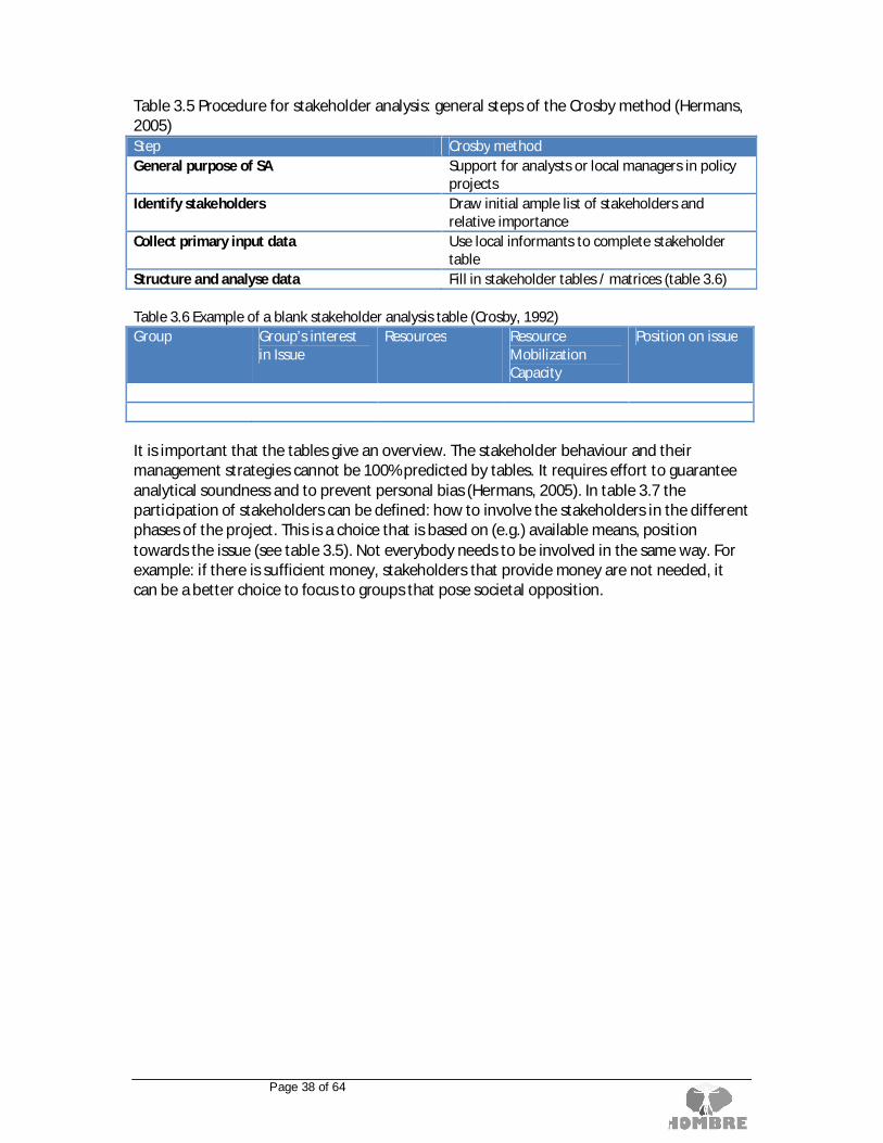
Page 38 of 64
Table 3.5 Procedure for stakeholder analysis: general steps of the Crosby method (Hermans,2005)Step Crosby methodGeneral purpose of SA Support for analysts or local managers in policy
projectsIdentify stakeholders Draw initial ample list of stakeholders and
relative importanceCollect primary input data Use local informants to complete stakeholder
tableStructure and analyse data Fill in stakeholder tables / matrices (table 3.6)
Table 3.6 Example of a blank stakeholder analysis table (Crosby, 1992)Group Group’s interest
in IssueResources Resource
MobilizationCapacity
Position on issue
It is important that the tables give an overview. The stakeholder behaviour and theirmanagement strategies cannot be 100% predicted by tables. It requires effort to guaranteeanalytical soundness and to prevent personal bias (Hermans, 2005). In table 3.7 theparticipation of stakeholders can be defined: how to involve the stakeholders in the differentphases of the project. This is a choice that is based on (e.g.) available means, positiontowards the issue (see table 3.5). Not everybody needs to be involved in the same way. Forexample: if there is sufficient money, stakeholders that provide money are not needed, itcan be a better choice to focus to groups that pose societal opposition.

Page 39 of 64
Table 3.7 Example of a blank stakeholder participation matrix (based on ODA, 1995; Mac Arthur,1997)Stage incycle
BFN step Type of participation
Inform Consult Partnership Control
Antic
ipat
ing
chan
ge
IDENTIFICATION
Plan
ning
the
tran
sitio
nan
dre
alis
atio
n
SCOPING
OPPORTUNITIES
ASSESSMENT
Man
agin
gth
ere
alis
atio
n REALISATION(not in BFN)
MONITORINGANDEVALUATION
Next to the stakeholder analysis, HOMBRE advises to keep track of the key decisions andobstacles for each phase or event within the regeneration project. (section 3.5.3).
Item: BF classification and strategies
When taking initiative of the BF regeneration, it is advised to use the ABC-classification(figure 2.2) of the Cabernet network to anticipate on the strategies the initiators can choose.Depending on criteria on land value and cost for development, all brownfield and vacantland sites are classified in a first approach by their marketability respective of theirdevelopment potential. The classes are:
A – easy marketableB – marketable with restrictionsC – not feasibly marketable due to the very high effort needed
For this assessment a tool was developed in Germany for the Saxony area (Ferber et al.,2006-I). The recommendation for a strategy (figure 3.4), following the classification, is alsoderived from this tool.

Page 40 of 64
The resulting strategy is based on the automatic and manual input of different factors (suchas former / current (interim) use, existing buildings / heritage protection, trafficinfrastructure, soil sealing, topography, contamination, ownership, land value, and so on)from a municipal portfolio-management system. Because not all sites can be returned intobeneficial use due to various social, economic and environmental criteria, the municipalitycan appoint priority sites upon which municipal action should be concentrated. The tool isbased on the general assumption that the need for the development of a site correlates withits relevance to enable effective urban planning and that the financial expenditures rise witha higher effort of mobilization (e.g for demolition, underground infrastructures orcontaminations). Six strategies can be defined based upon the factors mentioned above:1. “marketing”,2. “occupy development actively”,3. “develop actively”,4. “use intermediately”,5. “unseal/renaturate”, and6. “occupy passively”.The first two strategies are ‘self-developing’ areas, and do not necessarily need the HOMBREframework. For the latter strategies, the HOMBRE framework can give input, inspiration andguidance on how and what to do.
Figure 3.4: Basic types of strategy ABC scheme (after Ferber et al., 2006-I and II).

Page 41 of 64
3.3.2 Step OpportunitiesThe opportunities step is about finding the different opportunities on the BF (or site atstake).
Table 3.8 Planning the transition and realization - opportunitiesStep 3- OpportunitiesWhat do we want to do with the BF (or site at stake) and what are our opportunities?
Items in BFN Approach for local community involvement programAmbition and societal demandsDefining service indicatorsOpportunity plan with SWOT for the BF and its redevelopment, visionand scenarios
Including DST tool technology trainsScale Project site and regionUser Municipalities (advisor for the…)Result opportunity plan with different scenariosPoint of attention transfer moment to next step – stakeholders
The results of the scoping step are used here as input and can be added to. The mainquestion is: What do we want to achieve and what are the opportunities (and challenges)?To foster the probability of success, it is essential to involve stakeholders, in particular localcommunities, guided by a skilled BF Process Manager (Ferber et al., 2006-II). Thestakeholders will have to work together here to come to a realistic set of scenarios. Theystart with making a SWOT for the BF and its redevelopment as part of the opportunity plan.The stakeholders create a vision for the site, with (societal) ambitions. A specific HOMBREaddition is here to define criteria, to monitor if the projects ambitions will be reached. Thesecriteria can be partly the same as the early warning indicators, but also other and sitespecific. As a result, broad scenarios are set, and technology trains can be identified how toget there. The final product of the Opportunity step is an opportunity plan (box 3.1).
Box 3.1 Opportunity planThe Opportunity plan (OP) is not a technical tool, but mainly a communication tooladdressed to non-experts: citizens, stakeholders, decision makers, politicians. For thesustainable regeneration of brownfield sites and contribution to the comprehensiveregeneration of a wider area by delivering environmental protection, local economic andsocial benefits, it is necessary to develop and deliver opportunity plans. (Ferber et al., 2006-II). In the opportunity plan, the strengths and weaknesses, opportunities and threats of a siteare highlighted to a community, in order to build “places for people”. We have to rememberthat usually BFs are derelict places in which people are not happy to live in and probablyashamed of it. The OP allows to show scenarios for regeneration including, since the verybeginning of the regeneration process, needs, desires and dreams of stakeholders. For allthese reasons, the OP needs to be led by a specific professional, a BF Manager, able tofacilitate the exchanges between technicians and people, in order to match utopia withpragmatism through a sustainable BF regeneration project. The BFN is an asset in thisprocess, enabling everyone to have an immediate and veritable access to the scenarios.

Page 42 of 64
Item: Approach for local community involvement program
The convention on Access to Information, Public Participation in Decision-making and Accessto Justice in Environmental Matters, usually known as the Aarhus Convention, was signed onJune 25, 1998 in the Danish city of Aarhus. (UNECE, 1998) This means that for BFregeneration, the local community should be informed and consulted. CABERNETemphasizes this by having a position statement: “CABERNET believes that effective citizenparticipation in decision-making enhances the sustainability of brownfield regenerationprojects. However, CABERNET also comments that although there is a well-developedknowledge base relating to the inclusion of citizen participation in decision-making within BFregeneration, it is commonly undervalued or misunderstood. Much broader discussion anddissemination of tools and good practice is therefore required” (Ferber et al., 2006-II).Chanan (1999) wrote a handbook for good practice for local community involvement inschemes to develop or regenerate disadvantaged localities. The text is designed to servepolicy makers, planners and practitioners, including organisations belonging to the localcommunity itself. The content is limited to principles and lessons which apply to somedegree or another across all Member States, with some illustrations from policy statementsand research. Local practice is extremely varied, and it would be foolish to propose a singlemodel for all countries and regions.Local community inclusiveness in BF regeneration planning in early project stages is a strongdriver and guaranty for future active participation of community groups. As a result,communities are willing to claim more ownership of the project outcomes and feel moreresponsible for the land-use maintenance over its whole life cycle, thus strengthening socialcohesion. (Chanan, 1999, Figure 3.5).
Figure 3.5 Scheme/population/community sector (Chanan, 1999)
The BFN can support the involvement of the local community by visualizing the state of theBF (common problem definition), the scenarios and by keeping track if goals are beingreached by monitoring service indicators.

Page 43 of 64
Item: Vision, Ambition and societal demands
When investigating the opportunities for a BF, first a vision and ambitions should bedetermined for the BF and its surroundings. Setting ambitions for the BF regeneration,together with the stakeholders is needed to get from imagining to realizing possible futures.It is important to define together where we want to go, which objectives and societalchallenges are targeted with the regeneration. This sets boundary conditions to the possibledesigns, and supports the management of stakeholder’s expectations.The EU’s horizon2020 research and innovation programme (Com (2011) 808) defines societalchallenges to which the research and innovation should contribute. These challenges are:
A. Green citiesB. Climate change mitigation / adaptationC. Sustainable energy / Energy transitionsD. Human well-being and healthE. Sustainable food production (and resource efficiency)F. Strong and viable societiesG. Efficient use of spaceH. Accessibility and connectivity
Many of these challenges will also be addressed during regeneration of BF’s. Thesechallenges emerged through different forces, such as demographic changes, climate changeand the increasing scarcity of natural resources, along with the present economic crisis andmore specific, local forces. BF regeneration is affected by these issues but also offers avariety of possibilities to contribute to solutions for these global and regional societalchallenges by means of an effective and sustainable use of services (Figure 3.6) (After Otte etal., 2012).
Figure 3.6 Ecosystem services in the Netherlands (Otte et al., 2012).

Page 44 of 64
Obviously, in different projects on the topic of BF’s, the importance of a vision, settingobjectives and ambitions for environment, economy and society is stressed. Cabernetcomments: For BF regeneration schemes to fully realize sustainability goals, more attentionneeds to be paid to achieving social and cultural benefits (Ferber et al., 2006-II) instead ofjust cleaning up the site until regulatory boundaries and setting economical goals. In theRESCUE project, a set of sustainability objectives for BF regeneration are given (figure 3.7).
Figure 3.7 RESCUE sustainability objectives and responsible parties. Many objectives areshared by stakeholders but the principle responsible party is highlighted thus X. (Edwards etal., 2005)
To determine the vision (where do we want to go) and ambitions (to what do we want tocontribute to) the first three steps of figure 3.8 can be followed by stakeholders.

Page 45 of 64
Figure 3.8 Vision/societal challenges / ambitions /criteria (after Maring et al. 2009)
Note that the scoping step gives crucial information for the vision and ambitions. Theinformation about the site is collected, as well as the information on stakeholders and howthey can influence the path from ambition to realisation. The vision and ambitions should berealistic and the stakeholders should be able to steer towards the right direction. Anunrealistic ambition or an ambition that cannot be steered upon is useless and will causedisappointment.
Item: Defining service criteria
When stakeholders have set their objectives, it is necessary to set “criteria” as well to beable to see if these objectives for the project are reached. The criteria can be used to scorethe scenarios resulting from this opportunity step. The assessment of criteria might be doneusing expert judgement of the stakeholders involved. This comparison of the scenarioshappens in the BFN in step ´assessment’. It is important to define distinguishing and clearcriteria. It is also important to define the situation at the starting point moment, and when acriterion can be scored as positive (goal reached). Therefore it is recommended to define athreshold (figure 3.8).The defining and assessing of criteria is part of work package 2 and will be reported indeliverable 2.3 (planned 2014). At the moment of reporting deliverable 3.1, this work hasnot started yet.
Item: Scenarios and how to get there
To define different (realistic) scenarios, an interactive and creative process should bestarted. This process can be done in a charrette. “A charrette is an intensive, multi-disciplinary design workshop designed to facilitate an open discussion between stakeholdersof a regeneration project. A team of design experts meets with community groups,developers and neighbours over a period from 3-4 days to 2 weeks long” In the charrette,the vision and ambitions that are set beforehand or during the process are used.(http://www.charrettecenter.net/).

Page 46 of 64
Within the scenario design, obviously good (=feasible) ideas for a new use-phase arenecessary. Traditionally, the focus is set on solving problems that are associated withbrownfields. Economic (monetary) obstacles are seen as the dominant factor that preventthe transition towards a new use phase. A closer look at those economic (monetary)obstacles show that mismatches between the current status of a site/area and the intendeduse of a site are the main bottleneck, leading to high costs or disappointing revenues. Anoverview of potential values (either positive or negative) on site and on municipal level canhelp to choose “optimal” new use functions for sites, either brown- and greenfields.(Grotenhuis et al., 2012)
Where economic drive for ‘hard’ solutions is weak or technologies still need to bedeveloped, also alternative or interim ‘soft’ re-use of BFs is explored. Such measures arefocused on a sustainable environment, and create societal assets from the services offeredby the regenerated BFs. HOMBRE distinguishes hard and soft land usage using EU policy onsoil sealing (EC, 2012) as a context. Hard land usage is defined as re-use that predominantlycontains built or paved development. Soft land-use is where the land remains unsealed andthe soil remains in biologically productive use, for example for agriculture, habitat, forestry,amenity or landscaping. The two scenarios are not mutually exclusive and are in fact in manycases combined (Menger et al., 2013). It is important to be flexible within the planning phasefor alternative solutions (Arkel, van, 2012). Temporal “interim” land uses can add value to aplace during or after the regeneration and even before: to avoid further decline. Thistemporary use can be both soft and hard and the time span of the use can differ betweendays until years. Examples can be found on the website of the SEEDS-project. SEEDS ispromoting the short-term re-use of vacant land and buildings as a legitimate part of longer-term planning and development: http://www.seeds-project.com.
Once a, or some possible new uses and a preliminary planning are defined, the focus canshift towards the optimization of costs and benefits. BF innovative technology trains areintended to optimize this balance by increasing the production of services and goods(benefits) with decreasing costs, both during the transition and the next “use” phase as canbe seen in figure 3.9.
A distinction can therefore be made between technologies that provide goods and servicesthat are required for the regeneration itself (such as building materials, landscaping, soilphysics, and mitigation of acute environmental risks) and goods/services that are requiredfor the use of the area (such as water, energy, and mitigation of non-acute environmentalrisks). This aftercare should be appraised to make a more transparent comparison betweendifferent redevelopment scenario’s (incl. different technology (train) choices). Opportunitiescan be found through seeking synergy between, for example, technologies and spatialplanning.

Page 47 of 64
Figure 3.9: effects of technology trains within transition of land use phases (red arrows)(Grotenhuis et al., 2012)
In most cases of BF regeneration, investments are needed before the new use phasecommences. In figure 3.9 this is visualized as the temporary increase of the cost/benefitratio compared to “do nothing” represented by the horizontal dashed line. The setup oftechnology trains are chosen to facilitate land re-use and to extend the original land use inthe two following ways:
Red arrow in “regeneration phase”: reduce investments by re-using availableresources (soil and materials) and optimization of technologies (regarding time,space, and money) to improve the brownfield to a level that intended use is possible,Red arrow in “new use phase”: lower the costs/benefit ratio for the “new use phase”either by reducing costs of energy, water and resource usage, by increasing revenues(adding activities or new land uses to the area, valorisation of environmental quality,real estate potential, and –possibly- interim use), and reducing costs of theregeneration phase (pay back costs like interest). Also providing services forsurrounding area’s (as is one of the directions within WP5) is such an improvement.(Grotenhuis et al., 2012)
In HOMBRE’s WP 5 a decision support tool for the soft uses and technologies is beingdeveloped. This tool is still in development. In box 3.2, the outline of how this tool might beelaborated is described. Note that the tiered approach overlaps with the scoping –opportunities - assessment steps of the BFN.

Page 48 of 64
Box 3.2: version 1 of the proposed decision support system on soft uses and technologiesusing the operating window conceptIntroduction and overviewSoft end uses of brownfield, such as for biomass or green space, can provide services whichadd value to a regenerated site, both in their own right and integrated with hard uses suchas for buildings. The purpose of this decision support “tool” is to provide a framework andprocedure for evaluating these opportunities considering: (1) the services that can beprovided, their wider effects, and any synergies or trade-offs between them; (2) theprocesses or interventions that might deliver these services; (3) their overall value to aproject both directly and considering a wider sustainable development context. Theapproach taken is an iterative one with explicit use of stakeholder engagement. Theapproach is tiered beginning with simple steps. It uses a concept of operating windows tohelp decision makers rapidly identify the optimal use of the processes or interventionsavailable and to be aware of situations where while an application may be possible, it couldcarry higher technical risks. There are three tiers in this process, which are shown in figure3.10.
Figure 3.10: Tiered Approach to Brownfield Re-Use in the Decision Support Tool
A common feature across all three steps is stakeholder engagement. Stakeholderengagement is widely seen as critical for improving the value, acceptability and speed fimplementation of regeneration projects. However, the process of stakeholder identificationand engagement has to be carefully managed so that the right people are involved at theright time to avoid unnecessary or wasted work and to avoid disincentivising those peopleon whom a project’s value depends. The engagement process proposed here is combinesthe Dutch ecodynamic design approach with the charrette workshop process of design anddevelopment, both of which have been widely used. A stakeholder engagement plan needsto be in place before the commencement of Tier 1.
Tier 1 Opportunity MatrixFor a regeneration project to occur it is promoted by someone / an organisation, who willhave a vision of what they would like to achieve. This vision may be fairly specific with arange of re-uses already envisaged. However, in some cases the promoter for regenerationwork may not have a clear idea of what could be done, for example, it may be a localauthority motivated by a need to improve a brownfield that has yet to begin a designprocess.
Tier 1: Defining the Playfield (stakeholders& opportunities)
Tier 2: Optimisation and feasibility
Tier 3: Detailed design of optimisedapproach
D5.2
NOT SCOPE OF D5.2

Page 49 of 64
Another possibility may be that an area is seen as being at risk of becoming a brownfieldsite, for example as a result of early indicator monitoring, and this has triggered a desire toexplore re-use options that have a more robust long term use. A final possibility is that apromoter is considering an interim use for a site, pending a change in conditions or a longerterm re-use, for example, a soft re-use might maintain a site suitable for housingdevelopment during an economic down-turn. These possibilities are not mutually exclusiveand a range of opinions about a site might exist. The opportunity matrix is a simple tool thatallows stakeholders together to examine the pros and cons of different interventions for softend uses for a site: the services they provide, their possible inter-connections with hard enduses, and how multiple uses / services might be combined.Figure 3.11 illustrates the general features of the Opportunity Matrix. It lists a range ofexample interventions for a site (for example cultivation for willow coppice biomass) andmatches them against a range of possible services (for example revenue generation,biodiversity improvement). Linked to each cell of the matrix are links or references to casestudies These are intended to illustrate practicality and feasibility to the stakeholdersgathered during the design charrette process. The aim at Tier 1 is simply to imagine therange of possibilities and develop some favoured combinations of interventions andprocesses that can be taken forward for more detailed evaluation in subsequent phases.
Figure 3.11 General Features of the Opportunity Matrix
Tier 2 Investigating Synergies, Trade-Offs, Sustainability and overall valueTier 1 will have identified a range of ways in which a brownfield might be regenerated andthe services that this would provide, perhaps as several different visions of what might bepossible for a site. Tier 2 makes use of several HOMBRE tools for benchmarking these visionsagainst overall sustainability to optimise service delivery and value, and provide a viableoption for detailed design. During Tier 2 it is possible that some alternatives will be found tobe unviable and therefore will be discarded, whereas wider sustainability assessment mayidentify hitherto unappreciated service opportunities.
SERVICE
INTERVENTION
Intervention/process strongly contributes in delivering this service
Intervention/process is detrimental fordelivering this service
Intervention/process doesnot influence service
Intervention/process indirectly contributesin delivering this service
Intervention/process indirectly attenuatesdelivery of this service
Examples……
Examples
…

Page 50 of 64
Tier 3 Detailed designDetailed design is outside the scope of the D5.2 decision support framework. However, amatrix of available tools has been provided, including operating windows, that supportdetailed design and implementation, for example biomass deployment, selection of lowimpact (gentle) remediation alternatives.
(Unpublished, will be included in HOMBRE’s deliverable 5.2)
The extensive elaboration and implementation of the tools from work package 4 and 5 forthe BFN is not finished yet. Future work done for deliverables 4.3 (Description of operatingwindows for successful implementation of the technology trains for uptake in work package2 and 3 (due by May 2014)) and 5.2 (decision support for soft end-use implementation,based on operating windows (due by March 2014)) will give input for the opportunity step inthe BFN.
3.3.3 Step AssessmentThe Assessment step assesses the different scenarios resulting from the preceding steps (Scoping,Opportunities) and details the plans.
Table 3.9 Planning the transition and realization - assessmentStep 4- AssessmentWhich scenario is most favourable and feasible? And how to get there?Items in BFN: Evaluation service criteria, regulation test, CBA / financial viability
Choice of final scenarios and how to get thereScale Project site (and region)User Municipalities (advisor for the…)Result redevelopment plan (Final scenario ->to realisation)Point of attention transfer moment to next step – stakeholders
Note: mostly tools that should be used by experts: contractor, landscapearchitect, etc.
The main question is: Which scenario is feasible (based on cost-benefits, and regulation) and mostfavourable (based on the set service indicators)? And how to get there? The role of experts becomesmore important in this step. As a result, the final scenario is detailed in a working plan and ready forrealization. HOMBRE does not cover the production of working plans and the actual realization. Thenext step HOMBRE covers, is the evaluation and monitoring during the management of therealization phase (section 3.4).
Item: Test against service indicator criteria
The criteria (as set in step opportunities) can be used to score the scenarios as described inthe opportunity plan. The assessment of criteria can be done using expert judgement of thestakeholders involved. Because the situation at the starting point is known, as well as thedesired situation, the scoring for each criterion can be done using three values: positive(better than threshold), neutral (same as threshold) and negative (below threshold). Thisresults in a composite overview of criteria. Because the user was asked to prioritizeambitions, it is possible to use this overview in the further decision making for a final plan.Figure 3.12 gives an impression of the result of service criteria test.

Page 51 of 64
Scenario 1 Scenario 1
Omgevingswijzer.org is a widely used Dutch method to assess sustainability for large soil,water and infrastructure construction projects. The pieces of the pie represent differentthemes (soil, water, spatial quality, social relevance etc) and in each piece of the pie,multiple aspects can be scored within this theme if it is scored positive neutral negative.Figure 3.12 probable impression of the result of service criteria test
This will be further elaborated in work package 2, deliverable 2.3. The work has not startedyet.
Item: External regulation testing
(Local, regional and EU) regulation can offer potential project incentives and projectstoppers. It is important to check regulation for the scenarios that result from a creativeprocess. This is done 1) to find potential project stoppers that have to be solved (discusswith (local) authorities, etc.) and 2) finding incentives, these can also be linked to fundingopportunities.For this item a set of EU-directives, EU-reports and international publications were reviewedon the topic of brownfields and related environmental aspects. In appendix F, a list ofpublications is taken up that have been scanned for objectives, regulations and observations.The objective was to identify opportunities and challenges for brownfield regenerationprocesses, resulting from the EU perspective. National and regional policies andinterpretations of these EU policies are not included in this activity. Note that this list is aresult from a short desk study and not a complete overview of all to BFs related EUregulations.The desk study resulted in a table with 3 categories: environmental sustainability, economicfeasibility and social participation. Each category has multiple themes in which the relevantquotes from the documents (objectives, regulations and observations) are clustered. Aftereach quote is a reference included to where the quote has been found. At the most rightcolumn a short remark is made about how this quote may potentially influence brownfieldregeneration. The table can be found in appendix E.

Page 52 of 64
Item: Cost benefit analysis/ financial viability
Cost benefit analysis is a form of economic analysis in which costs and benefits areconverted into monetary values for comparison (known as “private costs”). Cost benefitanalysis considers a diverse range of impacts (known as “public costs”) that may differ fromone proposed solution to another, such as the effect on human health, the environment, theland use, and issues of stakeholder concern and acceptability by assigning values to eachimpact in common units. Deciding which impacts to include or exclude from the assessmentis likely to vary on a site-by-site basis. (Bardos et al., 2011). There are different methods forCBA and the tools for CBA differ per member state. It is however an important part of thedecision making in BF regeneration. Therefore a specialist should perform a sound CBA withthe subscribed or (by stakeholders) accepted CBA tools for the different scenarios that weredeveloped for the BF. Understanding overall value and making a convincing proposition ofvalue to Private and Public Sector stakeholders, funders and investors is the key to thesuccessful delivery of the HOMBRE concept. For more information on cost benefit analysiswe refer to the EU guide to cost benefit analysis of investment projects (Florio et al., 2008).HOMBRE deliverable 5.1 reviews tools that have been or could be used to examine value,costs and benefits from regeneration (Menger et al., 2013). Here also wider benefits thanmonetary value alone are taken into account.
Item: Choice of final scenarios and how to get there
When all information is gathered, scenarios are formed and investigated, the stakeholderscan make a final choice and give assignments to different experts (architects, projectdevelopers, landscapers, urban planners, environmentalists) to make a detailed finalworking plan. Making detailed plans for the realization of the final plan is beyond the scopeof HOMBRE. However, some points of attention here (not exhaustive) are to:
involve the long-term (maintenance and management phase and even ending of theuse)stay flexible within the plankeep the information available for the different partieskeep guard over the set objectivesinform and involve stakeholders (including local community) if plans are changedlook at possibilities for smart contracting to stay within time, money and projectobjectives

Page 53 of 64
3.4 Module Managing the realisationThe actual realization of the project is not within the HOMBE scope. However, part ofmanaging the realisation is guarding if the projects objectives are met in in what extent.Indicators can be set and monitored for this purpose. At the certain moment, this phase(module) continues into the anticipating change phase (module).
3.4.1 Step Evaluation and monitoringThe evaluation and monitoring step is about setting targets and defining indicators for theproject and to monitor them. Furthermore it is very important that monitoring is focused onlearning or adaptation. Therefore it is also important to anticipate what possible actions willbe taken if a certain level of the indicator is reached. This to prevent a stalemate after themonitoring starts.
Table 3.10 Managing the realization - assessmentStep 5- Evaluation and monitoring(in which extent) Did we reach our goals after realisation?Items in BFN: Defining sustainability indicators for monitoring
Monitoring and evaluation of sustainability indicators (was the projectsuccessful)
Role of the BFN Project evaluation through timeSupport expectation managementDocumentation
Scale Site (and region)
User Municipalities (advisor for the…)Result Indicators and evaluation resultsPoint of attention transfer moment to next step – stakeholders
Important aspects mentioned in HOMBRE for the successful regeneration of a brownfieldare financial viability, conformity with planning objectives and broader “sustainabilityindicators” (environmental risk, water supply and water management options, reuse ofenergy materials, reuse of soil, building materials, water, social aspects, landscape issuesetc.). For each project, the stakeholders are advised (how) to set up indicators and tomonitor them. This is elaborated in Hombres work package 2 (deliverable 2.2. Ellen et al.,2013-II).
Item: Selecting and constructing sustainability indicators
The selection and construction of sustainability indicators can be done following a few steps(figure 3.13)

Page 54 of 64
Figure 3.13 Selecting and constructing service criteria
In the first step, the objectives for the project on a longer time span are reviewed by thestakeholders. The central question is: what do we want to achieve with the regeneration interms of wellbeing, environment and prosperity.Note that some of the set ambitions and criteria from the opportunity step can be usedhere. However: if the ambitions (and criteria) are linked to a direct project result (such as‘building 2000 houses’), this is a good criterion, but not a useful indicator to monitor,because it will not change during and after the realisation. Employment rate is a goodindicator, because it says more about the projects impact and it will change in time.The second step is to define a SMART2 indicator. The data to measure the indicator shouldalso be obtainable without too much effort and/or costs, which is of course relative inrelation to the costs of the project.The third and fourth steps are to determine the “current” situation to be able to monitorchange. This t0 should be recorded and is normally the situation before the actual realizationstarts (BF stage). Also a target (consisting of a threshold value) should be determined. Whenis the goal reached? In many cases this will be an average of a comparable area, or a nationalaverage. Be sure this value is attainable (the A from SMART.)
2 specific, measurable, attainable, relevant and time-bound

Page 55 of 64
Item: Monitoring indicators
The aim of the monitoring of the service indicators is to certify on an ex post basis if the(sustainability) goals set for the project by its stakeholders are actually met, and if theproject was successful in delivering the required ‘services’. (Ellen et al, draft 2013-II)When it comes to monitoring we can identify three main stages within the monitoringprocess: (1) monitoring design, (2) collection of data; (3) use of results. (Ellen et al, 2013-II)
3.5 Supporting itemsThe role of supporting items described in this chapter support the decision making and thedifferent aspects of the decision support framework. In the BFN, they are available in allmodules and steps.
3.5.1 GIS and annotation functionalityVisualisation of information supports the main objective for WP 3: to provide betterplanning and more attractive communication technology for BF regeneration andstakeholder involvement.
The map utility of the BFN contains Basic map functionality like navigate, zoom and find alocation. For sketching on the map, the user can use free hand drawing, polygon, paths andpoints. They can be deleted and moved. If the user wants to take note or add text there is anoption for adding post-it with an icon. The user can save his/her sketch and load previoussketches. The user can also add own layers of data. By accessing the file manager andselecting the file. If the file has time data there is option to use this with the time slider. It isalso possible to arrange data layers. Data layers can be higher of lower in the stack, set intransparency or be turned off and on. Box 3.3 gives more information on the formats andprojection of the data layers.
Box 3.3 data types, projection for maps in the BFNThe accepted data types that can be added by the file manager are the following formats:kml, json and shape file. The admissible projection (coordinate system) is Web Mercator(Auxiliary Sphere) (EPSG:3857). Various GIS application are capable of converting databetween various formats and projections. The shape file and json formats do not supportstorage of symbols. The possible mark-up that accompanies the shape file in a GIS viewer islost in another viewer. Kml format supports screen overlays. Screen overlays are anchoredrelative to the screen and are added in the kml code. Screen overlay data is supported withinthe brownfield navigator, making it possible add a legend, logo, banner, or other image tothe project.

Page 56 of 64
3.5.2 Example database and Reference libraryThe example library for the BFN will be included in the tool to provide users withinspirational examples of brownfield regeneration and land use (figure 3.14). A format(appendix F) with three levels of examples is developed:
1. Brownfield redevelopment case studies;2. (New) land use examples;3. Societal ambitions contributed to by services, generated from brownfield
redevelopment / land use.For the classification of land uses, the land uses classes from the UK National land usedatabase version 4.4 were used. (Harrison, 2006). For the (ecosystem) services theclassification of the Millennium Assessment was used (MA, 2005). For the societal ambitions,the challenges as described in the research and innovation programme Horizon2020 wereused (COM (2011) 808).
Figure 3.14 Structure of the example library.
3.5.3 Rounds modelTo register and know which decisions and “boundary judgements3” will and have beenmade, it is important to look at the decision making process. The decision making processcan be reconstructed with a “rounds model” (Teisman, 2000). With such a model, eachround represents a specific time or event. This model gives a good overview of the historicalplayfield and insight in the involved parties, the main decisions and their character, andpotential boundary conditions (example figure 3.15). The stakeholders, their participationand the key information for each round can be updated in this rounds model (appendix A-2).
3 Boundary judgements are those decisions that demarcate the project (Teisman et al, 2009)

Page 57 of 64
Figure 3.15 decision-making process Terni Papigno (Arkel, van, 2012)
3.5.4 “Project administration”In the overall items, a note path is available to add all information needed. Each different BFregeneration project can be stored by a user in “My BFN” a directory with a common folderstructure where: results, scenarios, maps, decisions etc. can be stored
3.6 Technical information of the BFNAs mentioned, the Brownfield navigator is at this moment only available as an online tool,developed using only open source tools and software. It is written in PHP, a programminglanguage for web development but also used as a general-purpose programming language.The project runs on an Apache HTTP Server, commonly referred to as Apache, a web serverknown for playing a key role in the initial growth of the Internet.For the map function is OpenLayers used. OpenLayers is an open source JavaScript library fordisplaying map data in web browsers. It provides a strong basis for the geographic elementsof the BFN similar to Google Maps and Bing Maps. For the visual elements of the geographicelements the BFN uses OpenStreetMap. This is a collaborative project to create a freeeditable map of the world. These open source tools are combined as building blocks for theBrownfield Navigator.

Page 58 of 64
4 Wrap upThis report describes the decision support framework for successful brownfield regenerationthat is used for the Brownfield Navigator. As the reader may conclude, it is still work inprogress. Underneath the main points of attention and the planned activities are described.In the framework, lot of bits and pieces gathered from literature, workshops, experiences,HOMBRE and other research were used. These were used to give an overview of the landcycle phases – related to management activities that belong to these phases (what to do,which decisions to make).The objective of this decision support framework is not to make decisions, but to supportthem who have to make decisions, with visualization, information and tools. The objective ofthe BFN is not to replace the BF manager, but to give insight in management phases,decisions and to stimulate the use of the (HOMBRE) highlights that research on BFregeneration has provided and that can add to the business as usual.At the moment of writing, we can mention some of the highlights in HOMBRE:
1. Technology trains and project services, helping us to explore and realizeopportunities
2. Project criteria: setting ambition, monitoring, assessing if goals are reached.3. Evaluation and monitoring indicators4. Early Warning Indicators5. A storyline that helps us to close the land cycle6. Development of a Brownfield Navigator that can be used to imagine futures
together with stakeholders (visualisation, gathering material, examples,references) and that can be elaborated further due to its modular set up.
In the deliverable, we coupled the storyline to the Brownfield Navigator (highlights 5 & 6)and concepts from WP 2/4/5 (highlights 1, 2 ,3 ,4). And we put this in a modular decisionstructure.Some points of attention:
The workflow in the BFN is not coherent yet. The BFN provides information but thetransfer from one management phase to the other, from step to step and from itemto item should be made by the users. Attention should be paid to bridge the gapbetween the different items in each step (especially in the opportunity step).The transition from the outcome of the EWI tool (i.e. an area in which BF may occur)and the beginning of the planning the transition (which is at site scale) has not beenelaborated. There is a gap between management phases “anticipating change” and“planning the transition and realisation”, The BFN does not provide guidance on howto choose one site rather than another within an area at risk.The emphasis in most items is on the environmental, rather than on the social andeconomic aspects. Eg, the description for a conceptual site model and riskassessment is derived from environmental literature. Elaboration towards broader,BF related aspects, social / economic dimension(including wider benefits), yet has tobe done in the HOMBRE project.The emphasis and elaboration of items differ widely per step/item. Somemethodologies and tools are likely to be well elaborated (e.g. the proposed

Page 59 of 64
methodology on brownfield emergence EWI tool) before the end of the project whileothers are yet to be developed (e.g. the link with the technology trains). As describedin chapter three, some items will be elaborated in the final year. Other items willremain confined to a short instruction or a link to more information outside the BN.When feasible, recommendations for further elaboration will be given.For some items, the rationale should be tested. This will be done in some cases inWP4, 5 and 6, (testing the decision support tool and opportunity matrix the technicalwork packages 4 and 5) but in other cases this may not be possible within thetimeframe of the project (e.g. testing early warning indicators to predict BFemergence.)
In the final year of the HOMBRE project (Dec 2013-Nov 2014), more attention will be paid tothe HOMBRE framework and how the different HOMBRE aspects (work packages) connect.This can have an influence on the content and arrangement of HOMBRE items.Also, 2014 comprises the testing of the BFN. In task 3.3 (parts of) the BFN are tested. Thistesting will be used to improve the software and it will be used to improve or furtherelaborate the BFN content (items) as well as the decision support framework as a whole.During the testing the final recommendations for the BFN are formulated. The results will bedescribed in deliverable 3.3.The BFN will remain work in progress even after the HOMBRE project. The use experiencesand the desires from the user form the next versions. Due to the modular set up for the BFN,it is possible to add to and improve the tool.

Page 60 of 64
5 ReferencesAlphenaar Arne, Nauta Charlotte (2011). Upside down, sustainable redevelopment of
contaminated industrial areas / brownfields (Ondersteboven, duurzame herinrichtingvan verontreinigde bedrijfsterreinen). The Netherlands (In Dutch)
Arkel, Levina van. (2012) Adaptive brownfield management. Analysis of the way actors dealwith complexity and how this affects the governance capacity of the complexgovernance network. Master thesis public administration; governance andmanagement of complex systems. Erasmus University Rotterdam, The Netherlands
Bardos, R.P., Laurent M.M. Bakker, Hans L.A. Slenders, and C. Paul Nathanail Sustainabilityand Remediation (2011). Chapter 20 in Swartjes F.A. (ed.) (2011) Dealing withContaminated Sites, DOI 10.1007/978-90-481-9757-6_20, C _ SpringerScience+Business Media B.V.
Coffin, S.L., (2003). Closing the Brownfield Information Gap: Some Practical Methods forIdentifying Brownfields. Environmental Practice, Volume 1, Issue 1 pp 34-39.
COM (2011) 808 final Horizon 2020: the framework Programme for research and innovation.Edited by European Commission. Communication from the Commission to theEuropean Parliament, the Counsel, the European Economic and Social Committee,and the Committee of the Regions. Brussels.
COM (2011) 571 final Roadmap to a Resource Efficient Europe. Communication from theCommission to the European Parliament, the Counsel, the European Economic andSocial Committee, and the Committee of the Regions. Brussels.
Chanan, Gabriel (1999) Local Community Involvement A Handbook for Good PracticeEUROPEAN FOUNDATION for the Improvement of Living and Working Conditions.Dublin, Ireland.http://www.eurofound.europa.eu/pubdocs/1998/73/en/1/ef9873en.pdf
Crosby, Benjamin L. (1992). Stakeholder Analysis: A Vital Tool for Strategic Managers.Technical Notes Implementing Policy Change Project. No. 2 March 1992. USAID.(internet-version March 28, 2003) http://pdf.usaid.gov/pdf_docs/pnabr482.pdf
Davis, Todd S. (editor) (2002) Brownfields, a comprehensive guide to redevelopingcontaminated property. Second edition. American Bar association, USA
Dyment, Stephen, Michael Adam, (2011) Environmental Cleanup Best ManagementPractices: Effective Use of the Project Life Cycle Conceptual Site Model. EPA, USAhttp://clu-in.org/download/techdrct/csm-life-cycle-fact-sheet-final.pdf
EC (2012) Guidelines on best practice to limit, mitigate or compensate soil sealing,Commission Staff Working Document, Brussels, 12.4.2012, SWD(2012) 101 final.http://ec.europa.eu/environment/soil/pdf/soil_sealing_guidelines_en.pdf
Edwards, David, Gernot Pahlen, Catherine Bertram, Paul Nathanail (2005) The RESCUEmanual. Best Practice Guidance for Sustainable Brownfield Regeneration,
Ellen GeraldJan, Pauline van Gaans, Maaike van Aalst, Annemieke Marsman, Janneke Klein,Pierre Menger, Corinne Merly, Uwe Ferber, Paul Bardos, Yu-Ting Tang, Paul Nathanail(2013-I) D 2.1: Early Indicators for Brownfield origination
Ellen, GeraldJan, Maaike Blauw; Remco van Ek, Pauline van Gaans, Janneke Klein, LindaMaring, Annemieke Marsman, Levinia van Arkel, Paul Nathanail, YuTing Tang, UweFerber, Elsa Limasset, Paul Bardos, Pierre Menger, Wojciech Irminski, Martijn Smit,Renato Baciocchi, Katja Wendler, Maria Soledad Martin Castellote; Rocio BarrosGarcia, Grzegorz Malina (2013-II) D 2.2: Cost effective monitoring within the CircularLand Management Framework

Page 61 of 64
Ferguson, Colin, Dominique Darmendrail, Karin Freier, Bjorn Kaare Jensen, John Jensen,Harald Kasamas, Arantzazu Urzelai, Joop Vegter (1998). Risk Assessment forContaminated Sites in Europe. LQM, Nottingham, UK.http://www.commonforum.eu/Documents/DOC/Caracas/caracas_publ1.pdf
Ferber, U., Dieke, M., Rogge, P., Scherer, V. & T. Preuß (2006-I): Flächenmanagement undBodenentsiegelung in Ober-, Mittel- und Unterzentren des Freistaates Sachsen(Beispielgebiete). Pilotkommunen: Chemnitz, Freiberg, Brand-Erbisdorf.
Ferber, U, Grimski, D, Millar K., Nathanail, P. (2006-II). Sustainable Brownfield Regeneration:CABERNET (The Concerted Action on Brownfield and Economic RegenerationNetwork) Network Report (http://www.cabernet.org.uk)
Ferber, U (2010) BRING UP-project: Brownfield Integrated Governance: Baseline StudyDevelopment phasehttp://urbact.eu/fileadmin/Projects/Bring_up/outputs_media/BRING-Baselinestudy_final.pdf
Florio, Massimo, Silvia Maffii, Giles Atkinson, Ginés De Rus, David Evans, Marco Ponti, MarioGenco, Riccardo Parolin, Silvia Vignetti, Julien Bollati, Maurizia Giglio, Giovanni Panza,Davide Sartori (2008) Guide to COST-BENEFIT ANALYSIS of investment projects,EUROPEAN COMMISSIONhttp://ec.europa.eu/regional_policy/sources/docgener/guides/cost/guide2008_en.pdf
Grimble, R. and Wellard, K. (1997). Stakeholder Methodologies in Natural ResourceManagement: a Review of Principles, Contexts, Experiences and Opportunities.Agricultural Systems, Vol.55 (2): 173-193.
Grimble, Robin and Chan, Man-Kwun (1995). Stakeholder analysis for natural resourcemanagement in developing countries. Some practical guidelines for makingmanagement more participatory and effective. Natural Resources Forum, Vol.19 (2),pp.113-124.
Harrison, Andrew R (2006) National land use database version 4.4. landinform Ltd, for theoffice of the deputy prime minister, London UK
Grotenhuis, Tim, Renato Baciocchi, Niels Hartog, Wojciech Irminski, Greg Malina, PierreMenger, Martijn Smit, Niuvis Napoles Torres. (2012) Hombre D 4.1: In Depth Analysisand Feasibility of the Technology Trains
Hermans, L.M. (2005) Actor analysis for water resources management. Putting the promiseinto practice. Phd thesis, Eburon Publishers, Delft, The Netherlands
Keijzer, Thomas, Charles Pijls, Niels Hartog (2010 ) Handreiking voor het opstellen van eenconceptueel model. Tauw, Deventer, The Netherlands
MA (2005). Millennium Ecosystem Assessment. Ecosystems and Human Well-being:Synthesis. Island Press, Washington, DC
MacArthur, John (1997). Stakeholder analysis in project planning: origins, applications andrefinements of the method. Project Appraisal, Vol.12(4): December 1997, pp.251-265.
Maring, Linda, Suzanne van der Meulen, Edwin Snippen (2013) Hombre D 3.2: Software andprocedure of the Brownfield Navigator.
Maring, Linda, Mike Duijn, Mariëlle van Vliet, Jos Verheul, Josée Woertman, Dick Rumpff,Frency Huisman, Geiske Bouma. (2009) SPRONG: Stakeholder Participatie bij deOntwikkeling van Gebiedsgerichte bodemambities In DUTCH. The Netherlands
Menger, Pierre, Paul Bardos, Uwe Ferber, Francesca Neonato, Linda Maring, Victor Beumer,Thomas Track, Katja Wendler. (2013) Hombre D 5.1: Valuation approach for services

Page 62 of 64
from regeneration of Brownfields for soft re-use on a permanent or interim basis.Creating opportunities from synergies between environmental, economic and socialimprovements.
Nathanail, C. P. (2013) Engineering geology of sustainable risk-based contaminated landmanagement. In: Quarterly Journal of Engineering Geology and Hydrogeology 2013,v.46; p6-29
NICOLE Brownfields Working Group (2011). Environmental Liability Transfer for BrownfieldDivestment in Europe,
ODA (1995). Guidance note on how to do stakeholder analysis of aid projects andprogrammes. British Overseas Development Administration, Social DevelopmentDepartment.
Otte, Piet F., Linda Maring, Margot de Cleen, Sandra Boekhold, Transition in soil policy andassociated knowledge development. In: Current Opinion in EnvironmentalSustainability. Elsevier 2012.
Preuß, T. and Ferber, U. (2006). Circular Flow Land Use Management: New Strategic,Planning and Instrumental Approaches for Mobilisation of Brownfields, Berlin(German Institute of Urban Affairs, Occasional Paper).
Tang, Yu-Ting, C. Paul Nathanail (2012). Sticks and Stones: The Impact of the Definitions ofBrownfield in Policies on Socio-Economic Sustainability. Sustainability 4(5), p840-862.
Thomas Preuß and Uwe Ferber (2006). Circular Flow Land Use Management: New Strategic,Planning and Instrumental Approaches for Mobilisation of Brownfields, DeutschesInstitut für Urbanistik
Research Group “Fläche im Kreis. (2005) BBR (Bundesamt für Bauwesen und Raumordnung)(ed.), ExWoSt-Informationen 25/2, Bonn.
Rice, E. (editor) (not dated). REUSE Creating community-based brownfield redevelopmentstrategies. American Planning Association (APA) Planning and Community HealthResearch Center.
Teisman, G.R. (2000) Models for research into decision-making processes: on phases,streams and decision-making rounds. Public administration review
Teisman, Geert, Arwin van Buuren, Lasse Gerrits (editors). (2009)Managing complexgovernance systems. Dynamics, self-organization and coevolution in publicinvestments. Routledge, New York, USA / Londen, UK
UNECE (1998) Aarhus Convention: Convention on Access to Information, Public Participationin Decision-making and Access to Justice in Environmental Mattershttp://ec.europa.eu/environment/aarhus/
Varvasovszky, Zsuzsa and Burgha, Ruairi (2000). How to do (or not to do)…A stakeholderanalysis. Health Policy and Planning, Vol.15 (3), pp.338-345.
WebsitesBritish National Land Use Database http://www.nlud.org.uk/Brownfield revitalization-Saxony www.brachflächenrevitalisierung-sachsen.deCharrette center: www.charrettecenter.netCzech database on BF’s http://www.brownfieldy.org/brownfields-list/Ecoshape / Building with Nature http://www.ecoshape.nl/en_GB/wiki-guideline.html/guideline/162-EDD+-+Introduction+-+Five+StepsERDF project CircUse: Circular Land Management www.circuse.euMunicipality of Utrecht: urban Agriculture Maphttp://objectdesk.gemgids.nl/Publication/Site/272)

Page 63 of 64
Omgevingswijzer: www.omgevingswijzer.org Dutch method to assess sustainabilityfor large soil, water and infrastructure construction projects.SEEDS project: http://www.seeds-project.com Research project on interim usesWelcome (2004) Integrated Management Strategy EU FP5 project Welcome, EESD,EVK1-CT-2001-00103) http://publicwiki.deltares.nl/display/imsw/

Page 64 of 64
AppendicesAppendix A-1 Key decisionsAppendix A-2 format rounds modelAppendix B different steps in (re)development, regeneration research projectsAppendix C Early Indicators for Brownfield originationAppendix D EWI toolAppendix E EU regulations and policies related to Brownfield ManagementAppendix F Formats developed for the BFN example library

Appendix A Stakeholders, decisions, obstacles and information per phaseThis appendix gives an overview of stakeholders, their key obstacles and decisions they canencounter and the required information for each management phase. These tables were filled induring a workshop in 2012 by the HOMBRE project partners (milestone 2.1). They were not based ona real case and therefore, a stakeholder analysis was not performed , nor are these tables complete.The most common stakeholders and their responsibilities, key decisions, obstacles and informationwere gathered by the HOMBRE project partners. For each specific situation we advice the user toadd their case-specific information.
Anticipating change
StakeholdersStakeholders Roles Responsibilities Objectives
authorities MunicipalityLandmanagement,monitoring
Plan, regulate andrealise “greatplaces”
regional authoritiesnational authorities Set up policy
owners/users
land owner Keep their land inuse; or get theirland back into useAvoiding orcontrolling loss
currentusers/beneficiaries
projectexecutioners
potential investors Development ofnew land use
Locate potentiallocations at anearly stage
project developer Set up newprojects
urban/landscapearchitectcontractor Maintain and
refurbishpotentiallyimpacted
local residentsindividually
Generate wealth Pay taxes Be happy
local/regionalcommunity
Think locally, vote& active
Be happy
ObstaclesKey obstaclesReluctance of land owners in taking action and/or being open about conditionsLack of awareness / knowledge that a site is becoming underused: e.g. who will monitor earlywarning indicators (EWI) and who pays? (partly due to short election cycles)Tax: developers of brownfield properties generally pay higher property taxes than developers ofgreenfield sites.Fear of change: e.g. neighbourhood, community, municipality, water boards.

Weak communication towards the community, financial investors (banks)Lack of interest, thus no urge to anticipate on cessation of useLack of resources, due to missing urgeNo clear lead-responsible or not wanting to take responsibility therefore postponing the situationLiability of municipality, land ownerLack of consensus between the main stakeholdersOnly part of the stakeholders are involved (not-involved) stakeholders can become show stoppers
DecisionsKey decisions to be madeIs there a problem? This needs to be decided sooner (before the site has become a BF).Who benefits from "early anticipation"?Who needs to take the lead decide on ownershipMobilize land owners what/where/how/whenWhich stakeholders need to be involvedHow to avoid that the site becomes a BF?Decide what next?
InformationInformation requiredInventory of issues and problemsWho are the stakeholders?Select and monitor the right EWIMonitoring options and accompanying costs(What is the) value (baseline) of action ( €)
HOMBREHOMBRE solutionsEarly warning indicatorsTool to select relevant early warning indicatorsTool to assess trends of potential BF formation

Planning the transition and realisation
StakeholdersStakeholders Roles Responsibilities Objectives
authorities
municipality
Landmanagement,spatial planning
social stability-wellbeing, planand regulategreat places
- Meetregulations
- Economy- Win re-election
regional authorities
national authorities
Yes, sometimes (ifspatial planning ison national levele.g. nationalpolicy on urbanproblem areas)
owners/users
land owner
- avoiding costs- avoiding liability- making money
future users
- avoiding costs- avoiding liability- making money- happiness
currentusers/beneficiaries
Not loosing whatyou have
projectexecutioners
potential investors Corporate socialresponsibilityLong-term Euro
1policy,2making moneyproject developer
urban/landscapearchitect Help client EURO minus
liabilitycontractor Help client
potentiallyimpacted
local residentsindividually
Depends on whatwill be realized(e.g. housing,industry, soft re-use) Depends
Better livingconditions, €(house price etc.)
local/regionalcommunity
Safe, attractivenew use
action groups
Represent specificinterests
Safeguardsustainableredevelopment
ObstaclesKey ObstaclesLacking catalogues of vacant landLack of consensus between stakeholders, due to conflicting interestsLiabilitiesCommunity as project-killers, when not taken on board in the development processNegative value in books (=can also be an incentive to do something)Unsupportive tax and other policy

Fragmented land ownershipFragmented visualization of perspectives of the problemLack of imagining possible end-situations (due to scale and complexity)
DecisionsKey decisions to be made (and by whom)Decide if it is a BF and what for type of BF (A, B, C)If not decided in Step 1, who takes the lead? Point of attention: possible fear of being first(responsibility) / risk adverse. Appoint a BF manager.Acceptance of leadDetermine vision and ambitionsAllocating risks and benefits (=transition)Select options (=transition)Decide and act on what are we going to do next?Give permissions (land owner, municipality)
InformationInformation requiredSite info: ecological value, natural resources, history of site (former decisions and plans made,monitoring/data of the site), contamination etcStakeholder s analysis (including roles, responsibilities, objectives)Site potential (chances, synergies) and obstacles
HOMBREHOMBRE solutionsInterim use encourage flexibilityFormulating technology trainsIdentifying synergiesIdentifying ABC sitesGive inspiration/examplesQuick scan on site building materialsDefining service criteria
Managing the realization
StakeholdersStakeholders Roles Responsibilities objectives
authorities municipality
Monitoring thesuccess,policy compliance,positive boundaryconditions
policycompliancelocal wellbeing
regional authoritiesAvoid nuisanceAvoid future liabilities
national authorities
owners/users land ownerManage and maintainthe realisation Money
currentusers/benificiaries
Maintainpropertycorrectly
Benefit fromland usefunction
projectexecutioners potential investors Invest Invest
Earn moneyRealise asuccessfulproject
project developer Execute developmenturban/landscapearchitect
contractorRealize and
maintainComplete in time andat cost
potentiallyimpacted
local residentsindividually Benefit from
land usefunction
local/regionalcommunity
ObstaclesKey obstaclesLimited time horizon for authorities and project developers don't foresee future costs (e.g.maintenance)Lack of interface between realization and maintenanceLack of interest in long term design conditionsLack of policy support for innovationMortgaging the futureNuisance during realization
DecisionsKey decisions neededTypes of contract (DBMO: Design, build, maintain and operate contracts, PFI: private financeinitiative )What will be the value after realization?Risk and benefit allocation during developmentsAccessibility of the siteMitigating measures nuisances on short and long term / Compensation (who, when, how much)Taking into account “Resource efficiency”

InformationInformation requiredMonitoring set indicators (did the project reach its objectives)Monitoring “sustainability “Monitoring "value" creationEcosystem responseArchive decisions made, monitoring results etc
Overview BFNStep 5- Evaluation and monitoring(in which extent) Did we reach our goals after realisation?Items in BFN: Defining sustainability indicators for monitoring
Monitoring and evaluation of sustainability indicators (was the projectsuccessful)
Scale Site (and region)
User Municipalities (advisor for the…)Result Indicators and evaluation resultsPoint of attention transfer moment to next step – stakeholders

Appendix A-2 Stakeholder analysis and rounds modelFor each "round" the stakeholders, the main decisions, obstacles etc can be given Each round represents a specific time or event.Make a new sheet for each round. This gives a good overview of the (historical) playfield,the decisions already taken and potential boundary conditions during the project.
Scale: geographically and timing* What scale are the actions needed/required
in this phase?* What is the scale impact of actions?
Time scale?
Key decisions neededWhat are key decisions to be taken and by
whom?Which stakeholders should be involved ?
Key obstaclesWhat are key obstacles for further development
Information required
Which information is required tomake these decisions?Which information is available?Who has needed information?
stakeholders and their:- involvement, roles, responsibilities, objectives and liability
Record which decisions are taken, why and

Round x
Type of participation
Group Group’s interest in Issue Resources Resource Mobilization Capacity Position on issue (consult / inform / partnership)
Key decisions (to be) made (and by whom)
Key obstacles
Draw initial ample list of stakeholders and relative importance, Use local informants to complete stakeholder table, Fill in stakeholder tables / matrices.Specify (in the last column) the kind of participation for each stakeholders
Stakeholder Analysis
Information required (also consider Scale: geographically and timing)

Anticipating Change Is there a transition, with a risk of BFs ahead?
Type of participation
Group Group’s interest in Issue Resources Resource Mobilization Capacity Position on issue (consult / inform / partnership)
Key decisions (to be) made (and by whom)
Key obstacles
Stakeholder Analysis
Draw initial ample list of stakeholders and relative importance, Use local informants to complete stakeholder table, Fill in stakeholder tables / matrices.Specify (in the last column) the kind of participation for each stakeholders
Information required (also consider Scale: geographically and timing

Planning transition and realisation
Type of participation
Group Group’s interest in Issue Resources Resource Mobilization Capacity Position on issue (consult / inform / partnership)
Key decisions (to be) made (and by whom)
Key obstacles
Draw initial ample list of stakeholders and relative importance, Use local informants to complete stakeholder table, Fill in stakeholder tables / matrices.Specify (in the last column) the kind of participation for each stakeholders
Stakeholder Analysis
Information required (also consider Scale: geographically and timing

Management Realisation
Type of participation
Group Group’s interest in Issue Resources Resource Mobilization Capacity Position on issue (consult / inform / partnership)
Key decisions (to be) made (and by whom)
Key obstacles
Draw initial ample list of stakeholders and relative importance, Use local informants to complete stakeholder table, Fill in stakeholder tables / matrices.Specify (in the last column) the kind of participation for each stakeholders
Stakeholder Analysis
Information required (also consider Scale: geographically and timing

Appendix B different steps in (re)development, regeneration research projectsHOMBRE(figure 3.1, maintext)
RESCUE(figure B.1,)
REUSE(figure B.2)
Building with nature(figure B.3)
Upside down(Ondersteboven)(figure B.4)
Cabernet(figureB.5)
Aim
Describemanagement phasesalong life cycle
Describe projectphases for sustainableland use and urbandesign on brownfieldsites
Describe phases forcommunity-basedbrownfieldredevelopmentstrategies
Describe consecutive phases forproject development, though a cyclicprocess
Describeredevelopment stepsof contaminated sites /Brownfields
Describe phases forSustainable BrownfieldRegeneration andinvolvement ofdedicated agencies
Antic
ipat
ing
chan
ge
Identification (not included) (not included) (not included) (not included)
Plan
ning
the
tran
sitio
nan
dre
aliza
tion
Scoping Initiating phase,project preparation
Step 1: Develop aCommunity VisionStep 2: IdentifyBrownfield Sites*
*individual sites in aproblem area)
Initiative Orientation Step 1 Establish thevision
Initiative
Opportunities Characterisation phase Step 3: Assess Level ofContamination Step 4:Determine ReuseOptions
Planning and design*Understanding the systemIdentify realistic alternativesValuate the quality of alternatives and pre-select an integral solutionElaborate selected alternativesPrepare for implementation in the nextphase on the road to realization
Investigation Step 2 Consult on thevisionStep 3 Developnecessaryinfrastructure & publicrealm standards

Step 4 prepare sitedevelopment briefs
Assessment Planning and designphasePreparation of projectimplementation
Step 5: EvaluateCleanup Options
Development Step 5 training andemployment accessprinciples
Step 6 developer-partner selectionStep 7 developer-partner agreement
Man
agin
gth
ere
aliza
tion
Evaluation andmonitoring
Implementationphase: demolition,remediation
Step 6: Implement aRedevelopment Plan
Construction Contracting Step 8 implementation
Implementationphase:local publicinfrastructureconstruction,development
Operation and maintenance Allocation contracts Step 9 training andemployment linkagesactivated
RealisationProject closure Management and
maintenanceStep 10 aftercare
Sour
ce
Maring et al. (2013) Brüggemann et al.(2004)
Rice (ed.) (not dated) http://www.ecoshape.nl/en_GB/wiki-guideline.html/guideline/162-EDD+-+Introduction+-+Five+Steps
Alphenaar and Nauta(2011)
Ferber et al. (2006-II)

Figures
Figure B.1 RESCUE roadmap of a holistic BF regeneration project illustrating stakeholder involvementin the various project phases. (Edwards et al., 2005)
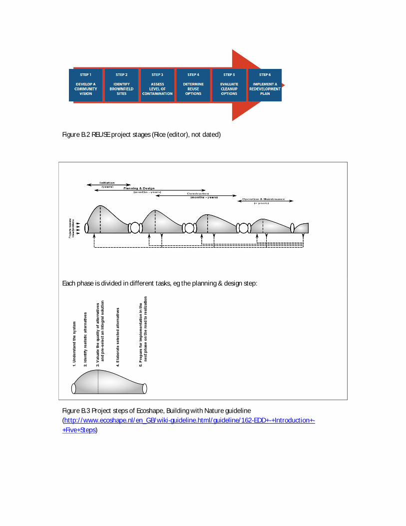
Figure B.2 REUSE project stages (Rice (editor), not dated)
Each phase is divided in different tasks, eg the planning & design step:
Figure B.3 Project steps of Ecoshape, Building with Nature guideline(http://www.ecoshape.nl/en_GB/wiki-guideline.html/guideline/162-EDD+-+Introduction+-+Five+Steps)

Figure B.4 Project phases for redevelopment of contaminated industrial sites (Alphenaar andNauta,2011). Translated from Dutch
Figure B.4 Cabernet project phases and possible role of dedicated agencies (in reality the model isnot necessarily linear, and many of these steps can be approached simultaneously) (Ferber et al.,2006-II)

References
Alphenaar Arne, Nauta Charlotte (2011). Upside down, sustainable redevelopment of contaminatedindustrial areas / brownfields (Ondersteboven, duurzame herinrichting van verontreinigdebedrijfsterreinen). The Netherlands (In Dutch)
Brüggemann Jürgen et al (2004) RESCUE Guidance on Sustainable land use and urban design onbrownfield sites Workpackage 4 – Deliverable D 4.1
Ecoshape / Building with nature: http://www.ecoshape.nl/en_GB/wiki-guideline.html/guideline/162-EDD+-+Introduction+-+Five+Steps
Edwards, David, Gernot Pahlen, Catherine Bertram, Paul Nathanail (2005) The RESCUE manual. BestPractice Guidance for Sustainable Brownfield Regeneration,
Ferber, U, Grimski, D, Millar K., Nathanail, P. (2006-II). Sustainable Brownfield Regeneration:CABERNET (The Concerted Action on Brownfield and Economic Regeneration Network)Network Report (http://www.cabernet.org.uk)
Maring, Linda, Suzanne van der Meulen, Edwin Snippen (2013) Hombre D 3.2: Software andprocedure of the Brownfield Navigator.
Rice, E. (editor) (not dated). REUSE Creating community-based brownfield redevelopment strategies.American Planning Association (APA) Planning and Community Health Research Center.

Appendix C Early Indicators for Brownfield origination
ELEMENT CATEGORYISSUES INDICATORS
MIGHT NEED TOCONSIDER
SUGGESTED INDICATORS
Effect onshort/long
term<10 years >
ScaleLocal/Regiona
l/National/Glo
bal
Source for data/info
Economy
deindustrialisation orrestructuring ofthe economicactivities
Land use
the change of thepercentages of areas underindustrial land use
Short term Local andNational
EUROSTAT
floor spaces for industrial,retail and office use Short term Local Local/national statistics1
Composition ofemployment
percentages of employmentin industrial sector andservice sector withinmunicipalities
Short termand long term
Local andnational
EUROSTATLocal/national statistics
Composition of GDPpercentages of GDP inindustrial sector and servicesector within municipalities
Short termand long term
Local andnational
EUROSTATnational statistics
Employment long term unemployment Long term Localnational
EUROSTATLocal/national statistics
Real estate market property price Short term Local
Local/national statisticsOnline directoriesProperty assessmentcooperation
transportation Accessibility, mobility,operational efficiency
average time from facility tomajor highwaynetwork/train facility
Short term/Long term Local Local infrastructure plans
bridge weight limits Short term/Long term Local Local infrastructure plans
1 For example:http://www.communities.gov.uk/planningandbuilding/planningbuilding/planningstatistics/previouslydevelopedbrownfield/
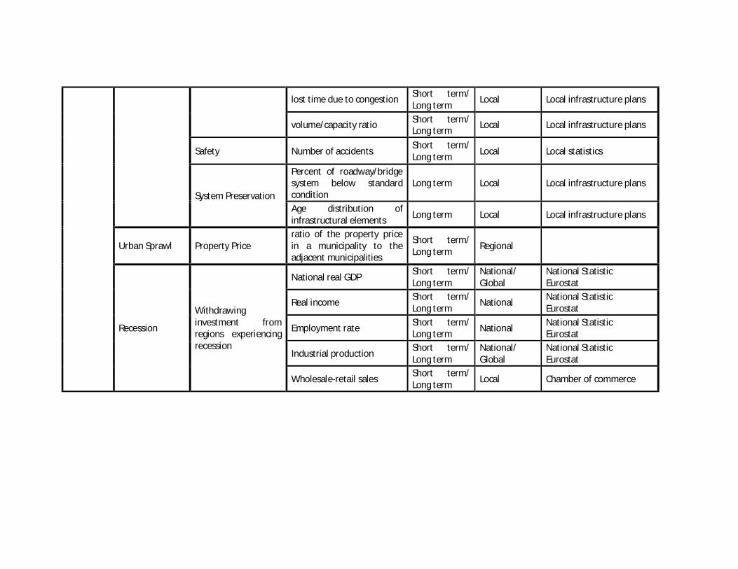
lost time due to congestion Short term/Long term Local Local infrastructure plans
volume/capacity ratio Short term/Long term Local Local infrastructure plans
Safety Number of accidents Short term/Long term Local Local statistics
System Preservation
Percent of roadway/bridgesystem below standardcondition
Long term Local Local infrastructure plans
Age distribution ofinfrastructural elements Long term Local Local infrastructure plans
Urban Sprawl Property Priceratio of the property pricein a municipality to theadjacent municipalities
Short term/Long term Regional
Recession
Withdrawinginvestment fromregions experiencingrecession
National real GDP Short term/Long term
National/Global
National StatisticEurostat
Real income Short term/Long term National National Statistic
Eurostat
Employment rate Short term/Long term National National Statistic
Eurostat
Industrial production Short term/Long term
National/Global
National StatisticEurostat
Wholesale-retail sales Short term/Long term Local Chamber of commerce

ELEMENT CATEGORYISSUES INDICATORS
MIGHT NEED TOCONSIDER
SUGGESTED INDICATORS
Effect onshort/long
term<10 years >
ScaleLocal/Regiona
l/National/Glo
bal
Source for data/info
Social
Societaldevelopment
Population wealth
% social rent dwellings% of uniform houses versusdiversification of houses% change in income groupsin certain period
Short term Local Local statistics
Education level % of university/highereducation in certain period
Short term/Long term
Local Local and national statistics
Available services
Average distance to schools/ shopping areas /restaurants etc (specific tocase)
Short term Local Local statistics
State of thesocial system
Crime
# of vandalism incidentsreported in certain periodcompared to regionalstatistics# of criminal incidentsreported in certain periodcompared to regionalstatistics
Short term Local/Regional
National DatabasesFor example in theNetherlands:http://www.ad.nl/ad/nl/1401/home/integration/nmc/frameset/nieuws/misdaadmeter.dhtml
Health Average age of death Long term Local/National Local and national statistics
Social cohesion
Change in the distributionof age groups in area. Long term Local Local and national statistics
% of people feeling somesort of commitment witharea
Local

ELEMENT CATEGORYISSUES INDICATORS
MIGHT NEED TOCONSIDER
SUGGESTED INDICATORS
Effect onshort/long
term<10 years >
ScaleLocal/Regiona
l/National/Glo
bal
Source for data/info
Environ-mental
Pollution
SoilContaminationamount/density; soil qualityassessment
Short term/Long term Local Local/National statistics
(Ground)Water EBI index Short term/Long term
Local/Regional
Local/National/EUstatistics
Air NOX/pm10 concentrations Short term/Long term Local Local/National/EU
statistics
Green areasThe presence ofgreen area at site andits quality
m2 of green area perinhabitant Long term Local Local/National statistics
Ecology Biodiversity Number of species per m2 Short term Local Local/National statistics
Hindrances Amount of hinder dueto noise
amount of dB at differentsites throughout the area Short term Local Local/National statistics

Appendix D– HOMBRE methodology on anticipating brownfield emergence –Module “Anticipating Change” and Step 1 identification of the BFNThis appendix gives an overview of the proposed activities to be followed when applying theproposed HOMBRE methodology to anticipating brownfield emergence
A mock-up for the EWI tool is under development. Once on line, the following activities for step“identification” of the BFN are expected to be prompted to the end user
BFN Setp 1 identification1 Obtain base map
The end-user is prompted to obtain relevant basemap(s) that should encompass the studiedarea (base maps are usually cadastral systems).
Note: The monitoring approach should be applicable to a municipality, a neighbourhood or aspecific area of land (e.g. megasite).
2 Define limits of studied area on BFN GIS support tool
The end-user is prompted to define the limits of the urban studied area and the various urbanunits within studied areaThe end user can be a moderator with relevant GIS/programming skills working for the officialend-users (land planners, urban planners) that work together on decision-making(multistakeholders).
Note: An urban unit present a functional area. Data could ideally be collected byadministrative boundaries, wards/neighbourhoods or even a site. Or should be generatedfrom existing sources.
The end-user can either draw manually the boundary of the studied area into a shapefilewithin the BFN GIS tool or import an existing boundary shapefile into the BFN GIS tool.The same applies to the urban units which are subdivision of the overall studies area.
3 Decide on relevant indicators
A list of indicators is proposed by default to the end-user. The end-user may decide thatadditional early indicators are needed if they are more relevant for the specific studied area.

With a ponderation system, the user estimates that some indicators should have more importancethan others in the overall score.
For the Monitoring approach For the consultation approach4 Organise data collection
The end-user is prompted to check thatneeded data is available for the monitoring ofthe chosen indicators.
Organise data collectionThe land planners/urban planners organise aninternal consultation with relevant stakeholderson potential brownfield emergence in aspecified area.Guidance should be provided (identification ofrelevant stakeholder, communities,communication of objectives, etc.)
5 It is proposed to provide on-line guidance to the end-user with rationales for the default listindicators and with suggestions of methodologies to analyse data trends. Thresholds forpotential of brownfield formation may be proposed. Apart from guidance, the BFN tool is notnecessarily needed at this stage.
6 Collect data
The end-user is prompted to collect thechosen indicator data over a time period andfrequencies that is relevant for each of theurban unit (it may be statistical or empiricaldata).
Collect resultsThe end-user is prompted to collect data byrunning public consultation on perception ofattendees of brownfield emergence in aspecified studied area.
All attendees are required to give their opinionon the trends the chosen indicators may havegone through over a specific period of timebased on their appreciation of the studied area,experience, knowledge, etc. They are to usequestionnaires on the day to hand them over tothe organisers/end-user (Local Authority, urbanplanners).
For any of the approaches afterwards7 Assess trends or asses results – fill in online form
After reviewing trends from the monitoring data or reviewing the scoring from theconsultation process, the end-user has to fill in an online form on potential brownfieldformation for each of the urban unit.
The end user will be prompted to analyse trends before filling in the questionnaire (eitherfrom long term monitoring datasets relevant to each of the default indicators or from the landplanners consultation). For each indicator, the user will have to score whether a specificindicator indicates a potential for brownfield formation of not (using scoring system from 1 to10 for example).

Monitoring of an indicator over time with hypothetical thresholds for brownfield formation(statistical data)
6 Display 1st results on BFN GIS support tool
The end-user is prompted to generate visual results for each indicator on the GIS basemap
7 Display main results on BFN GIS support tool
The end-user is prompted to generate an overall scoring for potential brownfield formationwithin each urban unit (using an algorithm integrating the scores from all indicators per zone).
8 Decision making
If end user is local authority/urban planners, decision may be taken and preventive orcorrective measures put in place
0
50
100
150
0 5 10 15 20 25

Appendix F EU regulations and policies related to Brownfield Management
This activity consists of scanning EU-directives, EU-reports and international publications onthe topic of brownfields and related environmental aspects. Below is a list of publicationsthat have been scanned for objectives, regulations and observations. The objective of thisactivity is to identify opportunities and challenges for brownfield regeneration processes,resulting from the EU perspective. National and regional policies and interpretations ofthese EU policies are not included in this activity.
The result of this activity is a table with 3 categories: environmental sustainability, economicfeasibility and social participation. Each category has multiple themes in which the quotes(objectives, regulations and observations) are bundled. After each quote is a referenceincluded to where the quote has been found. At the most right column a short remark ismade about how this quote may potentially influence brownfield regeneration.
DirectivesCouncil directive 92/43/EEC of 21 May 1992 on the conservation of natural habitats and of
wild fauna and floraCouncil directive 98/83/EC of 3 November 1998 on the quality of water intended for human
consumptionDirective 2000/60/EC of the European parliament and of the council of 23 October 2000
establishing a framework for Community action in the field of water policyDirective 2003/4/EC of the European parliament and of the council of 28 January 2003 on
public access to environmental information and repealing Council Directive90/313/EEC
Directive 2004/35/CE of the European parliament and of the council of 21 April 2004 onenvironmental liability with regard to the prevention and remedying ofenvironmental damage
Directive 2006/118/EC of the European parliament and of the council of 12 December 2006on the protection of groundwater against pollution and deterioration
Directive 2008/98/EC of the European parliament and of the council of 19 November 2008on waste and repealing certain Directives (Text with EEA relevance)
Directive 2009/147/EC of the European parliament and of the council of 30 November 2009on the conservation of wild birds (codified version)
Directive 2010/31/EU of the European parliament and of the council of 19 May 2010 on theenergy performance of buildings (recast)
EU publicationsCOM(2006) 231 final. Communication from the European Commission. Thematic strategy
for soil protection.COM(2011) 571 final Communication from the Commission. Roadmap to a resource efficient
Europe.Committee of the Regions (2012). Opinion of the Committee of the Regions on ‘A resource-
efficient Europe — Flagship initiative under the Europe 2020 strategy’. Doc.nr2012/C9/08

European Commission – Environment (2013). "Mapping and Assessment of Ecosystems andtheir Services. An analytical framework for ecosystem assessments under Action 5 ofthe EU Biodiversity Strategy to 2020". Discussion paper
European Commission – Environment (2011). Brochure on the EU biodiversity strategy to2020. Doc.nr. 10.2779/39229.
European Court of Auditors (2012). Have EU structural measures successfully supported theregeneration of industrial and military brownfield sites? Report nr. 2012-23. QJ-AB-12-024-NL-C
Other publicationsThornton, G., M. Franz, D. Edwards, G. Pahlen and P. Nathanail (2007). The challenge of
sustainability: incentives for brownfield regeneration in Europe. In: EnvironmentalScience and Policy nr. 10-2007
United Nations and Economic Commission for Europe (1998). Convention on access toinformation, public participation in decision-making and access to justice inenvironmental matters. Conducted at Aarhus, Denmark.
Gong, Yuyang(2010) International experience in policy and regulatory frameworks forbrownfield site management. Discussion paper 57890. World Bank Washington D.C.USA

Appendix E part2 table Incentives and barriers BFRQuote Reference Remarks
Environmental sustainabilityMeasurable indicators for sustainabilityRecommendation: Adopt a ‘basket’ of four main resource-use indicators: land footprint, use ofraw materials (biodiversity, biological and mineral resources), water footprint and greenhouse-gas footprint
Opinion of the Committee of the Regions on ‘A resource-efficient Europe —Flagship initiative under the Europe 2020 strategy’, doc.nr 2012/C9/08
If brownfield regeneration is more sustainable than other options, a betterquantification of these main indicators will contribute to include these effects in theconsideration. brownfield regeneration will then become a more favourable option.Quantifying these indicators will likely require demonstration projects, for which abrownfield regeneration project can be suited
Recommendation: propose, in cooperation with Member States and on the basis of scientificevidence and best practices: (i) EU standards for the definition of contaminated sites and thesignificance of the environmental and health risks they pose; (ii) an EU methodology for thedefinition of site-specific remediation standards taking account of final site use
"Have EU structural measures succesfully supported the regeneration ofindustrial and military brownfield sites?" Report of the European Court ofAuditors. Report nr. 2012-23. QJ-AB-12-024-NL-C
This is an incentive for policy makers to set the priorities for brownfield regeneration.For a specific site this may be less relevant. Standards and clear definitions mayreduce uncertainties and therefore contribute as an incentive
Recommendation: Compile lists of brownfield sites where contamination is suspected andclassify them according to the corresponding health and environmental risks. Sites should beprioritised for remediation to facilitate the preparation of remediation plans contributing tohealth protection and to the achievement of EU environmental objectives, such as the goodwater ecological status required by the European Water Framework Directive.
"Have EU structural measures succesfully supported the regeneration ofindustrial and military brownfield sites?" Report of the European Court ofAuditors. Report nr. 2012-23. QJ-AB-12-024-NL-C
This is an incentive for policy makers to set the priorities for brownfield regeneration.For a specific site this may be less relevant. Standards and clear definitions mayreduce uncertainties and therefore contribute as an incentive
Recommendation: Structural Funds are allocated at the point of delivery (regional/sub-regional)on a competitive basis. Successful proposals are evaluated in terms of their potential to delivermore ‘‘outputs’’ (measured numerically) such as number of jobs created, area of landreclaimed, etc. No consideration is made of the methods used to create these outputs (i.e.sustainable proposals are not differentiated from unsustainable proposals).
"The challenge of sustainability: incentives for brownfield regeneration inEurope", G. Thornton, M. Franz, D. Edwards, G. Pahlen and P. Nathanail. InEnvironmental Science and Policy nr. 10-2007
Better defined criteria and improved ability to measure them will benefit sustainablebrownfield regeneration projects.
Aichi Biodiversity Target 2. By 2020, at the latest, biodiversity values have been integrated intonational and local development and poverty reduction strategies and planning processes andare being incorporated into national accounting, as appropriate, and reporting systems.
"Mapping and Assessment of Ecosystems and their Services. An analyticalframework for ecosystem assessments under Action 5 of the EUBiodiversity Strategy to 2020". Discussion paper final april 2013
These developments will indirectly support broad defined brownfield regenerationprocesses.
Ecosystem and biodiversityRecommendation: Protect and restore ecosystem services Opinion of the Committee of the Regions on ‘A resource-efficient Europe —
Flagship initiative under the Europe 2020 strategy’, doc.nr 2012/C9/08brownfield regeneration and remediation may be supported by this recommendation
Objectives: maintain a good level of preservation of endangered or protected species, bird andhabitats.
Bird- and Habitatdirectives. Directive nr. 1992/43/EEG and 2009/147/EG brownfield regeneration might benefit from these directives. Soil remediation andadditional environmental measures may support a (nearby) habitat or species. On theother hand, abandoned terrains might have developed high quality habitats orbecame the habitat of protected species. Removing these habitats becomes difficultonce these species have settled there.
Target 2: The strategy also calls for the development of a green infrastructure for Europe. The EU isone of the most fragmented continents in the world. Thirty percent of the land is moderately tohighly fragmented due to urban sprawl, infrastructure developments and changing land uses. Thisnot only affects biodiversity but also undermines the many services that healthy ecosystems providesociety, such as a clean water supply, protection against floods and erosion etc. Building a greeninfrastructure can help overcome many of these challenges. It can reconnect fragmented naturalareas and improve their functional connectivity within the wider countryside. It can also encourage abetter use of naturebased approaches to tackle climate change and to improve resource efficiency,for instance through more integrated spatial planning and the development of multifunctional zonesthat are capable of delivering benefits to both biodiversity, the land user, and to society at large. TheCommission intends, therefore, to put forward a new strategy on an EU-wide green infrastructure by2012.
"EU biodiversity strategy to 2020". EU adopted strategy in May 2011 Urban sprawl is here mentioned as one of the factors that cause fragmentation and bythat pose a threat to ecosystems and biodiversity. Connecting brownfieldregeneration to the green infrastructure or remove barriers for migration of animalsand plants might create opportunities. brownfield regeneration most often alsocontributes in reducing urban sprawl (see soil sealing).
Aichi Biodiversity Target 14: By 2020, ecosystems that provide essential services, includingservices related to water, and contribute to health, livelihoods and well-being, are restored andsafeguarded, taking into account the needs of women, indigenous and local communities, andthe poor and vulnerable.
"Mapping and Assessment of Ecosystems and their Services. An analyticalframework for ecosystem assessments under Action 5 of the EUBiodiversity Strategy to 2020". Discussion paper final april 2013
brownfield regeneration may indirectly contribute to this target by preventingadditional pressures on ecosystems.

Aichi Biodiversity Target 15: By 2020, ecosystem resilience and the contribution of biodiversityto carbon stocks has been enhanced, through conservation and restoration, includingrestoration of at least 15 per cent of degraded ecosystems, thereby contributing to climatechange mitigation and adaptation and to combating desertification.
"Mapping and Assessment of Ecosystems and their Services. An analyticalframework for ecosystem assessments under Action 5 of the EUBiodiversity Strategy to 2020". Discussion paper final april 2013
brownfield regeneration contributes to this target by restoring degraded ecosystemsand preventing greenfields to become degraded.
Soil sealingRecommendation: Reduce the extent of existing soil sealing wherever needed Opinion of the Committee of the Regions on ‘A resource-efficient Europe —
Flagship initiative under the Europe 2020 strategy’, doc.nr 2012/C9/08brownfield regeneration directly contributes to this recommendation
Milestone target: By 2020, EU policies take into account their direct and indirect impact on landuse in the EU and globally, and the rate of land take is on track with an aim to achieve no netland take by 2050
"Roadmap to a resource efficient Europe". Communication from theEuropean Commission. Doc.nr COM(2011) 571 final
brownfield regeneration directly contributes to this milestone
Recommendation: promote the regeneration of brownfield sites, avoiding the use of greenfieldunless strictly necessary and otherwise requiring the application of compensation measures;
"Have EU structural measures succesfully supported the regeneration ofindustrial and military brownfield sites?" Report of the European Court ofAuditors. Report nr. 2012-23. QJ-AB-12-024-NL-C
This recommendation is a direct support of brownfield regeneration
Proposal for directive: In order to achieve a more rational use of soil, Member States will berequired to take appropriate measures to limit sealing by rehabilitating brownfield sites and tomitigate its effects by using construction techniques that allow maintaining as many soilfunctions as possible.
Thematic strategy for soil protection, communication from the EuropeanCommission. Doc.nr COM(2006) 231 final
This requirement (in the proposal of the soil-directive) will lead to the need forpolicies and funds at national and EU-level. This may affect the opportunities forbrownfield regeneration positively
Soil qualityObservation: Extensive evidence shows that most of the costs of soil degradation are not borneby the immediate land users, instead they are often borne by society at large and by players farfrom the location of the problem (off site).
Thematic strategy for soil protection, communication from the EuropeanCommission. Doc.nr COM(2006) 231 final
This observation may lead to policies for sustainable (economical) recalculation ofcosts and benefits. Then it may become a ground for a claim for funding
Guiding principle 1: Prevent further soil degradation and preserve its functions Thematic strategy for soil protection, communication from the EuropeanCommission. Doc.nr COM(2006) 231 final
The soils under brownfields are most often already degraded. This principle is not adirect support for brownfield regeneration
Observation: Soil degradation affects other environmental areas. Soil functions enormouslycontribute to areas such as biodiversity and marine protection, coastal management, and to themitigation of climate change.
Thematic strategy for soil protection, communication from the EuropeanCommission. Doc.nr COM(2006) 231 final
If brownfield regeneration restores soil functions that support other environmentalareas, these benefits may support other policy objectives. This may be a ground forfunding.
Observation: food safety – uptake of contaminants in the soil by food and feed crops and somefood producing animals can have a significant impact on the safety of feed and food, which aretraded freely within the internal market, by increasing their level of contaminants, hence posinga risk to human or animal health.
Thematic strategy for soil protection, communication from the EuropeanCommission. Doc.nr COM(2006) 231 final
In the case that a brownfields becomes farming land (urban farming), this aspect mustbe taken into account when setting remediation targets.
Further research is necessary to close the gaps in knowledge about soil and strengthen thefoundation for policies.
Thematic strategy for soil protection, communication from the EuropeanCommission. Doc.nr COM(2006) 231 final
Research programs on this topic might be an opportunity for additional funding of theprocess of brownfield regeneration.

Waste reduction and circular economyObservation: overall waste generation is stable in the EU, however, generation of some wastestreams like construction and demolition waste, to sewage sludge and marine litter is stillincreasing.
"Roadmap to a resource efficient Europe". Communication from theCommission. Doc.nr COM(2011) 571 final
brownfield regeneration combined with revitalising buildings and/or sustainable reuseof demolition waste can contribute to alter this trend
Observation: Other EU developments, such as the Landfill Directive, which seeks to make wastedisposal the last resort (particularly contaminated soil), are providing parallel legislative andeconomic drivers that can enable the necessary changes to be enacted rather than resisted.
"The challenge of sustainability: incentives for brownfield regeneration inEurope", G. Thornton, M. Franz, D. Edwards, G. Pahlen and P. Nathanail. InEnvironmental Science and Policy nr. 10-2007
This may be an incentive to reuse brownfields without creating much demolitionwaste
Recommendation: Achieve a zero-waste society through optimising waste prevention andseeing waste as a resource within a circular economy
Opinion of the Committee of the Regions on ‘A resource-efficient Europe —Flagship initiative under the Europe 2020 strategy’, doc.nr 2012/C9/08
brownfield regeneration based on the prevention of demolishment of obsoletebuildings (e.g. revitalise the buildings) can contribute to this recommendation
Milestone target: By 2020 the renovation and construction of buildings and infrastructure willbe made to high resource efficiency levels. The Life-cycle approach will be widely applied; allnew buildings will be nearly zero-energy and highly material efficient, and policies forrenovating the existing building stock will be in place so that it is cost-efficiently refurbished at arate of 2% per year. 70% of non-hazardous construction and demolition waste will be recycled.
"Roadmap to a resource efficient Europe". Communication from theCommission. Doc.nr COM(2011) 571 final
If brownfield regeneration results in highly efficient and life cycle concept basedbuildings, it may support this target
Recommendation: Better options to enable an increase in soil and waste reuse need, anddeserve, support.
"The challenge of sustainability: incentives for brownfield regeneration inEurope", G. Thornton, M. Franz, D. Edwards, G. Pahlen and P. Nathanail. InEnvironmental Science and Policy nr. 10-2007
Better options for reuse will make it easier to comply to objectives of the WasteDirective and make brownfield regeneration more sustainable
Target (article 11): by 2020, the preparing for re-use, recycling and other material recovery,including backfilling operations using waste to substitute other materials, of non-hazardousconstruction and demolition waste excluding naturally occurring material defined in category 1705 04 in the list of waste shall be increased to a minimum of 70 % by weight. Article 14 describesthe principle that the owner of the waste shall borne the costs of disposal.
Directive on waste. Directive nr. 2008/98/EC In the near future, demolition waste should be reused in a large extent. Depending onwho should be responsible for reusing the waste, this might require additional effortto find a good destination for these materials. In case the owner of the waste was notobliged to pay for discharging the materials, this might become an additional costfactor.
WaterThe objective of the drinking water directive shall be to protect human health from the adverseeffects of any contamination of water intended for human consumption by ensuring that it iswholesome and clean.
Directive on the quality of water intended for human consumption.Directive nr. 1998/83/EG
This directive is barely applicable for brownfield management, unless thecontamination may affect human health at these sites by entering the drinking waterchain/network.
The water framework directive gives a framework for an integrated approach on regional andriver basin management. If a brownfield has an influence on relevant water bodies, than theWater framework Directive is applicable. Water management organizations must then reporthow they are going to manage the site and which measures will be taken.
Water Framework Directive. Directive nr. 2000/60/EG This directive is applicable if the site has a direct influence on waterbodies(groundwater and surfacewater). If this is the case, the water managementorganization might have direct interests in a water quality improvement
Objective: In order to protect the environment as a whole, and human health in particular,detrimental concentrations of harmful pollutants in groundwater must be avoided, preventedor reduced
Groundwater directive. Directive nr. 2006/118/EC This directive is about groundwater bodies, which are much larger than a singlepollution site. The groundwater bodies should have a good chemical status andsupport ecological objectives. At locations nearby extractions for especially drinkingwater, the quality should be sufficient in order not to pose a threat for human health.
EnergyObjective: the application of minimum requirements to the energy performance of newbuildings and new building units;
Directive on Energy Performance of Buildings. Directive nr. 2010/31/EU New buildings must meet these minimum requirements. This poses no additionalcosts or benefits compared with new buildings on green fields
Objective: the application of minimum requirements to the energy performance of: existingbuildings, building units and building elements that are subject to major renovation; buildingelements that form part of the building envelope and that have a significant impact on theenergy performance of the building envelope when they are retrofitted or replaced; andtechnical building systems whenever they are installed, replaced or upgraded
Directive on Energy Performance of Buildings. Directive nr. 2010/31/EU When renovating existing buildings, the new construction parts must meet theseminimum requirements
Objective: national plans for increasing the number of nearly zero- energy buildings Directive on Energy Performance of Buildings. Directive nr. 2010/31/EU In case the brownfield regeneration project has high ambitions on this aspect, this EUobjective might generate support from these national plans

Economic feasibilityFocus on feasible targetsRecommendation: Brownfield regeneration projects should be part of an integrateddevelopment plan for the city or area concerned; ask promoters to carry out a market analysisand consider the relevant options for the possible future of brownfield sites which should bebased on the integrated development plan;
"Have EU structural measures succesfully supported the regeneration ofindustrial and military brownfield sites?" Report of the European Court ofAuditors. Report nr. 2012-23. QJ-AB-12-024-NL-C
In general, this would be wise to do in a brownfield regeneration-project. This willlikely become a requirement for EU funding.
Recommendation: Consider setting up brownfield site regeneration strategies with clear targets "Have EU structural measures succesfully supported the regeneration ofindustrial and military brownfield sites?" Report of the European Court ofAuditors. Report nr. 2012-23. QJ-AB-12-024-NL-C
The term "clear targets" refers to consider lower remediation targets when theproposed function of the area allows this. This may reduce costs of remediation andtherefore contribute to the feasibility of contaminated brownfield regeneration
Guiding principle 2: Restoring degraded soils to a level of functionality consistent at least withcurrent and intended use, thus also considering the cost implications of the restoration of soil
Thematic strategy for soil protection, communication from the EuropeanCommission. Doc.nr COM(2006) 231 final
This is a direct support for brownfield regeneration projects in which the target is torestore the soils to a state that suits current or intended use of the soil.
Environmental liability and the polluter pays principleRecommendation: Consider measures to address problematic sites that are privately ownedwhere the owner fails to take the necessary action. Require the extent to which the polluterpays principle can be applied to be explicitly considered for all regeneration projects andapplication of that principle to be made a condition for granting EU funding. Consider theopportunity to define EU common principles for the application of the polluter pays principle incase of contamination originating before the introduction of the principle in the law
"Have EU structural measures succesfully supported the regeneration ofindustrial and military brownfield sites?" Report of the European Court ofAuditors. Report nr. 2012-23. QJ-AB-12-024-NL-C
This recommendation and the eventually following actions may support the legalopportunities to achieve a better distribution of costs and benefits among theinvolved parties. These principles may help reduce uncertainties about thedistribution of costs and benefits and thereby help brownfield regeneration processes.
Principle: "the pollutant pays" as a basic rule to prevent society for being responsable for thecosts of environmental damage
Environmental liability directive. Directive nr. 2004/35/EG Recent pollutions have clear liabilities: the pollutant (or legal successor) or theinsurance company who took over the risk are liable
Directive: The environmental liability directive must be implemented in national law between2004 and 2007.
Environmental liability directive. Directive nr. 2004/35/EG The environmental liability directive does not offer any support in case of alreadyexisting pollutions, dating till the implementation of the directive
Directive: The environmental liability directive is not applicable to activities for national defence Environmental liability directive. Directive nr. 2004/35/EG Military brownfields are excluded from the environmental liability directive.
A just distribution of private investments and public funding that matches the private risks and public targetsRecommendation: Thoroughly assess the funding gap for each project "Have EU structural measures succesfully supported the regeneration of
industrial and military brownfield sites?" Report of the European Court ofAuditors. Report nr. 2012-23. QJ-AB-12-024-NL-C
In general this is already required for each project. This is meant as a special attention,because the costs and benefits of brownfield regeneration are very complicated
Make detailed checks to ensure that subsidies for remediation are not provided in respect ofsites for which a promoter has already received purchase price discounts. For this, the publicauthority should have a reliable market valuation of the land, a realistic assessment of the likelycosts of remediation works, and full transparency of terms of the land acquisition and any pricediscounts included therein;
"Have EU structural measures succesfully supported the regeneration ofindustrial and military brownfield sites?" Report of the European Court ofAuditors. Report nr. 2012-23. QJ-AB-12-024-NL-C
This is a specific point regarding concealed state aid. This will likely become arequirement for receiving EU funding
Recommendation: Include a reimbursement clause in all grant decisions for regenerationprojects to allow the possibility for them to reassess the financial performance of projects in thelight of developments over a longer period (say 15 years), and to allow where projects havegenerated more revenues than expected, part or all of a grant to be clawed back. TheCommission should follow up the application of such reimbursement clauses
"Have EU structural measures succesfully supported the regeneration ofindustrial and military brownfield sites?" Report of the European Court ofAuditors. Report nr. 2012-23. QJ-AB-12-024-NL-C
In case the private benefits are larger than expected, a part of the funding should bereturned. This will likely become a requirement for receiving EU funding
Observation: the most significant financial incentive in existence for sustainable brownfielddevelopment is EU Structural Funding and without such funding regeneration activity in Europewould have been almost exclusively restricted to economically feasible sites—the so called ‘A’sites
"The challenge of sustainability: incentives for brownfield regeneration inEurope", G. Thornton, M. Franz, D. Edwards, G. Pahlen and P. Nathanail. InEnvironmental Science and Policy nr. 10-2007
This means that without EU funding no or very low numbers of B and C sites would beregenerated. That makes EU funding a high priority for brownfield regeneration.
Observation: three EU Structural Funds are important for brownfield regeneration. 1.Development and structural adjustment of regions whose development is lagging behind. TheEuropean Regional Development Fund (ERDF) finances it. 2. Economic and social conversion ofareas facing structural difficulties. The European Regional Development Fund (ERDF) finances it.3. Adaptation and modernisation of national policies and systems of education, training andemployment (development of human resources). The European Social Fund (ESF) finances it.
"The challenge of sustainability: incentives for brownfield regeneration inEurope", G. Thornton, M. Franz, D. Edwards, G. Pahlen and P. Nathanail. InEnvironmental Science and Policy nr. 10-2007
66% of the funding of the ERDF goes to areas with low gross domestic product. Also, inmore wealthy areas, sites with structural socioeconomic problems may have fundingfrom this Fund (ERDF). In the other regions (besides the regions under 1.) the ESF is forcreating opportunities for human capital. If the brownfield regeneration is connectedto social objectives, the ESF may co-finance the brownfield regeneration. As funds arequite essential for brownfield regeneration, knowing the possibilities of (European)funding is important.

Community guidelines on State Aid for environmental protection act as an important legalincentive for improved brownfield regeneration. The objectives of the guidelines are two-fold:to ensure that state aid allowed for environmental purposes complies with the ‘‘polluter pays’’principle and is consistent with the internal market and EU competition policies. Theseguidelines contain a specific subsection, E.1.8, which provides for a clearer regime for state aidgranted for the rehabilitation of polluted industrial sites. The guidelines only concerninterventions made by firms. Thus, interventions made by public authorities fall out of its scope.In practice the distinction between firms and public authorities will not always be obvious.
"The challenge of sustainability: incentives for brownfield regeneration inEurope", G. Thornton, M. Franz, D. Edwards, G. Pahlen and P. Nathanail. InEnvironmental Science and Policy nr. 10-2007
The rules for State Aid in the case of brownfield regeneration are already clearlywritten down, although some discussion may remain. The clarity makes brownfieldregeneration more feasible by reducing uncertainty about the extent and allowance offunding by governments
Level playing field and clarity about prioritiesRecommendation: Require regional or local authorities to maintain registers of brownfield andcontaminated sites; these should be standardised at least at Member State level in order toallow for their consolidation into a national register to facilitate the implementation of abrownfield regeneration and remediation policy
"Have EU structural measures succesfully supported the regeneration ofindustrial and military brownfield sites?" Report of the European Court ofAuditors. Report nr. 2012-23. QJ-AB-12-024-NL-C
Having a clear definition of brownfields and knowing which sites are entitled so, mightincrease the opportunities for national and/or EU funding
Observation: Distortion of the functioning of the internal market – the wide differencesbetween national soil protection regimes, in particular as regards soil contamination,sometimes impose very different obligations on economic operators, thus creating anunbalanced situation in their fixed costs.
Thematic strategy for soil protection, communication from the EuropeanCommission. Doc.nr COM(2006) 231 final
International competitiveness may be an argument for setting lower remediationtargets (or acquire EU funding) in a brownfield regeneration-process to keep an areacompetitive
Proposal for directive: Within seven years of implementation, the member states must draw upnational remediation strategies including: remediation targets, a prioritization strategy, startingwith those sites that pose a significant risk to public health, a timetable for implementation, andallocation of funds. The remediation strategy has to be made public within eight years and is tobe reviewed every five years.
World Bank discussion paper on brownfield site management. World Bank,september 2010
For brownfield regeneration this would be an incentive: this will make prioritiesincluding funding clear
Social participationAccess to informationPillar I, Access to Information - access to environmental information ensures that members ofthe public can understand what is happening in the environment around them. It also ensuresthat the public is able to participate in an informed manner.
United Nations / Economic Commission for Europe - Convention on accessto information, public participation in decision-making and access to justicein environmental matters. Conducted at Aarhus, Denmark, on 25 June1998.
The access to information is a first requirement for public participation. Informationabout the extent of pollutions and the remediation alternatives will be known tointerested citizens. brownfield regeneration process managers should take this intoaccount.
Objective 1: guarantee the right of access to environmental informationheld by or for public authorities
Directive on public access to environmental information. Directive nr.2003/4/EC
The access to information is a first requirement for public participation. Informationabout the extent of pollutions and the remediation alternatives will be known tointerested citizens. brownfield regeneration process managers should take this intoaccount.
Objective 2: ensure that, as a matter of course, environmental informationis progressively made available and disseminated tothe public in order to achieve the widest possible systematicavailability and dissemination to the public of environmentalinformation.
Directive on public access to environmental information. Directive nr.2003/4/EC
This requires governmental organizations to pro-active inform citizens about theenvironmental status of a brownfields. This will be less applicable to a specificbrownfield regeneration-process, but may on the longer term influence the prioritiesin regenerating brownfields.
Observation: Resistance from certain commercial interest groups, including real estate tradeassociations, will focus on the disclosure of compulsory soil-status reports to the regulator.These commercial interest groups believe that the Soil Directive will not only increase the costof transactions, but that it may attract unwanted third-party attention in certain circumstances.
World Bank discussion paper on brownfield site management. World Bank,september 2010
This kind of confidentiality between private companies might be threatened bydisclosure. Public and private parties should contemplate on which information inwhat form can be disclosed.

Arranging participationPillar II, Public Participation in Decision Making – this requires more than simply following a setof procedures; it involves public authorities genuinely listening to public input and being open tothe possibility of being influenced by it.
United Nations / Economic Commission for Europe - Convention on accessto information, public participation in decision-making and access to justicein environmental matters. Conducted at Aarhus, Denmark, on 25 June1998.
Working according to this pillar will lead to a participative process: this will affectspeed and outcome of the process. This may be positive or negative depending on theexpectations
Observation: The EU-funding seems to ignore sustainability and public participation processesdue to a lack of hard criteria on these aspects at time of this article
"The challenge of sustainability: incentives for brownfield regeneration inEurope", G. Thornton, M. Franz, D. Edwards, G. Pahlen and P. Nathanail. InEnvironmental Science and Policy nr. 10-2007
This may be an obstacle to receive funding for these additional objectives. It is herenot further researched whether this observation is still valid.
Recommendation 4. There is a widespread lack of knowledge and understanding amongdevelopers, authorities and politicians regarding the potential added value that CitizenParticipation can provide. To illustrate the feasibility of Citizen Participation,the European commission should encourage and support pilot projects in each of the affectedEU-countries
"The challenge of sustainability: incentives for brownfield regeneration inEurope", G. Thornton, M. Franz, D. Edwards, G. Pahlen and P. Nathanail. InEnvironmental Science and Policy nr. 10-2007
Public participation is the "new" reality. brownfield regeneration processes with thisapproach should be able to receive more or faster funding.
Access to justicePillar III, Access to Justice - this enforces both the information and the participation pillars indomestic legal systems, and strengthens enforcement of domestic environmental law.
United Nations / Economic Commission for Europe - Convention on accessto information, public participation in decision-making and access to justicein environmental matters. Conducted at Aarhus, Denmark, on 25 June1998.
A brownfield regeneration process that encounters resilience from citizens or privatecompanies might be interrupted by legal procedures
Cultural aspectsRecommendation: The European Commission should more explicitly promote the inclusion ofindustrial buildings within listings of cultural heritage monuments to enable and facilitatereservation of industrial buildings and infrastructures.
"The challenge of sustainability: incentives for brownfield regeneration inEurope", G. Thornton, M. Franz, D. Edwards, G. Pahlen and P. Nathanail. InEnvironmental Science and Policy nr. 10-2007
This aspect may create better opportunities to broaden the scope of brownfieldregeneration towards cultural aspects.

Appendix F format example database BFN
Project summary
Description date: m/yyyy
Please give a short and clear description of the case, in which the following questions are addressed:1) What was the problem (why did the area become a brownfield?)2) Why was the area redeveloped? (who took the initiative + why)3) To what new use was the area redeveloped?
Key features
Name Name of the caseArea City / countryStatus Running / finished (year)Scale [ha] Scale [ha]Former land use order Choose from appendix AFormer land use group Choose from appendix A
SpecificationOwn description / name of thepartial area
Stakeholders
Please provide an overview of the stakeholders involved in this redevelopment, in the following format:- Stakeholder 1 (role…)- Stakeholder 2 (role…)- …..- Stakeholder x (role…)
New land use(s)
Land use order Land use group Specification Status Temporary SoftUse standardclasses from
table, in appendixA
Use standard classesfrom table, in appendix A
Own description / nameof the partial area
Realized /planned (year) Y/N Y/N
Societal ambitions
Check if applicable (are they addressed in the project?):- Green cities- Climate change mitigation and adaptation- Sustainable energy- Human well-being and health- Sustainable food production- Resource efficiency- Strong and viable societies- Efficient use of space- Accessibility and connectivity

*If in this project specific services were addressed by a specific land use, please indicate this in the level B part
References
Give a here the references to articles, reports, websites or personal contact information upon which thisdescription is based.
Geographic data
Maps and plans
Figures
Photos and other information---------------------------------------------
*Level B
(optional, only if specific services were addressed by a specific land use in the case)
Land use: choose from the list in appendix A
Check if applicable:- Soft use- Temporary use
[Description: Please, describe here the land use example]
[Figure: If desired, an image illustrating the land use example can be uploaded here]
[Reference: Please, give here the reference(s) to articles, reports, websites or personal contact information uponwhich this description is based]
[Please indicate in the table below to which (ecosystem) services and societal ambitions this example contributes]
In this example, the following (ecosystem) services and societal ambitions are contributed to:Services Societal ambitions
Choose one or multiple services from the list inappendix B
Choose one or more ambitions from the list- Green cities- Climate change mitigation and adaptation- Sustainable energy- Human well-being and health- Sustainable food production- Resource efficiency- Strong and viable societies- Efficient use of space- Accessibility and connectivity
… …

Appendix A: Standard land use classes
Land use order Land use groupAGRICULTURE AND FISHERIES agriculture
fisheriesFORESTRY managed forest
un-managed forestMINERALS mineral works and quarriesRECREATION AND LEISURE outdoor amenities and open spaces
amusement and show placeslibraries museums and galleriessport facilities and groundsholiday parks and campsallotments and city farms
TRANSPORT transport tracks and waystransport terminals and interchangescar parksvehicle storagegoods and freight terminalswaterways
UTILITIES AND INFRASTRUCTURE energy production and distributionwater storage and treatmentrefuse disposalcemeteries and crematoriapost and telecommunication
RESIDENTIAL dwellingshotels, boarding and guest housesresidential institutions
COMMUNITY SERVICES medical and health care servicesplaces of worshipeducationcommunity services
RETAIL shopsfinancial and professional servicesrestaurants and cafespublic houses and bars
INDUSTRY AND BUSINESS manufacturingofficesstoragewholesale distribution
VACANT AND DERELICT vacantderelict
DEFENCE defenceUNUSED LAND unused land
Source: Harrison, Andrew R (2006) National land use database version 4.4. landinform Ltd, for the officeof the deputy prime minister, London UK

Appendix B: Services
default' links between societal challenges enservices
Greencities
Climate changemitigation andadaptation
Sustainable energy
Human well-being andhealth
Sustainablefoodproduction
Resourceefficiency
Strong andviablesocieties
Efficientuse ofspace
Accessibilityandconnectivity
provisioningservices
food x x x
fiber x x
biomass x xecosystem goods: minerals,fuels, etc x? x x
genetic resources xbiochemicals / naturalmedicins and pharmaceuticals x x x
fresh water x x x
water,soil, wind energy x x xregulating
servicesair quality regulation x x
climate regulation x x x
water regulation x x x
erosion regulation x x xwater purification and wastetreatment x x
disease regulation x x
pest regulation x x
pollination x x
natural hazard regulation x x xculturalservices
cultural diversity x x
spiritual and religious values x x
knowledge systems x x
educational values x x
inspiration x x
aestatic values x x
social relations x x
sense of place x x
cultural heritage values x x

recreation and ecotourism x xsupporting
servicessoil formation x x
photosynthesis x x
primary production x x
nutrient cycling x x
water cycling x x
Ecosystem services from: MA (2005). Millennium Ecosystem Assessment. Ecosystems and Human Well-being: Synthesis. Island Press, Washington, DCred: depends not on land use, but mainly other factorsPurple: added to the services list of Millennium ecosystem