please take a moment to read this document as it contains...
TRANSCRIPT

Map Intelligence SP 4.2 Readme 1
Please take a moment to read this document as it contains late-breaking information that will help get you up
and running quickly with Map Intelligence. This Readme file relates to version 4.2 of Map Intelligence SP.
Important Notes
Prerequisites
Compatibility
Upgrading from the 4.1 Release
What’s New in this Release?
Known Issues with the Server

Map Intelligence SP 4.2 Readme 2
In previous versions of Map Intelligence setting the property in wms.properties called wms.base.url, only
needed to be set if the external URL used to access Map Intelligence was different from the machine name.
This was typical where the server was behind a firewall and published under a different URL. As of version 4.2
and above, this property must be set even if it is to the internal URL. For further information please see the
‘Important Note: Setting the wms.base.url property” in the Map Intelligence SP Installation Guide.
Licensing: When updating license certificates, ensure that you stop the server, remove the old “lc” certificate
files then re-start the server and install the new licenses.
Documentation: The software download package contains all the Map Intelligence documentation in the
documentation.zip file. This zip file can be found in the help folder. During installation this zip file is unpacked
and the documents available to view at: support.pb.com/ekip/index?page=content&id=RE15215

Map Intelligence SP 4.2 Readme 3
Operating System as per the compatibility table, see Compatibility.
Browser as per Compatibility.
Confirm that a Java Development Kit (JDK) is installed. JDK version to use as per the compatibility
table, see Compatibility.
You can download and install the latest JDK from Oracle’s Java site.
http://java.sun.com/javase/downloads/index.jsp
At least 1024 Mb physical RAM allowance for Map Intelligence.
Approximately 500 Mb is required for installed files. In addition, you will need to make a prudent allowance for log files. Map Intelligence log files are located in “$Mi_HOME/tomcat/webapps/mapIntelligence/WEB-INF/logs” and are named ‘mapIntelligence-trace.log’ and ‘mapIntelligence-trace.log.1” The log file size will depend on the rate of usage, the level of tracing, and how often these files are archived or purged. By default, Map Intelligence limits the size of each log file to approximately 10Mb. When this limit is reached the file is copied to “mapIntelligence.trace.log.1” potentially overwriting the old contents and a new ‘mapIntelligence-trace.log’ file is created and used. Also, with layer and feature caching the amount of disk space is variable and will depend on the number of layers and features accessed. It is advised that the System Administrator should monitor the size of the 'jcs' folder under the $MI_WEBAPP location.
The Map Intelligence Data Provider jar, must be installed into the Spectrum Server before Map
Intelligence SP can work with Spectrum. The Spectrum Server is now shipped with this jar installed.
Make sure that the following products are already installed: Spectrum Spatial version 9. If you wish to geocode you should have the Spectrum Geocoding Module installed or another suitable geocoder.
Using MapInfo Professional, ensure your default map is correctly prepared by creating an
appropriately designed .mws file (map) that has all default map layers you require (turned off) and
ensure it uses the projection EPSG: 3857.
Load the .mws file directly into Spectrum via the add Named Map feature in the Management Console
and overwrite named tables. Note: After load, select modify on your map to ensure the tables have a
green tick box and have loaded successfully.
Important Note after finishing Installation. For Spectrum Spatial version 9, it is necessary to ensure
that the setting Ignore Case for Area Groups is set to false.
From the Map Intelligence Tools page, click the Settings button on the Map Intelligence Tools page. A
login page will appear, enter the Administrator username and Administrator password entered in the
Administrator credentials dialog during installation. Scroll down to the Ignore Case for Area Groups
and set to False.
Please also read the Map Intelligence SP Installation Guide including the section “Before Beginning
the Installation”.

Map Intelligence SP 4.2 Readme 4
After installing the Spectrum Server, you need to increase the maximum number of features that the feature
service can return. This is done by modifying the Feature Service configuration file in the Spectrum Repository.
Note: Named configurations are not like other named resources that are held in the repository. You cannot use
the Named Resource Service to access named configurations. Instead, you must use a WebDAV tool of your
choice, such as DAVExplorer or Windows web folders.
To modify this file:
1. Pull the named configuration file (FeatureConfiguration.xml) for the Feature Service out of the
repository using your favorite WebDAV tool. The configuration files are located in :
http://localhost:8080/RepositoryService/repository/default/Configuration/
2. Using a text editor, edit the FeatureConfiguration.xml file to increase the number of
MaximumFeatures from the default 1000 to 50000.
3. Re-add the named configuration file back into the repository using your favorite WebDAV tool.
4. Once you have modified a service configuration, reload the configuration in the repository using the
JMX Console. To reload the service configuration:
a. Access the JMX Console using the following URL: http://localhost:8080/jmx-console/
b. Under the Domain: Spatial section, select the administration link for the service. For example,
Spatial:name=Administration,type=Feature Service.
c. Click the Invoke button for the reloadConfiguration operation.

Map Intelligence SP 4.2 Readme 5
MI Server SP 4.2 has been tested with the following Map Intelligence, third party components and tools:
Component Version Comment Map Intelligence Clients
MI Clients for BIRT, Business Objects, Cognos, Microsoft SQL Reporting Services, MicroStrategy, OBIEE and QlikView
3.2 and later
MI Excel Client 4.1.0.3
Operating System
Microsoft Windows 7, 8, 8.1 and updates
Windows Server 2008, 2012 and updates
Fedora Up to 21
Ubuntu 8.0.4, 8.1.0, 9.0.4, 9.1.0, 10.0.4
Solaris 10
Java VM
Java Development Kit (JDK) JDK7, JDK 8 Compatible with: JDK 8 (1.8.0_40)
GIS Provider
Spectrum Spatial 9
Geocoding Provider
Google Geocoding Service v3 API
Pitney Bowes Spectrum v7 to v9
WIGeoGIS v 4.2
Database Layers
Microsoft Access 2000 9.0.3821 SR-1
Microsoft SQL Server 2000, 2005, 2008 Tested with MS SQL Server 2000, but should work with more recent releases.
Oracle 8, 9, 10 Tested with an Oracle 8 database but newer versions should be fine.
Browsers
Internet Explorer 8, 9, 10, 11
Firefox Up to 37
Google Chrome Up to 41
Android Tablet Fennec version 26 Google Chrome 33
Tested using ASUS Memo Pad 10” running 4.2.2

Map Intelligence SP 4.2 Readme 6
Please note that the upgrade process does not copy third party libraries such as JDBC driver jars that have
been put into the WEBINF\lib directory. These must be copied manually.
The following information describes how specific settings can be restored with the new Map Intelligence
installation.
COLORS
If any new colors have been added to Map Intelligence, copy the files from
[old_installation]\tomcat\webapps\mapIntelligence\colors
to
[new_installation]\tomcat\webapps\mapIntelligence\colors
SYMBOLS
If any new symbols have been added to Map Intelligence, copy them from
[old_installation]\tomcat\webapps\mapIntelligence\symbols
to
[new_installation]\tomcat\webapps\mapIntelligence\symbols
BATCH SCHEDULES
If any schedules or data sources have been set for the batch geocoder, copy everything from
[old_installation]\tomcat\webapps\mapIntelligence\WEB-INF\properties\batch
to
[new_installation]\tomcat\webapps\mapIntelligence\WEB-INF\properties\batch
TEMPLATES
The installation will preserve the old values and properties in the previous templates directory.
The directory:
[old_installation]\tomcat\webapps\mapIntelligence\WEB-INF\templates
will replace the directory:
[new_installation]\tomcat\webapps\mapIntelligence\WEB-INF\templates
A directory:
[new_installation]\tomcat\webapps\mapIntelligence\WEB-INF\templates.NEW
will contain the templates for the this release.

Map Intelligence SP 4.2 Readme 7
If you want to use templates from the new installation instead of the old one (for example a new version of one
of the viewer templates) then you will need to restore this to the templates directory from the templates.NEW
directory.
PREFERENCES AND SETTINGS
Any changes made to the Map Intelligence default settings are stored in the file user.preferences.properties.
Copy it from
[old_installation]\tomcat\webapps\mapIntelligence\WEB-INF\properties
to
[new_installation]\tomcat\webapps\mapIntelligence\WEB-INF\properties
In addition, you (or your System Administrator) may have changed some properties. This version of
the installer1 DOES NOT copy these modified property values. Instead you have to manually reconcile
the new and old properties by merging them. Here is the list of properties files that need to be
checked:
o wms.properties
o flexSocketProfileServer.properties
o geocoder.xxx.properties
o network.properties - see Network Settings section on page 8 for more information.
o google-maps.properties
o kml.properties
o logConfig.xml
o ogc.api.properties
Note about locations of properties when an install/upgrade style/type of installation is used.
The Map Intelligence installers offer you the option, during installation of ‘upgrading’ a previously
installed version of the Map Intelligence Server. For more information about this option please see the
Map Intelligence Server Installation Guide.
After an installation with the ‘update/upgrade’ option the final Map Intelligence Server location will
have in the folder
[new_installation]\tomcat\webapps\mapIntelligence\WEB-INF\properties
two folders: ‘properties’ which will contain the ‘new’ properties and ‘properties-OLD’ which will
contain the old property values. You would still need to manually merge the property values of the
previously mentioned list.
NETWORK SETTINGS
In order to add support for HTTP Proxy types which use NTLM authentication, all the properties affecting this
behavior are in a file named “network.properties”, found under the …/Map Intelligence/WEB-INF/properties”.
1 In the future the installer may have better logic for handling the merging of those properties

Map Intelligence SP 4.2 Readme 8
IMPORTANT: When upgrading from a previous installation of a Map Intelligence Server, care must be taken to
manually edit the new “network’ properties to reflect pre-set values which are found in both the “mapsettings”
and “user.preferences” older properties files.
For further information refer to Technical Note: Map Intelligence Network Settings.

Map Intelligence SP 4.2 Readme 9
The following major changes have occurred in version 4.2
Radius Relationship Layers
A new MI Custom Layer type is now available - Radius
relationship Layers. Radius relationship layers are
circular regions with themes around certain points of
interest that show information about other points
which fall within that circular region. These layers are
generated by Map Intelligence. They are based on
calculations made by Map Intelligence on the specified
data values as defined by the Layer Designer. For
example: different colored circles indicate the average
house price within half a kilometer of a proposed
waste plant. Another example is where different
colored circles indicate the number of burglaries that
have occurred within a five-mile distance of houses
belonging to known burglars. In the current version of
Map Intelligence, the circle center points (e.g.: houses
belonging to known burglars) and the data being
analyzed (burglaries), must be point layers.
Figure 1: The MI Viewer displaying a Radius Relationship
layer. The small blue circles represent gyms. Around
each gym is a 2 km radius colored according to the number
of fast food outlets offering a low fat menu. Pale Green
Circles indicate there are more than 5 outlets and red circles
indicate there are no outlets.
For further information on all layer types see the ‘MI Custom Layer Types’ section on page 9 of the MI Viewer Manual.
MI Viewer (MING) – UI Configuration Options
It is now possible to alter the behavior of a few UI elements of the MING (all variants) on a site wide basis. A
new properties file to control this feature named ‘ming.ui.properties’ can found in mapIntelligence\WEB-
INF\properties.
For a full description of the properties which can be changed, their type and their effect can be found in the “UI
Configuration Options” section of the Technical Note: Map Intelligence Next Generation (MING) (Version 12
and above).
Two configurations worth noting are:
The property 'include.mini.map' has a default value of FALSE which has the effect of not generating the Reference Map. If Users of previous releases rely on the presence of the Reference Map this new property MUST be manually set to TRUE.
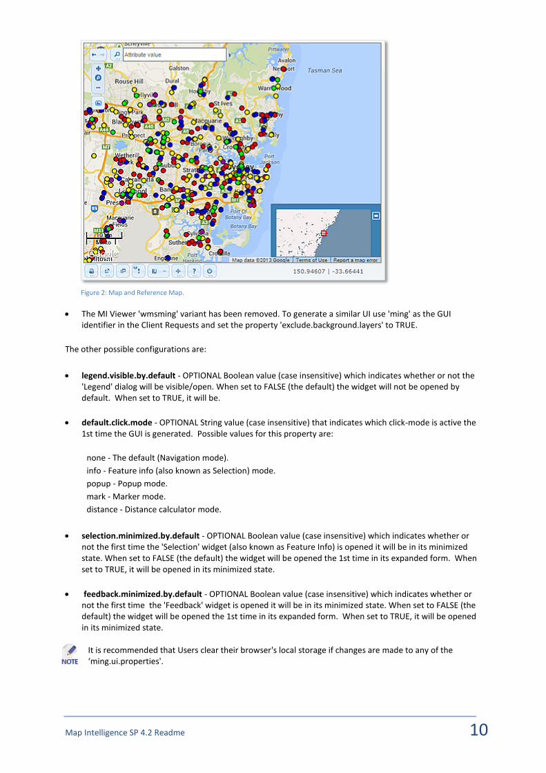
Map Intelligence SP 4.2 Readme 10
Figure 2: Map and Reference Map.
The MI Viewer 'wmsming' variant has been removed. To generate a similar UI use 'ming' as the GUI identifier in the Client Requests and set the property 'exclude.background.layers' to TRUE.
The other possible configurations are:
legend.visible.by.default - OPTIONAL Boolean value (case insensitive) which indicates whether or not the 'Legend' dialog will be visible/open. When set to FALSE (the default) the widget will not be opened by default. When set to TRUE, it will be.
default.click.mode - OPTIONAL String value (case insensitive) that indicates which click-mode is active the 1st time the GUI is generated. Possible values for this property are:
none - The default (Navigation mode).
info - Feature info (also known as Selection) mode.
popup - Popup mode.
mark - Marker mode.
distance - Distance calculator mode.
selection.minimized.by.default - OPTIONAL Boolean value (case insensitive) which indicates whether or not the first time the 'Selection' widget (also known as Feature Info) is opened it will be in its minimized state. When set to FALSE (the default) the widget will be opened the 1st time in its expanded form. When set to TRUE, it will be opened in its minimized state.
feedback.minimized.by.default - OPTIONAL Boolean value (case insensitive) which indicates whether or not the first time the 'Feedback' widget is opened it will be in its minimized state. When set to FALSE (the default) the widget will be opened the 1st time in its expanded form. When set to TRUE, it will be opened in its minimized state.
It is recommended that Users clear their browser's local storage if changes are made to any of the ‘ming.ui.properties'.

Map Intelligence SP 4.2 Readme 11
ming.api property – select.visible.features.
We now have an additional property defined in 'ming.api'properties file which controls how selections from
custom layers which have their visibility flag turned on are handled:
select.visible.features
The default value of this property is TRUE indicating that features from custom layers which have their visibility
flag turned on and the width of the current view's extent is within the layer's zoom range, will be selected.
Changing this property to FALSE relaxes the constraint and features are always selected as long as their custom
layer's visibility flag is turned on. When this is the case features are selected even if their symbol is not
rendered/visible in the thematic map because the width of the current view's extent is outside the layer's zoom
range.
For further information see Appendix B – Properties Files in the MI Server Tools and Admin Guide.
The MapMarker Geocoder is no longer an available option during the Geocoder Installation process.
We now allow Developers to specify in an overlays.json entry the width and height of a legend image in case
the WMS Service in question (e.g. ArcGIS) interprets those parameters literally and not as a hint like other
servers.
For further information see Technical Note: Extended Overlays.json (version 1.3 and above)
Map Intelligence Data Provider jar
The Spectrum Server is now shipped with this jar installed. Previously the jar was supplied in the MI SP package
and required copying to the Spectrum Server in order for Map Intelligence to work with Spectrum.
The following known issues have been fixed in version 4.2
Issue 144: Contour Tool Limitations
The Contour too was not correctly filling a contour area when the boundary intersected with the Viewer area's
edges.
We now have an alternative to the Snyder algorithm based on the Marching Squares algorithm. For more
details see https://en.wikipedia.org/wiki/Marching_squares.
The Marching Squares algorithm is now used by default. Snyder implementation is used as a fall-back if an
exception is caught or if the system administrator sets the 'contour.use.snyder' property in 'contour.properties'
to TRUE.
The Marching Squares implementation has also the added benefit of (slightly) improved performance.

Map Intelligence SP 4.2 Readme 12
1725 – Layers stop being rendered after inactivity
Rendering of thematic Layers may stop after 30 minutes of inactivity, the session will need to be ended and the
map regenerated.
Issue 1723: Editing an existing layer whilst a Map Intelligence session is active (MI SP)
It's recommended to end an existing Map Intelligence session after making edits to existing layer
configurations. There may otherwise be unexpected results, although these can subsequently still be resolved
by ending the session at any time. This issue will be resolved in a future release.
Issue 1722: Radius Relationship Layers In a Radius Relationship Layer, when a radius contains no points, the radius will not be rendered. Issue 1706: Selection box not fully visible MING Viewer: The Selection panel grows in dimensions to a point where its height exceeds that of the viewer, causing the top/header to become invisible and thus inaccessible to the User. This only occurs when:
the property 'selection.minimized.by.default' in the 'ming.ui.properties' is set to 'true', and
the window/dialog is not re-sized before its contents cause it to grow in height.
Once it's re-sized the window does not grow tall out of control.
Figure 3: Example of the selection panel height exceeding that of the viewer.

Map Intelligence SP 4.2 Readme 13
Issue: 1669: Geocoder Installation (Windows 7)
When using the MI Geocoders Installer on Windows 7, the ‘Upgrading GeoServer Data’ dialog box may show a
mouse pointer with the busy/loading icon even though the process is complete. Once the ‘Next’ button
becomes active please click it and proceed with the installation.
Stop Press: Known Issues
Late breaking known issues can be found in the Stop Press section of on the Integeo Website Download Center.
The issues presented here are not considered of major concern to the product’s performance and will be tackled in a future release. Issue 1656: Uniform Aggregation (MI SP) In the current version of MI SP, the uniform aggregation is not supported for string based themes. Issue 1641: Relationship Layer – Null values shown for Invalid or conflicting values (MI SP).
Currently for relationship layers, the Spectrum Server performs the aggregation calculation. Spectrum has no
concept of an invalid or conflicting value for a string aggregation and will return null in these cases. Therefore
we get the same response for empty, invalid and conflict - null.
Issue 1574: Internet Explorer 8 and MI Client Excel embedded map: Lines Generator Color picker This issue only happens when using Internet Explorer 8 and the MI Client for Excel with an embedded map. When selecting Start and End line colors, the color picker fails to open correctly. Issue 1561: Internet Explorer and MI Client Excel embedded map: Visualization layer configuration – empty attribute property setting. This issue only happens when using the MI Client Excel and an embedded map. If you have created a visualization layer, if after sending a second request you view the visualization layer configuration, the second attribute layer property appears empty, clicking the down arrows however shows all the columns of the selected layer. Issue 1491: Layer visibility problem with MI Client Excel while in development mode. In Development mode, MI Clients allow the developer to create various Custom Layer with specific attributes related to Built-in layers in the map to use. For the Excel Client this ultimately leads to the creation for later re-use of a 'template' file. If Custom Layers are added in this process and the developer regularly 'tests' the process (by clicking the 'Show Map' button in this Client) the requests all use the same User ID. If the developer does not end the session before going back to the Excel Client and adding new layers, the visibility flags of some Custom Layers are not processed correctly. Specifically if a colour-based custom layer (i.e. Region Relationship or Area Group layer) is added, a test request is generated, the session is NOT ended, and another colour-based custom layer (i.e. Area Group or Region Relationship layer respectively) is added which uses the same built-in region layer as the previous layer, upon generating the new test request, both layers will appear to have their visibility flag turned on. In contrast when a clean session is started and even if the request states that both such custom layers are visible, the server correctly turns the visibility flag of one of them off and signals this to the user.
Issue 1383: Windows 7 and Licensing
On Windows 7 Pro (SP1), a JavaScript error may be thrown while installing licenses.

Map Intelligence SP 4.2 Readme 14
The next 3 issues only appear with some misbehaving MI Clients.
Issue 1385: GUI may signal a JavaScript error if the request references an in existent column Issue 1375: Request processing is incomplete if it contains layers with unknown referenced (built-in) layers. Issue 1376: Some MI Clients may send wrong column types with aggregation functions.
Issue 1267: MING - When Graticule layer is visible, Mark client events are not handled
In the MING viewer, after creating a Marker (right-click + select [Mark location]), clicking on the marker's icon should open a bubble with the reverse-geocoding information for the location. When the Graticule layer ([Graticule] option in the [User layers] accordion in the [Layout Manager] dialog) is visible, mouse click events are not handled correctly.
JDK7 on Windows
Sometimes, when using JDK7 on Windows, it may be necessary to move the 'jaxrpc-spi-1.1.3.jar' (and potentially 'jaxrpc-impl-1.1.3.jar')from MI webapp lib folder to the Tomcat's 'endorsed' folder replacing the 'jaxrpc-api-xxx.jar' there.
Issue 999: Settings page displays numbers incorrectly formatted in non-English locales
When setting decimal values in the settings page, the values are entered using the current locale’s decimal separator, but the result of the change is shown with a “.” decimal point.
Issue 998: Selection by region fails with remote map layers
If your map definition file contains remotely sourced layers (not on the local file system), selection by region may fail with a “Error retrieving the geometry of a region” message. The workaround is to use maps local to the file system.
Issue 939: Problem with Sun/Oracle JDBC-ODBC Bridge causes Batch Geocoder to fail
The JDBC-ODBC bridge does not recognize UTF-16 character, so the batch geocoder fails when geocoding addresses that have characters other than ASCII characters in them.
Issue 662: Incorrect start-up shell title
Due to the underlying component inter-dependencies, the DOS CMD-shell title bar is incorrect.
Issue 603: Issues when using Internet Explorer 8
NOTES:
1. You need to set IE8 as follows to ensure that pages get updated correctly: Tools -> Internet Options ->
Browsing History -> Settings -> Temporary Internet files -> Check for newer versions of stored pages -
> Every time I visit the web page
2. There is a known issue with IE8 and Excel when it is used as an embedded browser. The print dialog
keeps appearing and must be cancelled when actions are carried out in the MI Viewer. Microsoft has
released a hot fix for this in MS Office 2007. The ID of the hotfix is 978399 and it must be installed
before this problem disappears. The hotfix requires that Service Pack 2 of Office 2007 be installed.
Important Note for the Batch Geocoder
The Batch Geocoder can make use of the PostgresSQL database and this database distinguishes between upper and lower case letters in names. You must ensure that your names are all the same case or the queries may fail. Other databases may have the same characteristics and users should check before using them.

Map Intelligence SP 4.2 Readme 15
Formatting of numeric data in columns
There is little control over the formatting of numeric data displayed in the MI Viewer. For example, Australian
4-digit postal codes are usually written without a “thousands” separator e.g. “2000”. In Map Intelligence they
will be displayed with a comma as the thousand separator e.g. “2,000”. The workaround is to ensure in the
client that they are in a string column rather than a numeric column. If necessary, add a new computed item
column to convert them.
Java Date and Time
This is not specifically a Map Intelligence problem but will affect its operation. An issue exists with some
Windows / Java combinations where Java is unaware of the time zone specified by Windows. To fix this: change
the time zone to something else, then change it back to the correct time zone. Java should now use the correct
time zone. This needs to be done when a JVM is installed on a machine for the first time.
Batch Geocoder Scheduling
When scheduling Batch Geocoder jobs, be careful not to use names that are identical except for letter case.
Errors may occur if names differ only by capitalization.
Printing Region Data
When printing the data for a region layer, if two regions have the same label, only one will be printed.
Plugin Properties
The plugin.properties file contains the list of tools that can be enabled/disabled.
The forge.extent.history.marquee and the forge.extent.history plugins will cause errors in Map Intelligence if they are disabled.